
Regional summary of 54 dive sites. Figures are averages across the sites that report them (n = sites with a value); each site's own page has its individual values. Part of the Australia (GBR) overview.
⬇ Download this region as a report card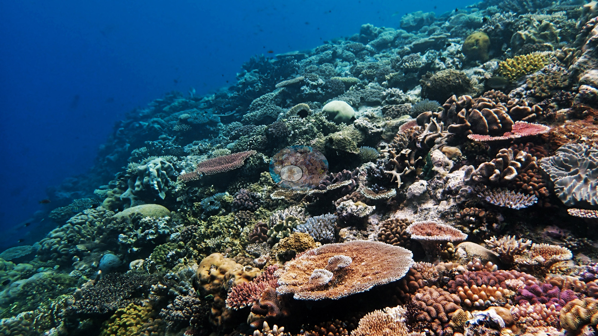

Fifty-four Green stations on no-take reefs on the far northern Great Barrier Reef, surveyed in 2014, span current-swept walls, vast Acropora meadows, and Wood Reef, which Anderson rated the expedition's best dives. Elsewhere, Lark Reef's staghorn was at least 90% dead, and much needle coral was bleached.
Heat stress
Long-term record: 7 years since 1985 reached 8 or more °C-weeks at NOAA’s Far Northern GBR, Northern GBR stations. Download the annual DHW data (CSV).
54 sites in this region — click a marker to open that site.
Regional setting
Spalding et al. (2001) single out the ribbon reefs as the defining feature of the northern Great Barrier Reef. Beyond Raine Island the shelf is generally less than 50 km wide, and along its outer rim long, slender reefs, mostly under 500 m across and up to 25 km in length, are strung out between narrow passes, with water deepening past 1,000 m only a few hundred meters seaward. In the northernmost 80 km or so of this line, sediment swept through the passes by strong currents has built delta-like formations on the sheltered side, which then became a base for new reef growth. Shoreward are mid-shelf and inner-shelf reefs, and fringing reefs that border the mainland directly. The South Equatorial Current divides on reaching the shelf: a weak branch, the Hiri Current, runs north above roughly 14°S, and the East Australia Current carries water south. The atlas records most of the reef's 350 or so coral species from the northern GBR and estimates Australia's national reef area at about 48,960 km²; Souter et al. (2021) give 35,487 km² for the GCRMN subregion made up of the Torres Strait–northern GBR, central–southern GBR, and Tweed–Moreton ecoregions. When the atlas was written, only about 5% of the Marine Park was closed to fishing, though that share took in more than 120 reefs; Wilkinson (2006) reports that in mid-2004 the Australian Parliament extended highly protected, no-take status to 33% of the GBR World Heritage Area.
According to Souter et al. (2021), the 2016 bleaching did the most recent damage to these northern reefs, killing an estimated 30% of shallow-water coral in the northern third of the GBR, with effects detected as deep as 40 m. Earlier bleaching was less focused on the north: the 1998 event was mostly confined to inshore reefs, the 2002 event reached offshore reefs as well, and the central GBR was the most affected both times. Coral cover in the Torres Strait and northern GBR increased between 2002 and 2008. Since 2009, eight severe cyclones have struck the GBR, and crown-of-thorns starfish have erupted periodically since the early 1960s, most recently from 2010 in the Cairns–Cooktown section. By 2019, the GBR-wide mean for hard coral cover stood at 24%, down from about 34% in the late 1990s.
Overview
This unit covers the 54 far northern Great Barrier Reef stations coded Green in Anderson's 2014 survey set. The unit is the expedition's Green stratum, its no-take reefs: Marine National Park (Green) Zone reefs plus Yonge Reef, which the Zoning Plan designates a Scientific Research Zone (no-take, research by permit) with a Conservation Park Zone on its lee side (AUYG37-42). On the zoning map four positions on the Ribbon Reef 7 and Yonge Reef edges (AUR701, AUR702, AUR703, AUYG38) fall a few tens of meters into the adjoining Buffer Zone. The stations spread from about 11 to 15.3°S and were surveyed by in situ transect between 3 September and 1 October 2014, mostly at 5-9 m; recorded depths ran from 4.9 m at AU3480 (the other expedition team's survey depth) to 24.1 m at AUWO103 on Wood Reef. Named reefs include Lark, Monkman, Siddons, Wood, and Yonge Reefs, Ribbon Reef 7, the area near Hilder and Eyrie Reefs, and Unnamed Reefs 34, 74, and 11-096.
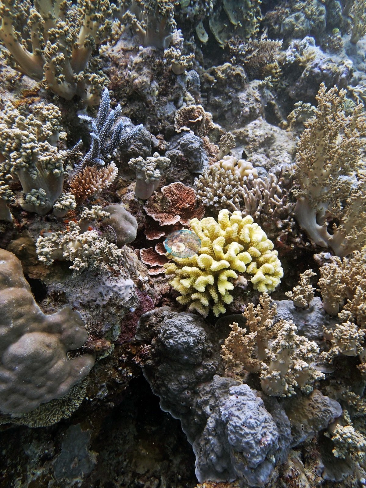
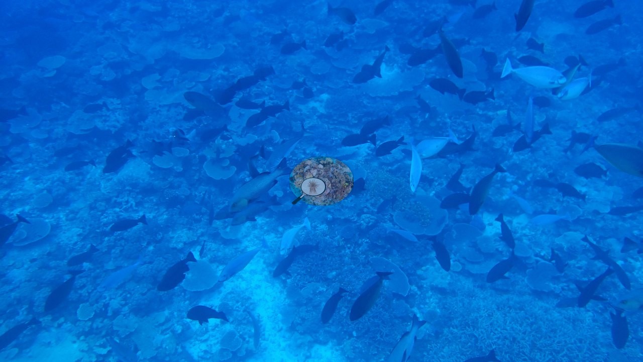
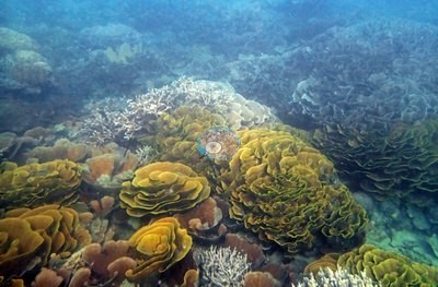
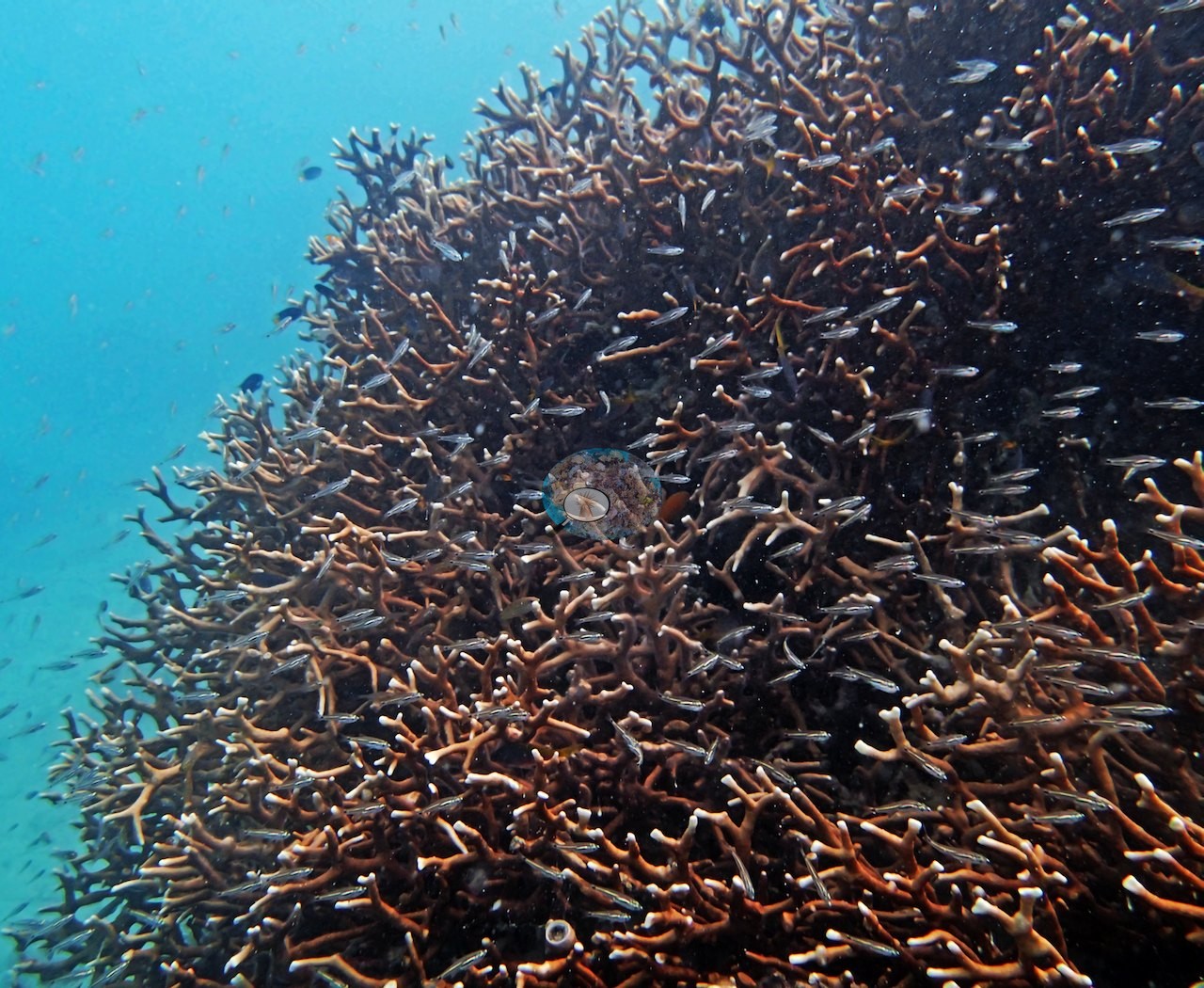
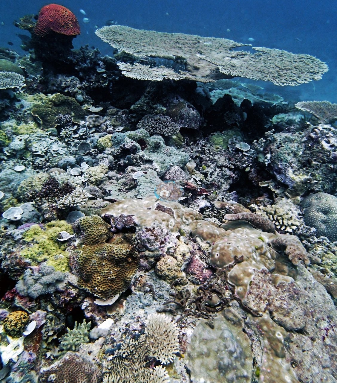
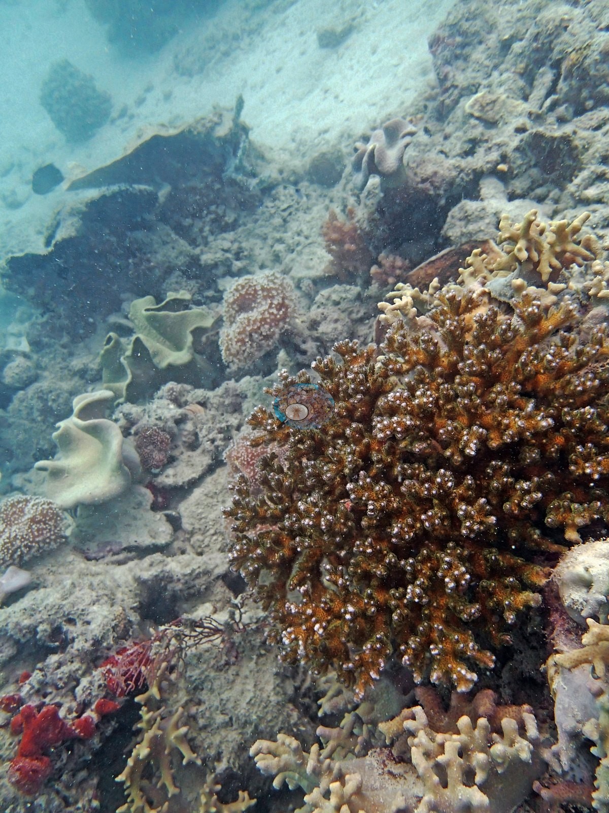
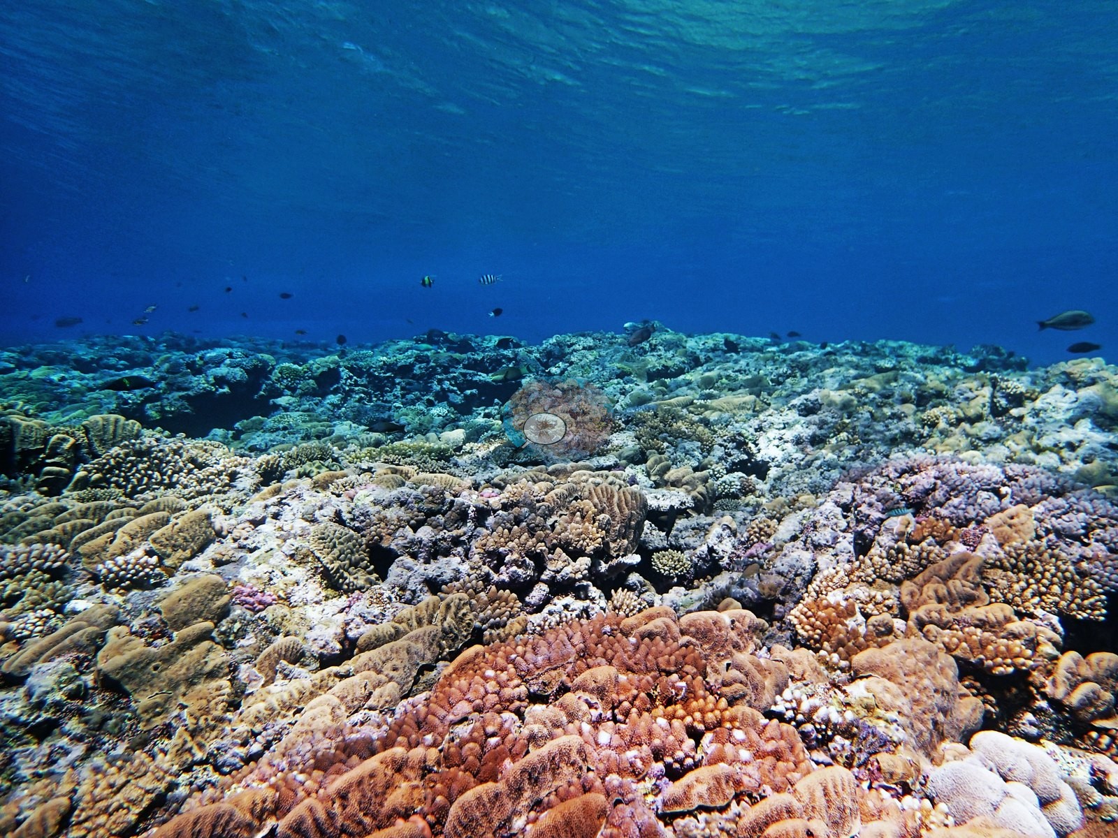
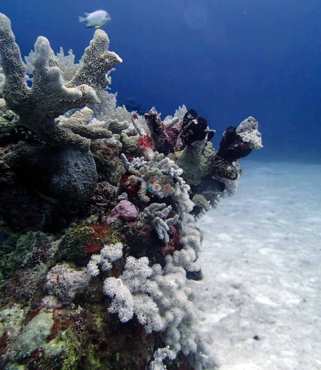
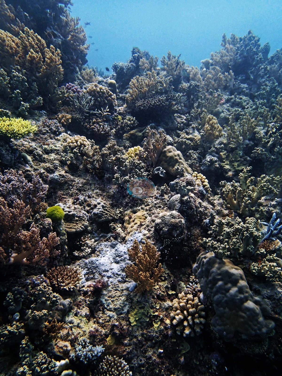
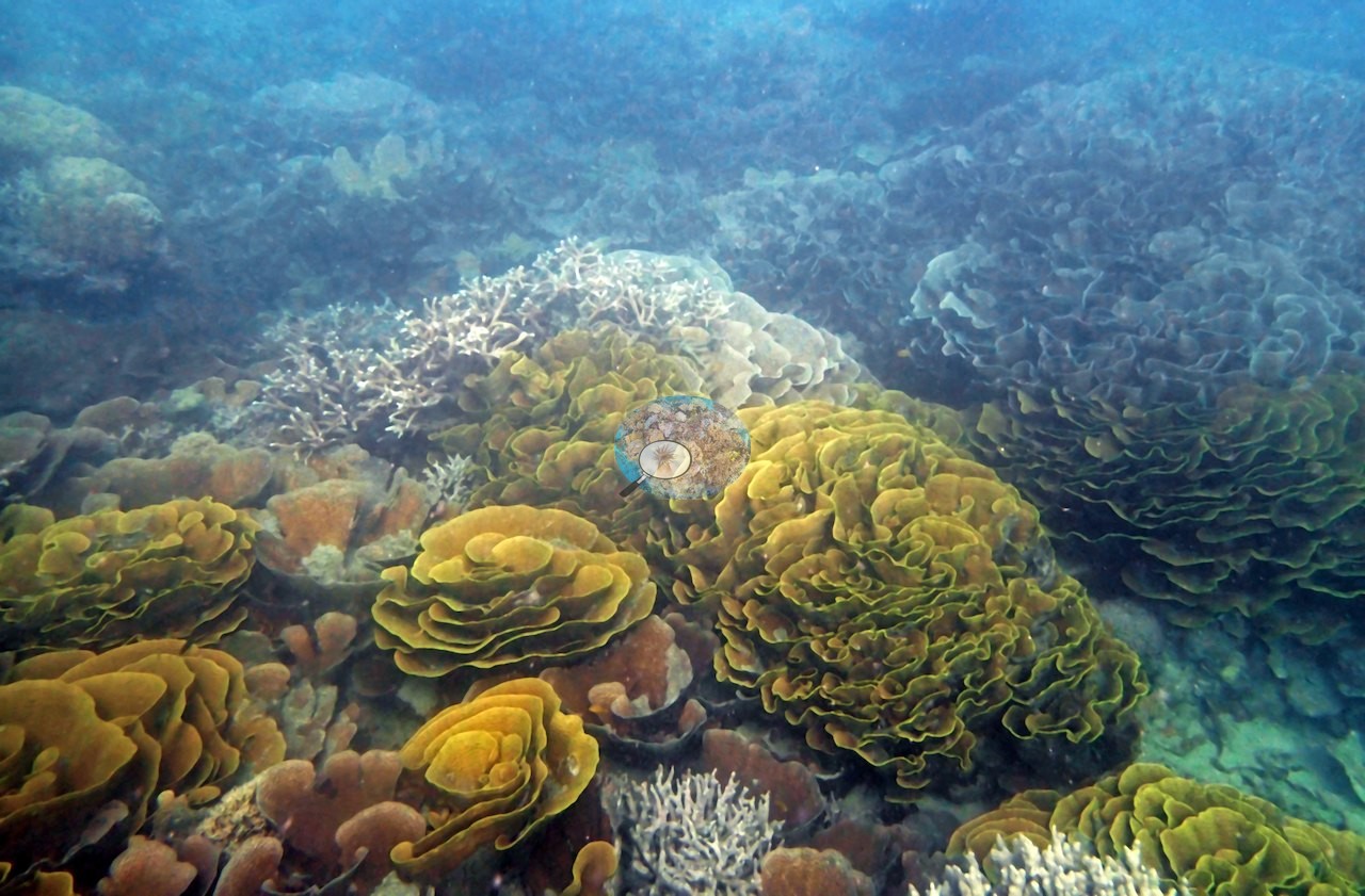
The settings vary widely. On Unnamed Reef 34, a steep wall dived in a 1.5-knot current (AU3483) carried Turbinaria, Porites, Diploastrea, and plating corals at close to 100% cover by eye at 3-5 m, while silty neighboring dives turned to rubble by 10 m (AU3479) or sand below 17 m (AU3481). Siddons Reef has level Acropora meadows hundreds of meters wide, with staghorn and elkhorn colonies over 10 m long. On Monkman Reef, Pavona cactus carpets the 4-8 m band. At Wood Reef, a slope, a bommie field, and a second platform drop past 35 m, and the second Wood Reef dive (AUWO105) crossed dense Acropora cover with schools of jacks, barracuda, and wahoo. Ribbon Reef 7 has a windward slope to 25-30 m and, on its leeward side, bommies rising from sand.
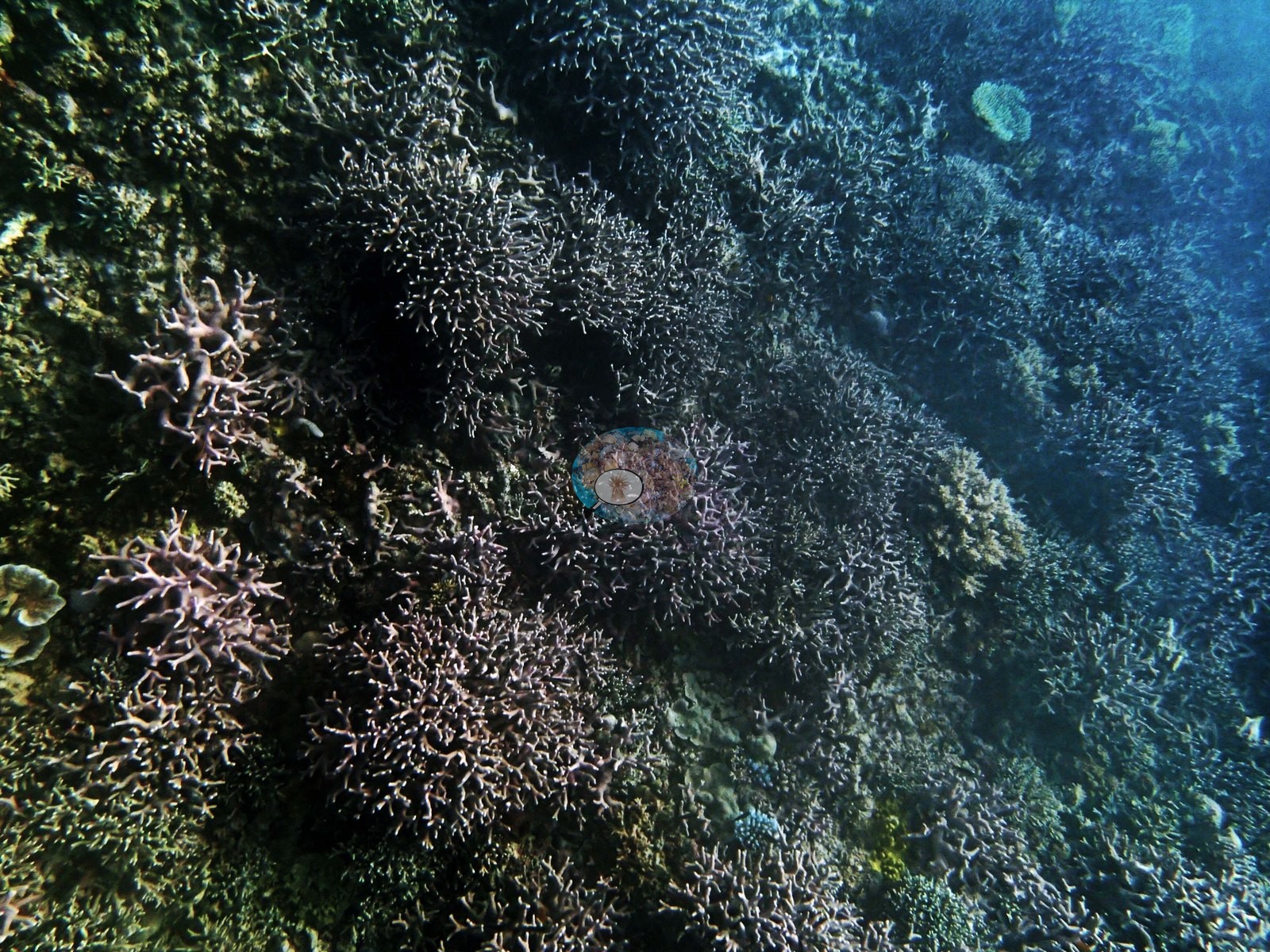
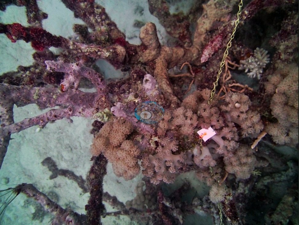
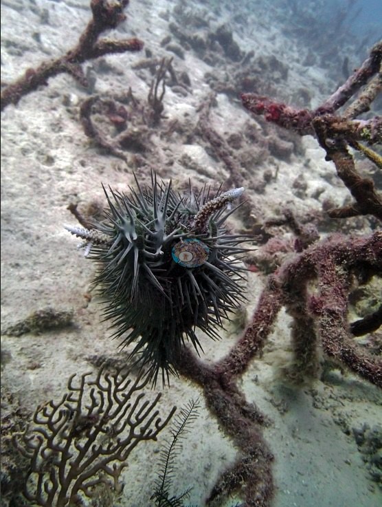
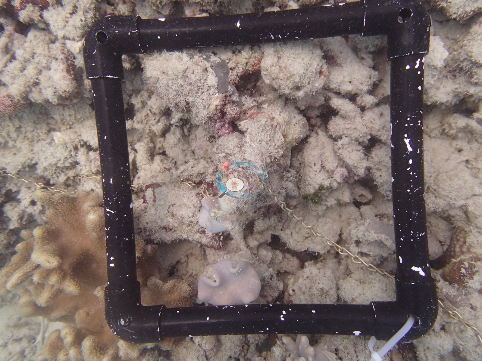
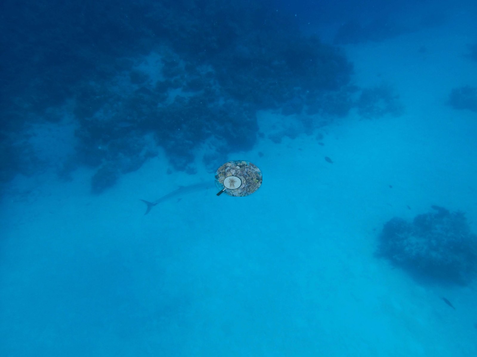
Transect cover ranged from 1.8% at AULK30 and 4.0% at AULK22 on Lark Reef to 79% at AU74147 on Unnamed Reef 74. On Lark Reef, 90% or more of the staghorn framework was dead. That is where the expedition's first crown-of-thorns starfish were found, but Anderson judged that the die-off predated them. Needle coral (Seriatopora) was the recurring warning. About 95% of colonies were bleached at Wood Reef station AUWO103, and nearly all were pale or bleached at 20-25 m on Ribbon Reef 7's windward face. Needle coral was healthy, however, at AUSD133 and AUWO105. Crown-of-thorns damage was recorded at 14 m at AU74151 and at about 15 m at AU74147 on Unnamed Reef 74, and starfish at AUSD131 (one) and AULK21, where several colonies in Anderson's frames are also stark white (no extent estimated). At AU3479 the 10 m rubble was blanketed in clay silt and fleshy macroalgae. Silvertip and gray reef sharks, Malabar groupers, cuttlefish, and benthic comb jellies at Siddons Reef were among the sightings.
Highlights
- AU74147 (Unnamed Reef 74): 79% coral against 7.8% algae
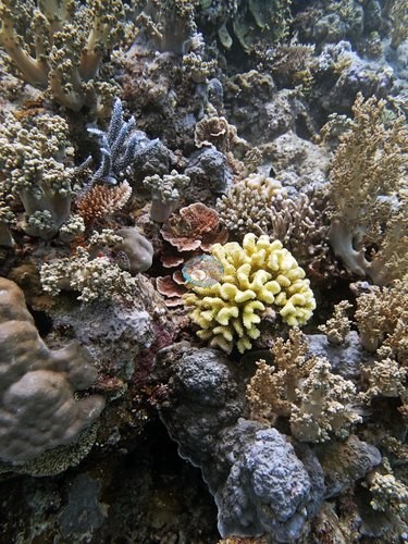
- AUWO105 on Wood Reef: 61% coral against 9.3% algae
- AUMO97 on Monkman Reef: 68% coral, with Pavona cactus carpeting the 4-8 m band
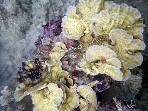
- Siddons Reef: staghorn and elkhorn colonies over 10 m long in Acropora meadows hundreds of meters wide (AUSD131, AUSD133), with 53% and 47% live coral on those transects
- Lark Reef (AULK19): Acropora thickets 90% dead or worse and the expedition's first crown-of-thorns starfish, five in all; the Global Reef Expedition (GRE) team's AULK30 transects recorded 1.8% live coral
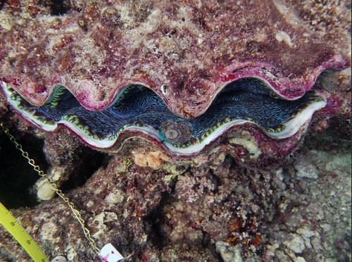
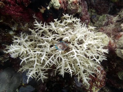
- About 95% of needle coral bleached at Wood Reef (AUWO103)
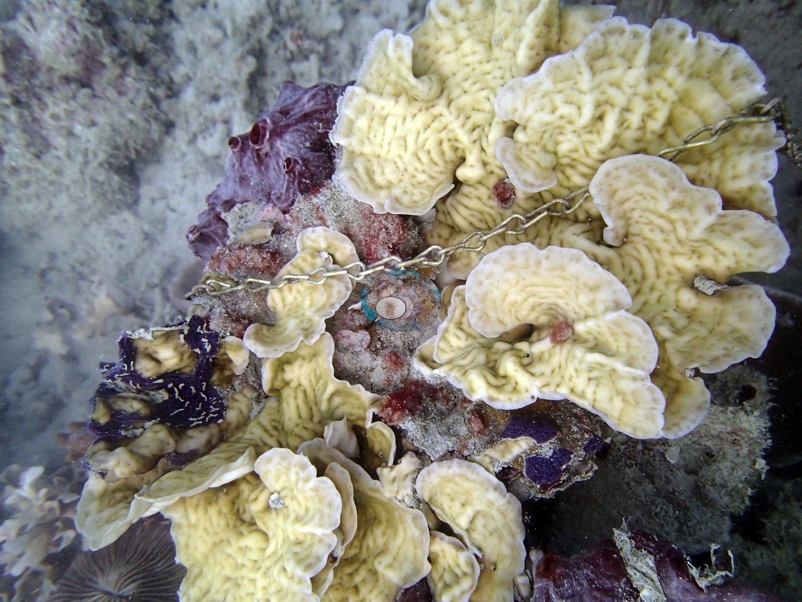
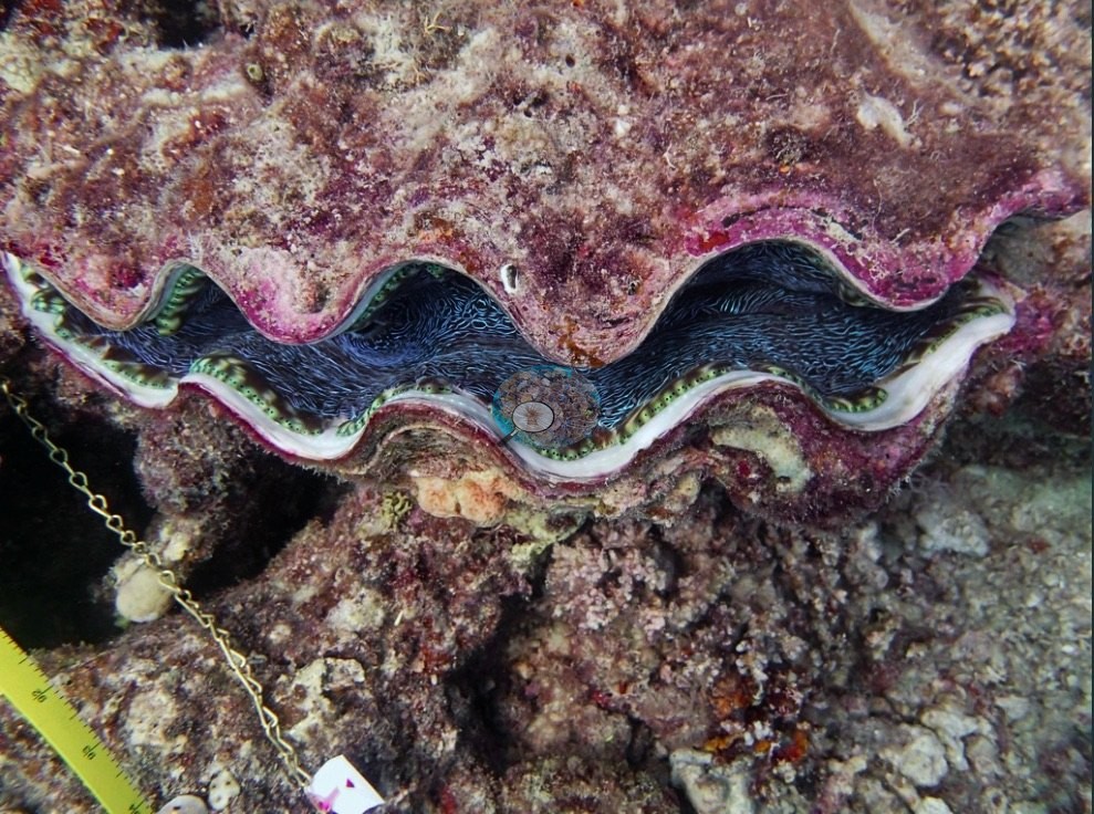
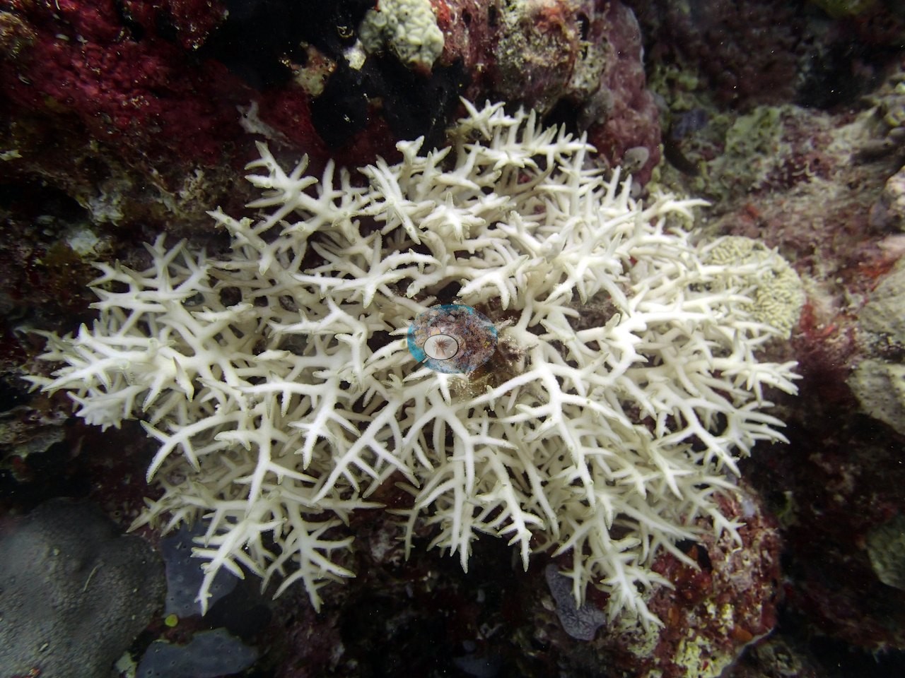
Notable observations (16)
- N. GBR - Green (AU3479): partial die-off on staghorn; sediment the recorded problem, with fleshy macroalgae on the 10 m rubble
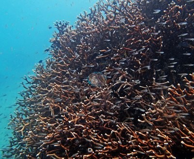
- N. GBR - Green (AU74151): crown-of-thorns damage to multiple colonies at 14 m; sickly and dying Seriatopora hystrix
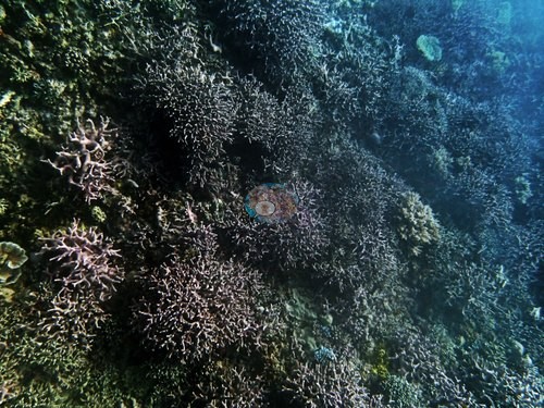
- N. GBR - Green (AU96119): dying or sickly needle coral at 20 m
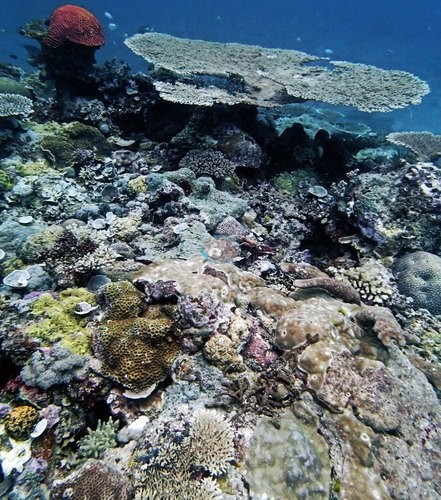
- N. GBR - Green (AULK19): staghorn thickets 90% dead or worse; five crown-of-thorns starfish, mostly feeding; Anderson concluded the die-off predated the starfish
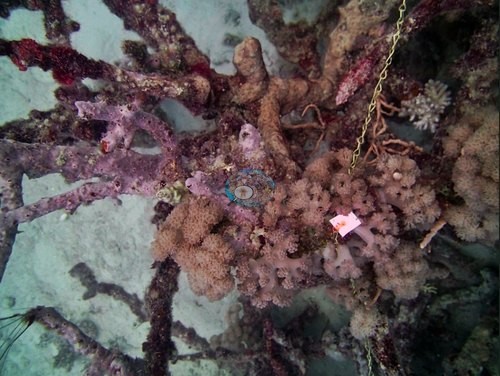
- N. GBR - Green (AULK21): several colonies stark white in the photographs (frame description only, no extent estimated; his notes do not mention bleaching); heavy partial mortality on Porites rus and crown-of-thorns starfish in his notes, with starfish in three frames
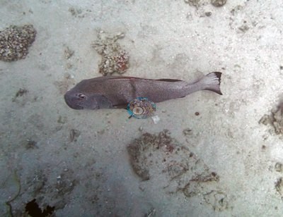
- N. GBR - Green (AULK29): 90% or more of the staghorn framework dead; two crown-of-thorns starfish, too few in Anderson's view to explain the die-off
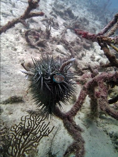 photo: N. GBR - Green (AULK19)
- N. GBR - Green (AUMO99): several needle corals on the flat visibly sickly
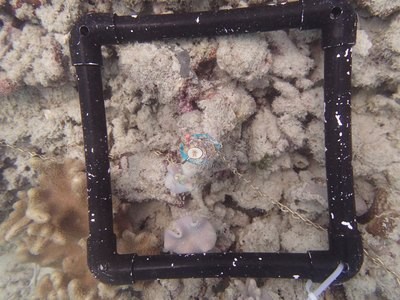
- N. GBR - Green (AUMO101): dead needle coral on one transect
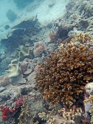
- N. GBR - Green (AUR702): needle corals at 20-25 m almost uniformly bleached, many dying
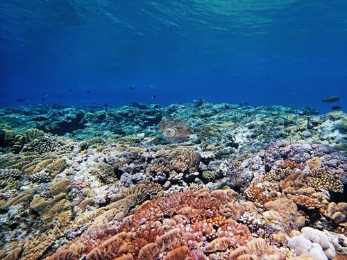
- N. GBR - Green (AUR704): a single pale branching colony (photo only; bleaching not separable from tissue loss)
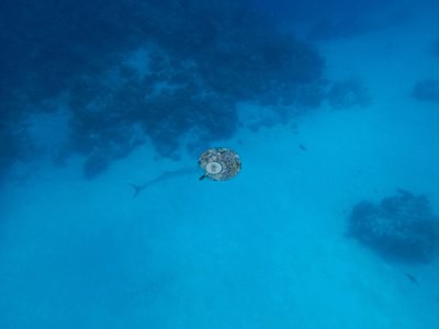
- N. GBR - Green (AUSD129): needle corals dying in several spots; one staghorn thicket about half dead and overgrown by algae
- N. GBR - Green (AUSD131): a single crown-of-thorns starfish; sickly or dying needle corals on five of six transects
- N. GBR - Green (AUWO103): Seriatopora badly bleached, about 95% of colonies by Anderson's field estimate
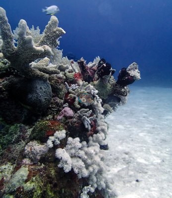
- N. GBR - Green (AUYG37): needle coral at 20.5 m looked bleached and unhealthy; a few pale or white colonies in photos (not separable from tissue loss)
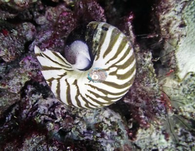
- N. GBR - Green (AU74147): most needle corals looking bad in his notes (sickly Seriatopora hystrix on transects at 10-14.7 m); crown-of-thorns-damaged Acropora on one transect at about 15 m
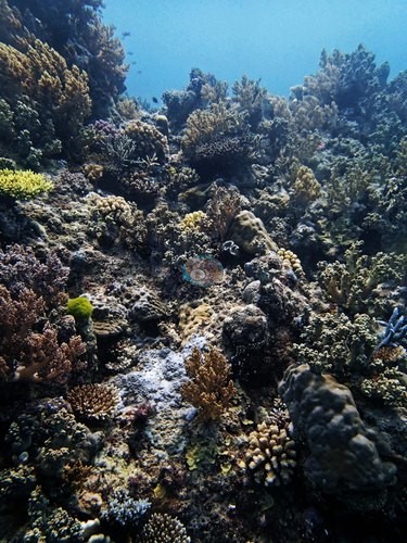
- N. GBR - Green (AU3483): recent partial mortality on one foliose plate, cause unclear; no bleaching, disease, or crown-of-thorns starfish in his notes
Coral cover over time (pooled)
 the year includes his Global Reef Expedition dives with the Khaled bin Sultan Living Oceans Foundation (CRD+LOF data).
Sites in this region (54)
- N. GBR - Green (AU3479) — 46% coral cover
- N. GBR - Green (AU3480) — 40% coral cover
- N. GBR - Green (AU3481) — 44% coral cover
- N. GBR - Green (AU3482) — 25% coral cover
- N. GBR - Green (AU3483) — 50% coral cover
- N. GBR - Green (AU3484) — 58% coral cover
- N. GBR - Green (AU74147) — 79% coral cover
- N. GBR - Green (AU74148) — 47% coral cover
- N. GBR - Green (AU74149) — 52% coral cover
- N. GBR - Green (AU74150) — 67% coral cover
- N. GBR - Green (AU74151) — 35% coral cover
- N. GBR - Green (AU74152) — 41% coral cover
- N. GBR - Green (AU96117) — 26% coral cover
- N. GBR - Green (AU96118) — 16% coral cover
- N. GBR - Green (AU96119) — 36% coral cover
- N. GBR - Green (AU96120) — 21% coral cover
- N. GBR - Green (AU96121) — 36% coral cover
- N. GBR - Green (AU96122) — 35% coral cover
- N. GBR - Green (AUEY163) — 26% coral cover
- N. GBR - Green (AUEY164) — 33% coral cover
- N. GBR - Green (AULK19) — 33% coral cover
- N. GBR - Green (AULK20) — 51% coral cover
- N. GBR - Green (AULK21) — 19% coral cover
- N. GBR - Green (AULK22) — 4.0% coral cover
- N. GBR - Green (AULK29) — 16% coral cover
- N. GBR - Green (AULK30) — 1.8% coral cover
- N. GBR - Green (AUMO100) — 49% coral cover
- N. GBR - Green (AUMO101) — 44% coral cover
- N. GBR - Green (AUMO102) — 40% coral cover
- N. GBR - Green (AUMO97) — 68% coral cover
- N. GBR - Green (AUMO98) — 46% coral cover
- N. GBR - Green (AUMO99) — 28% coral cover
- N. GBR - Green (AUR701) — 40% coral cover
- N. GBR - Green (AUR702) — 46% coral cover
- N. GBR - Green (AUR703) — 44% coral cover
- N. GBR - Green (AUR704) — 44% coral cover
- N. GBR - Green (AUR705) — 37% coral cover
- N. GBR - Green (AUR706) — 22% coral cover
- N. GBR - Green (AUSD129) — 52% coral cover
- N. GBR - Green (AUSD130) — 41% coral cover
- N. GBR - Green (AUSD131) — 53% coral cover
- N. GBR - Green (AUSD132) — 63% coral cover
- N. GBR - Green (AUSD133) — 47% coral cover
- N. GBR - Green (AUSD134) — 55% coral cover
- N. GBR - Green (AUWD104) — 37% coral cover
- N. GBR - Green (AUWD106) — 36% coral cover
- N. GBR - Green (AUWO103) — 36% coral cover
- N. GBR - Green (AUWO105) — 61% coral cover
- N. GBR - Green (AUYG37) — 24% coral cover
- N. GBR - Green (AUYG38) — 57% coral cover
- N. GBR - Green (AUYG39) — 36% coral cover
- N. GBR - Green (AUYG40) — 11% coral cover
- N. GBR - Green (AUYG41) — 24% coral cover
- N. GBR - Green (AUYG42) — 41% coral cover
Nearby external survey stations
230 independent survey records within 5 km of a site in this region (each record counted once).
Show all 230 records
- AIMS LTMP — NO NAME REEF site 1 (1993): 18% hard coral cover, 1.81 km from N. GBR - Green (AUYG41)
- AIMS LTMP — NO NAME REEF site 1 (1994): 26% hard coral cover, 1.81 km from N. GBR - Green (AUYG41)
- AIMS LTMP — NO NAME REEF site 1 (1995): 39% hard coral cover, 1.81 km from N. GBR - Green (AUYG41)
- AIMS LTMP — NO NAME REEF site 1 (1996): 45% hard coral cover, 1.81 km from N. GBR - Green (AUYG41)
- AIMS LTMP — NO NAME REEF site 1 (1997): 52% hard coral cover, 1.81 km from N. GBR - Green (AUYG41)
- AIMS LTMP — NO NAME REEF site 1 (1998): 66% hard coral cover, 1.81 km from N. GBR - Green (AUYG41)
- AIMS LTMP — NO NAME REEF site 1 (1999): 58% hard coral cover, 1.81 km from N. GBR - Green (AUYG41)
- AIMS LTMP — NO NAME REEF site 1 (2000): 55% hard coral cover, 1.81 km from N. GBR - Green (AUYG41)
- AIMS LTMP — NO NAME REEF site 1 (2001): 63% hard coral cover, 1.81 km from N. GBR - Green (AUYG41)
- AIMS LTMP — NO NAME REEF site 1 (2002): 58% hard coral cover, 1.81 km from N. GBR - Green (AUYG41)
- AIMS LTMP — NO NAME REEF site 1 (2003): 51% hard coral cover, 1.81 km from N. GBR - Green (AUYG41)
- AIMS LTMP — NO NAME REEF site 1 (2004): 40% hard coral cover, 1.81 km from N. GBR - Green (AUYG41)
- AIMS LTMP — NO NAME REEF site 1 (2006): 21% hard coral cover, 1.81 km from N. GBR - Green (AUYG41)
- AIMS LTMP — NO NAME REEF site 1 (2008): 37% hard coral cover, 1.81 km from N. GBR - Green (AUYG41)
- AIMS LTMP — NO NAME REEF site 1 (2010): 37% hard coral cover, 1.81 km from N. GBR - Green (AUYG41)
- AIMS LTMP — NO NAME REEF site 1 (2012): 43% hard coral cover, 1.81 km from N. GBR - Green (AUYG41)
- AIMS LTMP — NO NAME REEF site 1 (2014): 12% hard coral cover, 1.81 km from N. GBR - Green (AUYG41)
- AIMS LTMP — NO NAME REEF site 1 (2016): 8.2% hard coral cover, 1.81 km from N. GBR - Green (AUYG41)
- AIMS LTMP — NO NAME REEF site 1 (2018): 11% hard coral cover, 1.81 km from N. GBR - Green (AUYG41)
- AIMS LTMP — NO NAME REEF site 1 (2020): 20% hard coral cover, 1.81 km from N. GBR - Green (AUYG41)
- AIMS LTMP — NO NAME REEF site 1 (2021): 29% hard coral cover, 1.81 km from N. GBR - Green (AUYG41)
- AIMS LTMP — NO NAME REEF site 1 (2022): 33% hard coral cover, 1.81 km from N. GBR - Green (AUYG41)
- AIMS LTMP — NO NAME REEF site 1 (2022): 37% hard coral cover, 1.81 km from N. GBR - Green (AUYG41)
- AIMS LTMP — NO NAME REEF site 2 (1993): 18% hard coral cover, 2.25 km from N. GBR - Green (AUYG41)
- AIMS LTMP — NO NAME REEF site 2 (1994): 26% hard coral cover, 2.25 km from N. GBR - Green (AUYG41)
- AIMS LTMP — NO NAME REEF site 2 (1995): 39% hard coral cover, 2.25 km from N. GBR - Green (AUYG41)
- AIMS LTMP — NO NAME REEF site 2 (1996): 41% hard coral cover, 2.25 km from N. GBR - Green (AUYG41)
- AIMS LTMP — NO NAME REEF site 2 (1997): 50% hard coral cover, 2.25 km from N. GBR - Green (AUYG41)
- AIMS LTMP — NO NAME REEF site 2 (1998): 56% hard coral cover, 2.25 km from N. GBR - Green (AUYG41)
- AIMS LTMP — NO NAME REEF site 2 (1999): 46% hard coral cover, 2.25 km from N. GBR - Green (AUYG41)
- AIMS LTMP — NO NAME REEF site 2 (2000): 48% hard coral cover, 2.25 km from N. GBR - Green (AUYG41)
- AIMS LTMP — NO NAME REEF site 2 (2001): 56% hard coral cover, 2.25 km from N. GBR - Green (AUYG41)
- AIMS LTMP — NO NAME REEF site 2 (2002): 53% hard coral cover, 2.25 km from N. GBR - Green (AUYG41)
- AIMS LTMP — NO NAME REEF site 2 (2003): 54% hard coral cover, 2.25 km from N. GBR - Green (AUYG41)
- AIMS LTMP — NO NAME REEF site 2 (2004): 35% hard coral cover, 2.25 km from N. GBR - Green (AUYG41)
- AIMS LTMP — NO NAME REEF site 2 (2008): 29% hard coral cover, 2.25 km from N. GBR - Green (AUYG41)
- AIMS LTMP — NO NAME REEF site 2 (2010): 37% hard coral cover, 2.25 km from N. GBR - Green (AUYG41)
- AIMS LTMP — NO NAME REEF site 2 (2012): 29% hard coral cover, 2.25 km from N. GBR - Green (AUYG41)
- AIMS LTMP — NO NAME REEF site 2 (2014): 24% hard coral cover, 2.25 km from N. GBR - Green (AUYG41)
- AIMS LTMP — NO NAME REEF site 2 (2016): 13% hard coral cover, 2.25 km from N. GBR - Green (AUYG41)
- AIMS LTMP — NO NAME REEF site 2 (2018): 14% hard coral cover, 2.25 km from N. GBR - Green (AUYG41)
- AIMS LTMP — NO NAME REEF site 2 (2020): 26% hard coral cover, 2.25 km from N. GBR - Green (AUYG41)
- AIMS LTMP — NO NAME REEF site 2 (2021): 31% hard coral cover, 2.25 km from N. GBR - Green (AUYG41)
- AIMS LTMP — NO NAME REEF site 2 (2022): 31% hard coral cover, 2.25 km from N. GBR - Green (AUYG41)
- AIMS LTMP — NO NAME REEF site 3 (1993): 27% hard coral cover, 2.65 km from N. GBR - Green (AUYG41)
- AIMS LTMP — NO NAME REEF site 3 (1994): 34% hard coral cover, 2.65 km from N. GBR - Green (AUYG41)
- AIMS LTMP — NO NAME REEF site 3 (1995): 43% hard coral cover, 2.65 km from N. GBR - Green (AUYG41)
- AIMS LTMP — NO NAME REEF site 3 (1996): 46% hard coral cover, 2.65 km from N. GBR - Green (AUYG41)
- AIMS LTMP — NO NAME REEF site 3 (1997): 52% hard coral cover, 2.65 km from N. GBR - Green (AUYG41)
- AIMS LTMP — NO NAME REEF site 3 (1998): 57% hard coral cover, 2.65 km from N. GBR - Green (AUYG41)
- AIMS LTMP — NO NAME REEF site 3 (1999): 51% hard coral cover, 2.65 km from N. GBR - Green (AUYG41)
- AIMS LTMP — NO NAME REEF site 3 (2000): 53% hard coral cover, 2.65 km from N. GBR - Green (AUYG41)
- AIMS LTMP — NO NAME REEF site 3 (2001): 51% hard coral cover, 2.65 km from N. GBR - Green (AUYG41)
- AIMS LTMP — NO NAME REEF site 3 (2002): 45% hard coral cover, 2.65 km from N. GBR - Green (AUYG41)
- AIMS LTMP — NO NAME REEF site 3 (2003): 48% hard coral cover, 2.65 km from N. GBR - Green (AUYG41)
- AIMS LTMP — NO NAME REEF site 3 (2004): 38% hard coral cover, 2.65 km from N. GBR - Green (AUYG41)
- AIMS LTMP — NO NAME REEF site 3 (2006): 27% hard coral cover, 2.65 km from N. GBR - Green (AUYG41)
- AIMS LTMP — NO NAME REEF site 3 (2008): 41% hard coral cover, 2.65 km from N. GBR - Green (AUYG41)
- AIMS LTMP — NO NAME REEF site 3 (2010): 41% hard coral cover, 2.65 km from N. GBR - Green (AUYG41)
- AIMS LTMP — NO NAME REEF site 3 (2012): 24% hard coral cover, 2.65 km from N. GBR - Green (AUYG41)
- AIMS LTMP — NO NAME REEF site 3 (2014): 26% hard coral cover, 2.65 km from N. GBR - Green (AUYG41)
- AIMS LTMP — NO NAME REEF site 3 (2016): 9.2% hard coral cover, 2.65 km from N. GBR - Green (AUYG41)
- AIMS LTMP — NO NAME REEF site 3 (2018): 14% hard coral cover, 2.65 km from N. GBR - Green (AUYG41)
- AIMS LTMP — NO NAME REEF site 3 (2020): 25% hard coral cover, 2.65 km from N. GBR - Green (AUYG41)
- AIMS LTMP — NO NAME REEF site 3 (2021): 29% hard coral cover, 2.65 km from N. GBR - Green (AUYG41)
- AIMS LTMP — NO NAME REEF site 3 (2022): 32% hard coral cover, 2.65 km from N. GBR - Green (AUYG41)
- AIMS LTMP — YONGE REEF site 1 (1993): 15% hard coral cover, 1.99 km from N. GBR - Green (AUYG38)
- AIMS LTMP — YONGE REEF site 1 (1994): 23% hard coral cover, 1.99 km from N. GBR - Green (AUYG38)
- AIMS LTMP — YONGE REEF site 1 (1995): 28% hard coral cover, 1.99 km from N. GBR - Green (AUYG38)
- AIMS LTMP — YONGE REEF site 1 (1996): 36% hard coral cover, 1.99 km from N. GBR - Green (AUYG38)
- AIMS LTMP — YONGE REEF site 1 (1997): 47% hard coral cover, 1.99 km from N. GBR - Green (AUYG38)
- AIMS LTMP — YONGE REEF site 1 (1998): 59% hard coral cover, 1.99 km from N. GBR - Green (AUYG38)
- AIMS LTMP — YONGE REEF site 1 (1999): 58% hard coral cover, 1.99 km from N. GBR - Green (AUYG38)
- AIMS LTMP — YONGE REEF site 1 (2000): 64% hard coral cover, 1.99 km from N. GBR - Green (AUYG38)
- AIMS LTMP — YONGE REEF site 1 (2001): 66% hard coral cover, 1.99 km from N. GBR - Green (AUYG38)
- AIMS LTMP — YONGE REEF site 1 (2002): 58% hard coral cover, 1.99 km from N. GBR - Green (AUYG38)
- AIMS LTMP — YONGE REEF site 1 (2003): 62% hard coral cover, 1.99 km from N. GBR - Green (AUYG38)
- AIMS LTMP — YONGE REEF site 1 (2004): 51% hard coral cover, 1.99 km from N. GBR - Green (AUYG38)
- AIMS LTMP — YONGE REEF site 1 (2006): 23% hard coral cover, 1.99 km from N. GBR - Green (AUYG38)
- AIMS LTMP — YONGE REEF site 1 (2008): 31% hard coral cover, 1.99 km from N. GBR - Green (AUYG38)
- AIMS LTMP — YONGE REEF site 1 (2010): 44% hard coral cover, 1.99 km from N. GBR - Green (AUYG38)
- AIMS LTMP — YONGE REEF site 1 (2012): 24% hard coral cover, 1.99 km from N. GBR - Green (AUYG38)
- AIMS LTMP — YONGE REEF site 1 (2014): 23% hard coral cover, 1.99 km from N. GBR - Green (AUYG38)
- AIMS LTMP — YONGE REEF site 1 (2016): 9.6% hard coral cover, 1.99 km from N. GBR - Green (AUYG38)
- AIMS LTMP — YONGE REEF site 1 (2018): 18% hard coral cover, 1.99 km from N. GBR - Green (AUYG38)
- AIMS LTMP — YONGE REEF site 1 (2020): 25% hard coral cover, 1.99 km from N. GBR - Green (AUYG38)
- AIMS LTMP — YONGE REEF site 1 (2021): 29% hard coral cover, 1.99 km from N. GBR - Green (AUYG38)
- AIMS LTMP — YONGE REEF site 1 (2022): 34% hard coral cover, 1.99 km from N. GBR - Green (AUYG38)
- AIMS LTMP — YONGE REEF site 1 (2022): 37% hard coral cover, 1.99 km from N. GBR - Green (AUYG38)
- AIMS LTMP — YONGE REEF site 2 (1993): 7.6% hard coral cover, 1.50 km from N. GBR - Green (AUYG38)
- AIMS LTMP — YONGE REEF site 2 (1994): 16% hard coral cover, 1.50 km from N. GBR - Green (AUYG38)
- AIMS LTMP — YONGE REEF site 2 (1995): 25% hard coral cover, 1.50 km from N. GBR - Green (AUYG38)
- AIMS LTMP — YONGE REEF site 2 (1996): 34% hard coral cover, 1.50 km from N. GBR - Green (AUYG38)
- AIMS LTMP — YONGE REEF site 2 (1997): 45% hard coral cover, 1.50 km from N. GBR - Green (AUYG38)
- AIMS LTMP — YONGE REEF site 2 (1998): 60% hard coral cover, 1.50 km from N. GBR - Green (AUYG38)
- AIMS LTMP — YONGE REEF site 2 (1999): 58% hard coral cover, 1.50 km from N. GBR - Green (AUYG38)
- AIMS LTMP — YONGE REEF site 2 (2000): 58% hard coral cover, 1.50 km from N. GBR - Green (AUYG38)
- AIMS LTMP — YONGE REEF site 2 (2001): 63% hard coral cover, 1.50 km from N. GBR - Green (AUYG38)
- AIMS LTMP — YONGE REEF site 2 (2002): 62% hard coral cover, 1.50 km from N. GBR - Green (AUYG38)
- AIMS LTMP — YONGE REEF site 2 (2003): 64% hard coral cover, 1.50 km from N. GBR - Green (AUYG38)
- AIMS LTMP — YONGE REEF site 2 (2004): 50% hard coral cover, 1.50 km from N. GBR - Green (AUYG38)
- AIMS LTMP — YONGE REEF site 2 (2006): 23% hard coral cover, 1.50 km from N. GBR - Green (AUYG38)
- AIMS LTMP — YONGE REEF site 2 (2008): 31% hard coral cover, 1.50 km from N. GBR - Green (AUYG38)
- AIMS LTMP — YONGE REEF site 2 (2010): 36% hard coral cover, 1.50 km from N. GBR - Green (AUYG38)
- AIMS LTMP — YONGE REEF site 2 (2012): 17% hard coral cover, 1.50 km from N. GBR - Green (AUYG38)
- AIMS LTMP — YONGE REEF site 2 (2014): 18% hard coral cover, 1.50 km from N. GBR - Green (AUYG38)
- AIMS LTMP — YONGE REEF site 2 (2016): 8.2% hard coral cover, 1.50 km from N. GBR - Green (AUYG38)
- AIMS LTMP — YONGE REEF site 2 (2018): 13% hard coral cover, 1.50 km from N. GBR - Green (AUYG38)
- AIMS LTMP — YONGE REEF site 2 (2020): 22% hard coral cover, 1.50 km from N. GBR - Green (AUYG38)
- AIMS LTMP — YONGE REEF site 2 (2021): 30% hard coral cover, 1.50 km from N. GBR - Green (AUYG38)
- AIMS LTMP — YONGE REEF site 2 (2022): 31% hard coral cover, 1.50 km from N. GBR - Green (AUYG38)
- AIMS LTMP — YONGE REEF site 2 (2022): 34% hard coral cover, 1.50 km from N. GBR - Green (AUYG38)
- AIMS LTMP — YONGE REEF site 3 (1993): 12% hard coral cover, 0.84 km from N. GBR - Green (AUYG38)
- AIMS LTMP — YONGE REEF site 3 (1994): 20% hard coral cover, 0.84 km from N. GBR - Green (AUYG38)
- AIMS LTMP — YONGE REEF site 3 (1995): 28% hard coral cover, 0.84 km from N. GBR - Green (AUYG38)
- AIMS LTMP — YONGE REEF site 3 (1996): 29% hard coral cover, 0.84 km from N. GBR - Green (AUYG38)
- AIMS LTMP — YONGE REEF site 3 (1997): 38% hard coral cover, 0.84 km from N. GBR - Green (AUYG38)
- AIMS LTMP — YONGE REEF site 3 (1998): 44% hard coral cover, 0.84 km from N. GBR - Green (AUYG38)
- AIMS LTMP — YONGE REEF site 3 (1999): 47% hard coral cover, 0.84 km from N. GBR - Green (AUYG38)
- AIMS LTMP — YONGE REEF site 3 (2000): 51% hard coral cover, 0.84 km from N. GBR - Green (AUYG38)
- AIMS LTMP — YONGE REEF site 3 (2001): 55% hard coral cover, 0.84 km from N. GBR - Green (AUYG38)
- AIMS LTMP — YONGE REEF site 3 (2002): 51% hard coral cover, 0.84 km from N. GBR - Green (AUYG38)
- AIMS LTMP — YONGE REEF site 3 (2003): 51% hard coral cover, 0.84 km from N. GBR - Green (AUYG38)
- AIMS LTMP — YONGE REEF site 3 (2004): 44% hard coral cover, 0.84 km from N. GBR - Green (AUYG38)
- AIMS LTMP — YONGE REEF site 3 (2006): 27% hard coral cover, 0.84 km from N. GBR - Green (AUYG38)
- AIMS LTMP — YONGE REEF site 3 (2008): 38% hard coral cover, 0.84 km from N. GBR - Green (AUYG38)
- AIMS LTMP — YONGE REEF site 3 (2010): 43% hard coral cover, 0.84 km from N. GBR - Green (AUYG38)
- AIMS LTMP — YONGE REEF site 3 (2012): 25% hard coral cover, 0.84 km from N. GBR - Green (AUYG38)
- AIMS LTMP — YONGE REEF site 3 (2014): 13% hard coral cover, 0.84 km from N. GBR - Green (AUYG38)
- AIMS LTMP — YONGE REEF site 3 (2016): 3.9% hard coral cover, 0.84 km from N. GBR - Green (AUYG38)
- AIMS LTMP — YONGE REEF site 3 (2018): 7.2% hard coral cover, 0.84 km from N. GBR - Green (AUYG38)
- AIMS LTMP — YONGE REEF site 3 (2020): 17% hard coral cover, 0.84 km from N. GBR - Green (AUYG38)
- AIMS LTMP — YONGE REEF site 3 (2021): 31% hard coral cover, 0.84 km from N. GBR - Green (AUYG38)
- AIMS LTMP — YONGE REEF site 3 (2022): 29% hard coral cover, 0.84 km from N. GBR - Green (AUYG38)
- AIMS LTMP — YONGE REEF site 3 (2022): 31% hard coral cover, 0.84 km from N. GBR - Green (AUYG38)
- AIMS manta tow — EYRIE REEF (1995): 16% hard coral cover, 3.58 km from N. GBR - Green (AUEY164)
- AIMS manta tow — EYRIE REEF (1998): 15% hard coral cover, 3.58 km from N. GBR - Green (AUEY164)
- AIMS manta tow — EYRIE REEF (2001): 20% hard coral cover, 3.58 km from N. GBR - Green (AUEY164)
- AIMS manta tow — EYRIE REEF (2004): 14% hard coral cover, 3.58 km from N. GBR - Green (AUEY164)
- AIMS manta tow — EYRIE REEF (2007): 23% hard coral cover, 3.58 km from N. GBR - Green (AUEY164)
- AIMS manta tow — EYRIE REEF (2013): 27% hard coral cover, 3.58 km from N. GBR - Green (AUEY164)
- AIMS manta tow — EYRIE REEF (2015): 5.5% hard coral cover, 3.58 km from N. GBR - Green (AUEY164)
- AIMS manta tow — EYRIE REEF (2021): 30% hard coral cover, 3.58 km from N. GBR - Green (AUEY164)
- AIMS manta tow — NO NAME REEF (1994): 29% hard coral cover, 4.21 km from N. GBR - Green (AUYG41)
- AIMS manta tow — NO NAME REEF (1995): 32% hard coral cover, 4.21 km from N. GBR - Green (AUYG41)
- AIMS manta tow — NO NAME REEF (1996): 29% hard coral cover, 4.21 km from N. GBR - Green (AUYG41)
- AIMS manta tow — NO NAME REEF (1997): 26% hard coral cover, 4.21 km from N. GBR - Green (AUYG41)
- AIMS manta tow — NO NAME REEF (1998): 27% hard coral cover, 4.21 km from N. GBR - Green (AUYG41)
- AIMS manta tow — NO NAME REEF (1999): 40% hard coral cover, 4.21 km from N. GBR - Green (AUYG41)
- AIMS manta tow — NO NAME REEF (2000): 28% hard coral cover, 4.21 km from N. GBR - Green (AUYG41)
- AIMS manta tow — NO NAME REEF (2001): 24% hard coral cover, 4.21 km from N. GBR - Green (AUYG41)
- AIMS manta tow — NO NAME REEF (2002): 23% hard coral cover, 4.21 km from N. GBR - Green (AUYG41)
- AIMS manta tow — NO NAME REEF (2003): 31% hard coral cover, 4.21 km from N. GBR - Green (AUYG41)
- AIMS manta tow — NO NAME REEF (2004): 22% hard coral cover, 4.21 km from N. GBR - Green (AUYG41)
- AIMS manta tow — NO NAME REEF (2005): 24% hard coral cover, 4.21 km from N. GBR - Green (AUYG41)
- AIMS manta tow — NO NAME REEF (2006): 17% hard coral cover, 4.21 km from N. GBR - Green (AUYG41)
- AIMS manta tow — NO NAME REEF (2007): 11% hard coral cover, 4.21 km from N. GBR - Green (AUYG41)
- AIMS manta tow — NO NAME REEF (2008): 17% hard coral cover, 4.21 km from N. GBR - Green (AUYG41)
- AIMS manta tow — NO NAME REEF (2009): 17% hard coral cover, 4.21 km from N. GBR - Green (AUYG41)
- AIMS manta tow — NO NAME REEF (2010): 20% hard coral cover, 4.21 km from N. GBR - Green (AUYG41)
- AIMS manta tow — NO NAME REEF (2011): 16% hard coral cover, 4.21 km from N. GBR - Green (AUYG41)
- AIMS manta tow — NO NAME REEF (2013): 15% hard coral cover, 4.21 km from N. GBR - Green (AUYG41)
- AIMS manta tow — NO NAME REEF (2015): 12% hard coral cover, 4.21 km from N. GBR - Green (AUYG41)
- AIMS manta tow — NO NAME REEF (2017): 4.3% hard coral cover, 4.21 km from N. GBR - Green (AUYG41)
- AIMS manta tow — NO NAME REEF (2019): 8.4% hard coral cover, 4.21 km from N. GBR - Green (AUYG41)
- AIMS manta tow — NO NAME REEF (2020): 13% hard coral cover, 4.21 km from N. GBR - Green (AUYG41)
- AIMS manta tow — NO NAME REEF (2021): 22% hard coral cover, 4.21 km from N. GBR - Green (AUYG41)
- AIMS manta tow — NO NAME REEF (2022): 30% hard coral cover, 4.21 km from N. GBR - Green (AUYG41)
- AIMS manta tow — NO NAME REEF (2023): 25% hard coral cover, 4.21 km from N. GBR - Green (AUYG41)
- AIMS manta tow — SWINGER REEF (1995): 20% hard coral cover, 3.77 km from N. GBR - Green (AULK29)
- AIMS manta tow — SWINGER REEF (1998): 17% hard coral cover, 3.77 km from N. GBR - Green (AULK29)
- AIMS manta tow — SWINGER REEF (2001): 16% hard coral cover, 3.77 km from N. GBR - Green (AULK29)
- AIMS manta tow — SWINGER REEF (2004): 14% hard coral cover, 3.77 km from N. GBR - Green (AULK29)
- AIMS manta tow — SWINGER REEF (2007): 25% hard coral cover, 3.77 km from N. GBR - Green (AULK29)
- AIMS manta tow — SWINGER REEF (2009): 30% hard coral cover, 3.77 km from N. GBR - Green (AULK29)
- AIMS manta tow — SWINGER REEF (2010): 24% hard coral cover, 3.77 km from N. GBR - Green (AULK29)
- AIMS manta tow — SWINGER REEF (2015): 11% hard coral cover, 3.77 km from N. GBR - Green (AULK29)
- AIMS manta tow — SWINGER REEF (2021): 26% hard coral cover, 3.77 km from N. GBR - Green (AULK29)
- AIMS manta tow — SWINGER REEF (2023): 39% hard coral cover, 3.77 km from N. GBR - Green (AULK29)
- AIMS manta tow — YONGE REEF (1993): 14% hard coral cover, 0.22 km from N. GBR - Green (AUYG42)
- AIMS manta tow — YONGE REEF (1994): 17% hard coral cover, 0.22 km from N. GBR - Green (AUYG42)
- AIMS manta tow — YONGE REEF (1995): 23% hard coral cover, 0.22 km from N. GBR - Green (AUYG42)
- AIMS manta tow — YONGE REEF (1996): 18% hard coral cover, 0.22 km from N. GBR - Green (AUYG42)
- AIMS manta tow — YONGE REEF (1997): 25% hard coral cover, 0.22 km from N. GBR - Green (AUYG42)
- AIMS manta tow — YONGE REEF (1998): 30% hard coral cover, 0.22 km from N. GBR - Green (AUYG42)
- AIMS manta tow — YONGE REEF (1999): 30% hard coral cover, 0.22 km from N. GBR - Green (AUYG42)
- AIMS manta tow — YONGE REEF (2000): 29% hard coral cover, 0.22 km from N. GBR - Green (AUYG42)
- AIMS manta tow — YONGE REEF (2001): 30% hard coral cover, 0.22 km from N. GBR - Green (AUYG42)
- AIMS manta tow — YONGE REEF (2002): 27% hard coral cover, 0.22 km from N. GBR - Green (AUYG42)
- AIMS manta tow — YONGE REEF (2003): 26% hard coral cover, 0.22 km from N. GBR - Green (AUYG42)
- AIMS manta tow — YONGE REEF (2004): 24% hard coral cover, 0.22 km from N. GBR - Green (AUYG42)
- AIMS manta tow — YONGE REEF (2005): 34% hard coral cover, 0.22 km from N. GBR - Green (AUYG42)
- AIMS manta tow — YONGE REEF (2006): 18% hard coral cover, 0.22 km from N. GBR - Green (AUYG42)
- AIMS manta tow — YONGE REEF (2007): 15% hard coral cover, 0.22 km from N. GBR - Green (AUYG42)
- AIMS manta tow — YONGE REEF (2008): 18% hard coral cover, 0.22 km from N. GBR - Green (AUYG42)
- AIMS manta tow — YONGE REEF (2009): 17% hard coral cover, 0.22 km from N. GBR - Green (AUYG42)
- AIMS manta tow — YONGE REEF (2011): 15% hard coral cover, 0.22 km from N. GBR - Green (AUYG42)
- AIMS manta tow — YONGE REEF (2013): 13% hard coral cover, 0.22 km from N. GBR - Green (AUYG42)
- AIMS manta tow — YONGE REEF (2015): 9.2% hard coral cover, 0.22 km from N. GBR - Green (AUYG42)
- AIMS manta tow — YONGE REEF (2017): 5.5% hard coral cover, 0.22 km from N. GBR - Green (AUYG42)
- AIMS manta tow — YONGE REEF (2019): 12% hard coral cover, 0.22 km from N. GBR - Green (AUYG42)
- AIMS manta tow — YONGE REEF (2021): 19% hard coral cover, 0.22 km from N. GBR - Green (AUYG42)
- AIMS manta tow — YONGE REEF (2022): 29% hard coral cover, 0.22 km from N. GBR - Green (AUYG42)
- AIMS manta tow — YONGE REEF (2022): 21% hard coral cover, 0.22 km from N. GBR - Green (AUYG42)
- AIMS manta tow — YONGE REEF (2023): 35% hard coral cover, 0.22 km from N. GBR - Green (AUYG42)
- Reef Check — Pixie Reef Ribbon #3 (2003): 24% hard coral cover, 2.57 km from N. GBR - Green (AUYG38)
- Reef Check — Ribbon Reef 10 - No Name Reef (Back reef slope) Site 1 (1998): 43% hard coral cover, 4.81 km from N. GBR - Green (AUYG41)
- Reef Check — Ribbon Reef 10 - No Name Reef (Back reef slope) Site 1 (1999): 60% hard coral cover, 4.81 km from N. GBR - Green (AUYG41)
- Reef Check — Ribbon Reef 10 - No Name Reef (Back reef slope) Site 1 (2002): 49% hard coral cover, 4.81 km from N. GBR - Green (AUYG41)
- XL Catlin Seaview Survey — transect 12004 (2014): 7.7% hard coral cover, 1.41 km from N. GBR - Green (AUYG41)
- XL Catlin Seaview Survey — transect 12004 (2016): 5.1% hard coral cover, 0.65 km from N. GBR - Green (AUYG37)
- XL Catlin Seaview Survey — transect 12004 (2017): 4.3% hard coral cover, 1.23 km from N. GBR - Green (AUYG41)
- XL Catlin Seaview Survey — transect 12005 (2012): 17% hard coral cover, 1.99 km from N. GBR - Green (AUYG39)
- XL Catlin Seaview Survey — transect 12005 (2014): 8.7% hard coral cover, 0.91 km from N. GBR - Green (AUYG39)
- XL Catlin Seaview Survey — transect 12005 (2016): 6.4% hard coral cover, 0.90 km from N. GBR - Green (AUYG39)
- XL Catlin Seaview Survey — transect 12005 (2017): 5.9% hard coral cover, 2.01 km from N. GBR - Green (AUYG39)
- XL Catlin Seaview Survey — transect 12028 (2012): 24% hard coral cover, 0.87 km from N. GBR - Green (AUYG38)
- XL Catlin Seaview Survey — transect 12028 (2014): 16% hard coral cover, 0.71 km from N. GBR - Green (AUYG38)
- XL Catlin Seaview Survey — transect 12028 (2016): 11% hard coral cover, 0.77 km from N. GBR - Green (AUYG38)
- XL Catlin Seaview Survey — transect 12028 (2017): 8.6% hard coral cover, 0.68 km from N. GBR - Green (AUYG38)
- XL Catlin Seaview Survey — transect 15001 (2014): 22% hard coral cover, 4.74 km from N. GBR - Green (AUWO105)
- XL Catlin Seaview Survey — transect 15001 (2017): 20% hard coral cover, 4.76 km from N. GBR - Green (AUWO105)
- XL Catlin Seaview Survey — transect 15002 (2012): 25% hard coral cover, 1.72 km from N. GBR - Green (AUWO103)
- XL Catlin Seaview Survey — transect 15005 (2012): 34% hard coral cover, 4.26 km from N. GBR - Green (AUWO103)
- XL Catlin Seaview Survey — transect 15022 (2012): 32% hard coral cover, 1.78 km from N. GBR - Green (AU74148)
- XL Catlin Seaview Survey — transect 15022 (2016): 17% hard coral cover, 2.33 km from N. GBR - Green (AU74148)
- XL Catlin Seaview Survey — transect 15023 (2012): 32% hard coral cover, 3.03 km from N. GBR - Green (AU74152)
- XL Catlin Seaview Survey — transect 15023 (2016): 26% hard coral cover, 3.01 km from N. GBR - Green (AU74152)
- XL Catlin Seaview Survey — transect 15024 (2012): 16% hard coral cover, 0.22 km from N. GBR - Green (AU74148)
- XL Catlin Seaview Survey — transect 15024 (2016): 16% hard coral cover, 0.19 km from N. GBR - Green (AU74148)
All images from Coral Reef Diagnostics. Data are from the Khaled bin Sultan Living Oceans Foundation Global Reef Expedition, Coral Reef Diagnostics, Reef Check Foundation, Australian Institute of Marine Science, Global Coral Reef Monitoring Network, and XL Catlin Seaview Survey (University of Queensland).
 © Coral Reef Diagnostics.
References
- Souter D, et al. (eds) (2021) Status of Coral Reefs of the World: 2020. International Coral Reef Initiative / Global Coral Reef Monitoring Network. [PDF]
- Spalding MD, et al. (2001) World Atlas of Coral Reefs. University of California Press, Berkeley. [PDF]
- Wilkinson C (2006) Status of coral reefs of the world: summary of threats and remedial action. In: Côté IM, Reynolds JD (eds) Coral Reef Conservation. Cambridge University Press, Cambridge. [PDF]