

Part of the regional summaries: Australia (GBR) - Far North: Green stations (no-take reefs) and Australia (GBR)
More info
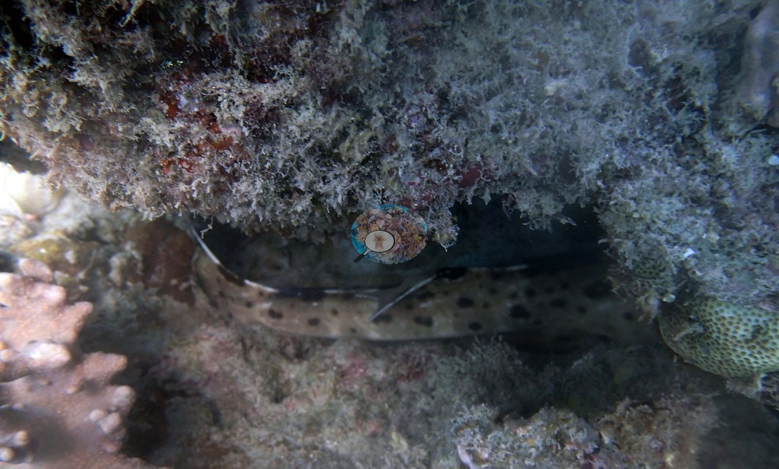
Northern GBR (NOAA CRW virtual station)A shallow, murky site near Hilder Reef and Eyrie, only 8.5 m deep with 2-3 m visibility, where most of the bottom was fleshy algae and algae-covered rubble and living coral was sparse. A cat shark tucked under a turf-furred ledge and a gray reef shark were the highlights, and no bleaching, disease, or crown-of-thorns were seen. Surveyed on the Living Oceans Foundation's Global Reef Expedition.
One independent survey station shown with the program’s logo — click one to see how far it is from this site.
One other CRD dive site within 5 km shown in orange — click a marker to open its page.
🗺 Detailed map of the Global Reef Expedition dive sites, Jewell, Hilder, and Eyrie Reefs, northern Great Barrier Reef (Khaled bin Sultan Living Oceans Foundation; opens in a new window)
Site description
Setting
This last dive of the day near Hilder Reef and Eyrie was a shallow, murky affair, visibility down to 2-3 m and a maximum site depth of only 8.5 m, and the photographs reflect it: every frame is shot close, with no wide view of the reef available.
General benthic features
The algae-covered substrate shows up clearly in one frame, where a cat shark lies tucked under a ledge whose whole underside is furred with gray-brown algal turf (e.g., Image 3).
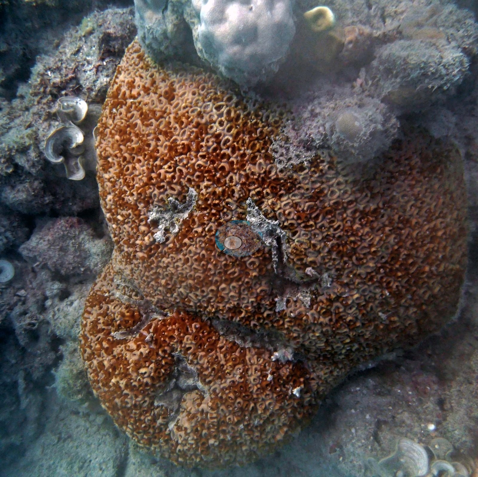
The corals photographed are the ones Anderson listed as providing what structure there was: a massive Galaxea-type colony, rust-orange and packed with tubular corallites, carrying a few bare scars, and two purple-tipped Acropora colonies growing on knobby Porites and rubble in green, particle-heavy water (e.g., Image 1, Image 2, Image 4).
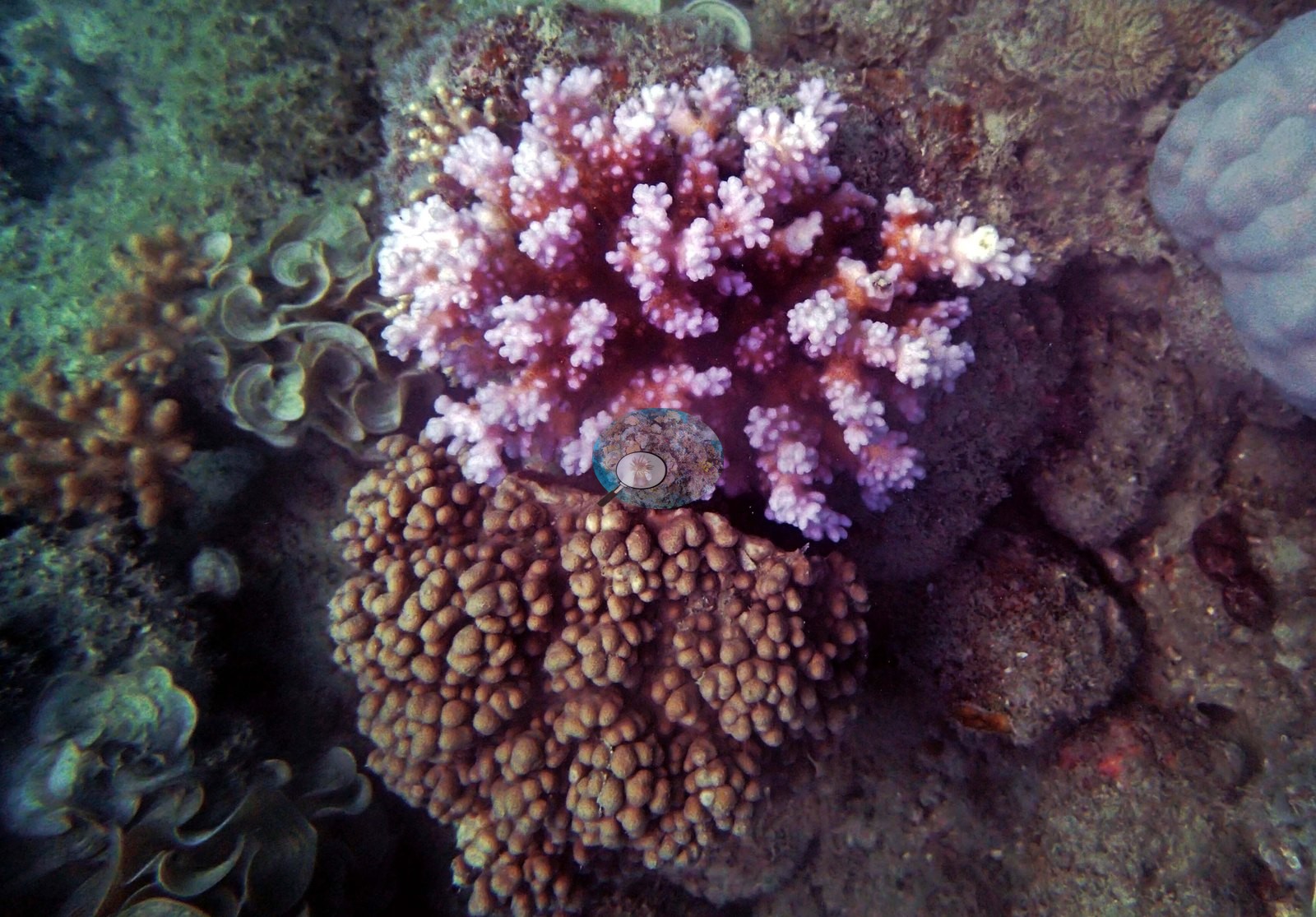
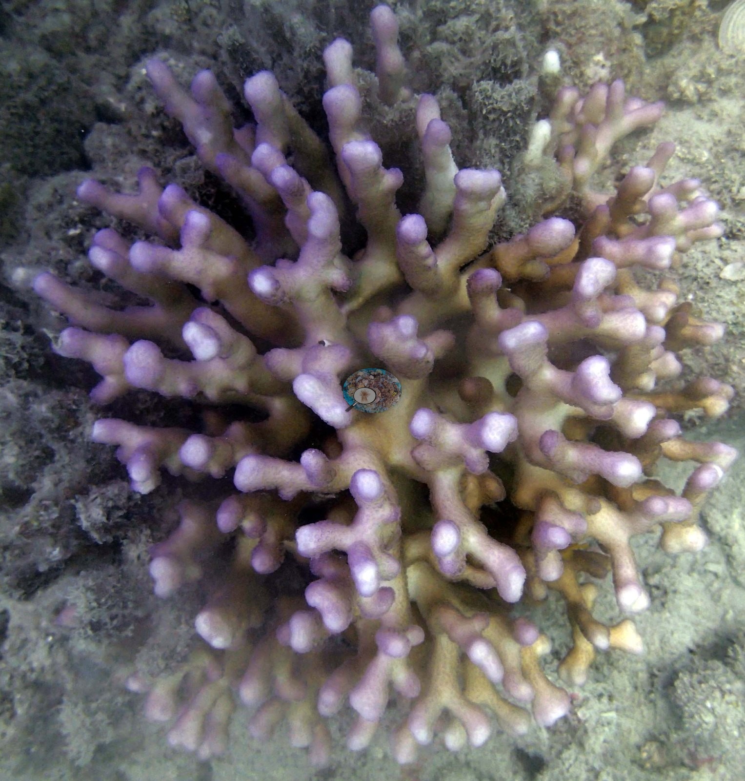
Massive Porites, Lobophyllia, Galaxea, and scattered faviids filled out the rest, and recruit numbers stayed decent even where adult cover was thin.
Coral cover
- Reference: Khaled bin Sultan Living Oceans Foundation, Global Reef Expedition (in situ transect)
- Live coral cover measured 26% at this point, within a site where all eight transects stayed low, generally under 5%, dominated by fleshy macroalgae and algae-covered rubble rather than living coral.
- Transect mean 26 ± 7.6% SE (n = 4 transects; Living Oceans Foundation per-transect benthic data); the headline above is the expedition's station value.
Fish and other fauna
A gray reef shark joined the cat shark as the dive's highlight, and nothing here pointed to bleaching, disease, or crown-of-thorns starfish.
Comparisons with other data
No other surveys have been conducted at this site to date. Within 5 km, one independent station, AIMS manta tow at EYRIE REEF, 3.72 km away, read 5.5–30% between 1995 and 2021.
Independent surveys nearby
 LOF
Within 5 km, 1 independent survey station recorded hard coral cover in 8 surveys between 1995 and 2021. The one station surveyed in more than one year increased by 13.4 points between its first and latest surveys. The longest record, EYRIE REEF (AIMS manta tow, 3.72 km away), went from 16% in 1995 to 30% in 2021. One survey since 2021 recorded 30%. This site's own estimate (26%) is not compared with these surveys: none lies within 2 km.
Collected by other programs using different methods (AIMS manta tow is a towed visual estimate in categorical bins), so these are context for the figures above, not a like-for-like comparison. Where a station was surveyed more than once, the cell shows either the range of its values or, as a single value, the mean of surveys made in one year. Station names are not dive-site names.
| Agency | Site / location | Date | Hard coral cover (%) | Distance | Link |
|---|---|---|---|---|---|
| AIMS manta tow | EYRIE REEF | 1995–2021 | 5.5–30% (8 surveys) | 3.72 km | doi:10.25845/5c09b0abf315a |
Data & links
- Download benthic survey data (CSV) ↗
- Download all LOF-GRE data (933 sites) ↗
- Photo portfolio ↗
- Coral Reef Diagnostics country page ↗
All images from Coral Reef Diagnostics. Data are from the Khaled bin Sultan Living Oceans Foundation Global Reef Expedition, Coral Reef Diagnostics, and the organizations named in the data sources above.
 © Coral Reef Diagnostics.