

Part of the regional summaries: Australia (GBR) - Far North: Green stations (no-take reefs) and Australia (GBR)
More info
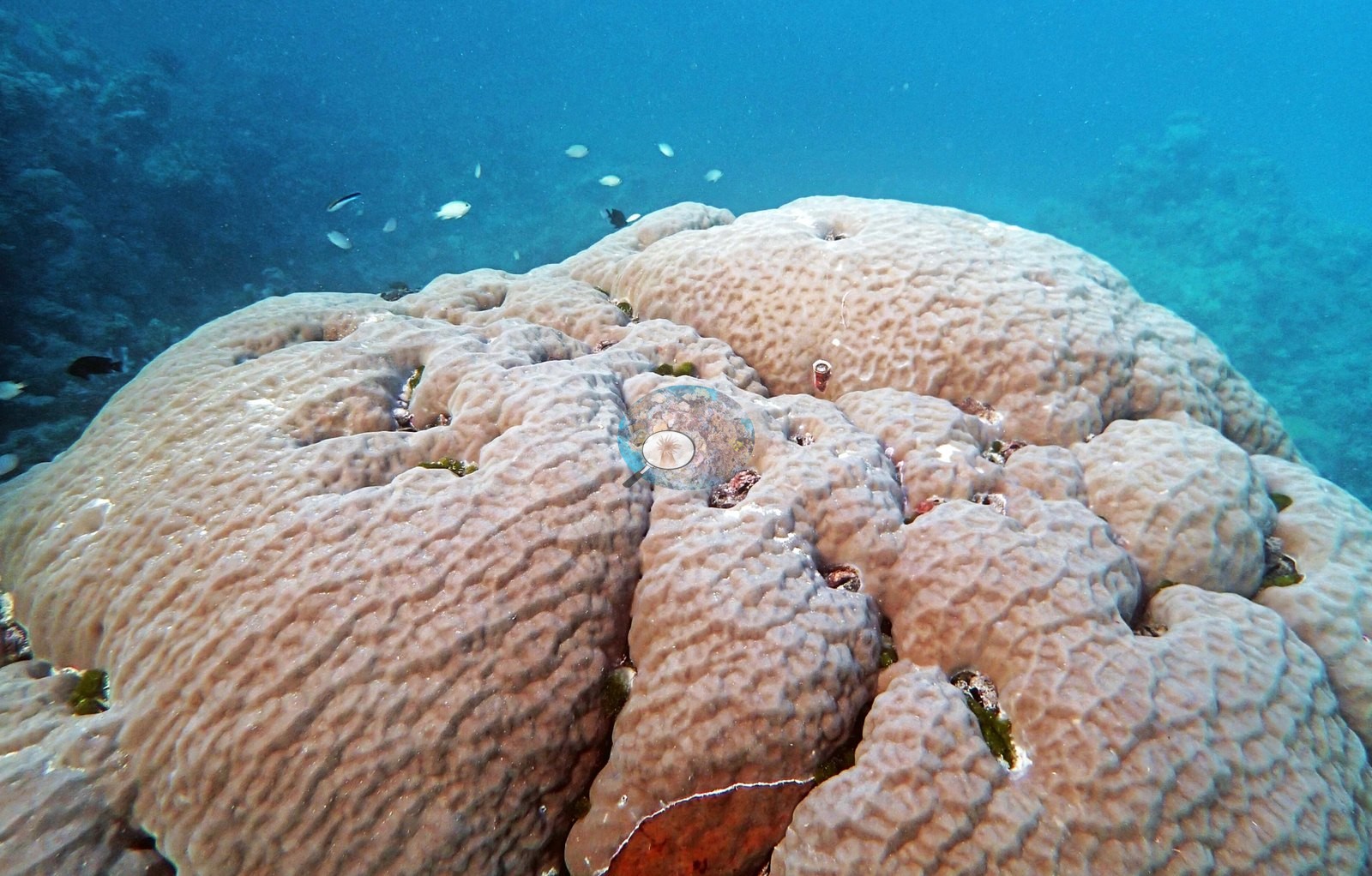
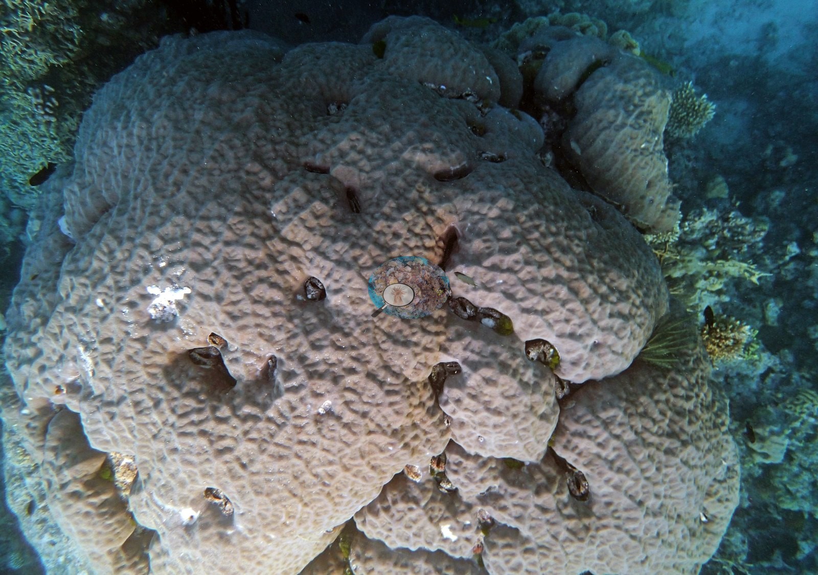
Northern GBR (NOAA CRW virtual station)AUYG41's defining feature is a large lobed massive coral colony, its surface a fine mosaic studded with embedded bivalve shells and only a few small dead patches, set within an otherwise branching-dominated reef of mauve Acropora thickets, a moray eel wedged in a crevice, and a giant clam on the sand apron. Cover measured 24%. Surveyed on the Living Oceans Foundation's Global Reef Expedition.
Twelve independent survey stations shown with the program’s logo — click one to see how far it is from this site.
Five other CRD dive sites within 5 km shown in orange — click a marker to open its page.
🗺 Detailed map of the Global Reef Expedition dive sites, Yonge, Hicks, and Carter Reefs, northern Great Barrier Reef (Khaled bin Sultan Living Oceans Foundation; opens in a new window)
Site description
Setting
Anderson's notes describe a more protected leeward reef: essentially one larger bommie (more than 40 m across) in a 12-13 m sand apron holding dozens of smaller bommies within 100 m of the GPS point, with a maximum depth of 15-16 m reachable only more than 150 m from that point. The expedition surveyed Yonge Reef as one of its Green (no-take) reefs; under the GBRMPA Zoning Plan the reef is a Scientific Research Zone (no-take, research by permit) with a Conservation Park Zone on its lee side, and the recorded position lies inside the Scientific Research Zone.
General benthic features
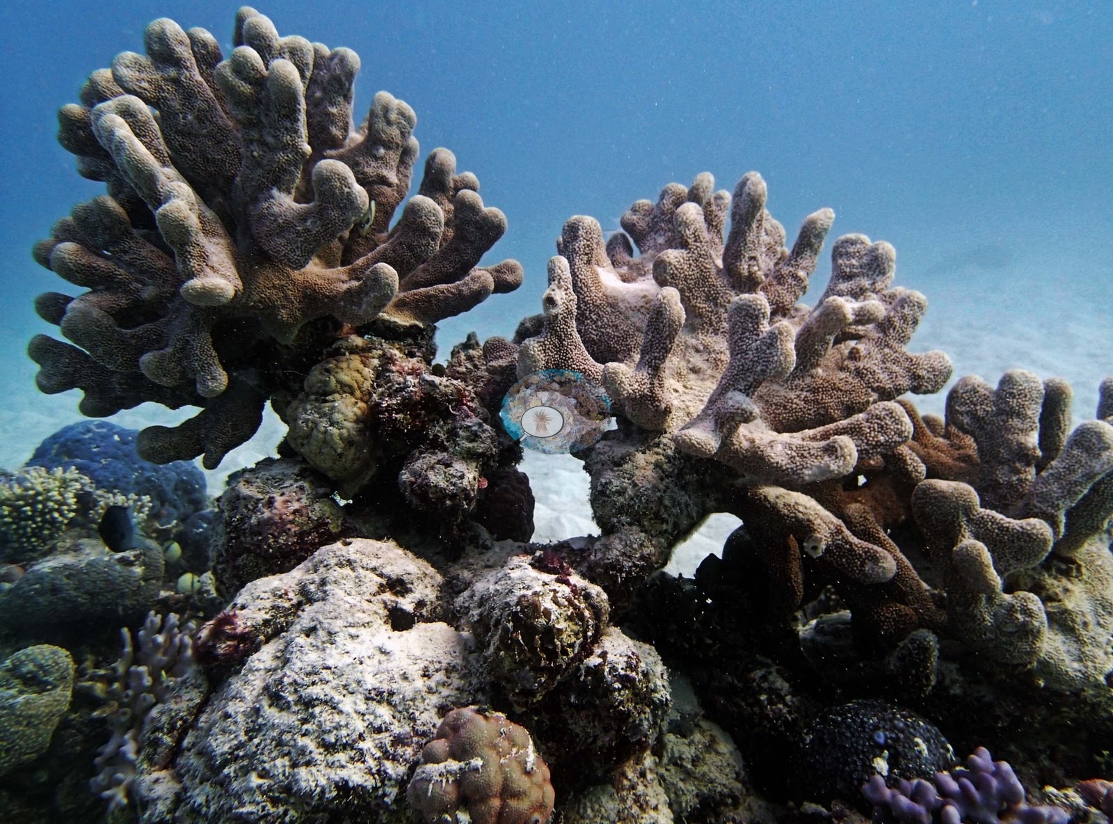
Eleven frames were posted from this dive, all reef imagery, and their main subject is a large lobed massive colony. Image 7 and Image 11 both show that colony at close range. Image 7 shows a huge pale cream-gray lobed mass filling the frame against clear blue, its surface broken into rounded lobes and deep valleys. Image 11 closes in further: a fine, even mosaic of small corallites across the whole surface, punctuated by more than a dozen dark curved bivalve shells embedded flush in the living tissue, a scatter of small white patches where the skeleton is exposed, and a green feather star perched on the flank.
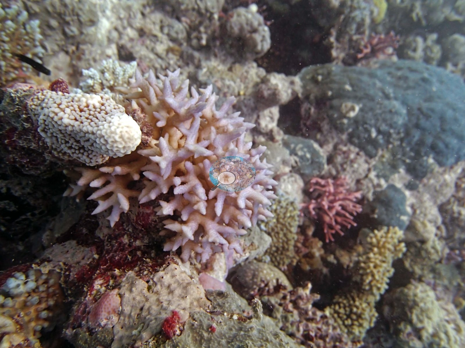
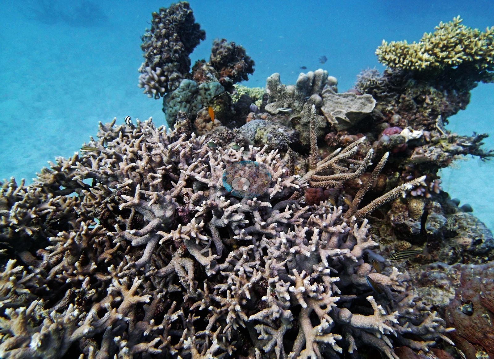
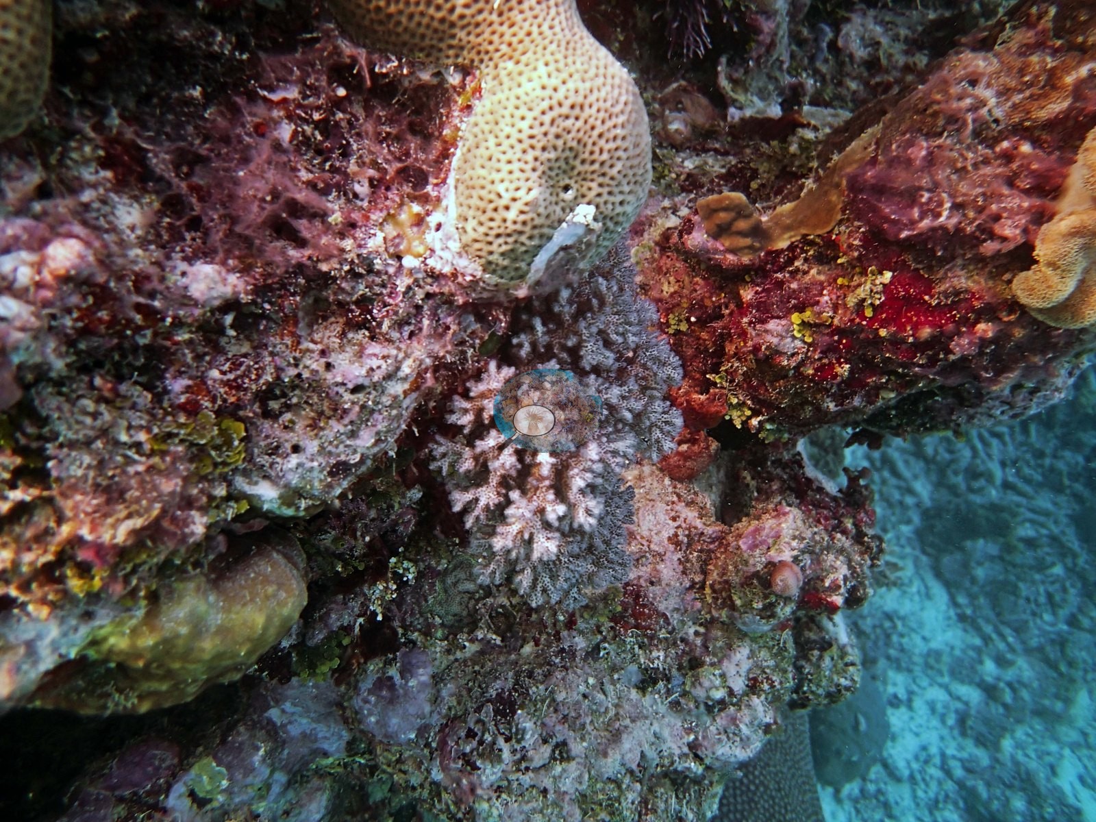
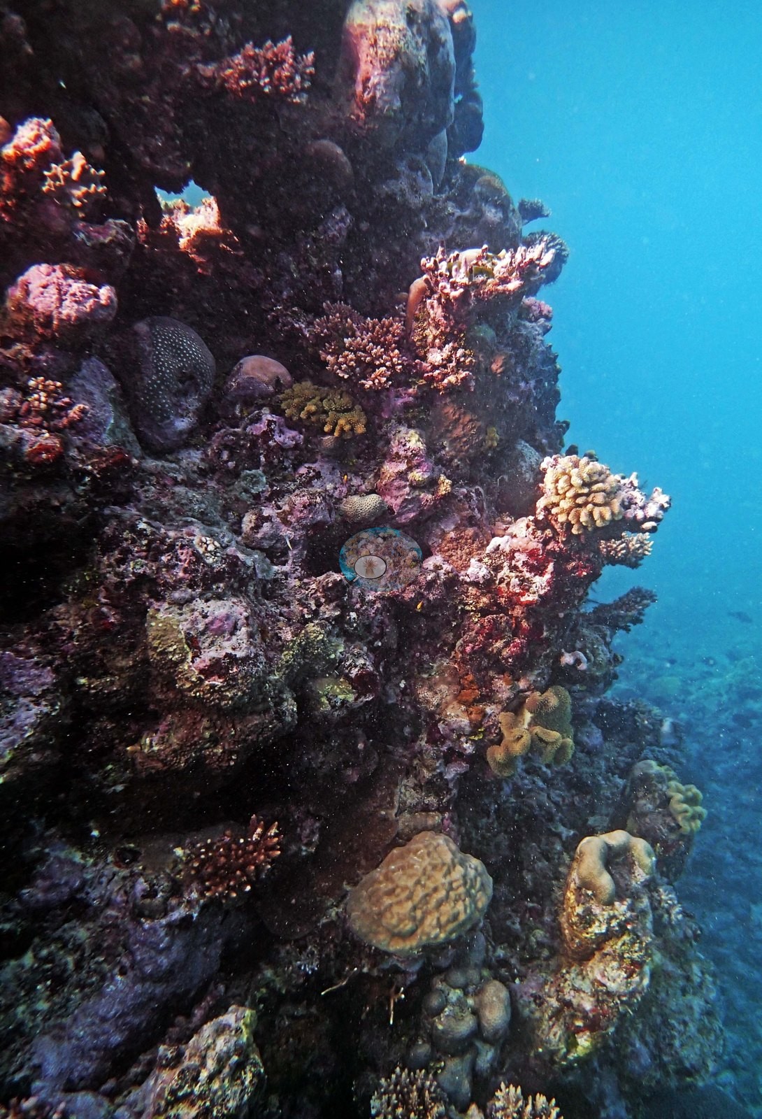
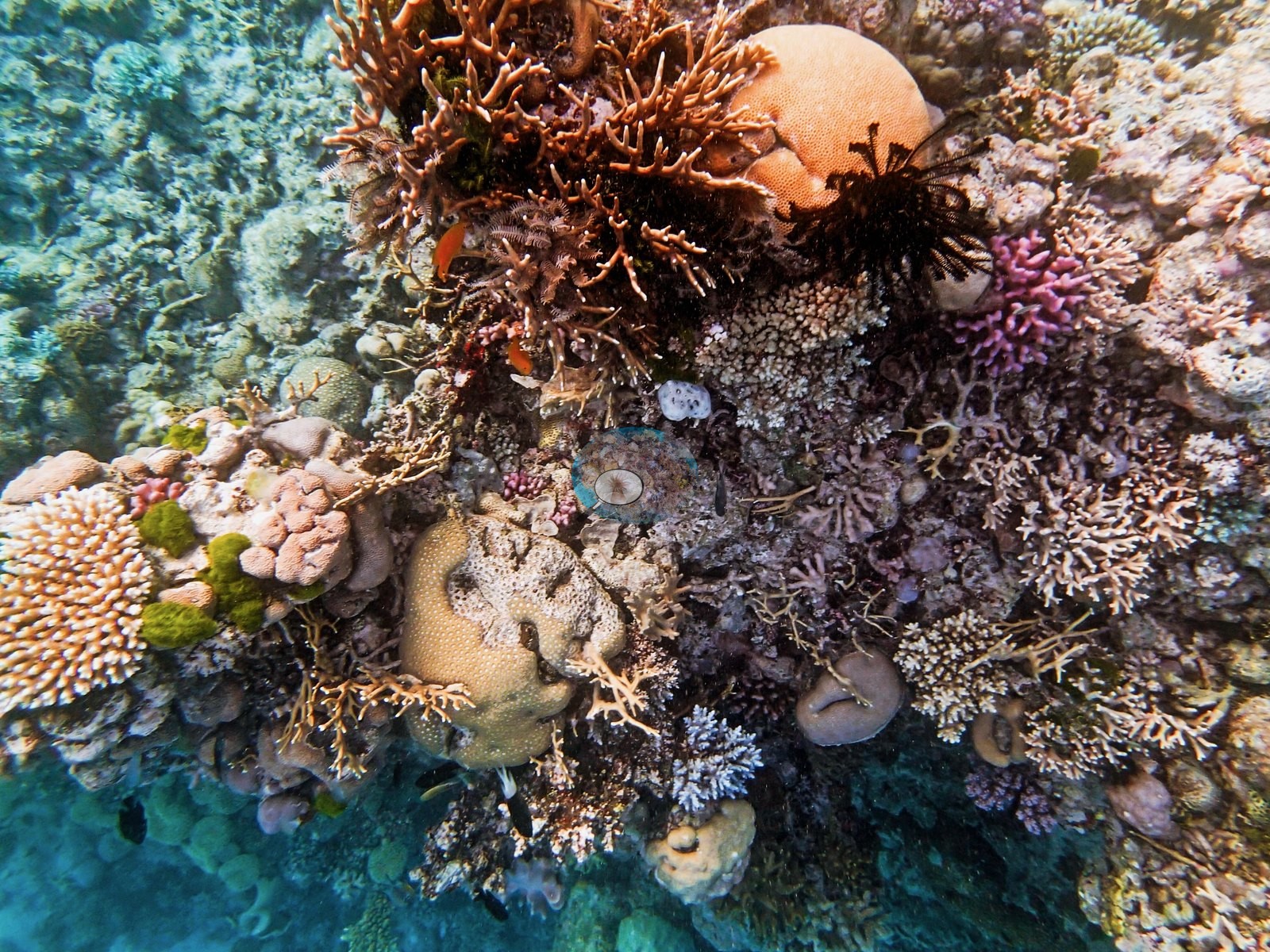
The reef around it is branching-dominated. Image 4 is the strongest frame: a dense thicket of mauve and lilac-gray branching Acropora with pale growing tips, clearly alive, standing over the framework with a yellow-green tabulate Acropora behind it, blue-green plating colonies, sponges, cardinalfish, and damselfish among the branches. Image 3 shows chunky brown columnar and thick-branched colonies rising off rubble in bright blue; Image 1 is a pale lilac branching colony photographed close with tan and rose neighbors; Image 8 and Image 9 are mixed reef shoulders of pale branching colonies, tan massives, and magenta coralline against blue. Image 10 is the crowded-crest frame: rust-brown branching colonies, cream corymbose Acropora, orange sponges, pale mounds, pink coralline, and black feather stars packed within about a meter.
Coral cover
- Reference: Khaled bin Sultan Living Oceans Foundation, Global Reef Expedition (in situ transect)
- Point-count cover here measured 24%, and Anderson calculated from randomly placed transects that roughly 18% of the surrounding 12-13 m sand-apron benthos was bommie structure.
- One transect was scored at this station (24%; n = 1, so no SE; Living Oceans Foundation per-transect benthic data); it is the expedition's station value printed above.
Stressors
Nothing about this colony reads as recent stress; the white patches are small and isolated against an otherwise continuous living surface. Across 11 of the 14 frames on file no bleaching, disease lesion, or crown-of-thorns feeding scar is visible.
Fish and other fauna
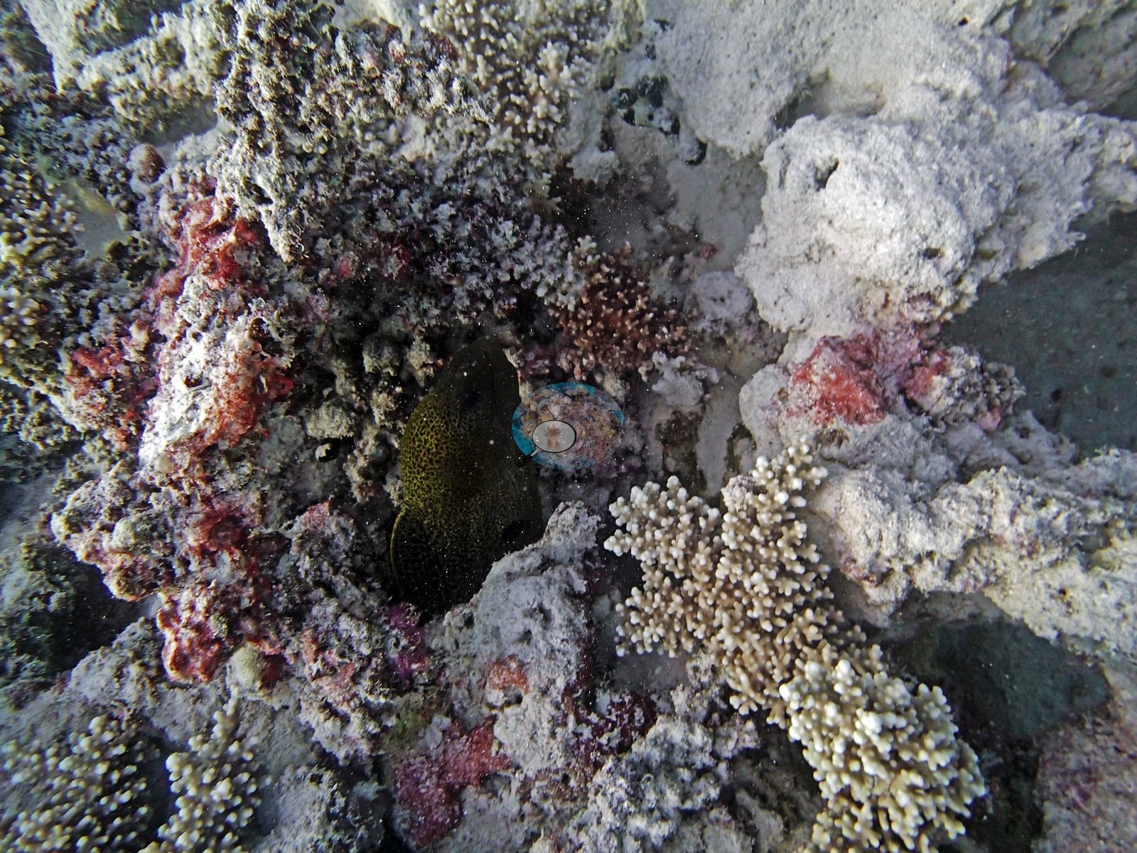
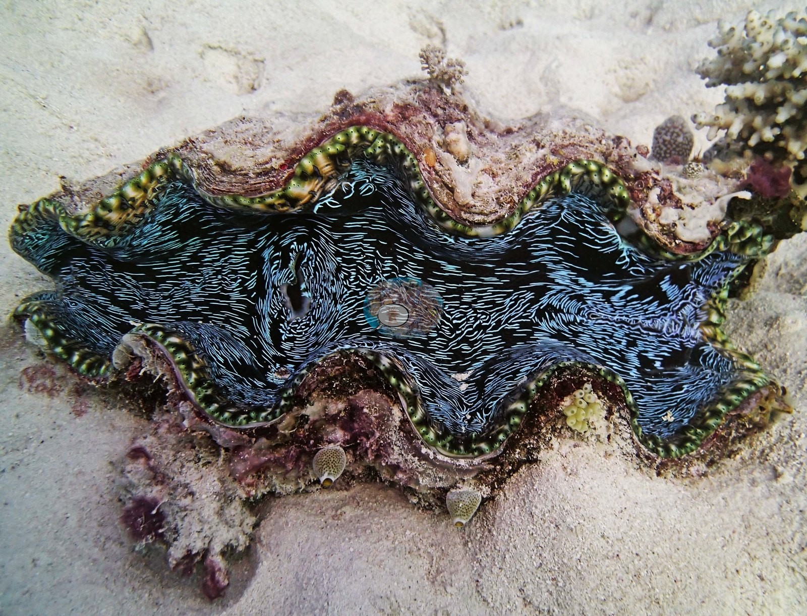
One frame shows the moray: a dark, yellow-flecked moray head wedged into a crevice in pale, silt-dusted coralline framework (e.g., Image 5); his notes call it the "first moray eel of trip." Image 2 is a giant clam lying on clean sand at the edge of the bommie apron, its mantle a dense black-and-green vermiculate pattern with a strongly fluted shell margin; it is a fauna frame over sand and carries no cover information.
Comparisons with other data
No other surveys have been conducted at this site to date. Within 5 km, twelve independent stations recorded 3.9–66% hard coral cover between 1993 and 2023; the nearest, XL Catlin Seaview Survey at transect 12004, 1.23 km away, read 4.3–7.7% between 2014 and 2017.
Other notes
Position approximate: expedition-estimated (three decimals in the 933-site table); Anderson's sheet and the expedition's planning table carry another day's coordinates for this station.
Independent surveys nearby
| Agency / program | Year(s) | Stations / distance | Link |
|---|---|---|---|
| AIMS LTMP | 1993–2022 | 5 stations, 1.81–4.82 km | Records ↓ |
| AIMS manta tow | 1993–2023 | 2 stations, 1.98–4.21 km | Records ↓ |
| Reef Check | 1998–2003 | 2 stations, 4.67–4.81 km | Records ↓ |
| XL Catlin Seaview Survey | 2012–2017 | 3 stations, 1.23–4.44 km | Records ↓ |
 LOF Global Reef ExpeditionYear-average (illustrative only, programs differ)
Within 5 km, 12 independent survey stations recorded hard coral cover in 176 surveys between 1993 and 2023. Of the 11 stations surveyed in more than one year, 8 were scored by divers or by people annotating photographs: 1 declined (by 3.8 points) and 7 increased (by 4.9–23.3 points) between their first and latest surveys. The other 3 were scored by automated image analysis: 1 declined by more than 7 points; 2 changed by 7 points or less, inside the 7-point method-noise floor (inconclusive). The longest record, YONGE REEF (AIMS manta tow, 1.98 km away), went from 14% in 1993 to 35% in 2023. Since 2021, station-year means average 29% (range 19–35%; n = 16 station-years from 16 surveys). This site's own estimate (24%) sits within the recent range up to 2 km away (19–35%); the methods differ, so the comparison is context, not a like-for-like test.
Collected by other programs using different methods (Reef Check uses point-intercept transects; AIMS manta tow is a towed visual estimate in categorical bins; AIMS LTMP uses fixed photo-transects; the XL Catlin Seaview Survey uses photo-transects with automated image annotation), so these are context for the figures above, not a like-for-like comparison. Where a station was surveyed more than once, the cell shows either the range of its values or, as a single value, the mean of surveys made in one year. Station names are not dive-site names.
Show all 12 independent survey records
| Agency | Site / location | Date | Hard coral cover (%) | Distance | Link |
|---|---|---|---|---|---|
| AIMS LTMP | NO NAME REEF site 1 | 1993–2022 | 8.2–66% (22 surveys) | 1.81 km | doi:10.25845/5c09bc4ff315c |
| AIMS manta tow | YONGE REEF | 1993–2023 | 5.5–35% (25 surveys) | 1.98 km | doi:10.25845/5c09b0abf315a |
| AIMS LTMP | NO NAME REEF site 2 | 1993–2022 | 13–56% (21 surveys) | 2.25 km | doi:10.25845/5c09bc4ff315c |
| AIMS LTMP | NO NAME REEF site 3 | 1993–2022 | 9.2–57% (22 surveys) | 2.65 km | doi:10.25845/5c09bc4ff315c |
| AIMS LTMP | YONGE REEF site 3 | 1993–2022 | 3.9–55% (range of yearly means; 23 surveys) | 4.17 km | doi:10.25845/5c09bc4ff315c |
| AIMS LTMP | YONGE REEF site 2 | 1993–2022 | 7.6–64% (range of yearly means; 23 surveys) | 4.82 km | doi:10.25845/5c09bc4ff315c |
| AIMS manta tow | NO NAME REEF | 1994–2023 | 4.3–40% (26 surveys) | 4.21 km | doi:10.25845/5c09b0abf315a |
| Reef Check | Ribbon Reef 10 - No Name Reef (Back reef slope) Site 1 | 1998–2002 | 43–60% (range of yearly means; 4 surveys) | 4.81 km | — |
| Reef Check | Pixie Reef Ribbon #3 | 2003 | 24% | 4.67 km | — |
| XL Catlin Seaview Survey | transect 12028 | 2012–2017 | 8.6–24% (4 surveys) | 2.76 km | doi:10.14264/uql.2019.930 |
| XL Catlin Seaview Survey | transect 12004 | 2014–2017 | 4.3–7.7% (3 surveys) | 1.23 km | doi:10.14264/uql.2019.930 |
| XL Catlin Seaview Survey | transect 12005 | 2014–2016 | 6.4–8.7% (2 surveys) | 4.44 km | doi:10.14264/uql.2019.930 |
Data & links
- Download benthic survey data (CSV) ↗
- Download all LOF-GRE data (933 sites) ↗
- Photo portfolio ↗
- Coral Reef Diagnostics country page ↗
All images from Coral Reef Diagnostics. Data are from the Khaled bin Sultan Living Oceans Foundation Global Reef Expedition, Coral Reef Diagnostics, and the organizations named in the data sources above.
 © Coral Reef Diagnostics.