
Chagos Archipelago - Peros Banhos

Regional summary of 20 dive sites. Figures are averages across the sites that report them (n = sites with a value); each site's own page has its individual values. Part of the Chagos Archipelago overview.
⬇ Download this region as a report card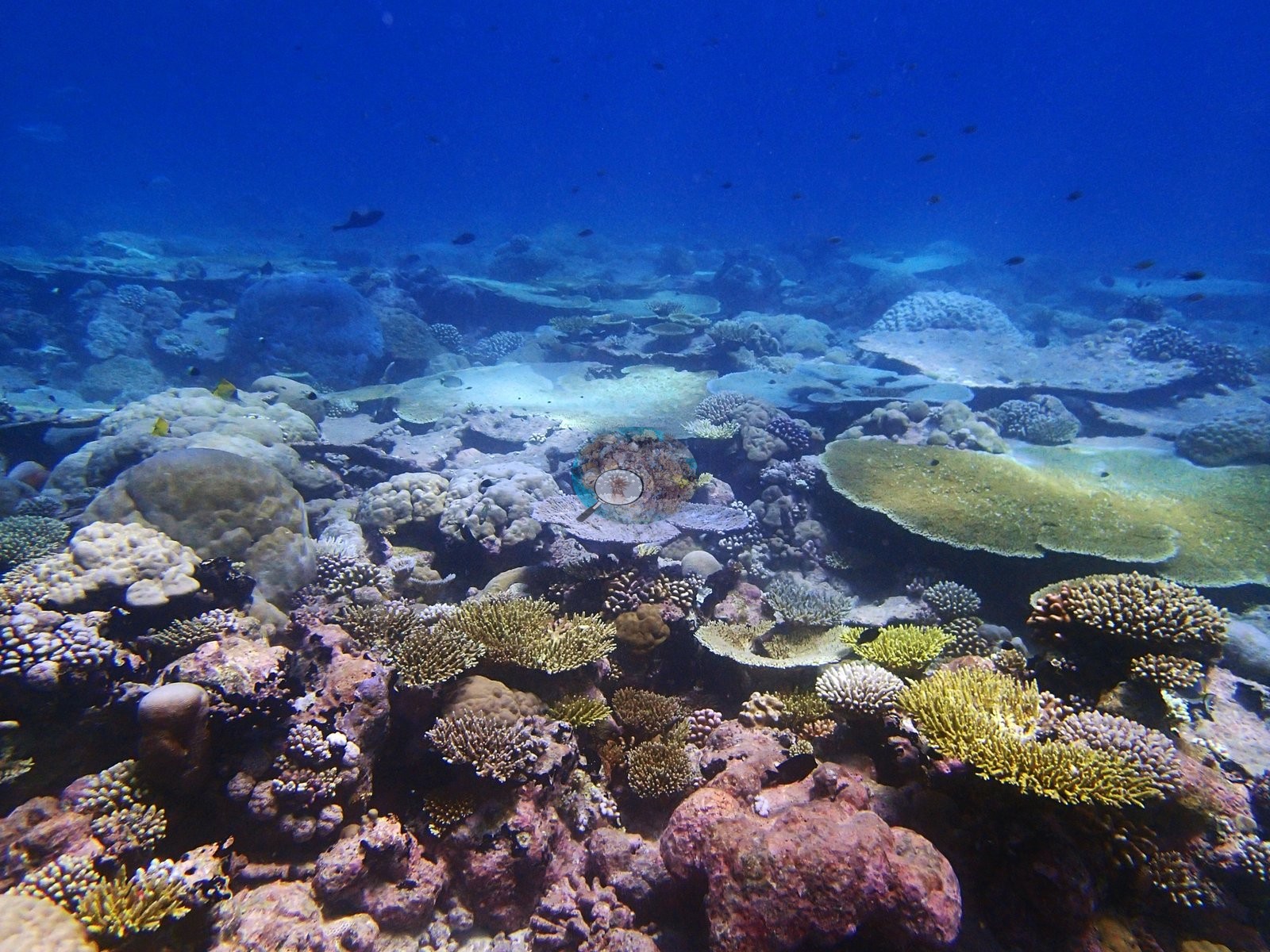

Peros Banhos pairs Acropora-dominated lagoon patch reefs and pinnacles with diverse, exposed outer forereefs, surveyed in April and May 2015. Repeat dives caught bleaching as it developed, climbing from 0% to 36.5% at one site in about two weeks.
Heat stress
Long-term record: 3 years since 1985 reached 8 or more °C-weeks at NOAA’s Chagos station. Download the annual DHW data (CSV).
20 sites in this region — click a marker to open that site.
Regional setting
Peros Banhos is one of the five true atolls of the Chagos Archipelago, along with Blenheim Reef, Diego Garcia, Egmont, and Salomon (Spalding et al. 2001). Like the other northern atolls it has only small islands dotted around its rim, in contrast to the almost unbroken land rim of Diego Garcia in the south. The archipelago grew up over the volcanic track of the Réunion hotspot at the southern end of the Chagos–Laccadive Ridge, and its nearest reef neighbors, in the Maldives, lie some 500 km to the north. Spalding et al. (2001) record about 220 scleractinian species there and describe the Chagos as a biogeographic stepping stone linking eastern and western Indian Ocean faunas. Their photograph of the Peros Banhos reef crest shows it dominated by coralline algae rather than corals, and eastern Peros Banhos was made a Strict Nature Reserve in 1998. Before 1998, corals typically occupied 50–80% of seaward and lagoon slopes to about 40 m, but that year's bleaching is estimated to have removed 80–85% of the coral on seaward reefs, on average. Spalding et al. (2001) estimate about 3,770 km² of reef for the archipelago as a whole, and Souter et al. (2021), working from a newer map, give 2,731 km² for the Chagos ecoregion.
Summarizing the 2004 regional status report, Wilkinson (2006) notes encouraging recovery on Chagos reefs after the 1998 mortality. The monitoring record compiled by Souter et al. (2021), which for this region begins with Chagos surveys in 1978, shows cover in the Chagos subregion climbing again until about 2015 and then dropping after the 2016 bleaching. Region-wide, that event wiped out over 42% of South Asia's living hard coral, and smaller, localized bleaching from 2017 to 2019 kept cover falling. The same report notes that atolls on the Lakshadweep–Maldives–Chagos Ridge face far less human pressure than mainland coasts, that the Chagos marine protected area (MPA) is the largest of the region's atoll MPAs, and that bleaching remains the main threat. Its authors warn that repeated bleaching may now leave too little time for reefs to recover fully between events.
Overview
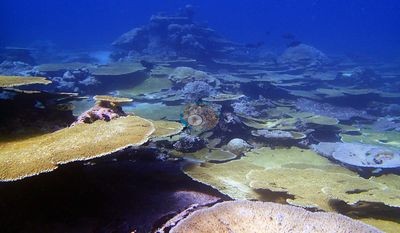
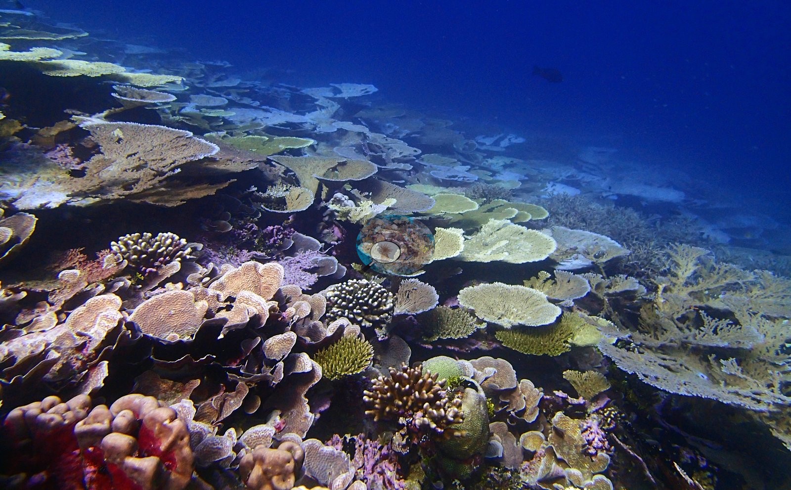
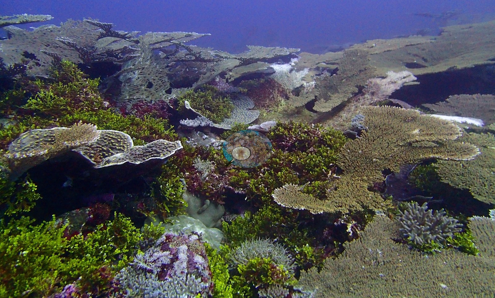
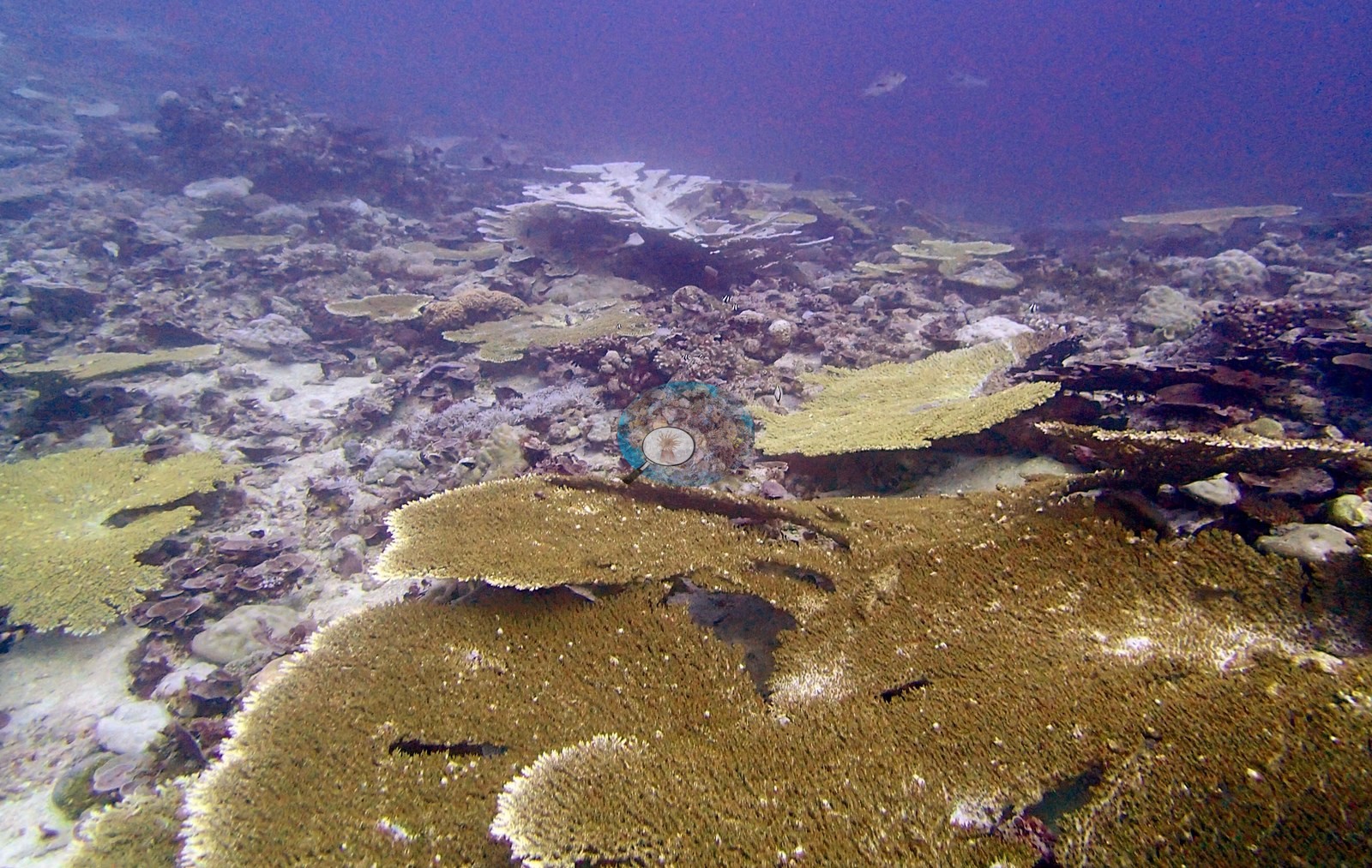
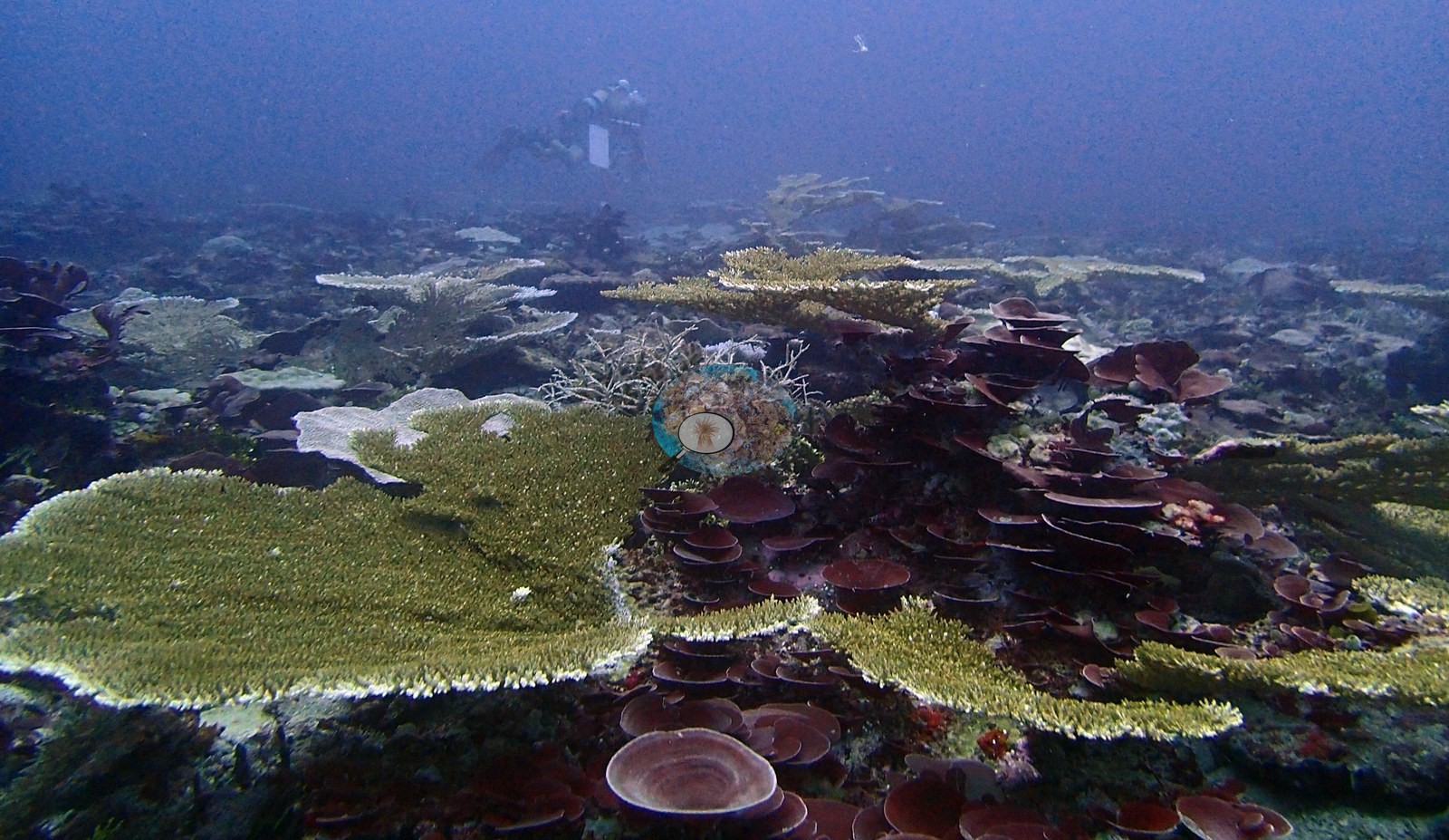
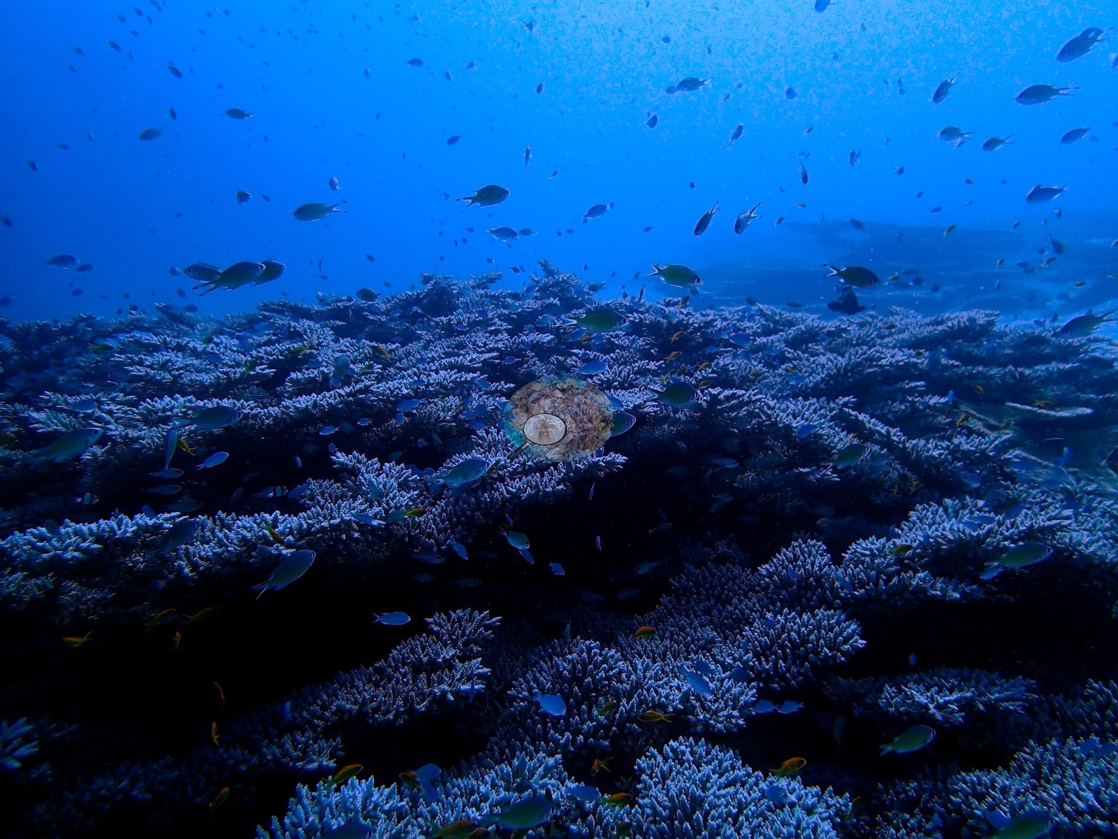
The 20 Peros Banhos sites span sheltered lagoonal patch reefs and pinnacles, lagoon channels, and exposed forereefs on the outer rim, surveyed between 14 April and 3 May 2015. Logged maximum depths ran from 20.9 m at BIPB66 to 31.2 m at BIPB75 (BIPB69 and BIPB71 have no logged depth). The lagoon reefs are overwhelmingly Acropora reefs, built of tiered table fields and staghorn thickets at BIPB69, BIPB70, BIPB74, and BIPB62, where the shallowest transect was 94% Acropora. Several outer forereefs break that pattern: Porites leads at BIPB114, and massive Porites mounds build BIPB75. At most sites cover falls with depth as the assemblage hands over from Acropora to Porites, Echinopora, Favia, or Montipora.
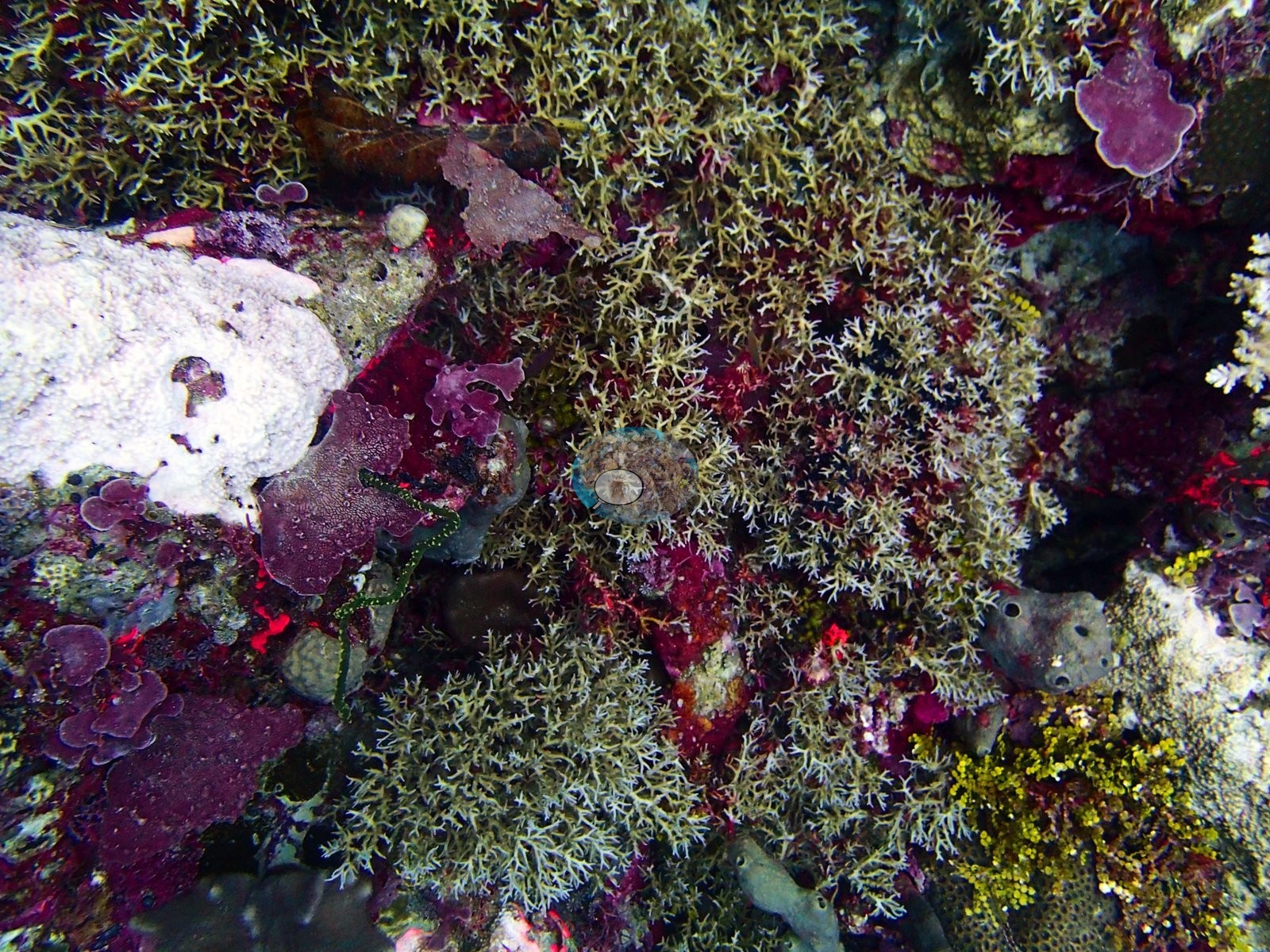
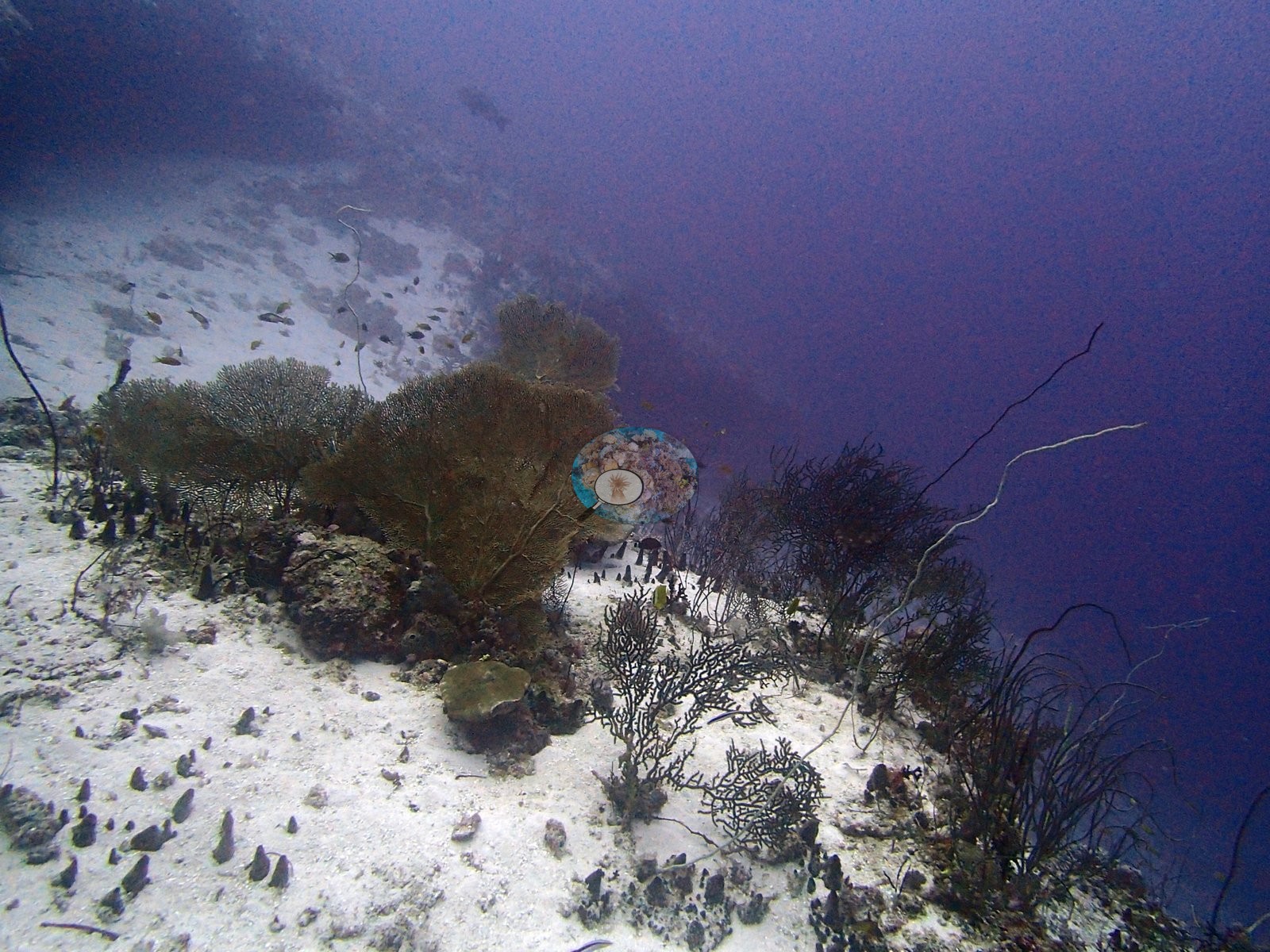
Transect coral cover ranged from 7.0% on the sand-and-rubble channel floor at BIPB66 to 64.7% at BIPB69. The back-reef pinnacle at BIPB72 reached 72.4%, a figure best read as its richest patch rather than a site-wide mean. The windward forereefs carried the highest genus counts recorded in the unit, 31 coral genera at BIPB114 and 30 at BIPB112. By contrast, the channel and rim reefs at BIPB61 and BIPB66 are dominated by algae and turf and carry dense stands of gorgonian sea fans and whip corals. BIPB76 holds an extensive field of intact but dead table corals coated in turf and silt, and dead coral averaged 15.7% across the transects at BIPB71.
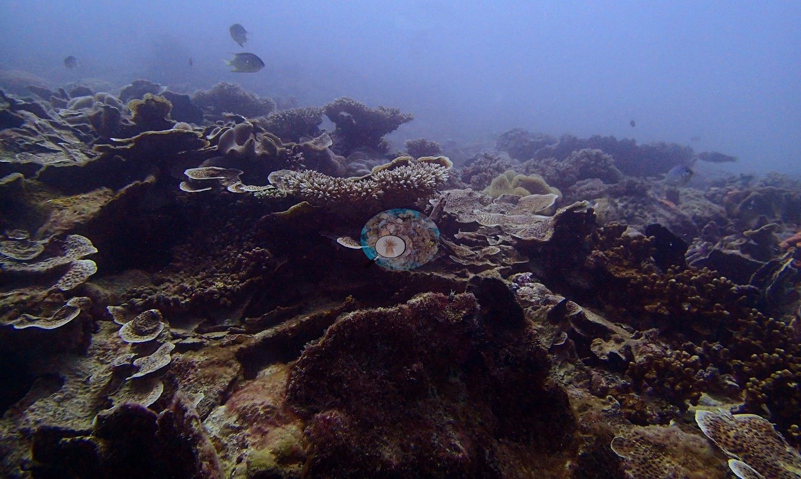
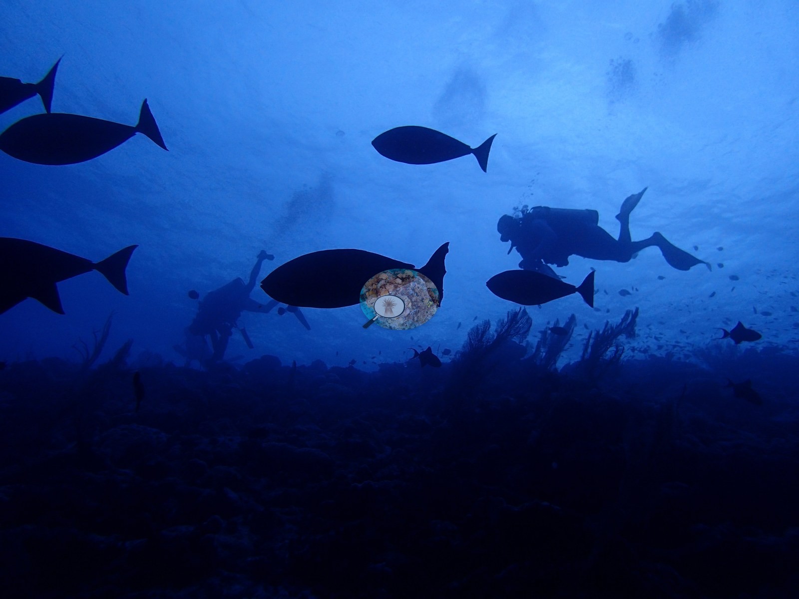
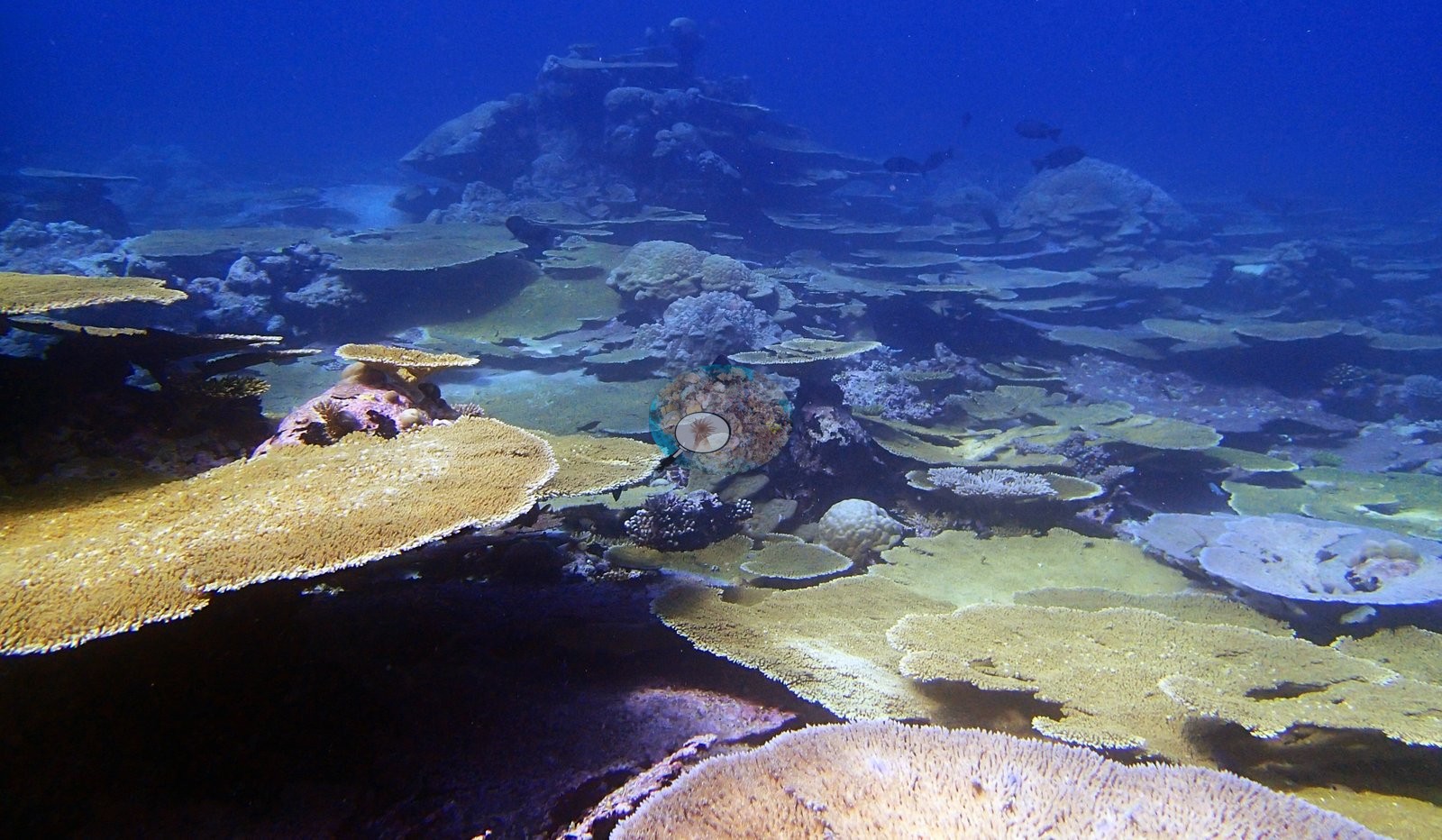
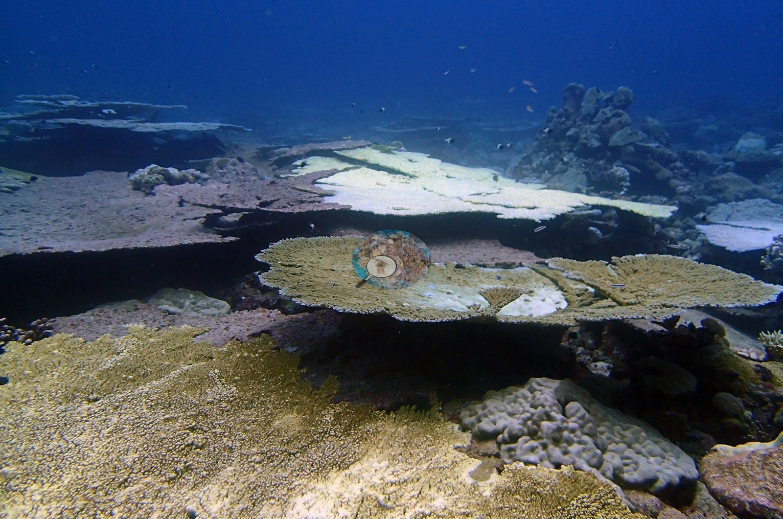
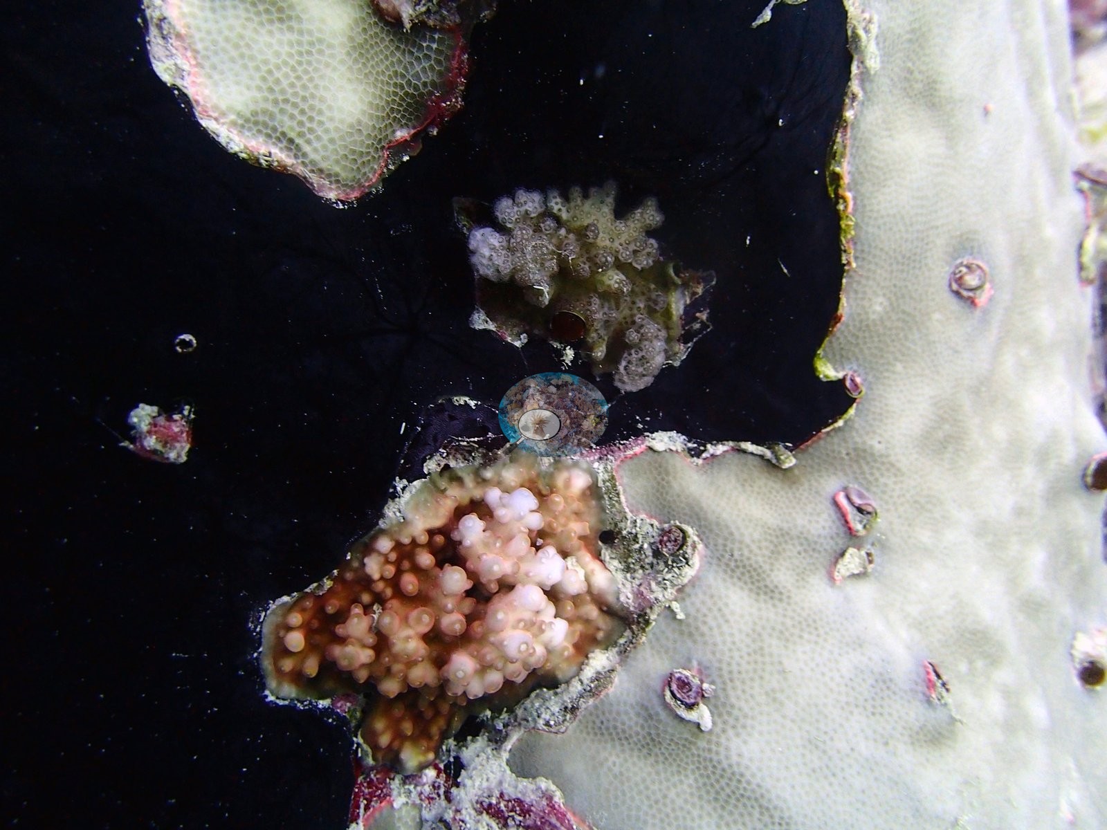
Bleaching was developing during the surveys. Published values ranged from 0.0% on BIPB69's first dive and 0.9% at BIPB68 to 38.2% at BIPB112, the highest of any of the 112 Chagos stations, where meter-scale tables had gone bone-white beside pigmented neighbors. Repeat dives tracked the event. BIPB69 rose from 0.0% on 16 April to 12% the next day and 36.5% by 2 May, BIPB70 from 3.7% to 33.3%, and BIPB72 from 10.0% to 37.5% in 13 days. Tabular Acropora was worst affected, while many branching stands stayed pigmented. No crown-of-thorns or disease was reported at the sites that recorded their absence. Wildlife included a reef manta ray at BIPB66, gray and whitetip reef sharks, and a hawksbill turtle resting on pale tables at BIPB74.
Highlights
- BIPB68: a gentle slope of unbroken staghorn thickets stacked with meter-wide table corals, at 55.0% cover and 0.9% bleaching
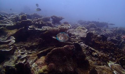
- BIPB62: 59.6% cover carried by Acropora and plate-forming Echinopora, with Porites nearly absent
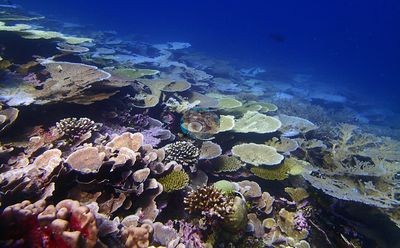
- BIPB112 recorded the highest published bleaching of any Chagos station (38.2%)
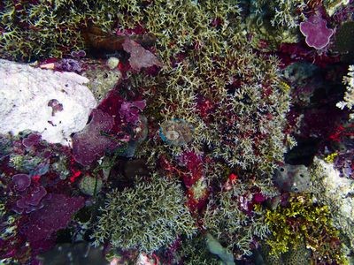
- Repeat dives at BIPB69, BIPB70 and BIPB72 caught bleaching rising by roughly 27 to 36 points within about two weeks
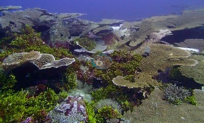
- Windward forereefs BIPB114 and BIPB112 carry 31 and 30 coral genera
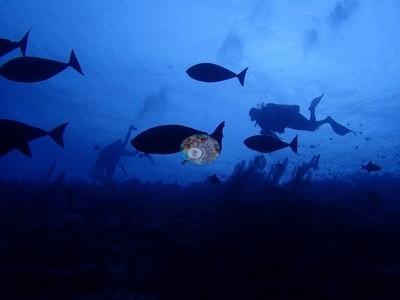
- Dense gorgonian sea fan and whip coral stands on the channel slopes at BIPB61 and BIPB66
Notable observations (12)
- Chagos Archipelago - Peros Banhos (BIPB112): Bleaching: 38.2% on the canonical column, highest of any of the 112 Chagos stations; meter-scale tables uniformly bone-white beside pigmented neighbors. No disease, predation, or crown-of-thorns seen.
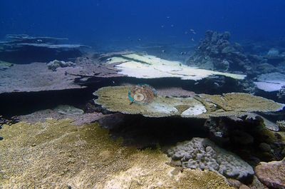
- Chagos Archipelago - Peros Banhos (BIPB69): Bleaching tracked over three dives: 0% on 16 April, 12.05% on 17 April, 36.47% on 2 May; fields of white tables beside dark branching stands. No crown-of-thorns, disease, or predation seen.
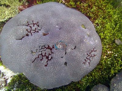
- Chagos Archipelago - Peros Banhos (BIPB70): Bleaching rose from 3.7% (17 April) to 33.3% (1 May); landscape-scale fields of stark-white tables, overwhelmingly Acropora.
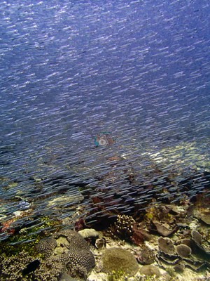
- Chagos Archipelago - Peros Banhos (BIPB72): Bleaching rose from 10.0% to 37.5% in 13 days; near-continuous field of white table corals; Pocillopora slopes paled rather than turning fully white.
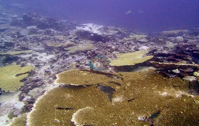
- Chagos Archipelago - Peros Banhos (BIPB74): Bleaching: 5.35% in April; the 1 May revisit was photographed but not scored and shows a visibly worse mosaic of whitened Acropora, Pocillopora and fungiids. No crown-of-thorns or disease in either dive.
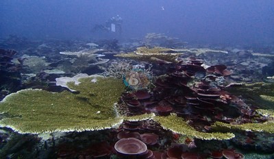
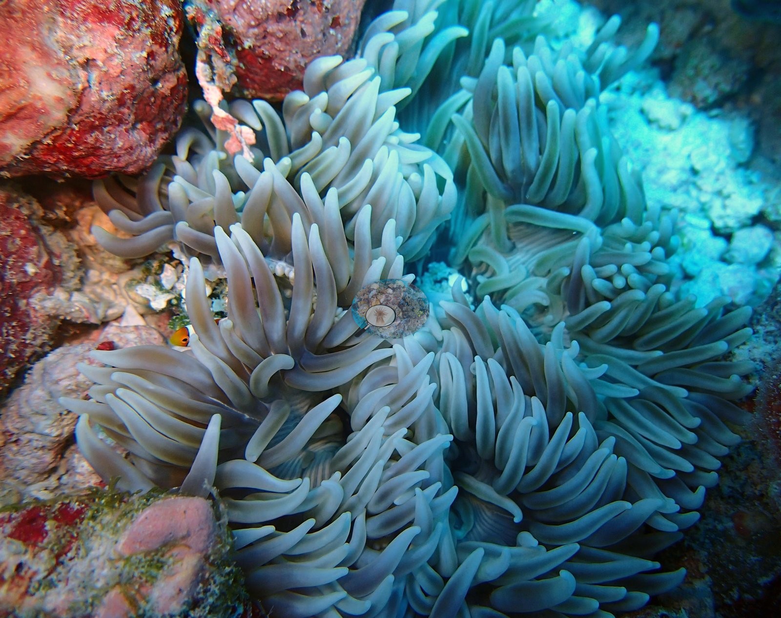
- Chagos Archipelago - Peros Banhos (BIPB114): Bleaching about 23% of coral on two consecutive dives; white corymbose and plate colonies and a bleached host anemone. No crown-of-thorns or disease.
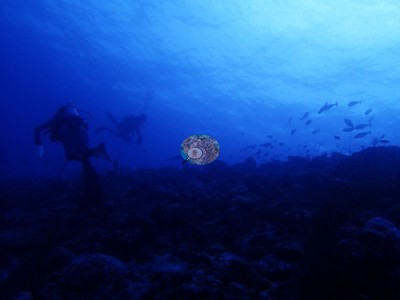
- Chagos Archipelago - Peros Banhos (BIPB76): Bleaching 22.0%; bone-white tables and branching colonies in at least seven frames; extensive field of dead tables coated in turf and silt; one encrusting colony with a white band could not be resolved between tissue loss and bleaching followed by mortality. No crown-of-thorns or diagnostic disease sign.
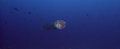
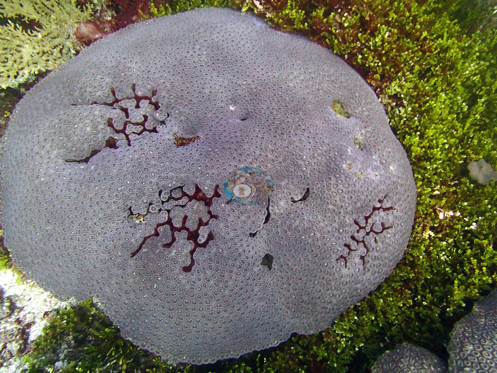
- Chagos Archipelago - Peros Banhos (BIPB75): Bleaching 17.4%; fully white plating colonies and a brain colony gone pale mauve. No disease or crown-of-thorns.
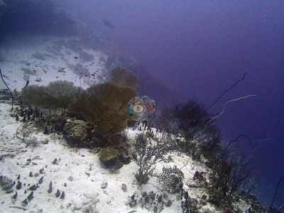
- Chagos Archipelago - Peros Banhos (BIPB110): Bleaching unmistakable across several growth forms, including an enormous massive colony with extensive white tissue (14.8%).
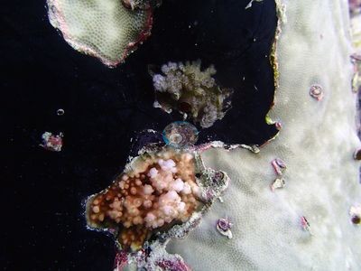
- Chagos Archipelago - Peros Banhos (BIPB63): Conspicuous colony-scale white pallor among tabular corals despite a published bleaching figure of 2.0%; discrepancy unresolved.
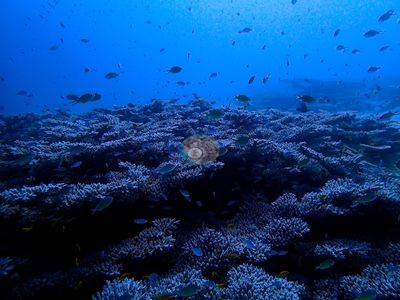
- Chagos Archipelago - Peros Banhos (BIPB64): Several colonies with clear colony-scale bleaching, including one large table almost entirely white (9.5%).
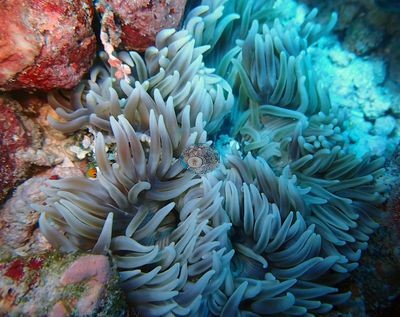
- Chagos Archipelago - Peros Banhos (BIPB71): Mortality: dead coral averaged 15.7% across the transects, in a very high-cover (63.1%) Acropora reef. No photographs and no bleaching value.
Coral cover over time (pooled)
 the year includes his Global Reef Expedition dives with the Khaled bin Sultan Living Oceans Foundation (CRD+LOF data).
Sites in this region (20)
- Chagos Archipelago - Peros Banhos (BIPB110) — 39% coral cover
- Chagos Archipelago - Peros Banhos (BIPB112) — 45% coral cover
- Chagos Archipelago - Peros Banhos (BIPB114) — 40% coral cover
- Chagos Archipelago - Peros Banhos (BIPB60) — 42% coral cover
- Chagos Archipelago - Peros Banhos (BIPB61) — 20% coral cover
- Chagos Archipelago - Peros Banhos (BIPB62) — 60% coral cover
- Chagos Archipelago - Peros Banhos (BIPB63) — 56% coral cover
- Chagos Archipelago - Peros Banhos (BIPB64) — 31% coral cover
- Chagos Archipelago - Peros Banhos (BIPB65) — 41% coral cover
- Chagos Archipelago - Peros Banhos (BIPB66) — 7.0% coral cover
- Chagos Archipelago - Peros Banhos (BIPB67) — 42% coral cover
- Chagos Archipelago - Peros Banhos (BIPB68) — 55% coral cover
- Chagos Archipelago - Peros Banhos (BIPB69) — 65% coral cover
- Chagos Archipelago - Peros Banhos (BIPB70) — 60% coral cover
- Chagos Archipelago - Peros Banhos (BIPB71) — 63% coral cover
- Chagos Archipelago - Peros Banhos (BIPB72) — 72% coral cover
- Chagos Archipelago - Peros Banhos (BIPB73) — 50% coral cover
- Chagos Archipelago - Peros Banhos (BIPB74) — 62% coral cover
- Chagos Archipelago - Peros Banhos (BIPB75) — 44% coral cover
- Chagos Archipelago - Peros Banhos (BIPB76) — 36% coral cover
% coral cover by method
Pooled across 104 dive sites
| Method | Mean % coral cover | Std. dev. between dive sites | n dive sites | Note |
|---|---|---|---|---|
| Manual point count (author) | 34.0% | ±13 | 28 | frame-weighted 40.1% over 613 frames |
| CoralNet automated point classifier | 32.8% | ±11 | 89 | frame-weighted 34.0% over 1,895 frames |
| CoralSCOP (SAM-based mask-sum), edited photos | 32.2% | ±8.3 | 104 | frame-weighted 33.9% over 2,498 frames |
| Claude (Anthropic), blind point count | 26.5% | ±11 | 104 | frame-weighted 29.0% over 2,495 frames |
| In-house DINOv3 point classifier | 30.5% | ±11 | 104 | frame-weighted 31.2% over 2,500 frames |
| In-water diver transect (line/point intercept) | 37.7% | ±16 | 101 | — |
The mean is an UNWEIGHTED mean of the dive site values — each dive site counts once, whatever its photo count — which is the convention of the published tables and of every other figure on this page. The frame-weighted alternative is given per method in the Note column; where the two differ, the difference is a photo-count imbalance, not a coral-cover finding.
Closest to the reference
Over the dive sites where an independent reference exists, Manual point count (author) sits closest to it — a mean absolute deviation of 9.5 pp across 27 dive sites, then CoralNet automated point classifier 10.5 pp (n=86), Claude (Anthropic), blind point count 13.2 pp (n=101). A mean absolute deviation is not an accuracy score: a model with a consistent offset is correctable, while one with the same deviation scattered in both directions is not.
By dive site
| Dive site | Manual point count | CoralNet | CoralSCOP (edited) | Claude | DINOv3 | Diver transect | coralscapes_v1 | coralscapes |
|---|---|---|---|---|---|---|---|---|
| BIBL82 | 17.5% n=4 | 27.6% n=18 | 35.8% n=22 | 28.3% n=22 | 26.1% n=22 | 37.9% | 42.0% n=22 | 50.2% n=22 |
| BIBL83 | 20.8% n=9 | 25.6% n=6 | 40.7% n=15 | 23.8% n=15 | 24.7% n=15 | 33.1% | 42.2% n=15 | 45.2% n=15 |
| BIBL86 | — | 31.9% n=27 | 25.1% n=27 | 34.4% n=27 | 36.0% n=27 | 47.2% | 50.5% n=27 | 49.4% n=27 |
| BIBL87 | — | 27.9% n=35 | 29.5% n=35 | 30.3% n=35 | 34.0% n=35 | 40.6% | 41.5% n=35 | 48.0% n=35 |
| BICC35 | — | 17.0% n=15 | 20.5% n=15 | 6.7% n=15 | 13.1% n=15 | 13.8% | 21.0% n=15 | 23.9% n=15 |
| BICC36 | — | 19.4% n=15 | 24.7% n=15 | 6.4% n=15 | 18.2% n=15 | 5.8% | 21.0% n=15 | 26.5% n=15 |
| BICC50 | — | 29.4% n=11 | 28.8% n=11 | 15.7% n=11 | 30.0% n=11 | 12.1% | 36.9% n=11 | 48.0% n=11 |
| BICC51 | — | 21.9% n=17 | 27.5% n=17 | 20.7% n=17 | 24.1% n=17 | 15.4% | 26.9% n=17 | 28.4% n=17 |
| BIDI08 | — | 36.4% n=35 | 38.9% n=35 | 35.2% n=35 | 29.1% n=35 | 59.0% | 50.2% n=35 | 53.1% n=35 |
| BIDI09 | — | 38.0% n=30 | 32.2% n=30 | 33.6% n=30 | 23.6% n=30 | 37.7% | 56.2% n=30 | 61.0% n=30 |
| BIDI10 | — | 27.1% n=13 | 32.9% n=13 | 22.5% n=13 | 16.2% n=13 | 23.0% | 44.2% n=13 | 49.4% n=13 |
| BIDI12 | — | 10.4% n=14 | 17.9% n=14 | 2.9% n=14 | 11.0% n=14 | 4.2% | 8.2% n=14 | 10.0% n=14 |
| BIDI13 | — | 20.5% n=11 | 24.9% n=11 | 17.8% n=11 | 18.2% n=11 | 7.8% | 22.0% n=11 | 23.5% n=11 |
| BIDI14 | — | 23.5% n=9 | 30.3% n=9 | 19.2% n=9 | 21.9% n=9 | 15.2% | 26.7% n=9 | 26.2% n=9 |
| BIDI15 | — | 24.6% n=9 | 20.6% n=9 | 36.4% n=9 | 37.0% n=9 | 20.1% | 45.3% n=9 | 48.3% n=9 |
| BIDI16 | — | 25.6% n=13 | 30.9% n=13 | 24.4% n=13 | 22.3% n=13 | 30.4% | 32.2% n=13 | 35.6% n=13 |
| BIEA18 | — | 22.3% n=35 | 28.1% n=35 | 17.7% n=35 | 14.6% n=35 | 20.7% | 32.9% n=35 | 32.4% n=34 |
| BIEA19 | — | 27.2% n=14 | 39.2% n=14 | 30.8% n=14 | 25.5% n=14 | 27.5% | 41.9% n=14 | 44.8% n=14 |
| BIEA20 | — | 24.6% n=19 | 27.1% n=19 | 22.2% n=19 | 16.0% n=19 | 10.8% | 30.8% n=19 | 35.4% n=19 |
| BIEA22 | — | 49.2% n=23 | 50.0% n=23 | 30.8% n=23 | 44.8% n=23 | 21.6% | 44.0% n=23 | 46.1% n=23 |
| BIEA23 | — | 35.7% n=24 | 39.5% n=24 | 28.5% n=24 | 28.8% n=24 | 24.6% | 43.8% n=24 | 49.2% n=24 |
| BIEA24 | — | 40.6% n=11 | 39.2% n=11 | 37.4% n=11 | 41.2% n=11 | 12.7% | 48.5% n=11 | 49.3% n=11 |
| BIEA25 | — | 29.5% n=19 | 29.8% n=19 | 16.4% n=19 | 25.6% n=19 | 15.7% | 31.1% n=19 | 32.8% n=19 |
| BIEA26 | — | 21.0% n=30 | 27.2% n=30 | 14.5% n=30 | 14.1% n=30 | 21.0% | 23.3% n=30 | 28.4% n=30 |
| BIEA52 | — | 38.1% n=22 | 39.1% n=22 | 34.5% n=22 | 21.8% n=22 | 34.1% | 49.6% n=22 | 50.0% n=22 |
| BIEG02 | 25.5% n=21 | — | 23.7% n=21 | 18.2% n=21 | 23.7% n=21 | 31.8% | 31.1% n=21 | 34.5% n=21 |
| BIEG03 | 23.9% n=36 | — | 25.7% n=36 | 16.6% n=36 | 18.4% n=36 | 37.3% | 31.5% n=36 | 34.0% n=36 |
| BIEG04 | 33.9% n=19 | — | 28.2% n=19 | 25.9% n=19 | 35.1% n=19 | 29.2% | 36.4% n=19 | 38.7% n=19 |
| BIEG05 | 40.7% n=35 | 57.8% n=24 | 41.4% n=59 | 39.1% n=59 | 40.2% n=59 | 46.7% | 61.2% n=59 | 63.6% n=59 |
| BIEG06 | — | 44.2% n=30 | 22.6% n=30 | 31.6% n=30 | 34.0% n=30 | 43.5% | 46.0% n=30 | 46.5% n=30 |
| BIEG07 | 40.6% n=8 | — | 26.8% n=8 | 28.5% n=8 | 56.7% n=8 | 47.5% | 30.9% n=8 | 33.5% n=8 |
| BINI77 | — | 29.8% n=11 | 33.5% n=11 | 25.7% n=11 | 26.1% n=11 | 43.0% | 38.2% n=11 | 41.1% n=11 |
| BINI78 | — | 24.4% n=16 | 28.4% n=16 | 24.8% n=16 | 29.0% n=16 | 19.1% | 26.9% n=16 | 28.6% n=16 |
| BINI79 | — | 19.4% n=15 | 21.2% n=15 | 17.9% n=15 | 21.6% n=15 | 31.5% | 27.2% n=15 | 25.0% n=15 |
| BINI80 | 37.6% n=10 | 26.8% n=14 | 34.9% n=24 | 29.4% n=24 | 36.9% n=24 | 42.8% | 42.4% n=24 | 45.9% n=24 |
| BIPB110 | — | 36.6% n=45 | 36.7% n=44 | 29.5% n=45 | 36.6% n=45 | 39.3% | 44.3% n=43 | 49.6% n=43 |
| BIPB112 | 43.6% n=14 | — | 37.7% n=14 | 28.7% n=14 | 44.3% n=14 | 45.0% | 50.6% n=14 | 55.0% n=14 |
| BIPB114 | 29.0% n=22 | 34.4% n=7 | 35.2% n=29 | 20.0% n=29 | 31.7% n=29 | 39.6% | 37.0% n=29 | 38.5% n=29 |
| BIPB60 | 38.8% n=38 | — | 41.9% n=38 | 29.5% n=38 | 33.4% n=38 | 42.2% | 55.5% n=38 | 57.2% n=38 |
| BIPB61 | 17.9% n=14 | — | 32.5% n=14 | 17.0% n=14 | 22.1% n=14 | 20.0% | 41.0% n=14 | 43.0% n=14 |
| BIPB62 | 48.0% n=19 | — | 31.6% n=19 | 33.6% n=19 | 35.3% n=19 | 59.6% | 57.6% n=18 | 57.5% n=18 |
| BIPB63 | 46.9% n=29 | — | 38.4% n=29 | 35.0% n=29 | 33.3% n=29 | 56.0% | 66.2% n=29 | 66.7% n=29 |
| BIPB64 | 22.7% n=21 | — | 33.3% n=21 | 22.8% n=21 | 26.2% n=21 | 31.2% | 34.3% n=21 | 41.4% n=21 |
| BIPB65 | 32.9% n=19 | — | 27.5% n=19 | 30.3% n=19 | 32.3% n=19 | 41.4% | 52.3% n=19 | 54.9% n=19 |
| BIPB66 | 12.5% n=6 | — | 28.8% n=6 | 2.3% n=6 | 26.1% n=6 | 7.0% | 41.9% n=6 | 40.9% n=6 |
| BIPB67 | 36.4% n=41 | — | 29.5% n=41 | 26.1% n=41 | 33.8% n=41 | 41.9% | 49.3% n=41 | 52.2% n=41 |
| BIPB68 | 44.9% n=43 | — | 39.2% n=43 | 36.8% n=43 | 38.5% n=43 | 55.0% | 71.9% n=43 | 73.8% n=43 |
| BIPB69 | 54.2% n=110 | 56.1% n=6 | 42.6% n=116 | 39.1% n=116 | 47.4% n=116 | 64.7% | 74.4% n=116 | 75.4% n=116 |
| BIPB70 | 45.4% n=28 | 45.1% n=27 | 35.7% n=55 | 34.9% n=55 | 40.2% n=55 | 60.3% | 56.6% n=55 | 59.5% n=55 |
| BIPB72 | 50.5% n=41 | 56.1% n=34 | 39.9% n=75 | 44.3% n=75 | 49.2% n=75 | 72.4% | 64.4% n=75 | 69.0% n=75 |
| BIPB73 | — | 45.2% n=45 | 46.9% n=45 | 37.6% n=45 | 45.3% n=45 | 50.1% | 48.0% n=45 | 50.6% n=45 |
| BIPB74 | 39.3% n=8 | 56.0% n=13 | 47.1% n=21 | 51.1% n=21 | 48.9% n=21 | 62.4% | 64.5% n=21 | 65.9% n=21 |
| BIPB75 | — | 39.2% n=9 | 43.7% n=9 | 32.4% n=9 | 42.2% n=9 | 43.9% | 51.0% n=9 | 56.5% n=9 |
| BIPB76 | — | 29.9% n=20 | 29.0% n=20 | 20.9% n=20 | 31.5% n=20 | 35.9% | 34.7% n=20 | 39.8% n=20 |
| BISA102 | — | 31.1% n=27 | 34.4% n=27 | 21.5% n=27 | 30.1% n=27 | 30.9% | 33.2% n=27 | 34.7% n=27 |
| BISA103 | — | 28.4% n=19 | 36.1% n=19 | 30.1% n=19 | 37.2% n=19 | 32.5% | 40.5% n=19 | 44.5% n=19 |
| BISA104 | — | 44.2% n=16 | 41.0% n=16 | 35.7% n=16 | 45.6% n=16 | 36.2% | 46.0% n=16 | 50.6% n=16 |
| BISA105 | — | 23.8% n=19 | 23.4% n=19 | 27.8% n=19 | 36.0% n=19 | 50.3% | 41.8% n=19 | 47.0% n=19 |
| BISA107 | — | 18.0% n=12 | 21.7% n=12 | 18.5% n=12 | 20.6% n=12 | 24.6% | 32.1% n=12 | 41.2% n=12 |
| BISA84 | 25.8% n=2 | 16.7% n=5 | 40.1% n=7 | 17.5% n=7 | 28.6% n=7 | 48.8% | 35.3% n=7 | 34.3% n=7 |
| BISA88 | — | 45.8% n=13 | 43.4% n=13 | 42.7% n=13 | 54.1% n=13 | 56.7% | 55.3% n=13 | 59.9% n=13 |
| BISA91 | — | 46.7% n=13 | 44.0% n=13 | 40.3% n=13 | 55.6% n=13 | 52.4% | 58.0% n=13 | 64.8% n=13 |
| BISA92 | — | 29.4% n=39 | 29.0% n=39 | 18.8% n=39 | 25.6% n=39 | 24.5% | 33.1% n=39 | 34.3% n=39 |
| BISA93 | — | 38.7% n=27 | 26.4% n=28 | 33.0% n=27 | 26.4% n=28 | 39.1% | 58.3% n=26 | 61.0% n=27 |
| BISA94 | — | 47.4% n=2 | 21.4% n=2 | 23.1% n=2 | 56.7% n=2 | 40.3% | 43.5% n=2 | 63.2% n=2 |
| BISA97 | — | 51.1% n=12 | 29.4% n=12 | 51.1% n=12 | 49.7% n=12 | 54.4% | 67.8% n=12 | 69.3% n=12 |
| BISP100 | — | 21.7% n=7 | 27.0% n=7 | 31.9% n=7 | 34.8% n=7 | 53.9% | 42.2% n=7 | 43.2% n=7 |
| BISP101 | — | 39.1% n=13 | 32.6% n=13 | 23.0% n=13 | 32.1% n=13 | 50.0% | 42.2% n=13 | 43.5% n=13 |
| BISP89 | — | 17.2% n=13 | 27.6% n=13 | 19.9% n=13 | 21.5% n=13 | 33.2% | 28.6% n=13 | 29.9% n=13 |
| BISP90 | — | 27.6% n=8 | 37.9% n=8 | 24.7% n=8 | 30.8% n=8 | 39.8% | 41.6% n=8 | 43.2% n=8 |
| BISP95 | — | 21.9% n=26 | 23.1% n=25 | 17.8% n=26 | 20.4% n=26 | 56.9% | 28.0% n=26 | 27.6% n=26 |
| BISP96 | — | 55.6% n=18 | 48.2% n=18 | 51.5% n=18 | 49.3% n=18 | 86.0% | 69.0% n=18 | 72.7% n=18 |
| BITB27 | — | 34.5% n=16 | 37.5% n=16 | 23.8% n=16 | 24.4% n=16 | 36.6% | 45.9% n=16 | 47.8% n=16 |
| BITB28 | — | 26.9% n=43 | 29.0% n=43 | 18.5% n=43 | 20.2% n=43 | 28.5% | 33.5% n=43 | 37.5% n=43 |
| BITB29 | — | 29.6% n=49 | 25.9% n=49 | 18.5% n=49 | 23.7% n=49 | 30.2% | 39.5% n=49 | 42.1% n=49 |
| BITB30 | — | 29.9% n=12 | 30.3% n=12 | 14.0% n=12 | 18.3% n=12 | 42.5% | 33.9% n=12 | 38.2% n=12 |
| BITB32 | — | 16.7% n=19 | 19.9% n=19 | 11.7% n=19 | 11.8% n=19 | 30.3% | 17.9% n=19 | 19.8% n=19 |
| BITB33 | — | 20.3% n=27 | 22.3% n=27 | 7.9% n=27 | 11.5% n=27 | 18.5% | 18.4% n=26 | 17.5% n=26 |
| BITB34 | — | 41.4% n=11 | 46.6% n=11 | 37.0% n=11 | 34.5% n=11 | 61.1% | 56.5% n=11 | 66.7% n=10 |
| BITB37 | — | 37.3% n=56 | 42.4% n=57 | 29.0% n=56 | 29.6% n=57 | 38.8% | 51.2% n=55 | 54.5% n=55 |
| BITB38 | — | 33.7% n=44 | 31.5% n=44 | 26.3% n=44 | 28.1% n=44 | 56.0% | 54.1% n=44 | 56.3% n=44 |
| BITB39 | — | 40.1% n=60 | 44.4% n=61 | 36.7% n=60 | 31.7% n=61 | 50.3% | 53.3% n=59 | 57.5% n=59 |
| BITB40 | — | 28.5% n=5 | 30.8% n=5 | 23.6% n=5 | 22.7% n=5 | 44.9% | 39.7% n=5 | 45.7% n=5 |
| BITB41 | — | 31.8% n=13 | 39.5% n=13 | 24.9% n=13 | 31.8% n=13 | 41.9% | 40.3% n=13 | 42.0% n=13 |
| BITB42 | — | 31.1% n=49 | 35.4% n=51 | 22.6% n=49 | 24.4% n=51 | 36.2% | 39.5% n=50 | 42.8% n=51 |
| BITB43 | — | 35.9% n=12 | 36.6% n=12 | 22.3% n=12 | 14.7% n=12 | 28.7% | 46.7% n=12 | 50.3% n=12 |
| BITB44 | — | 33.2% n=36 | 38.7% n=36 | 26.9% n=36 | 29.4% n=36 | 40.5% | 44.2% n=36 | 47.0% n=36 |
| BITB45 | — | 44.5% n=13 | 36.1% n=13 | 33.3% n=13 | 39.2% n=13 | 45.6% | 50.5% n=13 | 51.9% n=13 |
| BITB46 | — | 27.5% n=11 | 31.3% n=11 | 18.4% n=11 | 15.2% n=11 | 25.8% | 34.5% n=10 | 37.7% n=10 |
| BITB47 | — | 43.0% n=2 | 33.2% n=2 | 25.5% n=2 | 35.0% n=2 | 53.7% | 46.0% n=2 | 45.2% n=2 |
| BITB53 | — | 35.2% n=22 | 27.4% n=22 | 23.4% n=22 | 30.8% n=22 | 36.7% | 40.7% n=22 | 42.0% n=22 |
| BITB54 | — | 34.3% n=99 | 30.9% n=99 | 29.8% n=99 | 20.8% n=99 | 49.5% | 50.0% n=97 | 53.9% n=97 |
| BITB55 | — | 43.3% n=14 | 38.3% n=14 | 33.2% n=14 | 33.8% n=14 | 47.6% | 47.1% n=14 | 51.0% n=14 |
| BITB56 | — | 19.9% n=13 | 18.0% n=13 | 19.4% n=13 | 20.3% n=13 | 21.3% | 25.0% n=13 | 26.2% n=13 |
| BITB57 | — | 44.0% n=111 | 36.4% n=111 | 43.4% n=111 | 33.2% n=111 | 40.1% | 65.6% n=111 | 67.8% n=111 |
| BITB58 | — | 31.0% n=1 | 29.9% n=1 | 31.0% n=1 | 40.0% n=1 | 67.0% | 28.1% n=1 | 32.6% n=1 |
| BIVB108 | 40.0% n=1 | 25.1% n=10 | 28.2% n=11 | 11.7% n=11 | 23.9% n=11 | 45.7% | 23.2% n=10 | 18.1% n=11 |
| BIVB109 | 36.7% n=1 | 35.0% n=32 | 24.9% n=33 | 35.0% n=33 | 39.0% n=33 | 34.7% | 67.3% n=33 | 66.1% n=33 |
| BIVB81 | — | 37.8% n=5 | 49.2% n=5 | 56.7% n=5 | 44.7% n=5 | 51.7% | 60.9% n=5 | 63.4% n=5 |
| BIVB99 | — | 20.8% n=11 | 18.5% n=11 | 35.4% n=11 | 24.5% n=11 | 55.6% | 64.2% n=11 | 62.9% n=11 |
| BICA01 | 0.0% n=1 | — | 0.3% n=1 | 0.0% n=1 | 3.3% n=1 | 4.6% | 1.3% n=1 | 0.4% n=1 |
| BIDI16.5 | 45.6% n=13 | 38.7% n=11 | 29.7% n=11 | 26.3% n=11 | 41.8% n=11 | — | 37.2% n=11 | 39.4% n=11 |
| BIEA24.5 | — | 19.6% n=5 | 21.2% n=5 | 15.2% n=5 | 20.7% n=5 | — | 20.3% n=5 | 22.0% n=5 |
| BITB34.5 | — | 47.2% n=3 | 33.4% n=3 | 21.9% n=3 | 53.3% n=3 | — | 29.2% n=3 | 28.6% n=3 |
n under each value is the number of photographs that method scored at that dive site. ⚠ marks a cell that is not an independent check.
Reference: IN-WATER DIVER TRANSECT, independent of the imagery (Mayfield & Dempsey 2026, Oceans 7:1). Denominator: line/point intercept along the transect; not a photo-point denominator. Source: published (Mayfield & Dempsey 2026, Oceans 7:1, suppl. S1); formal 38.7% cover / 30.5% bleaching, tourist-diver 35.1% / 31.8% ⚠ The reference here is NOT the same instrument as at Mauritius, Oman, Kenya or the Red Sea. Those are point counts on the photographs; this is a diver swimming a transect. The models and the reference never saw the same thing. ⚠ SITE-LEVEL ONLY. The 2,500 frames were not associated with any transect taken within 200 m of them, so transect-vs-image comparisons are site means, never frames. The transect value is already in the pin `cover` field (109 of 112 pins, sourced to the paper's suppl. S1) and is read from there, never re-imported.
Nearby external survey stations
13 independent survey records within 5 km of a site in this region (deduplicated across sites).
- Sheppard et al. (2008) — Peros Banhos (2006): 44% hard coral cover, 2.60 km from Chagos Archipelago - Peros Banhos (BIPB60)
- Spalding et al. 2025 (Chagos 2024 bleaching report) — Peros Banhos - West Ile Bois Mangue, lagoon (N, 2-6 m) (2024): 30% hard coral cover, 0.44 km from Chagos Archipelago - Peros Banhos (BIPB73)
- Spalding et al. 2025 (Chagos 2024 bleaching report) — Peros Banhos - West Ile Bois Mangue, ocean (N, 7-10 m) (2024): 70% hard coral cover, 0.44 km from Chagos Archipelago - Peros Banhos (BIPB73)
- Spalding et al. 2025 (Chagos 2024 bleaching report) — Peros Banhos - lagoon Knoll (N, 6-9 m) (2024): 70% hard coral cover, 1.91 km from Chagos Archipelago - Peros Banhos (BIPB63)
- Spalding et al. 2025 (Chagos 2024 bleaching report) — Peros Banhos - lagoon Knoll (N, 9-12 m) (2024): 80% hard coral cover, 1.91 km from Chagos Archipelago - Peros Banhos (BIPB63)
- XL Catlin Seaview Survey — transect 36005 (2015): 20% hard coral cover, 1.50 km from Chagos Archipelago - Peros Banhos (BIPB64)
- XL Catlin Seaview Survey — transect 36006 (2015): 27% hard coral cover, 3.25 km from Chagos Archipelago - Peros Banhos (BIPB62)
- XL Catlin Seaview Survey — transect 36007 (2015): 29% hard coral cover, 3.34 km from Chagos Archipelago - Peros Banhos (BIPB65)
- XL Catlin Seaview Survey — transect 36008 (2015): 21% hard coral cover, 3.00 km from Chagos Archipelago - Peros Banhos (BIPB71)
- XL Catlin Seaview Survey — transect 36009 (2015): 21% hard coral cover, 2.03 km from Chagos Archipelago - Peros Banhos (BIPB71)
- XL Catlin Seaview Survey — transect 36010 (2015): 26% hard coral cover, 1.38 km from Chagos Archipelago - Peros Banhos (BIPB71)
- XL Catlin Seaview Survey — transect 36011 (2015): 21% hard coral cover, 0.16 km from Chagos Archipelago - Peros Banhos (BIPB76)
- XL Catlin Seaview Survey — transect 36012 (2015): 26% hard coral cover, 1.88 km from Chagos Archipelago - Peros Banhos (BIPB75)
All images from Coral Reef Diagnostics. Data are from Coral Reef Diagnostics and XL Catlin Seaview Survey (University of Queensland).
© Coral Reef Diagnostics.
References
- Souter D, et al. (eds) (2021) Status of Coral Reefs of the World: 2020. International Coral Reef Initiative / Global Coral Reef Monitoring Network. [PDF]
- Spalding MD, et al. (2001) World Atlas of Coral Reefs. University of California Press, Berkeley. [PDF]
- Wilkinson C (2006) Status of coral reefs of the world: summary of threats and remedial action. In: Côté IM, Reynolds JD (eds) Coral Reef Conservation. Cambridge University Press, Cambridge. [PDF]
- Mayfield AB, Dempsey AC (2026). Using tourist diver images to estimate coral cover and bleaching prevalence in a remote Indian Ocean coral reef system. Oceans 7(1):1. PDF
- Sheppard C, Harris A, Sheppard A (2008). Archipelago-wide coral recovery patterns since 1998 in the Chagos Archipelago, central Indian Ocean. Marine Ecology Progress Series 362:109-117. PDF
- Spalding M, Bourasseau M, et al. (2025). Coral bleaching and mortality in the Chagos Archipelago, 2024. British Indian Ocean Territory Administration report (gray literature). PDF