
Part of the regional summaries: Chagos Archipelago - Peros Banhos and Chagos Archipelago

2015-05-01
More info
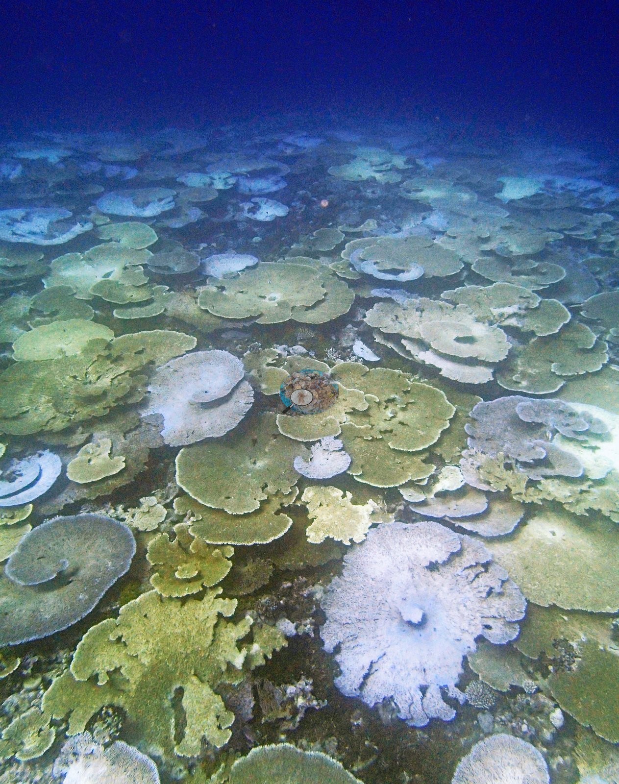
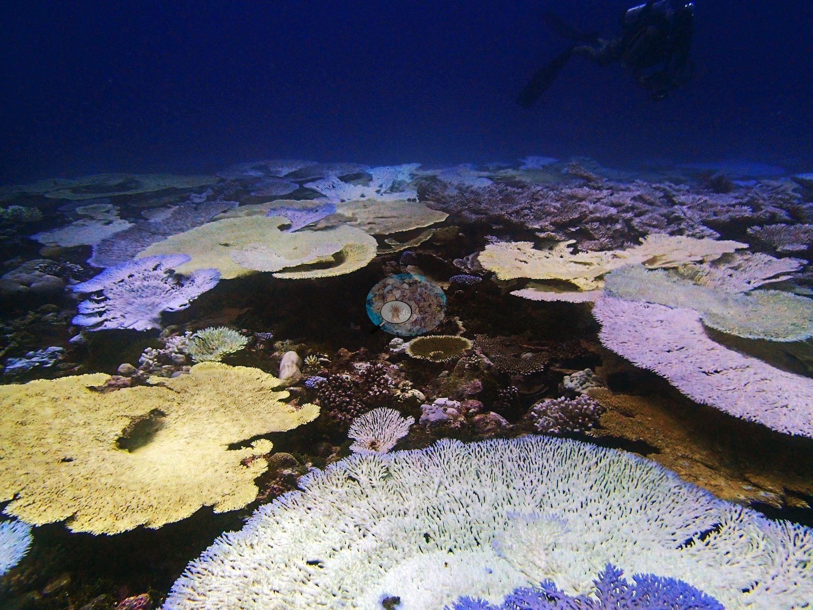
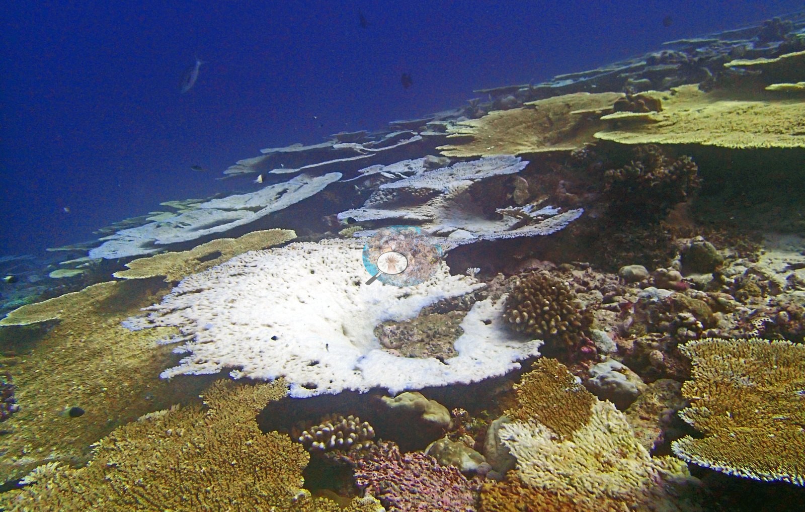
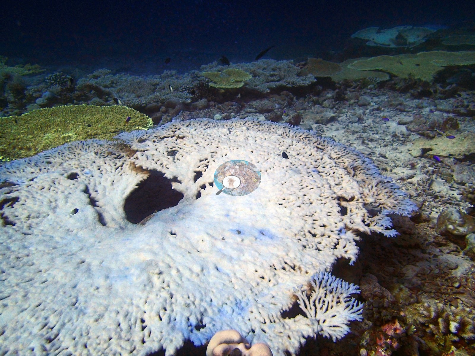
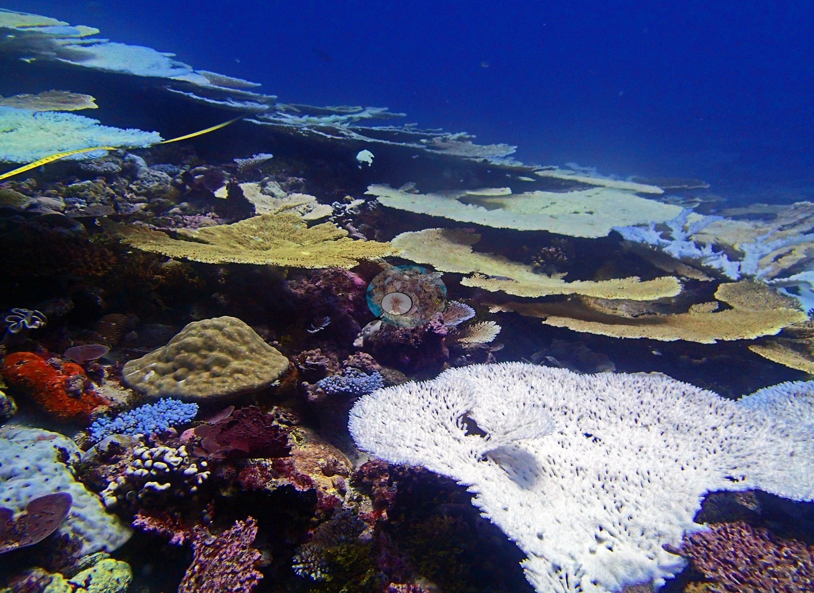
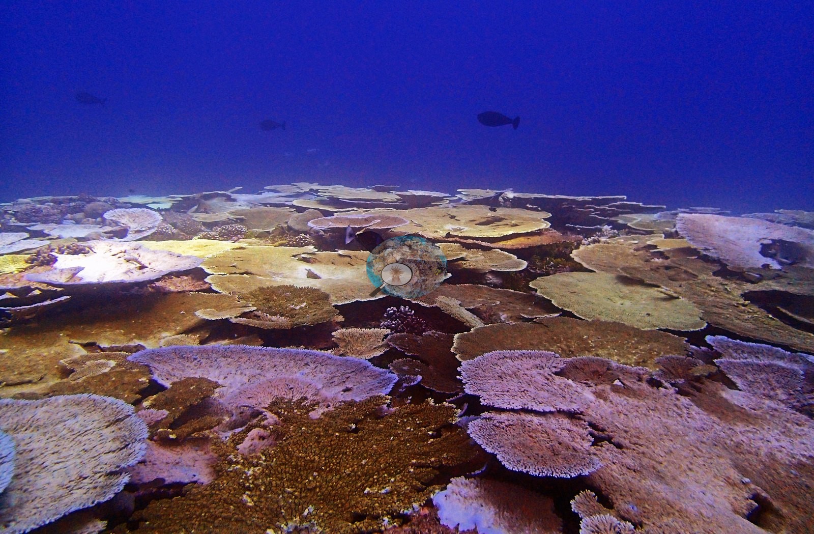
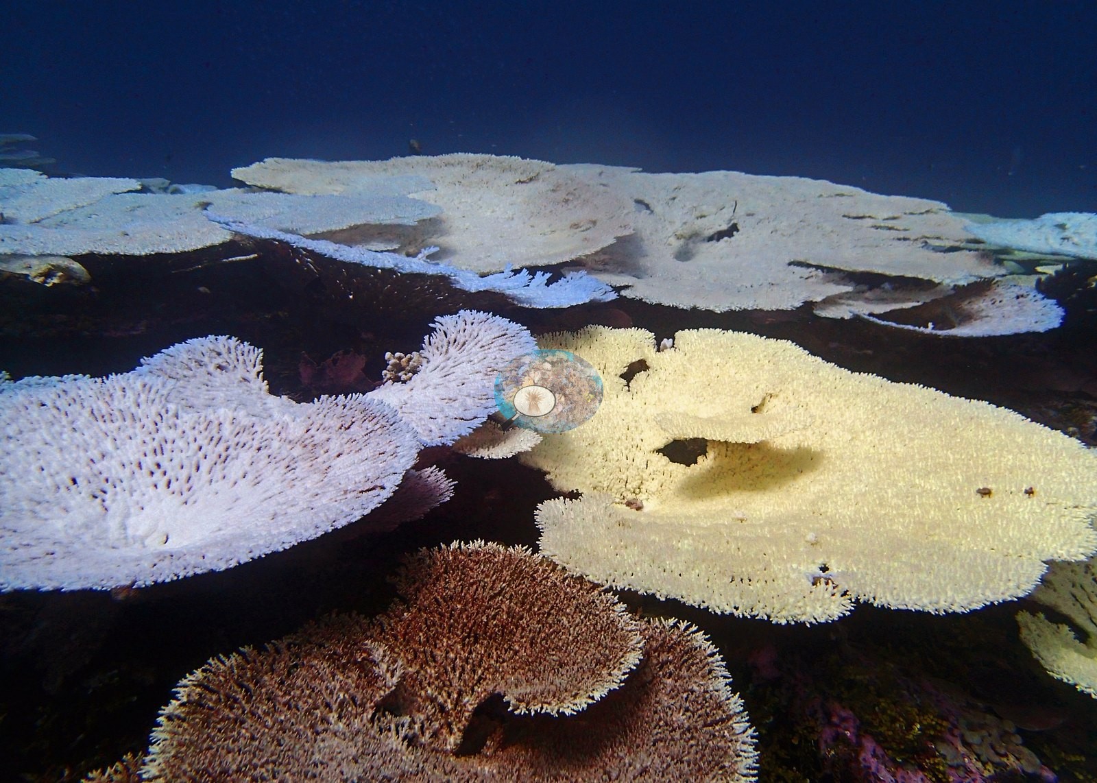
Chagos (NOAA CRW virtual station)A back-reef pinnacle inside the Peros Banhos lagoon with the second-highest coral cover of all 109 Chagos sites (72.4%). Bleaching jumped from 10% to 37.5% in 13 days, and one photo shows a near-continuous field of white table corals running to the limit of visibility, while Pocillopora slopes paled rather than turning fully white. Surveyed on the Living Oceans Foundation's Global Reef Expedition.
Two independent survey stations shown with the program’s logo — click one to see how far it is from this site.
One other CRD dive site within 5 km shown in orange — click a marker to open its page.
🗺 Detailed map of the Global Reef Expedition dive sites, Peros Banhos, Chagos (Khaled bin Sultan Living Oceans Foundation; opens in a new window)
Site description
Setting
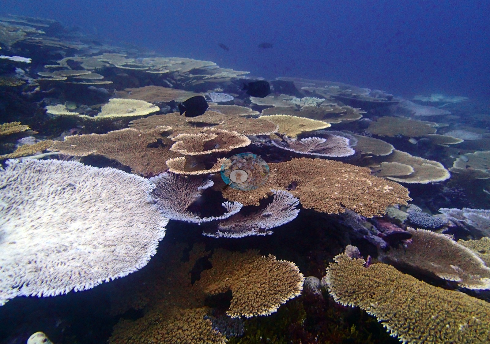
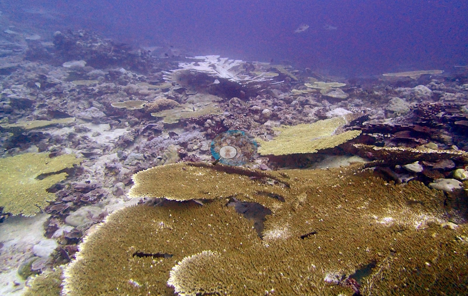
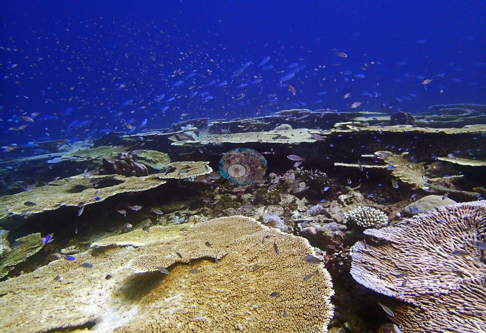
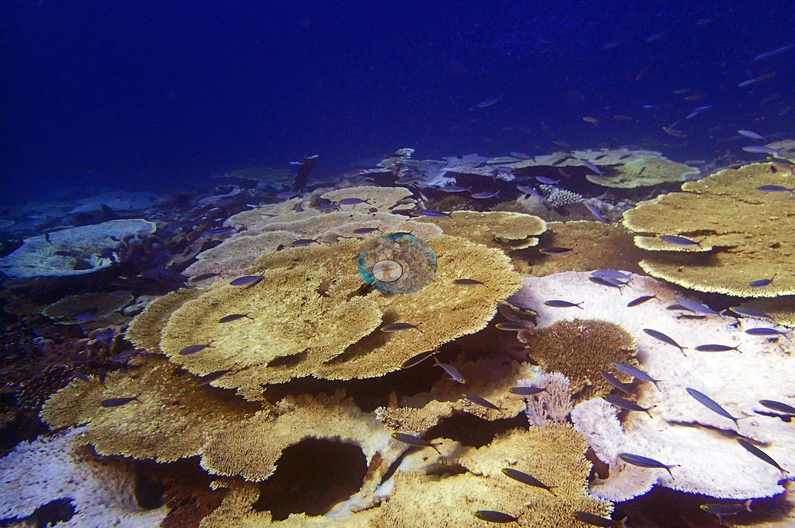
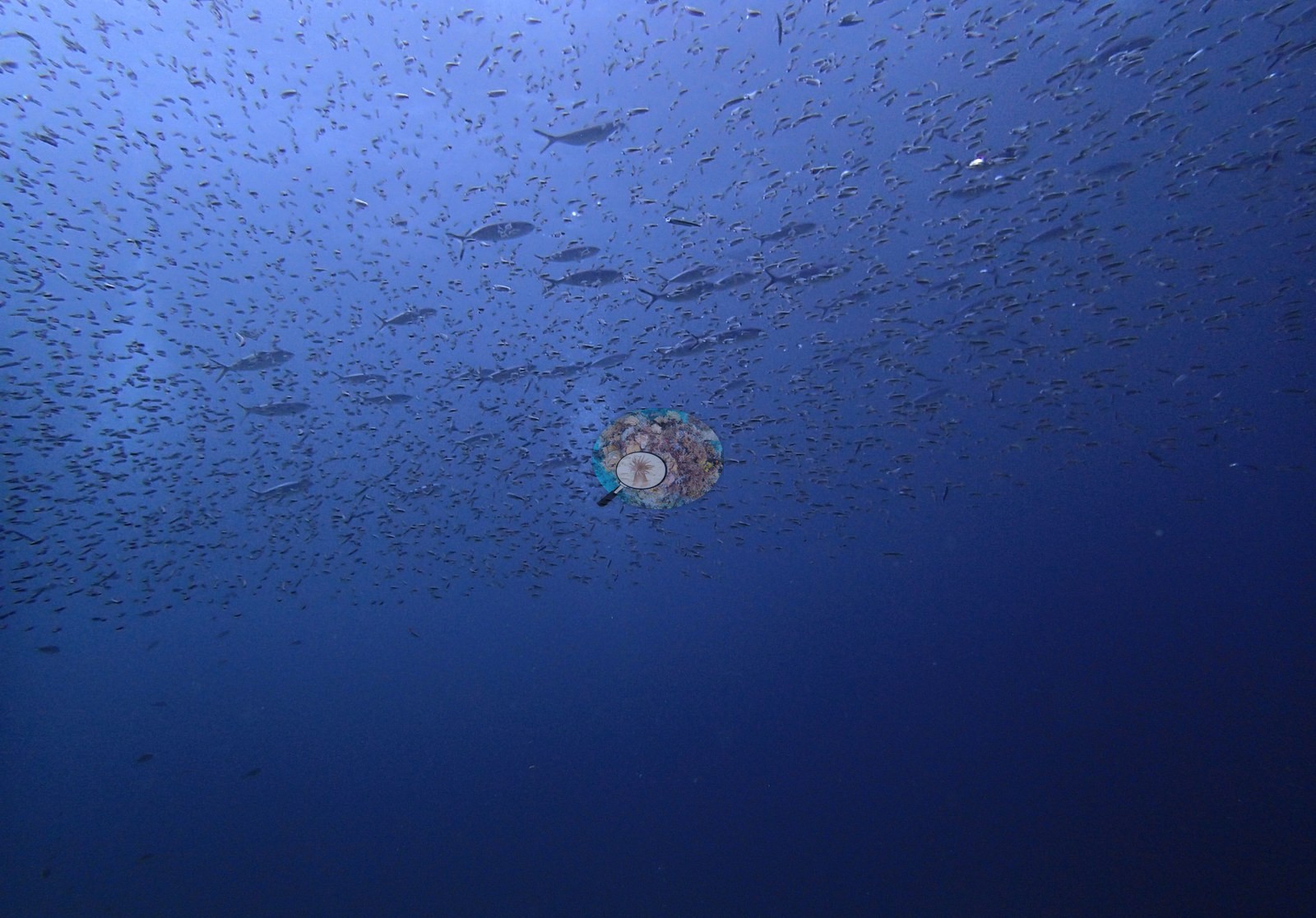
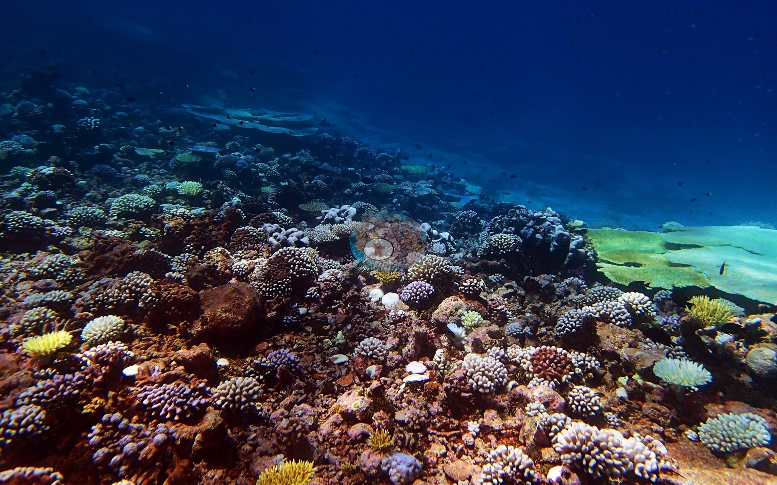
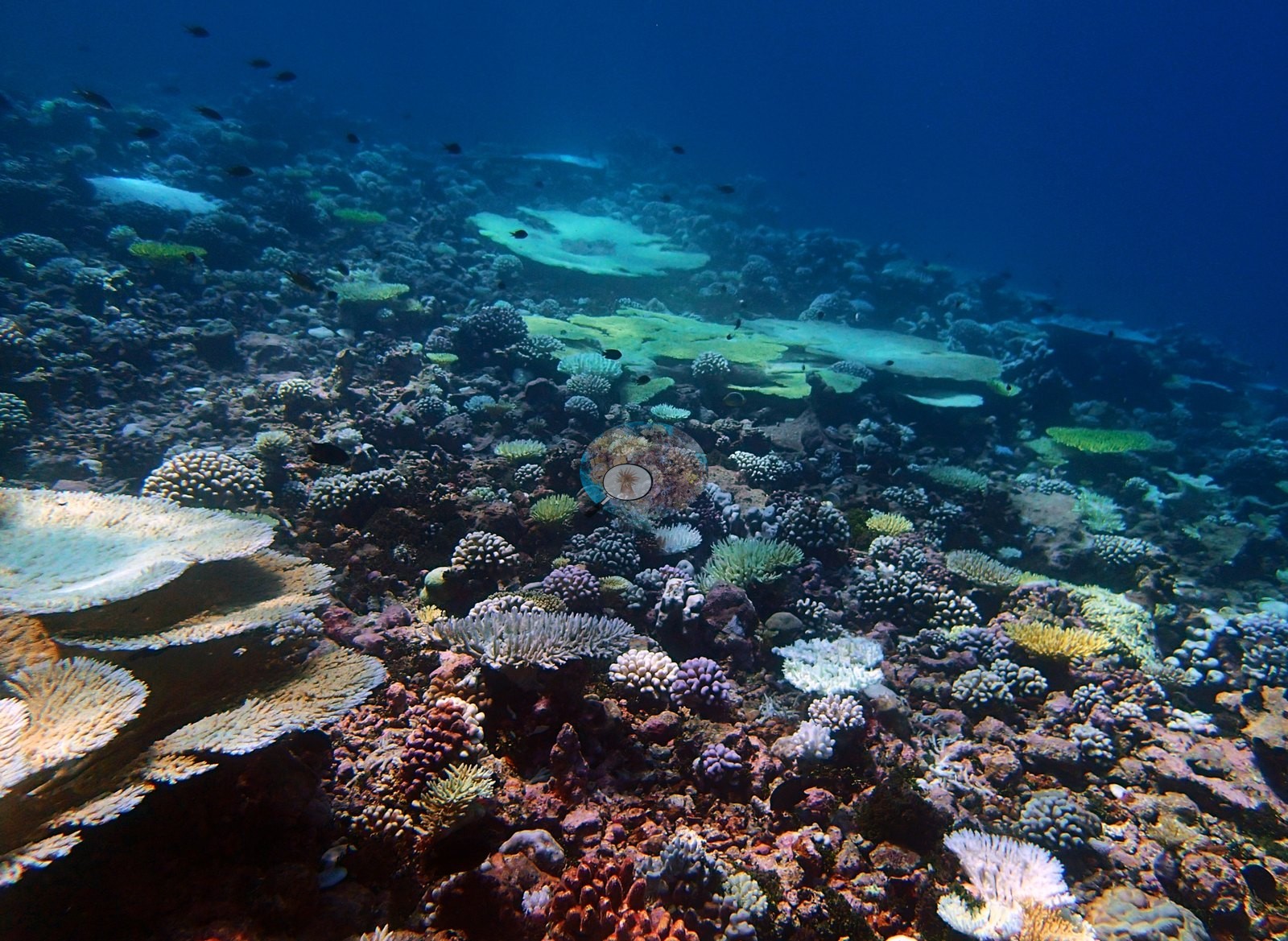
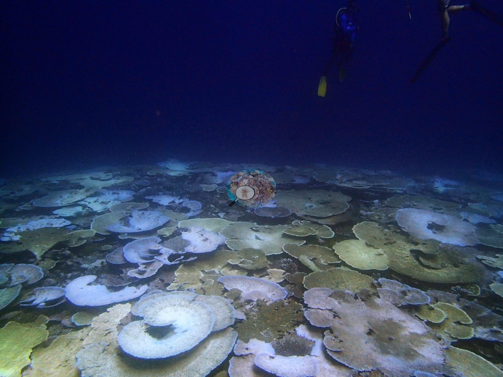
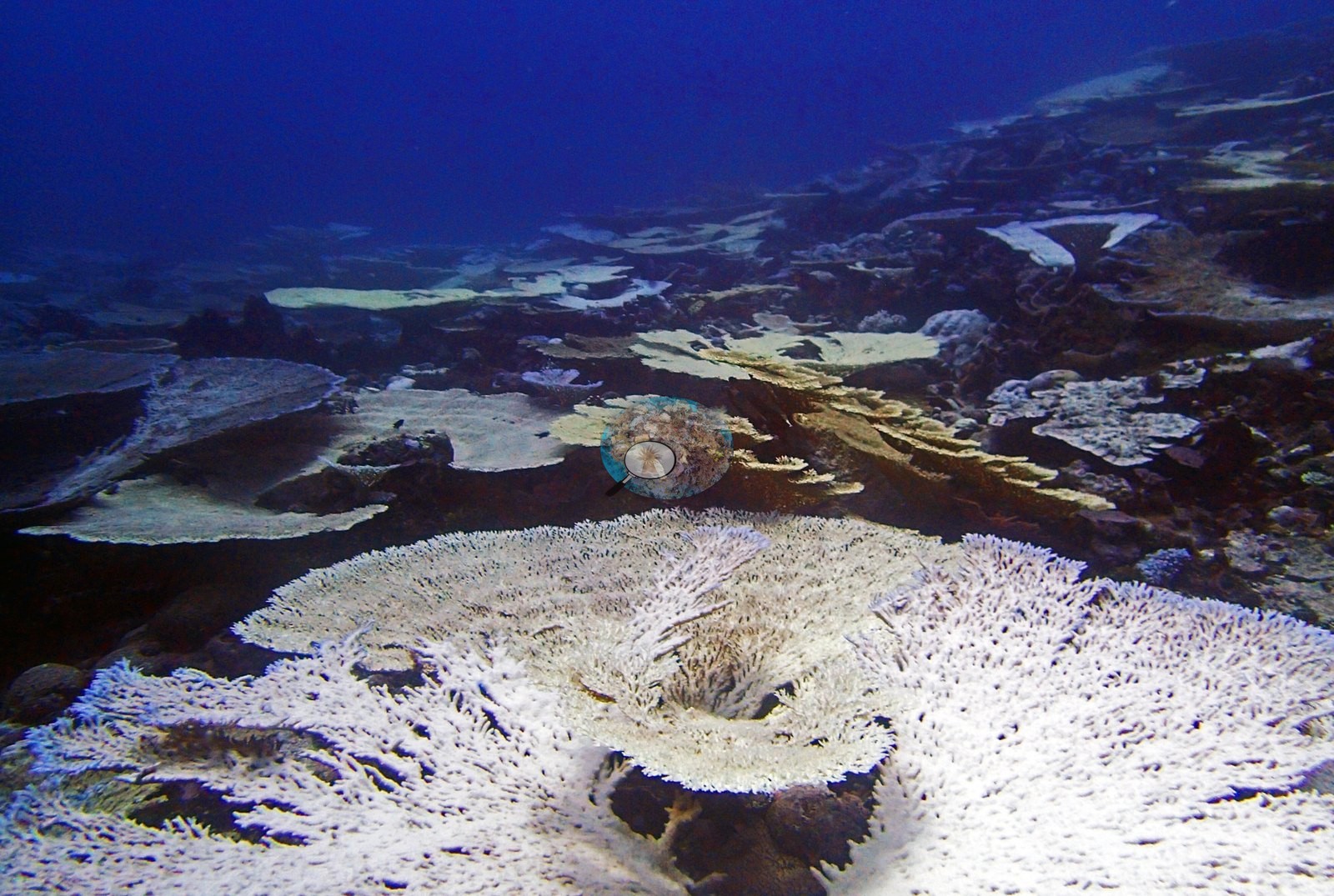
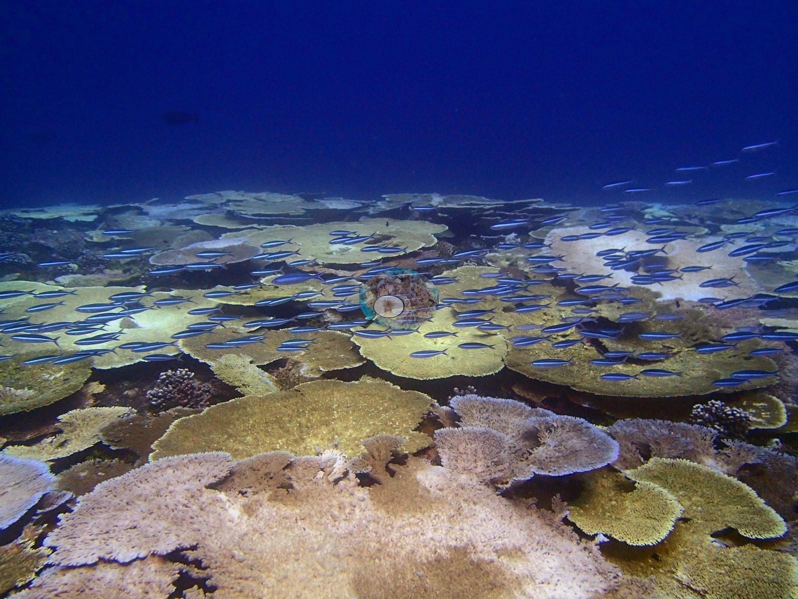
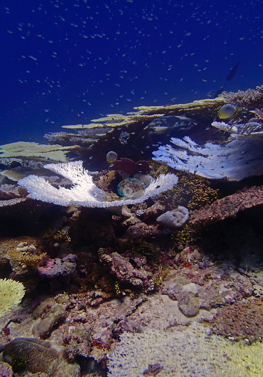
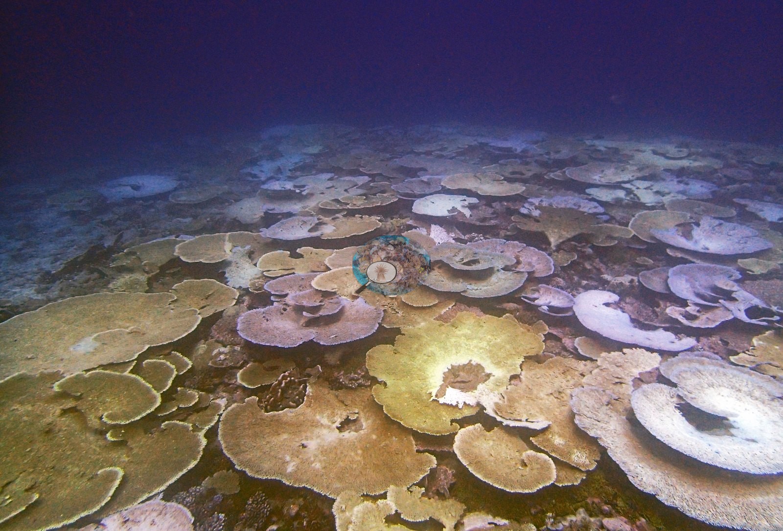
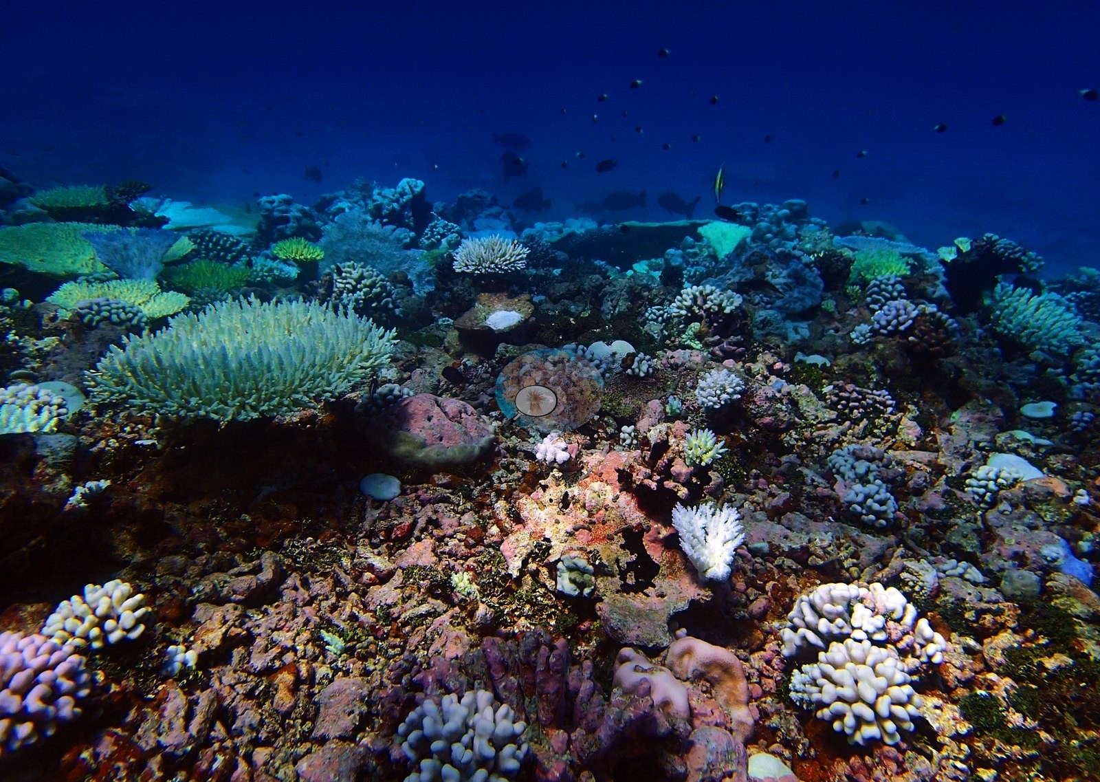
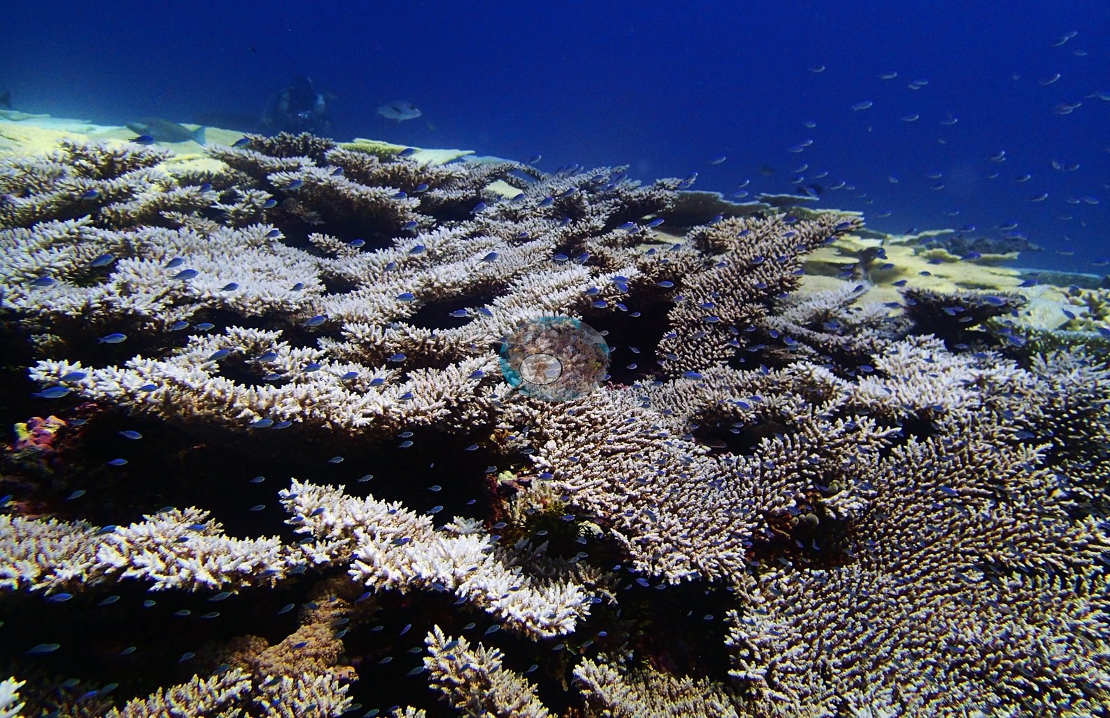
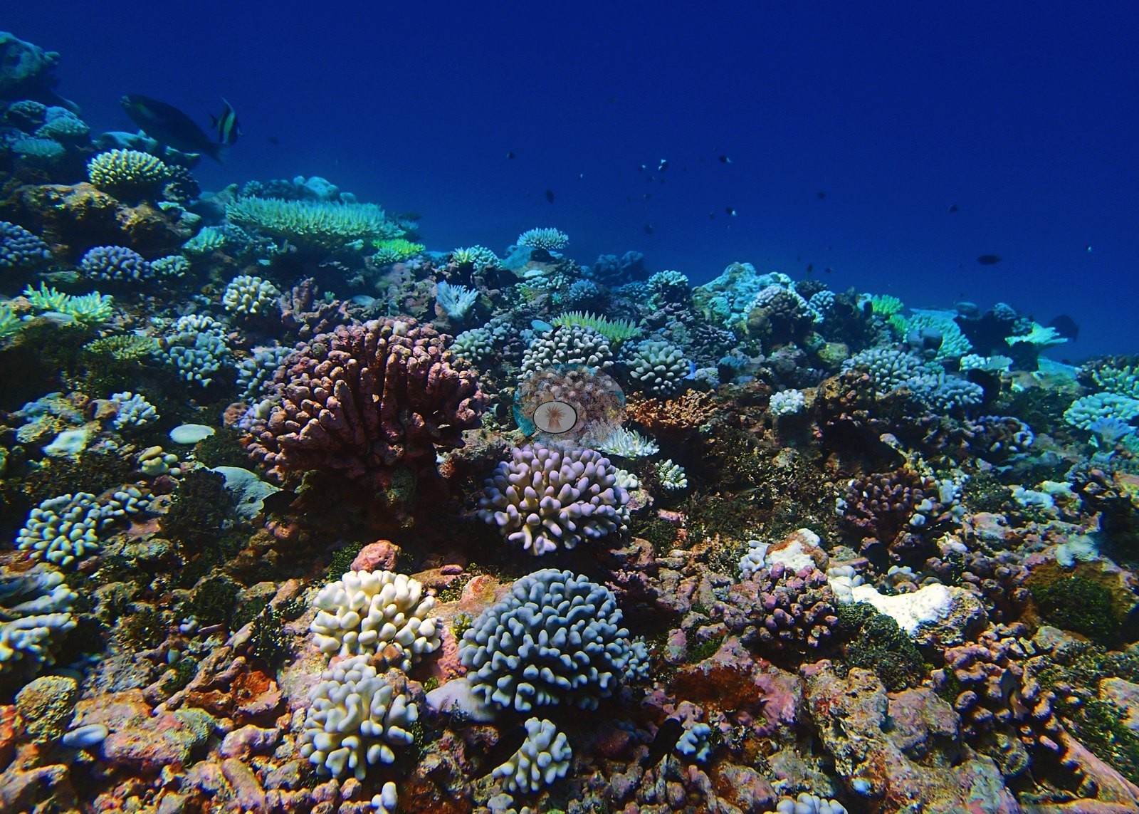
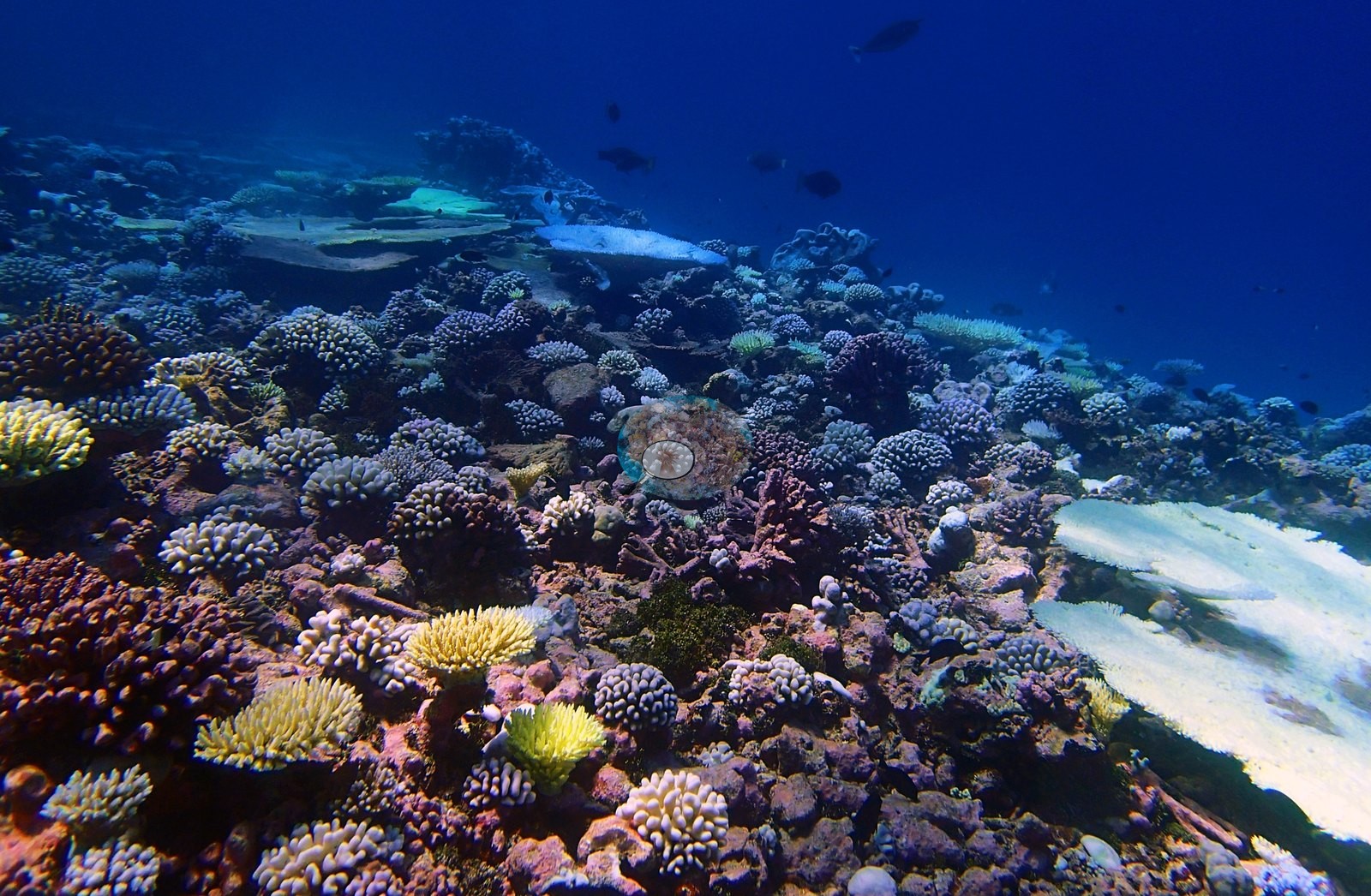
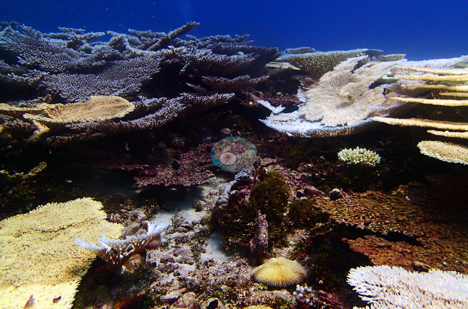
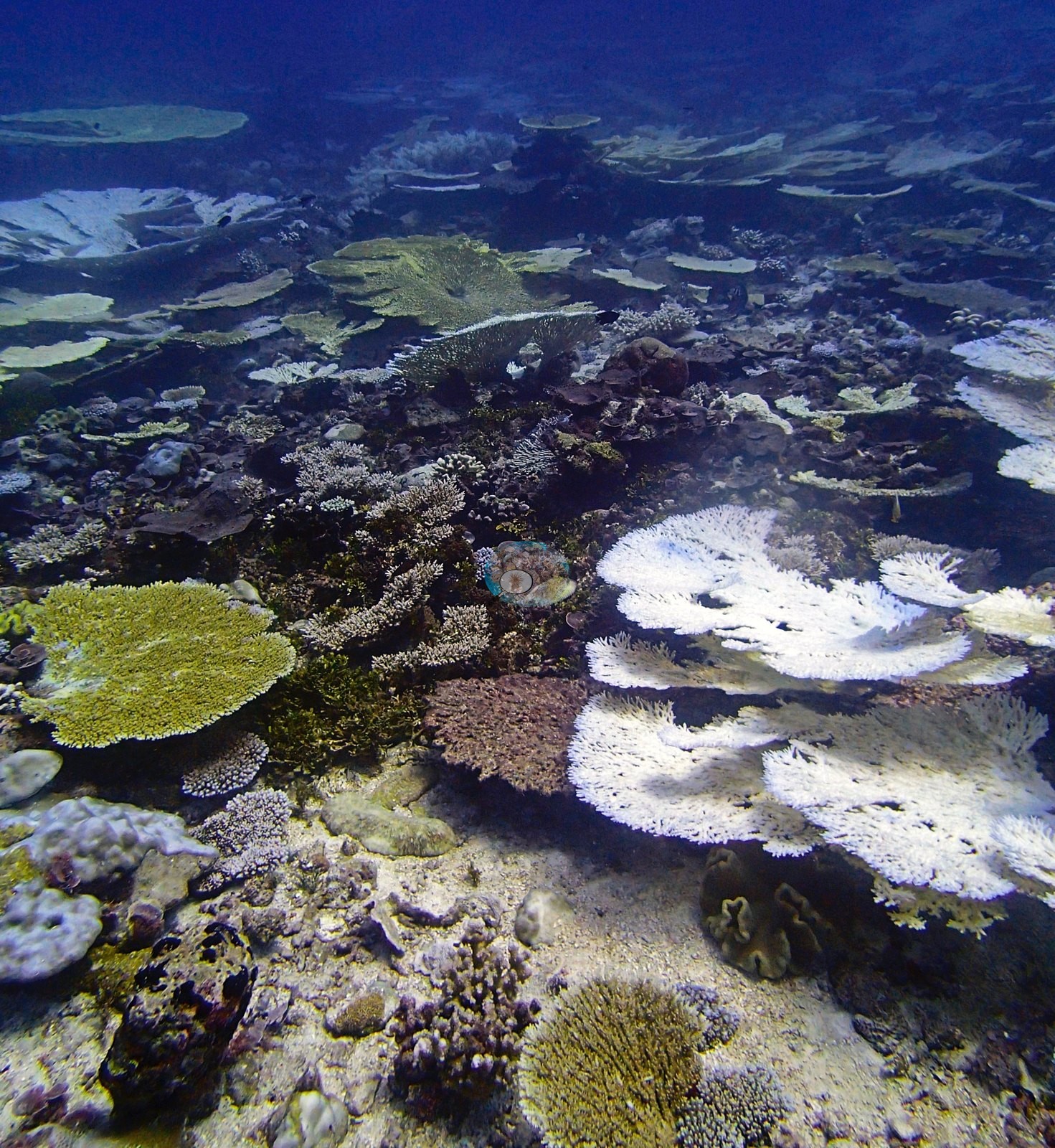
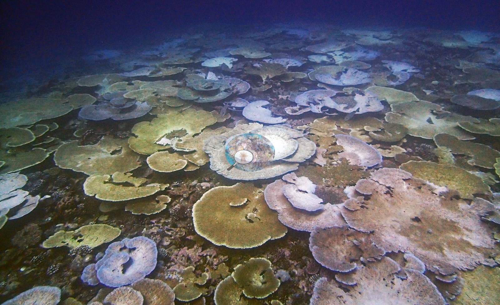
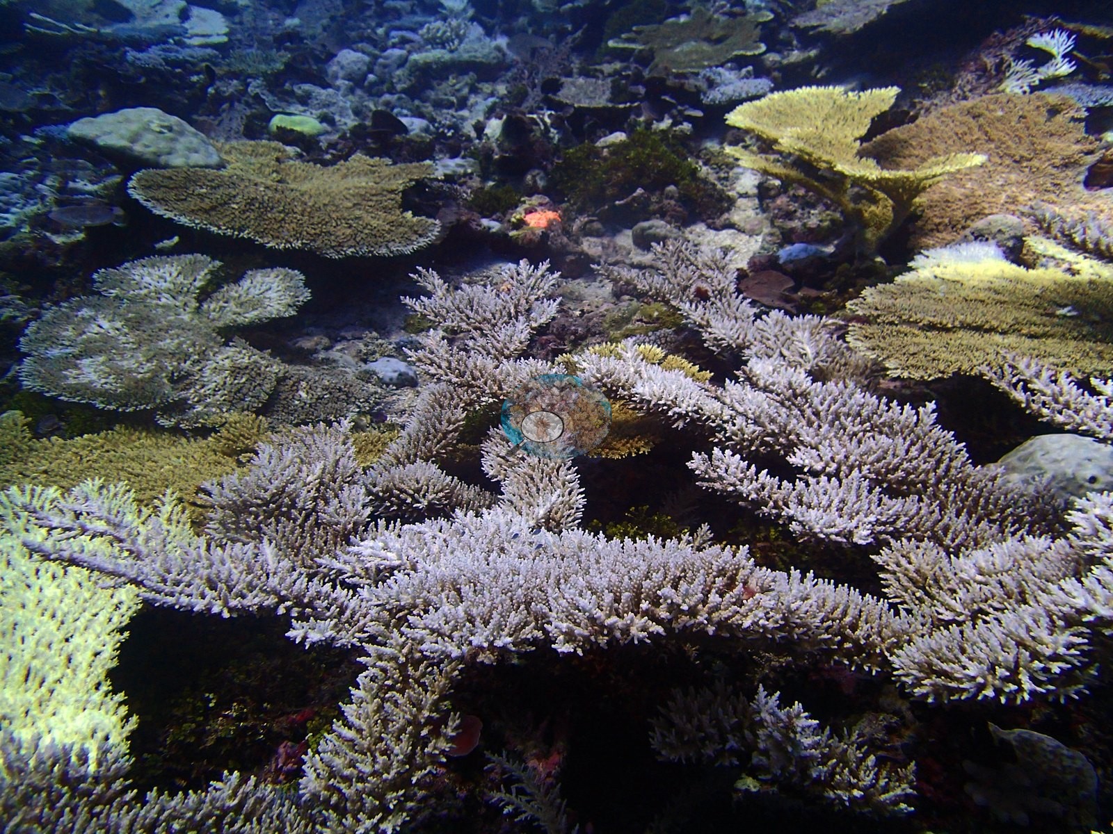
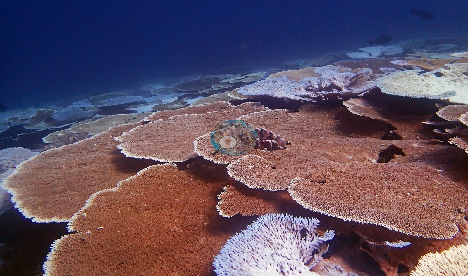
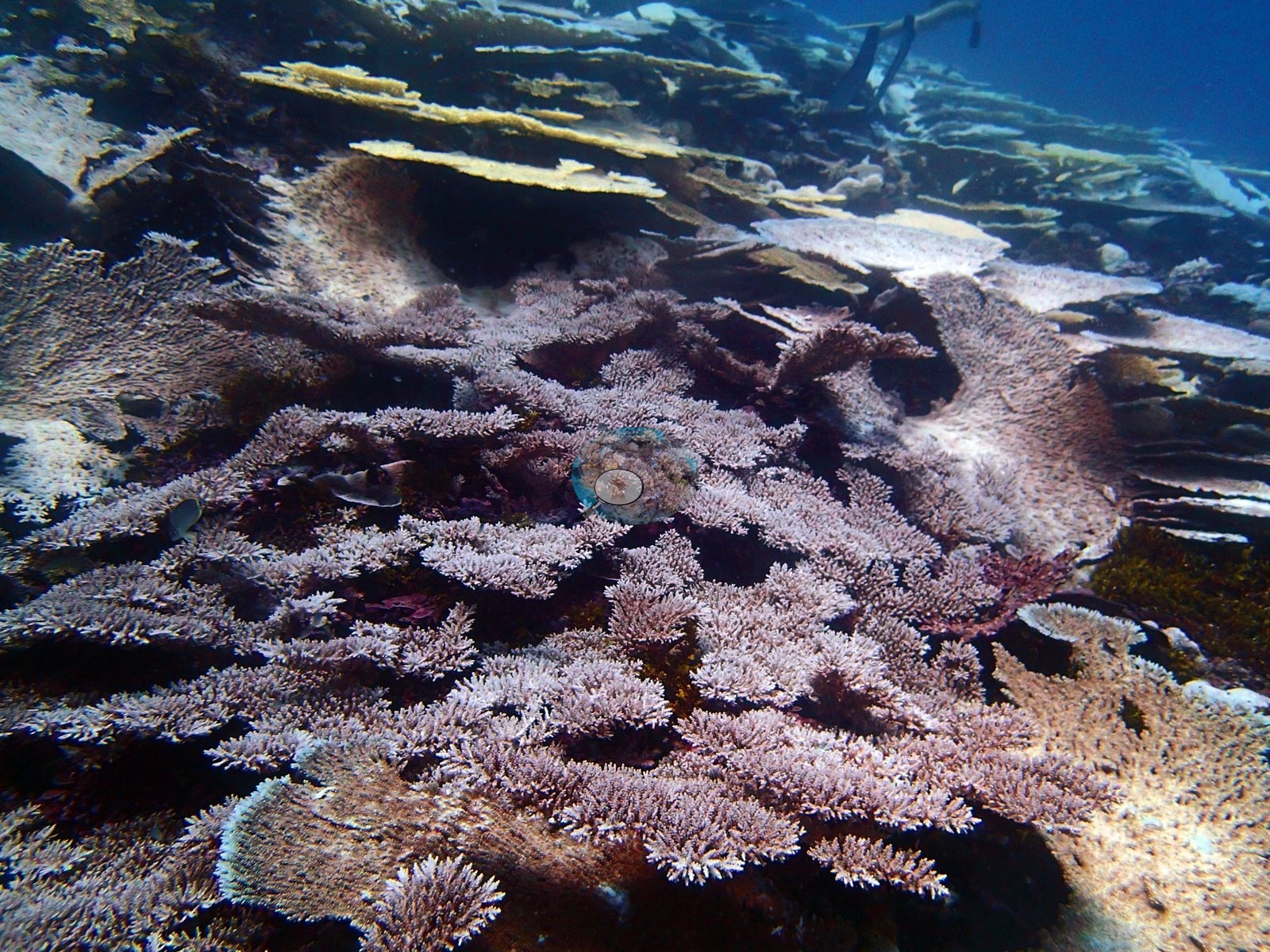
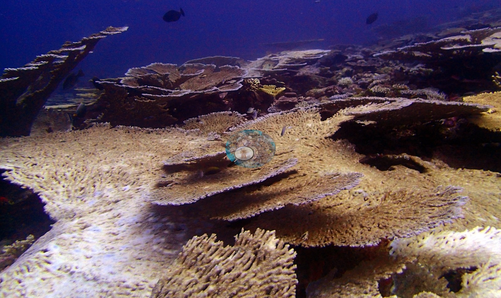
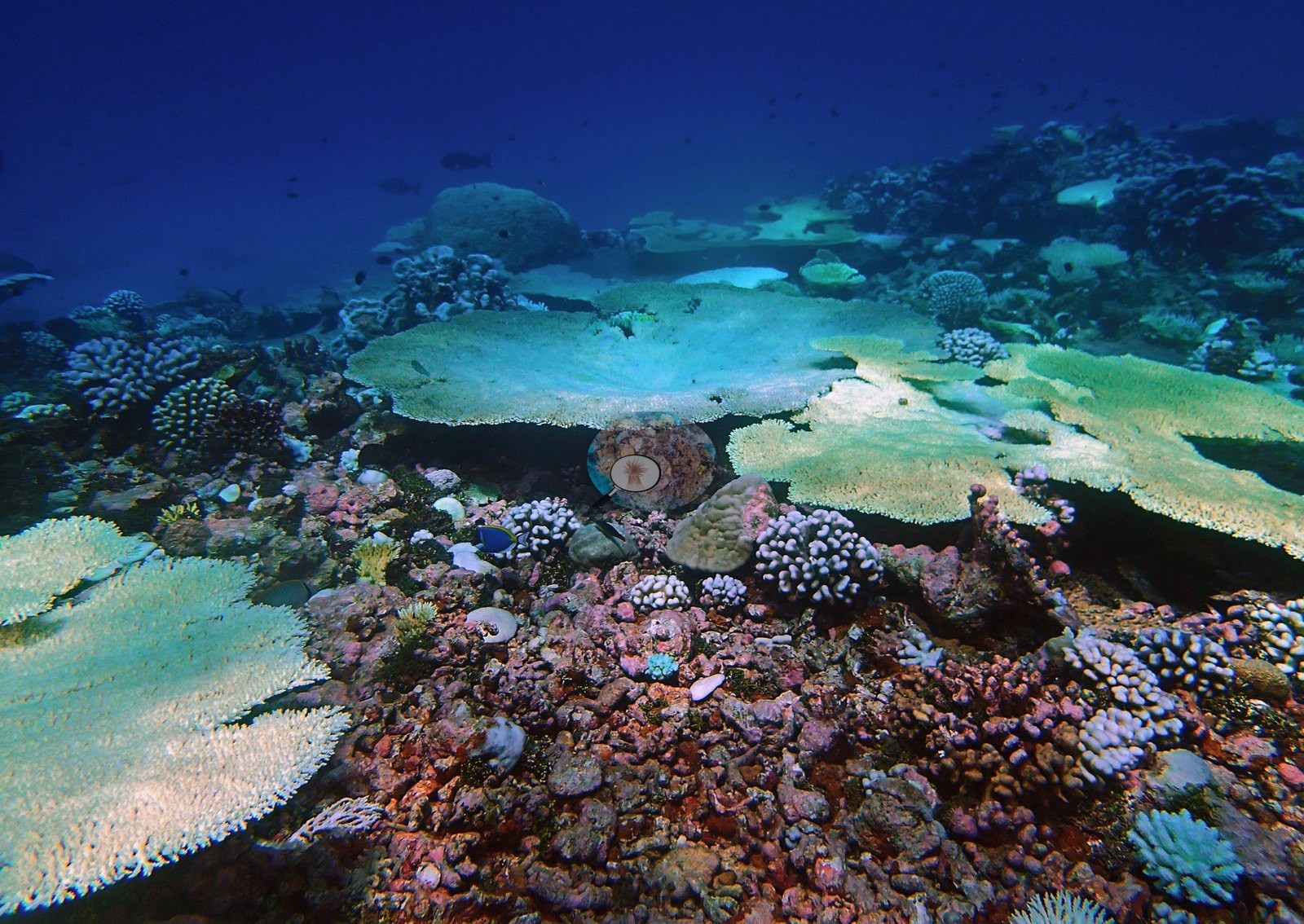
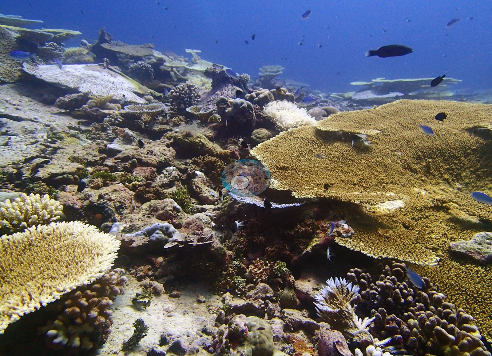
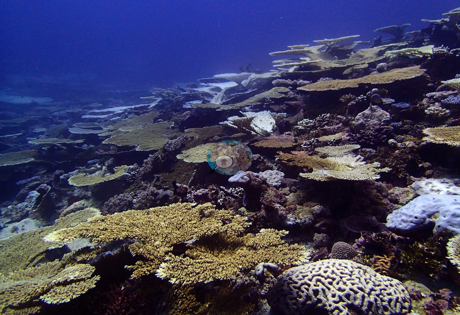
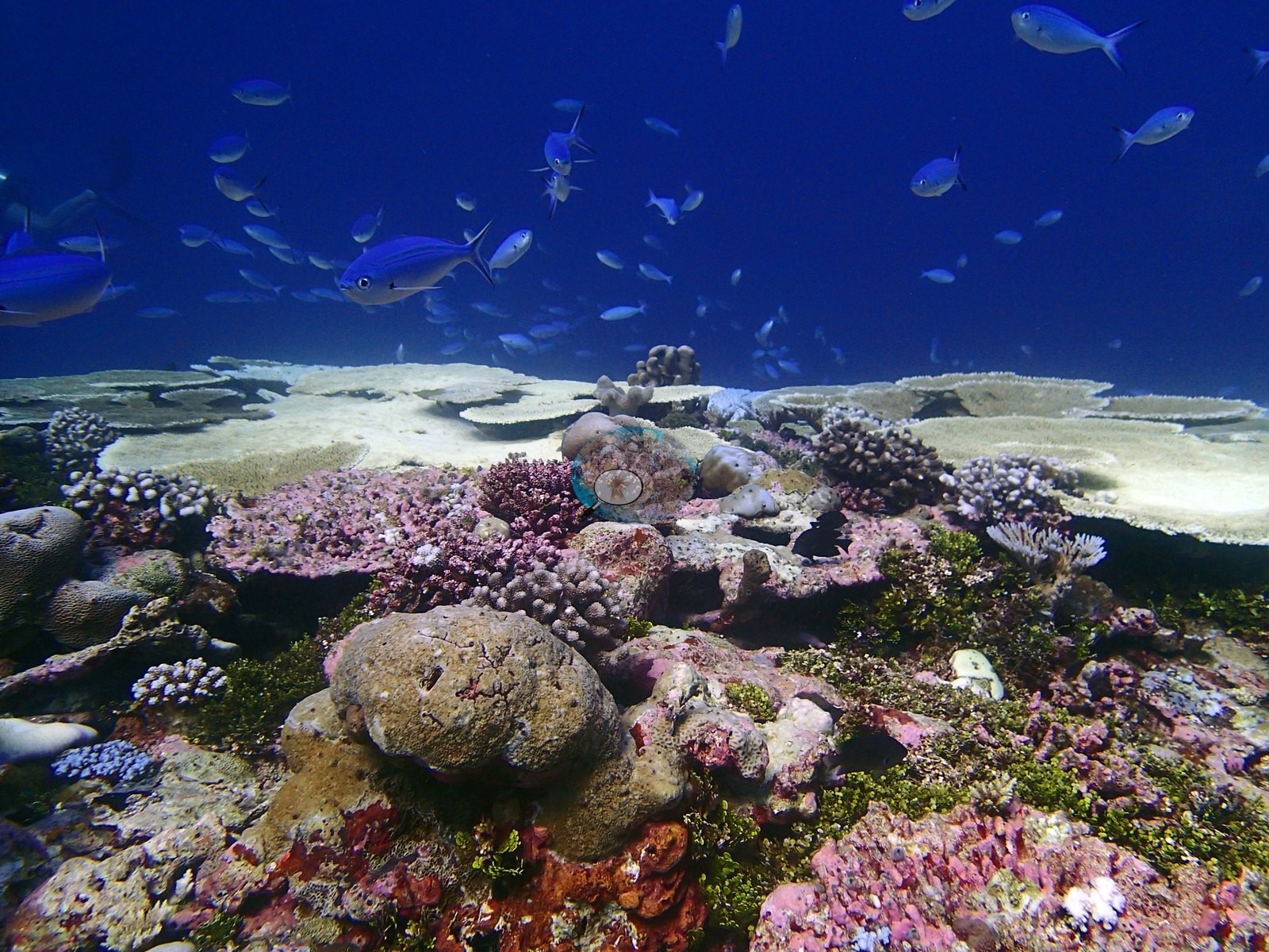
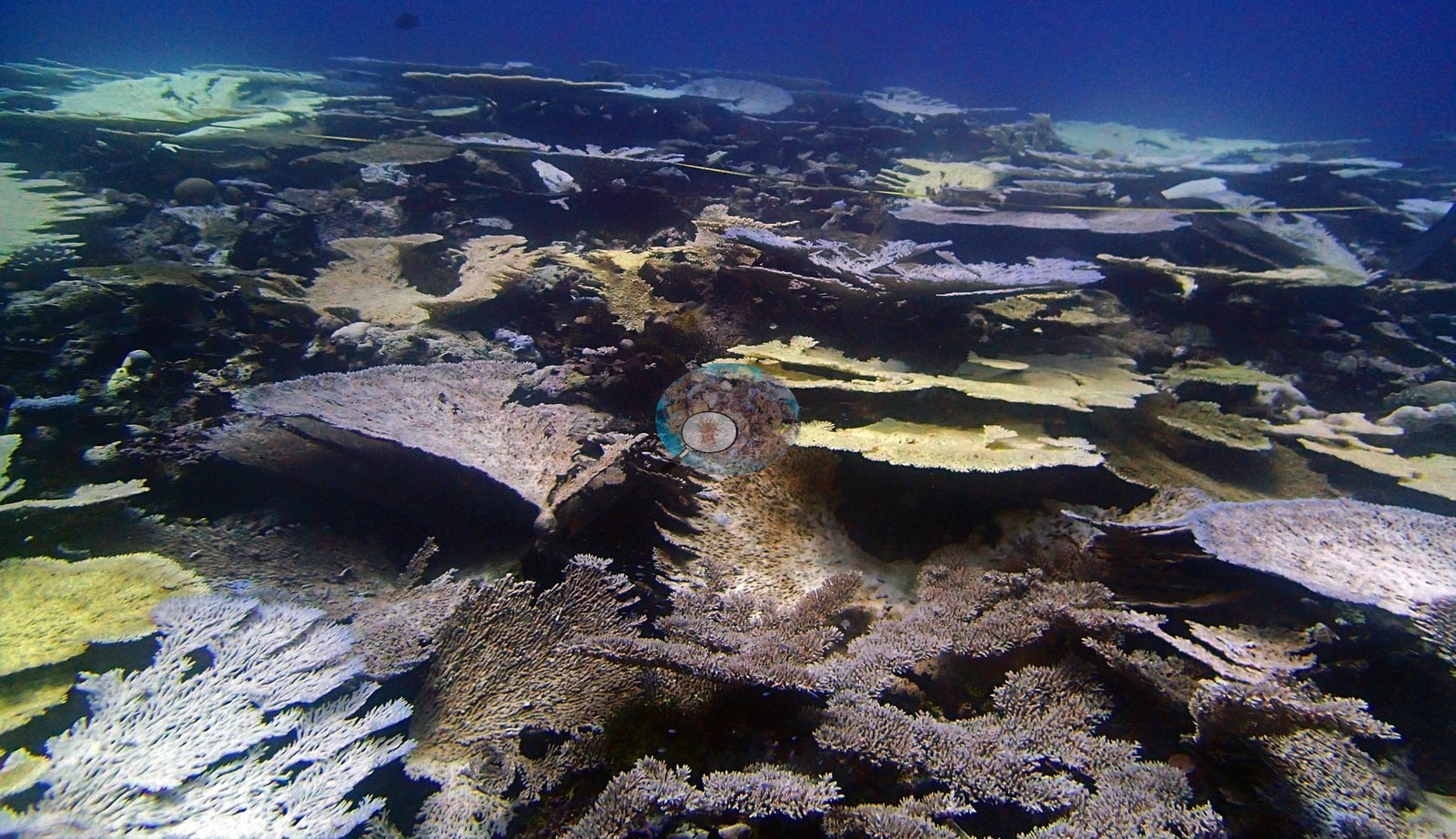
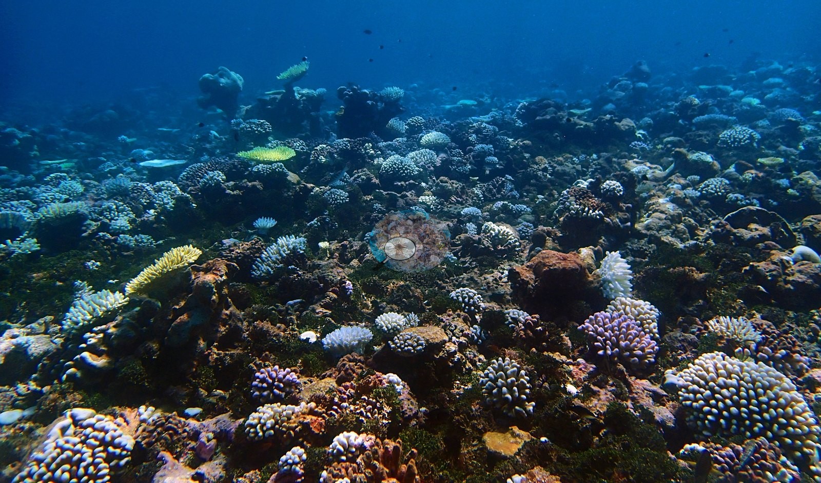
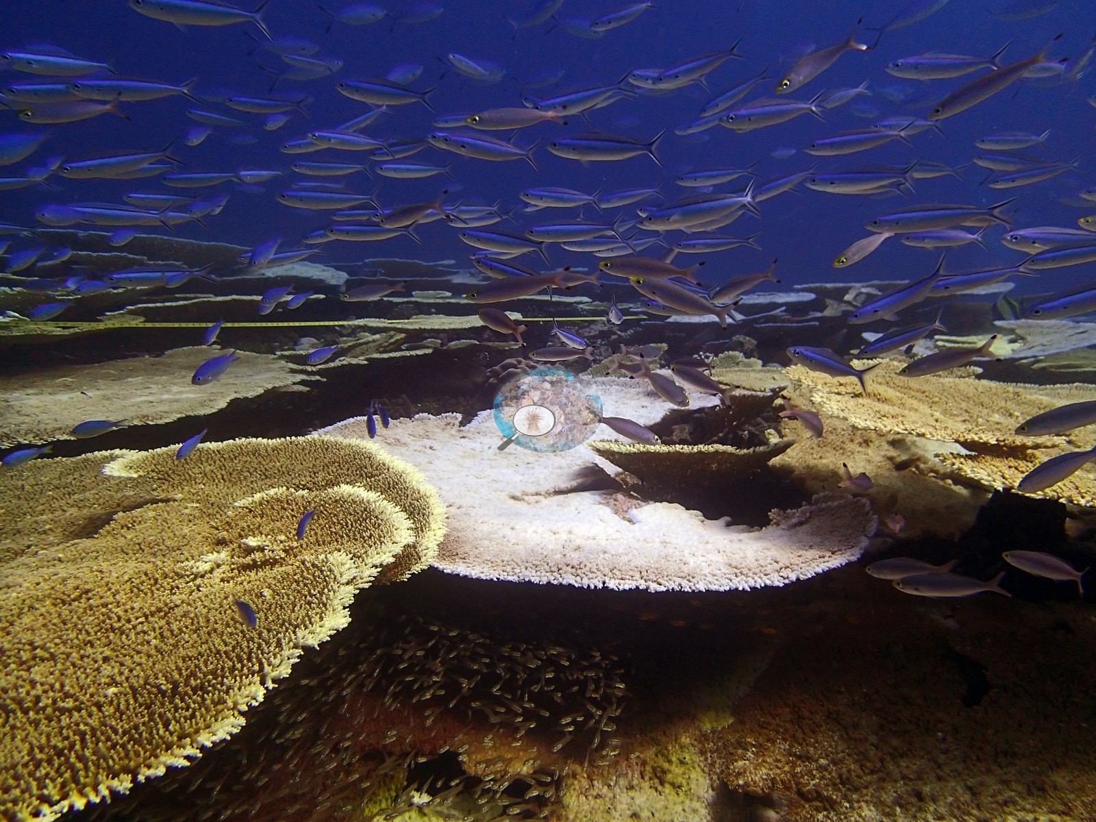
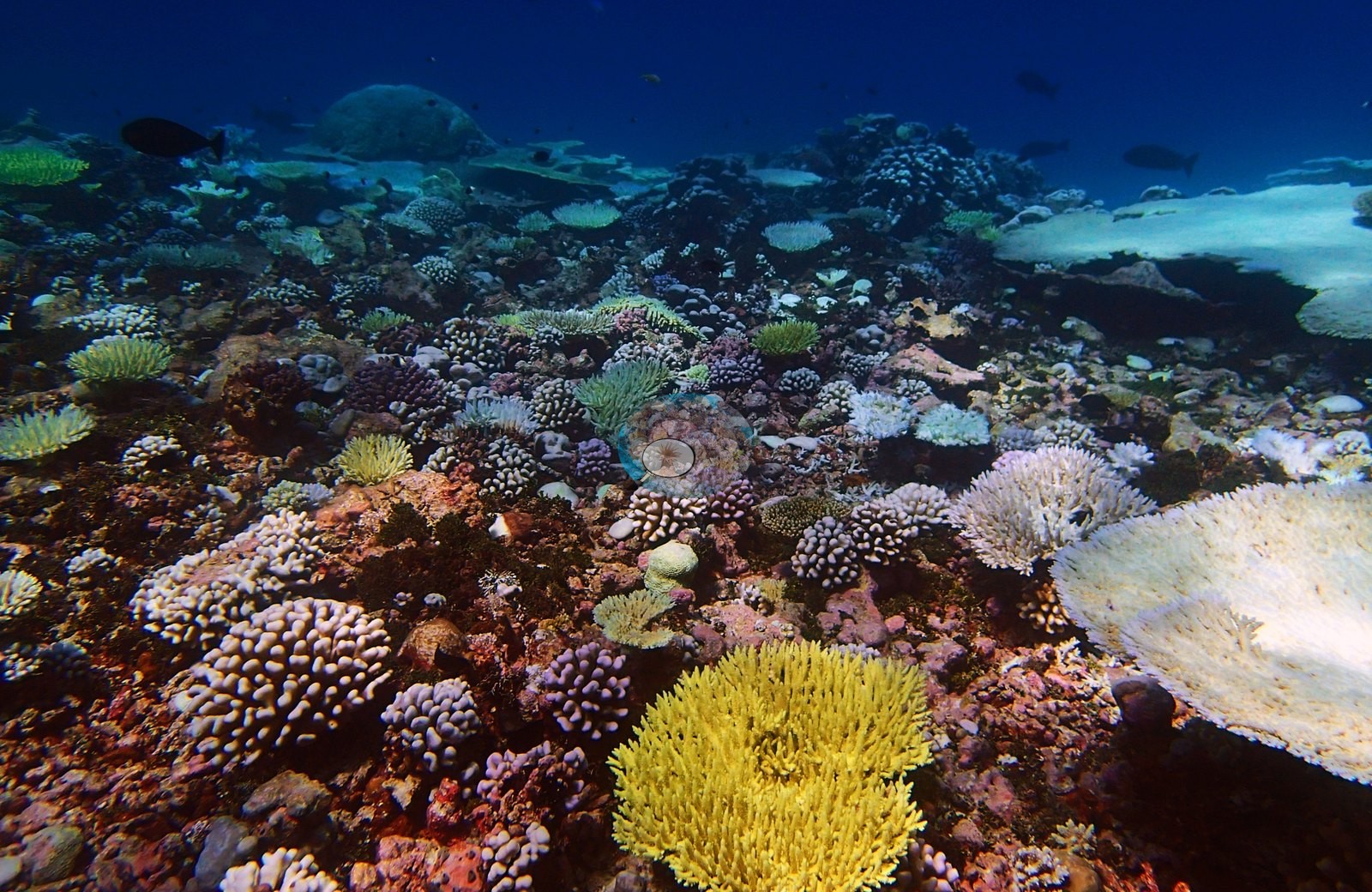
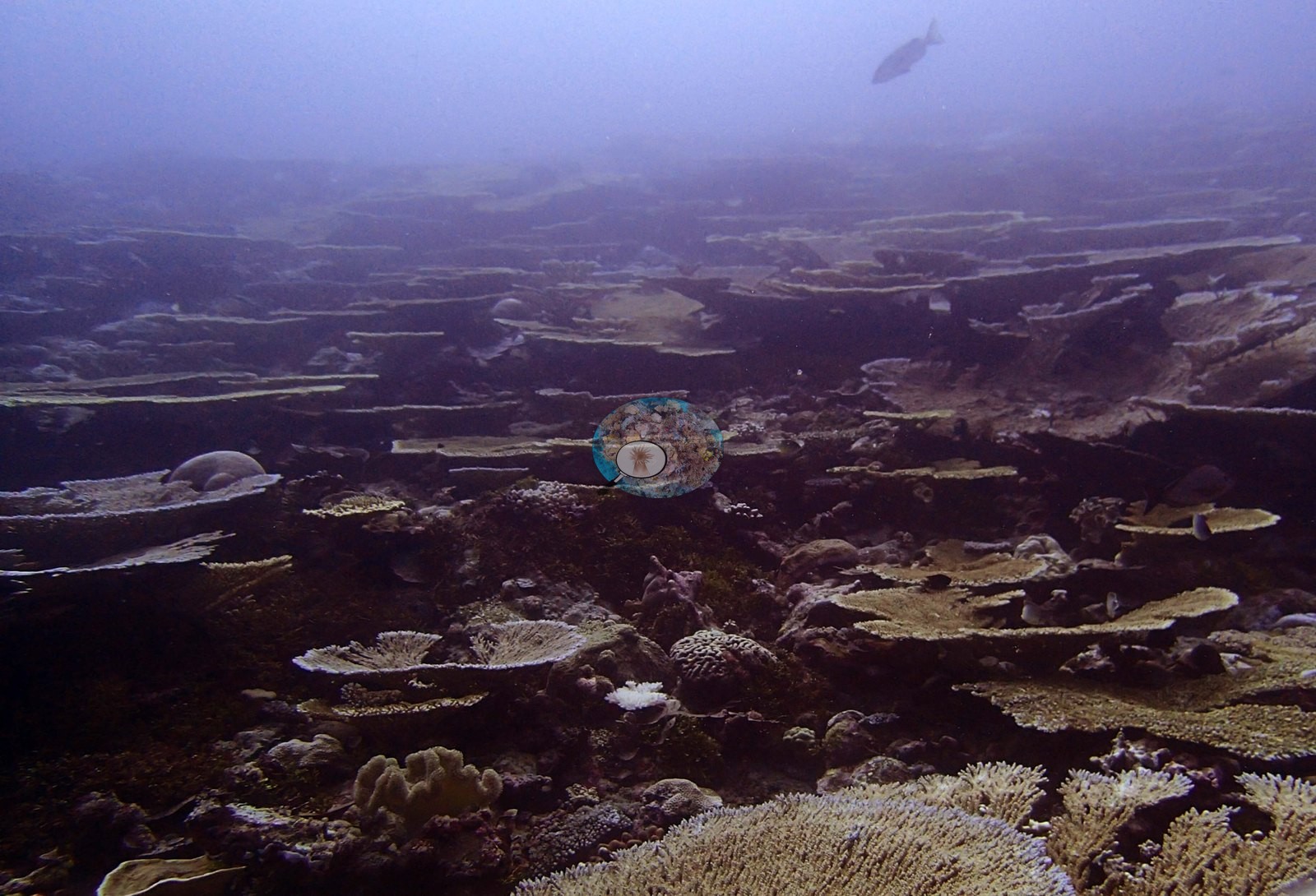
The setting is a protected, emergent back-reef pinnacle inside the Peros Banhos lagoon at 18 m — a very different habitat from the exposed forereefs that carry most of the archipelago's other high-cover sites — at 30.3°C and 34.4 salinity. Quality is generally good: clear water and wide oblique reef views, mostly natural light, with the deep-water frames going blue-green (P4180756, P5010997, P5010999, P5011017, P5011020) and a handful running warm-yellow (P4180757, P5011001, P5011003). P5010980 is the most severe frame in the set — a near-continuous field of white tabular Acropora running to the limit of visibility, with a diver crossing the upper frame — and a yellow survey tape lies on the bottom in P5010976 and P5010981, so a survey line was deployed on the 1 May dive.
General benthic features
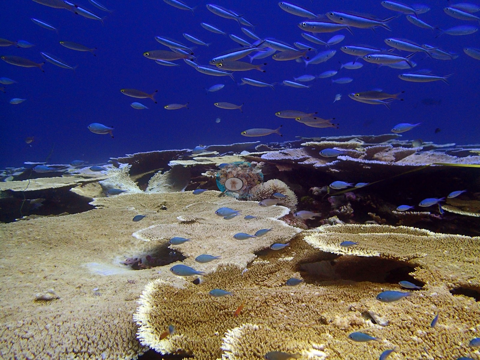
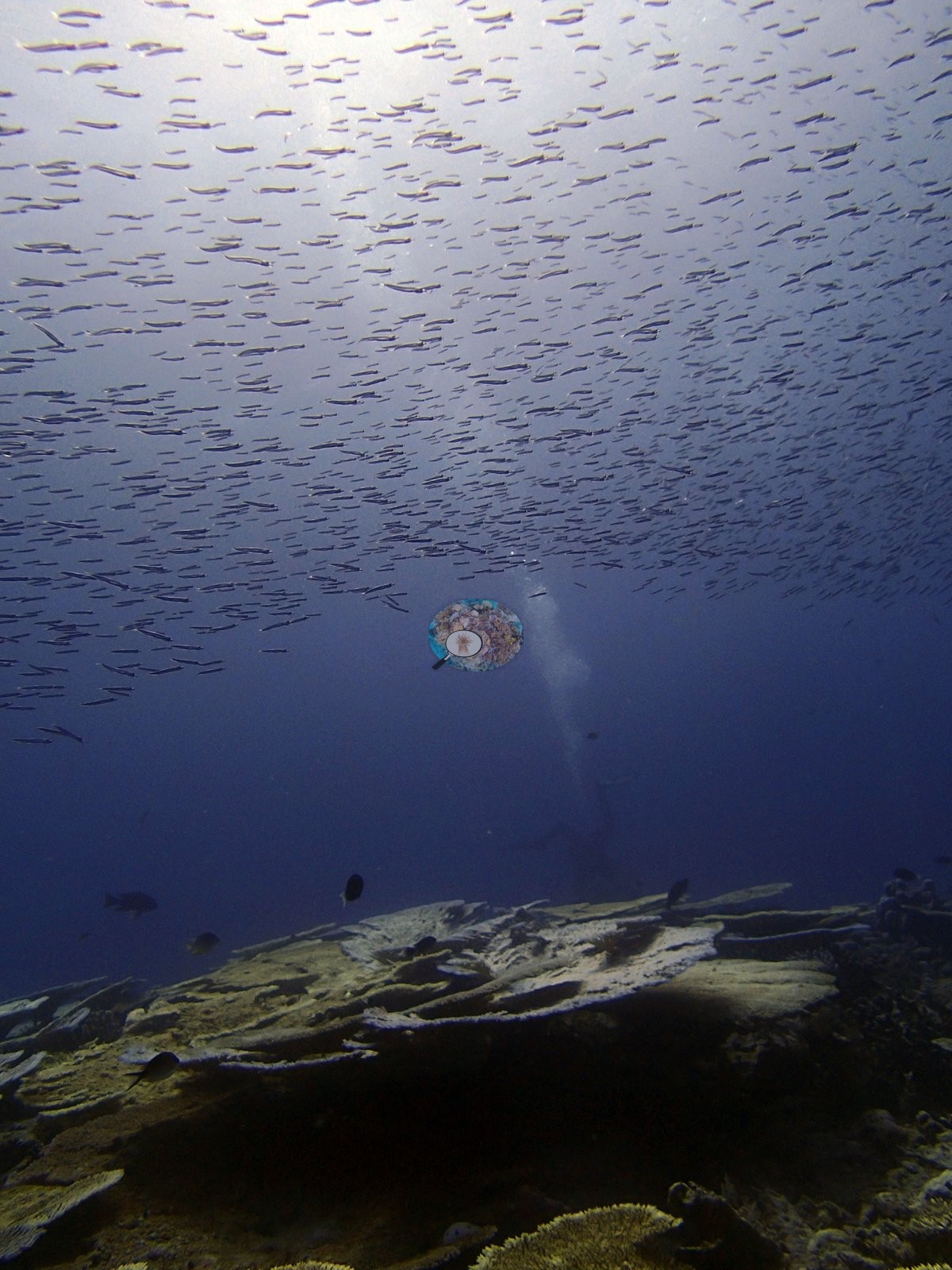
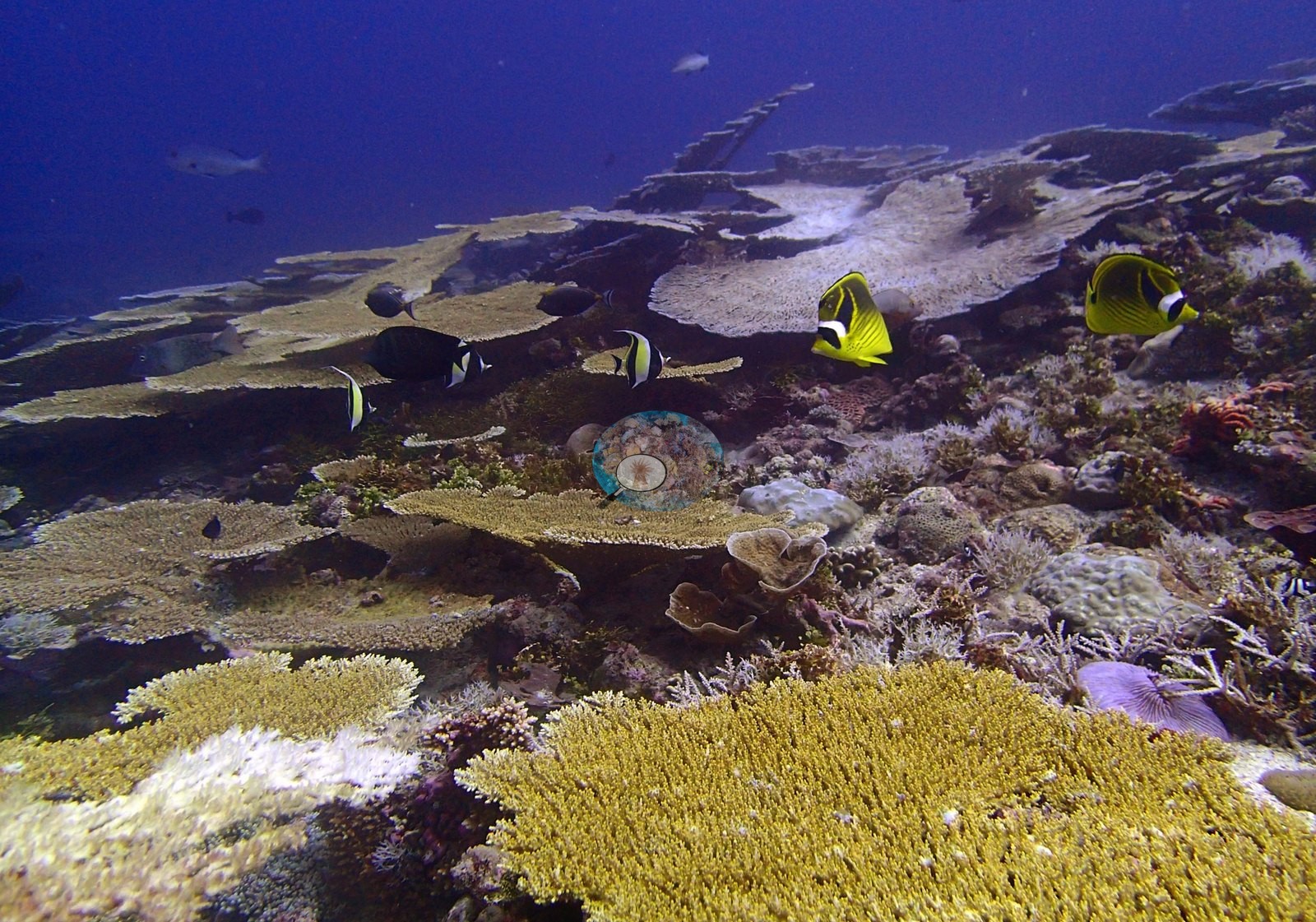
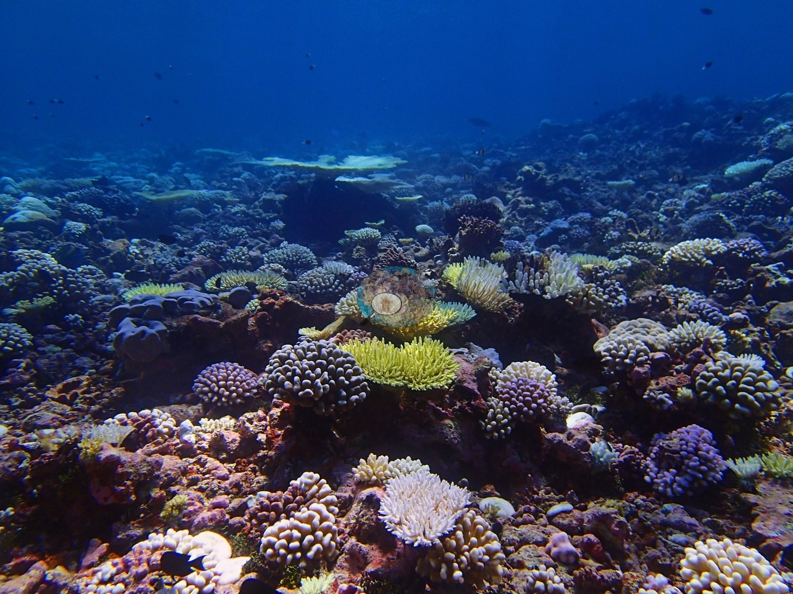
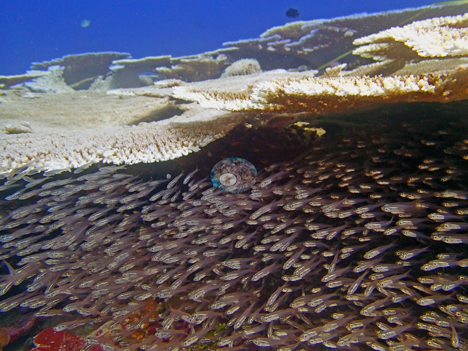
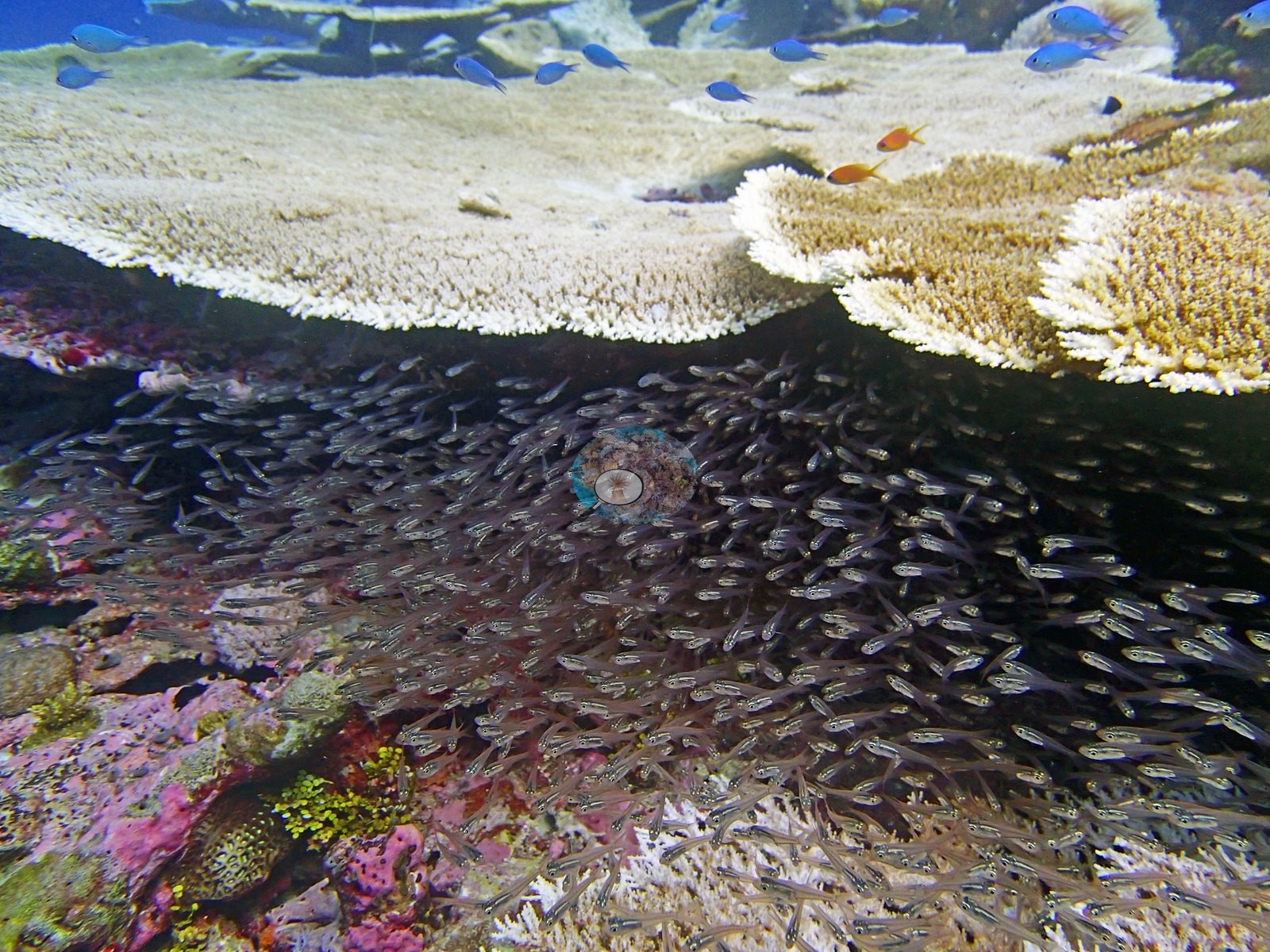
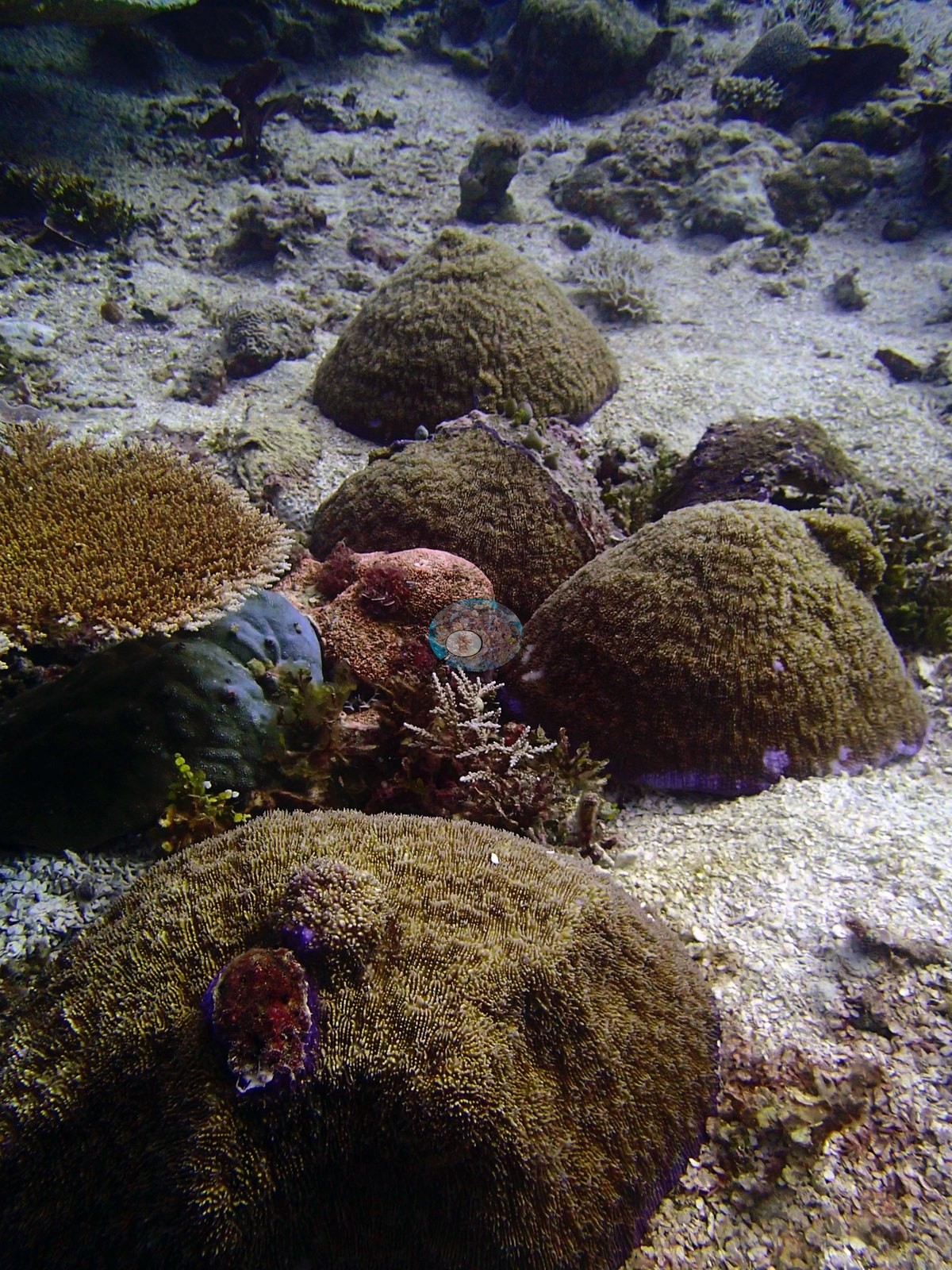
Non-coral invertebrates hold only 2.6% of the benthos and bare substrate a mere 2.7%; nearly everything that is not live coral is a thin algal fringe split between turf (6.31%), macroalgae (6.26%) and erect algae (5.70%), plus 4.06% crustose coralline algae and 0.04% turf-plus-sediment. The assemblage is overwhelmingly a single-genus reef. Acropora alone holds 59.04% of the entire benthos — 81.6% of all the coral recorded here — one of the most extreme single-genus dominance values in the Chagos dataset. Twenty-one genera are present in total, but every other one is minor: Pavona (2.06%), Montipora (1.91%), Porites (1.80%), Goniastrea (1.65%), Pocillopora (1.35%) and Seriatopora (1.17%) form a modest second tier, and the remaining fourteen — Symphyllia (0.67%), Favia (0.59%), Lobophyllia (0.54%), Stylophora (0.28%), Fungia (0.24%), Astreopora and Millepora (0.19%), Gardineroseris and Leptastrea (0.15%), Isopora (0.11%), and Coscinaraea, Cyphastrea, Echinopora, and Montastrea (0.07% each) — each hold under 0.7%. Genus richness is respectable on paper, but essentially all of it is a long tail beneath one dominant taxon. The depth profile is a clean two-part story: an Acropora monoculture in the shallow-to-mid zone giving way to a lower-cover, more even community at depth. D2 (79.4% coral, 17.6% algae) and D3 (78.1% coral, 11.6% algae) are both effectively Acropora reef — Acropora at 70.44% and 70.67% of the benthos respectively, 89% and 90% of all the coral on each transect — with only trace amounts of Porites, Favia, Pocillopora, Goniastrea, Pavona, and Montipora filling the rest. D4 breaks that pattern: cover falls to 59.5% and algae more than doubles to 38.0%, and while Acropora is still the leading genus at 36.00%, its share of the coral present drops to 60% as five other genera — Pavona (4.50%), Goniastrea (3.50%), Montipora (3.50%), Seriatopora (3.50%) and Porites (2.50%) — each cross the 2.5% mark for the first time. 18 April. The wide frames confirm the shallow monoculture in dramatic fashion. Frame after frame — P4180680, P4180687, P4180695, P4180702–P4180705, P4180733–P4180740 and the wide panoramas P4180756–P4180759 — shows a near-continuous canopy of broad, overlapping tabular and corymbose Acropora plates tiled edge to edge across a low-relief pavement and running out to the limit of visibility, with almost no bare substrate visible between them; exactly the structure implied by 70%-plus Acropora on D2 and D3. Tables are stacked in two and three tiers in places (P4180703, P4180734, P4180738) and shelter dense, near-opaque shoals of small silvery glassfish and cardinalfish directly beneath their overhangs (P4180722, P4180725, P4180726, P4180739, P4180751). Away from the tabular canopy the community broadens: mustard-colored massive and hemispherical colonies with digitate and branching Acropora on coarse rubble beside a giant clam in P4180686, a taller stack of pale, weathered massive colonies hosting anthias in P4180733, and a mixed pavement of pink crustose coralline algae, green turf, small purple branching colonies and low mounds in P4180739 — the visible counterpart of the site's 4.06% CCA. Those isolated massive boulder colonies are conspicuous, but transect Porites (1.80%) and Favia (0.59%) are both minor, so the imagery and the transect genus counts disagree on how much of the visible massive-coral cover these two genera actually represent; that disagreement is unresolved and the domes should not be captioned to a specific genus. The pale colonies sit among dark red and maroon fleshy macroalgae and turf that the April frames do not show as prominently (P5010950, P5010952, P5010977). The deeper, lower-relief zone photographed at the end of the dive (P5011011–P5011024) is a different habitat again — a mixed carpet of small Pocillopora, digitate Acropora, encrusting, and low massive colonies over coralline-crusted pavement and rubble, with a mushroom coral in P5010982 and a bare rubble-and-CCA close-up in P5011023 — and here whitening is patchy rather than continuous.
Coral cover
The LOF benthic transect is this site's measurement. Coral cover at BIPB72 is 72.4%, from the LOF BIOT-1 in situ transects (Mayfield & Dempsey 2026, Oceans, suppl. S1) — the second-highest coral cover of all 109 Chagos sites — against algal cover of 22.4% of the benthos. That figure comes from three formal transects, D2–D4, on the 18 April 2015 survey, and it is the authoritative record of cover and community at this site. The site-level figure of 59.04% Acropora is the average of a near-total monoculture and a markedly more mixed, lower-cover deep zone; neither number describes the other, and the per-transect range 59.5–79.4% is the honest span of cover at this site. Coral cover across methods, and why they differ. Method comparison only. Formal transects 72.4% · CoralNet points 28.6% · Coralscapes masks 29.0% (76 frames). Read those two image figures with care: the 76-frame pool blends both dives. It is exactly 34 April frames plus 42 May frames, so the CV values average a pre-bleaching and a bleaching-onset reef and are not interpretable as either; the apparent 40-plus-point transect-vs-CV gap at this site is inflated by that pooling. The 72.4% transect figure is April-only and is unaffected. Two further cautions attach to the image products here. First, the same structural reason as at the other high-cover Chagos sites applies: cover carried by broad horizontal tabular plates is foreshortened by an oblique photograph and under-called by mask segmentation wherever a plate edge shadows the substrate beneath it, and the photo-vs-transect gap grows with cover. Second, the image-derived cover drop across the two dives — 56.4% in April against 45.1% in May — must not be read as mortality: bleached coral is still live coral, and an eleven-point change in thirteen days is far more likely to be the classifier reassigning white colonies than the reef losing tissue. These products have different sampling footprints and denominators and should not be averaged. Nothing photographic here is a measurement of either number, and no percentage is derived from any frame. Also on record for this site: BIPB72 is a protected emergent back-reef pinnacle inside the Peros Banhos lagoon at 18 m, and it carries the second-highest coral cover of all 109 Chagos sites — 72.4% living coral against just 22.4% algae, with bare substrate at only 2.7%.
Stressors
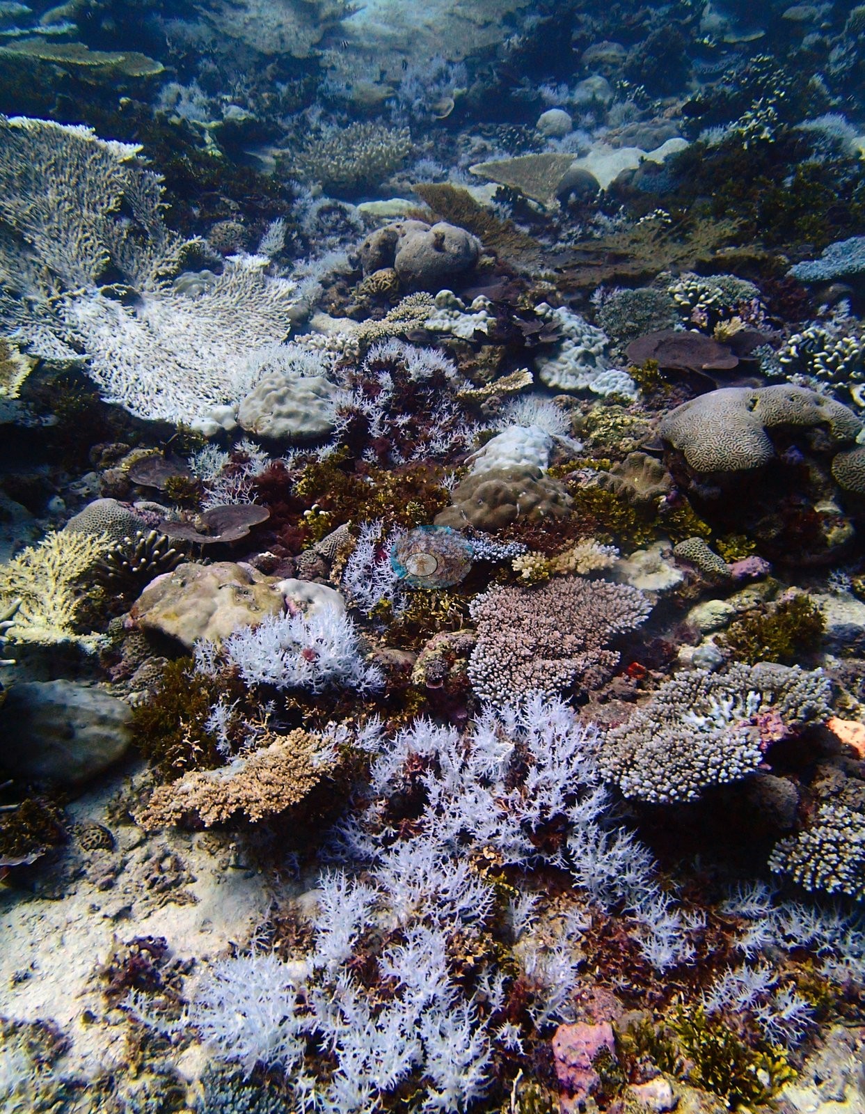
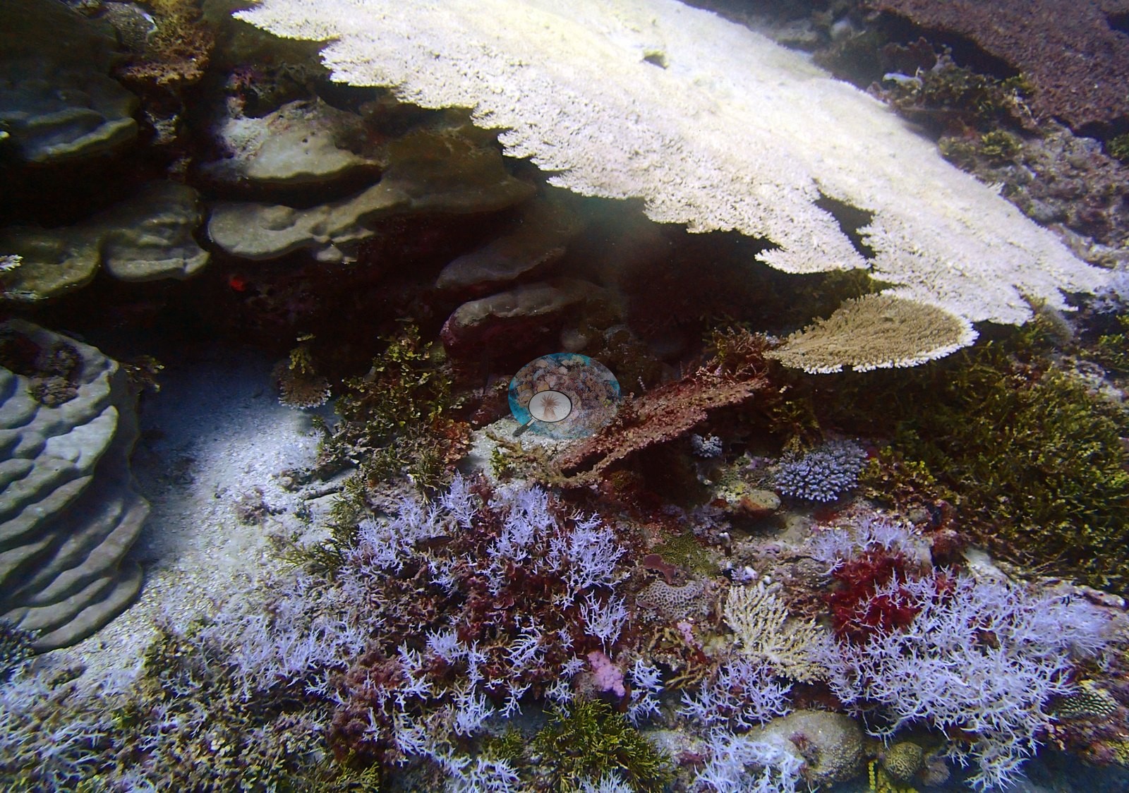
No crown-of-thorns, disease lesions or predation scars were noted in the 34 April frames. 1 May. The revisit frames record the same reef in a different state, and whitening is no longer confined to scattered colonies. Whole table fields read pale or white in the wide views — P5010994, P5010995, P5010996, P5010997, P5010998, P5010999, P5011000, P5011001, P5011002, and P5011003 — and branching and corymbose Acropora stands are white or lilac-white across entire thickets in P5010950, P5010951, P5010977, P5010979, P5010984, and P5010985. P5010966 sets the contrast in a single frame: a bank of stark-white tables on the right, a fully pigmented yellow-green table on the left, olive-brown tables between them, and pale tables receding into the distance behind. P5010949 shows a large stark-white table above substrate carrying extensive white and lilac fine-branching colonies. The growth-form pattern legible in the imagery is the familiar one: acroporids — tabular, corymbose and branching alike — carry most of the visible whitening, while the massive, meandroid, and encrusting colonies scattered through the same frames (P5010978, P5010983, P5011011, P5011018) hold their color. Not everything is affected: fully pigmented yellow-green digitate and corymbose Acropora, brown Pocillopora and gold tables appear in the same frames as bleached neighbors throughout (P5010966, P5011003, P5011013, P5011014, P5011015, P5011018, P5011022). The Pocillopora-dominated slope frames show a different signature: not stark white but widespread paling — in P5011016 and P5011024 the great majority of Pocillopora colonies are pale lilac or white-tipped rather than fully bleached, with a minority still carrying full dark-brown pigment and the occasional intact yellow-green Acropora table among them. Read together, the two signatures suggest the tables had progressed further into whitening by 1 May than the Pocillopora had; that is an ordering visible in the photographs, and no severity index is computed from them. Condition. Anderson's published per-site bleaching values are the authority on this site's condition, and they are stated in the record retained below: 10.0% on 18 April and 37.5% on the 1 May revisit, both CoralNet annotations of the informal survey images rather than diver estimates. What the photographs establish qualitatively is the shape of the event: on 18 April a moderate, patchy, colony-scale signal — a minority of tables stark white or pale lavender beside fully pigmented tan and olive neighbors throughout the tabular field (P4180680, P4180702, P4180703, P4180704, P4180718, P4180719, P4180734–P4180738, P4180756–P4180759), diffuse paling of plate margins and branch tips in P4180695, P4180705, P4180719, and P4180734, and one large massive colony in P4180750 bleached essentially in its entirety with tissue still clearly intact and no algal overgrowth. That is coherent, colony-scale pallor consistent with thermal stress rather than growth-tip whitening or a lighting artifact. By 1 May it is widespread and concentrated in the acroporids, as described above. Unlike 18 April, when bleaching stood at 10.0%, the 1 May revisit thirteen days later found 37.5% of the coral bleached, the highest May value of the four Peros Banhos sites revisited that week. Both bleaching figures are CoralNet annotations of the informal survey images, not diver estimates, and human-model agreement is weaker for bleaching (r = 0.40) than for cover (r = 0.72).
Fish and other fauna
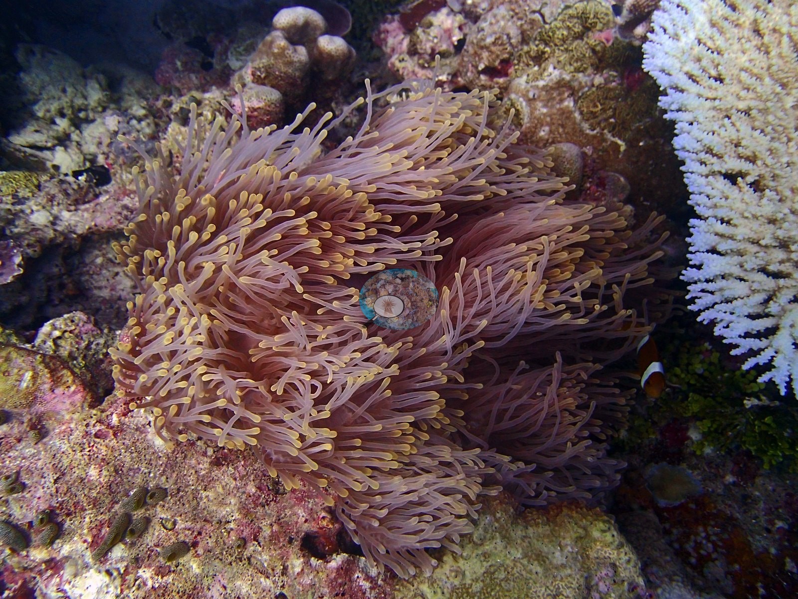
P4180717 is a macro of a large anemone consistent with the magnificent sea anemone (Heteractis magnifica) hosting anemonefish in a wall recess beside a bleached tabular colony, with encrusting sponge alongside. Fish are present throughout without dominating — butterflyfish, a Moorish idol and damselfish over the flat in P4180687 and P4180721, surgeonfish through the table field, and open-water schools of fusiliers and small jacks streaming over the reef crest in P4180702, P4180723, P4180733–P4180737, P4180737 and P4180748, the last a mid-water baitfish wall.
Comparisons with other data
No independent survey was made at this exact site; the nearest ones are listed in the table below.
Dive record
It was dived twice.
Other notes
Everything photographic below supplements it. Image-by-image. All 76 habitat frames were reviewed, drawn from two of Anderson's own field folders. The split is a dive split, not a filing artifact: BiPb72-finished holds 34 frames (P4180680–P4180759, 18 April 2015, EXIF spanning one continuous 51-minute window, 12:40–13:31 UTC) and BiPb72b-finished holds 42 (P5010933–P5011024, 1 May 2015) — the two visits already on record for this pin. They are treated as one site and described as two visits, because they are visibly different reefs thirteen days apart. There are no sampled-colony frames. A diver's transect tape is laid directly across the table field in P4180704, P4180720, P4180722, and P4180723 — physical documentation of the formal survey passing through this same habitat — and a diver appears in P4180756. The photographs cannot quantify it and are not used to.
Survey summary
BIPB72 (Peros Banhos): surveyed twice, Apr–May 2015; bleaching rose from 10.0% (mid-April) to 37.5% of coral (early May) as the 2015 bleaching event set in (CoralNet analysis of informal survey images; Mayfield & Dempsey 2026, Oceans). Surveyed during the Khaled bin Sultan Living Oceans Foundation Global Reef Expedition.
CV model comparison
More info
Those are point counts on the photographs; this is a diver swimming a transect. The models and the reference never saw the same thing. ⚠ SITE-LEVEL ONLY. The 2,500 frames were not associated with any transect taken within 200 m of them, so transect-vs-image comparisons are site means, never frames. The transect value is already in the pin `cover` field (109 of 112 pins, sourced to the paper's suppl. S1) and is read from there, never re-imported. The transect is THE coral-cover value for this site and stands alone. The rows below it are a methods comparison only: no computer-vision value is averaged with it, feeds the headline, or carries over to the site's cover figure (Anderson, 2026-09-22).| Method | Hard-coral cover (%) |
|---|---|
| Transect (published) | 72.4 |
| CoralNet | 56.1 |
| In-house DINOv3 | 49.2 |
| CoralSCOP edited | 39.9 |
| Claude | 44.3 |
Dive history
Coral bleached: computer-vision (CoralNet) estimate from the survey images, per dive, as published in Mayfield & Dempsey (2026), supplemental file S1.
| Date | Time in | Max depth (m) | Bottom time (min) | Coral bleached (%) |
|---|---|---|---|---|
| 2015-04-18 | 08:29 | — | 65 | 10.0 |
| 2015-05-01 | — | — | — | 37.5 |
Independent surveys nearby
| Agency / program | Year(s) | Stations / distance | Link |
|---|---|---|---|
| Spalding et al. (2024) | 2024 | 2 stations, 0.81 km | Records ↓ |
| Spalding et al. 2025 (Chagos 2024 bleaching report) | 2024 | 2 stations, 0.81 km | Records ↓ |
Within 5 km, 4 independent survey stations recorded hard coral cover in 2024. Surveys since 2021 average 50% (range 30–70%, n=4). This site's own estimate (72%) is indistinguishable from the recent range (30–70%): the 2.4-point gap is inside the ±7 percentage-point noise between methods; the methods differ, so the comparison is context, not a like-for-like test.
Collected by other programs using different methods, so these are context for the figures above, not a like-for-like comparison. Where a station was surveyed more than once the range is shown. Station names are not dive-site names.
| Agency | Site / location | Date | Hard coral cover (%) | Distance | Link |
|---|---|---|---|---|---|
| Spalding et al. 2025 (Chagos 2024 bleaching report) | Peros Banhos - West Ile Bois Mangue, lagoon (N, 2-6 m) | 2024 | 30% | 0.81 km | — |
| Spalding et al. 2025 (Chagos 2024 bleaching report) | Peros Banhos - West Ile Bois Mangue, ocean (N, 7-10 m) | 2024 | 70% | 0.81 km | — |
| Spalding et al. (2024) | Peros Banhos - West Ile Bois Mangue, lagoon (N, 2-6 m) | 2024 | 30% | 0.81 km | — |
| Spalding et al. (2024) | Peros Banhos - West Ile Bois Mangue, ocean (N, 7-10 m) | 2024 | 70% | 0.81 km | — |
Data & links
- Read the full site report ↗
- Download benthic survey data (CSV) ↗
- Download all LOF-GRE data (933 sites) ↗
- CoralNet image repository for this region ↗
- Photo portfolio ↗
- Coral Reef Diagnostics page for this area ↗
All images from Coral Reef Diagnostics. Data are from Coral Reef Diagnostics and the organizations named in the data-sources table above.
© Coral Reef Diagnostics.
References
- Mayfield AB, Dempsey AC (2026). Using tourist diver images to estimate coral cover and bleaching prevalence in a remote Indian Ocean coral reef system. Oceans 7(1):1. PDF
- Spalding M, Bourasseau M, et al. (2025). Coral bleaching and mortality in the Chagos Archipelago, 2024. British Indian Ocean Territory Administration report (gray literature). PDF