
Part of the regional summaries: Chagos Archipelago - Peros Banhos and Chagos Archipelago
More info
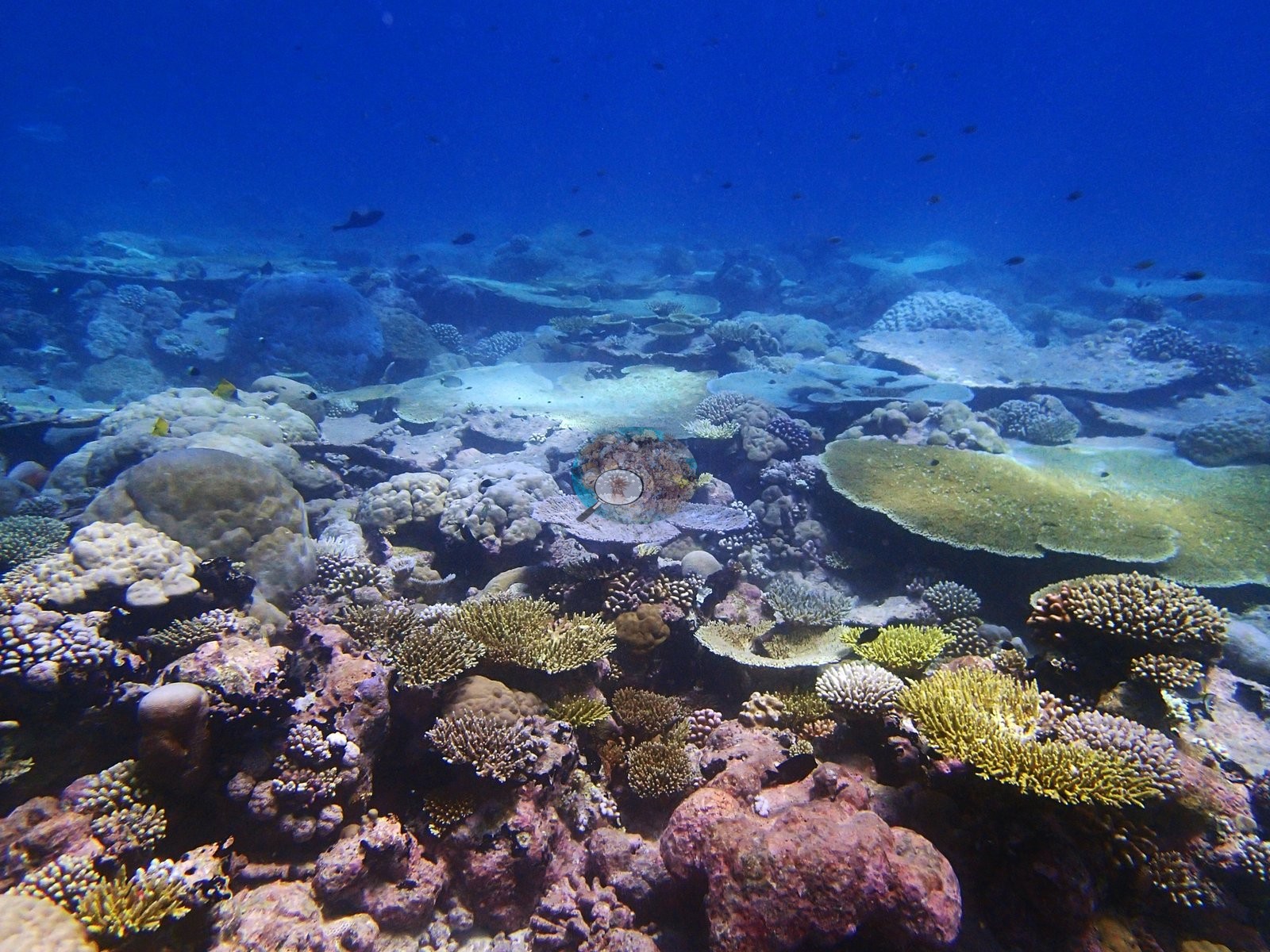
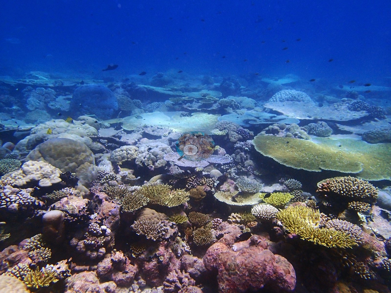
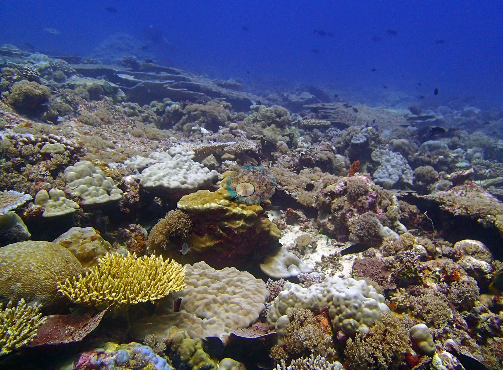
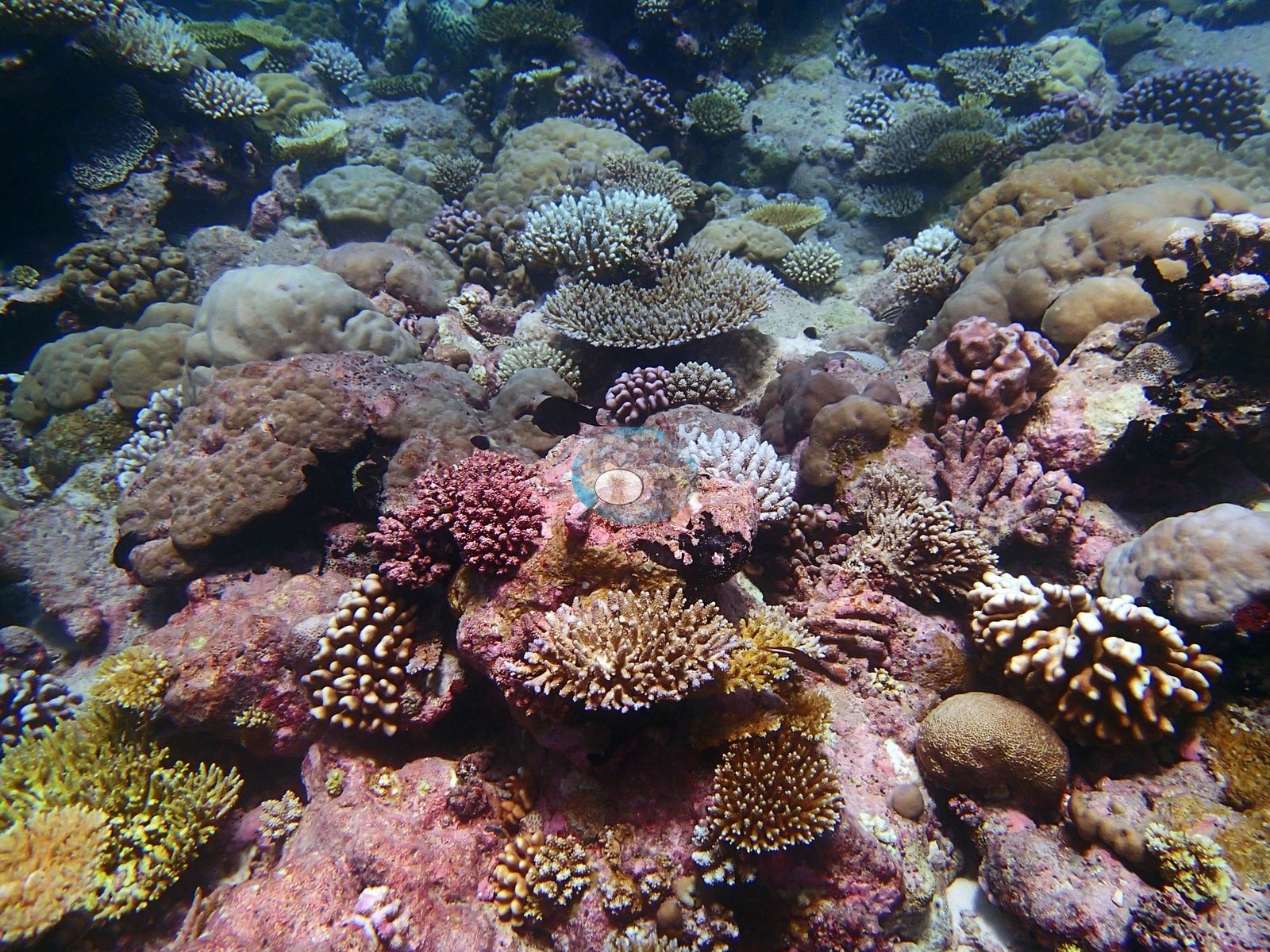
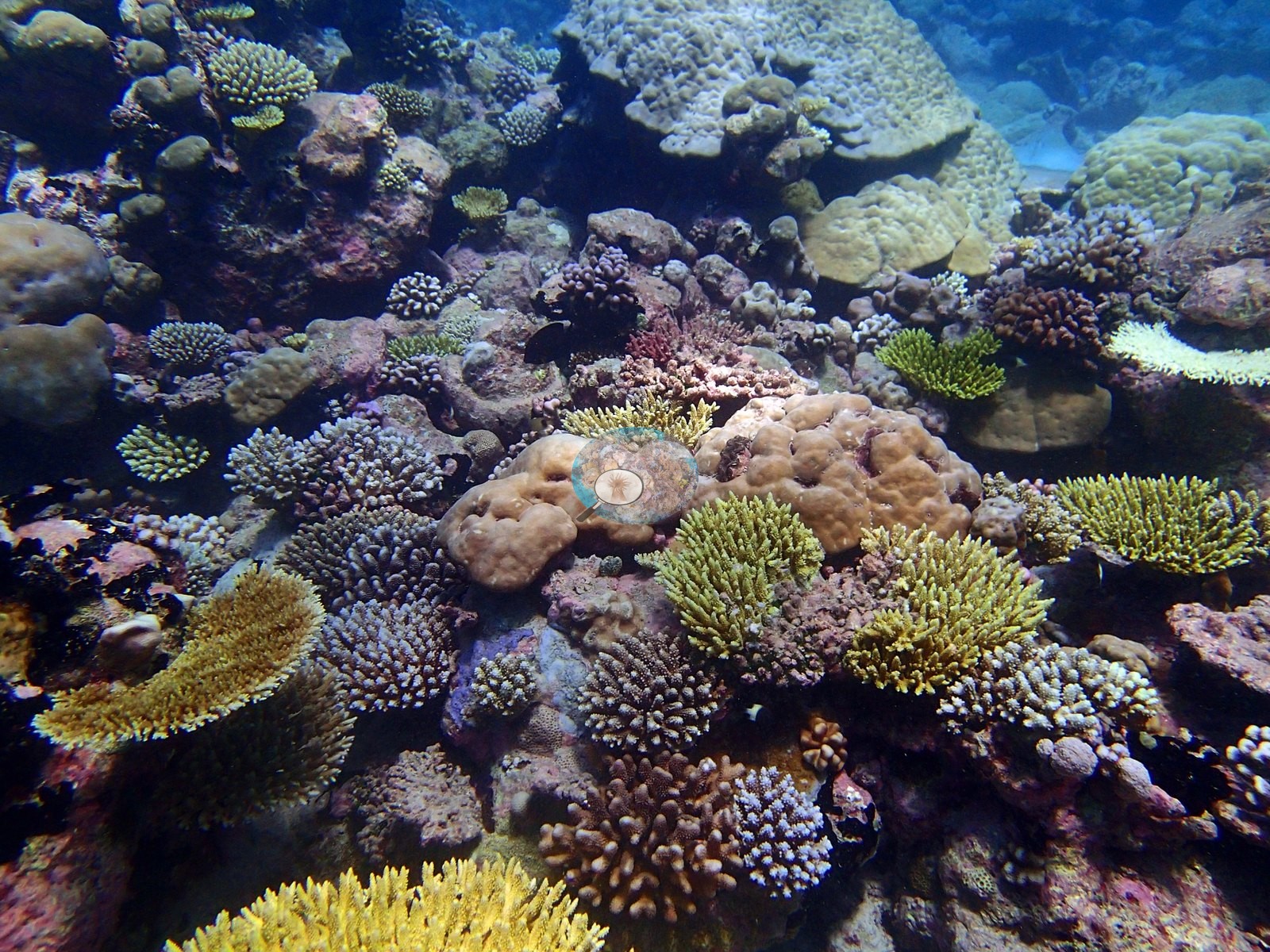
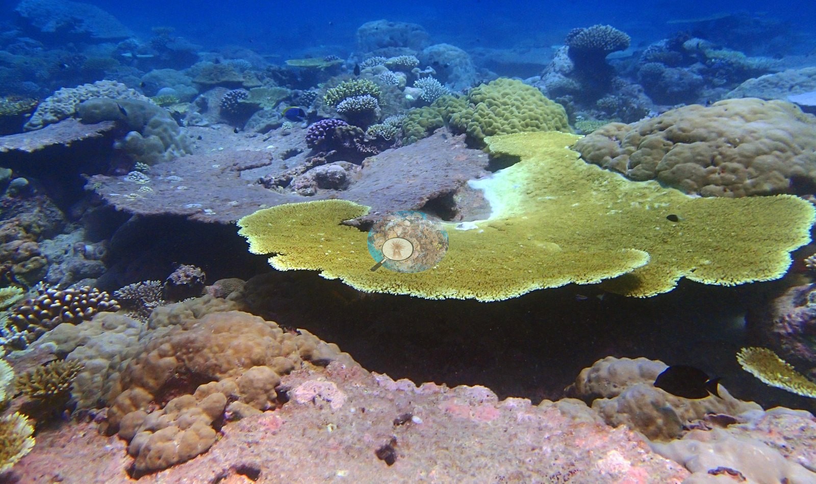
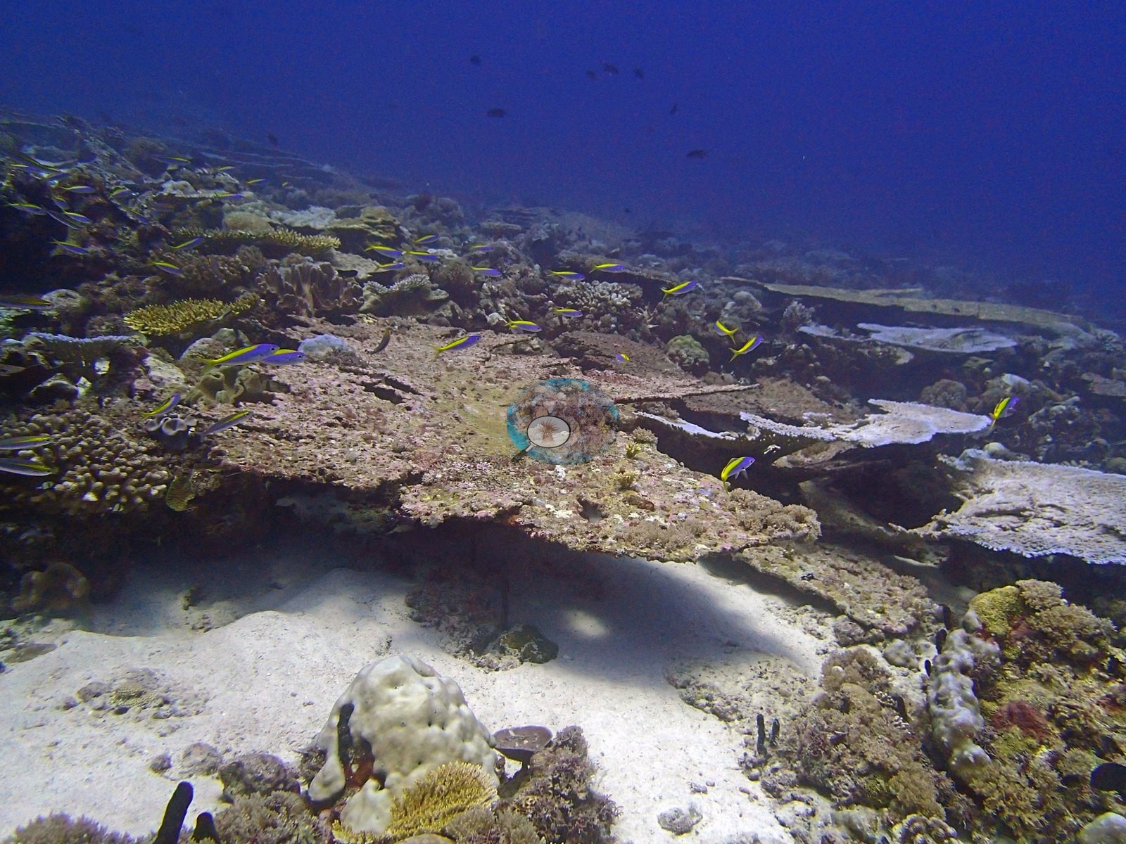
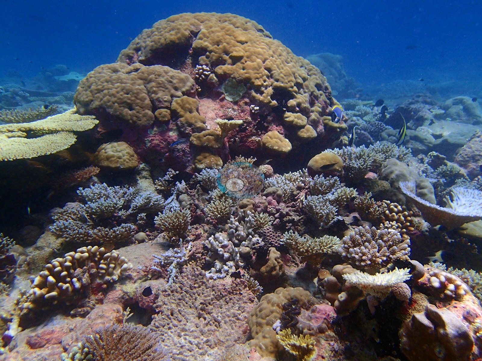
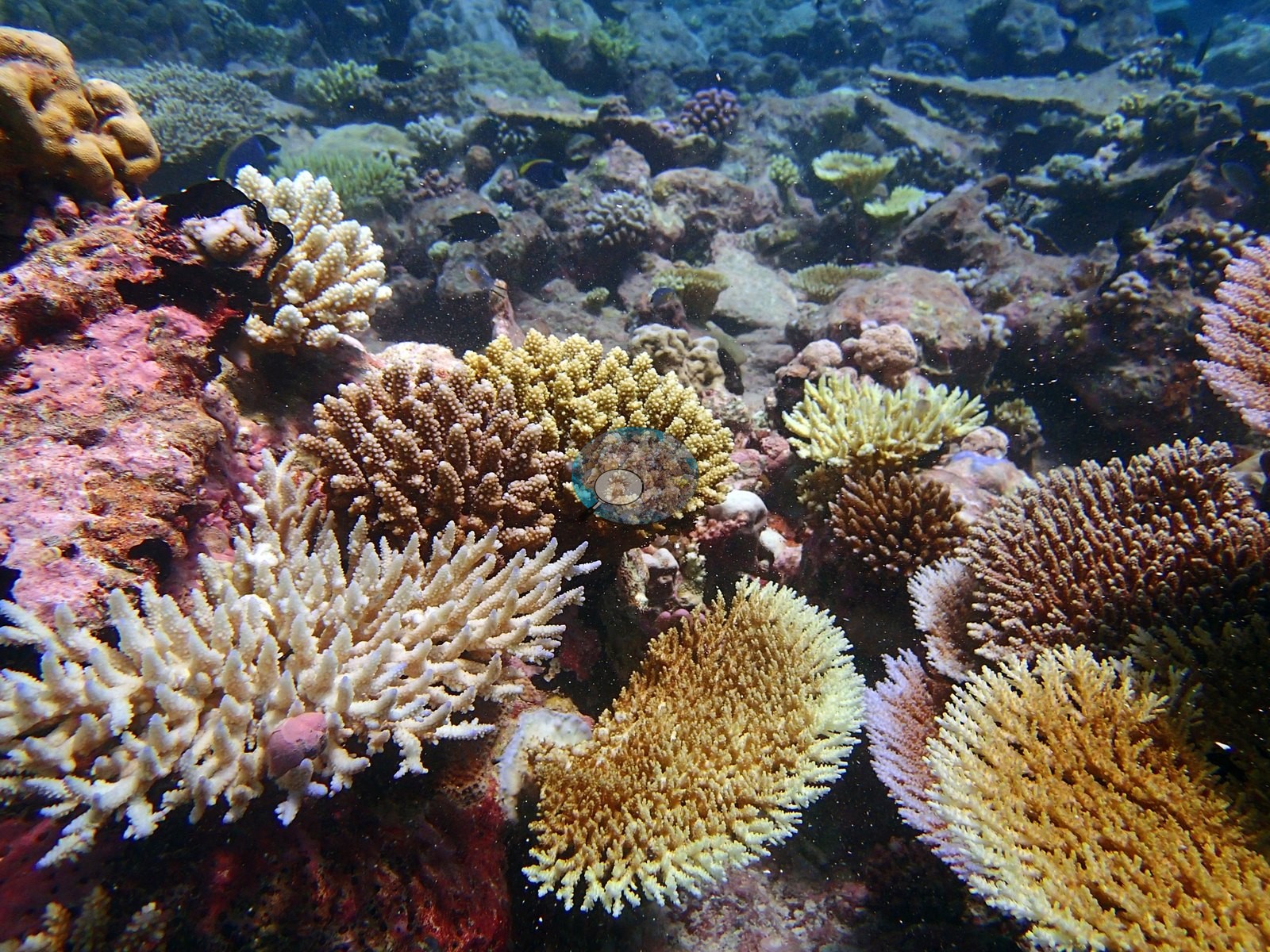
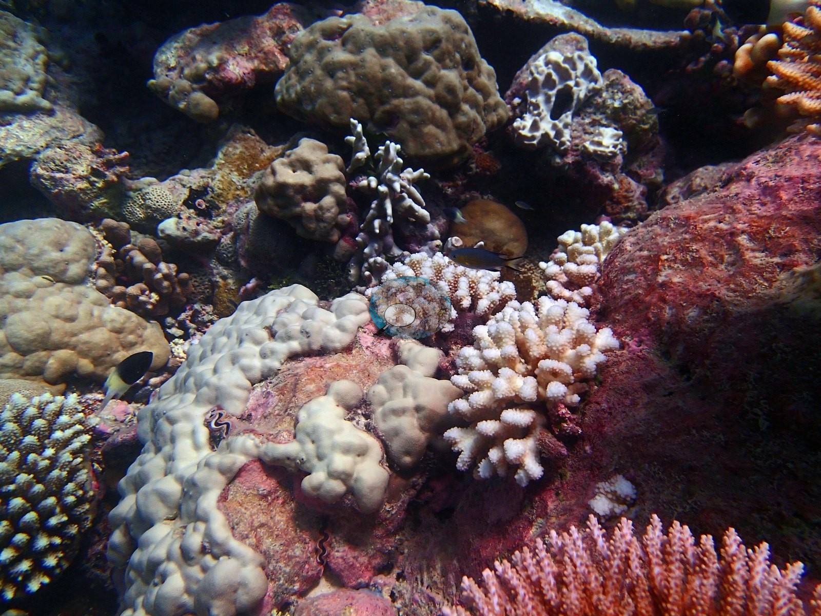
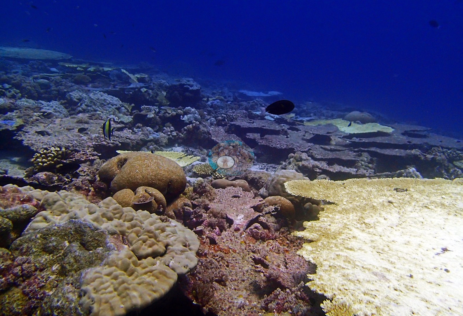
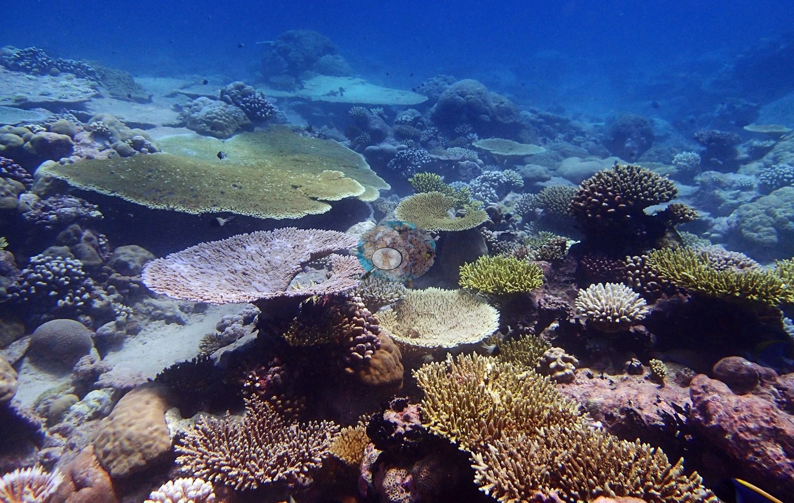
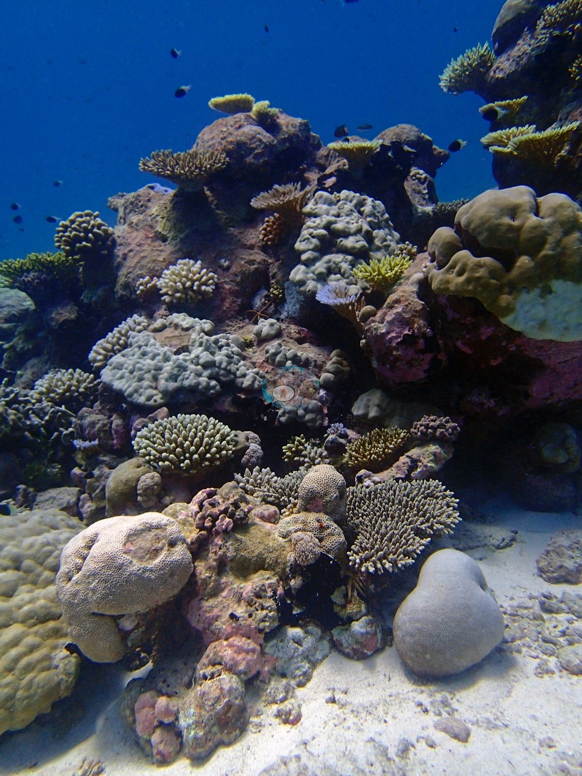
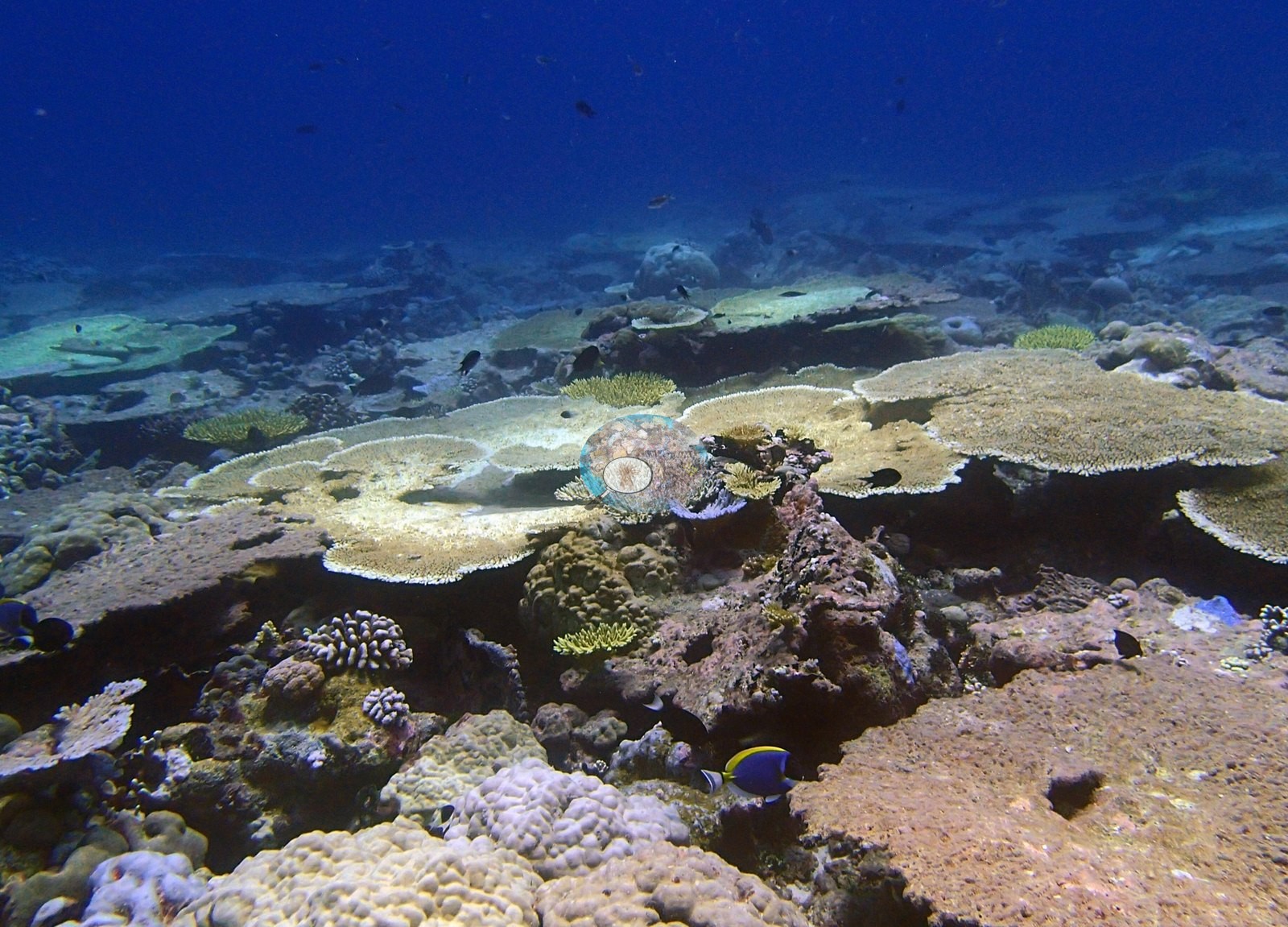
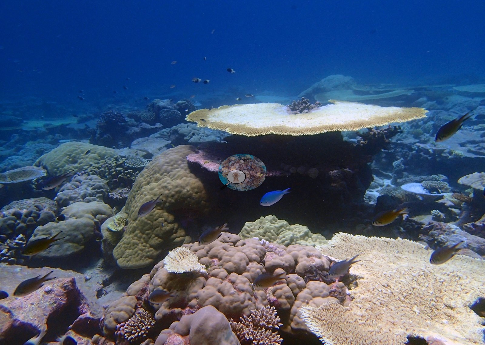
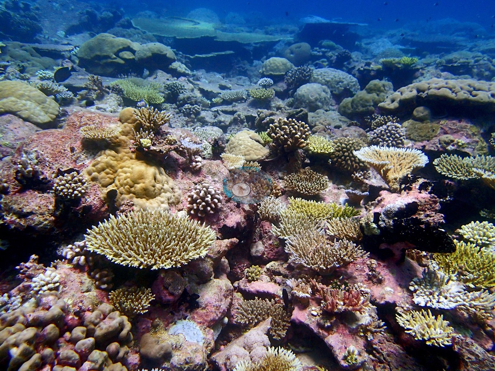
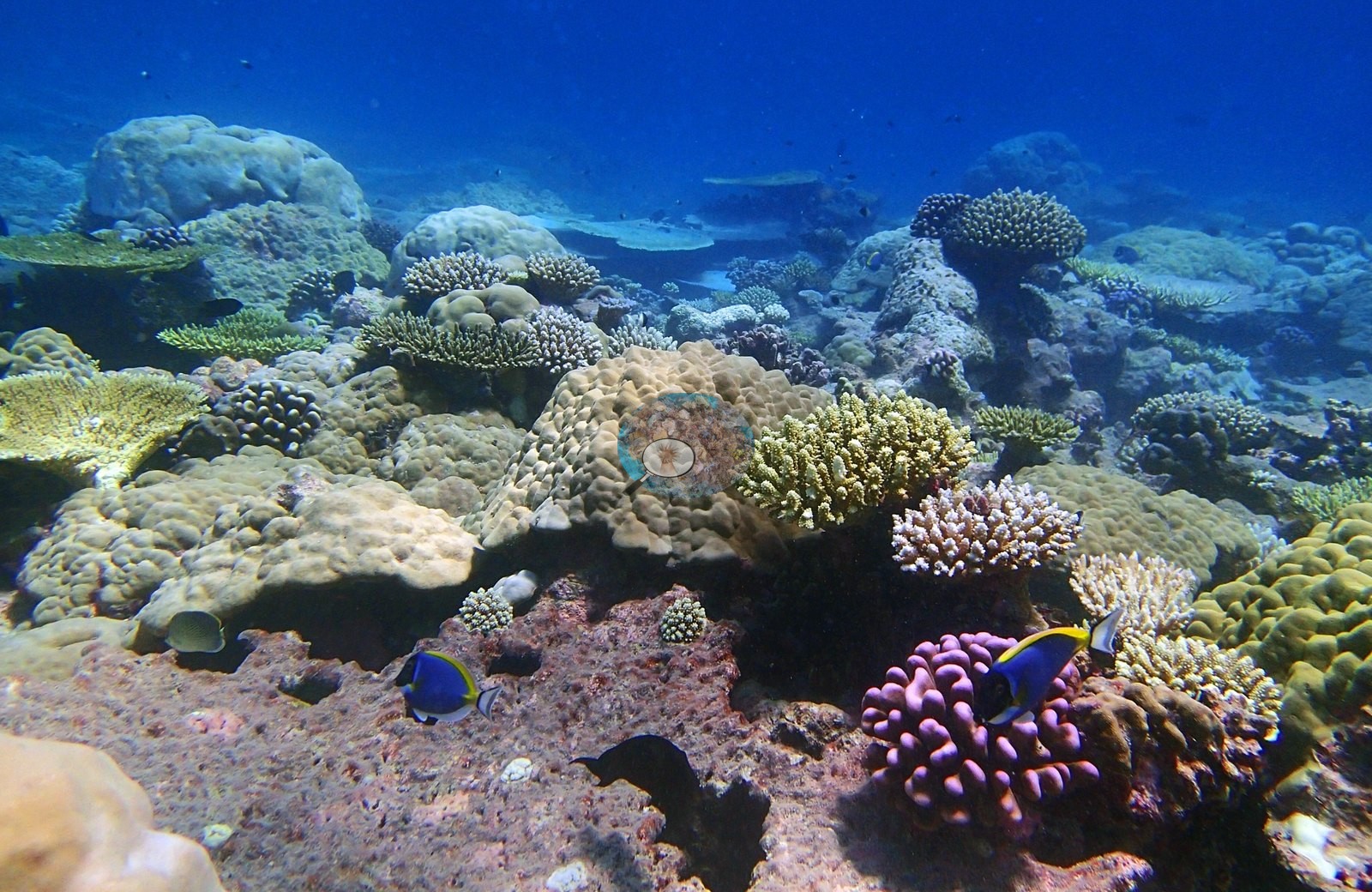
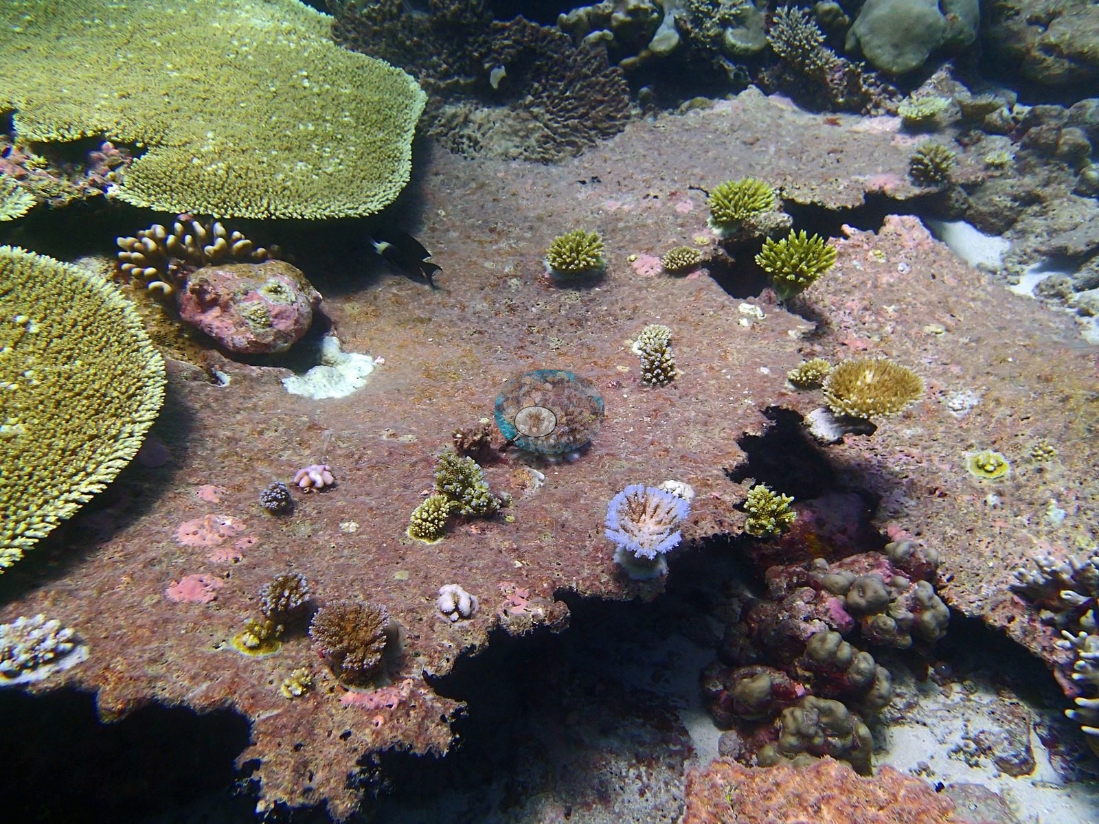
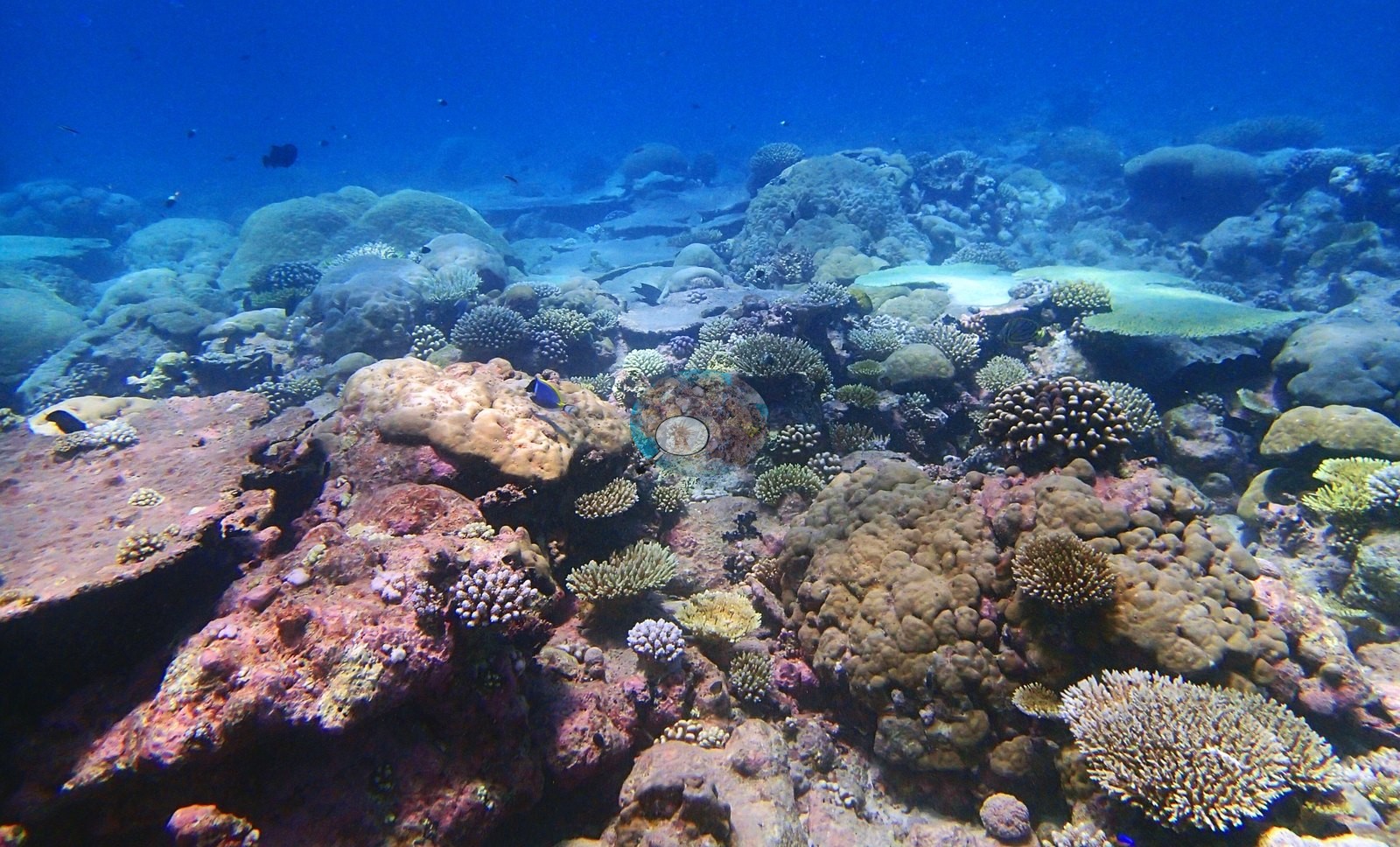
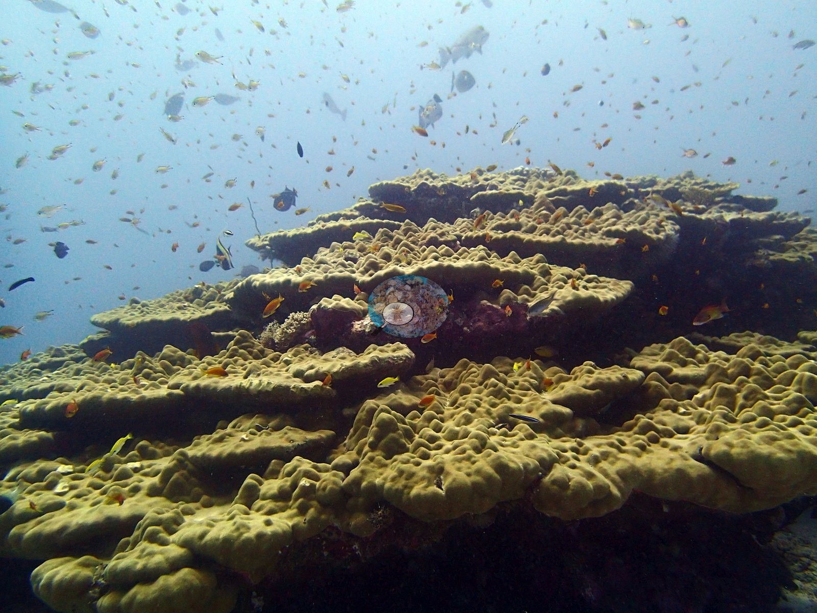
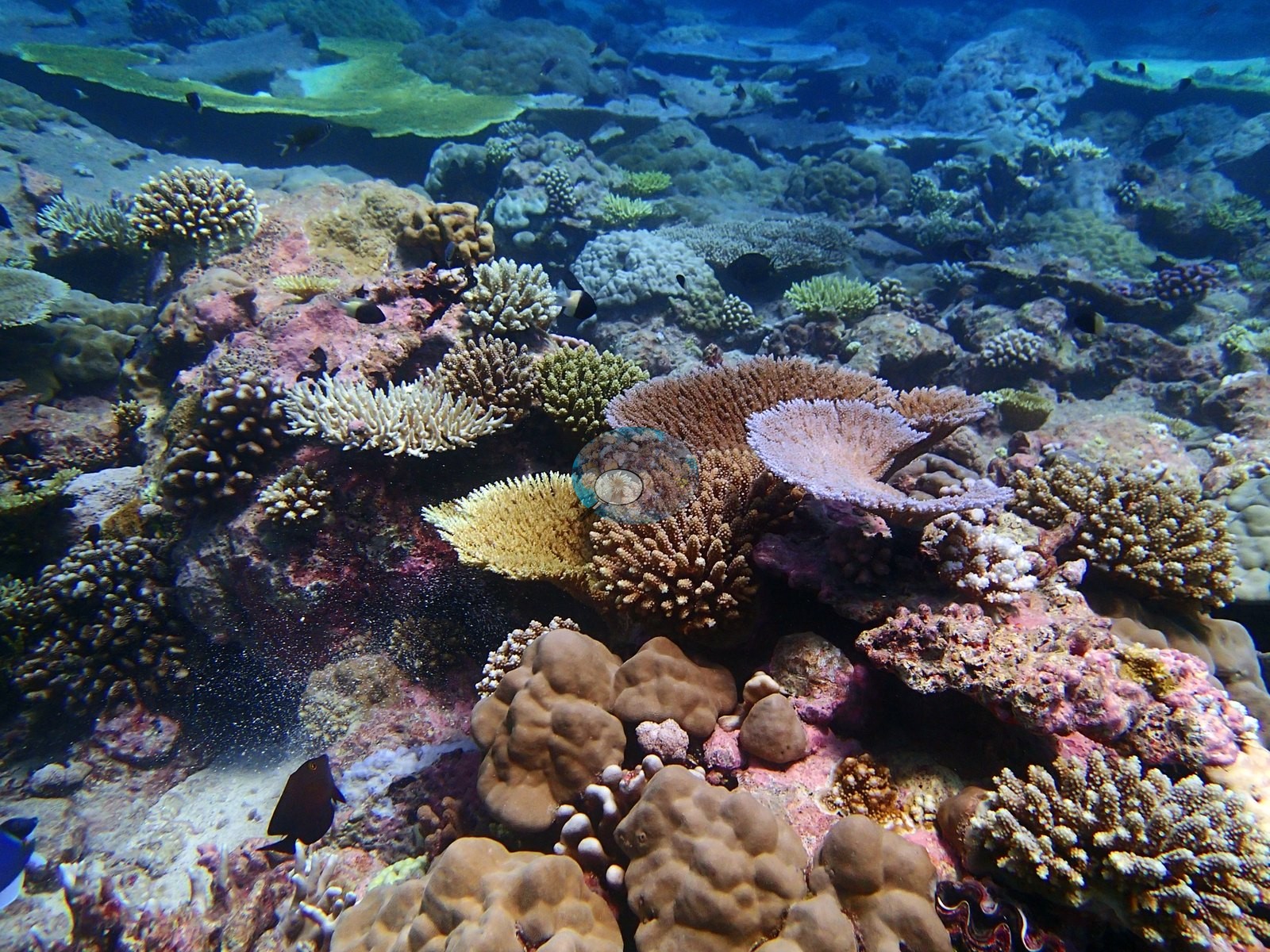
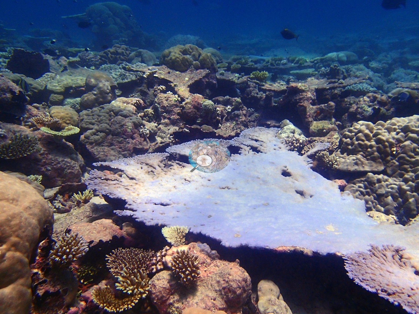
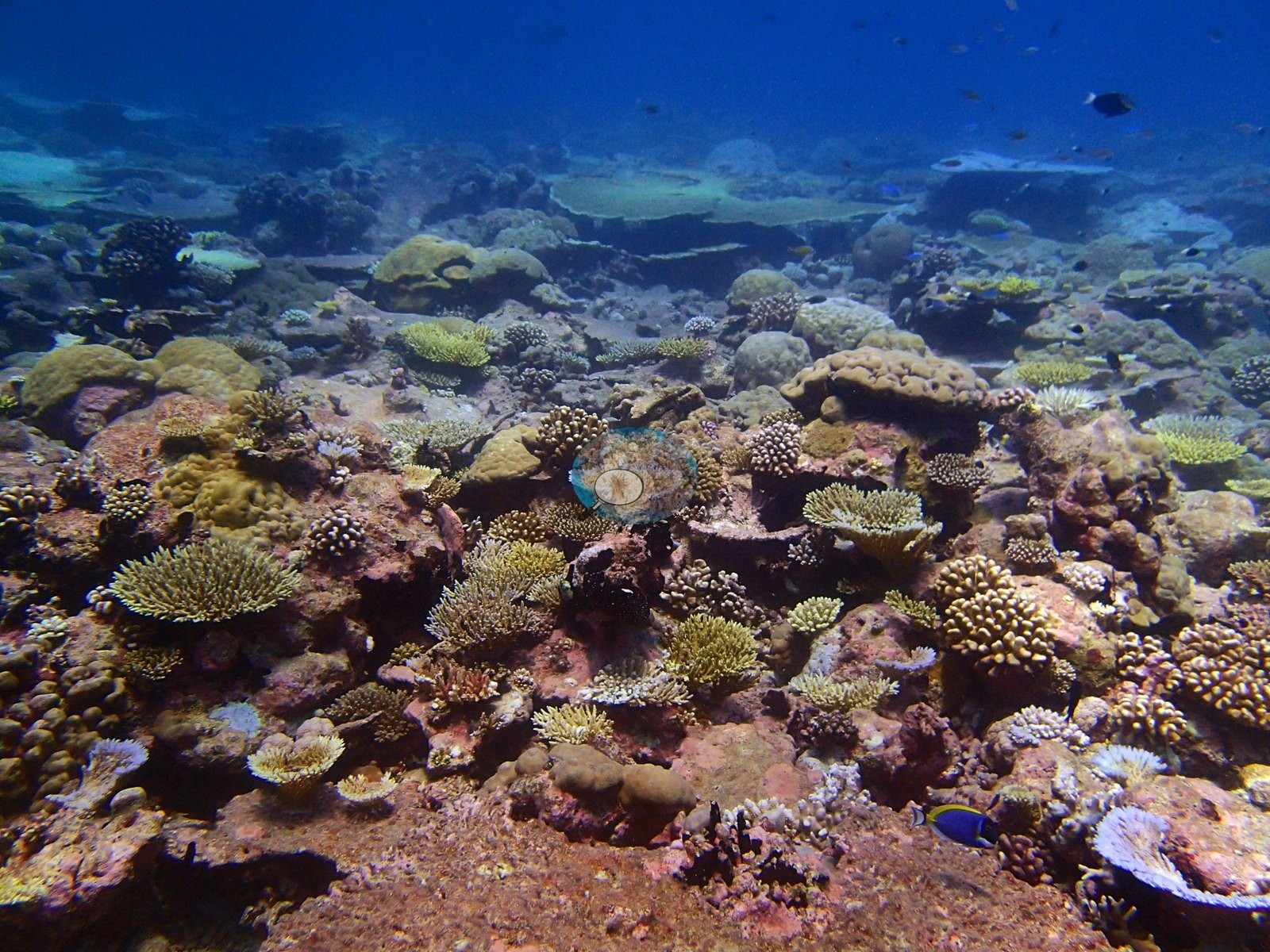
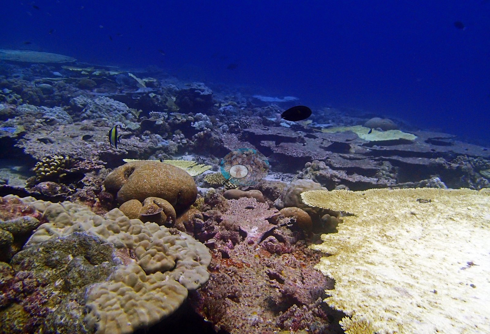
Chagos (NOAA CRW virtual station)A mixed Peros Banhos reef (50% cover) with a striking stepped table of tiered plate coral, sandy patches, and a colorful low coral garden of branching Acropora, Porites boulders, and pink coralline pavement. Bleaching was limited to a few scattered colonies, such as one stark white plate coral. Surveyed on the Living Oceans Foundation's Global Reef Expedition.
Two independent survey stations shown with the program’s logo — click one to see how far it is from this site.
One other CRD dive site within 5 km shown in orange — click a marker to open its page.
🗺 Detailed map of the Global Reef Expedition dive sites, Peros Banhos, Chagos (Khaled bin Sultan Living Oceans Foundation; opens in a new window)
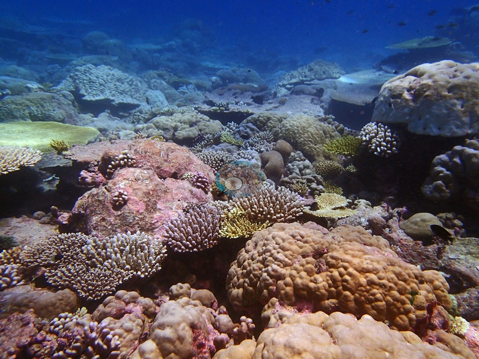
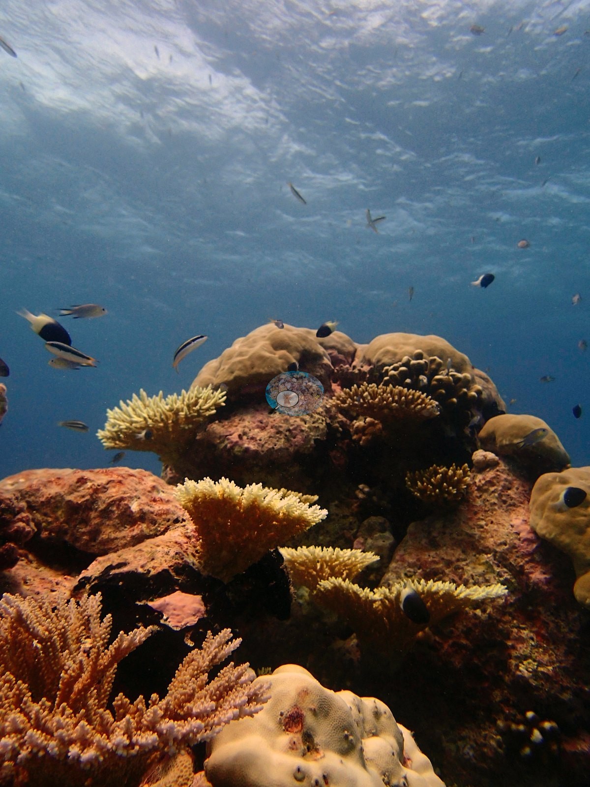
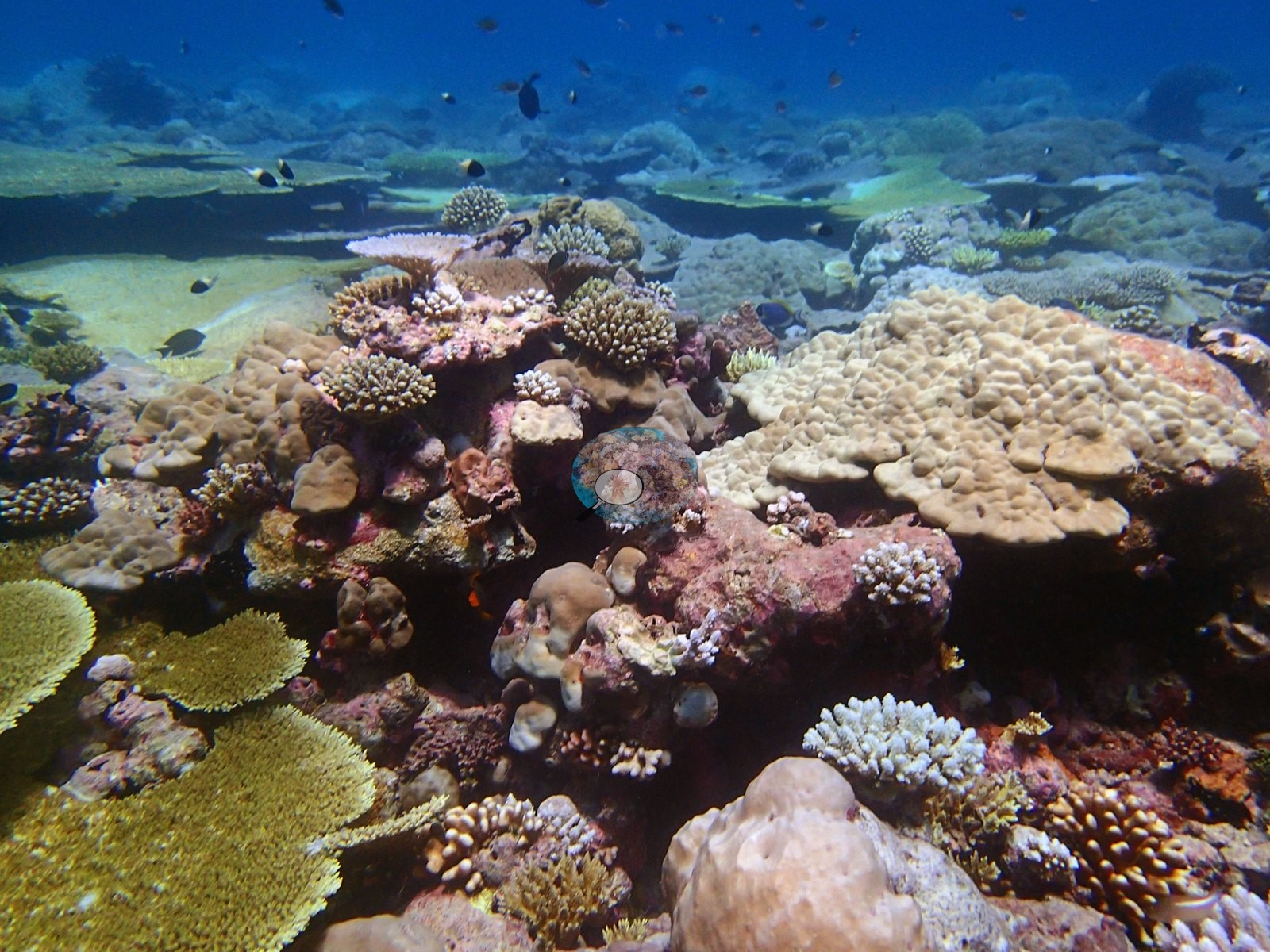
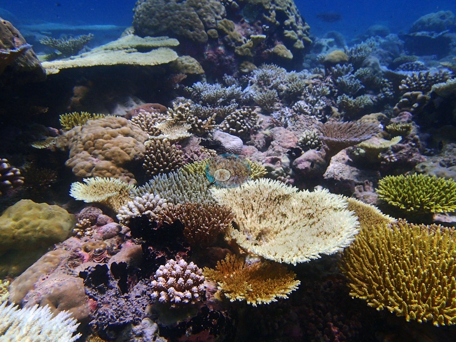
Site description
Setting
S1) — Anderson's own published value, surveyed 18 April 2015 at Peros Banhos during the Khaled bin Sultan Living Oceans Foundation Global Reef Expedition (5.26732°S, 71.88862°E; exposed emergent fringing reef, 30 m; in situ temperature 30.2°C, salinity 34.2). Quality is unusually good — mostly well-exposed wide reef views in clear water at shallow to mid fore-reef depths, with a handful of shallow frames where the surface is visible (P4180833) and one deeper blue-water frame (P4180791).
General benthic features
Against that, algal cover is a modest 23.08% and non-coral invertebrates hold an unusually large 16.03% of the benthos — by far the largest non-coral, non-algal component of the substrate here, well above what several other Chagos sites carry, and visibly explained in the photographs by frequent giant clams, sponges and a resident anemone with its fish. Bare substrate is 10.8%, turf 9.05%, crustose coralline algae 5.33%, macroalgae 3.5%, erect algae 3.37% and cyanobacteria 0.07%.
Seventeen scleractinian genera were recorded and the assemblage is carried by two of them: Acropora at 20.98% of the benthos (42% of live coral) and Porites at 15.72% (31%) — together nearly three-quarters of all coral on the reef. Montipora is a distant third at 3.12%, then Pocillopora 2.57%, Echinopora 1.50%, Astreopora 1.47%, Pavona 0.98%, Ctenella 0.67% (the Chagos-endemic monotypic genus, not to be confused with Cynarina — the known stale-lookup-table error), Fungia 0.67%, Psammocora 0.65%, Goniastrea 0.50%, Leptastrea 0.48%, Stylophora 0.27%, Favia 0.22%, Favites 0.17%, Lobophyllia 0.07% and Montastrea 0.07%.
The depth structure here is unusually clean and is worth stating in full, because the site-level averages describe no single transect. Cover was taken on three formal transects spanning depth strata D2–D4. D2, the shallowest stratum, carries by far the highest cover of the three at 68.25% coral against only 22.75% algae, and it is essentially a two-genus reef: Acropora 34.75% (51% of the coral present) and Porites 18.25% (27%), with Pocillopora, Astreopora, Montipora, and Ctenella filling out the rest at 2–4% each (Ctenella reaching 2.00% of D2 coral cover). D3 drops sharply to 37% coral, the site's low point, and the genus dominance inverts — Porites leads at 16.40% (44% of the coral) over Acropora at 12.20% (33%) — with Montipora, Astreopora, Pocillopora, and Psammocora each in the low single digits. D4 partially recovers to 45% coral and Acropora regains the lead at 16.00% (36%), but the composition is not simply D2 repeated: Porites holds 12.50% (28%), while Echinopora and Montipora each reach 4.50% (10% of coral apiece) and Fungia appears at 2.00% — none of which feature meaningfully in the shallower strata. The site mean of 50.08% coral sits between D3 and D4 and matches neither transect, and the 20.98%/15.72% Acropora/Porites split is the average of a shallow reef that is essentially two genera and a deeper reef where a third and fourth genus (Echinopora, Fungia) become relevant. This depth-stratified breakdown is the richest thing on this page and is the transect's own account of the reef.
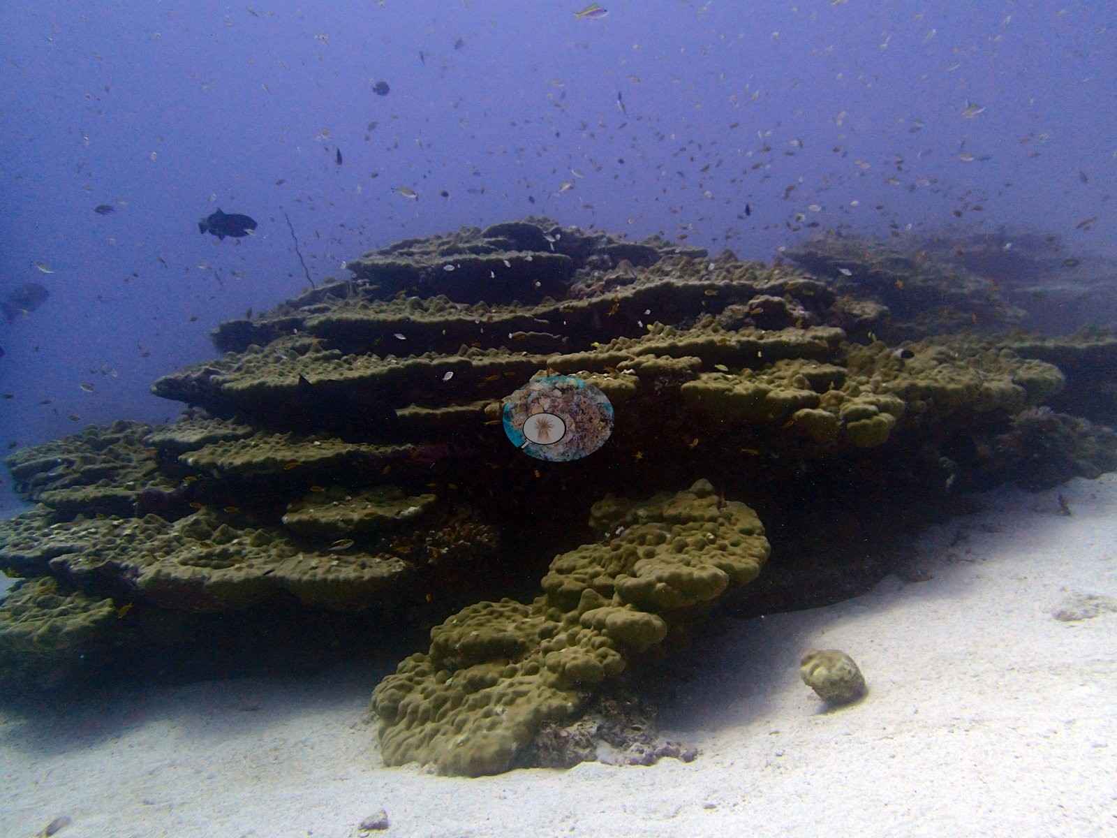
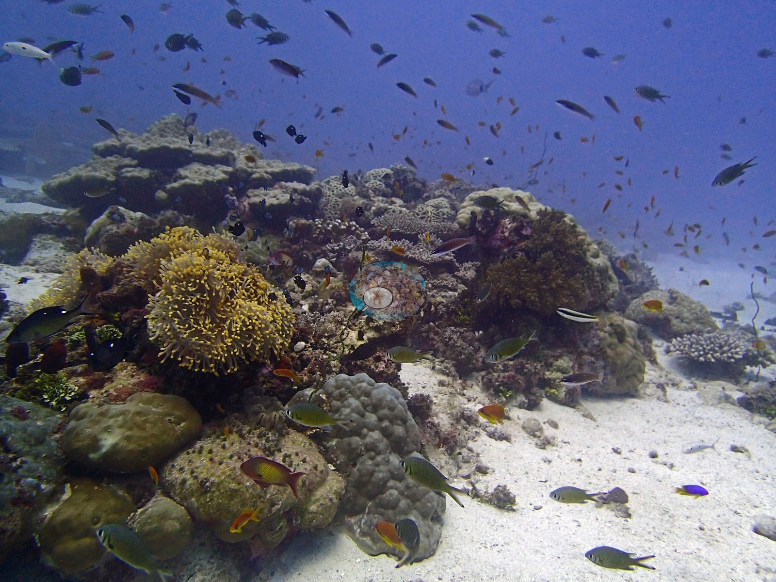
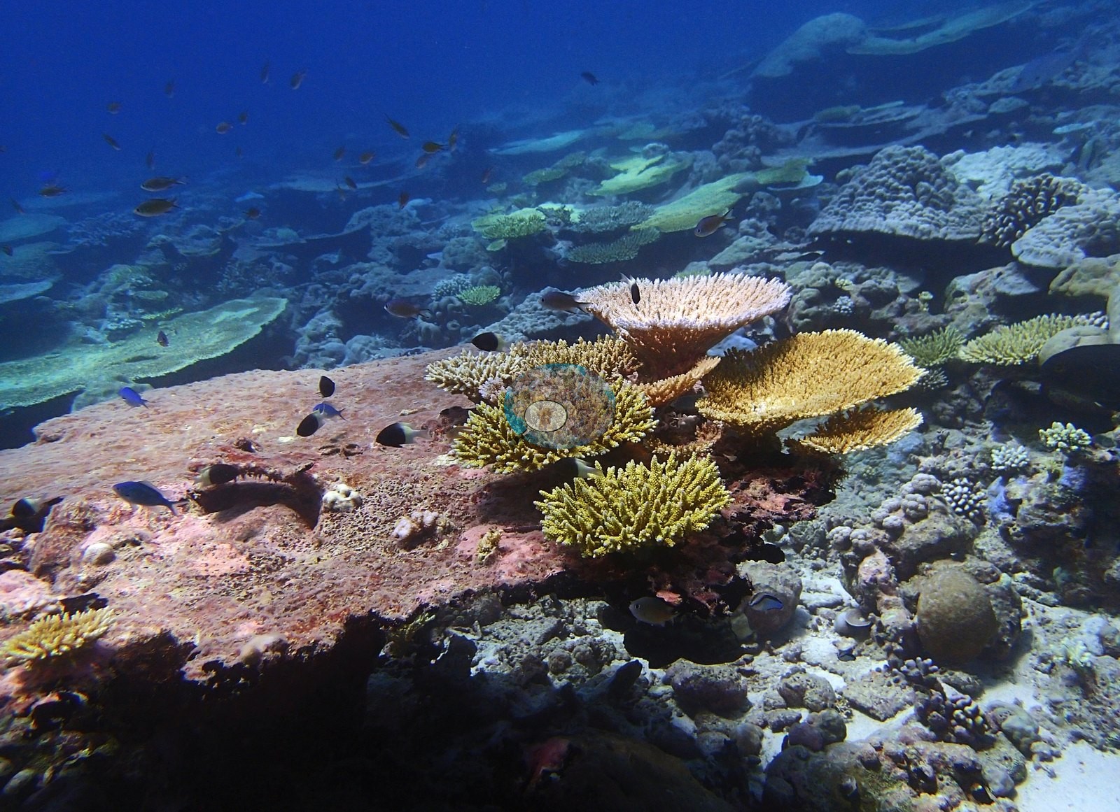
The set opens on the site's signature structure. P4180760 and P4180761 show a large tiered, wedding-cake colony of stacked laminar whorls, mustard to olive-yellow, standing clear of white sand with encrusting and nodular growth banking its base and maroon coralline crusts in its shaded interstices, orange anthias and small planktivores streaming over it — a laminar plating growth form compatible with Echinopora or Montipora, though the frames alone cannot settle the genus. Both genera are on the transect list, Echinopora at 1.50% site-wide and 4.50% in D4.
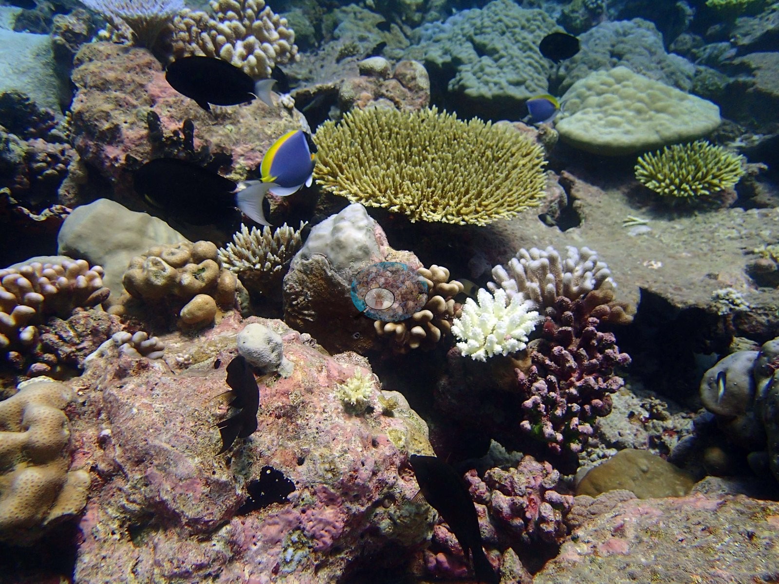
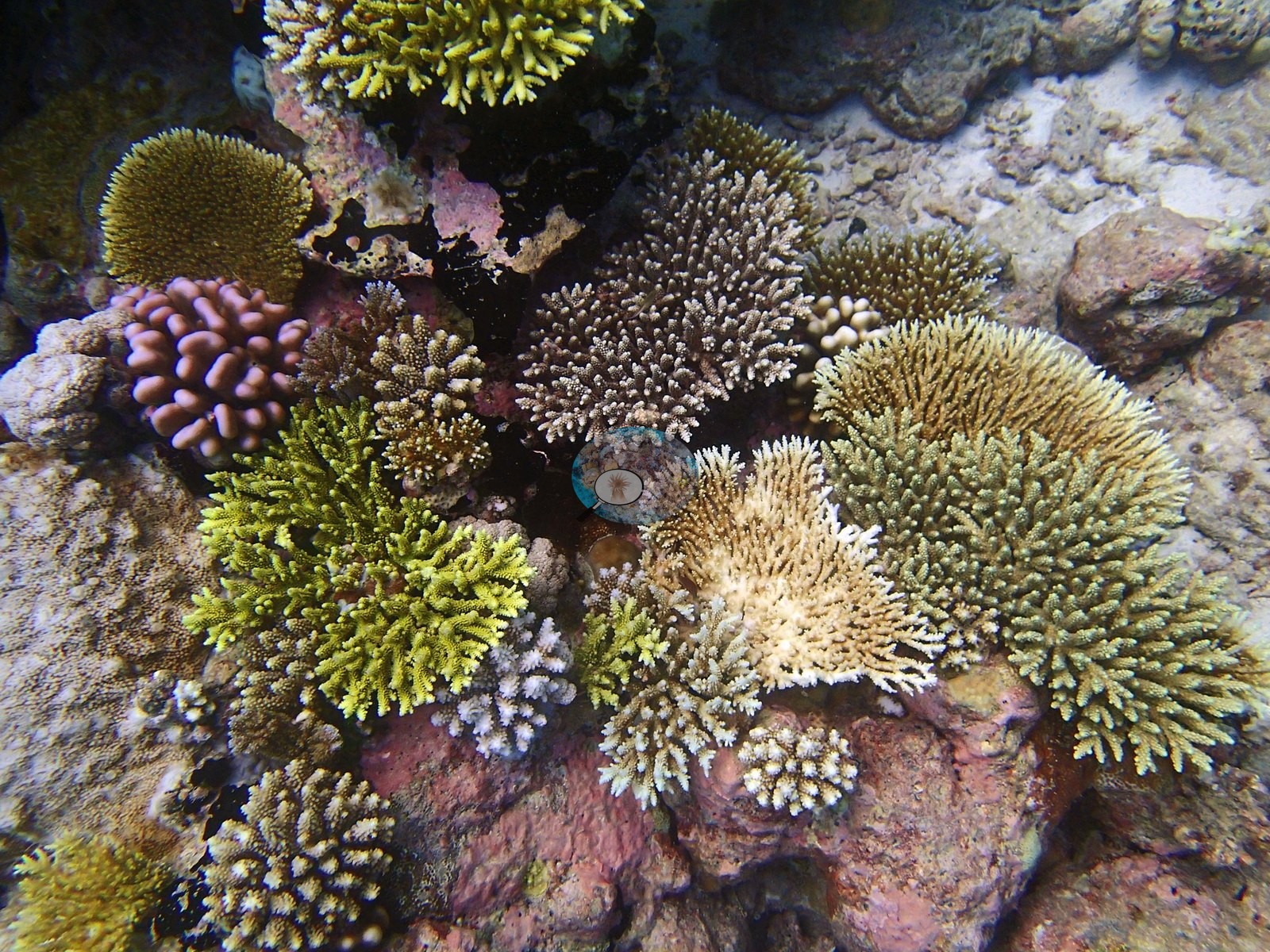
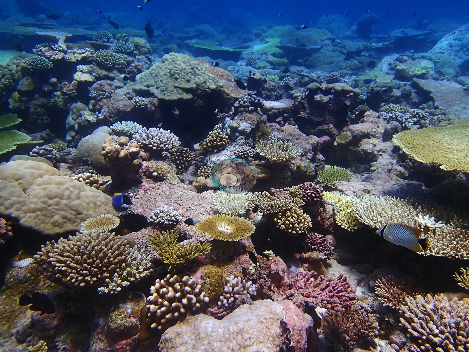
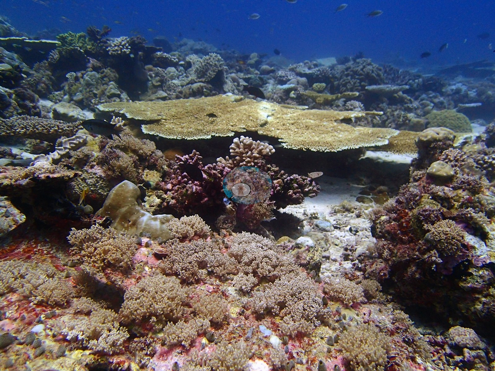
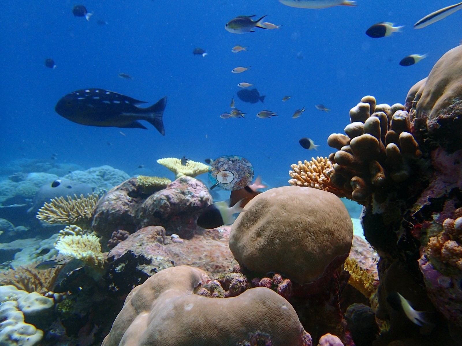
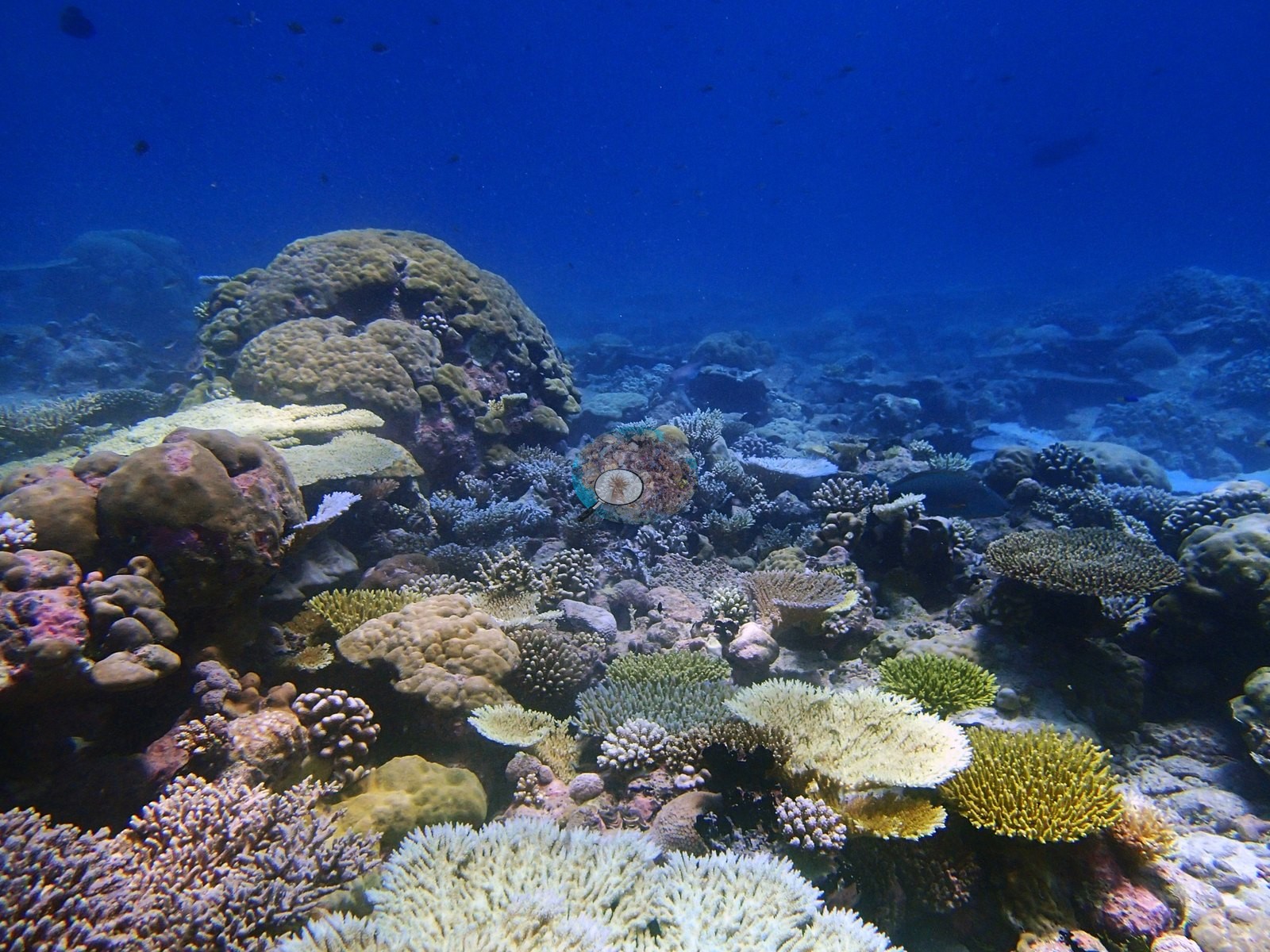
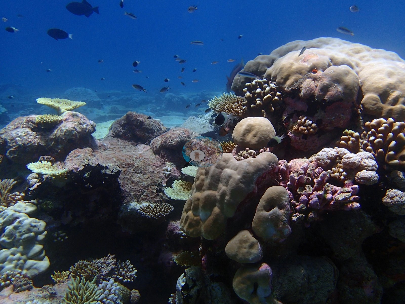
Away from that structure the dominant impression is a dense, close-packed coral garden on pink and mauve coralline pavement. Corymbose, digitate and bottlebrush Acropora in chartreuse, cream, gold, and tan fill P4180809, P4180810, P4180816, P4180819, P4180823, and P4180834; thin tabular acroporids from dinner-plate to meter-class, stacked in overlapping tiers, run through P4180779, P4180808, P4180817, P4180824, P4180826, and P4180835; lumpy and hemispherical massive Porites range from small heads to a boulder-sized dome filling most of P4180827; mauve and pink-brown pocilloporid clusters appear in P4180815, P4180818, P4180823, and P4180834; a scatter of meandroid brain colonies sits at bottom right of P4180792; and giant clams are set into the pavement in P4180813, P4180830 and P4180832. Dense high-cover sections combining tabular and corymbose Acropora with large massive and faviid domes over pink CCA-encrusted framework dominate P4180813, P4180818, P4180823, P4180830, P4180832, and P4180834 — the photographic face of the mixed Acropora–Porites-plus-others assemblage the transects describe. P4180835 is a textbook fore-reef terracing structure: a large table coral shading a massive dome beneath it. Free-living and encrusting forms — small fungiids, foliose plates compatible with Montipora or Pavona — recur through P4180777 and P4180809. Sand and rubble are present but subordinate: white sand channels and patches floor P4180760, P4180762, P4180777, P4180832, and P4180835, and several frames catch the coral-garden-to-sand interface directly. Relief is moderate and built from coalesced bommies and pavement steps rather than from spur-and-groove. P4180812 is the useful counterpoint — a broad flat expanse of hard, pink coralline-crusted pavement carrying only scattered small coral recruits and one pale soft-coral colony — the photographic counterpart of the site's 10.8% bare substrate, and evidence that open low-relief surfaces occur between the coral thickets.
Coral cover
The measurement at BIPB73 is the benthic transect survey. Coral cover 50%, from LOF BIOT-1 in situ transects (Mayfield & Dempsey 2026, Oceans, suppl. That diver transect figure is the authoritative record of cover and community here. The photographs described below supplement it; they are qualitative only, no cover value may be read off any of them, and where the imagery and the transect appear to disagree the transect governs.
What the transects recorded. BIPB73 is a coral-abundant fore-reef: 50% cover ranks 25th of 109 Chagos sites, above both the Peros Banhos regional mean (46.55% across 20 sites) and the dataset mean (37.92%).
Computer-vision comparison — method against method, not against the transect. All 45 frames in the site folder carry both products (the photo-method frame count matches the folder count exactly, so there is no frame-count mismatch here), giving a paired-frame count of n = 45. CoralNet point annotation returns 36.1% live hard coral and Coralscapes mask segmentation 25.5% of image area, against the transect's 50.1%: deviation −24.6 to −14.0 pp, mean of the three methods 37.2% ± 12.3 (that SD reflects systematic method bias between sampling designs, not measurement precision — photo methods read low at high cover; see CHAGOS_MULTIMETHOD_README.md). This is a wide multi-method spread, and the depth structure above is a large part of why: the transect mean averages a 68% shallow stratum with a 37% mid stratum, while the photographs sample whatever the camera was pointed at across an architecturally varied fore-reef, including sand channels, a flat sparse pavement and several frames composed on animals rather than on substrate. The two image products also disagree with each other by 10.6 pp here, the mask model reading lowest — consistent with a reef whose cover is carried substantially by thin tabular and laminar plates, which foreshorten in oblique frames. A separate 30-point human-annotated tally for this site puts bleached points at 2.44% (by taxon: Acropora 1.85%, other hard coral 0.44%, Pocillopora 0.15%). All of these are image-product outputs with their own footprints and denominators; none of them corrects the transect, and they must not be averaged. Six of the 45 are subject portraits rather than habitat views and carry little benthic information (P4180769, P4180770, P4180771, P4180799, P4180806, P4180763), leaving roughly 38 genuinely usable wide frames. No percentage of any kind is derived here from these photographs. This site's published bleached fraction is a separate, authoritative number from Anderson's own record, quoted only in the survey block retained below; the photographs neither corroborate, qualify nor revise it.
Coral cover 50%, measured on the in situ benthic transects of the LOF BIOT-1 expedition (Mayfield & Dempsey 2026, Oceans, supplemental S1) — a diver transect measurement, not a photographic or computer-vision estimate. That transect figure is the authoritative record of cover at BIPB73; the photographs above are qualitative and illustrative only, and no image-derived product overrides or qualifies it. Coral cover 50% (formal transect surveys); 6.4% of coral bleached (CoralNet analysis of informal survey images; Mayfield & Dempsey 2026, Oceans). Transect detail: 50.1% (formal transect surveys) · % bleached: 6.4% (CoralNet analysis of informal survey images). Live hard coral cover across methods: (n=45 photos): transect 50.1% · CoralNet points 36.1% · Coralscapes 25.5%. Deviation vs transect -24.6 to -14.0 pp. Mean of 3: 37.2% ± 12.3. (SD here reflects systematic method bias, not precision — photo methods read low at high cover; see CHAGOS_MULTIMETHOD_README.md.)
Stressors
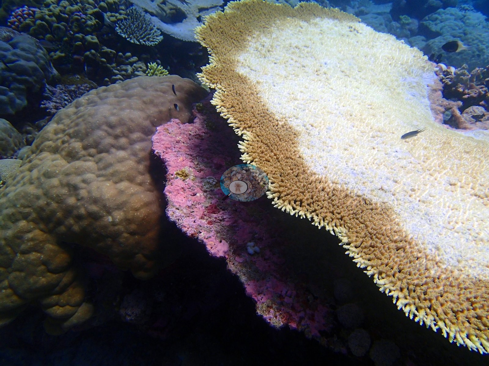
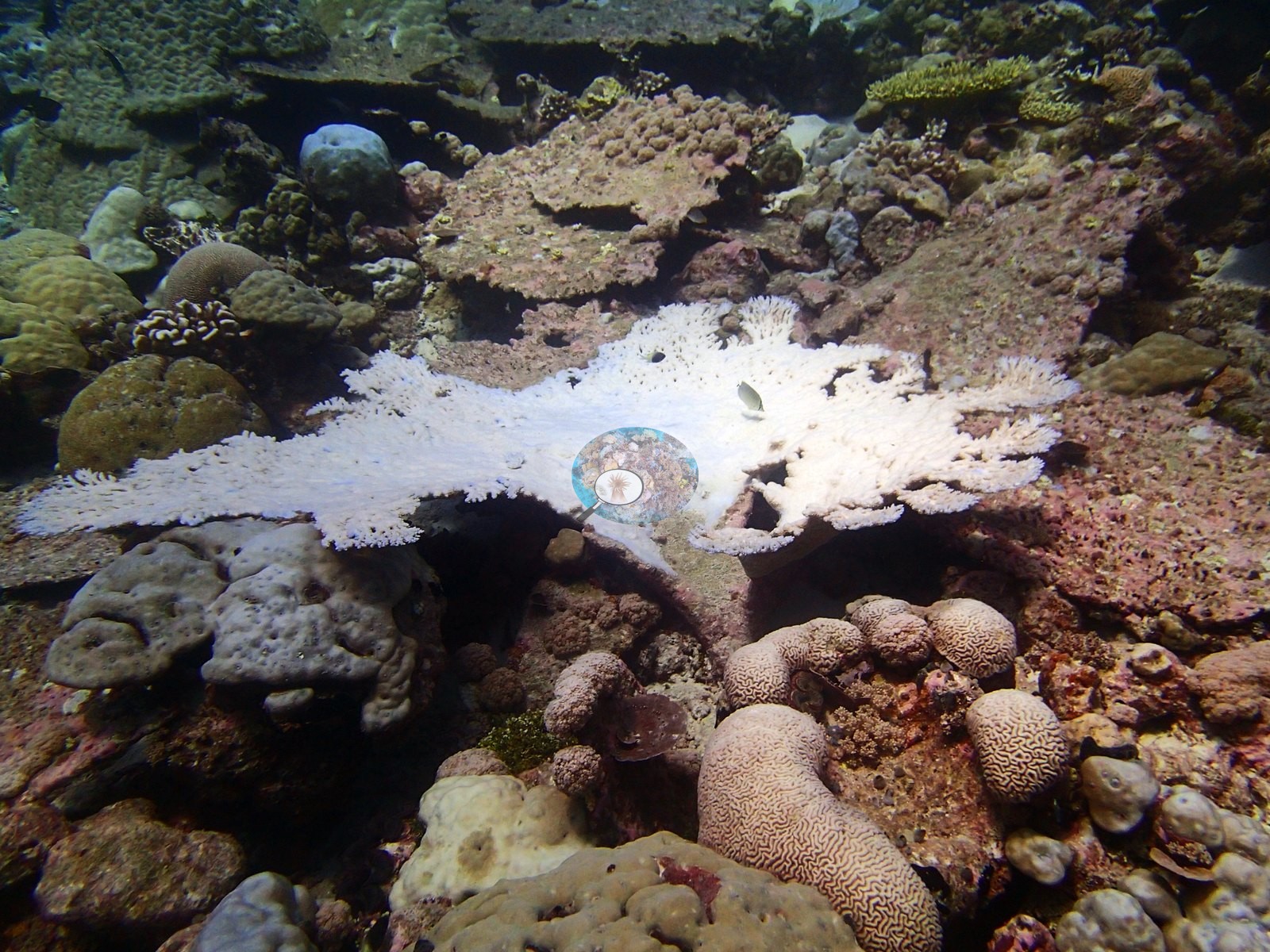
Condition. Bone-white and stark cream colonies are clearly present in this set and are recorded as seen. P4180792 holds a bright white patch bridging two otherwise pigmented plates on a massive colony. P4180807 shows a bone-white branching colony standing among fully pigmented neighbors in an otherwise dense garden. P4180825 carries a stark white wedge cutting across an otherwise olive-yellow massive coral. P4180826 holds white and cream tables and digitate clusters. P4180829 and P4180831 are consecutive frames of one large table coral that is almost entirely stark white with only a narrow band of pigmented brown tissue at one edge — an unambiguous, tissue-intact colony-scale event, not algae-covered mortality. P4180830 holds a group of unambiguously bone-white branching colonies against pigmented massives. P4180836 is the clearest single image of the phenomenon: one large table whose golden-brown pigmented margin grades inward to a bone-white center — partial bleaching within a single colony. Additional pale-cream tables in P4180778, P4180791 and P4180808 may be bleached or may simply be lightly pigmented tabular acroporids; that distinction cannot be settled photographically. No crown-of-thorns, no disease lesions and no corallivore predation scars were observed in any of the 45 frames. Typical recent thermal stress: mean annual maximum of 4.4°C-weeks (Degree Heating Weeks, 2021-2025, NOAA CRW; Chagos ecoregion). Note: this bleaching figure derives from automated image annotation; no bleaching was observed in the field during the March–April 2015 surveys, and pre-May 2015 site values should be treated as provisional.
Fish and other fauna
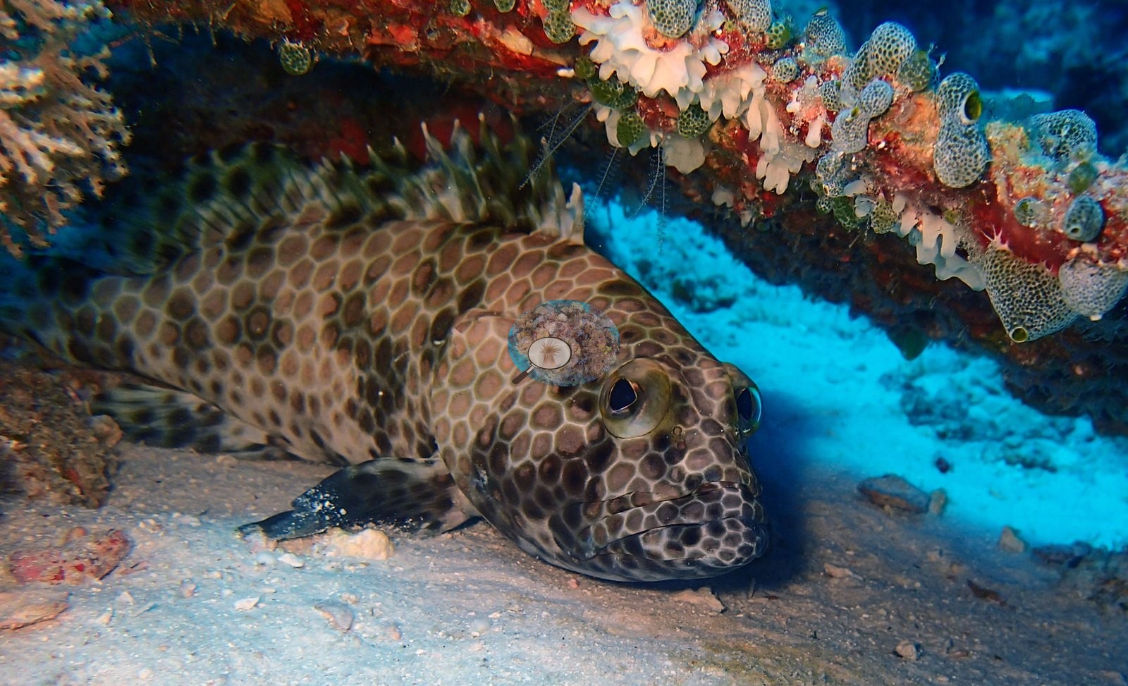
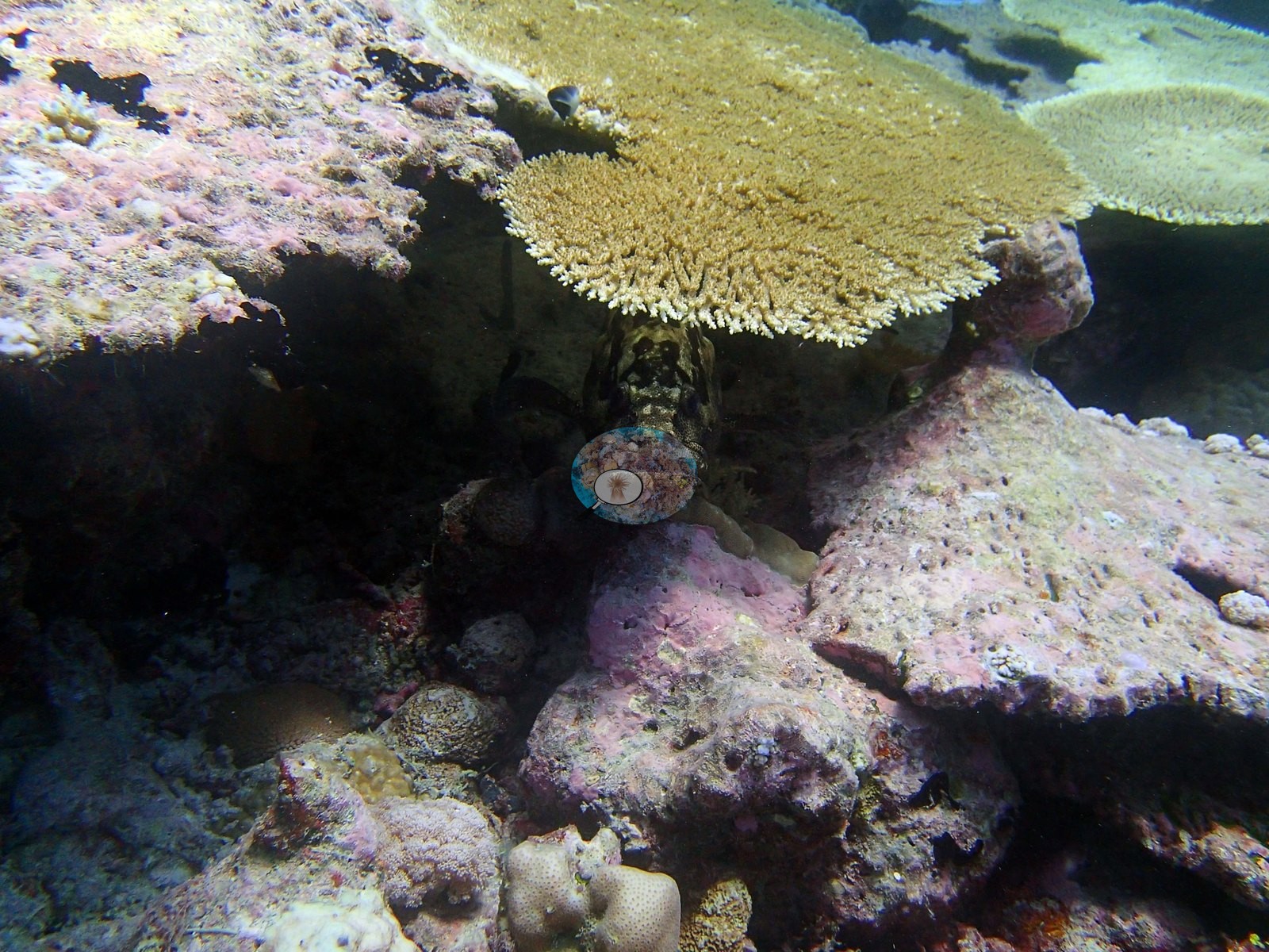
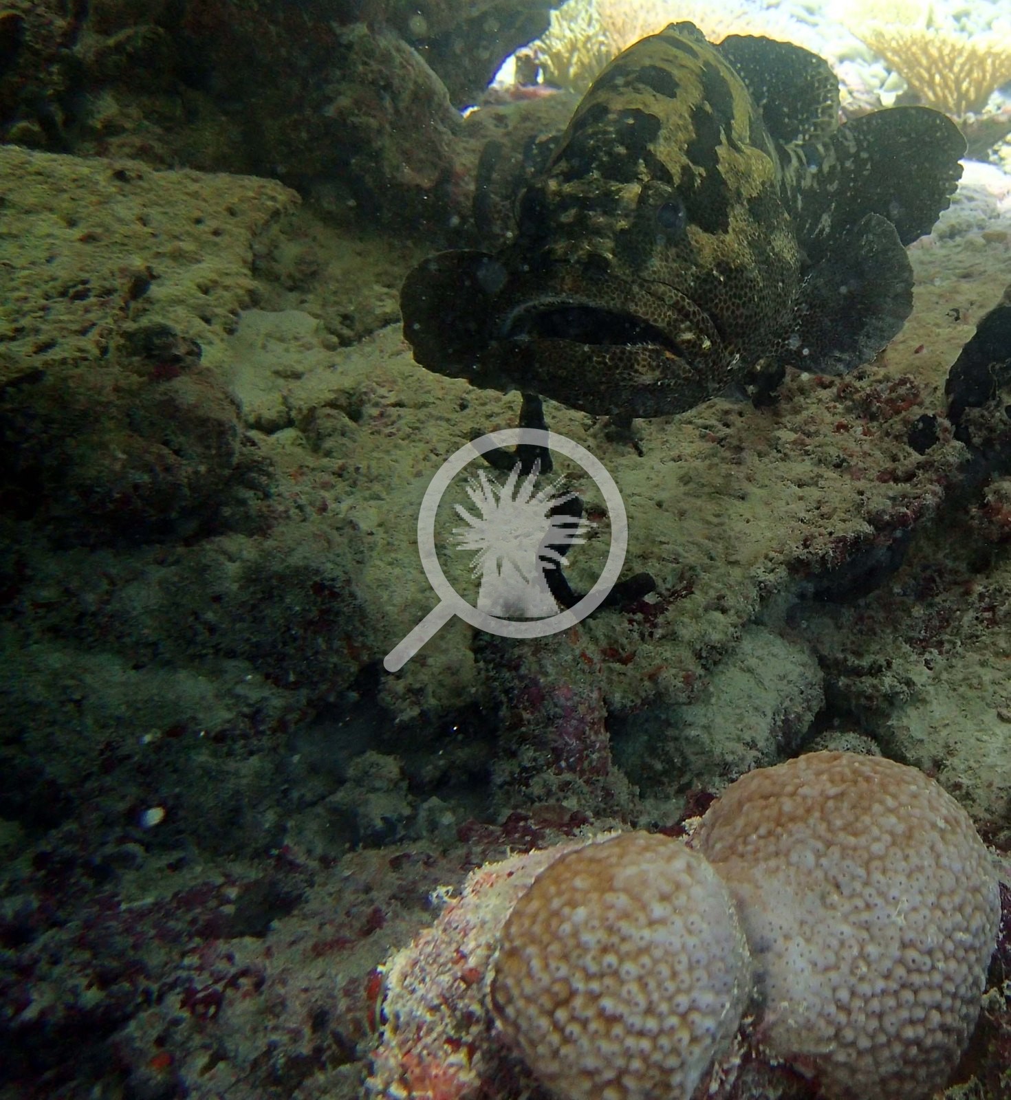
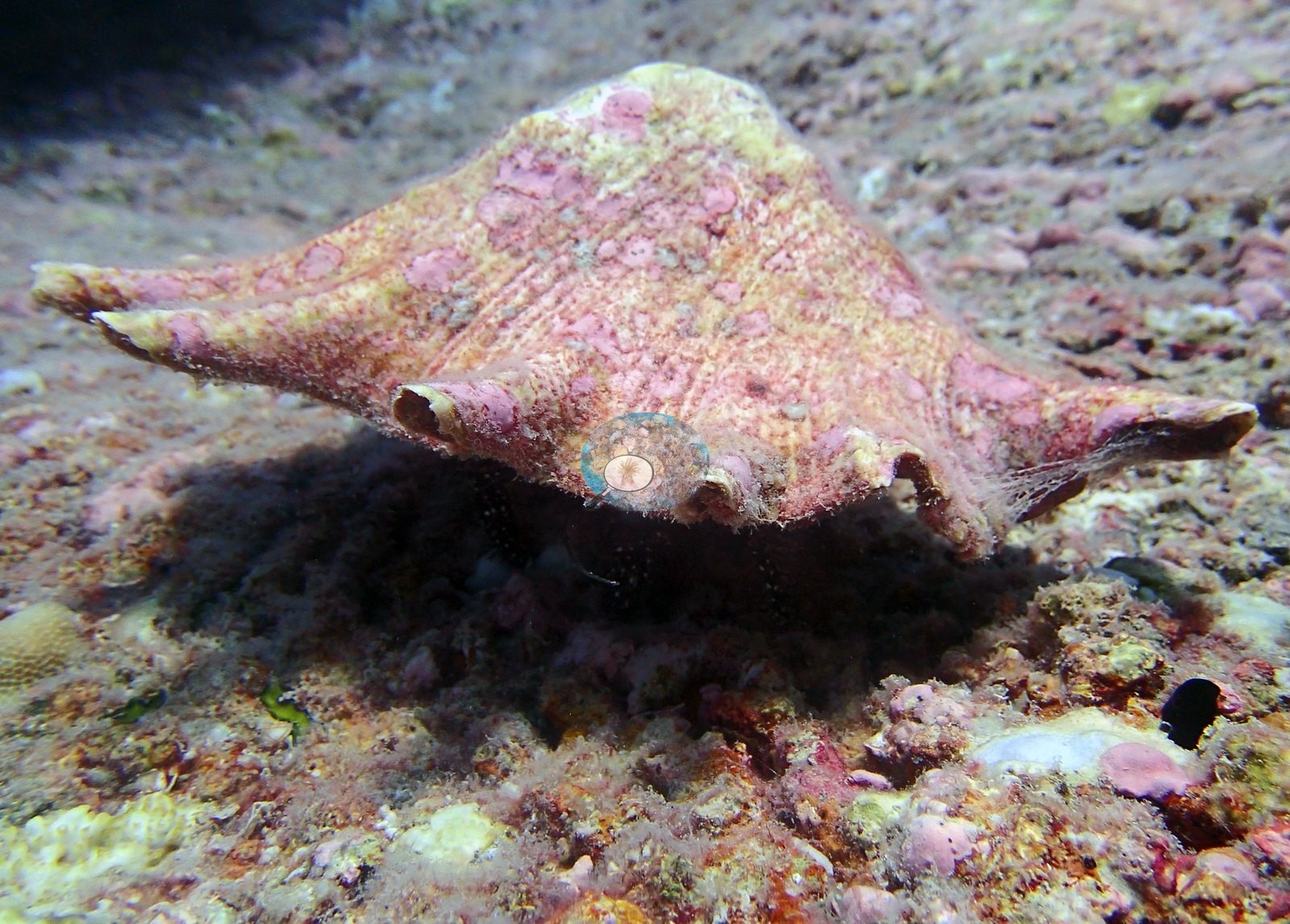
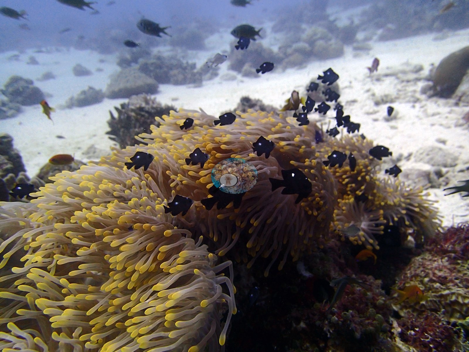
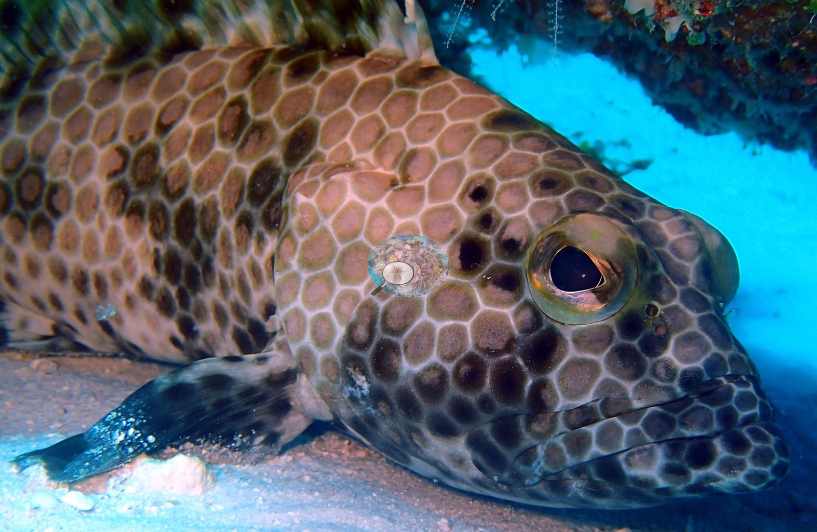
Fauna. Reef fauna is well represented and is the visible face of that 16.03% invertebrate cover. A resident sea anemone with yellow-tipped tentacles hosts both anemonefish and a crowd of three-spot dascyllus or domino damsels in P4180762 and P4180763. A honeycomb-patterned grouper is photographed three times at rest under a ledge, in P4180769, P4180770 and P4180771 — three consecutive close-ups of the same animal, its flank a fine pale-outlined hexagonal reticulum, beneath an overhang crusted with red sponge and pale ascidians. A second and quite different fish, a heavy dark marbled grouper, hangs over sand in P4180806. A reef shark cruises in the background of at least three wide shots (P4180779, P4180819, P4180821); a turtle crosses past table Acropora in two consecutive frames (P4180810, P4180811); and P4180799 is a close frame of a large pink gastropod shell with a broadly flaring, algae-crusted lip, consistent with a conch. Powder-blue surgeonfish work the shallow garden in P4180807, P4180808 and P4180818; chevron and other butterflyfishes appear in P4180813; bannerfish in P4180791 and P4180827; angelfish in P4180818 and P4180827; a dark spotted snapper- or sweetlips-type fish in P4180829; yellow-and-blue fusilier-type schooling fish under the overhang in P4180777; clouds of anthias and chromis over the tiered colony in P4180761; and schooling fusiliers and Chromis recur throughout.
Comparisons with other data
Also on record for this site: BIPB73 (Peros Banhos): surveyed 18 Apr 2015 during the Khaled bin Sultan Living Oceans Foundation Global Reef Expedition.
Other notes
Image-by-image. Forty-five habitat frames from the 18 April dive, all from Anderson's own edited folder BiPb73-finished; no sampled-colony images exist for this site, so the whole account is habitat. No quadrat, transect line or scale reference appears in any frame, so no colony dimension or areal figure can be read from them.
CV model comparison
More info
Those are point counts on the photographs; this is a diver swimming a transect. The models and the reference never saw the same thing. ⚠ SITE-LEVEL ONLY. The 2,500 frames were not associated with any transect taken within 200 m of them, so transect-vs-image comparisons are site means, never frames. The transect value is already in the pin `cover` field (109 of 112 pins, sourced to the paper's suppl. S1) and is read from there, never re-imported. The transect is THE coral-cover value for this site and stands alone. The rows below it are a methods comparison only: no computer-vision value is averaged with it, feeds the headline, or carries over to the site's cover figure (Anderson, 2026-09-22).| Method | Hard-coral cover (%) |
|---|---|
| Transect (published) | 50.1 |
| CoralNet | 45.2 |
| In-house DINOv3 | 45.3 |
| CoralSCOP edited | 46.9 |
| Claude | 37.6 |
Independent surveys nearby
| Agency / program | Year(s) | Stations / distance | Link |
|---|---|---|---|
| Spalding et al. (2024) | 2024 | 2 stations, 0.44 km | Records ↓ |
| Spalding et al. 2025 (Chagos 2024 bleaching report) | 2024 | 2 stations, 0.44 km | Records ↓ |
Within 5 km, 4 independent survey stations recorded hard coral cover in 2024. Surveys since 2021 average 50% (range 30–70%, n=4). This site's own estimate (50%) sits within the recent range (30–70%); the methods differ, so the comparison is context, not a like-for-like test.
Collected by other programs using different methods, so these are context for the figures above, not a like-for-like comparison. Where a station was surveyed more than once the range is shown. Station names are not dive-site names.
| Agency | Site / location | Date | Hard coral cover (%) | Distance | Link |
|---|---|---|---|---|---|
| Spalding et al. 2025 (Chagos 2024 bleaching report) | Peros Banhos - West Ile Bois Mangue, lagoon (N, 2-6 m) | 2024 | 30% | 0.44 km | — |
| Spalding et al. 2025 (Chagos 2024 bleaching report) | Peros Banhos - West Ile Bois Mangue, ocean (N, 7-10 m) | 2024 | 70% | 0.44 km | — |
| Spalding et al. (2024) | Peros Banhos - West Ile Bois Mangue, lagoon (N, 2-6 m) | 2024 | 30% | 0.44 km | — |
| Spalding et al. (2024) | Peros Banhos - West Ile Bois Mangue, ocean (N, 7-10 m) | 2024 | 70% | 0.44 km | — |
Data & links
- Read the full site report ↗
- Download benthic survey data (CSV) ↗
- Download all LOF-GRE data (933 sites) ↗
- CoralNet image repository for this region ↗
- Photo portfolio ↗
- Coral Reef Diagnostics page for this area ↗
All images from Coral Reef Diagnostics. Data are from Coral Reef Diagnostics and the organizations named in the data-sources table above.
 © Coral Reef Diagnostics.
References
- Mayfield AB, Dempsey AC (2026). Using tourist diver images to estimate coral cover and bleaching prevalence in a remote Indian Ocean coral reef system. Oceans 7(1):1. PDF
- Spalding M, Bourasseau M, et al. (2025). Coral bleaching and mortality in the Chagos Archipelago, 2024. British Indian Ocean Territory Administration report (gray literature). PDF