
USA - Florida

Regional summary of 22 dive sites (21 with their own page). Figures are averages across the sites that report them (n = sites with a value); each site's own page has its individual values.
⬇ Download this region as a report card

Florida's sites span Panhandle ledges, Miami's urban hard-bottom, wrecks, and Keys reefs where Anderson ran NOAA studies, including the inshore Cheeca Rocks. Living coral is mostly thin, but North Dry Rocks stands out with large, intact elkhorn and dense staghorn thickets.
Heat stress
Long-term record: 9 years from 1985 through 2025 reached 8 or more °C-weeks at NOAA’s Southeast Florida, Florida Keys stations. Download the annual DHW data (CSV).
22 sites in this region — click a marker to open that site.
Regional setting
South Florida holds the only significant coral reefs of the continental United States, and together with Bermuda and the northern Bahamas it marks the northern limit of reef growth in the western Atlantic (Wells 1988). North of Miami, true reef building gives way to octocoral-dominated hard bottom and, farther north, Oculina banks. The Florida Reef Tract itself is a band of reefs averaging 6.5 km wide that arcs roughly 370 km southwest from Fowey Rocks off southern Miami all the way to the Dry Tortugas, separated from the low Pleistocene-limestone Keys by Hawk Channel. It contains more than 6,000 patch reefs and about 96 km of outer bank reefs at 5–10 m, many with shallow spur-and-groove built by Acropora palmata; 62 stony coral species had been recorded from the Keys and Dry Tortugas. Wells (1988) adds that at least half the tract is poorly suited to coral growth, especially opposite the large tidal passes between Islamorada and Big Pine Key, where silty Florida Bay water spills onto the reefs on each falling tide. Spalding et al. (2001) describe Florida's reefs as among the most intensively studied and most degraded in the region: Acropora that covered up to 96% of the benthos in places in 1981 had dropped to about 3% by 1986, largely through white band disease, and overall coral cover was typically about 14% in the late 1990s. They give about 1,250 km² of coral reef for the USA's Atlantic sector.
Souter et al. (2021) report recent trends only for their Gulf of Mexico and Florida subregion, where mean hard coral cover slid steadily from about 13% (1999) to 9.1% (2019), and algal cover, after dipping to 16.9% in 2005, rose about 2.3-fold to 39% by 2015. The same report records that stony coral tissue loss disease (SCTLD) emerged in Florida in 2014, during a severe bleaching event and beside a dredging project on an urban reef, and calls it the deadliest disturbance on record in the Caribbean, with population losses above 90% in the most susceptible species. Earlier, Spalding et al. (2001) noted that bleaching in 1997 and the more intense bleaching of 1998, followed by Hurricane Georges, caused considerable coral loss in shallow areas, and listed ship groundings, eutrophication, sewage, and heavy fishing pressure among chronic threats. Wilkinson (2006), drawing on the 2004 status report for the American Caribbean, noted continuing fishing pressure along the Florida coast.
Overview
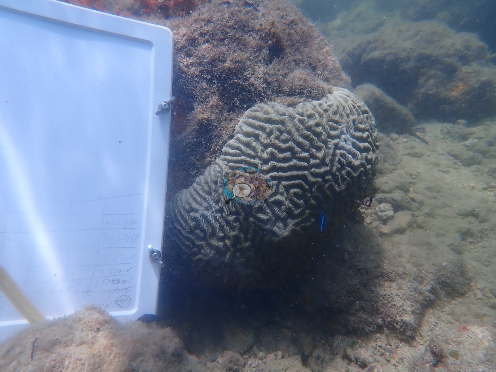
The Florida unit runs from the northern Gulf to the Lower Keys and covers very different settings. Anderson's dated dives run from May 2019 to November 2025, and recorded depths run from 1.8 m at MacArthur Causeway North to 29.3 m at the Orion shipwreck. The four Panhandle sites (Destin to Carrabelle) sit on limestone ledges, sand, seagrass, and artificial reefs rather than coral reef. Around Miami and Key Biscayne, the Urban Corals sites at MacArthur Causeway and Star Island are flat, silt-draped hard-bottom where tagged Pseudodiploria strigosa colonies were sampled, while Emerald Reef, the clean-water comparison site, is a low pavement under a meadow of sea plumes, sea rods, and sea fans. Flamingo Reef nearby is low-relief hard-bottom whose largest mounds are draped in zoanthid (Palythoa) mat, with no branching Acropora.
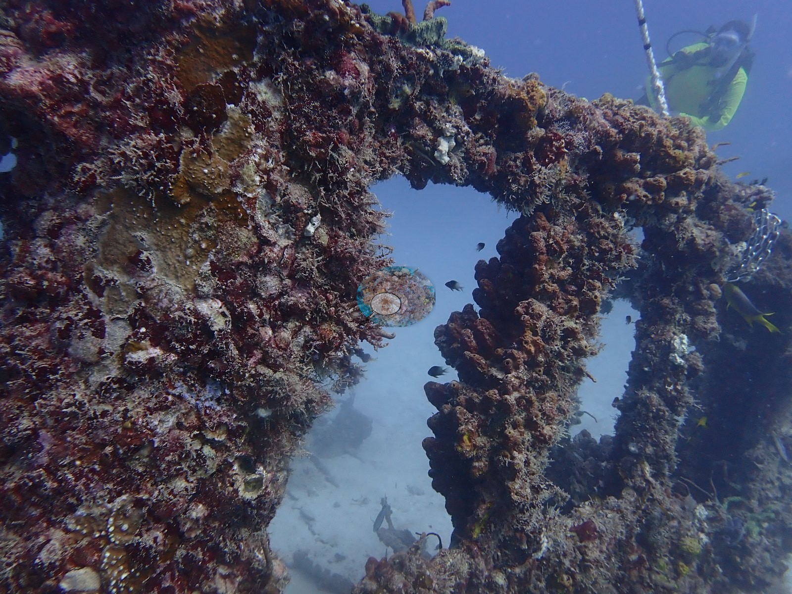
Three members are artificial structures: the Orion wreck, the Belcher Barge scatter, and Neptune Memorial Reef. On all of them stony corals occur only as scattered recruits among sponges, octocorals, and coralline algae, and fish schools are the main feature.
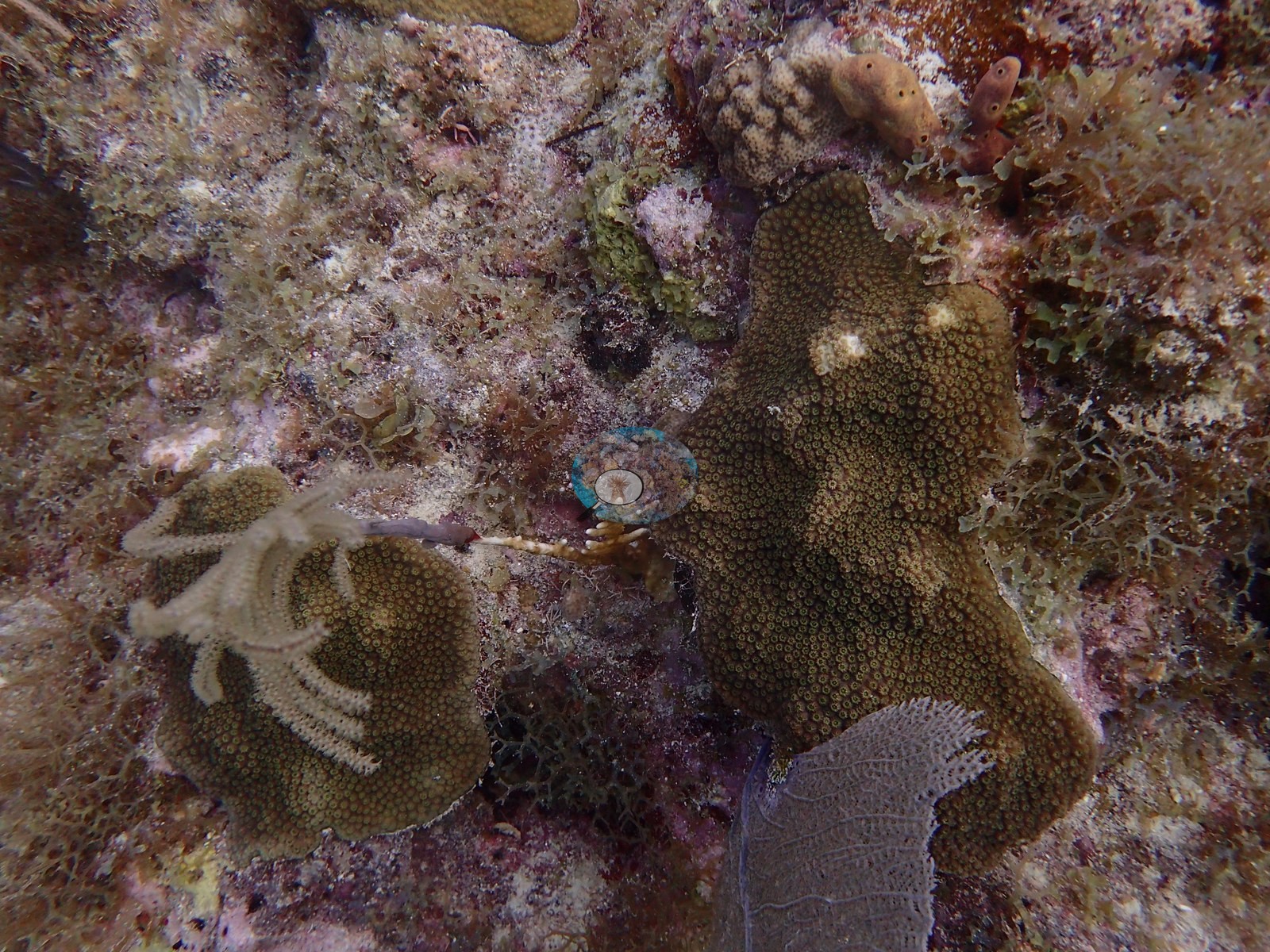
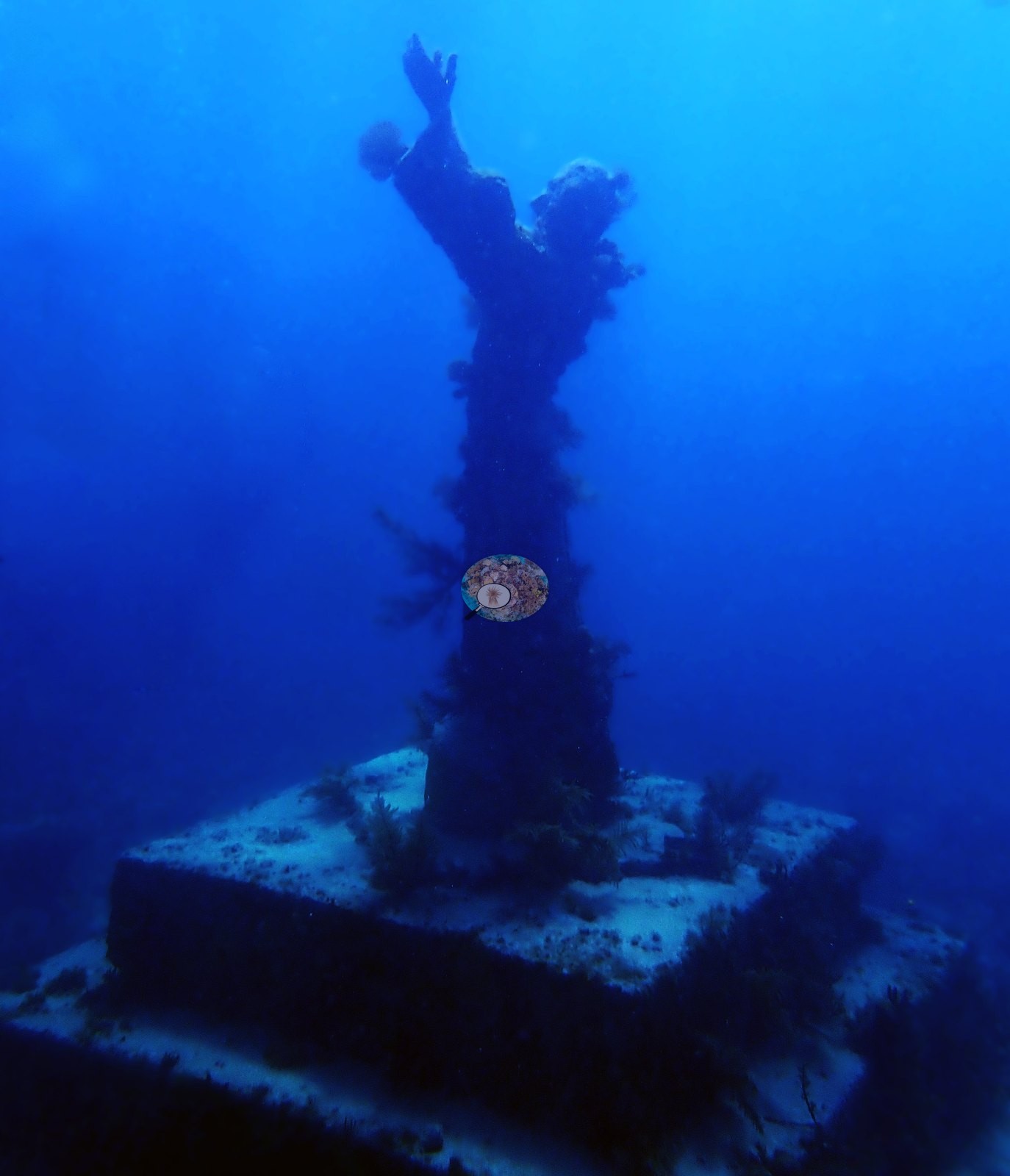
In the Upper Keys, Anderson's NOAA study sites span inshore and offshore reefs. The inshore reef Cheeca Rocks, where Anderson resampled in 2019 colonies tagged and genotyped by the NOAA AOML team in July 2017, had 32% coral cover in August 2016 (NOAA NCRMP and AOML photo transects; Manzello et al. 2019) and 29% on permanent plots in 2014 (Gintert et al. 2018), and heat stress there peaked at 22.3 degree heating weeks in 2023 (NOAA Coral Reef Watch, Florida Keys virtual station). Anderson's own 2019 frames and logs record the condition of the four study reefs that year: stony coral tissue loss disease (SCTLD, the diver's field call), a diseased Orbicella faveolata, and August bleaching at Cheeca Rocks; two tagged colonies paling at The Rocks in August; 'some incidence of bleaching' logged at Little Conch; and two diseased colonies and an active tissue-loss front at Crocker Reef in December. The Rocks' massive star corals show obvious partial mortality, with 9.3% cover in 2016, and Little Conch (6.9%) and Crocker Reef (1.5%) offshore are low-relief reefs with isolated colonies. North Dry Rocks has large, intact elkhorn (Acropora palmata) and dense staghorn thickets alongside outplanted Orbicella faveolata fragments, although some elkhorn show pale or partly bare patches, and its Coral Health Index is 1.00 on the 0-5 scale (Key Largo Dry Rocks also scores 1.00, and Little Conch 0.50). Key Largo Dry Rocks is gorgonian-dominated spur-and-pavement around the Christ of the Abyss statue. Looe Key in the Lower Keys keeps its spur-and-groove architecture, but living coral is thin and octocorals do most of the growing.
Independent surveys near many sites average low: 1.2% near Brewster Reef and 5.9% near Looe Key. Several Keys sites carry only Reef Check records from 1997-1999, which predate stony coral tissue loss disease. On the natural reefs Anderson photographed, a blind Claude computer-vision point count of the photographs puts coral cover between 8.3% at Key Largo Dry Rocks and 40% at Cheeca Rocks, and the artificial structures between 1.4% (Belcher Barge) and 4.2% (Orion shipwreck). The Broward and Palm Beach sites have their own Southeast Florida summary.
Highlights
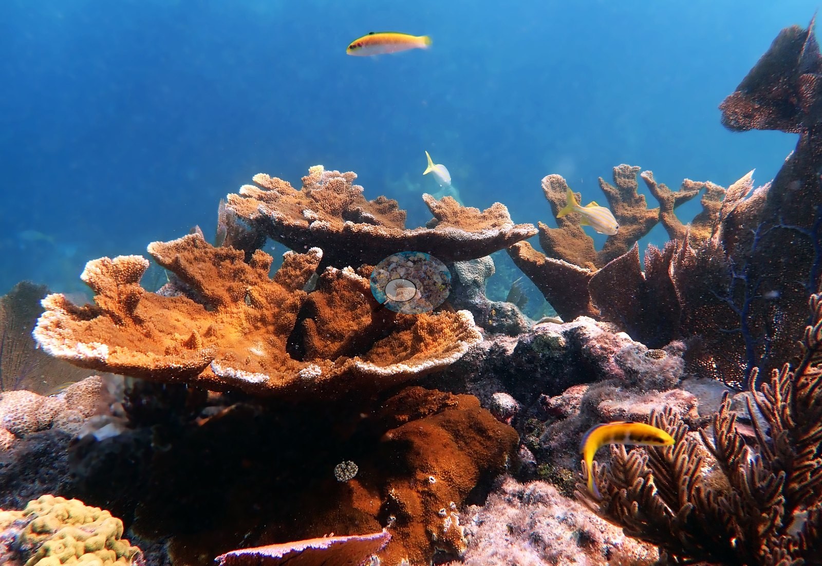
- North Dry Rocks: meter-scale standing elkhorn and dense staghorn thickets, plus outplanted Orbicella faveolata
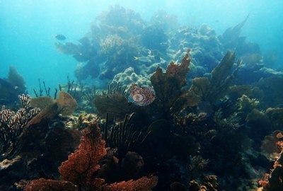 photo: North Dry Rocks (Key Largo)
- Cheeca Rocks: inshore patch reef with 32% cover (2016, NOAA NCRMP/AOML), with colonies tagged and genotyped by the NOAA AOML team in July 2017 and resampled by Anderson in 2019
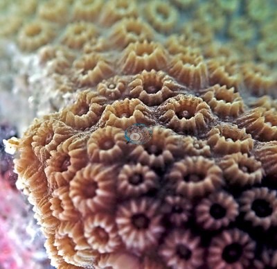 photo: Cheeca Rocks (FKNMS)
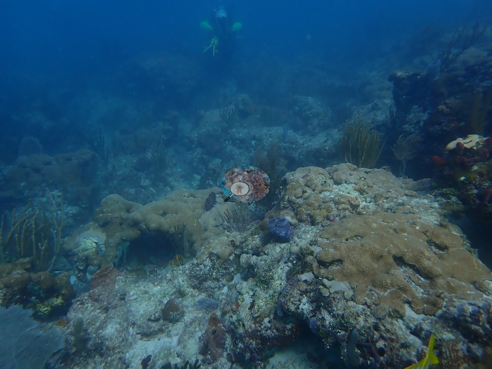
- Emerald Reef: the Urban Corals clean-water yardstick, a low pavement under sea plumes, sea rods, and purple sea fans, with outplanted staghorn
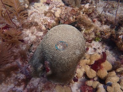 photo: Emerald Reef (Key Biscayne)
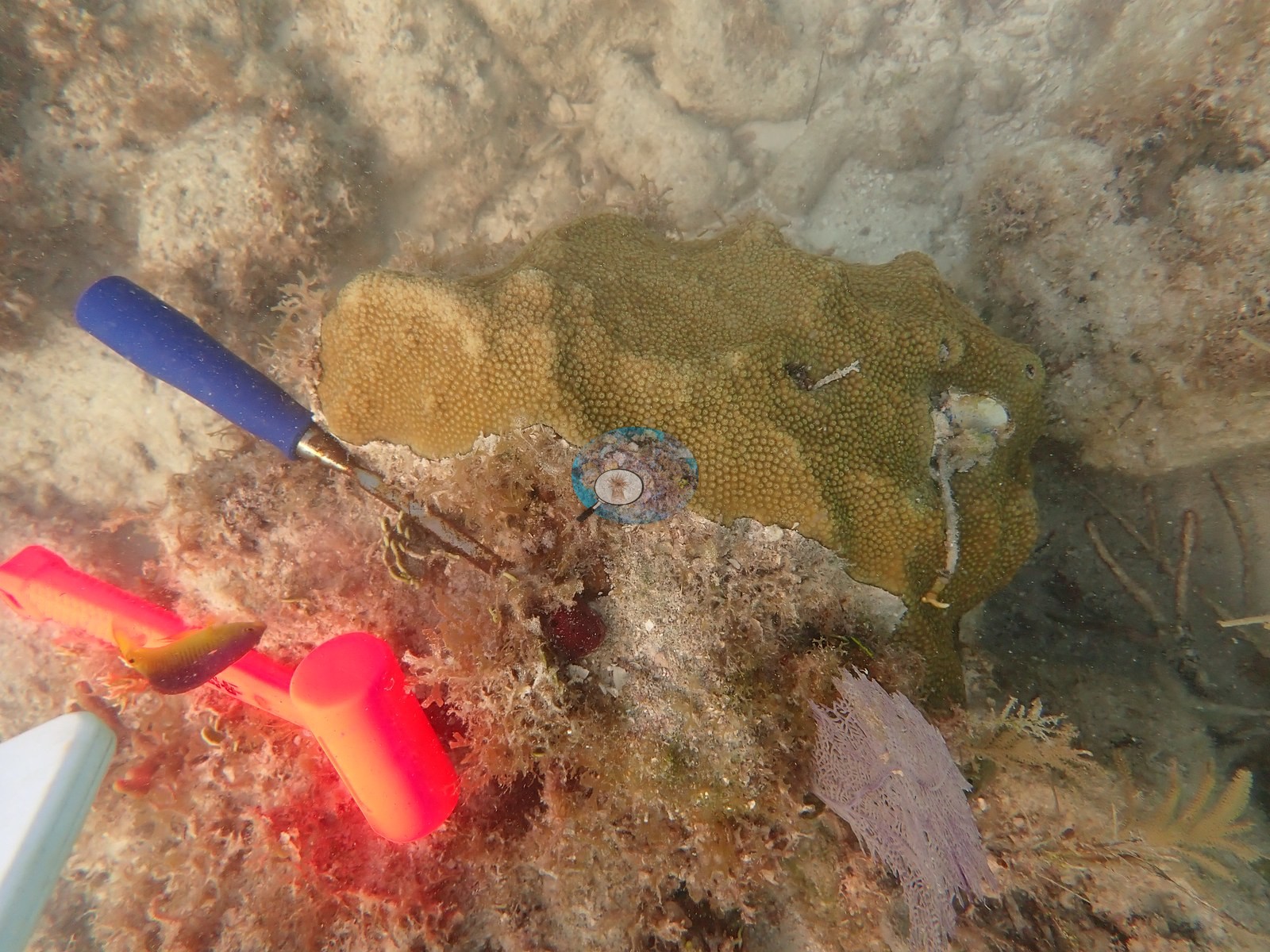
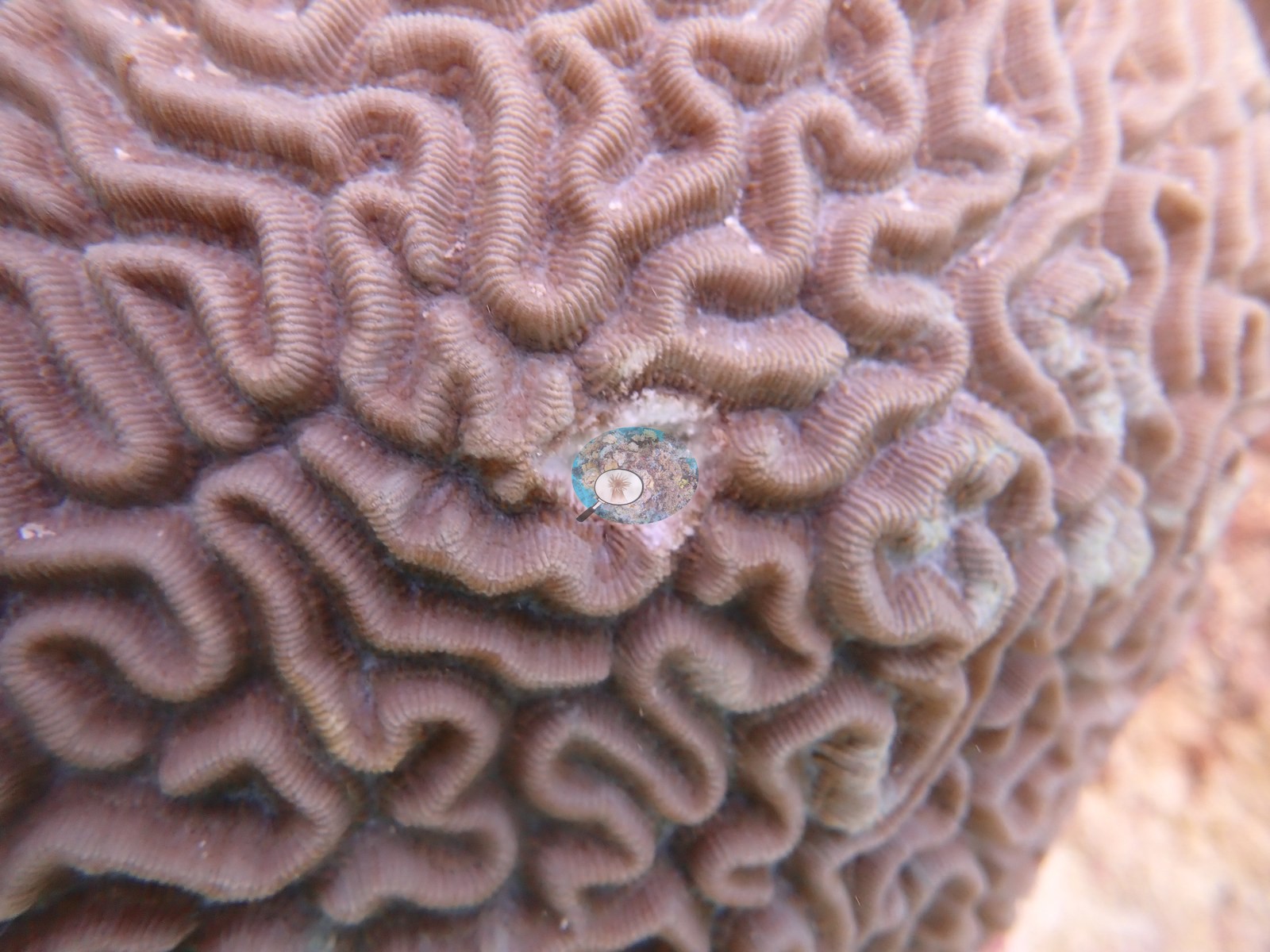
- Flamingo Reef: low hardbottom whose biggest mounds are draped in zoanthid (Palythoa) mat, with brain corals, two of them with stony coral tissue loss disease (SCTLD, Anderson's field call)
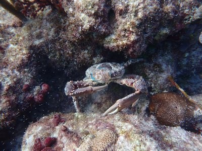 photo: Flamingo Reef (Key Biscayne)
- Crocker Reef: the independent field-validation reef for Anderson's coral-stress diagnostics, surveyed on four visits in 2019
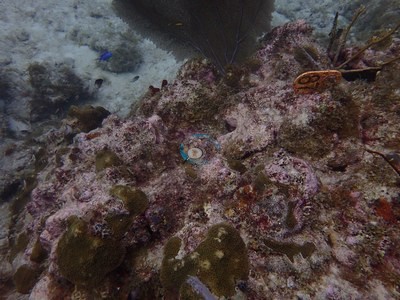 photo: Crocker Reef (FKNMS)
- Neptune Memorial Reef, the Orion wreck, and the Belcher Barge hulls carry only scattered coral recruits
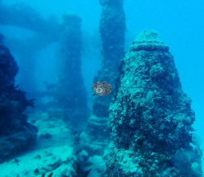 photo: Neptune Memorial Reef
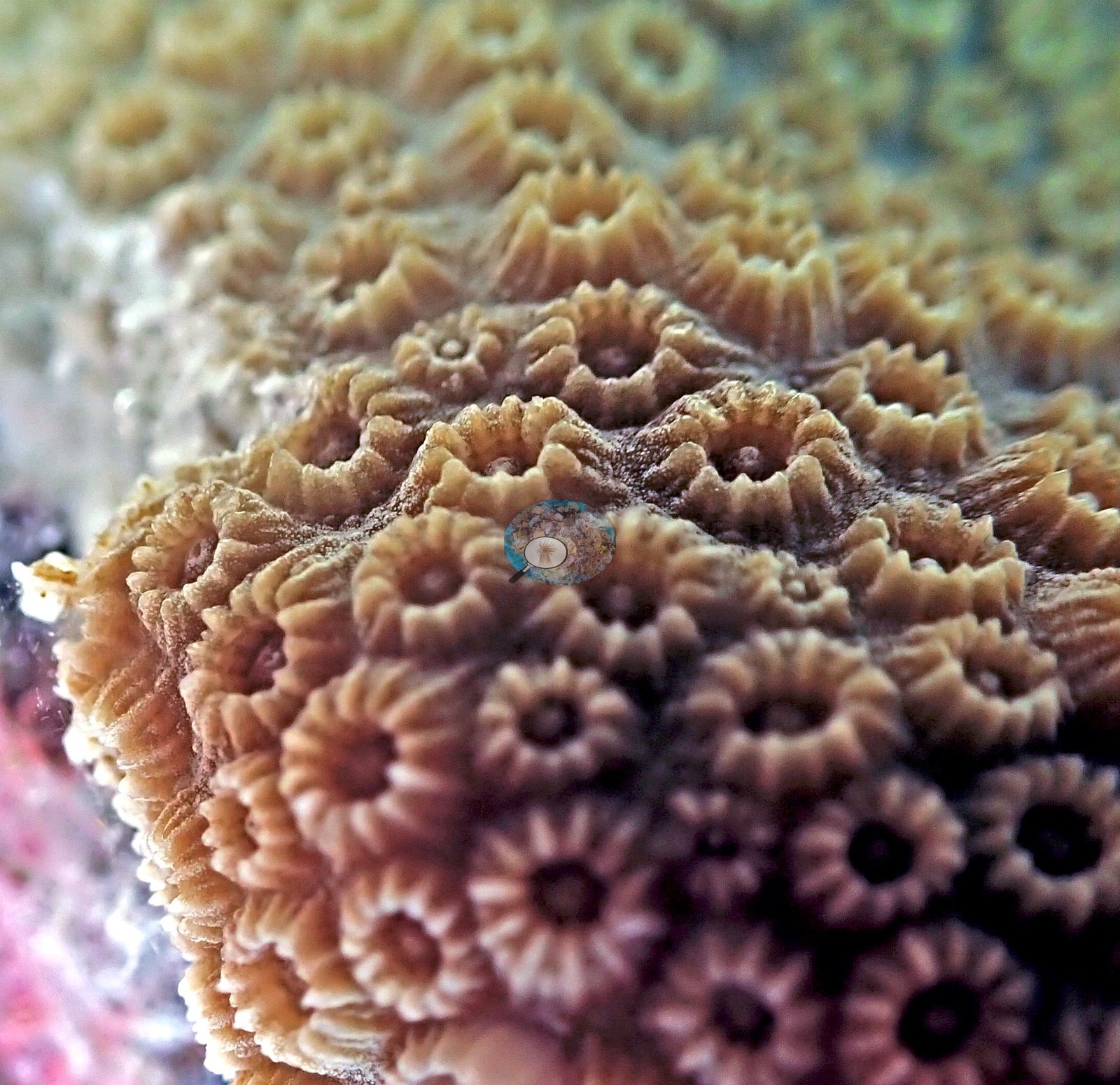
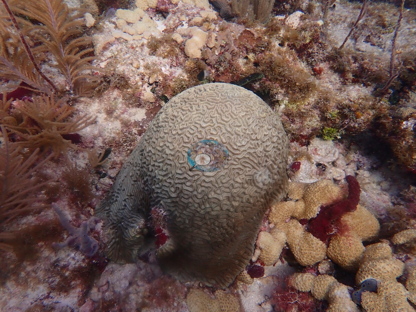
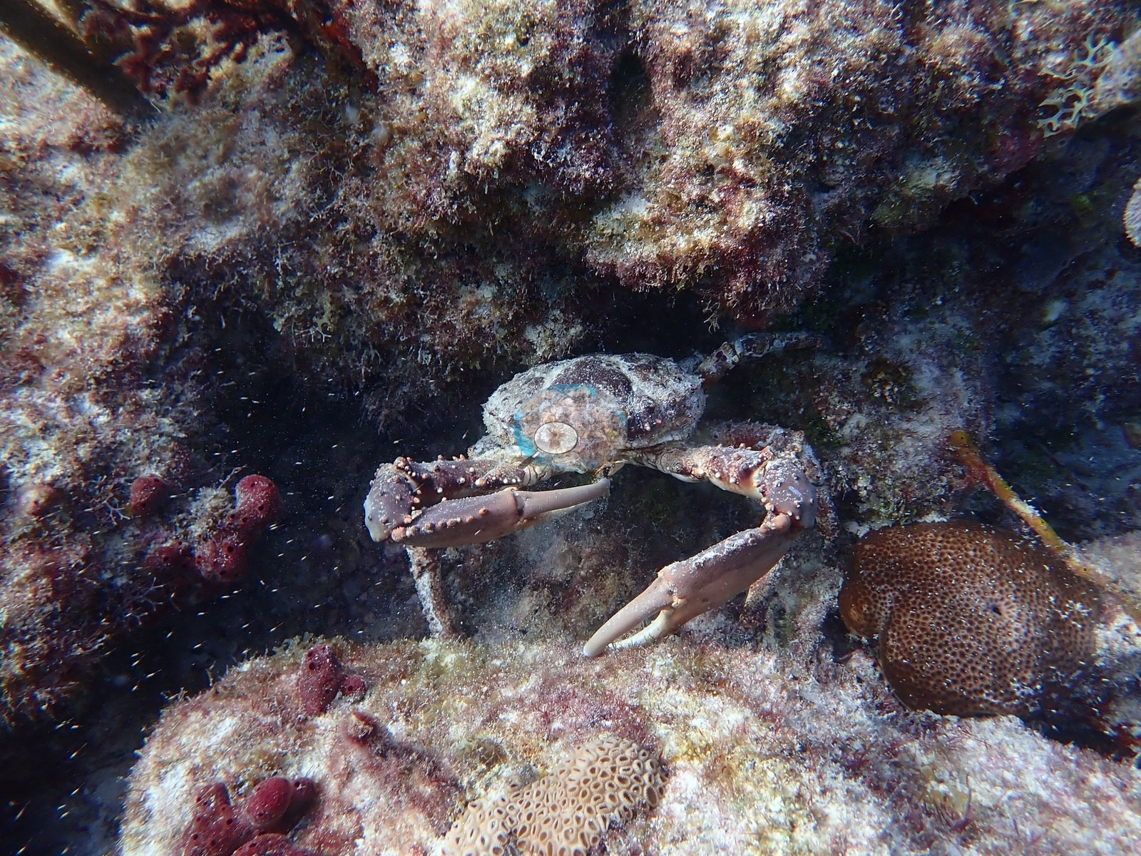
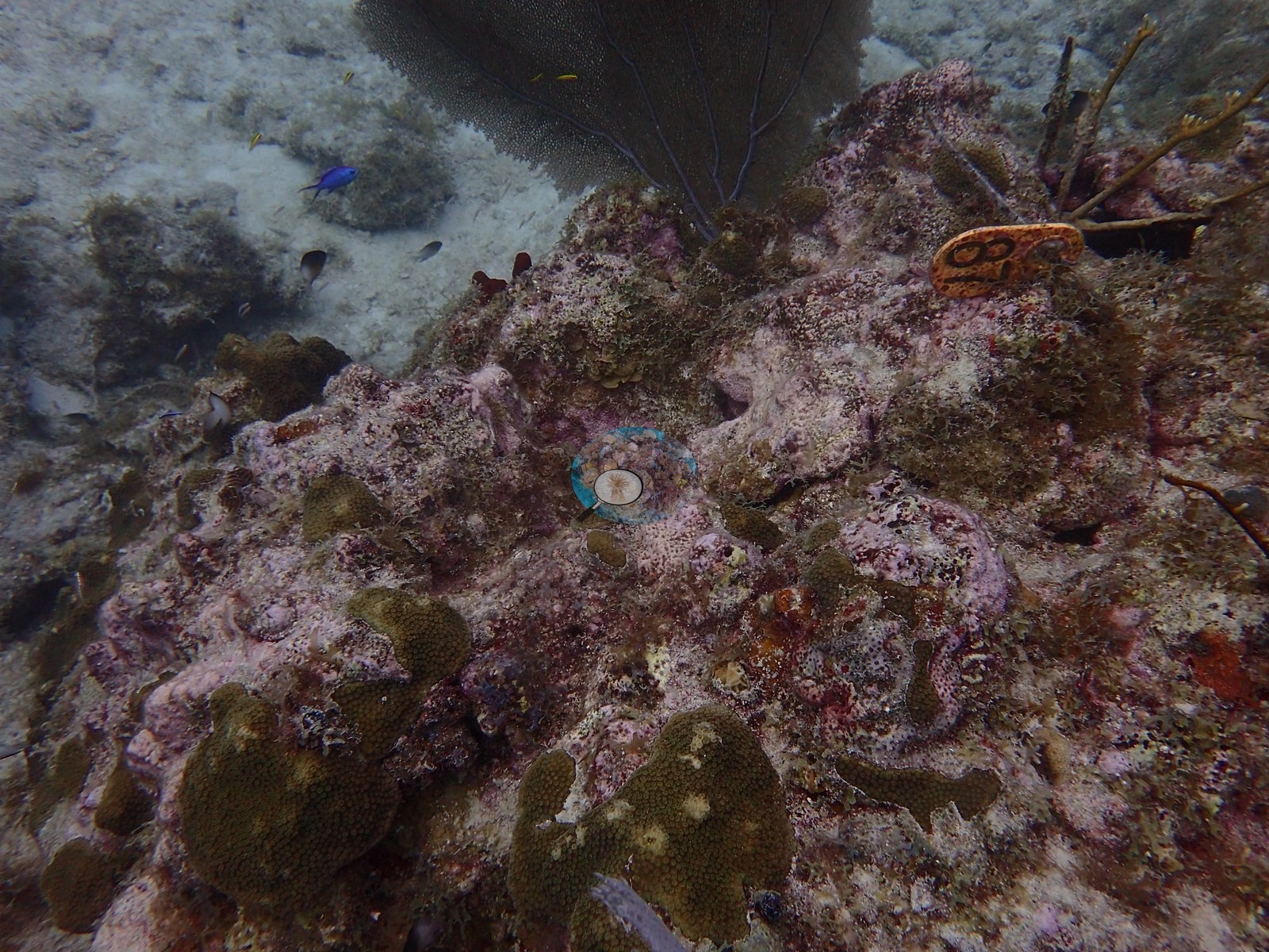
Notable observations (11)
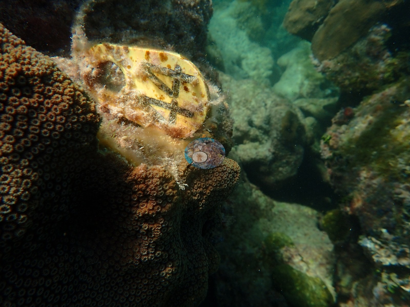
- The Rocks (FKNMS): massive star corals carry obvious partial mortality; bare skeleton patches and surviving tissue islands ringed by turf and algae; tagged colony 3975 and a second colony paling on 21 August 2019, and a Siderastrea with an active tissue-loss margin in October 2019 (Anderson's frames)
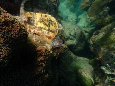
- Little Conch (FKNMS): lesions and partial mortality on living colonies; Anderson's log, 21 August 2019: 'some incidence of bleaching', with partial bleaching on the colonies sampled that day; a tissue-loss margin on tagged colony LC-3128
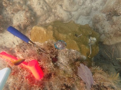
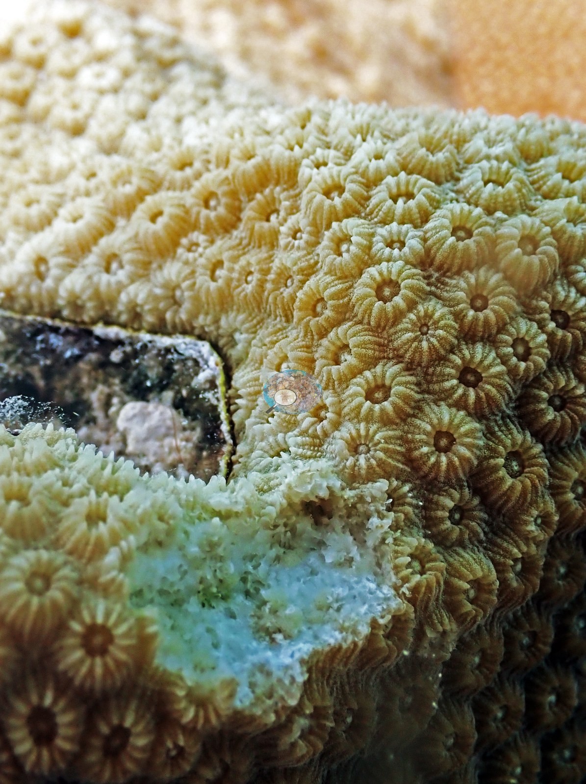
- North Dry Rocks (Key Largo): some elkhorn show pale or partly bare patches at their bases and blade edges
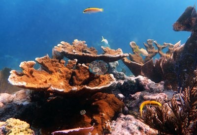
- Flamingo Reef (Key Biscayne): two colonies with stony coral tissue loss disease (SCTLD, Anderson's field call), others with white patches or partial mortality; the log says the zoanthid Palythoa has smothered the reef
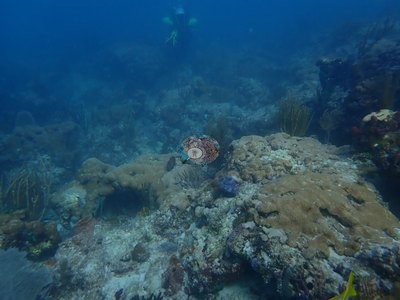
- Belcher Barge (Key Biscayne): small scattered coral recruits; a few bleached stony colonies and one bleached sea rod
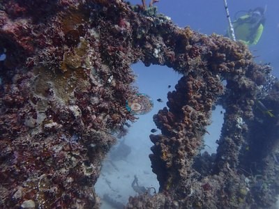
- NOAA - MacArthur Causeway South (Urban Corals), Miami: partial mortality is visible on the tagged colonies; not bleached
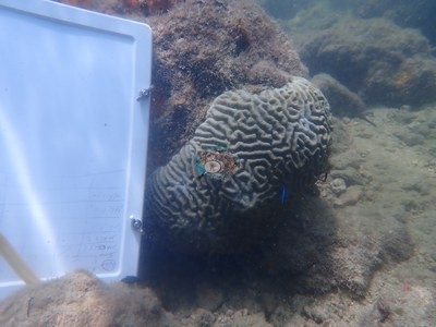
- NOAA - Star Island (Urban Corals), Miami: at least one tagged colony carries substantial dead, algae-covered skeleton across its top half; no bleaching recorded
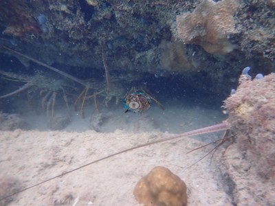
- Cheeca Rocks (FKNMS): Anderson's own 2019 frames: SCTLD and a diseased Orbicella faveolata with multifocal lesions; August 2019 bleaching of fire coral, a Porites colony, and part of an O. faveolata, with paling brain corals
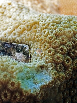
- Crocker Reef (FKNMS): 4 December 2019: two diseased colonies, one an Orbicella faveolata, and an active tissue-loss front on a plating colony (Anderson's frames)
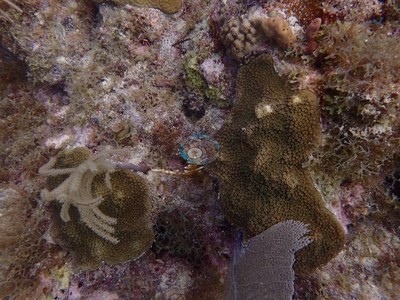
- Emerald Reef (Key Biscayne): one bleached Palythoa mass among the zoanthid carpets (May 2021)
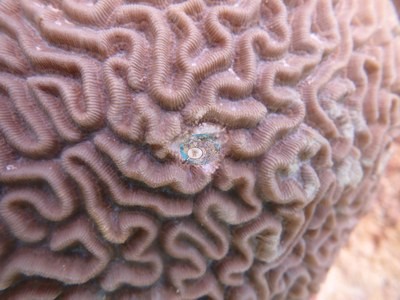
- Key Largo Dry Rocks (Christ of the Abyss): some staghorn tips recently dead and overgrown by fine algae (April 2023)
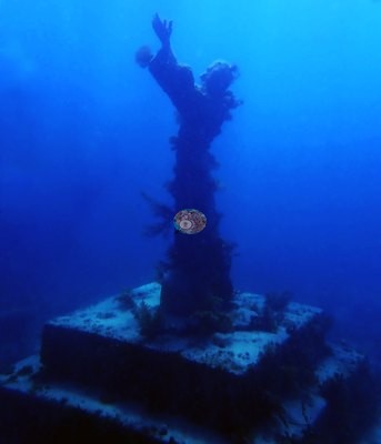
Coral cover over time (pooled)
Sites in this region (22)
- Belcher Barge (Key Biscayne) — 1.4%† coral cover
- Cheeca Rocks (FKNMS) — 32% coral cover
- Crocker Reef (FKNMS) — 1.5% coral cover
- Emerald Reef (Key Biscayne) — 12% coral cover
- Flamingo Reef (Key Biscayne) — 21%† coral cover
- Florida - Bear Cut (Miami)
- Florida - Brewster Reef (Miami) — 3.0% (newest survey within 0.5 km, not this site: NOAA NCRMP Florida, FLK PSU 1246-1 station, 2024-11-12, 0.18 km away)
- Florida - Marathon 3 — 7.2% (nearest station surveyed in the last 10 years, not this site: FWC CREMP (Florida Keys), Thor #241 station, 2024-05-17, 0.91 km away)
- Florida Panhandle - Cape San Blas
- Florida Panhandle - Carrabelle
- Florida Panhandle - Destin
- Florida Panhandle - Santa Rosa
- Key Largo Dry Rocks (Christ of the Abyss) — 8.3% coral cover
- Little Conch (FKNMS) — 6.9% coral cover
- Looe Key — 20% coral cover
- Neptune Memorial Reef — 1.6% coral cover
- NOAA - MacArthur Causeway North (Urban Corals), Miami
- NOAA - MacArthur Causeway South (Urban Corals), Miami — 19%* coral cover
- NOAA - Star Island (Urban Corals), Miami
- North Dry Rocks (Key Largo) — 20% coral cover
- Orion shipwreck (Key Biscayne) — 4.2% coral cover
- The Rocks (FKNMS) — 9.3% coral cover
* Based on only 10–19 reef-habitat photos; this estimate is less certain.
† Includes unedited photographs: edited versions of most of this dive's photos do not exist.
Nearby external survey stations
1082 independent survey records within 5 km of a site in this region (each record counted once; 1072 lines, and a line that pools several records says how many).
Show all 1082 records
- FWC CREMP (Florida Keys) — Conch Shallow #531 (1996): 3.9% hard coral cover, 4.55 km from Little Conch (FKNMS)
- FWC CREMP (Florida Keys) — Conch Shallow #531 (1997): 3.9% hard coral cover, 4.55 km from Little Conch (FKNMS)
- FWC CREMP (Florida Keys) — Conch Shallow #531 (1998): 2.4% hard coral cover, 4.55 km from Little Conch (FKNMS)
- FWC CREMP (Florida Keys) — Conch Shallow #531 (1999): 1.4% hard coral cover, 4.55 km from Little Conch (FKNMS)
- FWC CREMP (Florida Keys) — Conch Shallow #531 (2000): 1.2% hard coral cover, 4.55 km from Little Conch (FKNMS)
- FWC CREMP (Florida Keys) — Conch Shallow #531 (2001): 0.9% hard coral cover, 4.55 km from Little Conch (FKNMS)
- FWC CREMP (Florida Keys) — Conch Shallow #531 (2002): 1.4% hard coral cover, 4.55 km from Little Conch (FKNMS)
- FWC CREMP (Florida Keys) — Conch Shallow #531 (2003): 3.1% hard coral cover, 4.55 km from Little Conch (FKNMS)
- FWC CREMP (Florida Keys) — Conch Shallow #531 (2004): 1.6% hard coral cover, 4.55 km from Little Conch (FKNMS)
- FWC CREMP (Florida Keys) — Conch Shallow #531 (2005): 0.6% hard coral cover, 4.55 km from Little Conch (FKNMS)
- FWC CREMP (Florida Keys) — Conch Shallow #531 (2006): 1.5% hard coral cover, 4.55 km from Little Conch (FKNMS)
- FWC CREMP (Florida Keys) — Conch Shallow #531 (2007): 0.6% hard coral cover, 4.55 km from Little Conch (FKNMS)
- FWC CREMP (Florida Keys) — Conch Shallow #531 (2008): 0.7% hard coral cover, 4.55 km from Little Conch (FKNMS)
- FWC CREMP (Florida Keys) — Conch Shallow #531 (2009): 0.3% hard coral cover, 4.55 km from Little Conch (FKNMS)
- FWC CREMP (Florida Keys) — Conch Shallow #531 (2010): 0.2% hard coral cover, 4.55 km from Little Conch (FKNMS)
- FWC CREMP (Florida Keys) — Conch Shallow #531 (2011): 2.5% hard coral cover, 4.55 km from Little Conch (FKNMS)
- FWC CREMP (Florida Keys) — Conch Shallow #531 (2012): 1.9% hard coral cover, 4.55 km from Little Conch (FKNMS)
- FWC CREMP (Florida Keys) — Conch Shallow #531 (2013): 3.1% hard coral cover, 4.55 km from Little Conch (FKNMS)
- FWC CREMP (Florida Keys) — Conch Shallow #531 (2014): 3.0% hard coral cover, 4.55 km from Little Conch (FKNMS)
- FWC CREMP (Florida Keys) — Conch Shallow #531 (2015): 2.3% hard coral cover, 4.55 km from Little Conch (FKNMS)
- FWC CREMP (Florida Keys) — Conch Shallow #531 (2016): 1.8% hard coral cover, 4.55 km from Little Conch (FKNMS)
- FWC CREMP (Florida Keys) — Conch Shallow #531 (2017): 1.2% hard coral cover, 4.55 km from Little Conch (FKNMS)
- FWC CREMP (Florida Keys) — Conch Shallow #531 (2018): 0.6% hard coral cover, 4.55 km from Little Conch (FKNMS)
- FWC CREMP (Florida Keys) — Conch Shallow #531 (2019): 0.2% hard coral cover, 4.55 km from Little Conch (FKNMS)
- FWC CREMP (Florida Keys) — Conch Shallow #531 (2020): 0.5% hard coral cover, 4.55 km from Little Conch (FKNMS)
- FWC CREMP (Florida Keys) — Conch Shallow #531 (2021): 0.2% hard coral cover, 4.55 km from Little Conch (FKNMS)
- FWC CREMP (Florida Keys) — Conch Shallow #531 (2022): 0.4% hard coral cover, 4.55 km from Little Conch (FKNMS)
- FWC CREMP (Florida Keys) — Conch Shallow #531 (2023): 0.6% hard coral cover, 4.55 km from Little Conch (FKNMS)
- FWC CREMP (Florida Keys) — Conch Shallow #531 (2024): 0.9% hard coral cover, 4.55 km from Little Conch (FKNMS)
- FWC CREMP (Florida Keys) — Conch Shallow #532 (1996): 1.0% hard coral cover, 4.55 km from Little Conch (FKNMS)
- FWC CREMP (Florida Keys) — Conch Shallow #532 (1997): 0.8% hard coral cover, 4.55 km from Little Conch (FKNMS)
- FWC CREMP (Florida Keys) — Conch Shallow #532 (1998): 0.6% hard coral cover, 4.55 km from Little Conch (FKNMS)
- FWC CREMP (Florida Keys) — Conch Shallow #532 (1999): 1.1% hard coral cover, 4.55 km from Little Conch (FKNMS)
- FWC CREMP (Florida Keys) — Conch Shallow #532 (2000): 0.4% hard coral cover, 4.55 km from Little Conch (FKNMS)
- FWC CREMP (Florida Keys) — Conch Shallow #532 (2011): 0.6% hard coral cover, 4.55 km from Little Conch (FKNMS)
- FWC CREMP (Florida Keys) — Conch Shallow #532 (2012): 0.7% hard coral cover, 4.55 km from Little Conch (FKNMS)
- FWC CREMP (Florida Keys) — Conch Shallow #532 (2013): 0.7% hard coral cover, 4.55 km from Little Conch (FKNMS)
- FWC CREMP (Florida Keys) — Conch Shallow #532 (2014): 1.7% hard coral cover, 4.55 km from Little Conch (FKNMS)
- FWC CREMP (Florida Keys) — Conch Shallow #532 (2015): 0.9% hard coral cover, 4.55 km from Little Conch (FKNMS)
- FWC CREMP (Florida Keys) — Conch Shallow #532 (2016): 0.8% hard coral cover, 4.55 km from Little Conch (FKNMS)
- FWC CREMP (Florida Keys) — Conch Shallow #532 (2017): 0.4% hard coral cover, 4.55 km from Little Conch (FKNMS)
- FWC CREMP (Florida Keys) — Conch Shallow #532 (2018): 0.4% hard coral cover, 4.55 km from Little Conch (FKNMS)
- FWC CREMP (Florida Keys) — Conch Shallow #532 (2019): 0.4% hard coral cover, 4.55 km from Little Conch (FKNMS)
- FWC CREMP (Florida Keys) — Conch Shallow #532 (2020): 2.7% hard coral cover, 4.55 km from Little Conch (FKNMS)
- FWC CREMP (Florida Keys) — Conch Shallow #532 (2021): 4.4% hard coral cover, 4.55 km from Little Conch (FKNMS)
- FWC CREMP (Florida Keys) — Conch Shallow #532 (2022): 2.9% hard coral cover, 4.55 km from Little Conch (FKNMS)
- FWC CREMP (Florida Keys) — Conch Shallow #532 (2023): 0.9% hard coral cover, 4.55 km from Little Conch (FKNMS)
- FWC CREMP (Florida Keys) — Conch Shallow #532 (2024): 0.8% hard coral cover, 4.55 km from Little Conch (FKNMS)
- FWC CREMP (Florida Keys) — Conch Shallow #533 (1996): 2.7% hard coral cover, 4.66 km from Little Conch (FKNMS)
- FWC CREMP (Florida Keys) — Conch Shallow #533 (1997): 2.1% hard coral cover, 4.66 km from Little Conch (FKNMS)
- FWC CREMP (Florida Keys) — Conch Shallow #533 (1998): 1.2% hard coral cover, 4.66 km from Little Conch (FKNMS)
- FWC CREMP (Florida Keys) — Conch Shallow #533 (1999): 0.8% hard coral cover, 4.66 km from Little Conch (FKNMS)
- FWC CREMP (Florida Keys) — Conch Shallow #533 (2000): 0.7% hard coral cover, 4.66 km from Little Conch (FKNMS)
- FWC CREMP (Florida Keys) — Conch Shallow #533 (2001): 1.0% hard coral cover, 4.66 km from Little Conch (FKNMS)
- FWC CREMP (Florida Keys) — Conch Shallow #533 (2002): 0.8% hard coral cover, 4.66 km from Little Conch (FKNMS)
- FWC CREMP (Florida Keys) — Conch Shallow #533 (2003): 0.5% hard coral cover, 4.66 km from Little Conch (FKNMS)
- FWC CREMP (Florida Keys) — Conch Shallow #533 (2004): 0.0% hard coral cover, 4.66 km from Little Conch (FKNMS)
- FWC CREMP (Florida Keys) — Conch Shallow #533 (2005): 1.2% hard coral cover, 4.66 km from Little Conch (FKNMS)
- FWC CREMP (Florida Keys) — Conch Shallow #533 (2006): 0.7% hard coral cover, 4.66 km from Little Conch (FKNMS)
- FWC CREMP (Florida Keys) — Conch Shallow #533 (2007): 1.1% hard coral cover, 4.66 km from Little Conch (FKNMS)
- FWC CREMP (Florida Keys) — Conch Shallow #533 (2008): 1.4% hard coral cover, 4.66 km from Little Conch (FKNMS)
- FWC CREMP (Florida Keys) — Conch Shallow #533 (2009): 2.1% hard coral cover, 4.66 km from Little Conch (FKNMS)
- FWC CREMP (Florida Keys) — Conch Shallow #533 (2010): 1.9% hard coral cover, 4.66 km from Little Conch (FKNMS)
- FWC CREMP (Florida Keys) — Conch Shallow #533 (2011): 2.0% hard coral cover, 4.66 km from Little Conch (FKNMS)
- FWC CREMP (Florida Keys) — Conch Shallow #533 (2012): 1.5% hard coral cover, 4.66 km from Little Conch (FKNMS)
- FWC CREMP (Florida Keys) — Conch Shallow #533 (2013): 2.2% hard coral cover, 4.66 km from Little Conch (FKNMS)
- FWC CREMP (Florida Keys) — Conch Shallow #533 (2014): 1.6% hard coral cover, 4.66 km from Little Conch (FKNMS)
- FWC CREMP (Florida Keys) — Conch Shallow #533 (2015): 2.2% hard coral cover, 4.66 km from Little Conch (FKNMS)
- FWC CREMP (Florida Keys) — Conch Shallow #533 (2016): 1.1% hard coral cover, 4.66 km from Little Conch (FKNMS)
- FWC CREMP (Florida Keys) — Conch Shallow #533 (2017): 2.3% hard coral cover, 4.66 km from Little Conch (FKNMS)
- FWC CREMP (Florida Keys) — Conch Shallow #533 (2018): 0.3% hard coral cover, 4.66 km from Little Conch (FKNMS)
- FWC CREMP (Florida Keys) — Conch Shallow #533 (2019): 0.4% hard coral cover, 4.66 km from Little Conch (FKNMS)
- FWC CREMP (Florida Keys) — Conch Shallow #533 (2020): 0.1% hard coral cover, 4.66 km from Little Conch (FKNMS)
- FWC CREMP (Florida Keys) — Conch Shallow #533 (2021): 0.5% hard coral cover, 4.66 km from Little Conch (FKNMS)
- FWC CREMP (Florida Keys) — Conch Shallow #533 (2022): 0.5% hard coral cover, 4.66 km from Little Conch (FKNMS)
- FWC CREMP (Florida Keys) — Conch Shallow #533 (2023): 0.6% hard coral cover, 4.66 km from Little Conch (FKNMS)
- FWC CREMP (Florida Keys) — Conch Shallow #533 (2024): 0.8% hard coral cover, 4.66 km from Little Conch (FKNMS)
- FWC CREMP (Florida Keys) — Conch Shallow #534 (1996): 20% hard coral cover, 4.66 km from Little Conch (FKNMS)
- FWC CREMP (Florida Keys) — Conch Shallow #534 (1997): 20% hard coral cover, 4.66 km from Little Conch (FKNMS)
- FWC CREMP (Florida Keys) — Conch Shallow #534 (1998): 17% hard coral cover, 4.66 km from Little Conch (FKNMS)
- FWC CREMP (Florida Keys) — Conch Shallow #534 (1999): 11% hard coral cover, 4.66 km from Little Conch (FKNMS)
- FWC CREMP (Florida Keys) — Conch Shallow #534 (2000): 17% hard coral cover, 4.66 km from Little Conch (FKNMS)
- FWC CREMP (Florida Keys) — Conch Shallow #534 (2001): 11% hard coral cover, 4.66 km from Little Conch (FKNMS)
- FWC CREMP (Florida Keys) — Conch Shallow #534 (2002): 9.9% hard coral cover, 4.66 km from Little Conch (FKNMS)
- FWC CREMP (Florida Keys) — Conch Shallow #534 (2003): 5.8% hard coral cover, 4.66 km from Little Conch (FKNMS)
- FWC CREMP (Florida Keys) — Conch Shallow #534 (2004): 3.4% hard coral cover, 4.66 km from Little Conch (FKNMS)
- FWC CREMP (Florida Keys) — Conch Shallow #534 (2005): 5.4% hard coral cover, 4.66 km from Little Conch (FKNMS)
- FWC CREMP (Florida Keys) — Conch Shallow #534 (2006): 3.2% hard coral cover, 4.66 km from Little Conch (FKNMS)
- FWC CREMP (Florida Keys) — Conch Shallow #534 (2007): 4.5% hard coral cover, 4.66 km from Little Conch (FKNMS)
- FWC CREMP (Florida Keys) — Conch Shallow #534 (2008): 5.8% hard coral cover, 4.66 km from Little Conch (FKNMS)
- FWC CREMP (Florida Keys) — Conch Shallow #534 (2009): 2.9% hard coral cover, 4.66 km from Little Conch (FKNMS)
- FWC CREMP (Florida Keys) — Conch Shallow #534 (2010): 5.1% hard coral cover, 4.66 km from Little Conch (FKNMS)
- FWC CREMP (Florida Keys) — Conch Shallow #534 (2011): 5.6% hard coral cover, 4.66 km from Little Conch (FKNMS)
- FWC CREMP (Florida Keys) — Conch Shallow #534 (2012): 4.3% hard coral cover, 4.66 km from Little Conch (FKNMS)
- FWC CREMP (Florida Keys) — Conch Shallow #534 (2013): 6.1% hard coral cover, 4.66 km from Little Conch (FKNMS)
- FWC CREMP (Florida Keys) — Conch Shallow #534 (2014): 4.2% hard coral cover, 4.66 km from Little Conch (FKNMS)
- FWC CREMP (Florida Keys) — Conch Shallow #534 (2015): 2.1% hard coral cover, 4.66 km from Little Conch (FKNMS)
- FWC CREMP (Florida Keys) — Conch Shallow #534 (2016): 0.8% hard coral cover, 4.66 km from Little Conch (FKNMS)
- FWC CREMP (Florida Keys) — Conch Shallow #534 (2017): 0.1% hard coral cover, 4.66 km from Little Conch (FKNMS)
- FWC CREMP (Florida Keys) — Conch Shallow #534 (2018): 0.4% hard coral cover, 4.66 km from Little Conch (FKNMS)
- FWC CREMP (Florida Keys) — Conch Shallow #534 (2019): 0.1% hard coral cover, 4.66 km from Little Conch (FKNMS)
- FWC CREMP (Florida Keys) — Conch Shallow #534 (2020): 0.2% hard coral cover, 4.66 km from Little Conch (FKNMS)
- FWC CREMP (Florida Keys) — Conch Shallow #534 (2021): 0.4% hard coral cover, 4.66 km from Little Conch (FKNMS)
- FWC CREMP (Florida Keys) — Conch Shallow #534 (2022): 0.5% hard coral cover, 4.66 km from Little Conch (FKNMS)
- FWC CREMP (Florida Keys) — Conch Shallow #534 (2023): 0.2% hard coral cover, 4.66 km from Little Conch (FKNMS)
- FWC CREMP (Florida Keys) — Conch Shallow #534 (2024): 0.4% hard coral cover, 4.66 km from Little Conch (FKNMS)
- FWC CREMP (Florida Keys) — Dustan Rocks #351 (1996): 9.1% hard coral cover, 3.78 km from Florida - Marathon 3
- FWC CREMP (Florida Keys) — Dustan Rocks #351 (1997): 19% hard coral cover, 3.78 km from Florida - Marathon 3
- FWC CREMP (Florida Keys) — Dustan Rocks #351 (1998): 11% hard coral cover, 3.78 km from Florida - Marathon 3
- FWC CREMP (Florida Keys) — Dustan Rocks #351 (1999): 9.7% hard coral cover, 3.78 km from Florida - Marathon 3
- FWC CREMP (Florida Keys) — Dustan Rocks #351 (2000): 7.9% hard coral cover, 3.78 km from Florida - Marathon 3
- FWC CREMP (Florida Keys) — Dustan Rocks #351 (2011): 8.2% hard coral cover, 3.78 km from Florida - Marathon 3
- FWC CREMP (Florida Keys) — Dustan Rocks #351 (2012): 7.6% hard coral cover, 3.78 km from Florida - Marathon 3
- FWC CREMP (Florida Keys) — Dustan Rocks #351 (2013): 8.0% hard coral cover, 3.78 km from Florida - Marathon 3
- FWC CREMP (Florida Keys) — Dustan Rocks #351 (2014): 11% hard coral cover, 3.78 km from Florida - Marathon 3
- FWC CREMP (Florida Keys) — Dustan Rocks #351 (2015): 12% hard coral cover, 3.78 km from Florida - Marathon 3
- FWC CREMP (Florida Keys) — Dustan Rocks #351 (2016): 12% hard coral cover, 3.78 km from Florida - Marathon 3
- FWC CREMP (Florida Keys) — Dustan Rocks #351 (2017): 14% hard coral cover, 3.78 km from Florida - Marathon 3
- FWC CREMP (Florida Keys) — Dustan Rocks #351 (2018): 12% hard coral cover, 3.78 km from Florida - Marathon 3
- FWC CREMP (Florida Keys) — Dustan Rocks #351 (2019): 11% hard coral cover, 3.78 km from Florida - Marathon 3
- FWC CREMP (Florida Keys) — Dustan Rocks #351 (2020): 7.5% hard coral cover, 3.78 km from Florida - Marathon 3
- FWC CREMP (Florida Keys) — Dustan Rocks #351 (2021): 9.7% hard coral cover, 3.78 km from Florida - Marathon 3
- FWC CREMP (Florida Keys) — Dustan Rocks #351 (2022): 9.4% hard coral cover, 3.78 km from Florida - Marathon 3
- FWC CREMP (Florida Keys) — Dustan Rocks #351 (2023): 9.8% hard coral cover, 3.78 km from Florida - Marathon 3
- FWC CREMP (Florida Keys) — Dustan Rocks #351 (2024): 8.3% hard coral cover, 3.78 km from Florida - Marathon 3
- FWC CREMP (Florida Keys) — Dustan Rocks #352 (1996): 22% hard coral cover, 3.78 km from Florida - Marathon 3
- FWC CREMP (Florida Keys) — Dustan Rocks #352 (1997): 20% hard coral cover, 3.78 km from Florida - Marathon 3
- FWC CREMP (Florida Keys) — Dustan Rocks #352 (1998): 16% hard coral cover, 3.78 km from Florida - Marathon 3
- FWC CREMP (Florida Keys) — Dustan Rocks #352 (1999): 14% hard coral cover, 3.78 km from Florida - Marathon 3
- FWC CREMP (Florida Keys) — Dustan Rocks #352 (2000): 21% hard coral cover, 3.78 km from Florida - Marathon 3
- FWC CREMP (Florida Keys) — Dustan Rocks #352 (2001): 14% hard coral cover, 3.78 km from Florida - Marathon 3
- FWC CREMP (Florida Keys) — Dustan Rocks #352 (2002): 18% hard coral cover, 3.78 km from Florida - Marathon 3
- FWC CREMP (Florida Keys) — Dustan Rocks #352 (2003): 17% hard coral cover, 3.78 km from Florida - Marathon 3
- FWC CREMP (Florida Keys) — Dustan Rocks #352 (2004): 13% hard coral cover, 3.78 km from Florida - Marathon 3
- FWC CREMP (Florida Keys) — Dustan Rocks #352 (2005): 14% hard coral cover, 3.78 km from Florida - Marathon 3
- FWC CREMP (Florida Keys) — Dustan Rocks #352 (2006): 15% hard coral cover, 3.78 km from Florida - Marathon 3
- FWC CREMP (Florida Keys) — Dustan Rocks #352 (2007): 18% hard coral cover, 3.78 km from Florida - Marathon 3
- FWC CREMP (Florida Keys) — Dustan Rocks #352 (2008): 14% hard coral cover, 3.78 km from Florida - Marathon 3
- FWC CREMP (Florida Keys) — Dustan Rocks #352 (2009): 20% hard coral cover, 3.78 km from Florida - Marathon 3
- FWC CREMP (Florida Keys) — Dustan Rocks #352 (2010): 9.8% hard coral cover, 3.78 km from Florida - Marathon 3
- FWC CREMP (Florida Keys) — Dustan Rocks #352 (2011): 16% hard coral cover, 3.78 km from Florida - Marathon 3
- FWC CREMP (Florida Keys) — Dustan Rocks #352 (2012): 14% hard coral cover, 3.78 km from Florida - Marathon 3
- FWC CREMP (Florida Keys) — Dustan Rocks #352 (2013): 13% hard coral cover, 3.78 km from Florida - Marathon 3
- FWC CREMP (Florida Keys) — Dustan Rocks #352 (2014): 15% hard coral cover, 3.78 km from Florida - Marathon 3
- FWC CREMP (Florida Keys) — Dustan Rocks #352 (2015): 14% hard coral cover, 3.78 km from Florida - Marathon 3
- FWC CREMP (Florida Keys) — Dustan Rocks #352 (2016): 11% hard coral cover, 3.78 km from Florida - Marathon 3
- FWC CREMP (Florida Keys) — Dustan Rocks #352 (2017): 11% hard coral cover, 3.78 km from Florida - Marathon 3
- FWC CREMP (Florida Keys) — Dustan Rocks #352 (2018): 14% hard coral cover, 3.78 km from Florida - Marathon 3
- FWC CREMP (Florida Keys) — Dustan Rocks #352 (2019): 15% hard coral cover, 3.78 km from Florida - Marathon 3
- FWC CREMP (Florida Keys) — Dustan Rocks #352 (2020): 14% hard coral cover, 3.78 km from Florida - Marathon 3
- FWC CREMP (Florida Keys) — Dustan Rocks #352 (2021): 15% hard coral cover, 3.78 km from Florida - Marathon 3
- FWC CREMP (Florida Keys) — Dustan Rocks #352 (2022): 16% hard coral cover, 3.78 km from Florida - Marathon 3
- FWC CREMP (Florida Keys) — Dustan Rocks #352 (2023): 16% hard coral cover, 3.78 km from Florida - Marathon 3
- FWC CREMP (Florida Keys) — Dustan Rocks #352 (2024): 13% hard coral cover, 3.78 km from Florida - Marathon 3
- FWC CREMP (Florida Keys) — Dustan Rocks #353 (1996): 13% hard coral cover, 3.78 km from Florida - Marathon 3
- FWC CREMP (Florida Keys) — Dustan Rocks #353 (1997): 11% hard coral cover, 3.78 km from Florida - Marathon 3
- FWC CREMP (Florida Keys) — Dustan Rocks #353 (1998): 9.7% hard coral cover, 3.78 km from Florida - Marathon 3
- FWC CREMP (Florida Keys) — Dustan Rocks #353 (1999): 9.1% hard coral cover, 3.78 km from Florida - Marathon 3
- FWC CREMP (Florida Keys) — Dustan Rocks #353 (2000): 10% hard coral cover, 3.78 km from Florida - Marathon 3
- FWC CREMP (Florida Keys) — Dustan Rocks #353 (2001): 9.9% hard coral cover, 3.78 km from Florida - Marathon 3
- FWC CREMP (Florida Keys) — Dustan Rocks #353 (2002): 8.1% hard coral cover, 3.78 km from Florida - Marathon 3
- FWC CREMP (Florida Keys) — Dustan Rocks #353 (2003): 12% hard coral cover, 3.78 km from Florida - Marathon 3
- FWC CREMP (Florida Keys) — Dustan Rocks #353 (2004): 10% hard coral cover, 3.78 km from Florida - Marathon 3
- FWC CREMP (Florida Keys) — Dustan Rocks #353 (2005): 9.9% hard coral cover, 3.78 km from Florida - Marathon 3
- FWC CREMP (Florida Keys) — Dustan Rocks #353 (2006): 14% hard coral cover, 3.78 km from Florida - Marathon 3
- FWC CREMP (Florida Keys) — Dustan Rocks #353 (2007): 10% hard coral cover, 3.78 km from Florida - Marathon 3
- FWC CREMP (Florida Keys) — Dustan Rocks #353 (2008): 11% hard coral cover, 3.78 km from Florida - Marathon 3
- FWC CREMP (Florida Keys) — Dustan Rocks #353 (2009): 12% hard coral cover, 3.78 km from Florida - Marathon 3
- FWC CREMP (Florida Keys) — Dustan Rocks #353 (2010): 10% hard coral cover, 3.78 km from Florida - Marathon 3
- FWC CREMP (Florida Keys) — Dustan Rocks #353 (2011): 11% hard coral cover, 3.78 km from Florida - Marathon 3
- FWC CREMP (Florida Keys) — Dustan Rocks #353 (2012): 11% hard coral cover, 3.78 km from Florida - Marathon 3
- FWC CREMP (Florida Keys) — Dustan Rocks #353 (2013): 14% hard coral cover, 3.78 km from Florida - Marathon 3
- FWC CREMP (Florida Keys) — Dustan Rocks #353 (2014): 12% hard coral cover, 3.78 km from Florida - Marathon 3
- FWC CREMP (Florida Keys) — Dustan Rocks #353 (2015): 12% hard coral cover, 3.78 km from Florida - Marathon 3
- FWC CREMP (Florida Keys) — Dustan Rocks #353 (2016): 12% hard coral cover, 3.78 km from Florida - Marathon 3
- FWC CREMP (Florida Keys) — Dustan Rocks #353 (2017): 12% hard coral cover, 3.78 km from Florida - Marathon 3
- FWC CREMP (Florida Keys) — Dustan Rocks #353 (2018): 12% hard coral cover, 3.78 km from Florida - Marathon 3
- FWC CREMP (Florida Keys) — Dustan Rocks #353 (2019): 10% hard coral cover, 3.78 km from Florida - Marathon 3
- FWC CREMP (Florida Keys) — Dustan Rocks #353 (2020): 10% hard coral cover, 3.78 km from Florida - Marathon 3
- FWC CREMP (Florida Keys) — Dustan Rocks #353 (2021): 11% hard coral cover, 3.78 km from Florida - Marathon 3
- FWC CREMP (Florida Keys) — Dustan Rocks #353 (2022): 12% hard coral cover, 3.78 km from Florida - Marathon 3
- FWC CREMP (Florida Keys) — Dustan Rocks #353 (2023): 11% hard coral cover, 3.78 km from Florida - Marathon 3
- FWC CREMP (Florida Keys) — Dustan Rocks #353 (2024): 9.1% hard coral cover, 3.78 km from Florida - Marathon 3
- FWC CREMP (Florida Keys) — Dustan Rocks #354 (1996): 13% hard coral cover, 3.78 km from Florida - Marathon 3
- FWC CREMP (Florida Keys) — Dustan Rocks #354 (1997): 16% hard coral cover, 3.78 km from Florida - Marathon 3
- FWC CREMP (Florida Keys) — Dustan Rocks #354 (1998): 16% hard coral cover, 3.78 km from Florida - Marathon 3
- FWC CREMP (Florida Keys) — Dustan Rocks #354 (1999): 22% hard coral cover, 3.78 km from Florida - Marathon 3
- FWC CREMP (Florida Keys) — Dustan Rocks #354 (2000): 18% hard coral cover, 3.78 km from Florida - Marathon 3
- FWC CREMP (Florida Keys) — Dustan Rocks #354 (2001): 15% hard coral cover, 3.78 km from Florida - Marathon 3
- FWC CREMP (Florida Keys) — Dustan Rocks #354 (2002): 19% hard coral cover, 3.78 km from Florida - Marathon 3
- FWC CREMP (Florida Keys) — Dustan Rocks #354 (2003): 24% hard coral cover, 3.78 km from Florida - Marathon 3
- FWC CREMP (Florida Keys) — Dustan Rocks #354 (2004): 19% hard coral cover, 3.78 km from Florida - Marathon 3
- FWC CREMP (Florida Keys) — Dustan Rocks #354 (2005): 21% hard coral cover, 3.78 km from Florida - Marathon 3
- FWC CREMP (Florida Keys) — Dustan Rocks #354 (2006): 21% hard coral cover, 3.78 km from Florida - Marathon 3
- FWC CREMP (Florida Keys) — Dustan Rocks #354 (2007): 24% hard coral cover, 3.78 km from Florida - Marathon 3
- FWC CREMP (Florida Keys) — Dustan Rocks #354 (2008): 21% hard coral cover, 3.78 km from Florida - Marathon 3
- FWC CREMP (Florida Keys) — Dustan Rocks #354 (2009): 23% hard coral cover, 3.78 km from Florida - Marathon 3
- FWC CREMP (Florida Keys) — Dustan Rocks #354 (2010): 16% hard coral cover, 3.78 km from Florida - Marathon 3
- FWC CREMP (Florida Keys) — Dustan Rocks #354 (2011): 13% hard coral cover, 3.78 km from Florida - Marathon 3
- FWC CREMP (Florida Keys) — Dustan Rocks #354 (2012): 14% hard coral cover, 3.78 km from Florida - Marathon 3
- FWC CREMP (Florida Keys) — Dustan Rocks #354 (2013): 22% hard coral cover, 3.78 km from Florida - Marathon 3
- FWC CREMP (Florida Keys) — Dustan Rocks #354 (2014): 18% hard coral cover, 3.78 km from Florida - Marathon 3
- FWC CREMP (Florida Keys) — Dustan Rocks #354 (2015): 16% hard coral cover, 3.78 km from Florida - Marathon 3
- FWC CREMP (Florida Keys) — Dustan Rocks #354 (2016): 16% hard coral cover, 3.78 km from Florida - Marathon 3
- FWC CREMP (Florida Keys) — Dustan Rocks #354 (2017): 20% hard coral cover, 3.78 km from Florida - Marathon 3
- FWC CREMP (Florida Keys) — Dustan Rocks #354 (2018): 19% hard coral cover, 3.78 km from Florida - Marathon 3
- FWC CREMP (Florida Keys) — Dustan Rocks #354 (2019): 19% hard coral cover, 3.78 km from Florida - Marathon 3
- FWC CREMP (Florida Keys) — Dustan Rocks #354 (2020): 16% hard coral cover, 3.78 km from Florida - Marathon 3
- FWC CREMP (Florida Keys) — Dustan Rocks #354 (2021): 16% hard coral cover, 3.78 km from Florida - Marathon 3
- FWC CREMP (Florida Keys) — Dustan Rocks #354 (2022): 17% hard coral cover, 3.78 km from Florida - Marathon 3
- FWC CREMP (Florida Keys) — Dustan Rocks #354 (2023): 19% hard coral cover, 3.78 km from Florida - Marathon 3
- FWC CREMP (Florida Keys) — Dustan Rocks #354 (2024): 20% hard coral cover, 3.78 km from Florida - Marathon 3
- FWC CREMP (Florida Keys) — Grecian Rocks #511 (1996): 38% hard coral cover, 1.94 km from Key Largo Dry Rocks (Christ of the Abyss)
- FWC CREMP (Florida Keys) — Grecian Rocks #511 (1997): 39% hard coral cover, 1.94 km from Key Largo Dry Rocks (Christ of the Abyss)
- FWC CREMP (Florida Keys) — Grecian Rocks #511 (1998): 28% hard coral cover, 1.94 km from Key Largo Dry Rocks (Christ of the Abyss)
- FWC CREMP (Florida Keys) — Grecian Rocks #511 (1999): 31% hard coral cover, 1.94 km from Key Largo Dry Rocks (Christ of the Abyss)
- FWC CREMP (Florida Keys) — Grecian Rocks #511 (2000): 27% hard coral cover, 1.94 km from Key Largo Dry Rocks (Christ of the Abyss)
- FWC CREMP (Florida Keys) — Grecian Rocks #511 (2001): 29% hard coral cover, 1.94 km from Key Largo Dry Rocks (Christ of the Abyss)
- FWC CREMP (Florida Keys) — Grecian Rocks #511 (2002): 30% hard coral cover, 1.94 km from Key Largo Dry Rocks (Christ of the Abyss)
- FWC CREMP (Florida Keys) — Grecian Rocks #511 (2003): 29% hard coral cover, 1.94 km from Key Largo Dry Rocks (Christ of the Abyss)
- FWC CREMP (Florida Keys) — Grecian Rocks #511 (2004): 26% hard coral cover, 1.94 km from Key Largo Dry Rocks (Christ of the Abyss)
- FWC CREMP (Florida Keys) — Grecian Rocks #511 (2005): 23% hard coral cover, 1.94 km from Key Largo Dry Rocks (Christ of the Abyss)
- FWC CREMP (Florida Keys) — Grecian Rocks #511 (2006): 26% hard coral cover, 1.94 km from Key Largo Dry Rocks (Christ of the Abyss)
- FWC CREMP (Florida Keys) — Grecian Rocks #511 (2007): 21% hard coral cover, 1.94 km from Key Largo Dry Rocks (Christ of the Abyss)
- FWC CREMP (Florida Keys) — Grecian Rocks #511 (2008): 21% hard coral cover, 1.94 km from Key Largo Dry Rocks (Christ of the Abyss)
- FWC CREMP (Florida Keys) — Grecian Rocks #511 (2009): 23% hard coral cover, 1.94 km from Key Largo Dry Rocks (Christ of the Abyss)
- FWC CREMP (Florida Keys) — Grecian Rocks #511 (2010): 20% hard coral cover, 1.94 km from Key Largo Dry Rocks (Christ of the Abyss)
- FWC CREMP (Florida Keys) — Grecian Rocks #511 (2011): 27% hard coral cover, 1.94 km from Key Largo Dry Rocks (Christ of the Abyss)
- FWC CREMP (Florida Keys) — Grecian Rocks #511 (2012): 28% hard coral cover, 1.94 km from Key Largo Dry Rocks (Christ of the Abyss)
- FWC CREMP (Florida Keys) — Grecian Rocks #511 (2013): 27% hard coral cover, 1.94 km from Key Largo Dry Rocks (Christ of the Abyss)
- FWC CREMP (Florida Keys) — Grecian Rocks #511 (2014): 26% hard coral cover, 1.94 km from Key Largo Dry Rocks (Christ of the Abyss)
- FWC CREMP (Florida Keys) — Grecian Rocks #511 (2015): 21% hard coral cover, 1.94 km from Key Largo Dry Rocks (Christ of the Abyss)
- FWC CREMP (Florida Keys) — Grecian Rocks #511 (2016): 21% hard coral cover, 1.94 km from Key Largo Dry Rocks (Christ of the Abyss)
- FWC CREMP (Florida Keys) — Grecian Rocks #511 (2017): 14% hard coral cover, 1.94 km from Key Largo Dry Rocks (Christ of the Abyss)
- FWC CREMP (Florida Keys) — Grecian Rocks #511 (2018): 17% hard coral cover, 1.94 km from Key Largo Dry Rocks (Christ of the Abyss)
- FWC CREMP (Florida Keys) — Grecian Rocks #511 (2019): 15% hard coral cover, 1.94 km from Key Largo Dry Rocks (Christ of the Abyss)
- FWC CREMP (Florida Keys) — Grecian Rocks #511 (2020): 12% hard coral cover, 1.94 km from Key Largo Dry Rocks (Christ of the Abyss)
- FWC CREMP (Florida Keys) — Grecian Rocks #511 (2021): 14% hard coral cover, 1.94 km from Key Largo Dry Rocks (Christ of the Abyss)
- FWC CREMP (Florida Keys) — Grecian Rocks #511 (2022): 12% hard coral cover, 1.94 km from Key Largo Dry Rocks (Christ of the Abyss)
- FWC CREMP (Florida Keys) — Grecian Rocks #511 (2023): 15% hard coral cover, 1.94 km from Key Largo Dry Rocks (Christ of the Abyss)
- FWC CREMP (Florida Keys) — Grecian Rocks #511 (2024): 10% hard coral cover, 1.94 km from Key Largo Dry Rocks (Christ of the Abyss)
- FWC CREMP (Florida Keys) — Grecian Rocks #512 (1996): 8.3% hard coral cover, 1.94 km from Key Largo Dry Rocks (Christ of the Abyss)
- FWC CREMP (Florida Keys) — Grecian Rocks #512 (1997): 6.0% hard coral cover, 1.94 km from Key Largo Dry Rocks (Christ of the Abyss)
- FWC CREMP (Florida Keys) — Grecian Rocks #512 (1998): 11% hard coral cover, 1.94 km from Key Largo Dry Rocks (Christ of the Abyss)
- FWC CREMP (Florida Keys) — Grecian Rocks #512 (1999): 3.4% hard coral cover, 1.94 km from Key Largo Dry Rocks (Christ of the Abyss)
- FWC CREMP (Florida Keys) — Grecian Rocks #512 (2000): 1.3% hard coral cover, 1.94 km from Key Largo Dry Rocks (Christ of the Abyss)
- FWC CREMP (Florida Keys) — Grecian Rocks #512 (2001): 2.2% hard coral cover, 1.94 km from Key Largo Dry Rocks (Christ of the Abyss)
- FWC CREMP (Florida Keys) — Grecian Rocks #512 (2002): 0.7% hard coral cover, 1.94 km from Key Largo Dry Rocks (Christ of the Abyss)
- FWC CREMP (Florida Keys) — Grecian Rocks #512 (2003): 2.6% hard coral cover, 1.94 km from Key Largo Dry Rocks (Christ of the Abyss)
- FWC CREMP (Florida Keys) — Grecian Rocks #512 (2004): 0.6% hard coral cover, 1.94 km from Key Largo Dry Rocks (Christ of the Abyss)
- FWC CREMP (Florida Keys) — Grecian Rocks #512 (2005): 0.4% hard coral cover, 1.94 km from Key Largo Dry Rocks (Christ of the Abyss)
- FWC CREMP (Florida Keys) — Grecian Rocks #512 (2006): 0.7% hard coral cover, 1.94 km from Key Largo Dry Rocks (Christ of the Abyss)
- FWC CREMP (Florida Keys) — Grecian Rocks #512 (2007): 0.1% hard coral cover, 1.94 km from Key Largo Dry Rocks (Christ of the Abyss)
- FWC CREMP (Florida Keys) — Grecian Rocks #512 (2008): 0.5% hard coral cover, 1.94 km from Key Largo Dry Rocks (Christ of the Abyss)
- FWC CREMP (Florida Keys) — Grecian Rocks #512 (2009): 0.1% hard coral cover, 1.94 km from Key Largo Dry Rocks (Christ of the Abyss)
- FWC CREMP (Florida Keys) — Grecian Rocks #512 (2010): 0.5% hard coral cover, 1.94 km from Key Largo Dry Rocks (Christ of the Abyss)
- FWC CREMP (Florida Keys) — Grecian Rocks #512 (2011): 0.6% hard coral cover, 1.94 km from Key Largo Dry Rocks (Christ of the Abyss)
- FWC CREMP (Florida Keys) — Grecian Rocks #512 (2012): 0.9% hard coral cover, 1.94 km from Key Largo Dry Rocks (Christ of the Abyss)
- FWC CREMP (Florida Keys) — Grecian Rocks #512 (2013): 0.2% hard coral cover, 1.94 km from Key Largo Dry Rocks (Christ of the Abyss)
- FWC CREMP (Florida Keys) — Grecian Rocks #512 (2014): 2.2% hard coral cover, 1.94 km from Key Largo Dry Rocks (Christ of the Abyss)
- FWC CREMP (Florida Keys) — Grecian Rocks #512 (2015): 2.6% hard coral cover, 1.94 km from Key Largo Dry Rocks (Christ of the Abyss)
- FWC CREMP (Florida Keys) — Grecian Rocks #512 (2016): 1.1% hard coral cover, 1.94 km from Key Largo Dry Rocks (Christ of the Abyss)
- FWC CREMP (Florida Keys) — Grecian Rocks #512 (2017): 1.2% hard coral cover, 1.94 km from Key Largo Dry Rocks (Christ of the Abyss)
- FWC CREMP (Florida Keys) — Grecian Rocks #512 (2018): 0.5% hard coral cover, 1.94 km from Key Largo Dry Rocks (Christ of the Abyss)
- FWC CREMP (Florida Keys) — Grecian Rocks #512 (2019): 0.4% hard coral cover, 1.94 km from Key Largo Dry Rocks (Christ of the Abyss)
- FWC CREMP (Florida Keys) — Grecian Rocks #512 (2020): 0.6% hard coral cover, 1.94 km from Key Largo Dry Rocks (Christ of the Abyss)
- FWC CREMP (Florida Keys) — Grecian Rocks #512 (2021): 0.2% hard coral cover, 1.94 km from Key Largo Dry Rocks (Christ of the Abyss)
- FWC CREMP (Florida Keys) — Grecian Rocks #512 (2022): 0.4% hard coral cover, 1.94 km from Key Largo Dry Rocks (Christ of the Abyss)
- FWC CREMP (Florida Keys) — Grecian Rocks #512 (2023): 0.4% hard coral cover, 1.94 km from Key Largo Dry Rocks (Christ of the Abyss)
- FWC CREMP (Florida Keys) — Grecian Rocks #512 (2024): 0.5% hard coral cover, 1.94 km from Key Largo Dry Rocks (Christ of the Abyss)
- FWC CREMP (Florida Keys) — Grecian Rocks #513 (1996): 12% hard coral cover, 1.94 km from Key Largo Dry Rocks (Christ of the Abyss)
- FWC CREMP (Florida Keys) — Grecian Rocks #513 (1997): 11% hard coral cover, 1.94 km from Key Largo Dry Rocks (Christ of the Abyss)
- FWC CREMP (Florida Keys) — Grecian Rocks #513 (1998): 7.5% hard coral cover, 1.94 km from Key Largo Dry Rocks (Christ of the Abyss)
- FWC CREMP (Florida Keys) — Grecian Rocks #513 (1999): 5.8% hard coral cover, 1.94 km from Key Largo Dry Rocks (Christ of the Abyss)
- FWC CREMP (Florida Keys) — Grecian Rocks #513 (2000): 9.2% hard coral cover, 1.94 km from Key Largo Dry Rocks (Christ of the Abyss)
- FWC CREMP (Florida Keys) — Grecian Rocks #513 (2001): 7.5% hard coral cover, 1.94 km from Key Largo Dry Rocks (Christ of the Abyss)
- FWC CREMP (Florida Keys) — Grecian Rocks #513 (2002): 7.8% hard coral cover, 1.94 km from Key Largo Dry Rocks (Christ of the Abyss)
- FWC CREMP (Florida Keys) — Grecian Rocks #513 (2003): 7.0% hard coral cover, 1.94 km from Key Largo Dry Rocks (Christ of the Abyss)
- FWC CREMP (Florida Keys) — Grecian Rocks #513 (2004): 4.9% hard coral cover, 1.94 km from Key Largo Dry Rocks (Christ of the Abyss)
- FWC CREMP (Florida Keys) — Grecian Rocks #513 (2005): 4.9% hard coral cover, 1.94 km from Key Largo Dry Rocks (Christ of the Abyss)
- FWC CREMP (Florida Keys) — Grecian Rocks #513 (2006): 4.5% hard coral cover, 1.94 km from Key Largo Dry Rocks (Christ of the Abyss)
- FWC CREMP (Florida Keys) — Grecian Rocks #513 (2007): 7.4% hard coral cover, 1.94 km from Key Largo Dry Rocks (Christ of the Abyss)
- FWC CREMP (Florida Keys) — Grecian Rocks #513 (2008): 7.4% hard coral cover, 1.94 km from Key Largo Dry Rocks (Christ of the Abyss)
- FWC CREMP (Florida Keys) — Grecian Rocks #513 (2009): 6.9% hard coral cover, 1.94 km from Key Largo Dry Rocks (Christ of the Abyss)
- FWC CREMP (Florida Keys) — Grecian Rocks #513 (2010): 6.7% hard coral cover, 1.94 km from Key Largo Dry Rocks (Christ of the Abyss)
- FWC CREMP (Florida Keys) — Grecian Rocks #513 (2011): 8.4% hard coral cover, 1.94 km from Key Largo Dry Rocks (Christ of the Abyss)
- FWC CREMP (Florida Keys) — Grecian Rocks #513 (2012): 8.2% hard coral cover, 1.94 km from Key Largo Dry Rocks (Christ of the Abyss)
- FWC CREMP (Florida Keys) — Grecian Rocks #513 (2013): 8.7% hard coral cover, 1.94 km from Key Largo Dry Rocks (Christ of the Abyss)
- FWC CREMP (Florida Keys) — Grecian Rocks #513 (2014): 7.0% hard coral cover, 1.94 km from Key Largo Dry Rocks (Christ of the Abyss)
- FWC CREMP (Florida Keys) — Grecian Rocks #513 (2015): 8.0% hard coral cover, 1.94 km from Key Largo Dry Rocks (Christ of the Abyss)
- FWC CREMP (Florida Keys) — Grecian Rocks #513 (2016): 11% hard coral cover, 1.94 km from Key Largo Dry Rocks (Christ of the Abyss)
- FWC CREMP (Florida Keys) — Grecian Rocks #513 (2017): 7.8% hard coral cover, 1.94 km from Key Largo Dry Rocks (Christ of the Abyss)
- FWC CREMP (Florida Keys) — Grecian Rocks #513 (2018): 5.3% hard coral cover, 1.94 km from Key Largo Dry Rocks (Christ of the Abyss)
- FWC CREMP (Florida Keys) — Grecian Rocks #513 (2019): 7.8% hard coral cover, 1.94 km from Key Largo Dry Rocks (Christ of the Abyss)
- FWC CREMP (Florida Keys) — Grecian Rocks #513 (2020): 7.4% hard coral cover, 1.94 km from Key Largo Dry Rocks (Christ of the Abyss)
- FWC CREMP (Florida Keys) — Grecian Rocks #513 (2021): 5.8% hard coral cover, 1.94 km from Key Largo Dry Rocks (Christ of the Abyss)
- FWC CREMP (Florida Keys) — Grecian Rocks #513 (2022): 5.5% hard coral cover, 1.94 km from Key Largo Dry Rocks (Christ of the Abyss)
- FWC CREMP (Florida Keys) — Grecian Rocks #513 (2023): 6.0% hard coral cover, 1.94 km from Key Largo Dry Rocks (Christ of the Abyss)
- FWC CREMP (Florida Keys) — Grecian Rocks #513 (2024): 4.9% hard coral cover, 1.94 km from Key Largo Dry Rocks (Christ of the Abyss)
- FWC CREMP (Florida Keys) — Grecian Rocks #514 (1996): 5.1% hard coral cover, 1.94 km from Key Largo Dry Rocks (Christ of the Abyss)
- FWC CREMP (Florida Keys) — Grecian Rocks #514 (1997): 8.5% hard coral cover, 1.94 km from Key Largo Dry Rocks (Christ of the Abyss)
- FWC CREMP (Florida Keys) — Grecian Rocks #514 (1998): 12% hard coral cover, 1.94 km from Key Largo Dry Rocks (Christ of the Abyss)
- FWC CREMP (Florida Keys) — Grecian Rocks #514 (1999): 4.6% hard coral cover, 1.94 km from Key Largo Dry Rocks (Christ of the Abyss)
- FWC CREMP (Florida Keys) — Grecian Rocks #514 (2000): 3.9% hard coral cover, 1.94 km from Key Largo Dry Rocks (Christ of the Abyss)
- FWC CREMP (Florida Keys) — Grecian Rocks #514 (2001): 3.3% hard coral cover, 1.94 km from Key Largo Dry Rocks (Christ of the Abyss)
- FWC CREMP (Florida Keys) — Grecian Rocks #514 (2002): 5.2% hard coral cover, 1.94 km from Key Largo Dry Rocks (Christ of the Abyss)
- FWC CREMP (Florida Keys) — Grecian Rocks #514 (2003): 3.7% hard coral cover, 1.94 km from Key Largo Dry Rocks (Christ of the Abyss)
- FWC CREMP (Florida Keys) — Grecian Rocks #514 (2004): 5.5% hard coral cover, 1.94 km from Key Largo Dry Rocks (Christ of the Abyss)
- FWC CREMP (Florida Keys) — Grecian Rocks #514 (2005): 5.8% hard coral cover, 1.94 km from Key Largo Dry Rocks (Christ of the Abyss)
- FWC CREMP (Florida Keys) — Grecian Rocks #514 (2006): 3.4% hard coral cover, 1.94 km from Key Largo Dry Rocks (Christ of the Abyss)
- FWC CREMP (Florida Keys) — Grecian Rocks #514 (2007): 3.9% hard coral cover, 1.94 km from Key Largo Dry Rocks (Christ of the Abyss)
- FWC CREMP (Florida Keys) — Grecian Rocks #514 (2008): 4.3% hard coral cover, 1.94 km from Key Largo Dry Rocks (Christ of the Abyss)
- FWC CREMP (Florida Keys) — Grecian Rocks #514 (2009): 6.6% hard coral cover, 1.94 km from Key Largo Dry Rocks (Christ of the Abyss)
- FWC CREMP (Florida Keys) — Grecian Rocks #514 (2010): 5.8% hard coral cover, 1.94 km from Key Largo Dry Rocks (Christ of the Abyss)
- FWC CREMP (Florida Keys) — Grecian Rocks #514 (2011): 7.2% hard coral cover, 1.94 km from Key Largo Dry Rocks (Christ of the Abyss)
- FWC CREMP (Florida Keys) — Grecian Rocks #514 (2012): 11% hard coral cover, 1.94 km from Key Largo Dry Rocks (Christ of the Abyss)
- FWC CREMP (Florida Keys) — Grecian Rocks #514 (2013): 7.2% hard coral cover, 1.94 km from Key Largo Dry Rocks (Christ of the Abyss)
- FWC CREMP (Florida Keys) — Grecian Rocks #514 (2014): 7.2% hard coral cover, 1.94 km from Key Largo Dry Rocks (Christ of the Abyss)
- FWC CREMP (Florida Keys) — Grecian Rocks #514 (2015): 8.2% hard coral cover, 1.94 km from Key Largo Dry Rocks (Christ of the Abyss)
- FWC CREMP (Florida Keys) — Grecian Rocks #514 (2016): 5.4% hard coral cover, 1.94 km from Key Largo Dry Rocks (Christ of the Abyss)
- FWC CREMP (Florida Keys) — Grecian Rocks #514 (2017): 5.6% hard coral cover, 1.94 km from Key Largo Dry Rocks (Christ of the Abyss)
- FWC CREMP (Florida Keys) — Grecian Rocks #514 (2018): 4.5% hard coral cover, 1.94 km from Key Largo Dry Rocks (Christ of the Abyss)
- FWC CREMP (Florida Keys) — Grecian Rocks #514 (2019): 3.6% hard coral cover, 1.94 km from Key Largo Dry Rocks (Christ of the Abyss)
- FWC CREMP (Florida Keys) — Grecian Rocks #514 (2020): 3.7% hard coral cover, 1.94 km from Key Largo Dry Rocks (Christ of the Abyss)
- FWC CREMP (Florida Keys) — Grecian Rocks #514 (2021): 6.6% hard coral cover, 1.94 km from Key Largo Dry Rocks (Christ of the Abyss)
- FWC CREMP (Florida Keys) — Grecian Rocks #514 (2022): 5.5% hard coral cover, 1.94 km from Key Largo Dry Rocks (Christ of the Abyss)
- FWC CREMP (Florida Keys) — Grecian Rocks #514 (2023): 6.3% hard coral cover, 1.94 km from Key Largo Dry Rocks (Christ of the Abyss)
- FWC CREMP (Florida Keys) — Grecian Rocks #514 (2024): 1.3% hard coral cover, 1.94 km from Key Largo Dry Rocks (Christ of the Abyss)
- FWC CREMP (Florida Keys) — Looe Key Deep #771 (1996): 9.9% hard coral cover, 1.22 km from Looe Key
- FWC CREMP (Florida Keys) — Looe Key Deep #771 (1997): 11% hard coral cover, 1.22 km from Looe Key
- FWC CREMP (Florida Keys) — Looe Key Deep #771 (1998): 8.4% hard coral cover, 1.22 km from Looe Key
- FWC CREMP (Florida Keys) — Looe Key Deep #771 (1999): 6.4% hard coral cover, 1.22 km from Looe Key
- FWC CREMP (Florida Keys) — Looe Key Deep #771 (2000): 9.5% hard coral cover, 1.22 km from Looe Key
- FWC CREMP (Florida Keys) — Looe Key Deep #771 (2001): 8.9% hard coral cover, 1.22 km from Looe Key
- FWC CREMP (Florida Keys) — Looe Key Deep #771 (2002): 6.1% hard coral cover, 1.22 km from Looe Key
- FWC CREMP (Florida Keys) — Looe Key Deep #771 (2003): 6.8% hard coral cover, 1.22 km from Looe Key
- FWC CREMP (Florida Keys) — Looe Key Deep #771 (2004): 4.5% hard coral cover, 1.22 km from Looe Key
- FWC CREMP (Florida Keys) — Looe Key Deep #771 (2005): 4.3% hard coral cover, 1.22 km from Looe Key
- FWC CREMP (Florida Keys) — Looe Key Deep #771 (2006): 5.0% hard coral cover, 1.22 km from Looe Key
- FWC CREMP (Florida Keys) — Looe Key Deep #771 (2007): 5.2% hard coral cover, 1.22 km from Looe Key
- FWC CREMP (Florida Keys) — Looe Key Deep #771 (2008): 1.3% hard coral cover, 1.22 km from Looe Key
- FWC CREMP (Florida Keys) — Looe Key Deep #771 (2009): 4.9% hard coral cover, 1.22 km from Looe Key
- FWC CREMP (Florida Keys) — Looe Key Deep #771 (2010): 3.2% hard coral cover, 1.22 km from Looe Key
- FWC CREMP (Florida Keys) — Looe Key Deep #771 (2011): 6.3% hard coral cover, 1.22 km from Looe Key
- FWC CREMP (Florida Keys) — Looe Key Deep #771 (2012): 3.8% hard coral cover, 1.22 km from Looe Key
- FWC CREMP (Florida Keys) — Looe Key Deep #771 (2013): 8.0% hard coral cover, 1.22 km from Looe Key
- FWC CREMP (Florida Keys) — Looe Key Deep #771 (2014): 7.9% hard coral cover, 1.22 km from Looe Key
- FWC CREMP (Florida Keys) — Looe Key Deep #771 (2015): 6.4% hard coral cover, 1.22 km from Looe Key
- FWC CREMP (Florida Keys) — Looe Key Deep #771 (2016): 5.6% hard coral cover, 1.22 km from Looe Key
- FWC CREMP (Florida Keys) — Looe Key Deep #771 (2017): 4.9% hard coral cover, 1.22 km from Looe Key
- FWC CREMP (Florida Keys) — Looe Key Deep #771 (2018): 4.0% hard coral cover, 1.22 km from Looe Key
- FWC CREMP (Florida Keys) — Looe Key Deep #771 (2019): 4.9% hard coral cover, 1.22 km from Looe Key
- FWC CREMP (Florida Keys) — Looe Key Deep #771 (2020): 6.2% hard coral cover, 1.22 km from Looe Key
- FWC CREMP (Florida Keys) — Looe Key Deep #771 (2021): 4.7% hard coral cover, 1.22 km from Looe Key
- FWC CREMP (Florida Keys) — Looe Key Deep #771 (2022): 4.7% hard coral cover, 1.22 km from Looe Key
- FWC CREMP (Florida Keys) — Looe Key Deep #771 (2023): 5.1% hard coral cover, 1.22 km from Looe Key
- FWC CREMP (Florida Keys) — Looe Key Deep #771 (2024): 5.4% hard coral cover, 1.22 km from Looe Key
- FWC CREMP (Florida Keys) — Looe Key Deep #772 (1996): 6.1% hard coral cover, 1.22 km from Looe Key
- FWC CREMP (Florida Keys) — Looe Key Deep #772 (1997): 8.0% hard coral cover, 1.22 km from Looe Key
- FWC CREMP (Florida Keys) — Looe Key Deep #772 (1998): 5.3% hard coral cover, 1.22 km from Looe Key
- FWC CREMP (Florida Keys) — Looe Key Deep #772 (1999): 3.4% hard coral cover, 1.22 km from Looe Key
- FWC CREMP (Florida Keys) — Looe Key Deep #772 (2000): 5.4% hard coral cover, 1.22 km from Looe Key
- FWC CREMP (Florida Keys) — Looe Key Deep #772 (2001): 5.6% hard coral cover, 1.22 km from Looe Key
- FWC CREMP (Florida Keys) — Looe Key Deep #772 (2002): 4.0% hard coral cover, 1.22 km from Looe Key
- FWC CREMP (Florida Keys) — Looe Key Deep #772 (2003): 5.0% hard coral cover, 1.22 km from Looe Key
- FWC CREMP (Florida Keys) — Looe Key Deep #772 (2004): 2.9% hard coral cover, 1.22 km from Looe Key
- FWC CREMP (Florida Keys) — Looe Key Deep #772 (2005): 3.5% hard coral cover, 1.22 km from Looe Key
- FWC CREMP (Florida Keys) — Looe Key Deep #772 (2006): 1.2% hard coral cover, 1.22 km from Looe Key
- FWC CREMP (Florida Keys) — Looe Key Deep #772 (2007): 1.5% hard coral cover, 1.22 km from Looe Key
- FWC CREMP (Florida Keys) — Looe Key Deep #772 (2008): 3.3% hard coral cover, 1.22 km from Looe Key
- FWC CREMP (Florida Keys) — Looe Key Deep #772 (2009): 1.7% hard coral cover, 1.22 km from Looe Key
- FWC CREMP (Florida Keys) — Looe Key Deep #772 (2010): 2.1% hard coral cover, 1.22 km from Looe Key
- FWC CREMP (Florida Keys) — Looe Key Deep #772 (2011): 3.3% hard coral cover, 1.22 km from Looe Key
- FWC CREMP (Florida Keys) — Looe Key Deep #772 (2012): 3.1% hard coral cover, 1.22 km from Looe Key
- FWC CREMP (Florida Keys) — Looe Key Deep #772 (2013): 3.0% hard coral cover, 1.22 km from Looe Key
- FWC CREMP (Florida Keys) — Looe Key Deep #772 (2014): 3.2% hard coral cover, 1.22 km from Looe Key
- FWC CREMP (Florida Keys) — Looe Key Deep #772 (2015): 3.9% hard coral cover, 1.22 km from Looe Key
- FWC CREMP (Florida Keys) — Looe Key Deep #772 (2016): 4.7% hard coral cover, 1.22 km from Looe Key
- FWC CREMP (Florida Keys) — Looe Key Deep #772 (2017): 3.8% hard coral cover, 1.22 km from Looe Key
- FWC CREMP (Florida Keys) — Looe Key Deep #772 (2018): 2.8% hard coral cover, 1.22 km from Looe Key
- FWC CREMP (Florida Keys) — Looe Key Deep #772 (2019): 3.1% hard coral cover, 1.22 km from Looe Key
- FWC CREMP (Florida Keys) — Looe Key Deep #772 (2020): 4.7% hard coral cover, 1.22 km from Looe Key
- FWC CREMP (Florida Keys) — Looe Key Deep #772 (2021): 3.7% hard coral cover, 1.22 km from Looe Key
- FWC CREMP (Florida Keys) — Looe Key Deep #772 (2022): 2.8% hard coral cover, 1.22 km from Looe Key
- FWC CREMP (Florida Keys) — Looe Key Deep #772 (2023): 4.3% hard coral cover, 1.22 km from Looe Key
- FWC CREMP (Florida Keys) — Looe Key Deep #772 (2024): 4.4% hard coral cover, 1.22 km from Looe Key
- FWC CREMP (Florida Keys) — Looe Key Deep #773 (1996): 5.3% hard coral cover, 0.96 km from Looe Key
- FWC CREMP (Florida Keys) — Looe Key Deep #773 (1997): 6.2% hard coral cover, 0.96 km from Looe Key
- FWC CREMP (Florida Keys) — Looe Key Deep #773 (1998): 2.2% hard coral cover, 0.96 km from Looe Key
- FWC CREMP (Florida Keys) — Looe Key Deep #773 (1999): 5.9% hard coral cover, 0.96 km from Looe Key
- FWC CREMP (Florida Keys) — Looe Key Deep #773 (2000): 4.9% hard coral cover, 0.96 km from Looe Key
- FWC CREMP (Florida Keys) — Looe Key Deep #773 (2001): 4.3% hard coral cover, 0.96 km from Looe Key
- FWC CREMP (Florida Keys) — Looe Key Deep #773 (2002): 4.8% hard coral cover, 0.96 km from Looe Key
- FWC CREMP (Florida Keys) — Looe Key Deep #773 (2003): 4.9% hard coral cover, 0.96 km from Looe Key
- FWC CREMP (Florida Keys) — Looe Key Deep #773 (2004): 5.2% hard coral cover, 0.96 km from Looe Key
- FWC CREMP (Florida Keys) — Looe Key Deep #773 (2005): 3.5% hard coral cover, 0.96 km from Looe Key
- FWC CREMP (Florida Keys) — Looe Key Deep #773 (2006): 2.4% hard coral cover, 0.96 km from Looe Key
- FWC CREMP (Florida Keys) — Looe Key Deep #773 (2007): 2.2% hard coral cover, 0.96 km from Looe Key
- FWC CREMP (Florida Keys) — Looe Key Deep #773 (2008): 1.6% hard coral cover, 0.96 km from Looe Key
- FWC CREMP (Florida Keys) — Looe Key Deep #773 (2009): 1.6% hard coral cover, 0.96 km from Looe Key
- FWC CREMP (Florida Keys) — Looe Key Deep #773 (2010): 2.0% hard coral cover, 0.96 km from Looe Key
- FWC CREMP (Florida Keys) — Looe Key Deep #773 (2011): 3.3% hard coral cover, 0.96 km from Looe Key
- FWC CREMP (Florida Keys) — Looe Key Deep #773 (2012): 3.1% hard coral cover, 0.96 km from Looe Key
- FWC CREMP (Florida Keys) — Looe Key Deep #773 (2013): 4.8% hard coral cover, 0.96 km from Looe Key
- FWC CREMP (Florida Keys) — Looe Key Deep #773 (2014): 3.5% hard coral cover, 0.96 km from Looe Key
- FWC CREMP (Florida Keys) — Looe Key Deep #773 (2015): 3.0% hard coral cover, 0.96 km from Looe Key
- FWC CREMP (Florida Keys) — Looe Key Deep #773 (2016): 4.0% hard coral cover, 0.96 km from Looe Key
- FWC CREMP (Florida Keys) — Looe Key Deep #773 (2017): 4.0% hard coral cover, 0.96 km from Looe Key
- FWC CREMP (Florida Keys) — Looe Key Deep #773 (2018): 3.6% hard coral cover, 0.96 km from Looe Key
- FWC CREMP (Florida Keys) — Looe Key Deep #773 (2019): 4.6% hard coral cover, 0.96 km from Looe Key
- FWC CREMP (Florida Keys) — Looe Key Deep #773 (2020): 2.9% hard coral cover, 0.96 km from Looe Key
- FWC CREMP (Florida Keys) — Looe Key Deep #773 (2021): 4.3% hard coral cover, 0.96 km from Looe Key
- FWC CREMP (Florida Keys) — Looe Key Deep #773 (2022): 4.3% hard coral cover, 0.96 km from Looe Key
- FWC CREMP (Florida Keys) — Looe Key Deep #773 (2023): 3.2% hard coral cover, 0.96 km from Looe Key
- FWC CREMP (Florida Keys) — Looe Key Deep #773 (2024): 3.5% hard coral cover, 0.96 km from Looe Key
- FWC CREMP (Florida Keys) — Looe Key Deep #774 (1996): 7.1% hard coral cover, 0.96 km from Looe Key
- FWC CREMP (Florida Keys) — Looe Key Deep #774 (1997): 5.4% hard coral cover, 0.96 km from Looe Key
- FWC CREMP (Florida Keys) — Looe Key Deep #774 (1998): 4.7% hard coral cover, 0.96 km from Looe Key
- FWC CREMP (Florida Keys) — Looe Key Deep #774 (1999): 3.2% hard coral cover, 0.96 km from Looe Key
- FWC CREMP (Florida Keys) — Looe Key Deep #774 (2000): 4.7% hard coral cover, 0.96 km from Looe Key
- FWC CREMP (Florida Keys) — Looe Key Deep #774 (2011): 3.4% hard coral cover, 0.96 km from Looe Key
- FWC CREMP (Florida Keys) — Looe Key Deep #774 (2012): 3.7% hard coral cover, 0.96 km from Looe Key
- FWC CREMP (Florida Keys) — Looe Key Deep #774 (2013): 4.4% hard coral cover, 0.96 km from Looe Key
- FWC CREMP (Florida Keys) — Looe Key Deep #774 (2014): 4.1% hard coral cover, 0.96 km from Looe Key
- FWC CREMP (Florida Keys) — Looe Key Deep #774 (2015): 2.9% hard coral cover, 0.96 km from Looe Key
- FWC CREMP (Florida Keys) — Looe Key Deep #774 (2016): 5.8% hard coral cover, 0.96 km from Looe Key
- FWC CREMP (Florida Keys) — Looe Key Deep #774 (2017): 3.0% hard coral cover, 0.96 km from Looe Key
- FWC CREMP (Florida Keys) — Looe Key Deep #774 (2018): 3.2% hard coral cover, 0.96 km from Looe Key
- FWC CREMP (Florida Keys) — Looe Key Deep #774 (2019): 2.7% hard coral cover, 0.96 km from Looe Key
- FWC CREMP (Florida Keys) — Looe Key Deep #774 (2020): 2.8% hard coral cover, 0.96 km from Looe Key
- FWC CREMP (Florida Keys) — Looe Key Deep #774 (2021): 3.6% hard coral cover, 0.96 km from Looe Key
- FWC CREMP (Florida Keys) — Looe Key Deep #774 (2022): 2.1% hard coral cover, 0.96 km from Looe Key
- FWC CREMP (Florida Keys) — Looe Key Deep #774 (2023): 3.3% hard coral cover, 0.96 km from Looe Key
- FWC CREMP (Florida Keys) — Looe Key Deep #774 (2024): 4.2% hard coral cover, 0.96 km from Looe Key
- FWC CREMP (Florida Keys) — Looe Key Shallow #571 (1996): 18% hard coral cover, 0.40 km from Looe Key
- FWC CREMP (Florida Keys) — Looe Key Shallow #571 (1997): 8.6% hard coral cover, 0.40 km from Looe Key
- FWC CREMP (Florida Keys) — Looe Key Shallow #571 (1998): 9.4% hard coral cover, 0.40 km from Looe Key
- FWC CREMP (Florida Keys) — Looe Key Shallow #571 (1999): 5.9% hard coral cover, 0.40 km from Looe Key
- FWC CREMP (Florida Keys) — Looe Key Shallow #571 (2000): 7.5% hard coral cover, 0.40 km from Looe Key
- FWC CREMP (Florida Keys) — Looe Key Shallow #571 (2011): 9.4% hard coral cover, 0.40 km from Looe Key
- FWC CREMP (Florida Keys) — Looe Key Shallow #571 (2012): 8.8% hard coral cover, 0.40 km from Looe Key
- FWC CREMP (Florida Keys) — Looe Key Shallow #571 (2013): 11% hard coral cover, 0.40 km from Looe Key
- FWC CREMP (Florida Keys) — Looe Key Shallow #571 (2014): 10% hard coral cover, 0.40 km from Looe Key
- FWC CREMP (Florida Keys) — Looe Key Shallow #571 (2015): 9.9% hard coral cover, 0.40 km from Looe Key
- FWC CREMP (Florida Keys) — Looe Key Shallow #571 (2016): 11% hard coral cover, 0.40 km from Looe Key
- FWC CREMP (Florida Keys) — Looe Key Shallow #571 (2017): 11% hard coral cover, 0.40 km from Looe Key
- FWC CREMP (Florida Keys) — Looe Key Shallow #571 (2018): 9.9% hard coral cover, 0.40 km from Looe Key
- FWC CREMP (Florida Keys) — Looe Key Shallow #571 (2019): 10% hard coral cover, 0.40 km from Looe Key
- FWC CREMP (Florida Keys) — Looe Key Shallow #571 (2020): 9.8% hard coral cover, 0.40 km from Looe Key
- FWC CREMP (Florida Keys) — Looe Key Shallow #571 (2021): 9.4% hard coral cover, 0.40 km from Looe Key
- FWC CREMP (Florida Keys) — Looe Key Shallow #571 (2022): 11% hard coral cover, 0.40 km from Looe Key
- FWC CREMP (Florida Keys) — Looe Key Shallow #571 (2023): 8.2% hard coral cover, 0.40 km from Looe Key
- FWC CREMP (Florida Keys) — Looe Key Shallow #571 (2024): 7.0% hard coral cover, 0.40 km from Looe Key
- FWC CREMP (Florida Keys) — Looe Key Shallow #572 (1996): 16% hard coral cover, 0.33 km from Looe Key
- FWC CREMP (Florida Keys) — Looe Key Shallow #572 (1997): 16% hard coral cover, 0.33 km from Looe Key
- FWC CREMP (Florida Keys) — Looe Key Shallow #572 (1998): 15% hard coral cover, 0.33 km from Looe Key
- FWC CREMP (Florida Keys) — Looe Key Shallow #572 (1999): 7.2% hard coral cover, 0.33 km from Looe Key
- FWC CREMP (Florida Keys) — Looe Key Shallow #572 (2000): 5.6% hard coral cover, 0.33 km from Looe Key
- FWC CREMP (Florida Keys) — Looe Key Shallow #572 (2001): 6.7% hard coral cover, 0.33 km from Looe Key
- FWC CREMP (Florida Keys) — Looe Key Shallow #572 (2002): 4.7% hard coral cover, 0.33 km from Looe Key
- FWC CREMP (Florida Keys) — Looe Key Shallow #572 (2003): 4.8% hard coral cover, 0.33 km from Looe Key
- FWC CREMP (Florida Keys) — Looe Key Shallow #572 (2004): 4.1% hard coral cover, 0.33 km from Looe Key
- FWC CREMP (Florida Keys) — Looe Key Shallow #572 (2005): 4.8% hard coral cover, 0.33 km from Looe Key
- FWC CREMP (Florida Keys) — Looe Key Shallow #572 (2006): 4.4% hard coral cover, 0.33 km from Looe Key
- FWC CREMP (Florida Keys) — Looe Key Shallow #572 (2007): 4.7% hard coral cover, 0.33 km from Looe Key
- FWC CREMP (Florida Keys) — Looe Key Shallow #572 (2008): 3.6% hard coral cover, 0.33 km from Looe Key
- FWC CREMP (Florida Keys) — Looe Key Shallow #572 (2009): 5.0% hard coral cover, 0.33 km from Looe Key
- FWC CREMP (Florida Keys) — Looe Key Shallow #572 (2010): 5.9% hard coral cover, 0.33 km from Looe Key
- FWC CREMP (Florida Keys) — Looe Key Shallow #572 (2011): 6.1% hard coral cover, 0.33 km from Looe Key
- FWC CREMP (Florida Keys) — Looe Key Shallow #572 (2012): 5.5% hard coral cover, 0.33 km from Looe Key
- FWC CREMP (Florida Keys) — Looe Key Shallow #572 (2013): 6.0% hard coral cover, 0.33 km from Looe Key
- FWC CREMP (Florida Keys) — Looe Key Shallow #572 (2014): 5.7% hard coral cover, 0.33 km from Looe Key
- FWC CREMP (Florida Keys) — Looe Key Shallow #572 (2015): 4.4% hard coral cover, 0.33 km from Looe Key
- FWC CREMP (Florida Keys) — Looe Key Shallow #572 (2016): 5.5% hard coral cover, 0.33 km from Looe Key
- FWC CREMP (Florida Keys) — Looe Key Shallow #572 (2017): 4.6% hard coral cover, 0.33 km from Looe Key
- FWC CREMP (Florida Keys) — Looe Key Shallow #572 (2018): 3.7% hard coral cover, 0.33 km from Looe Key
- FWC CREMP (Florida Keys) — Looe Key Shallow #572 (2019): 3.8% hard coral cover, 0.33 km from Looe Key
- FWC CREMP (Florida Keys) — Looe Key Shallow #572 (2020): 3.7% hard coral cover, 0.33 km from Looe Key
- FWC CREMP (Florida Keys) — Looe Key Shallow #572 (2021): 4.4% hard coral cover, 0.33 km from Looe Key
- FWC CREMP (Florida Keys) — Looe Key Shallow #572 (2022): 5.4% hard coral cover, 0.33 km from Looe Key
- FWC CREMP (Florida Keys) — Looe Key Shallow #572 (2023): 5.2% hard coral cover, 0.33 km from Looe Key
- FWC CREMP (Florida Keys) — Looe Key Shallow #572 (2024): 2.3% hard coral cover, 0.33 km from Looe Key
- FWC CREMP (Florida Keys) — Looe Key Shallow #573 (1996): 5.4% hard coral cover, 0.24 km from Looe Key
- FWC CREMP (Florida Keys) — Looe Key Shallow #573 (1997): 7.6% hard coral cover, 0.24 km from Looe Key
- FWC CREMP (Florida Keys) — Looe Key Shallow #573 (1998): 5.3% hard coral cover, 0.24 km from Looe Key
- FWC CREMP (Florida Keys) — Looe Key Shallow #573 (1999): 7.2% hard coral cover, 0.24 km from Looe Key
- FWC CREMP (Florida Keys) — Looe Key Shallow #573 (2000): 8.2% hard coral cover, 0.24 km from Looe Key
- FWC CREMP (Florida Keys) — Looe Key Shallow #573 (2001): 7.0% hard coral cover, 0.24 km from Looe Key
- FWC CREMP (Florida Keys) — Looe Key Shallow #573 (2002): 6.4% hard coral cover, 0.24 km from Looe Key
- FWC CREMP (Florida Keys) — Looe Key Shallow #573 (2003): 7.0% hard coral cover, 0.24 km from Looe Key
- FWC CREMP (Florida Keys) — Looe Key Shallow #573 (2004): 4.4% hard coral cover, 0.24 km from Looe Key
- FWC CREMP (Florida Keys) — Looe Key Shallow #573 (2005): 6.0% hard coral cover, 0.24 km from Looe Key
- FWC CREMP (Florida Keys) — Looe Key Shallow #573 (2006): 5.0% hard coral cover, 0.24 km from Looe Key
- FWC CREMP (Florida Keys) — Looe Key Shallow #573 (2007): 5.3% hard coral cover, 0.24 km from Looe Key
- FWC CREMP (Florida Keys) — Looe Key Shallow #573 (2008): 4.2% hard coral cover, 0.24 km from Looe Key
- FWC CREMP (Florida Keys) — Looe Key Shallow #573 (2009): 8.4% hard coral cover, 0.24 km from Looe Key
- FWC CREMP (Florida Keys) — Looe Key Shallow #573 (2010): 8.3% hard coral cover, 0.24 km from Looe Key
- FWC CREMP (Florida Keys) — Looe Key Shallow #573 (2011): 9.8% hard coral cover, 0.24 km from Looe Key
- FWC CREMP (Florida Keys) — Looe Key Shallow #573 (2012): 9.5% hard coral cover, 0.24 km from Looe Key
- FWC CREMP (Florida Keys) — Looe Key Shallow #573 (2013): 15% hard coral cover, 0.24 km from Looe Key
- FWC CREMP (Florida Keys) — Looe Key Shallow #573 (2014): 11% hard coral cover, 0.24 km from Looe Key
- FWC CREMP (Florida Keys) — Looe Key Shallow #573 (2015): 9.5% hard coral cover, 0.24 km from Looe Key
- FWC CREMP (Florida Keys) — Looe Key Shallow #573 (2016): 15% hard coral cover, 0.24 km from Looe Key
- FWC CREMP (Florida Keys) — Looe Key Shallow #573 (2017): 10% hard coral cover, 0.24 km from Looe Key
- FWC CREMP (Florida Keys) — Looe Key Shallow #573 (2018): 12% hard coral cover, 0.24 km from Looe Key
- FWC CREMP (Florida Keys) — Looe Key Shallow #573 (2019): 7.9% hard coral cover, 0.24 km from Looe Key
- FWC CREMP (Florida Keys) — Looe Key Shallow #573 (2020): 5.8% hard coral cover, 0.24 km from Looe Key
- FWC CREMP (Florida Keys) — Looe Key Shallow #573 (2021): 7.3% hard coral cover, 0.24 km from Looe Key
- FWC CREMP (Florida Keys) — Looe Key Shallow #573 (2022): 5.4% hard coral cover, 0.24 km from Looe Key
- FWC CREMP (Florida Keys) — Looe Key Shallow #573 (2023): 6.0% hard coral cover, 0.24 km from Looe Key
- FWC CREMP (Florida Keys) — Looe Key Shallow #573 (2024): 3.2% hard coral cover, 0.24 km from Looe Key
- FWC CREMP (Florida Keys) — Looe Key Shallow #574 (1996): 38% hard coral cover, 0.24 km from Looe Key
- FWC CREMP (Florida Keys) — Looe Key Shallow #574 (1997): 39% hard coral cover, 0.24 km from Looe Key
- FWC CREMP (Florida Keys) — Looe Key Shallow #574 (1998): 39% hard coral cover, 0.24 km from Looe Key
- FWC CREMP (Florida Keys) — Looe Key Shallow #574 (1999): 34% hard coral cover, 0.24 km from Looe Key
- FWC CREMP (Florida Keys) — Looe Key Shallow #574 (2000): 33% hard coral cover, 0.24 km from Looe Key
- FWC CREMP (Florida Keys) — Looe Key Shallow #574 (2001): 31% hard coral cover, 0.24 km from Looe Key
- FWC CREMP (Florida Keys) — Looe Key Shallow #574 (2002): 39% hard coral cover, 0.24 km from Looe Key
- FWC CREMP (Florida Keys) — Looe Key Shallow #574 (2003): 33% hard coral cover, 0.24 km from Looe Key
- FWC CREMP (Florida Keys) — Looe Key Shallow #574 (2004): 35% hard coral cover, 0.24 km from Looe Key
- FWC CREMP (Florida Keys) — Looe Key Shallow #574 (2005): 27% hard coral cover, 0.24 km from Looe Key
- FWC CREMP (Florida Keys) — Looe Key Shallow #574 (2006): 30% hard coral cover, 0.24 km from Looe Key
- FWC CREMP (Florida Keys) — Looe Key Shallow #574 (2007): 29% hard coral cover, 0.24 km from Looe Key
- FWC CREMP (Florida Keys) — Looe Key Shallow #574 (2008): 27% hard coral cover, 0.24 km from Looe Key
- FWC CREMP (Florida Keys) — Looe Key Shallow #574 (2009): 30% hard coral cover, 0.24 km from Looe Key
- FWC CREMP (Florida Keys) — Looe Key Shallow #574 (2010): 31% hard coral cover, 0.24 km from Looe Key
- FWC CREMP (Florida Keys) — Looe Key Shallow #574 (2011): 26% hard coral cover, 0.24 km from Looe Key
- FWC CREMP (Florida Keys) — Looe Key Shallow #574 (2012): 28% hard coral cover, 0.24 km from Looe Key
- FWC CREMP (Florida Keys) — Looe Key Shallow #574 (2013): 30% hard coral cover, 0.24 km from Looe Key
- FWC CREMP (Florida Keys) — Looe Key Shallow #574 (2014): 28% hard coral cover, 0.24 km from Looe Key
- FWC CREMP (Florida Keys) — Looe Key Shallow #574 (2015): 29% hard coral cover, 0.24 km from Looe Key
- FWC CREMP (Florida Keys) — Looe Key Shallow #574 (2016): 27% hard coral cover, 0.24 km from Looe Key
- FWC CREMP (Florida Keys) — Looe Key Shallow #574 (2017): 17% hard coral cover, 0.24 km from Looe Key
- FWC CREMP (Florida Keys) — Looe Key Shallow #574 (2018): 18% hard coral cover, 0.24 km from Looe Key
- FWC CREMP (Florida Keys) — Looe Key Shallow #574 (2019): 11% hard coral cover, 0.24 km from Looe Key
- FWC CREMP (Florida Keys) — Looe Key Shallow #574 (2020): 9.4% hard coral cover, 0.24 km from Looe Key
- FWC CREMP (Florida Keys) — Looe Key Shallow #574 (2021): 8.1% hard coral cover, 0.24 km from Looe Key
- FWC CREMP (Florida Keys) — Looe Key Shallow #574 (2022): 6.4% hard coral cover, 0.24 km from Looe Key
- FWC CREMP (Florida Keys) — Looe Key Shallow #574 (2023): 7.4% hard coral cover, 0.24 km from Looe Key
- FWC CREMP (Florida Keys) — Looe Key Shallow #574 (2024): 1.0% hard coral cover, 0.24 km from Looe Key
- FWC CREMP (Florida Keys) — Porter Patch #321 (1996): 1.9% hard coral cover, 3.47 km from Key Largo Dry Rocks (Christ of the Abyss)
- FWC CREMP (Florida Keys) — Porter Patch #321 (1997): 2.8% hard coral cover, 3.47 km from Key Largo Dry Rocks (Christ of the Abyss)
- FWC CREMP (Florida Keys) — Porter Patch #321 (1998): 3.4% hard coral cover, 3.47 km from Key Largo Dry Rocks (Christ of the Abyss)
- FWC CREMP (Florida Keys) — Porter Patch #321 (1999): 2.6% hard coral cover, 3.47 km from Key Largo Dry Rocks (Christ of the Abyss)
- FWC CREMP (Florida Keys) — Porter Patch #321 (2000): 2.8% hard coral cover, 3.47 km from Key Largo Dry Rocks (Christ of the Abyss)
- FWC CREMP (Florida Keys) — Porter Patch #321 (2001): 5.1% hard coral cover, 3.47 km from Key Largo Dry Rocks (Christ of the Abyss)
- FWC CREMP (Florida Keys) — Porter Patch #321 (2002): 2.5% hard coral cover, 3.47 km from Key Largo Dry Rocks (Christ of the Abyss)
- FWC CREMP (Florida Keys) — Porter Patch #321 (2003): 2.0% hard coral cover, 3.47 km from Key Largo Dry Rocks (Christ of the Abyss)
- FWC CREMP (Florida Keys) — Porter Patch #321 (2004): 2.9% hard coral cover, 3.47 km from Key Largo Dry Rocks (Christ of the Abyss)
- FWC CREMP (Florida Keys) — Porter Patch #321 (2005): 1.5% hard coral cover, 3.47 km from Key Largo Dry Rocks (Christ of the Abyss)
- FWC CREMP (Florida Keys) — Porter Patch #321 (2006): 1.4% hard coral cover, 3.47 km from Key Largo Dry Rocks (Christ of the Abyss)
- FWC CREMP (Florida Keys) — Porter Patch #321 (2007): 3.1% hard coral cover, 3.47 km from Key Largo Dry Rocks (Christ of the Abyss)
- FWC CREMP (Florida Keys) — Porter Patch #321 (2008): 2.6% hard coral cover, 3.47 km from Key Largo Dry Rocks (Christ of the Abyss)
- FWC CREMP (Florida Keys) — Porter Patch #321 (2009): 3.5% hard coral cover, 3.47 km from Key Largo Dry Rocks (Christ of the Abyss)
- FWC CREMP (Florida Keys) — Porter Patch #321 (2010): 3.6% hard coral cover, 3.47 km from Key Largo Dry Rocks (Christ of the Abyss)
- FWC CREMP (Florida Keys) — Porter Patch #321 (2011): 4.2% hard coral cover, 3.47 km from Key Largo Dry Rocks (Christ of the Abyss)
- FWC CREMP (Florida Keys) — Porter Patch #321 (2012): 5.0% hard coral cover, 3.47 km from Key Largo Dry Rocks (Christ of the Abyss)
- FWC CREMP (Florida Keys) — Porter Patch #321 (2013): 5.1% hard coral cover, 3.47 km from Key Largo Dry Rocks (Christ of the Abyss)
- FWC CREMP (Florida Keys) — Porter Patch #321 (2014): 5.0% hard coral cover, 3.47 km from Key Largo Dry Rocks (Christ of the Abyss)
- FWC CREMP (Florida Keys) — Porter Patch #321 (2015): 3.0% hard coral cover, 3.47 km from Key Largo Dry Rocks (Christ of the Abyss)
- FWC CREMP (Florida Keys) — Porter Patch #321 (2016): 2.0% hard coral cover, 3.47 km from Key Largo Dry Rocks (Christ of the Abyss)
- FWC CREMP (Florida Keys) — Porter Patch #321 (2017): 1.6% hard coral cover, 3.47 km from Key Largo Dry Rocks (Christ of the Abyss)
- FWC CREMP (Florida Keys) — Porter Patch #321 (2018): 1.3% hard coral cover, 3.47 km from Key Largo Dry Rocks (Christ of the Abyss)
- FWC CREMP (Florida Keys) — Porter Patch #321 (2019): 1.1% hard coral cover, 3.47 km from Key Largo Dry Rocks (Christ of the Abyss)
- FWC CREMP (Florida Keys) — Porter Patch #321 (2020): 1.9% hard coral cover, 3.47 km from Key Largo Dry Rocks (Christ of the Abyss)
- FWC CREMP (Florida Keys) — Porter Patch #321 (2021): 1.3% hard coral cover, 3.47 km from Key Largo Dry Rocks (Christ of the Abyss)
- FWC CREMP (Florida Keys) — Porter Patch #321 (2022): 1.9% hard coral cover, 3.47 km from Key Largo Dry Rocks (Christ of the Abyss)
- FWC CREMP (Florida Keys) — Porter Patch #321 (2023): 1.8% hard coral cover, 3.47 km from Key Largo Dry Rocks (Christ of the Abyss)
- FWC CREMP (Florida Keys) — Porter Patch #321 (2024): 1.5% hard coral cover, 3.47 km from Key Largo Dry Rocks (Christ of the Abyss)
- FWC CREMP (Florida Keys) — Porter Patch #322 (1996): 4.2% hard coral cover, 3.47 km from Key Largo Dry Rocks (Christ of the Abyss)
- FWC CREMP (Florida Keys) — Porter Patch #322 (1997): 3.8% hard coral cover, 3.47 km from Key Largo Dry Rocks (Christ of the Abyss)
- FWC CREMP (Florida Keys) — Porter Patch #322 (1998): 5.3% hard coral cover, 3.47 km from Key Largo Dry Rocks (Christ of the Abyss)
- FWC CREMP (Florida Keys) — Porter Patch #322 (1999): 6.0% hard coral cover, 3.47 km from Key Largo Dry Rocks (Christ of the Abyss)
- FWC CREMP (Florida Keys) — Porter Patch #322 (2000): 6.6% hard coral cover, 3.47 km from Key Largo Dry Rocks (Christ of the Abyss)
- FWC CREMP (Florida Keys) — Porter Patch #322 (2001): 4.3% hard coral cover, 3.47 km from Key Largo Dry Rocks (Christ of the Abyss)
- FWC CREMP (Florida Keys) — Porter Patch #322 (2002): 7.4% hard coral cover, 3.47 km from Key Largo Dry Rocks (Christ of the Abyss)
- FWC CREMP (Florida Keys) — Porter Patch #322 (2003): 4.9% hard coral cover, 3.47 km from Key Largo Dry Rocks (Christ of the Abyss)
- FWC CREMP (Florida Keys) — Porter Patch #322 (2004): 3.0% hard coral cover, 3.47 km from Key Largo Dry Rocks (Christ of the Abyss)
- FWC CREMP (Florida Keys) — Porter Patch #322 (2005): 4.3% hard coral cover, 3.47 km from Key Largo Dry Rocks (Christ of the Abyss)
- FWC CREMP (Florida Keys) — Porter Patch #322 (2006): 3.9% hard coral cover, 3.47 km from Key Largo Dry Rocks (Christ of the Abyss)
- FWC CREMP (Florida Keys) — Porter Patch #322 (2007): 5.2% hard coral cover, 3.47 km from Key Largo Dry Rocks (Christ of the Abyss)
- FWC CREMP (Florida Keys) — Porter Patch #322 (2008): 5.8% hard coral cover, 3.47 km from Key Largo Dry Rocks (Christ of the Abyss)
- FWC CREMP (Florida Keys) — Porter Patch #322 (2009): 4.3% hard coral cover, 3.47 km from Key Largo Dry Rocks (Christ of the Abyss)
- FWC CREMP (Florida Keys) — Porter Patch #322 (2010): 6.4% hard coral cover, 3.47 km from Key Largo Dry Rocks (Christ of the Abyss)
- FWC CREMP (Florida Keys) — Porter Patch #322 (2011): 5.4% hard coral cover, 3.47 km from Key Largo Dry Rocks (Christ of the Abyss)
- FWC CREMP (Florida Keys) — Porter Patch #322 (2012): 6.4% hard coral cover, 3.47 km from Key Largo Dry Rocks (Christ of the Abyss)
- FWC CREMP (Florida Keys) — Porter Patch #322 (2013): 7.1% hard coral cover, 3.47 km from Key Largo Dry Rocks (Christ of the Abyss)
- FWC CREMP (Florida Keys) — Porter Patch #322 (2014): 5.7% hard coral cover, 3.47 km from Key Largo Dry Rocks (Christ of the Abyss)
- FWC CREMP (Florida Keys) — Porter Patch #322 (2015): 5.5% hard coral cover, 3.47 km from Key Largo Dry Rocks (Christ of the Abyss)
- FWC CREMP (Florida Keys) — Porter Patch #322 (2016): 5.7% hard coral cover, 3.47 km from Key Largo Dry Rocks (Christ of the Abyss)
- FWC CREMP (Florida Keys) — Porter Patch #322 (2017): 5.2% hard coral cover, 3.47 km from Key Largo Dry Rocks (Christ of the Abyss)
- FWC CREMP (Florida Keys) — Porter Patch #322 (2018): 3.6% hard coral cover, 3.47 km from Key Largo Dry Rocks (Christ of the Abyss)
- FWC CREMP (Florida Keys) — Porter Patch #322 (2019): 4.0% hard coral cover, 3.47 km from Key Largo Dry Rocks (Christ of the Abyss)
- FWC CREMP (Florida Keys) — Porter Patch #322 (2020): 4.0% hard coral cover, 3.47 km from Key Largo Dry Rocks (Christ of the Abyss)
- FWC CREMP (Florida Keys) — Porter Patch #322 (2021): 3.8% hard coral cover, 3.47 km from Key Largo Dry Rocks (Christ of the Abyss)
- FWC CREMP (Florida Keys) — Porter Patch #322 (2022): 4.0% hard coral cover, 3.47 km from Key Largo Dry Rocks (Christ of the Abyss)
- FWC CREMP (Florida Keys) — Porter Patch #322 (2023): 4.8% hard coral cover, 3.47 km from Key Largo Dry Rocks (Christ of the Abyss)
- FWC CREMP (Florida Keys) — Porter Patch #322 (2024): 5.0% hard coral cover, 3.47 km from Key Largo Dry Rocks (Christ of the Abyss)
- FWC CREMP (Florida Keys) — Porter Patch #323 (1996): 0.4% hard coral cover, 3.47 km from Key Largo Dry Rocks (Christ of the Abyss)
- FWC CREMP (Florida Keys) — Porter Patch #323 (1997): 2.4% hard coral cover, 3.47 km from Key Largo Dry Rocks (Christ of the Abyss)
- FWC CREMP (Florida Keys) — Porter Patch #323 (1998): 0.7% hard coral cover, 3.47 km from Key Largo Dry Rocks (Christ of the Abyss)
- FWC CREMP (Florida Keys) — Porter Patch #323 (1999): 0.7% hard coral cover, 3.47 km from Key Largo Dry Rocks (Christ of the Abyss)
- FWC CREMP (Florida Keys) — Porter Patch #323 (2000): 1.2% hard coral cover, 3.47 km from Key Largo Dry Rocks (Christ of the Abyss)
- FWC CREMP (Florida Keys) — Porter Patch #323 (2001): 5.2% hard coral cover, 3.47 km from Key Largo Dry Rocks (Christ of the Abyss)
- FWC CREMP (Florida Keys) — Porter Patch #323 (2002): 1.1% hard coral cover, 3.47 km from Key Largo Dry Rocks (Christ of the Abyss)
- FWC CREMP (Florida Keys) — Porter Patch #323 (2003): 0.8% hard coral cover, 3.47 km from Key Largo Dry Rocks (Christ of the Abyss)
- FWC CREMP (Florida Keys) — Porter Patch #323 (2004): 1.1% hard coral cover, 3.47 km from Key Largo Dry Rocks (Christ of the Abyss)
- FWC CREMP (Florida Keys) — Porter Patch #323 (2005): 0.6% hard coral cover, 3.47 km from Key Largo Dry Rocks (Christ of the Abyss)
- FWC CREMP (Florida Keys) — Porter Patch #323 (2006): 0.9% hard coral cover, 3.47 km from Key Largo Dry Rocks (Christ of the Abyss)
- FWC CREMP (Florida Keys) — Porter Patch #323 (2007): 1.4% hard coral cover, 3.47 km from Key Largo Dry Rocks (Christ of the Abyss)
- FWC CREMP (Florida Keys) — Porter Patch #323 (2008): 1.4% hard coral cover, 3.47 km from Key Largo Dry Rocks (Christ of the Abyss)
- FWC CREMP (Florida Keys) — Porter Patch #323 (2009): 1.6% hard coral cover, 3.47 km from Key Largo Dry Rocks (Christ of the Abyss)
- FWC CREMP (Florida Keys) — Porter Patch #323 (2010): 2.8% hard coral cover, 3.47 km from Key Largo Dry Rocks (Christ of the Abyss)
- FWC CREMP (Florida Keys) — Porter Patch #323 (2011): 2.7% hard coral cover, 3.47 km from Key Largo Dry Rocks (Christ of the Abyss)
- FWC CREMP (Florida Keys) — Porter Patch #323 (2012): 2.1% hard coral cover, 3.47 km from Key Largo Dry Rocks (Christ of the Abyss)
- FWC CREMP (Florida Keys) — Porter Patch #323 (2013): 2.0% hard coral cover, 3.47 km from Key Largo Dry Rocks (Christ of the Abyss)
- FWC CREMP (Florida Keys) — Porter Patch #323 (2014): 2.8% hard coral cover, 3.47 km from Key Largo Dry Rocks (Christ of the Abyss)
- FWC CREMP (Florida Keys) — Porter Patch #323 (2015): 1.8% hard coral cover, 3.47 km from Key Largo Dry Rocks (Christ of the Abyss)
- FWC CREMP (Florida Keys) — Porter Patch #323 (2016): 2.1% hard coral cover, 3.47 km from Key Largo Dry Rocks (Christ of the Abyss)
- FWC CREMP (Florida Keys) — Porter Patch #323 (2017): 1.5% hard coral cover, 3.47 km from Key Largo Dry Rocks (Christ of the Abyss)
- FWC CREMP (Florida Keys) — Porter Patch #323 (2018): 1.0% hard coral cover, 3.47 km from Key Largo Dry Rocks (Christ of the Abyss)
- FWC CREMP (Florida Keys) — Porter Patch #323 (2019): 1.0% hard coral cover, 3.47 km from Key Largo Dry Rocks (Christ of the Abyss)
- FWC CREMP (Florida Keys) — Porter Patch #323 (2020): 1.3% hard coral cover, 3.47 km from Key Largo Dry Rocks (Christ of the Abyss)
- FWC CREMP (Florida Keys) — Porter Patch #323 (2021): 1.3% hard coral cover, 3.47 km from Key Largo Dry Rocks (Christ of the Abyss)
- FWC CREMP (Florida Keys) — Porter Patch #323 (2022): 2.3% hard coral cover, 3.47 km from Key Largo Dry Rocks (Christ of the Abyss)
- FWC CREMP (Florida Keys) — Porter Patch #323 (2023): 2.2% hard coral cover, 3.47 km from Key Largo Dry Rocks (Christ of the Abyss)
- FWC CREMP (Florida Keys) — Porter Patch #323 (2024): 1.7% hard coral cover, 3.47 km from Key Largo Dry Rocks (Christ of the Abyss)
- FWC CREMP (Florida Keys) — Porter Patch #324 (1996): 2.9% hard coral cover, 3.47 km from Key Largo Dry Rocks (Christ of the Abyss)
- FWC CREMP (Florida Keys) — Porter Patch #324 (1997): 3.3% hard coral cover, 3.47 km from Key Largo Dry Rocks (Christ of the Abyss)
- FWC CREMP (Florida Keys) — Porter Patch #324 (1998): 2.6% hard coral cover, 3.47 km from Key Largo Dry Rocks (Christ of the Abyss)
- FWC CREMP (Florida Keys) — Porter Patch #324 (1999): 2.6% hard coral cover, 3.47 km from Key Largo Dry Rocks (Christ of the Abyss)
- FWC CREMP (Florida Keys) — Porter Patch #324 (2000): 3.6% hard coral cover, 3.47 km from Key Largo Dry Rocks (Christ of the Abyss)
- FWC CREMP (Florida Keys) — Porter Patch #324 (2011): 2.0% hard coral cover, 3.47 km from Key Largo Dry Rocks (Christ of the Abyss)
- FWC CREMP (Florida Keys) — Porter Patch #324 (2012): 3.8% hard coral cover, 3.47 km from Key Largo Dry Rocks (Christ of the Abyss)
- FWC CREMP (Florida Keys) — Porter Patch #324 (2013): 1.3% hard coral cover, 3.47 km from Key Largo Dry Rocks (Christ of the Abyss)
- FWC CREMP (Florida Keys) — Porter Patch #324 (2014): 2.6% hard coral cover, 3.47 km from Key Largo Dry Rocks (Christ of the Abyss)
- FWC CREMP (Florida Keys) — Porter Patch #324 (2015): 3.1% hard coral cover, 3.47 km from Key Largo Dry Rocks (Christ of the Abyss)
- FWC CREMP (Florida Keys) — Porter Patch #324 (2016): 3.7% hard coral cover, 3.47 km from Key Largo Dry Rocks (Christ of the Abyss)
- FWC CREMP (Florida Keys) — Porter Patch #324 (2017): 2.4% hard coral cover, 3.47 km from Key Largo Dry Rocks (Christ of the Abyss)
- FWC CREMP (Florida Keys) — Porter Patch #324 (2018): 1.6% hard coral cover, 3.47 km from Key Largo Dry Rocks (Christ of the Abyss)
- FWC CREMP (Florida Keys) — Porter Patch #324 (2019): 2.1% hard coral cover, 3.47 km from Key Largo Dry Rocks (Christ of the Abyss)
- FWC CREMP (Florida Keys) — Porter Patch #324 (2020): 2.3% hard coral cover, 3.47 km from Key Largo Dry Rocks (Christ of the Abyss)
- FWC CREMP (Florida Keys) — Porter Patch #324 (2021): 3.8% hard coral cover, 3.47 km from Key Largo Dry Rocks (Christ of the Abyss)
- FWC CREMP (Florida Keys) — Porter Patch #324 (2022): 4.1% hard coral cover, 3.47 km from Key Largo Dry Rocks (Christ of the Abyss)
- FWC CREMP (Florida Keys) — Porter Patch #324 (2023): 3.0% hard coral cover, 3.47 km from Key Largo Dry Rocks (Christ of the Abyss)
- FWC CREMP (Florida Keys) — Porter Patch #324 (2024): 2.6% hard coral cover, 3.47 km from Key Largo Dry Rocks (Christ of the Abyss)
- FWC CREMP (Florida Keys) — Thor #241 (2009): 14% hard coral cover, 0.91 km from Florida - Marathon 3
- FWC CREMP (Florida Keys) — Thor #241 (2010): 13% hard coral cover, 0.91 km from Florida - Marathon 3
- FWC CREMP (Florida Keys) — Thor #241 (2011): 15% hard coral cover, 0.91 km from Florida - Marathon 3
- FWC CREMP (Florida Keys) — Thor #241 (2012): 21% hard coral cover, 0.91 km from Florida - Marathon 3
- FWC CREMP (Florida Keys) — Thor #241 (2013): 14% hard coral cover, 0.91 km from Florida - Marathon 3
- FWC CREMP (Florida Keys) — Thor #241 (2014): 19% hard coral cover, 0.91 km from Florida - Marathon 3
- FWC CREMP (Florida Keys) — Thor #241 (2015): 20% hard coral cover, 0.91 km from Florida - Marathon 3
- FWC CREMP (Florida Keys) — Thor #241 (2016): 19% hard coral cover, 0.91 km from Florida - Marathon 3
- FWC CREMP (Florida Keys) — Thor #241 (2017): 17% hard coral cover, 0.91 km from Florida - Marathon 3
- FWC CREMP (Florida Keys) — Thor #241 (2018): 8.4% hard coral cover, 0.91 km from Florida - Marathon 3
- FWC CREMP (Florida Keys) — Thor #241 (2019): 9.7% hard coral cover, 0.91 km from Florida - Marathon 3
- FWC CREMP (Florida Keys) — Thor #241 (2020): 10% hard coral cover, 0.91 km from Florida - Marathon 3
- FWC CREMP (Florida Keys) — Thor #241 (2021): 11% hard coral cover, 0.91 km from Florida - Marathon 3
- FWC CREMP (Florida Keys) — Thor #241 (2022): 12% hard coral cover, 0.91 km from Florida - Marathon 3
- FWC CREMP (Florida Keys) — Thor #241 (2023): 14% hard coral cover, 0.91 km from Florida - Marathon 3
- FWC CREMP (Florida Keys) — Thor #241 (2024): 7.2% hard coral cover, 0.91 km from Florida - Marathon 3
- FWC CREMP (Florida Keys) — Thor #242 (2009): 14% hard coral cover, 0.91 km from Florida - Marathon 3
- FWC CREMP (Florida Keys) — Thor #242 (2010): 13% hard coral cover, 0.91 km from Florida - Marathon 3
- FWC CREMP (Florida Keys) — Thor #242 (2011): 14% hard coral cover, 0.91 km from Florida - Marathon 3
- FWC CREMP (Florida Keys) — Thor #242 (2012): 14% hard coral cover, 0.91 km from Florida - Marathon 3
- FWC CREMP (Florida Keys) — Thor #242 (2013): 15% hard coral cover, 0.91 km from Florida - Marathon 3
- FWC CREMP (Florida Keys) — Thor #242 (2014): 18% hard coral cover, 0.91 km from Florida - Marathon 3
- FWC CREMP (Florida Keys) — Thor #242 (2015): 16% hard coral cover, 0.91 km from Florida - Marathon 3
- FWC CREMP (Florida Keys) — Thor #242 (2016): 18% hard coral cover, 0.91 km from Florida - Marathon 3
- FWC CREMP (Florida Keys) — Thor #242 (2017): 17% hard coral cover, 0.91 km from Florida - Marathon 3
- FWC CREMP (Florida Keys) — Thor #242 (2018): 14% hard coral cover, 0.91 km from Florida - Marathon 3
- FWC CREMP (Florida Keys) — Thor #242 (2019): 15% hard coral cover, 0.91 km from Florida - Marathon 3
- FWC CREMP (Florida Keys) — Thor #242 (2020): 9.7% hard coral cover, 0.91 km from Florida - Marathon 3
- FWC CREMP (Florida Keys) — Thor #242 (2021): 12% hard coral cover, 0.91 km from Florida - Marathon 3
- FWC CREMP (Florida Keys) — Thor #242 (2022): 13% hard coral cover, 0.91 km from Florida - Marathon 3
- FWC CREMP (Florida Keys) — Thor #242 (2023): 14% hard coral cover, 0.91 km from Florida - Marathon 3
- FWC CREMP (Florida Keys) — Thor #242 (2024): 13% hard coral cover, 0.91 km from Florida - Marathon 3
- FWC CREMP (Florida Keys) — Thor #243 (2014): 14% hard coral cover, 0.91 km from Florida - Marathon 3
- FWC CREMP (Florida Keys) — Thor #243 (2015): 13% hard coral cover, 0.91 km from Florida - Marathon 3
- FWC CREMP (Florida Keys) — Thor #243 (2016): 13% hard coral cover, 0.91 km from Florida - Marathon 3
- FWC CREMP (Florida Keys) — Thor #243 (2017): 12% hard coral cover, 0.91 km from Florida - Marathon 3
- FWC CREMP (Florida Keys) — Thor #243 (2018): 8.4% hard coral cover, 0.91 km from Florida - Marathon 3
- FWC CREMP (Florida Keys) — Thor #243 (2019): 7.9% hard coral cover, 0.91 km from Florida - Marathon 3
- FWC CREMP (Florida Keys) — Thor #243 (2020): 7.7% hard coral cover, 0.91 km from Florida - Marathon 3
- FWC CREMP (Florida Keys) — Thor #243 (2021): 7.5% hard coral cover, 0.91 km from Florida - Marathon 3
- FWC CREMP (Florida Keys) — Thor #243 (2022): 6.6% hard coral cover, 0.91 km from Florida - Marathon 3
- FWC CREMP (Florida Keys) — Thor #243 (2023): 9.0% hard coral cover, 0.91 km from Florida - Marathon 3
- FWC CREMP (Florida Keys) — Thor #243 (2024): 8.4% hard coral cover, 0.91 km from Florida - Marathon 3
- FWC CREMP (Florida Keys) — Thor #244 (2014): 20% hard coral cover, 0.91 km from Florida - Marathon 3
- FWC CREMP (Florida Keys) — Thor #244 (2015): 20% hard coral cover, 0.91 km from Florida - Marathon 3
- FWC CREMP (Florida Keys) — Thor #244 (2016): 20% hard coral cover, 0.91 km from Florida - Marathon 3
- FWC CREMP (Florida Keys) — Thor #244 (2017): 25% hard coral cover, 0.91 km from Florida - Marathon 3
- FWC CREMP (Florida Keys) — Thor #244 (2018): 16% hard coral cover, 0.91 km from Florida - Marathon 3
- FWC CREMP (Florida Keys) — Thor #244 (2019): 16% hard coral cover, 0.91 km from Florida - Marathon 3
- FWC CREMP (Florida Keys) — Thor #244 (2020): 17% hard coral cover, 0.91 km from Florida - Marathon 3
- FWC CREMP (Florida Keys) — Thor #244 (2021): 18% hard coral cover, 0.91 km from Florida - Marathon 3
- FWC CREMP (Florida Keys) — Thor #244 (2022): 16% hard coral cover, 0.91 km from Florida - Marathon 3
- FWC CREMP (Florida Keys) — Thor #244 (2023): 18% hard coral cover, 0.91 km from Florida - Marathon 3
- FWC CREMP (Florida Keys) — Thor #244 (2024): 13% hard coral cover, 0.91 km from Florida - Marathon 3
- FWC CREMP (Southeast Florida, SECREMP) — Dade County 4 #991 (2010): 0.9% hard coral cover, 0.33 km from Florida - Brewster Reef (Miami)
- FWC CREMP (Southeast Florida, SECREMP) — Dade County 4 #991 (2011): 1.0% hard coral cover, 0.33 km from Florida - Brewster Reef (Miami)
- FWC CREMP (Southeast Florida, SECREMP) — Dade County 4 #991 (2012): 1.9% hard coral cover, 0.33 km from Florida - Brewster Reef (Miami)
- FWC CREMP (Southeast Florida, SECREMP) — Dade County 4 #991 (2013): 1.8% hard coral cover, 0.33 km from Florida - Brewster Reef (Miami)
- FWC CREMP (Southeast Florida, SECREMP) — Dade County 4 #991 (2014): 1.3% hard coral cover, 0.33 km from Florida - Brewster Reef (Miami)
- FWC CREMP (Southeast Florida, SECREMP) — Dade County 4 #991 (2015): 0.7% hard coral cover, 0.33 km from Florida - Brewster Reef (Miami)
- FWC CREMP (Southeast Florida, SECREMP) — Dade County 4 #991 (2016): 1.4% hard coral cover, 0.33 km from Florida - Brewster Reef (Miami)
- FWC CREMP (Southeast Florida, SECREMP) — Dade County 4 #991 (2017): 1.0% hard coral cover, 0.33 km from Florida - Brewster Reef (Miami)
- FWC CREMP (Southeast Florida, SECREMP) — Dade County 4 #991 (2018): 0.5% hard coral cover, 0.33 km from Florida - Brewster Reef (Miami)
- FWC CREMP (Southeast Florida, SECREMP) — Dade County 4 #991 (2019): 0.9% hard coral cover, 0.33 km from Florida - Brewster Reef (Miami)
- FWC CREMP (Southeast Florida, SECREMP) — Dade County 4 #991 (2020): 1.4% hard coral cover, 0.33 km from Florida - Brewster Reef (Miami)
- FWC CREMP (Southeast Florida, SECREMP) — Dade County 4 #991 (2021): 1.2% hard coral cover, 0.33 km from Florida - Brewster Reef (Miami)
- FWC CREMP (Southeast Florida, SECREMP) — Dade County 4 #991 (2022): 1.1% hard coral cover, 0.33 km from Florida - Brewster Reef (Miami)
- FWC CREMP (Southeast Florida, SECREMP) — Dade County 4 #991 (2023): 0.7% hard coral cover, 0.33 km from Florida - Brewster Reef (Miami)
- FWC CREMP (Southeast Florida, SECREMP) — Dade County 4 #991 (2024): 1.1% hard coral cover, 0.33 km from Florida - Brewster Reef (Miami)
- FWC CREMP (Southeast Florida, SECREMP) — Dade County 4 #992 (2010): 0.7% hard coral cover, 0.33 km from Florida - Brewster Reef (Miami)
- FWC CREMP (Southeast Florida, SECREMP) — Dade County 4 #992 (2011): 0.7% hard coral cover, 0.33 km from Florida - Brewster Reef (Miami)
- FWC CREMP (Southeast Florida, SECREMP) — Dade County 4 #992 (2012): 1.1% hard coral cover, 0.33 km from Florida - Brewster Reef (Miami)
- FWC CREMP (Southeast Florida, SECREMP) — Dade County 4 #992 (2013): 0.8% hard coral cover, 0.33 km from Florida - Brewster Reef (Miami)
- FWC CREMP (Southeast Florida, SECREMP) — Dade County 4 #992 (2014): 0.6% hard coral cover, 0.33 km from Florida - Brewster Reef (Miami)
- FWC CREMP (Southeast Florida, SECREMP) — Dade County 4 #992 (2015): 0.7% hard coral cover, 0.33 km from Florida - Brewster Reef (Miami)
- FWC CREMP (Southeast Florida, SECREMP) — Dade County 4 #992 (2016): 1.1% hard coral cover, 0.33 km from Florida - Brewster Reef (Miami)
- FWC CREMP (Southeast Florida, SECREMP) — Dade County 4 #992 (2017): 0.5% hard coral cover, 0.33 km from Florida - Brewster Reef (Miami)
- FWC CREMP (Southeast Florida, SECREMP) — Dade County 4 #992 (2018): 0.8% hard coral cover, 0.33 km from Florida - Brewster Reef (Miami)
- FWC CREMP (Southeast Florida, SECREMP) — Dade County 4 #992 (2019): 1.5% hard coral cover, 0.33 km from Florida - Brewster Reef (Miami)
- FWC CREMP (Southeast Florida, SECREMP) — Dade County 4 #992 (2020): 1.0% hard coral cover, 0.33 km from Florida - Brewster Reef (Miami)
- FWC CREMP (Southeast Florida, SECREMP) — Dade County 4 #992 (2021): 0.6% hard coral cover, 0.33 km from Florida - Brewster Reef (Miami)
- FWC CREMP (Southeast Florida, SECREMP) — Dade County 4 #992 (2022): 0.7% hard coral cover, 0.33 km from Florida - Brewster Reef (Miami)
- FWC CREMP (Southeast Florida, SECREMP) — Dade County 4 #992 (2023): 0.6% hard coral cover, 0.33 km from Florida - Brewster Reef (Miami)
- FWC CREMP (Southeast Florida, SECREMP) — Dade County 4 #992 (2024): 0.5% hard coral cover, 0.33 km from Florida - Brewster Reef (Miami)
- FWC CREMP (Southeast Florida, SECREMP) — Dade County 4 #993 (2010): 2.4% hard coral cover, 0.33 km from Florida - Brewster Reef (Miami)
- FWC CREMP (Southeast Florida, SECREMP) — Dade County 4 #993 (2011): 1.9% hard coral cover, 0.33 km from Florida - Brewster Reef (Miami)
- FWC CREMP (Southeast Florida, SECREMP) — Dade County 4 #993 (2012): 2.6% hard coral cover, 0.33 km from Florida - Brewster Reef (Miami)
- FWC CREMP (Southeast Florida, SECREMP) — Dade County 4 #993 (2013): 2.8% hard coral cover, 0.33 km from Florida - Brewster Reef (Miami)
- FWC CREMP (Southeast Florida, SECREMP) — Dade County 4 #993 (2014): 3.0% hard coral cover, 0.33 km from Florida - Brewster Reef (Miami)
- FWC CREMP (Southeast Florida, SECREMP) — Dade County 4 #993 (2015): 2.0% hard coral cover, 0.33 km from Florida - Brewster Reef (Miami)
- FWC CREMP (Southeast Florida, SECREMP) — Dade County 4 #993 (2016): 1.1% hard coral cover, 0.33 km from Florida - Brewster Reef (Miami)
- FWC CREMP (Southeast Florida, SECREMP) — Dade County 4 #993 (2017): 1.6% hard coral cover, 0.33 km from Florida - Brewster Reef (Miami)
- FWC CREMP (Southeast Florida, SECREMP) — Dade County 4 #993 (2018): 1.2% hard coral cover, 0.33 km from Florida - Brewster Reef (Miami)
- FWC CREMP (Southeast Florida, SECREMP) — Dade County 4 #993 (2019): 1.1% hard coral cover, 0.33 km from Florida - Brewster Reef (Miami)
- FWC CREMP (Southeast Florida, SECREMP) — Dade County 4 #993 (2020): 1.6% hard coral cover, 0.33 km from Florida - Brewster Reef (Miami)
- FWC CREMP (Southeast Florida, SECREMP) — Dade County 4 #993 (2021): 1.6% hard coral cover, 0.33 km from Florida - Brewster Reef (Miami)
- FWC CREMP (Southeast Florida, SECREMP) — Dade County 4 #993 (2022): 1.6% hard coral cover, 0.33 km from Florida - Brewster Reef (Miami)
- FWC CREMP (Southeast Florida, SECREMP) — Dade County 4 #993 (2023): 1.8% hard coral cover, 0.33 km from Florida - Brewster Reef (Miami)
- FWC CREMP (Southeast Florida, SECREMP) — Dade County 4 #993 (2024): 1.3% hard coral cover, 0.33 km from Florida - Brewster Reef (Miami)
- FWC CREMP (Southeast Florida, SECREMP) — Dade County 4 #994 (2010): 0.7% hard coral cover, 0.33 km from Florida - Brewster Reef (Miami)
- FWC CREMP (Southeast Florida, SECREMP) — Dade County 4 #994 (2011): 0.3% hard coral cover, 0.33 km from Florida - Brewster Reef (Miami)
- FWC CREMP (Southeast Florida, SECREMP) — Dade County 4 #994 (2012): 1.5% hard coral cover, 0.33 km from Florida - Brewster Reef (Miami)
- FWC CREMP (Southeast Florida, SECREMP) — Dade County 4 #994 (2013): 0.7% hard coral cover, 0.33 km from Florida - Brewster Reef (Miami)
- FWC CREMP (Southeast Florida, SECREMP) — Dade County 4 #994 (2014): 0.5% hard coral cover, 0.33 km from Florida - Brewster Reef (Miami)
- FWC CREMP (Southeast Florida, SECREMP) — Dade County 4 #994 (2015): 1.9% hard coral cover, 0.33 km from Florida - Brewster Reef (Miami)
- FWC CREMP (Southeast Florida, SECREMP) — Dade County 4 #994 (2016): 0.8% hard coral cover, 0.33 km from Florida - Brewster Reef (Miami)
- FWC CREMP (Southeast Florida, SECREMP) — Dade County 4 #994 (2017): 0.9% hard coral cover, 0.33 km from Florida - Brewster Reef (Miami)
- FWC CREMP (Southeast Florida, SECREMP) — Dade County 4 #994 (2018): 0.7% hard coral cover, 0.33 km from Florida - Brewster Reef (Miami)
- FWC CREMP (Southeast Florida, SECREMP) — Dade County 4 #994 (2019): 0.7% hard coral cover, 0.33 km from Florida - Brewster Reef (Miami)
- FWC CREMP (Southeast Florida, SECREMP) — Dade County 4 #994 (2020): 0.4% hard coral cover, 0.33 km from Florida - Brewster Reef (Miami)
- FWC CREMP (Southeast Florida, SECREMP) — Dade County 4 #994 (2021): 1.2% hard coral cover, 0.33 km from Florida - Brewster Reef (Miami)
- FWC CREMP (Southeast Florida, SECREMP) — Dade County 4 #994 (2022): 1.2% hard coral cover, 0.33 km from Florida - Brewster Reef (Miami)
- FWC CREMP (Southeast Florida, SECREMP) — Dade County 4 #994 (2023): 0.2% hard coral cover, 0.33 km from Florida - Brewster Reef (Miami)
- FWC CREMP (Southeast Florida, SECREMP) — Dade County 4 #994 (2024): 1.2% hard coral cover, 0.33 km from Florida - Brewster Reef (Miami)
- FWC CREMP (Southeast Florida, SECREMP) — Dade County 5 #1 (2010): 2.8% hard coral cover, 2.08 km from Florida - Brewster Reef (Miami)
- FWC CREMP (Southeast Florida, SECREMP) — Dade County 5 #1 (2011): 1.7% hard coral cover, 2.08 km from Florida - Brewster Reef (Miami)
- FWC CREMP (Southeast Florida, SECREMP) — Dade County 5 #1 (2012): 1.5% hard coral cover, 2.08 km from Florida - Brewster Reef (Miami)
- FWC CREMP (Southeast Florida, SECREMP) — Dade County 5 #1 (2013): 1.3% hard coral cover, 2.08 km from Florida - Brewster Reef (Miami)
- FWC CREMP (Southeast Florida, SECREMP) — Dade County 5 #1 (2014): 1.4% hard coral cover, 2.08 km from Florida - Brewster Reef (Miami)
- FWC CREMP (Southeast Florida, SECREMP) — Dade County 5 #1 (2015): 1.3% hard coral cover, 2.08 km from Florida - Brewster Reef (Miami)
- FWC CREMP (Southeast Florida, SECREMP) — Dade County 5 #1 (2016): 0.8% hard coral cover, 2.08 km from Florida - Brewster Reef (Miami)
- FWC CREMP (Southeast Florida, SECREMP) — Dade County 5 #1 (2017): 1.3% hard coral cover, 2.08 km from Florida - Brewster Reef (Miami)
- FWC CREMP (Southeast Florida, SECREMP) — Dade County 5 #1 (2018): 0.3% hard coral cover, 2.08 km from Florida - Brewster Reef (Miami)
- FWC CREMP (Southeast Florida, SECREMP) — Dade County 5 #1 (2019): 1.7% hard coral cover, 2.08 km from Florida - Brewster Reef (Miami)
- FWC CREMP (Southeast Florida, SECREMP) — Dade County 5 #1 (2020): 1.7% hard coral cover, 2.08 km from Florida - Brewster Reef (Miami)
- FWC CREMP (Southeast Florida, SECREMP) — Dade County 5 #1 (2021): 1.0% hard coral cover, 2.08 km from Florida - Brewster Reef (Miami)
- FWC CREMP (Southeast Florida, SECREMP) — Dade County 5 #1 (2022): 1.9% hard coral cover, 2.08 km from Florida - Brewster Reef (Miami)
- FWC CREMP (Southeast Florida, SECREMP) — Dade County 5 #1 (2023): 1.4% hard coral cover, 2.08 km from Florida - Brewster Reef (Miami)
- FWC CREMP (Southeast Florida, SECREMP) — Dade County 5 #1 (2024): 1.8% hard coral cover, 2.08 km from Florida - Brewster Reef (Miami)
- FWC CREMP (Southeast Florida, SECREMP) — Dade County 5 #2 (2010): 1.7% hard coral cover, 2.08 km from Florida - Brewster Reef (Miami)
- FWC CREMP (Southeast Florida, SECREMP) — Dade County 5 #2 (2011): 0.8% hard coral cover, 2.08 km from Florida - Brewster Reef (Miami)
- FWC CREMP (Southeast Florida, SECREMP) — Dade County 5 #2 (2012): 0.7% hard coral cover, 2.08 km from Florida - Brewster Reef (Miami)
- FWC CREMP (Southeast Florida, SECREMP) — Dade County 5 #2 (2013): 1.0% hard coral cover, 2.08 km from Florida - Brewster Reef (Miami)
- FWC CREMP (Southeast Florida, SECREMP) — Dade County 5 #2 (2014): 1.1% hard coral cover, 2.08 km from Florida - Brewster Reef (Miami)
- FWC CREMP (Southeast Florida, SECREMP) — Dade County 5 #2 (2015): 0.4% hard coral cover, 2.08 km from Florida - Brewster Reef (Miami)
- FWC CREMP (Southeast Florida, SECREMP) — Dade County 5 #2 (2016): 0.7% hard coral cover, 2.08 km from Florida - Brewster Reef (Miami)
- FWC CREMP (Southeast Florida, SECREMP) — Dade County 5 #2 (2017): 0.7% hard coral cover, 2.08 km from Florida - Brewster Reef (Miami)
- FWC CREMP (Southeast Florida, SECREMP) — Dade County 5 #2 (2018): 0.4% hard coral cover, 2.08 km from Florida - Brewster Reef (Miami)
- FWC CREMP (Southeast Florida, SECREMP) — Dade County 5 #2 (2019): 1.2% hard coral cover, 2.08 km from Florida - Brewster Reef (Miami)
- FWC CREMP (Southeast Florida, SECREMP) — Dade County 5 #2 (2020): 1.5% hard coral cover, 2.08 km from Florida - Brewster Reef (Miami)
- FWC CREMP (Southeast Florida, SECREMP) — Dade County 5 #2 (2021): 1.0% hard coral cover, 2.08 km from Florida - Brewster Reef (Miami)
- FWC CREMP (Southeast Florida, SECREMP) — Dade County 5 #2 (2022): 1.3% hard coral cover, 2.08 km from Florida - Brewster Reef (Miami)
- FWC CREMP (Southeast Florida, SECREMP) — Dade County 5 #2 (2023): 0.7% hard coral cover, 2.08 km from Florida - Brewster Reef (Miami)
- FWC CREMP (Southeast Florida, SECREMP) — Dade County 5 #2 (2024): 0.7% hard coral cover, 2.08 km from Florida - Brewster Reef (Miami)
- FWC CREMP (Southeast Florida, SECREMP) — Dade County 5 #3 (2010): 2.1% hard coral cover, 2.08 km from Florida - Brewster Reef (Miami)
- FWC CREMP (Southeast Florida, SECREMP) — Dade County 5 #3 (2011): 1.8% hard coral cover, 2.08 km from Florida - Brewster Reef (Miami)
- FWC CREMP (Southeast Florida, SECREMP) — Dade County 5 #3 (2012): 1.8% hard coral cover, 2.08 km from Florida - Brewster Reef (Miami)
- FWC CREMP (Southeast Florida, SECREMP) — Dade County 5 #3 (2013): 2.2% hard coral cover, 2.08 km from Florida - Brewster Reef (Miami)
- FWC CREMP (Southeast Florida, SECREMP) — Dade County 5 #3 (2014): 5.8% hard coral cover, 2.08 km from Florida - Brewster Reef (Miami)
- FWC CREMP (Southeast Florida, SECREMP) — Dade County 5 #3 (2015): 1.2% hard coral cover, 2.08 km from Florida - Brewster Reef (Miami)
- FWC CREMP (Southeast Florida, SECREMP) — Dade County 5 #3 (2016): 0.8% hard coral cover, 2.08 km from Florida - Brewster Reef (Miami)
- FWC CREMP (Southeast Florida, SECREMP) — Dade County 5 #3 (2017): 0.9% hard coral cover, 2.08 km from Florida - Brewster Reef (Miami)
- FWC CREMP (Southeast Florida, SECREMP) — Dade County 5 #3 (2018): 0.4% hard coral cover, 2.08 km from Florida - Brewster Reef (Miami)
- FWC CREMP (Southeast Florida, SECREMP) — Dade County 5 #3 (2019): 0.3% hard coral cover, 2.08 km from Florida - Brewster Reef (Miami)
- FWC CREMP (Southeast Florida, SECREMP) — Dade County 5 #3 (2020): 1.2% hard coral cover, 2.08 km from Florida - Brewster Reef (Miami)
- FWC CREMP (Southeast Florida, SECREMP) — Dade County 5 #3 (2021): 1.4% hard coral cover, 2.08 km from Florida - Brewster Reef (Miami)
- FWC CREMP (Southeast Florida, SECREMP) — Dade County 5 #3 (2022): 0.7% hard coral cover, 2.08 km from Florida - Brewster Reef (Miami)
- FWC CREMP (Southeast Florida, SECREMP) — Dade County 5 #3 (2023): 0.6% hard coral cover, 2.08 km from Florida - Brewster Reef (Miami)
- FWC CREMP (Southeast Florida, SECREMP) — Dade County 5 #3 (2024): 1.2% hard coral cover, 2.08 km from Florida - Brewster Reef (Miami)
- FWC CREMP (Southeast Florida, SECREMP) — Dade County 5 #4 (2010): 2.6% hard coral cover, 2.08 km from Florida - Brewster Reef (Miami)
- FWC CREMP (Southeast Florida, SECREMP) — Dade County 5 #4 (2011): 1.8% hard coral cover, 2.08 km from Florida - Brewster Reef (Miami)
- FWC CREMP (Southeast Florida, SECREMP) — Dade County 5 #4 (2012): 2.9% hard coral cover, 2.08 km from Florida - Brewster Reef (Miami)
- FWC CREMP (Southeast Florida, SECREMP) — Dade County 5 #4 (2013): 1.8% hard coral cover, 2.08 km from Florida - Brewster Reef (Miami)
- FWC CREMP (Southeast Florida, SECREMP) — Dade County 5 #4 (2014): 3.5% hard coral cover, 2.08 km from Florida - Brewster Reef (Miami)
- FWC CREMP (Southeast Florida, SECREMP) — Dade County 5 #4 (2015): 1.8% hard coral cover, 2.08 km from Florida - Brewster Reef (Miami)
- FWC CREMP (Southeast Florida, SECREMP) — Dade County 5 #4 (2016): 0.5% hard coral cover, 2.08 km from Florida - Brewster Reef (Miami)
- FWC CREMP (Southeast Florida, SECREMP) — Dade County 5 #4 (2017): 0.8% hard coral cover, 2.08 km from Florida - Brewster Reef (Miami)
- FWC CREMP (Southeast Florida, SECREMP) — Dade County 5 #4 (2018): 0.5% hard coral cover, 2.08 km from Florida - Brewster Reef (Miami)
- FWC CREMP (Southeast Florida, SECREMP) — Dade County 5 #4 (2019): 1.2% hard coral cover, 2.08 km from Florida - Brewster Reef (Miami)
- FWC CREMP (Southeast Florida, SECREMP) — Dade County 5 #4 (2020): 0.4% hard coral cover, 2.08 km from Florida - Brewster Reef (Miami)
- FWC CREMP (Southeast Florida, SECREMP) — Dade County 5 #4 (2021): 0.6% hard coral cover, 2.08 km from Florida - Brewster Reef (Miami)
- FWC CREMP (Southeast Florida, SECREMP) — Dade County 5 #4 (2022): 0.9% hard coral cover, 2.08 km from Florida - Brewster Reef (Miami)
- FWC CREMP (Southeast Florida, SECREMP) — Dade County 5 #4 (2023): 0.6% hard coral cover, 2.08 km from Florida - Brewster Reef (Miami)
- FWC CREMP (Southeast Florida, SECREMP) — Dade County 5 #4 (2024): 0.4% hard coral cover, 2.08 km from Florida - Brewster Reef (Miami)
- FWC CREMP (Southeast Florida, SECREMP) — Dade County 8 #61 (2013): 3.1% hard coral cover, 2.05 km from Emerald Reef (Key Biscayne)
- FWC CREMP (Southeast Florida, SECREMP) — Dade County 8 #61 (2014): 1.8% hard coral cover, 2.05 km from Emerald Reef (Key Biscayne)
- FWC CREMP (Southeast Florida, SECREMP) — Dade County 8 #61 (2015): 1.8% hard coral cover, 2.05 km from Emerald Reef (Key Biscayne)
- FWC CREMP (Southeast Florida, SECREMP) — Dade County 8 #61 (2016): 2.6% hard coral cover, 2.05 km from Emerald Reef (Key Biscayne)
- FWC CREMP (Southeast Florida, SECREMP) — Dade County 8 #61 (2017): 1.8% hard coral cover, 2.05 km from Emerald Reef (Key Biscayne)
- FWC CREMP (Southeast Florida, SECREMP) — Dade County 8 #61 (2018): 2.2% hard coral cover, 2.05 km from Emerald Reef (Key Biscayne)
- FWC CREMP (Southeast Florida, SECREMP) — Dade County 8 #61 (2019): 1.9% hard coral cover, 2.05 km from Emerald Reef (Key Biscayne)
- FWC CREMP (Southeast Florida, SECREMP) — Dade County 8 #61 (2020): 3.0% hard coral cover, 2.05 km from Emerald Reef (Key Biscayne)
- FWC CREMP (Southeast Florida, SECREMP) — Dade County 8 #61 (2021): 1.2% hard coral cover, 2.05 km from Emerald Reef (Key Biscayne)
- FWC CREMP (Southeast Florida, SECREMP) — Dade County 8 #61 (2022): 2.5% hard coral cover, 2.05 km from Emerald Reef (Key Biscayne)
- FWC CREMP (Southeast Florida, SECREMP) — Dade County 8 #61 (2023): 1.7% hard coral cover, 2.05 km from Emerald Reef (Key Biscayne)
- FWC CREMP (Southeast Florida, SECREMP) — Dade County 8 #61 (2024): 1.5% hard coral cover, 2.05 km from Emerald Reef (Key Biscayne)
- FWC CREMP (Southeast Florida, SECREMP) — Dade County 8 #62 (2013): 0.8% hard coral cover, 2.05 km from Emerald Reef (Key Biscayne)
- FWC CREMP (Southeast Florida, SECREMP) — Dade County 8 #62 (2014): 0.9% hard coral cover, 2.05 km from Emerald Reef (Key Biscayne)
- FWC CREMP (Southeast Florida, SECREMP) — Dade County 8 #62 (2015): 0.8% hard coral cover, 2.05 km from Emerald Reef (Key Biscayne)
- FWC CREMP (Southeast Florida, SECREMP) — Dade County 8 #62 (2016): 1.0% hard coral cover, 2.05 km from Emerald Reef (Key Biscayne)
- FWC CREMP (Southeast Florida, SECREMP) — Dade County 8 #62 (2017): 0.7% hard coral cover, 2.05 km from Emerald Reef (Key Biscayne)
- FWC CREMP (Southeast Florida, SECREMP) — Dade County 8 #62 (2018): 0.7% hard coral cover, 2.05 km from Emerald Reef (Key Biscayne)
- FWC CREMP (Southeast Florida, SECREMP) — Dade County 8 #62 (2019): 0.8% hard coral cover, 2.05 km from Emerald Reef (Key Biscayne)
- FWC CREMP (Southeast Florida, SECREMP) — Dade County 8 #62 (2020): 0.8% hard coral cover, 2.05 km from Emerald Reef (Key Biscayne)
- FWC CREMP (Southeast Florida, SECREMP) — Dade County 8 #62 (2021): 0.6% hard coral cover, 2.05 km from Emerald Reef (Key Biscayne)
- FWC CREMP (Southeast Florida, SECREMP) — Dade County 8 #62 (2022): 0.4% hard coral cover, 2.05 km from Emerald Reef (Key Biscayne)
- FWC CREMP (Southeast Florida, SECREMP) — Dade County 8 #62 (2023): 0.4% hard coral cover, 2.05 km from Emerald Reef (Key Biscayne)
- FWC CREMP (Southeast Florida, SECREMP) — Dade County 8 #62 (2024): 0.6% hard coral cover, 2.05 km from Emerald Reef (Key Biscayne)
- FWC CREMP (Southeast Florida, SECREMP) — Dade County 8 #63 (2013): 1.3% hard coral cover, 2.05 km from Emerald Reef (Key Biscayne)
- FWC CREMP (Southeast Florida, SECREMP) — Dade County 8 #63 (2014): 2.4% hard coral cover, 2.05 km from Emerald Reef (Key Biscayne)
- FWC CREMP (Southeast Florida, SECREMP) — Dade County 8 #63 (2015): 1.3% hard coral cover, 2.05 km from Emerald Reef (Key Biscayne)
- FWC CREMP (Southeast Florida, SECREMP) — Dade County 8 #63 (2016): 1.7% hard coral cover, 2.05 km from Emerald Reef (Key Biscayne)
- FWC CREMP (Southeast Florida, SECREMP) — Dade County 8 #63 (2017): 0.7% hard coral cover, 2.05 km from Emerald Reef (Key Biscayne)
- FWC CREMP (Southeast Florida, SECREMP) — Dade County 8 #63 (2018): 0.7% hard coral cover, 2.05 km from Emerald Reef (Key Biscayne)
- FWC CREMP (Southeast Florida, SECREMP) — Dade County 8 #63 (2019): 1.0% hard coral cover, 2.05 km from Emerald Reef (Key Biscayne)
- FWC CREMP (Southeast Florida, SECREMP) — Dade County 8 #63 (2020): 0.5% hard coral cover, 2.05 km from Emerald Reef (Key Biscayne)
- FWC CREMP (Southeast Florida, SECREMP) — Dade County 8 #63 (2021): 0.1% hard coral cover, 2.05 km from Emerald Reef (Key Biscayne)
- FWC CREMP (Southeast Florida, SECREMP) — Dade County 8 #63 (2022): 1.7% hard coral cover, 2.05 km from Emerald Reef (Key Biscayne)
- FWC CREMP (Southeast Florida, SECREMP) — Dade County 8 #63 (2023): 1.1% hard coral cover, 2.05 km from Emerald Reef (Key Biscayne)
- FWC CREMP (Southeast Florida, SECREMP) — Dade County 8 #63 (2024): 0.7% hard coral cover, 2.05 km from Emerald Reef (Key Biscayne)
- FWC CREMP (Southeast Florida, SECREMP) — Dade County 8 #64 (2013): 0.8% hard coral cover, 2.05 km from Emerald Reef (Key Biscayne)
- FWC CREMP (Southeast Florida, SECREMP) — Dade County 8 #64 (2014): 1.0% hard coral cover, 2.05 km from Emerald Reef (Key Biscayne)
- FWC CREMP (Southeast Florida, SECREMP) — Dade County 8 #64 (2015): 0.8% hard coral cover, 2.05 km from Emerald Reef (Key Biscayne)
- FWC CREMP (Southeast Florida, SECREMP) — Dade County 8 #64 (2016): 0.2% hard coral cover, 2.05 km from Emerald Reef (Key Biscayne)
- FWC CREMP (Southeast Florida, SECREMP) — Dade County 8 #64 (2017): 1.1% hard coral cover, 2.05 km from Emerald Reef (Key Biscayne)
- FWC CREMP (Southeast Florida, SECREMP) — Dade County 8 #64 (2018): 0.3% hard coral cover, 2.05 km from Emerald Reef (Key Biscayne)
- FWC CREMP (Southeast Florida, SECREMP) — Dade County 8 #64 (2019): 0.5% hard coral cover, 2.05 km from Emerald Reef (Key Biscayne)
- FWC CREMP (Southeast Florida, SECREMP) — Dade County 8 #64 (2020): 1.1% hard coral cover, 2.05 km from Emerald Reef (Key Biscayne)
- FWC CREMP (Southeast Florida, SECREMP) — Dade County 8 #64 (2021): 0.3% hard coral cover, 2.05 km from Emerald Reef (Key Biscayne)
- FWC CREMP (Southeast Florida, SECREMP) — Dade County 8 #64 (2022): 0.6% hard coral cover, 2.05 km from Emerald Reef (Key Biscayne)
- FWC CREMP (Southeast Florida, SECREMP) — Dade County 8 #64 (2023): 0.5% hard coral cover, 2.05 km from Emerald Reef (Key Biscayne)
- FWC CREMP (Southeast Florida, SECREMP) — Dade County 8 #64 (2024): 0.6% hard coral cover, 2.05 km from Emerald Reef (Key Biscayne)
- Lirman et al. (2007) — Key Biscayne (2004): 1.4% hard coral cover, 0.66 km from Emerald Reef (Key Biscayne)
- NOAA NCRMP — FLK-1 (2014): 2.0% hard coral cover, 4.50 km from Little Conch (FKNMS)
- NOAA NCRMP — FLK-173 (2014): 8.0% hard coral cover, 4.93 km from Little Conch (FKNMS)
- NOAA NCRMP — FLK-2 (2014): 0.0% hard coral cover, 4.50 km from Little Conch (FKNMS)
- NOAA NCRMP — FLK-20 (2014): 3.0% hard coral cover, 4.26 km from Little Conch (FKNMS)
- NOAA NCRMP — FLK-21 (2014): 0.0% hard coral cover, 2.34 km from Little Conch (FKNMS)
- NOAA NCRMP — FLK-210 (2014): 22% hard coral cover, 2.65 km from The Rocks (FKNMS)
- NOAA NCRMP — FLK-211 (2014): 36% hard coral cover, 1.54 km from The Rocks (FKNMS)
- NOAA NCRMP — FLK-211 (2016): 10% hard coral cover, 1.54 km from The Rocks (FKNMS)
- NOAA NCRMP — FLK-212 (2014): 14% hard coral cover, 1.54 km from The Rocks (FKNMS)
- NOAA NCRMP — FLK-213 (2014): 25% hard coral cover, 0.91 km from The Rocks (FKNMS)
- NOAA NCRMP — FLK-214 (2014): 12% hard coral cover, 0.52 km from Cheeca Rocks (FKNMS)
- NOAA NCRMP — FLK-215 (2014): 23% hard coral cover, 0.52 km from Cheeca Rocks (FKNMS)
- NOAA NCRMP — FLK-216 (2014): 44% hard coral cover, 0.52 km from Cheeca Rocks (FKNMS)
- NOAA NCRMP — FLK-22 (2014): 5.0% hard coral cover, 1.93 km from Little Conch (FKNMS)
- NOAA NCRMP — FLK-221 (2014): 3.0% hard coral cover, 2.28 km from Crocker Reef (FKNMS)
- NOAA NCRMP — FLK-23 (2014): 14% hard coral cover, 0.40 km from Key Largo Dry Rocks (Christ of the Abyss)
- NOAA NCRMP — FLK-238 (2014): 8.5% hard coral cover, 4.43 km from Florida - Marathon 3 (2 records)
- NOAA NCRMP — FLK-239 (2014): 34% hard coral cover, 2.33 km from Florida - Marathon 3 (2 records)
- NOAA NCRMP — FLK-24 (2014): 3.5% hard coral cover, 0.40 km from Key Largo Dry Rocks (Christ of the Abyss)
- NOAA NCRMP — FLK-240 (2014): 37% hard coral cover, 0.63 km from Florida - Marathon 3
- NOAA NCRMP — FLK-242 (2014): 29% hard coral cover, 1.46 km from Florida - Marathon 3 (2 records)
- NOAA NCRMP — FLK-243 (2014): 17% hard coral cover, 2.84 km from Florida - Marathon 3
- NOAA NCRMP — FLK-244 (2014): 2.0% hard coral cover, 3.17 km from Florida - Marathon 3
- NOAA NCRMP — FLK-245 (2014): 6.0% hard coral cover, 0.84 km from Crocker Reef (FKNMS)
- NOAA NCRMP — FLK-246 (2014): 0.0% hard coral cover, 1.23 km from Crocker Reef (FKNMS)
- NOAA NCRMP — FLK-247 (2014): 2.0% hard coral cover, 1.23 km from Crocker Reef (FKNMS)
- NOAA NCRMP — FLK-248 (2015): 6.0% hard coral cover, 0.44 km from Little Conch (FKNMS)
- NOAA NCRMP — FLK-249 (2015): 1.0% hard coral cover, 2.34 km from Little Conch (FKNMS)
- NOAA NCRMP — FLK-252 (2015): 3.0% hard coral cover, 0.63 km from Looe Key
- NOAA NCRMP — FLK-252 (2016): 0.0% hard coral cover, 0.63 km from Looe Key
- NOAA NCRMP — FLK-253 (2015): 6.0% hard coral cover, 0.88 km from Looe Key
- NOAA NCRMP — FLK-253 (2016): 22% hard coral cover, 0.88 km from Looe Key
- NOAA NCRMP — FLK-254 (2015): 0.0% hard coral cover, 0.78 km from Looe Key
- NOAA NCRMP — FLK-255 (2015): 0.0% hard coral cover, 0.78 km from Looe Key
- NOAA NCRMP — FLK-256 (2015): 2.5% hard coral cover, 1.74 km from Looe Key
- NOAA NCRMP — FLK-26 (2014): 1.5% hard coral cover, 0.40 km from Key Largo Dry Rocks (Christ of the Abyss)
- NOAA NCRMP — FLK-269 (2015): 16% hard coral cover, 2.13 km from Looe Key
- NOAA NCRMP — FLK-27 (2014): 11% hard coral cover, 0.40 km from Key Largo Dry Rocks (Christ of the Abyss)
- NOAA NCRMP — FLK-270 (2015): 24% hard coral cover, 3.63 km from Looe Key
- NOAA NCRMP — FLK-28 (2014): 3.5% hard coral cover, 1.77 km from Key Largo Dry Rocks (Christ of the Abyss)
- NOAA NCRMP — FLK-29 (2014): 17% hard coral cover, 2.42 km from Key Largo Dry Rocks (Christ of the Abyss)
- NOAA NCRMP — FLK-3 (2014): 1.0% hard coral cover, 4.26 km from Little Conch (FKNMS)
- NOAA NCRMP — FLK-30 (2014): 14% hard coral cover, 2.42 km from Key Largo Dry Rocks (Christ of the Abyss)
- NOAA NCRMP — FLK-301 (2015): 29% hard coral cover, 0.63 km from Florida - Marathon 3
- NOAA NCRMP — FLK-302 (2015): 4.0% hard coral cover, 4.06 km from Florida - Marathon 3 (2 records)
- NOAA NCRMP — FLK-31 (2014): 9.5% hard coral cover, 3.38 km from Key Largo Dry Rocks (Christ of the Abyss)
- NOAA NCRMP — FLK-315 (2015): 25% hard coral cover, 4.95 km from Looe Key
- NOAA NCRMP — FLK-317 (2015): 22% hard coral cover, 4.64 km from Looe Key
- NOAA NCRMP — FLK-319 (2015): 5.0% hard coral cover, 2.68 km from Looe Key
- NOAA NCRMP — FLK-32 (2014): 5.0% hard coral cover, 1.43 km from Key Largo Dry Rocks (Christ of the Abyss)
- NOAA NCRMP — FLK-325 (2015): 4.0% hard coral cover, 1.65 km from Looe Key
- NOAA NCRMP — FLK-33 (2014): 8.0% hard coral cover, 1.43 km from Key Largo Dry Rocks (Christ of the Abyss)
- NOAA NCRMP — FLK-34 (2014): 4.0% hard coral cover, 1.90 km from Key Largo Dry Rocks (Christ of the Abyss)
- NOAA NCRMP — FLK-35 (2014): 4.0% hard coral cover, 1.90 km from Key Largo Dry Rocks (Christ of the Abyss)
- NOAA NCRMP — FLK-36 (2014): 5.5% hard coral cover, 3.40 km from Key Largo Dry Rocks (Christ of the Abyss)
- NOAA NCRMP — FLK-37 (2014): 0.0% hard coral cover, 4.29 km from Key Largo Dry Rocks (Christ of the Abyss)
- NOAA NCRMP — FLK-38 (2014): 0.0% hard coral cover, 3.85 km from Key Largo Dry Rocks (Christ of the Abyss)
- NOAA NCRMP — FLK-387 (2016): 6.0% hard coral cover, 2.47 km from Looe Key
- NOAA NCRMP — FLK-398 (2016): 5.0% hard coral cover, 2.84 km from Florida - Marathon 3
- NOAA NCRMP — FLK-399 (2016): 16% hard coral cover, 3.17 km from Florida - Marathon 3
- NOAA NCRMP — FLK-4 (2014): 1.0% hard coral cover, 4.26 km from Little Conch (FKNMS)
- NOAA NCRMP — FLK-400 (2016): 5.0% hard coral cover, 4.06 km from Florida - Marathon 3
- NOAA NCRMP — FLK-404 (2016): 0.0% hard coral cover, 4.45 km from Cheeca Rocks (FKNMS)
- NOAA NCRMP — FLK-405 (2014): 44% hard coral cover, 0.52 km from Cheeca Rocks (FKNMS)
- NOAA NCRMP — FLK-405 (2016): 34% hard coral cover, 0.52 km from Cheeca Rocks (FKNMS)
- NOAA NCRMP — FLK-408 (2016): 3.0% hard coral cover, 1.11 km from Florida - Brewster Reef (Miami)
- NOAA NCRMP — FLK-411 (2016): 8.0% hard coral cover, 2.45 km from North Dry Rocks (Key Largo)
- NOAA NCRMP — FLK-426 (2016): 9.0% hard coral cover, 2.28 km from Crocker Reef (FKNMS)
- NOAA NCRMP — FLK-427 (2016): 8.0% hard coral cover, 2.95 km from Little Conch (FKNMS)
- NOAA NCRMP — FLK-428 (2014): 2.0% hard coral cover, 2.88 km from Crocker Reef (FKNMS)
- NOAA NCRMP — FLK-428 (2016): 9.0% hard coral cover, 2.88 km from Crocker Reef (FKNMS)
- NOAA NCRMP — FLK-43 (2014): 0.0% hard coral cover, 4.07 km from North Dry Rocks (Key Largo)
- NOAA NCRMP — FLK-430 (2016): 1.0% hard coral cover, 0.84 km from Crocker Reef (FKNMS)
- NOAA NCRMP — FLK-431 (2016): 3.0% hard coral cover, 1.39 km from Crocker Reef (FKNMS)
- NOAA NCRMP — FLK-433 (2016): 2.0% hard coral cover, 4.26 km from Little Conch (FKNMS)
- NOAA NCRMP — FLK-434 (2016): 4.0% hard coral cover, 4.26 km from Little Conch (FKNMS)
- NOAA NCRMP — FLK-435 (2016): 4.0% hard coral cover, 3.25 km from Little Conch (FKNMS)
- NOAA NCRMP — FLK-436 (2016): 10% hard coral cover, 0.46 km from The Rocks (FKNMS)
- NOAA NCRMP — FLK-437 (2016): 4.0% hard coral cover, 1.41 km from Little Conch (FKNMS)
- NOAA NCRMP — FLK-439 (2016): 1.0% hard coral cover, 3.94 km from Crocker Reef (FKNMS)
- NOAA NCRMP — FLK-44 (2014): 0.0% hard coral cover, 4.07 km from North Dry Rocks (Key Largo)
- NOAA NCRMP — FLK-440 (2016): 10% hard coral cover, 2.95 km from Little Conch (FKNMS)
- NOAA NCRMP — FLK-441 (2016): 7.0% hard coral cover, 2.36 km from Crocker Reef (FKNMS)
- NOAA NCRMP — FLK-442 (2016): 6.0% hard coral cover, 1.41 km from Little Conch (FKNMS)
- NOAA NCRMP — FLK-45 (2014): 2.5% hard coral cover, 4.95 km from North Dry Rocks (Key Largo) (2 records)
- NOAA NCRMP — FLK-46 (2014): 6.0% hard coral cover, 3.61 km from North Dry Rocks (Key Largo)
- NOAA NCRMP — FLK-47 (2014): 2.0% hard coral cover, 3.61 km from North Dry Rocks (Key Largo)
- NOAA NCRMP — FLK-48 (2014): 2.5% hard coral cover, 3.26 km from North Dry Rocks (Key Largo)
- NOAA NCRMP — FLK-49 (2014): 0.5% hard coral cover, 4.61 km from North Dry Rocks (Key Largo)
- NOAA NCRMP — FLK-50 (2014): 6.0% hard coral cover, 3.57 km from North Dry Rocks (Key Largo)
- NOAA NCRMP — FLK-51 (2014): 6.0% hard coral cover, 3.29 km from North Dry Rocks (Key Largo)
- NOAA NCRMP — FLK-51 (2016): 2.0% hard coral cover, 3.29 km from North Dry Rocks (Key Largo)
- NOAA NCRMP — FLK-52 (2014): 13% hard coral cover, 3.29 km from North Dry Rocks (Key Largo)
- NOAA NCRMP — FLK-53 (2014): 0.0% hard coral cover, 3.26 km from North Dry Rocks (Key Largo)
- NOAA NCRMP — FLK-54 (2014): 1.0% hard coral cover, 3.46 km from North Dry Rocks (Key Largo)
- NOAA NCRMP — FLK-7 (2014): 1.0% hard coral cover, 2.88 km from Crocker Reef (FKNMS)
- NOAA NCRMP — FLK-8 (2014): 4.5% hard coral cover, 2.95 km from Little Conch (FKNMS)
- NOAA NCRMP Florida — FLK PSU 1006-1 (2024): 1.0% hard coral cover, 1.16 km from The Rocks (FKNMS)
- NOAA NCRMP Florida — FLK PSU 1007-1 (2024): 0.0% hard coral cover, 2.72 km from The Rocks (FKNMS)
- NOAA NCRMP Florida — FLK PSU 1010-1 (2024): 0.0% hard coral cover, 2.41 km from Flamingo Reef (Key Biscayne)
- NOAA NCRMP Florida — FLK PSU 1082-1 (2024): 8.0% hard coral cover, 4.73 km from North Dry Rocks (Key Largo)
- NOAA NCRMP Florida — FLK PSU 1098-1 (2024): 4.0% hard coral cover, 2.97 km from Looe Key
- NOAA NCRMP Florida — FLK PSU 1128-1 (2024): 3.0% hard coral cover, 1.91 km from Little Conch (FKNMS)
- NOAA NCRMP Florida — FLK PSU 1130-1 (2024): 0.0% hard coral cover, 1.57 km from Little Conch (FKNMS)
- NOAA NCRMP Florida — FLK PSU 1139-1 (2024): 1.0% hard coral cover, 2.80 km from North Dry Rocks (Key Largo)
- NOAA NCRMP Florida — FLK PSU 1145-1 (2024): 0.0% hard coral cover, 4.38 km from Key Largo Dry Rocks (Christ of the Abyss)
- NOAA NCRMP Florida — FLK PSU 1148-1 (2024): 1.0% hard coral cover, 2.81 km from Flamingo Reef (Key Biscayne)
- NOAA NCRMP Florida — FLK PSU 1168-1 (2024): 6.0% hard coral cover, 2.61 km from Crocker Reef (FKNMS)
- NOAA NCRMP Florida — FLK PSU 1177-1 (2024): 3.0% hard coral cover, 0.49 km from Flamingo Reef (Key Biscayne)
- NOAA NCRMP Florida — FLK PSU 1180-1 (2024): 5.0% hard coral cover, 2.62 km from Flamingo Reef (Key Biscayne)
- NOAA NCRMP Florida — FLK PSU 1187-1 (2024): 0.0% hard coral cover, 4.84 km from Looe Key
- NOAA NCRMP Florida — FLK PSU 1216-1 (2024): 2.0% hard coral cover, 4.71 km from Crocker Reef (FKNMS)
- NOAA NCRMP Florida — FLK PSU 1217-1 (2024): 5.0% hard coral cover, 2.89 km from Crocker Reef (FKNMS)
- NOAA NCRMP Florida — FLK PSU 1224-1 (2024): 2.0% hard coral cover, 3.79 km from North Dry Rocks (Key Largo)
- NOAA NCRMP Florida — FLK PSU 1233-1 (2024): 4.0% hard coral cover, 2.50 km from Flamingo Reef (Key Biscayne)
- NOAA NCRMP Florida — FLK PSU 1241-1 (2024): 2.0% hard coral cover, 3.72 km from Little Conch (FKNMS)
- NOAA NCRMP Florida — FLK PSU 1246-1 (2024): 3.0% hard coral cover, 0.18 km from Florida - Brewster Reef (Miami)
- NOAA NCRMP Florida — FLK PSU 1255-1 (2024): 0.0% hard coral cover, 0.45 km from Looe Key
- NOAA NCRMP Florida — FLK PSU 1271-1 (2024): 8.0% hard coral cover, 2.82 km from Crocker Reef (FKNMS)
- NOAA NCRMP Florida — FLK PSU 1277-1 (2024): 1.0% hard coral cover, 3.66 km from North Dry Rocks (Key Largo)
- NOAA NCRMP Florida — FLK PSU 1287-1 (2024): 2.0% hard coral cover, 0.32 km from Orion shipwreck (Key Biscayne)
- NOAA NCRMP Florida — FLK PSU 1298-1 (2024): 15% hard coral cover, 0.75 km from Cheeca Rocks (FKNMS)
- NOAA NCRMP Florida — FLK PSU 1301-1 (2024): 15% hard coral cover, 2.68 km from Looe Key
- NOAA NCRMP Florida — FLK PSU 1336-1 (2024): 0.0% hard coral cover, 3.72 km from North Dry Rocks (Key Largo)
- NOAA NCRMP Florida — FLK PSU 1337-1 (2024): 1.0% hard coral cover, 3.60 km from North Dry Rocks (Key Largo)
- NOAA NCRMP Florida — FLK PSU 1343-1 (2024): 3.0% hard coral cover, 0.66 km from Looe Key
- NOAA NCRMP Florida — FLK PSU 1366-1 (2024): 0.0% hard coral cover, 3.84 km from North Dry Rocks (Key Largo)
- NOAA NCRMP Florida — FLK PSU 1367-1 (2024): 2.0% hard coral cover, 1.93 km from Key Largo Dry Rocks (Christ of the Abyss)
- NOAA NCRMP Florida — FLK PSU 1372-1 (2024): 0.0% hard coral cover, 4.51 km from Little Conch (FKNMS)
- NOAA NCRMP Florida — FLK PSU 1566-1 (2024): 4.0% hard coral cover, 3.61 km from Florida - Marathon 3
- NOAA NCRMP Florida — FLK PSU 1672-1 (2024): 10% hard coral cover, 2.96 km from Little Conch (FKNMS)
- NOAA NCRMP Florida — FLK PSU 1801-1 (2024): 1.0% hard coral cover, 2.99 km from Florida - Marathon 3
- NOAA NCRMP Florida — FLK PSU 1803-1 (2024): 1.0% hard coral cover, 3.54 km from Flamingo Reef (Key Biscayne)
- NOAA NCRMP Florida — FLK PSU 8012-1 (2024): 21% hard coral cover, 0.29 km from Cheeca Rocks (FKNMS)
- NOAA NCRMP Florida — FLK PSU 8013-1 (2024): 22% hard coral cover, 0.44 km from Cheeca Rocks (FKNMS)
- NOAA NCRMP Florida — FLK PSU 8017-1 (2024): 15% hard coral cover, 0.26 km from Cheeca Rocks (FKNMS)
- NOAA NCRMP Florida — FLK PSU 8018-1 (2024): 29% hard coral cover, 0.14 km from Cheeca Rocks (FKNMS)
- NOAA NCRMP Florida — FLK PSU 8019-1 (2024): 20% hard coral cover, 0.49 km from Cheeca Rocks (FKNMS)
- NOAA NCRMP Florida — FLK PSU 8020-1 (2024): 12% hard coral cover, 0.58 km from Cheeca Rocks (FKNMS)
- NOAA NCRMP Florida — FLK PSU 8021-1 (2024): 34% hard coral cover, 0.27 km from Cheeca Rocks (FKNMS)
- NOAA NCRMP Florida — FLK PSU 8057-1 (2024): 0.0% hard coral cover, 0.14 km from Looe Key
- NOAA NCRMP Florida — FLK PSU 8058-1 (2024): 6.0% hard coral cover, 0.15 km from Looe Key
- NOAA NCRMP Florida — FLK PSU 8059-1 (2024): 0.0% hard coral cover, 0.56 km from Looe Key
- NOAA NCRMP Florida — FLK PSU 8072-1 (2024): 2.0% hard coral cover, 0.23 km from Looe Key
- NOAA NCRMP Florida — FLK PSU 8094-1 (2024): 0.0% hard coral cover, 0.61 km from Looe Key
- NOAA NCRMP Florida — FLK PSU 8096-1 (2024): 2.0% hard coral cover, 0.34 km from Looe Key
- NOAA NCRMP Florida — FLK PSU 8097-1 (2024): 1.0% hard coral cover, 0.18 km from Looe Key
- NOAA NCRMP Florida — FLK PSU 8098-1 (2024): 0.0% hard coral cover, 0.24 km from Looe Key
- NOAA NCRMP Florida — FLK PSU 8110-1 (2024): 17% hard coral cover, 0.23 km from Cheeca Rocks (FKNMS)
- NOAA NCRMP Florida — FLK PSU 8114-1 (2024): 21% hard coral cover, 0.40 km from Cheeca Rocks (FKNMS)
- NOAA NCRMP Florida — FLK PSU 8115-1 (2024): 20% hard coral cover, 0.79 km from Cheeca Rocks (FKNMS)
- NOAA NCRMP Florida — FLK PSU 8116-1 (2024): 18% hard coral cover, 0.77 km from Cheeca Rocks (FKNMS)
- NOAA NCRMP Florida — FLK PSU 8126-1 (2024): 0.0% hard coral cover, 1.08 km from North Dry Rocks (Key Largo)
- NOAA NCRMP Florida — FLK PSU 8157-1 (2024): 1.0% hard coral cover, 0.14 km from Looe Key
- NOAA NCRMP Florida — FLK PSU 8173-1 (2024): 1.0% hard coral cover, 0.08 km from Looe Key
- NOAA NCRMP Florida — FLK PSU 8195-1 (2024): 4.0% hard coral cover, 0.07 km from Looe Key
- NOAA NCRMP Florida — FLK PSU 8246-1 (2024): 1.0% hard coral cover, 0.92 km from North Dry Rocks (Key Largo)
- NOAA NCRMP Florida — FLK PSU 8252-1 (2024): 2.0% hard coral cover, 1.03 km from North Dry Rocks (Key Largo)
- NOAA NCRMP Florida — FLK PSU 8358-1 (2024): 0.0% hard coral cover, 0.44 km from Looe Key
- NOAA NCRMP Florida — SEFCRI PSU 3094-1 (2024): 0.0% hard coral cover, 3.30 km from NOAA - Star Island (Urban Corals), Miami
- NOAA NCRMP Florida — SEFCRI PSU 3096-1 (2024): 0.0% hard coral cover, 4.92 km from NOAA - Star Island (Urban Corals), Miami
- NOAA NCRMP Florida — SEFCRI PSU 3104-1 (2024): 4.0% hard coral cover, 4.93 km from NOAA - Star Island (Urban Corals), Miami
- Reef Check — Alligator Reef/Capt. Arnos (2023): 0.0% hard coral cover, 4.83 km from Crocker Reef (FKNMS)
- Reef Check — Cheeca Rocks (1997): 40% hard coral cover, 1.06 km from Cheeca Rocks (FKNMS)
- Reef Check — Conch Reef (1997): 6.3% hard coral cover, mean of 2 surveys (3 m and 10 m), 4.90 km from Little Conch (FKNMS) (2 records)
- Reef Check — Conch Reef (1998): 5.6% hard coral cover, 4.90 km from Little Conch (FKNMS)
- Reef Check — Conch Reef (1999): 2.5% hard coral cover, 4.57 km from Little Conch (FKNMS)
- Reef Check — Conch reef (research only) (1997): 8.1% hard coral cover, 4.56 km from Little Conch (FKNMS)
- Reef Check — Crocker Control (1997): 5.6% hard coral cover, 1.09 km from Crocker Reef (FKNMS)
- Reef Check — Crocker Control (1998): 5.0% hard coral cover, 1.09 km from Crocker Reef (FKNMS)
- Reef Check — Davis Reef (1997): 2.5% hard coral cover, mean of 2 surveys (3 m and 10 m), 2.60 km from Little Conch (FKNMS) (2 records)
- Reef Check — Davis Reef (1998): 5.6% hard coral cover, 2.60 km from Little Conch (FKNMS)
- Reef Check — Dry Rocks (1997): 11% hard coral cover, mean of 2 surveys (3 m and 10 m), 0.13 km from North Dry Rocks (Key Largo) (2 records)
- Reef Check — Elbow (2011): 5.0% hard coral cover, 4.48 km from North Dry Rocks (Key Largo)
- Reef Check — Elbow Reef (1998): 26% hard coral cover, 3.69 km from North Dry Rocks (Key Largo)
- Reef Check — Elbow Reef (1999): 13% hard coral cover, 3.63 km from North Dry Rocks (Key Largo)
- Reef Check — Elbow Reef (2005): 19% hard coral cover, 3.63 km from North Dry Rocks (Key Largo)
- Reef Check — Elbow Reef (2006): 3.1% hard coral cover, 3.74 km from North Dry Rocks (Key Largo)
- Reef Check — Grecian (Banana) Reef (2010): 13% hard coral cover, 1.98 km from Key Largo Dry Rocks (Christ of the Abyss)
- Reef Check — Grecian - Banana (G1) (2018): 5.0% hard coral cover, 1.92 km from Key Largo Dry Rocks (Christ of the Abyss)
- Reef Check — Grecian Dry Rocks (1997): 20% hard coral cover, mean of 2 surveys (3 m and 10 m), 1.48 km from Key Largo Dry Rocks (Christ of the Abyss) (2 records)
- Reef Check — Grecian Dry Rocks (1998): 22% hard coral cover, 1.48 km from Key Largo Dry Rocks (Christ of the Abyss)
- Reef Check — Grecian Dry Rocks (2001): 25% hard coral cover, 1.48 km from Key Largo Dry Rocks (Christ of the Abyss)
- Reef Check — Grecian Dry Rocks (2006): 16% hard coral cover, 1.48 km from Key Largo Dry Rocks (Christ of the Abyss)
- Reef Check — Grecian Rocks Buoy G12 (2001): 28% hard coral cover, mean of 2 surveys, 1.51 km from Key Largo Dry Rocks (Christ of the Abyss) (2 records)
- Reef Check — Hens and Chickens (1997): 28% hard coral cover, 2.27 km from The Rocks (FKNMS)
- Reef Check — Hens and Chickens (1998): 37% hard coral cover, 2.27 km from The Rocks (FKNMS)
- Reef Check — Hens and Chickens Reef (1999): 20% hard coral cover, 3.90 km from Crocker Reef (FKNMS)
- Reef Check — Hens and Chickens Reef 2 (1999): 20% hard coral cover, 2.21 km from The Rocks (FKNMS)
- Reef Check — Horseshoe Reef (1998): 6.3% hard coral cover, 0.97 km from North Dry Rocks (Key Largo)
- Reef Check — Maze (2023): 0.6% hard coral cover, 3.72 km from Crocker Reef (FKNMS)
- Reef Check — North North Dry Rocks (2016): 5.6% hard coral cover, 0.86 km from North Dry Rocks (Key Largo)
- Reef Check — North North Dry Rocks (2017): 16% hard coral cover, 0.86 km from North Dry Rocks (Key Largo)
- Reef Check — Pleasure Reef (1998): 3.8% hard coral cover, 2.01 km from Crocker Reef (FKNMS)
- Reef Check — Rocky Top (2023): 6.3% hard coral cover, 1.83 km from Cheeca Rocks (FKNMS)
- Reef Check — The Elbow (2004): 18% hard coral cover, 3.40 km from North Dry Rocks (Key Largo)
- Reef Check — The Elbow (2010): 11% hard coral cover, 3.88 km from North Dry Rocks (Key Largo)
- Reef Check — The Elbow (2011): 41% hard coral cover, 3.88 km from North Dry Rocks (Key Largo)
- Reef Check — The Elbow (2013): 9.4% hard coral cover, 3.88 km from North Dry Rocks (Key Largo)
- Reef Check — The Elbow (2014): 27% hard coral cover, 3.88 km from North Dry Rocks (Key Largo)
- Reef Check — The Elbow (2015): 21% hard coral cover, 3.88 km from North Dry Rocks (Key Largo)
- Reef Check — The Elbow (2017): 11% hard coral cover, 3.88 km from North Dry Rocks (Key Largo)
- Wallace (2011) (2009): 10% hard coral cover, 2.19 km from North Dry Rocks (Key Largo)
All images from Coral Reef Diagnostics. Data are from Coral Reef Diagnostics, Reef Check Foundation, NOAA Coral Reef Watch, FWC-FWRI CREMP (Florida Fish and Wildlife Conservation Commission), NOAA National Coral Reef Monitoring Program, Lirman et al. (2007), and Wallace (2011).
© Coral Reef Diagnostics.
References
- DeMerlis A, et al. (2022) Pre-exposure to a variable temperature treatment improves the response of Acropora cervicornis to acute thermal stress. Coral Reefs, 41: 435-445. [DOI]
- Gintert BE, et al. (2018) Marked annual coral bleaching resilience of an inshore patch reef in the Florida Keys: A nugget of hope, aberrance, or last man standing? Coral Reefs, 37: 533-547. [DOI]
- Gintert BE, et al. (2019) Regional coral disease outbreak overwhelms impacts from a local dredge project. Environmental Monitoring and Assessment, 191: 630. [DOI]
- Manzello DP, et al. (2019) Role of host genetics and heat-tolerant algal symbionts in sustaining populations of the endangered coral Orbicella faveolata in the Florida Keys with ocean warming. Global Change Biology, 25: 1016-1031. [DOI]
- Manzello DP, et al. (2025) Heat-driven functional extinction of Caribbean Acropora corals from Florida's Coral Reef. Science, 390: 361-366. [DOI]
- Mayfield AB (2022) Machine-learning-based proteomic predictive modeling with thermally-challenged Caribbean reef corals. Diversity, 14: 33. [DOI]
- Mayfield AB, et al. (2021) Shotgun proteomics of thermally challenged Caribbean reef corals. Frontiers in Marine Science, 8: 660153. [DOI]
- Mayfield AB, Lin C (2023) Field-testing a proteomics-derived machine-learning model for predicting coral bleaching susceptibility. Applied Sciences, 13: 1718. [DOI]
- Precht WF, et al. (2016) Unprecedented disease-related coral mortality in southeastern Florida. Scientific Reports, 6: 31374. [DOI]
- Rubin E, et al. (2021) Molecular mechanisms of coral persistence within highly urbanized locations in the Port of Miami, Florida. Frontiers in Marine Science, 8: 695236. [DOI]
- Souter D, et al. (eds) (2021) Status of Coral Reefs of the World: 2020. International Coral Reef Initiative / Global Coral Reef Monitoring Network. [PDF]
- Spalding MD, et al. (2001) World Atlas of Coral Reefs. University of California Press, Berkeley. [PDF]
- Toth LT, et al. (2019) The unprecedented loss of Florida's reef-building corals and the emergence of a novel coral-reef assemblage. Ecology, 100: e02781. [DOI]
- Wells SM (ed.) (1988) Coral Reefs of the World. Volume 1: Atlantic and Eastern Pacific. UNEP/IUCN, Cambridge. [PDF]
- Wilkinson C (2006) Status of coral reefs of the world: summary of threats and remedial action. In: Côté IM, Reynolds JD (eds) Coral Reef Conservation. Cambridge University Press, Cambridge. [PDF]
- Lirman D, Gracias NR, Gintert BE, Gleason ACR, Reid RP, Negahdaripour S, et al. (2007). Development and application of a video-mosaic survey technology to document the status of coral reef communities. Environmental Monitoring and Assessment 125:59-73. DOI
- Wallace A (2011). Dynamics of stony coral assemblages on patch reefs of the Upper Florida Reef Tract, including Biscayne National Park. MS thesis, College of Marine Science, University of South Florida.