
NOAA - MacArthur Causeway South (Urban Corals), Miami
Part of the regional summary: USA - Florida
More info
Southeast Florida (NOAA CRW virtual station)Miami's urban reef in miniature: hazy, sediment-draped hard-bottom at the foot of MacArthur Causeway, where Anderson sampled 10 silt-dusted Pseudodiploria strigosa brain corals on 26 June 2019 (the sample sheet) among mustard-yellow mounding corals. The Urban Corals study (Rubin et al. 2021) reports a separate collection of 10 colonies here on 14 February 2020.
One independent survey station shown with the program’s logo — click one to see how far it is from this site.
Three other CRD dive sites with their own pages within 5 km shown in orange — click a marker to open its page.
Site description
Setting
Slide in off MacArthur Causeway and the contrast with the offshore reefs is immediate: visibility drops, the water turns hazy green-brown, and silt coats every rock and coral (e.g., Image 5).
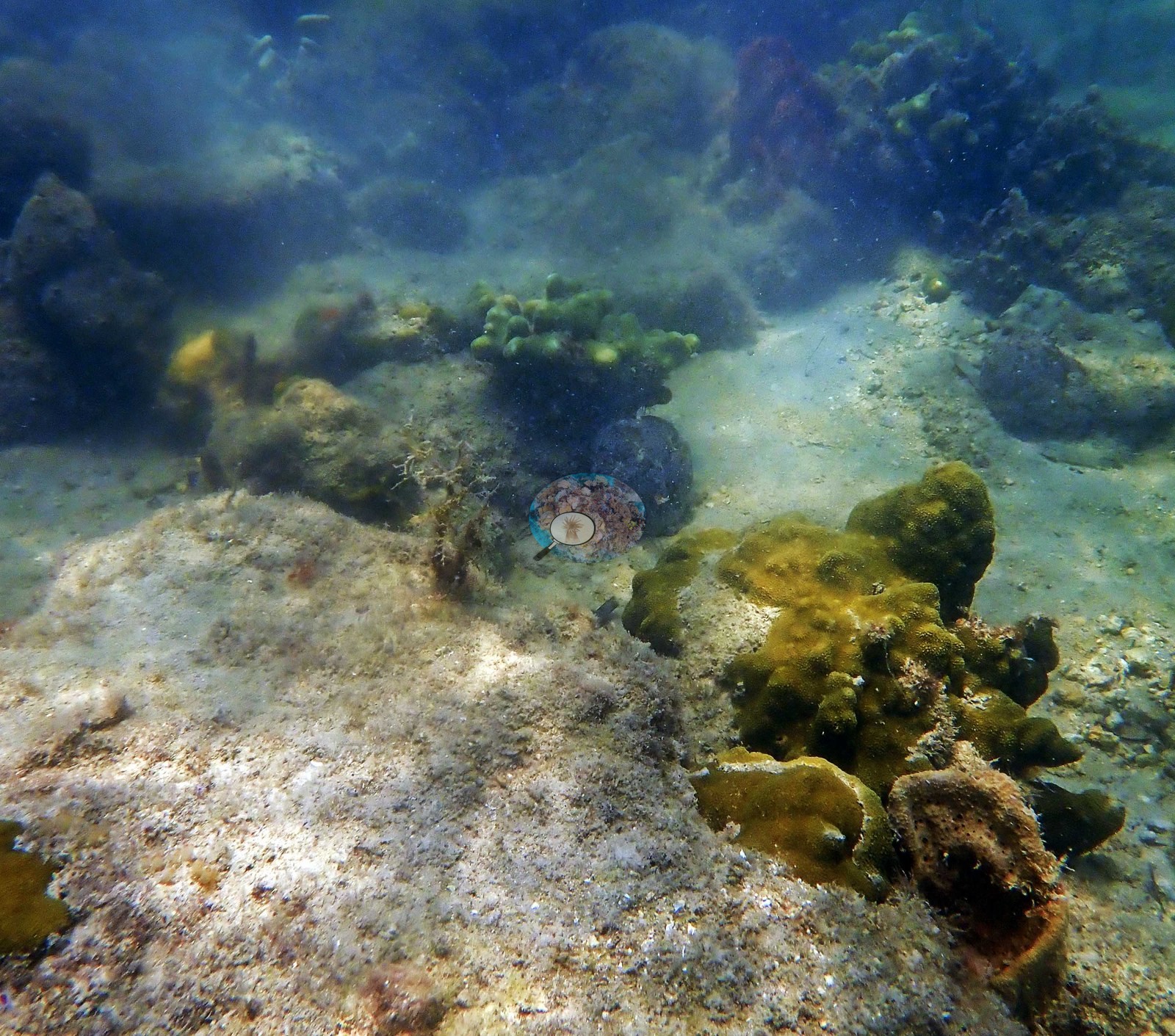
This is Miami's urban reef — flat, sediment-draped hard-bottom and riprap at the foot of MacArthur Causeway (Anderson's log: 'diving off the MacArthur Causeway'), one of four sites in a study of how corals cope with city living (e.g., Image 4).
General benthic features
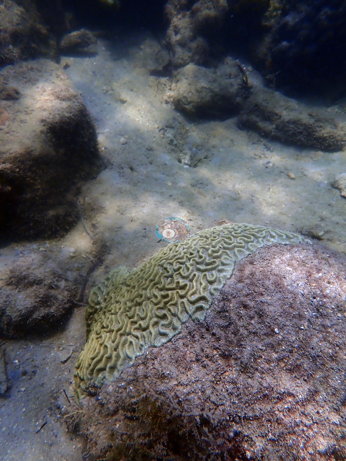
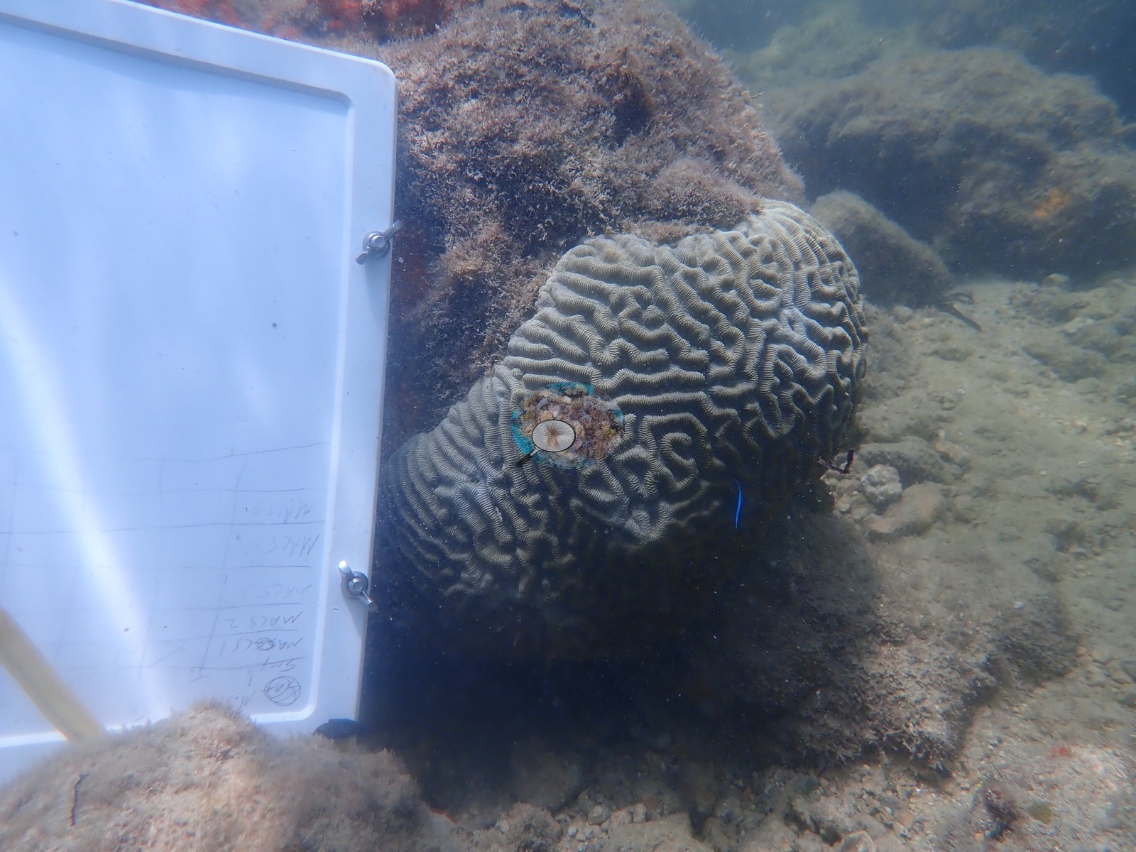
Anderson sampled 10 Pseudodiploria strigosa colonies here on 26 June 2019 (the sample sheet, MACS1-MACS10); the boulder brain corals in these frames sit dusted in sediment, photographed with a dive slate for scale (e.g., Image 1, Image 2).
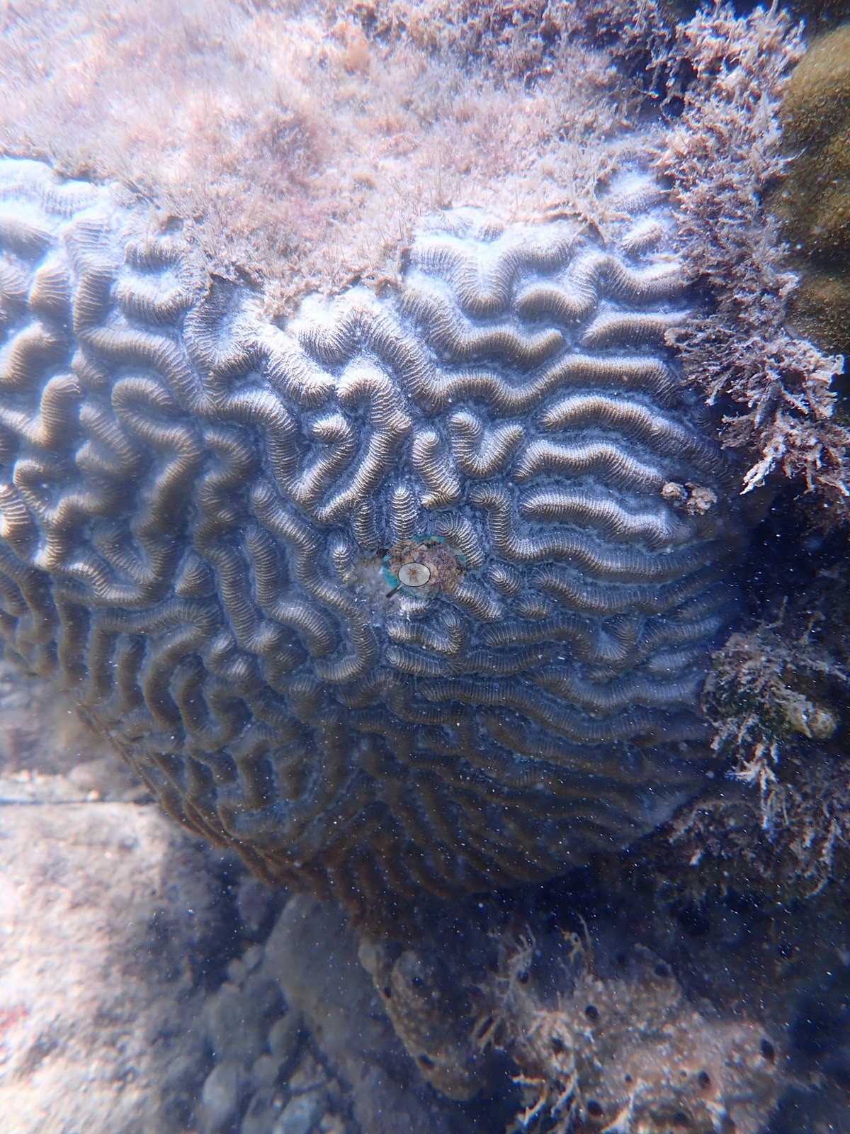
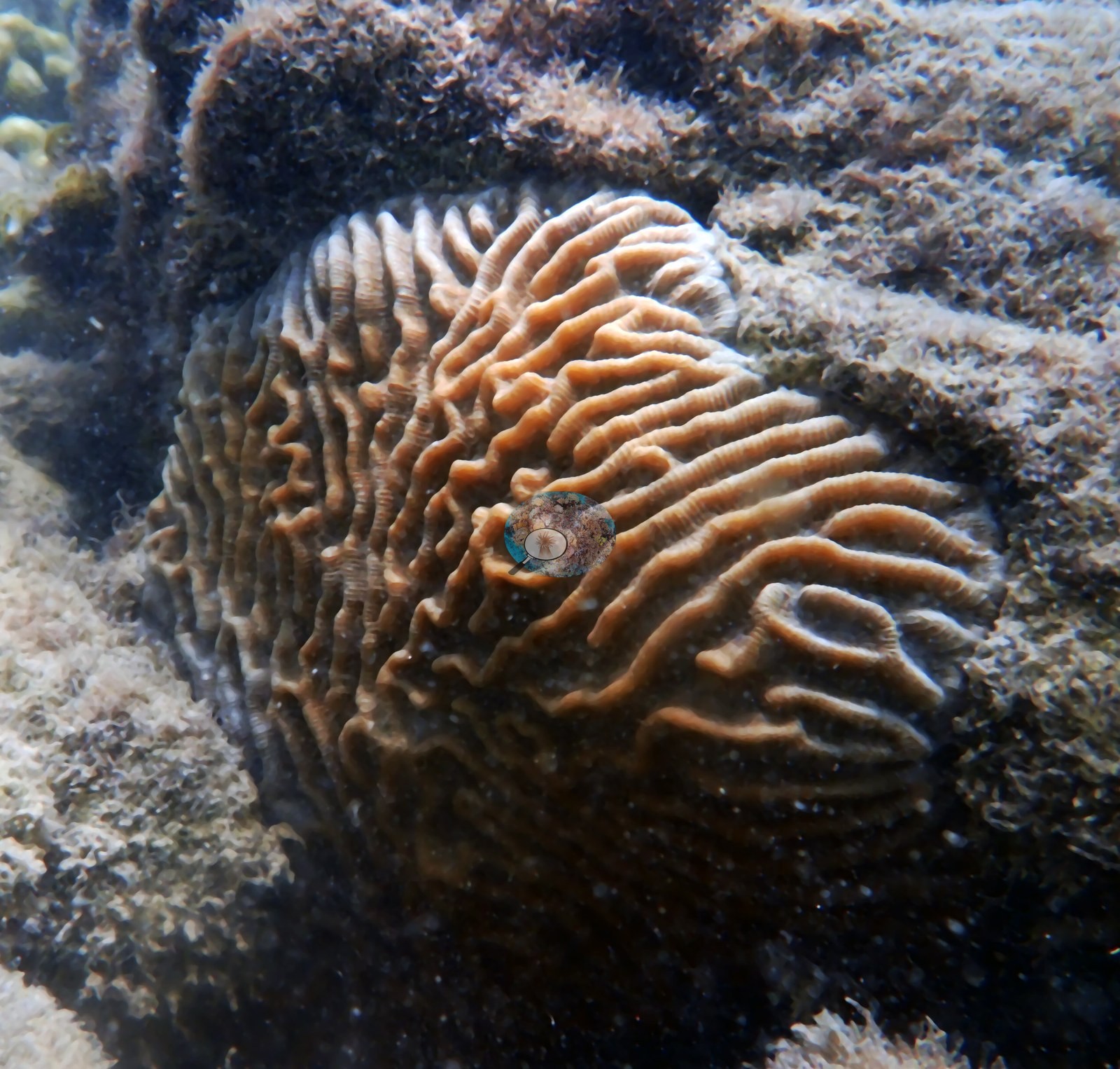
The Urban Corals study reports a separate collection at this site: tissue from 10 P. strigosa colonies on 14 February 2020 (Rubin et al. 2021, Frontiers in Marine Science 8:695236). Look past the murk and there's still life: a third brain coral glowing orange-brown (e.g., Image 3), and mustard-yellow mounding colonies, with a small branching cluster on the rubble (e.g., Image 5).
Nothing here looks pristine — that's the point: corals persisting a stone's throw from downtown Miami.
Coral cover
- Reference: Claude CV point count (this site's photos)
- Coral cover: 19% — a blind Claude computer-vision point count of 13 of Anderson's edited photographs (20 points per photo; water, fish, and obstructions excluded).
- No published coral-cover value exists for this site.
Stressors
Silt coats every rock and coral, and settled sediment sits in the valleys of the sampled brain corals (e.g., Image 1, Image 2); sedimentation and turbidity are the defining stressors at this urban site. Anderson's sample sheet notes old mortality on one sampled colony (MACS6) and some new mortality on another (MACS8). No corallivores were evident.
Comparisons with other data
Enochs et al. (2023) surveyed this site (MacArthur South). Within 5 km, one independent station, NOAA NCRMP Florida at SEFCRI PSU 3094-1, 4.21 km away, read 0.0% in 2024.
CV model comparison
More info
A few low-cover photos (sand, rubble, or open bottom) pull the mean down; the median is the typical photo. No computer-vision method yet estimates coral cover accurately on new images, so treat this as indicative rather than a measurement; it is revised as the methods improve.More info
Other rows are for comparison only and are never averaged. No diver transect exists for these photos, so agreement between rows is not accuracy.| Method | Hard coral cover (%) | Photos (n) ± SE |
|---|---|---|
| Claude (edited photos) | 18.7* | n = 13 · SE 2.5 |
*Based on only 13 reef-habitat photos; this estimate is less certain.
See a more detailed, stand-alone version of this table.
Independent surveys nearby
Within 5 km, 1 independent survey station recorded hard coral cover in 2024. One survey since 2021 recorded 0.0%. This site's own estimate (19%) is not compared with these surveys: none lies within 2 km.
Collected by other programs using different methods (NOAA rows come from NOAA monitoring programs (NCRMP, PIFSC, NCCOS), and each row's method is in its hover text), so these are context for the figures above, not a like-for-like comparison. Where a station was surveyed more than once, the cell shows either the range of its values or, as a single value, the mean of surveys made in one year. Station names are not dive-site names.
| Agency | Site / location | Date | Hard coral cover (%) | Distance | Link |
|---|---|---|---|---|---|
| NOAA NCRMP Florida | SEFCRI PSU 3094-1 | 2024 | 0.0% | 4.21 km | NCEI 0306238 |
Data & links
All images from Coral Reef Diagnostics. Data are from Coral Reef Diagnostics and the organizations named in the data sources above.
© Coral Reef Diagnostics.
References
- Rubin ET, Enochs IC, Foord C, Mayfield AB, Kolodziej G, Basden I, et al. (2021). Molecular Mechanisms of Coral Persistence Within Highly Urbanized Locations in the Port of Miami, Florida. Frontiers in Marine Science 8:695236. PDF
- Enochs IC, Studivan MS, Kolodziej G, Foord C, Basden I, Boyd A, et al. (2023). Coral persistence despite marginal conditions in the Port of Miami. Scientific Reports 13:6759. DOI