
Looe Key
Part of the regional summary: USA - Florida
More info
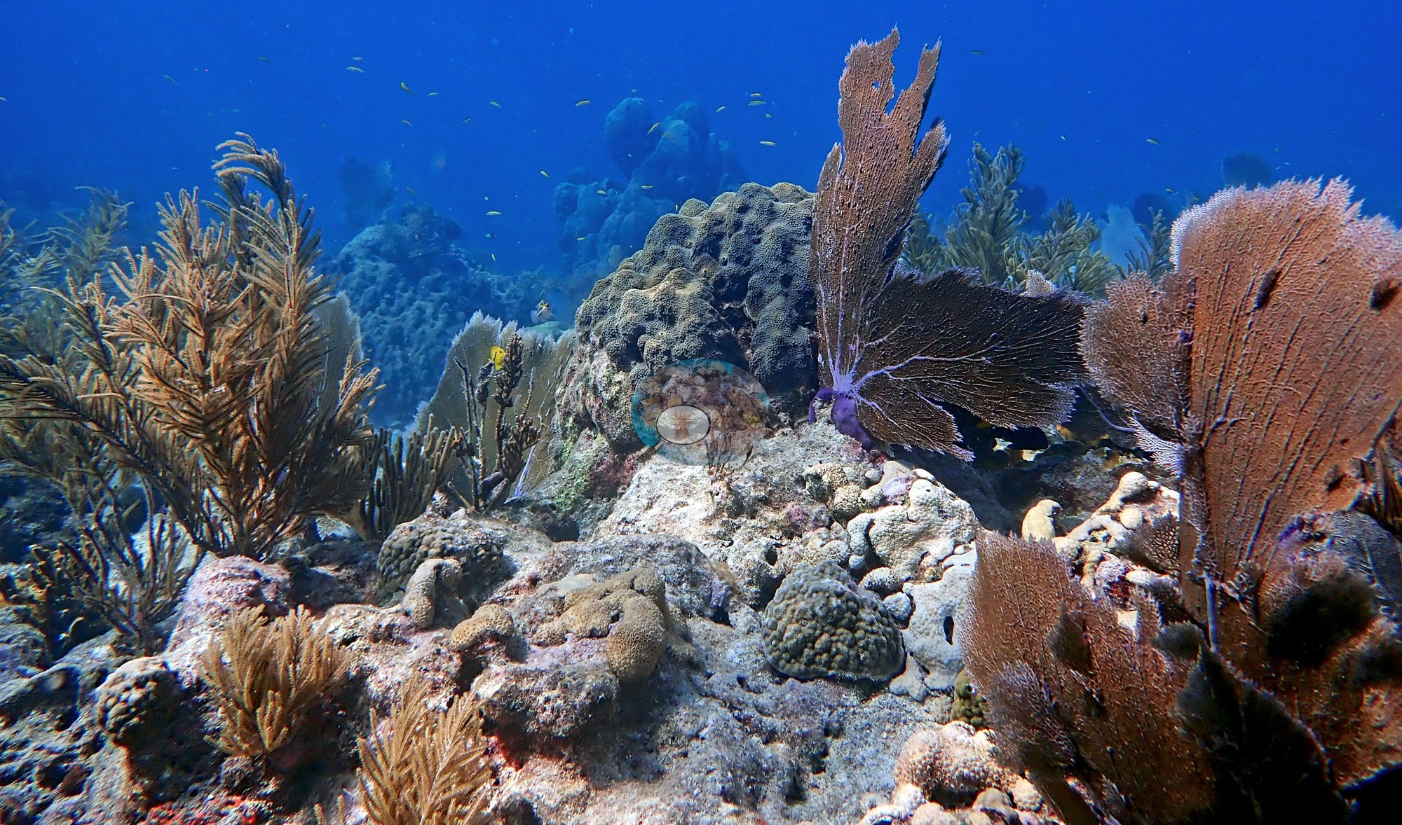
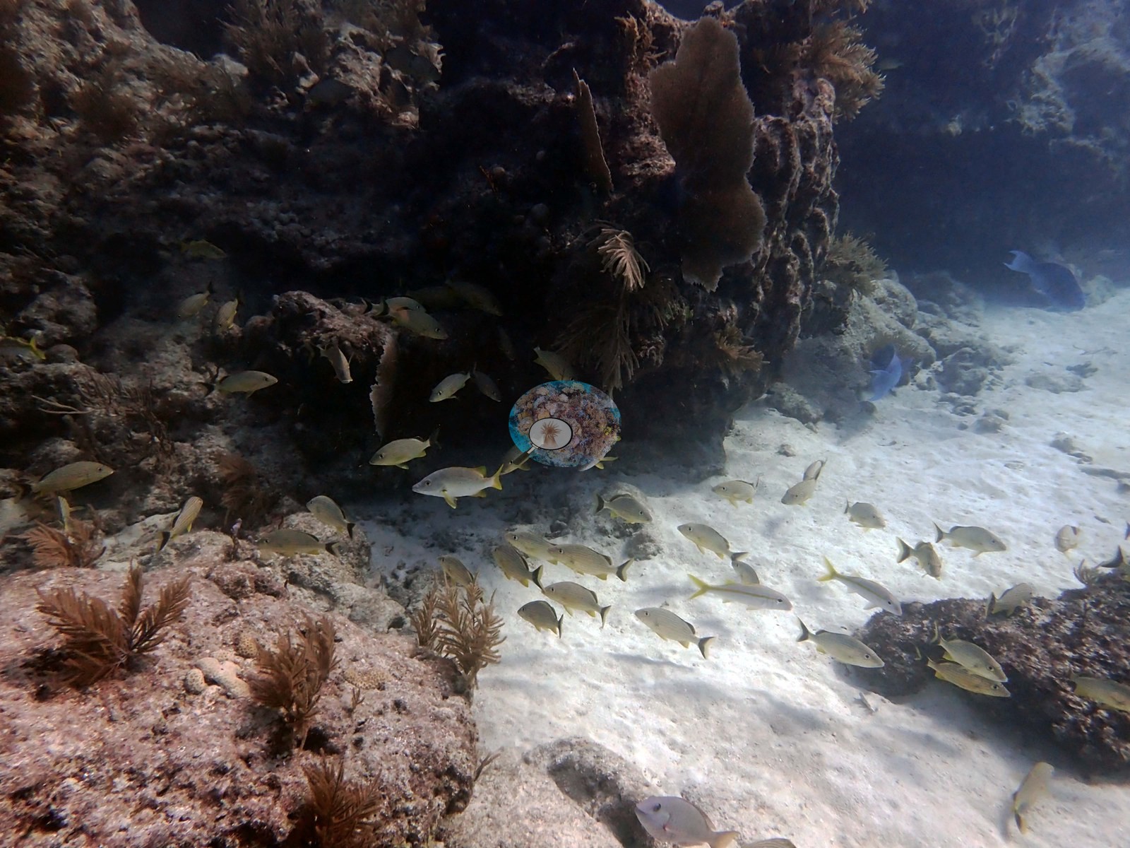
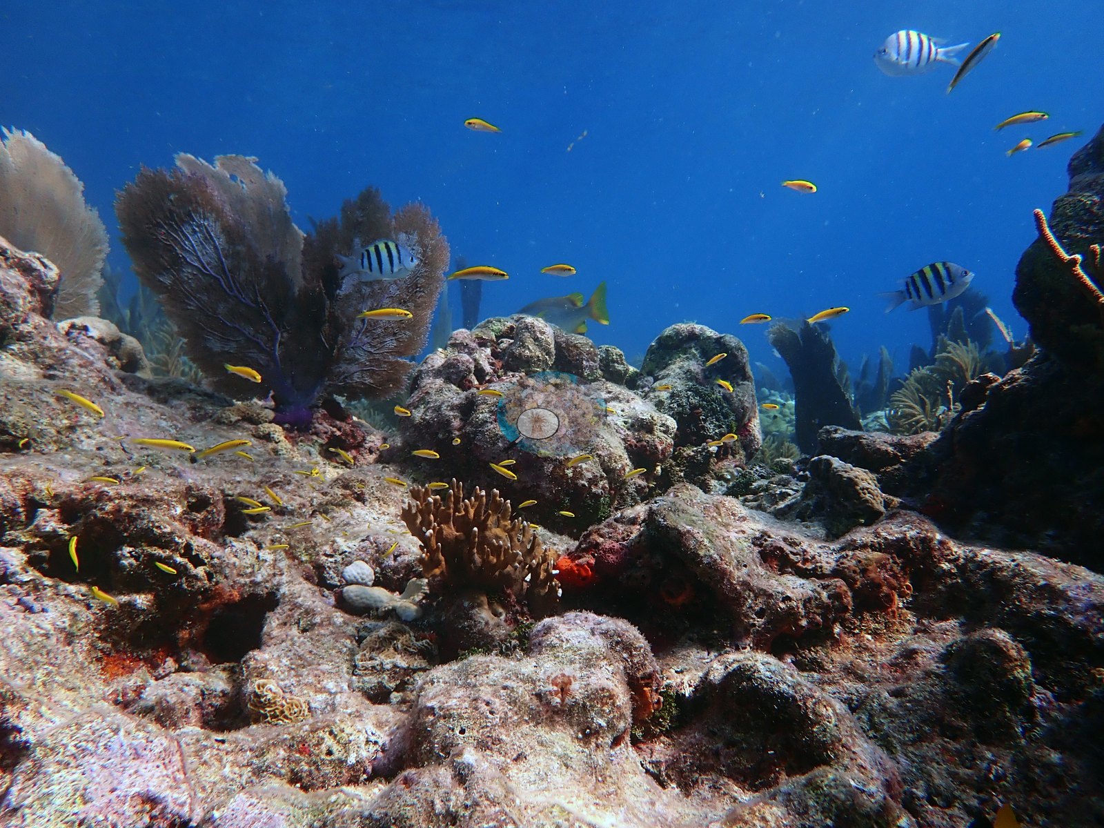
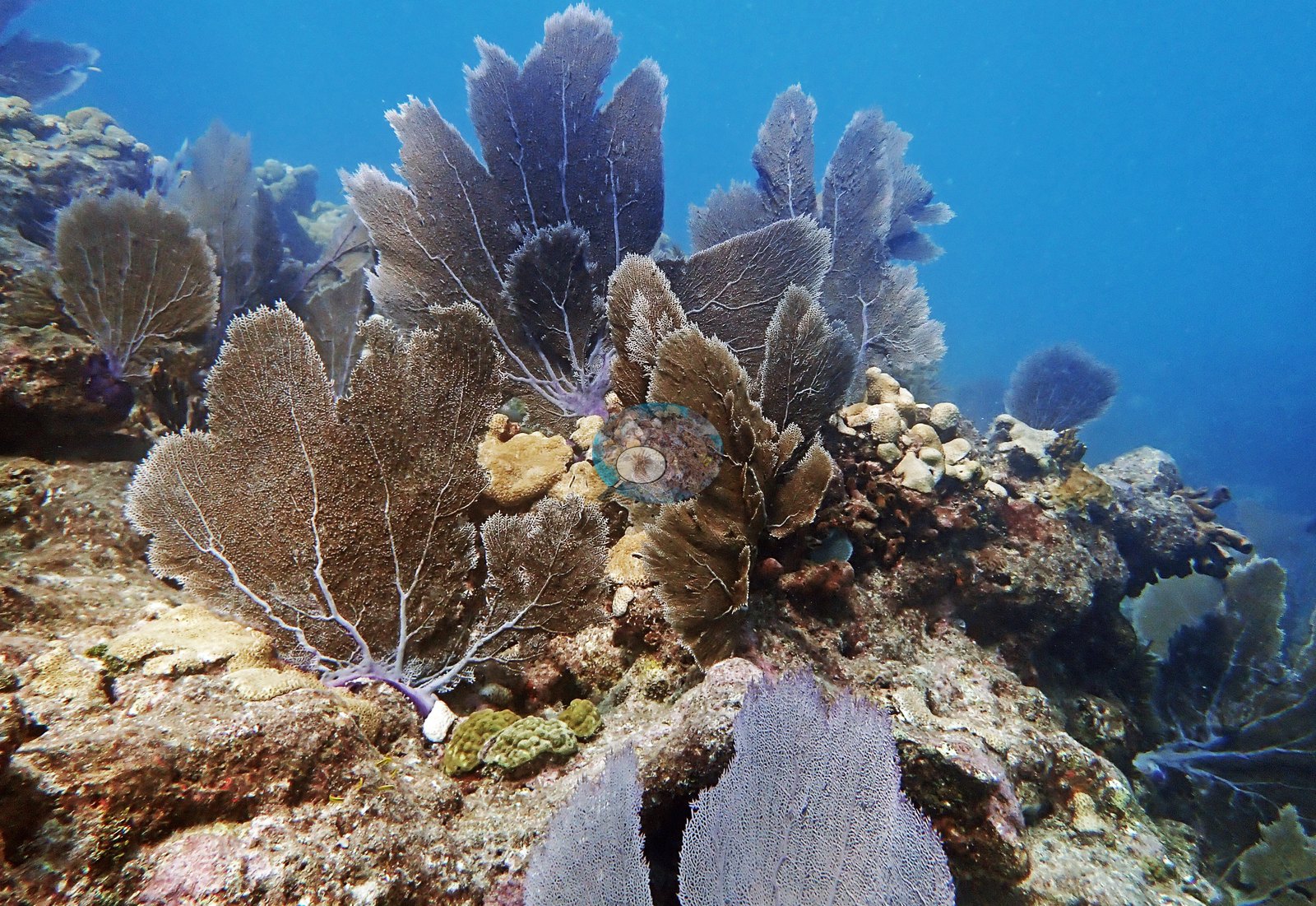
Florida Keys (NOAA CRW virtual station)Looe Key is the classic Lower Keys spur-and-groove reef, with its coral spurs and white sand grooves still intact but the living coral thin; sea plumes, sea rods, and sea fans do most of the growing on eroded, algae-fuzzed crests. Fish life is good, with sergeant majors, blue tang, yellowtail snapper, and a great barracuda on both dives.
37 independent survey stations shown with the program’s logo — click one to see how far it is from this site.
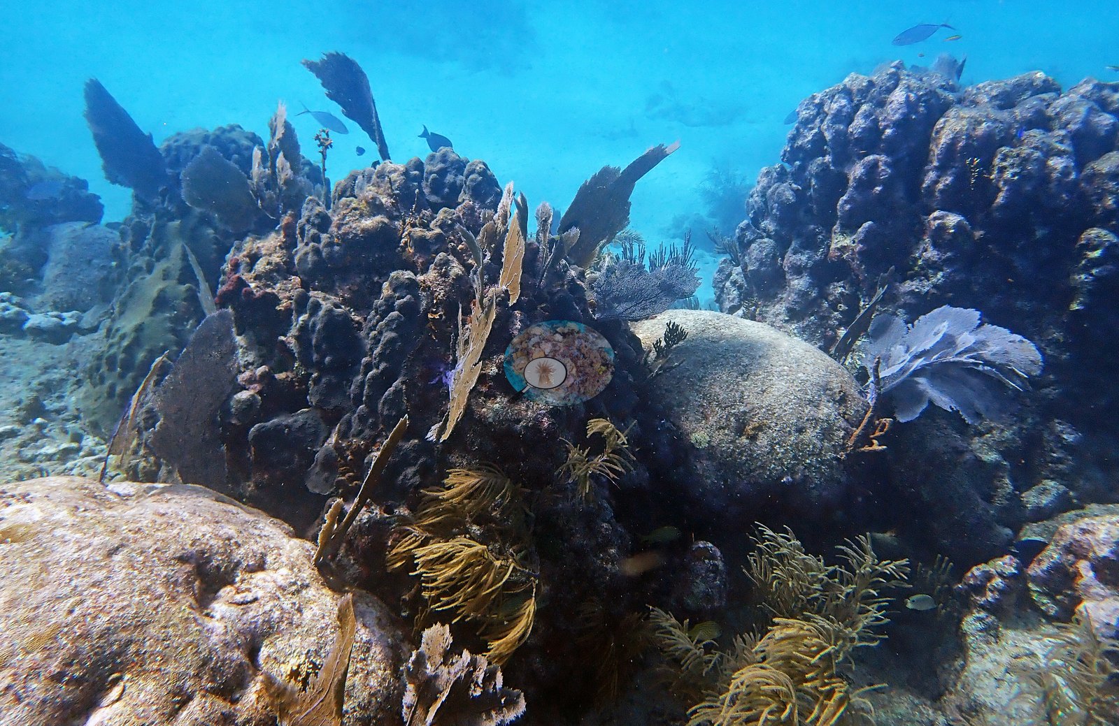
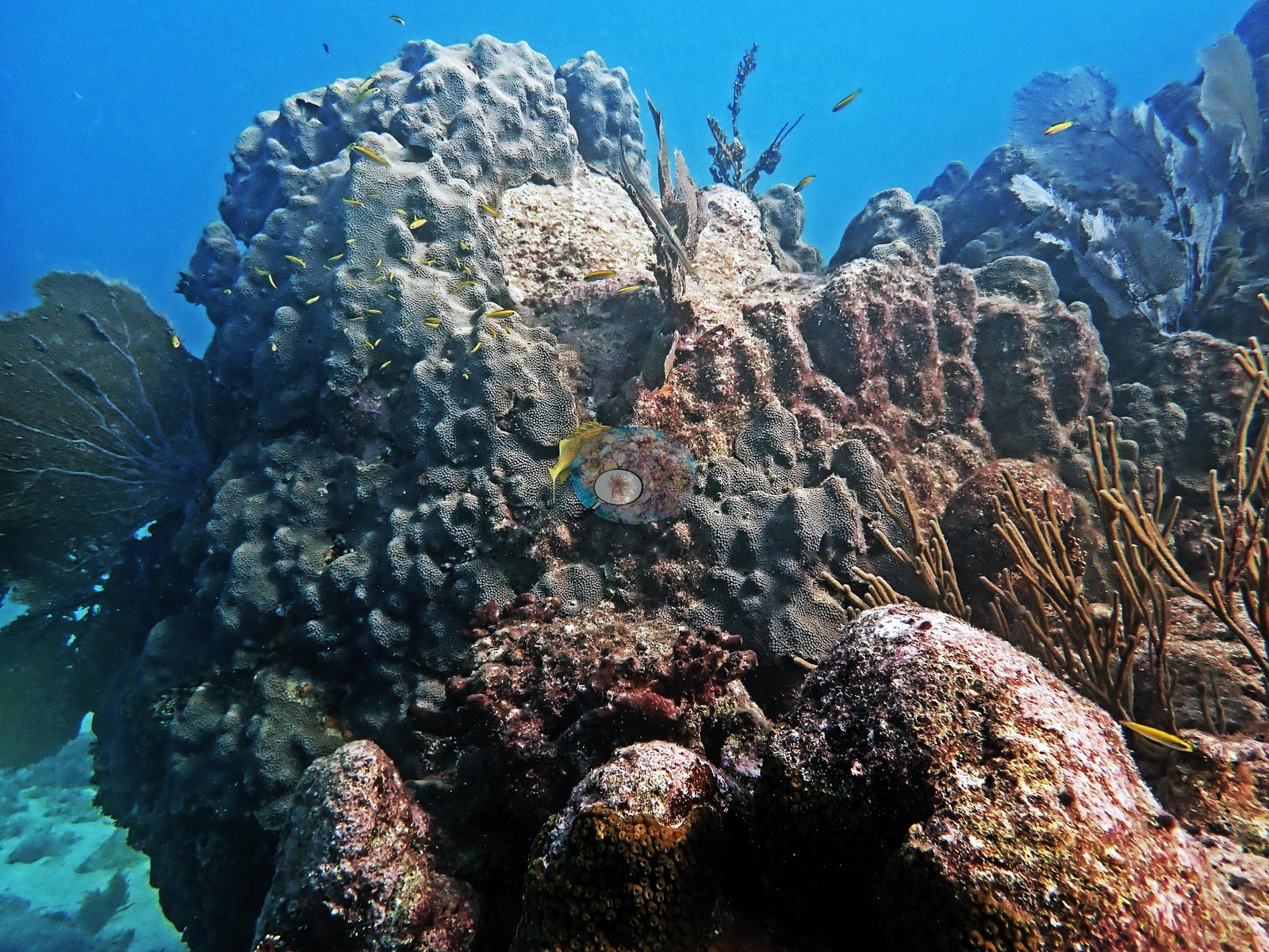
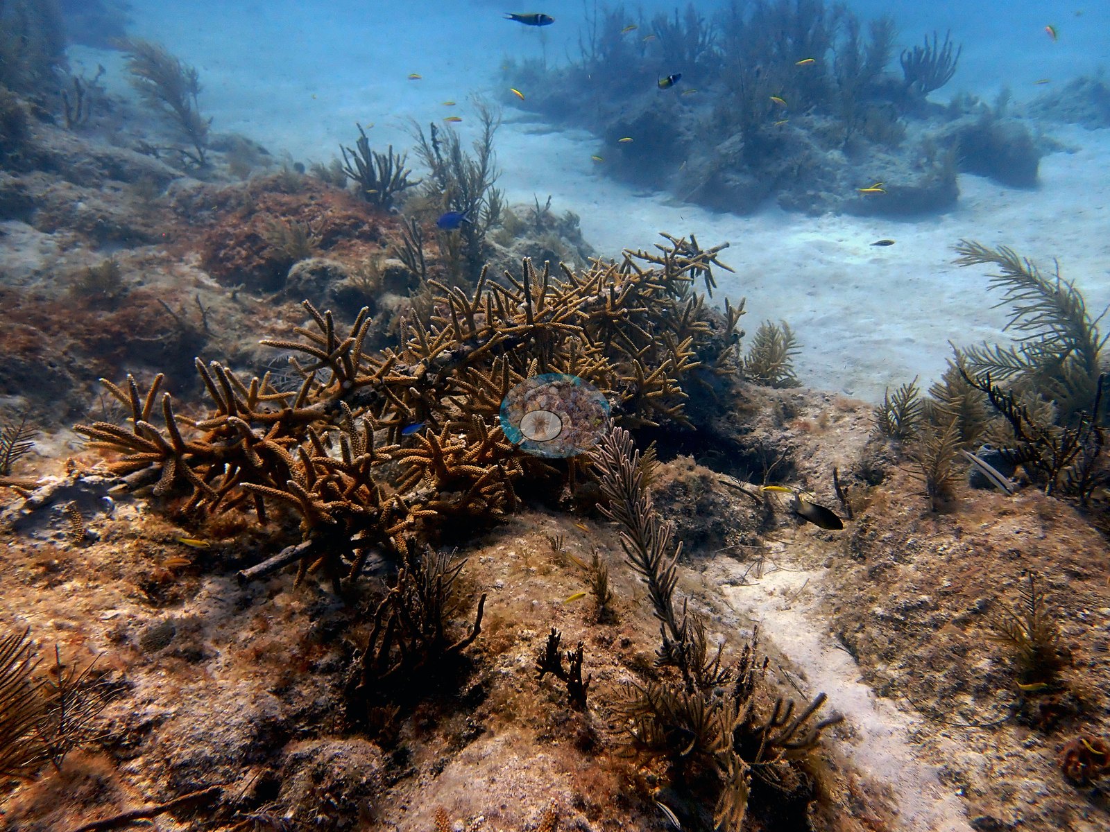
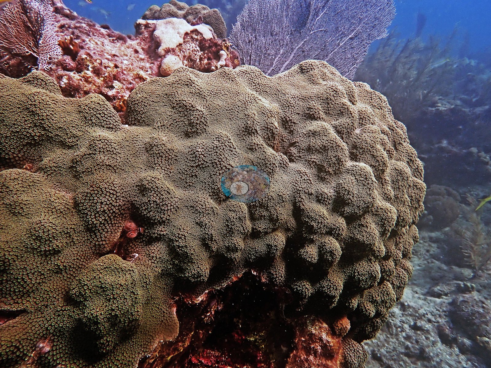
9 of the 26 photographs on this page are shown beside the text that discusses them under "Site description" below.
Site description
Setting
Looe Key Sanctuary Preservation Area, south of Big Pine Key — the classic Lower Keys spur-and-groove reef, dived twice on 9 December 2021 (09:41 and 10:50; 9.8 m maximum, 26.1–26.3°C average, 48 and 56 minutes).
General benthic features
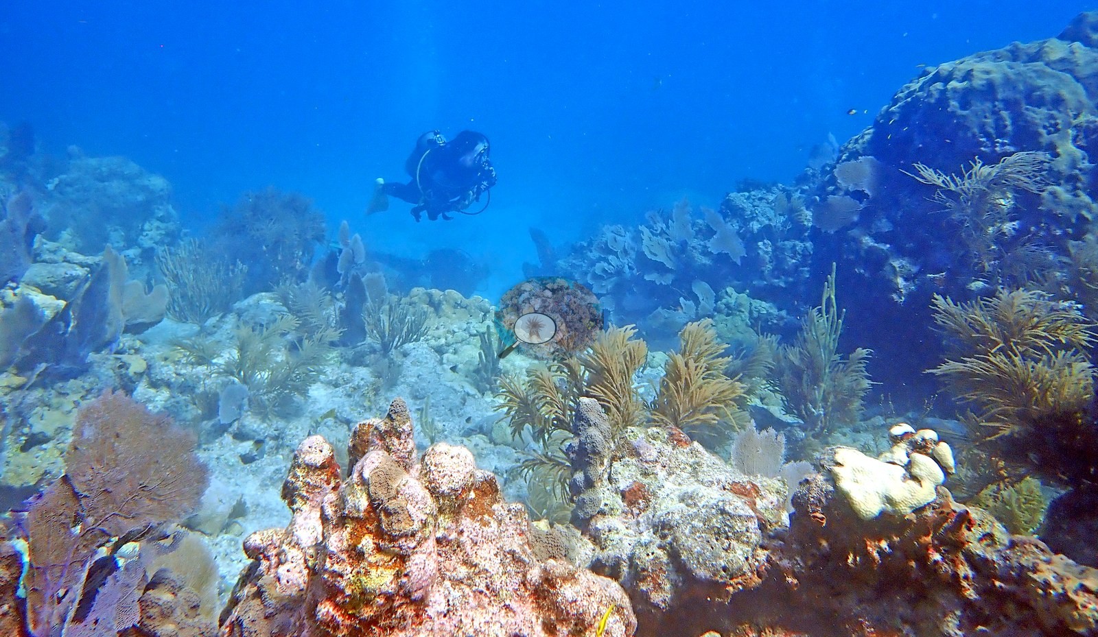
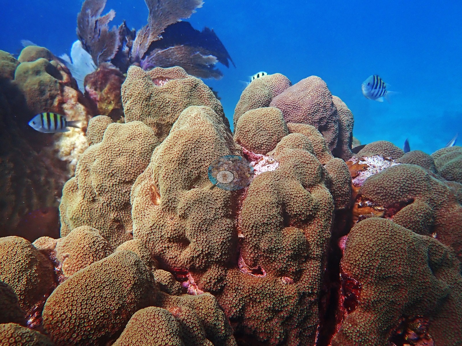
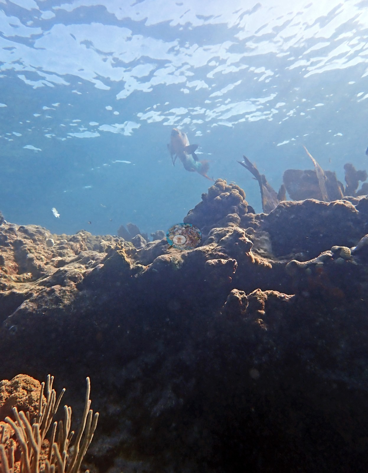
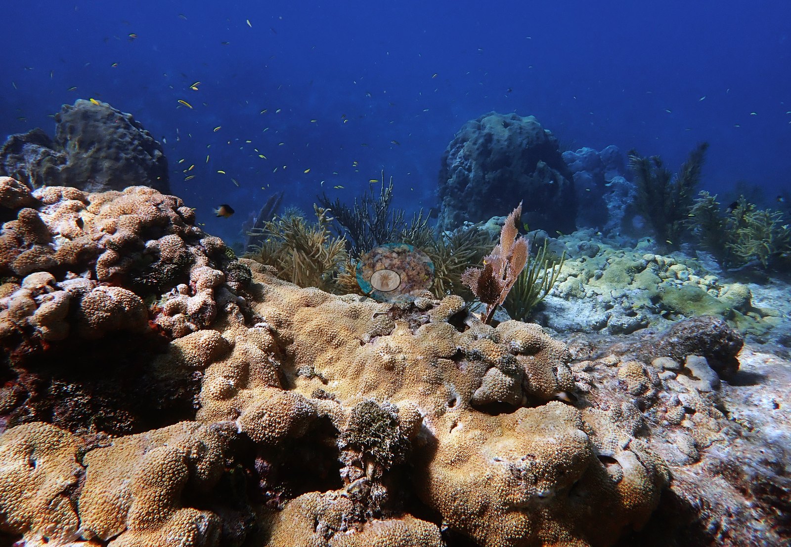
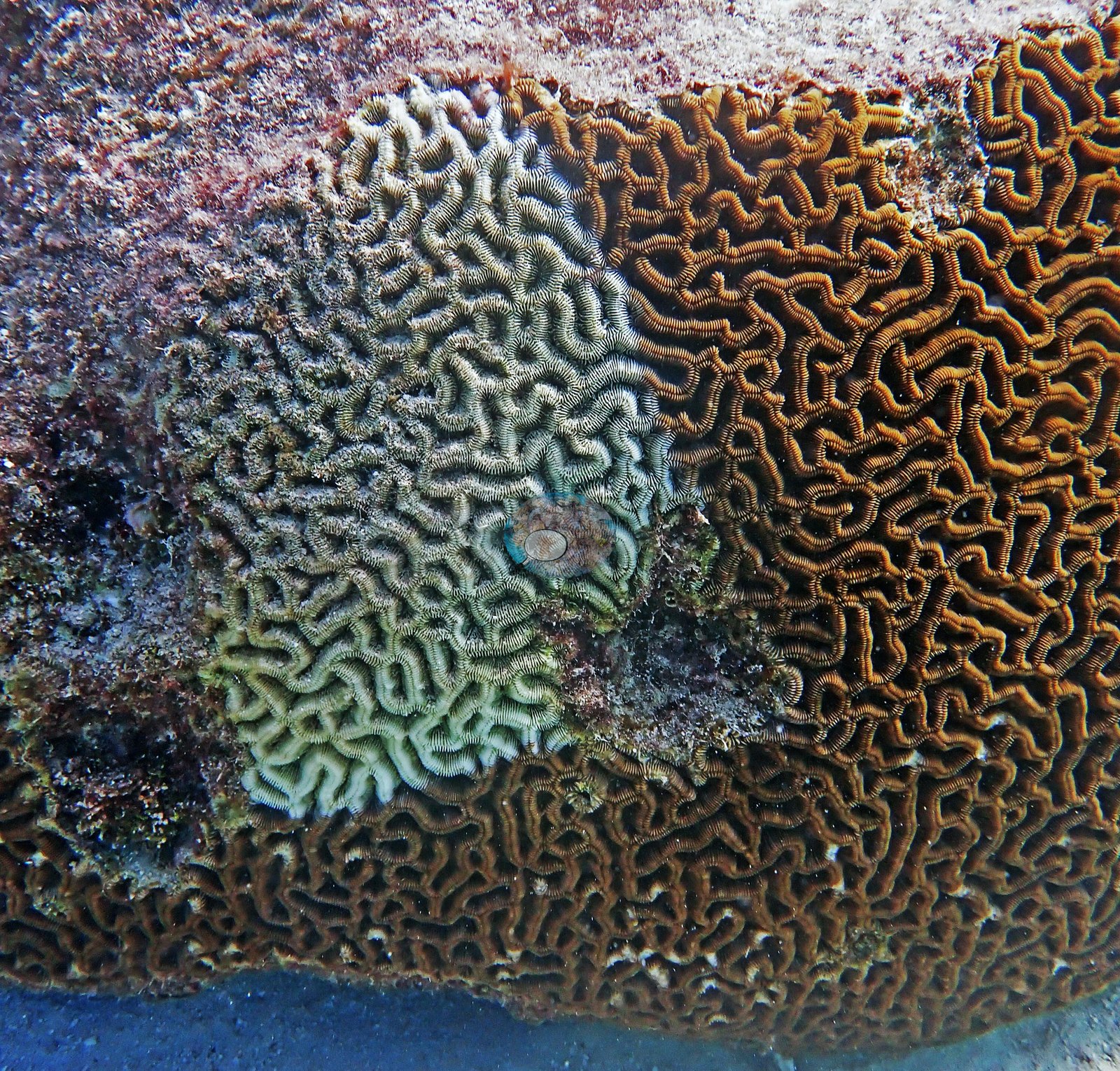
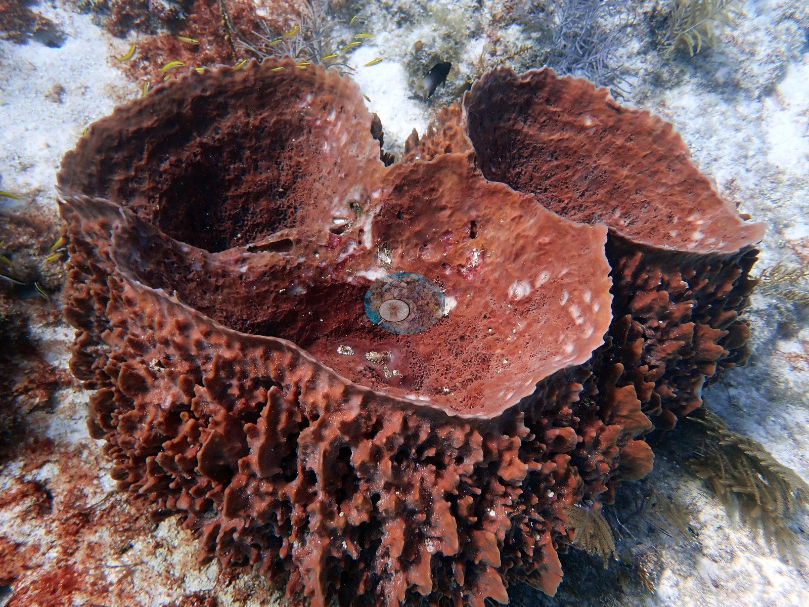
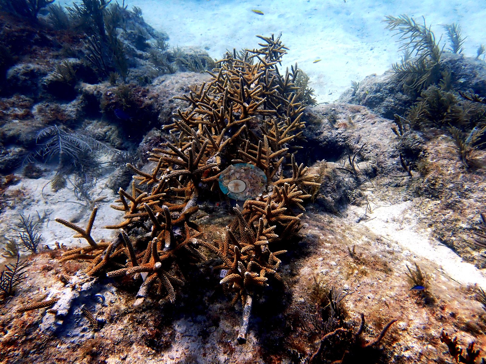
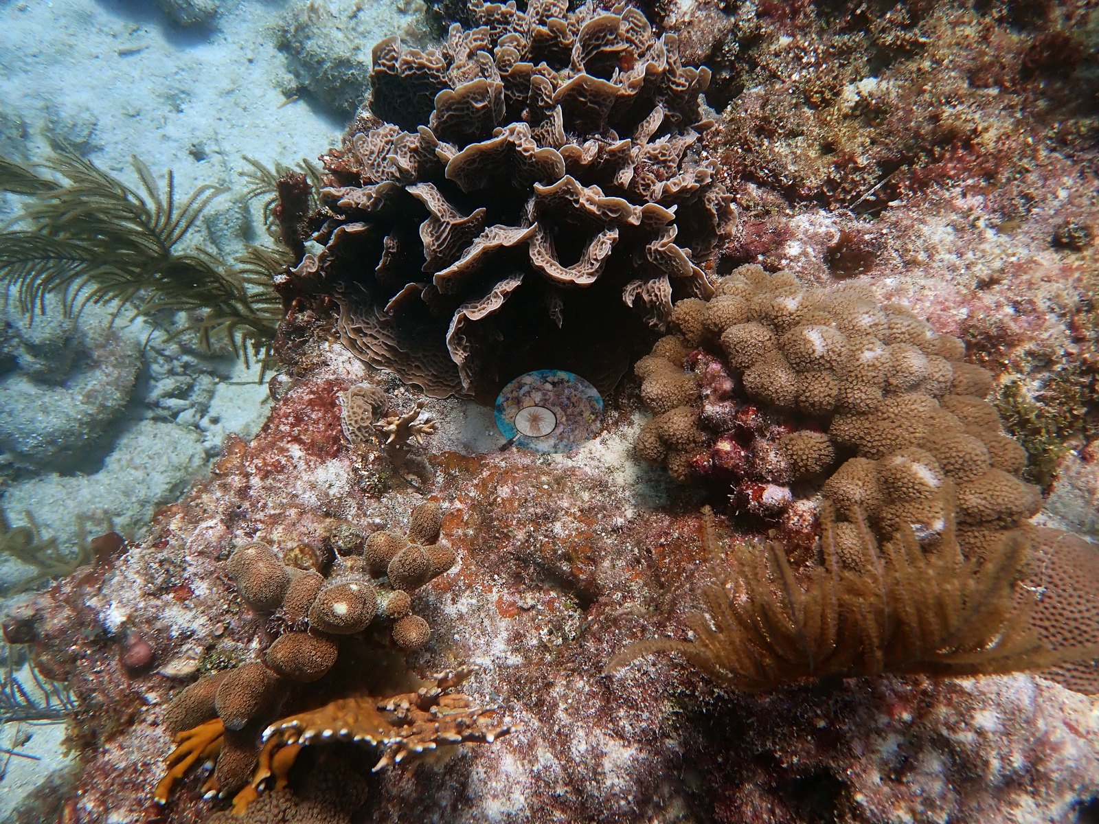
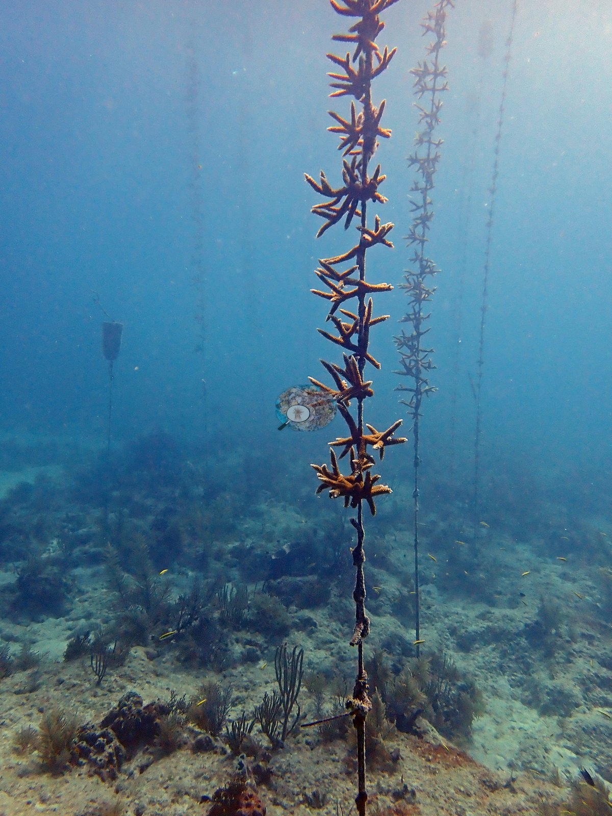
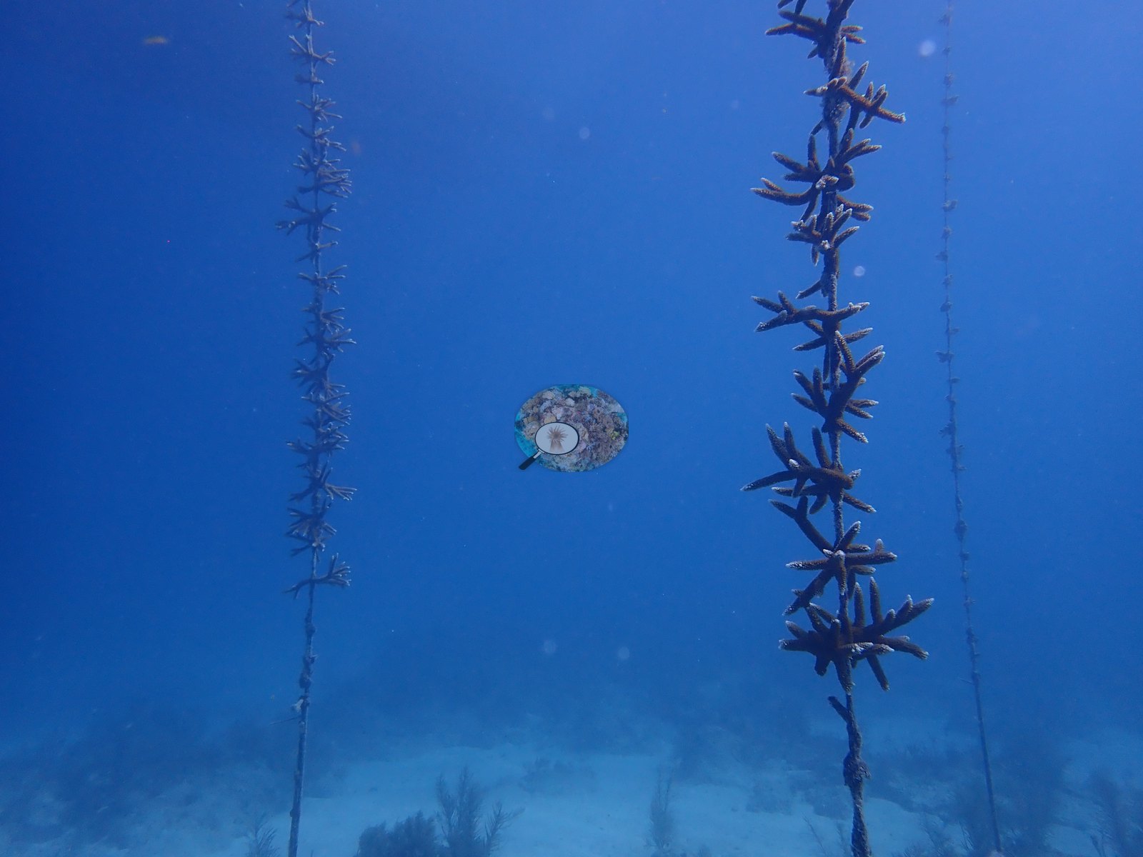
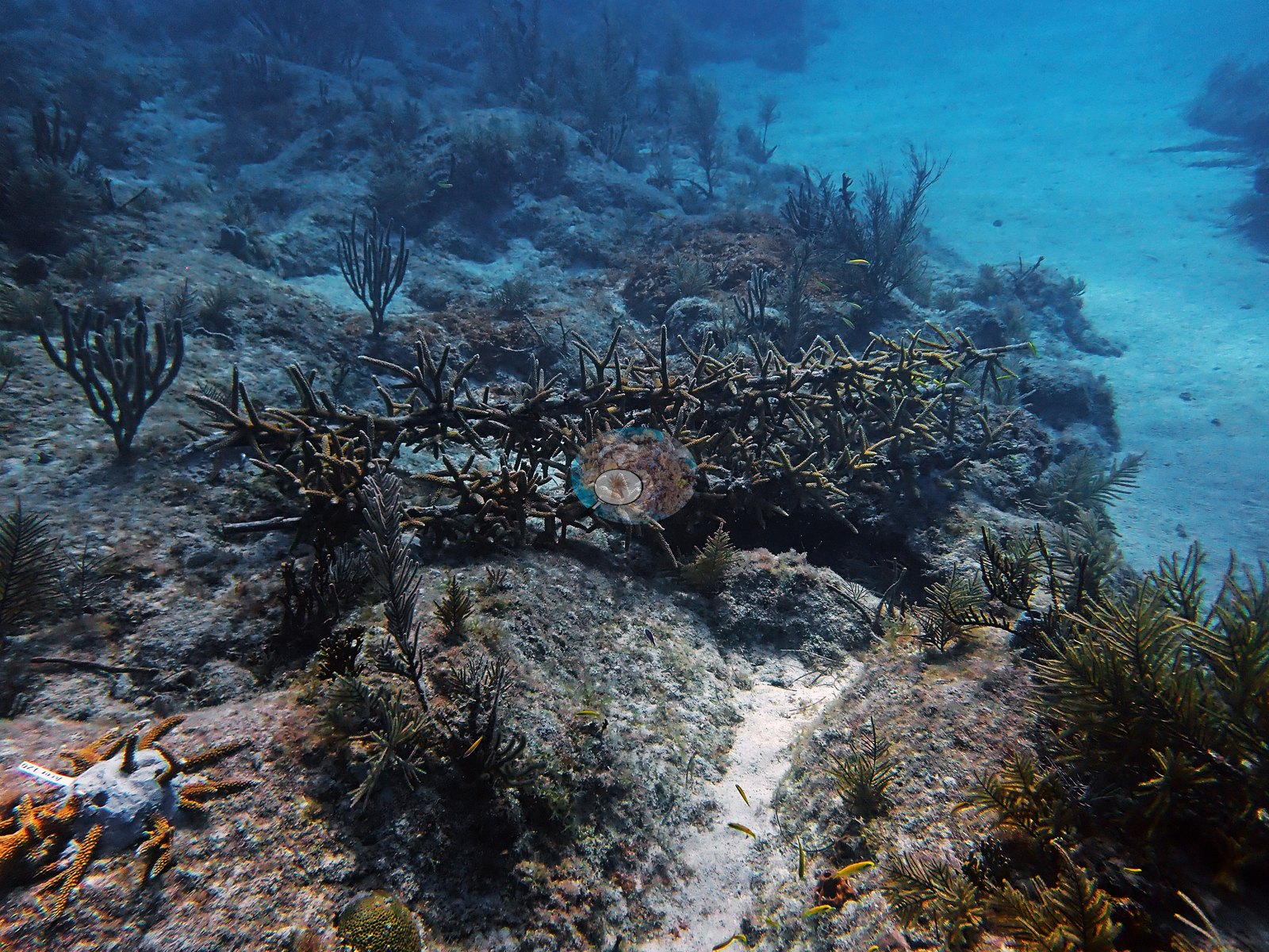
The photographs show a reef whose architecture is largely relict and whose living coral is concentrated in the shallowest zones. Limestone spurs run seaward between white sand grooves; most spur flanks are old framework skinned in pink crustose coralline algae and turf, with sea fans (Gorgonia ventalina), sea plumes and sea rods standing in dense stands over it. Where living stony coral does hold ground it does so emphatically: several meter-scale Orbicella-group boulder heads sit intact on the spur tops with tissue over the whole dome, and both bladed and branching fire coral (Millepora complanata / M. alcicornis) form waist- to chest-high stands. The shallowest crests carry near-continuous carpets of the zoanthid Palythoa (Anderson's identification), mounded mats of large separate polyps that almost surround some of the stony colonies. Living elkhorn coral (Acropora palmata) is present on the shallow fore-reef in several separate colonies. An in-water staghorn nursery — Acropora cervicornis fragments strung on line droppers from multiple tree structures (e.g., Image 21, Image 22) — stands over sand nearby, and a numbered outplant disk sits on the pavement beside a linear staghorn array (e.g., Image 10).
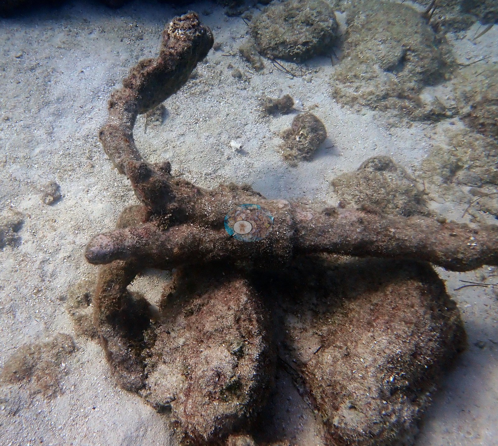
A heavily corroded iron anchor lies in one sand groove among encrusted rubble; the reef takes its name from HMS Looe, which ran aground here in 1744, but nothing visible on the anchor dates or attributes it (e.g., Image 23).
Coral cover
- Reference: Claude CV point count (this site's photos)
- Coral cover: 20% — a blind Claude computer-vision point count of 108 of Anderson's edited photographs (20 points per photo; water, fish, and obstructions excluded). Other computer-vision methods are listed in the method table. Nothing below is a cover estimate — the habitat notes describe what is in the frames, not what fraction of the benthos it covers, and cover is deliberately not eyeballed from photographs.
Stressors
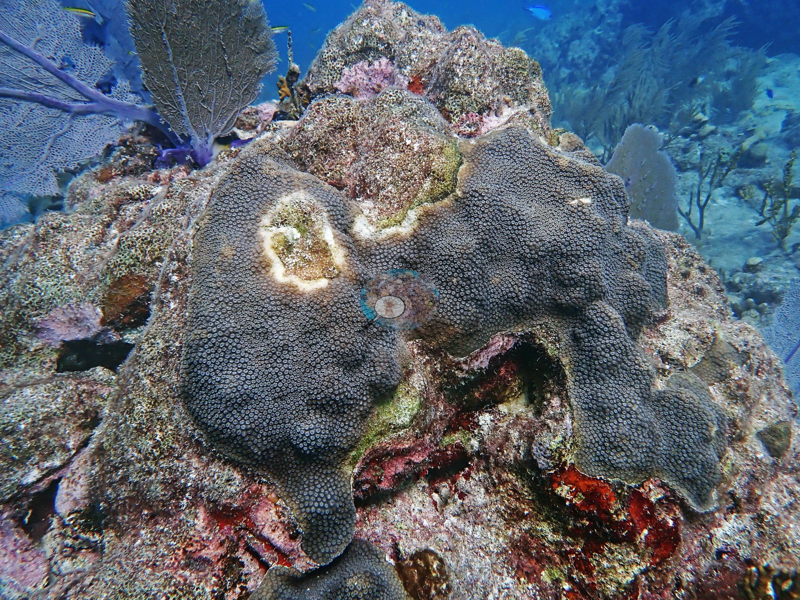
One massive colony carries two tissue-loss lesions consistent with stony coral tissue loss disease (SCTLD), each a ring of freshly exposed white skeleton between live tissue and an older, turf-covered dead center (e.g., Image 26).
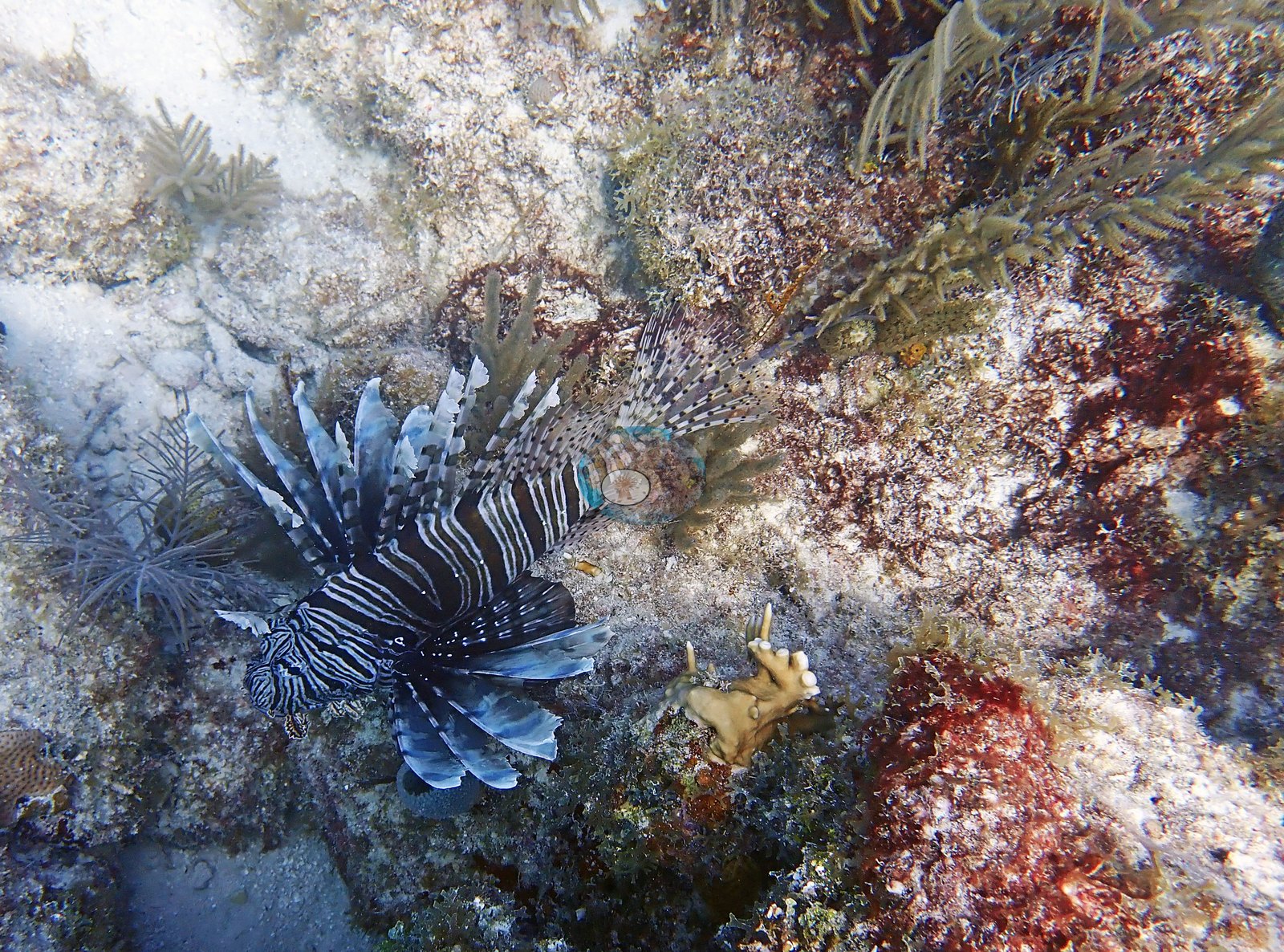
The zoanthid Palythoa carpets on the shallowest crests almost surround some of the stony colonies there. An invasive lionfish was photographed on the reef pavement (Anderson's identification) (e.g., Image 18).
No corallivores were evident.
Fish and other fauna
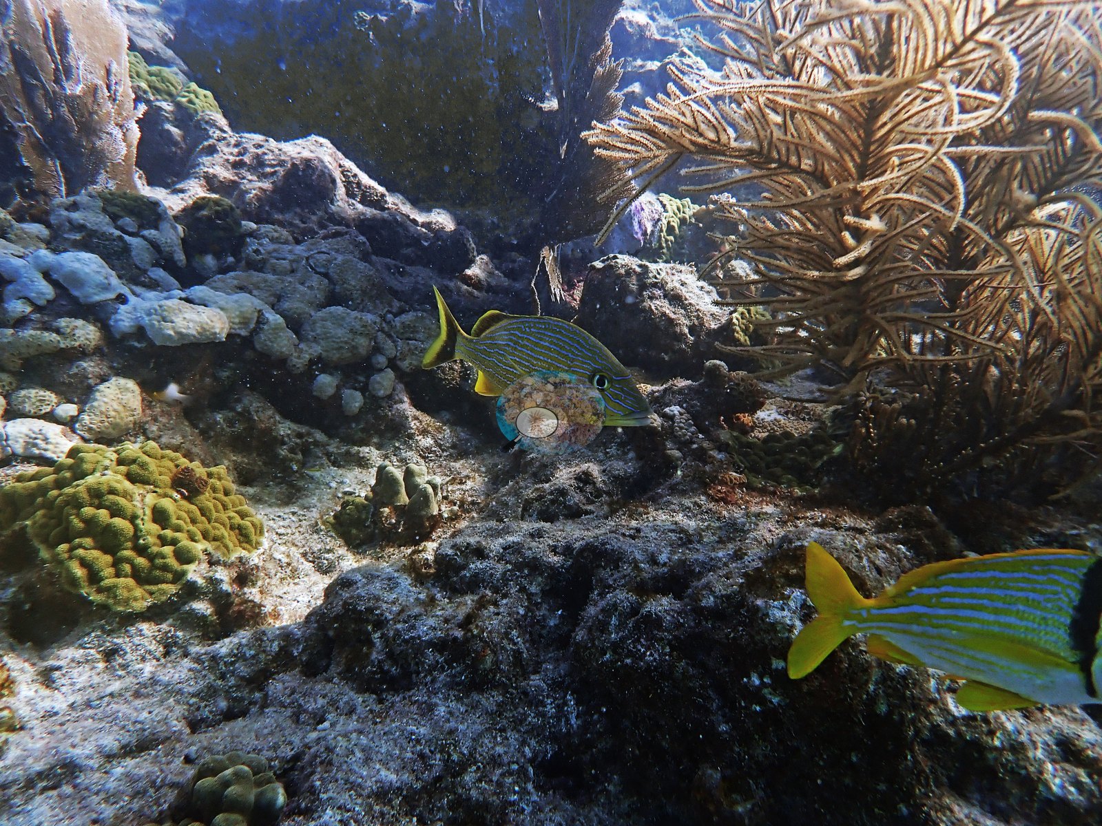
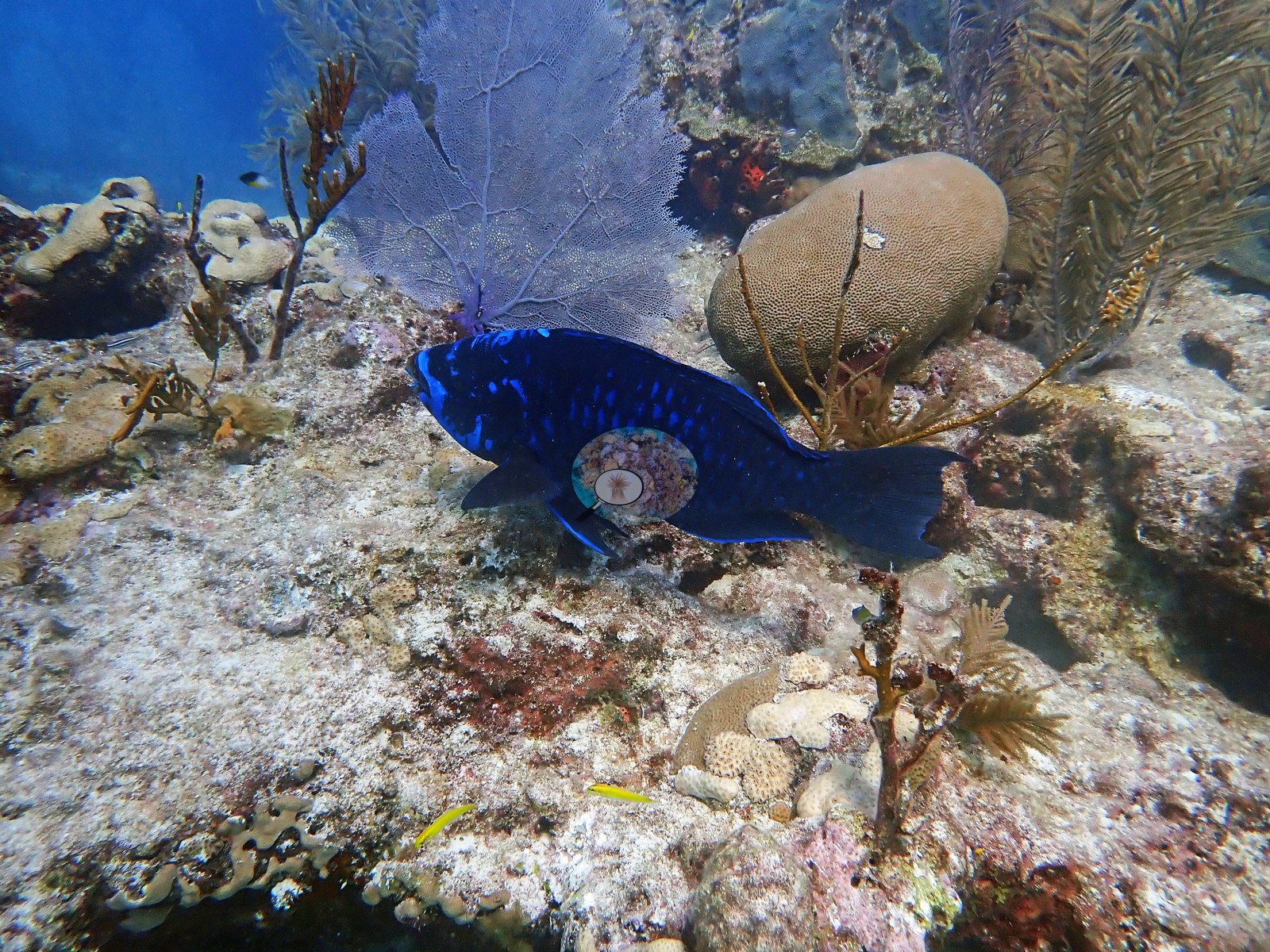
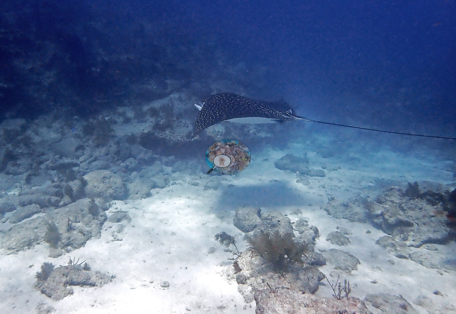
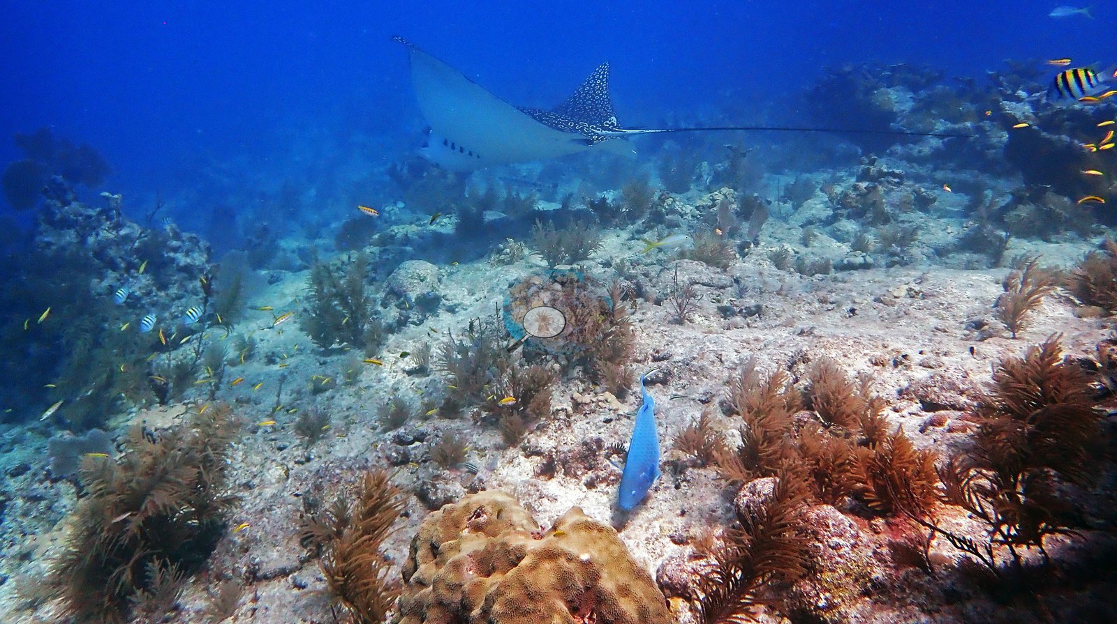
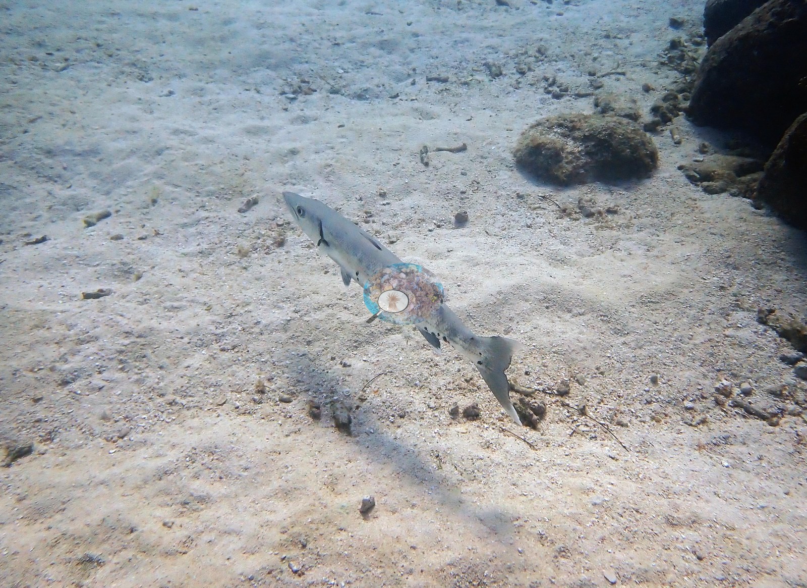
Fish were abundant throughout — sergeant majors in loose clouds, bluehead and yellowhead wrasse, blue tang, blue chromis, yellowtail snapper, a great barracuda on both dives, an invasive lionfish, and a spotted eagle ray crossing the reef (e.g., Image 24, Image 25); the barracuda hangs low over the sand in Image 3.
Comparisons with other data
NOAA NCRMP Florida surveyed this site (FLK PSU 8195-1) in 2024, 0.07 km from the pin. Within 5 km, 37 independent stations recorded station-year means of 0.0–39% hard coral cover between 1996 and 2024; the nearest, NOAA NCRMP Florida at FLK PSU 8195-1, 0.07 km away, read 4.0% in 2024.
CV model comparison
More info
A few colony-focused photos raise the mean; the median is the typical photo. No computer-vision method yet estimates coral cover accurately on new images, so treat this as indicative rather than a measurement; it is revised as the methods improve.More info
Other rows are for comparison only and are never averaged. No diver transect exists for these photos, so agreement between rows is not accuracy.| Method | Hard coral cover (%) | Photos (n) ± SE |
|---|---|---|
| CoralSCOP edited | 25.5 | n = 87 |
| Claude (edited photos) | 19.8 | n = 108 · SE 1.9 |
CoralSCOP (edited photos) reads 25.5%, within 5.7 pp of Claude's blind point count (19.8%).
See a more detailed, stand-alone version of this table.
Dive history
| Date | Time in | Max depth (m) | Bottom time (min) |
|---|---|---|---|
| 2021-12-09 | 09:41 | 8.2 | 48 |
| 2021-12-09 | 10:50 | 9.8 | 56 |
Independent surveys nearby
| Agency / program | Year(s) | Stations / distance | Link |
|---|---|---|---|
| FWC CREMP (Florida Keys) | 1996–2024 | 8 stations, 0.24–1.22 km | Records ↓ |
| NOAA NCRMP | 2015–2016 | 12 stations, 0.63–4.95 km | Records ↓ |
| NOAA NCRMP Florida | 2024 | 17 stations, 0.07–4.84 km | Records ↓ |
 Coral Reef DiagnosticsYear-average (illustrative only, programs differ)
Within 5 km, 37 independent survey stations recorded hard coral cover in 243 records between 1996 and 2024. Of the 10 stations surveyed in more than one year, 9 declined (by 1.7–37 points) and 1 increased (by 16 points) between their first and latest surveys. 8 stations share the longest span (1996–2024); one, Looe Key Shallow #573 (FWC CREMP (Florida Keys), 0.24 km away), went from 5.4% in 1996 to 3.2% in 2024. Since 2021, station-year means average 4.1% (range 0.0–15%; n = 49 station-years from 49 records). This site's own estimate (20%) sits 9 points above the recent range of station-year means up to 2 km away (0.0–11%); the methods differ, so the comparison is context, not a like-for-like test.
Collected by other programs using different methods (NOAA rows come from NOAA monitoring programs (NCRMP, PIFSC, NCCOS), and each row's method is in its hover text; FWC-FWRI uses fixed-station point counts), so these are context for the figures above, not a like-for-like comparison. Where a station was surveyed more than once, the cell shows either the range of its values or, as a single value, the mean of surveys made in one year. Station names are not dive-site names.
Show all 243 independent survey records
| Agency | Site / location | Date | Hard coral cover (%) | Distance | Link |
|---|---|---|---|---|---|
| FWC CREMP (Florida Keys) | Looe Key Shallow #573 | 1996–2024 | 3.2–15% (29 surveys) | 0.24 km | — |
| FWC CREMP (Florida Keys) | Looe Key Shallow #574 | 1996–2024 | 1.0–39% (29 surveys) | 0.24 km | — |
| FWC CREMP (Florida Keys) | Looe Key Shallow #572 | 1996–2024 | 2.3–16% (29 surveys) | 0.33 km | — |
| FWC CREMP (Florida Keys) | Looe Key Shallow #571 | 1996–2024 | 5.9–18% (19 surveys) | 0.40 km | — |
| FWC CREMP (Florida Keys) | Looe Key Deep #773 | 1996–2024 | 1.6–6.2% (29 surveys) | 0.96 km | — |
| FWC CREMP (Florida Keys) | Looe Key Deep #774 | 1996–2024 | 2.1–7.1% (19 surveys) | 0.96 km | — |
| FWC CREMP (Florida Keys) | Looe Key Deep #771 | 1996–2024 | 1.3–11% (29 surveys) | 1.22 km | — |
| FWC CREMP (Florida Keys) | Looe Key Deep #772 | 1996–2024 | 1.2–8.0% (29 surveys) | 1.22 km | — |
| NOAA NCRMP | FLK-252 | 2015–2016 | 0.0–3.0% (range of yearly means; 2 records) | 0.63 km | — |
| NOAA NCRMP | FLK-254 | 2015 | 0.0% | 0.78 km | — |
| NOAA NCRMP | FLK-255 | 2015 | 0.0% | 0.78 km | — |
| NOAA NCRMP | FLK-253 | 2015–2016 | 6.0–22% (range of yearly means; 2 records) | 0.88 km | — |
| NOAA NCRMP | FLK-325 | 2015 | 4.0% | 1.65 km | — |
| NOAA NCRMP | FLK-256 | 2015 | 2.5% | 1.74 km | — |
| NOAA NCRMP | FLK-269 | 2015 | 16% | 2.13 km | — |
| NOAA NCRMP | FLK-319 | 2015 | 5.0% | 2.68 km | — |
| NOAA NCRMP | FLK-270 | 2015 | 24% | 3.63 km | — |
| NOAA NCRMP | FLK-317 | 2015 | 22% | 4.64 km | — |
| NOAA NCRMP | FLK-315 | 2015 | 25% | 4.95 km | — |
| NOAA NCRMP | FLK-387 | 2016 | 6.0% | 2.47 km | — |
| NOAA NCRMP Florida | FLK PSU 8195-1 | 2024 | 4.0% | 0.07 km | NCEI 0306238 |
| NOAA NCRMP Florida | FLK PSU 8173-1 | 2024 | 1.0% | 0.08 km | NCEI 0306238 |
| NOAA NCRMP Florida | FLK PSU 8057-1 | 2024 | 0.0% | 0.14 km | NCEI 0306238 |
| NOAA NCRMP Florida | FLK PSU 8157-1 | 2024 | 1.0% | 0.14 km | NCEI 0306238 |
| NOAA NCRMP Florida | FLK PSU 8058-1 | 2024 | 6.0% | 0.15 km | NCEI 0306238 |
| NOAA NCRMP Florida | FLK PSU 8097-1 | 2024 | 1.0% | 0.18 km | NCEI 0306238 |
| NOAA NCRMP Florida | FLK PSU 8072-1 | 2024 | 2.0% | 0.23 km | NCEI 0306238 |
| NOAA NCRMP Florida | FLK PSU 8098-1 | 2024 | 0.0% | 0.24 km | NCEI 0306238 |
| NOAA NCRMP Florida | FLK PSU 8096-1 | 2024 | 2.0% | 0.34 km | NCEI 0306238 |
| NOAA NCRMP Florida | FLK PSU 8358-1 | 2024 | 0.0% | 0.44 km | NCEI 0306238 |
| NOAA NCRMP Florida | FLK PSU 1255-1 | 2024 | 0.0% | 0.45 km | NCEI 0306238 |
| NOAA NCRMP Florida | FLK PSU 8059-1 | 2024 | 0.0% | 0.56 km | NCEI 0306238 |
| NOAA NCRMP Florida | FLK PSU 8094-1 | 2024 | 0.0% | 0.61 km | NCEI 0306238 |
| NOAA NCRMP Florida | FLK PSU 1343-1 | 2024 | 3.0% | 0.66 km | NCEI 0306238 |
| NOAA NCRMP Florida | FLK PSU 1301-1 | 2024 | 15% | 2.68 km | NCEI 0306238 |
| NOAA NCRMP Florida | FLK PSU 1098-1 | 2024 | 4.0% | 2.97 km | NCEI 0306238 |
| NOAA NCRMP Florida | FLK PSU 1187-1 | 2024 | 0.0% | 4.84 km | NCEI 0306238 |
Long-term monitoring nearby: FWC Coral Reef Evaluation and Monitoring Project
Two FWC monitoring sites lie within 2 km of this site. They differ in depth or habitat, so each is shown on its own rather than averaged together.
Stony coral cover
Stony coral covered 3.4% ± 1.3 at Looe Key Shallow in 2024 (mean ± SE of 4 stations; 19% in 1996) and 4.4% ± 0.4 at Looe Key Deep in 2024 (mean ± SE of 4 stations; 7.1% in 1996).
What covers the bottom (2024)
| Group | Looe Key Shallow | Looe Key Deep |
|---|---|---|
| Stony coral | 3.4% ± 1.3 | 4.4% ± 0.4 |
| Octocorals | 5.1% ± 0.8 | 9.8% ± 1.9 |
| Macroalgae | 22% ± 3.3 | 17% ± 1.6 |
| Sponges | 2.1% ± 0.3 | 7.7% ± 1.7 |
| Zoanthids | 4.3% ± 1.6 | 0.1% ± 0.1 |
| Cyanobacteria | 0.7% ± 0.3 | 0.2% ± 0.1 |
| Bare substrate | 62% ± 2.7 | 61% ± 2.1 |
Mean ± SE percentage of bottom area. Most common stony corals by cover: Looe Key Shallow: Orbicella annularis complex 1.5%; Siderastrea siderea 0.7%; Porites astreoides 0.6%. Looe Key Deep: Siderastrea siderea 1.9%; Millepora alcicornis 1.5%; Porites astreoides 0.2%.
Coral colonies: number, size, and recruits
| Looe Key Shallow | Looe Key Deep | |
|---|---|---|
| Colonies per m² | 4.7 (2011) → 6.4 ± 0.6 (2024) | 4.9 (2011) → 6.4 ± 0.9 (2024) |
| Juvenile colonies per station | 32 (2018) → 56 ± 6 colonies (2024) | 71 (2018) → 132 ± 26 colonies (2024) |
Living stony coral tissue area, m² per station (estimated from colony size)
Looe Key Shallow: 20.2 m² per station in 2011, 1.5 m² in 2024; Looe Key Deep: 2.2 m² per station in 2011, 0.8 m² in 2024.
Bleaching and disease in surveyed colonies
| Year | Looe Key Shallow | Looe Key Deep | ||
|---|---|---|---|---|
| Bleached or pale | Diseased | Bleached or pale | Diseased | |
| 2011 | 2% May | 4% | 2% May | 3% |
| 2012 | 7% May | 1% | 5% May | 1% |
| 2013 | 0% May | 1% | 1% May | 2% |
| 2014 | 25% Aug | 3% | 4% Jul | 2% |
| 2015 | 20% Aug | 4% | 7% May | 2% |
| 2016 | 4% Sep | 4% | 10% Sep | 1% |
| 2017 | 14% Oct | 2% | 16% Dec | 0% |
| 2018 | 30% Jun | 13% (SCTLD 20) | 14% Jun | 2% (SCTLD 3) |
| 2019 | 16% May | 5% (SCTLD 8) | 21% May | 2% (SCTLD 1) |
| 2020 | 21% Sep | 4% (SCTLD 6) | 31% Sep | 2% (SCTLD 1) |
| 2021 | 12% May | 1% | 28% May | 0% |
| 2022 | 16% May | 0% (SCTLD 1) | 28% May | 2% |
| 2023 | 10% May | 1% (SCTLD 1) | 26% May | 0% |
| 2024 | 40% Aug | 1% | 50% Sep | 0% |
Share of surveyed stony coral colonies that FWC recorded as bleached, partly bleached, or pale, and with any disease; the survey month is beside each bleaching value, because FWC's survey month varies between years and bleaching shares are comparable only within a season. SCTLD = stony coral tissue loss disease (number of colonies).
Water temperature at the reef (in-situ loggers)
Mean temperature of the warmest month each year, complete logger years only. Averaged over 2009–2023, the annual mean was 27.1°C at Looe Key Shallow; 2009–2023, the annual mean was 27.0°C at Looe Key Deep.
Surveys and data: Florida Fish and Wildlife Conservation Commission's Fish and Wildlife Research Institute (FWC), Coral Reef Evaluation and Monitoring Project (CREMP); FWC CREMP 2024 data release (2025), gis.myfwc.com. Each FWC site is shown on its own and is not combined with other programs' surveys.
Data & links
All images from Coral Reef Diagnostics. Data are from Coral Reef Diagnostics and the organizations named in the data sources above.
© Coral Reef Diagnostics.