
Part of the regional summary: USA - Florida
2019-08-21
2019-10-09
2019-12-04
More info
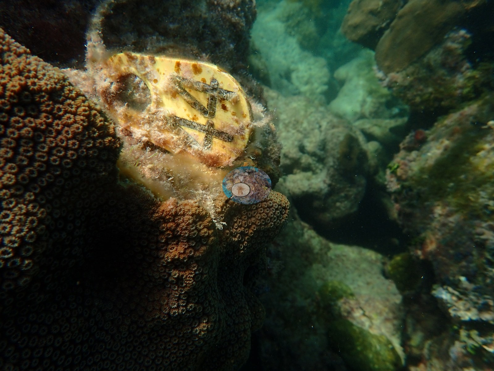
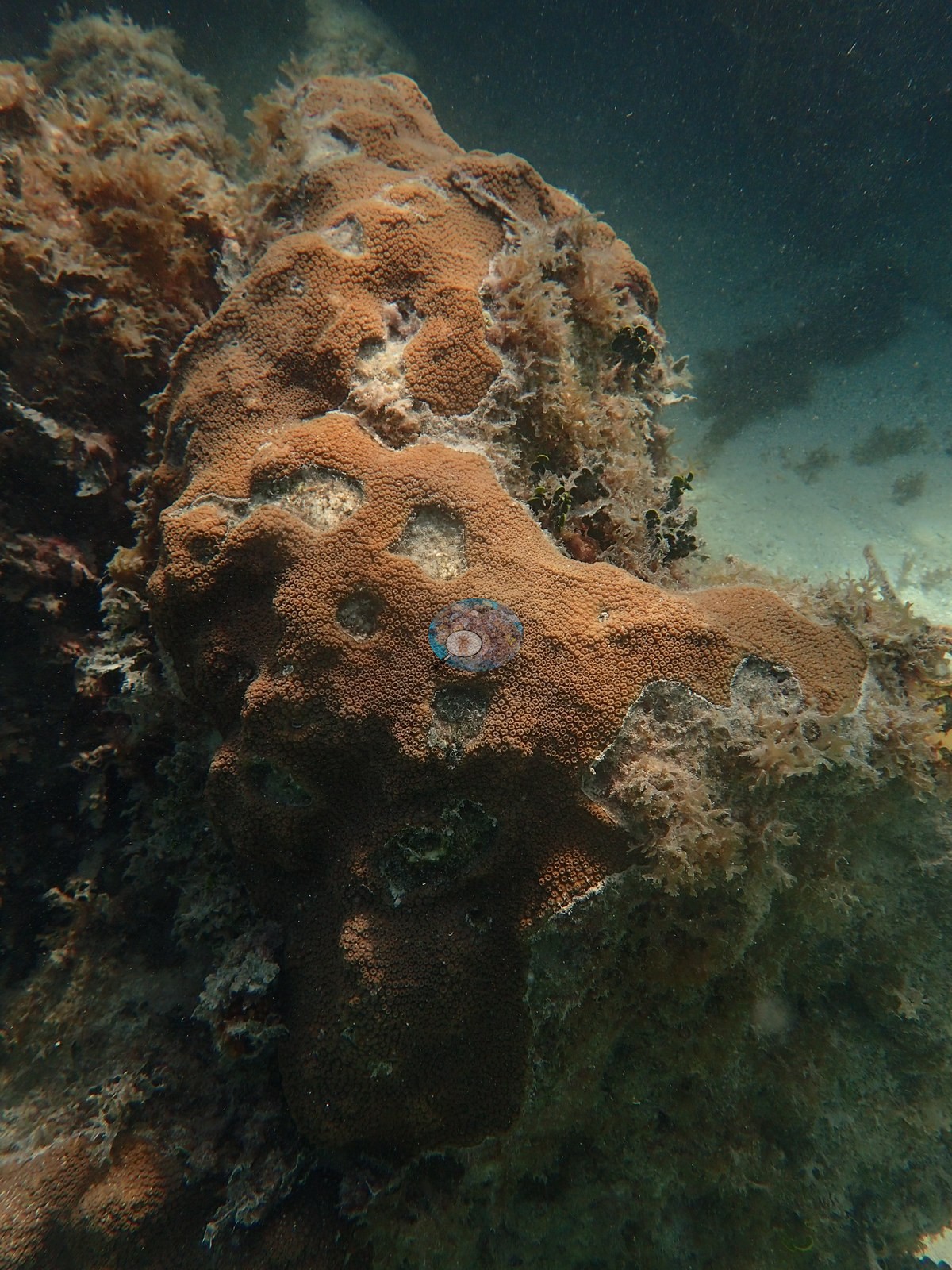
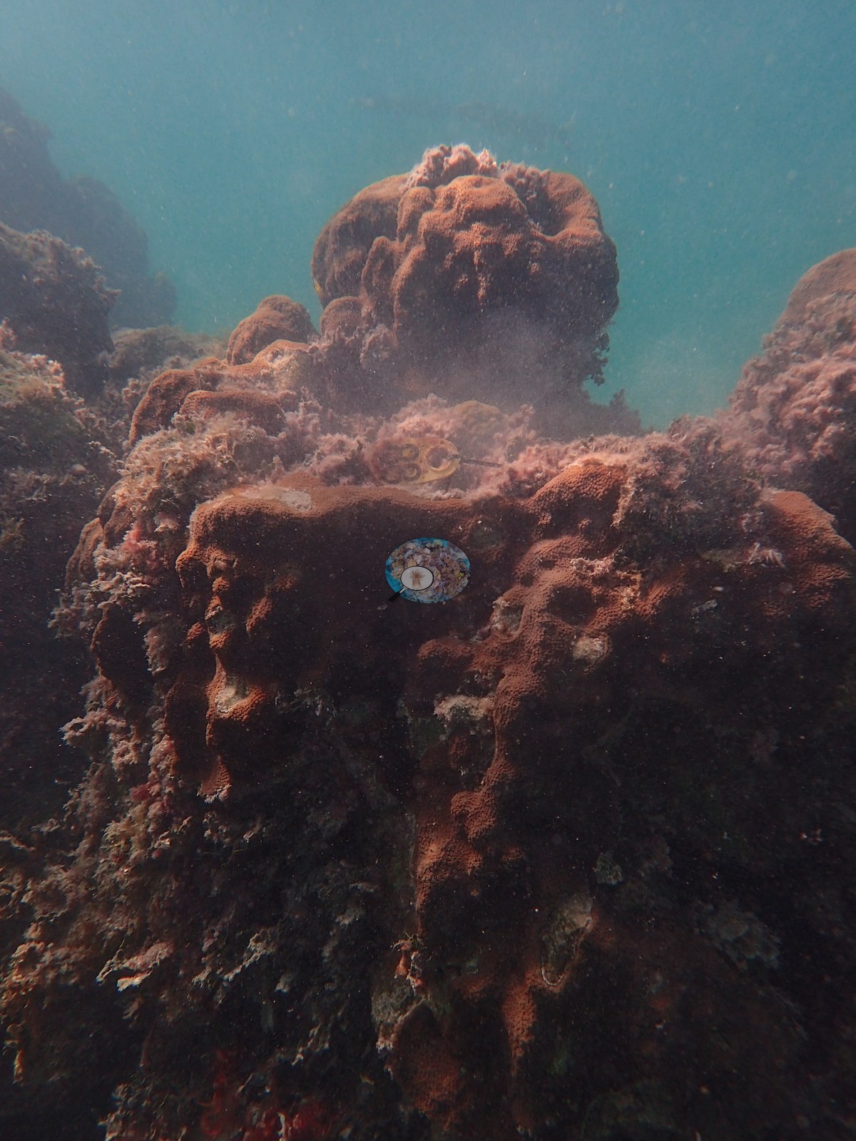
Florida Keys (NOAA CRW virtual station)An Upper Keys inshore patch reef and one of Anderson's four NOAA study sites, with colonies tagged by the NOAA AOML team in July 2017 and resampled by Anderson in 2019. Its massive corals show tissue loss: a large Siderastrea siderea dome with a fresh tissue-loss margin beside a turf- and sediment-covered dead patch, and a tagged colony so overgrown by turf and macroalgae that living tissue survives only on its crest.
Twelve independent survey stations shown with the program’s logo — click one to see how far it is from this site.
One other CRD dive site with its own page within 5 km shown in orange — click a marker to open its page.
Site description
Setting
The Rocks is an Upper Keys inshore patch reef, one of the four NOAA/FKNMS research sites with colonies tagged and genotyped by the NOAA AOML team in July 2017, which Anderson resampled in 2019 for the work published as Mayfield et al. 2021–2023.
General benthic features
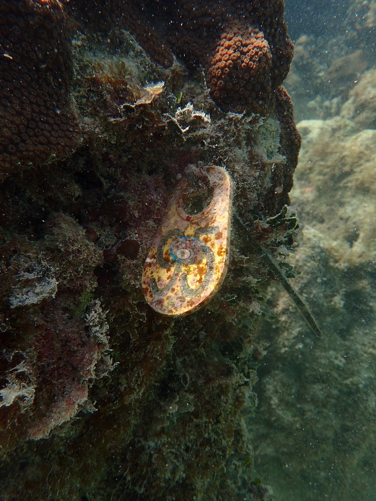
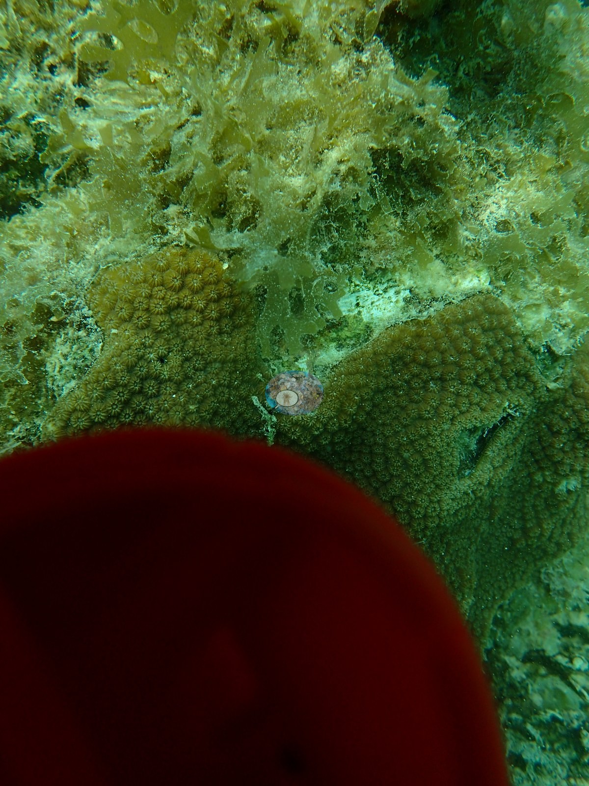
The photographs show a working monitoring station rather than a scenic reef. Scattered mounding Orbicella faveolata and Montastraea cavernosa heads and Siderastrea siderea domes sit on low limestone hardground, and the space between them, and much of the rock itself, is blanketed in thick red and brown fleshy macroalgae — in places the algae fills the foreground completely and the reef is only inferable from the fish above it.
Coral cover
- Coral cover: 9.3% (August 2016), from the NOAA NCRMP and NOAA AOML photo-transect survey of this reef published by Manzello et al. (2019, Global Change Biology) — 40 frames on two 10 m transects, point-counted. Macroalgae and turf covered over 80% of the benthos.
Stressors
Tagged study colonies are conspicuous: several carry rows of circular biopsy core holes, one colony, photographed with a fluorescent hammer for scale, is so overgrown by turf and fleshy macroalgae that living tissue survives only as a patch on the crest, and a temperature or light logger sits fouled on rebar stakes among the corals. Two condition observations are Anderson's own field calls. A large Siderastrea siderea dome, recorded as dying (October 2019), has an active tissue-loss margin: a band of clean white, freshly exposed skeleton separates its live tissue from a large turf- and sediment-covered dead patch (cause unclear). Tagged colony 3975 was pale cream all over in August 2019 (Anderson noted it as paling), when the dive-average water temperature was 31.6°C. A second knobby colony photographed on the same 21 August 2019 dive was paling too, its upper part cream-white over tan tissue: the same paling (partial bleaching) event (photo not shown). No corallivores were evident.
Fish and other fauna
Fish are abundant despite all this: a school of Atlantic spadefish over dense French grunts, sergeant majors, and three Caribbean spiny lobsters under an algae-covered ledge.
Comparisons with other data
Apart from the NOAA survey shown here, we found no other surveys at this site as of 2026. Within 5 km, twelve independent stations (NOAA NCRMP, NOAA NCRMP Florida, and Reef Check) recorded station-year means of 0.0–37% hard coral cover between 1997 and 2024; the nearest, NOAA NCRMP at FLK-436, 0.46 km away, read 10% in 2016.
Dive record
Anderson logged four dives here in 2019 (10 July, 21 August, 9 October, 4 December; 4.3 m maximum, 24.5–31.6°C (dive averages) — the August water was over 31°C).
Coral cover score card
This site is listed in a stand-alone coral cover score card.
Dive history
| Date | Time in | Max depth (m) | Bottom time (min) |
|---|---|---|---|
| 2019-07-10 | 15:53 | 4.3 | 36 |
| 2019-08-21 | 16:19 | 4.3 | 28 |
| 2019-10-09 | 13:04 | 4.0 | 23 |
| 2019-12-04 | 12:44 | 4.0 | 21 |
Independent surveys nearby
| Agency / program | Year(s) | Stations / distance | Link |
|---|---|---|---|
| NOAA NCRMP | 2014–2016 | 8 stations, 0.46–4.93 km | Records ↓ |
| NOAA NCRMP Florida | 2024 | 2 stations, 1.16–2.72 km | Records ↓ |
| Reef Check | 1997–1999 | 2 stations, 2.21–2.27 km | Records ↓ |
Within 5 km, 12 independent survey stations recorded hard coral cover in 14 records between 1997 and 2024. Of the 2 stations surveyed in more than one year, 1 declined (by 26 points) and 1 increased (by 9.0 points) between their first and latest surveys. The longest record, FLK-211 (NOAA NCRMP, 1.54 km away), went from 36% in 2014 to 10% in 2016. Since 2021, station-year means average 0.5% (range 0.0–1.0%; n = 2 station-years from 2 records). This site's headline survey value (9.3%) sits 8.3 points above the recent value up to 2 km away (1.0%); the methods differ, so the comparison is context, not a like-for-like test.
Collected by other programs using different methods (Reef Check uses point-intercept transects; NOAA rows come from NOAA monitoring programs (NCRMP, PIFSC, NCCOS), and each row's method is in its hover text), so these are context for the figures above, not a like-for-like comparison. Where a station was surveyed more than once, the cell shows either the range of its values or, as a single value, the mean of surveys made in one year. Station names are not dive-site names.
Show all 14 independent survey records
| Agency | Site / location | Date | Hard coral cover (%) | Distance | Link |
|---|---|---|---|---|---|
| Reef Check | Hens and Chickens | 1997–1998 | 28–37% (2 surveys) | 2.27 km | — |
| Reef Check | Hens and Chickens Reef 2 | 1999 | 20% | 2.21 km | — |
| NOAA NCRMP | FLK-213 | 2014 | 25% | 0.91 km | — |
| NOAA NCRMP | FLK-211 | 2014–2016 | 10–36% (range of yearly means; 2 records) | 1.54 km | — |
| NOAA NCRMP | FLK-212 | 2014 | 14% | 1.54 km | — |
| NOAA NCRMP | FLK-210 | 2014 | 22% | 2.65 km | — |
| NOAA NCRMP | FLK-247 | 2014 | 2.0% | 4.93 km | — |
| NOAA NCRMP | FLK-246 | 2014 | 0.0% | 4.93 km | — |
| NOAA NCRMP | FLK-248 | 2015 | 6.0% | 4.86 km | — |
| NOAA NCRMP | FLK-436 | 2016 | 10% | 0.46 km | — |
| NOAA NCRMP Florida | FLK PSU 1006-1 | 2024 | 1.0% | 1.16 km | NCEI 0306238 |
| NOAA NCRMP Florida | FLK PSU 1007-1 | 2024 | 0.0% | 2.72 km | NCEI 0306238 |
Data & links
All images from Coral Reef Diagnostics. Data are from Coral Reef Diagnostics and the organizations named in the data sources above.
 © Coral Reef Diagnostics.