
NOAA - MacArthur Causeway North (Urban Corals), Miami
Part of the regional summary: USA - Florida
More info
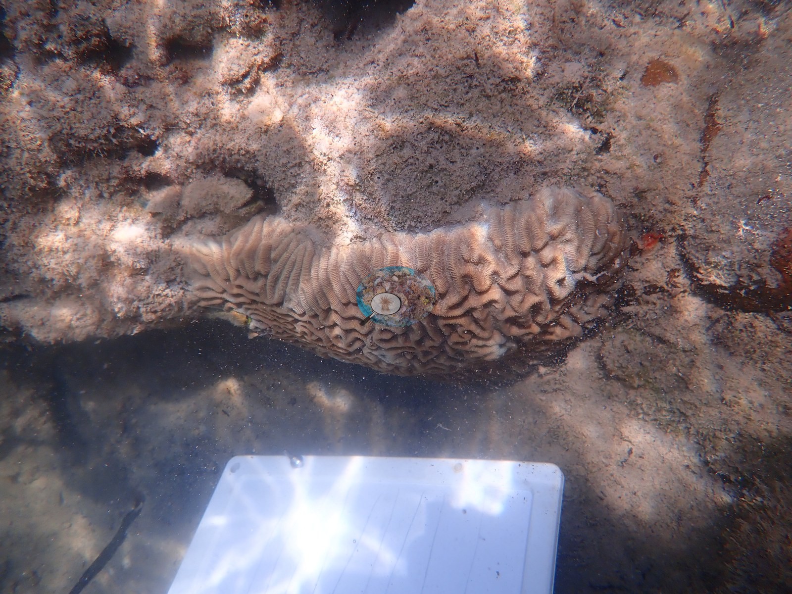
Southeast Florida (NOAA CRW virtual station)A Port of Miami urban-corals site where Anderson sampled 10 Pseudodiploria strigosa colonies on 26 June 2019 (the sample sheet); the Urban Corals gene-expression study (Rubin et al. 2021) reports a separate collection of 10 colonies here on 14 February 2020. The log calls this side of the causeway 'more like a trash-strewn mangrove swamp'. The camera battery died on the dive, so no habitat photos or coral-cover figure exist for this site.
One independent survey station shown with the program’s logo — click one to see how far it is from this site.
Three other CRD dive sites with their own pages within 5 km shown in orange — click a marker to open its page.
Site description
Coral cover
- There are no habitat photographs — the camera battery died on this dive, so only a single frame survives — and no benthic transect survey covers this site, so no coral-cover value is reported for it.
Stressors
Anderson's log describes this side of the causeway as 'more like a trash-strewn mangrove swamp', and the sample sheet notes some mortality on one sampled colony (MACN2), one colony that 'almost looks dead, dirt-colored, though oozed mucous when sampled' (MACN7), and several beige, mud-colored, or dirt-colored colonies (MACN3, MACN8, MACN10).
Comparisons with other data
Rubin et al. (2021) is a coral gene-expression study and reports no benthic cover for this site.
Dive record
Anderson sampled 10 Pseudodiploria strigosa colonies here on 26 June 2019 (the sample sheet, MACN1-MACN10). The Urban Corals study reports a separate collection at this site: tissue from 10 P. strigosa colonies on 14 February 2020 (Rubin et al. 2021, Frontiers in Marine Science 8:695236).
Other notes
The photographs that survive describe those sampled colonies, not the reef (e.g., Image 1).
Dive history
| Date | Time in | Max depth (m) | Bottom time (min) |
|---|---|---|---|
| 2019-06-26 | 14:56 | 1.8 | 2 |
| 2019-06-26 | 15:10 | 1.5 | — |
Independent surveys nearby
Within 5 km, 1 independent survey station recorded hard coral cover in 2024. One survey since 2021 recorded 0.0%.
Collected by other programs using different methods (NOAA rows come from NOAA monitoring programs (NCRMP, PIFSC, NCCOS), and each row's method is in its hover text), so these are context for the figures above, not a like-for-like comparison. Where a station was surveyed more than once, the cell shows either the range of its values or, as a single value, the mean of surveys made in one year. Station names are not dive-site names.
| Agency | Site / location | Date | Hard coral cover (%) | Distance | Link |
|---|---|---|---|---|---|
| NOAA NCRMP Florida | SEFCRI PSU 3094-1 | 2024 | 0.0% | 4.22 km | NCEI 0306238 |
Data & links
All images from Coral Reef Diagnostics. Data on this page are from Coral Reef Diagnostics (the dive record) and the organizations named in the data sources above; Coral Reef Diagnostics has no coral cover estimate of its own at this site.
© Coral Reef Diagnostics.