
Taiwan

Overview of 14 dive sites (13 with their own page). Figures are averages across the sites that report them (n = sites with a value); each site's own page has its individual values. Regional summaries: Taiwan (mainland + offshore islands), Dongsha.
⬇ Download this overview as a report card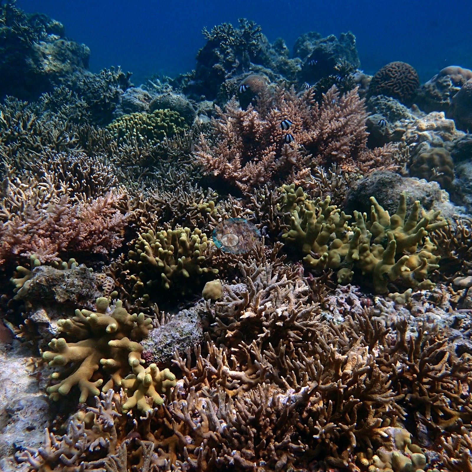

Heat stress
Long-term record: 13 years from 1985 through 2025 reached 8 or more °C-weeks at NOAA’s Dongsha, Taiwan, Southern Taiwan stations. Download the annual DHW data (CSV): south-kuroshio, south-china-sea-oceanic-islands.
14 sites in this region — click a marker to open that site.
Overview
Taiwan lies well north of the main reef belt, but Spalding et al. (2001) record well-developed coral communities along its southern coast and around its offshore islands, sustained by the Kuroshio Current, whose influence weakens in winter under the Northeast Monsoon. About 300 hard coral species and 1,200 fish species are recorded for the island. Well-known mainland reefs include the fringing communities of the Hengchun Peninsula and Kenting National Park, established in 1982, broken into a discontinuous chain by sand channels and varying markedly in fauna from place to place, with some areas dominated by alcyonarians; about 250 scleractinian species in 58 genera have been recorded there. Hsiao-Liu-Chiu has diverse fringing reefs, and the volcanic islands of Lan-Yu and Lu-Tao off the east coast sit in the path of the Kuroshio. The atlas estimates about 940 km² of coral reef for Taiwan as a whole. Dongsha is treated separately, in a section shared with the Spratly and Paracel Islands: a large submerged atoll in the northern South China Sea carrying a single island, with more than 70 coral species recorded, sovereignty disputed between China and Taiwan, and no separate reef-area estimate given.
This page covers 14 sites in two regional groups. Taiwan (mainland + offshore islands) holds eight: the Kenting/Nanwan coast at the island's southern tip, Hsiao Liouchiou off the southwest, and Green Island and five Lanyu (Orchid Island) sites off the southeast. Taiwan - Dongsha holds six: a regional atoll marker, four numbered research stations, and two dives on 6 April 2016 at a site whose position was not recorded. The two are a single page only because they are both Anderson's Taiwanese fieldwork; biogeographically they are not one system, and the classic account keeps them apart. The record is thin and of two kinds. The mainland and offshore-island sites are almost entirely dive logs from 2008 to 2011, with photographs at only one site, and no coral cover was measured anywhere in that group. The Dongsha sites are Dongsha Atoll Research Station work photographed on 4-6 April 2016, where pocilloporid corals were sampled in the search for heat-tolerant genotypes, and three of the four stations carry a value. Recorded maximum depths in the mainland group ran from 13.7 m at Green Island to 35.1 m at Yeyou on Lanyu; at Dongsha, Anderson's sample sheets give maximum dive depths of 4.0-12.8 m.
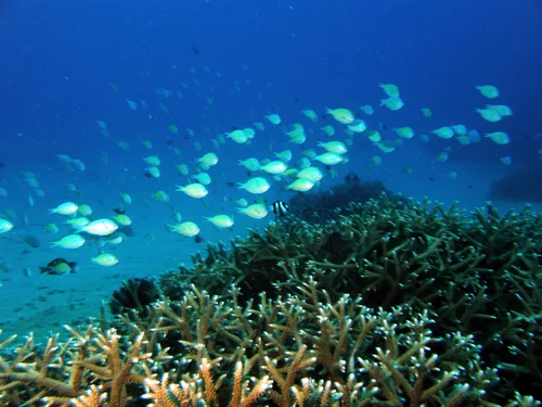
The Kenting/Nanwan record is the densest part of the record: a regional marker covering more than fifty logged dives from 3.7 m to 33.5 m between February 2008 and July 2011. They support Anderson's work comparing Seriatopora hystrix at cold-upwelling Houbihu with non-upwelling Houwan, and include collections of Seriatopora, Pocillopora damicornis, and Stylophora pistillata, a coral-spawning night dive, dives in a power-plant thermal outlet at roughly 30°C, and a dive near a sewage outfall where coral was overgrown by algae. Its photographs show a branching Acropora thicket at the edge of a silt-sand plain, a densely covered but turbid slope of stacked plating colonies with a large brain coral, and a steep plating wall hung with feather stars. Murky water is a recurring complaint in the logs. The offshore islands read very differently: four August 2008 dives at Green Island logged visibility of more than 45 m ('150 ft-plus'), soft coral meadows and '1,000 year old Porites colonies'; the Lanyu dives logged a 20 m ledge of high coral diversity with sea snakes at Yeyou, a fish-filled cavern and tunnel system at Blue Hole, coral caverns and 50 m visibility at Hen's Rock, and abundant hard coral south of Twin Lion Rocks.
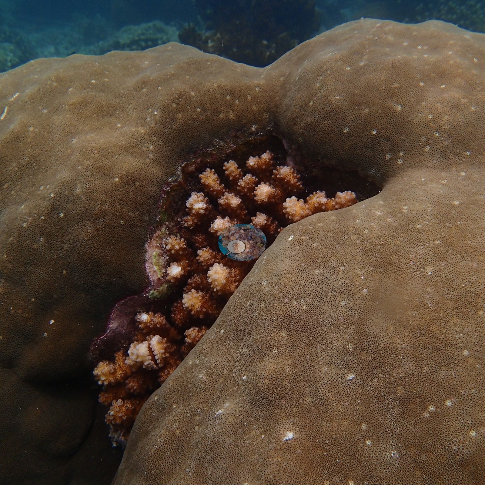
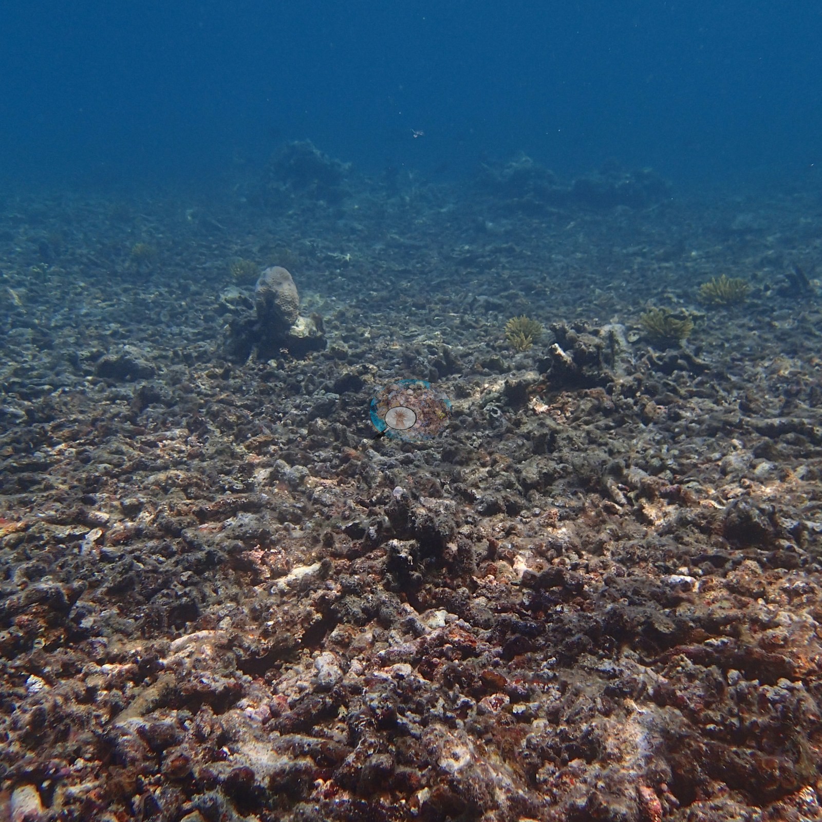
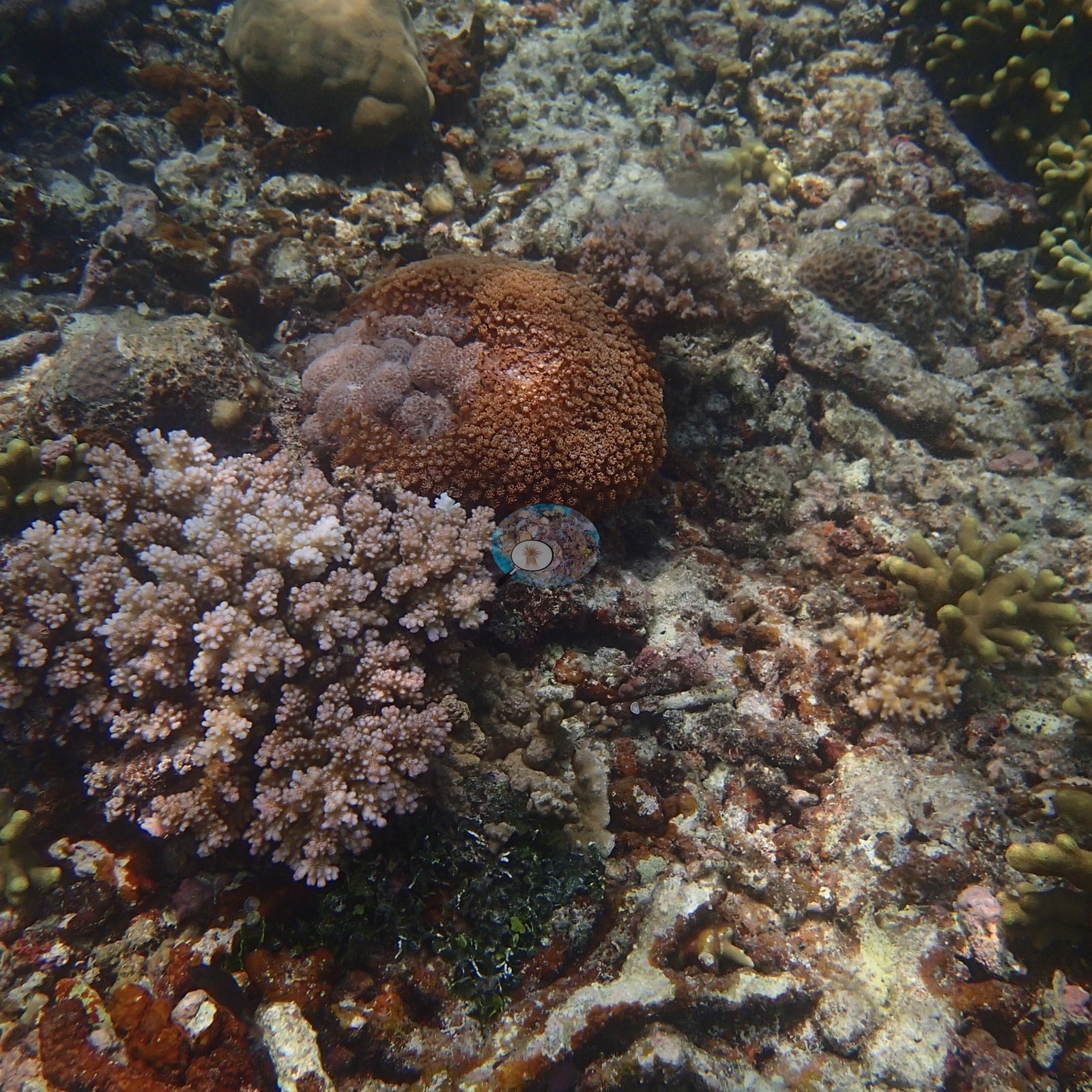
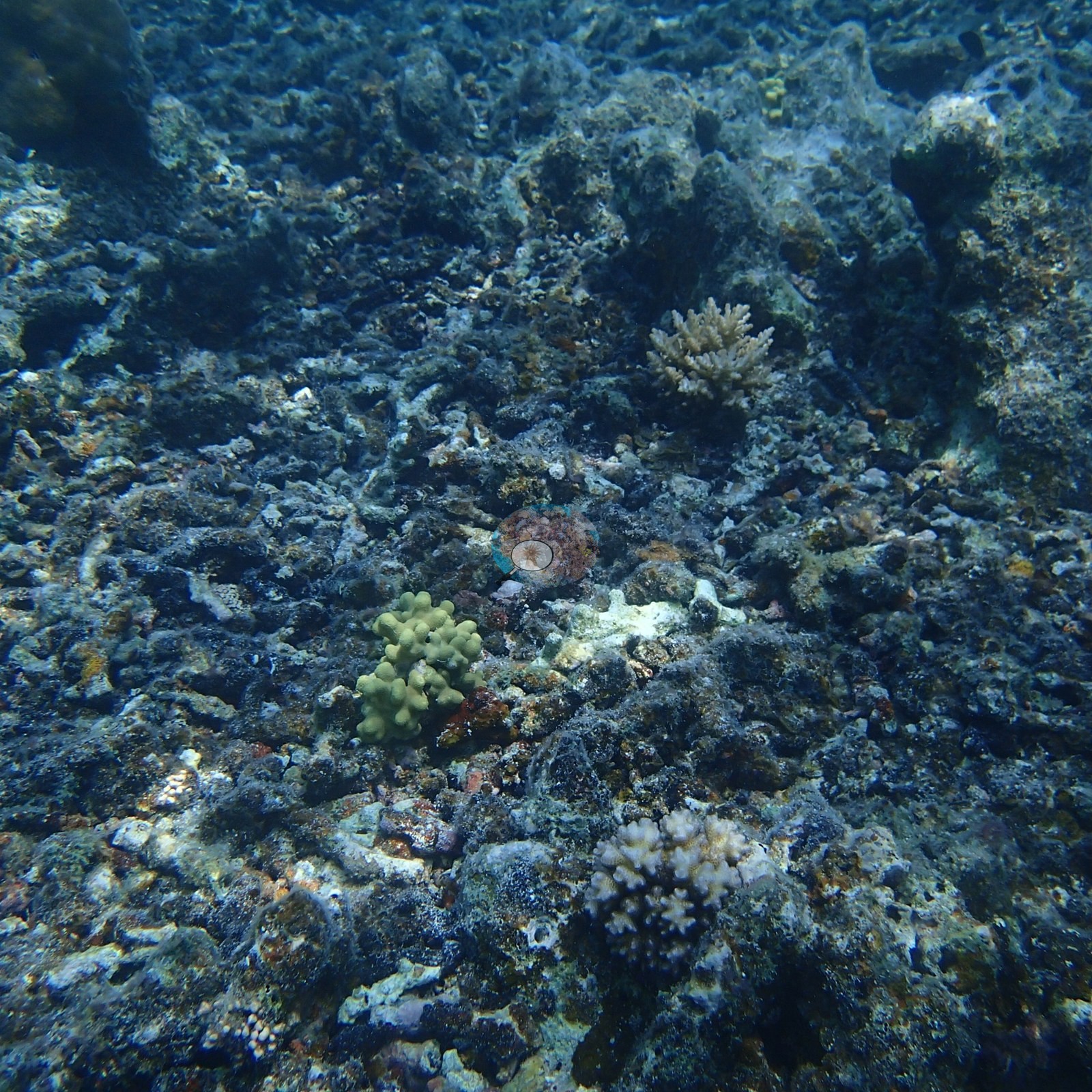
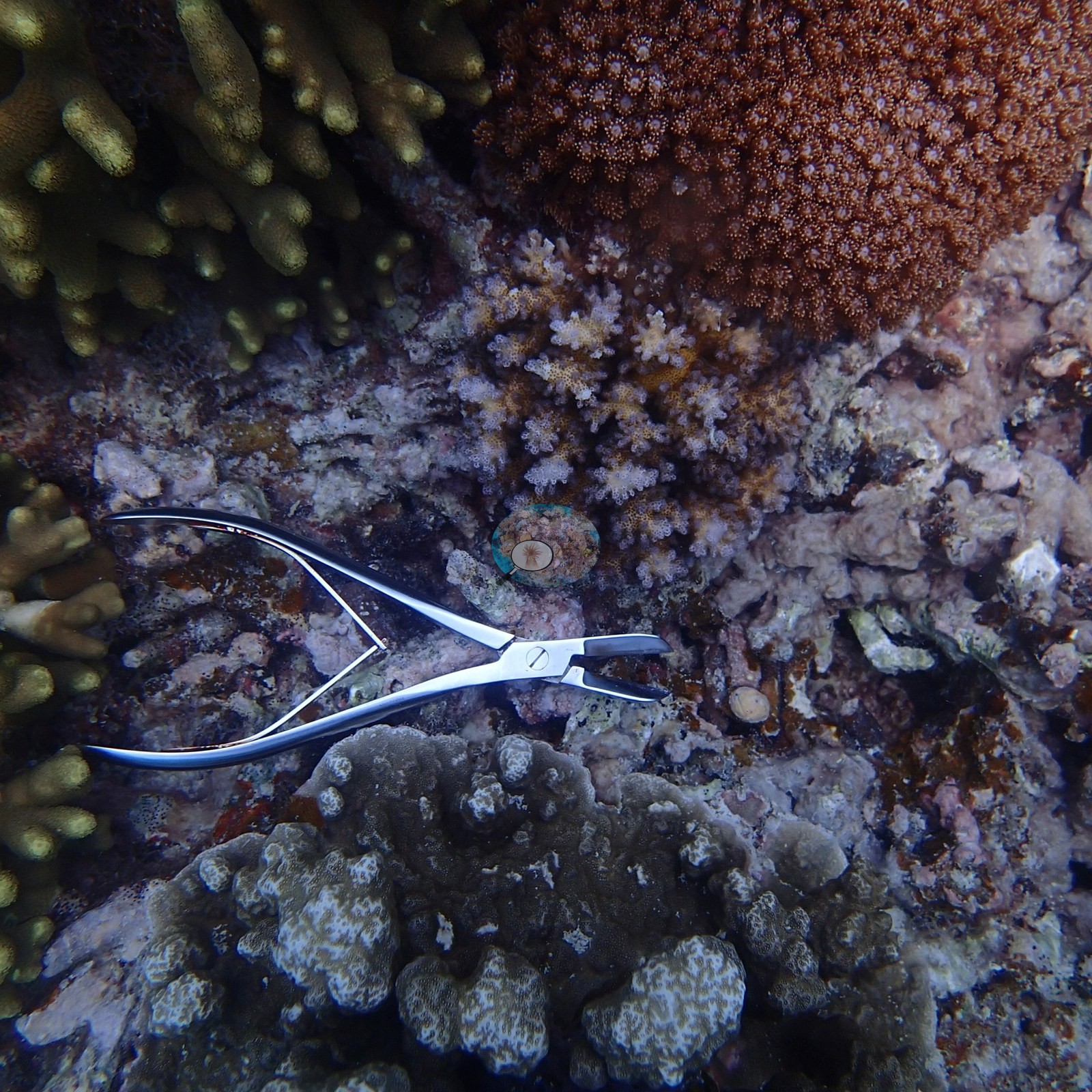
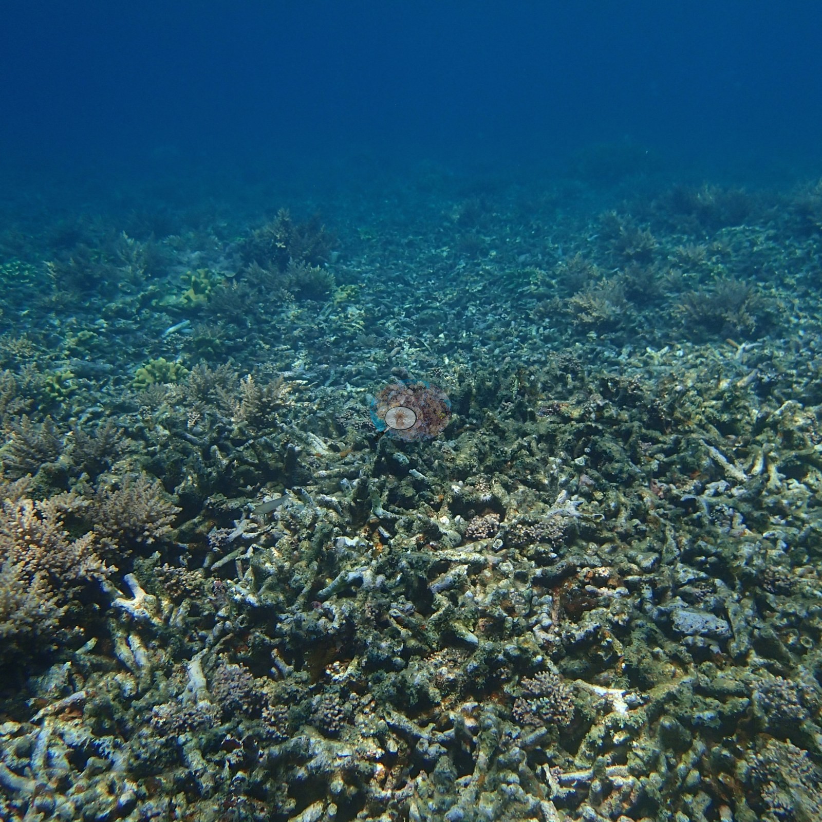
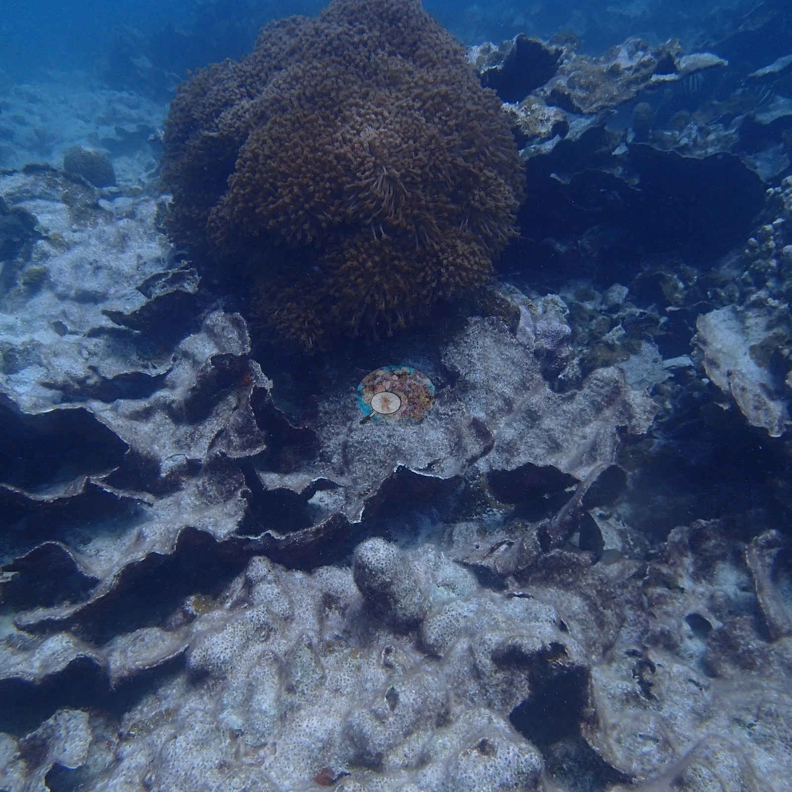
Dongsha is the only place on this page with measured numbers: blind Claude computer-vision point counts of 57% at Site 6, 54% at Site 13, 30% at Site 7, and 24% on the 6 April dives, from Anderson's photographs rather than transects. The stations are structurally varied. Site 13 is a vast, low bank of yellow-green to olive finger-form coral running to the limit of visibility, with giant massive Porites-type domes, one mushroom-shaped and deeply undercut, and tiered plate-coral pinnacles standing 2-3 m clear of the reef. Site 6 is a high-relief, near wall-to-wall hard coral reef of branching and tabular Acropora, meter-wide Porites domes, brain corals, red sea fans, and broad foliose plate fields, while the 6 April dives, at a position not recorded, found a lower, more turbid flat carpeted with hundreds of leathery soft corals. Site 7 is a mosaic of dense living coral banks separated by broad stretches of older, turf-coated dead rubble and pavement, and Site 12 is a field of thin, tiered foliose plates, most of them dead and silt-coated (the field sheet: mostly Echinopora rubble, low live cover), broken by a dense branching thicket.
The condition signal in the Dongsha frames is paling rather than anything sharper. Anderson's sample sheet records seven of the eight colonies sampled at Site 7 as healthy (one lightly pigmented) and, of the twelve at Site 13, one as about 20% bleached and another with 20% recent mortality; at Site 6 the sample sheet records storm damage and old partial mortality among the eight colonies sampled; and at Site 12 most of the foliose plates are dead and silt-coated (the field sheet: mostly Echinopora rubble, low live cover). No crown-of-thorns starfish, Drupella aggregations, or disease fronts were seen at Sites 6, 7 or 13, but derelict monofilament line was found on a Porites-type colony at Site 13, alongside one patch of recent tissue loss. On the mainland the recorded pressures are human and specific, from the Kenting log: coral overgrown by algae beside a sewage outfall, dives in a power-plant thermal outlet, and 2009 typhoon destruction of branching acroporids. Nearby Reef Check stations show how variable the setting is, from 46-67% hard coral within 2 km of Hen's Rock to 43-51% at Lion Couple Rock South, where the Twin Lion Rocks pin sits, and 18-22% near Houbihu in 2024-2025. Wilkinson (2006) found reefs near dense human activity in East and North Asia still declining while remote reefs recovered from 1998, and Souter et al. (2021), who do not report Taiwan's trends separately, list Taiwan among the places hit by severe bleaching in 2020.
Highlights
- Kenting/Nanwan hosts more than fifty logged dives between February 2008 and July 2011, behind Anderson's Seriatopora hystrix cold-upwelling work at Houbihu and Houwan.
- Dongsha Site 13 carries tiered plate-coral pinnacles 2-3 m tall above a vast digitate coral bank, and 54% coral cover from a blind Claude computer-vision point count.
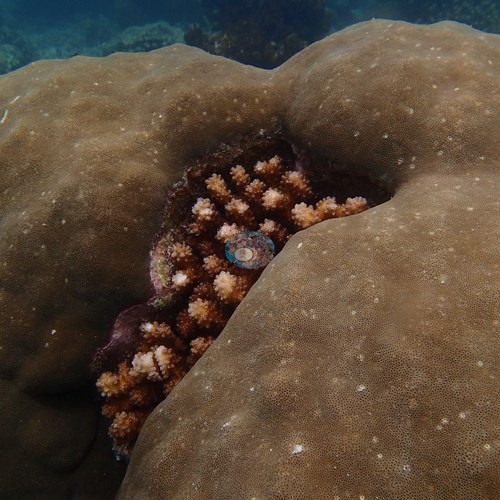 photo: Dongsha Atoll - Site 13
- Dongsha Site 6 is a high-relief hard coral reef; two dives the next day, at a position not recorded, crossed a soft-coral flat (April 2016).
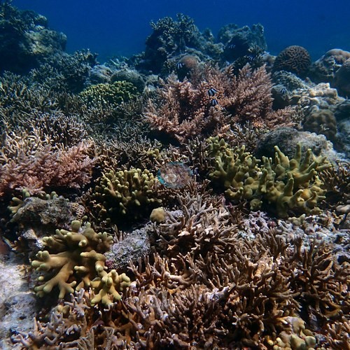 photo: Dongsha Atoll - Site 6 (branching)
- At Dongsha Site 7, Anderson's sample sheet records seven of the eight sampled colonies as healthy and one as lightly pigmented (April 2016).
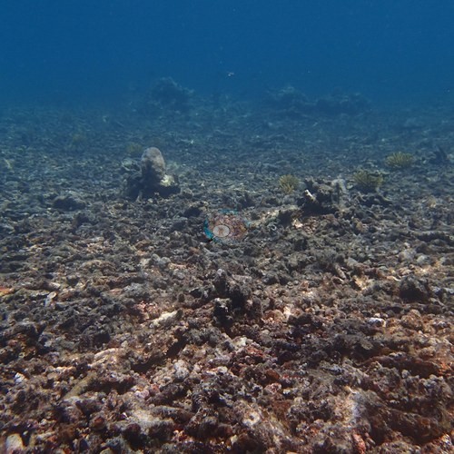 photo: Dongsha Atoll - Site 7 (branching)
- Anderson's Lanyu logs record sea snakes, coral caverns and 50 m visibility; the Green Island log records soft coral meadows and very old Porites colonies.
- The Kenting log records coral overgrown by algae beside a sewage outfall, dives in a power-plant thermal outlet at roughly 30°C, and typhoon destruction of branching acroporids in 2009.
- Derelict monofilament fishing line on a coral colony at Dongsha Site 13.
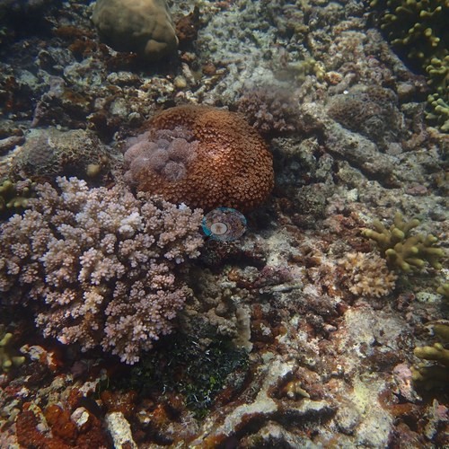 photo: Dongsha Atoll - Site 13
- No coral cover has been measured at any of the eight mainland and offshore-island sites; nearby Reef Check values there range from 6.3% to 67%.
Notable observations
- Dongsha Atoll - Site 7 (branching): Sample sheet: seven of the eight sampled colonies healthy, one lightly pigmented; extensive old, turf-coated dead rubble pavement. No crown-of-thorns starfish, Drupella aggregations, disease lesion fronts, or predation scars in any of the 47 frames.
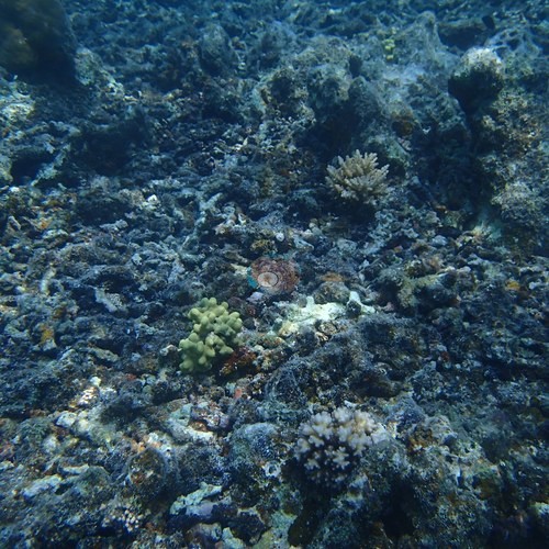
- Dongsha Atoll - Site 13: Derelict gear and tissue loss: monofilament fishing line draped across a knobby Porites-type colony with pale contact patches, and recent partial tissue loss (bare white skeleton with a sharp margin) on a massive dome, cause not determinable; Anderson's sample sheet records one of the twelve sampled colonies as about 20% bleached and another with 20% recent mortality. No crown-of-thorns, Drupella, or disease fronts in any of the 63 frames.
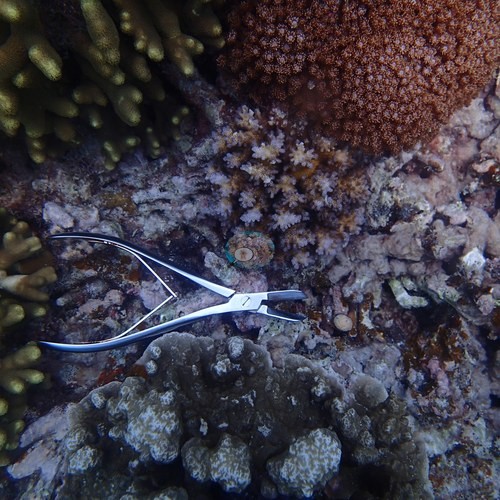
- Dongsha Atoll - Site 6 (branching): Old, consolidated dead branching rubble; Anderson's sample sheet records storm damage and old partial mortality among the eight sampled colonies. No crown-of-thorns starfish, Drupella aggregations, or disease lesion fronts in any of the 123 frames.
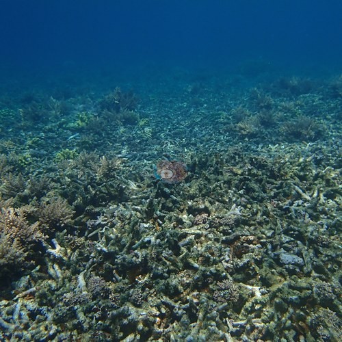
- Dongsha Atoll - Site 12: Most foliose plates dead and silt-coated (the field sheet: mostly Echinopora rubble, low live cover).
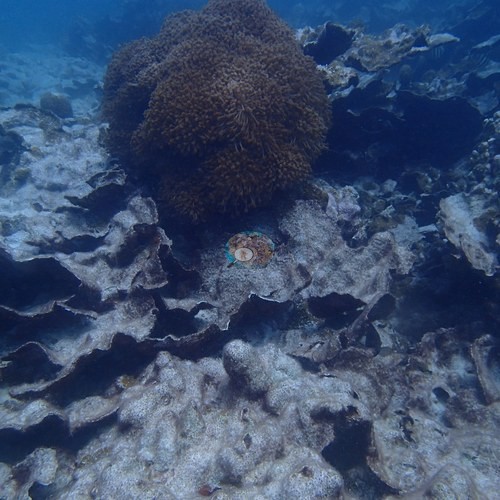
- Taiwan - Kenting / Nanwan (mainland): Human pressures from Anderson's log: coral overgrown by algae beside a sewage outfall, dives in a power-plant thermal outlet at roughly 30°C, and 2009 typhoon destruction of branching acroporids. One of Anderson's frames, recorded at the time as bleaching, shows partial bleaching of a large massive coral (photo not shown); no disease or predation is resolvable in the photographs.

Coral cover over time (pooled)
Sites in this region (14)
- Dongsha Atoll - Site 12
- Dongsha Atoll - Site 13 — 54%† coral cover
- Dongsha Atoll - Site 6 (branching) — 57%† coral cover
- Dongsha Atoll - Site 7 (branching) — 30%*† coral cover
- Dongsha, 6 April 2016 — 24%† coral cover
- Taiwan - Dongsha / Pratas Atoll (South China Sea)
- Taiwan - Green Island (Ludao, offshore) — 38% (nearest station surveyed in the last 10 years, not this site: Reef Check, Chenshiang station, 2019-04-11, 1.70 km away)
- Taiwan - Hsiao Liouchiou Island (north shore) — 19% (nearest station surveyed in the last 10 years, not this site: Reef Check, Beauty Cave station, mean of 2 surveys (5 m and 10 m), 2019-10-30, 0.97 km away)
- Taiwan - Kenting / Nanwan (mainland) — 15% (nearest survey station, not this site: XL Catlin Seaview Survey, transect 42011 station, 2018-05-03, 0.71 km away)
- Taiwan - Lanyu (Orchid Island): Blue Hole (Yeyou large boat harbor) — 48% (nearest station surveyed in the last 10 years, not this site: Reef Check, Beauty Rock station, mean of 2 surveys (5 m and 10 m), 2019-06-30, 1.94 km away; the station's published position is on land)
- Taiwan - Lanyu (Orchid Island): Hen's Rock (north shore) — 57% (survey at this site: Reef Check, Hen Rock station, mean of 2 surveys (5 m and 10 m), 2019-06-30, 0.00 km away)
- Taiwan - Lanyu (Orchid Island): Lion's Head Rock — 44% (nearest station surveyed in the last 10 years, not this site: Reef Check, Nipple Mountain station, mean of 2 surveys (5 m and 10 m), 2017-06-10, 1.96 km away)
- Taiwan - Lanyu (Orchid Island): South of Twin Lion Rocks — 43% (survey at this site: Reef Check, Lion Couple Rock South station, mean of 2 surveys (5 m and 10 m), 2019-06-30, 0.00 km away)
- Taiwan - Lanyu (Orchid Island): Yeyou
* Based on only 10–19 reef-habitat photos; this estimate is less certain.
† Includes unedited photographs: edited versions of most of this dive's photos do not exist.
Nearby external survey stations
245 independent survey records within 5 km of a site in this region (each record counted once; 139 lines, and a line that pools several records says how many).
Show all 245 records
- Meng et al. (Kenting monitoring, unpublished) — Nuclear power plant outlet, left (出水口左) (2003): 10% hard coral cover, mean of 3 transects, 2.28 km from Taiwan - Kenting / Nanwan (mainland)
- Meng et al. (Kenting monitoring, unpublished) — Nuclear power plant outlet, left (出水口左) (2004): 9.6% hard coral cover, mean of 3 transects, 2.28 km from Taiwan - Kenting / Nanwan (mainland)
- Meng et al. (Kenting monitoring, unpublished) — Nuclear power plant outlet, left (出水口左) (2005): 12% hard coral cover, mean of 3 transects, 2.28 km from Taiwan - Kenting / Nanwan (mainland)
- Meng et al. (Kenting monitoring, unpublished) — Nuclear power plant outlet, left (出水口左) (2006): 6.6% hard coral cover, mean of 3 transects, 2.28 km from Taiwan - Kenting / Nanwan (mainland)
- Meng et al. (Kenting monitoring, unpublished) — Nuclear power plant outlet, right (出水口右) (2003): 8.7% hard coral cover, mean of 3 transects, 2.28 km from Taiwan - Kenting / Nanwan (mainland)
- Meng et al. (Kenting monitoring, unpublished) — Nuclear power plant outlet, right (出水口右) (2004): 12% hard coral cover, mean of 3 transects, 2.28 km from Taiwan - Kenting / Nanwan (mainland)
- Meng et al. (Kenting monitoring, unpublished) — Nuclear power plant outlet, right (出水口右) (2005): 9.2% hard coral cover, mean of 3 transects, 2.28 km from Taiwan - Kenting / Nanwan (mainland)
- Meng et al. (Kenting monitoring, unpublished) — Nuclear power plant outlet, right (出水口右) (2006): 7.2% hard coral cover, mean of 3 transects, 2.28 km from Taiwan - Kenting / Nanwan (mainland)
- Meng et al. (Kenting monitoring, unpublished) — Tiaoshi (跳石) (2003): 29% hard coral cover, mean of 3 transects, 2.34 km from Taiwan - Kenting / Nanwan (mainland)
- Meng et al. (Kenting monitoring, unpublished) — Tiaoshi (跳石) (2004): 32% hard coral cover, mean of 3 transects, 2.34 km from Taiwan - Kenting / Nanwan (mainland)
- Meng et al. (Kenting monitoring, unpublished) — Tiaoshi (跳石) (2005): 38% hard coral cover, mean of 3 transects, 2.34 km from Taiwan - Kenting / Nanwan (mainland)
- Meng et al. (Kenting monitoring, unpublished) — Tiaoshi (跳石) (2006): 31% hard coral cover, mean of 3 transects, 2.34 km from Taiwan - Kenting / Nanwan (mainland)
- Reef Check — Beauty Cave (2009): 10% hard coral cover, mean of 2 surveys (5 m and 10 m), 0.35 km from Taiwan - Hsiao Liouchiou Island (north shore) (2 records)
- Reef Check — Beauty Cave (2010): 9.4% hard coral cover, mean of 2 surveys (5 m and 10 m), 1.02 km from Taiwan - Hsiao Liouchiou Island (north shore) (2 records)
- Reef Check — Beauty Cave (2014): 25% hard coral cover, mean of 2 surveys (5 m and 10 m), 0.97 km from Taiwan - Hsiao Liouchiou Island (north shore) (2 records)
- Reef Check — Beauty Cave (2015): 32% hard coral cover, mean of 2 surveys (5 m and 10 m), 0.97 km from Taiwan - Hsiao Liouchiou Island (north shore) (2 records)
- Reef Check — Beauty Cave (2016): 23% hard coral cover, mean of 2 surveys (5 m and 10 m), 1.25 km from Taiwan - Hsiao Liouchiou Island (north shore) (2 records)
- Reef Check — Beauty Cave (2017): 26% hard coral cover, mean of 2 surveys, 0.97 km from Taiwan - Hsiao Liouchiou Island (north shore) (2 records)
- Reef Check — Beauty Cave (2018): 25% hard coral cover, mean of 2 surveys (5 m and 10 m), 0.97 km from Taiwan - Hsiao Liouchiou Island (north shore) (2 records)
- Reef Check — Beauty Cave (2019): 19% hard coral cover, mean of 2 surveys (5 m and 10 m), 0.97 km from Taiwan - Hsiao Liouchiou Island (north shore) (2 records)
- Reef Check — Beauty Rock (2016): 67% hard coral cover, mean of 2 surveys (5 m and 10 m), 3.31 km from Taiwan - Lanyu (Orchid Island): Blue Hole (Yeyou large boat harbor) (2 records)
- Reef Check — Beauty Rock (2017): 50% hard coral cover, mean of 2 surveys, 1.94 km from Taiwan - Lanyu (Orchid Island): Blue Hole (Yeyou large boat harbor) (2 records)
- Reef Check — Beauty Rock (2018): 49% hard coral cover, mean of 2 surveys (5 m and 10 m), 1.94 km from Taiwan - Lanyu (Orchid Island): Blue Hole (Yeyou large boat harbor) (2 records)
- Reef Check — Beauty Rock (2019): 48% hard coral cover, mean of 2 surveys (5 m and 10 m), 1.94 km from Taiwan - Lanyu (Orchid Island): Blue Hole (Yeyou large boat harbor) (2 records)
- Reef Check — Chaikou (2008): 34% hard coral cover, mean of 2 surveys (5 m and 9 m), 2.24 km from Taiwan - Green Island (Ludao, offshore) (2 records)
- Reef Check — Chaikou (2009): 50% hard coral cover, mean of 2 surveys (5 m and 10 m), 2.24 km from Taiwan - Green Island (Ludao, offshore) (2 records)
- Reef Check — Chaikou (2010): 38% hard coral cover, mean of 2 surveys (5 m and 10 m), 2.48 km from Taiwan - Green Island (Ludao, offshore) (2 records)
- Reef Check — Chaikou (2014): 51% hard coral cover, mean of 2 surveys (5 m and 10 m), 2.29 km from Taiwan - Green Island (Ludao, offshore) (2 records)
- Reef Check — Chaikou (2015): 49% hard coral cover, mean of 2 surveys (5 m and 10 m), 2.13 km from Taiwan - Green Island (Ludao, offshore) (2 records)
- Reef Check — Chaikou (2016): 46% hard coral cover, mean of 2 surveys (5 m and 10 m), 2.29 km from Taiwan - Green Island (Ludao, offshore) (2 records)
- Reef Check — Chaikou (2017): 58% hard coral cover, mean of 2 surveys (5 m and 10 m), 2.13 km from Taiwan - Green Island (Ludao, offshore) (2 records)
- Reef Check — Chaikou (2018): 60% hard coral cover, mean of 2 surveys (5 m and 10 m), 2.29 km from Taiwan - Green Island (Ludao, offshore) (2 records)
- Reef Check — Chenshiang (2019): 38% hard coral cover, 1.70 km from Taiwan - Green Island (Ludao, offshore)
- Reef Check — Dabaisha (2016): 52% hard coral cover, mean of 2 surveys (5 m and 10 m), 2.50 km from Taiwan - Green Island (Ludao, offshore) (2 records)
- Reef Check — Dabaisha (2018): 24% hard coral cover, mean of 2 surveys (5 m and 10 m), 2.50 km from Taiwan - Green Island (Ludao, offshore) (2 records)
- Reef Check — Dabaisha (2019): 24% hard coral cover, mean of 2 surveys (5 m and 10 m), 2.50 km from Taiwan - Green Island (Ludao, offshore) (2 records)
- Reef Check — Gateway Rock (2008): 32% hard coral cover, mean of 2 surveys (4.5 m and 10 m), 2.56 km from Taiwan - Green Island (Ludao, offshore) (2 records)
- Reef Check — Geban Bay (2009): 10% hard coral cover, mean of 2 surveys (5 m and 14 m), 2.56 km from Taiwan - Hsiao Liouchiou Island (north shore) (2 records)
- Reef Check — Geban Bay (2010): 6.9% hard coral cover, mean of 2 surveys (5 m and 10 m), 3.11 km from Taiwan - Hsiao Liouchiou Island (north shore) (2 records)
- Reef Check — GeeChang (1998): 6.3% hard coral cover, mean of 2 surveys (3 m and 10 m), 3.71 km from Taiwan - Lanyu (Orchid Island): Yeyou (2 records)
- Reef Check — General Rock (2010): 41% hard coral cover, mean of 2 surveys (5 m and 10 m), 2.09 km from Taiwan - Green Island (Ludao, offshore) (2 records)
- Reef Check — General Rock (2017): 40% hard coral cover, mean of 2 surveys (5 m and 10 m), 2.09 km from Taiwan - Green Island (Ludao, offshore) (2 records)
- Reef Check — Gong-guan (2010): 39% hard coral cover, mean of 2 surveys (5 m and 10 m), 1.97 km from Taiwan - Green Island (Ludao, offshore) (2 records)
- Reef Check — Gongguanbi (2017): 40% hard coral cover, mean of 2 surveys (5 m and 10 m), 2.20 km from Taiwan - Green Island (Ludao, offshore) (2 records)
- Reef Check — Haishen Flats (2008): 37% hard coral cover, mean of 2 surveys (4 m and 11 m), 2.18 km from Taiwan - Green Island (Ludao, offshore) (2 records)
- Reef Check — Hejie (2016): 43% hard coral cover, mean of 2 surveys, 3.98 km from Taiwan - Kenting / Nanwan (mainland) (2 records)
- Reef Check — Hejie (2017): 45% hard coral cover, mean of 4 surveys, 3.98 km from Taiwan - Kenting / Nanwan (mainland) (4 records)
- Reef Check — Hejie (2018): 43% hard coral cover, mean of 4 surveys, 3.98 km from Taiwan - Kenting / Nanwan (mainland) (4 records)
- Reef Check — Hejie (2019): 49% hard coral cover, mean of 4 surveys, 3.98 km from Taiwan - Kenting / Nanwan (mainland) (4 records)
- Reef Check — Hejie (2024): 31% hard coral cover, mean of 4 surveys, 3.98 km from Taiwan - Kenting / Nanwan (mainland) (4 records)
- Reef Check — Hejie (2025): 26% hard coral cover, mean of 4 surveys, 3.98 km from Taiwan - Kenting / Nanwan (mainland) (4 records)
- Reef Check — Hen Rock (2015): 62% hard coral cover, mean of 2 surveys (5 m and 10 m), 0.48 km from Taiwan - Lanyu (Orchid Island): Hen's Rock (north shore) (2 records)
- Reef Check — Hen Rock (2017): 50% hard coral cover, mean of 2 surveys (5 m and 10 m), 0.00 km from Taiwan - Lanyu (Orchid Island): Hen's Rock (north shore) (2 records)
- Reef Check — Hen Rock (2018): 63% hard coral cover, mean of 2 surveys (5 m and 10 m), 0.00 km from Taiwan - Lanyu (Orchid Island): Hen's Rock (north shore) (2 records)
- Reef Check — Hen Rock (2019): 57% hard coral cover, mean of 2 surveys (5 m and 10 m), 0.00 km from Taiwan - Lanyu (Orchid Island): Hen's Rock (north shore) (2 records)
- Reef Check — Hongtoe (1998): 8.8% hard coral cover, 2.26 km from Taiwan - Lanyu (Orchid Island): Blue Hole (Yeyou large boat harbor)
- Reef Check — Houbihu (2024): 18% hard coral cover, mean of 4 surveys, 1.52 km from Taiwan - Kenting / Nanwan (mainland) (4 records)
- Reef Check — Houbihu (2025): 22% hard coral cover, mean of 4 surveys, 1.52 km from Taiwan - Kenting / Nanwan (mainland) (4 records)
- Reef Check — Houshi (2010): 38% hard coral cover, mean of 2 surveys (5 m and 10 m), 3.97 km from Taiwan - Hsiao Liouchiou Island (north shore) (2 records)
- Reef Check — Houshi (2016): 7.2% hard coral cover, mean of 2 surveys (5 m and 10 m), 3.97 km from Taiwan - Hsiao Liouchiou Island (north shore) (2 records)
- Reef Check — Houshi (2018): 8.4% hard coral cover, mean of 2 surveys (5 m and 10 m), 3.97 km from Taiwan - Hsiao Liouchiou Island (north shore) (2 records)
- Reef Check — Houshi (2019): 6.6% hard coral cover, mean of 2 surveys (5 m and 10 m), 3.97 km from Taiwan - Hsiao Liouchiou Island (north shore) (2 records)
- Reef Check — Houshi Fringing Reef (2009): 27% hard coral cover, mean of 2 surveys (5 m and 10 m), 3.56 km from Taiwan - Hsiao Liouchiou Island (north shore) (2 records)
- Reef Check — Houshi Fringing Reef (2014): 42% hard coral cover, mean of 2 surveys (5 m and 10 m), 3.69 km from Taiwan - Hsiao Liouchiou Island (north shore) (2 records)
- Reef Check — Houshi Fringing Reef (2015): 51% hard coral cover, mean of 2 surveys (5 m and 10 m), 3.69 km from Taiwan - Hsiao Liouchiou Island (north shore) (2 records)
- Reef Check — Houshi Fringing Reef (2017): 13% hard coral cover, mean of 2 surveys (5 m and 10 m), 3.69 km from Taiwan - Hsiao Liouchiou Island (north shore) (2 records)
- Reef Check — Hutoupo (2014): 50% hard coral cover, mean of 2 surveys (5 m and 10 m), 1.58 km from Taiwan - Lanyu (Orchid Island): Yeyou (2 records)
- Reef Check — Jiangjunyan (2014): 56% hard coral cover, mean of 2 surveys (5 m and 10 m), 2.14 km from Taiwan - Green Island (Ludao, offshore) (2 records)
- Reef Check — Kungkuan (2009): 36% hard coral cover, mean of 2 surveys (5 m and 10 m), 1.99 km from Taiwan - Green Island (Ludao, offshore) (2 records)
- Reef Check — Land Temple/Earth God Temple (2016): 20% hard coral cover, mean of 2 surveys (5 m and 10 m), 1.78 km from Taiwan - Lanyu (Orchid Island): Blue Hole (Yeyou large boat harbor) (2 records)
- Reef Check — Langdao Harbor (2015): 46% hard coral cover, mean of 2 surveys (5 m and 10 m), 2.45 km from Taiwan - Lanyu (Orchid Island): Hen's Rock (north shore) (2 records)
- Reef Check — Lion Couple Rock (2010): 43% hard coral cover, mean of 2 surveys (3 m and 11 m), 0.18 km from Taiwan - Lanyu (Orchid Island): South of Twin Lion Rocks (2 records)
- Reef Check — Lion Couple Rock South (2018): 51% hard coral cover, mean of 2 surveys (5 m and 10 m), 0.00 km from Taiwan - Lanyu (Orchid Island): South of Twin Lion Rocks (2 records)
- Reef Check — Lion Couple Rock South (2019): 43% hard coral cover, mean of 2 surveys (5 m and 10 m), 0.00 km from Taiwan - Lanyu (Orchid Island): South of Twin Lion Rocks (2 records)
- Reef Check — Maiden Rock (2015): 57% hard coral cover, mean of 2 surveys (5 m and 10 m), 3.34 km from Taiwan - Lanyu (Orchid Island): Blue Hole (Yeyou large boat harbor) (2 records)
- Reef Check — Nanliao (1997): 22% hard coral cover, mean of 2 surveys (3 m and 10 m), 2.84 km from Taiwan - Green Island (Ludao, offshore) (2 records)
- Reef Check — Nanliao (1998): 7.7% hard coral cover, mean of 3 surveys (1 m, 3 m, and 10 m), 2.84 km from Taiwan - Green Island (Ludao, offshore) (3 records)
- Reef Check — Nipple Mountain (2017): 44% hard coral cover, mean of 2 surveys (5 m and 10 m), 1.96 km from Taiwan - Lanyu (Orchid Island): Lion's Head Rock (2 records)
- Reef Check — Reef Outside Airport (2009): 11% hard coral cover, mean of 2 surveys (3 m and 6 m), 3.71 km from Taiwan - Lanyu (Orchid Island): Lion's Head Rock (2 records)
- Reef Check — Shilang (2014): 18% hard coral cover, mean of 2 surveys (5 m and 10 m), 1.79 km from Taiwan - Green Island (Ludao, offshore) (2 records)
- Reef Check — Shilang (2015): 18% hard coral cover, mean of 2 surveys (5 m and 10 m), 1.95 km from Taiwan - Green Island (Ludao, offshore) (2 records)
- Reef Check — Shilang (2016): 13% hard coral cover, mean of 2 surveys (5 m and 10 m), 2.15 km from Taiwan - Green Island (Ludao, offshore) (2 records)
- Reef Check — Shilang (2018): 19% hard coral cover, mean of 2 surveys (5 m and 10 m), 2.15 km from Taiwan - Green Island (Ludao, offshore) (2 records)
- Reef Check — Shilang (2019): 16% hard coral cover, mean of 2 surveys (5 m and 10 m), 2.15 km from Taiwan - Green Island (Ludao, offshore) (2 records)
- Reef Check — Shuemezen (1997): 47% hard coral cover, mean of 2 surveys (3 m and 10 m), 1.41 km from Taiwan - Green Island (Ludao, offshore) (2 records)
- Reef Check — Tsaikou (1997): 53% hard coral cover, mean of 2 surveys (3 m and 10 m), 2.39 km from Taiwan - Green Island (Ludao, offshore) (2 records)
- Reef Check — Tsaikou (1998): 31% hard coral cover, mean of 3 surveys (1 m, 3 m, and 10 m), 2.39 km from Taiwan - Green Island (Ludao, offshore) (3 records)
- Reef Check — Tudigong Temple (2009): 14% hard coral cover, mean of 2 surveys (3 m and 6 m), 0.67 km from Taiwan - Lanyu (Orchid Island): Blue Hole (Yeyou large boat harbor) (2 records)
- Reef Check — Turtle Bay (2015): 49% hard coral cover, mean of 2 surveys (5 m and 10 m), 2.06 km from Taiwan - Green Island (Ludao, offshore) (2 records)
- Reef Check — Turtle Bay (2019): 33% hard coral cover, mean of 2 surveys (5 m and 10 m), 2.06 km from Taiwan - Green Island (Ludao, offshore) (2 records)
- Reef Check — Virgin Rock (2010): 48% hard coral cover, mean of 2 surveys (3 m and 10 m), 3.01 km from Taiwan - Lanyu (Orchid Island): Hen's Rock (north shore) (2 records)
- Reef Check — Yeyou (2009): 28% hard coral cover, mean of 2 surveys (3 m and 6 m), 0.00 km from Taiwan - Lanyu (Orchid Island): Yeyou (2 records)
- Reef Check — Yeyou (2016): 20% hard coral cover, mean of 2 surveys (5 m and 10 m), 1.86 km from Taiwan - Lanyu (Orchid Island): Yeyou (2 records)
- Reef Check — Yeyou Harbor (2014): 24% hard coral cover, mean of 2 surveys (5 m and 10 m), 0.47 km from Taiwan - Lanyu (Orchid Island): Yeyou (2 records)
- Reef Check — Yie-yin Village (2010): 45% hard coral cover, mean of 2 surveys (3 m and 12 m), 1.86 km from Taiwan - Lanyu (Orchid Island): Lion's Head Rock (2 records)
- Reef Check — Yuchengwei (2014): 19% hard coral cover, mean of 2 surveys (5 m and 10 m), 1.51 km from Taiwan - Hsiao Liouchiou Island (north shore) (2 records)
- Reef Check — Yuchengwei (2015): 12% hard coral cover, mean of 2 surveys (5 m and 10 m), 1.51 km from Taiwan - Hsiao Liouchiou Island (north shore) (2 records)
- Reef Check — Yuchengwei (2016): 7.5% hard coral cover, mean of 2 surveys (5 m and 10 m), 1.17 km from Taiwan - Hsiao Liouchiou Island (north shore) (2 records)
- Reef Check — Yuchengwei (2017): 10% hard coral cover, mean of 2 surveys (5 m and 10 m), 1.17 km from Taiwan - Hsiao Liouchiou Island (north shore) (2 records)
- Reef Check — Yuchengwei (2018): 8.4% hard coral cover, mean of 2 surveys (5 m and 10 m), 1.17 km from Taiwan - Hsiao Liouchiou Island (north shore) (2 records)
- Reef Check — Yuchengwei (2019): 11% hard coral cover, mean of 2 surveys (5 m and 10 m), 1.17 km from Taiwan - Hsiao Liouchiou Island (north shore) (2 records)
- Ribas-Deulofeu et al. (2016) — Chaikou (2011): 41% hard coral cover, 2.45 km from Taiwan - Green Island (Ludao, offshore)
- Ribas-Deulofeu et al. (2016) — Dabaisha (2011): 41% hard coral cover, 2.22 km from Taiwan - Green Island (Ludao, offshore)
- Ribas-Deulofeu et al. (2016) — Dingbaisha (2011): 4.8% hard coral cover, 4.27 km from Taiwan - Kenting / Nanwan (mainland)
- Ribas-Deulofeu et al. (2016) — Gongguan (2011): 45% hard coral cover, 2.22 km from Taiwan - Green Island (Ludao, offshore)
- Ribas-Deulofeu et al. (2016) — Hongchai (2011): 2.3% hard coral cover, 3.81 km from Taiwan - Kenting / Nanwan (mainland)
- Ribas-Deulofeu et al. (2016) — Houbihu (2011): 48% hard coral cover, 1.11 km from Taiwan - Kenting / Nanwan (mainland)
- Ribas-Deulofeu et al. (2016) — Leidashih (2011): 28% hard coral cover, 2.45 km from Taiwan - Kenting / Nanwan (mainland)
- Ribas-Deulofeu et al. (2016) — Outlet (2011): 45% hard coral cover, 2.22 km from Taiwan - Kenting / Nanwan (mainland)
- Ribas-Deulofeu et al. (2016) — Shihlang (2011): 25% hard coral cover, 2.33 km from Taiwan - Green Island (Ludao, offshore)
- Ribas-Deulofeu et al. (2016) — Tanzihwan (2011): 14% hard coral cover, 3.09 km from Taiwan - Kenting / Nanwan (mainland)
- Ribas-Deulofeu et al. (2016) — Tioashih (2011): 10% hard coral cover, 2.34 km from Taiwan - Kenting / Nanwan (mainland)
- Tkachenko and Soong (2010) — Hobihu No-Take area (2007): 27% hard coral cover, 1.11 km from Taiwan - Kenting / Nanwan (mainland) (2 records)
- Tkachenko and Soong (2010) — Outlet (2007): 30% hard coral cover, 3.49 km from Taiwan - Kenting / Nanwan (mainland) (2 records)
- Tkachenko and Soong (2010) — Tiaoshi (2007): 40% hard coral cover, 2.34 km from Taiwan - Kenting / Nanwan (mainland) (2 records)
- XL Catlin Seaview Survey — transect 42003 (2016): 19% hard coral cover, 1.79 km from Taiwan - Green Island (Ludao, offshore)
- XL Catlin Seaview Survey — transect 42003 (2018): 11% hard coral cover, 1.80 km from Taiwan - Green Island (Ludao, offshore)
- XL Catlin Seaview Survey — transect 42004 (2016): 31% hard coral cover, 2.44 km from Taiwan - Green Island (Ludao, offshore)
- XL Catlin Seaview Survey — transect 42004 (2018): 21% hard coral cover, 2.21 km from Taiwan - Green Island (Ludao, offshore)
- XL Catlin Seaview Survey — transect 42006 (2016): 20% hard coral cover, 2.39 km from Taiwan - Green Island (Ludao, offshore)
- XL Catlin Seaview Survey — transect 42006 (2018): 17% hard coral cover, 1.97 km from Taiwan - Green Island (Ludao, offshore)
- XL Catlin Seaview Survey — transect 42007 (2016): 25% hard coral cover, 2.27 km from Taiwan - Green Island (Ludao, offshore)
- XL Catlin Seaview Survey — transect 42008 (2016): 31% hard coral cover, 2.00 km from Taiwan - Green Island (Ludao, offshore)
- XL Catlin Seaview Survey — transect 42008 (2018): 31% hard coral cover, 2.94 km from Taiwan - Green Island (Ludao, offshore)
- XL Catlin Seaview Survey — transect 42009 (2016): 20% hard coral cover, 1.96 km from Taiwan - Green Island (Ludao, offshore)
- XL Catlin Seaview Survey — transect 42009 (2018): 22% hard coral cover, 1.95 km from Taiwan - Green Island (Ludao, offshore)
- XL Catlin Seaview Survey — transect 42010 (2016): 29% hard coral cover, 2.31 km from Taiwan - Green Island (Ludao, offshore)
- XL Catlin Seaview Survey — transect 42011 (2016): 18% hard coral cover, 0.66 km from Taiwan - Kenting / Nanwan (mainland)
- XL Catlin Seaview Survey — transect 42011 (2018): 15% hard coral cover, 0.71 km from Taiwan - Kenting / Nanwan (mainland)
- XL Catlin Seaview Survey — transect 42012 (2016): 5.1% hard coral cover, 1.26 km from Taiwan - Kenting / Nanwan (mainland)
- XL Catlin Seaview Survey — transect 42012 (2018): 9.9% hard coral cover, 1.23 km from Taiwan - Kenting / Nanwan (mainland)
- XL Catlin Seaview Survey — transect 42013 (2016): 13% hard coral cover, 2.10 km from Taiwan - Kenting / Nanwan (mainland)
- XL Catlin Seaview Survey — transect 42013 (2018): 16% hard coral cover, 2.86 km from Taiwan - Kenting / Nanwan (mainland)
- XL Catlin Seaview Survey — transect 42014 (2016): 25% hard coral cover, 4.09 km from Taiwan - Kenting / Nanwan (mainland)
- XL Catlin Seaview Survey — transect 42014 (2018): 21% hard coral cover, 4.12 km from Taiwan - Kenting / Nanwan (mainland)
- XL Catlin Seaview Survey — transect 42015 (2016): 11% hard coral cover, 2.24 km from Taiwan - Kenting / Nanwan (mainland)
- XL Catlin Seaview Survey — transect 42016 (2016): 19% hard coral cover, 2.08 km from Taiwan - Kenting / Nanwan (mainland)
- XL Catlin Seaview Survey — transect 42017 (2016): 14% hard coral cover, 1.89 km from Taiwan - Kenting / Nanwan (mainland)
- XL Catlin Seaview Survey — transect 42017 (2018): 9.6% hard coral cover, 1.93 km from Taiwan - Kenting / Nanwan (mainland)
All images from Coral Reef Diagnostics. Data are from Coral Reef Diagnostics, Reef Check Foundation, XL Catlin Seaview Survey (University of Queensland), Meng et al. (Kenting monitoring, unpublished), Ribas-Deulofeu et al. (2016), and Tkachenko and Soong (2010).
© Coral Reef Diagnostics.
References
- Spalding MD, Ravilious C, Green EP (2001). World Atlas of Coral Reefs. University of California Press, Berkeley. PDF
- Wilkinson C (2006). Status of coral reefs of the world: summary of threats and remedial action. In: Cote IM, Reynolds JD (eds) Coral Reef Conservation. Cambridge University Press, Cambridge. PDF
- Souter D, Planes S, Wicquart J, Logan M, Obura D, Staub F (eds) (2021). Status of Coral Reefs of the World: 2020. International Coral Reef Initiative / Global Coral Reef Monitoring Network. PDF
- Ribas-Deulofeu L, Denis V, De Palmas S, Kuo CY, Hsieh HJ, Chen CA (2016). Structure of Benthic Communities along the Taiwan Latitudinal Gradient. PLOS ONE 11:e0160601. PDF
- Tkachenko KS, Soong K (2010). Protection of habitat types: a case study of the effectiveness of a small marine reserve and impacts of different habitats on the diversity and abundance of coral reef fishes. Zoological Studies 49:195-210.