
Regional summary of 6 dive sites. Figures are averages across the sites that report them (n = sites with a value); each site's own page has its individual values. Part of the Taiwan overview.
⬇ Download this region as a report card

Dongsha Atoll stations, photographed in April 2016 while sampling corals for heat tolerance, range from a vast finger-coral bank with tiered plate pinnacles to a high-relief hard coral reef. Most sampled pocilloporids were recorded as healthy, and no crown-of-thorns or disease fronts were seen.
Heat stress
Long-term record: 12 years from 1985 through 2025 reached 8 or more °C-weeks at NOAA’s Dongsha, Taiwan station. Download the annual DHW data (CSV).
6 sites in this region — click a marker to open that site.
Regional setting
Spalding et al. (2001) treat the Tung-Sha (Dongsha Qundao) reefs apart from Taiwan, in a section shared with the Spratly and Paracel Islands. They place the reefs in the northern South China Sea, built around a large submerged atoll that carries a single island. By regional standards diversity is not high, although more than 70 coral species had been recorded. Sovereignty is disputed between China and Taiwan, and Taiwan maintains a lighthouse and a meteorological station on the island. The atlas gives no separate reef-area estimate for the atoll.
Neither later source reports on Dongsha itself. Summarizing the 2004 status reports for East and North Asia, Wilkinson (2006) found that reefs close to heavy human activity were still declining, while remote reefs were recovering from the losses of the 1998 bleaching. For the East Asian Seas as a whole, Souter et al. (2021) link abrupt drops in hard coral cover to the mass bleaching events of 2010 and 2016, amounting to a relative loss of about 11% over the decade to 2019. They caution that monitoring in the region has concentrated on accessible, well-known reefs, so remote reefs are poorly represented in these trends.
Overview
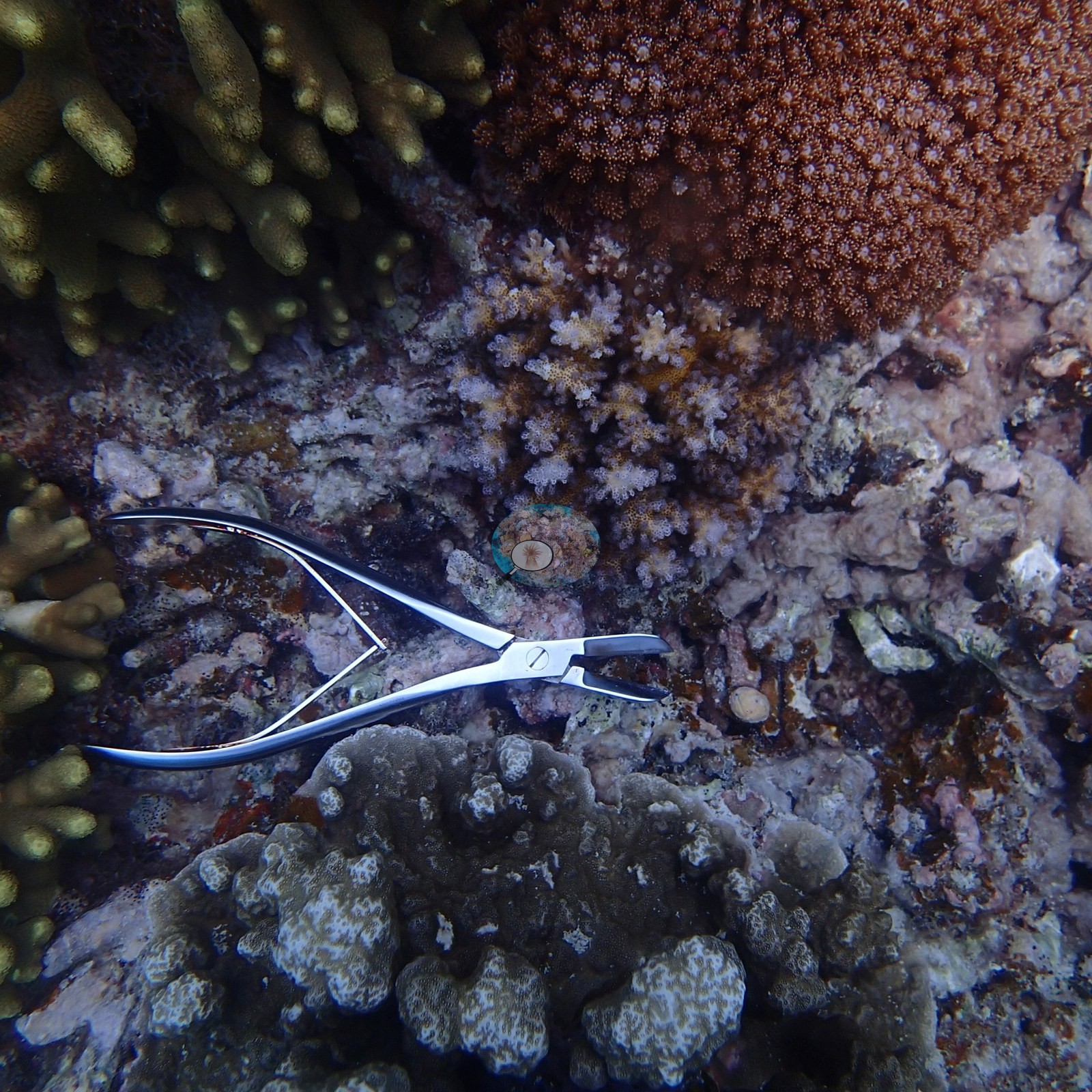
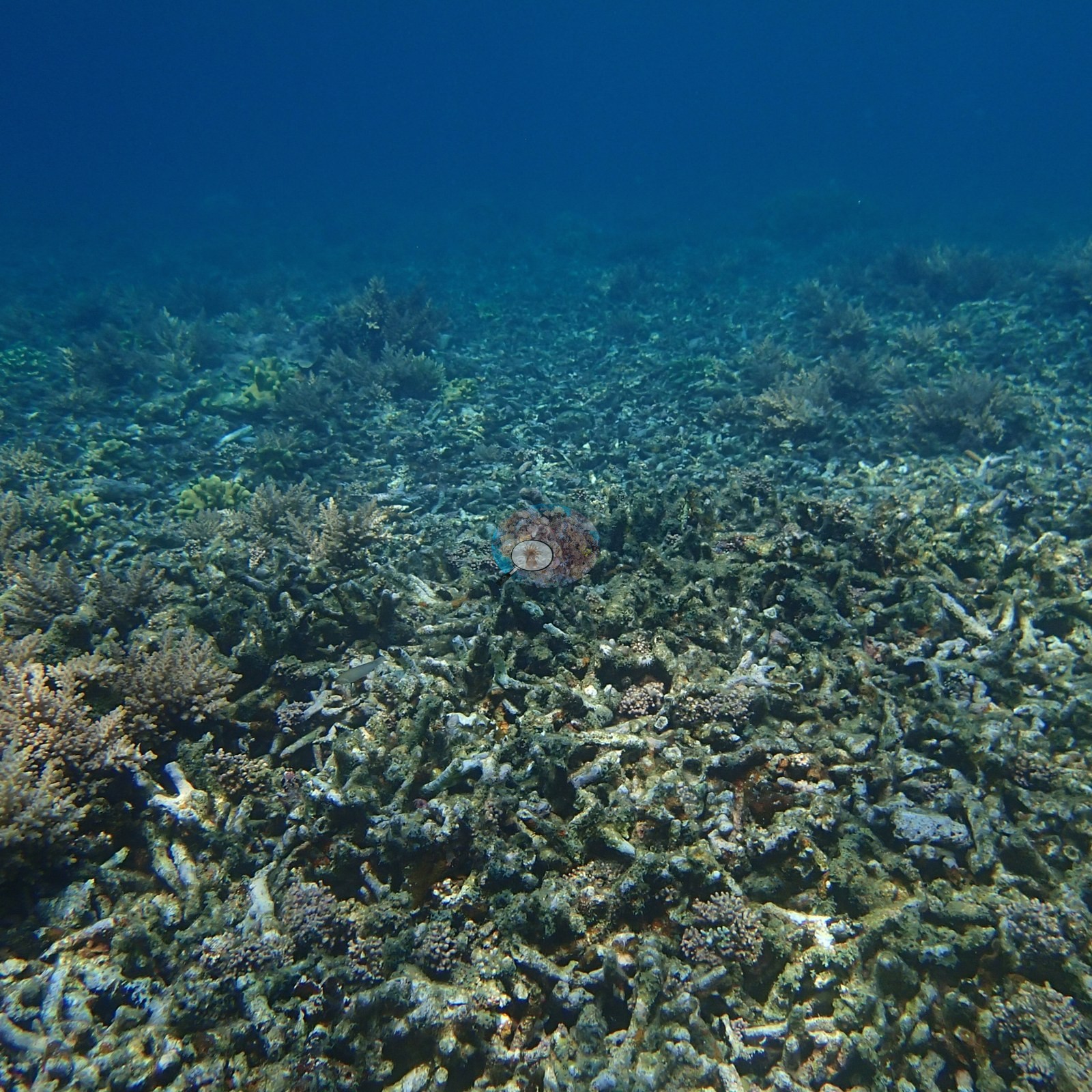
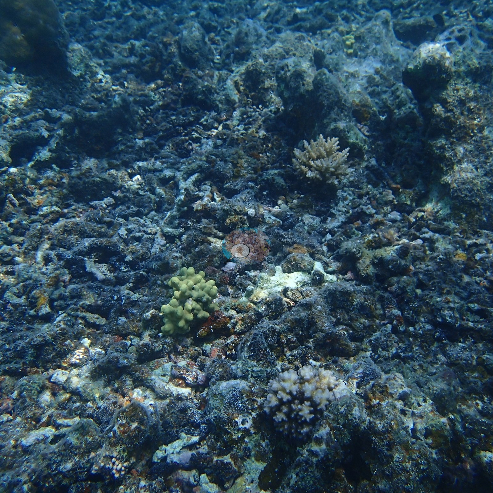
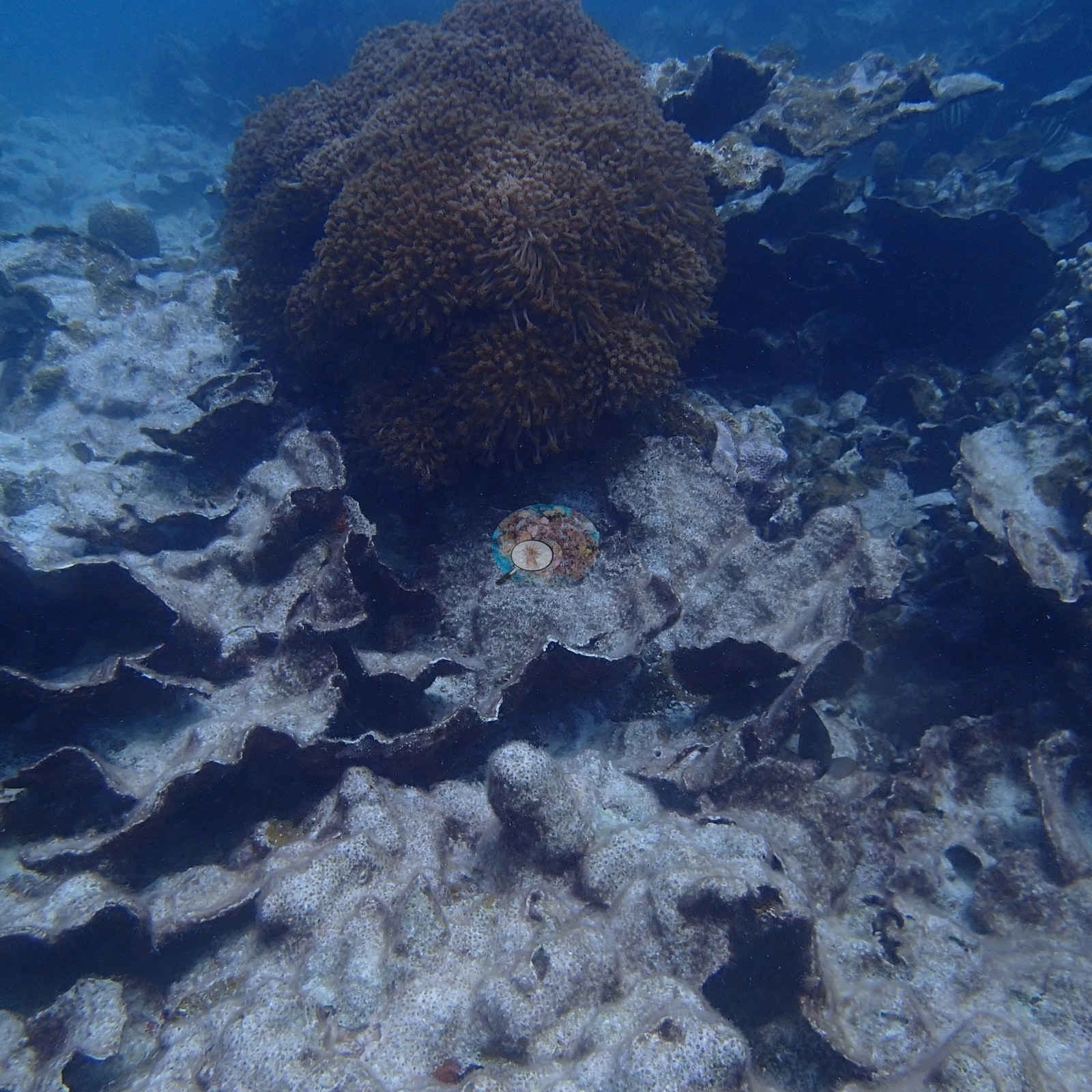
The six Dongsha (Pratas) Atoll records record Anderson's Dongsha Atoll Research Station work in the open South China Sea. There is a regional atoll marker and four numbered stations (Sites 6, 7, 12, and 13), photographed on 4-5 April 2016, where pocilloporid corals were sampled in the search for heat-tolerant genotypes, plus two dives on 6 April 2016 at a site whose position was not recorded. Dr. Coral sampled 28 Pocillopora damicornis / P. acuta colonies across three sites: 12 at Site 13 on 4 April 2016, and 8 each at Sites 6 and 7 on 5 April 2016. The stations are structurally varied. Site 13 is a vast, low bank of yellow-green to olive finger-form coral running to the limit of visibility, with giant massive Porites-type domes, one mushroom-shaped and deeply undercut, and tiered plate-coral pinnacles standing 2-3 m clear of the reef. Site 6 is a high-relief, near wall-to-wall hard coral reef of branching and tabular Acropora, meter-wide Porites domes, brain corals, red sea fans, and broad foliose plate fields. The 6 April dives, at a position not recorded, found a lower, more turbid flat carpeted with hundreds of leathery soft corals.
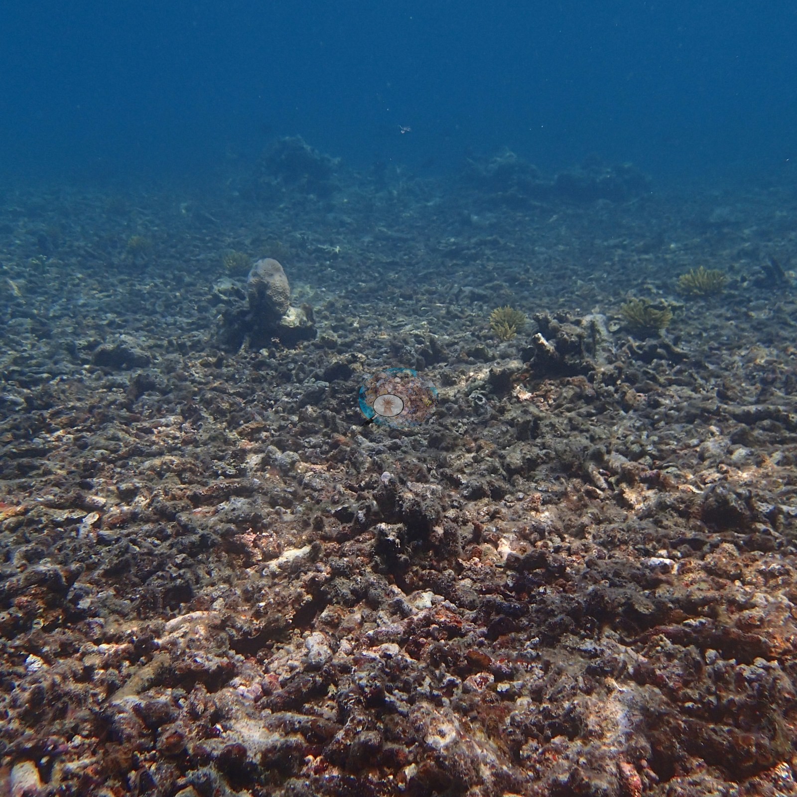
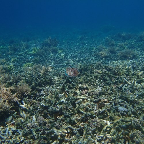
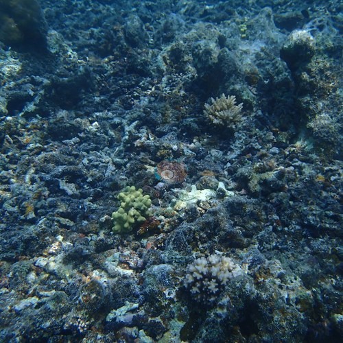
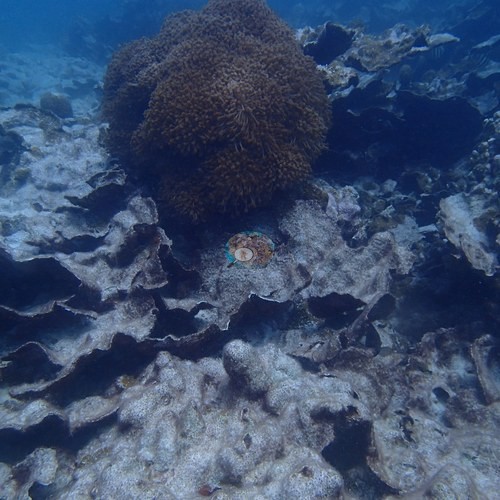
The other stations are patchier. Site 7 is a mosaic of dense living coral banks separated by broad stretches of older, turf-coated dead rubble and pavement. Site 12 is a field of thin, tiered foliose plates, most of them dead and silt-coated (the field sheet: mostly Echinopora rubble, low live cover), broken by a dense branching thicket; a transect tape runs across its frames. Old dead branching rubble also appears at Site 6, where a live thicket has re-established on top of it. Blind Claude computer-vision point counts put coral cover at 57% at Site 6 (edited and unedited photos), 54% at Site 13, 30% at Site 7, and 24% on the 6 April dives (edited and unedited photos); Sites 13 and 7 have only unedited camera originals, and Site 7 rests on 16 photos. Site 12 has no cover value.
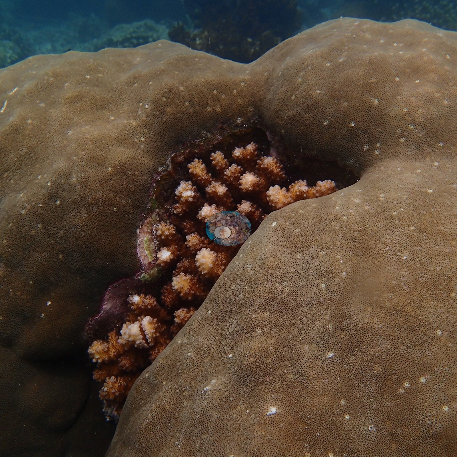
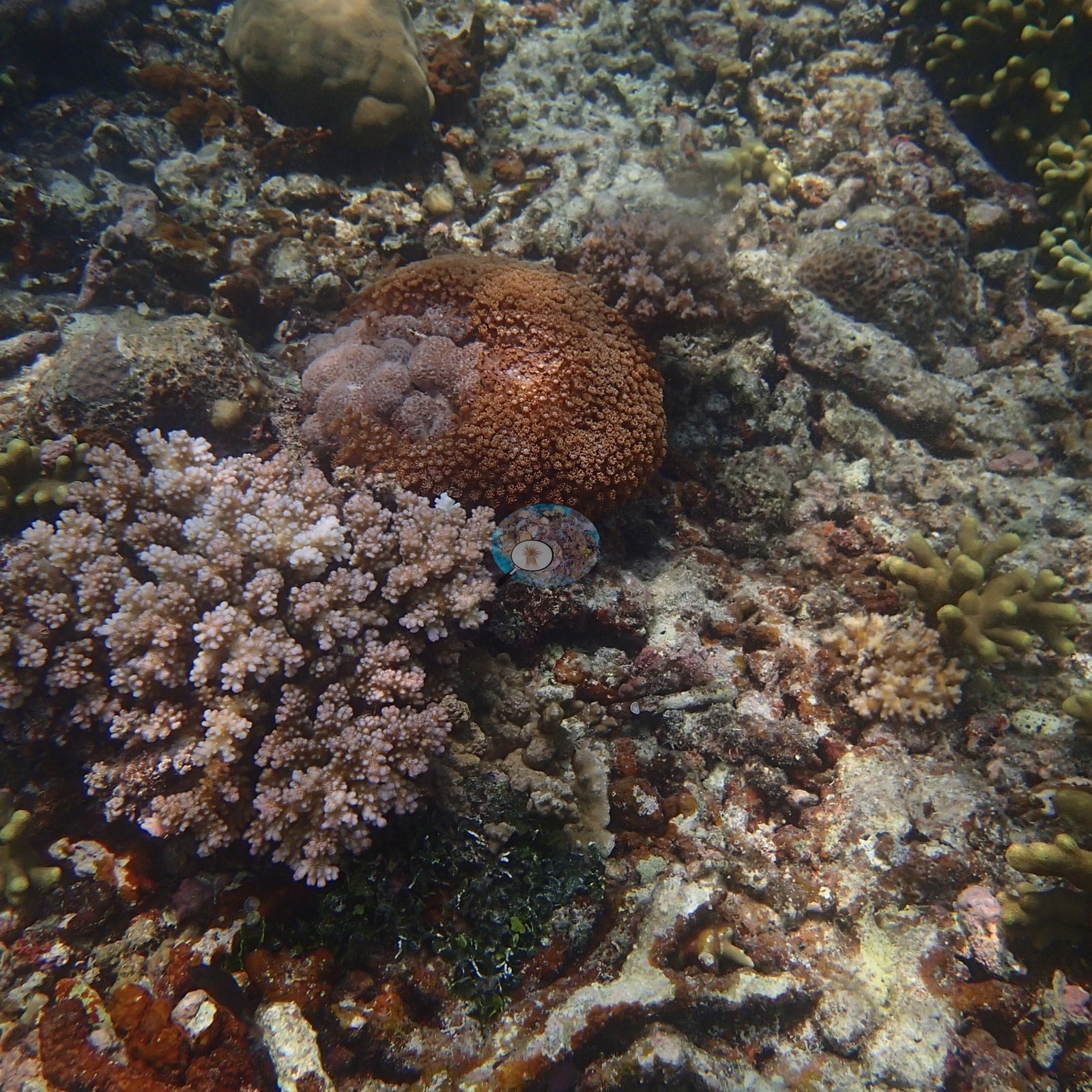
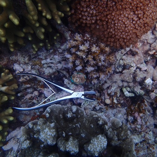
Anderson's sample sheets record the majority of sampled colonies as healthy: seven of the eight at Site 7 (one lightly pigmented) and ten of the twelve at Site 13, where one colony was about 20% bleached and another had 20% recent mortality. At Site 6, the sample sheet records storm damage and old partial mortality among the eight colonies sampled. Site 13 also has derelict monofilament line on a Porites-type colony and one patch of recent tissue loss. No crown-of-thorns seastars, Drupella aggregations, or disease fronts were seen at Sites 6, 7, or 13. Fauna highlights include a loose group of large cuttlefish at Site 6, a barracuda on the 6 April dives, dense damselfish aggregations, and a giant clam at Site 13.
Highlights
- Site 13 carries tiered plate-coral pinnacles 2-3 m tall above a vast digitate coral bank.
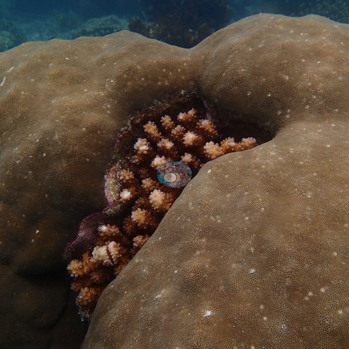 photo: Dongsha Atoll - Site 13
- Site 6 is a high-relief hard coral reef; the 6 April dives, at a position not recorded, crossed a soft-coral flat.
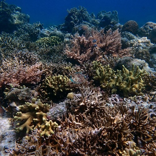 photo: Dongsha Atoll - Site 6 (branching)
- At Site 7, Anderson's sample sheet records seven of the eight sampled colonies as healthy and one as lightly pigmented (April 2016).
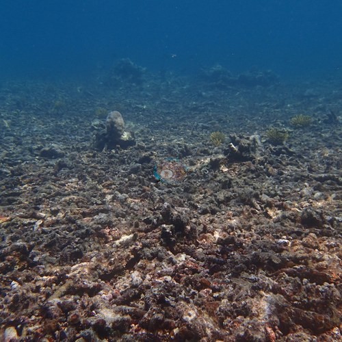 photo: Dongsha Atoll - Site 7 (branching)
- Derelict fishing line was found on a coral colony at Site 13.
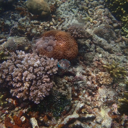 photo: Dongsha Atoll - Site 13
- No crown-of-thorns seastars, Drupella aggregations, or disease fronts were seen in any frame from Sites 6, 7, and 13.
本文為英文摘要的機器翻譯;內容以英文原文為準。 AI translation of this summary; the English is authoritative.
Regional setting
Spalding et al. (2001) 將東沙(Tung-Sha,東沙群島)的珊瑚礁與台灣分開討論,放在與南沙群島和西沙群島共用的章節中。他們將這些珊瑚礁定位於南海北部,以一座只有一個島嶼的大型沉水環礁為主體。以區域標準而言,其多樣性不算高,但已記錄超過70種珊瑚。主權由中國與台灣爭議,台灣在島上設有燈塔和氣象站。該地圖集沒有為這個環礁提供單獨的珊瑚礁面積估計。
後來的兩份資料都沒有報告東沙本身。Wilkinson (2006) 在總結2004年東亞和北亞的珊瑚礁狀況報告時發現,靠近密集人類活動的珊瑚礁仍在衰退,而偏遠的珊瑚礁正從1998年白化造成的損失中恢復。就整個東亞海域而言,Souter et al. (2021) 將石珊瑚覆蓋率的驟降與2010年和2016年的大規模白化事件連結,至2019年為止的十年間相對損失約11%。他們提醒,該區域的監測集中在容易抵達、知名的珊瑚礁,因此偏遠珊瑚礁在這些趨勢中代表性不足。
Overview
東沙(Pratas)環礁的六筆紀錄記錄了 Anderson 在南海開闊海域東沙環礁研究站的工作。其中包括一個環礁層級的區域標記和四個編號站(第6、7、12、13站),於2016年四月4-5日拍攝,並在這些地點採集鹿角珊瑚科(pocilloporid)珊瑚,以尋找耐熱的基因型;另有2016年四月6日在一個未記錄位置的地點進行的兩次潛水。Dr. Coral 在三個測站共採集了28個 Pocillopora damicornis / P. acuta 群體:2016年四月4日在第13站採集12個,2016年四月5日在第6站和第7站各採集8個。各站結構差異很大。第13站是一片廣闊低矮、由黃綠色至橄欖色指狀珊瑚組成的礁丘,延伸到能見度極限,並有巨大的塊狀 Porites 型圓頂,其中一個呈蘑菇狀且底部深深內凹,還有高出礁面2-3公尺、層層疊疊的板狀珊瑚礁柱。第6站是一片高起伏、幾乎滿布石珊瑚的礁區,有枝狀和桌形軸孔珊瑚(Acropora)、一公尺寬的 Porites 圓頂、腦珊瑚、紅色海扇和大片葉狀板珊瑚。四月6日在未記錄位置的潛水則發現一片較低、較混濁的礁坪,上面覆滿數以百計的革質軟珊瑚。
其他站點較為零散。第7站是由茂密活珊瑚丘拼接而成,其間隔著大片較老、覆蓋藻皮的死珊瑚碎屑和礁盤。第12站是一片薄而層疊的葉狀板珊瑚,大多已死亡並覆有沉積物(他的野外記錄表:大多為 Echinopora 碎屑,活珊瑚覆蓋率低),中間夾著一叢茂密的枝狀珊瑚;畫面中有一條穿越線捲尺。第6站也可見到老舊的枝狀珊瑚碎屑,一叢活珊瑚已在其上重新生長。Claude 電腦視覺盲點計數估計第6站的珊瑚覆蓋率為57%(經編輯與未經編輯照片)、第13站為54%、第7站為30%,四月6日的潛水為24%(經編輯與未經編輯照片);第13站和第7站只有未經編輯的相機原檔,第7站僅依據16張照片。第12站沒有覆蓋率數值。
Anderson 的採樣記錄表記載大多數採樣群體為健康:第7站八個中有七個(一個色素略淡),第13站十二個中有十個,該站有一個群體約20%白化,另一個有20%近期死亡。在第6站,他的記錄表記載他採樣的八個群體中有風暴損傷和舊的部分死亡。第13站還有廢棄的單絲釣線纏在一個 Porites 型群體上,以及一處近期組織損失。在第6、7、13站都沒有看到棘冠海星、Drupella 聚集或疾病前緣。動物方面的亮點包括第6站一群鬆散的大型烏賊、四月6日潛水時的一條梭魚、密集的雀鯛群,以及第13站的一個硨磲貝。
Highlights
- 第13站在一片廣闊的指狀珊瑚礁丘上,矗立著高2-3公尺、層層疊疊的板狀珊瑚礁柱。
- 第6站是一片高起伏的石珊瑚礁;四月6日在未記錄位置的潛水則經過一片軟珊瑚礁坪。
- 在第7站,Anderson 的採樣記錄表記載八個採樣群體中有七個健康,一個色素略淡(2016年四月)。
- 在第13站的一個珊瑚群體上發現廢棄的釣線。
- 第6、7、13站的所有畫面中都沒有看到棘冠海星、Drupella 聚集或疾病前緣。
Notable observations
- Dongsha Atoll - Site 13: Derelict monofilament fishing line draped across a knobby Porites-type colony with pale contact patches; recent partial tissue loss (bare white skeleton with a sharp margin) on a massive dome, cause not determinable; Anderson's sample sheet records one of the twelve sampled colonies about 20% bleached and one with 20% recent mortality. No crown-of-thorns starfish, Drupella aggregations, or disease lesion fronts in any of the 63 frames.
- Dongsha Atoll - Site 6 (branching): Old, consolidated dead branching rubble; Anderson's sample sheet records storm damage and old partial mortality among the eight sampled colonies. No crown-of-thorns starfish, Drupella aggregations, or disease lesion fronts in any of the 123 frames.
- Dongsha Atoll - Site 7 (branching): Sample sheet: seven of the eight sampled colonies healthy, one lightly pigmented; extensive old, turf-coated dead rubble pavement. No crown-of-thorns starfish, Drupella aggregations, disease lesion fronts, or predation scars in any of the 47 frames.
- Dongsha Atoll - Site 12: Most foliose plates dead and silt-coated (the field sheet: mostly Echinopora rubble, low live cover).
Sites in this region
- Dongsha Atoll - Site 12
- Dongsha Atoll - Site 13 — 54%† coral cover
- Dongsha Atoll - Site 6 (branching) — 57%† coral cover
- Dongsha Atoll - Site 7 (branching) — 30%*† coral cover
- Dongsha, 6 April 2016 — 24%† coral cover
- Taiwan - Dongsha / Pratas Atoll (South China Sea)
* Based on only 10–19 reef-habitat photos; this estimate is less certain.
† Includes unedited photographs: edited versions of most of this dive's photos do not exist.
All images from Coral Reef Diagnostics. Data are from Coral Reef Diagnostics.
 © Coral Reef Diagnostics.
References
- Souter D, et al. (eds) (2021) Status of Coral Reefs of the World: 2020. International Coral Reef Initiative / Global Coral Reef Monitoring Network. [PDF]
- Spalding MD, et al. (2001) World Atlas of Coral Reefs. University of California Press, Berkeley. [PDF]
- Wilkinson C (2006) Status of coral reefs of the world: summary of threats and remedial action. In: Côté IM, Reynolds JD (eds) Coral Reef Conservation. Cambridge University Press, Cambridge. [PDF]