
Regional summary of 8 dive sites. Figures are averages across the sites that report them (n = sites with a value); each site's own page has its individual values. Part of the Chagos Archipelago overview.
⬇ Download this region as a report card

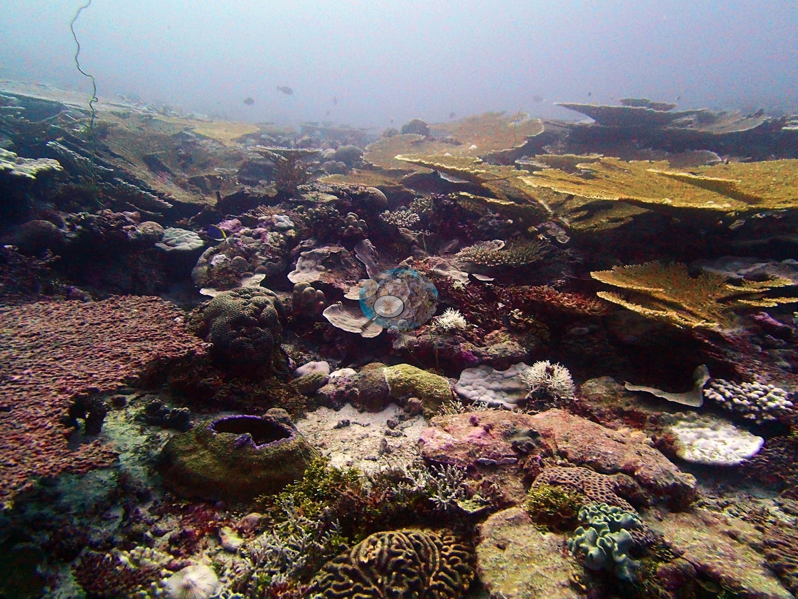
Sheltered lagoon and bank reefs on the northern Great Chagos Bank and isolated Victory Bank, dived in April 2015, include one site that is nearly four-fifths blue coral and records of the endemic Ctenella chagius. An active crown-of-thorns outbreak was photographed at one northern-bank site.
Heat stress
Long-term record: 3 years since 1985 reached 8 or more °C-weeks at NOAA’s Chagos station. Download the annual DHW data (CSV).
8 sites in this region — click a marker to open that site.
Regional setting
Most of this unit lies on the Great Chagos Bank, which Spalding et al. (2001) describe as a largely submerged atoll and, at roughly 13,000 km², the world's largest atoll structure, bigger in area than even the largest Maldivian atolls. Only a few islands break the surface along its rim. Nelson Island, on the northern rim, became a Strict Nature Reserve in 1998, and the atlas map shows Victory Bank as a small, separate bank lying north of the Great Chagos Bank. The archipelago formed over the volcanic trace of the Réunion hotspot and is the youngest, southernmost part of the Chagos–Laccadive Ridge, isolated from the Maldives by about 500 km of open ocean. Before 1998, corals typically covered 50–80% of seaward and lagoon slopes to about 40 m and approached 100% in places. No one measured bleaching intensity in 1998, but coral loss on seaward reefs is estimated to have averaged 80–85%. As of 2001, the authors still counted the Chagos reefs among the most pristine and best protected in the Indian Ocean. Spalding et al. (2001) estimate about 3,770 km² of reef across the archipelago as a whole, and Souter et al. (2021) give 2,731 km² for the Chagos ecoregion from a newer map.
In the GCRMN analysis of Souter et al. (2021), coral cover in the Chagos subregion fell sharply after 1998, rebuilt until about 2015, and then declined again after the 2016 bleaching. Across South Asia, the 2016 event killed more than 42% of living hard coral, cutting average cover to 26.3%, and localized bleaching from 2017 to 2019 added further losses. Atoll reefs on the Lakshadweep–Maldives–Chagos Ridge have generally recovered better than nearshore mainland reefs, which carry heavier fishing and pollution, but the authors caution that back-to-back disturbances may now outpace recovery, so reefs never fully return to their earlier state before the next event. They name bleaching, rather than local human pressure, as the primary threat to the protected Chagos atolls.
Overview
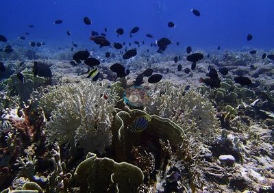
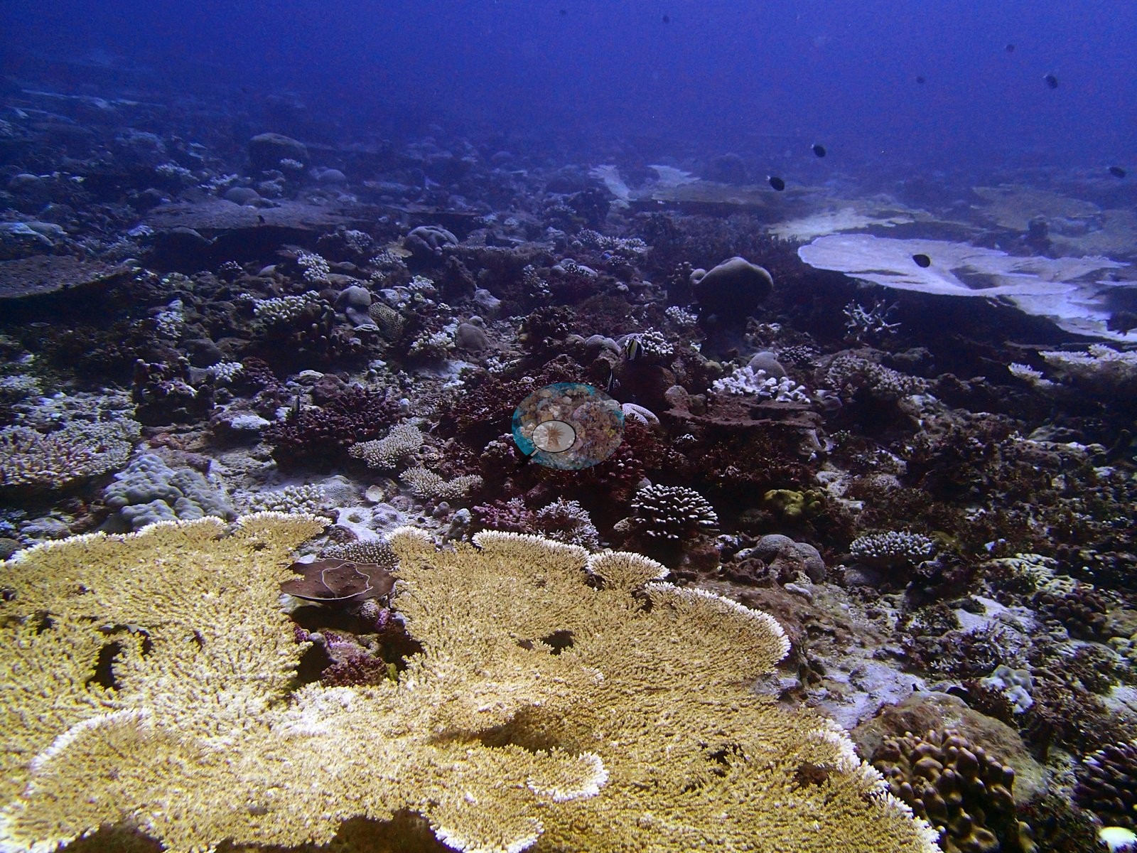
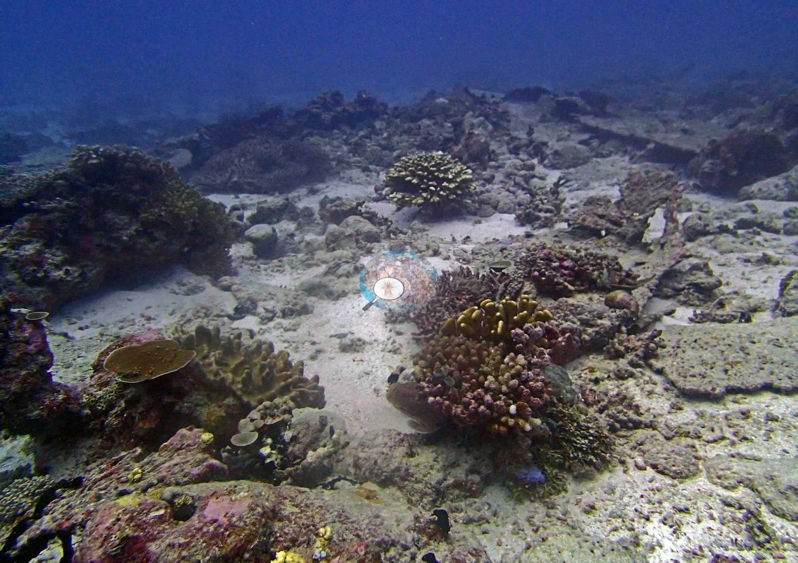
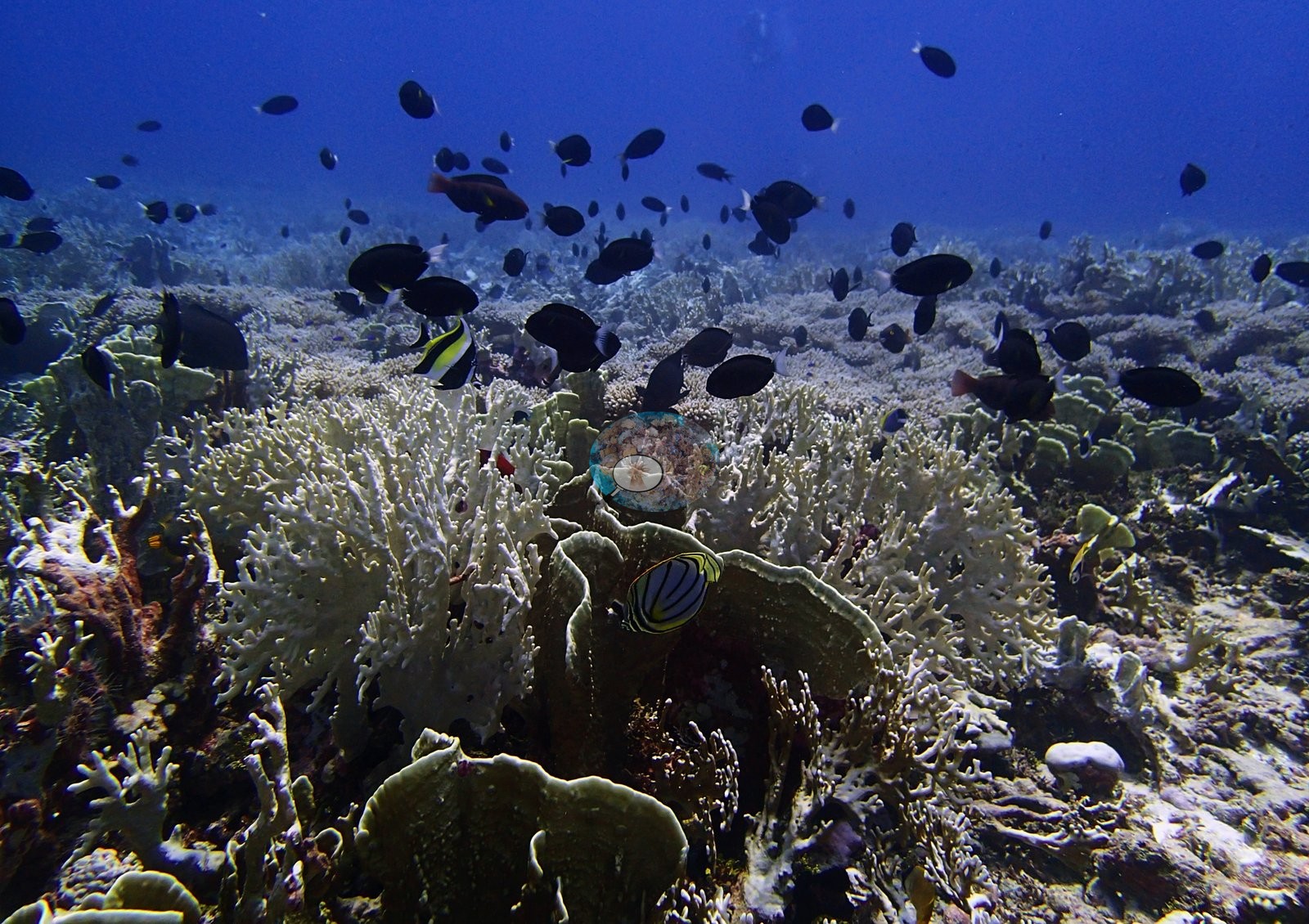
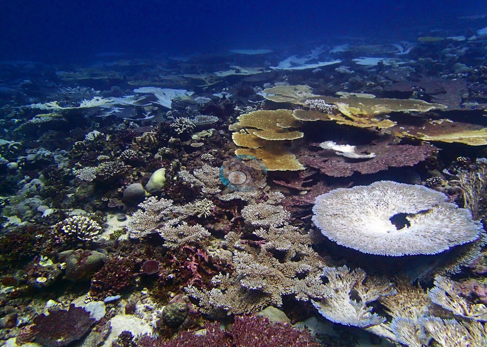
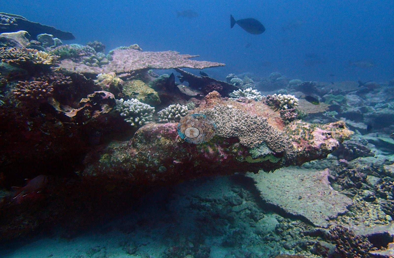
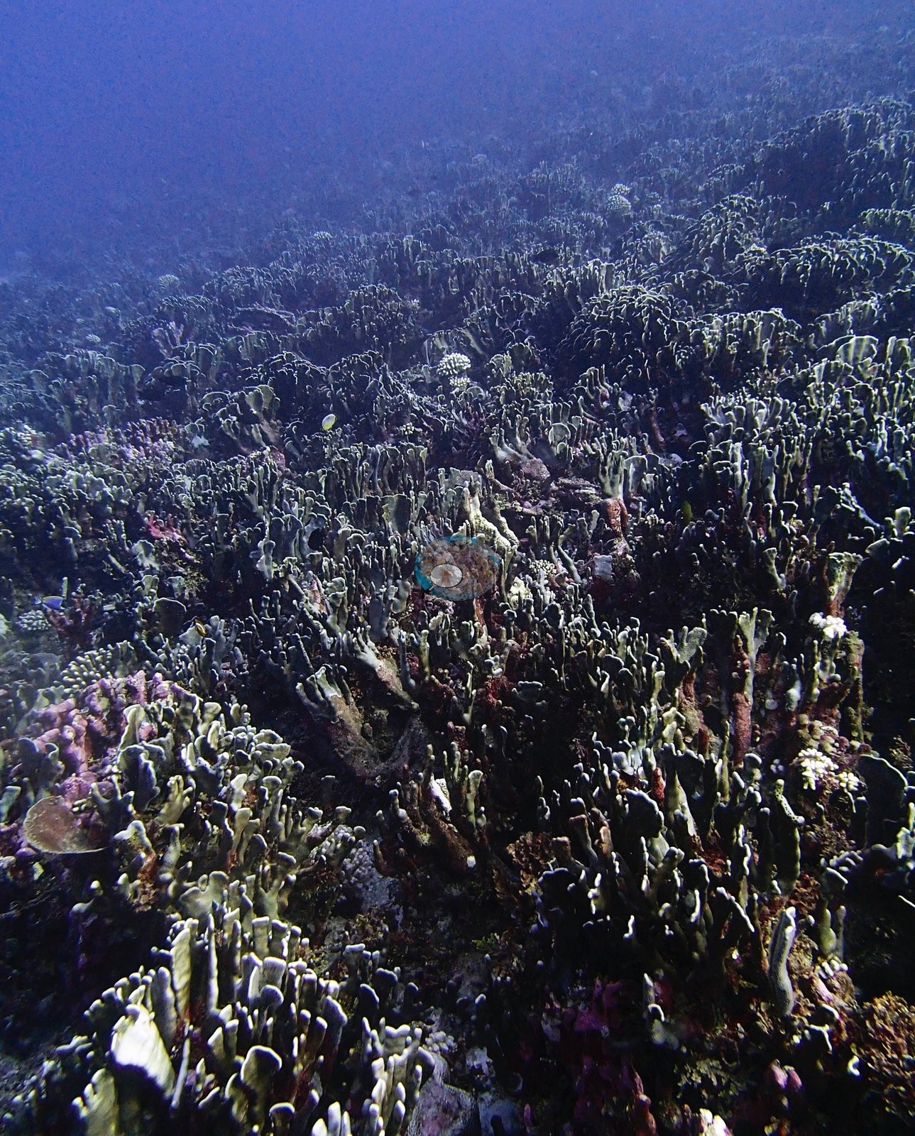
This unit pairs reefs inside the Nelson Island lagoon on the northern Great Chagos Bank, plus a fourth northern-bank site at BINI80, with the isolated offshore Victory Bank. The eight sites were surveyed between 20 and 30 April 2015. Logged maximum depths ran from 16.4 m at BIVB109 to 31.2 m at BIVB99, with BINI79 and BIVB81 close behind at 30.9 m and 31.1 m; BINI80 has no logged depth, and its transects spanned about 10-20 m. Most are sheltered lagoon or bank reefs, and BIVB109 is a forereef. Acropora leads at most sites, often giving way to Porites at depth, as at BINI77. BIVB99 is the exception: blue coral (Heliopora) makes up nearly four-fifths of the coral there, in dense thickets of upright folded blades. At BIVB109, Acropora, Porites, and fire coral (Millepora) share the coral almost equally. The Chagos-endemic Ctenella chagius was recorded at BIVB108 and BIVB109.
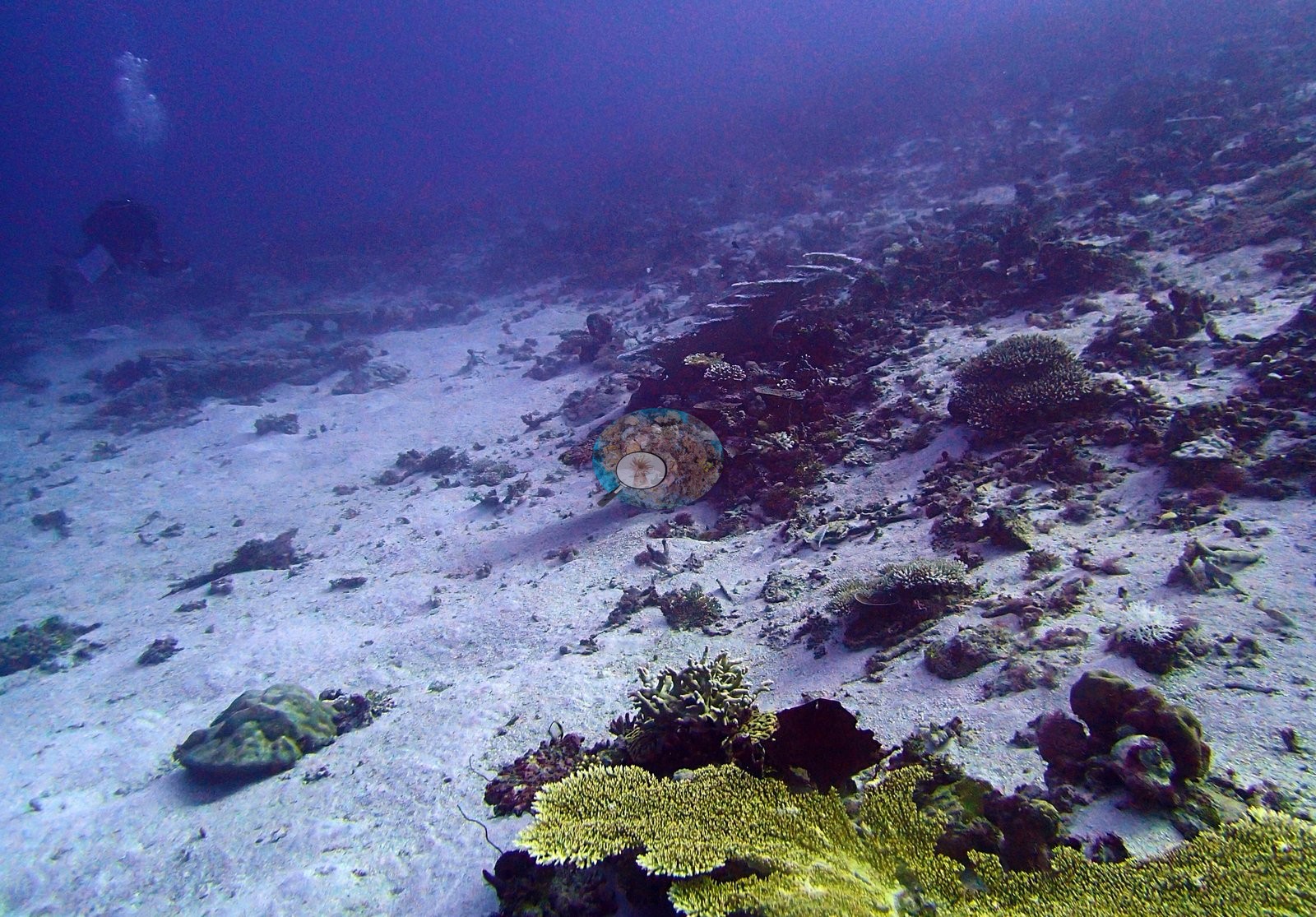
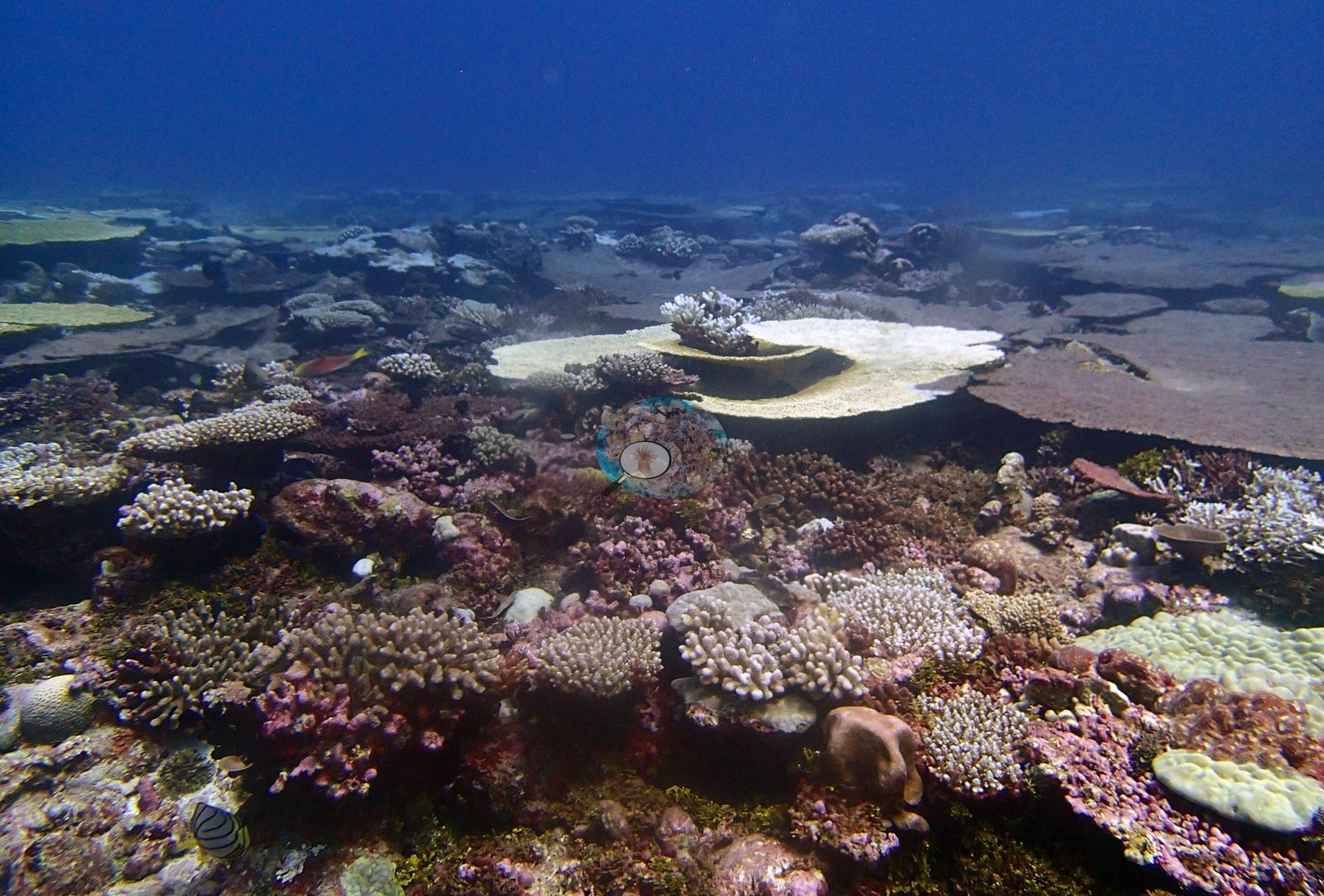
Cover ranged from 19.1% at BINI78, where sponges and other invertebrates take an unusually large share of the bottom, to 55.6% at BIVB99. The substrate varied from clean, coralline-crusted rock at BINI77 to unusually silty turf and macroalgae at BIVB81. Photos at BIVB81 also show a near-continuous stand of whorled plate coral that the transects did not record.
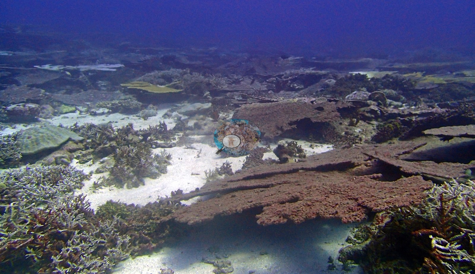
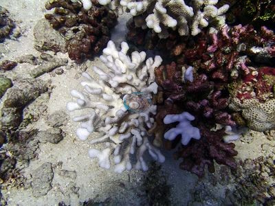
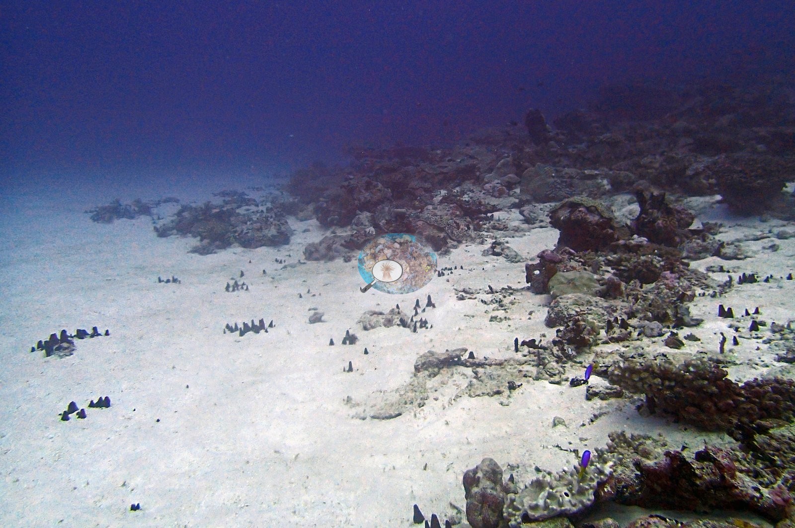
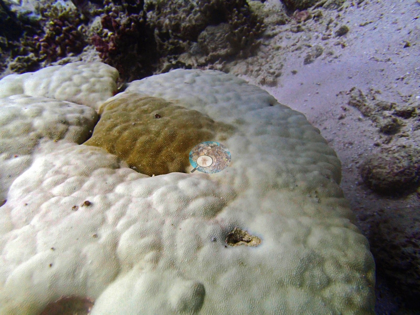
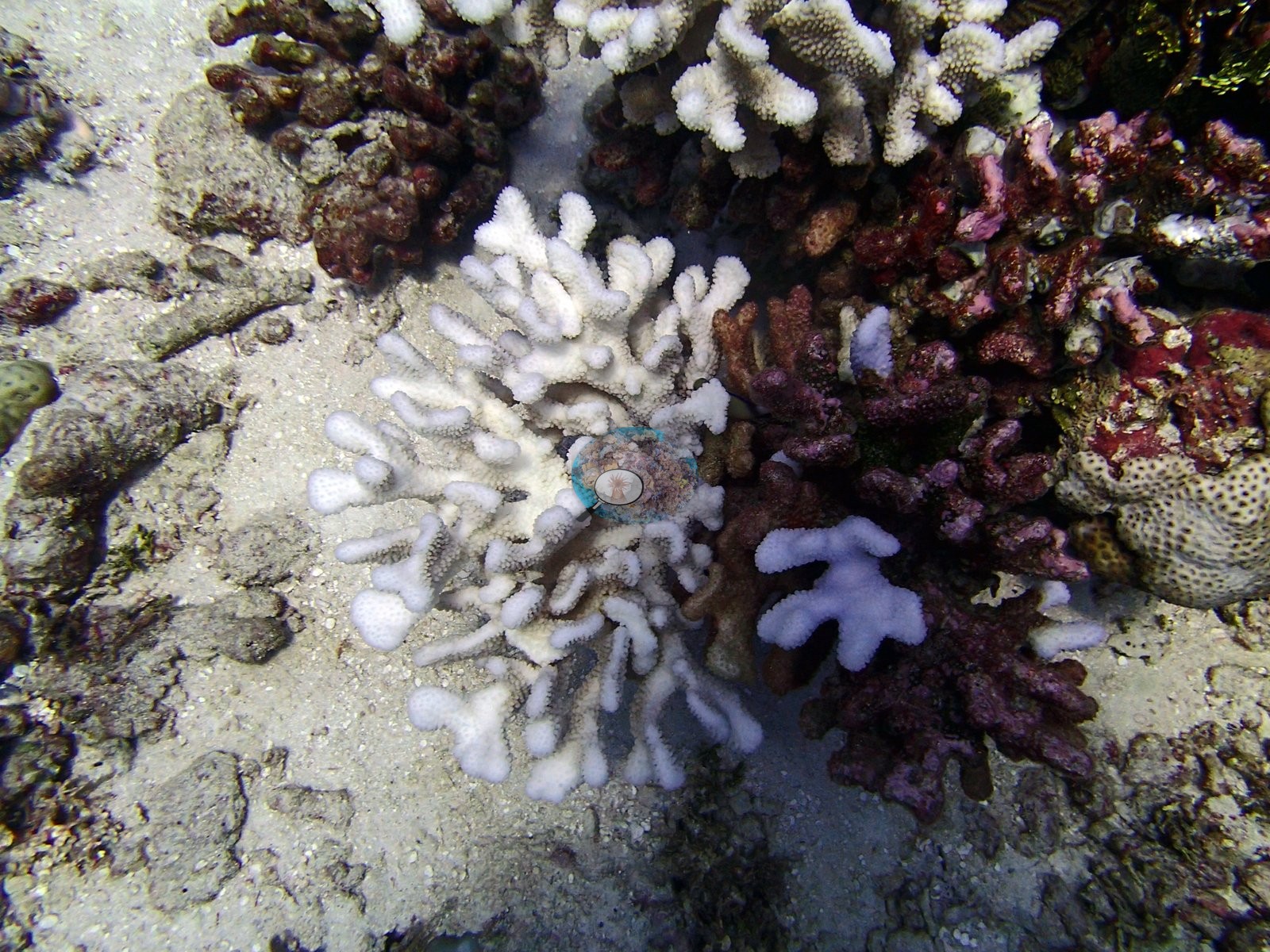
Published bleaching ran from 5.0% at BINI79 to 16.1% at BINI77, where stark white tables and branching colonies stood beside table framework that appears to be standing dead. At BIVB108 at least five of 15 frames show chalk-white tables beside pigmented neighbors, suggesting its 10.7% figure is conservative. At BINI78, by contrast, the 11.6% figure is driven largely by misread frames, including a pale encrusting sponge that mimics bleached coral. The most serious finding is at BINI80, where an active crown-of-thorns outbreak was photographed: at least eleven starfish in five frames, including a group of six or more on freshly killed white skeleton. Whitetip reef sharks were seen at BINI79 and BINI80 and three times at BIVB109, and a dogtooth tuna was also recorded at BINI79.
Highlights
- Heliopora blue coral makes up nearly four-fifths of the coral at BIVB99, which has the unit's highest cover, 55.6%
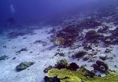
- Active crown-of-thorns outbreak at BINI80: at least eleven starfish in five frames
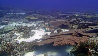
- Chagos-endemic Ctenella chagius recorded at BIVB108 and BIVB109
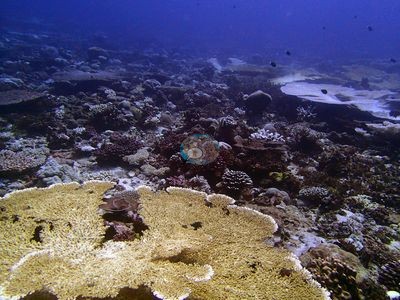
- Cover ran from 19.1% at BINI78, where sponges take an unusually large share of the bottom, to 55.6% at BIVB99
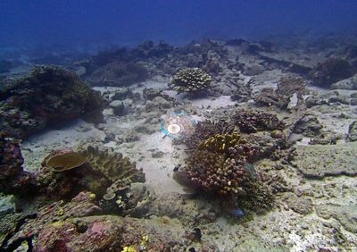
- Whitetip reef sharks at BIVB109 (three encounters), BINI79, and BINI80
Notable observations
- Chagos Archipelago - Great Chagos Bank North (BINI80): Crown-of-thorns: active outbreak, at least eleven sightings across five frames in one day, including an aggregation of six or more animals on freshly exposed white skeleton. No bleaching figure was published for this station.
- Chagos Archipelago - Great Chagos Bank North (BINI77): Bleaching 16.1%; stark white tables and branching colonies, and much of the table-coral framework appears to be standing dead. No disease or crown-of-thorns.
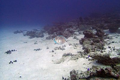
- Chagos Archipelago - Victory Bank (BIVB108): Bleaching 10.7%, photos suggest conservative; at least five of 15 frames show chalk-white tables beside pigmented neighbors. No disease, predation, or crown-of-thorns.
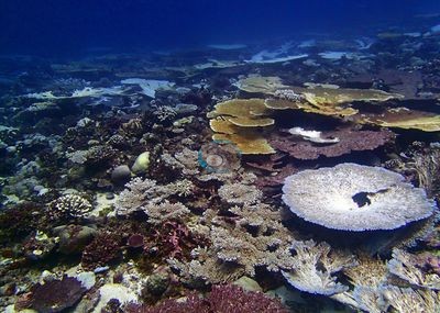
- Chagos Archipelago - Great Chagos Bank North (BINI79): Published bleaching 5.0%, but photos show more stark white and pale colonies; some logged as ambiguous between partial bleaching and recently dead skeleton. No crown-of-thorns or disease.

- Chagos Archipelago - Great Chagos Bank North (BINI78): Published 11.6% bleaching driven largely by misread frames (pale growing tips and a pale encrusting sponge); frames with genuinely white coral scored no bleaching.
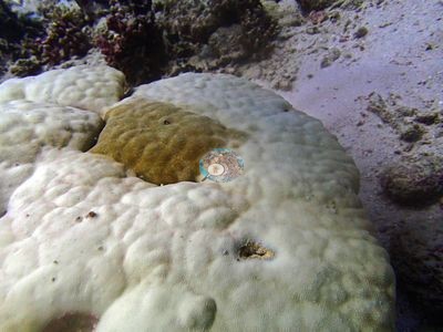
- Chagos Archipelago - Victory Bank (BIVB99): Localized bleaching restricted to compact branching colonies; the dominant Heliopora sheets are not affected.
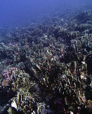
- Chagos Archipelago - Victory Bank (BIVB81): Several white elements logged as ambiguous rather than confirmed bleaching (5.1%). No disease, predation, or crown-of-thorns.
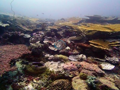
- Chagos Archipelago - Victory Bank (BIVB109): Bleaching 8.7%, flagged for extra skepticism because of abundant Millepora. No disease or crown-of-thorns.
Sites in this region
- Chagos Archipelago - Great Chagos Bank North (BINI77) — 43% coral cover
- Chagos Archipelago - Great Chagos Bank North (BINI78) — 19% coral cover
- Chagos Archipelago - Great Chagos Bank North (BINI79) — 32% coral cover
- Chagos Archipelago - Great Chagos Bank North (BINI80) — 43% coral cover
- Chagos Archipelago - Victory Bank (BIVB108) — 46% coral cover
- Chagos Archipelago - Victory Bank (BIVB109) — 35% coral cover
- Chagos Archipelago - Victory Bank (BIVB81) — 52% coral cover
- Chagos Archipelago - Victory Bank (BIVB99) — 56% coral cover
% coral cover by method
Pooled across 104 dive sites
| Method | Mean % coral cover | Std. dev. between dive sites | n dive sites | Note |
|---|---|---|---|---|
| Manual point count (author) | 34.0% | ±13 | 28 | frame-weighted 40.1% over 613 frames |
| CoralNet automated point classifier | 32.8% | ±11 | 89 | frame-weighted 34.0% over 1,895 frames |
| CoralSCOP (SAM-based mask-sum), edited photos | 32.2% | ±8.3 | 104 | frame-weighted 33.9% over 2,498 frames |
| Claude (Anthropic), blind point count | 26.5% | ±11 | 104 | frame-weighted 29.0% over 2,495 frames |
| In-house DINOv3 point classifier | 30.5% | ±11 | 104 | frame-weighted 31.2% over 2,500 frames |
| In-water diver transect (line/point intercept) | 37.7% | ±16 | 101 | — |
The mean is an UNWEIGHTED mean of the dive site values — each dive site counts once, whatever its photo count — which is the convention of the published tables and of every other figure on this page. The frame-weighted alternative is given per method in the Note column; where the two differ, the difference is a photo-count imbalance, not a coral-cover finding.
Closest to the reference
Over the dive sites where an independent reference exists, Manual point count (author) sits closest to it — a mean absolute deviation of 9.5 pp across 27 dive sites, then CoralNet automated point classifier 10.5 pp (n=86), Claude (Anthropic), blind point count 13.2 pp (n=101). A mean absolute deviation is not an accuracy score: a model with a consistent offset is correctable, while one with the same deviation scattered in both directions is not.
By dive site
| Dive site | Manual point count | CoralNet | CoralSCOP (edited) | Claude | DINOv3 | Diver transect | coralscapes_v1 | coralscapes |
|---|---|---|---|---|---|---|---|---|
| BIBL82 | 17.5% n=4 | 27.6% n=18 | 35.8% n=22 | 28.3% n=22 | 26.1% n=22 | 37.9% | 42.0% n=22 | 50.2% n=22 |
| BIBL83 | 20.8% n=9 | 25.6% n=6 | 40.7% n=15 | 23.8% n=15 | 24.7% n=15 | 33.1% | 42.2% n=15 | 45.2% n=15 |
| BIBL86 | — | 31.9% n=27 | 25.1% n=27 | 34.4% n=27 | 36.0% n=27 | 47.2% | 50.5% n=27 | 49.4% n=27 |
| BIBL87 | — | 27.9% n=35 | 29.5% n=35 | 30.3% n=35 | 34.0% n=35 | 40.6% | 41.5% n=35 | 48.0% n=35 |
| BICC35 | — | 17.0% n=15 | 20.5% n=15 | 6.7% n=15 | 13.1% n=15 | 13.8% | 21.0% n=15 | 23.9% n=15 |
| BICC36 | — | 19.4% n=15 | 24.7% n=15 | 6.4% n=15 | 18.2% n=15 | 5.8% | 21.0% n=15 | 26.5% n=15 |
| BICC50 | — | 29.4% n=11 | 28.8% n=11 | 15.7% n=11 | 30.0% n=11 | 12.1% | 36.9% n=11 | 48.0% n=11 |
| BICC51 | — | 21.9% n=17 | 27.5% n=17 | 20.7% n=17 | 24.1% n=17 | 15.4% | 26.9% n=17 | 28.4% n=17 |
| BIDI08 | — | 36.4% n=35 | 38.9% n=35 | 35.2% n=35 | 29.1% n=35 | 59.0% | 50.2% n=35 | 53.1% n=35 |
| BIDI09 | — | 38.0% n=30 | 32.2% n=30 | 33.6% n=30 | 23.6% n=30 | 37.7% | 56.2% n=30 | 61.0% n=30 |
| BIDI10 | — | 27.1% n=13 | 32.9% n=13 | 22.5% n=13 | 16.2% n=13 | 23.0% | 44.2% n=13 | 49.4% n=13 |
| BIDI12 | — | 10.4% n=14 | 17.9% n=14 | 2.9% n=14 | 11.0% n=14 | 4.2% | 8.2% n=14 | 10.0% n=14 |
| BIDI13 | — | 20.5% n=11 | 24.9% n=11 | 17.8% n=11 | 18.2% n=11 | 7.8% | 22.0% n=11 | 23.5% n=11 |
| BIDI14 | — | 23.5% n=9 | 30.3% n=9 | 19.2% n=9 | 21.9% n=9 | 15.2% | 26.7% n=9 | 26.2% n=9 |
| BIDI15 | — | 24.6% n=9 | 20.6% n=9 | 36.4% n=9 | 37.0% n=9 | 20.1% | 45.3% n=9 | 48.3% n=9 |
| BIDI16 | — | 25.6% n=13 | 30.9% n=13 | 24.4% n=13 | 22.3% n=13 | 30.4% | 32.2% n=13 | 35.6% n=13 |
| BIEA18 | — | 22.3% n=35 | 28.1% n=35 | 17.7% n=35 | 14.6% n=35 | 20.7% | 32.9% n=35 | 32.4% n=34 |
| BIEA19 | — | 27.2% n=14 | 39.2% n=14 | 30.8% n=14 | 25.5% n=14 | 27.5% | 41.9% n=14 | 44.8% n=14 |
| BIEA20 | — | 24.6% n=19 | 27.1% n=19 | 22.2% n=19 | 16.0% n=19 | 10.8% | 30.8% n=19 | 35.4% n=19 |
| BIEA22 | — | 49.2% n=23 | 50.0% n=23 | 30.8% n=23 | 44.8% n=23 | 21.6% | 44.0% n=23 | 46.1% n=23 |
| BIEA23 | — | 35.7% n=24 | 39.5% n=24 | 28.5% n=24 | 28.8% n=24 | 24.6% | 43.8% n=24 | 49.2% n=24 |
| BIEA24 | — | 40.6% n=11 | 39.2% n=11 | 37.4% n=11 | 41.2% n=11 | 12.7% | 48.5% n=11 | 49.3% n=11 |
| BIEA25 | — | 29.5% n=19 | 29.8% n=19 | 16.4% n=19 | 25.6% n=19 | 15.7% | 31.1% n=19 | 32.8% n=19 |
| BIEA26 | — | 21.0% n=30 | 27.2% n=30 | 14.5% n=30 | 14.1% n=30 | 21.0% | 23.3% n=30 | 28.4% n=30 |
| BIEA52 | — | 38.1% n=22 | 39.1% n=22 | 34.5% n=22 | 21.8% n=22 | 34.1% | 49.6% n=22 | 50.0% n=22 |
| BIEG02 | 25.5% n=21 | — | 23.7% n=21 | 18.2% n=21 | 23.7% n=21 | 31.8% | 31.1% n=21 | 34.5% n=21 |
| BIEG03 | 23.9% n=36 | — | 25.7% n=36 | 16.6% n=36 | 18.4% n=36 | 37.3% | 31.5% n=36 | 34.0% n=36 |
| BIEG04 | 33.9% n=19 | — | 28.2% n=19 | 25.9% n=19 | 35.1% n=19 | 29.2% | 36.4% n=19 | 38.7% n=19 |
| BIEG05 | 40.7% n=35 | 57.8% n=24 | 41.4% n=59 | 39.1% n=59 | 40.2% n=59 | 46.7% | 61.2% n=59 | 63.6% n=59 |
| BIEG06 | — | 44.2% n=30 | 22.6% n=30 | 31.6% n=30 | 34.0% n=30 | 43.5% | 46.0% n=30 | 46.5% n=30 |
| BIEG07 | 40.6% n=8 | — | 26.8% n=8 | 28.5% n=8 | 56.7% n=8 | 47.5% | 30.9% n=8 | 33.5% n=8 |
| BINI77 | — | 29.8% n=11 | 33.5% n=11 | 25.7% n=11 | 26.1% n=11 | 43.0% | 38.2% n=11 | 41.1% n=11 |
| BINI78 | — | 24.4% n=16 | 28.4% n=16 | 24.8% n=16 | 29.0% n=16 | 19.1% | 26.9% n=16 | 28.6% n=16 |
| BINI79 | — | 19.4% n=15 | 21.2% n=15 | 17.9% n=15 | 21.6% n=15 | 31.5% | 27.2% n=15 | 25.0% n=15 |
| BINI80 | 37.6% n=10 | 26.8% n=14 | 34.9% n=24 | 29.4% n=24 | 36.9% n=24 | 42.8% | 42.4% n=24 | 45.9% n=24 |
| BIPB110 | — | 36.6% n=45 | 36.7% n=44 | 29.5% n=45 | 36.6% n=45 | 39.3% | 44.3% n=43 | 49.6% n=43 |
| BIPB112 | 43.6% n=14 | — | 37.7% n=14 | 28.7% n=14 | 44.3% n=14 | 45.0% | 50.6% n=14 | 55.0% n=14 |
| BIPB114 | 29.0% n=22 | 34.4% n=7 | 35.2% n=29 | 20.0% n=29 | 31.7% n=29 | 39.6% | 37.0% n=29 | 38.5% n=29 |
| BIPB60 | 38.8% n=38 | — | 41.9% n=38 | 29.5% n=38 | 33.4% n=38 | 42.2% | 55.5% n=38 | 57.2% n=38 |
| BIPB61 | 17.9% n=14 | — | 32.5% n=14 | 17.0% n=14 | 22.1% n=14 | 20.0% | 41.0% n=14 | 43.0% n=14 |
| BIPB62 | 48.0% n=19 | — | 31.6% n=19 | 33.6% n=19 | 35.3% n=19 | 59.6% | 57.6% n=18 | 57.5% n=18 |
| BIPB63 | 46.9% n=29 | — | 38.4% n=29 | 35.0% n=29 | 33.3% n=29 | 56.0% | 66.2% n=29 | 66.7% n=29 |
| BIPB64 | 22.7% n=21 | — | 33.3% n=21 | 22.8% n=21 | 26.2% n=21 | 31.2% | 34.3% n=21 | 41.4% n=21 |
| BIPB65 | 32.9% n=19 | — | 27.5% n=19 | 30.3% n=19 | 32.3% n=19 | 41.4% | 52.3% n=19 | 54.9% n=19 |
| BIPB66 | 12.5% n=6 | — | 28.8% n=6 | 2.3% n=6 | 26.1% n=6 | 7.0% | 41.9% n=6 | 40.9% n=6 |
| BIPB67 | 36.4% n=41 | — | 29.5% n=41 | 26.1% n=41 | 33.8% n=41 | 41.9% | 49.3% n=41 | 52.2% n=41 |
| BIPB68 | 44.9% n=43 | — | 39.2% n=43 | 36.8% n=43 | 38.5% n=43 | 55.0% | 71.9% n=43 | 73.8% n=43 |
| BIPB69 | 54.2% n=110 | 56.1% n=6 | 42.6% n=116 | 39.1% n=116 | 47.4% n=116 | 64.7% | 74.4% n=116 | 75.4% n=116 |
| BIPB70 | 45.4% n=28 | 45.1% n=27 | 35.7% n=55 | 34.9% n=55 | 40.2% n=55 | 60.3% | 56.6% n=55 | 59.5% n=55 |
| BIPB72 | 50.5% n=41 | 56.1% n=34 | 39.9% n=75 | 44.3% n=75 | 49.2% n=75 | 72.4% | 64.4% n=75 | 69.0% n=75 |
| BIPB73 | — | 45.2% n=45 | 46.9% n=45 | 37.6% n=45 | 45.3% n=45 | 50.1% | 48.0% n=45 | 50.6% n=45 |
| BIPB74 | 39.3% n=8 | 56.0% n=13 | 47.1% n=21 | 51.1% n=21 | 48.9% n=21 | 62.4% | 64.5% n=21 | 65.9% n=21 |
| BIPB75 | — | 39.2% n=9 | 43.7% n=9 | 32.4% n=9 | 42.2% n=9 | 43.9% | 51.0% n=9 | 56.5% n=9 |
| BIPB76 | — | 29.9% n=20 | 29.0% n=20 | 20.9% n=20 | 31.5% n=20 | 35.9% | 34.7% n=20 | 39.8% n=20 |
| BISA102 | — | 31.1% n=27 | 34.4% n=27 | 21.5% n=27 | 30.1% n=27 | 30.9% | 33.2% n=27 | 34.7% n=27 |
| BISA103 | — | 28.4% n=19 | 36.1% n=19 | 30.1% n=19 | 37.2% n=19 | 32.5% | 40.5% n=19 | 44.5% n=19 |
| BISA104 | — | 44.2% n=16 | 41.0% n=16 | 35.7% n=16 | 45.6% n=16 | 36.2% | 46.0% n=16 | 50.6% n=16 |
| BISA105 | — | 23.8% n=19 | 23.4% n=19 | 27.8% n=19 | 36.0% n=19 | 50.3% | 41.8% n=19 | 47.0% n=19 |
| BISA107 | — | 18.0% n=12 | 21.7% n=12 | 18.5% n=12 | 20.6% n=12 | 24.6% | 32.1% n=12 | 41.2% n=12 |
| BISA84 | 25.8% n=2 | 16.7% n=5 | 40.1% n=7 | 17.5% n=7 | 28.6% n=7 | 48.8% | 35.3% n=7 | 34.3% n=7 |
| BISA88 | — | 45.8% n=13 | 43.4% n=13 | 42.7% n=13 | 54.1% n=13 | 56.7% | 55.3% n=13 | 59.9% n=13 |
| BISA91 | — | 46.7% n=13 | 44.0% n=13 | 40.3% n=13 | 55.6% n=13 | 52.4% | 58.0% n=13 | 64.8% n=13 |
| BISA92 | — | 29.4% n=39 | 29.0% n=39 | 18.8% n=39 | 25.6% n=39 | 24.5% | 33.1% n=39 | 34.3% n=39 |
| BISA93 | — | 38.7% n=27 | 26.4% n=28 | 33.0% n=27 | 26.4% n=28 | 39.1% | 58.3% n=26 | 61.0% n=27 |
| BISA94 | — | 47.4% n=2 | 21.4% n=2 | 23.1% n=2 | 56.7% n=2 | 40.3% | 43.5% n=2 | 63.2% n=2 |
| BISA97 | — | 51.1% n=12 | 29.4% n=12 | 51.1% n=12 | 49.7% n=12 | 54.4% | 67.8% n=12 | 69.3% n=12 |
| BISP100 | — | 21.7% n=7 | 27.0% n=7 | 31.9% n=7 | 34.8% n=7 | 53.9% | 42.2% n=7 | 43.2% n=7 |
| BISP101 | — | 39.1% n=13 | 32.6% n=13 | 23.0% n=13 | 32.1% n=13 | 50.0% | 42.2% n=13 | 43.5% n=13 |
| BISP89 | — | 17.2% n=13 | 27.6% n=13 | 19.9% n=13 | 21.5% n=13 | 33.2% | 28.6% n=13 | 29.9% n=13 |
| BISP90 | — | 27.6% n=8 | 37.9% n=8 | 24.7% n=8 | 30.8% n=8 | 39.8% | 41.6% n=8 | 43.2% n=8 |
| BISP95 | — | 21.9% n=26 | 23.1% n=25 | 17.8% n=26 | 20.4% n=26 | 56.9% | 28.0% n=26 | 27.6% n=26 |
| BISP96 | — | 55.6% n=18 | 48.2% n=18 | 51.5% n=18 | 49.3% n=18 | 86.0% | 69.0% n=18 | 72.7% n=18 |
| BITB27 | — | 34.5% n=16 | 37.5% n=16 | 23.8% n=16 | 24.4% n=16 | 36.6% | 45.9% n=16 | 47.8% n=16 |
| BITB28 | — | 26.9% n=43 | 29.0% n=43 | 18.5% n=43 | 20.2% n=43 | 28.5% | 33.5% n=43 | 37.5% n=43 |
| BITB29 | — | 29.6% n=49 | 25.9% n=49 | 18.5% n=49 | 23.7% n=49 | 30.2% | 39.5% n=49 | 42.1% n=49 |
| BITB30 | — | 29.9% n=12 | 30.3% n=12 | 14.0% n=12 | 18.3% n=12 | 42.5% | 33.9% n=12 | 38.2% n=12 |
| BITB32 | — | 16.7% n=19 | 19.9% n=19 | 11.7% n=19 | 11.8% n=19 | 30.3% | 17.9% n=19 | 19.8% n=19 |
| BITB33 | — | 20.3% n=27 | 22.3% n=27 | 7.9% n=27 | 11.5% n=27 | 18.5% | 18.4% n=26 | 17.5% n=26 |
| BITB34 | — | 41.4% n=11 | 46.6% n=11 | 37.0% n=11 | 34.5% n=11 | 61.1% | 56.5% n=11 | 66.7% n=10 |
| BITB37 | — | 37.3% n=56 | 42.4% n=57 | 29.0% n=56 | 29.6% n=57 | 38.8% | 51.2% n=55 | 54.5% n=55 |
| BITB38 | — | 33.7% n=44 | 31.5% n=44 | 26.3% n=44 | 28.1% n=44 | 56.0% | 54.1% n=44 | 56.3% n=44 |
| BITB39 | — | 40.1% n=60 | 44.4% n=61 | 36.7% n=60 | 31.7% n=61 | 50.3% | 53.3% n=59 | 57.5% n=59 |
| BITB40 | — | 28.5% n=5 | 30.8% n=5 | 23.6% n=5 | 22.7% n=5 | 44.9% | 39.7% n=5 | 45.7% n=5 |
| BITB41 | — | 31.8% n=13 | 39.5% n=13 | 24.9% n=13 | 31.8% n=13 | 41.9% | 40.3% n=13 | 42.0% n=13 |
| BITB42 | — | 31.1% n=49 | 35.4% n=51 | 22.6% n=49 | 24.4% n=51 | 36.2% | 39.5% n=50 | 42.8% n=51 |
| BITB43 | — | 35.9% n=12 | 36.6% n=12 | 22.3% n=12 | 14.7% n=12 | 28.7% | 46.7% n=12 | 50.3% n=12 |
| BITB44 | — | 33.2% n=36 | 38.7% n=36 | 26.9% n=36 | 29.4% n=36 | 40.5% | 44.2% n=36 | 47.0% n=36 |
| BITB45 | — | 44.5% n=13 | 36.1% n=13 | 33.3% n=13 | 39.2% n=13 | 45.6% | 50.5% n=13 | 51.9% n=13 |
| BITB46 | — | 27.5% n=11 | 31.3% n=11 | 18.4% n=11 | 15.2% n=11 | 25.8% | 34.5% n=10 | 37.7% n=10 |
| BITB47 | — | 43.0% n=2 | 33.2% n=2 | 25.5% n=2 | 35.0% n=2 | 53.7% | 46.0% n=2 | 45.2% n=2 |
| BITB53 | — | 35.2% n=22 | 27.4% n=22 | 23.4% n=22 | 30.8% n=22 | 36.7% | 40.7% n=22 | 42.0% n=22 |
| BITB54 | — | 34.3% n=99 | 30.9% n=99 | 29.8% n=99 | 20.8% n=99 | 49.5% | 50.0% n=97 | 53.9% n=97 |
| BITB55 | — | 43.3% n=14 | 38.3% n=14 | 33.2% n=14 | 33.8% n=14 | 47.6% | 47.1% n=14 | 51.0% n=14 |
| BITB56 | — | 19.9% n=13 | 18.0% n=13 | 19.4% n=13 | 20.3% n=13 | 21.3% | 25.0% n=13 | 26.2% n=13 |
| BITB57 | — | 44.0% n=111 | 36.4% n=111 | 43.4% n=111 | 33.2% n=111 | 40.1% | 65.6% n=111 | 67.8% n=111 |
| BITB58 | — | 31.0% n=1 | 29.9% n=1 | 31.0% n=1 | 40.0% n=1 | 67.0% | 28.1% n=1 | 32.6% n=1 |
| BIVB108 | 40.0% n=1 | 25.1% n=10 | 28.2% n=11 | 11.7% n=11 | 23.9% n=11 | 45.7% | 23.2% n=10 | 18.1% n=11 |
| BIVB109 | 36.7% n=1 | 35.0% n=32 | 24.9% n=33 | 35.0% n=33 | 39.0% n=33 | 34.7% | 67.3% n=33 | 66.1% n=33 |
| BIVB81 | — | 37.8% n=5 | 49.2% n=5 | 56.7% n=5 | 44.7% n=5 | 51.7% | 60.9% n=5 | 63.4% n=5 |
| BIVB99 | — | 20.8% n=11 | 18.5% n=11 | 35.4% n=11 | 24.5% n=11 | 55.6% | 64.2% n=11 | 62.9% n=11 |
| BICA01 | 0.0% n=1 | — | 0.3% n=1 | 0.0% n=1 | 3.3% n=1 | 4.6% | 1.3% n=1 | 0.4% n=1 |
| BIDI16.5 | 45.6% n=13 | 38.7% n=11 | 29.7% n=11 | 26.3% n=11 | 41.8% n=11 | — | 37.2% n=11 | 39.4% n=11 |
| BIEA24.5 | — | 19.6% n=5 | 21.2% n=5 | 15.2% n=5 | 20.7% n=5 | — | 20.3% n=5 | 22.0% n=5 |
| BITB34.5 | — | 47.2% n=3 | 33.4% n=3 | 21.9% n=3 | 53.3% n=3 | — | 29.2% n=3 | 28.6% n=3 |
n under each value is the number of photographs that method scored at that dive site. ⚠ marks a cell that is not an independent check.
Reference: IN-WATER DIVER TRANSECT, independent of the imagery (Mayfield & Dempsey 2026, Oceans 7:1). Denominator: line/point intercept along the transect; not a photo-point denominator. Source: published (Mayfield & Dempsey 2026, Oceans 7:1, suppl. S1); formal 38.7% cover / 30.5% bleaching, tourist-diver 35.1% / 31.8% ⚠ The reference here is NOT the same instrument as at Mauritius, Oman, Kenya or the Red Sea. Those are point counts on the photographs; this is a diver swimming a transect. The models and the reference never saw the same thing. ⚠ SITE-LEVEL ONLY. The 2,500 frames were not associated with any transect taken within 200 m of them, so transect-vs-image comparisons are site means, never frames. The transect value is already in the pin `cover` field (109 of 112 pins, sourced to the paper's suppl. S1) and is read from there, never re-imported.
Nearby external survey stations
4 independent survey records within 5 km of a site in this region (deduplicated across sites).
- XL Catlin Seaview Survey — transect 36024 (2015): 17% hard coral cover, 1.58 km from Chagos Archipelago - Great Chagos Bank North (BINI79)
- XL Catlin Seaview Survey — transect 36025 (2015): 3.4% hard coral cover, 1.71 km from Chagos Archipelago - Great Chagos Bank North (BINI79)
- XL Catlin Seaview Survey — transect 36026 (2015): 12% hard coral cover, 0.41 km from Chagos Archipelago - Great Chagos Bank North (BINI79)
- XL Catlin Seaview Survey — transect 36027 (2015): 15% hard coral cover, 1.76 km from Chagos Archipelago - Great Chagos Bank North (BINI78)
All images from Coral Reef Diagnostics. Data are from Coral Reef Diagnostics and Global Coral Reef Monitoring Network and XL Catlin Seaview Survey (University of Queensland).
 © Coral Reef Diagnostics.
References
- Souter D, et al. (eds) (2021) Status of Coral Reefs of the World: 2020. International Coral Reef Initiative / Global Coral Reef Monitoring Network. [PDF]
- Spalding MD, et al. (2001) World Atlas of Coral Reefs. University of California Press, Berkeley. [PDF]
- Mayfield AB, Dempsey AC (2026). Using tourist diver images to estimate coral cover and bleaching prevalence in a remote Indian Ocean coral reef system. Oceans 7(1):1. PDF