
Regional summary of 3 dive sites. Figures are averages across the sites that report them (n = sites with a value); each site's own page has its individual values.
⬇ Download this region as a report card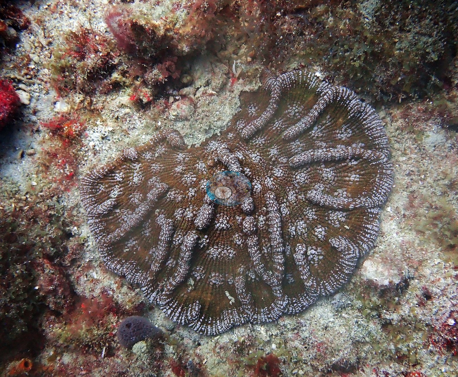

Three sites off Broward and Palm Beach counties, dived in 2022: a sponge-dominated ledge off Pompano Beach, a freighter wreck off Boca Raton, and sunken oil-platform sections. Photo-derived cover is 4.4% on the ledge, 3.8% on the wreck, and 2.6% on the platform sections.
Heat stress
Long-term record: 3 years from 1985 through 2025 reached 8 or more °C-weeks at NOAA’s Southeast Florida station. Download the annual DHW data (CSV).
3 sites in this region — click a marker to open that site.
Overview
The three Southeast Florida sites lie off Broward and Palm Beach counties on the northern Florida reef tract, between Hallandale and Boca Raton. Anderson dived Tenneco Towers on 26 February 2022, and Rabbit Ears off Pompano Beach and the United Caribbean wreck, off the Boca Raton/Deerfield Beach line (a Fort Lauderdale-area dive), on 8 April 2022, a two-dive day.
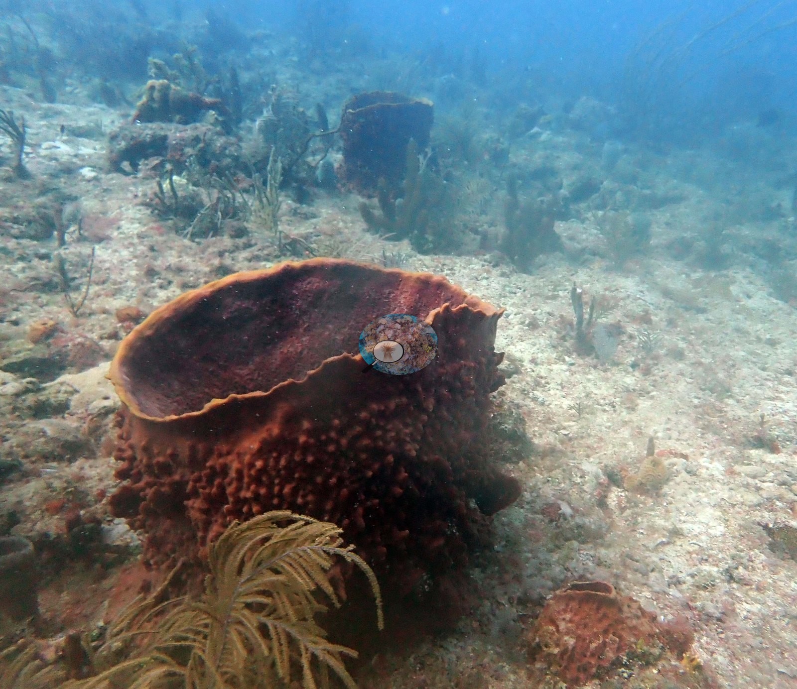
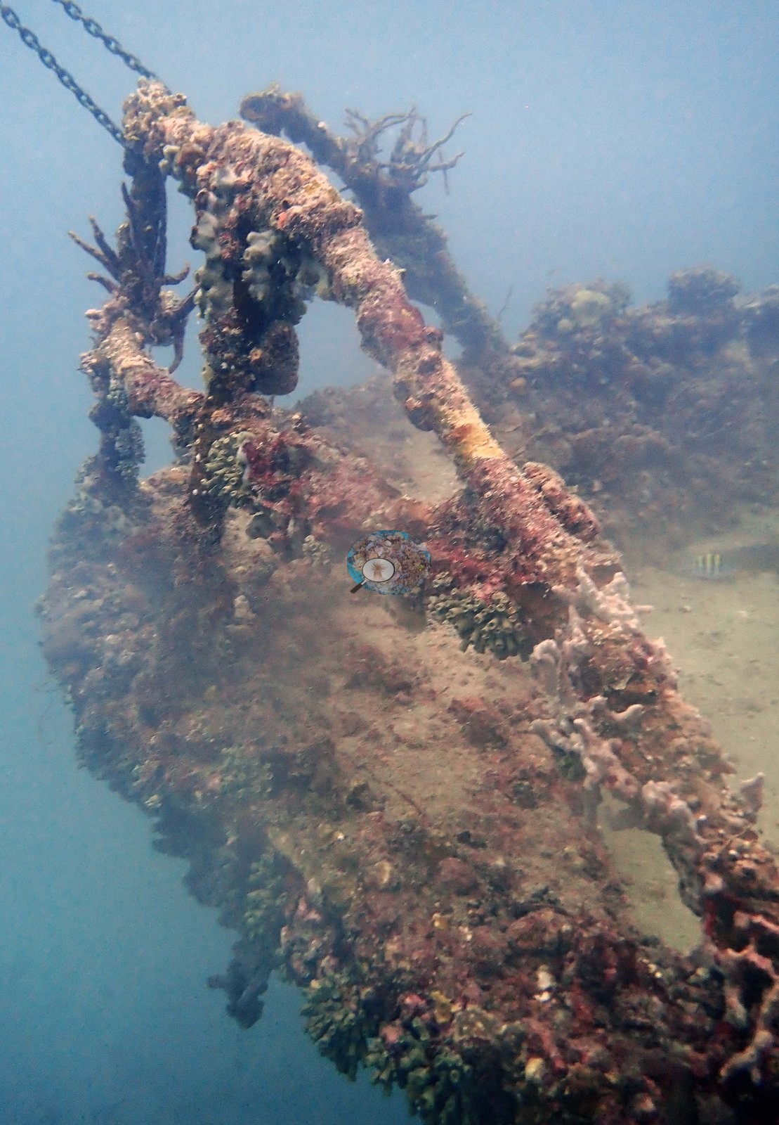
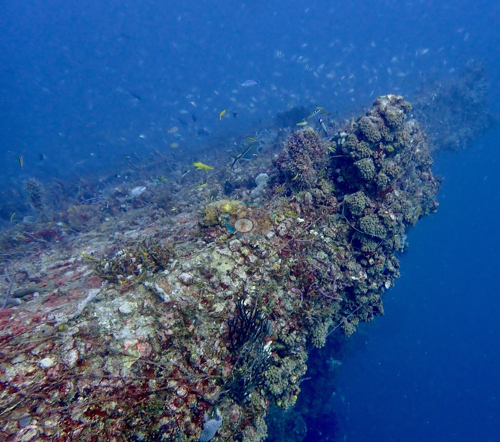
Rabbit Ears is a low natural ledge ruled by giant barrel sponges, set among sea rods, sea plumes, and red and orange encrusting sponges, with only a few small stony coral colonies (meandroid corals and a large-polyp massive coral) on algae-covered rock. The other two sites are artificial. The United Caribbean is a 43 m (140 ft) freighter sunk in 2000 in about 21 m (70 ft) of water (Florida Fish and Wildlife Conservation Commission deployment PB0050), its girders and hull plating overgrown with sponges, coralline algae, and hydroids. Tenneco Towers is a set of decommissioned oil and gas platform sections whose steel legs carry sponges, octocorals, and a few stony corals, including a well-grown brain coral, wrapped in dense schools of baitfish and grunts.
A blind Claude computer-vision point count of Anderson's own photographs puts coral cover at 4.4% at Rabbit Ears (17 photos), 3.8% on the United Caribbean wreck (14 photos), and 2.6% on Tenneco Towers (45 photos). On the United Caribbean, one small colony carries white blotches of unclear cause (partial bleaching or tissue loss).
Highlights
- Rabbit Ears (Pompano Beach): a low ledge of giant barrel sponges, some big enough to shelter a small fish
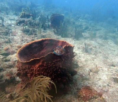 photo: Rabbit Ears (Pompano Beach)
- United Caribbean: a 43 m (140 ft) freighter sunk in 2000 off the Boca Raton/Deerfield Beach line (a Fort Lauderdale-area dive), overgrown with sponges and hydroids
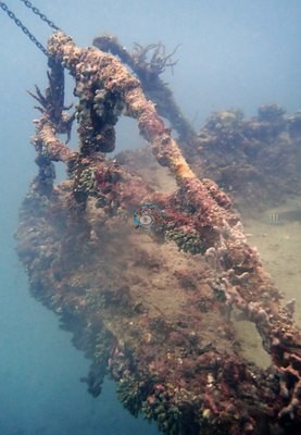 photo: United Caribbean (wreck, Fort Lauderdale)
- Tenneco Towers: sunken oil and gas platform sections wrapped in baitfish and grunt schools
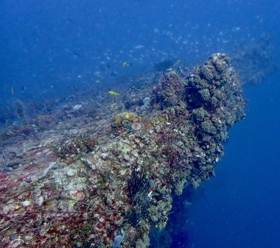 photo: Tenneco Towers
Coral cover over time (pooled)
Sites in this region
- Rabbit Ears (Pompano Beach) — 4.4%* coral cover
- Tenneco Towers — 2.6%† coral cover
- United Caribbean (wreck, Fort Lauderdale) — 3.8%* coral cover
* Based on only 10–19 reef-habitat photos; this estimate is less certain.
† Includes unedited photographs: edited versions of most of this dive's photos do not exist.
Nearby external survey stations
247 independent survey records within 5 km of a site in this region (each record counted once).
Show all 247 records
- FWC CREMP (Southeast Florida, SECREMP) — Broward County 5 #21 (2013): 2.4% hard coral cover, 2.33 km from United Caribbean (wreck, Fort Lauderdale)
- FWC CREMP (Southeast Florida, SECREMP) — Broward County 5 #21 (2014): 0.5% hard coral cover, 2.33 km from United Caribbean (wreck, Fort Lauderdale)
- FWC CREMP (Southeast Florida, SECREMP) — Broward County 5 #21 (2015): 1.0% hard coral cover, 2.33 km from United Caribbean (wreck, Fort Lauderdale)
- FWC CREMP (Southeast Florida, SECREMP) — Broward County 5 #21 (2016): 0.2% hard coral cover, 2.33 km from United Caribbean (wreck, Fort Lauderdale)
- FWC CREMP (Southeast Florida, SECREMP) — Broward County 5 #21 (2017): 0.4% hard coral cover, 2.33 km from United Caribbean (wreck, Fort Lauderdale)
- FWC CREMP (Southeast Florida, SECREMP) — Broward County 5 #21 (2018): 0.1% hard coral cover, 2.33 km from United Caribbean (wreck, Fort Lauderdale)
- FWC CREMP (Southeast Florida, SECREMP) — Broward County 5 #21 (2019): 0.0% hard coral cover, 2.33 km from United Caribbean (wreck, Fort Lauderdale)
- FWC CREMP (Southeast Florida, SECREMP) — Broward County 5 #21 (2020): 0.2% hard coral cover, 2.33 km from United Caribbean (wreck, Fort Lauderdale)
- FWC CREMP (Southeast Florida, SECREMP) — Broward County 5 #21 (2021): 0.1% hard coral cover, 2.33 km from United Caribbean (wreck, Fort Lauderdale)
- FWC CREMP (Southeast Florida, SECREMP) — Broward County 5 #21 (2022): 0.1% hard coral cover, 2.33 km from United Caribbean (wreck, Fort Lauderdale)
- FWC CREMP (Southeast Florida, SECREMP) — Broward County 5 #21 (2023): 0.7% hard coral cover, 2.33 km from United Caribbean (wreck, Fort Lauderdale)
- FWC CREMP (Southeast Florida, SECREMP) — Broward County 5 #21 (2024): 0.6% hard coral cover, 2.33 km from United Caribbean (wreck, Fort Lauderdale)
- FWC CREMP (Southeast Florida, SECREMP) — Broward County 5 #22 (2013): 1.1% hard coral cover, 2.33 km from United Caribbean (wreck, Fort Lauderdale)
- FWC CREMP (Southeast Florida, SECREMP) — Broward County 5 #22 (2014): 0.3% hard coral cover, 2.33 km from United Caribbean (wreck, Fort Lauderdale)
- FWC CREMP (Southeast Florida, SECREMP) — Broward County 5 #22 (2015): 1.8% hard coral cover, 2.33 km from United Caribbean (wreck, Fort Lauderdale)
- FWC CREMP (Southeast Florida, SECREMP) — Broward County 5 #22 (2016): 0.1% hard coral cover, 2.33 km from United Caribbean (wreck, Fort Lauderdale)
- FWC CREMP (Southeast Florida, SECREMP) — Broward County 5 #22 (2017): 0.1% hard coral cover, 2.33 km from United Caribbean (wreck, Fort Lauderdale)
- FWC CREMP (Southeast Florida, SECREMP) — Broward County 5 #22 (2018): 0.3% hard coral cover, 2.33 km from United Caribbean (wreck, Fort Lauderdale)
- FWC CREMP (Southeast Florida, SECREMP) — Broward County 5 #22 (2019): 0.4% hard coral cover, 2.33 km from United Caribbean (wreck, Fort Lauderdale)
- FWC CREMP (Southeast Florida, SECREMP) — Broward County 5 #22 (2020): 0.3% hard coral cover, 2.33 km from United Caribbean (wreck, Fort Lauderdale)
- FWC CREMP (Southeast Florida, SECREMP) — Broward County 5 #22 (2021): 0.4% hard coral cover, 2.33 km from United Caribbean (wreck, Fort Lauderdale)
- FWC CREMP (Southeast Florida, SECREMP) — Broward County 5 #22 (2022): 0.5% hard coral cover, 2.33 km from United Caribbean (wreck, Fort Lauderdale)
- FWC CREMP (Southeast Florida, SECREMP) — Broward County 5 #22 (2023): 0.6% hard coral cover, 2.33 km from United Caribbean (wreck, Fort Lauderdale)
- FWC CREMP (Southeast Florida, SECREMP) — Broward County 5 #22 (2024): 0.6% hard coral cover, 2.33 km from United Caribbean (wreck, Fort Lauderdale)
- FWC CREMP (Southeast Florida, SECREMP) — Broward County 5 #23 (2013): 1.3% hard coral cover, 2.33 km from United Caribbean (wreck, Fort Lauderdale)
- FWC CREMP (Southeast Florida, SECREMP) — Broward County 5 #23 (2014): 1.7% hard coral cover, 2.33 km from United Caribbean (wreck, Fort Lauderdale)
- FWC CREMP (Southeast Florida, SECREMP) — Broward County 5 #23 (2015): 1.2% hard coral cover, 2.33 km from United Caribbean (wreck, Fort Lauderdale)
- FWC CREMP (Southeast Florida, SECREMP) — Broward County 5 #23 (2016): 0.1% hard coral cover, 2.33 km from United Caribbean (wreck, Fort Lauderdale)
- FWC CREMP (Southeast Florida, SECREMP) — Broward County 5 #23 (2017): 0.6% hard coral cover, 2.33 km from United Caribbean (wreck, Fort Lauderdale)
- FWC CREMP (Southeast Florida, SECREMP) — Broward County 5 #23 (2018): 0.2% hard coral cover, 2.33 km from United Caribbean (wreck, Fort Lauderdale)
- FWC CREMP (Southeast Florida, SECREMP) — Broward County 5 #23 (2019): 0.4% hard coral cover, 2.33 km from United Caribbean (wreck, Fort Lauderdale)
- FWC CREMP (Southeast Florida, SECREMP) — Broward County 5 #23 (2020): 0.9% hard coral cover, 2.33 km from United Caribbean (wreck, Fort Lauderdale)
- FWC CREMP (Southeast Florida, SECREMP) — Broward County 5 #23 (2021): 0.0% hard coral cover, 2.33 km from United Caribbean (wreck, Fort Lauderdale)
- FWC CREMP (Southeast Florida, SECREMP) — Broward County 5 #23 (2022): 0.2% hard coral cover, 2.33 km from United Caribbean (wreck, Fort Lauderdale)
- FWC CREMP (Southeast Florida, SECREMP) — Broward County 5 #23 (2023): 0.5% hard coral cover, 2.33 km from United Caribbean (wreck, Fort Lauderdale)
- FWC CREMP (Southeast Florida, SECREMP) — Broward County 5 #23 (2024): 0.6% hard coral cover, 2.33 km from United Caribbean (wreck, Fort Lauderdale)
- FWC CREMP (Southeast Florida, SECREMP) — Broward County 5 #24 (2013): 1.2% hard coral cover, 2.33 km from United Caribbean (wreck, Fort Lauderdale)
- FWC CREMP (Southeast Florida, SECREMP) — Broward County 5 #24 (2014): 1.8% hard coral cover, 2.33 km from United Caribbean (wreck, Fort Lauderdale)
- FWC CREMP (Southeast Florida, SECREMP) — Broward County 5 #24 (2015): 1.8% hard coral cover, 2.33 km from United Caribbean (wreck, Fort Lauderdale)
- FWC CREMP (Southeast Florida, SECREMP) — Broward County 5 #24 (2016): 0.2% hard coral cover, 2.33 km from United Caribbean (wreck, Fort Lauderdale)
- FWC CREMP (Southeast Florida, SECREMP) — Broward County 5 #24 (2017): 0.1% hard coral cover, 2.33 km from United Caribbean (wreck, Fort Lauderdale)
- FWC CREMP (Southeast Florida, SECREMP) — Broward County 5 #24 (2018): 0.2% hard coral cover, 2.33 km from United Caribbean (wreck, Fort Lauderdale)
- FWC CREMP (Southeast Florida, SECREMP) — Broward County 5 #24 (2019): 0.8% hard coral cover, 2.33 km from United Caribbean (wreck, Fort Lauderdale)
- FWC CREMP (Southeast Florida, SECREMP) — Broward County 5 #24 (2020): 0.3% hard coral cover, 2.33 km from United Caribbean (wreck, Fort Lauderdale)
- FWC CREMP (Southeast Florida, SECREMP) — Broward County 5 #24 (2021): 0.3% hard coral cover, 2.33 km from United Caribbean (wreck, Fort Lauderdale)
- FWC CREMP (Southeast Florida, SECREMP) — Broward County 5 #24 (2022): 0.2% hard coral cover, 2.33 km from United Caribbean (wreck, Fort Lauderdale)
- FWC CREMP (Southeast Florida, SECREMP) — Broward County 5 #24 (2023): 0.2% hard coral cover, 2.33 km from United Caribbean (wreck, Fort Lauderdale)
- FWC CREMP (Southeast Florida, SECREMP) — Broward County 5 #24 (2024): 1.3% hard coral cover, 2.33 km from United Caribbean (wreck, Fort Lauderdale)
- FWC CREMP (Southeast Florida, SECREMP) — Broward County 6 #31 (2013): 1.3% hard coral cover, 2.24 km from United Caribbean (wreck, Fort Lauderdale)
- FWC CREMP (Southeast Florida, SECREMP) — Broward County 6 #31 (2014): 1.2% hard coral cover, 2.24 km from United Caribbean (wreck, Fort Lauderdale)
- FWC CREMP (Southeast Florida, SECREMP) — Broward County 6 #31 (2015): 1.2% hard coral cover, 2.24 km from United Caribbean (wreck, Fort Lauderdale)
- FWC CREMP (Southeast Florida, SECREMP) — Broward County 6 #31 (2016): 0.6% hard coral cover, 2.24 km from United Caribbean (wreck, Fort Lauderdale)
- FWC CREMP (Southeast Florida, SECREMP) — Broward County 6 #31 (2017): 0.2% hard coral cover, 2.24 km from United Caribbean (wreck, Fort Lauderdale)
- FWC CREMP (Southeast Florida, SECREMP) — Broward County 6 #31 (2018): 0.6% hard coral cover, 2.24 km from United Caribbean (wreck, Fort Lauderdale)
- FWC CREMP (Southeast Florida, SECREMP) — Broward County 6 #31 (2019): 0.5% hard coral cover, 2.24 km from United Caribbean (wreck, Fort Lauderdale)
- FWC CREMP (Southeast Florida, SECREMP) — Broward County 6 #31 (2020): 0.9% hard coral cover, 2.24 km from United Caribbean (wreck, Fort Lauderdale)
- FWC CREMP (Southeast Florida, SECREMP) — Broward County 6 #31 (2021): 0.5% hard coral cover, 2.24 km from United Caribbean (wreck, Fort Lauderdale)
- FWC CREMP (Southeast Florida, SECREMP) — Broward County 6 #31 (2022): 0.6% hard coral cover, 2.24 km from United Caribbean (wreck, Fort Lauderdale)
- FWC CREMP (Southeast Florida, SECREMP) — Broward County 6 #31 (2023): 0.8% hard coral cover, 2.24 km from United Caribbean (wreck, Fort Lauderdale)
- FWC CREMP (Southeast Florida, SECREMP) — Broward County 6 #31 (2024): 1.1% hard coral cover, 2.24 km from United Caribbean (wreck, Fort Lauderdale)
- FWC CREMP (Southeast Florida, SECREMP) — Broward County 6 #32 (2013): 0.5% hard coral cover, 2.24 km from United Caribbean (wreck, Fort Lauderdale)
- FWC CREMP (Southeast Florida, SECREMP) — Broward County 6 #32 (2014): 0.5% hard coral cover, 2.24 km from United Caribbean (wreck, Fort Lauderdale)
- FWC CREMP (Southeast Florida, SECREMP) — Broward County 6 #32 (2015): 0.2% hard coral cover, 2.24 km from United Caribbean (wreck, Fort Lauderdale)
- FWC CREMP (Southeast Florida, SECREMP) — Broward County 6 #32 (2016): 0.2% hard coral cover, 2.24 km from United Caribbean (wreck, Fort Lauderdale)
- FWC CREMP (Southeast Florida, SECREMP) — Broward County 6 #32 (2017): 0.3% hard coral cover, 2.24 km from United Caribbean (wreck, Fort Lauderdale)
- FWC CREMP (Southeast Florida, SECREMP) — Broward County 6 #32 (2018): 0.4% hard coral cover, 2.24 km from United Caribbean (wreck, Fort Lauderdale)
- FWC CREMP (Southeast Florida, SECREMP) — Broward County 6 #32 (2019): 0.2% hard coral cover, 2.24 km from United Caribbean (wreck, Fort Lauderdale)
- FWC CREMP (Southeast Florida, SECREMP) — Broward County 6 #32 (2020): 0.4% hard coral cover, 2.24 km from United Caribbean (wreck, Fort Lauderdale)
- FWC CREMP (Southeast Florida, SECREMP) — Broward County 6 #32 (2021): 0.5% hard coral cover, 2.24 km from United Caribbean (wreck, Fort Lauderdale)
- FWC CREMP (Southeast Florida, SECREMP) — Broward County 6 #32 (2022): 0.5% hard coral cover, 2.24 km from United Caribbean (wreck, Fort Lauderdale)
- FWC CREMP (Southeast Florida, SECREMP) — Broward County 6 #32 (2023): 0.2% hard coral cover, 2.24 km from United Caribbean (wreck, Fort Lauderdale)
- FWC CREMP (Southeast Florida, SECREMP) — Broward County 6 #32 (2024): 0.4% hard coral cover, 2.24 km from United Caribbean (wreck, Fort Lauderdale)
- FWC CREMP (Southeast Florida, SECREMP) — Broward County 6 #33 (2013): 0.5% hard coral cover, 2.24 km from United Caribbean (wreck, Fort Lauderdale)
- FWC CREMP (Southeast Florida, SECREMP) — Broward County 6 #33 (2014): 0.5% hard coral cover, 2.24 km from United Caribbean (wreck, Fort Lauderdale)
- FWC CREMP (Southeast Florida, SECREMP) — Broward County 6 #33 (2015): 0.7% hard coral cover, 2.24 km from United Caribbean (wreck, Fort Lauderdale)
- FWC CREMP (Southeast Florida, SECREMP) — Broward County 6 #33 (2016): 0.1% hard coral cover, 2.24 km from United Caribbean (wreck, Fort Lauderdale)
- FWC CREMP (Southeast Florida, SECREMP) — Broward County 6 #33 (2017): 0.9% hard coral cover, 2.24 km from United Caribbean (wreck, Fort Lauderdale)
- FWC CREMP (Southeast Florida, SECREMP) — Broward County 6 #33 (2018): 0.1% hard coral cover, 2.24 km from United Caribbean (wreck, Fort Lauderdale)
- FWC CREMP (Southeast Florida, SECREMP) — Broward County 6 #33 (2019): 0.6% hard coral cover, 2.24 km from United Caribbean (wreck, Fort Lauderdale)
- FWC CREMP (Southeast Florida, SECREMP) — Broward County 6 #33 (2020): 0.5% hard coral cover, 2.24 km from United Caribbean (wreck, Fort Lauderdale)
- FWC CREMP (Southeast Florida, SECREMP) — Broward County 6 #33 (2021): 0.1% hard coral cover, 2.24 km from United Caribbean (wreck, Fort Lauderdale)
- FWC CREMP (Southeast Florida, SECREMP) — Broward County 6 #33 (2022): 0.4% hard coral cover, 2.24 km from United Caribbean (wreck, Fort Lauderdale)
- FWC CREMP (Southeast Florida, SECREMP) — Broward County 6 #33 (2023): 0.6% hard coral cover, 2.24 km from United Caribbean (wreck, Fort Lauderdale)
- FWC CREMP (Southeast Florida, SECREMP) — Broward County 6 #33 (2024): 0.4% hard coral cover, 2.24 km from United Caribbean (wreck, Fort Lauderdale)
- FWC CREMP (Southeast Florida, SECREMP) — Broward County 6 #34 (2013): 0.8% hard coral cover, 2.24 km from United Caribbean (wreck, Fort Lauderdale)
- FWC CREMP (Southeast Florida, SECREMP) — Broward County 6 #34 (2014): 0.1% hard coral cover, 2.24 km from United Caribbean (wreck, Fort Lauderdale)
- FWC CREMP (Southeast Florida, SECREMP) — Broward County 6 #34 (2015): 0.4% hard coral cover, 2.24 km from United Caribbean (wreck, Fort Lauderdale)
- FWC CREMP (Southeast Florida, SECREMP) — Broward County 6 #34 (2016): 0.4% hard coral cover, 2.24 km from United Caribbean (wreck, Fort Lauderdale)
- FWC CREMP (Southeast Florida, SECREMP) — Broward County 6 #34 (2017): 0.6% hard coral cover, 2.24 km from United Caribbean (wreck, Fort Lauderdale)
- FWC CREMP (Southeast Florida, SECREMP) — Broward County 6 #34 (2018): 0.5% hard coral cover, 2.24 km from United Caribbean (wreck, Fort Lauderdale)
- FWC CREMP (Southeast Florida, SECREMP) — Broward County 6 #34 (2019): 0.1% hard coral cover, 2.24 km from United Caribbean (wreck, Fort Lauderdale)
- FWC CREMP (Southeast Florida, SECREMP) — Broward County 6 #34 (2020): 0.0% hard coral cover, 2.24 km from United Caribbean (wreck, Fort Lauderdale)
- FWC CREMP (Southeast Florida, SECREMP) — Broward County 6 #34 (2021): 0.1% hard coral cover, 2.24 km from United Caribbean (wreck, Fort Lauderdale)
- FWC CREMP (Southeast Florida, SECREMP) — Broward County 6 #34 (2022): 0.2% hard coral cover, 2.24 km from United Caribbean (wreck, Fort Lauderdale)
- FWC CREMP (Southeast Florida, SECREMP) — Broward County 6 #34 (2023): 0.3% hard coral cover, 2.24 km from United Caribbean (wreck, Fort Lauderdale)
- FWC CREMP (Southeast Florida, SECREMP) — Broward County 6 #34 (2024): 0.0% hard coral cover, 2.24 km from United Caribbean (wreck, Fort Lauderdale)
- FWC CREMP (Southeast Florida, SECREMP) — Dade County 6 #41 (2013): 1.6% hard coral cover, 4.43 km from Tenneco Towers
- FWC CREMP (Southeast Florida, SECREMP) — Dade County 6 #41 (2014): 1.4% hard coral cover, 4.43 km from Tenneco Towers
- FWC CREMP (Southeast Florida, SECREMP) — Dade County 6 #41 (2015): 1.3% hard coral cover, 4.43 km from Tenneco Towers
- FWC CREMP (Southeast Florida, SECREMP) — Dade County 6 #41 (2016): 1.8% hard coral cover, 4.43 km from Tenneco Towers
- FWC CREMP (Southeast Florida, SECREMP) — Dade County 6 #41 (2017): 1.0% hard coral cover, 4.43 km from Tenneco Towers
- FWC CREMP (Southeast Florida, SECREMP) — Dade County 6 #41 (2018): 1.2% hard coral cover, 4.43 km from Tenneco Towers
- FWC CREMP (Southeast Florida, SECREMP) — Dade County 6 #41 (2019): 1.3% hard coral cover, 4.43 km from Tenneco Towers
- FWC CREMP (Southeast Florida, SECREMP) — Dade County 6 #41 (2020): 1.9% hard coral cover, 4.43 km from Tenneco Towers
- FWC CREMP (Southeast Florida, SECREMP) — Dade County 6 #41 (2021): 1.1% hard coral cover, 4.43 km from Tenneco Towers
- FWC CREMP (Southeast Florida, SECREMP) — Dade County 6 #41 (2022): 1.3% hard coral cover, 4.43 km from Tenneco Towers
- FWC CREMP (Southeast Florida, SECREMP) — Dade County 6 #41 (2023): 1.3% hard coral cover, 4.43 km from Tenneco Towers
- FWC CREMP (Southeast Florida, SECREMP) — Dade County 6 #41 (2024): 1.5% hard coral cover, 4.43 km from Tenneco Towers
- FWC CREMP (Southeast Florida, SECREMP) — Dade County 6 #42 (2013): 2.1% hard coral cover, 4.43 km from Tenneco Towers
- FWC CREMP (Southeast Florida, SECREMP) — Dade County 6 #42 (2014): 2.5% hard coral cover, 4.43 km from Tenneco Towers
- FWC CREMP (Southeast Florida, SECREMP) — Dade County 6 #42 (2015): 3.0% hard coral cover, 4.43 km from Tenneco Towers
- FWC CREMP (Southeast Florida, SECREMP) — Dade County 6 #42 (2016): 1.4% hard coral cover, 4.43 km from Tenneco Towers
- FWC CREMP (Southeast Florida, SECREMP) — Dade County 6 #42 (2017): 1.4% hard coral cover, 4.43 km from Tenneco Towers
- FWC CREMP (Southeast Florida, SECREMP) — Dade County 6 #42 (2018): 0.4% hard coral cover, 4.43 km from Tenneco Towers
- FWC CREMP (Southeast Florida, SECREMP) — Dade County 6 #42 (2019): 0.8% hard coral cover, 4.43 km from Tenneco Towers
- FWC CREMP (Southeast Florida, SECREMP) — Dade County 6 #42 (2020): 0.2% hard coral cover, 4.43 km from Tenneco Towers
- FWC CREMP (Southeast Florida, SECREMP) — Dade County 6 #42 (2021): 0.5% hard coral cover, 4.43 km from Tenneco Towers
- FWC CREMP (Southeast Florida, SECREMP) — Dade County 6 #42 (2022): 0.9% hard coral cover, 4.43 km from Tenneco Towers
- FWC CREMP (Southeast Florida, SECREMP) — Dade County 6 #42 (2023): 0.6% hard coral cover, 4.43 km from Tenneco Towers
- FWC CREMP (Southeast Florida, SECREMP) — Dade County 6 #42 (2024): 0.8% hard coral cover, 4.43 km from Tenneco Towers
- FWC CREMP (Southeast Florida, SECREMP) — Dade County 6 #43 (2013): 3.8% hard coral cover, 4.43 km from Tenneco Towers
- FWC CREMP (Southeast Florida, SECREMP) — Dade County 6 #43 (2014): 5.1% hard coral cover, 4.43 km from Tenneco Towers
- FWC CREMP (Southeast Florida, SECREMP) — Dade County 6 #43 (2015): 3.4% hard coral cover, 4.43 km from Tenneco Towers
- FWC CREMP (Southeast Florida, SECREMP) — Dade County 6 #43 (2016): 4.2% hard coral cover, 4.43 km from Tenneco Towers
- FWC CREMP (Southeast Florida, SECREMP) — Dade County 6 #43 (2017): 3.9% hard coral cover, 4.43 km from Tenneco Towers
- FWC CREMP (Southeast Florida, SECREMP) — Dade County 6 #43 (2018): 2.5% hard coral cover, 4.43 km from Tenneco Towers
- FWC CREMP (Southeast Florida, SECREMP) — Dade County 6 #43 (2019): 3.1% hard coral cover, 4.43 km from Tenneco Towers
- FWC CREMP (Southeast Florida, SECREMP) — Dade County 6 #43 (2020): 3.5% hard coral cover, 4.43 km from Tenneco Towers
- FWC CREMP (Southeast Florida, SECREMP) — Dade County 6 #43 (2021): 3.0% hard coral cover, 4.43 km from Tenneco Towers
- FWC CREMP (Southeast Florida, SECREMP) — Dade County 6 #43 (2022): 3.5% hard coral cover, 4.43 km from Tenneco Towers
- FWC CREMP (Southeast Florida, SECREMP) — Dade County 6 #43 (2023): 2.9% hard coral cover, 4.43 km from Tenneco Towers
- FWC CREMP (Southeast Florida, SECREMP) — Dade County 6 #43 (2024): 3.3% hard coral cover, 4.43 km from Tenneco Towers
- FWC CREMP (Southeast Florida, SECREMP) — Dade County 6 #44 (2013): 2.6% hard coral cover, 4.43 km from Tenneco Towers
- FWC CREMP (Southeast Florida, SECREMP) — Dade County 6 #44 (2014): 2.5% hard coral cover, 4.43 km from Tenneco Towers
- FWC CREMP (Southeast Florida, SECREMP) — Dade County 6 #44 (2015): 5.4% hard coral cover, 4.43 km from Tenneco Towers
- FWC CREMP (Southeast Florida, SECREMP) — Dade County 6 #44 (2016): 3.5% hard coral cover, 4.43 km from Tenneco Towers
- FWC CREMP (Southeast Florida, SECREMP) — Dade County 6 #44 (2017): 2.6% hard coral cover, 4.43 km from Tenneco Towers
- FWC CREMP (Southeast Florida, SECREMP) — Dade County 6 #44 (2018): 1.0% hard coral cover, 4.43 km from Tenneco Towers
- FWC CREMP (Southeast Florida, SECREMP) — Dade County 6 #44 (2019): 1.2% hard coral cover, 4.43 km from Tenneco Towers
- FWC CREMP (Southeast Florida, SECREMP) — Dade County 6 #44 (2020): 1.0% hard coral cover, 4.43 km from Tenneco Towers
- FWC CREMP (Southeast Florida, SECREMP) — Dade County 6 #44 (2021): 1.2% hard coral cover, 4.43 km from Tenneco Towers
- FWC CREMP (Southeast Florida, SECREMP) — Dade County 6 #44 (2022): 1.1% hard coral cover, 4.43 km from Tenneco Towers
- FWC CREMP (Southeast Florida, SECREMP) — Dade County 6 #44 (2023): 0.5% hard coral cover, 4.43 km from Tenneco Towers
- FWC CREMP (Southeast Florida, SECREMP) — Dade County 6 #44 (2024): 0.6% hard coral cover, 4.43 km from Tenneco Towers
- FWC CREMP (Southeast Florida, SECREMP) — Dade County 7 #51 (2013): 0.6% hard coral cover, 2.93 km from Tenneco Towers
- FWC CREMP (Southeast Florida, SECREMP) — Dade County 7 #51 (2014): 1.0% hard coral cover, 2.93 km from Tenneco Towers
- FWC CREMP (Southeast Florida, SECREMP) — Dade County 7 #51 (2015): 0.5% hard coral cover, 2.93 km from Tenneco Towers
- FWC CREMP (Southeast Florida, SECREMP) — Dade County 7 #51 (2016): 0.3% hard coral cover, 2.93 km from Tenneco Towers
- FWC CREMP (Southeast Florida, SECREMP) — Dade County 7 #51 (2017): 0.3% hard coral cover, 2.93 km from Tenneco Towers
- FWC CREMP (Southeast Florida, SECREMP) — Dade County 7 #51 (2018): 0.8% hard coral cover, 2.93 km from Tenneco Towers
- FWC CREMP (Southeast Florida, SECREMP) — Dade County 7 #51 (2019): 0.8% hard coral cover, 2.93 km from Tenneco Towers
- FWC CREMP (Southeast Florida, SECREMP) — Dade County 7 #51 (2020): 0.7% hard coral cover, 2.93 km from Tenneco Towers
- FWC CREMP (Southeast Florida, SECREMP) — Dade County 7 #51 (2021): 0.7% hard coral cover, 2.93 km from Tenneco Towers
- FWC CREMP (Southeast Florida, SECREMP) — Dade County 7 #51 (2022): 0.8% hard coral cover, 2.93 km from Tenneco Towers
- FWC CREMP (Southeast Florida, SECREMP) — Dade County 7 #51 (2023): 0.7% hard coral cover, 2.93 km from Tenneco Towers
- FWC CREMP (Southeast Florida, SECREMP) — Dade County 7 #51 (2024): 1.2% hard coral cover, 2.93 km from Tenneco Towers
- FWC CREMP (Southeast Florida, SECREMP) — Dade County 7 #52 (2013): 0.4% hard coral cover, 2.93 km from Tenneco Towers
- FWC CREMP (Southeast Florida, SECREMP) — Dade County 7 #52 (2014): 0.3% hard coral cover, 2.93 km from Tenneco Towers
- FWC CREMP (Southeast Florida, SECREMP) — Dade County 7 #52 (2015): 0.4% hard coral cover, 2.93 km from Tenneco Towers
- FWC CREMP (Southeast Florida, SECREMP) — Dade County 7 #52 (2016): 0.0% hard coral cover, 2.93 km from Tenneco Towers
- FWC CREMP (Southeast Florida, SECREMP) — Dade County 7 #52 (2017): 0.6% hard coral cover, 2.93 km from Tenneco Towers
- FWC CREMP (Southeast Florida, SECREMP) — Dade County 7 #52 (2018): 0.1% hard coral cover, 2.93 km from Tenneco Towers
- FWC CREMP (Southeast Florida, SECREMP) — Dade County 7 #52 (2019): 0.1% hard coral cover, 2.93 km from Tenneco Towers
- FWC CREMP (Southeast Florida, SECREMP) — Dade County 7 #52 (2020): 0.1% hard coral cover, 2.93 km from Tenneco Towers
- FWC CREMP (Southeast Florida, SECREMP) — Dade County 7 #52 (2021): 1.2% hard coral cover, 2.93 km from Tenneco Towers
- FWC CREMP (Southeast Florida, SECREMP) — Dade County 7 #52 (2022): 1.3% hard coral cover, 2.93 km from Tenneco Towers
- FWC CREMP (Southeast Florida, SECREMP) — Dade County 7 #52 (2023): 0.4% hard coral cover, 2.93 km from Tenneco Towers
- FWC CREMP (Southeast Florida, SECREMP) — Dade County 7 #52 (2024): 0.7% hard coral cover, 2.93 km from Tenneco Towers
- FWC CREMP (Southeast Florida, SECREMP) — Dade County 7 #53 (2013): 0.4% hard coral cover, 2.93 km from Tenneco Towers
- FWC CREMP (Southeast Florida, SECREMP) — Dade County 7 #53 (2014): 0.3% hard coral cover, 2.93 km from Tenneco Towers
- FWC CREMP (Southeast Florida, SECREMP) — Dade County 7 #53 (2015): 0.3% hard coral cover, 2.93 km from Tenneco Towers
- FWC CREMP (Southeast Florida, SECREMP) — Dade County 7 #53 (2016): 0.3% hard coral cover, 2.93 km from Tenneco Towers
- FWC CREMP (Southeast Florida, SECREMP) — Dade County 7 #53 (2017): 0.3% hard coral cover, 2.93 km from Tenneco Towers
- FWC CREMP (Southeast Florida, SECREMP) — Dade County 7 #53 (2018): 0.4% hard coral cover, 2.93 km from Tenneco Towers
- FWC CREMP (Southeast Florida, SECREMP) — Dade County 7 #53 (2019): 0.2% hard coral cover, 2.93 km from Tenneco Towers
- FWC CREMP (Southeast Florida, SECREMP) — Dade County 7 #53 (2020): 0.2% hard coral cover, 2.93 km from Tenneco Towers
- FWC CREMP (Southeast Florida, SECREMP) — Dade County 7 #53 (2021): 0.6% hard coral cover, 2.93 km from Tenneco Towers
- FWC CREMP (Southeast Florida, SECREMP) — Dade County 7 #53 (2022): 0.6% hard coral cover, 2.93 km from Tenneco Towers
- FWC CREMP (Southeast Florida, SECREMP) — Dade County 7 #53 (2023): 0.4% hard coral cover, 2.93 km from Tenneco Towers
- FWC CREMP (Southeast Florida, SECREMP) — Dade County 7 #53 (2024): 0.8% hard coral cover, 2.93 km from Tenneco Towers
- FWC CREMP (Southeast Florida, SECREMP) — Dade County 7 #54 (2013): 0.7% hard coral cover, 2.93 km from Tenneco Towers
- FWC CREMP (Southeast Florida, SECREMP) — Dade County 7 #54 (2014): 0.5% hard coral cover, 2.93 km from Tenneco Towers
- FWC CREMP (Southeast Florida, SECREMP) — Dade County 7 #54 (2015): 0.4% hard coral cover, 2.93 km from Tenneco Towers
- FWC CREMP (Southeast Florida, SECREMP) — Dade County 7 #54 (2016): 0.1% hard coral cover, 2.93 km from Tenneco Towers
- FWC CREMP (Southeast Florida, SECREMP) — Dade County 7 #54 (2017): 0.6% hard coral cover, 2.93 km from Tenneco Towers
- FWC CREMP (Southeast Florida, SECREMP) — Dade County 7 #54 (2018): 0.0% hard coral cover, 2.93 km from Tenneco Towers
- FWC CREMP (Southeast Florida, SECREMP) — Dade County 7 #54 (2019): 0.1% hard coral cover, 2.93 km from Tenneco Towers
- FWC CREMP (Southeast Florida, SECREMP) — Dade County 7 #54 (2020): 0.1% hard coral cover, 2.93 km from Tenneco Towers
- FWC CREMP (Southeast Florida, SECREMP) — Dade County 7 #54 (2021): 0.0% hard coral cover, 2.93 km from Tenneco Towers
- FWC CREMP (Southeast Florida, SECREMP) — Dade County 7 #54 (2022): 0.5% hard coral cover, 2.93 km from Tenneco Towers
- FWC CREMP (Southeast Florida, SECREMP) — Dade County 7 #54 (2023): 0.5% hard coral cover, 2.93 km from Tenneco Towers
- FWC CREMP (Southeast Florida, SECREMP) — Dade County 7 #54 (2024): 0.4% hard coral cover, 2.93 km from Tenneco Towers
- NOAA NCRMP — SEFCRI-100 (2016): 2.0% hard coral cover, 1.36 km from Tenneco Towers
- NOAA NCRMP — SEFCRI-101 (2016): 2.0% hard coral cover, 1.36 km from Tenneco Towers
- NOAA NCRMP — SEFCRI-102 (2016): 3.0% hard coral cover, 3.13 km from Tenneco Towers
- NOAA NCRMP — SEFCRI-103 (2016): 1.0% hard coral cover, 2.85 km from Tenneco Towers
- NOAA NCRMP — SEFCRI-106 (2016): 1.0% hard coral cover, 4.45 km from Rabbit Ears (Pompano Beach)
- NOAA NCRMP — SEFCRI-107 (2016): 4.0% hard coral cover, 4.45 km from Rabbit Ears (Pompano Beach)
- NOAA NCRMP — SEFCRI-124 (2016): 1.0% hard coral cover, 3.62 km from Tenneco Towers
- NOAA NCRMP — SEFCRI-127 (2016): 4.0% hard coral cover, 1.65 km from United Caribbean (wreck, Fort Lauderdale)
- NOAA NCRMP — SEFCRI-137 (2016): 4.0% hard coral cover, 0.99 km from United Caribbean (wreck, Fort Lauderdale)
- NOAA NCRMP — SEFCRI-138 (2016): 1.0% hard coral cover, 2.35 km from United Caribbean (wreck, Fort Lauderdale)
- NOAA NCRMP — SEFCRI-139 (2016): 1.0% hard coral cover, 1.48 km from United Caribbean (wreck, Fort Lauderdale)
- NOAA NCRMP — SEFCRI-140 (2016): 7.0% hard coral cover, 1.49 km from Rabbit Ears (Pompano Beach)
- NOAA NCRMP — SEFCRI-141 (2016): 3.0% hard coral cover, 2.59 km from United Caribbean (wreck, Fort Lauderdale)
- NOAA NCRMP — SEFCRI-16 (2014): 3.0% hard coral cover, 3.66 km from Tenneco Towers
- NOAA NCRMP — SEFCRI-17 (2014): 5.0% hard coral cover, 2.01 km from Tenneco Towers
- NOAA NCRMP — SEFCRI-18 (2014): 2.0% hard coral cover, 1.11 km from Rabbit Ears (Pompano Beach)
- NOAA NCRMP — SEFCRI-19 (2014): 3.0% hard coral cover, 2.22 km from Rabbit Ears (Pompano Beach)
- NOAA NCRMP — SEFCRI-20 (2014): 0.0% hard coral cover, 2.22 km from Rabbit Ears (Pompano Beach)
- NOAA NCRMP — SEFCRI-21 (2014): 0.0% hard coral cover, 2.22 km from Rabbit Ears (Pompano Beach)
- NOAA NCRMP — SEFCRI-46 (2014): 5.0% hard coral cover, 2.20 km from Tenneco Towers
- NOAA NCRMP — SEFCRI-63 (2016): 4.0% hard coral cover, 4.37 km from Tenneco Towers
- NOAA NCRMP — SEFCRI-64 (2016): 1.0% hard coral cover, 4.37 km from Tenneco Towers
- NOAA NCRMP Florida — SEFCRI PSU 3112-1 (2024): 2.0% hard coral cover, 3.58 km from Tenneco Towers
- NOAA NCRMP Florida — SEFCRI PSU 3114-1 (2024): 1.0% hard coral cover, 1.24 km from Rabbit Ears (Pompano Beach)
- NOAA NCRMP Florida — SEFCRI PSU 3117-1 (2024): 0.0% hard coral cover, 1.40 km from United Caribbean (wreck, Fort Lauderdale)
- NOAA NCRMP Florida — SEFCRI PSU 3126-1 (2024): 3.0% hard coral cover, 4.68 km from Tenneco Towers
- NOAA NCRMP Florida — SEFCRI PSU 3151-1 (2024): 1.0% hard coral cover, 0.85 km from United Caribbean (wreck, Fort Lauderdale)
- NOAA NCRMP Florida — SEFCRI PSU 3163-1 (2024): 2.0% hard coral cover, 4.54 km from Tenneco Towers
- NOAA NCRMP Florida — SEFCRI PSU 3168-1 (2024): 0.0% hard coral cover, 1.12 km from Tenneco Towers
- NOAA NCRMP Florida — SEFCRI PSU 3174-1 (2024): 1.0% hard coral cover, 2.84 km from Tenneco Towers
- NOAA NCRMP Florida — SEFCRI PSU 3185-1 (2024): 0.0% hard coral cover, 2.46 km from Tenneco Towers
- NOAA NCRMP Florida — SEFCRI PSU 3189-1 (2024): 0.0% hard coral cover, 2.44 km from Tenneco Towers
- NOAA NCRMP Florida — SEFCRI PSU 3200-1 (2024): 4.0% hard coral cover, 0.68 km from Rabbit Ears (Pompano Beach)
- NOAA NCRMP Florida — SEFCRI PSU 3201-1 (2024): 0.0% hard coral cover, 2.46 km from United Caribbean (wreck, Fort Lauderdale)
- NOAA NCRMP Florida — SEFCRI PSU 3217-1 (2024): 4.0% hard coral cover, 4.85 km from Rabbit Ears (Pompano Beach)
- NOAA NCRMP Florida — SEFCRI PSU 3223-1 (2024): 0.0% hard coral cover, 2.38 km from Rabbit Ears (Pompano Beach)
- NOAA NCRMP Florida — SEFCRI PSU 3224-1 (2024): 4.0% hard coral cover, 3.96 km from Rabbit Ears (Pompano Beach)
- NOAA NCRMP Florida — SEFCRI PSU 3240-1 (2024): 8.0% hard coral cover, 0.61 km from Rabbit Ears (Pompano Beach)
- NOAA NCRMP Florida — SEFCRI PSU 3241-1 (2024): 1.0% hard coral cover, 0.17 km from Rabbit Ears (Pompano Beach)
- NOAA NCRMP Florida — SEFCRI PSU 3244-1 (2024): 0.0% hard coral cover, 0.60 km from United Caribbean (wreck, Fort Lauderdale)
- NOAA NCRMP Florida — SEFCRI PSU 3254-1 (2024): 0.0% hard coral cover, 0.84 km from Tenneco Towers
- NOAA NCRMP Florida — SEFCRI PSU 3269-1 (2024): 1.0% hard coral cover, 2.45 km from Rabbit Ears (Pompano Beach)
- NOAA NCRMP Florida — SEFCRI PSU 3289-1 (2024): 0.0% hard coral cover, 2.71 km from Rabbit Ears (Pompano Beach)
- Reef Check — Abbey Too (2013): 4.4% hard coral cover, 0.11 km from Rabbit Ears (Pompano Beach)
- Reef Check — Abbey Too (2013): 1.9% hard coral cover, 1.90 km from Rabbit Ears (Pompano Beach)
- Reef Check — Abbey Too Reef (2011): 6.3% hard coral cover, 0.90 km from Rabbit Ears (Pompano Beach)
- Reef Check — Boca Artificial Reef (2014): 0.6% hard coral cover, 0.90 km from United Caribbean (wreck, Fort Lauderdale)
- Reef Check — Boca Artificial Reef Ledge (2011): 2.5% hard coral cover, 0.72 km from United Caribbean (wreck, Fort Lauderdale)
- Reef Check — Boca Patch Reef (2011): 0.6% hard coral cover, 1.01 km from United Caribbean (wreck, Fort Lauderdale)
- Reef Check — Honeycomb Reef (2011): 1.3% hard coral cover, 4.42 km from United Caribbean (wreck, Fort Lauderdale)
- Reef Check — Horseshoe Reef (2014): 3.1% hard coral cover, 0.16 km from Rabbit Ears (Pompano Beach)
- Reef Check — Pompano 3rd Reef into Razzle Dazzle Reef (2015): 5.6% hard coral cover, 1.92 km from Rabbit Ears (Pompano Beach)
- Reef Check — Razzle Dazzle Reef (2015): 3.1% hard coral cover, 2.81 km from Rabbit Ears (Pompano Beach)
- Reef Check — Sanctuary Reef- Pompano Beach (2011): 1.3% hard coral cover, 2.08 km from United Caribbean (wreck, Fort Lauderdale)
- Reef Check — Separated Reefs (2011): 8.1% hard coral cover, 0.93 km from United Caribbean (wreck, Fort Lauderdale)
All images from Coral Reef Diagnostics. Data are from Coral Reef Diagnostics, Reef Check Foundation, FWC-FWRI CREMP (Florida Fish and Wildlife Conservation Commission), and NOAA National Coral Reef Monitoring Program.
 © Coral Reef Diagnostics.