
Rabbit Ears (Pompano Beach)

Part of the regional summary: USA - Southeast Florida
More info
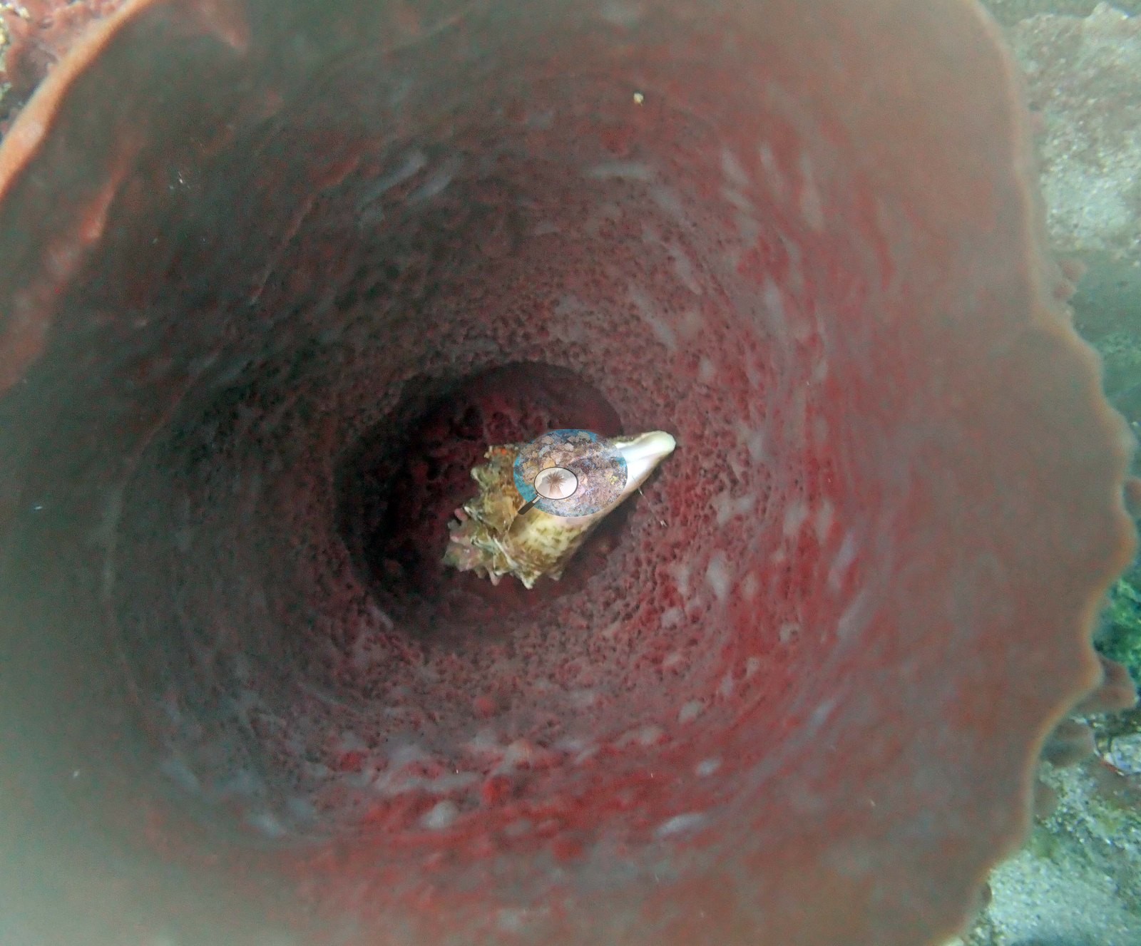
Southeast Florida (NOAA CRW virtual station)Rabbit Ears off Pompano Beach is a low southeast Florida ledge ruled by giant barrel sponges, one with a snail shell lodged in its opening, set among sea rods, sea plumes, and red and orange encrusting sponges. Stony coral is sparse, just a few small colonies (meandroid corals and a large-polyp massive coral) on algae-covered rock, with no sign of bleaching.
35 independent survey stations shown with the program’s logo — click one to see how far it is from this site.
Site description
Setting
Light is dim and blue — the surface is not visible in any frame and the wide shots go dark and blue at mid-distance — consistent with a deeper ledge dive.
General benthic features
Across 18 edited frames the site presents as a low-relief southeast Florida hardbottom ledge whose dominant living structure is sponge, not stony coral. Giant barrel sponges, consistent with Xestospongia muta, are the defining feature and appear in ten of the eighteen frames. Image 1 shows a broad red-brown barrel sitting on sand-veneered rock with a yellow sea plume growing at its base.
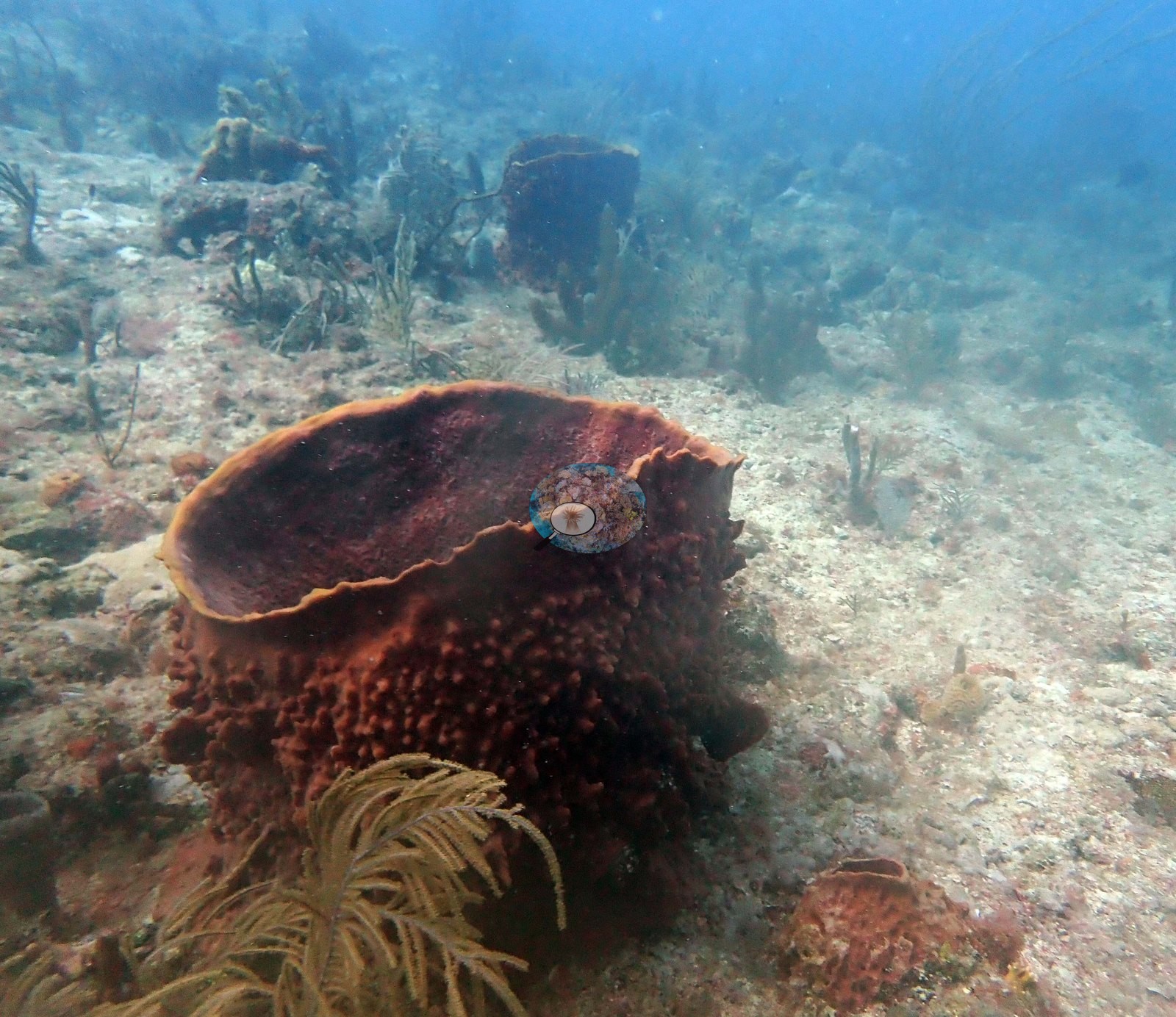
Image 4 is a tall red-orange barrel with red encrusting sponge skirting its foot.
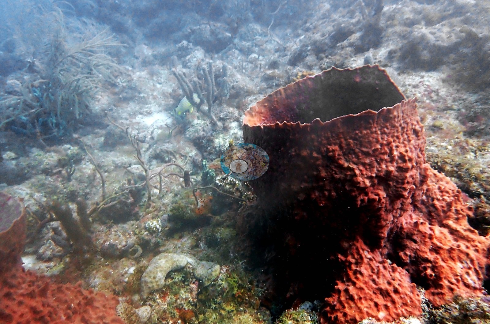
Image 14 is the best single specimen frame: a large orange-red barrel with a distinctly frilled, scalloped rim, a yellow grunt tucked at its base.
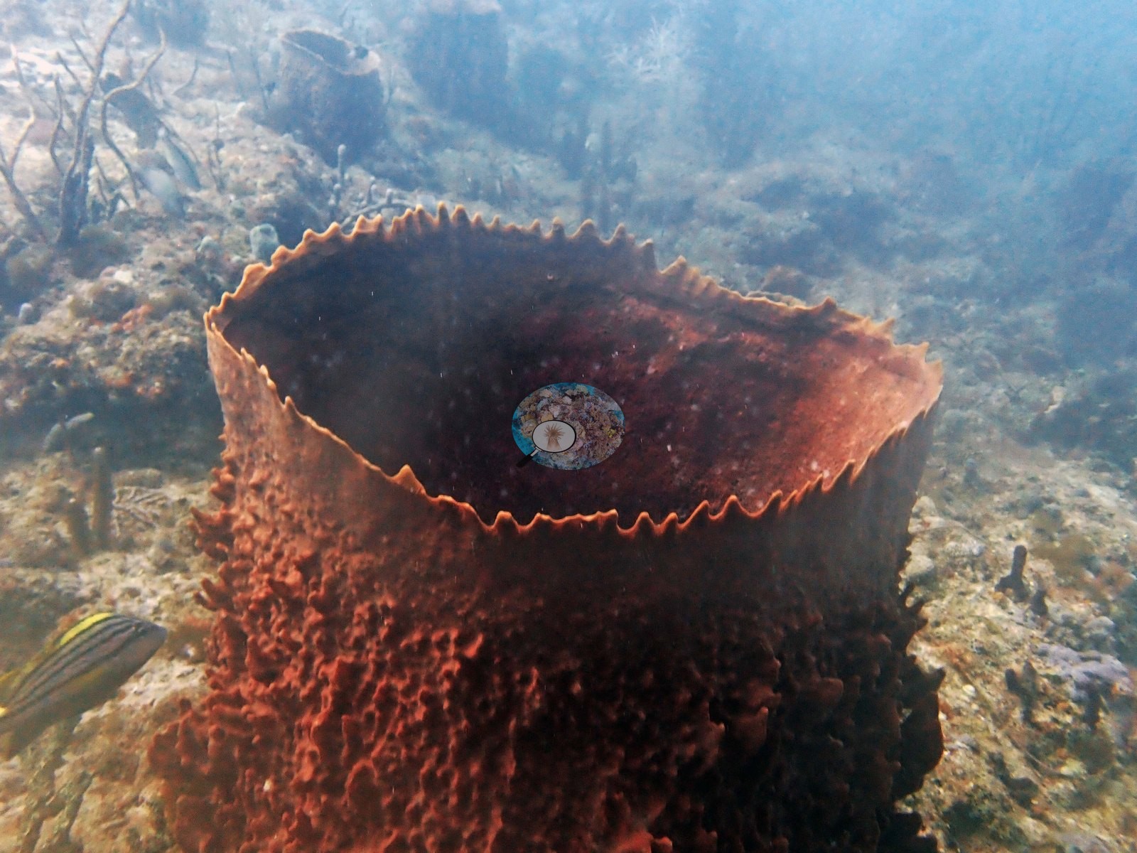
Image 3 is a close frame at the foot of a barrel wall, where a spotted moray looks out of a hole beside a small gray-brown tube sponge, a blue encrusting patch (blue sponge or colonial tunicate — not separable here), yellow tube-sponge or zoanthid growth, and green algal turf.
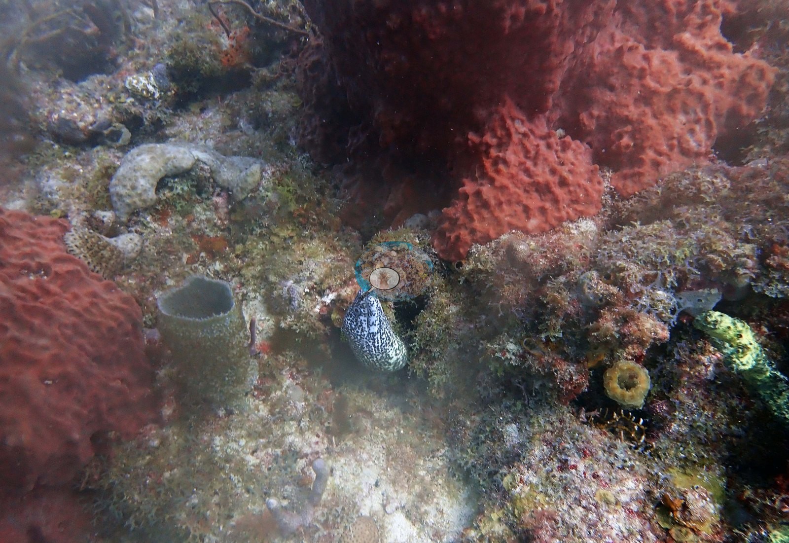
Image 8 is a smaller rose-to-mauve cup or vase sponge with a visibly ridged interior wall.
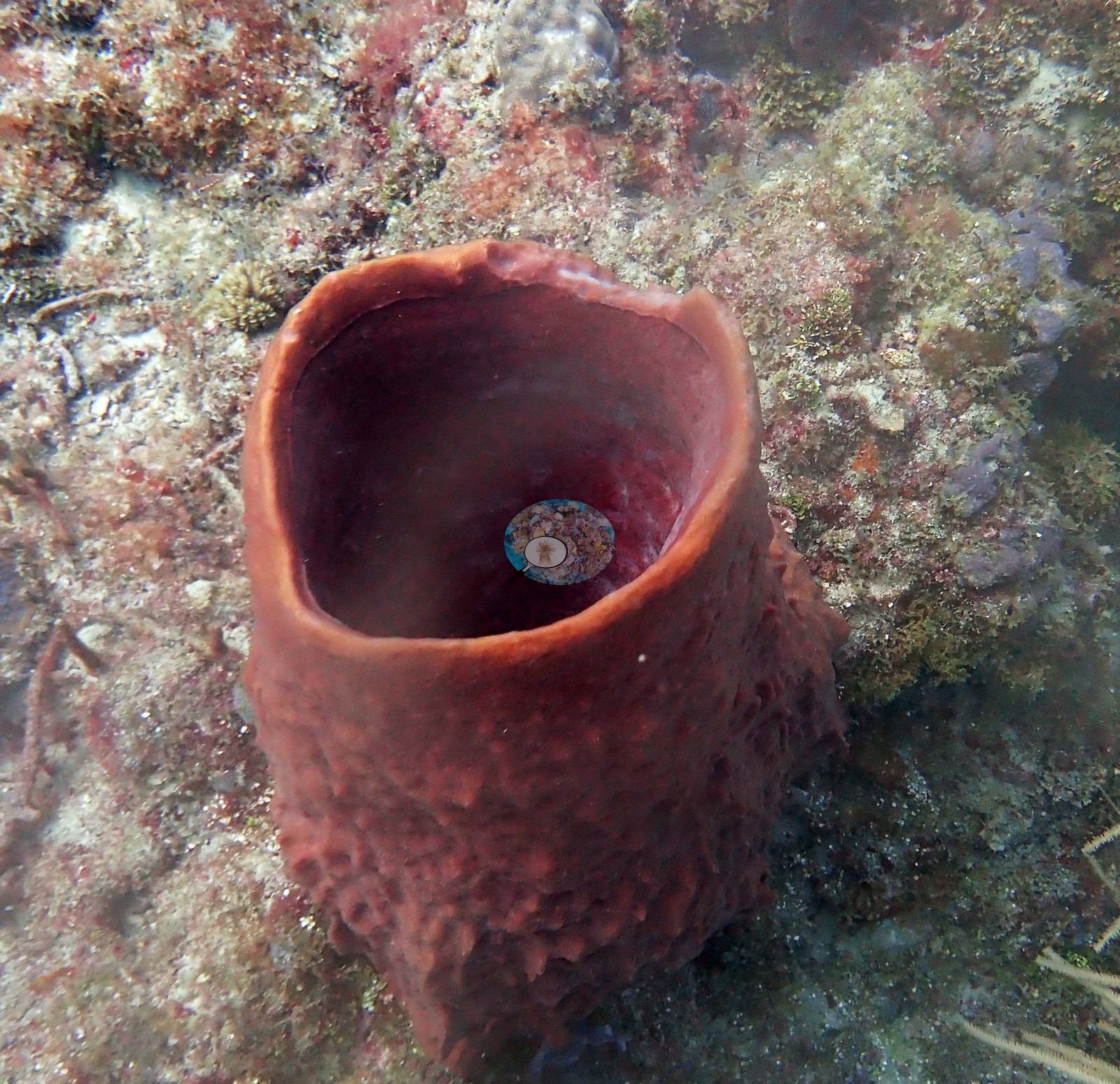
Image 13 and Image 16 both show several barrels at once along the ledge, with orange encrusting sponge, gorgonians, and a sea fan; Image 17 is a tall barrel silhouetted in the haze; Image 10 is a wide of the ledge with multiple barrels standing above it.
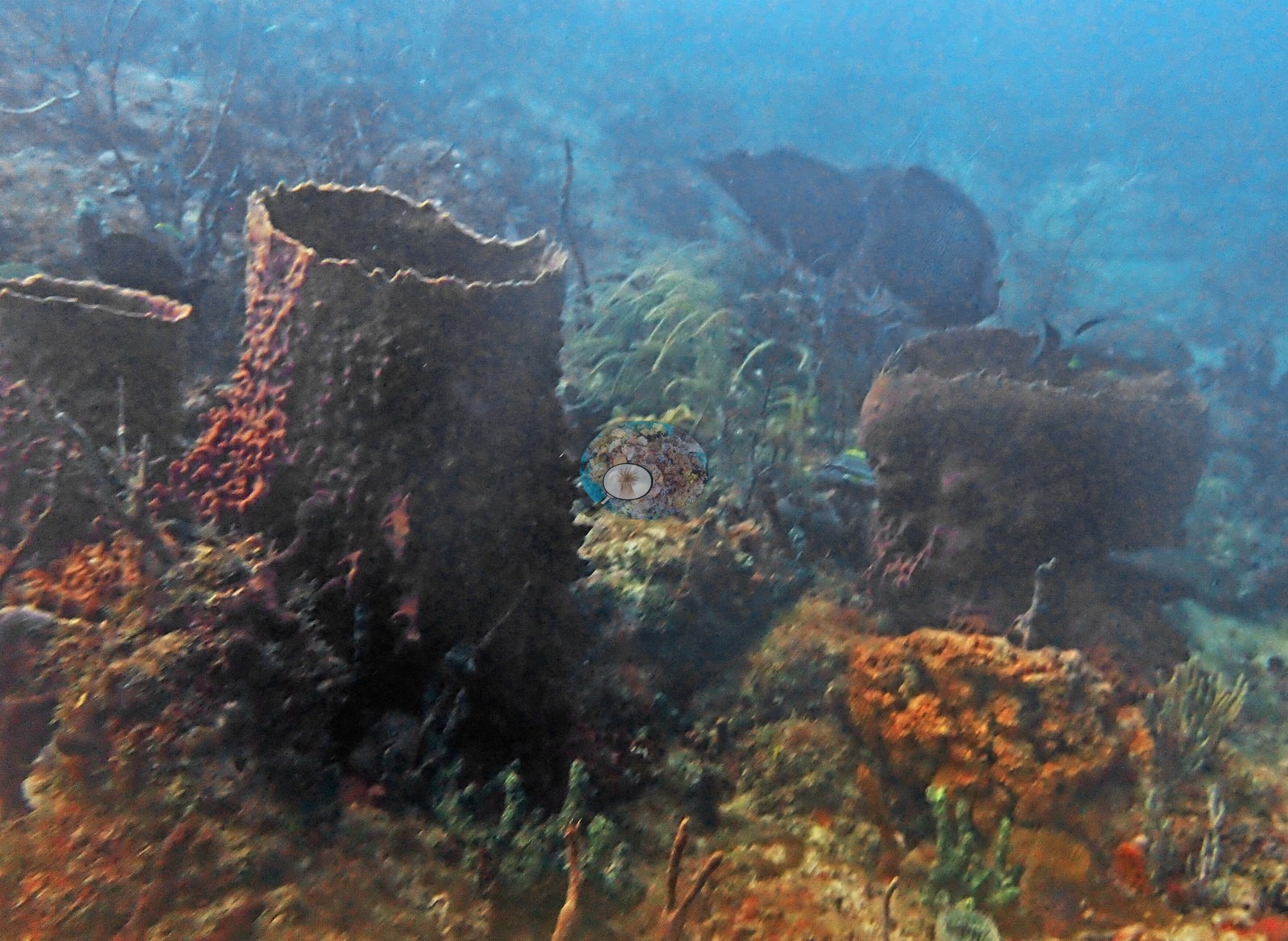
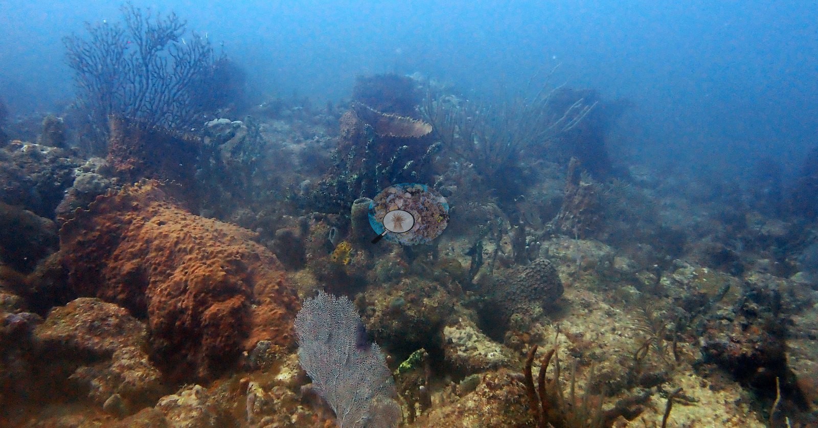
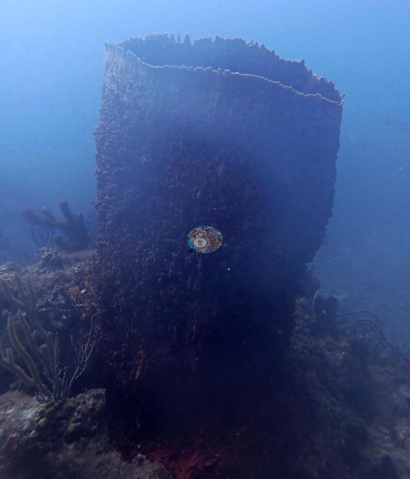
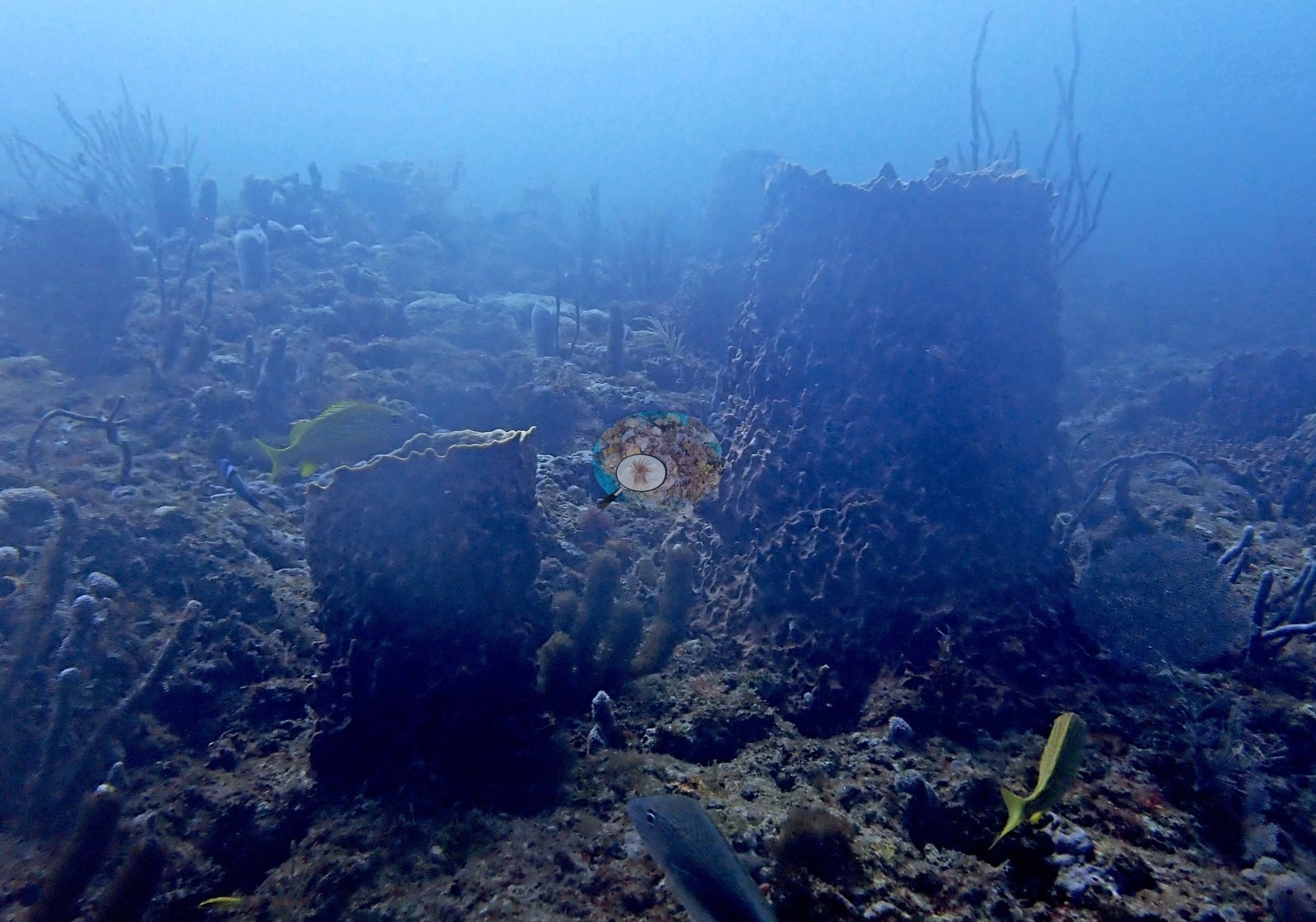
Image 18 looks directly down into a barrel's osculum, with a spiny snail shell lodged inside the opening (e.g., Image 18); no crab is visible in the shell.
Other sponges fill in around them: the bright red rounded ball sponge in Image 6, red and orange encrusting sponge sheets in Image 4, Image 9, and Image 13, and the gray-brown tube sponge in Image 3.
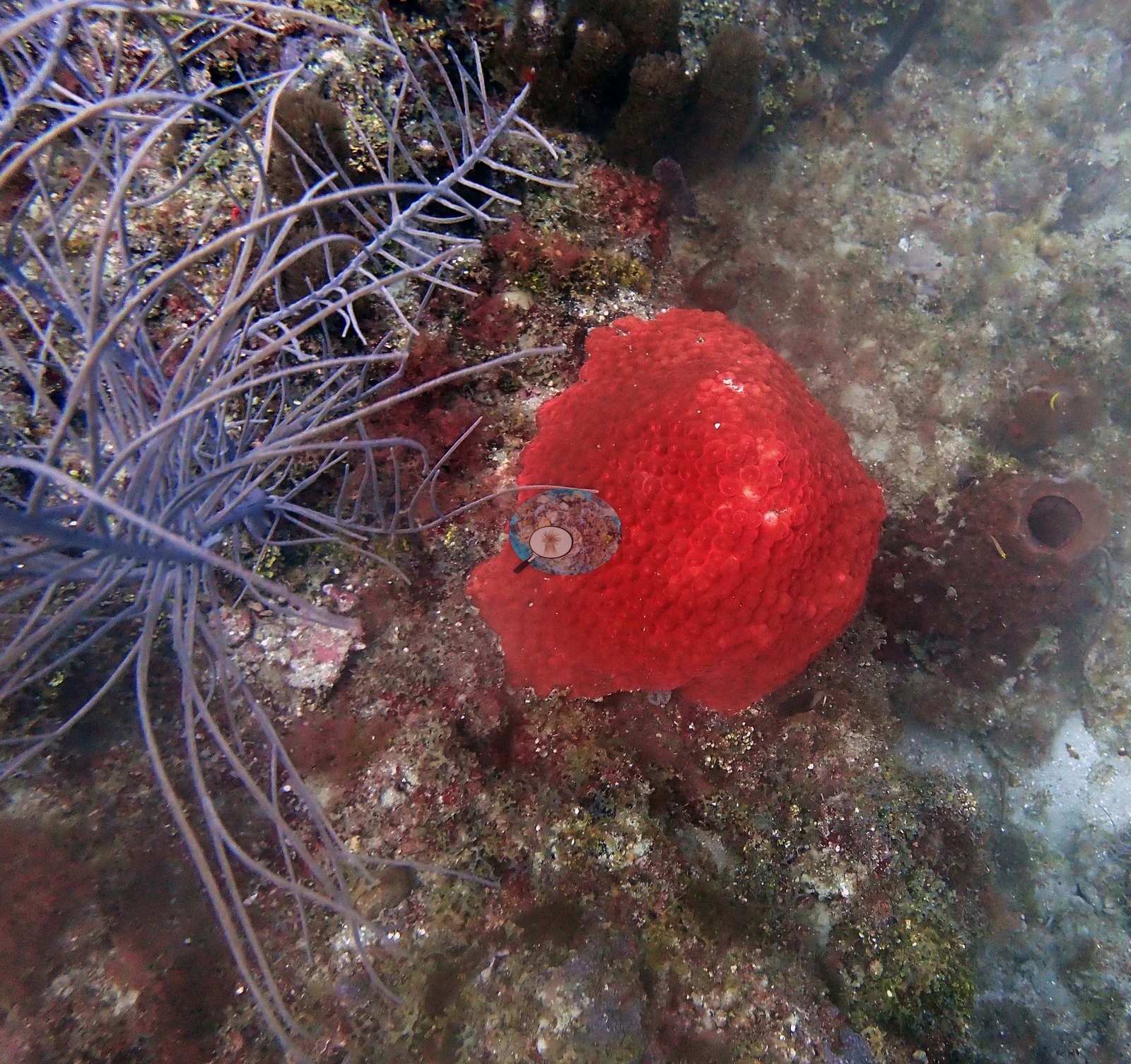
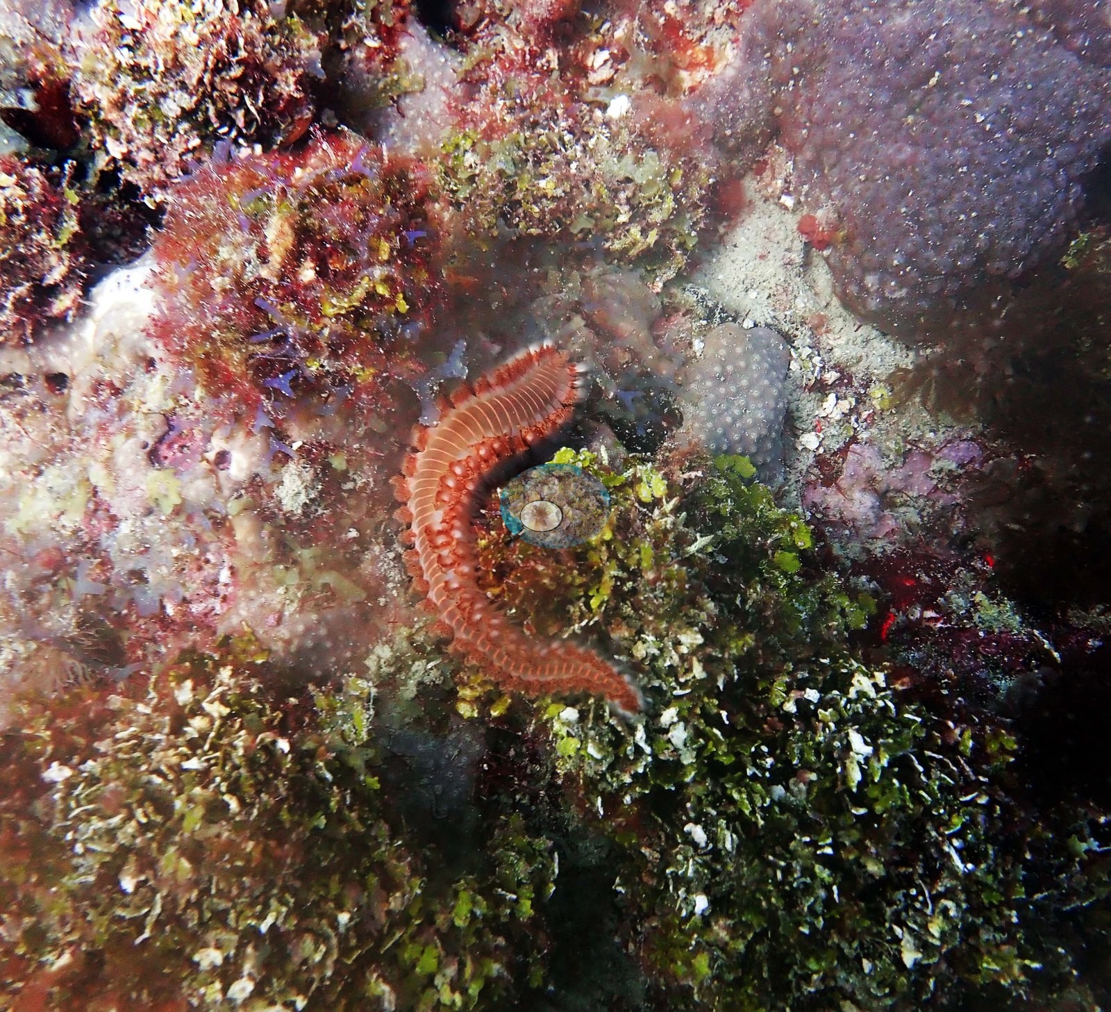
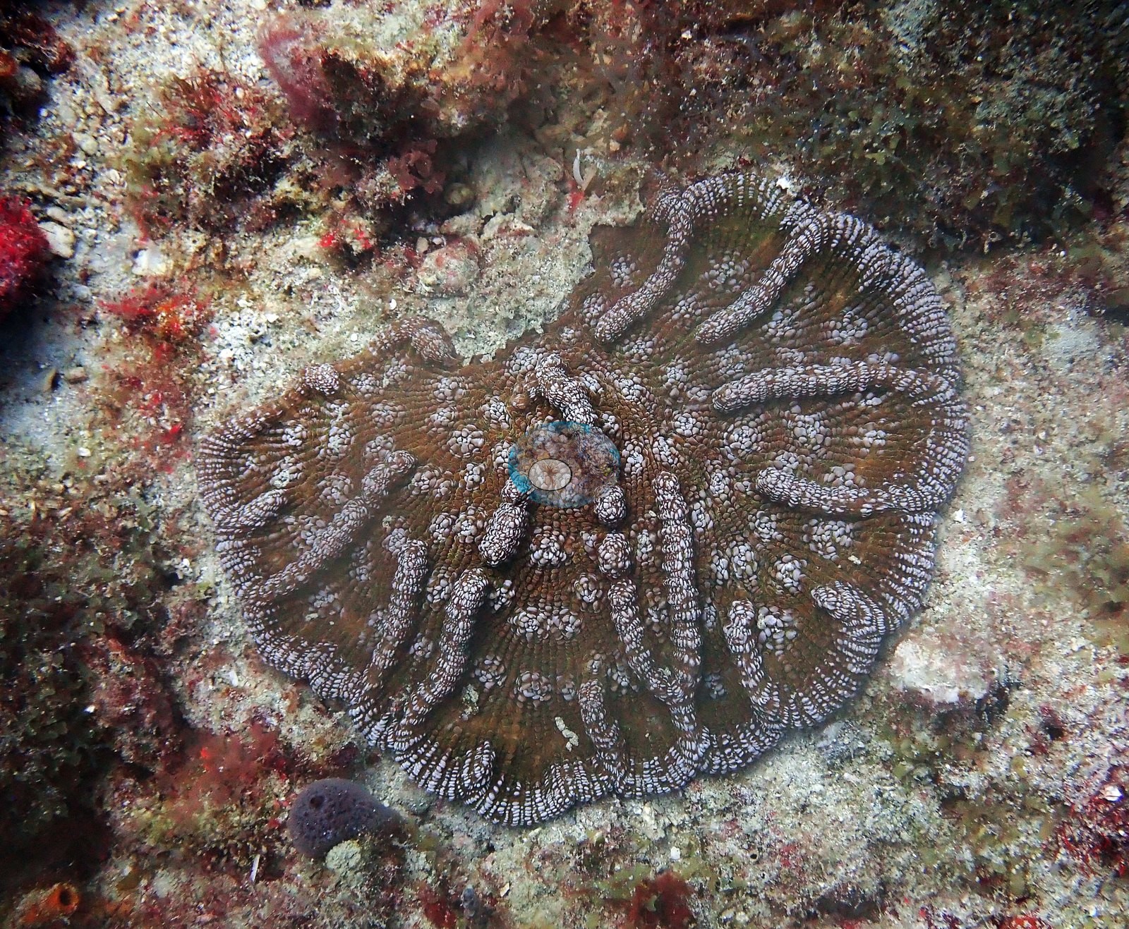
In Image 6 the red ball sponge is surrounded by long, slender, faintly banded whip-like structures radiating across the rock; these are either slender gorgonian branches or the arms of a basket star, and the frame does not settle which. Stony coral is present but sparse and confined to small, isolated colonies — there is no reef framework, no thicket-forming coral, and no Acropora anywhere in the set. Three frames carry identifiable colonies. Image 11 is a down-look on a single low, rounded colony with meandering tan ridges and pale valleys, sitting on turf- and macroalgae-covered rock beside a small gorgonian.
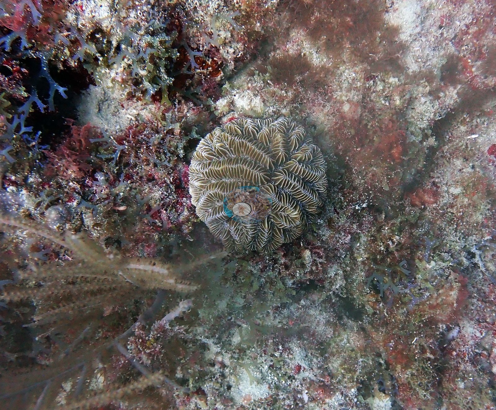
Image 15 is the sharpest coral frame of the dive: a flat-topped, plate-like colony whose fleshy polyps are arranged in meandering series with mouths and tentacles clearly resolved, pale gray-brown.
Both are meandroid corals; the photographs do not support a species call. Image 12 is a compact gray-brown dome of a large-polyp massive coral, its large corallites clearly resolved, on algal rock with a red-brown gorgonian branch alongside.
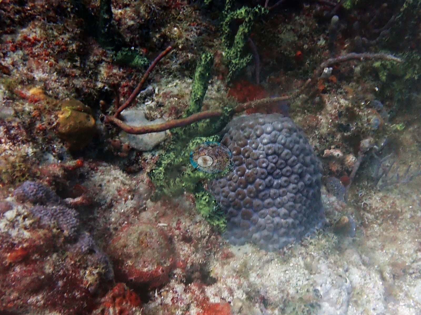
All three colonies are small relative to the barrel sponges beside them, and all three sit in a matrix of algal turf and fleshy macroalgae rather than coralline pavement. Octocorals are the other continuous element: sea rods, sea plumes, and sea whips cover the low relief in Image 1, Image 2, Image 5, Image 10, Image 13, Image 16, and Image 17, with a sea fan in Image 16.
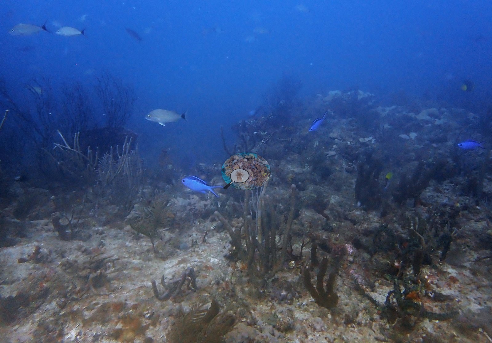
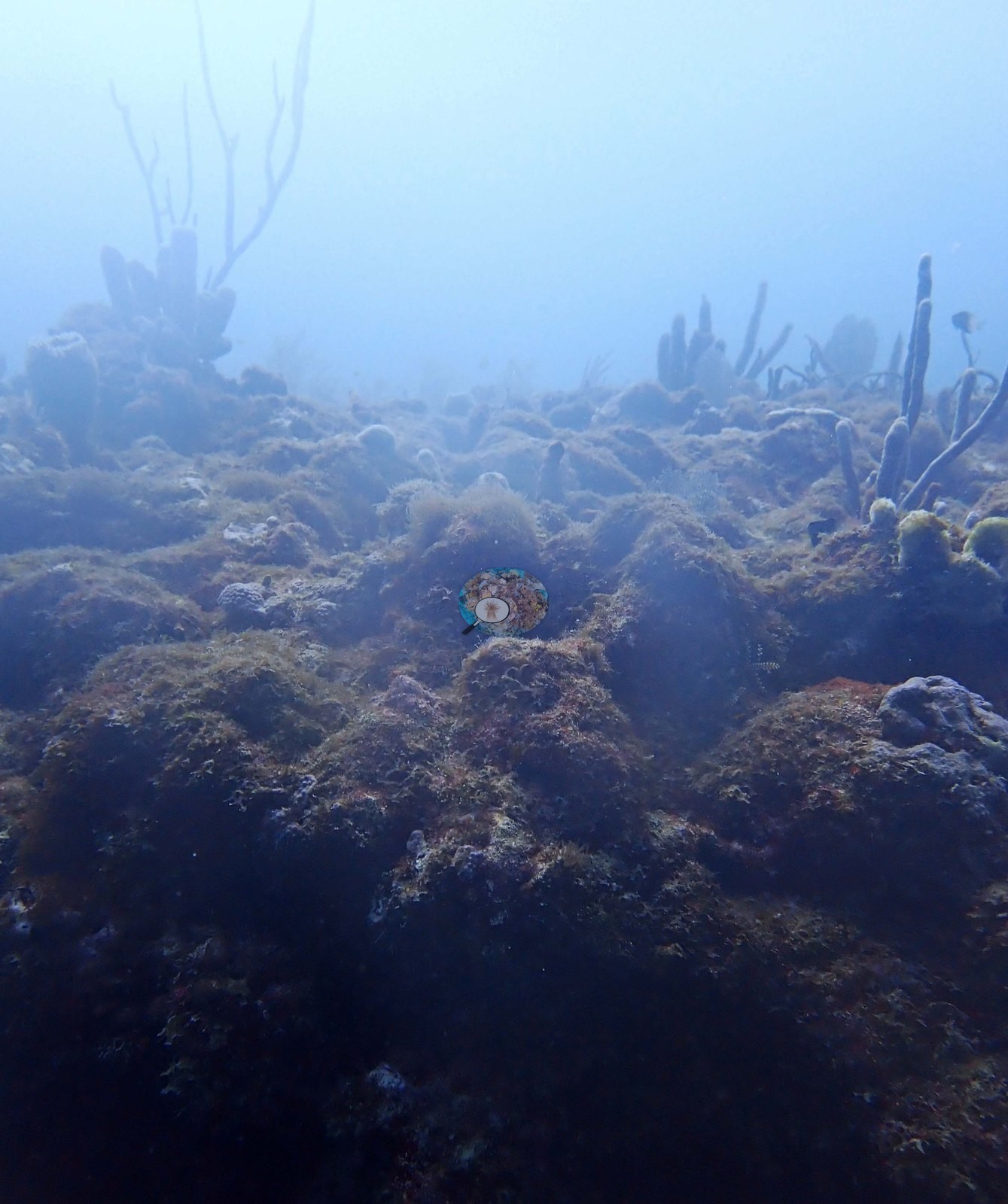
Image 2 is the most useful habitat-scale frame — an open, gorgonian-dotted low-relief bottom with sand patches, receding into blue water, with midwater fish overhead (a chub-shaped fish and a blue-bodied fish, most likely creole wrasse, though neither is confirmed). Image 5 and Image 7 are the same habitat in worse water: gorgonian-studded low relief with no distinguishable coral.
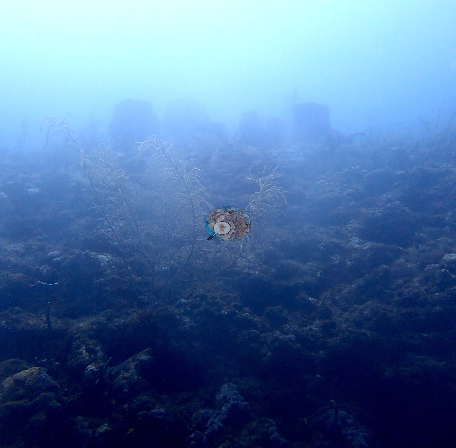
Image 9 is a close frame of algal-dominated hardbottom — green and red macroalgae over encrusting sponge — with a bearded fireworm (Hermodice carunculata) crawling across the algal turf.
Coral cover
- Reference: Claude CV point count (this site's photos)
- Coral cover: 4.4% — a blind Claude computer-vision point count of 17 of Anderson's edited photographs (20 points per photo; water, fish, and obstructions excluded). Other computer-vision methods are listed in the method table.
Stressors
No bleaching, paling, or recent mortality is evident on any of the three stony colonies or on any sponge in this set — and none is quantified.
Fish and other fauna
Fish in the set are incidental rather than aggregated: midwater fish in Image 2, a yellowtail and a blue-bodied fish over the ledge in Image 10, a yellow grunt at the base of the barrel in Image 14, a spotted moray in Image 3, and a bearded fireworm in Image 9.
Comparisons with other data
Reef Check surveyed a nearby station (Horseshoe Reef) in 2014, 0.16 km from the pin. Within 5 km, 35 independent stations recorded station-year means of 0.0–8.0% hard coral cover between 2011 and 2024; the nearest, Reef Check at Abbey Too, 0.11 km away, read 4.4% in 2013.
Dive record
Rabbit Ears, an outer-reef site near Rabbit Ear Pass at Abbey Too Reef about a mile north of Hillsboro Inlet, Pompano Beach, dived 8 April 2022 as the second dive of the day (in at 11:05, 41 minutes, 17.7 m maximum, 25.0°C average, dive-computer minimum 24.4°C, murky green water).
Other notes
No divers, boats, mooring lines, fishing gear, or debris appear in any frame.
CV model comparison
More info
A few colony-focused photos raise the mean; the median is the typical photo. No computer-vision method yet estimates coral cover accurately on new images, so treat this as indicative rather than a measurement; it is revised as the methods improve.More info
Other rows are for comparison only and are never averaged. No diver transect exists for these photos, so agreement between rows is not accuracy.| Method | Hard coral cover (%) | Photos (n) ± SE |
|---|---|---|
| CoralSCOP edited | 27.0* | n = 18 |
| Claude (edited photos) | 4.4* | n = 17 · SE 2.5 |
CoralSCOP (edited photos) reads 27.0%, 22.6 pp above Claude's blind point count (4.4%); the headline stays Claude's blind point count because no transect or manual count exists here.
*Based on only 18 reef-habitat photos; this estimate is less certain. (CoralSCOP edited)
*Based on only 17 reef-habitat photos; this estimate is less certain. (Claude (edited photos))
See a more detailed, stand-alone version of this table.
Independent surveys nearby
| Agency / program | Year(s) | Stations / distance | Link |
|---|---|---|---|
| FWC CREMP (Southeast Florida, SECREMP) | 2013–2024 | 8 stations, 3.55–3.58 km | Records ↓ |
| NOAA NCRMP | 2014–2016 | 10 stations, 1.11–4.45 km | Records ↓ |
| NOAA NCRMP Florida | 2024 | 10 stations, 0.17–4.85 km | Records ↓ |
| Reef Check | 2011–2015 | 7 stations, 0.11–3.73 km | Records ↓ |
 Coral Reef DiagnosticsYear-average (illustrative only, programs differ)
Within 5 km, 35 independent survey stations recorded hard coral cover in 123 records between 2011 and 2024. Of the 8 stations surveyed in more than one year, 7 declined (by 0.1–1.8 points) and 1 increased (by 0.1 points) between their first and latest surveys. 8 stations share the longest span (2013–2024); one, Broward County 5 #21 (FWC CREMP (Southeast Florida, SECREMP), 3.55 km away), went from 2.4% in 2013 to 0.6% in 2024. Since 2021, station-year means average 0.9% (range 0.0–8.0%; n = 42 station-years from 42 records). This site's own estimate (4.4%) sits within the recent range of station-year means up to 2 km away (1.0–8.0%); the methods differ, so the comparison is context, not a like-for-like test.
Collected by other programs using different methods (Reef Check uses point-intercept transects; NOAA rows come from NOAA monitoring programs (NCRMP, PIFSC, NCCOS), and each row's method is in its hover text; FWC-FWRI uses fixed-station point counts), so these are context for the figures above, not a like-for-like comparison. Where a station was surveyed more than once, the cell shows either the range of its values or, as a single value, the mean of surveys made in one year. Station names are not dive-site names.
Show all 123 independent survey records
| Agency | Site / location | Date | Hard coral cover (%) | Distance | Link |
|---|---|---|---|---|---|
| Reef Check | Abbey Too Reef | 2011 | 6.3% | 0.90 km | — |
| Reef Check | Sanctuary Reef- Pompano Beach | 2011 | 1.3% | 3.73 km | — |
| Reef Check | Abbey Too | 2013 | 4.4% | 0.11 km | — |
| Reef Check | Abbey Too | 2013 | 1.9% | 1.90 km | — |
| FWC CREMP (Southeast Florida, SECREMP) | Broward County 5 #21 | 2013–2024 | 0.0–2.4% (12 surveys) | 3.55 km | — |
| FWC CREMP (Southeast Florida, SECREMP) | Broward County 5 #22 | 2013–2024 | 0.1–1.8% (12 surveys) | 3.55 km | — |
| FWC CREMP (Southeast Florida, SECREMP) | Broward County 5 #23 | 2013–2024 | 0.0–1.7% (12 surveys) | 3.55 km | — |
| FWC CREMP (Southeast Florida, SECREMP) | Broward County 5 #24 | 2013–2024 | 0.1–1.8% (12 surveys) | 3.55 km | — |
| FWC CREMP (Southeast Florida, SECREMP) | Broward County 6 #31 | 2013–2024 | 0.2–1.3% (12 surveys) | 3.58 km | — |
| FWC CREMP (Southeast Florida, SECREMP) | Broward County 6 #32 | 2013–2024 | 0.2–0.5% (12 surveys) | 3.58 km | — |
| FWC CREMP (Southeast Florida, SECREMP) | Broward County 6 #33 | 2013–2024 | 0.1–0.9% (12 surveys) | 3.58 km | — |
| FWC CREMP (Southeast Florida, SECREMP) | Broward County 6 #34 | 2013–2024 | 0.0–0.8% (12 surveys) | 3.58 km | — |
| Reef Check | Horseshoe Reef | 2014 | 3.1% | 0.16 km | — |
| NOAA NCRMP | SEFCRI-18 | 2014 | 2.0% | 1.11 km | — |
| NOAA NCRMP | SEFCRI-21 | 2014 | 0.0% | 2.22 km | — |
| NOAA NCRMP | SEFCRI-20 | 2014 | 0.0% | 2.22 km | — |
| NOAA NCRMP | SEFCRI-19 | 2014 | 3.0% | 2.22 km | — |
| Reef Check | Pompano 3rd Reef into Razzle Dazzle Reef | 2015 | 5.6% | 1.92 km | — |
| Reef Check | Razzle Dazzle Reef | 2015 | 3.1% | 2.81 km | — |
| NOAA NCRMP | SEFCRI-140 | 2016 | 7.0% | 1.49 km | — |
| NOAA NCRMP | SEFCRI-141 | 2016 | 3.0% | 3.34 km | — |
| NOAA NCRMP | SEFCRI-138 | 2016 | 1.0% | 3.48 km | — |
| NOAA NCRMP | SEFCRI-107 | 2016 | 4.0% | 4.45 km | — |
| NOAA NCRMP | SEFCRI-106 | 2016 | 1.0% | 4.45 km | — |
| NOAA NCRMP | SEFCRI-127 | 2016 | 4.0% | 4.45 km | — |
| NOAA NCRMP Florida | SEFCRI PSU 3241-1 | 2024 | 1.0% | 0.17 km | NCEI 0306238 |
| NOAA NCRMP Florida | SEFCRI PSU 3240-1 | 2024 | 8.0% | 0.61 km | NCEI 0306238 |
| NOAA NCRMP Florida | SEFCRI PSU 3200-1 | 2024 | 4.0% | 0.68 km | NCEI 0306238 |
| NOAA NCRMP Florida | SEFCRI PSU 3114-1 | 2024 | 1.0% | 1.24 km | NCEI 0306238 |
| NOAA NCRMP Florida | SEFCRI PSU 3223-1 | 2024 | 0.0% | 2.38 km | NCEI 0306238 |
| NOAA NCRMP Florida | SEFCRI PSU 3269-1 | 2024 | 1.0% | 2.45 km | NCEI 0306238 |
| NOAA NCRMP Florida | SEFCRI PSU 3289-1 | 2024 | 0.0% | 2.71 km | NCEI 0306238 |
| NOAA NCRMP Florida | SEFCRI PSU 3201-1 | 2024 | 0.0% | 3.39 km | NCEI 0306238 |
| NOAA NCRMP Florida | SEFCRI PSU 3224-1 | 2024 | 4.0% | 3.96 km | NCEI 0306238 |
| NOAA NCRMP Florida | SEFCRI PSU 3217-1 | 2024 | 4.0% | 4.85 km | NCEI 0306238 |
Data & links
All images from Coral Reef Diagnostics. Data are from Coral Reef Diagnostics and the organizations named in the data sources above.
© Coral Reef Diagnostics.