
Saudi Red Sea - Um Mankout (Yanbu)
Part of the regional summaries: Saudi Arabia - Yanbu, Saudi Arabia, and Red Sea
More info
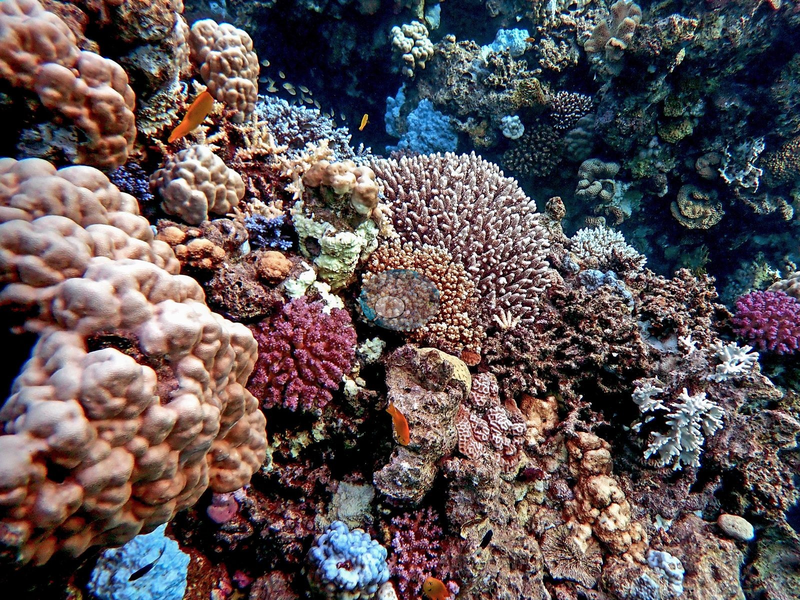
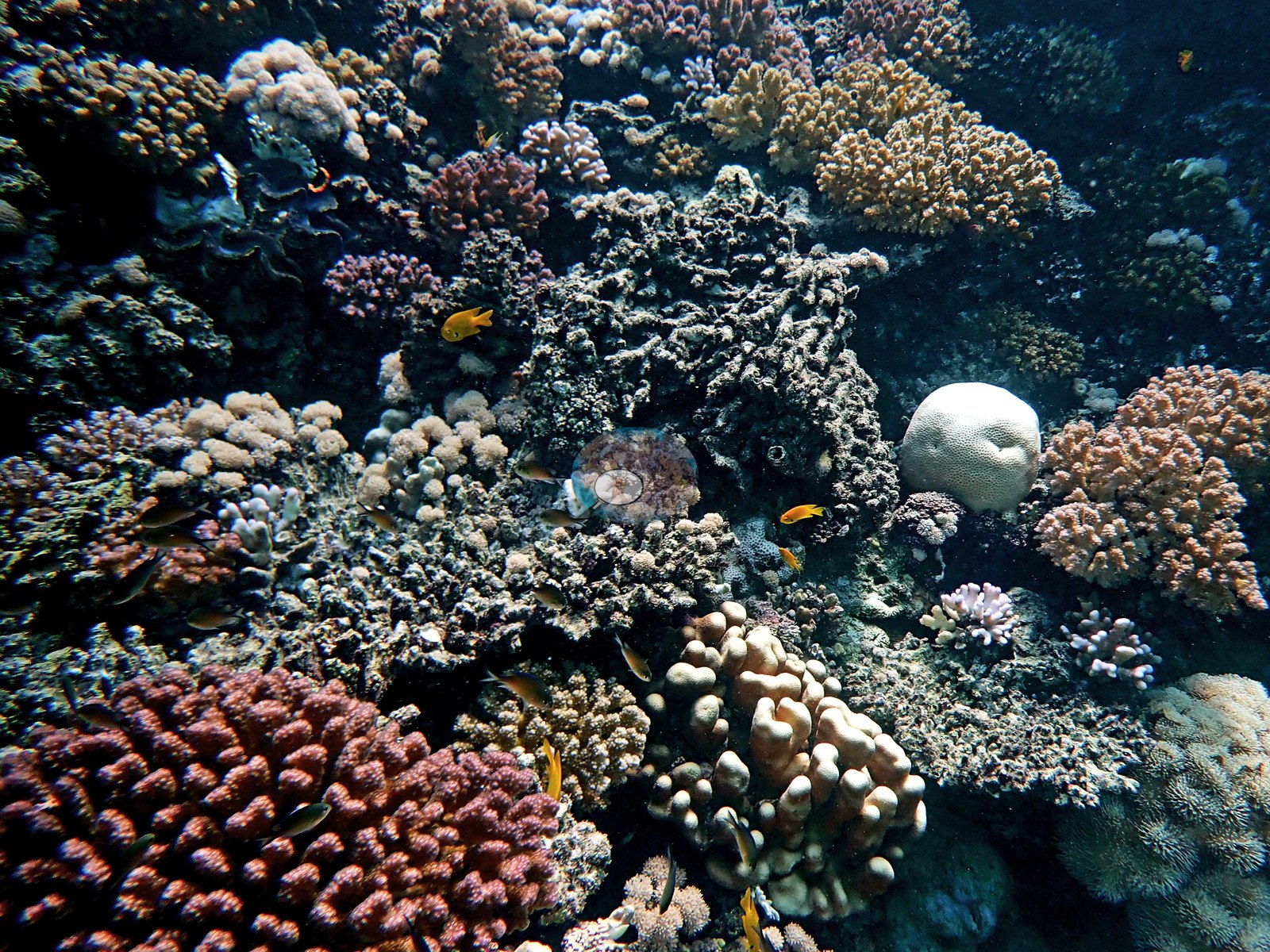
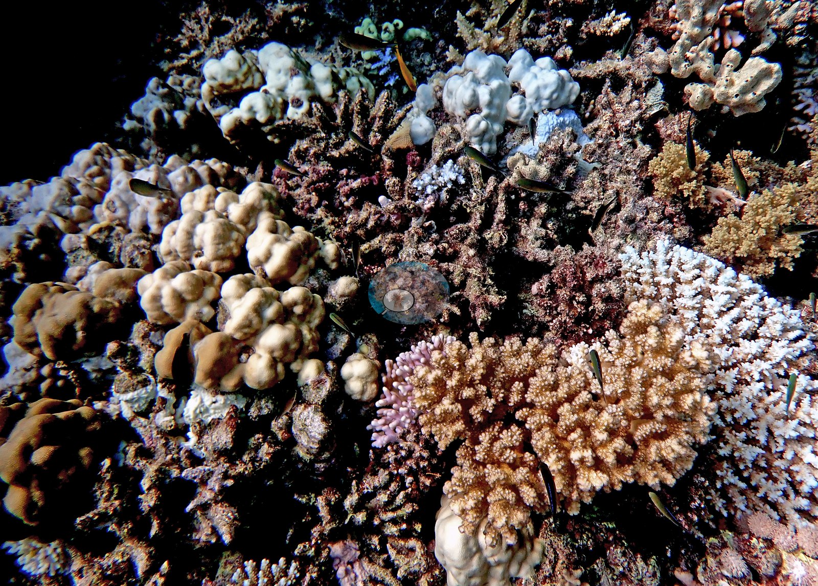
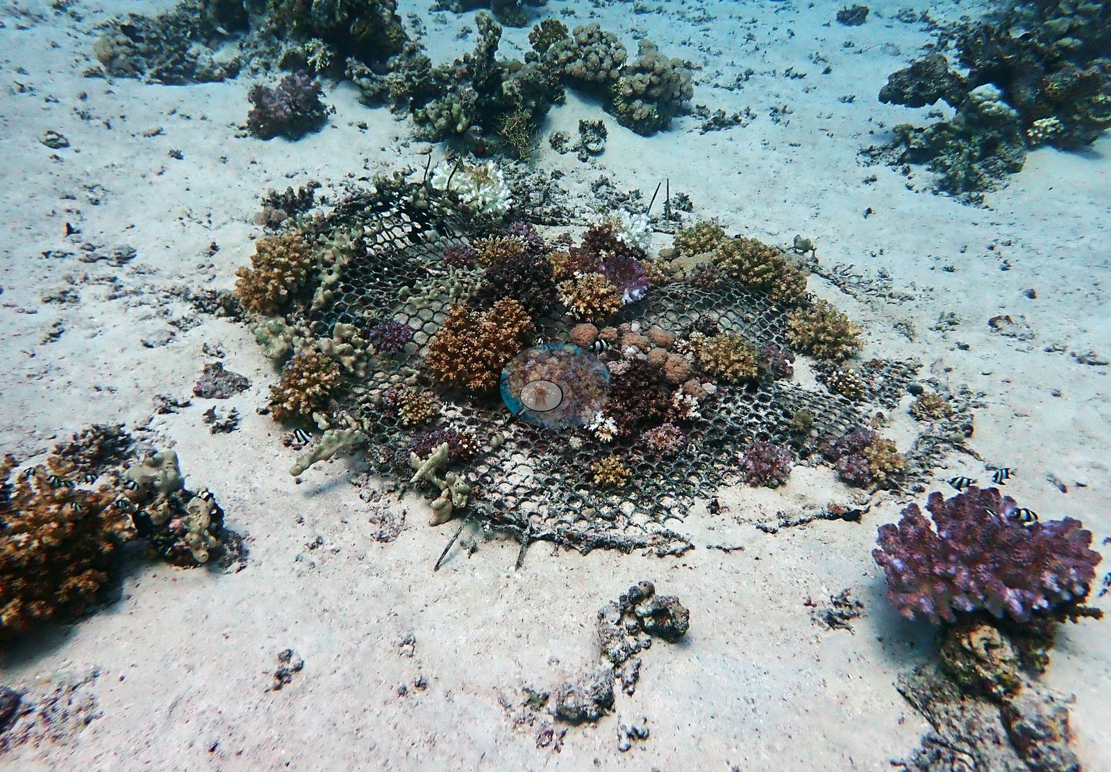
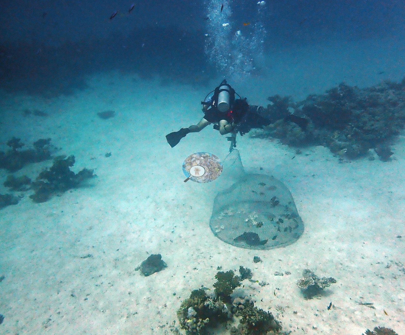
Al Madinah and Makkah (NOAA CRW virtual station)Um Mankout is a structurally complex Yanbu reef whose photographs show something close to a continuous coral carpet — knobby, columnar Porites growing colony against colony down the slope, topped by a colorful mix of digitate and corymbose Acropora, pocilloporids, and fire coral. Surveyed during the late-summer 2023 thermal-stress event, published cover was 26% with roughly 28% of coral tissue bleached, and the photographs show widespread paling across the dominant Porites framework alongside many stark-white massive colonies, and Anderson logged clear evidence of overfishing, including a derelict fish trap.
أم منقوط شعاب في ينبع معقدة البنية تُظهر صورها ما يقارب بساطًا مرجانيًا متصلًا - Porites عُقدية عمودية تنمو مستعمرة بجانب مستعمرة على طول المنحدر، تعلوها خلطة ملونة من Acropora الأصبعية والعنقودية والبوسيلوبوريات والمرجان الناري. ومُسحت خلال حدث الإجهاد الحراري في أواخر صيف 2023، فبلغت التغطية المنشورة 26% مع ابيضاض نحو 28% من نسيج المرجان، وتُظهر الصور شحوبًا واسعًا في هيكل Porites المهيمن إلى جانب كثير من المستعمرات الكتلية البيضاء الساطعة، وسجّل أندرسون دليلًا واضحًا على الصيد الجائر، منه مصيدة أسماك مهجورة.
ترجمة هذا الملخص بالذكاء الاصطناعي؛ النص الإنجليزي هو المعتمد.
More info
Note: NOAA's regional station series averages 2.5°C warmer than the satellite pixel nearest this site (1.5 km away), which is used here instead.6 of the 22 photographs on this page are shown beside the text that discusses them under "Site description" below.
Site description
General benthic features
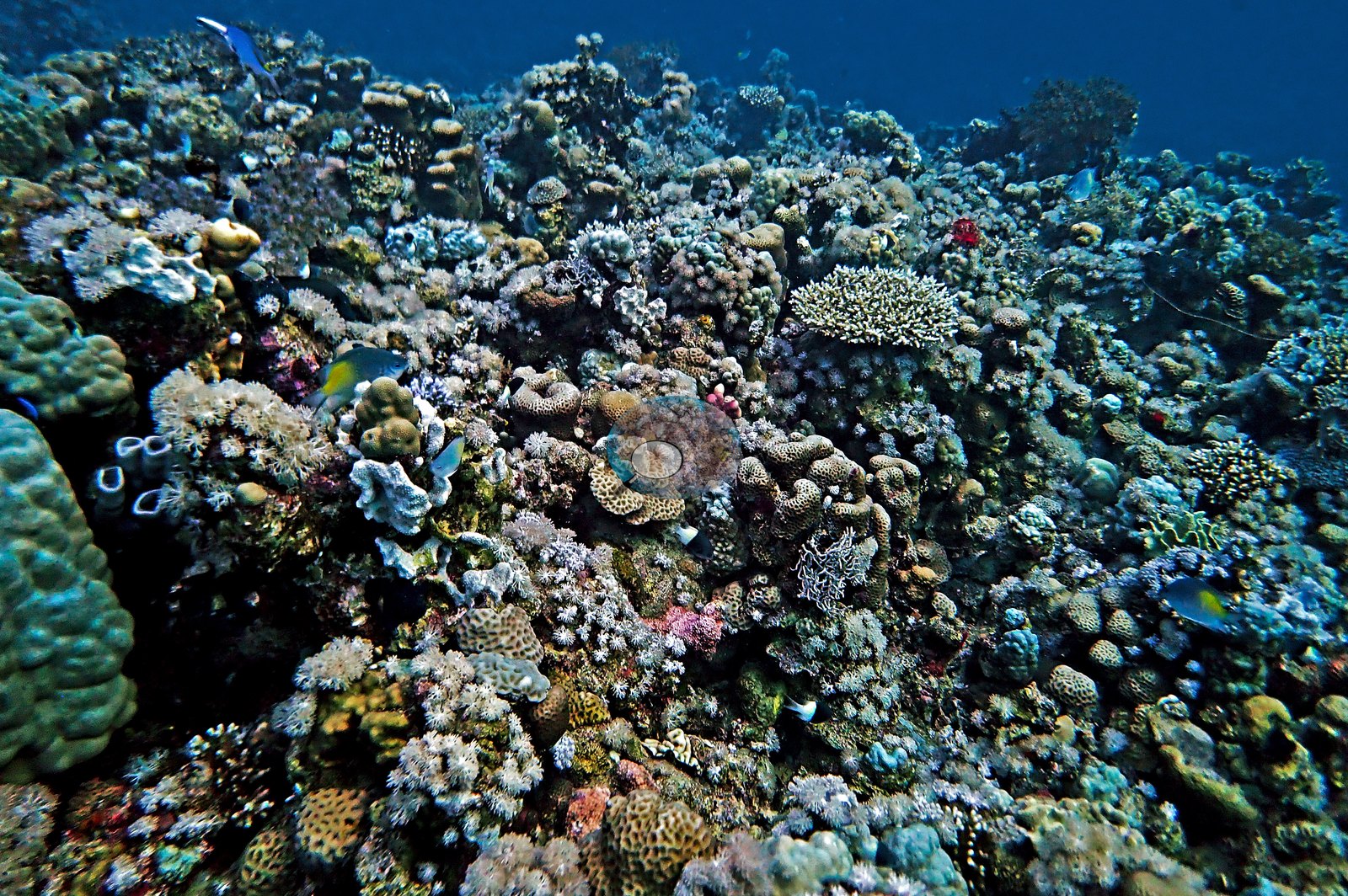
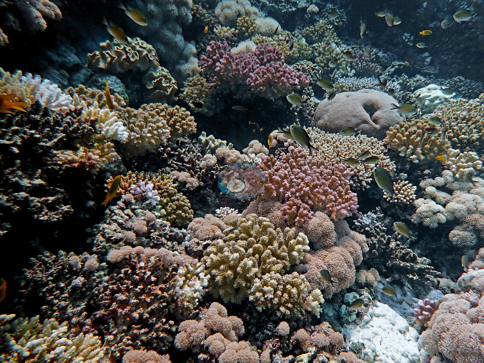
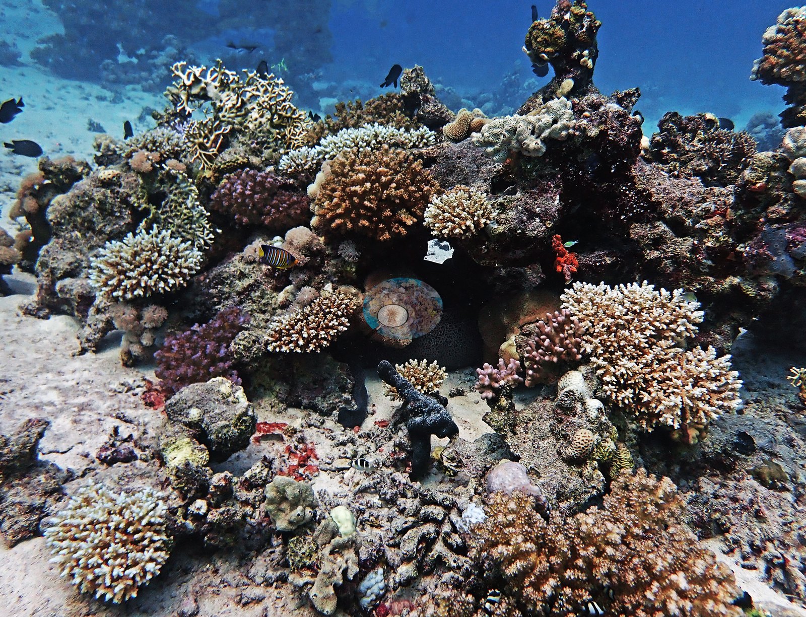
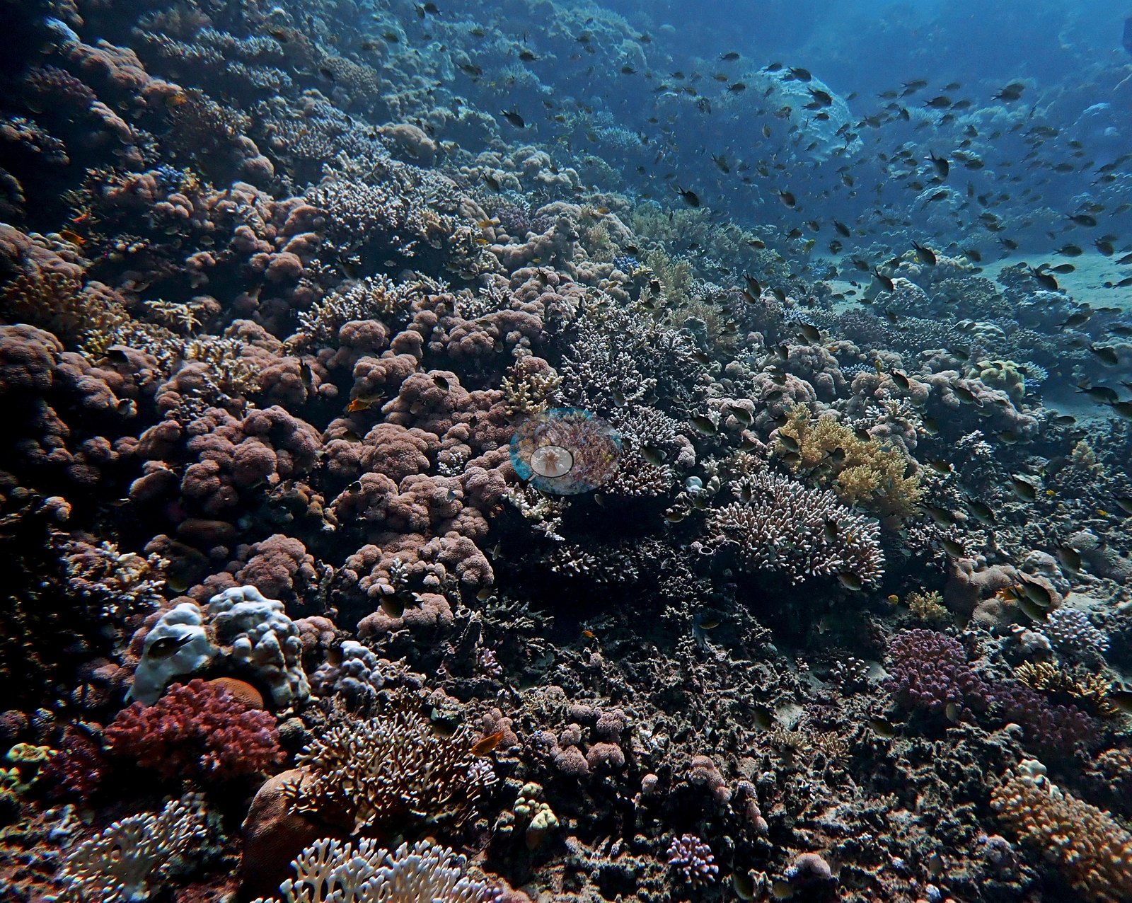
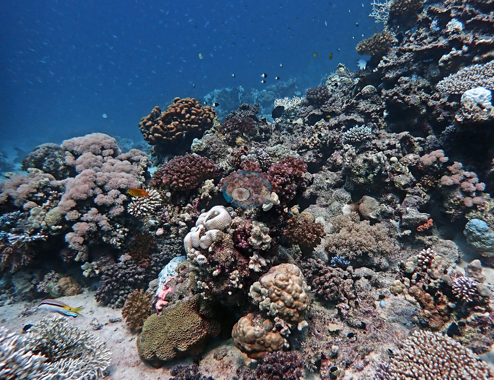
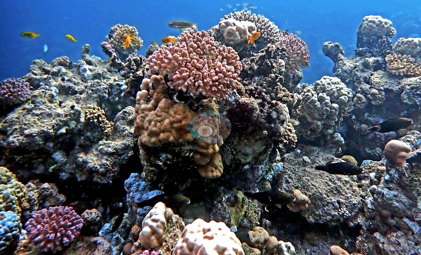
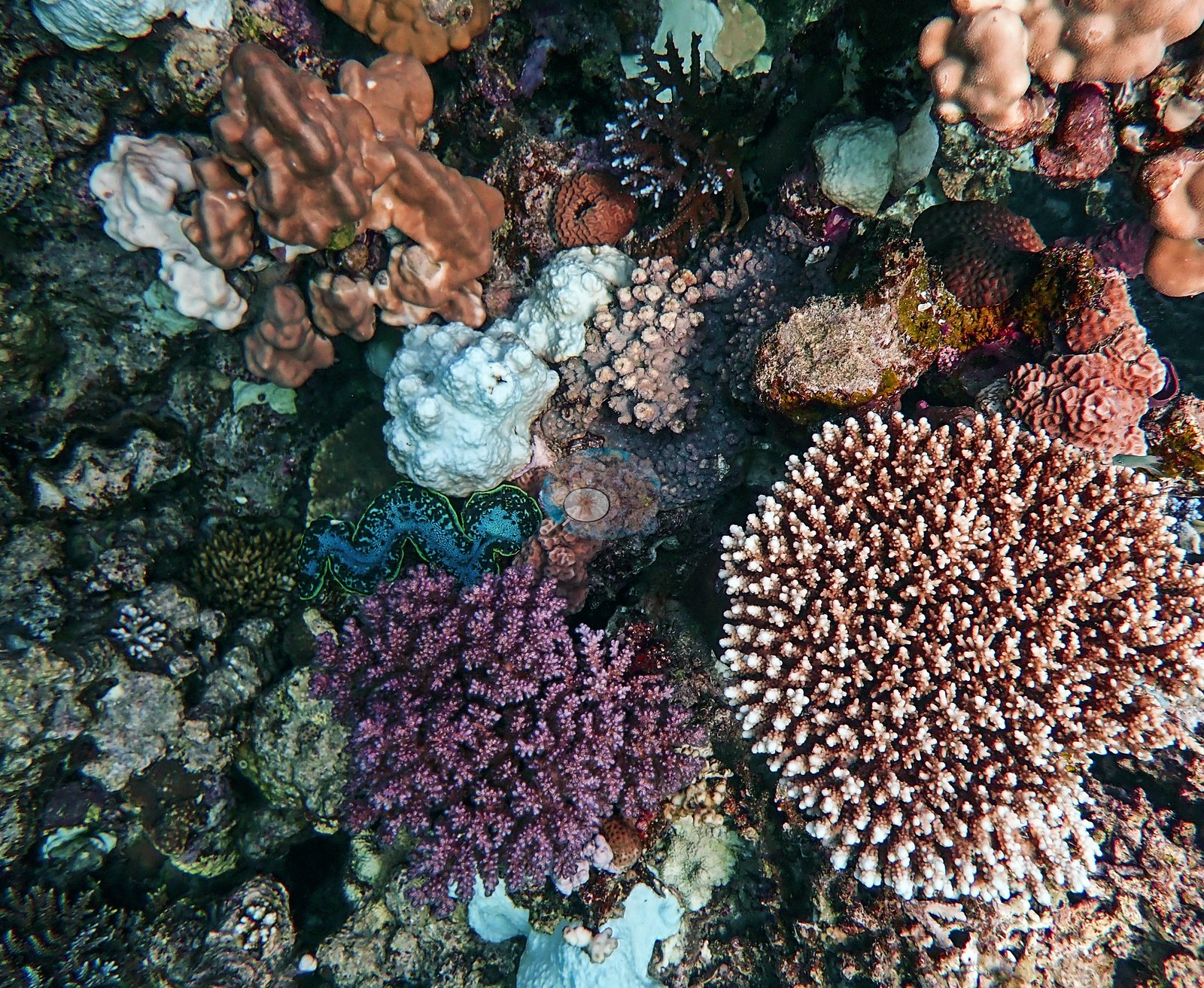
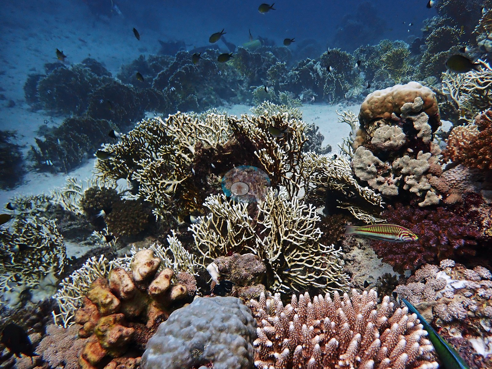
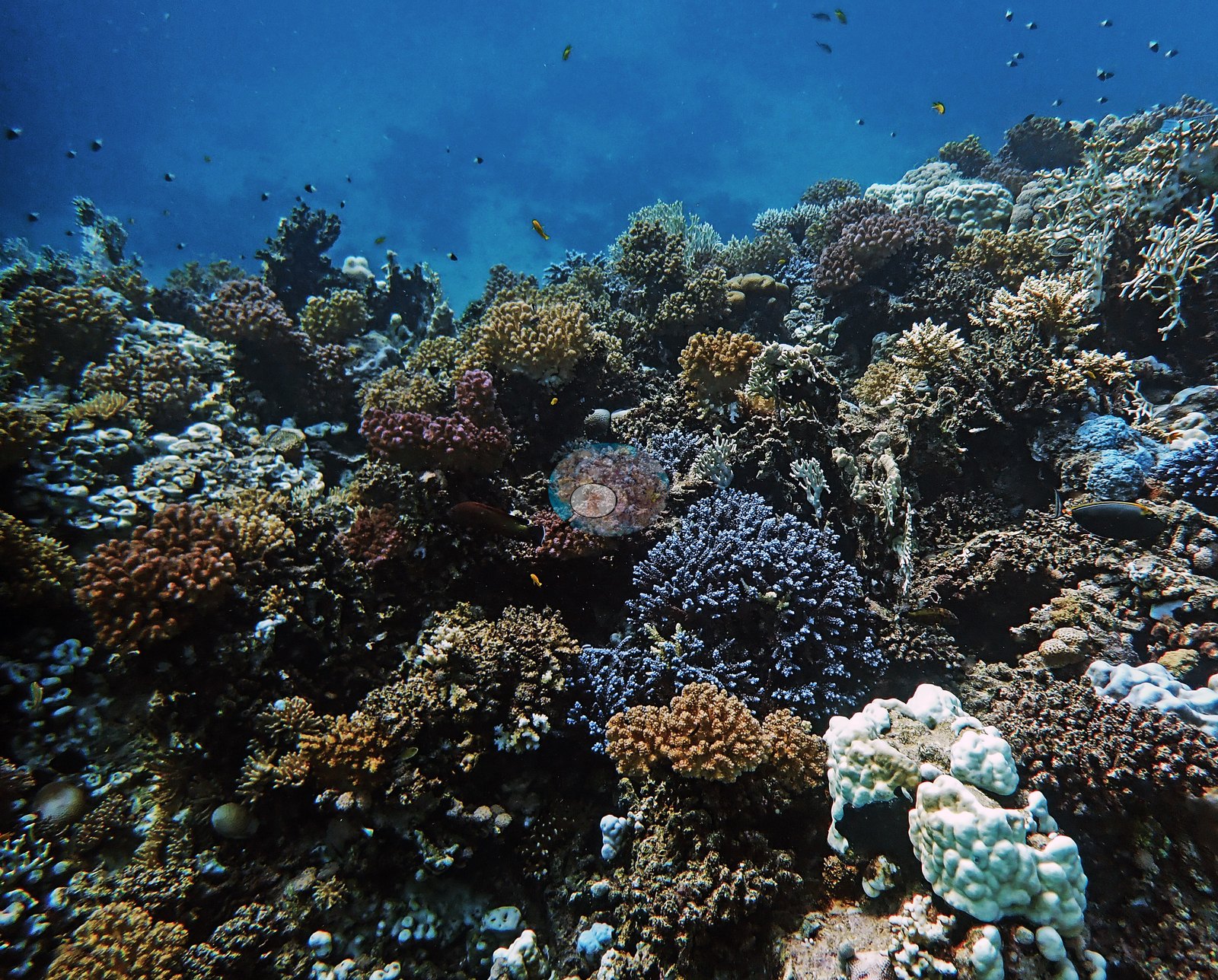
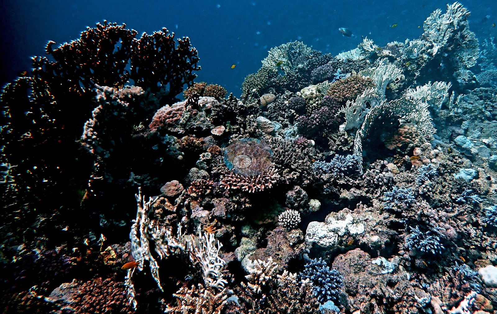
This is a structurally complex reef. The frames show something close to a continuous coral carpet: a slope blanketed in knobby, columnar, and lobate Porites growing colony against colony, over hundreds of square meters, with almost no bare pavement between them — a genuine Porites-dominated framework rather than isolated bommies (e.g., Image 1, Image 4).
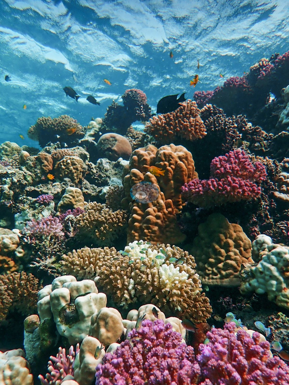
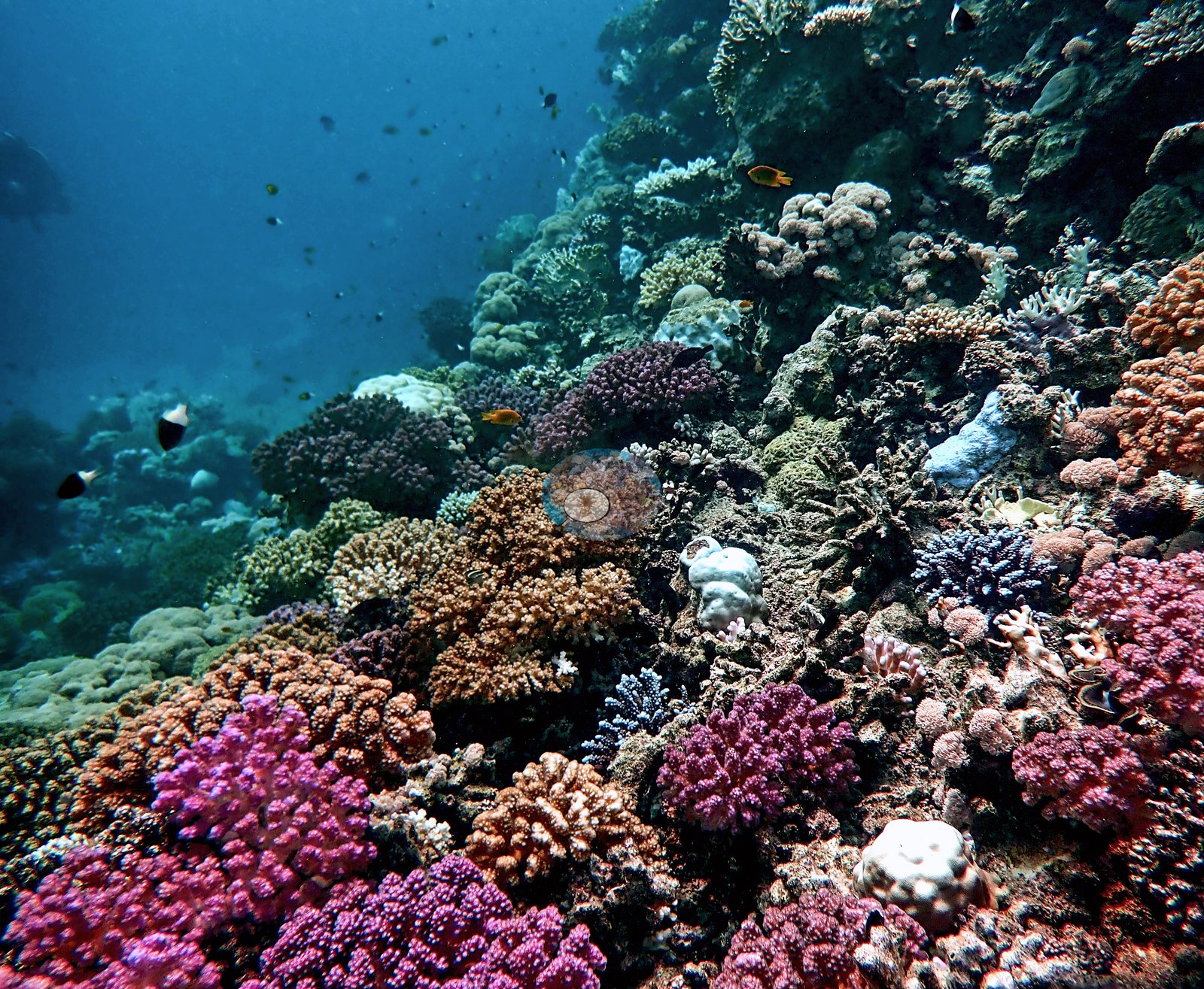
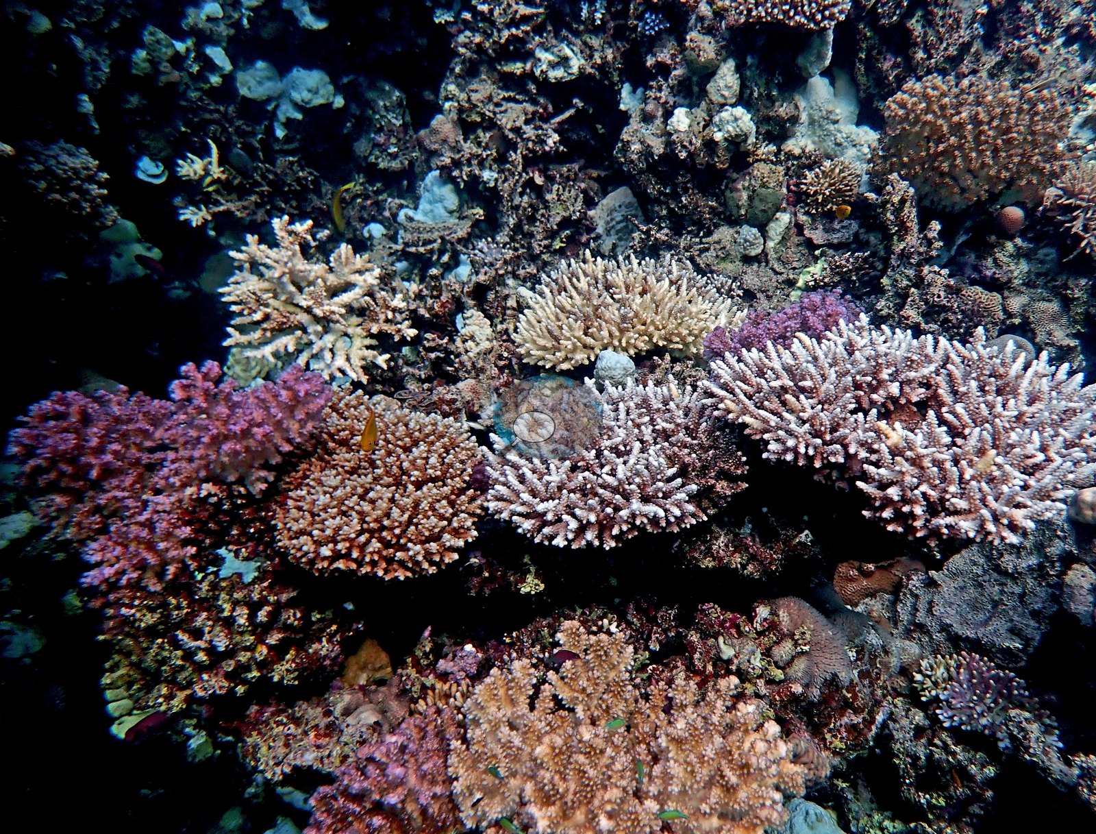
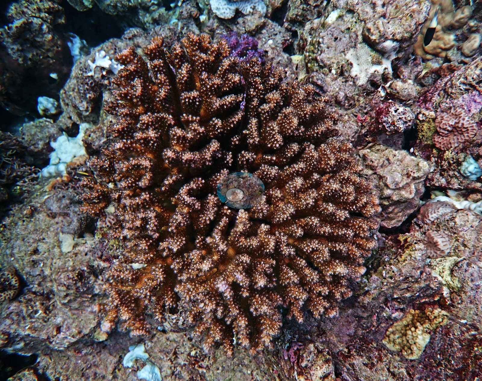
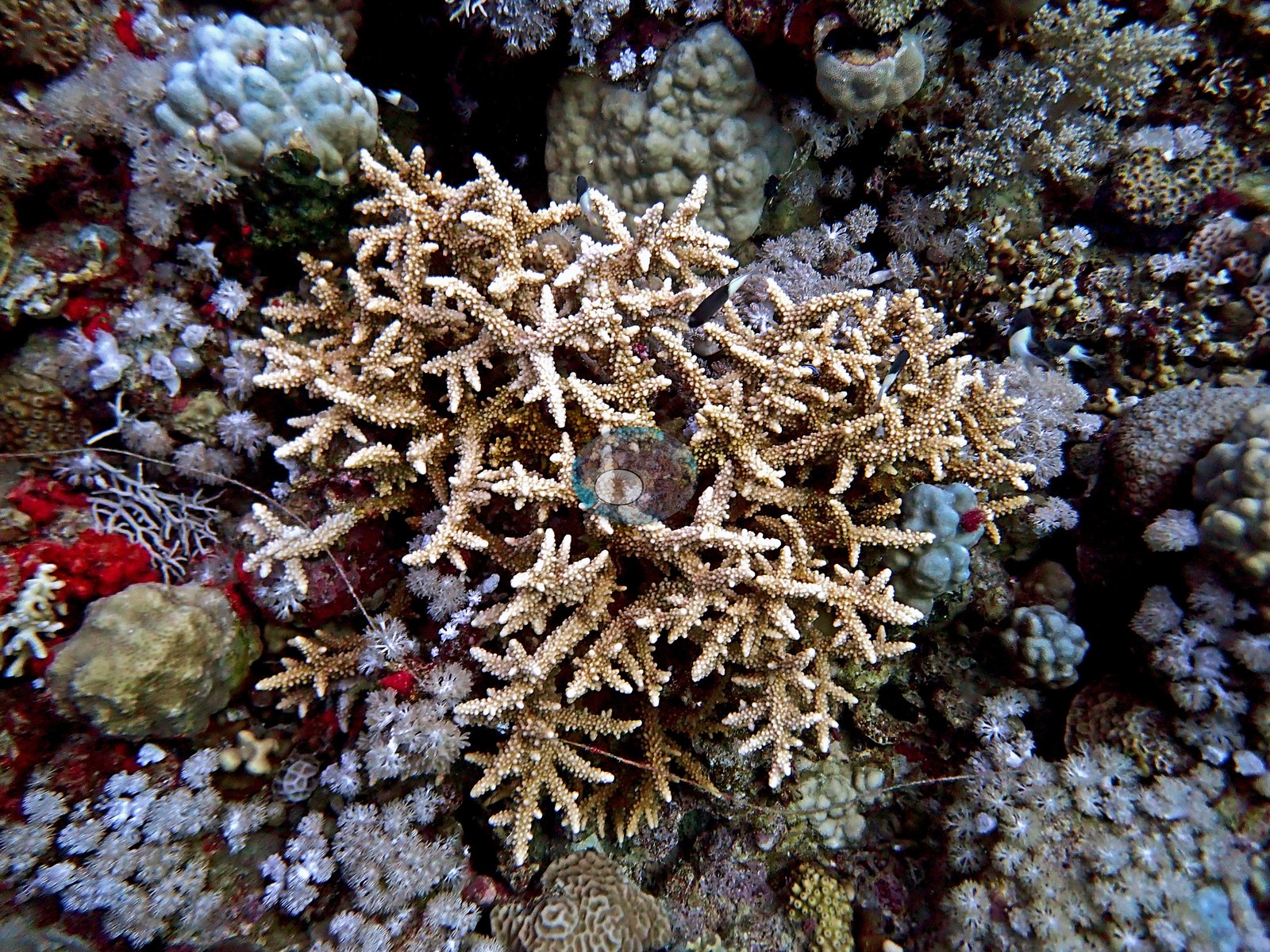
The reef top adds the color: emerald-green branching thickets, cobalt and powder-blue digitate Acropora, lavender, dusty-rose, and magenta pocilloporids, tan corymbose Acropora, cream bladed plates, and khaki domes, packed tightly together (e.g., Image 2, Image 3).
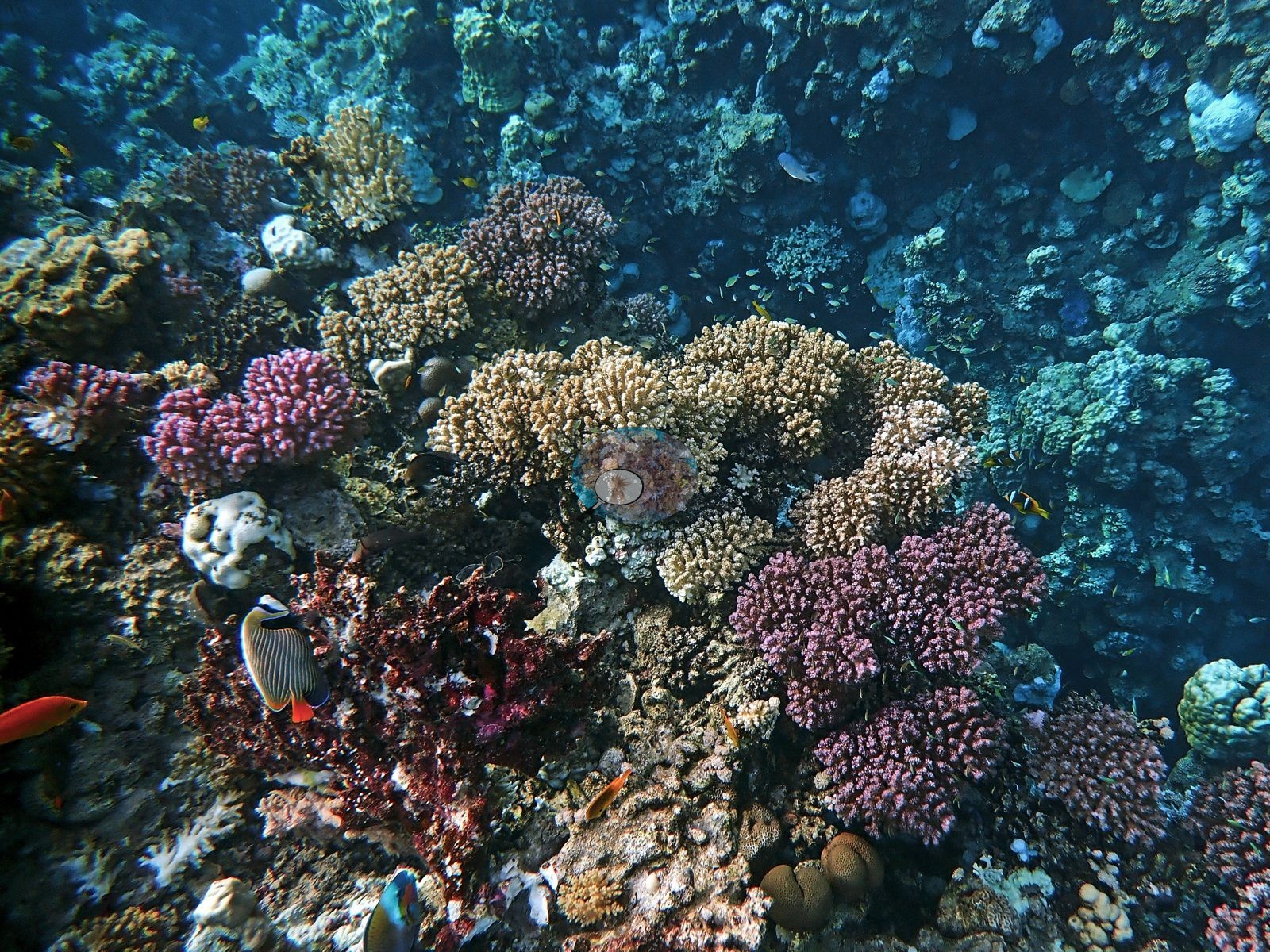
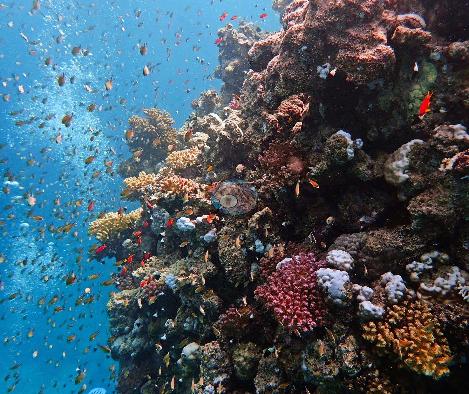
A large tan-and-cream foliose/plating colony forms a broad shelf. Down on the sand the picture is quieter — a wrasse working a bare patch beside a discarded corroded metal object and a dead shell.
Coral cover
- Reference: Mayfield (2025)
- Data file: (Mayfield, 2025-appendix A)
- CoralNet submission package (accession #5546)
- 26% ± 18% SD across 228 photographs.
- The 15 September visit recorded about 26% cover with 28% of coral tissue bleached at roughly 14.8°C-weeks DHW on the survey date (15 September 2023; NOAA Coral Reef Watch, Madinah-Makkah (Saudi Arabia) virtual station).
Stressors
This dive fell inside the late-summer 2023 thermal-stress event, and the paler colonies in the frames are consistent with that. Anderson logged "Clear evidence of overfishing" on the dawn dive, and the frames show it: a derelict fish trap, its flattened wire mesh now overgrown by corals, and a fish trap holding fish being towed over the sand by a diver (e.g., Image 21, Image 22).
Many massive colonies in Anderson's frames are stark white, not just a few.
Comparisons with other data
Apart from our own published survey shown here, we found no other surveys at this site as of 2026. If you would like to share yours, please email us.
Dive record
An offshore Yanbu reef dived twice on 15 September 2023 with Umluj Dive Center, to 27 m on the dawn dive and 23 m on the second, which explored a fissure feature in the reef.
CV model comparison
More info
The reference is this dive site's own published CoralNet point count by the author (Mayfield 2025, Environments 12:248, Appendix A; most frames annotated by CoralNet's AI, trained and checked by the author). The computer-vision rows are this site's own values: Claude is a blind point count of all of the site's edited photographs, DINOv3 ran on the site's benchmark frames (the photographs the author annotated point by point), and CoralSCOP is the site's finished survey of its edited photographs. They are on different frame sets from the published count, a row under 30 frames is indicative only, and no computer-vision method yet estimates coral cover accurately on new images.| Method | Hard coral cover (%) | Photos (n) ± SE |
|---|---|---|
| Published point count (CoralNet-assisted) | 26.4 | |
| In-house DINOv3 | too few photos (n=2) | |
| CoralSCOP edited | 31.5 | n = 229 |
| Claude (edited photos) | 28.5 | n = 227 · SE 1.2 |
The two computer-vision methods agree within 3.0 pp (28.5–31.5%) and read within 5.1 pp of the published point count (26.4%).
In-house DINOv3: this method was run on 2 of 229 photos, under the 10 needed for a value, so it is not shown and is left out of any mean; every other row rests on its own photo count.
See a more detailed, stand-alone version of this table.
Dive history
| Date | Time in | Max depth (m) | Bottom time (min) |
|---|---|---|---|
| 2023-09-15 | 07:16 | 27.0 | 55 |
| 2023-09-15 | 10:00 | 23.0 | 52 |
Data & links
- CoralNet image repository for this region ↗
- Photo portfolio ↗
- Photo portfolio ↗
- Coral Reef Diagnostics country page ↗
All images from Coral Reef Diagnostics. Data are from Coral Reef Diagnostics and NOAA Coral Reef Watch.
© Coral Reef Diagnostics.