
Saudi Red Sea - north Rabigh (shore) (Rabigh)
Part of the regional summaries: Saudi Arabia - Jeddah / KAUST (Thuwal) / Rabigh, Saudi Arabia, and Red Sea
More info
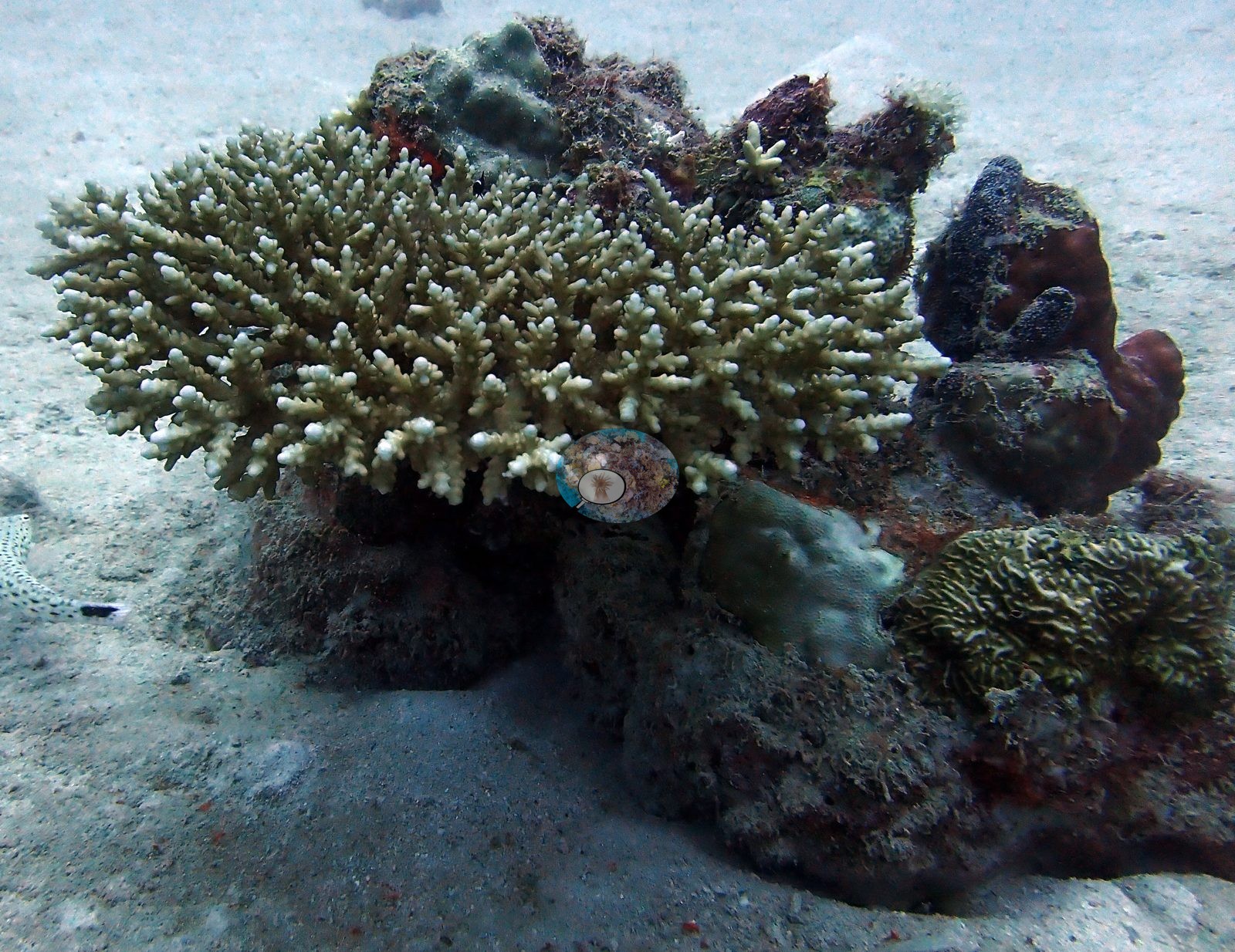
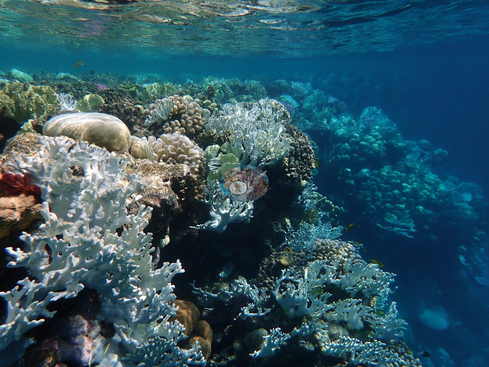
Makkah-Madine Saudi Arabia (NOAA CRW virtual station) · Northern and Central Red Sea ecoregion mean=12.2°C-heating weeksThis shore-entry reef north of Rabigh was surveyed at the height of the 2023-24 Red Sea bleaching event: much of the shallow branching and plate coral is stark bone-white, standing over darker, still-pigmented massive colonies, while some massive domes show blotchy partial bleaching with algae already creeping into dead margins. Published cover is 24% with 64.8% of coral tissue bleached.
شعبة مرجانية يُدخل إليها من الشاطئ، تقع شمال رابغ (Rabigh) على ساحل البحر الأحمر السعودي الأوسط، وقد جرى مسحها في 16 أغسطس 2024 خلال حدث ابيضاض 2023 و2024 في البحر الأحمر. الصور هي سجل للابيضاض أولاً وسجل للموطن ثانياً.
ترجمة هذا الملخص بالذكاء الاصطناعي؛ النص الإنجليزي هو المعتمد. Translated from the site’s shorter map summary.
More info
Note: NOAA's regional station series averages 2.1°C warmer than the satellite pixel nearest this site (2.1 km away), which is used here instead.Site description
Setting
A shore-entry reef north of Rabigh on the central Saudi Red Sea coast, surveyed 16 August 2024 with Captain Khaled during the 2023-24 Red Sea bleaching event.
General benthic features
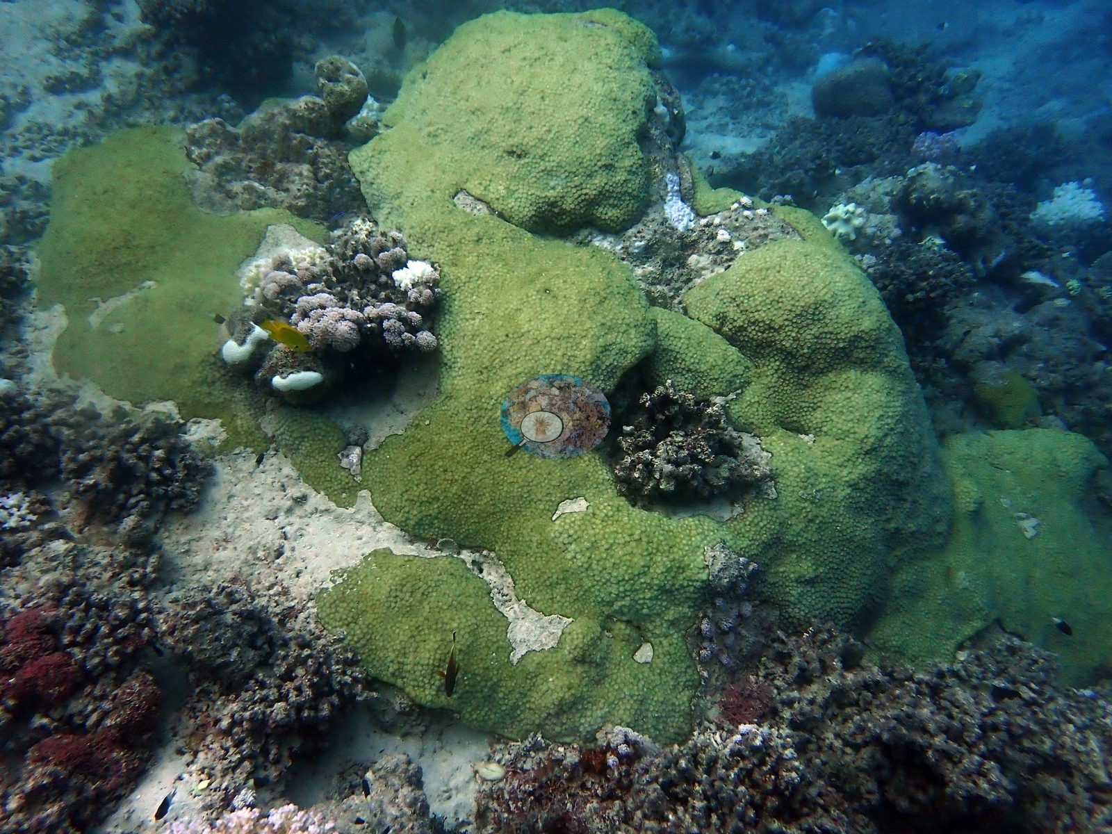
Away from the crest, isolated colonies sit on open carbonate sand, and turf-covered rubble separates surviving heads (e.g., Image 4).
Coral cover
Published CoralNet point counts put total coral cover here (bleached corals included) at 23.6% with 6% algae, and 64.8% of coral tissue bleached at about 16.9 degree-heating-weeks. That figure is a manual point count from Anderson's own published paper, not a computer vision estimate. Also on record for this site: It carries the provenance of the paper it appears in and is not subject to the CoralSCOP/DINOv3 caveats applied elsewhere on this map. Anderson considers this CoralSCOP and DINOv3 figure a work in progress and will replace it as soon as a better coral-cover CV model turns up.
Stressors
The photographs are a bleaching record first and a habitat record second. The crest is a shallow, wave-washed pavement almost at the surface, and much of the branching framework in the frame is stark bone-white - fully bleached branching and plate colonies standing over darker, still-pigmented massives (e.g., Image 1).
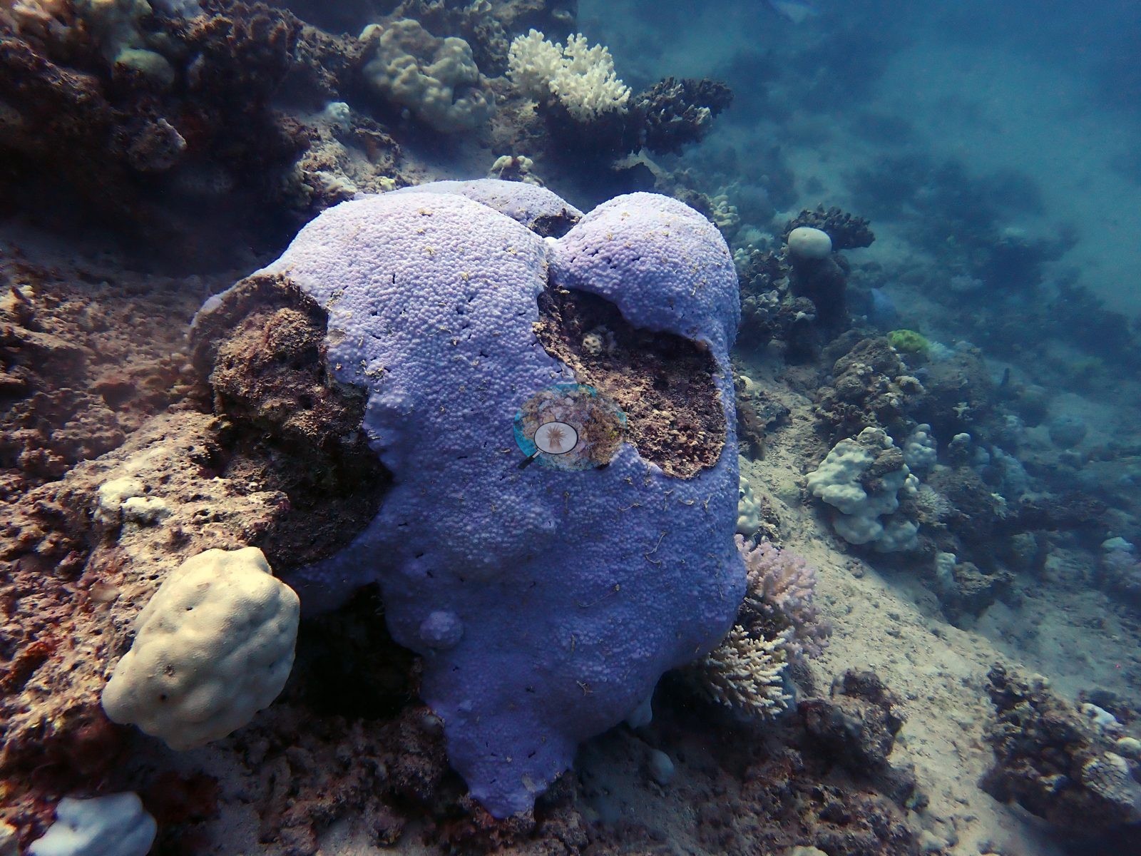
Massive colonies tell the same story more slowly: one dome is uniformly lilac-pale with two large patches of freshly exposed skeleton already fouling brown, another green-tinged massive is bleaching in blotches with algal turf creeping into the dead margins (e.g., Image 2, Image 3).
No crown-of-thorns starfish (COTS) or other corallivores evident.
Comparisons with other data
No prior survey data from this site. If you would like to share yours, please email us.
CV model comparison
More info
These figures are the published AREA value for Rabigh, not this dive site's own measurement. ⚠ These rows are REGIONS, not dive sites. The published paper reports cover by region only — no individual dive-site name appears in it — so no CRD dive site has its own manual value here. ⚠ The manual column and the CV columns are on DIFFERENT FRAME SETS. The published cover spans the region's full photo set (173–2,567 frames, most of them CoralNet robot-labeled); the CV arms ran only on the hand-scored reference subset, which is 6 frames at Thuwal, 274 at Jeddah and 173 at Rabigh. Read Thuwal's model columns as indicative only. CoralNet is n/a by design: the reference set IS the hand-scored set, so those frames carry no independent robot label to compare against. DINOv3 is restricted to frames it never saw, and reads roughly double the published cover at every Red Sea region. ⚠ 'unassigned region' is not a place: 135 frames carry no region label in the CoralNet metadata and map to no published row. It has no manual value and is excluded from the pooled reference. CoralNet automated point classifier: n/a — the reference set IS the hand-scored set; these frames carry no independent CoralNet robot label to compare against CoralSCOP (SAM-based mask-sum), unedited photos: pending — CoralSCOP run: 370/747 images scored at build time CoralSCOP (SAM-based mask-sum), edited photos: pending — CoralSCOP run: 370/747 images scored at build time| Method | Hard-coral cover (%) |
|---|---|
| Manual (published) | 23.6 |
| In-house DINOv3 | 48.1 |
| Claude | 31.0 |
Data & links
- CoralNet image repository for this region ↗
- Photo portfolio ↗
- Photo portfolio ↗
- Coral Reef Diagnostics country page ↗
All images from Coral Reef Diagnostics. Data are from Coral Reef Diagnostics.
© Coral Reef Diagnostics.