
Saudi Red Sea - Coral Gardens (Jeddah)
Part of the regional summaries: Saudi Arabia - Jeddah / KAUST (Thuwal) / Rabigh, Saudi Arabia, and Red Sea
2024-08-17
More info
Makkah-Madine Saudi Arabia (NOAA CRW virtual station) · Northern and Central Red Sea ecoregion mean=12.2°C-heating weeksCoral Gardens lives up to its name - a reef built on giant, several-meters-wide massive Porites mounds and tall pinnacles rising almost to the surface, layered with staghorn and corymbose Acropora and rose-colored pocilloporids. Across two August 2024 visits a week apart, cover held steady around 27-28% while the bleached fraction of coral tissue climbed from 41% to 45% as accumulated heat stress rose, with the reef's largest defining corals - the giant Porites mounds - showing near-universal paling.
حدائق المرجان جديرة باسمها: شعبة مبنية على تلال كتلية عملاقة من Porites يبلغ عرضها عدة أمتار وأبراج عالية ترتفع حتى تكاد تلامس السطح، تكسوها طبقات من Acropora القرني والعنقودي المسطح ومرجانيات شوكية وردية اللون.
ترجمة هذا الملخص بالذكاء الاصطناعي؛ النص الإنجليزي هو المعتمد. Translated from the site’s shorter map summary.
One independent survey station shown with the program’s logo — click one to see how far it is from this site.
One other CRD dive site within 5 km shown in orange — click a marker to open its page.
7 of these 9 photographs are shown beside the text that discusses them under "Site description" below.
Site description
General benthic features
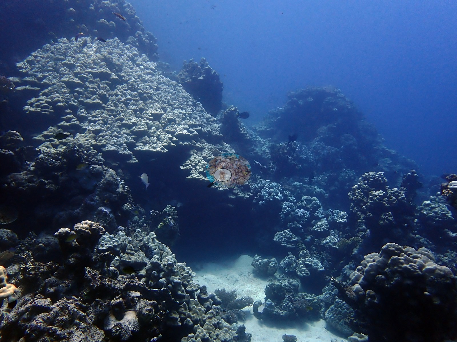
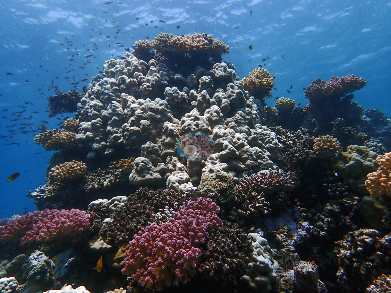
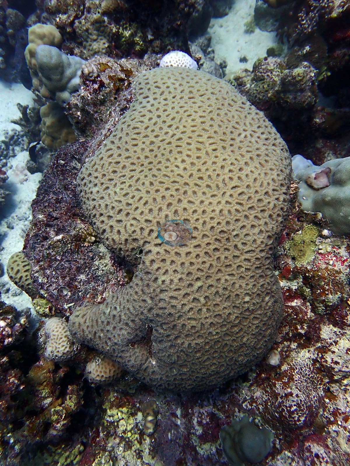
The reef is built on giants. Its defining structures are enormous knobby and columnar Porites mounds — one frame is filled edge to edge by a single colony several meters across and several meters tall, standing free on sand with anthias streaming past — and tall pinnacles that rise almost to the surface, their flanks holding clouds of small fish (e.g., Image 5, Image 6).
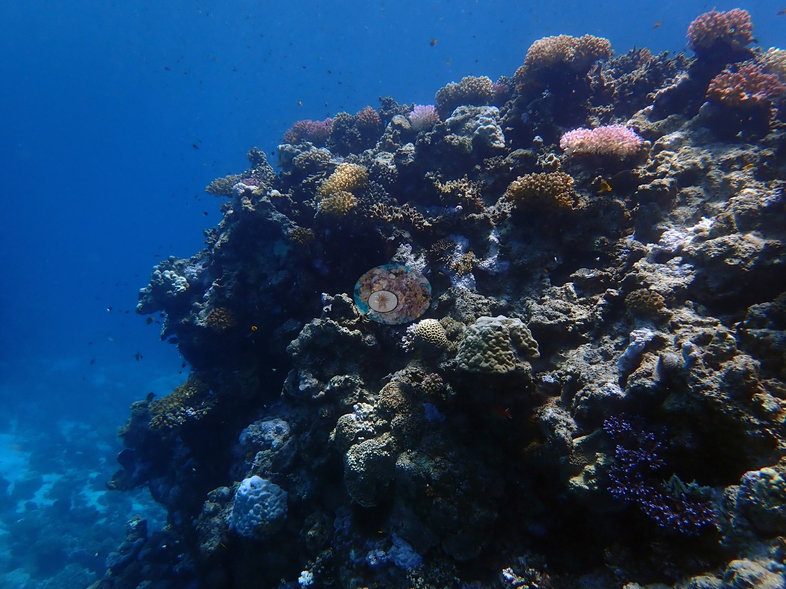
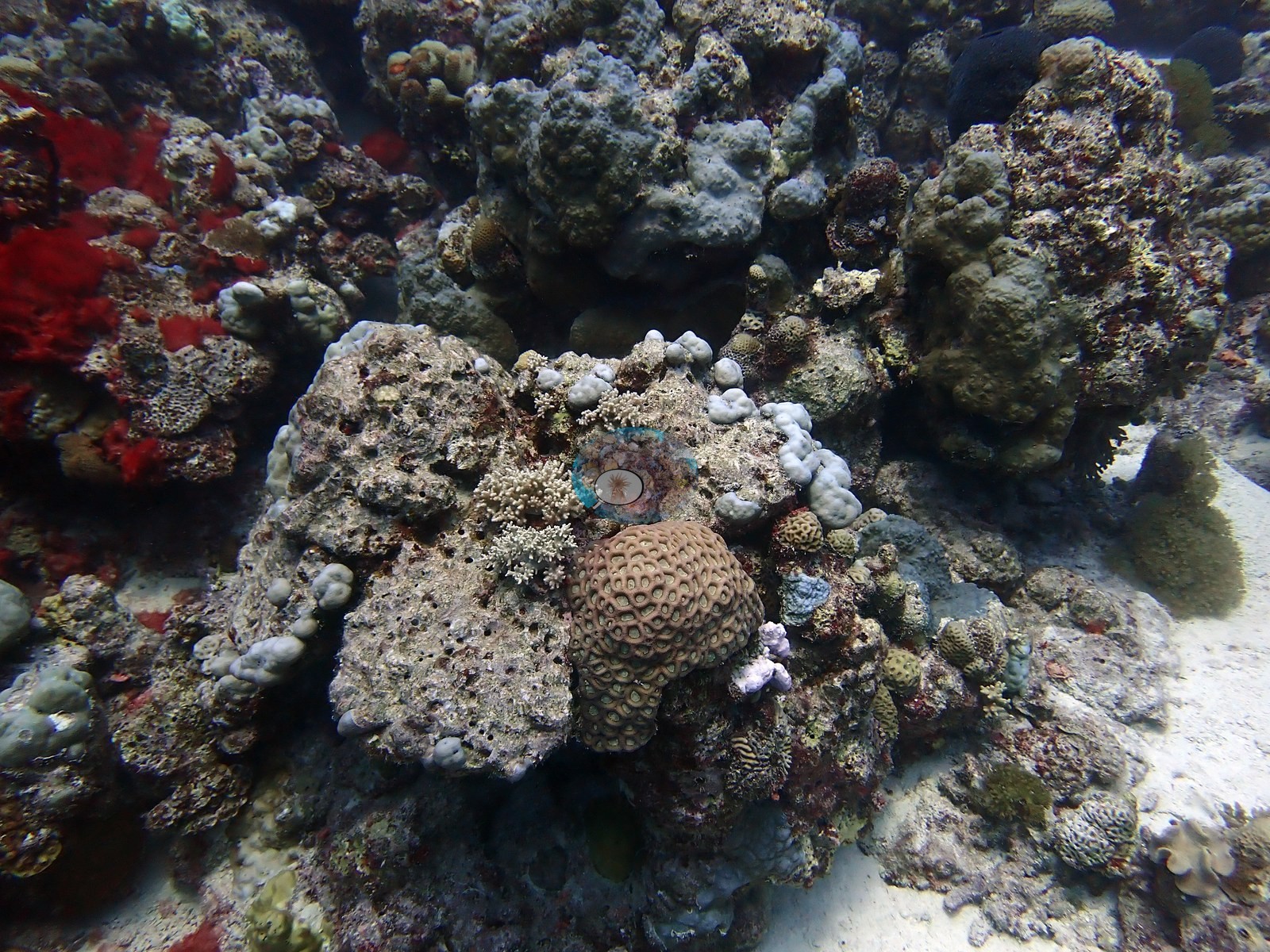
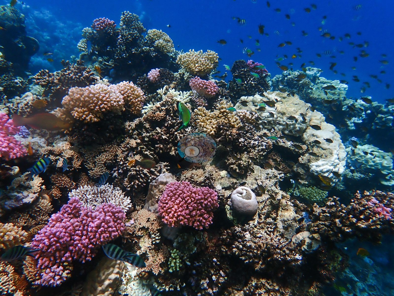
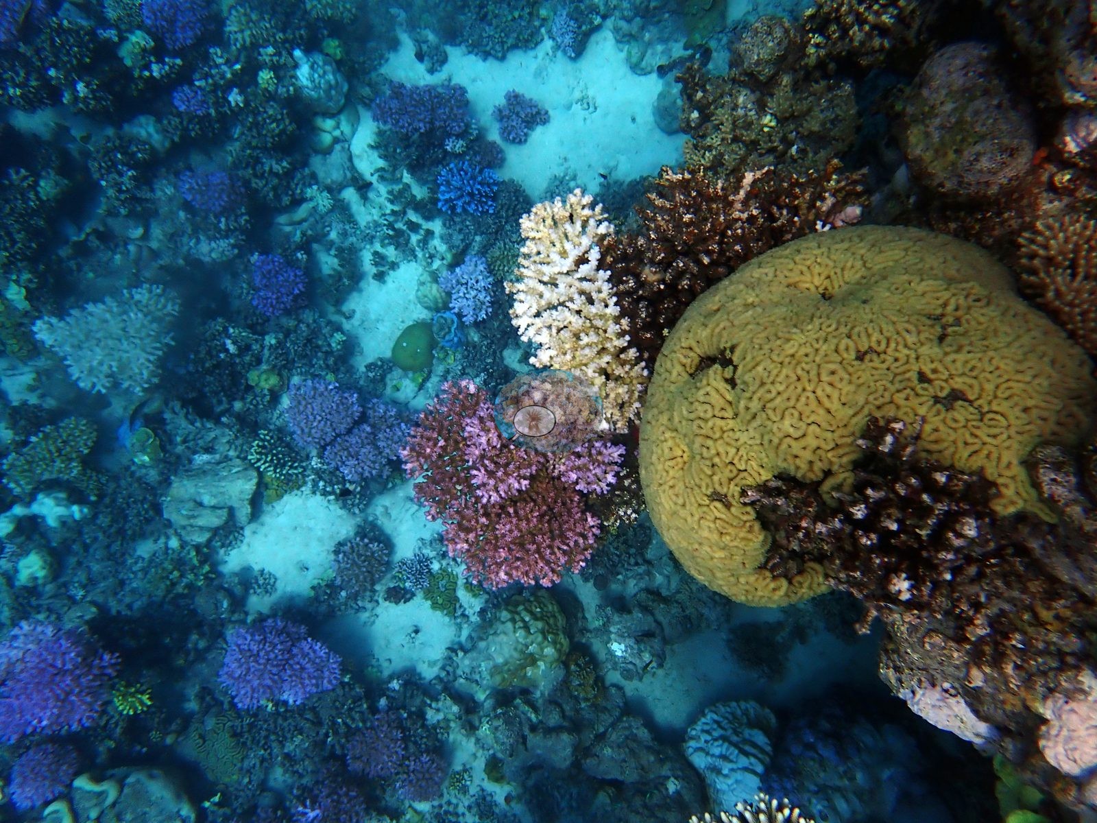
Between and over them sit corymbose and staghorn Acropora in tan and gold, dusty-rose and salmon pocilloporids, green foliose Turbinaria-type plates, Favia/Favites domes, encrusting Mycedium-type plates, giant clams, and blue-spotted ribbontail rays tucked into the pavement (e.g., Image 1, Image 8, Image 9).
Coral cover
Coral cover is 27.6% ± 17.5 across 300 photographs — the second-highest published cover value in this Red Sea set — quoted verbatim from Mayfield, A.B. (2025) Environments 12:248 — Red Sea 2023-24 bleaching; CoralNet point annotation, Appendix A, a manual, diver-annotated CoralNet point count from Anderson's own published work, not a computer vision output and not recomputed here. The site record carries the two visits separately: 29% cover with 41.4% of coral tissue bleached on 10 August (DHW 14.6, 32°C) and 26.7% with 45.4% bleached on 17 August (DHW 17.2, 33°C), the second labeled as at the height of the 2024 bleaching event. Cover held; the bleached fraction climbed as the heat accumulated.
Stressors
And nearly all of the big Porites are pale (e.g., Image 3, Image 7).
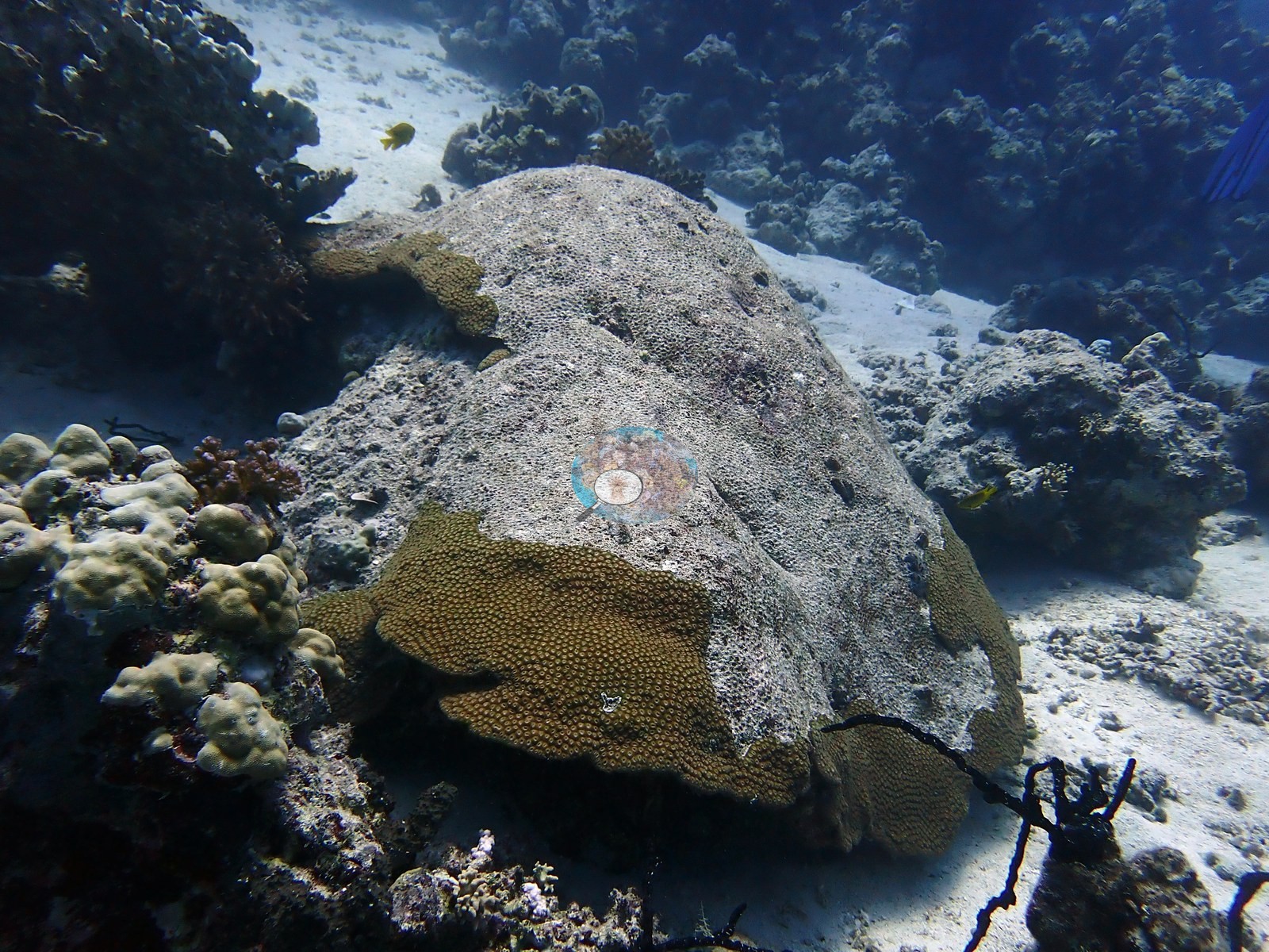
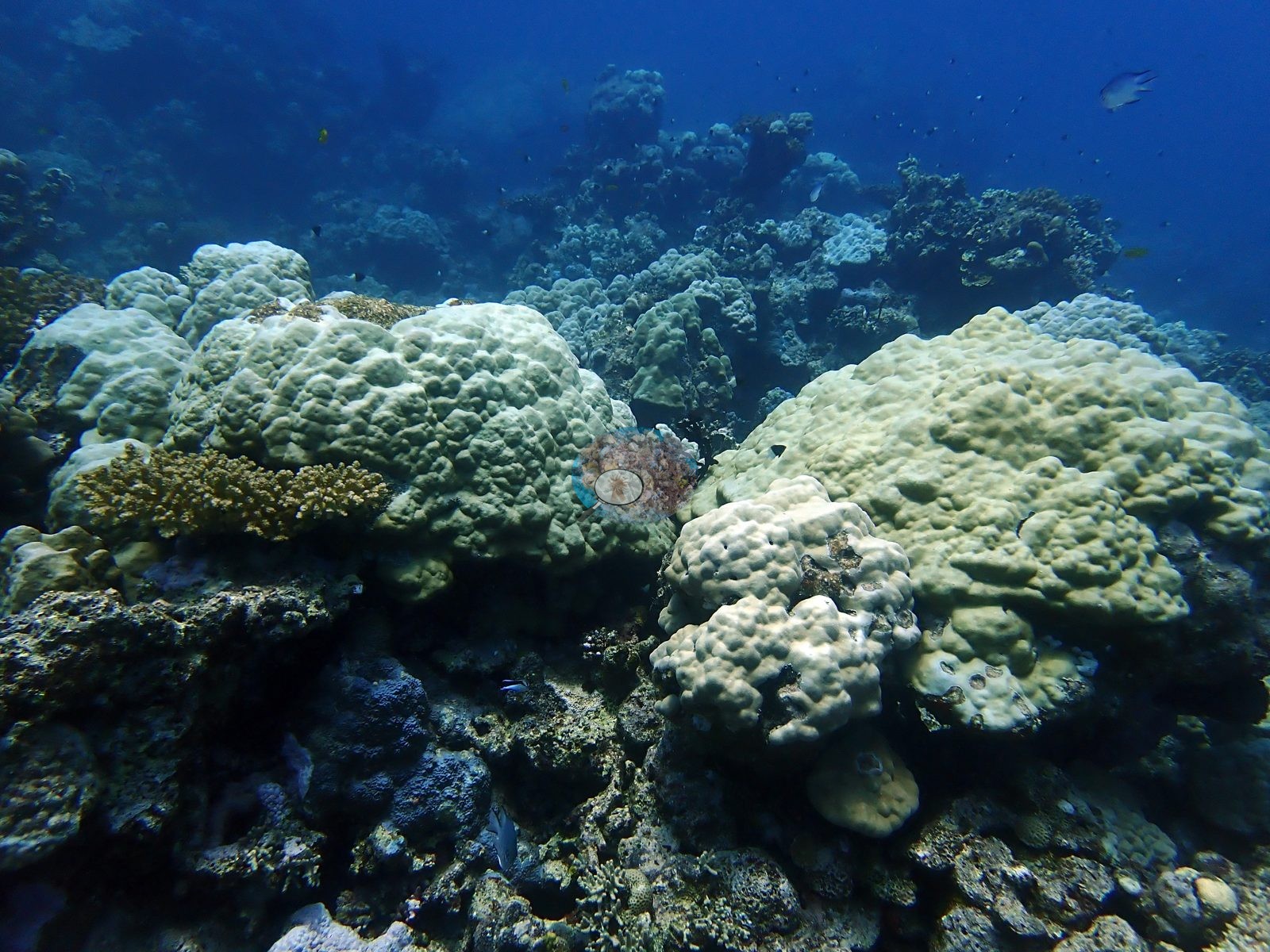
Anderson's own captions for these dives — "paling Porites", "paling poritids near Jeddah", "mild bleaching", "struggling corals", "bleached Pocillopora verrucosa", "Red Sea bleaching 2024", "Jeddah bleaching" — describe exactly what the frames show.
Comparisons with other data
No independent survey was made at this exact site; the nearest ones are listed in the table below.
Dive record
Two dives a week apart in August 2024 with Al-Haddad SCUBA, on a Jeddah reef that lives up to its name.
Other notes
See flags.
Survey summary
Coral Gardens: surveyed 2 times, Aug 2024–Aug 2024 (CoralNet point counts; Mayfield 2025, Environments 12:248). Surveyed in partnership with Al-Haddad SCUBA.
CV model comparison
More info
The reference row is this dive site's own published value (Mayfield 2025, Appendix A, 300 photos); the other rows are AREA-level (Jeddah) comparisons, not run on this site's frames. ⚠ The comparison rows are REGIONS, not dive sites: the paper's main tables report cover by region, and this site's own value comes from its Appendix A. ⚠ The manual column and the CV columns are on DIFFERENT FRAME SETS. The published cover spans the region's full photo set (173–2,567 frames, most of them CoralNet robot-labeled); the CV arms ran only on the hand-scored reference subset, which is 6 frames at Thuwal, 274 at Jeddah and 173 at Rabigh. Read Thuwal's model columns as indicative only. CoralNet is n/a by design: the reference set IS the hand-scored set, so those frames carry no independent robot label to compare against. DINOv3 is restricted to frames it never saw, and reads roughly double the published cover at every Red Sea region. ⚠ 'unassigned region' is not a place: 135 frames carry no region label in the CoralNet metadata and map to no published row. It has no manual value and is excluded from the pooled reference. CoralNet automated point classifier: n/a — the reference set IS the hand-scored set; these frames carry no independent CoralNet robot label to compare against CoralSCOP (SAM-based mask-sum), unedited photos: pending — CoralSCOP run: 370/747 images scored at build time CoralSCOP (SAM-based mask-sum), edited photos: pending — CoralSCOP run: 370/747 images scored at build time| Method | Hard-coral cover (%) |
|---|---|
| Manual (published) | 27.6 |
| In-house DINOv3 | 34.9 |
| Claude | 27.3 |
Dive history
Coral bleached: computer-vision (CoralNet) estimate from the survey images, per dive, as published in Mayfield (2025, Environments 12:248), Supplementary File S1.
| Date | Time in | Max depth (m) | Bottom time (min) | Coral bleached (%) |
|---|---|---|---|---|
| 2024-08-10 | — | — | — | 41.4 |
| 2024-08-17 | — | — | — | 45.4 |
Independent surveys nearby
Within 5 km, 1 independent survey station recorded hard coral cover in 2025. One survey since 2021 recorded 23%. This site's own estimate (28%) is indistinguishable from the recent value (23%): the 5.1-point gap is inside the ±7 percentage-point noise between methods; the methods differ, so the comparison is context, not a like-for-like test.
Collected by other programs using different methods, so these are context for the figures above, not a like-for-like comparison. Where a station was surveyed more than once the range is shown. Station names are not dive-site names.
| Agency | Site / location | Date | Hard coral cover (%) | Distance | Link |
|---|---|---|---|---|---|
| Coral Vita | Coral Vita 1 | 2025 | 23% | 3.21 km | Bean T, Matouk A, Re E. 2025. JCDC Coral Restoration Program. MERMAID |
Data & links
- CoralNet image repository for this region ↗
- Photo portfolio ↗
- Photo portfolio ↗
- Coral Reef Diagnostics country page ↗
All images from Coral Reef Diagnostics. Data are from Coral Reef Diagnostics and the organizations named in the data-sources table above.
© Coral Reef Diagnostics.