
Saudi Red Sea - Cement Reef (Thuwal)
Part of the regional summaries: Saudi Arabia - Jeddah / KAUST (Thuwal) / Rabigh, Saudi Arabia, and Red Sea
2024-01-12
2024-02-23
More info
Makkah-Madine Saudi Arabia (NOAA CRW virtual station) · Northern and Central Red Sea ecoregion mean=12.2°C-heating weeksCement Reef, named for a nearby shipwreck, is a high-relief spur-and-groove structure honeycombed with swim-throughs, carrying the richest coral cover of the Thuwal sites reviewed here - dense pocilloporid thickets and cobalt digitate Acropora on the upper slope, thinning to sparse rubble and sand lower down. A camera malfunction left only one usable photograph across all four logged dives, so the published 22% cover and 19.9% bleaching figures are site-level manuscript summaries rather than per-visit counts; the single available frame does show a large Porites colony uniformly white alongside normally pigmented neighbors.
شعبة الأسمنت، المسماة على اسم حطام سفينة قريب، هي بنية نتوءات وأخاديد عالية التضاريس تتخللها ممرات للسباحة، وتحمل أعلى غطاء مرجاني بين مواقع ثول التي جرت مراجعتها هنا: أجَمات كثيفة من المرجان الشوكي وأشجار Acropora الإصبعية بلون أزرق كوبالتي في أعلى المنحدر، تتناقص إلى حطام مرجاني متفرق ورمل في الأسفل.
ترجمة هذا الملخص بالذكاء الاصطناعي؛ النص الإنجليزي هو المعتمد. Translated from the site’s shorter map summary.
One independent survey station shown with the program’s logo — click one to see how far it is from this site.
One other CRD dive site within 5 km shown in orange — click a marker to open its page.
Site description
Setting
A Thuwal outer-reef site named for the cement carrier that went down nearby, dived four times between September 2023 and February 2024 with Coastline (KAUST). The reef is a high-relief spur-and-groove limestone structure honeycombed with swim-throughs — one frame looks up through a coral tunnel at a diver silhouetted in the blue (e.g., Image 4).
General benthic features
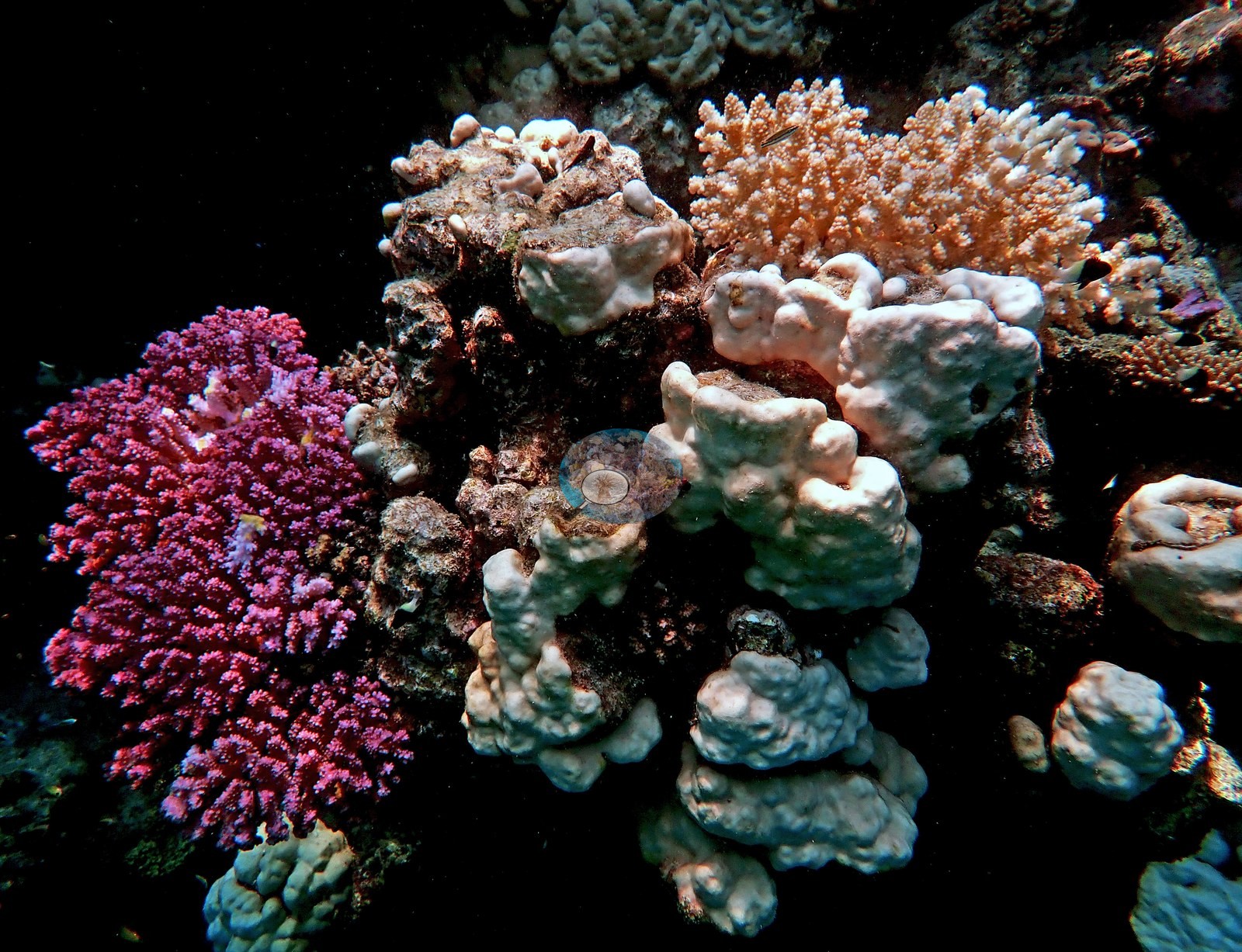
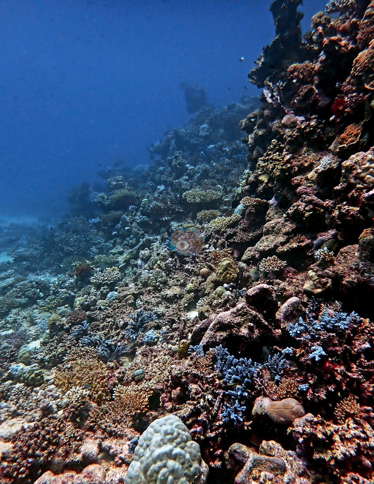
The upper slope carries the richest cover in the whole set of Thuwal sites reviewed here: dense pocilloporid thickets in lavender, dusty pink, and cream, striking cobalt-blue digitate Acropora, tabulate and corymbose Acropora, encrusting Montipora-type plates, and cream-to-tan Porites and Goniastrea boulders, with black damselfish and butterflyfish working the crest (e.g., Image 1, Image 2, Image 3, Image 5, Image 6, Image 9, Image 10).
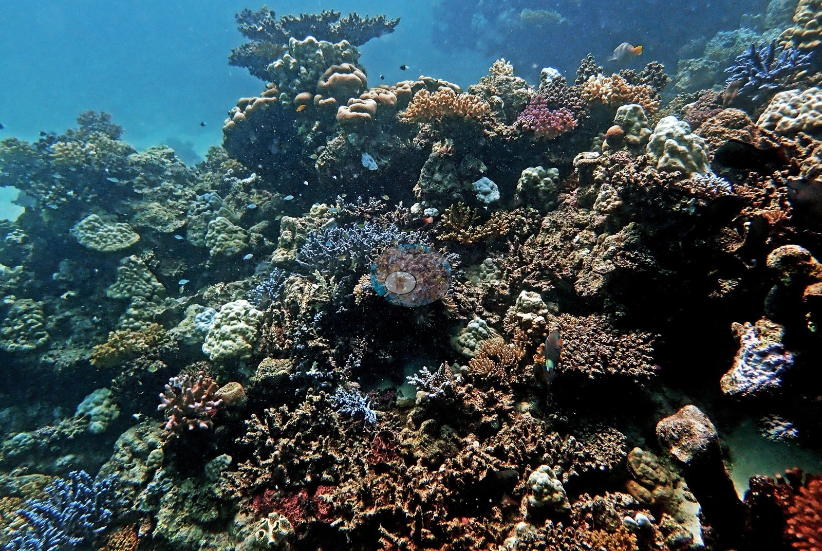
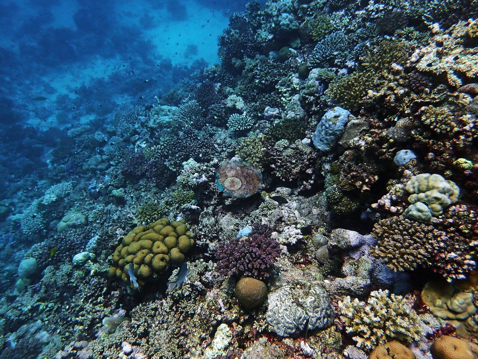
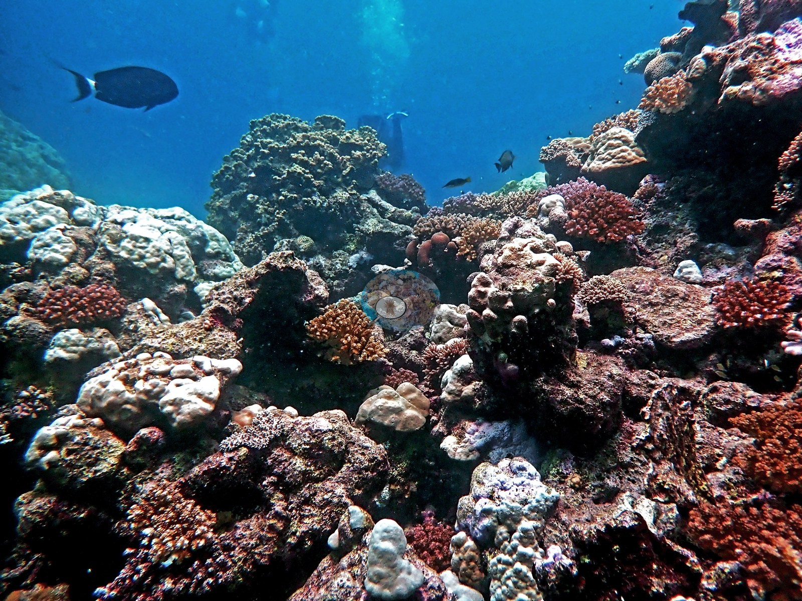
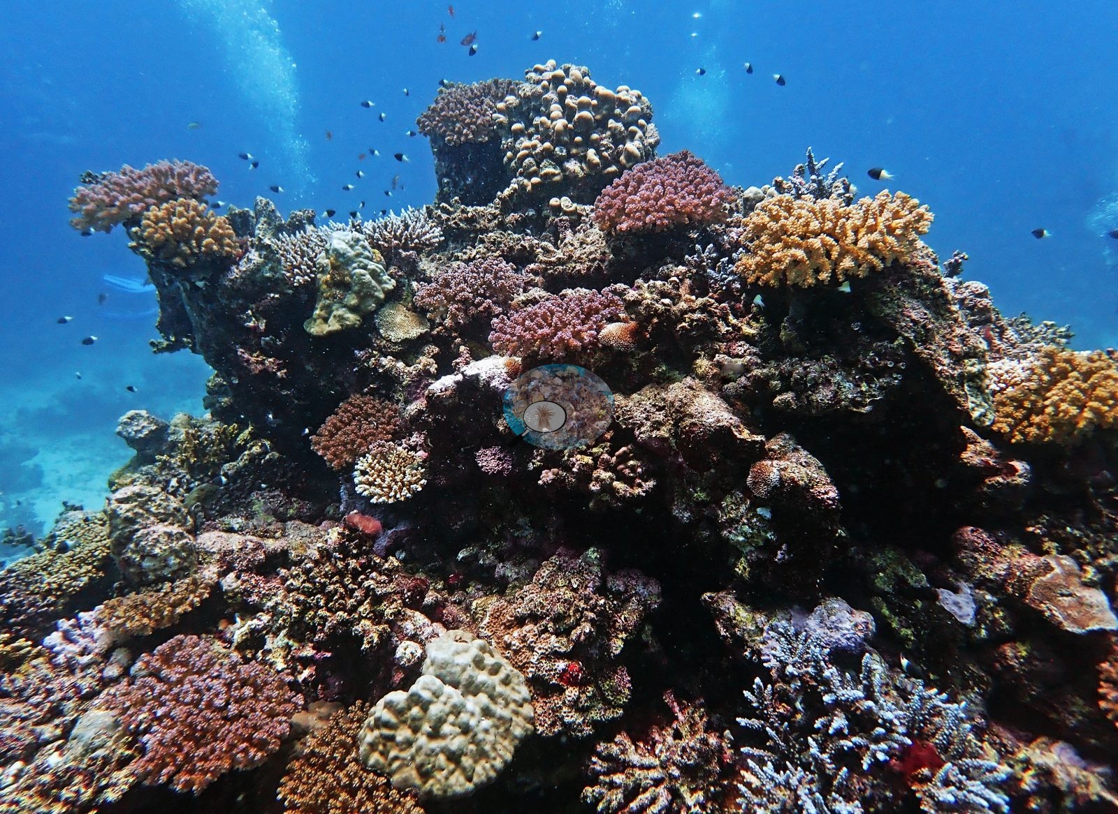
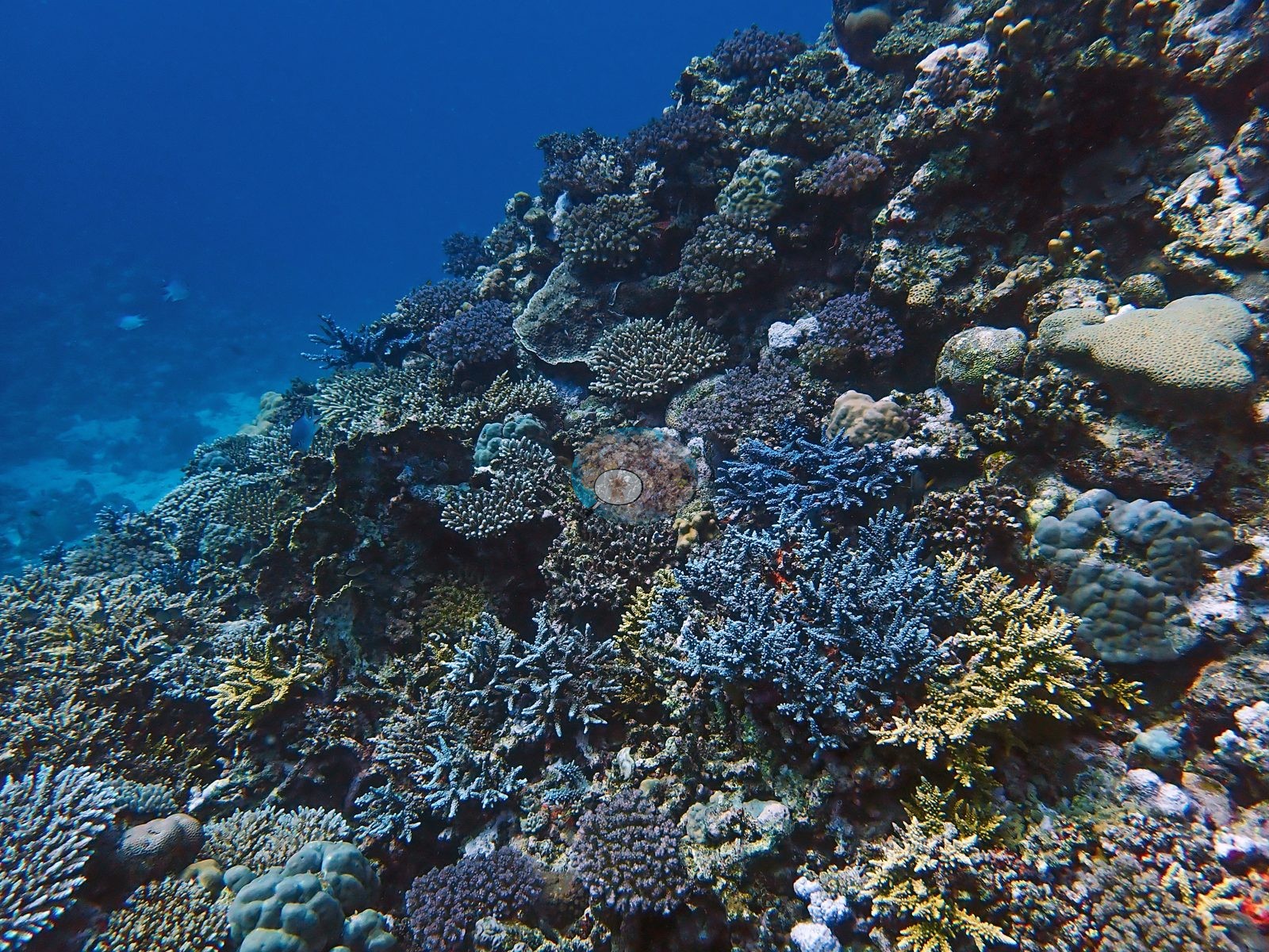
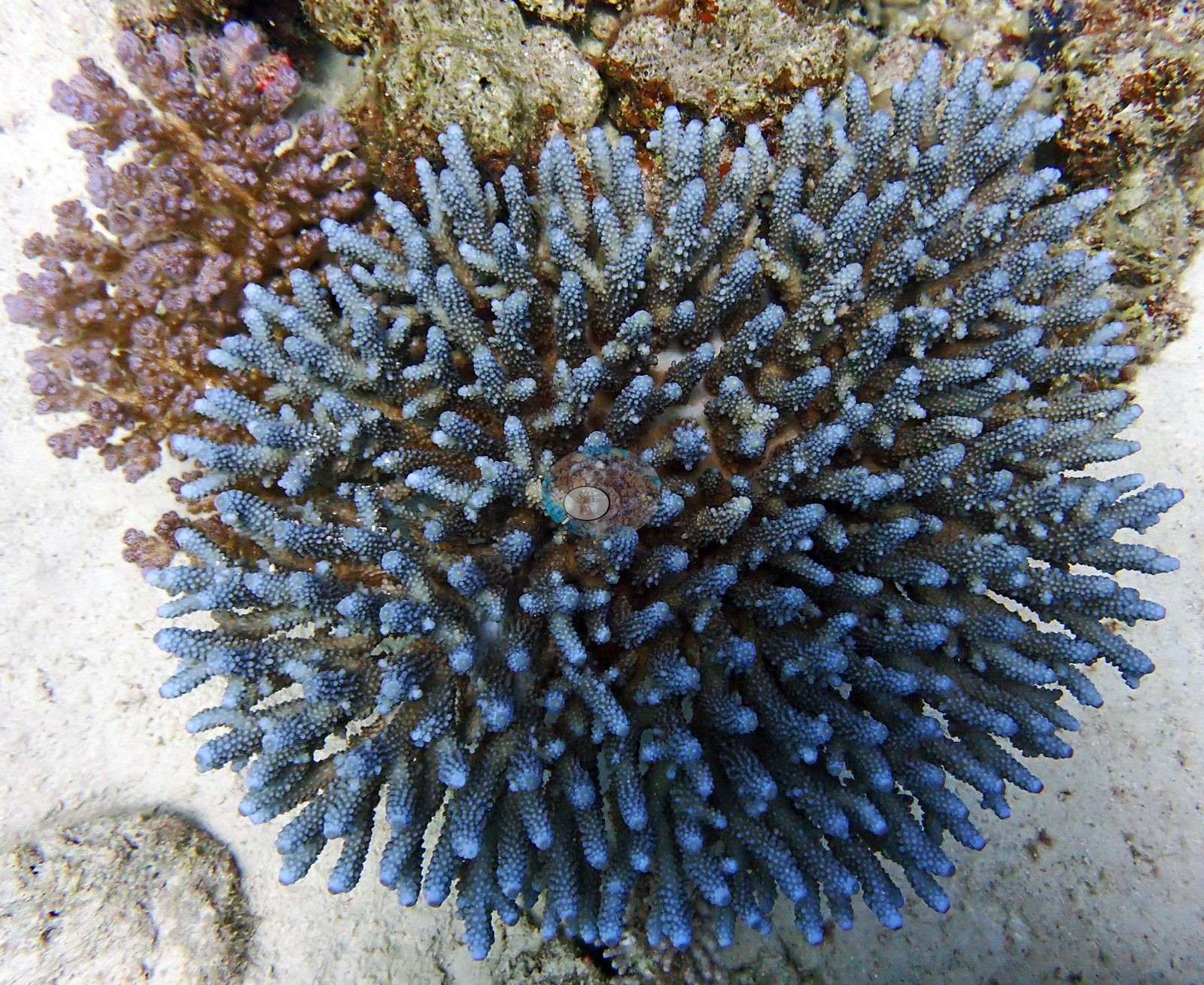
Below and away from the spurs the structure changes completely: a low pavement-and-rubble ridge crusted in coralline algae and turf with only scattered coral, then a wide white sand plain studded with isolated coral bommies of pocilloporids and small Acropora (e.g., Image 8).
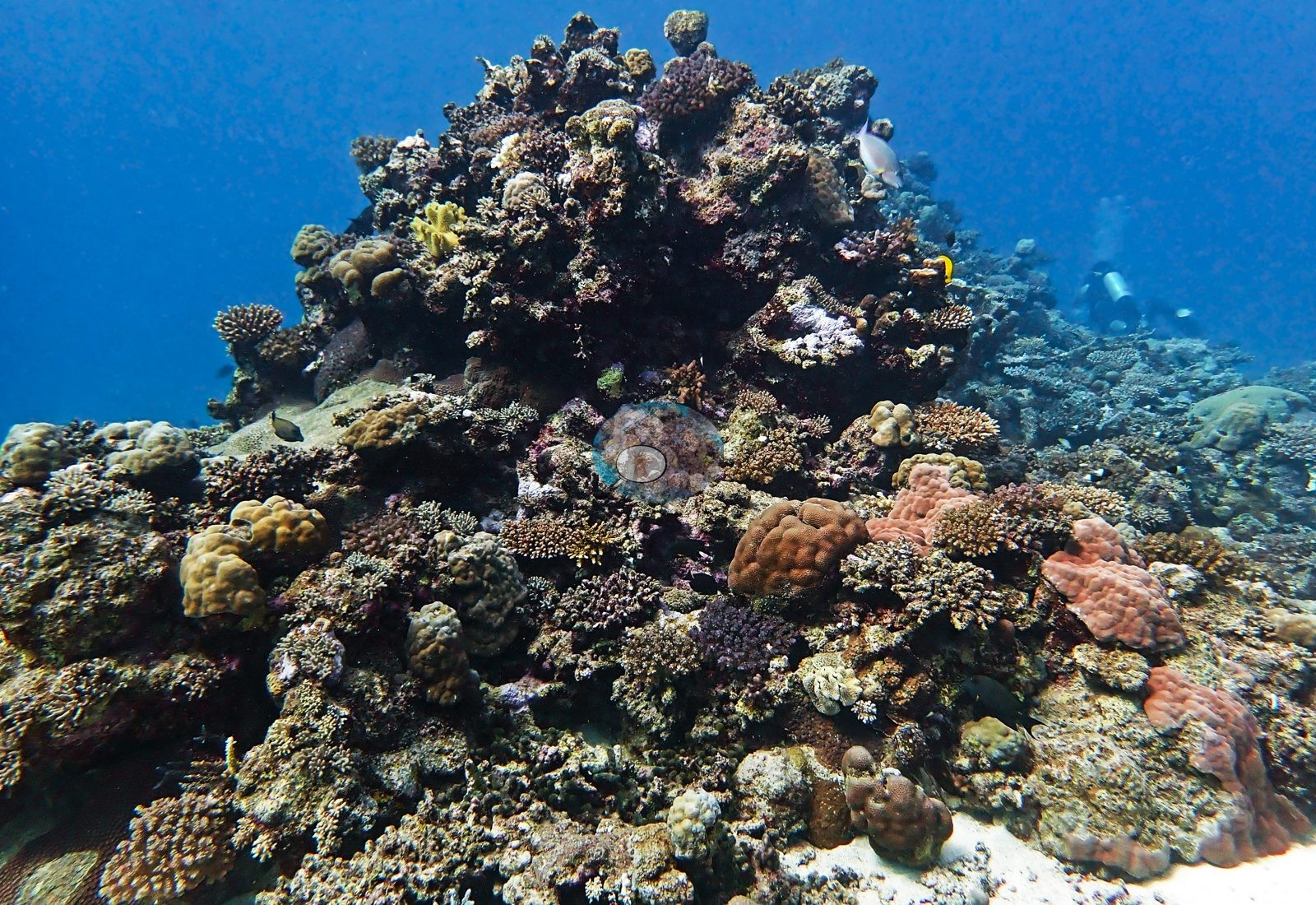
A large fungiid — an elongate slipper-coral form (Herpolitha/Ctenactis-type, with a long central axial furrow) — lies free on the sand, olive-green and apparently healthy.
Coral cover
Coral cover is 22.4% ± 16.5 across 469 photographs, quoted verbatim from the pin's source, Mayfield, A.B. (2025) Environments 12:248 — Red Sea 2023-24 bleaching; CoralNet point annotation, Appendix A — a manual, diver-annotated CoralNet point count from Anderson's own published work, not a computer vision estimate and not recomputed here. An important caveat travels with that number, recorded in the site record itself: the 22% cover and 19.9% bleaching figures come from the manuscript's site-level summary, not from a per-visit count, because a check of the full Red Sea annotation dataset found only ONE usable photograph for this site across all four logged dives. Anderson attributes the gap to camera malfunction rather than a processing backlog, so there is not enough annotated imagery here to support per-visit cover or bleaching values.
Comparisons with other data
No independent survey was made at this exact site; the nearest ones are listed in the table below.
Survey summary
Cement Reef: surveyed 3 times, Sep 2023–Feb 2024 (CoralNet point counts; Mayfield 2025, Environments 12:248). Surveyed in partnership with Coastline (KAUST).
CV model comparison
More info
The reference row is this dive site's own published value (Mayfield 2025, Appendix A, 469 photos); the other rows are AREA-level (Thuwal) comparisons, not run on this site's frames. ⚠ The comparison rows are REGIONS, not dive sites: the paper's main tables report cover by region, and this site's own value comes from its Appendix A. ⚠ The manual column and the CV columns are on DIFFERENT FRAME SETS. The published cover spans the region's full photo set (173–2,567 frames, most of them CoralNet robot-labeled); the CV arms ran only on the hand-scored reference subset, which is 6 frames at Thuwal, 274 at Jeddah and 173 at Rabigh. Read Thuwal's model columns as indicative only. CoralNet is n/a by design: the reference set IS the hand-scored set, so those frames carry no independent robot label to compare against. DINOv3 is restricted to frames it never saw, and reads roughly double the published cover at every Red Sea region. ⚠ 'unassigned region' is not a place: 135 frames carry no region label in the CoralNet metadata and map to no published row. It has no manual value and is excluded from the pooled reference. CoralNet automated point classifier: n/a — the reference set IS the hand-scored set; these frames carry no independent CoralNet robot label to compare against CoralSCOP (SAM-based mask-sum), unedited photos: pending — CoralSCOP run: 370/747 images scored at build time CoralSCOP (SAM-based mask-sum), edited photos: pending — CoralSCOP run: 370/747 images scored at build time| Method | Hard-coral cover (%) |
|---|---|
| Manual (published) | 22.4 |
| In-house DINOv3 | 47.5 |
| Claude | 23.9 |
Dive history
| Date | Time in | Max depth (m) | Bottom time (min) |
|---|---|---|---|
| 2023-09-02 | 12:44 | 12.5 | 54 |
| 2024-01-12 | 10:45 | 15.0 | 45 |
| 2024-01-12 | 12:45 | 24.0 | 45 |
| 2024-02-23 | 12:41 | 20.4 | 61 |
Independent surveys nearby
 Coral Reef Diagnostics survey
Within 5 km, 1 independent survey station recorded hard coral cover in 2010. The most recent nearby survey is from 2010, so these values predate recent heat stress. This site's own pooled estimate (22%) sits 8.6 points below the range of these surveys (31%); the methods differ, so the comparison is context, not a like-for-like test.
Collected by other programs using different methods, so these are context for the figures above, not a like-for-like comparison. Where a station was surveyed more than once the range is shown. Station names are not dive-site names.
| Agency | Site / location | Date | Hard coral cover (%) | Distance | Link |
|---|---|---|---|---|---|
| Furby et al. (2013) | Offshore reef 1 | 2010 | 31% (3 surveys) | 1.64 km | HeatCRD database |
Data & links
- CoralNet image repository for this region ↗
- HeatCRD database ↗
- (reference) ↗
- Photo portfolio ↗
- Photo portfolio ↗
- Photo portfolio ↗
- Coral Reef Diagnostics country page ↗
All images from Coral Reef Diagnostics. Data are from Coral Reef Diagnostics and the organizations named in the data-sources table above.
© Coral Reef Diagnostics.