

Indonesia - Banda Islands: Tanjung Pisang (Banana Island)

Part of the regional summaries: Indonesia - Banda and Indonesia - Maluku
More info
Maluku (NOAA CRW virtual station) · Banda Sea ecoregion mean=7.3°C-heating weeksTanjung Pisang is a steep wall running from coralline pavement through a soft-coral-draped section into a genus-rich upper terrace and a near-continuous Acropora carpet at its back half. A cluster of about five large plating corals was found bleached stark white with tissue still present, and a second pair of pale Porites-type colonies nearby suggests scattered, low-incidence paling across the reef rather than a single spot. No crown-of-thorns starfish (COTS), Drupella, or disease seen. A blind Claude computer-vision point count puts coral cover around 36%.
Tanjung Pisang adalah dinding curam yang membentang dari hamparan berkerak koralin, melewati bagian yang berselimut karang lunak, menuju teras atas yang kaya genus dan hamparan Acropora yang hampir menyambung di paruh belakangnya. Sekelompok sekitar lima koloni karang lembaran besar ditemukan memutih pucat dengan jaringan yang masih ada, dan sepasang koloni bertipe Porites yang pucat di dekatnya menunjukkan pemucatan yang tersebar dan berinsiden rendah di seluruh terumbu, bukan satu titik tunggal.
Terjemahan ringkasan ini oleh AI; versi bahasa Inggris yang berlaku. Translated from the site’s shorter map summary.
21 independent survey stations shown with the program’s logo — click one to see how far it is from this site.
Four other CRD dive sites within 5 km shown in orange — click a marker to open its page.
24 of these 25 photographs are shown beside the text that discusses them under "Site description" below.
Site description
Setting
Visibility was excellent throughout — open blue water on the seaward side of almost every wide frame and the far reef readable at 20 m (e.g., Image 22).
The site is a steep wall and upper slope falling away from a shallow reef top.
General benthic features
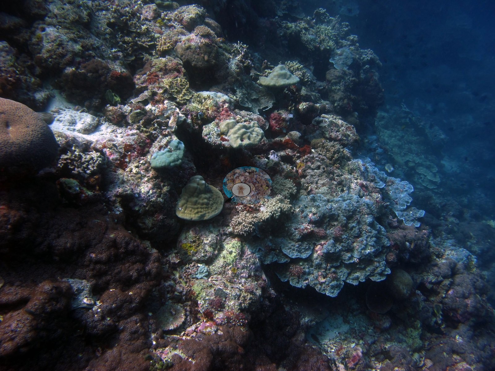
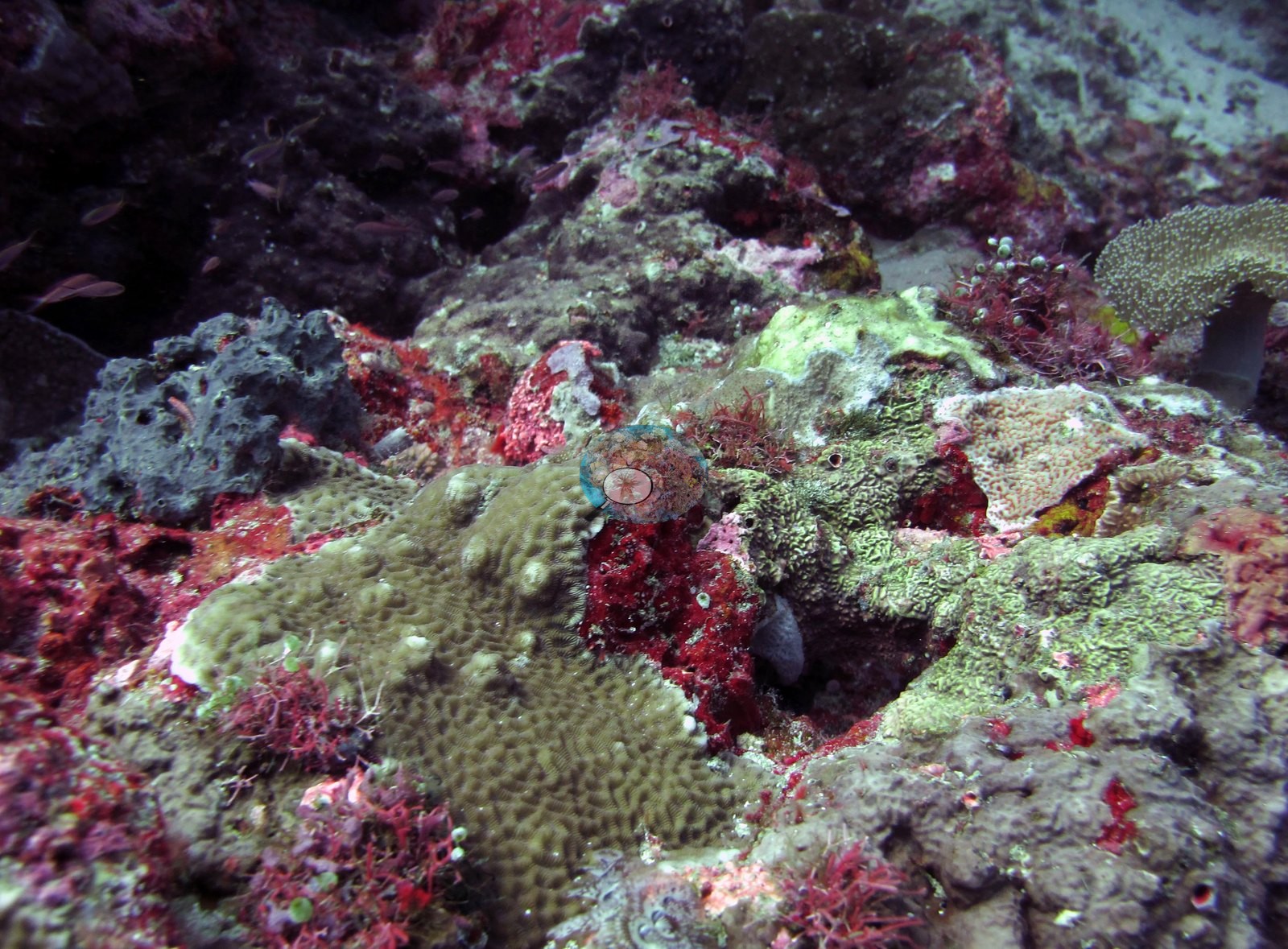
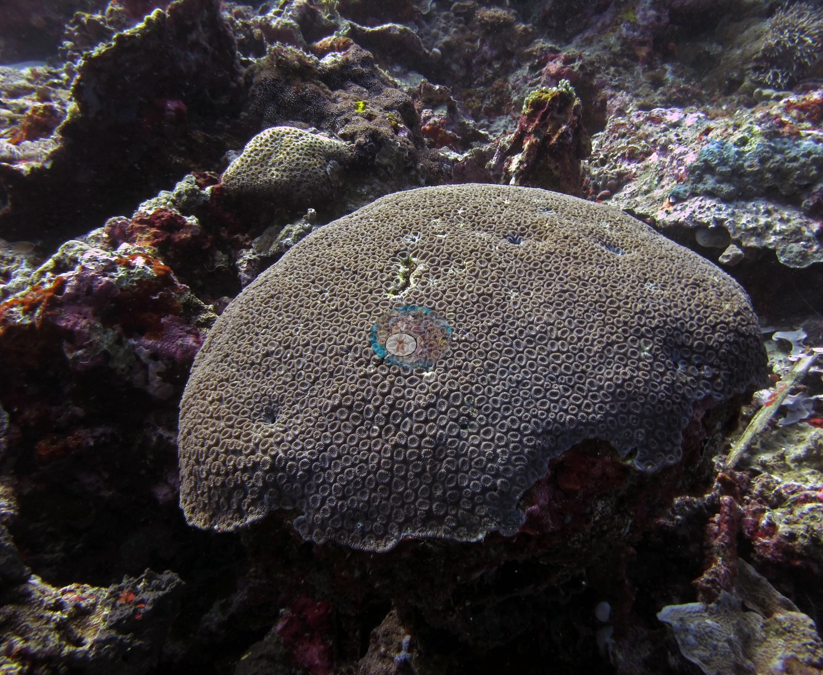
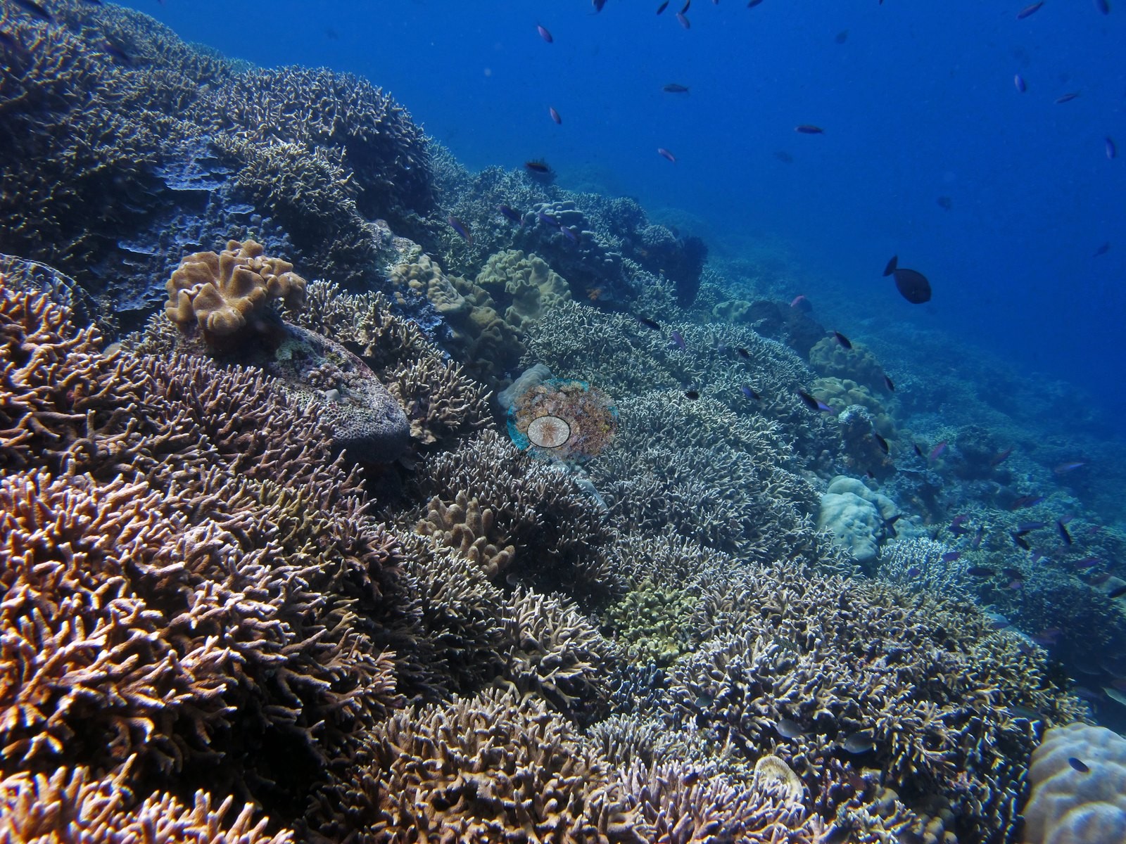
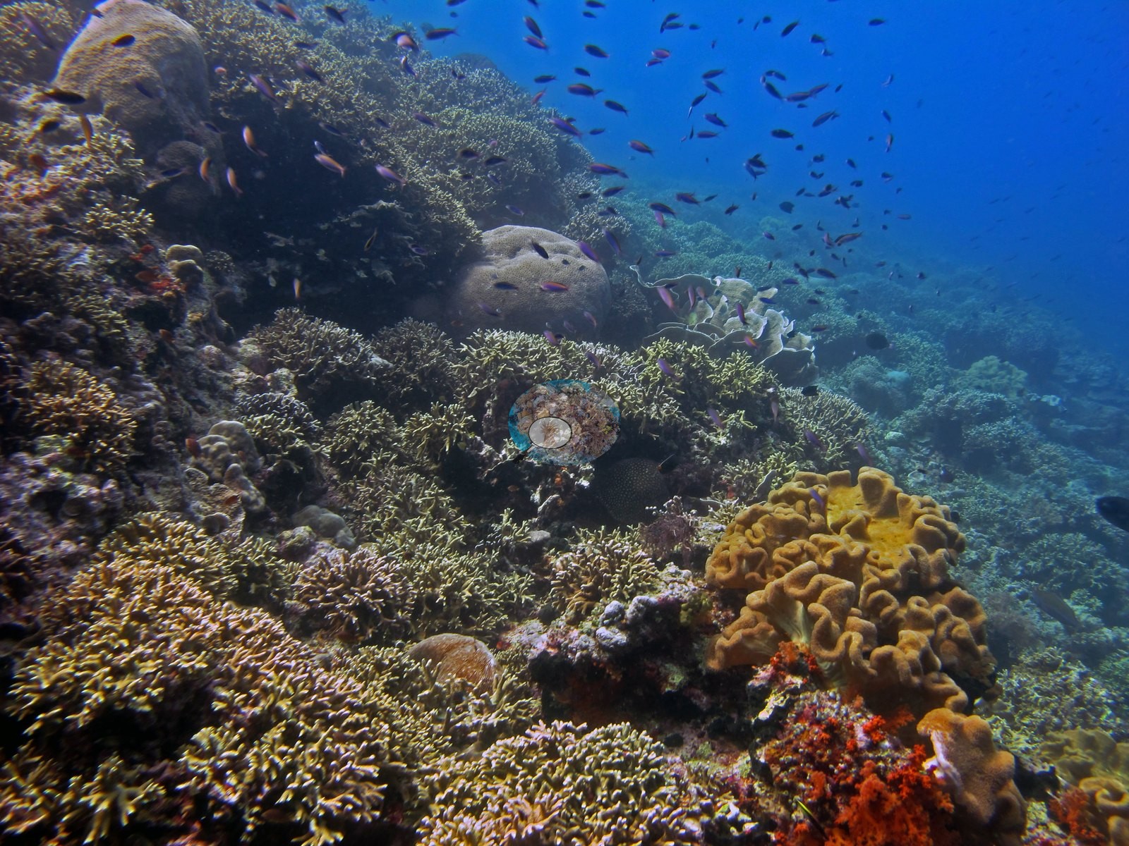
The habitat zones. The opening wall and bommie face (about 18 frames, 10:21–10:32) is coralline-crusted pavement with blue-gray encrusting and laminar colonies consistent with Montipora and Porites, cerioid Favites/Dipsastraea-type heads, a large gorgonian sea fan, and wire coral (e.g., Image 1, Image 2, Image 3, Image 4).
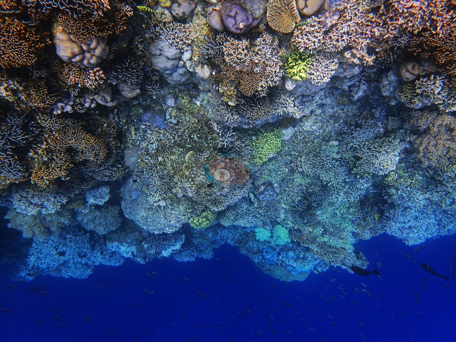
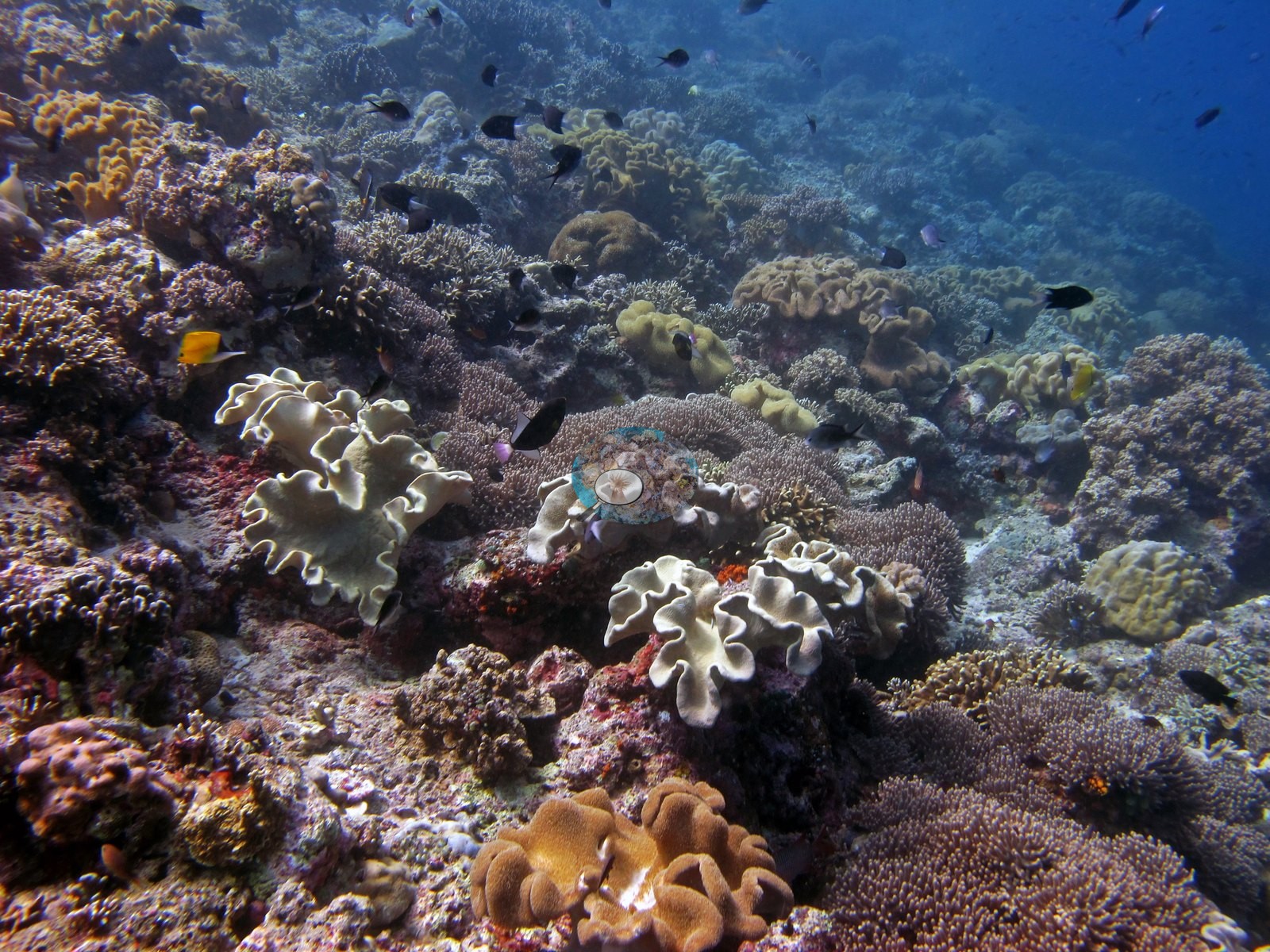
A soft-coral-draped wall follows (about 30 frames): dense Sarcophyton and Lobophytum toadstool leathers, pink and gray Xenia/Anthelia-type polyp carpets, red and orange Dendronephthya, blue encrusting sponge, barrel sponges, and feather stars (e.g., Image 5, Image 6, Image 7).
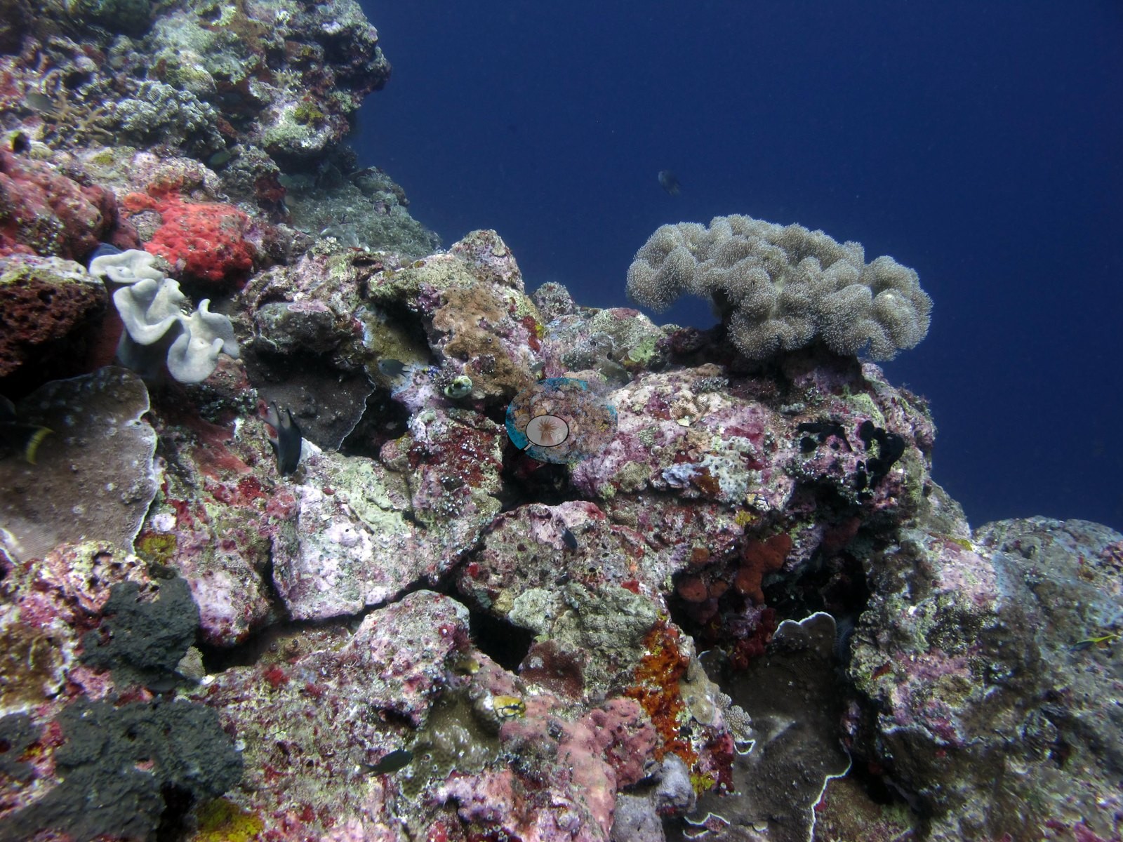
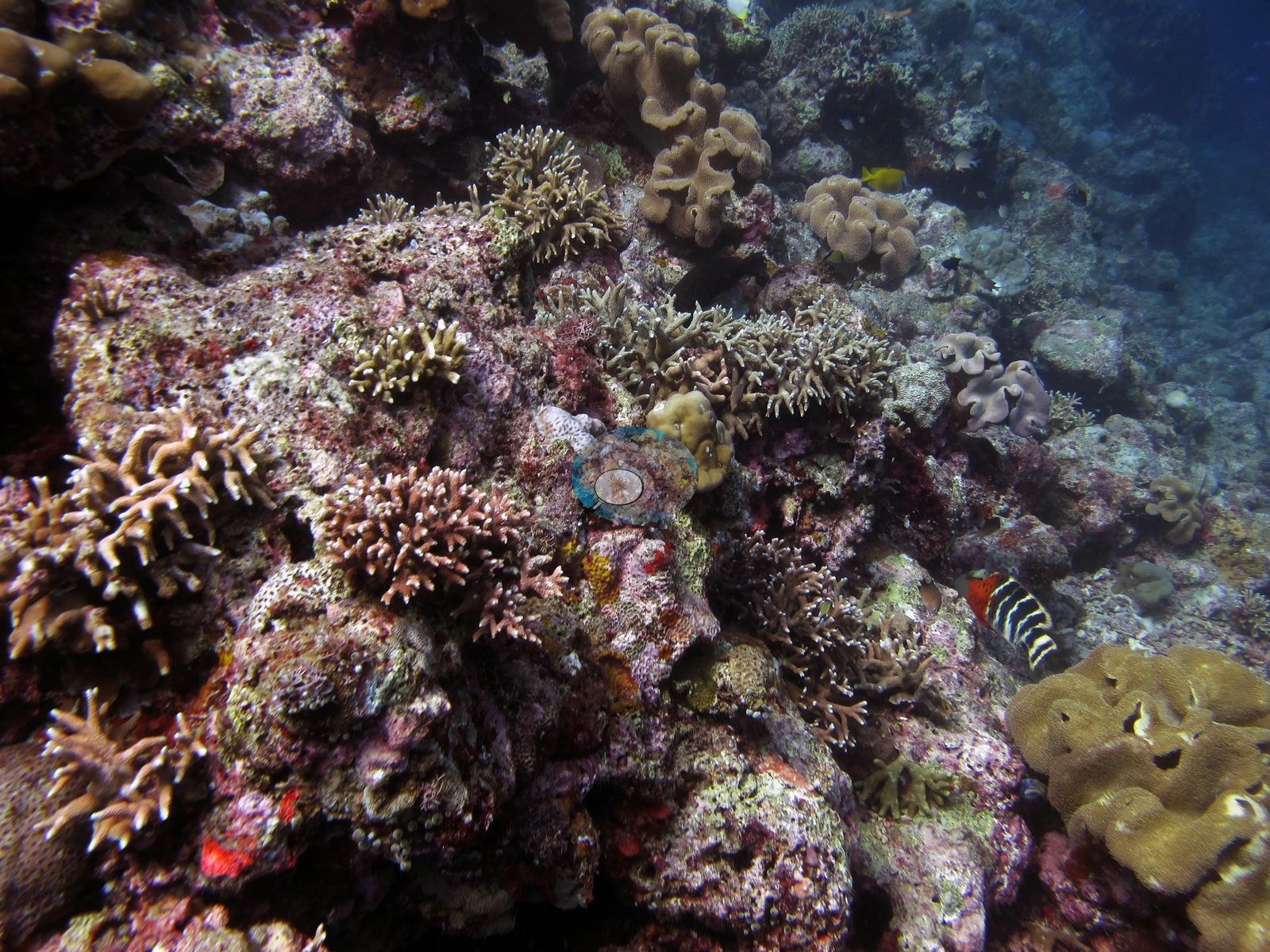
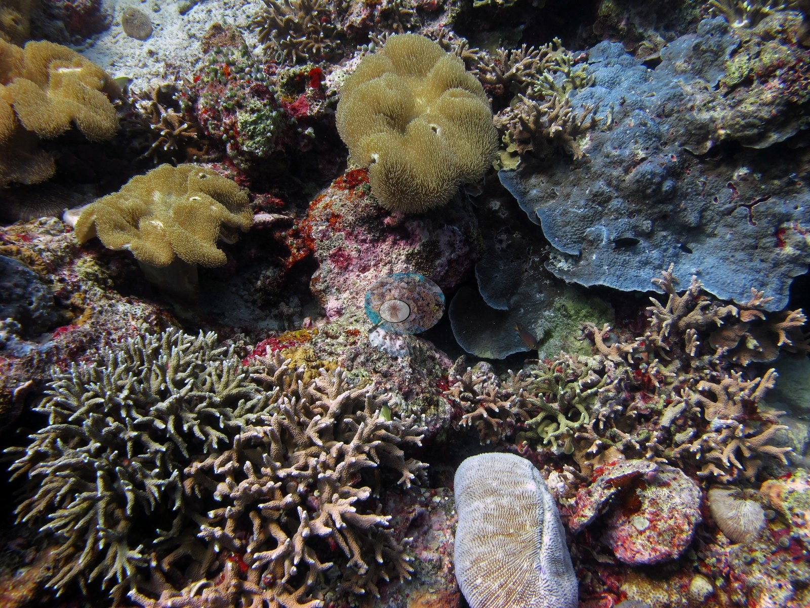
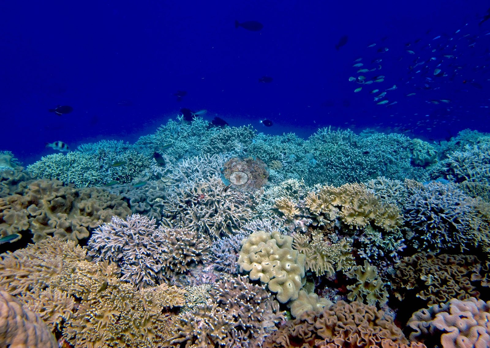
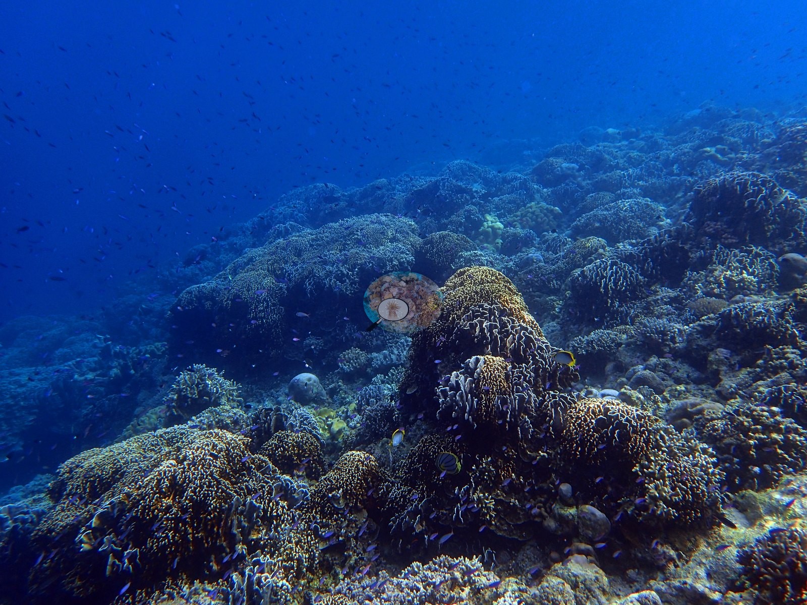
The upper terrace (about 40 frames) is a mixed branching-and-massive mosaic — corymbose and digitate Acropora, Pocillopora, Seriatopora, blunt-branched Porites cylindrica-type stands, Turbinaria and Pachyseris plates, massive Porites, and Platygyra-type brains (e.g., Image 8, Image 13, Image 14, Image 16, Image 17, Image 19, Image 23).
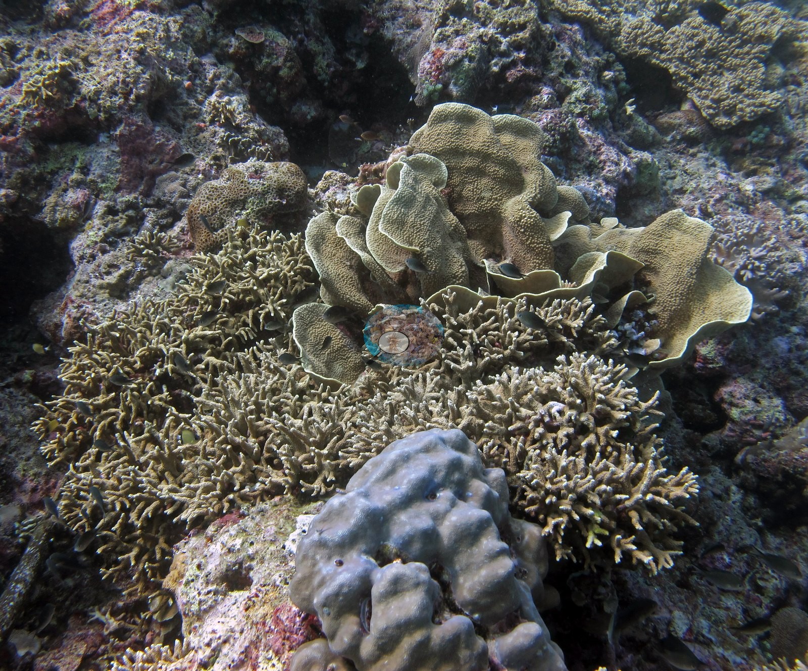
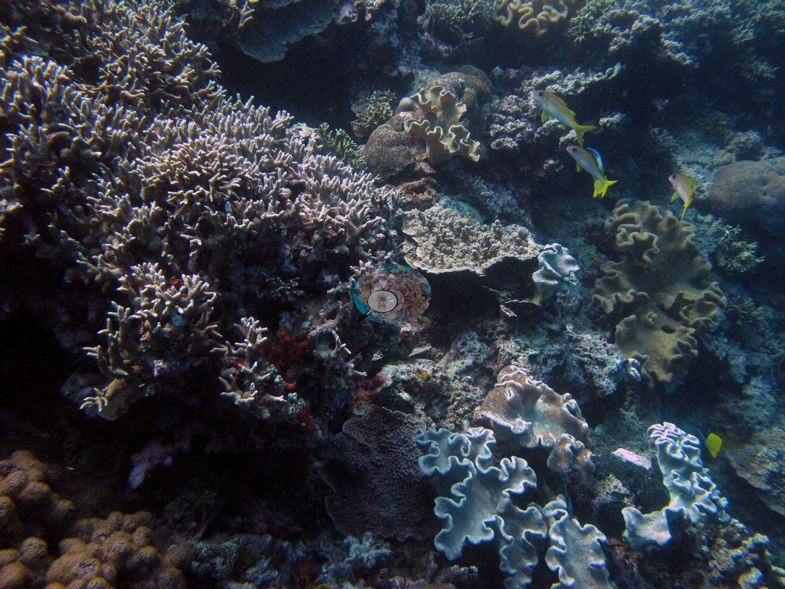
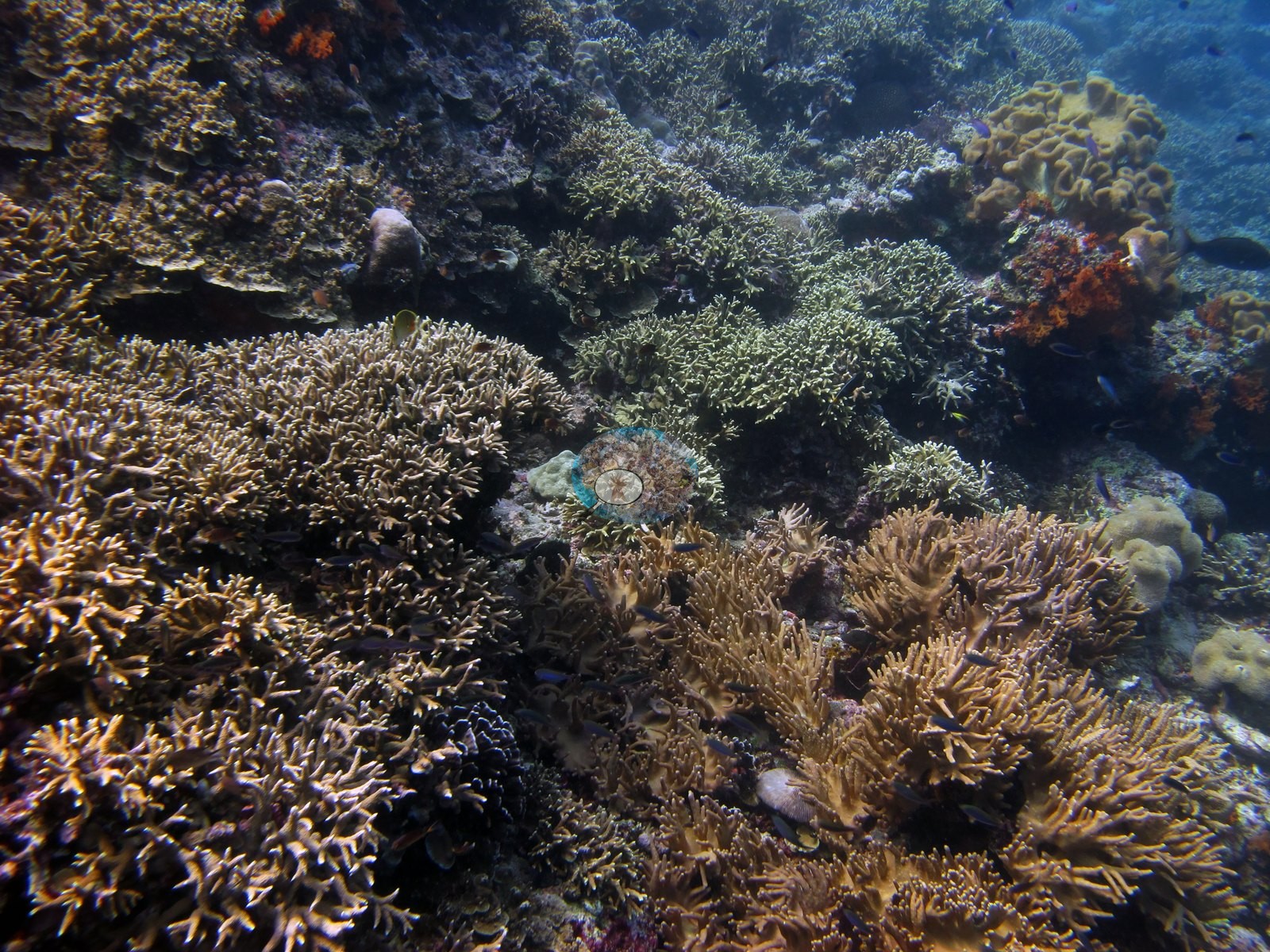
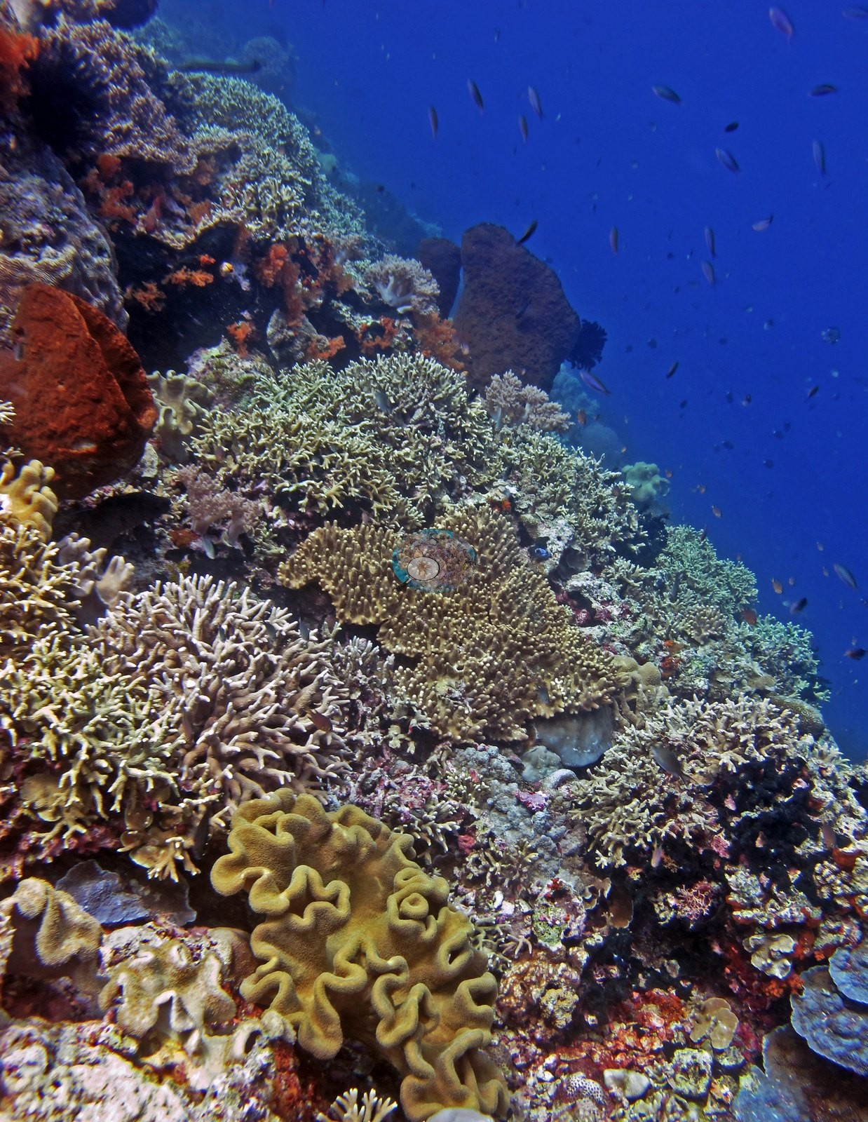
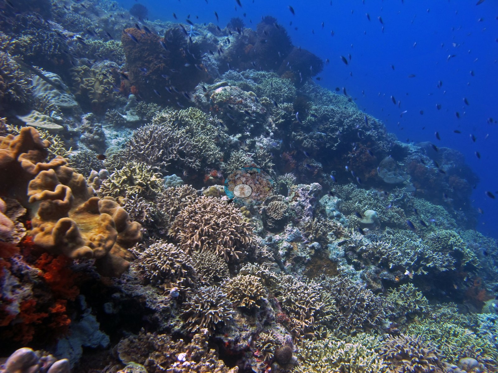
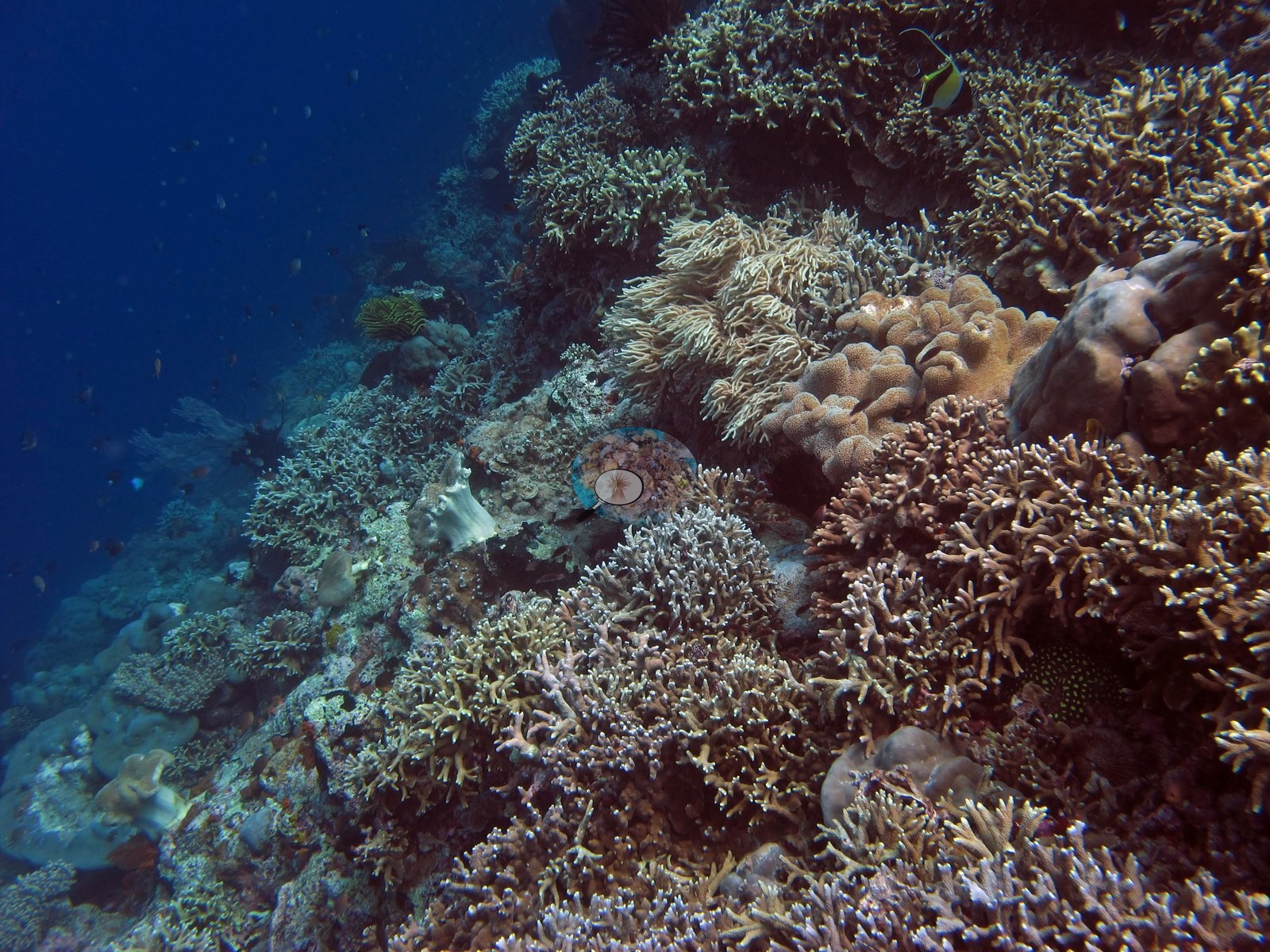
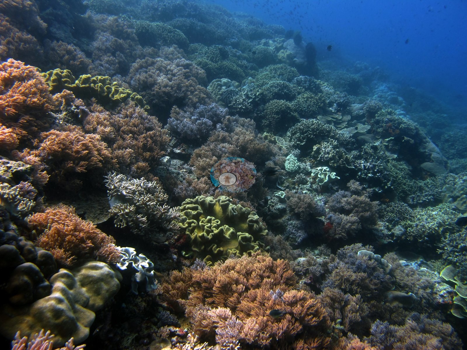
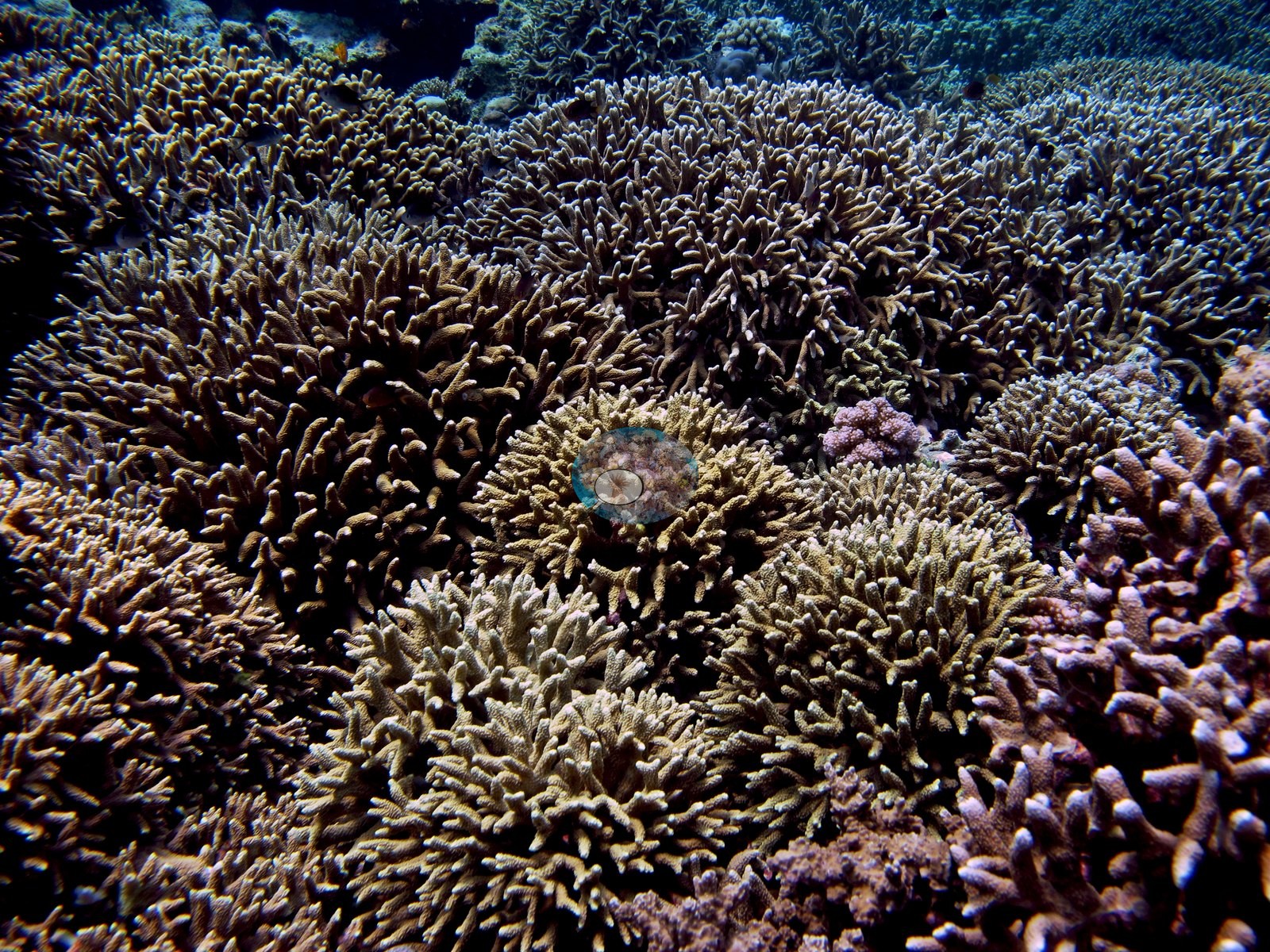
A leather-coral garden (about 30 frames, 11:05–11:12) holds the bleaching cluster, a giant clam, and barrel sponges. The back half of the dive (about 55 frames, 11:13–11:23) is near-continuous corymbose and digitate Acropora carpet, the site's signature habitat, and genus-rich with it (e.g., Image 10, Image 11, Image 12, Image 18, Image 20, Image 21, Image 25).
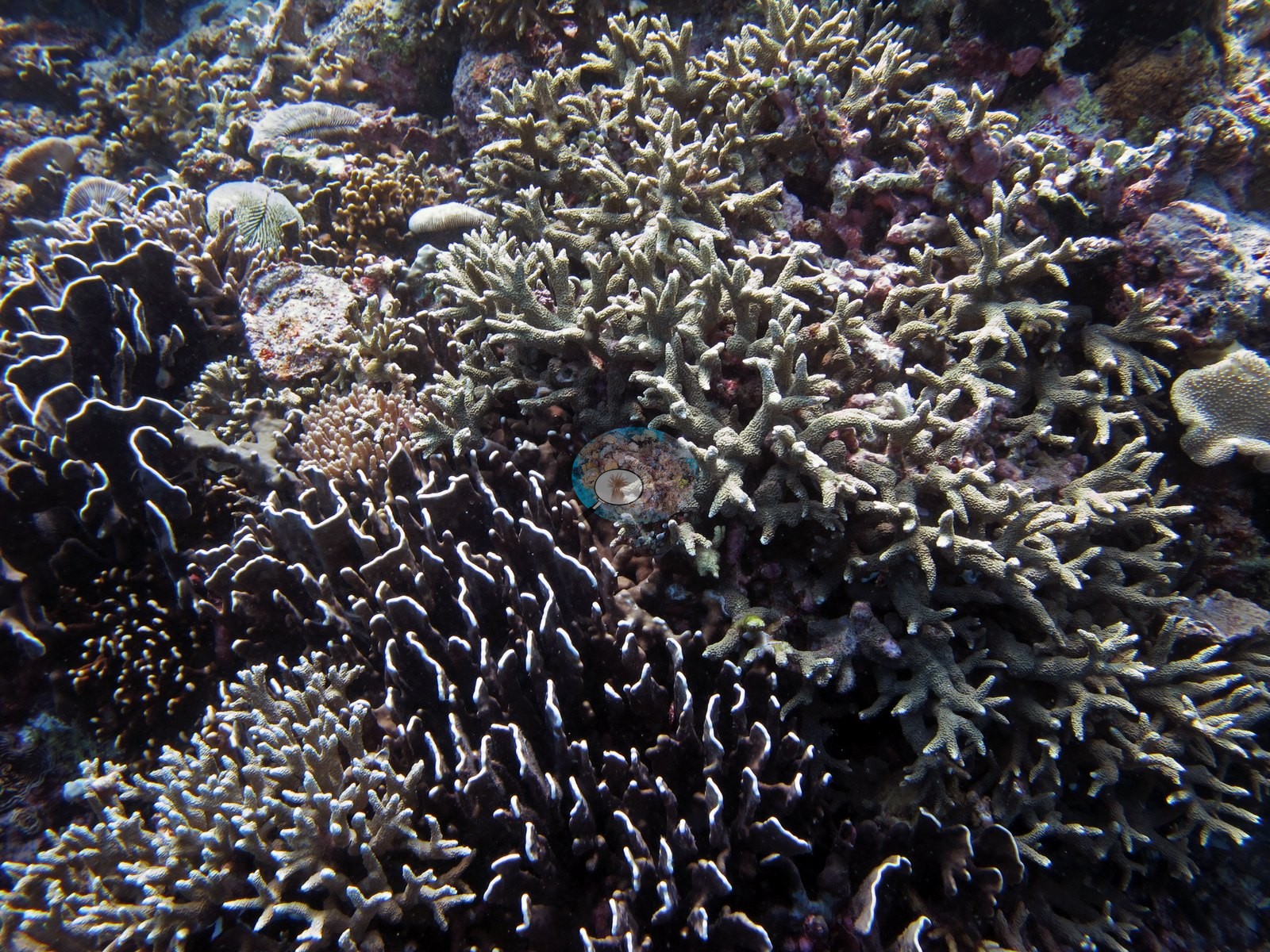
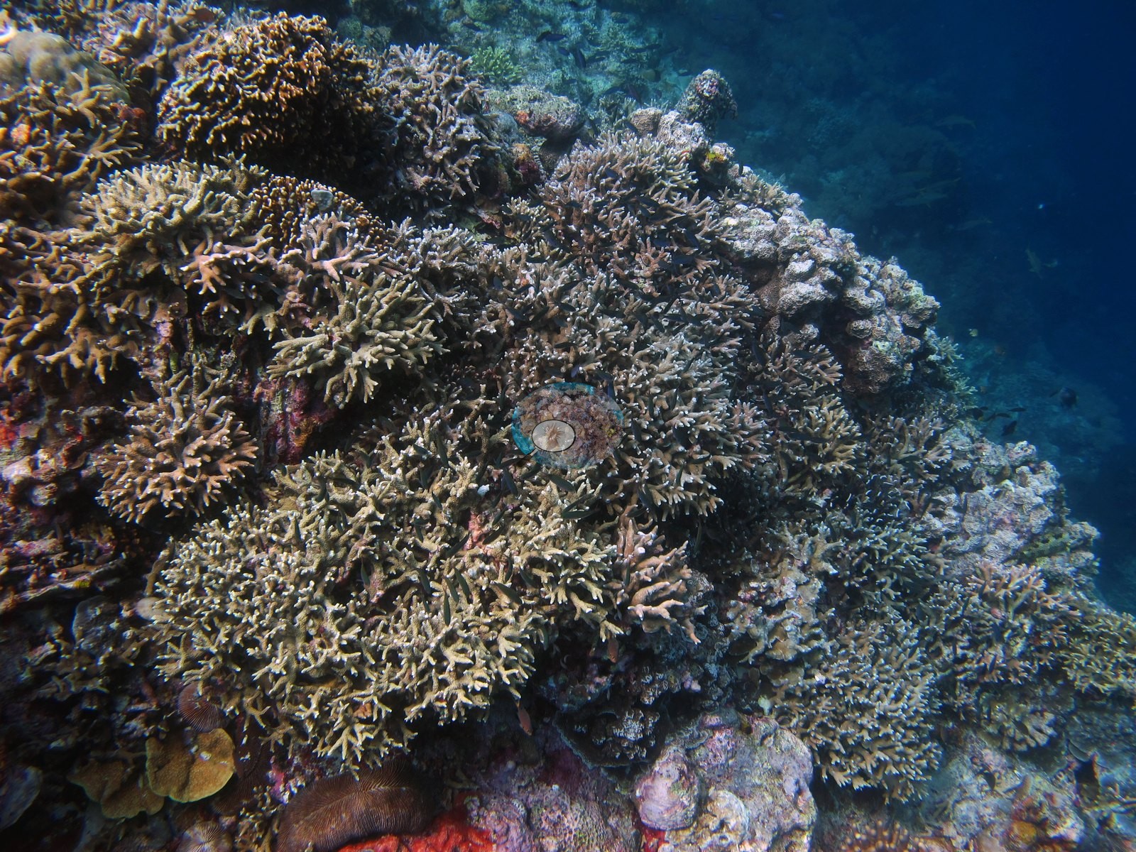
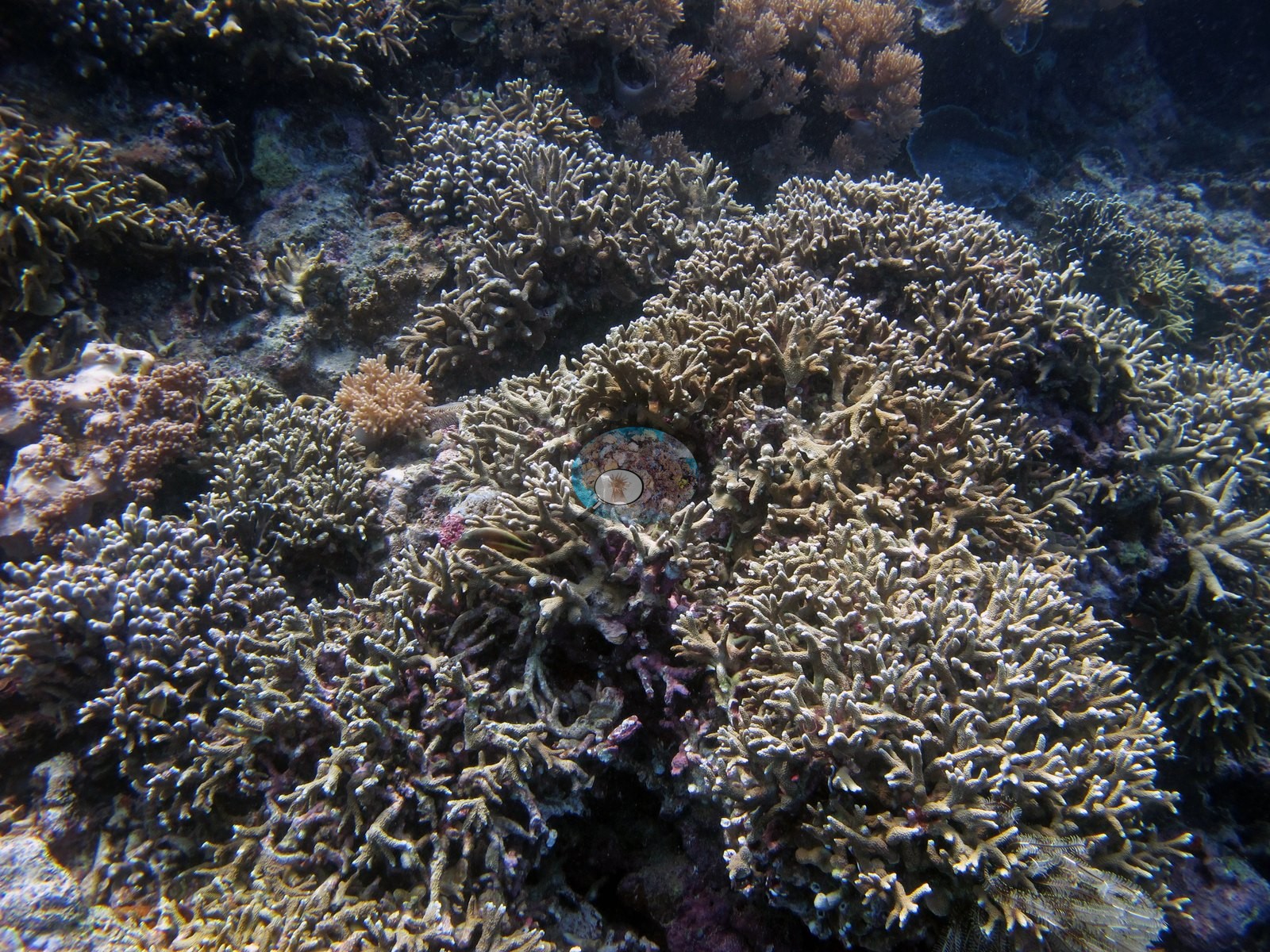
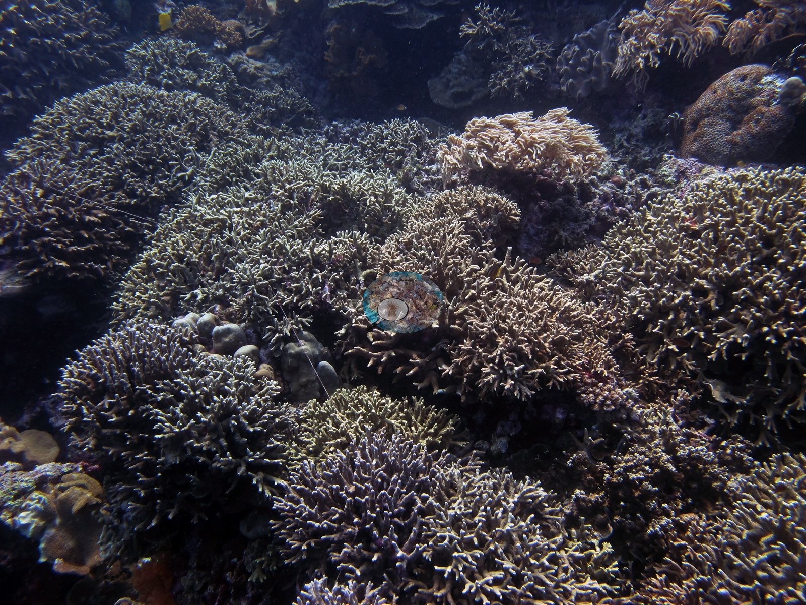
Nine snorkel frames cover the shallow flat: lower relief, meandering Merulina/Echinopora-type plates and Pachyseris, a mooring line across one frame, and a blue Linckia.
Coral cover
Coral cover. Coral cover: 36% — a blind Claude computer-vision point count of 180 of Anderson's edited photographs (20 points per photo; water, fish, and obstructions excluded). Other computer-vision methods are listed in the method table. Anderson is still comparing computer-vision models, and these figures will be updated as the methods improve.
Stressors
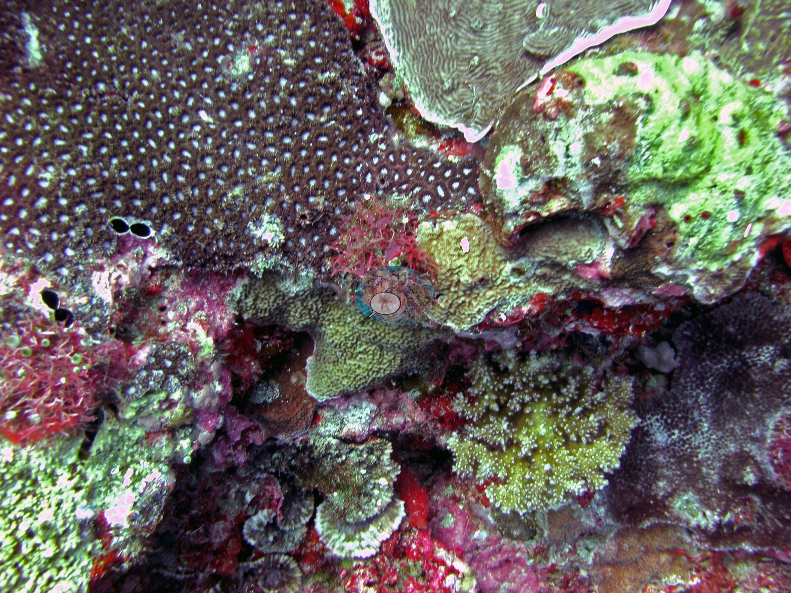
Condition. Bleaching is confirmed and localized. Four frames show a cluster of roughly five large laminar and plating colonies (Turbinaria/Echinopora-type) stark white with tissue clearly still present — corallite detail crisp, surfaces un-fouled, colony margins intact — one with a small central necrotic patch, beside paled blue-white submassive Porites-type heads and normally pigmented Acropora in the same exposure. A separate pair of pale Porites-type colonies at 10:45 puts the paling at low incidence scattered across the reef rather than confined to one patch. No crown-of-thorns, no Drupella, no disease, and no predation scars were seen in any of the 182 frames, and no rubble fields or standing dead thickets appear anywhere on the dive. Pale cream Sarcophyton leathers recur and are normal coloration, not bleaching (e.g., Image 9, Image 15).
Fish and other fauna
Fauna. Giant clams (Tridacna) recur, one with a mottled blue-and-gold mantle, alongside a long-tentacle mushroom coral (Heliofungia-type), magenta and pale gorgonians, pink-red barrel sponges holding damselfish, green barrel ascidians, black feather stars, a titan triggerfish, a bluefin trevally, anemonefish, Moorish idols, unicornfish, and dense chromis, anthias, and fusilier schools.
Comparisons with other data
Different station, different observers: a near-concurrent cross-check, not a repeat of this site.
Dive record
Tanjung Pisang (Banana Island, also logged as Tanjung Serrang) was the first dive of the 2018 Banda trip, on 25 April 2018. The log carries two entries that morning: a short snorkel at 09:34 over the shallow flat (2.4 m, 31.67°C) and the dive itself at 10:19, 63 minutes to a maximum of 31.4 m, averaging 13.11 m at 29.44°C. The site record's headline depth of 2.4 m is the snorkel, not the dive.
CV model comparison
More info
DINOv3 and CoralSCOP were run on the same photos and are listed for comparison. Coralscapes v2 and v1 were also run but are not shown: Anderson does not consider Coralscapes reliable for these photos. No diver transect exists for this trip, so agreement between the rows is not accuracy, and as of September 2026 no computer-vision method estimates coral cover accurately on new images; treat every row as indicative.| Method | Hard-coral cover (%) |
|---|---|
| In-house DINOv3 | 30.9 |
| CoralSCOP edited | 39.8 |
| Claude (edited photos) | 36.4 |
Dive history
| Date | Time in | Max depth (m) | Bottom time (min) |
|---|---|---|---|
| 2018-04-25 | 09:34 | 2.4 | — |
| 2018-04-25 | 10:19 | 31.4 | 63 |
Independent surveys nearby
| Agency / program | Year(s) | Stations / distance | Link |
|---|---|---|---|
| Coral Triangle Center (CTC) | 2014–2019 | 8 stations, 1.80–4.89 km | Records ↓ |
| Reef Check | 2015–2025 | 13 stations, 1.34–4.88 km | Records ↓ |
 Dr. Coral (CRD)
Within 5 km, 21 independent survey stations recorded hard coral cover in 94 surveys between 2014 and 2025. Of the 7 stations surveyed in more than one year, 3 declined, 2 increased, and 2 changed by less than 5 percentage points between their first and latest surveys. The longest record, Karnofol (Reef Check, 4.83 km away), went from 47% in 2015 to 56% in 2025. Surveys since 2021 average 54% (range 40–66%, n=5); 2 best-patch values above 70% are left out, as they are not site means. This site's own estimate (36%) is indistinguishable from the recent range (40–66%): the 3.3-point gap is inside the ±7 percentage-point noise between methods; the methods differ, so the comparison is context, not a like-for-like test.
Collected by other programs using different methods (Reef Check uses point-intercept transects), so these are context for the figures above, not a like-for-like comparison. Where a station was surveyed more than once the range is shown. Station names are not dive-site names. Values marked best patch exceed 70%: surveyors usually chose the richest area, so they are not site means.
Show all 21 independent survey records
| Agency | Site / location | Date | Hard coral cover (%) | Distance | Link |
|---|---|---|---|---|---|
| Coral Triangle Center (CTC) | Mangku Batu (20) | 2014–2019 | 27–43% (6 surveys) | 3.64 km | Currier K, Marine P, Welly M. 2019. Jejaring KKP Kepulauan Banda. MERMAID |
| Coral Triangle Center (CTC) | Wali (12) | 2014–2019 | 35–43% (6 surveys) | 4.07 km | Currier K, Marine P, Welly M. 2019. Jejaring KKP Kepulauan Banda. MERMAID |
| Reef Check | Tanah Rata | 2015 | 38% | 3.06 km | — |
| Reef Check | Karnofol | 2015–2025 | 40–56% (15 surveys) | 4.83 km | — |
| Reef Check | Pohon Miring | 2015–2025 | 52–73% (15 surveys) best patch | 4.88 km | — |
| Reef Check | Pantai Wali | 2017 | 47% (2 surveys) | 4.38 km | — |
| Reef Check | Bandara | 2018–2019 | 21–33% (4 surveys) | 1.34 km | — |
| Reef Check | Belakang Selamon | 2018 | 57% (2 surveys) | 4.42 km | — |
| Reef Check | Banda Besar 4.2 | 2018 | 47% (2 surveys) | 4.69 km | — |
| Reef Check | Rata Eyo | 2018–2019 | 33–38% (4 surveys) | 4.72 km | — |
| Reef Check | Banda Besar 4.25 | 2018 | 35% (2 surveys) | 4.72 km | — |
| Reef Check | Banda Besar 4.05 | 2018 | 85% (2 surveys) best patch | 4.82 km | — |
| Reef Check | Banda Besar 4.4 | 2018 | 42% (2 surveys) | 4.87 km | — |
| Coral Triangle Center (CTC) | Gunung Api Timur (07) | 2019 | 39% (3 surveys) | 1.80 km | Currier K, Marine P, Welly M. 2019. Jejaring KKP Kepulauan Banda. MERMAID |
| Coral Triangle Center (CTC) | Uring (18) | 2019 | 44% | 2.95 km | Currier K, Marine P, Welly M. 2019. Jejaring KKP Kepulauan Banda. MERMAID |
| Coral Triangle Center (CTC) | Gunung Api Selatan (08) | 2019 | 11% | 3.46 km | Currier K, Marine P, Welly M. 2019. Jejaring KKP Kepulauan Banda. MERMAID |
| Coral Triangle Center (CTC) | Mangku Batu (20) (mean of 6 surveys, 2014–2019) | 2019 | 34% (18 surveys) | 3.64 km | Currier K, Marine P, Welly M. 2019. Jejaring KKP Kepulauan Banda. MERMAID |
| Reef Check | Lampu Merah | 2019 | 56% (2 surveys) | 4.56 km | — |
| Coral Triangle Center (CTC) | Waer (17) | 2019 | 46% | 4.63 km | Currier K, Marine P, Welly M. 2019. Jejaring KKP Kepulauan Banda. MERMAID |
| Coral Triangle Center (CTC) | Pohon Miring (16) | 2019 | 65% | 4.89 km | Currier K, Marine P, Welly M. 2019. Jejaring KKP Kepulauan Banda. MERMAID |
| Reef Check | Lava Flow | 2024–2025 | 88–93% (4 surveys) best patch | 3.82 km | — |
Data & links
All images from Coral Reef Diagnostics. Data are from Coral Reef Diagnostics and the organizations named in the data-sources table above.
© Coral Reef Diagnostics.