

Indonesia - Banda Islands: Goat Hall (Pulau Ai)

Part of the regional summaries: Indonesia - Banda and Indonesia - Maluku
More info
Maluku (NOAA CRW virtual station) · Banda Sea ecoregion mean=7.3°C-heating weeksGoat Hall runs from a sponge- and coralline-crusted wall up through a genus-rich mixed slope into a near-continuous Acropora and hydrocoral crest, then a striking wall-to-wall Sarcophyton toadstool-leather terrace at the reef top. A hawksbill was photographed repeatedly and condition reads good, with no bleaching, disease, or crown-of-thorns starfish (COTS). A blind Claude computer-vision point count puts coral cover around 37%.
Goat Hall membentang dari dinding berkerak spons dan koralin, naik melalui lereng campuran yang kaya genus, menuju tubir Acropora dan karang api yang hampir menyambung, lalu teras karang kulit Sarcophyton yang mencolok dan menutup dari tepi ke tepi di puncak terumbu. Seekor penyu sisik terfoto berulang kali dan kondisinya terbaca baik, tanpa pemutihan, penyakit, maupun bintang laut mahkota duri.
Terjemahan ringkasan ini oleh AI; versi bahasa Inggris yang berlaku. Translated from the site’s shorter map summary.
Ten independent survey stations shown with the program’s logo — click one to see how far it is from this site.
One other CRD dive site within 5 km shown in orange — click a marker to open its page.
Site description
Setting
Goat Hall lies on the northeast shoulder of Pulau Ai, in the Banda Islands of Maluku, and Anderson dived it once, on the afternoon of 27 April 2018 — in at 13:04, 61 minutes, 14.0 m maximum, 8.53 m average, 29.44°C. The dive begins deep on a near-vertical wall and works steadily up onto a shallow crest, so the profile reads cleanly through the sequence.
General benthic features
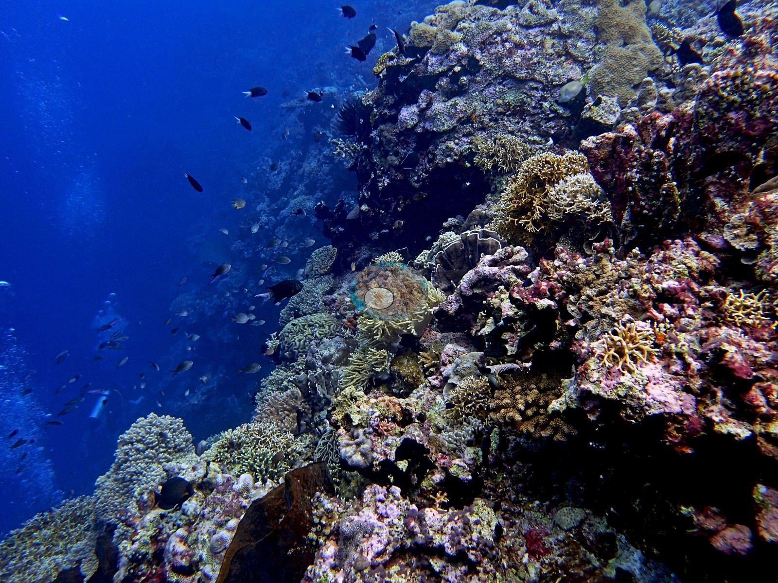
The wall and drop-off shoulder (39 frames) is a steep-to-vertical face crusted in pink and mauve coralline algae and worked over by filter feeders: brown barrel sponges standing off the wall, black-coral bushes, and cream Sarcophyton toadstools (e.g., Image 3).
Stony coral here is patchy and dominated by two forms — mustard-yellow and golden-orange ruffled foliose plating consistent with Turbinaria, and large tan domes with even, regularly spaced corallites consistent with Diploastrea and massive Porites (e.g., Image 1, Image 2).
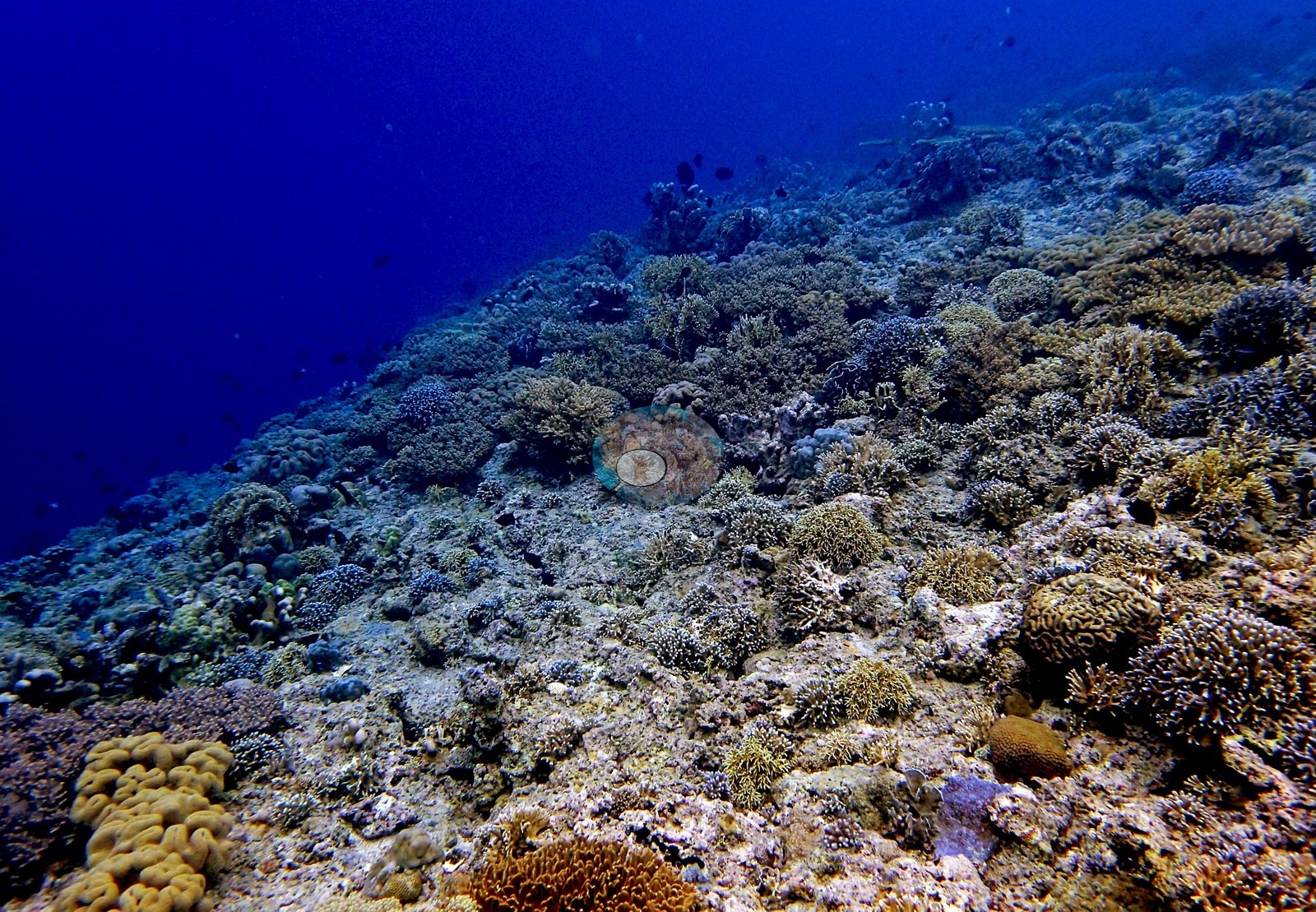
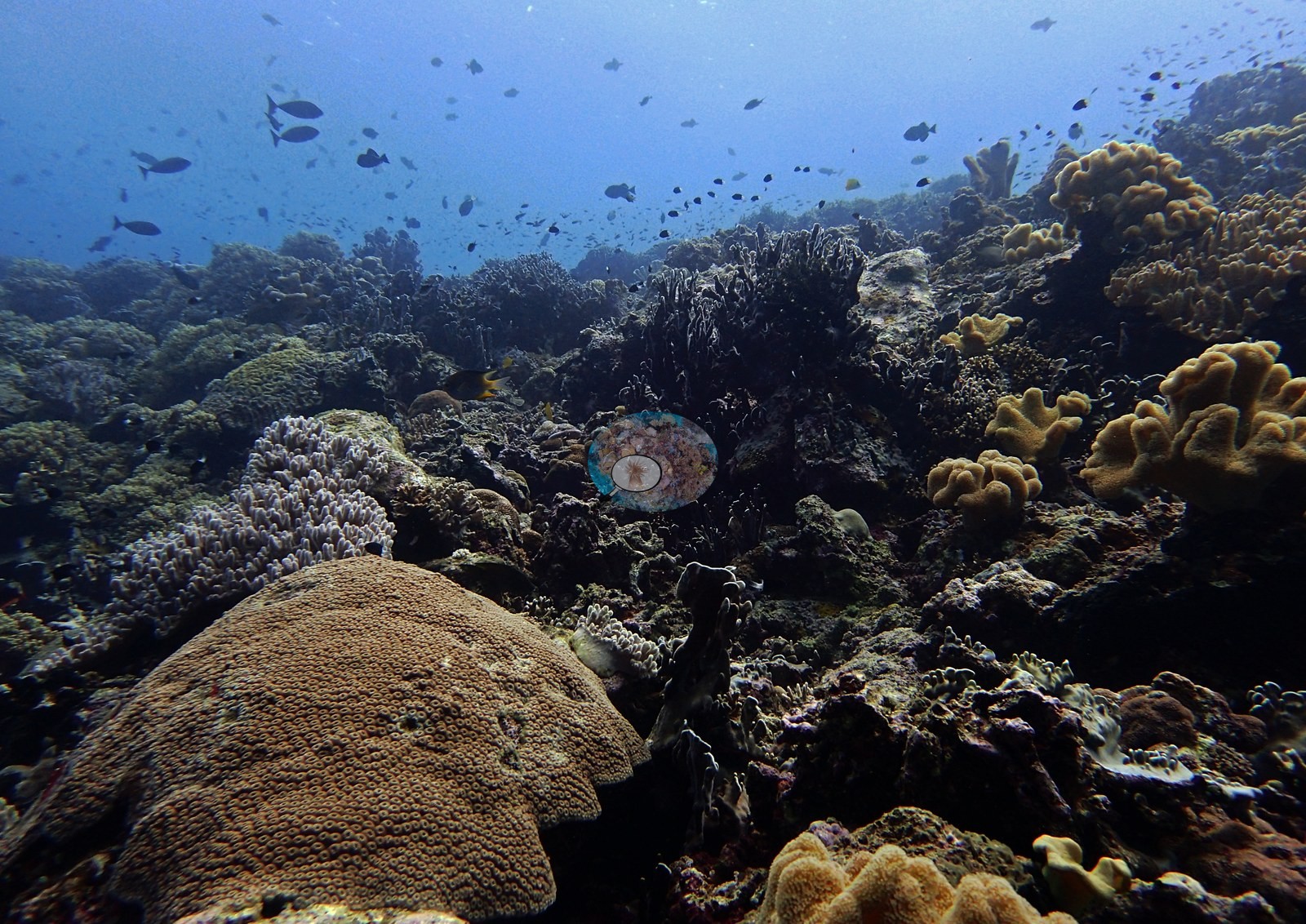
Bright green Nephthea- and Sinularia-type soft corals, cream branching Acropora, and pink knobby pocilloporids fill the gaps. The upper wall and mixed slope (48 frames) is the genus-rich middle of the dive and the most varied ground on it: corymbose and branching Acropora in salmon-pink, cream, gold, and bright green; thick-fingered columnar Porites of the P. cylindrica/rus habit; maroon and purple foliose plating (Montipora/Echinopora-type); meandroid Platygyra- and Lobophyllia-type brains; encrusting Montipora sheets in yellow-green; free-living fungiids; and a large salmon-and-red sea fan consistent with Melithaea standing off the lip (e.g., Image 4).
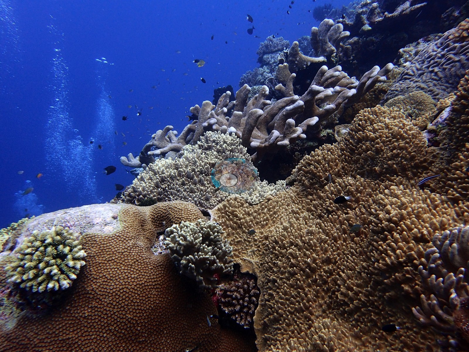
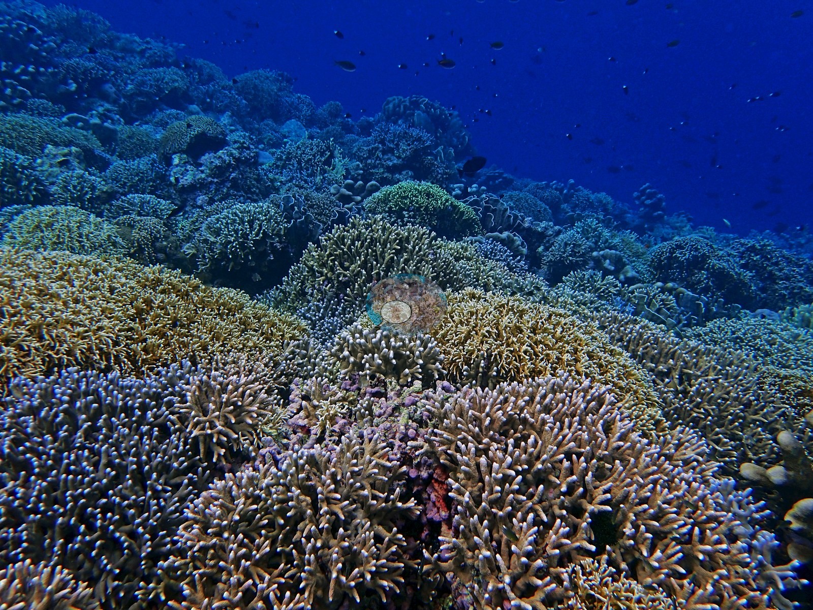
The crest and branching pavement (44 frames) is where the coral actually is. Fine-branched and corymbose Acropora, Seriatopora-type thickets, and golden Millepora-type hydrocoral form mounded, near-continuous carpets that run to the limit of visibility in four frames, with columnar Porites stands and pale lavender plating threaded through them (e.g., Image 5).
A Sarcophyton terrace follows (7 frames), and it is one of the striking sights of the dive: hundreds of golden-tan, deeply convoluted toadstool leather corals packed wall to wall over the reef top, with stony colonies reduced to emergents inside them.
Coral cover
Coral cover: 37% — a blind Claude computer-vision point count of 144 of Anderson's edited photographs (20 points per photo; water, fish, and obstructions excluded). Other computer-vision methods are listed in the method table. Anderson is still comparing computer-vision models, and these figures will be updated as the methods improve.
Stressors
Condition was good and there was no bleaching event here: no crown-of-thorns, no disease lesion, and no Drupella scarring was seen in any of the 146 frames, and the black spiny mass beneath one branching colony resolves on close crop to feather-star arms and urchin spines, not Acanthaster. Two observations are worth recording and both are hedged. One frame shows a large massive dome, consistent with Astreopora or Porites, carrying a sharply bounded patch of denuded skeleton across perhaps a fifth of its upper surface; the exposed skeleton is already fouled gray-green with turf and a green Acropora has grown against its margin, so this reads as older partial mortality rather than recent bleaching. Two frames show a large helmet-shaped dome that is uniformly pale lavender-white and conspicuously paler than every colony around it; on close crop its polyps are intact and each corallite is discretely pigmented gray-violet, with no exposed skeleton and no tissue-loss margin, so this is most consistent with a blue chromoprotein color morph rather than bleaching — logged, not scored.
Fish and other fauna
Feather stars in vivid yellow-green and in black perch on the framework throughout. A hawksbill turtle sequence and shallow crest close the dive (12 frames), the turtle photographed four times among staghorn and corymbose Acropora, with a 1.5 m tabulate Acropora table in one frame and sergeant majors, butterflyfish, and anemonefish over the top. Fauna: the hawksbill, fusilier and anthias clouds, chromis, sergeant majors, Moorish idols, bannerfish, butterflyfish, anemonefish, feather stars in yellow-green and black, Diadema-type urchins, and barrel sponges.
Comparisons with other data
No independent survey was made at this exact site; the nearest ones are listed in the table below.
Dive record
It was his second dive of that day, after Shark Point on the same island, and it produced 146 frames, every one of which was reviewed.
Other notes
Two closing frames are open blue water.
CV model comparison
More info
DINOv3 and CoralSCOP were run on the same photos and are listed for comparison. Coralscapes v2 and v1 were also run but are not shown: Anderson does not consider Coralscapes reliable for these photos. No diver transect exists for this trip, so agreement between the rows is not accuracy, and as of September 2026 no computer-vision method estimates coral cover accurately on new images; treat every row as indicative.| Method | Hard-coral cover (%) |
|---|---|
| In-house DINOv3 | 32.5 |
| CoralSCOP edited | 36.9 |
| Claude (edited photos) | 36.5 |
Independent surveys nearby
| Agency / program | Year(s) | Stations / distance | Link |
|---|---|---|---|
| Coral Triangle Center (CTC) | 2012–2019 | 6 stations, 1.02–1.33 km | Records ↓ |
| Reef Check | 2015–2025 | 4 stations, 0.52–1.69 km | Records ↓ |
 Dr. Coral (CRD)
Within 5 km, 10 independent survey stations recorded hard coral cover in 59 surveys between 2012 and 2025. Of the 5 stations surveyed in more than one year, 1 declined, 2 increased, and 2 changed by less than 5 percentage points between their first and latest surveys. The longest record, Pulau Ay, Lubang Kambing (Reef Check, 1.69 km away), went from 23% in 2015 to 51% in 2025. Surveys since 2021 average 48% (range 44–51%, n=4). This site's own estimate (37%) sits 7.9 points below the recent range (44–51%); the methods differ, so the comparison is context, not a like-for-like test.
Collected by other programs using different methods (Reef Check uses point-intercept transects), so these are context for the figures above, not a like-for-like comparison. Where a station was surveyed more than once the range is shown. Station names are not dive-site names.
Data & links
All images from Coral Reef Diagnostics. Data are from Coral Reef Diagnostics and the organizations named in the data-sources table above.
© Coral Reef Diagnostics.