

Indonesia - Banda Islands: Batu Kapal

Part of the regional summaries: Indonesia - Banda and Indonesia - Maluku
More info
Maluku (NOAA CRW virtual station) · Banda Sea ecoregion mean=7.3°C-heating weeksBatu Kapal is an isolated current-swept pinnacle whose deep wall is soft coral and sponge, whose crown is a wall-to-wall leather-coral terrace, and whose pavement is old coralline rubble - a genuinely moderate hard coral site rather than a continuous Acropora reef. Two large morays and a banded sea krait were photographed hunting the pavement. No bleaching, disease, or crown-of-thorns starfish (COTS). A blind Claude computer-vision point count puts coral cover around 16%.
Batu Kapal adalah puncak batu terpencil yang tersapu arus, yang dinding dalamnya berisi karang lunak dan spons, mahkotanya berupa teras karang kulit yang menutup dari tepi ke tepi, dan hamparannya berupa pecahan karang koralin tua — lokasi karang keras yang benar-benar sedang, bukan terumbu Acropora yang menyambung. Dua ekor belut moray besar dan seekor ular laut belang terfoto sedang berburu di hamparan itu. Tanpa pemutihan, penyakit, maupun bintang laut mahkota duri.
Terjemahan ringkasan ini oleh AI; versi bahasa Inggris yang berlaku. Translated from the site’s shorter map summary.
25 independent survey stations shown with the program’s logo — click one to see how far it is from this site.
Three other CRD dive sites within 5 km shown in orange — click a marker to open its page.
3 of these 5 photographs are shown beside the text that discusses them under "Site description" below.
Site description
Setting
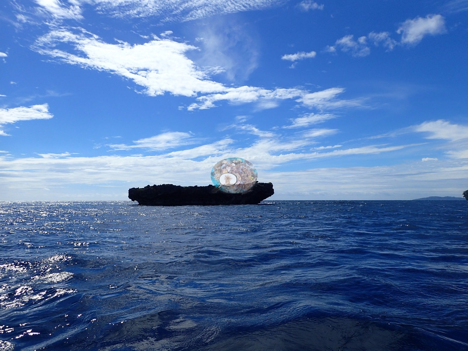
Batu Kapal — Indonesian for ship rock — is an isolated pinnacle in the channel northeast of Banda Neira, and the establishing topside frame shows exactly why it earned the name: a low, dark, flat-topped rock sitting alone on open water with the Banda mainland faint on the horizon.
General benthic features
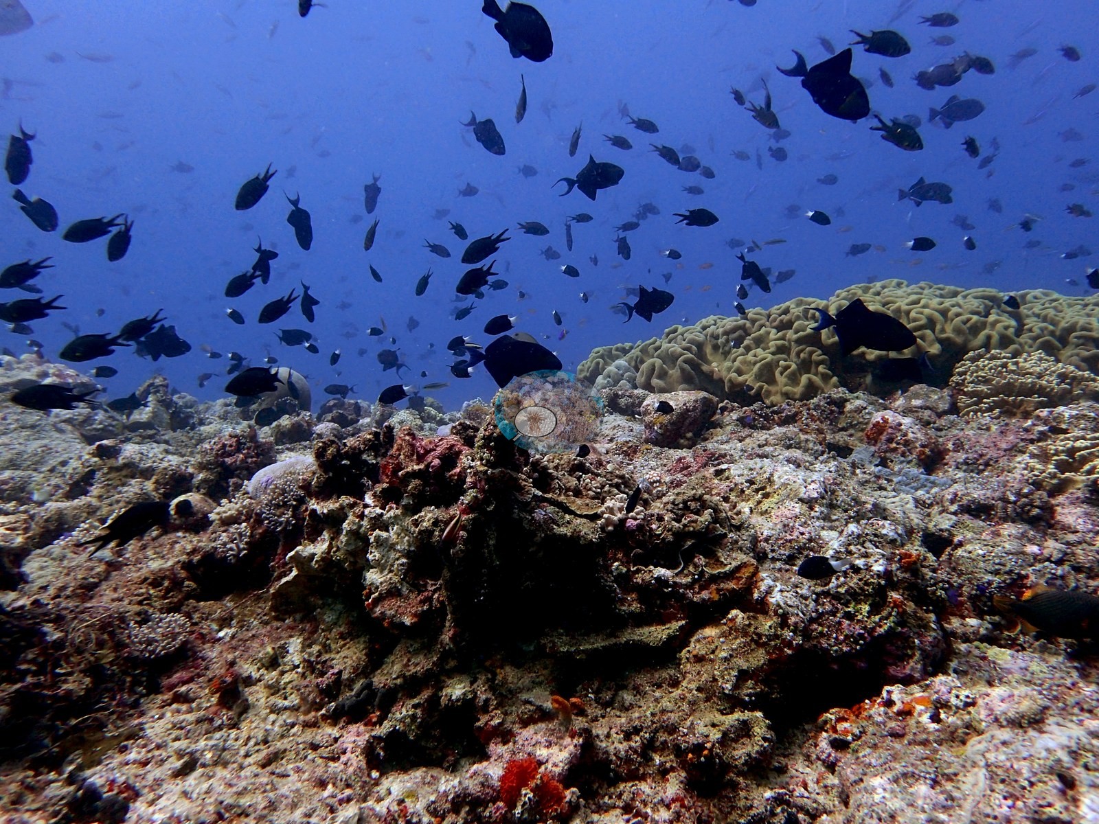
The deep wall and descent (17 frames) is a steep, current-swept face and it is not a stony-coral habitat at all: the wall is sheeted in bright orange Dendronephthya soft coral, in dense bushes and drapes, over pink and mauve crustose coralline algae, encrusting sponges, black-coral bushes, and blue tunicates, with hard coral reduced to a few small massives and pocilloporid clumps. A brain coral and plate shoulder follows (15 frames) where stony coral takes over: a superb golden-tan meandroid dome close to a meter across, consistent with Platygyra or Symphyllia, a vivid yellow-green Pocillopora colony, tabulate Acropora tables standing off the lip, foliose Turbinaria in mustard-yellow, red barrel sponges, and further orange Dendronephthya. A Sarcophyton and Lobophytum terrace caps the pinnacle (9 frames) and is the single most extensive habitat on the dive: cream and tan toadstool leather corals with deeply convoluted margins carpet the reef top essentially wall to wall in four frames, with stony colonies reduced to emergents inside them. The reef-top pavement (21 frames) is the low-cover ground and it is genuinely low: broad plains of coralline-crusted rubble and turf-covered pavement carrying scattered colonies, interspersed with real high spots — large smooth massive Porites domes and pale plating discs, further meandroid brains, and one extensive near-continuous field of mauve foliose plating (e.g., Image 3).
The mixed crest and plating wall closes the dive (18 frames): corymbose and digitate Acropora, pink and magenta Pocillopora, massive Porites, and a dense golden-brown Millepora-type hydrocoral thicket with white-tipped branches that holds two large morays, then a final wall zone of large pale gray-tan laminar and foliose plating colonies (e.g., Image 5).
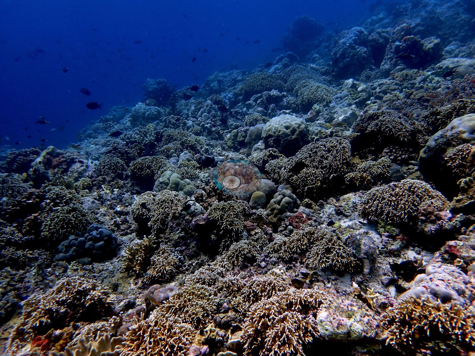
Batu Kapal is a small, exposed, current-swept pinnacle whose deep wall is soft coral and sponge, whose reef top is octocoral meadow, and whose pavement is old coralline rubble — a genuinely moderate hard coral habitat, unlike the continuous Acropora reefs at Pulau Ai.
Coral cover
Coral cover: 16% — a blind Claude computer-vision point count of 78 of Anderson's edited photographs (20 points per photo; water, fish, and obstructions excluded). Other computer-vision methods are listed in the method table. It is the lowest of the Banda dives, and the photographs largely support a moderate figure here. Anderson is still comparing computer-vision models, and these figures will be updated as the methods improve.
Stressors
Condition. No crown-of-thorns, no disease lesion, and no Drupella scarring was seen in any of the 81 frames, and there is no sign of a bleaching event. One earlier hedge is now resolved: the several large plates that looked chalky white on a frame shot into blue water at range are seen close in the next two frames to be living pale gray-tan foliose colonies whose margins carry a clean, thin, bright white growing rim. A crisp white growth margin on an otherwise pigmented plate is active accretion, not bleaching, and that call can now be closed. The one remaining hedge is a large pale cream-white massive dome distinctly paler than its neighbors, shot at range through hazy blue water where color cannot be trusted; it is logged, not scored. What the pinnacle does carry is a lot of long-dead framework: the rubble and turf pavement across eight frames is old, fully consolidated, and coralline-crusted, so it records historical loss rather than anything recent.
Fish and other fauna
Clouds of chromis, damsels, and fusiliers hang off the face in almost every frame, and a clown triggerfish (Balistoides conspicillum) works the wall across three consecutive frames (e.g., Image 2).
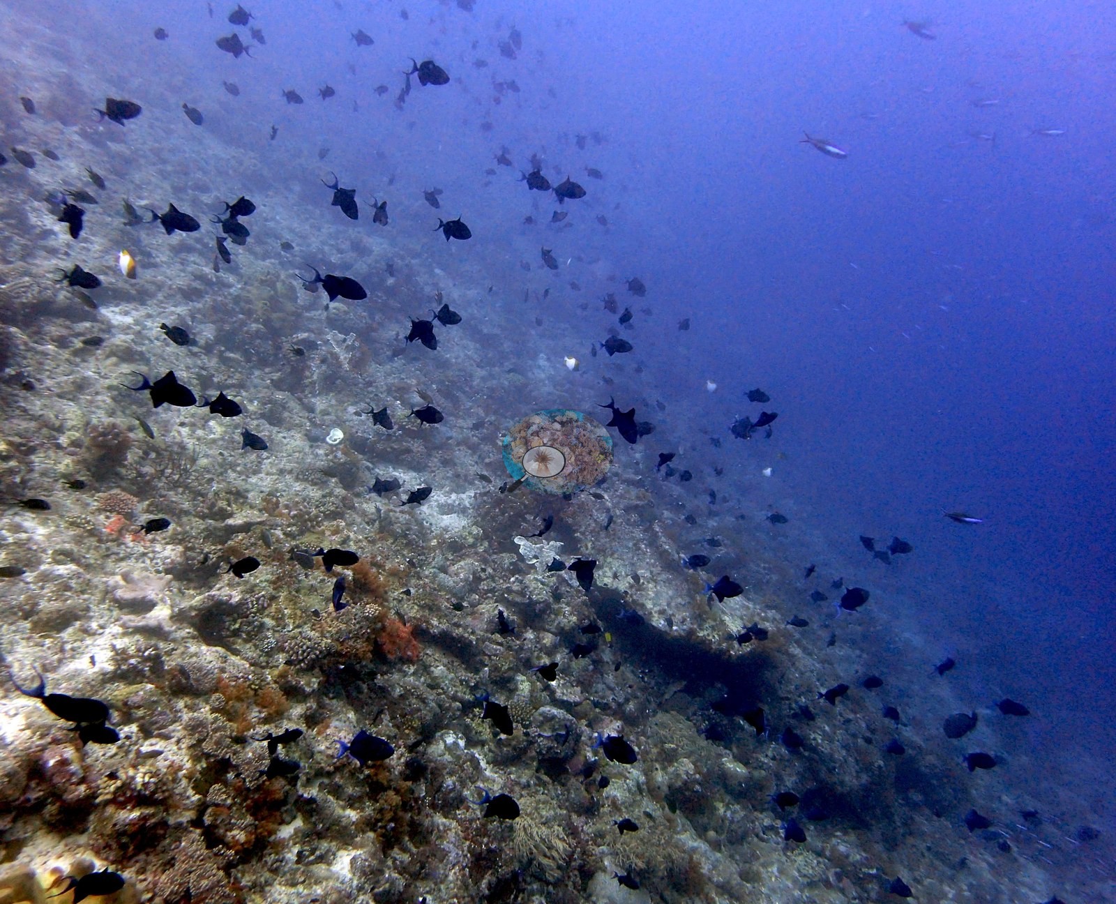
Fauna is the strength of this site. Two large morays were photographed, a honeycomb moray consistent with Gymnothorax favagineus tucked under a table Acropora and a gray speckle-headed moray consistent with Gymnothorax javanicus lying open-mouthed in the Millepora thicket. A banded sea krait (Laticauda colubrina) hunts across the pavement in two frames. Add the clown triggerfish, redtooth triggerfish, Pseudanthias, fusiliers, unicornfish, surgeonfish, pyramid butterflyfish, bannerfish, anemonefish, and the near-permanent planktivore cloud that the current feeds.
Comparisons with other data
How the number behaves here, and a disagreement worth Anderson's attention. Different station, different observers: a near-concurrent cross-check, not a repeat of this site.
Dive record
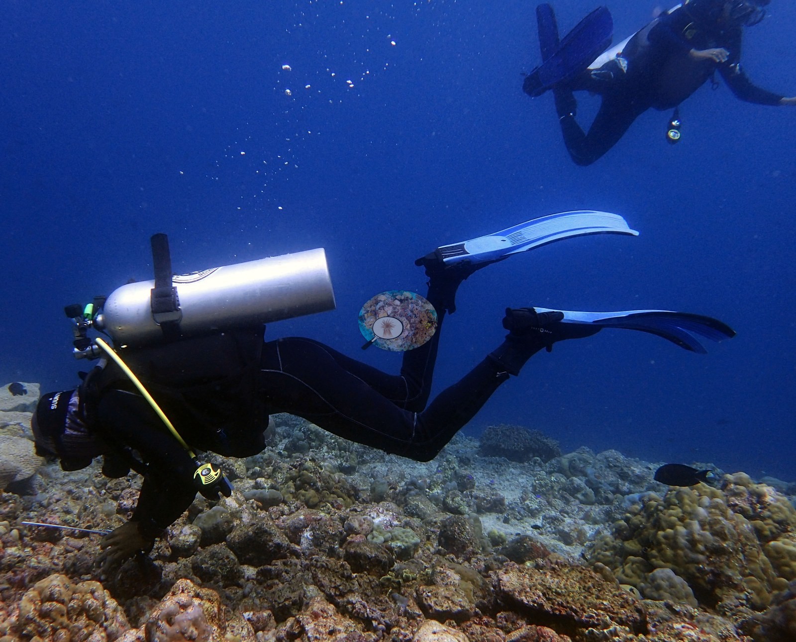
Anderson dived it on 28 April 2018, 09:51 to 10:46, 55 minutes, 14.9 m maximum and 10.06 m average, in 29.4°C water. It was a working dive — a buddy pair appears repeatedly running out a measuring tape and writing on a slate — and it produced 81 frames, every one of which was reviewed.
CV model comparison
More info
DINOv3 and CoralSCOP were run on the same photos and are listed for comparison. Coralscapes v2 and v1 were also run but are not shown: Anderson does not consider Coralscapes reliable for these photos. No diver transect exists for this trip, so agreement between the rows is not accuracy, and as of September 2026 no computer-vision method estimates coral cover accurately on new images; treat every row as indicative.| Method | Hard-coral cover (%) |
|---|---|
| In-house DINOv3 | 24.3 |
| CoralSCOP edited | 26.4 |
| Claude (edited photos) | 16.4 |
Independent surveys nearby
| Agency / program | Year(s) | Stations / distance | Link |
|---|---|---|---|
| Coral Triangle Center (CTC) | 2014–2019 | 10 stations, 1.57–4.69 km | Records ↓ |
| Reef Check | 2015–2025 | 15 stations, 1.59–4.93 km | Records ↓ |
 Dr. Coral (CRD)
Within 5 km, 25 independent survey stations recorded hard coral cover in 159 surveys between 2014 and 2025. Of the 11 stations surveyed in more than one year, 3 declined, 5 increased, and 3 changed by less than 5 percentage points between their first and latest surveys. The longest record, Pohon Miring (Reef Check, 3.10 km away), went from 73% (best patch) in 2015 to 66% in 2025. Surveys since 2021 average 54% (range 40–66%, n=6); 2 best-patch values above 70% are left out, as they are not site means. This site's own estimate (16%) sits 23.3 points below the recent range (40–66%); the methods differ, so the comparison is context, not a like-for-like test.
Collected by other programs using different methods (Reef Check uses point-intercept transects), so these are context for the figures above, not a like-for-like comparison. Where a station was surveyed more than once the range is shown. Station names are not dive-site names. Values marked best patch exceed 70%: surveyors usually chose the richest area, so they are not site means.
Show all 25 independent survey records
| Agency | Site / location | Date | Hard coral cover (%) | Distance | Link |
|---|---|---|---|---|---|
| Coral Triangle Center (CTC) | Mangku Batu (20) | 2014–2019 | 27–43% (6 surveys) | 1.57 km | Currier K, Marine P, Welly M. 2019. Jejaring KKP Kepulauan Banda. MERMAID |
| Coral Triangle Center (CTC) | Syahrir Timur (11) | 2014–2019 | 35–53% (6 surveys) | 1.89 km | Currier K, Marine P, Welly M. 2019. Jejaring KKP Kepulauan Banda. MERMAID |
| Coral Triangle Center (CTC) | Wali (12) | 2014–2019 | 35–43% (6 surveys) | 2.93 km | Currier K, Marine P, Welly M. 2019. Jejaring KKP Kepulauan Banda. MERMAID |
| Reef Check | Pulau Pisang West | 2015–2019 | 54–65% (14 surveys) | 1.59 km | — |
| Reef Check | Tanah Rata | 2015 | 38% | 1.90 km | — |
| Reef Check | Pohon Miring | 2015–2025 | 46–73% (25 surveys) best patch | 3.10 km | — |
| Reef Check | Lava Flow | 2015–2025 | 63–93% (18 surveys) best patch | 3.58 km | — |
| Reef Check | Karnofol | 2015–2025 | 40–56% (15 surveys) | 4.93 km | — |
| Reef Check | Batu Kapal | 2016–2019 | 28–34% (5 surveys) | 1.82 km | — |
| Reef Check | Pisang East | 2016–2022 | 37–56% (10 surveys) | 1.94 km | — |
| Reef Check | Pantai Wali | 2017 | 47% (2 surveys) | 2.46 km | — |
| Reef Check | Banda Besar 4.05 | 2018 | 85% (2 surveys) best patch | 3.14 km | — |
| Reef Check | Bandara | 2018–2019 | 21–33% (4 surveys) | 3.38 km | — |
| Reef Check | Rata Eyo | 2018–2019 | 33–38% (4 surveys) | 3.49 km | — |
| Reef Check | Belakang Selamon | 2018 | 57% (2 surveys) | 3.68 km | — |
| Reef Check | Banda Besar 4.2 | 2018 | 47% (2 surveys) | 4.36 km | — |
| Reef Check | Banda Besar 4.25 | 2018 | 35% (2 surveys) | 4.60 km | — |
| Coral Triangle Center (CTC) | Mangku Batu (20) (mean of 6 surveys, 2014–2019) | 2019 | 34% (18 surveys) | 1.57 km | Currier K, Marine P, Welly M. 2019. Jejaring KKP Kepulauan Banda. MERMAID |
| Coral Triangle Center (CTC) | Batu Kapal (10) | 2019 | 31% (2 surveys) | 1.85 km | Currier K, Marine P, Welly M. 2019. Jejaring KKP Kepulauan Banda. MERMAID |
| Coral Triangle Center (CTC) | Syahrir Timur (11) (mean of 6 surveys, 2014–2019) | 2019 | 47% (6 surveys) | 1.89 km | Currier K, Marine P, Welly M. 2019. Jejaring KKP Kepulauan Banda. MERMAID |
| Reef Check | Lampu Merah | 2019 | 56% (2 surveys) | 2.86 km | — |
| Coral Triangle Center (CTC) | Pohon Miring (16) | 2019 | 65% | 3.11 km | Currier K, Marine P, Welly M. 2019. Jejaring KKP Kepulauan Banda. MERMAID |
| Coral Triangle Center (CTC) | Karaka (06) | 2019 | 67% | 3.86 km | Currier K, Marine P, Welly M. 2019. Jejaring KKP Kepulauan Banda. MERMAID |
| Coral Triangle Center (CTC) | Lava Flow (09) | 2019 | 69% (2 surveys) | 4.45 km | Currier K, Marine P, Welly M. 2019. Jejaring KKP Kepulauan Banda. MERMAID |
| Coral Triangle Center (CTC) | Gunung Api Timur (07) | 2019 | 39% (3 surveys) | 4.69 km | Currier K, Marine P, Welly M. 2019. Jejaring KKP Kepulauan Banda. MERMAID |
Data & links
All images from Coral Reef Diagnostics. Data are from Coral Reef Diagnostics and the organizations named in the data-sources table above.
© Coral Reef Diagnostics.