
Part of the regional summaries: Tonga - Niuatoputapu and Tonga
More info
Northern Tonga (NOAA CRW virtual station)A sandy submerged fore reef off Niuatoputapu with low spurs and an extensive field of dead coral pillars at 15-18 m, fragile and thickly layered with coralline algae. Across the sand stand mushroom-shaped Porites lobata bommies up to 3 m tall, living on their caps and often colonized by branching corals where parts had died. Surveyed on the Living Oceans Foundation's Global Reef Expedition.
Ko ha tafaʻaki tuʻa ʻo e hakau kuo melemo (submerged fore reef) ʻoku ʻoneʻone ʻi Niuatoputapu mo e ngaahi spurs māʻulalo pea mo ha ngoue fālahi ʻo e ngaahi pou feo mate (dead coral pillars) ʻi he 15-18 m, ʻoku faingofua ke maumau pea kuo ʻufiʻufi matolu ʻe he limu feo (coralline algae). ʻI he funga ʻoneʻone ʻoku tuʻu ai ʻa e ngaahi bommie Porites lobata ʻoku hangē ha mushroom hono fōtunga ʻo aʻu ki he 3 m hono māʻolunga, ʻoku moʻui ʻi honau funga pea faʻa nofoʻi ʻe he feo fakavaʻavaʻa ʻi he ngaahi konga naʻe mate.
AI translation of this summary; the English is authoritative. (low confidence)
CTD-cast midpoint of 27.6–27.7°C
Three other CRD dive sites with their own pages within 5 km shown in orange — click a marker to open its page.
Site description
Setting
Submerged fore reef, northwest.
General benthic features
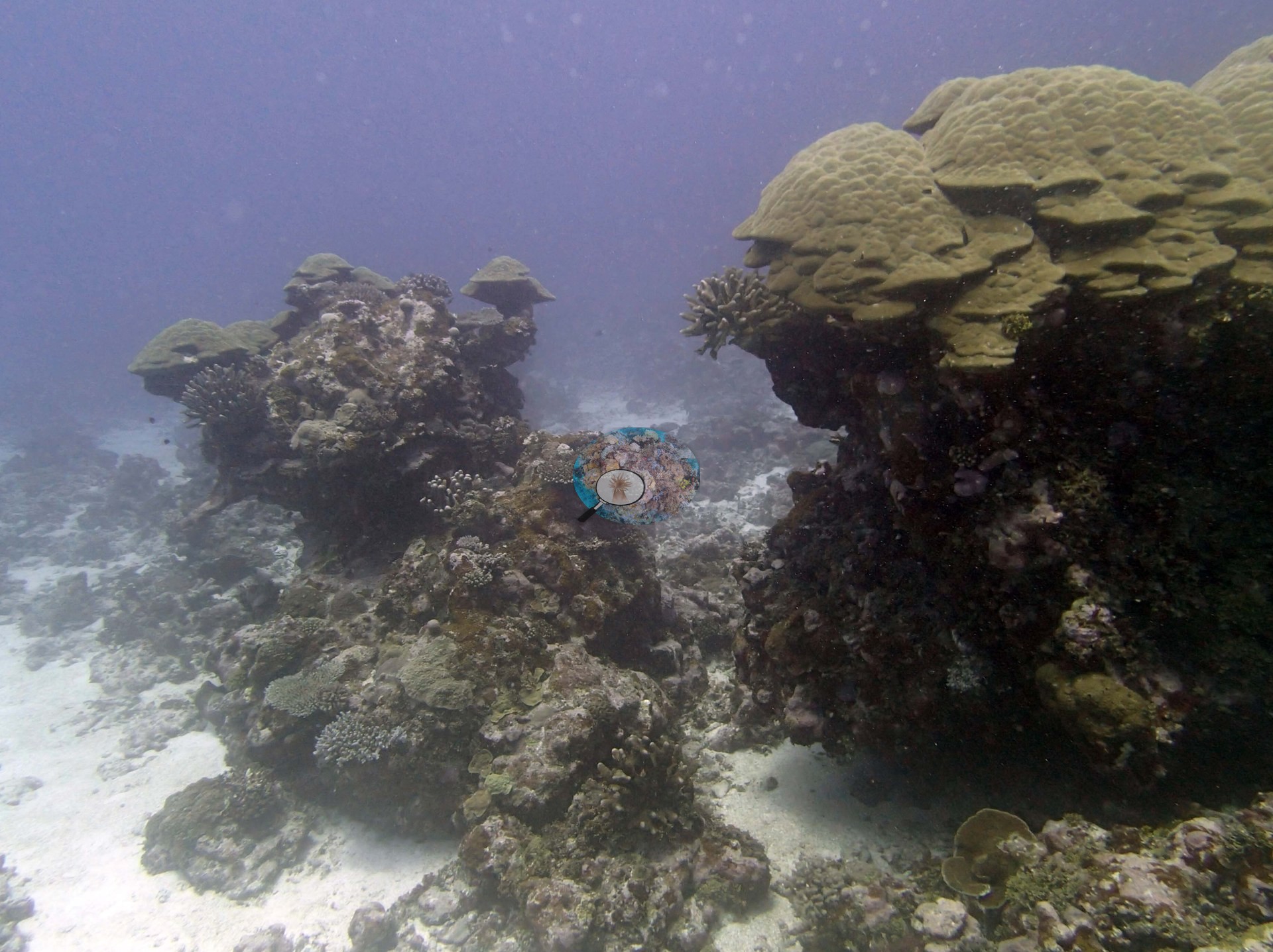
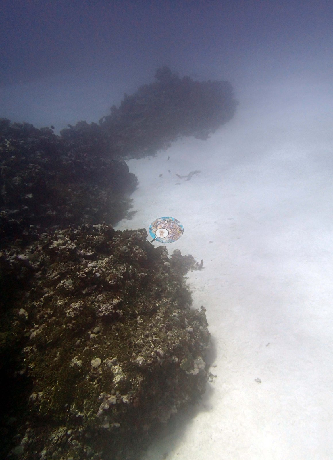
Only five frames were taken here, two of them nearly empty. What the frames do show is sand, and coral standing up out of it. Image 4 looks along a low, dark ridge of framework carrying little visible living cover, with a broad white sand flat opening away beside it, and Image 5 is almost entirely a pale sand patch running to a hazy horizon, a frame that carries essentially no benthic information beyond the sediment itself. Image 1 shows the same setting more usefully: two separate low mounds rising out of clean white sand, divided by open sediment, each capped with pale cream-yellow plating and columnar colonies and carrying small branching colonies on its flanks.
The frames are consistent with the survey's account of a sandy submerged fore reef with isolated bommies, and they support nothing finer than that. Image 3 is the best frame in the set. It is a single mound photographed side-on: pale cream-yellow tiered plating and lobate colonies covering the cap, dark red-brown flanks below with markedly less living cover on them, one small branching colony on the shoulder, and sand at the base.
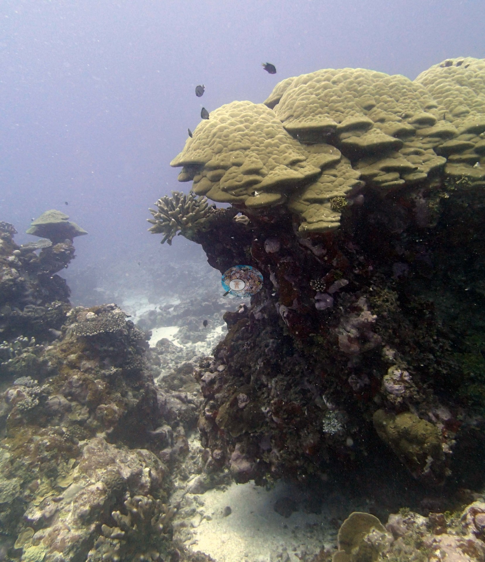
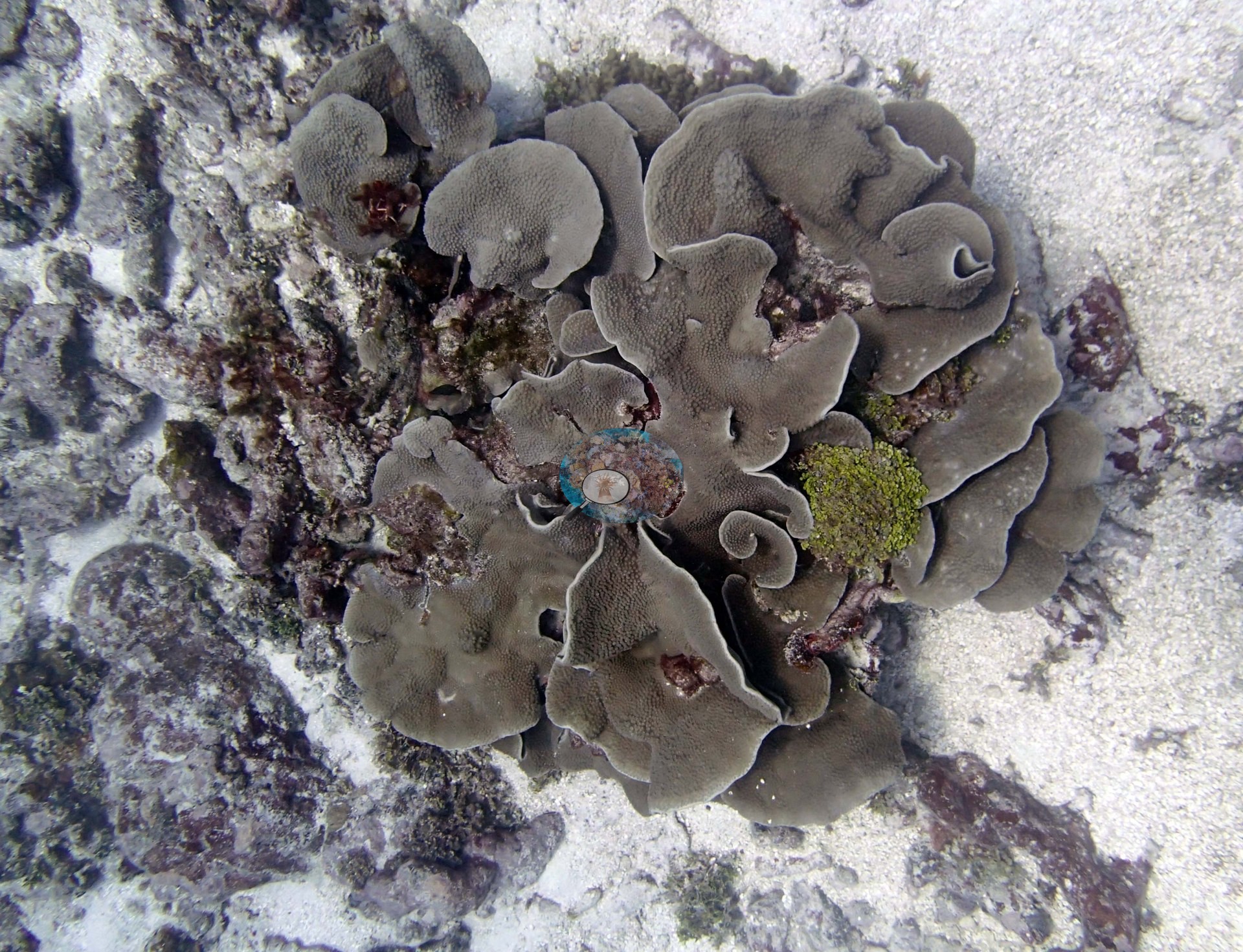
That vertical contrast — living cap, comparatively bare sides — is visible directly in the frame, and it is the one structural observation these photographs genuinely establish (e.g., Image 3). Image 2 is the only close subject. A gray-brown foliose colony of whorled, ruffled plates lies on clean white rubble and sand, with dark red-brown encrusting growth around it and a tuft of bright yellow-green algae in its center; the substrate immediately surrounding it is largely bare.
Survey team's site notes: This area has considerable areas of sand, mostly flat, with 1-2 m tall spurs with little rugosity (30-50 cm) and 5.0–10% cover. These slope gradually from 5 m to 15-18 m ending in sand with coral bommies. The sand flat continues to slope very gradually to 25 m depth. An extensive area of dead pillars, either Isopora spires or P. clavus colonies exists at 15-18 m. The pillars are easily broken and have very thick, multiple layers of CCA. This area has scattered living colonies of Isopora, Pocillopora, Goniastrea, small finely branched table acroporids, small favids, and some 60-100 cm Turbinaria colonies, at about 5.0–10% cover. Other spurs from 15-20 m depth have considerable colonization of thin, plating Montipora and other species with more table acroporids and 0.5-1 m Porites at 20 m. Throughout the sandy areas are numerous coral bommies up to 3 m tall and 2-3 m wide. These are all Porites lobata framework, many are mushroom shaped and have living P. lobata on their caps, with little coral on the sides. Often, parts of the Porites had died and other corals especially branching acroporids have colonized these structures. There are also some lower relief Porites domes (0.5-1 m wide, 30-100 cm tall).
Coral cover
- Reference: Khaled bin Sultan Living Oceans Foundation, Global Reef Expedition (in situ transect)
- 18%, from the Khaled bin Sultan Living Oceans Foundation's in situ transect survey (Global Reef Expedition site data); the photographs illustrate the site.
- In the dead-pillar area at 15-18 m the survey notes put live cover at about 5.0–10%, a by-eye estimate for one zone, below the 18% transect mean across all depths.
- Transect mean 18 ± 5.1% SE (n = 5 transects; Living Oceans Foundation per-transect benthic data); the headline above is this all-transect mean.
Stressors
No bleaching, disease lesion, or feeding scar resolves anywhere. The frames cannot establish depth zonation, and they do not reach or confirm the survey's most distinctive record here — the extensive field of dead, easily broken pillars under thick layers of crustose coralline algae at 15–18 m. The Living Oceans Foundation transects here recorded 0.4% cyanobacteria and no recently dead coral; they carry no bleaching, disease, or crown-of-thorns field. Typical recent thermal stress: mean annual maximum of 5.2°C-weeks (Degree Heating Weeks, 2021-2025, NOAA CRW; Northern Tonga virtual station).
Fish and other fauna
A few small fish work the cap.
Comparisons with other data
TONI58 (Niuatoputapu) was surveyed on 30 September 2013 during the Khaled bin Sultan Living Oceans Foundation Global Reef Expedition.
Other notes
Only five habitat frames survive from the dive (Niuatoputapu, 30 Sep 2013); there are no sampled-colony frames. Anderson found none of the target Pocillopora ('no Pdam'), the sampling target on this expedition, here, which is why no colony series exists. No species is claimed for the foliose colony in Image 2. Visibility is poor across the set — Image 1 and Image 3 are both hazy and low-contrast, and Image 5 is effectively empty — so this is not a sample from which any site-wide statement about condition, community composition, or cover should be drawn. There is no scale object, quadrat, or transect line in any frame, so no colony dimension here should be treated as measured.
Data & links
- Download benthic survey data (CSV) ↗
- Download all LOF-GRE data (933 sites) ↗
- Photo portfolio ↗
- Coral Reef Diagnostics region page ↗
All images from Coral Reef Diagnostics. Data are from the Khaled bin Sultan Living Oceans Foundation Global Reef Expedition and Coral Reef Diagnostics.
 © Coral Reef Diagnostics.