
Part of the regional summaries: Tonga - Ha'apai and Tonga
More info
Southern Tonga (NOAA CRW virtual station)A fringing fore reef off northeast Ha'apai where coral-covered mounds drop near vertically from 10 m to 30-40 m, their faces full of ledges, overhangs, and crevices. Large foliose plating corals line the base of the wall, and a steep slope to the south carries 80-100% cover of plating and encrusting corals, including Porites colonies 3-5 m across. Surveyed on the Living Oceans Foundation's Global Reef Expedition.
Ko ha tafaʻaki tuʻa ʻo ha hakau matafonua (fringing fore reef) ʻi he tokelau hahake ʻo Haʻapai, ʻoku tō hifo ai ʻa e ngaahi puke kuo ʻufiʻufi ʻe he feo meimei hangatonu mei he 10 m ki he 30-40 m, ʻoku fonu honau ngaahi mata ʻi he ngaahi tafungofunga (ledges), ngaahi feituʻu ʻoku tuʻu atu ki tuʻa (overhangs), mo e ngaahi kiʻi ava. ʻOku tuʻu ʻa e ngaahi feo fakapaleti fakalaʻā (foliose plating corals) lalahi ʻi he takele ʻo e holisi, pea ko ha tafaʻaki tuʻu ki he tonga ʻoku ʻi ai ʻa e ʻufiʻufi ʻo e 80-100% ʻe he ngaahi feo fakapaleti (plating) mo pipiki (encrusting), kau ai ʻa e ngaahi kulupu Porites ʻoku 3-5 m hono fālahi.
AI translation of this summary; the English is authoritative. (low confidence)
CTD-cast midpoint of 24.8–26.1°C
More info
Anderson's dive computer read 23.3°C (a single reading, probably a dive mean).One other CRD dive site with its own page within 5 km shown in orange — click a marker to open its page.
10 of the 11 photographs on this page are shown beside the text that discusses them under "Site description" below.
Site description
Setting
Intermediate-exposure fore reef. Fringing reef off northeast Ha'apai (LOF Tonga field report). Shallow mounds extend out from 3-4 m to 10 m, then drop vertically to 30-40 m, ending in a sand/rubble/coral field that continues to slope gently seaward. A number of deep channels separate each mound. There is 80-100 cm relief on the vertical surfaces.
General benthic features
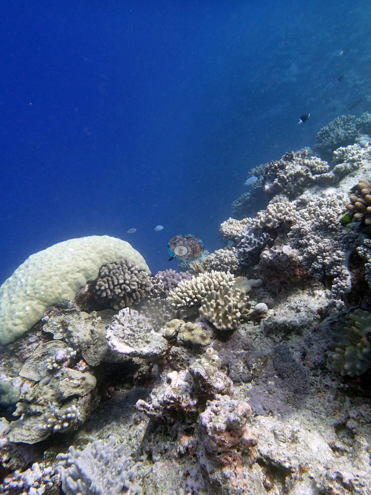
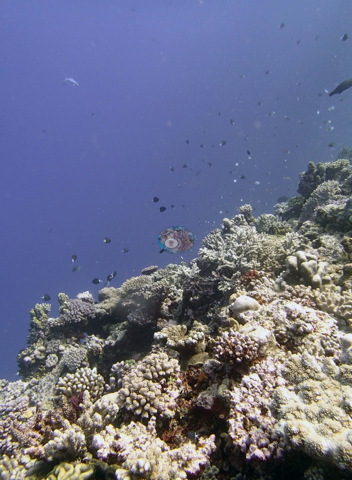
The frames are of a coral-topped mound and its drop-off, shot from the mound top looking out and over the edge. Image 1, Image 8, Image 2, Image 7, Image 3, Image 4, and Image 10 all show the same setting: a densely colonized reef top running out to an edge, with deep open water immediately beyond it and nothing but blue below.
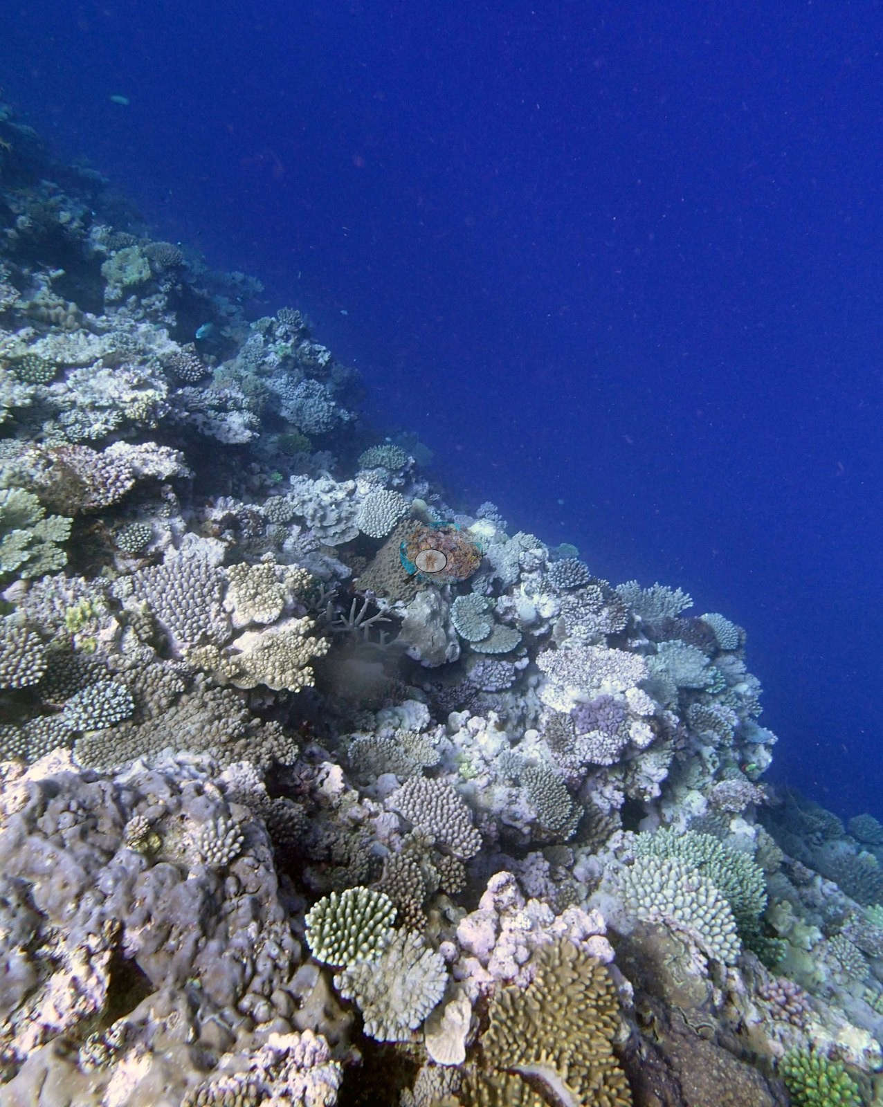
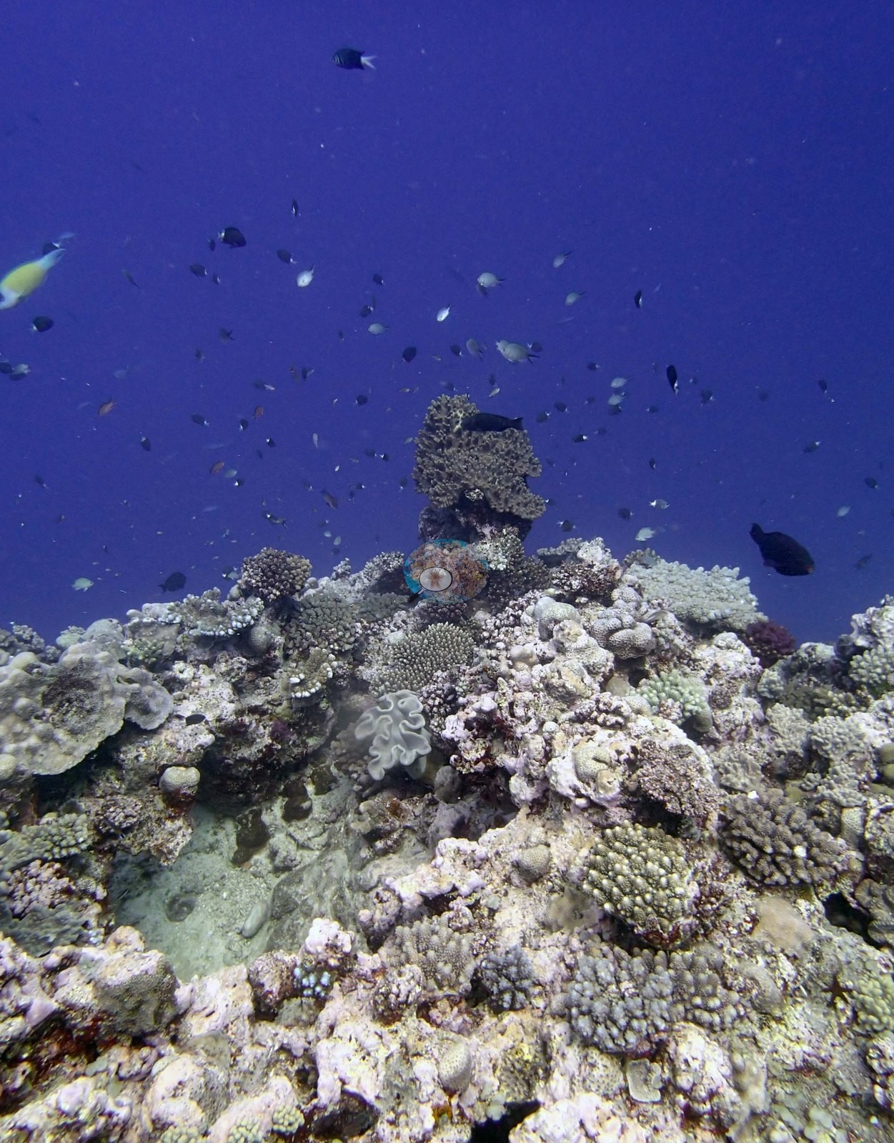
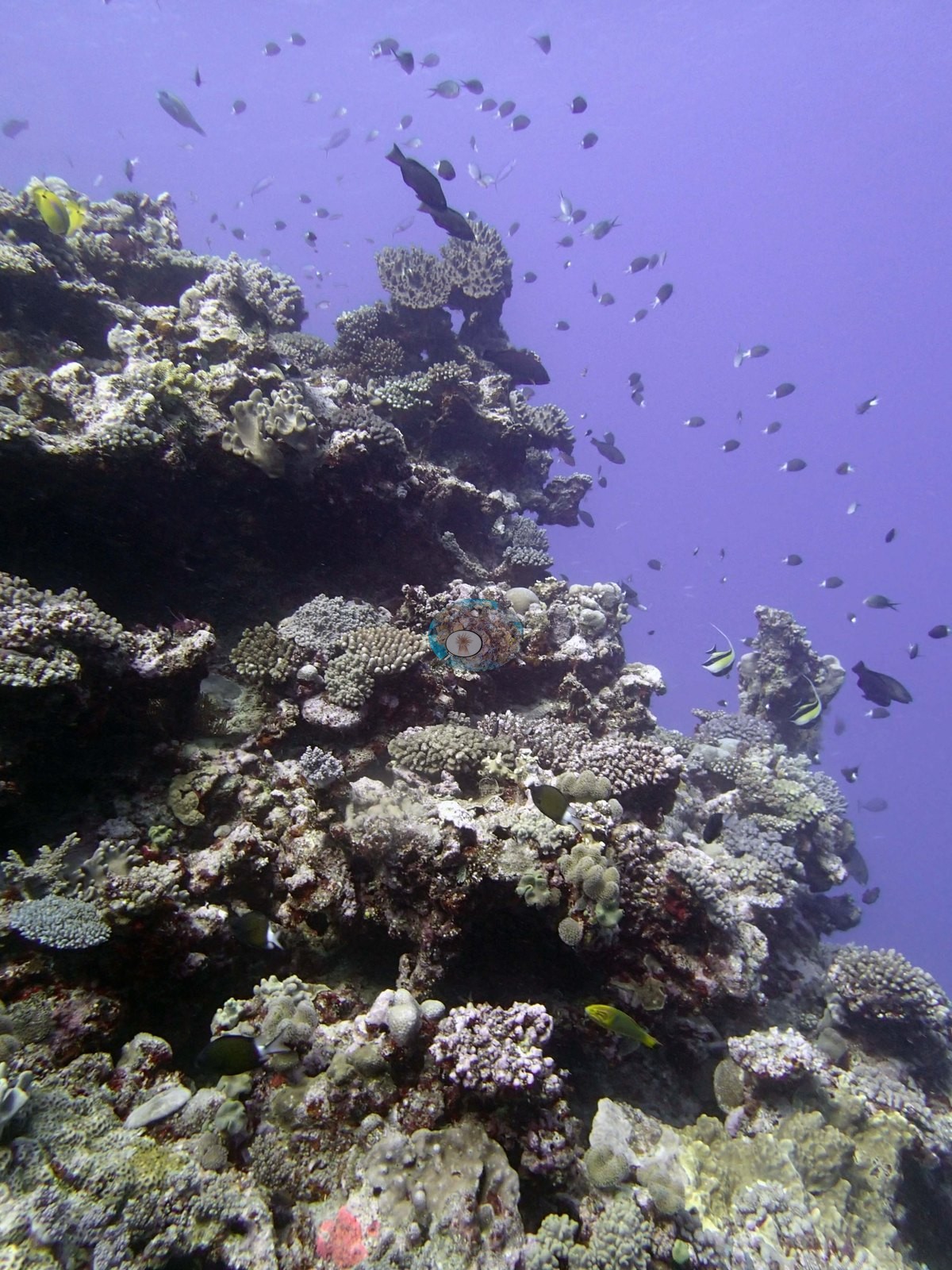
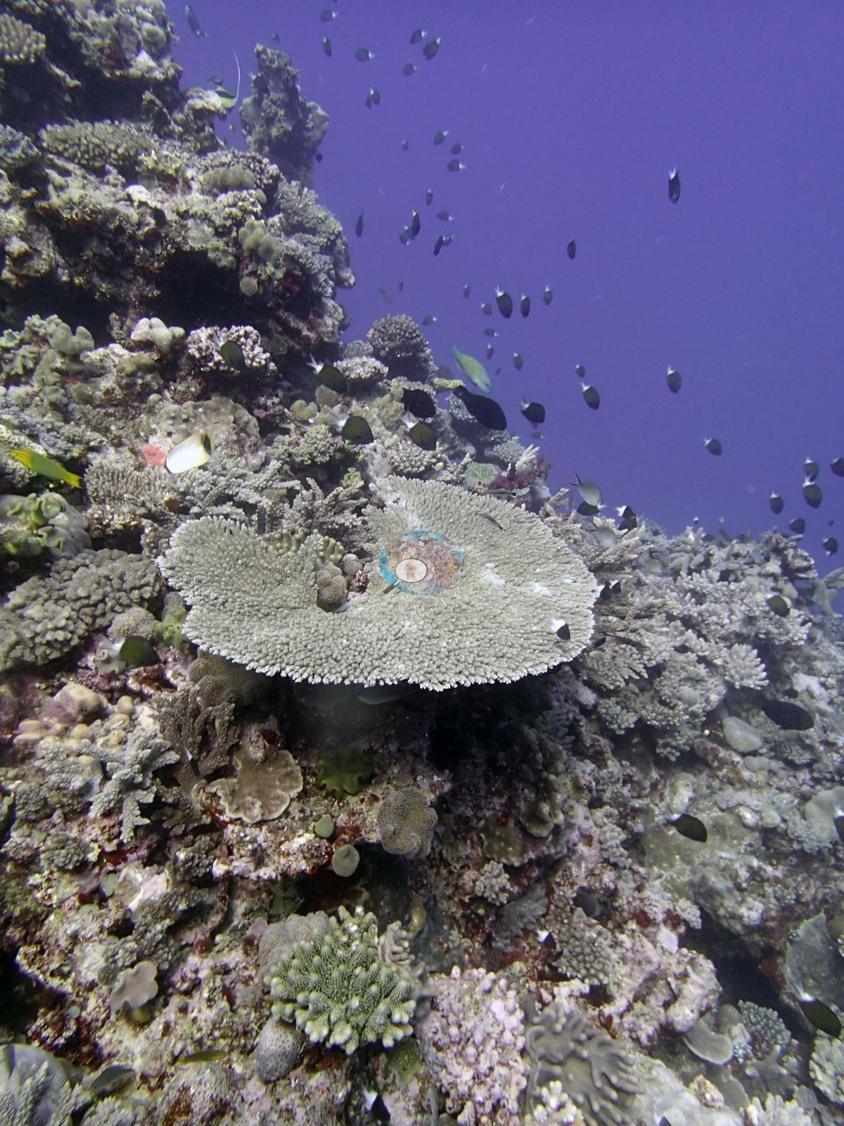
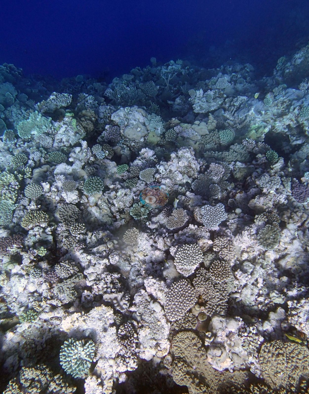
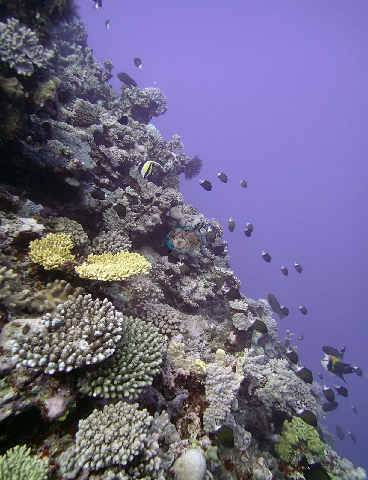
The community in these frames is pale-toned and highly mixed — corymbose and digitate acroporids, thin tabular plates, gray foliose and plating sheets, green corymbose colonies, brown branching clumps, rounded massives, and pavement crusted in pink and mauve coralline algae. Image 3 holds the set's cleanest single structural subject, a broad pale-gray tabular plate sitting proud on the crest; Image 1 has a large cream-yellow domal massive at its left edge; Image 10 has a bright yellow tabular colony on the flank. Image 6 is the best structural frame in the set. It is shot at the lip of the drop-off looking along and over it, with the reef edge crowded in the foreground — a bright yellow-cream massive with large polygonal corallites, tan branching and digitate colonies, and a pale plating colony — and the face falling away into open blue at the right of the frame.
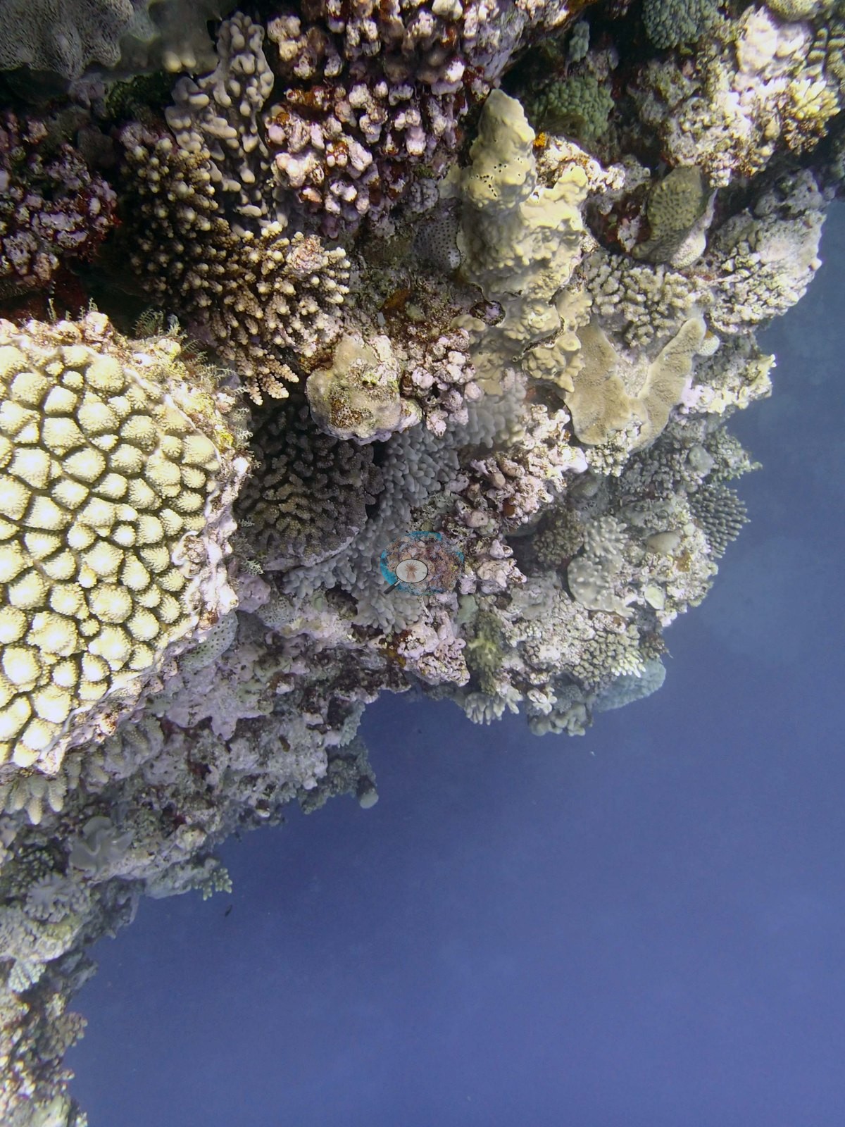
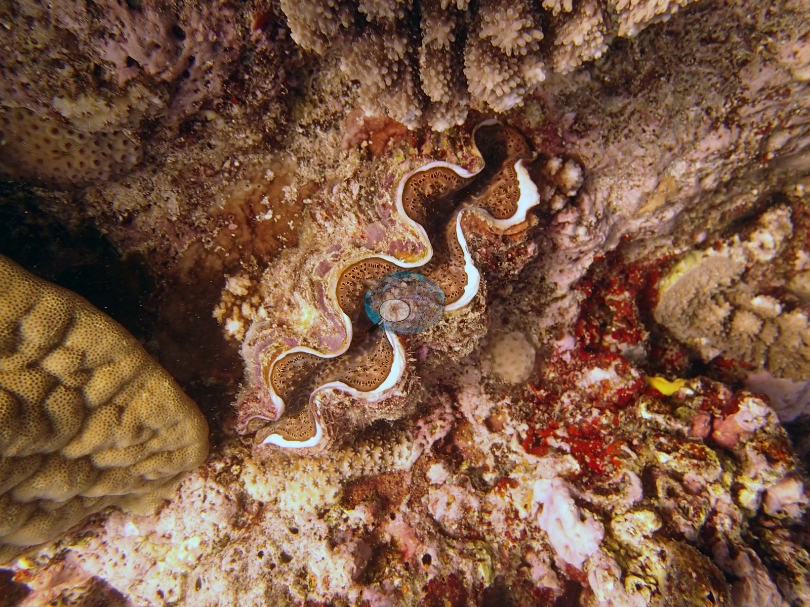
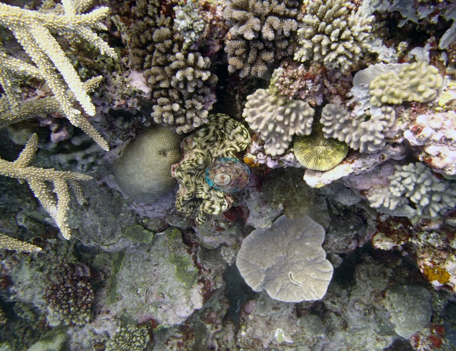
It shows that the edge is abrupt and that living cover runs right up to and over it, but the frame does not follow the wall down and settles nothing about the deeper community (e.g., Image 6). Two close frames record a giant clam (Anderson's identification). Image 5 is a tight view of a clam deeply embedded in the framework, its brown mantle edged in iridescent white along a strongly zigzag shell margin, beside a tan massive with large polygonal corallites and red-pink coralline crust. Image 9 is a wider version of the same close-range framework — staghorn branches at the upper left, a second clam with a mottled olive and cream mantle, a free-living disc coral, and gray foliose plates — and is the best frame in the set for reading the fine-scale packing of the reef top.
The deep part of the wall had many 1-2 m gorgonian sea fans. Soft coral increases in cover as you go shallow (5.0% at 30 m; 30% at 8 m). Parts of the wall had 10-20% cover of Millepora; at the edge were large groups of corallimorphs.
Coral cover
- Reference: Khaled bin Sultan Living Oceans Foundation, Global Reef Expedition (in situ transect)
- 40%, from the Khaled bin Sultan Living Oceans Foundation's in situ transect survey (Global Reef Expedition site data); the photographs illustrate the site.
- Transect mean 40 ± 6.5% SE (n = 8 transects; Living Oceans Foundation per-transect benthic data); the headline above is this all-transect mean.
Stressors
No bleaching, disease lesion, or corallivore feeding scar resolves with confidence. The frames cannot establish depth zonation, do not reach the base of the wall, and cannot confirm the survey's deeper records — the large foliaceous colonies at 35 m, the 1–2 m gorgonian sea fans, the Millepora cover, or the corallimorph patches at the edge. Typical recent thermal stress: mean annual maximum of 8.1°C-weeks (Degree Heating Weeks, 2021-2025, NOAA CRW; Southern Tonga virtual station). The 2013 survey notes for this site record snails on a number of the smaller Acropora, including staghorn coral (Khaled bin Sultan Living Oceans Foundation expedition site notes, 2013; regional summary in Bruckner 2014). The Living Oceans Foundation transects here recorded 6.8% cyanobacteria and no recently dead coral.
Fish and other fauna
Fish are conspicuous in the water column. Clouds of dark planktivores and damselfishes hang over the reef edge in Image 2, Image 7, Image 3, and Image 10, and Image 10 also carries a bannerfish and a butterflyfish among them. Small yellow fish appear among the colonies in Image 7.
Comparisons with other data
Apart from the Living Oceans Foundation survey shown here, we found no other surveys at this site as of 2026. If you would like to share yours, please email us.
Other notes
Eleven habitat frames survive from the dive (Ha'apai, 21 Sep 2013); there are no sampled-colony frames, so this is a habitat account throughout. None of the target Pocillopora ('no Pdam'), Anderson's sampling target on this expedition, was found here, which is why the site carries no sampled-colony series. Two frames are poor. There is no scale object, quadrat, or transect line anywhere in the set, so no colony dimension here should be treated as measured.
Survey team's site notes: The top of the mound is a scoured hardground near the reef crest, with moderately high cover (30-40%) of staghorn, digitate, thick plating, and tabular acroporids (some over 2 m), Pocillopora, Favia stelligera, Coscinaraea, Leptoria, Goniastrea, Lobophyllia, large Favites crusts, and many other species, and 25-30% soft coral near the edge of the drop-off. The mounds drop near vertically, with small ledges, overhangs, and crevices. At 10 m it is mostly Montipora, digitate acroporids, staghorn, medium-sized Porites, Pocillopora, Favia stelligera columns, and Favites crusts. At 15 m plates of Isopora, staghorn, digitate acroporids, Porites, and F. stelligera dominate with 30-50% live cover. Coral cover ranges from 5.0-50%, consisting of plating Montipora, submassive Porites, small acroporids and pocilloporids, Goniastrea, and other species. Deeper are numerous sheets of Mycedium, Merulina, Pachyseris, Leptoseris, Echinophyllia, and other species. At the base of the wall in 35 m are very large foliaceous Mycedium, Pachyseris, Merulina, Leptoseris, and Montipora. Further south is a steep slope (45-60 degree) with 80-100% cover of plating and encrusting corals extending from 32-20 m. This included 3-5 m encrusting Porites lobata, P. rus, Montipora, and other species. Further along was a large stand of thick-branched staghorn coral, with mounds of P. rus, Montipora, Goniastrea, and many other species.
CV model comparison
More info
The photo row below is a methods comparison only: it is never averaged with the transect and never used as the headline. It compares site means only: the photos come from the same survey dive as the transect but not from the same points.| Method | Hard coral cover (%) | Photos (n) ± SE |
|---|---|---|
| Transect mean (all transects) | 39.6 | |
| CoralSCOP unedited | 35.8* | n = 10 · SE 4.0 |
| Claude (edited photos) | 35.8* | n = 10 · SE 5.1 |
The two computer-vision methods agree within 0.0 pp (35.8%) and read within 3.8 pp of the in-water transect (39.6%).
*Based on only 10 reef-habitat photos; this estimate is less certain.
See a more detailed, stand-alone version of this table.
Data & links
- Download benthic survey data (CSV) ↗
- Download all LOF-GRE data (933 sites) ↗
- Photo portfolio ↗
- Coral Reef Diagnostics region page ↗
All images from Coral Reef Diagnostics. Data are from the Khaled bin Sultan Living Oceans Foundation Global Reef Expedition and Coral Reef Diagnostics.
 © Coral Reef Diagnostics.