
Part of the regional summaries: Tonga - Ha'apai and Tonga

More info
Southern Tonga (NOAA CRW virtual station)A lagoonal patch reef of shallow, partly emergent mounds whose edges carry a dense Acropora-dominated community at 50-80% cover, while the scoured shallows are mostly turf with isolated corals. Undercut ledges at the mound bases are carpeted by the red crust alga Peyssonnelia, and long spurs beyond alternate between bottlebrush, mixed, and staghorn communities. Surveyed on the Living Oceans Foundation's Global Reef Expedition.
Ko ha kiʻi hakau ʻi he namo (lagoonal patch reef) ʻo e ngaahi puke mamaha, ʻoku hā hake ha konga ʻi he funga tahi, ʻoku ʻi honau ngaahi tafaʻaki ha kulupu fefuʻifuʻi ʻoku puleʻi ʻe he Acropora ʻi he ʻufiʻufi ʻo e 50-80%, lolotonga ko e feituʻu mamaha kuo tafiʻi ko e limu nounou (turf) pē mo e ngaahi feo mavahevahe. Ko e ngaahi tafungofunga kuo keli ʻi lalo (undercut ledges) ʻi he takele ʻo e ngaahi puke ʻoku ʻufiʻufi ʻe he limu kulokula pipiki (red crust alga) Peyssonnelia, pea ko e ngaahi spurs loloa ʻi tuʻa ʻoku fetongitongi ai ʻa e ngaahi kulupu fakapulumu (bottlebrush), fefiofiofi, mo e staghorn.
AI translation of this summary; the English is authoritative. (low confidence)
CTD-cast midpoint; the cast read 25.8°C throughout
More info
Anderson's dive computer read 23.9°C (a single reading, probably a dive mean).Site description
Setting
Lagoonal patch reef with several shallow mounds (1-2 m deep) parts that are emergent and gently sloping spurs. At the base is a series of wide sand patches interspersed with large rubble fields. Adjacent to these are long, wide spurs. These slope up to 12-13 m at the top, and then slope very gradually seaward. In deeper areas, there is 3-4 m from the top of the spur to the sand channel.
General benthic features
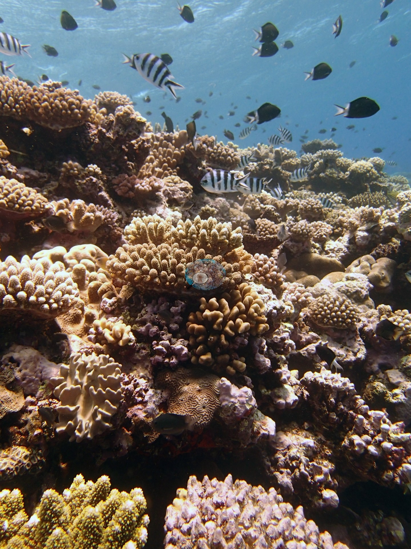
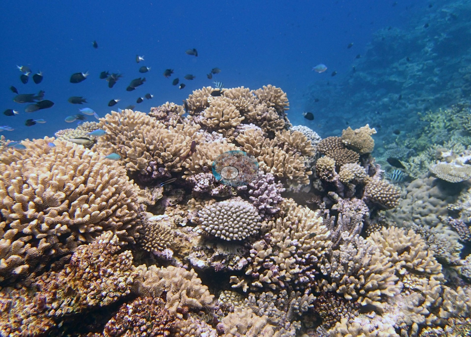
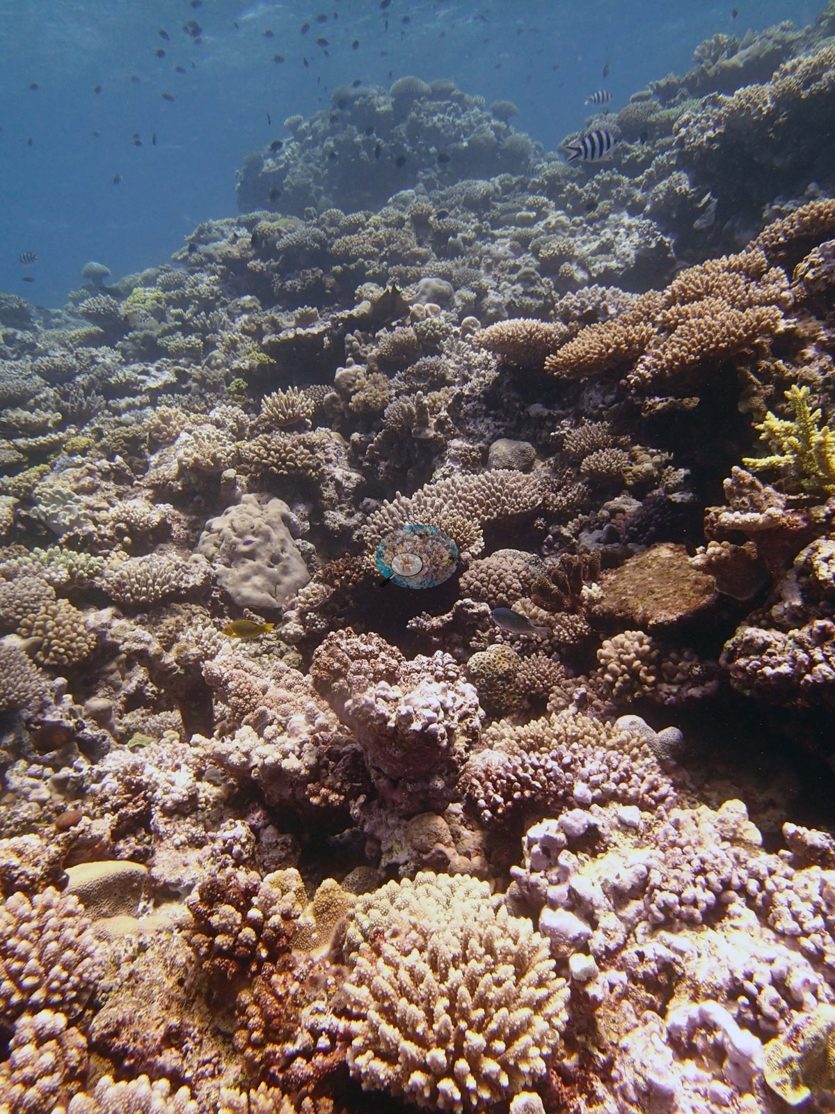
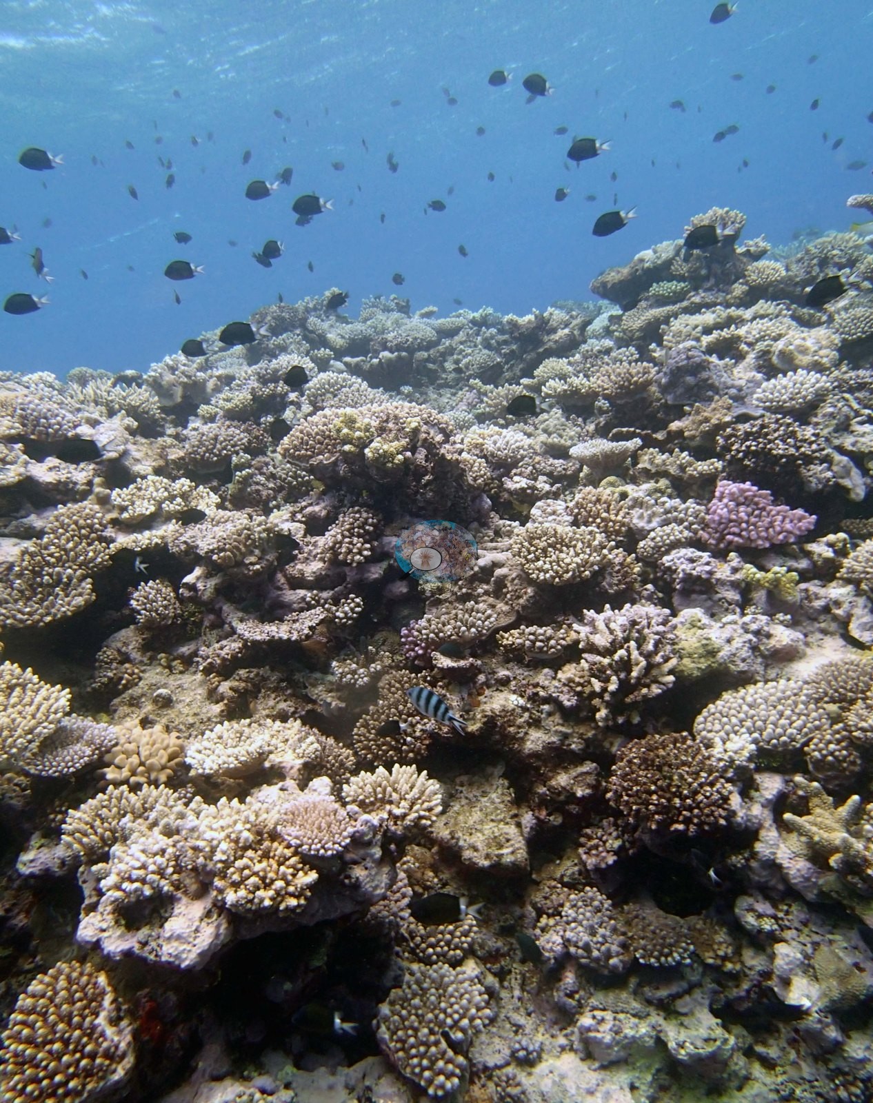
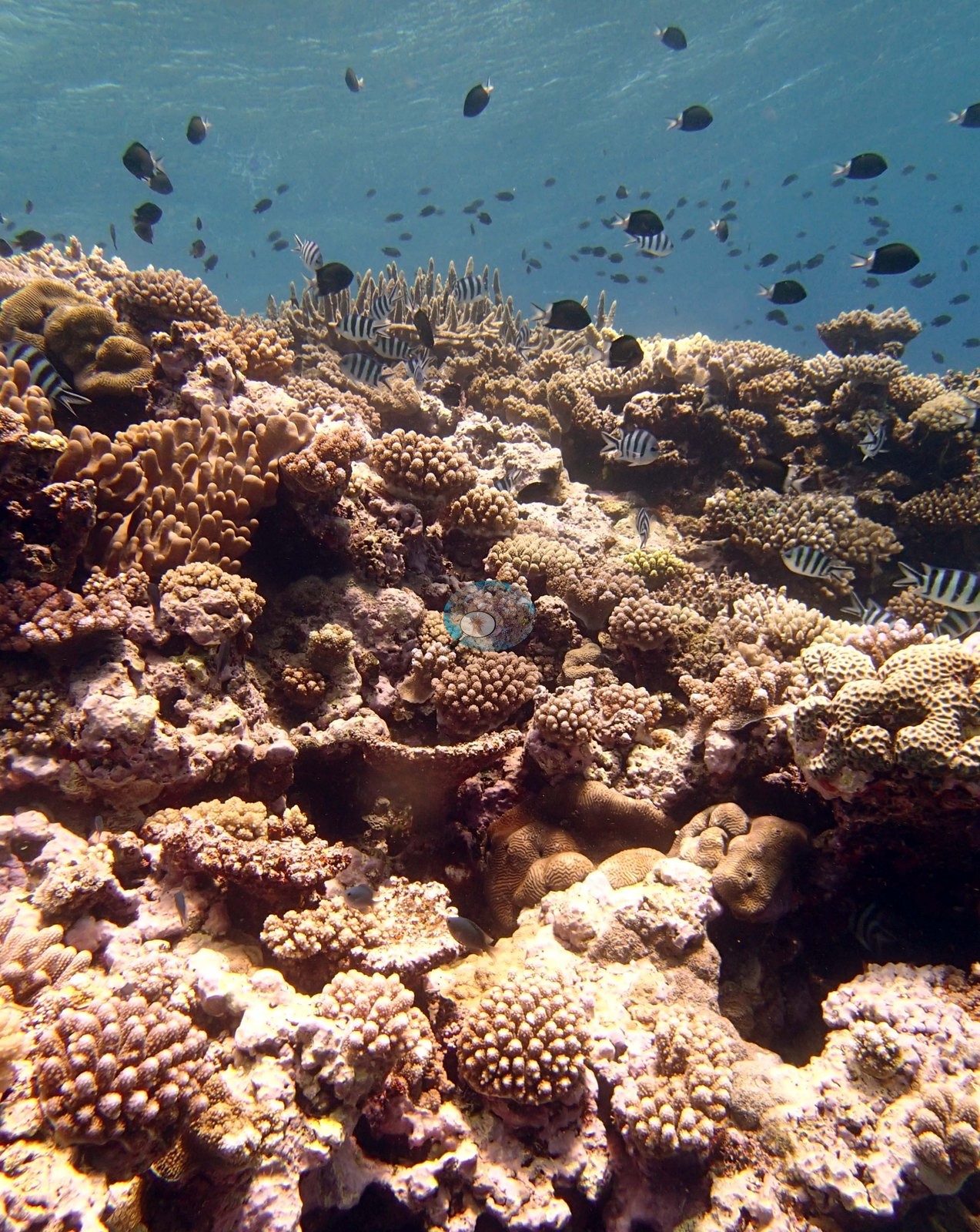
The habitat set is dominated by reef-top and upper-slope views of an exceptionally dense branching community. In Image 2, Image 17, Image 10, and Image 1 the substrate is almost invisible: a close-packed mosaic of pale tan, cream, and dusty-pink digitate, corymbose, and thick-branched Acropora interlocked with knobby, verrucose pocilloporid clumps, colony against colony with only narrow shaded gaps between them. Image 9, Image 8, Image 13, and Image 19 look up or along the flank of the same build-up and add fleshy octocorals to that picture — mustard-yellow and cream lobed and digitate leather corals set among the stony carpet, conspicuous but clearly intergrown rather than dominant.
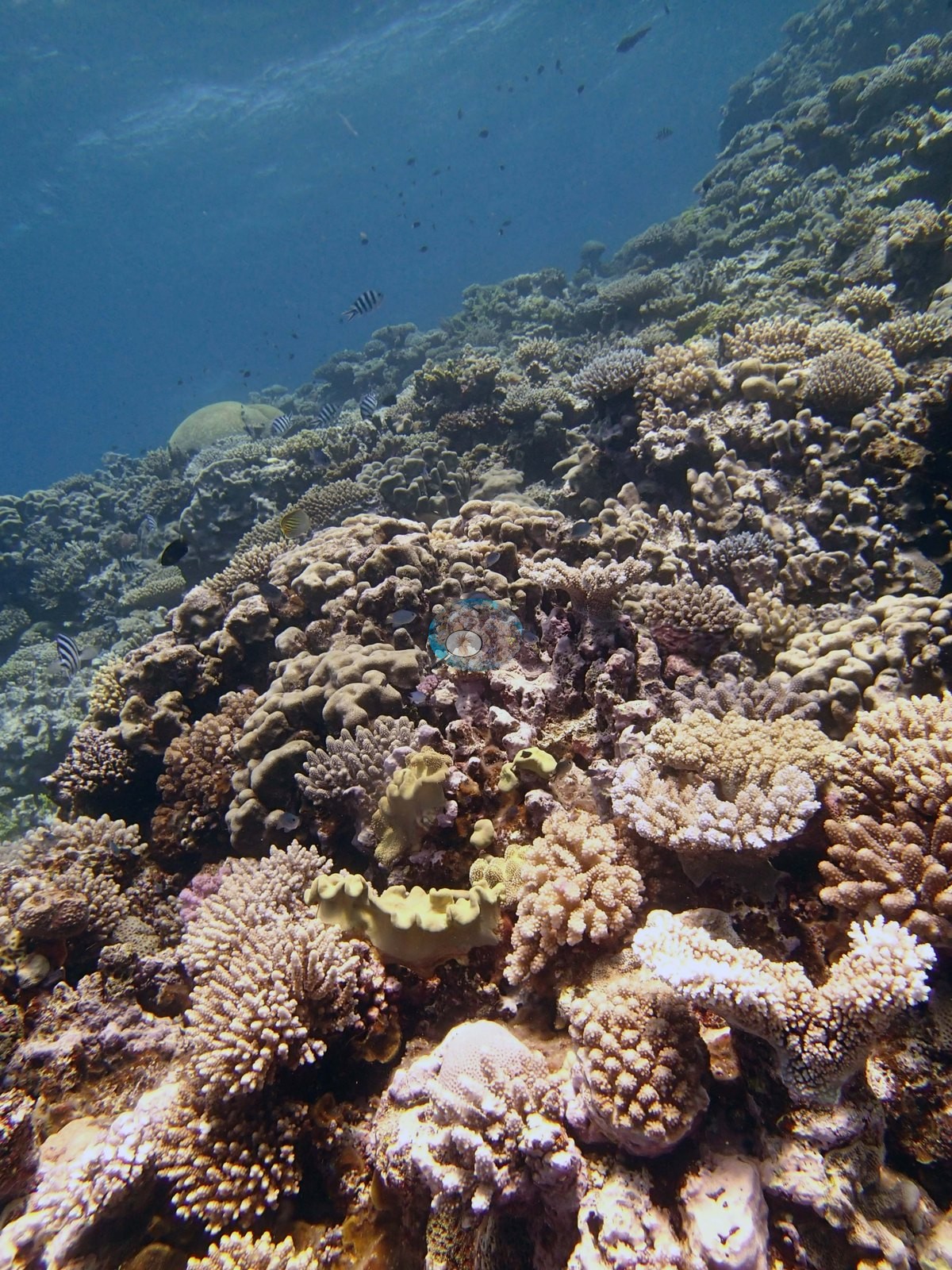
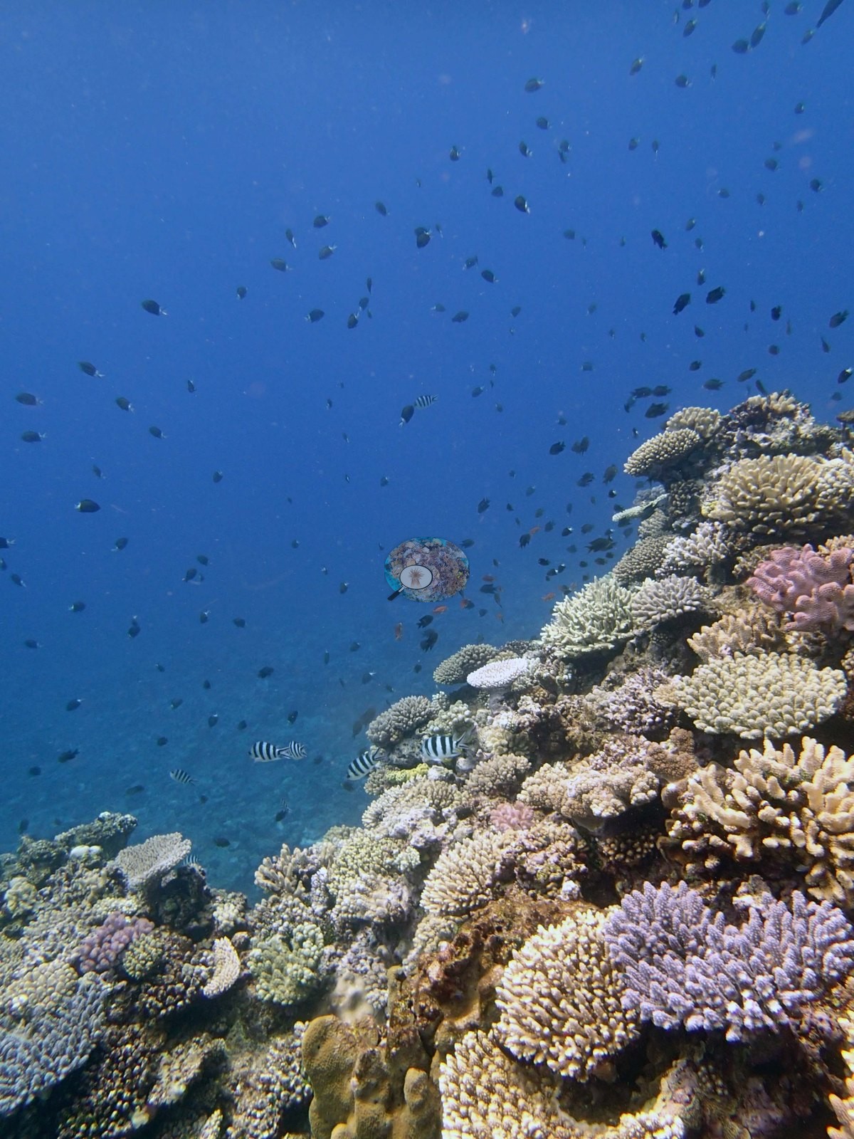
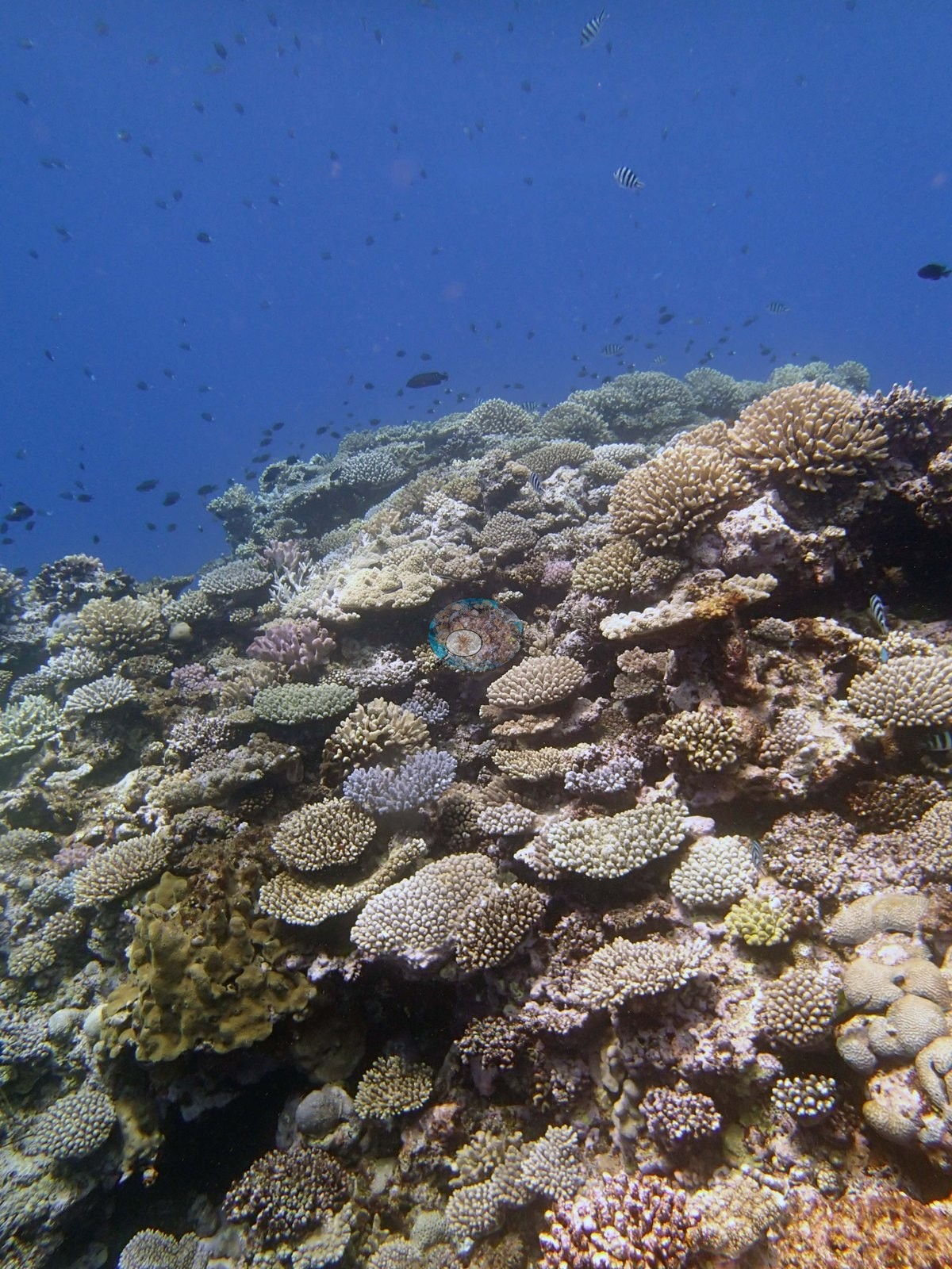
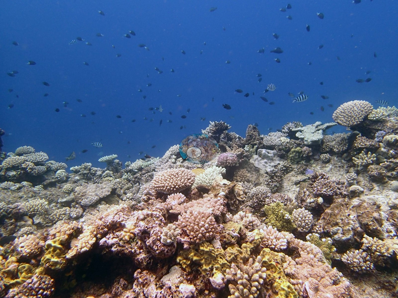
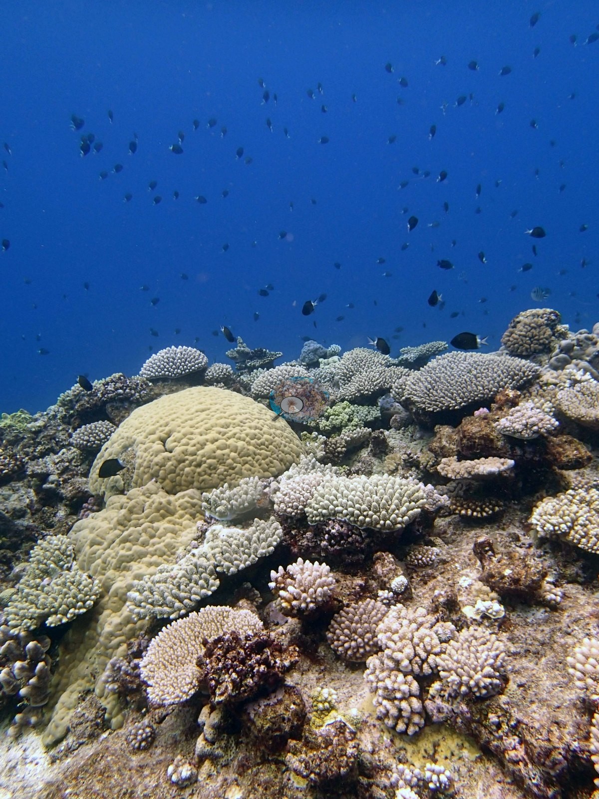
Massive corals are present but subordinate: a large tan dome fills the middle of Image 15, and meandroid brain corals with sinuous walled valleys appear in Image 4 and Image 3, several of them small and tucked at the foot of the branching stands. Image 5 is the best-lit frame of the reef top and shows the mosaic at close range — brown lobed leather corals, pocilloporids, small brains, and encrusting sheets, all under bright surface light.
Two frames show a very different bottom. Image 12 is a wide, dim, purple-cast view of low-relief pavement carrying continuous dark turf with only scattered pale colonies standing out of it, and Image 16 looks across mounds whose surfaces are largely encrusted and turf-bound.
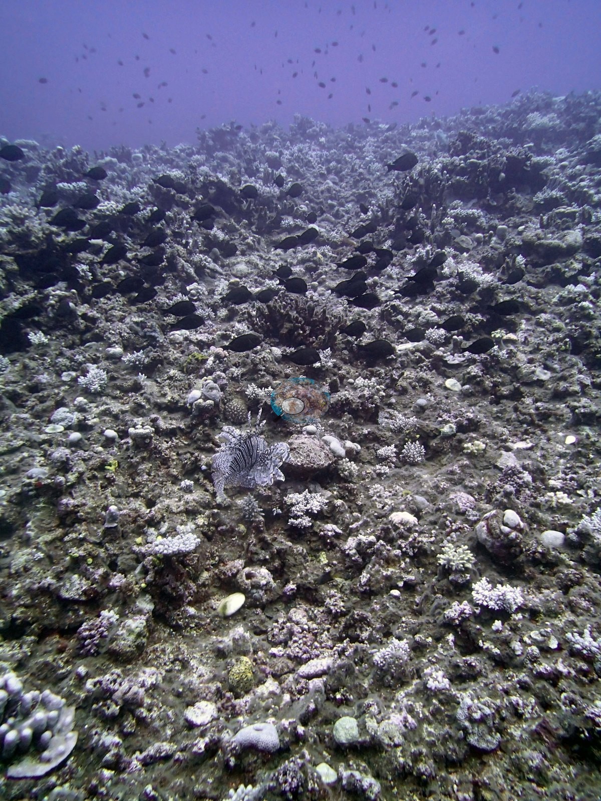
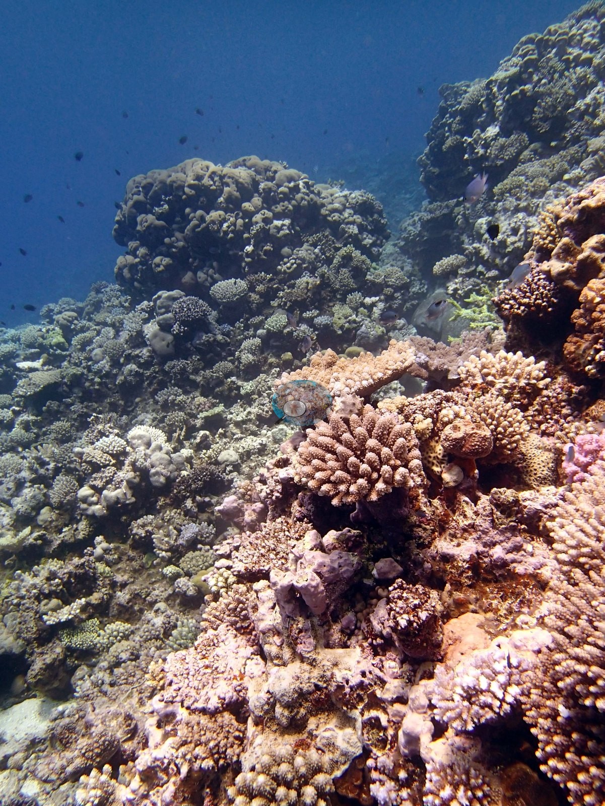
The shallows at 3-5 m are largely scoured hardgrounds with dense turf algae and isolated corals. At the edge of the mounds is a dense acropora dominated community (mostly digitate, thick tables and some thick staghorns), with massive Montipora foveolata, Pocillopora, Coscinaraea, Favia stelligera, Favites abdita crusts, Pachyseris, Gardineroseris, and many other taxa. The spurs alternate between areas dominated by bottlebrush acroporids, acropora mixed with small to medium massives, especially Goniastrea and Favia stelligera, mixed communities with faviids, Astreopora, acroporids, Pocillopora, Lobophyllia, and other species, and staghorn thickets. There were no large table acroporids. Cover ranges from 5.0-30% with dense Lobophora encroaching on the bases of the coral and open areas covered in Peyssonnelia with patches of Tydemania, cyanobacteria, and other algae. Many damselfish lawns in the staghorn acroporids.
Coral cover
- Reference: Khaled bin Sultan Living Oceans Foundation, Global Reef Expedition (in situ transect)
- Coral cover 31%, from LOF-GRE in situ transects (the mean of all of this station's own transects in the expedition's per-transect benthic data) — a diver transect measurement, not a photographic or computer-vision estimate.
- That transect figure is this site's authoritative cover value; the very high in-frame cover of the reef-top photographs is a framing effect of where the camera was pointed and neither supports nor qualifies it.
- Coral Health Index 2.51/5 (Mayfield & Dempsey 2025, Discover Oceans formula).
- Transect mean 31 ± 3.3% SE (n = 6 transects; Living Oceans Foundation per-transect benthic data); the headline above is this all-transect mean.
Stressors
Taken with Image 7 and Image 18, the turf-bound frames Image 12 and Image 16 are the visual counterpart to the turf, Peyssonnelia, and partial-mortality signal in the survey record; the photographs cannot say how much of the reef looks like this rather than like Image 2.
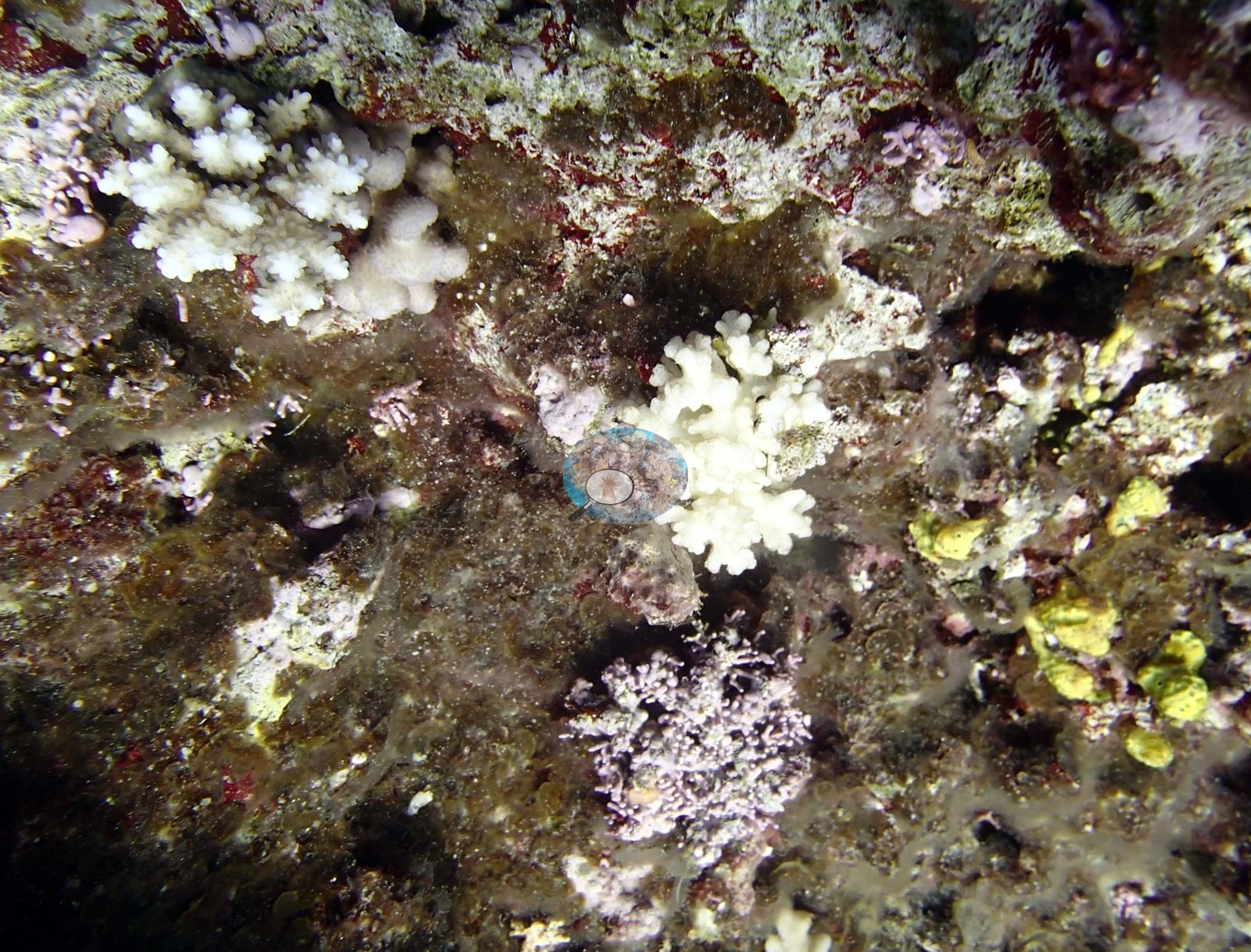
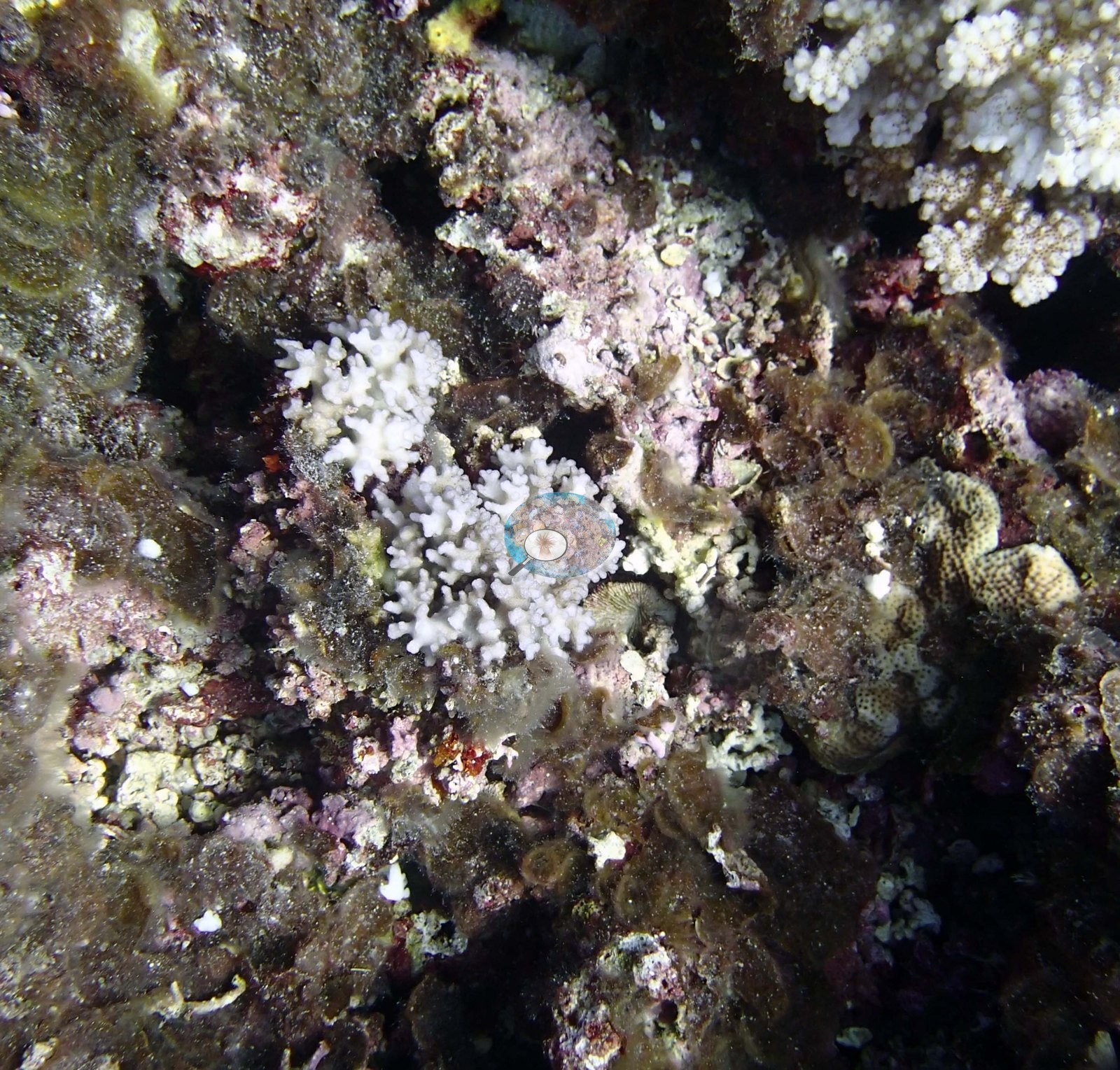
Two frames that Anderson recorded as dying pocilloporids (e.g., Image 18 and Image 7) both show a small pocilloporid colony fully bleached stark white, corallite texture intact and still alive, standing among rubble and dark, algal-bound substrate. Additional stark-white or cream branching colonies with intact corallite texture appear in Image 9, Image 8, Image 13, Image 19, and Image 6, and more white branch tips in Image 11; like Anderson's two 'dying' colonies they read as bleached, though no fraction has been read off the imagery.
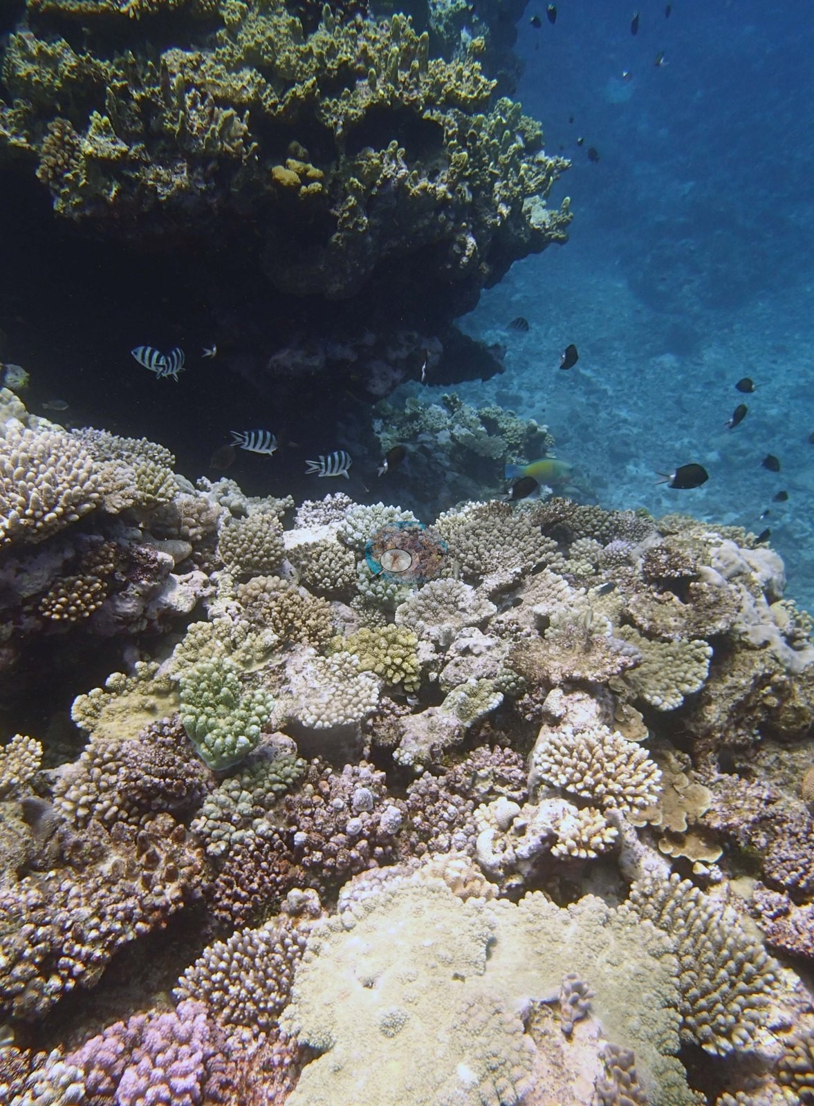
Anderson's sampling sheet for this dive records one of the three sampled colonies (colony 52) as 30% bleached and possibly unhealthy, and colonies 53 and 54 as healthy. The 2013 survey notes record the staghorn stands as 30-40% dead, with many damselfish. Typical recent thermal stress: mean annual maximum of 8.1°C-weeks (Degree Heating Weeks, 2021-2025, NOAA CRW; Southern Tonga virtual station). The 2013 survey notes for this site record considerable crown-of-thorns damage at 20-23 m, where two large starfish were collected (Khaled bin Sultan Living Oceans Foundation expedition site notes, 2013; regional summary in Bruckner 2014). The survey notes record that many of the Goniastrea had large multifocal lesions. The Living Oceans Foundation transects here recorded 13% cyanobacteria and no recently dead coral.
Fish and other fauna
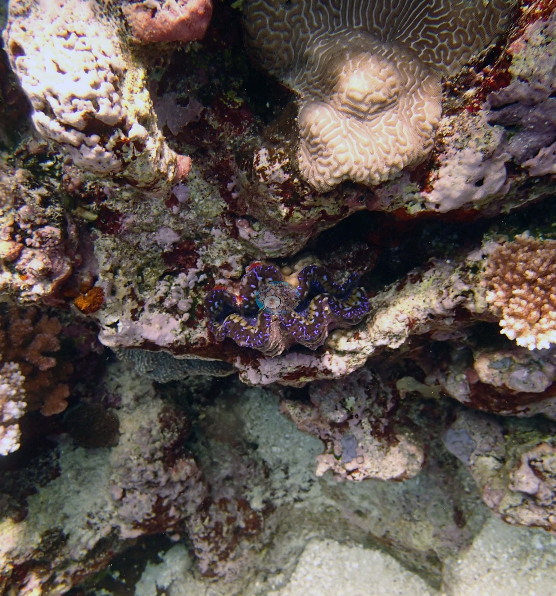
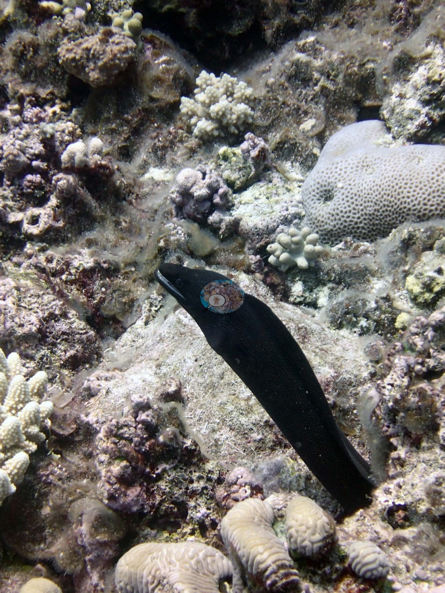
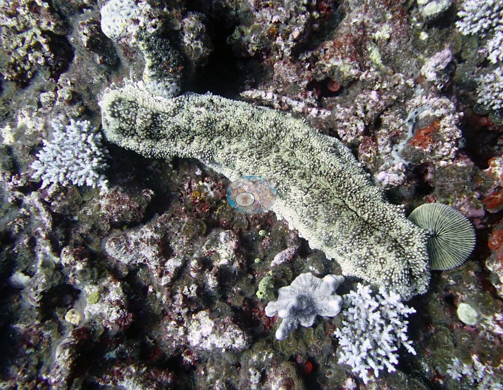
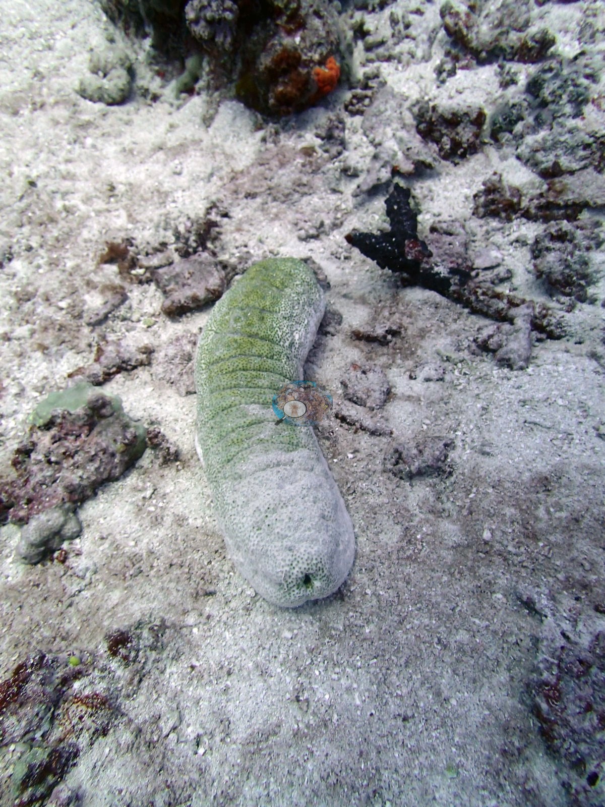
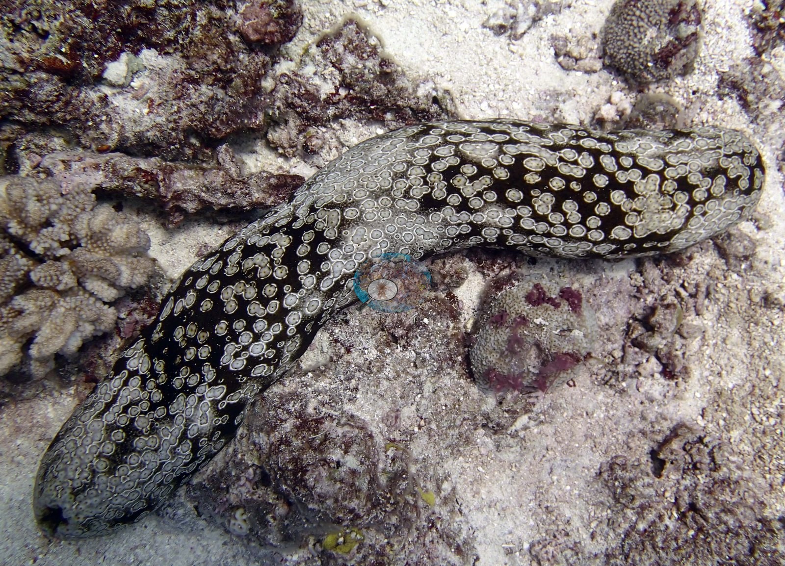
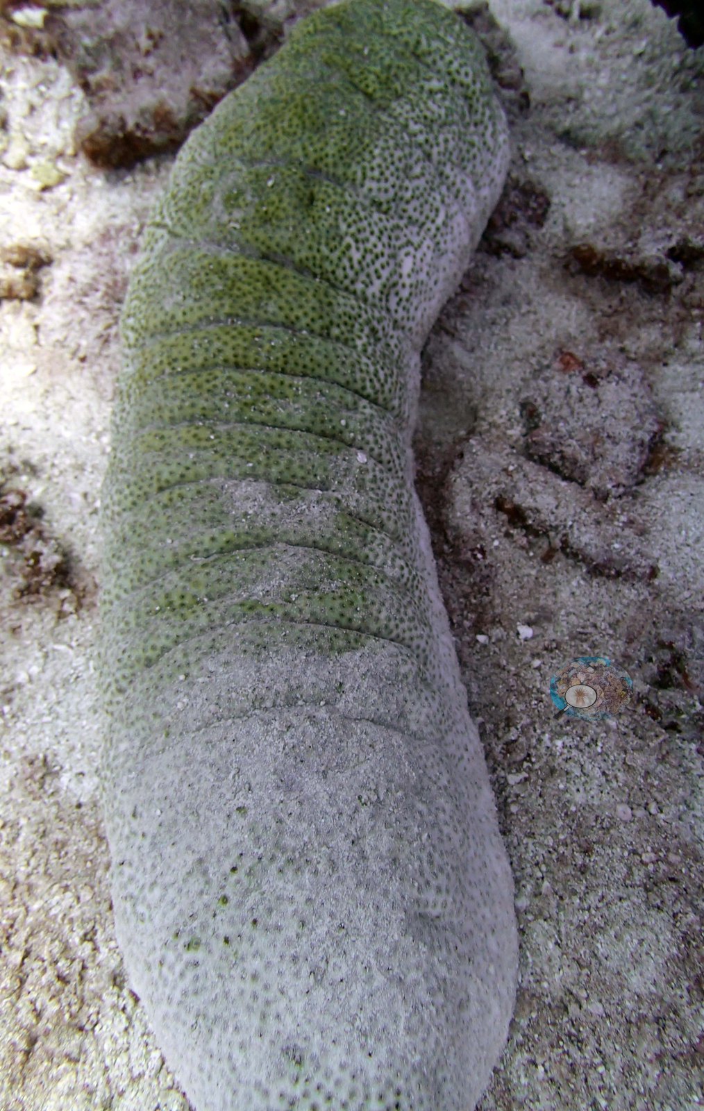
Sergeant majors, damselfishes, and dark planktivorous damselfishes work the reef top in Image 2, Image 8, Image 13, Image 19, Image 6, Image 5, Image 10, and Image 1, with surgeonfish over the crest in Image 5 and Image 1. The set's set-piece animals are a lionfish (Anderson's identification) hovering over turf pavement in Image 12, a black moray eel (also a field call) emerging from the rock in Image 3, a giant clam wedged under a ledge in Image 4, its mantle a deep violet-blue with fine pale reticulation and a meandroid brain coral directly above it, and four separate sea cucumber frames (e.g., Image 11, Image 20, Image 14, and Image 21) — a pale greenish holothurian over turf and rubble, a green-gray animal photographed twice on open sand, and a strikingly reticulated black-and-white one.
Comparisons with other data
Apart from the Living Oceans Foundation survey shown here, we found no other surveys at this site as of 2026. If you would like to share yours, please email us.
Other notes
Photo review of 21 habitat frames plus 17 sampled-colony close-ups (Ha'apai, 20 Sep 2013). The account on this page is written from the habitat frames only; the colony images are treated purely as a record of what was sampled. Three Pocillopora colonies were sampled at this site (colonies 52, 53, and 54), all three identified in the field by Anderson as P. damicornis; the 17 close-ups are repeat macro, tag and setting shots of only those three animals, and the sample sheet notes a blue fluorescent hue on colony 52 and dark pigmentation on colony 54. Those images describe the colonies, not the reef.
Survey team's site notes: The dense Acropora-dominated community at the mound edges makes up 50-80% cover, with 5.0–20% cover of soft corals. The mounds slope steeply to 10-15 m with large columnar Favites stelligera, thick-branched and digitate acroporids, Pocillopora, Coscinaraea, Platygyra, plates of Echinopora and Echinophyllia, and other species on the vertical or near vertical sides. The mounds have an undercut ledge at the base with some Pachyseris, Leptoseris, and other species, but cover is 5.0-10% and Peyssonnelia carpets much of this.
CV model comparison
More info
The photo row below is a methods comparison only: it is never averaged with the transect and never used as the headline. It compares site means only: the photos come from the same survey dive as the transect but not from the same points.| Method | Hard coral cover (%) | Photos (n) ± SE |
|---|---|---|
| Transect mean (all transects) | 31.2 | |
| CoralSCOP unedited | 31.9* | n = 17 · SE 2.4 |
| Claude (edited photos) | 46.3* | n = 17 · SE 6.0 |
The two computer-vision methods disagree by 14.4 pp (31.9–46.3%) and read 0.7–15.1 pp above the in-water transect (31.2%); the headline is the in-water transect because a diver transect is independent of the photographs.
*Based on only 17 reef-habitat photos; this estimate is less certain.
See a more detailed, stand-alone version of this table.
Data & links
- Download benthic survey data (CSV) ↗
- Download all LOF-GRE data (933 sites) ↗
- Photo portfolio ↗
- Coral Reef Diagnostics region page ↗
All images from Coral Reef Diagnostics. Data are from the Khaled bin Sultan Living Oceans Foundation Global Reef Expedition and Coral Reef Diagnostics.
© Coral Reef Diagnostics.
References
- Mayfield AB, Dempsey AC (2025). Machine-learning algorithms for identifying climate-resilient corals in the Republic of Palau. Discover Oceans 2:45. PDF
- Bruckner AW (2014). Global Reef Expedition: Kingdom of Tonga. Field Report. Khaled bin Sultan Living Oceans Foundation, Landover, MD. 28 pp. PDF