
Part of the regional summaries: Tonga - Ha'apai and Tonga
More info
Southern Tonga (NOAA CRW virtual station)A lagoonal fringing reef whose 10-25 m framework is a maze of large, eroded coral skeletons that died 5-10 years earlier and have been heavily recolonized by new corals. A minor crown-of-thorns outbreak was underway, the starfish hidden in holes with 5-10 freshly eaten corals around each den. Surveyed on the Living Oceans Foundation's Global Reef Expedition.
Ko ha hakau matafonua ʻi he namo (lagoonal fringing reef) ʻoku hangē hono fakavaʻe ʻi he 10-25 m ha fakatēvolo (maze) ʻo e ngaahi ivi feo lalahi kuo ʻauha, naʻe mate ʻi he taʻu ʻe 5-10 kimuʻa pea kuo toe nofoʻi lahi ʻe he ngaahi feo foʻou. Naʻe lolotonga ʻi ai ha kiʻi tupu lahi (outbreak) siʻi ʻo e ʻalamea (crown-of-thorns), ʻoku toitoi ʻa e ʻalamea ʻi he ngaahi ava pea ʻoku ʻi ai ha feo ʻe 5-10 naʻe toki kai takatakai ʻi he ʻapi taki taha.
AI translation of this summary; the English is authoritative. (low confidence)
CTD-cast midpoint of 25.1–25.9°C
More info
Anderson's dive computer read 22.2°C (a single reading, probably a dive mean).Two other CRD dive sites with their own pages within 5 km shown in orange — click a marker to open its page.
6 of the 7 photographs on this page are shown beside the text that discusses them under "Site description" below.
Site description
General benthic features
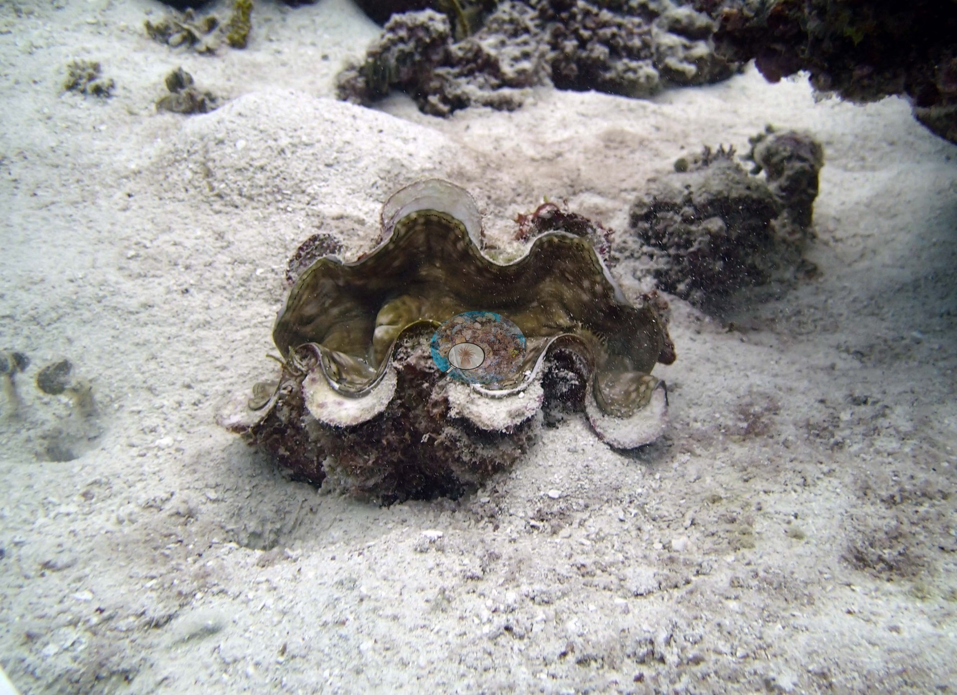
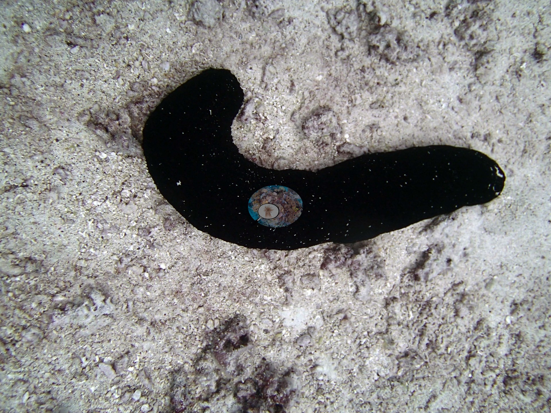
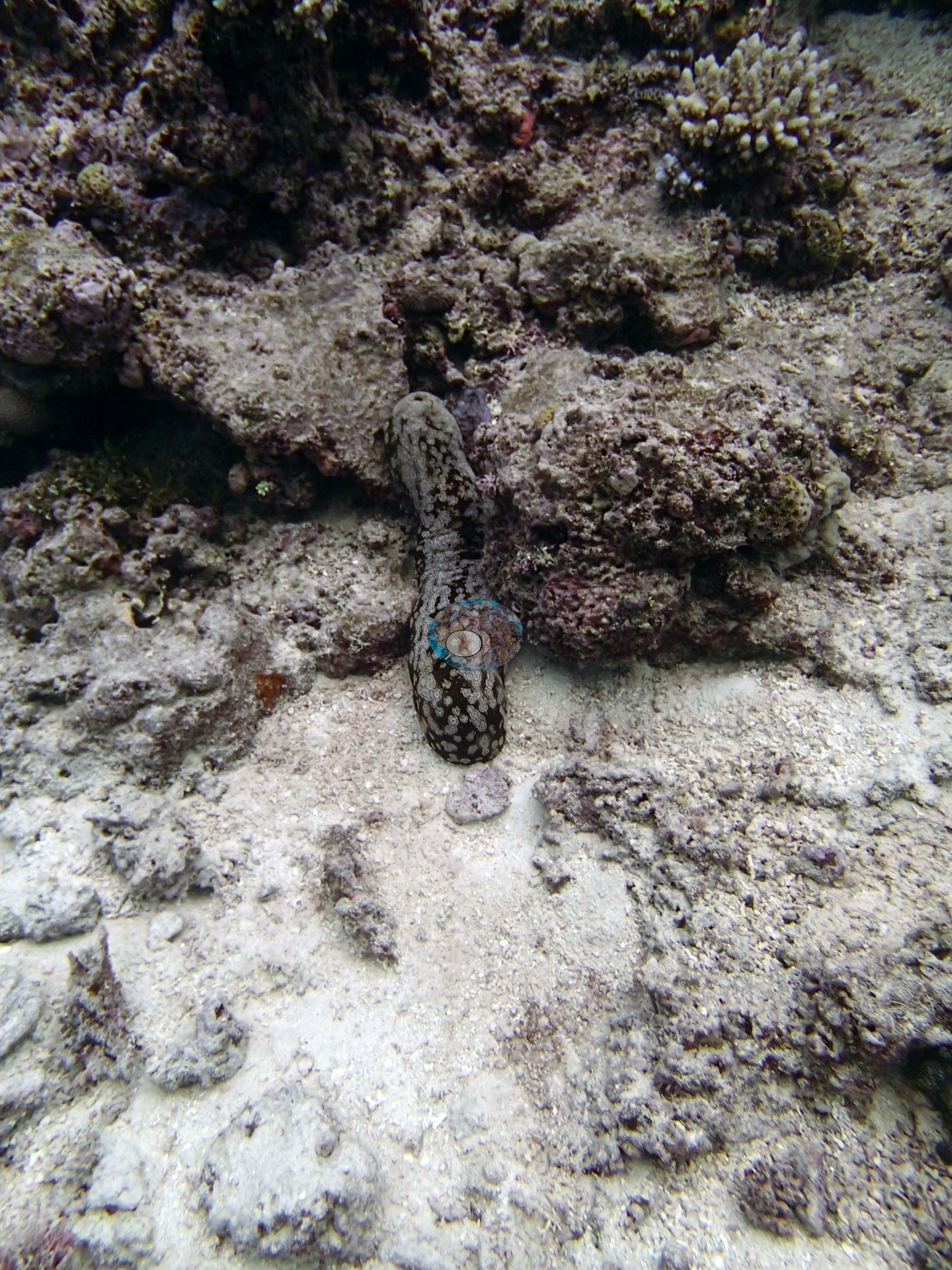
Almost everything known about this site's habitat comes from the in-water survey record rather than from photographs: the first three of the seven photographs here are all subject shots taken over open sand (the other four are close-ups of the sampled colonies 50 and 51) — a giant clam with fluted mantle open on white sand, a black holothurian on coarse sand, and a spotted holothurian at the foot of a low rubble bank with a small branching colony above it (e.g., Image 1, Image 2, Image 3).
They show clean carbonate sand, coarse rubble, and invertebrates on the sand flats between reef structures, and they settle nothing about the reef itself.
Coral cover
- Reference: Khaled bin Sultan Living Oceans Foundation, Global Reef Expedition (in situ transect)
- Benthic notes give 2.0–5.0% Tydemania, 30-60% turf, and 30-40% crustose coralline algae, with soft corals rare (2.0–5.0%) except on the shallow reef above 8 m.
- Coral cover: 31%. Live hard coral measured on in situ benthic transects during the Global Reef Expedition (LOF-GRE in situ transects; mean of all of this station's own transects).
- Transect data are this site's authoritative cover value; no photograph overrides it.
- Transect mean 31 ± 4.3% SE (n = 5 transects; Living Oceans Foundation per-transect benthic data); the headline above is this all-transect mean.
Stressors
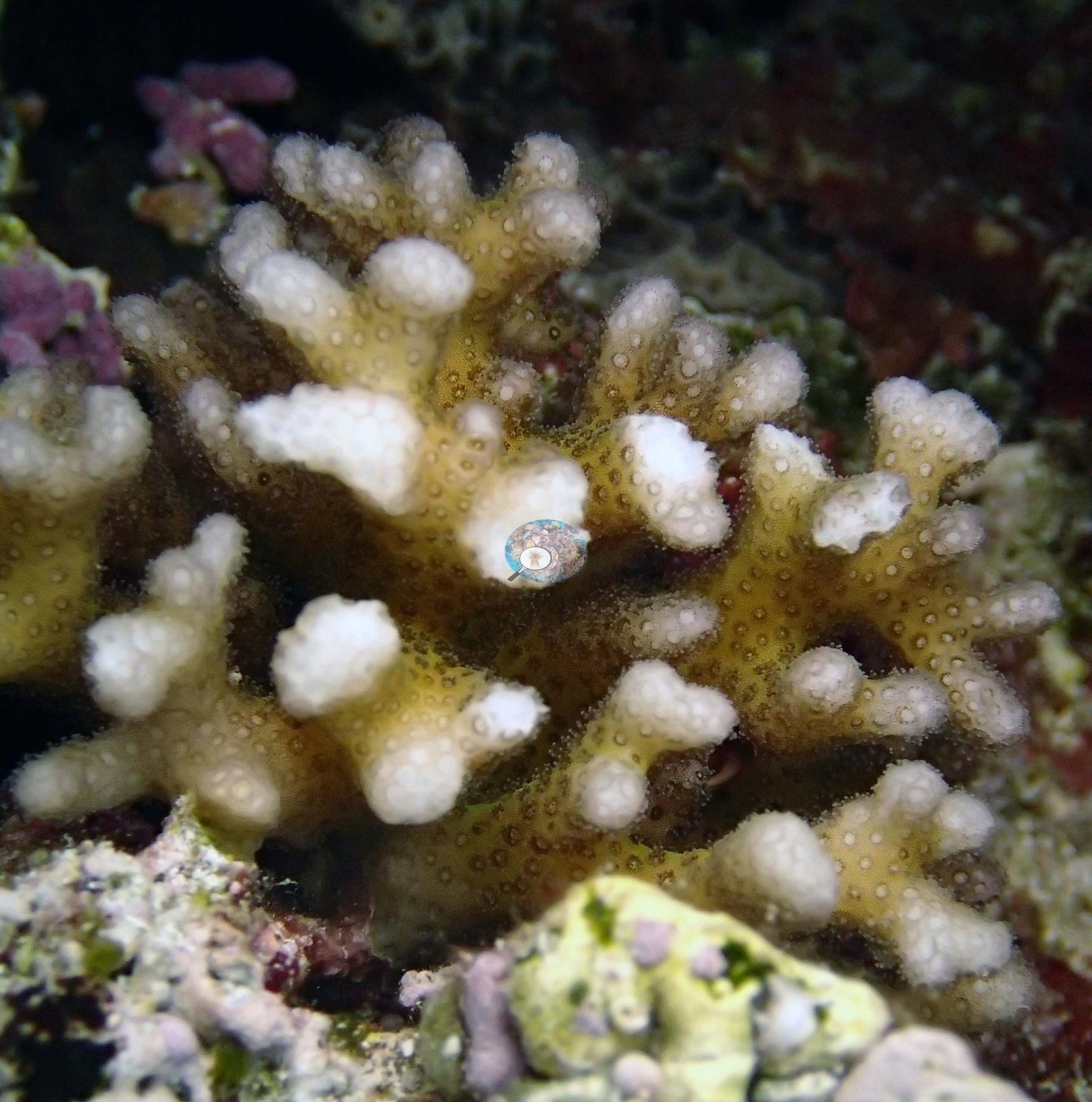
Anderson's sampling sheet for this dive records colony 50 as 80% bleached, unhealthy, and possibly dead, and colonies 49 and 51 as healthy (0% bleached); in the close-ups (e.g., Image 5, Image 6, Image 7) colony 50 is cream-white over all its branches.
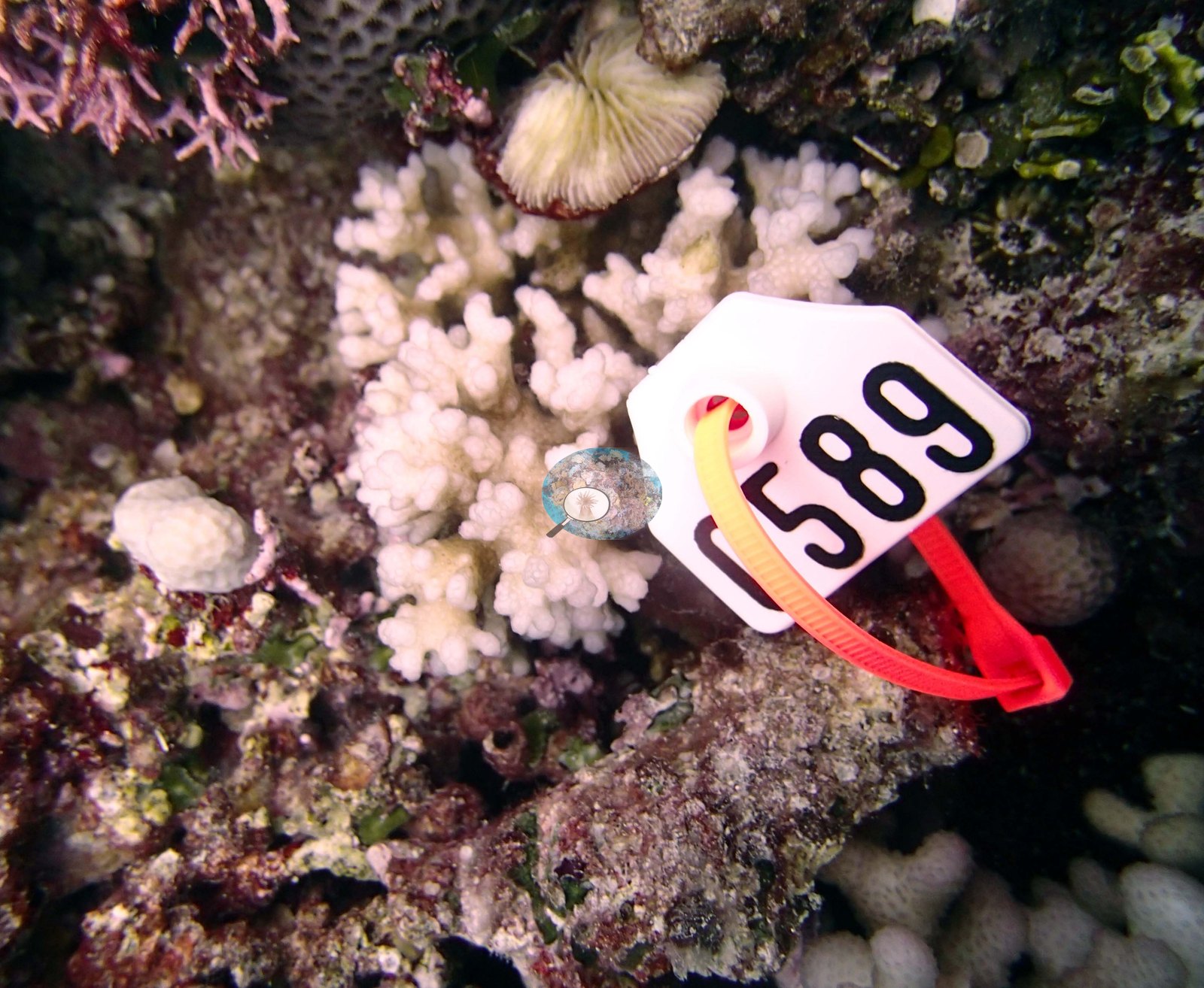
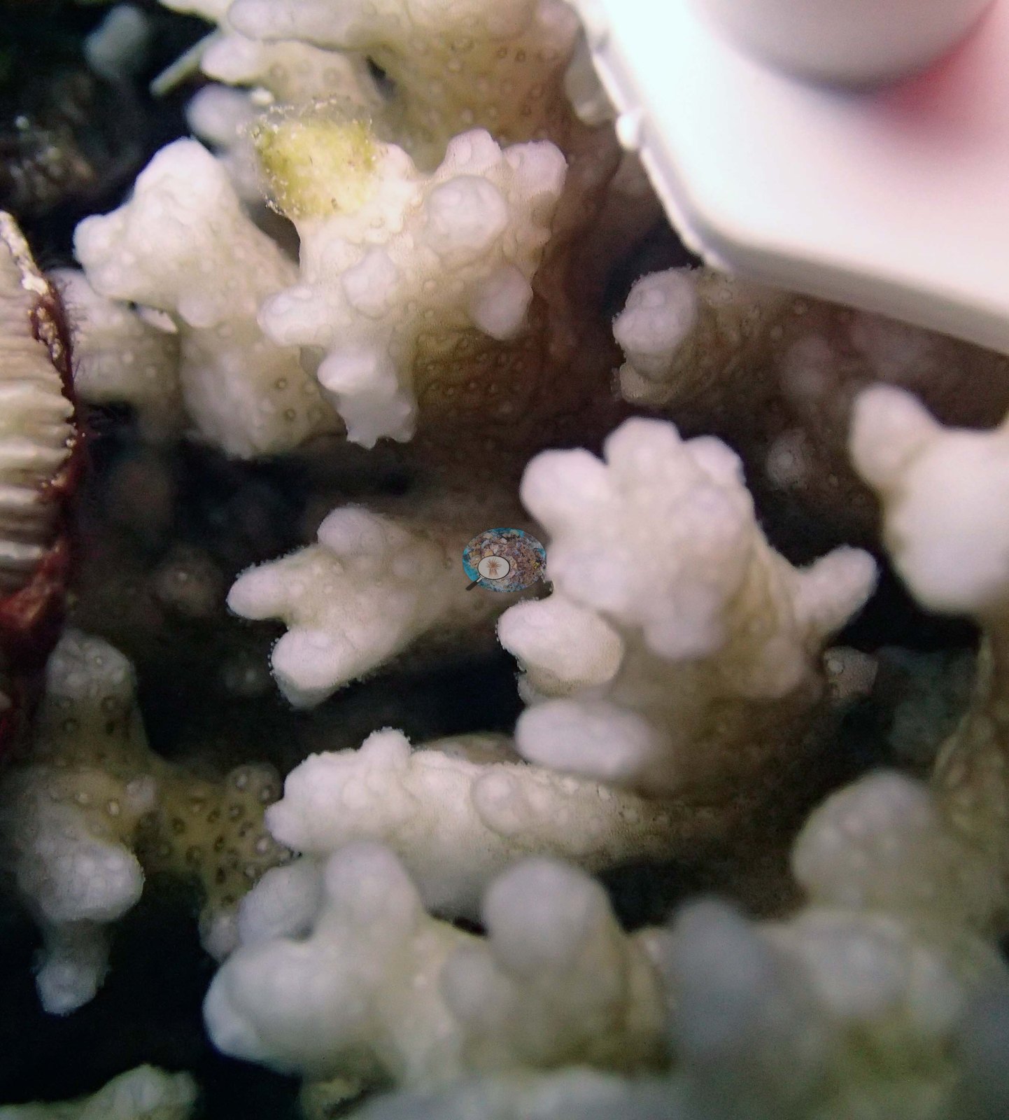
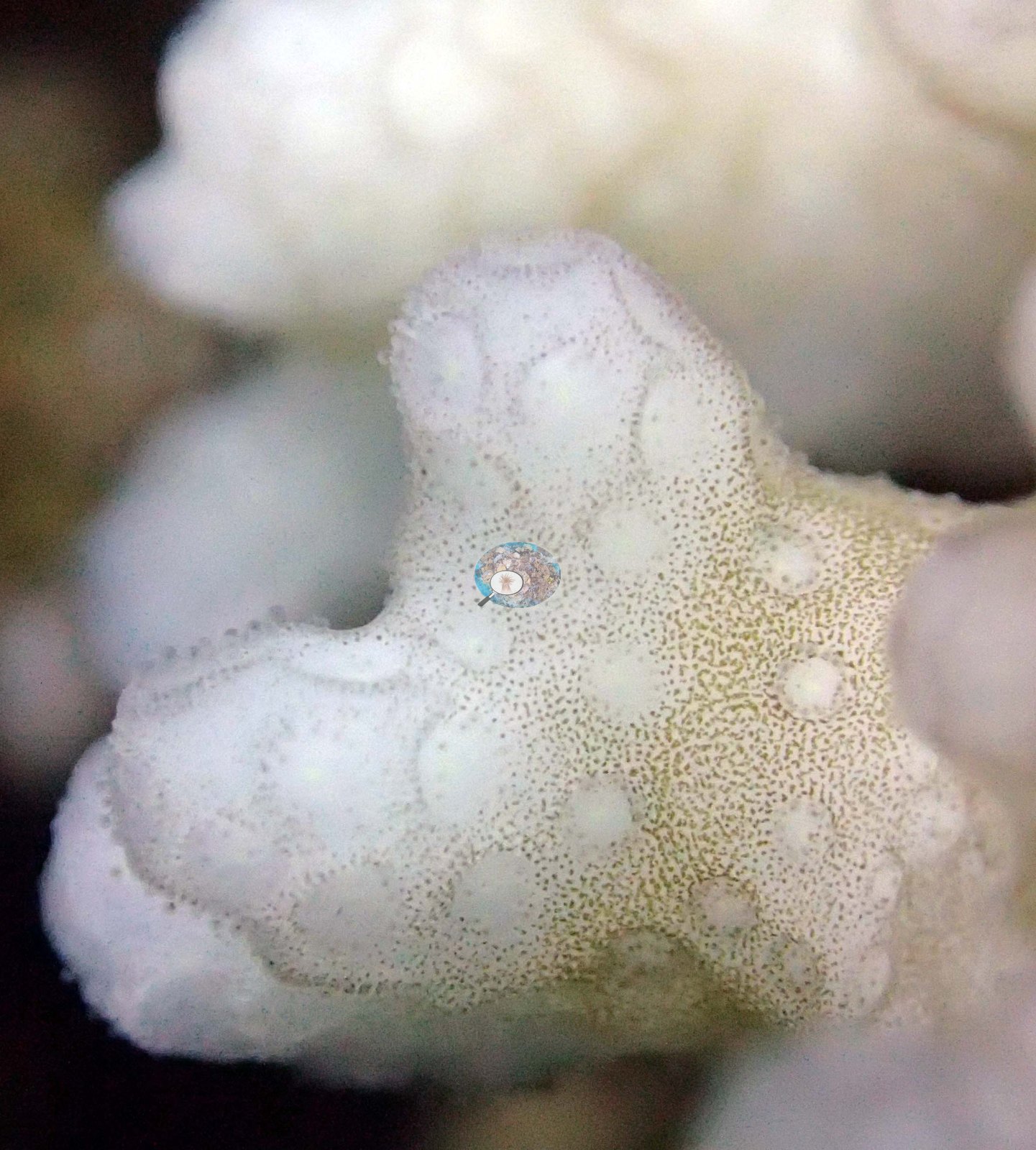
The 2013 survey notes for this site record a minor crown-of-thorns outbreak: seven starfish collected and five more seen, each den ringed by 5-10 recently eaten corals (Khaled bin Sultan Living Oceans Foundation expedition site notes, 2013; regional summary in Bruckner 2014). The Living Oceans Foundation transects here recorded 1.1% cyanobacteria and no recently dead coral.
Comparisons with other data
From the survey record: the shallow area consists of large mounds running from 3-4 m down to about 14 m and sloping steeply into a sand-and-rubble field, with a second set of very wide spurs extending seaward, sloping gently to 25 m and then dropping steeply to 35 m into sand; the sand lanes between the spurs sit 0.5 m below the framework in the shallows and 1-2 m below it deeper. The shallow reef is dominated by spires of Isopora, digitate, small tabular, and thickly branched acroporids, Pocillopora, small to medium faviids, and Lobophyllia, with several 2-3 m Diploastrea at the bases of the shoreward mounds. Between 10 and 25 m the framework is very complex, 60-150 cm of microrelief built from large heavily eroded dead massives, dead table acroporids, and fused staghorn skeletons riddled with crevices and holes; these appear to have died 5-10 years before the survey and are now recolonized by many species of massive, plating, and branching corals, most massives 2-15 cm, with plates on the sides of and between the upright framework and large stands of bottlebrush acroporids living only in their top 10-15 cm. The site was carrying a minor crown-of-thorns outbreak at the time: starfish in small groups, most hidden deep in holes and beneath the framework, each with 5-10 recently eaten corals near its den and many corals showing complete transitional mortality — acroporids taken off the top of the reef and encrusting and massive corals taken in the depressions near the dens; 7 were collected and 5 more seen. Coral Health Index 3.20/5 (Mayfield & Dempsey 2025, Discover Oceans formula). Typical recent thermal stress: mean annual maximum of 8.1 degree heating weeks (2021-2025, NOAA CRW; Southern Tonga virtual station).
Three Pocillopora colonies were tissue-sampled at TOHA26 — colonies 49, 50, and 51, all labeled P. damicornis in Anderson's own field archive, photographed.
Dive record
TOHA26 is a lagoonal fringing reef in Ha'apai, surveyed on 19 September 2013 during the Khaled bin Sultan Living Oceans Foundation Global Reef Expedition.
Data & links
- Download benthic survey data (CSV) ↗
- Download all LOF-GRE data (933 sites) ↗
- Photo portfolio ↗
- Coral Reef Diagnostics region page ↗
All images from Coral Reef Diagnostics. Data are from the Khaled bin Sultan Living Oceans Foundation Global Reef Expedition and Coral Reef Diagnostics.
 © Coral Reef Diagnostics.
References
- Bruckner AW (2014). Global Reef Expedition: Kingdom of Tonga. Field Report. Khaled bin Sultan Living Oceans Foundation, Landover, MD. 28 pp. PDF
- Mayfield AB, Dempsey AC (2025). Machine-learning algorithms for identifying climate-resilient corals in the Republic of Palau. Discover Oceans 2:45. PDF