
Part of the regional summaries: Tonga - Ha'apai and Tonga
More info
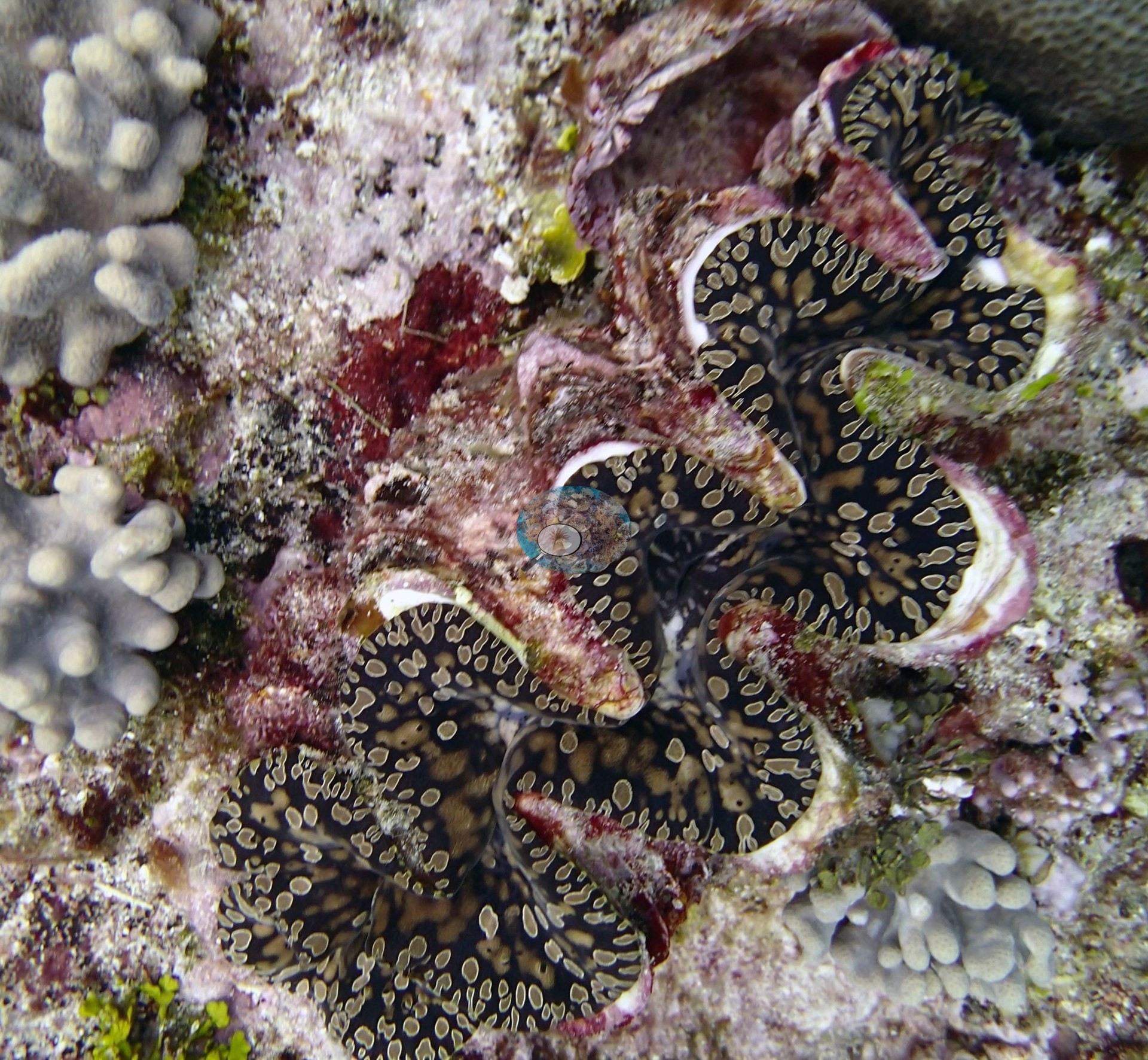
Southern Tonga (NOAA CRW virtual station)Cover here is 8.6%: a cave between undercut walls of blackened rock opening onto white sand, with only small, low-lying corals on the coralline-crusted pavement. A giant clam with an intricately gold-spotted black mantle was the standout, and none of the five photographs shows bleaching or disease. Surveyed on the Living Oceans Foundation's Global Reef Expedition.
Ko e ʻufiʻufi heni ko e 8.6%: ko ha ʻana ʻi he vahaʻa ʻo e ngaahi holisi kuo keli ʻi lalo ʻo e maka ʻuliʻuli ʻoku hū atu ki he ʻoneʻone hinehina, mo e ngaahi kiʻi feo māʻulalo pē ʻi he tuʻunga kuo ʻufiʻufi ʻe he limu feo (coralline-crusted pavement). Ko e meʻa mahuʻinga taha ko ha vāsuva (giant clam) ʻoku ʻuliʻuli hono kili (mantle) mo e ngaahi pulepule koula fakaʻofoʻofa, pea ʻoku ʻikai hā ha hinehina (bleaching) pe mahaki ʻi ha taha ʻo e ngaahi tā (photographs) ʻe nima.
AI translation of this summary; the English is authoritative. (low confidence)
CTD-cast midpoint of 24.6–24.7°C
More info
Anderson's dive computer read 22.8°C (a single reading, probably a dive mean).4 of the 5 photographs on this page are shown beside the text that discusses them under "Site description" below.
Site description
Setting
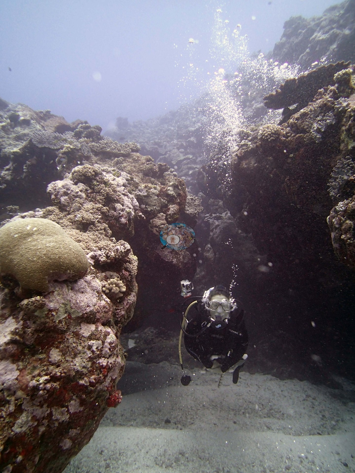
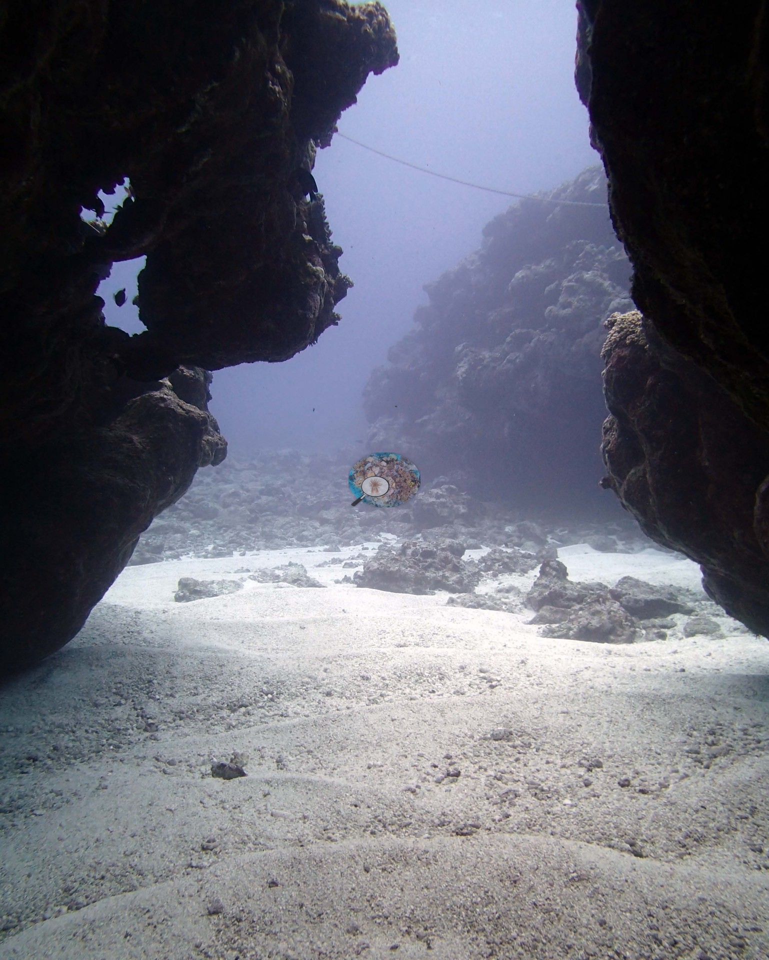
The two habitat frames look out of a cave between undercut walls of blackened coral rock onto clean white carbonate sand and scattered rubble; live coral is almost absent from both, the water is hazy gray-blue rather than clear blue, and one frame includes a diver with a camera tray finning out of the cave while a single pale tan massive dome sits on the ledge above (e.g., Image 3, Image 4).
General benthic features
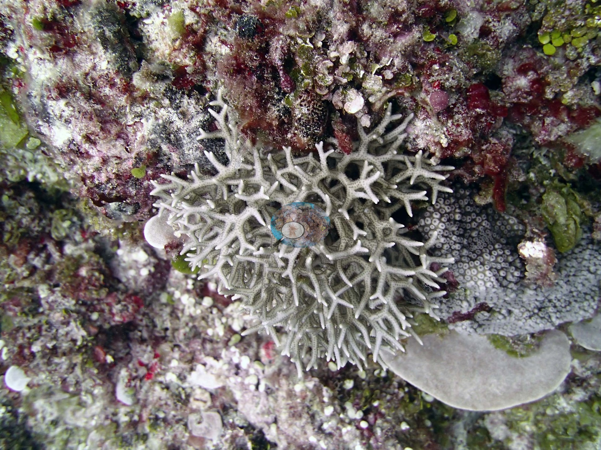
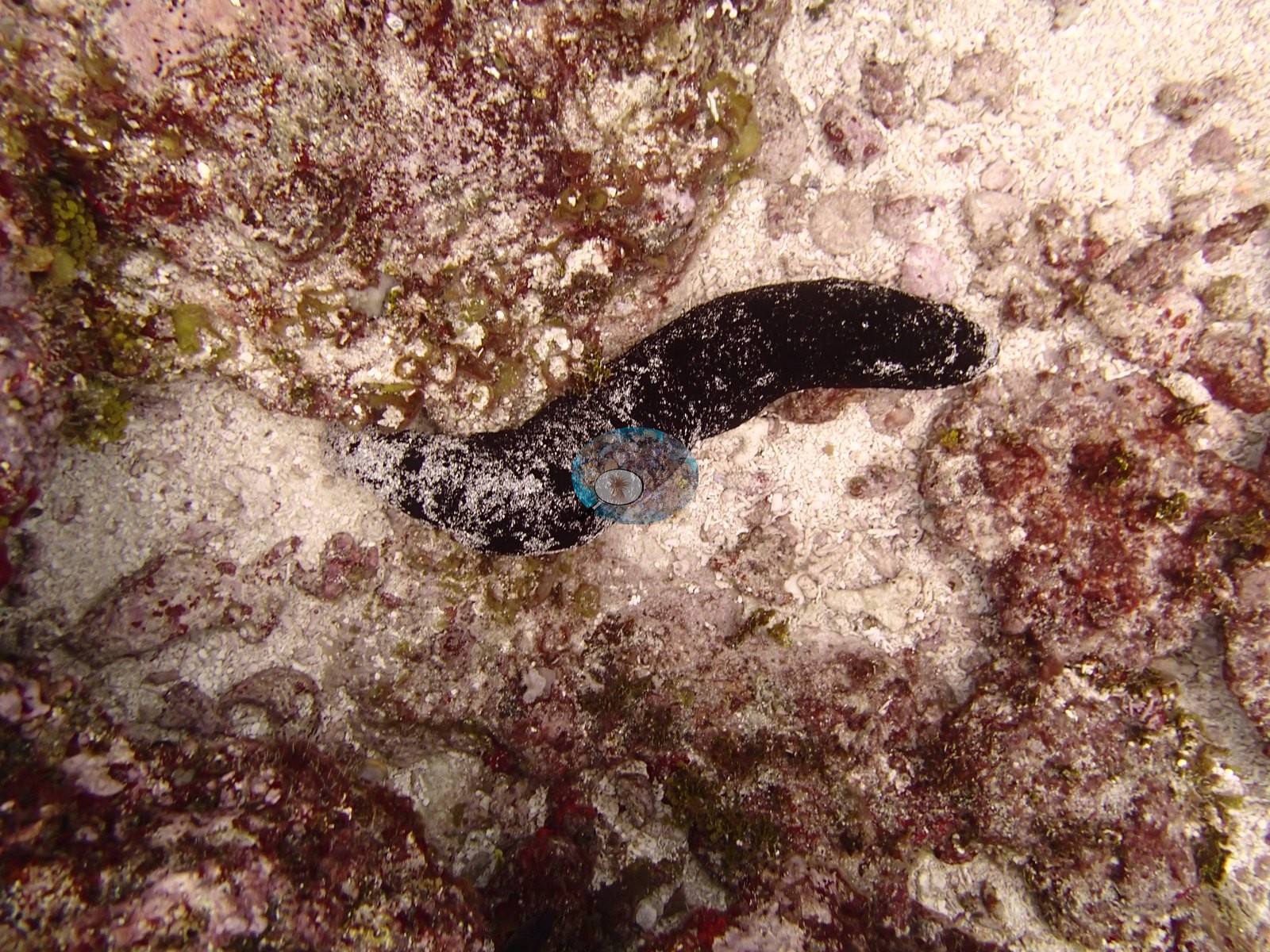
The other cave frame is essentially a study in bare substrate — dark eroded walls, a rippled sand floor, and a distant rubble slope — with a thin taut line crossing the top of the frame that appears man-made (fishing line or survey line; not identifiable) (e.g., Image 4). The two close-range frames fill in the substrate detail the wide views lack: pavement thickly encrusted in crimson and pink crustose coralline algae with yellow-green turf, small green Halimeda segments scattered across it, one small pale gray finely branched colony about 30 cm across (Anderson's Seriatopora hystrix, in its natural color), a small gray colony with widely spaced round corallites, and small pale digitate and knobby colonies — almost all of it low-lying and under 20-30 cm, exactly the size distribution the survey recorded (e.g., Image 1, Image 2).
Coral cover
- Reference: Khaled bin Sultan Living Oceans Foundation, Global Reef Expedition (in situ transect)
- This is a low-cover site (8.6%) and the photographs are consistent with that.
- Coral cover 8.6%, from LOF-GRE in situ transects (the mean of all of this station's own transects in the expedition's per-transect benthic data) — a diver transect measurement, not a photographic or computer vision estimate.
- Transect mean 8.6 ± 2.6% SE (n = 6 transects; Living Oceans Foundation per-transect benthic data); the headline above is this all-transect mean.
Stressors
No bleaching or disease is visible. The 2013 survey notes for this site record one crown-of-thorns starfish, one Culcita cushion star, and high numbers of snails on Isopora, Montipora, and Acropora (Khaled bin Sultan Living Oceans Foundation expedition site notes, 2013; regional summary in Bruckner 2014). The Living Oceans Foundation transects here recorded 0.5% cyanobacteria and no recently dead coral.
Fish and other fauna
The second close frame is a striking portrait of a giant clam (Tridacna) with an intricately gold-spotted black mantle wedged into that coralline pavement (e.g., Image 2).
Comparisons with other data
Apart from the Living Oceans Foundation survey shown here, we found no other surveys at this site as of 2026. If you would like to share yours, please email us.
Other notes
Survey team's site notes: From 3-9 m there is very little relief (10-20 cm) or corals (under 1.0-2.0% cover). At 8-15 m cover of Microdictyon ranges from 10-30% and Halimeda is 10-20% with scattered patches of cyanobacteria. The reef slopes very gradually to 10-12 m, then there is a second terrace sloping up slightly then gradually down to 12-15 m before dropping more steeply. The top surface of the deeper terrace is largely flat with some encrusting and submassive corals and large areas of thick turf with damselfish. The deeper mounds are also low relief; these start at about 15 m and slope gradually seaward to 25 m, then drop more steeply. On these deeper mounds the dominant coral is the gray thin foliaceous leather coral. Throughout the reef are small patches of 5.0-10% cover living coral mixed with 5.0–10% cover soft corals. Most corals are low-relief and small (5-15 cm) with isolated larger Montipora, Isopora plates, Submassive Porites, and Astreopora.
Data & links
- Download benthic survey data (CSV) ↗
- Download all LOF-GRE data (933 sites) ↗
- Photo portfolio ↗
- Coral Reef Diagnostics region page ↗
All images from Coral Reef Diagnostics. Data are from the Khaled bin Sultan Living Oceans Foundation Global Reef Expedition and Coral Reef Diagnostics.
 © Coral Reef Diagnostics.