
Part of the regional summaries: Tonga - Ha'apai and Tonga
More info
Southern Tonga (NOAA CRW virtual station)An uplifted coral island whose shore drops to a scoured terrace scattered with 3-5 m boulders fallen from land, nearly bare near shore but carrying soft corals and thick-branched Isopora toward the high-relief edge and wall. This was the first reef of the trip with large mats of the encrusting soft coral Briareum spreading over the substrate and overgrowing corals. Surveyed on the Living Oceans Foundation's Global Reef Expedition.
Ko ha motu feo kuo hiki hake (uplifted coral island) ʻoku tō hifo hono matātahi ki ha tuʻunga kuo tafiʻi ʻoku mafola ai ʻa e ngaahi maka lalahi ʻo e 3-5 m naʻe tō mai mei he fonua, ʻoku meimei tukuʻau ʻi he ofi ki he matātahi ka ʻoku ʻi ai ʻa e feo molū (soft corals) mo e Isopora vaʻa matolu ʻo ofi ki he tafaʻaki māʻolunga mo e holisi (wall). Ko e hakau ʻuluaki ʻeni ʻo e folau naʻe ʻi ai ʻa e ngaahi falikiliki lalahi ʻo e feo molū pipiki (encrusting soft coral) Briareum ʻoku mafola ʻi he takele pea tupu ʻi ʻolunga ʻi he ngaahi feo.
AI translation of this summary; the English is authoritative. (low confidence)
CTD-cast midpoint of 24.4–25.7°C
10 of the 13 photographs on this page are shown beside the text that discusses them under "Site description" below.
Site description
Setting
Photo review of 21 habitat frames (Ha'apai, 18 Sep 2013); 13 of them are on this page. Four of the 21 are topside frames (not shown), and all show the same shoreline — a low uplifted limestone island, palms and scrub on top, its seaward face deeply undercut into notches and a large sea cave, with dark blue water running straight up to the rock. Outer fore reef, windward side (the station lies about 70 m off the island's east-southeast-facing shore, open to the prevailing southeast trade winds). Uplifted coral island slopes down to 3-5 m vertically, then extends out about 100 m on a terrace that is 5-7 m deep.
General benthic features
Five more are single-subject invertebrate portraits (e.g., Image 3), leaving about twelve frames with real site-scale content.
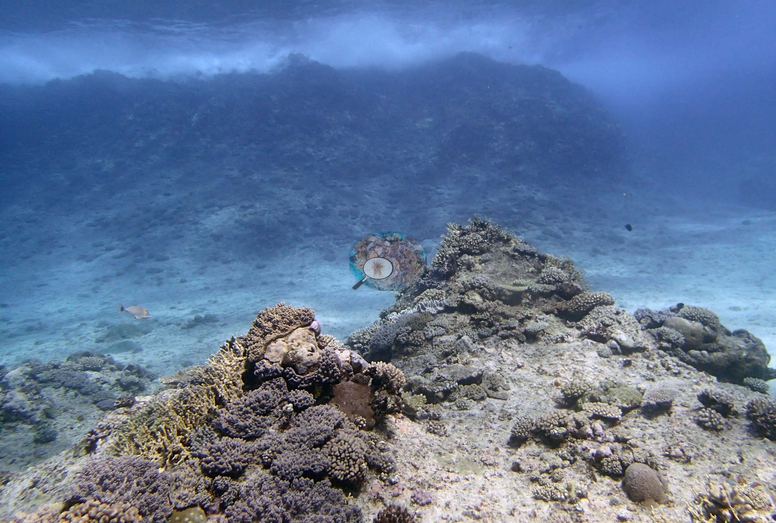
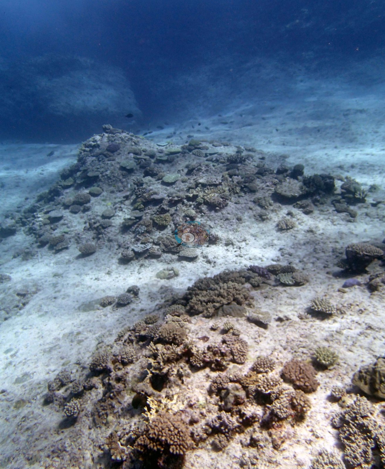
Those twelve divide cleanly, and the division matches the survey's account of a shallow scoured terrace giving way to a higher-relief edge. The terrace frames (not shown; one shows two divers at work over the bottom) show pale, scoured hardground and sand with only scattered low colonies on it: tan and dusty-pink knobby pocilloporid clumps, small digitate Acropora, small encrusting and submassive patches, and bare rock and sediment between them. One of them is mostly open scoured substrate with a low rubbly mound in the middle distance. Image 5 is distinctive: a near-vertical view of pavement carpeted in small ruffled, cabbage-like yellow-green octocorals growing in dozens of separate rosettes, interrupted by broad dark purple-brown encrusting mats that sheet directly over the substrate.
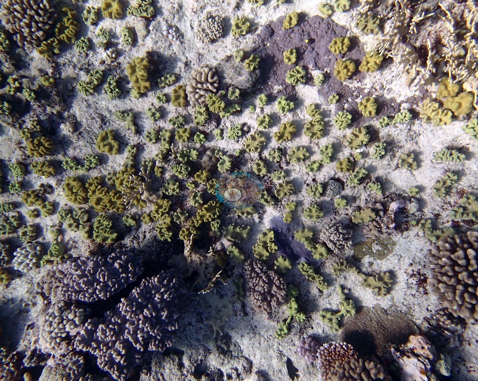
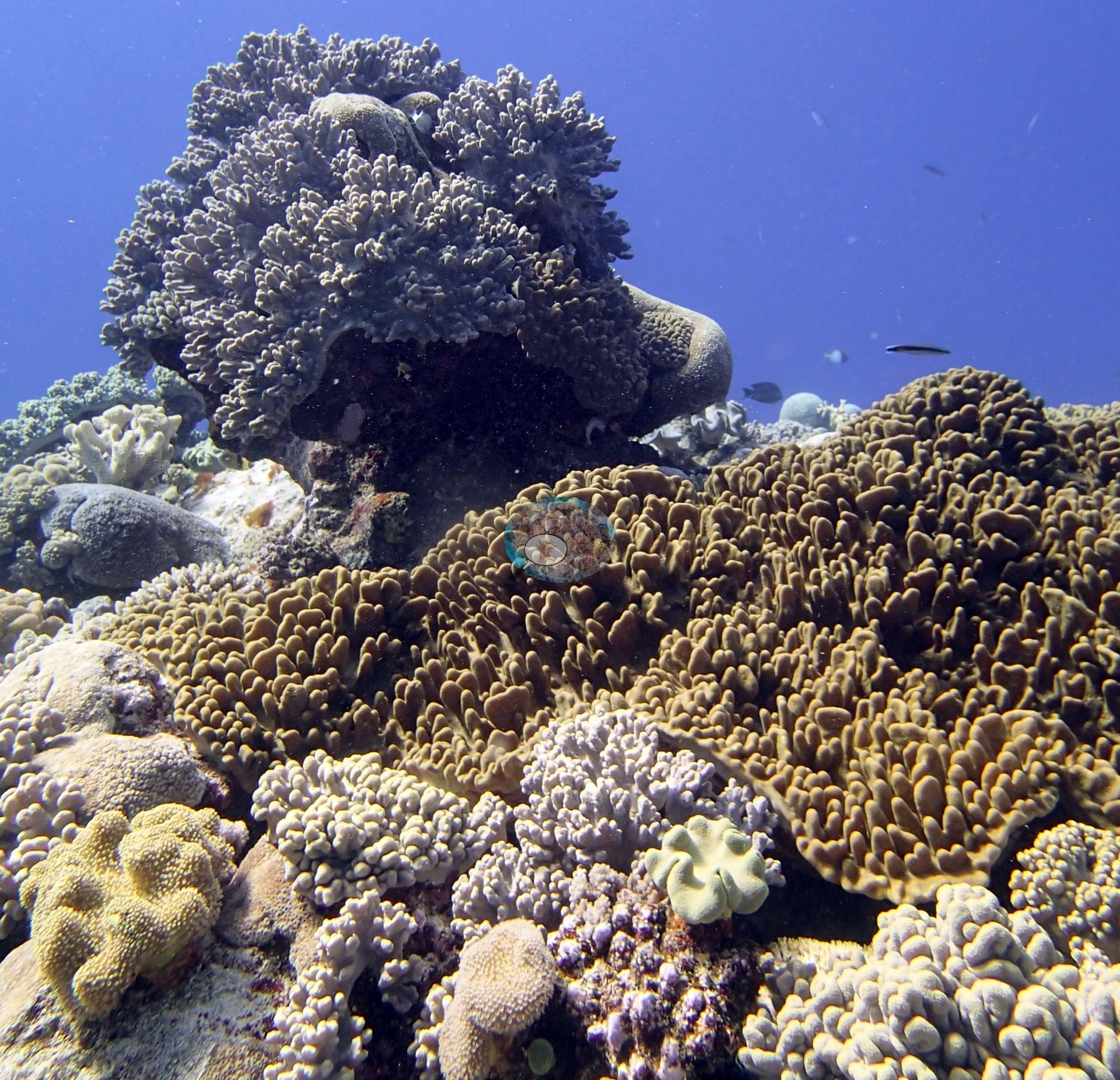
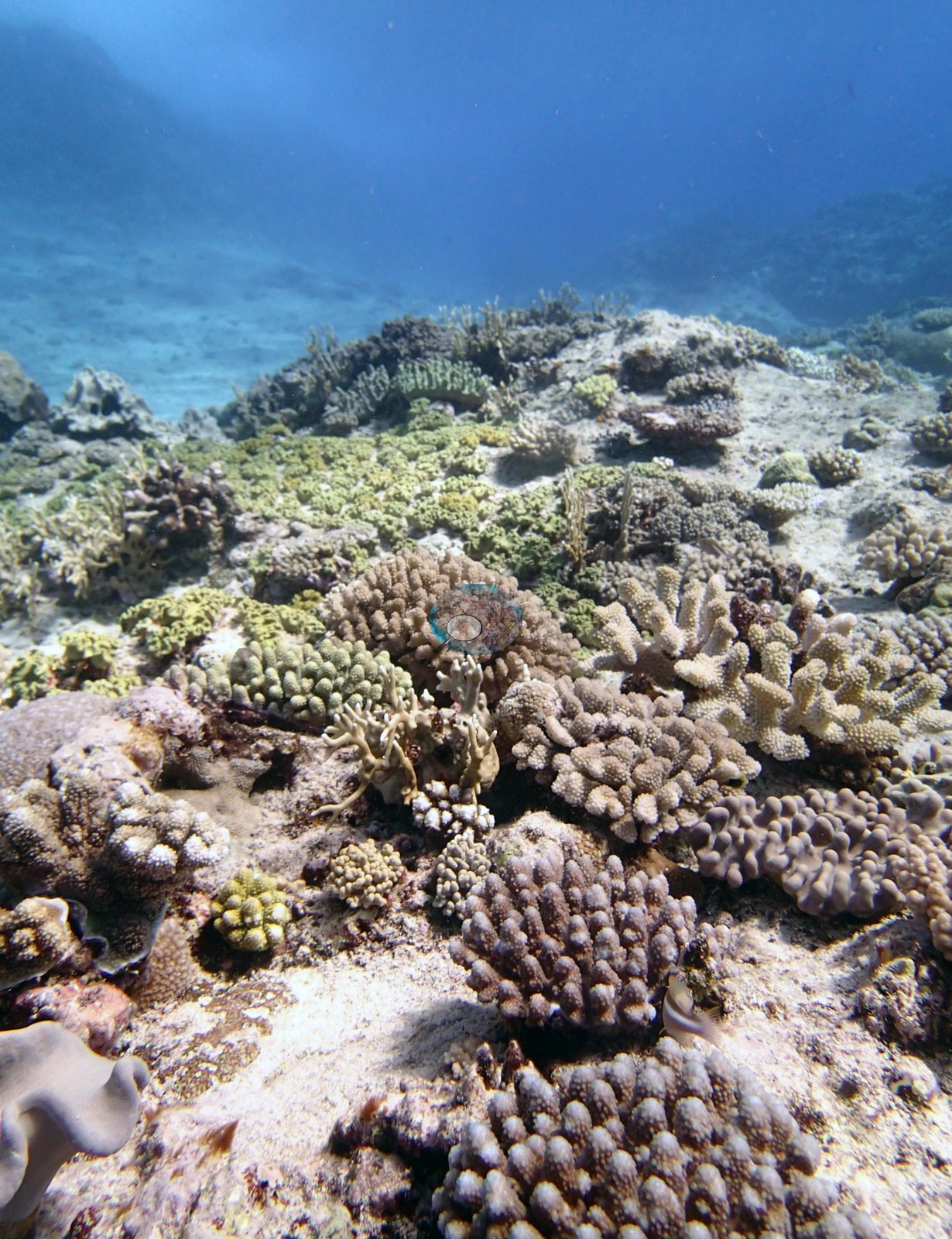
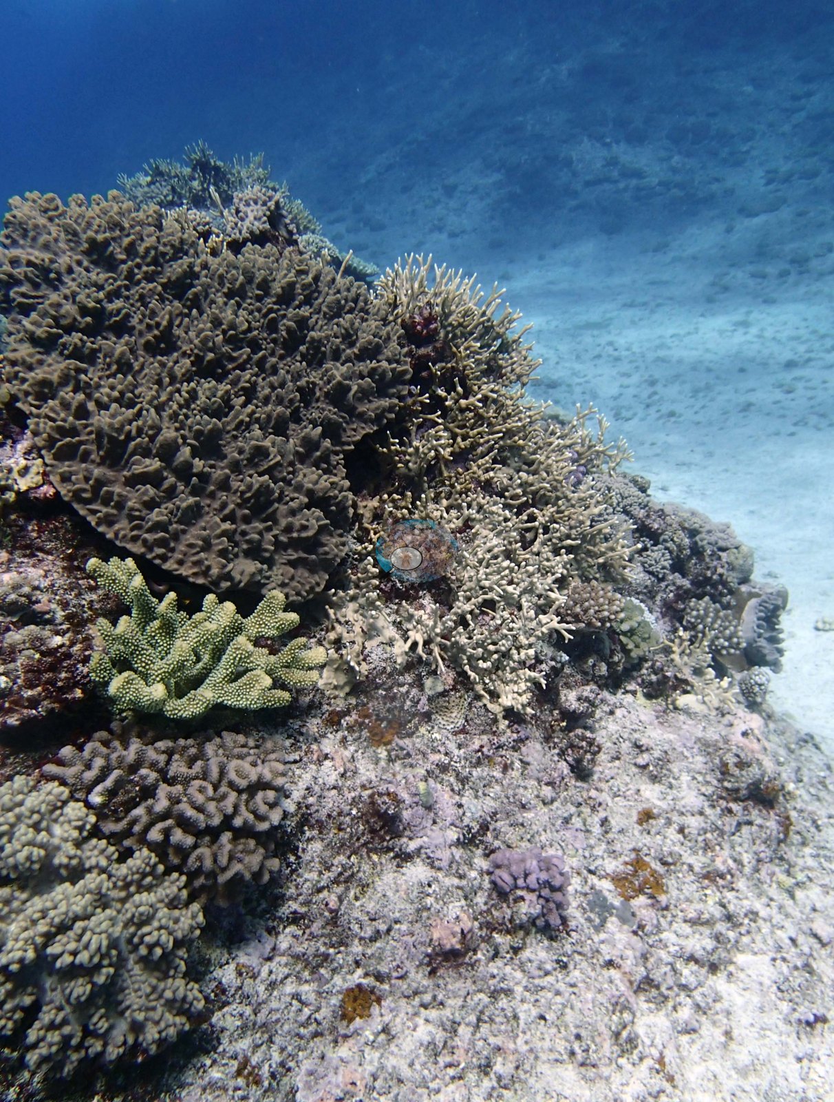
That soft-coral-and-encrusting-mat carpet is the photographic counterpart of the octocoral and encrusting-mat cover the survey recorded here. The edge and build-up frames are a different reef: Image 2 and Image 1 show high-relief, close-packed community — extensive golden-brown shingled and foliose plating coral sheeting across the lower half of Image 1, a large gray lobed leather coral perched on top of a dark mass above it, plus mustard-yellow leather corals, pale blue-lavender branching recruits, brain corals, and mixed small massives.
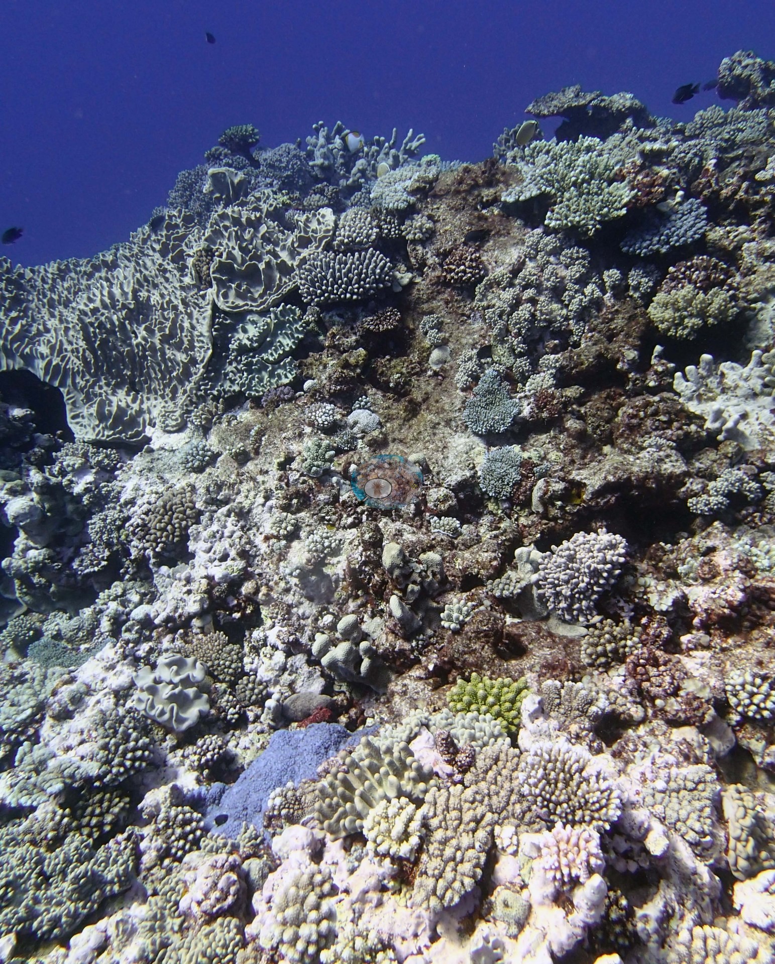
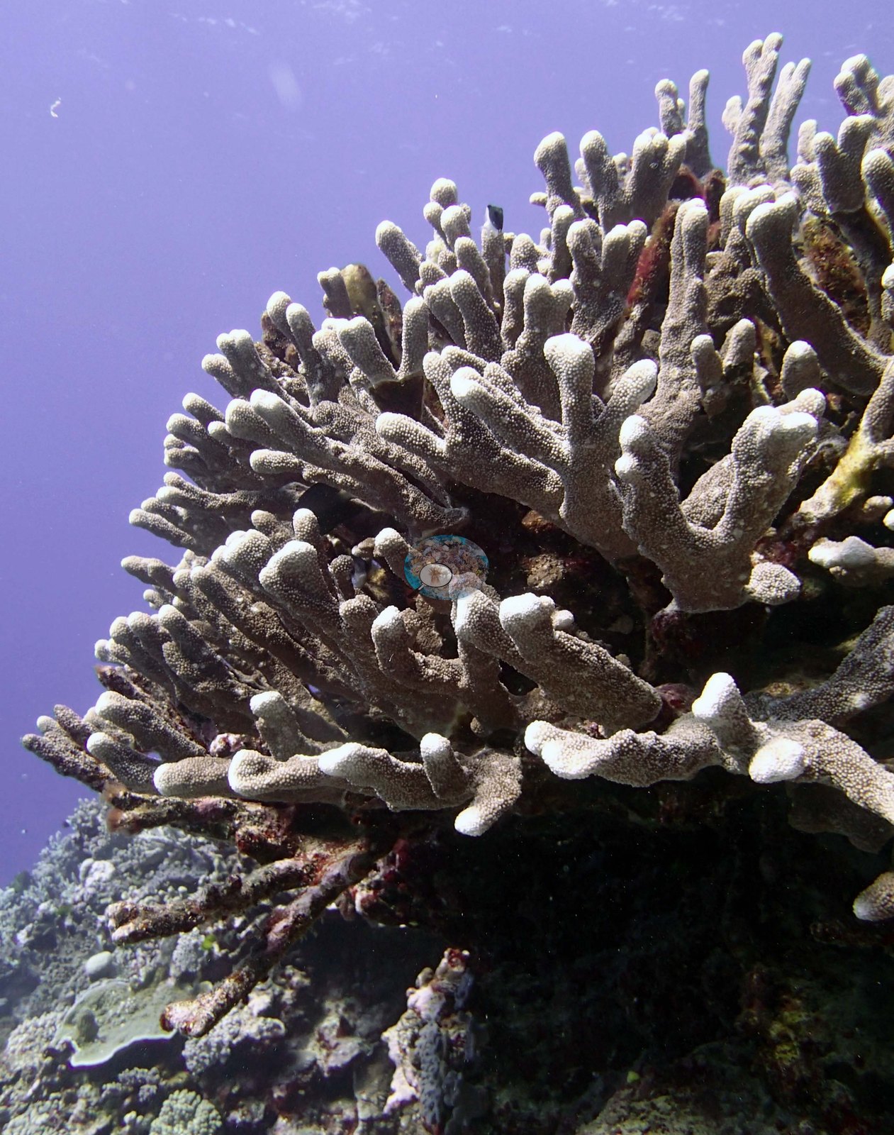
Image 7 is a portrait of a single thick-branched, blunt-tipped pale colony against open water, and Image 6 shows a build-up of plating and foliose colonies with green digitate branches over sand.
The other structural signature of this site is large massives. Image 9 and Image 10 are frame-filling tan-to-cream nodular domes with a diver for scale above, and Image 4 shows two large pale gray-green domes standing side by side on open pavement.
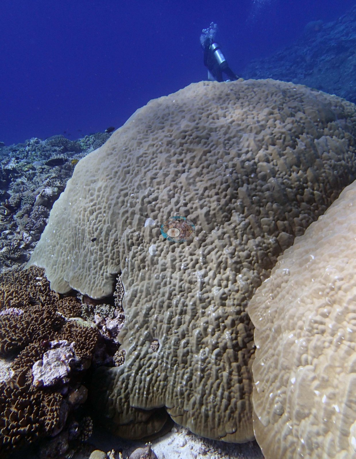
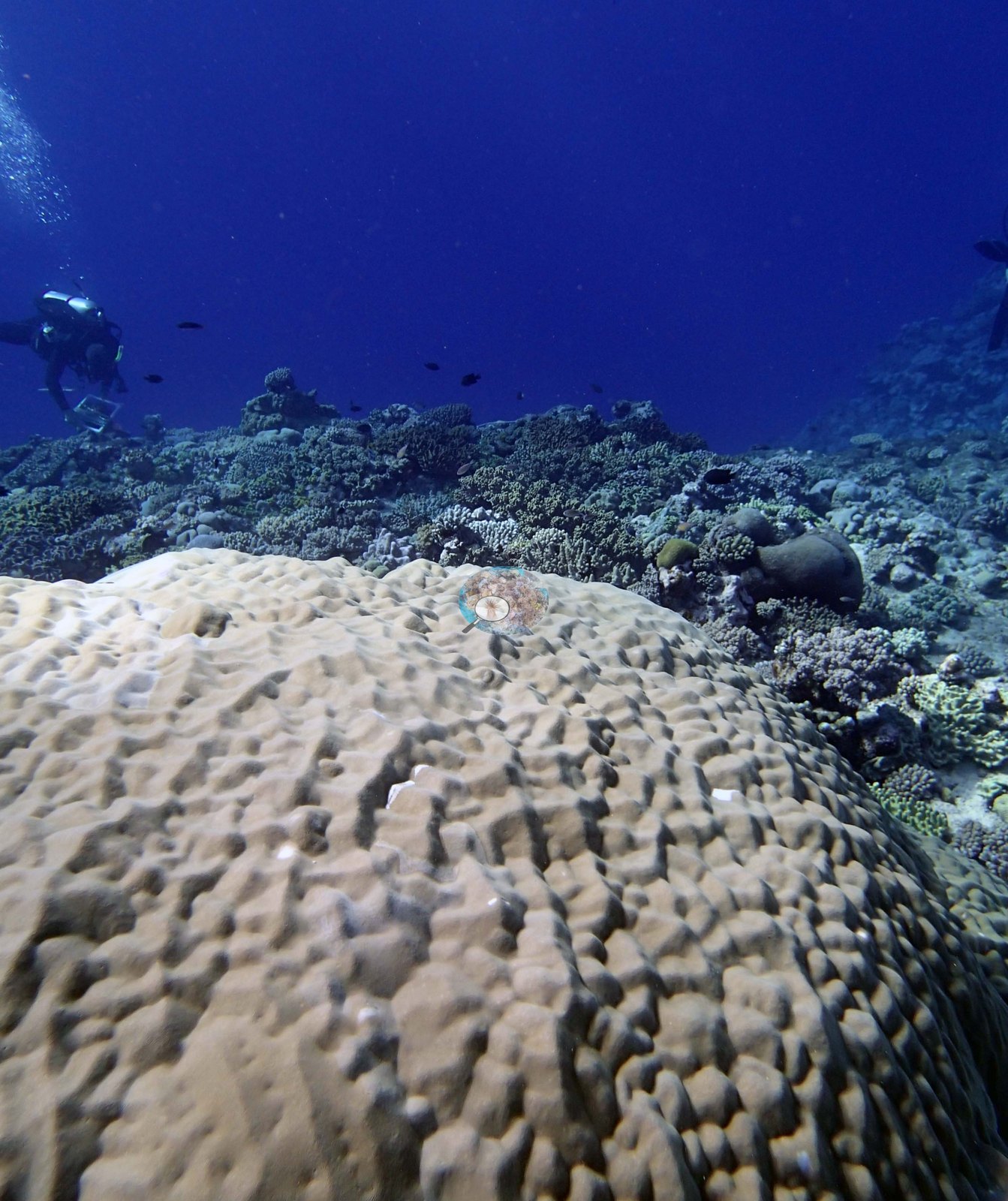
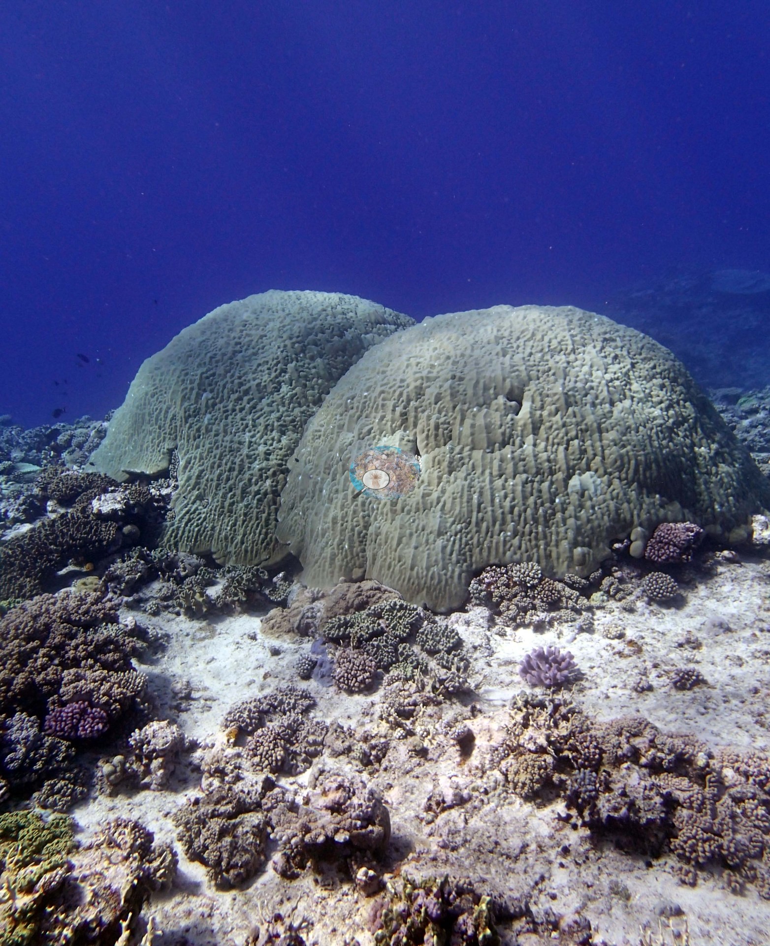
These are the biggest single colonies anywhere in the set. The survey team's notes record that the terrace is a scoured hardground in places with scoured sand channels (with minimal sand and some rubble) and scattered large boulders (3-5 m) that have fallen into the sea from shore. The sides of the boulders are colonized by hard corals (mostly Pocillopora and Acropora) and soft corals. The same notes record that the reef substrate has very little coral on the vertical slope near shore and the horizontal scoured hardground for the first 50 m; mostly small Pocillopora and Acropora, and some encrusting Porites. Colonies are low-lying (10-20 cm tall) and cover is 2.0%. Seaward of this the terrace has some areas that is hardground with turf algae, some CCA encrusted substrate, and some with scattered corals (5.0–10%), mostly small to medium (15-25 cm) digitate and tabular Acropora, Pocillopora, Astreopora, Montipora, and submassive Porites, high numbers of small Montastrea (10-15 cm) and higher amounts of Sinularia, Sarcophyton, and Lobophytum (20-50% cover). This is the first reef with large mats of Briareum encrusting the substrate and overgrowing corals. There is about 5.0% cyanobacteria on the terrace (a by-eye estimate; the transects recorded 0.5%) but no macroalgae. The edge of the slope, from 7-10 m has high relief (1-2 m) with prominent channels and a slight build-up dominated by thick branched Isopora, many 80-100 cm. The edge is intermixed with encrusting and branching Millepora, Favia stelligera, and lower abundances of Goniastrea, Pocillopora, Astreopora. The wall has medium to large plating and submassive Porites (50-200 cm), plating Goniastrea, Isopora, Montipora plates, Sheeting Porites rus (up to 2 m shingles), smaller Montastrea, Pocillopora and other species, with higher numbers of Pachyseris, Leptoseris scabra, Echinophyllia, and Echinopora plates between 20-30 m. Soft corals are 10-20% cover on the wall. There is good colonization by CCA, but a lot of turf algae. From 8-15 m depth high numbers of damselfish algal lawns, especially in Isopora colonies and staghorn coral.
Coral cover
- Reference: Khaled bin Sultan Living Oceans Foundation, Global Reef Expedition (in situ transect)
- Coral cover 35%, from LOF-GRE in situ transects (the mean of all of this station's own transects in the expedition's per-transect benthic data) — a diver transect measurement, not a photographic or computer-vision estimate.
- The transect figure is this site's authoritative cover value; these photographs are qualitative only and neither support nor qualify it, and the sparse terrace frames in particular should not be read as a cover statement.
- Transect mean 35 ± 4.2% SE (n = 6 transects; Living Oceans Foundation per-transect benthic data); the headline above is this all-transect mean.
Stressors
Condition cannot be read confidently from this material: the terrace frames show bare scoured rock and sediment rather than obvious mortality, no colony in any frame reads unambiguously as bleached, and the range, sunlight, and color balance vary too much across the set for pale tissue to be a reliable signal. Anderson's own dive log for this dive calls the reef unhealthy and records no branching Pocillopora. The Living Oceans Foundation transects here recorded 0.5% cyanobacteria and no recently dead coral; they carry no bleaching, disease, or crown-of-thorns field.
Fish and other fauna
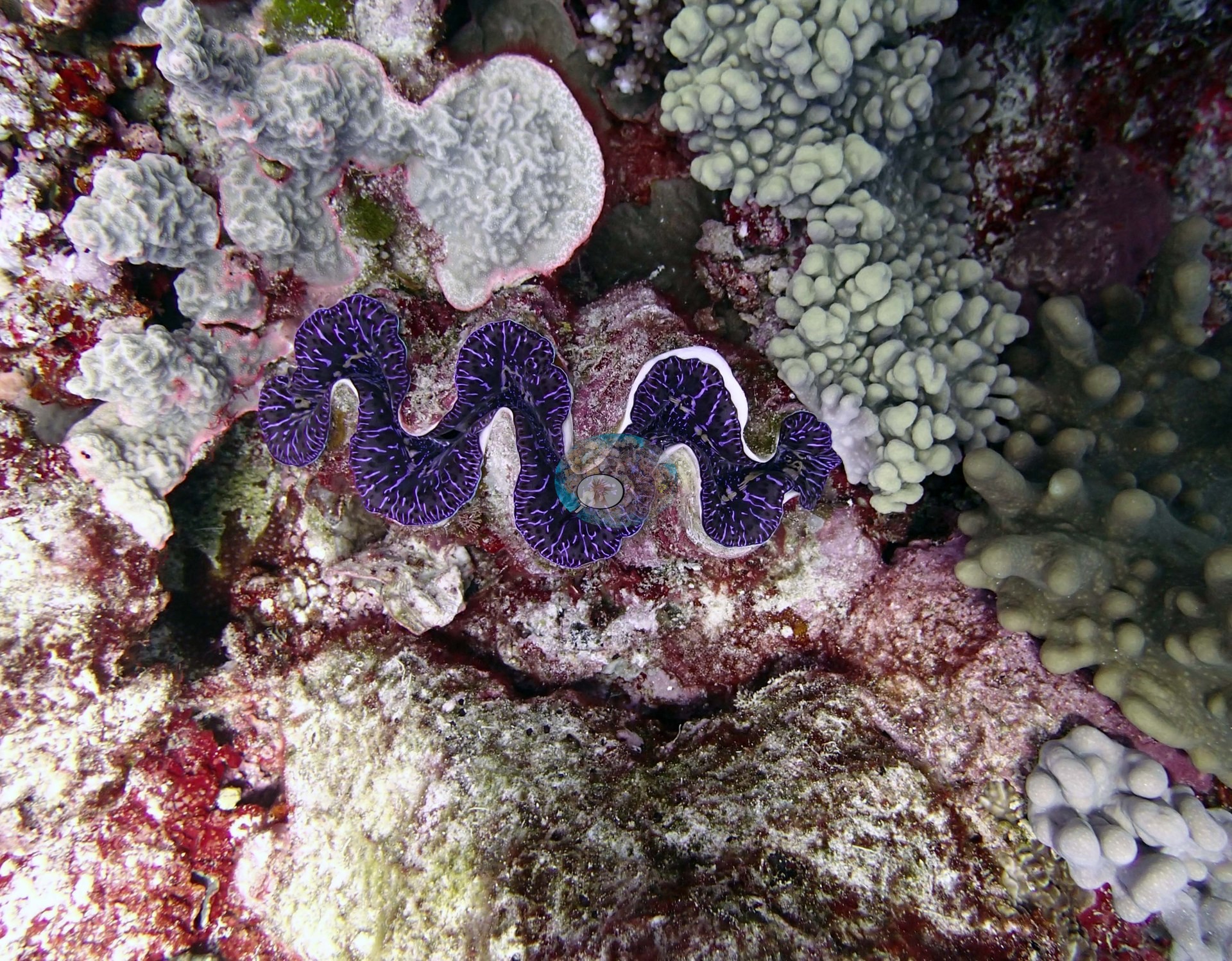
The invertebrate frames are the site's other story, and they are worth flagging against the survey record. Four separate frames are named for giant clams — three not shown (a small animal with a wavy white-lipped mantle photographed against a fingertip for scale; an olive-and-gold reticulated mantle set in pink coralline beside pocilloporids and a yellow honeycomb-corallite massive; and a small black-and-white reticulated mantle in pavement) and Image 3, a vivid violet-purple mantle with fine pale striae. Image 8 shows a dark mottled sea cucumber lying on open white sand.
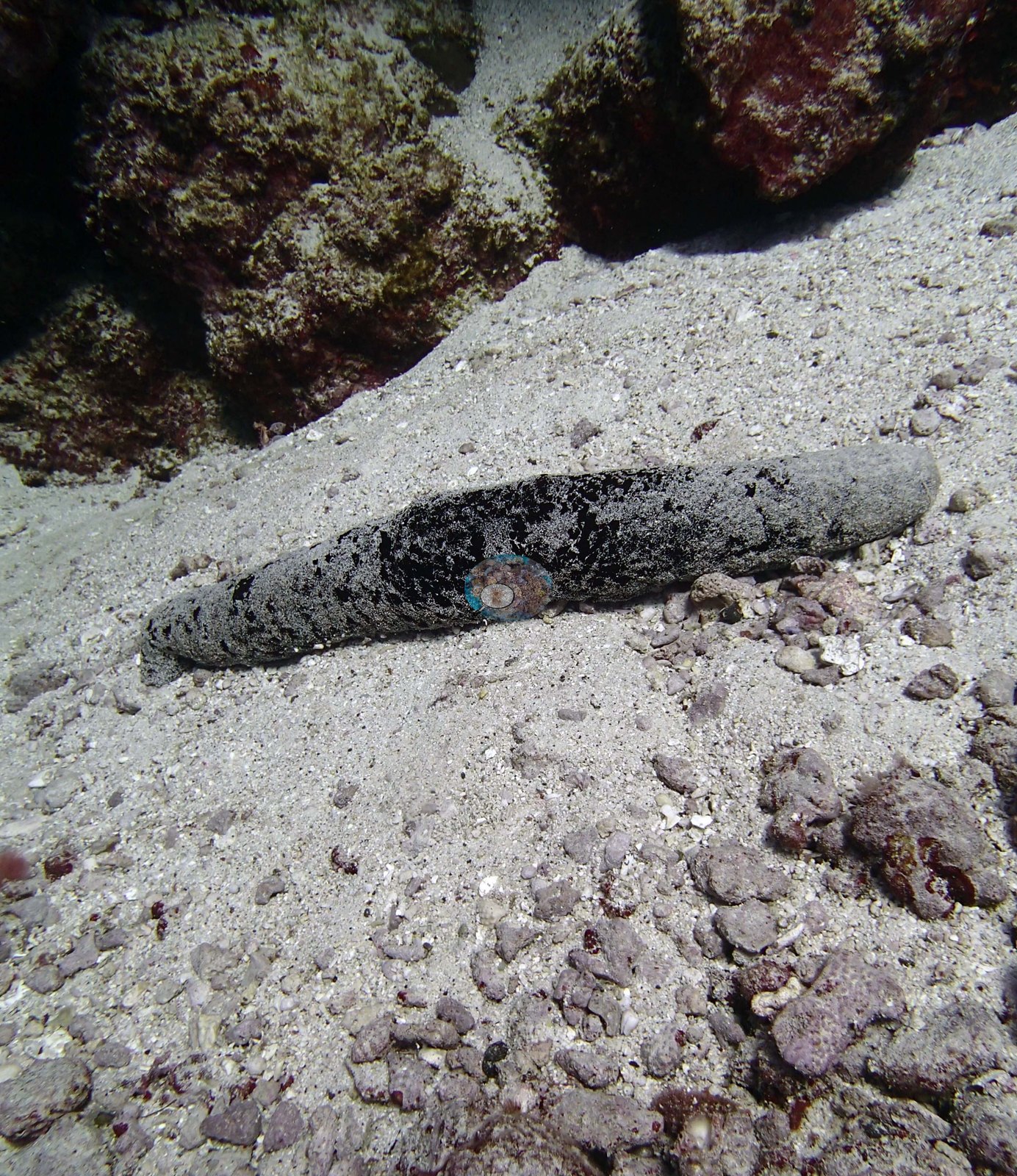
The survey team's notes record no sea cucumbers.
Comparisons with other data
Apart from the Living Oceans Foundation survey shown here, we found no other surveys at this site as of 2026. If you would like to share yours, please email us.
Other notes
There are no sampled-colony frames for this site. The four topside frames carry no benthic information but are the visual record of the uplifted island the survey describes.
Survey team's site notes: Low numbers of giant clams.
CV model comparison
More info
The photo row below is a methods comparison only: it is never averaged with the transect and never used as the headline. It compares site means only: the photos come from the same survey dive as the transect but not from the same points.| Method | Hard coral cover (%) | Photos (n) ± SE |
|---|---|---|
| Transect mean (all transects) | 35.2 | |
| CoralSCOP unedited | 38.4* | n = 12 · SE 6.1 |
| Claude (edited photos) | 31.9* | n = 12 · SE 7.8 |
The two computer-vision methods agree within 6.5 pp (31.9–38.4%) and read within 3.3 pp of the in-water transect (35.2%).
*Based on only 12 reef-habitat photos; this estimate is less certain.
See a more detailed, stand-alone version of this table.
Data & links
- Download benthic survey data (CSV) ↗
- Download all LOF-GRE data (933 sites) ↗
- Photo portfolio ↗
- Coral Reef Diagnostics region page ↗
All images from Coral Reef Diagnostics. Data are from the Khaled bin Sultan Living Oceans Foundation Global Reef Expedition and Coral Reef Diagnostics.
 © Coral Reef Diagnostics.