
Part of the regional summaries: Tonga - Ha'apai and Tonga
More info
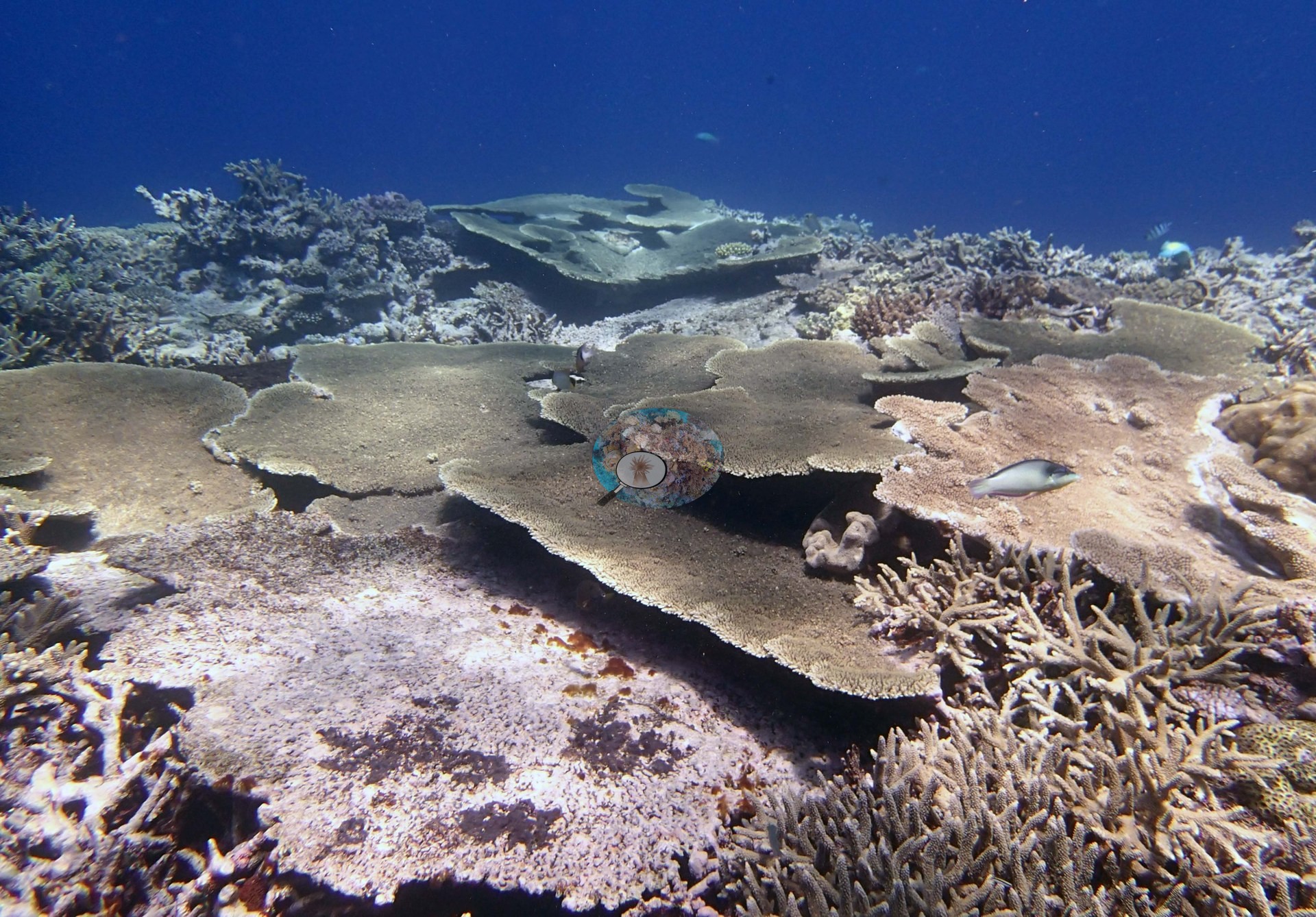
Southern Tonga (NOAA CRW virtual station)Elongate spurs in Ha'apai whose tops carry close-packed branching and staghorn Acropora with shingled table plates, while the edge and slope frames show more widely spaced colonies and more bare framework. One table was dead in place, mottled with encrusting growth. Surveyed on the Living Oceans Foundation's Global Reef Expedition.
Ko e ngaahi spurs loloa ʻi Haʻapai ʻoku ʻi honau funga ʻa e Acropora fakavaʻavaʻa mo staghorn ʻoku fefuʻifuʻi vāofi, mo e ngaahi lauʻi tēpile fakatokoto fetaulaki (shingled), lolotonga ia ʻoku hā ʻi he ngaahi tā ʻo e kauʻi hakau mo e hifoʻanga ha ngaahi kulupu feo ʻoku vāmamaʻo ange mo e lahi ange ʻa e maka feo tukuʻau. Naʻe mate ha tēpile ʻe taha ʻi hono tuʻuʻanga, ʻo pulepule ʻi he tupu pipiki (encrusting growth).
AI translation of this summary; the English is authoritative. (low confidence)
CTD-cast midpoint of 24.2–24.3°C
One other CRD dive site with its own page within 5 km shown in orange — click a marker to open its page.
8 of the 9 photographs on this page are shown beside the text that discusses them under "Site description" below.
Site description
General benthic features
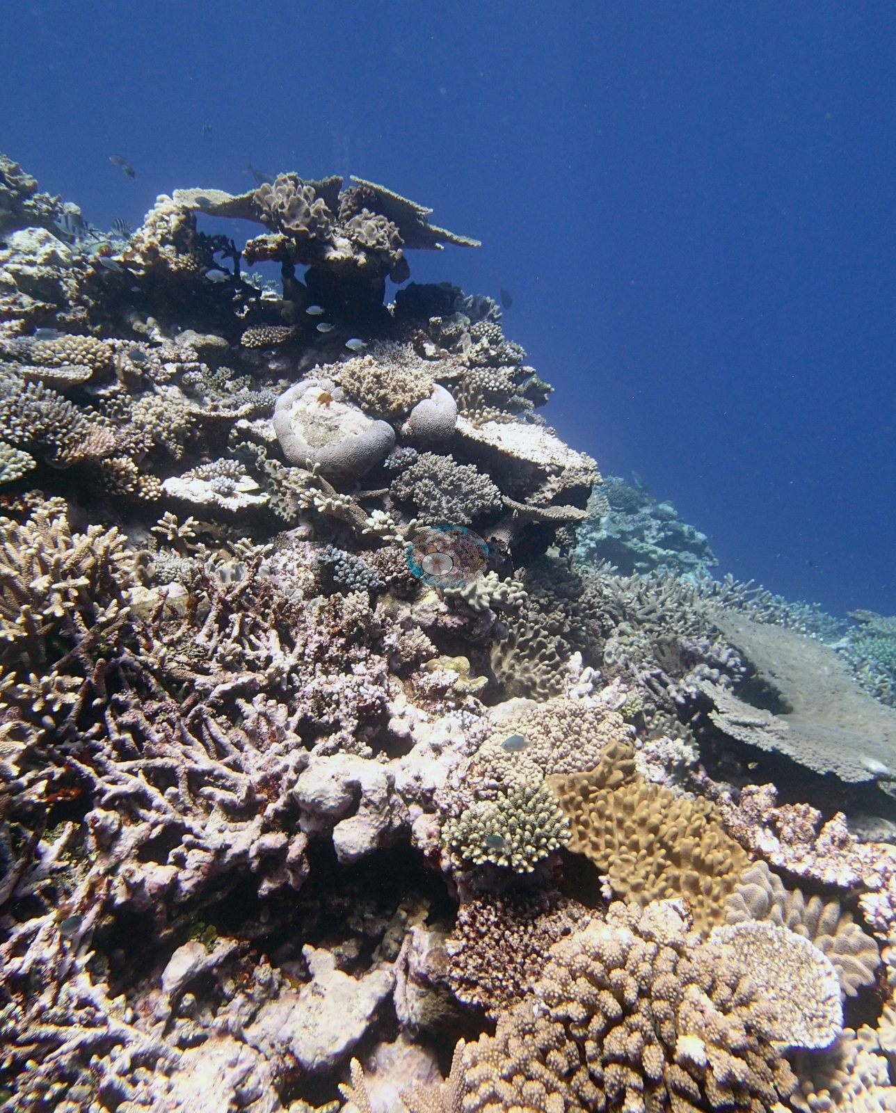
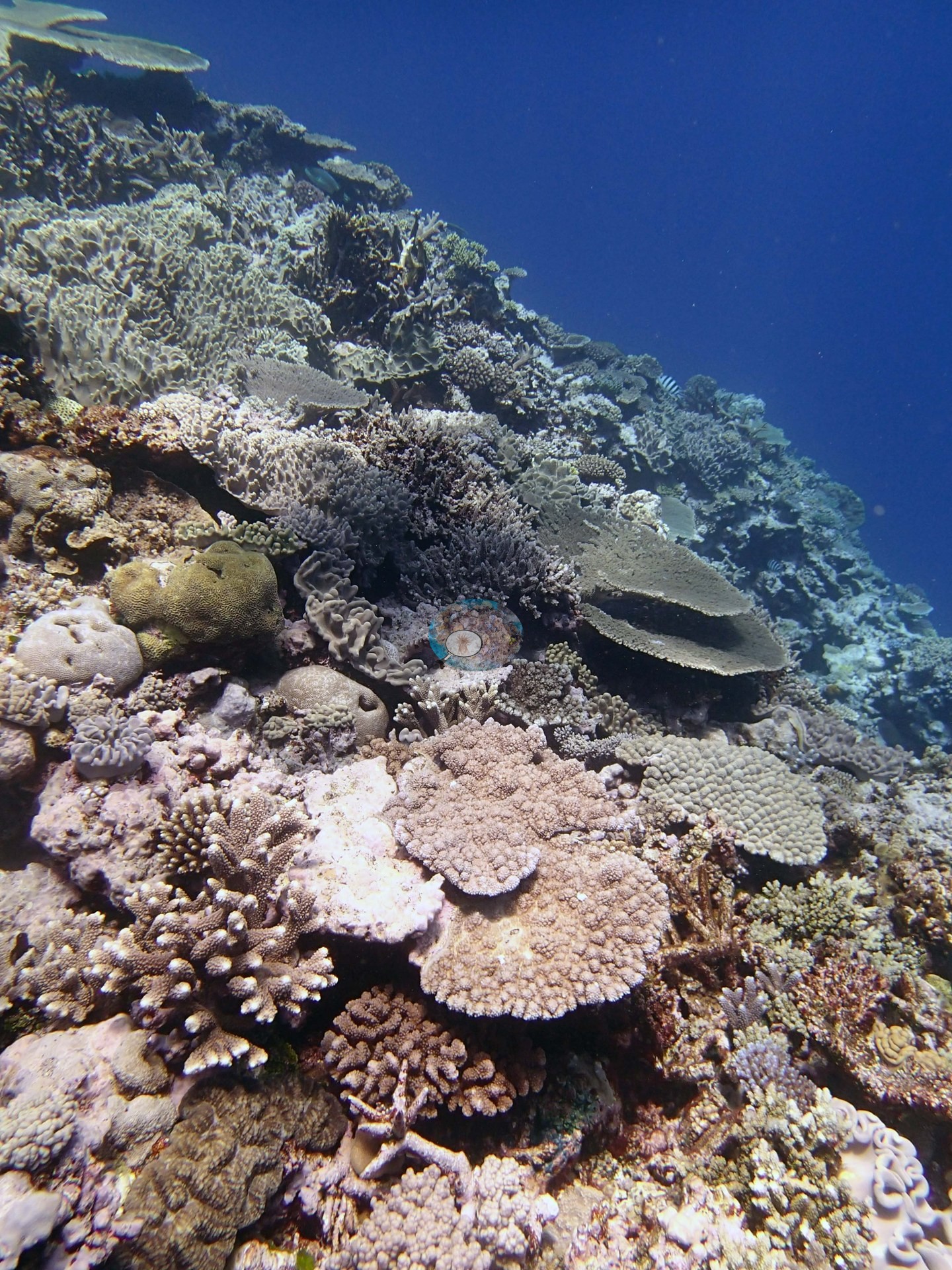
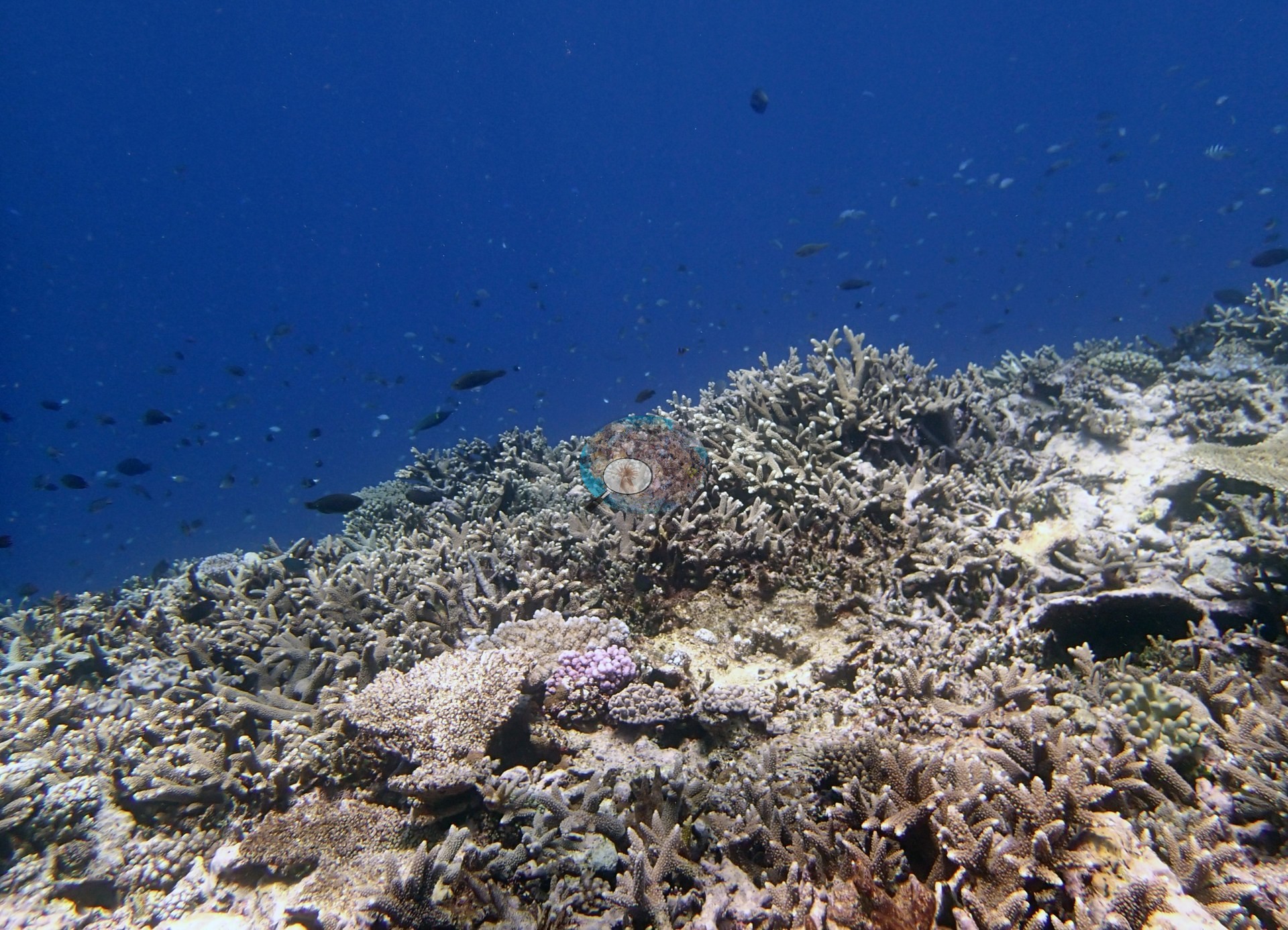
The frames divide fairly cleanly into reef-top views and edge views. On the reef top (e.g., Image 6, Image 7, Image 4, Image 2) the bottom is close-packed and structurally complex: broad thickets of gray-brown branching and staghorn Acropora, corymbose and digitate acroporids in tan, lilac, and mauve, flat table plates, tan to cream foliose and lettuce-like colonies, small lobed massive colonies, and scattered pale gray Porites-type mounds, with occasional bright chartreuse and orange-brown colonies breaking up the palette. Image 2 is the reefscape frame — a near-continuous carpet of branching acroporids running away into deep blue under a loose aggregation of small dark planktivores. Image 1 is the table frame: several large flat acroporid plates shingled over one another across the reef top, and in the foreground one plate unambiguously dead in growth position, its surface flattened, uniformly pale gray-mauve, and mottled with darker encrusting growth.
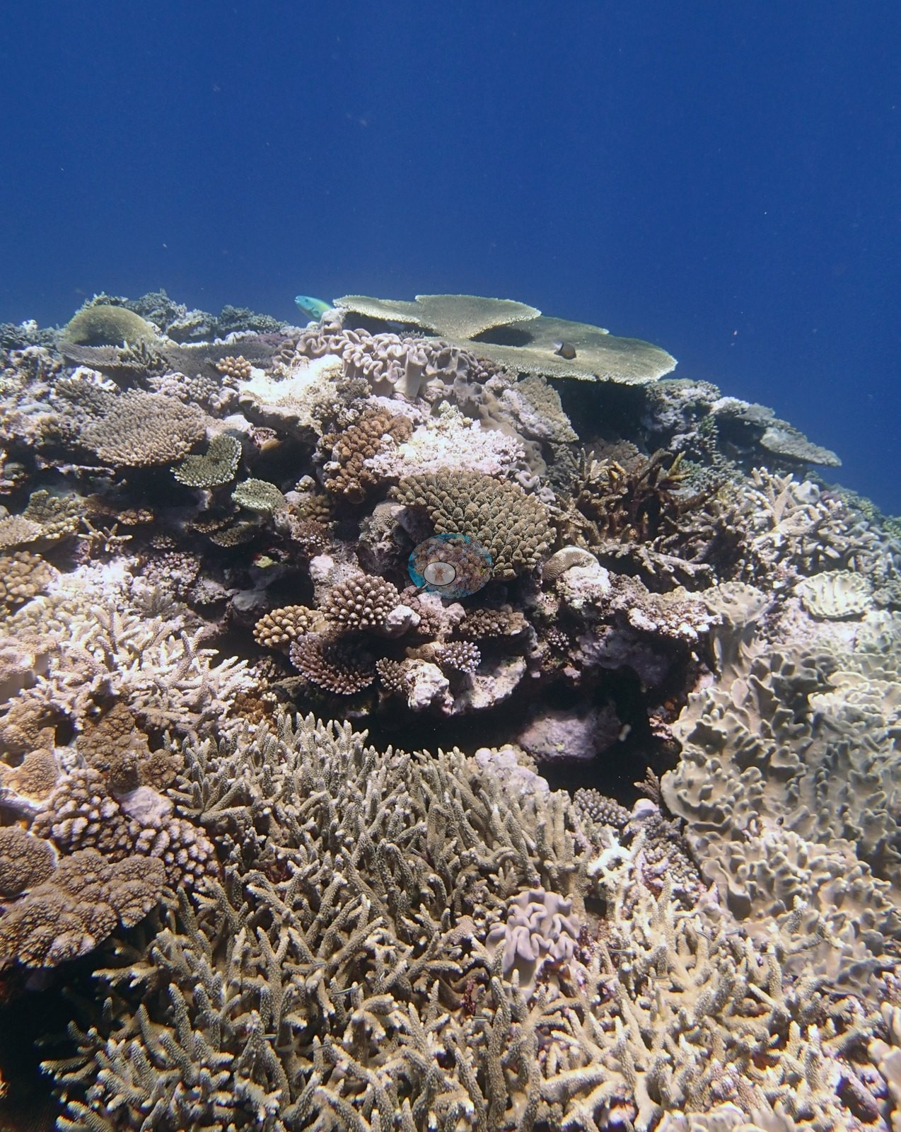
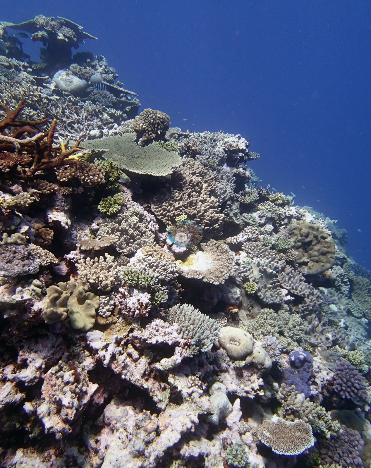
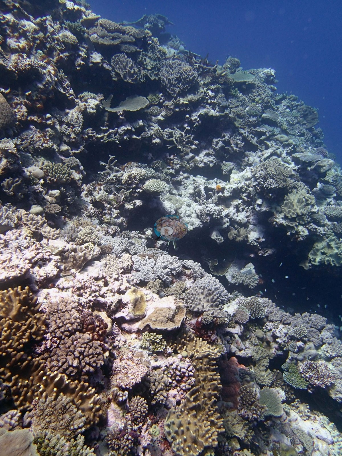
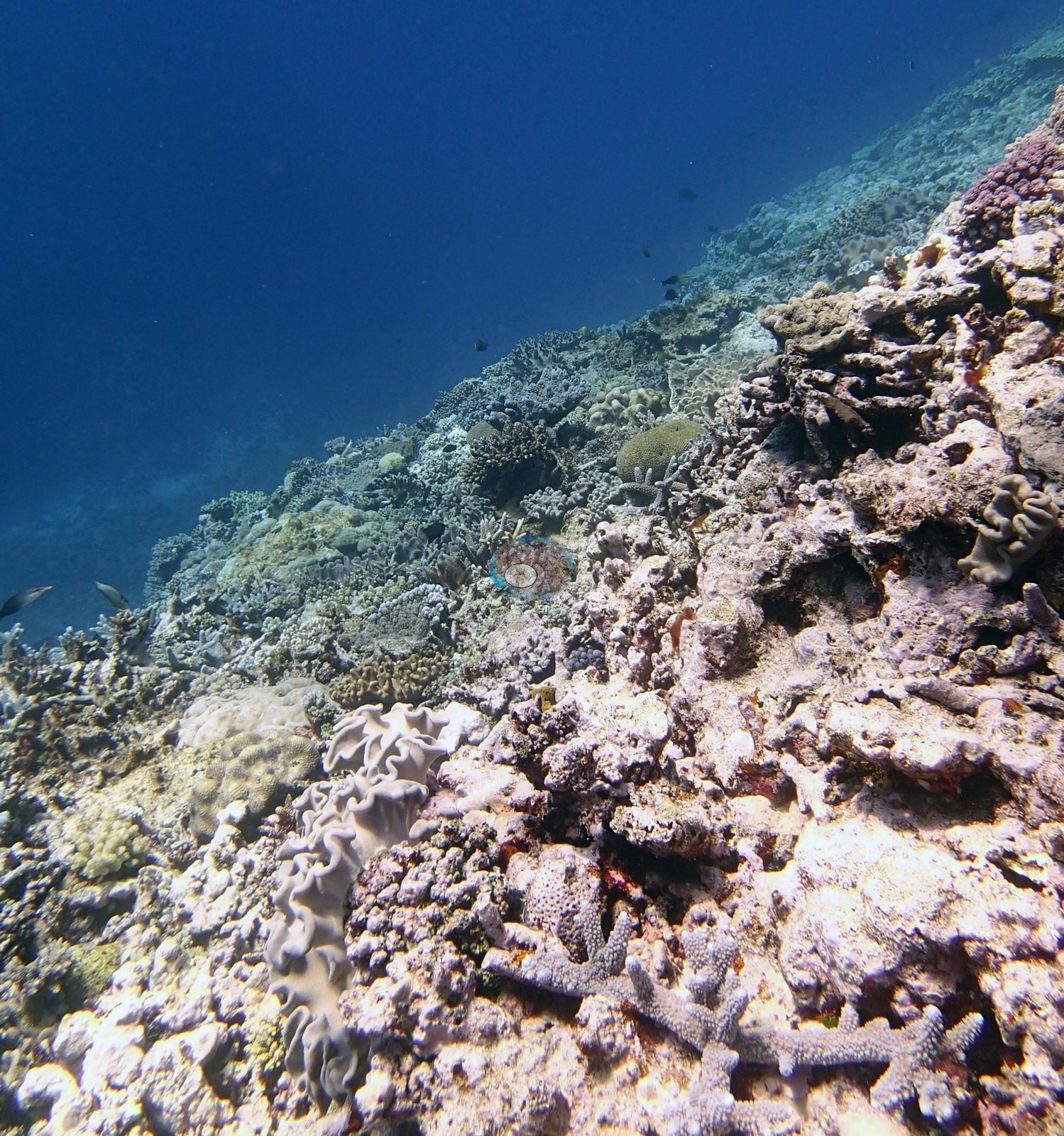
The edge and slope views are the counterweight. Image 9 looks obliquely down a spur into darker water, with a dense acroporid foreground giving way to lower, more widely spaced colonies over paler pavement; Image 5 looks along a near-vertical edge dropping into deep blue, and here pale coralline-crusted framework, gray-brown foliose plates, and dark maroon plating colonies make up much more of the surface than living branching coral; and Image 3 is a flatter reef top of well-spaced colonies over open pavement, visibly patchier than Image 6 or Image 2.
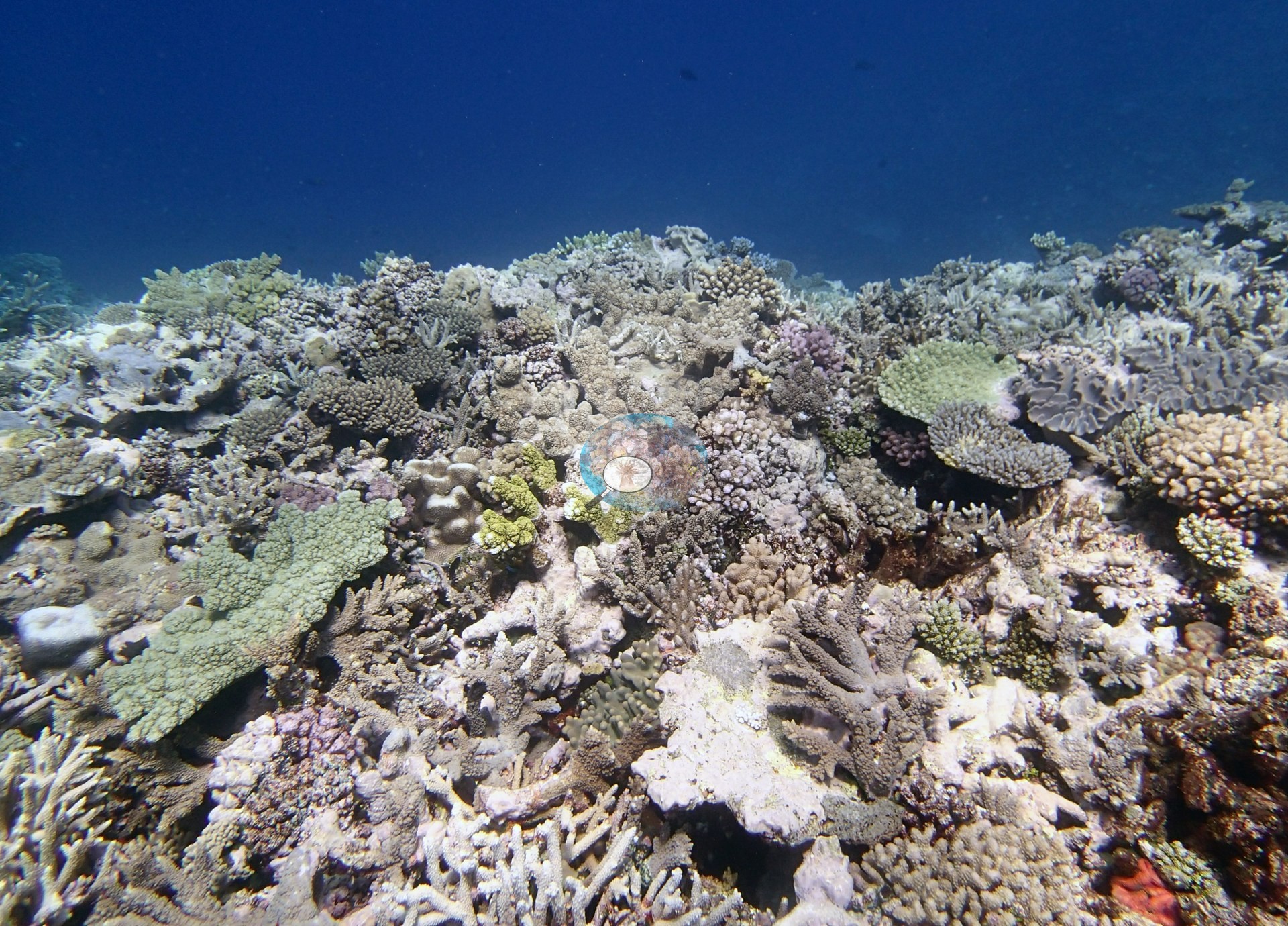
Anyone reading only the reef-top frames would come away with an impression of uniformly heavy cover that the rest of the set does not support.
Coral cover
- Reference: Khaled bin Sultan Living Oceans Foundation, Global Reef Expedition (in situ transect)
- 41%, from the Khaled bin Sultan Living Oceans Foundation's in situ transect survey (Global Reef Expedition site data); the photographs illustrate the site. Coral Health Index 3.50/5 (Mayfield et al. 2021, Platax).
- Transect mean 41 ± 4.7% SE (n = 5 transects; Living Oceans Foundation per-transect benthic data); the headline above is this all-transect mean.
Stressors
The dead table plate in Image 1 is the clearest mortality signal in the set; the photograph shows only a dead plate — it cannot show what killed it, and the disease lesions and corallivorous snails the surveyors recorded are not resolvable in it. Several frames contain pale, whitish, or bare patches among the living colonies; at these ranges and in this light those cannot be separated into naturally pale morphs, bleached tissue, recent tissue loss, and old skeleton, so the photographs do not settle the site's condition. Anderson's sampling sheet for this dive records one of the four sampled colonies (colony 33, P. acuta) as about half dead or bleached and unhealthy; the other three looked healthy. The 2013 survey notes for this site record white syndrome on 2-5% and corallivorous snails on about 2% of the staghorn thickets and table corals at 10-20 m (Khaled bin Sultan Living Oceans Foundation expedition site notes, 2013; regional summary in Bruckner 2014). The Living Oceans Foundation transects here recorded 5.4% cyanobacteria and no recently dead coral.
Fish and other fauna
Fish are present but unremarkable in most frames apart from the aggregation.
Comparisons with other data
Apart from the Living Oceans Foundation survey shown here, we found no other surveys at this site as of 2026. If you would like to share yours, please email us.
Other notes
Photo review of 9 habitat frames plus 23 sampled-colony close-ups (Ha'apai, 16 Sep 2013). The account on this page is written from the habitat frames only; the colony images are treated purely as a record of what was sampled. This is a good habitat set — nine genuine wide and mid-range reef views in clear water, with none of the extreme cropping that affects the colony frames — though none carries a scale bar, quadrat, or transect line, so no measurement of any kind can be taken from them. Four Pocillopora colonies were sampled at this site (colonies 32, 33, 34, and 35); Anderson's own field records label 32, 33, and 35 as P. acuta and 34 as P. damicornis. The 23 close-ups are repeat polyp-scale macro and tag shots of only those four colonies — and describe the colonies, not the reef.
Survey team's site notes: Elongate spurs at 8-10 m depth 1 m relief increasing to 3-4 m relief above sand channels at 15 m. Seaward end and sides of spurs drop near vertical to 30 m depth to sand/rubble, then slope more gradually into deep water. This is the first site with small clumps of Halimeda, up to 10% cover; the spurs and surrounding sand had about 10% rubble and 20% dead coral. Live cover ranged from 30-40% in 5-10 m depth dropping to 20-30% at 15 m and 5.0–20% at 20-30 m depth. Deeper reef is dominated by plates of Mycedium, Pachyseris, Echinophyllia, and Leptoseris scabra on vertical surfaces with lower cover on horizontal surfaces of small table acroporids, massive faviids, and other taxa.
Data & links
- Download benthic survey data (CSV) ↗
- Download all LOF-GRE data (933 sites) ↗
- Photo portfolio ↗
- Coral Reef Diagnostics region page ↗
All images from Coral Reef Diagnostics. Data are from the Khaled bin Sultan Living Oceans Foundation Global Reef Expedition and Coral Reef Diagnostics.
 © Coral Reef Diagnostics.
References
- Mayfield AB, Dempsey AC, Chen CS (2021). Assessing coral health in the Kingdom of Tonga with a coral health index. Platax 18:53-78. DOI
- Bruckner AW (2014). Global Reef Expedition: Kingdom of Tonga. Field Report. Khaled bin Sultan Living Oceans Foundation, Landover, MD. 28 pp. PDF