
Part of the regional summaries: Tonga - Ha'apai and Tonga

2013-09-14
More info
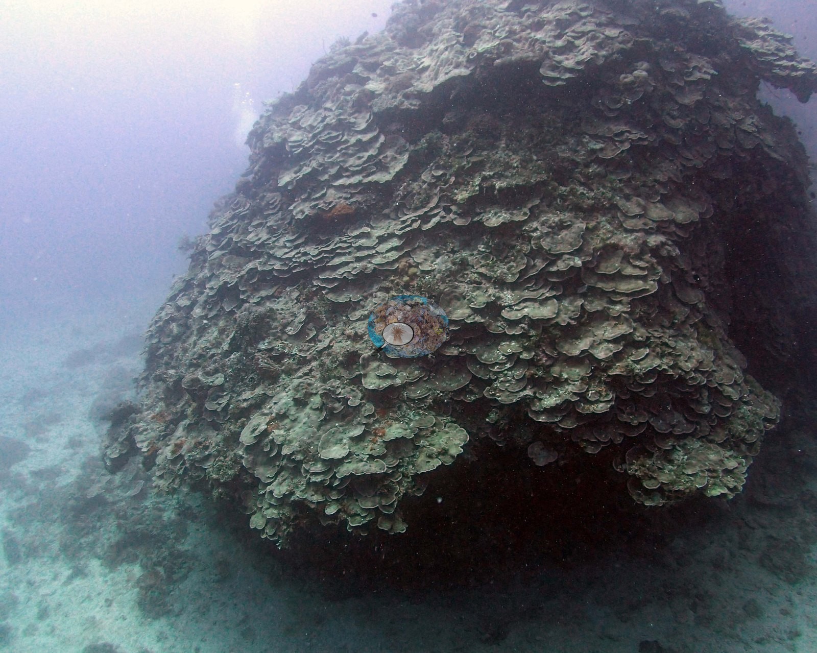
Southern Tonga (NOAA CRW virtual station)A shallow Ha'apai platform of low spurs dominated by soft corals and a high diversity of hard corals, with a moderately steep slope, vertical in places, from 12 to 20 m, then a gentler descent to 35 m or more. The deeper reef is the showpiece, with huge single-species stands: bottlebrush Acropora thickets 20-30 m long, a mound blanketed by overlapping Coscinaraea plates over 20 by 20 m, and big fields of Porites rus and Merulina. Surveyed on the Living Oceans Foundation's Global Reef Expedition.
Ko ha tuʻunga mamaha (platform) ʻi Haʻapai ʻo e ngaahi spurs māʻulalo ʻoku puleʻi ʻe he feo molū (soft corals) mo ha kehekehe lahi ʻo e ngaahi feo fefeka (hard corals), mo ha tafaʻaki tuʻu fakalotoloto, ʻoku tuʻu hangatonu ʻi ha ngaahi feituʻu, mei he 12 ki he 20 m, pea toki tō māmālie hifo ki he 35 m pe lahi ange. Ko e hakau loloto ange ʻa e meʻa mahuʻinga taha, mo e ngaahi vao lalahi ʻaupito ʻo e faʻahinga pē ʻe taha: ko e ngaahi vao Acropora fakapulumu (bottlebrush) ʻoku loloa ʻaki ʻa e 20-30 m, ha puke kuo ʻufiʻufi ʻe he ngaahi papa Coscinaraea ʻoku fetaulaki ʻo laka hake ʻi he 20 he 20 m, mo e ngaahi ngoue lalahi ʻo e Porites rus mo e Merulina.
AI translation of this summary; the English is authoritative. (low confidence)
CTD-cast midpoint; the cast read 24.3°C throughout; 13 Sep 2013 dive
More info
Anderson's dive computer read 23.3°C (a single reading, probably a dive mean).Three other CRD dive sites with their own pages within 5 km shown in orange — click a marker to open its page.
10 of the 30 photographs on this page are shown beside the text that discusses them under "Site description" below.
Site description
Setting
Reef has shallow platform at 6-8 m with wide low-relief spurs intersected by shallow, narrow channels. At 20 m the slope became more gradual, continuing to 35+ m. The reef ends at 30 m, becoming mostly sand with some rubble.
General benthic features
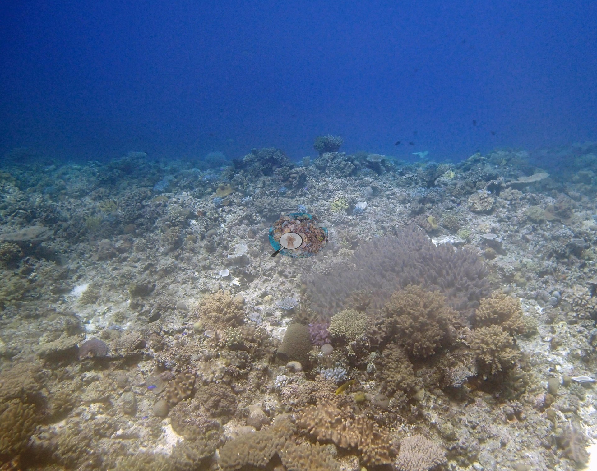
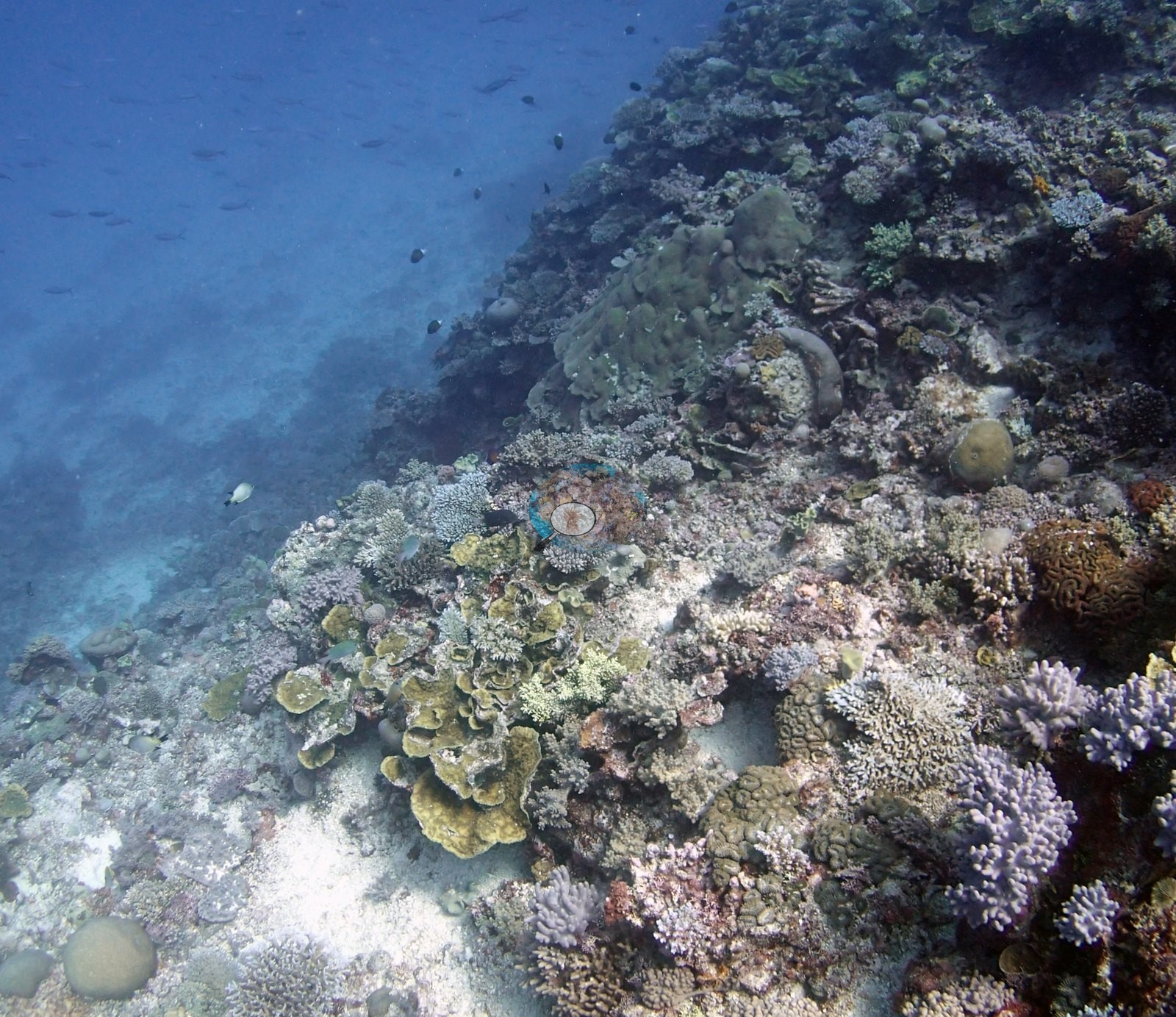
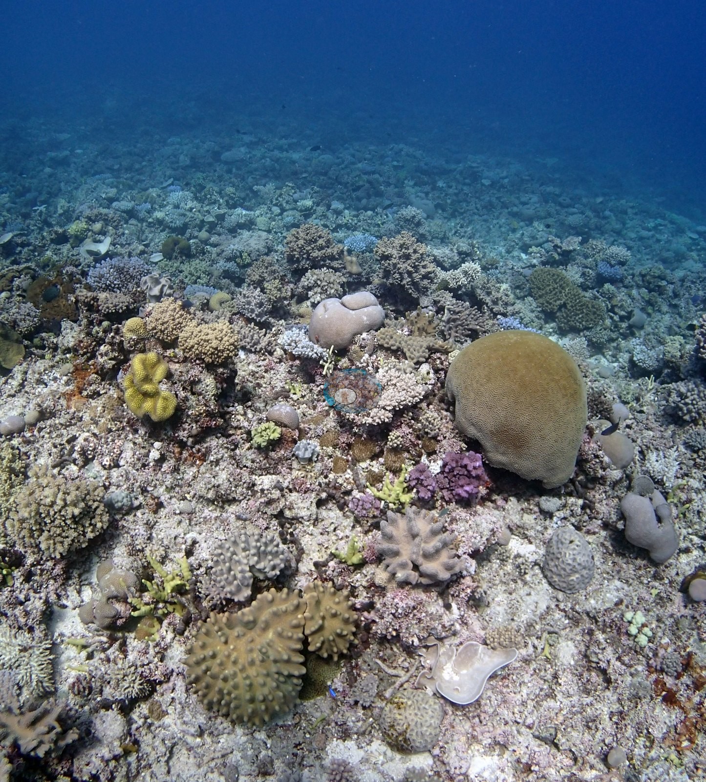
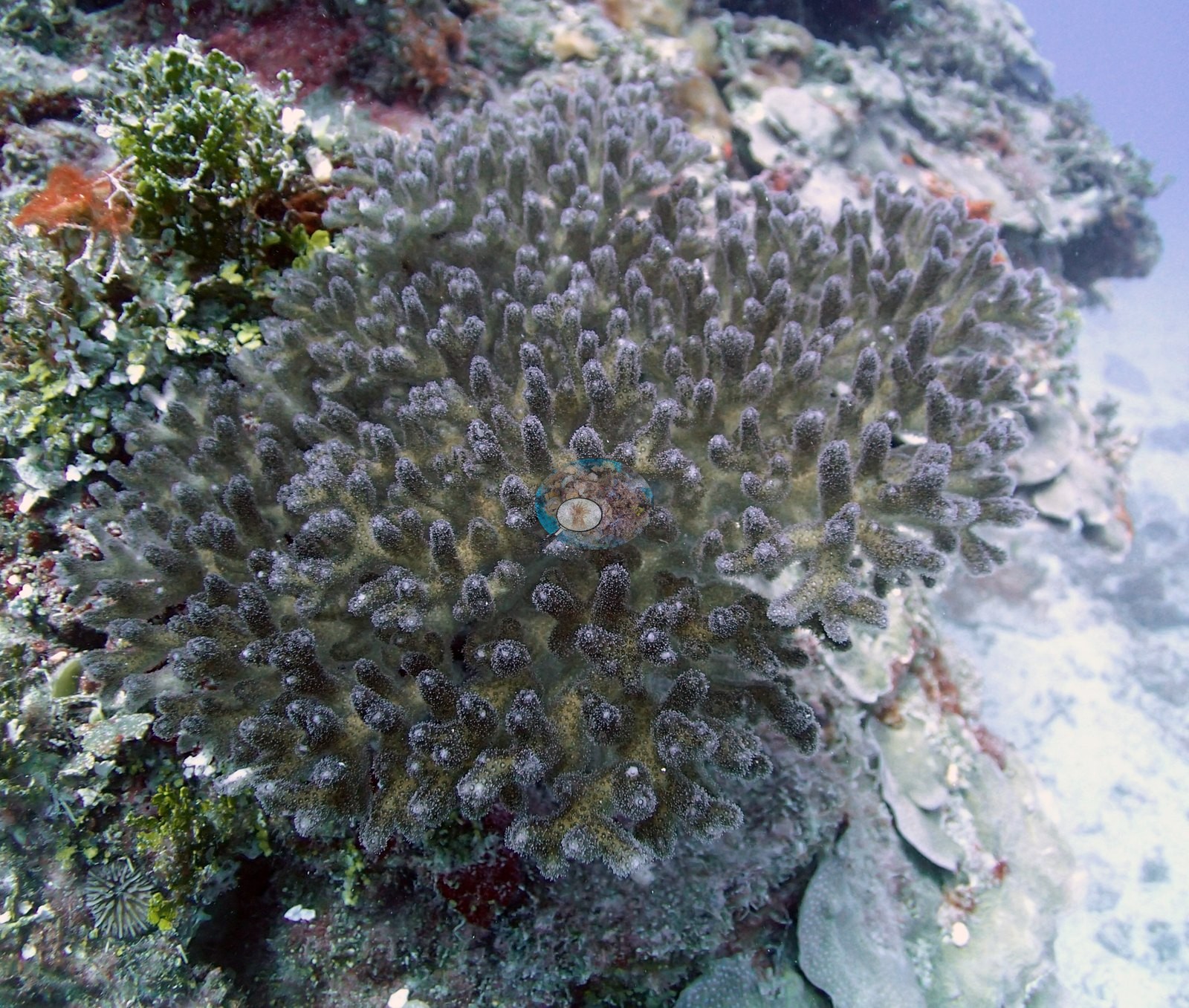
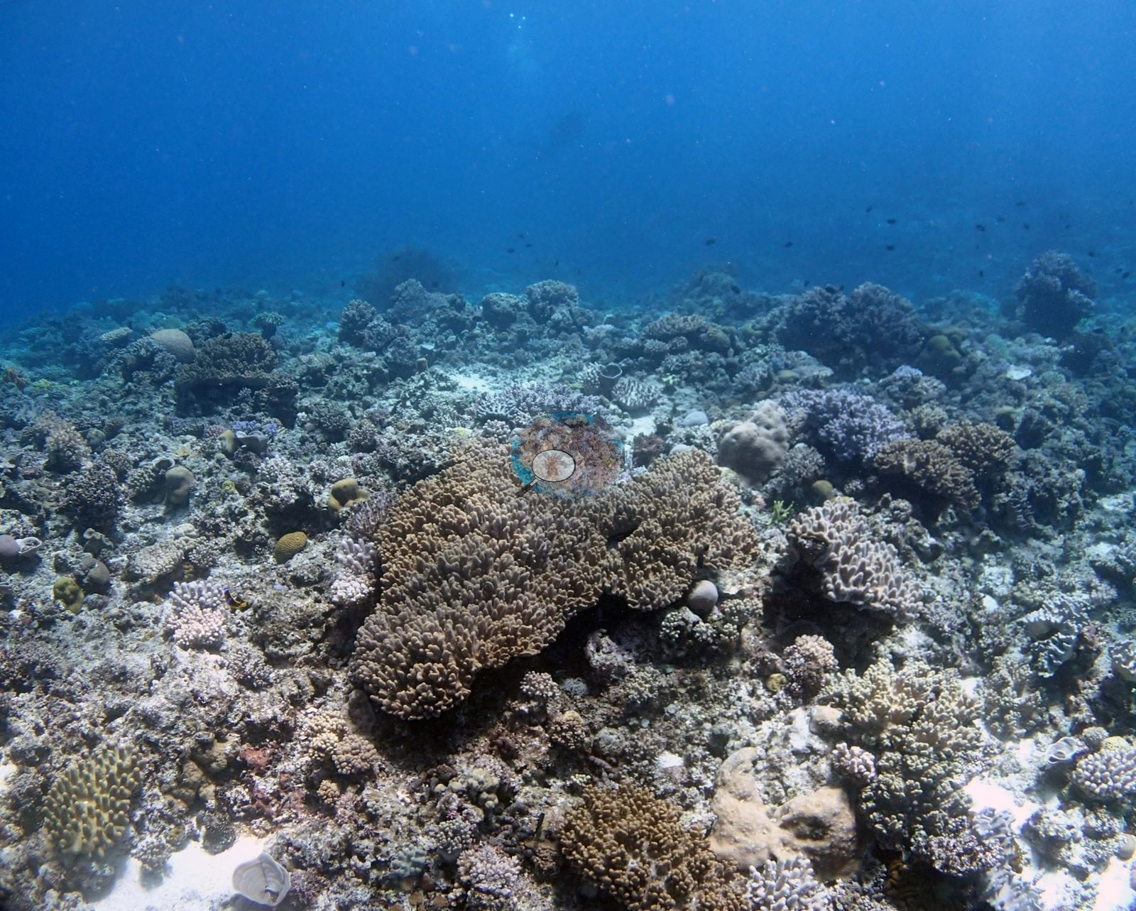
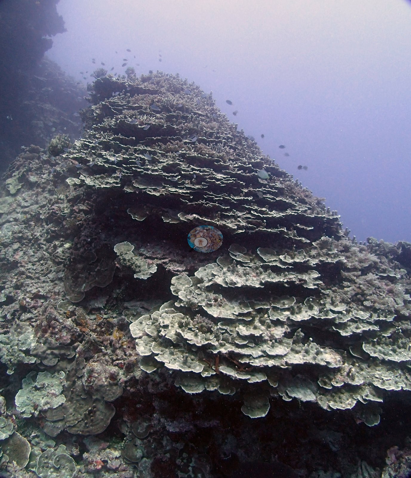
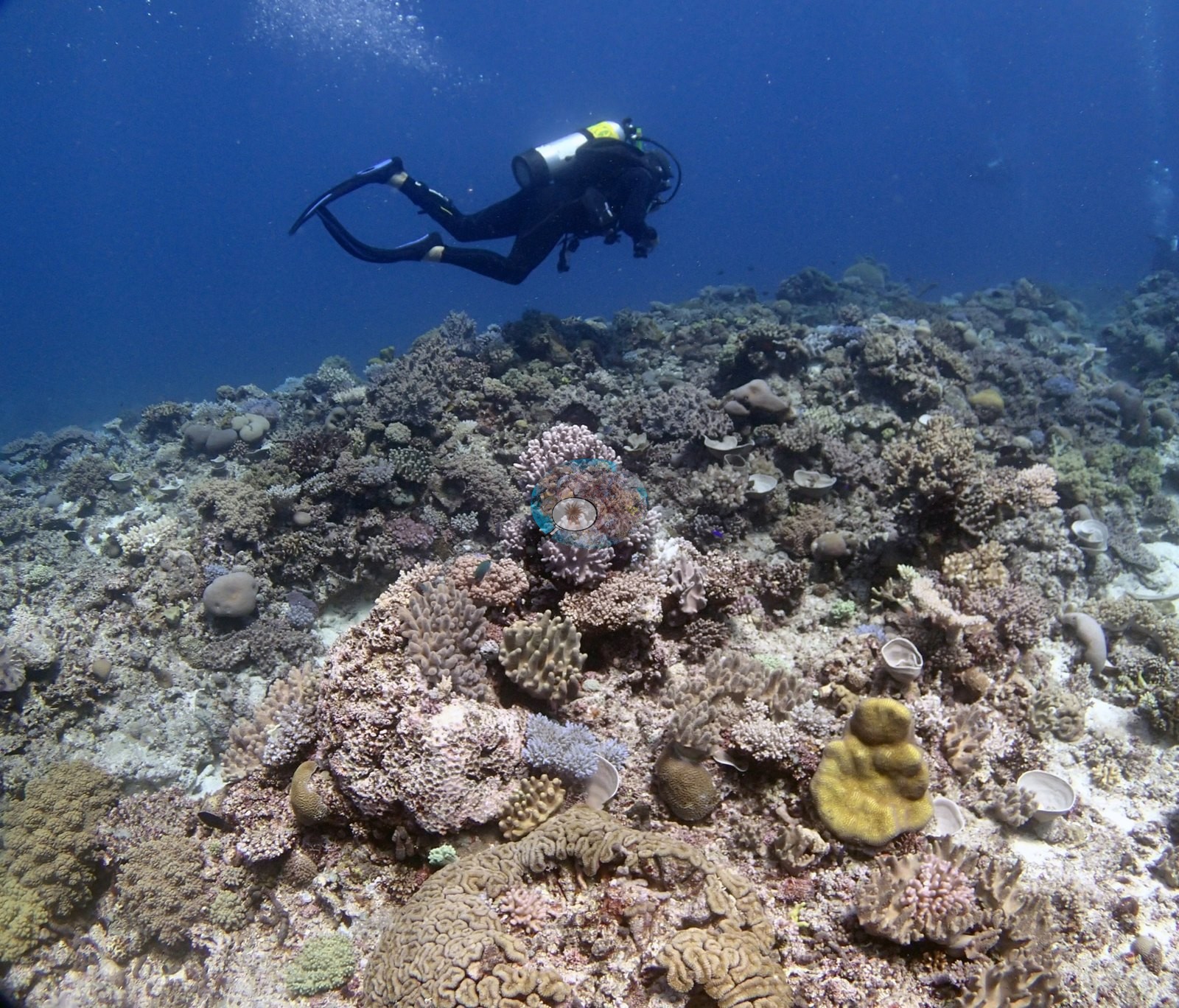
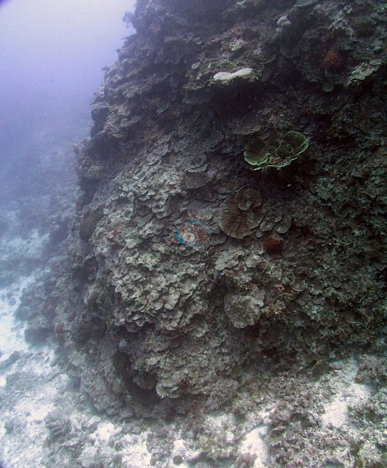
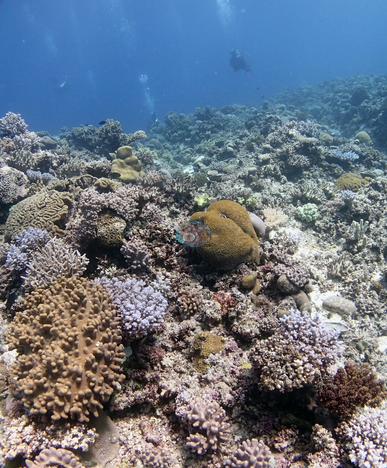
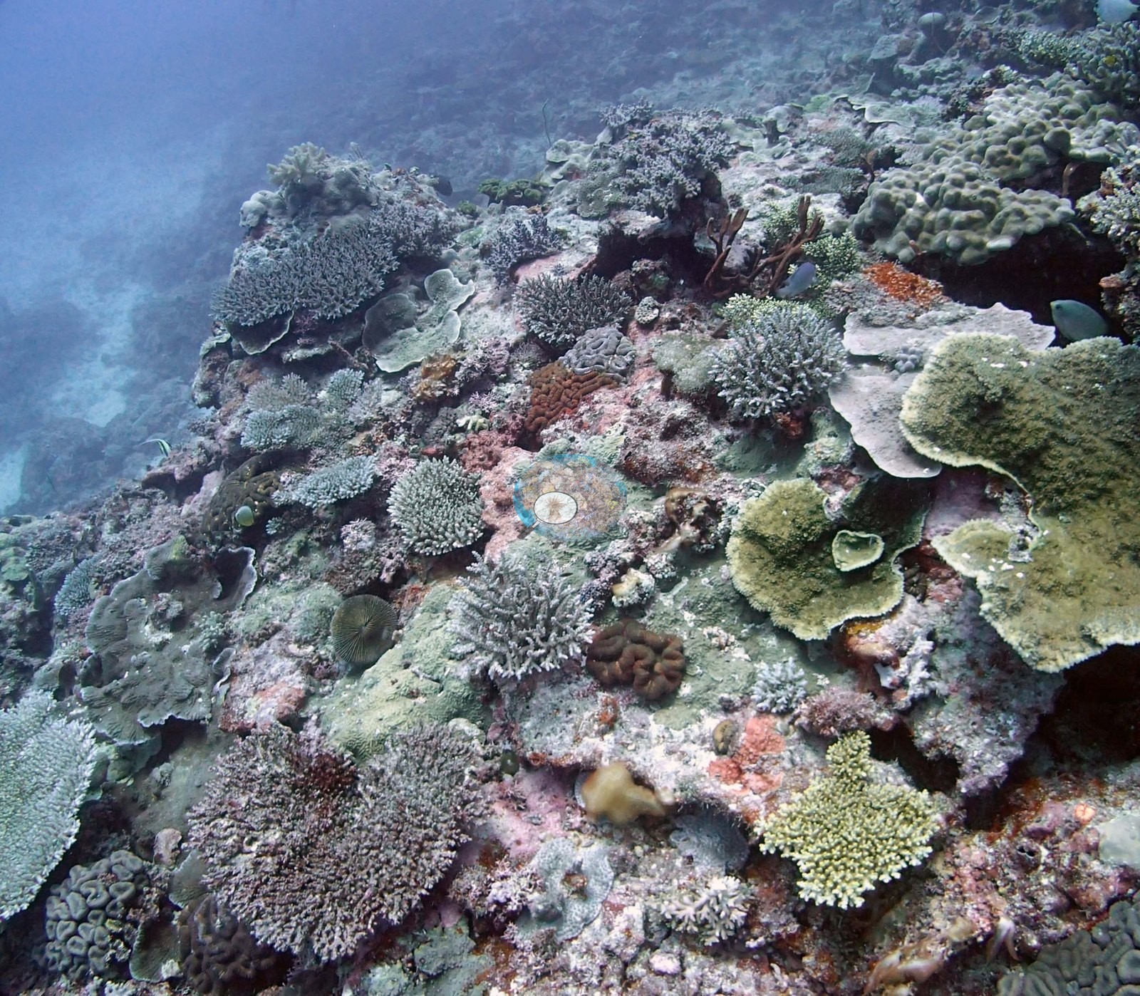
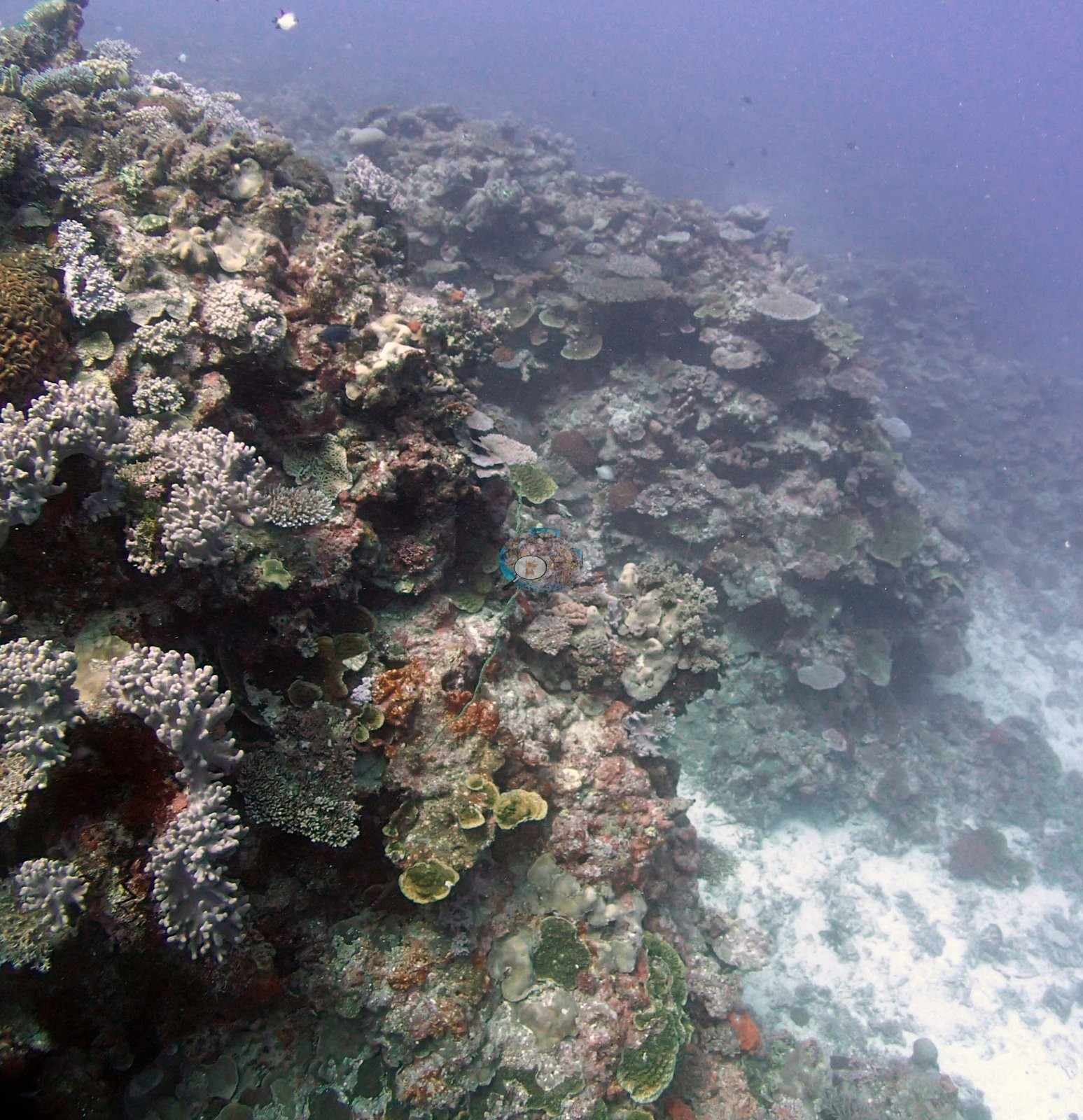
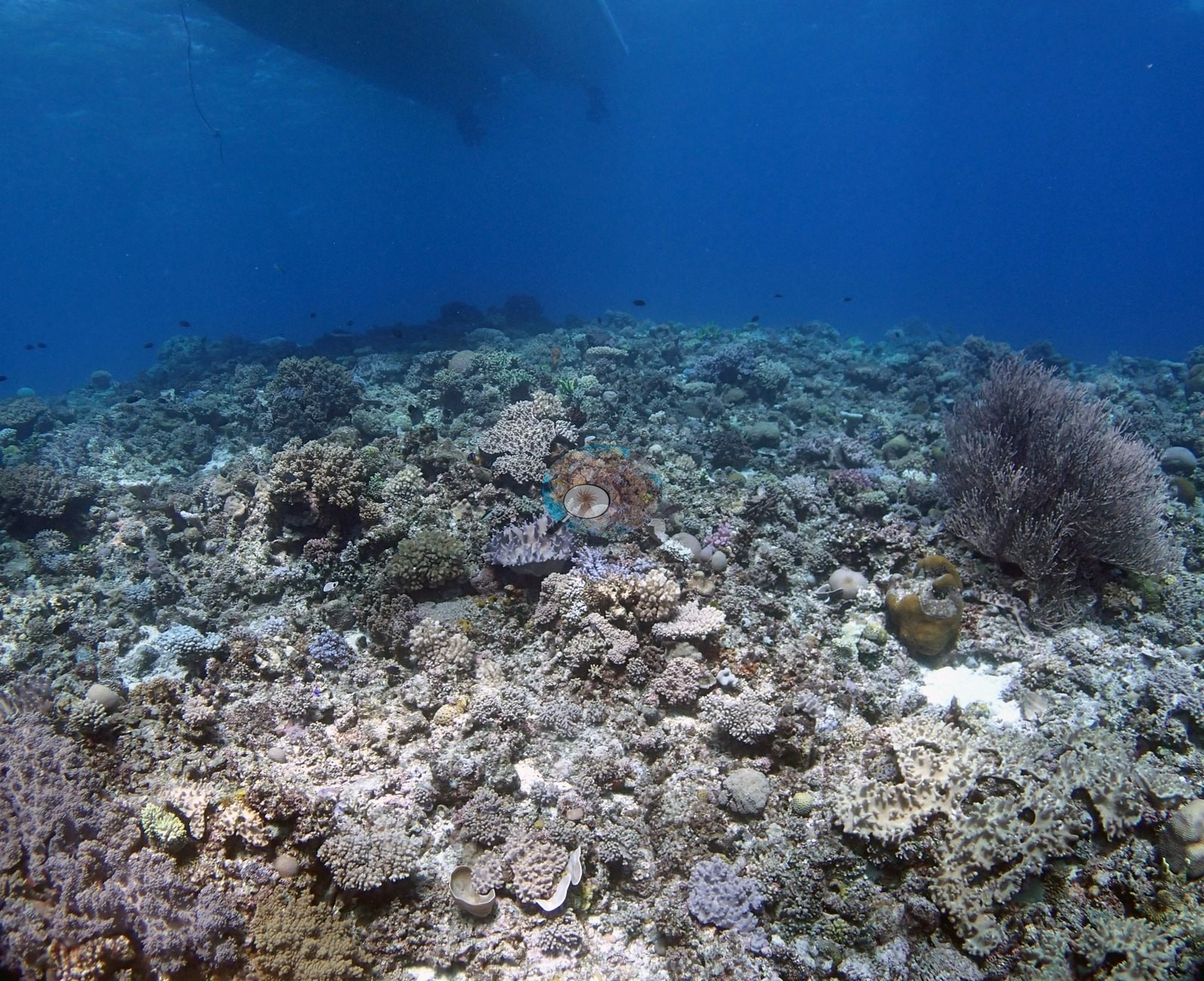
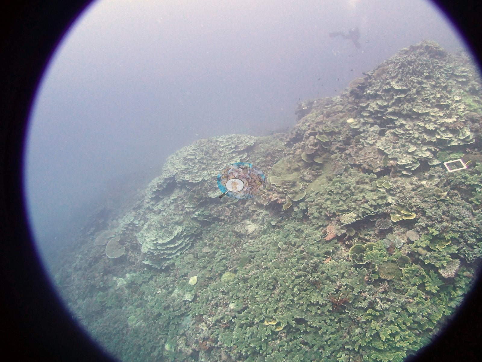
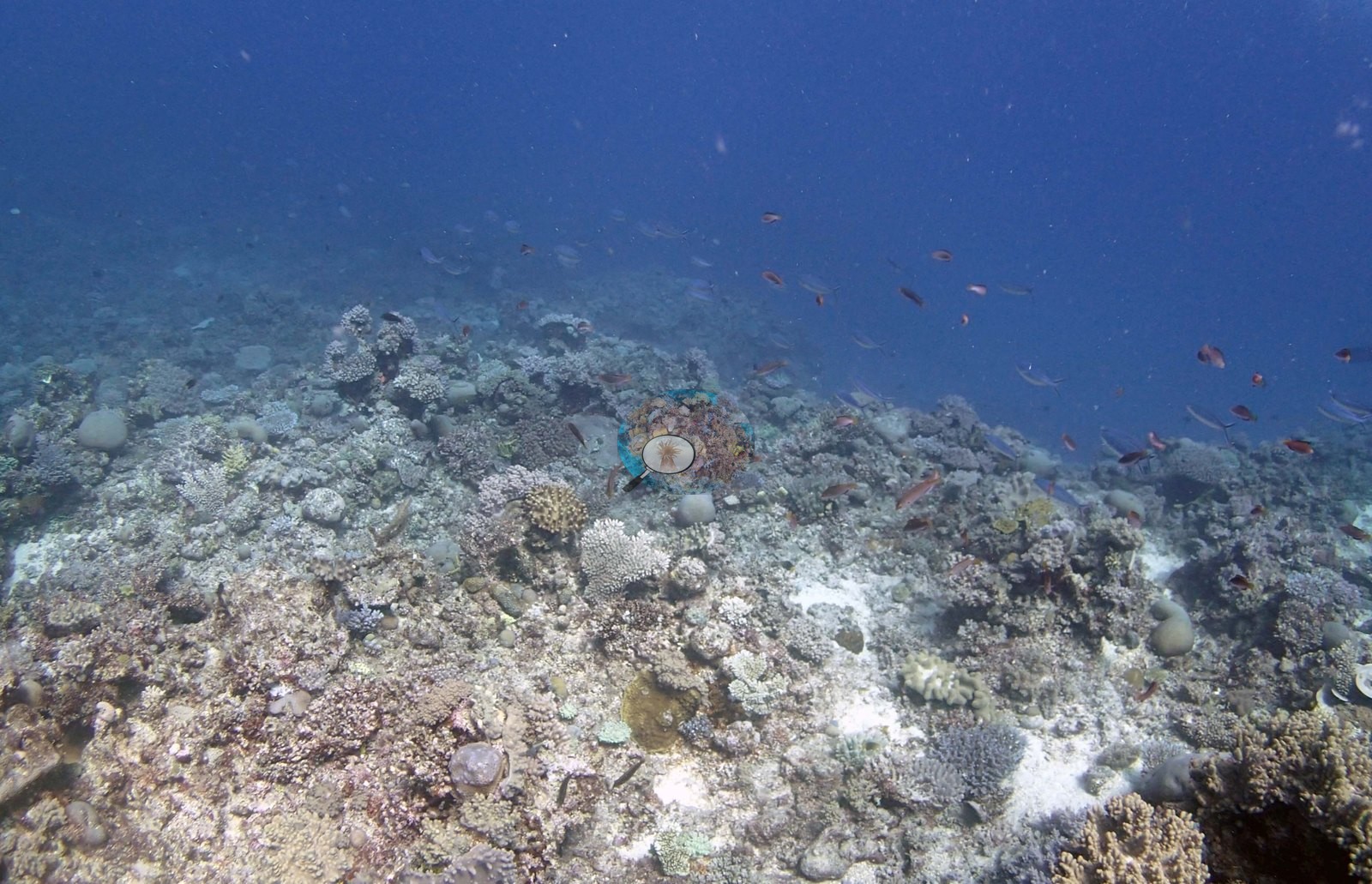
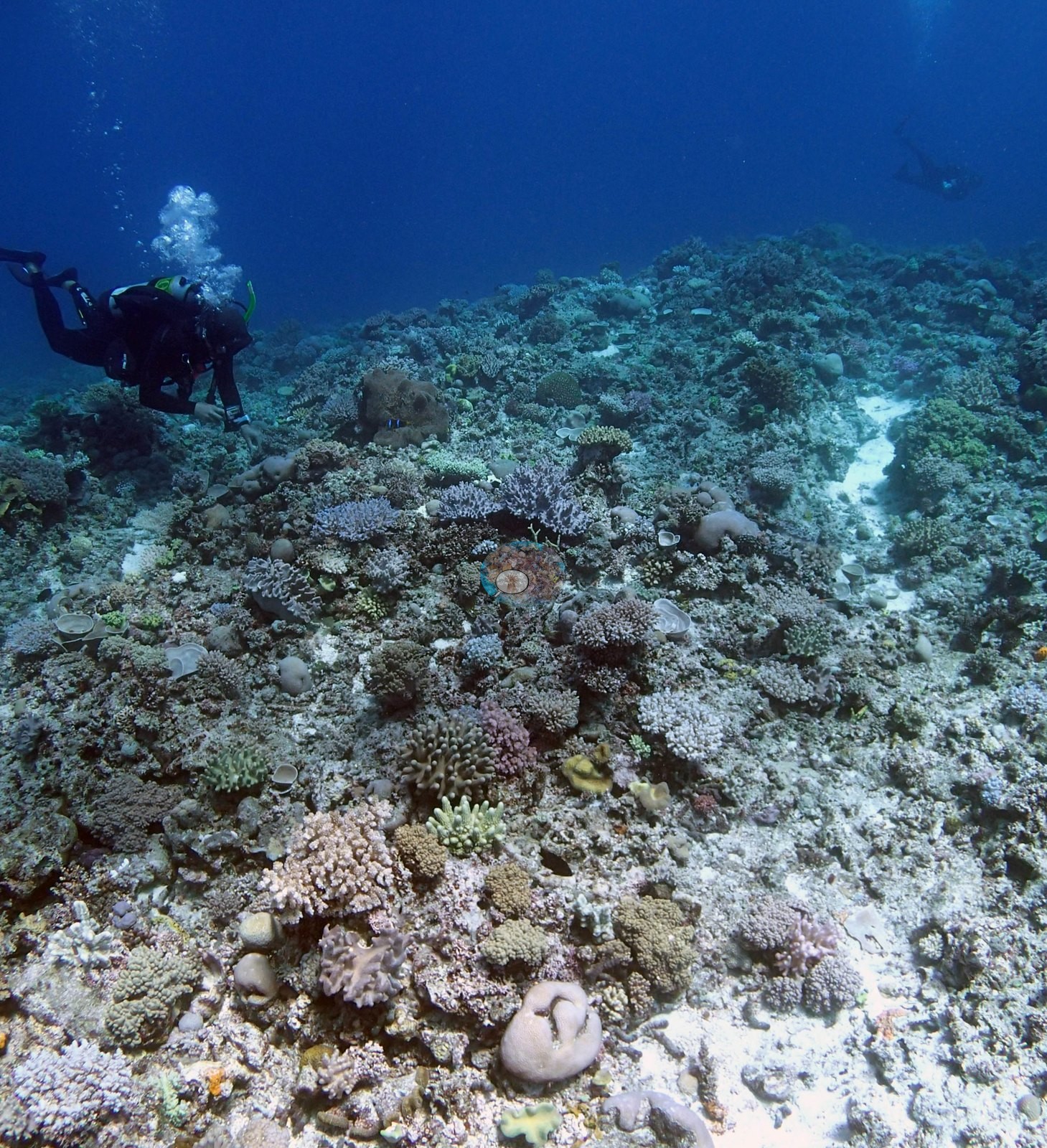
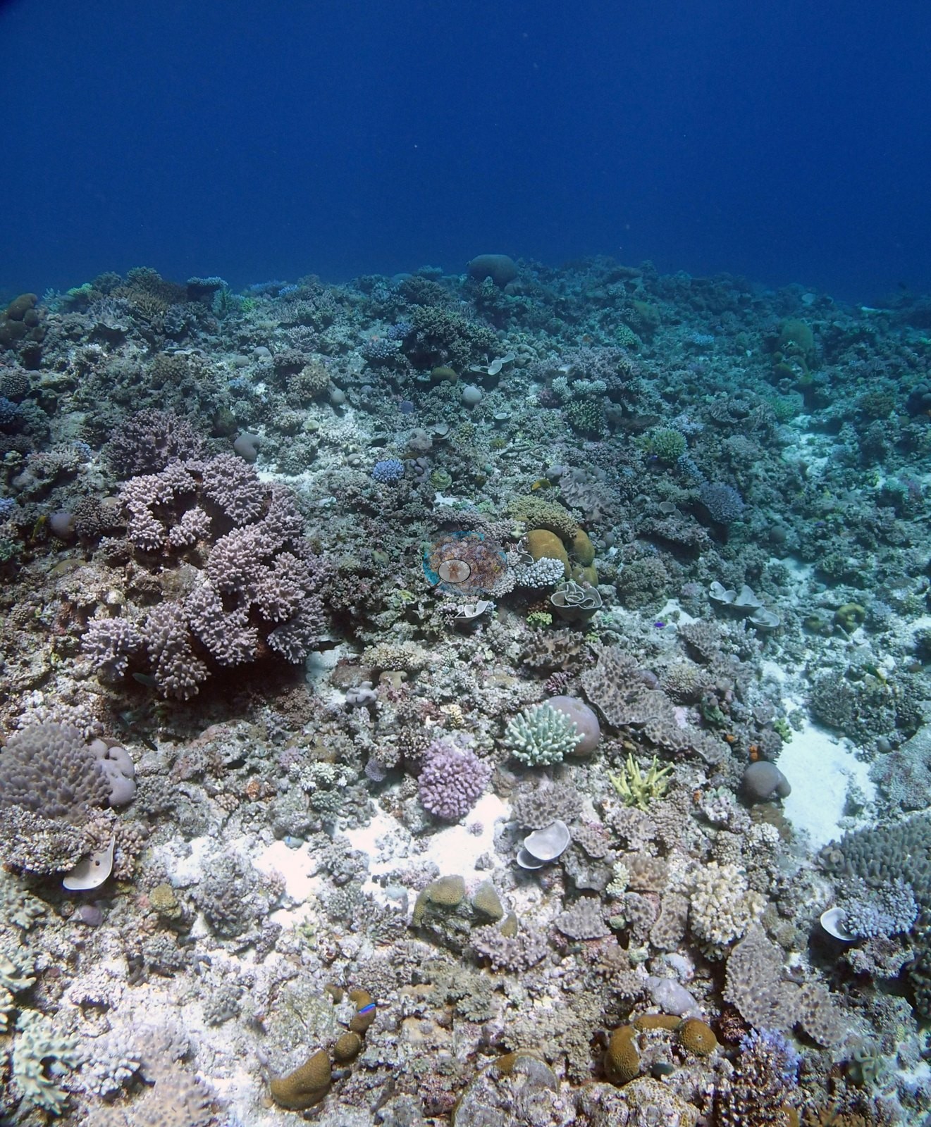
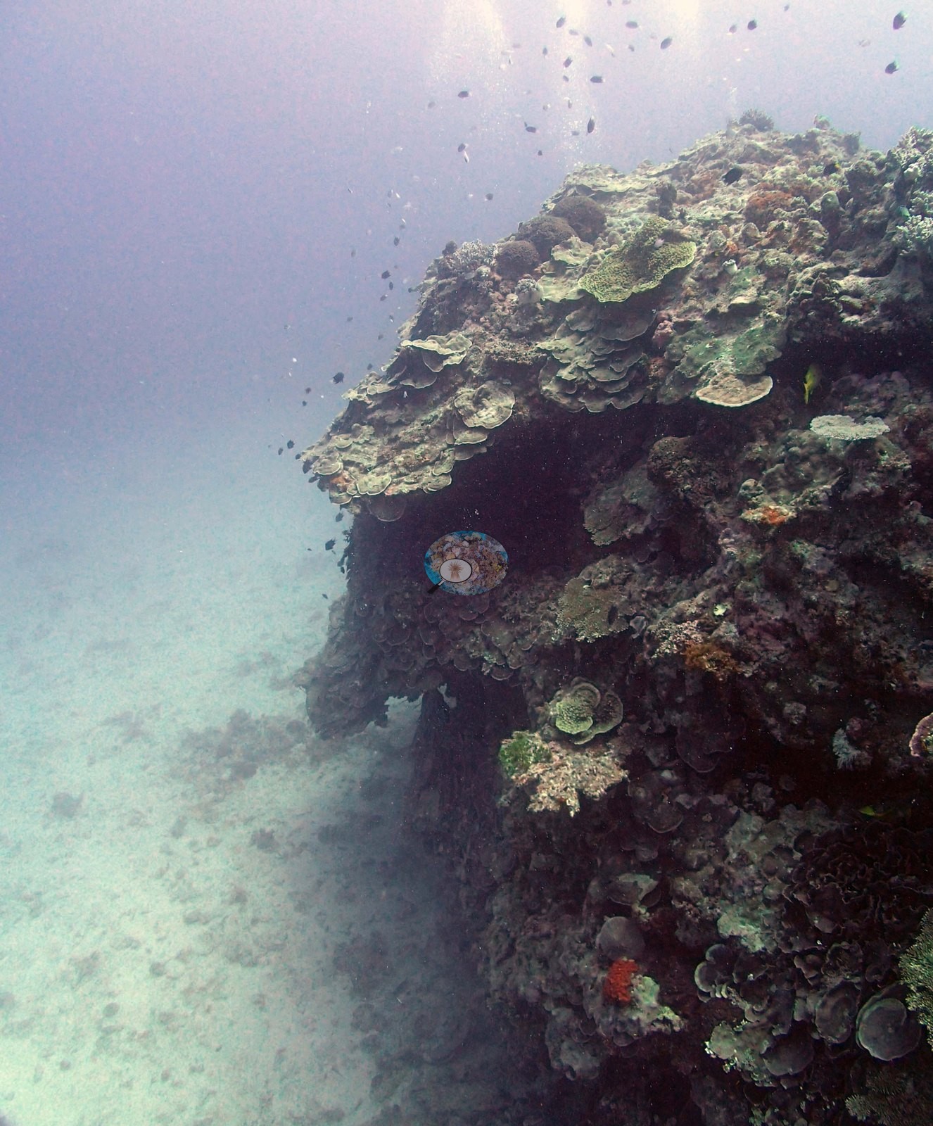
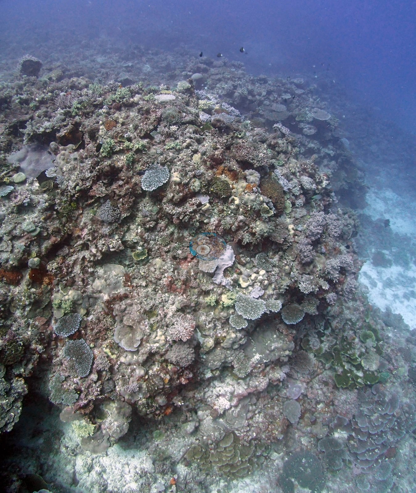
The 13 Sep 2013 survey dive left three habitat frames (e.g., Image 1, Image 2, Image 3) and seventeen close-ups of the five sampled colonies (one per colony Image 26, Image 27, Image 28, Image 29, Image 30); the other 22 photographs on this page are from a second dive at the station on 14 Sep 2013.
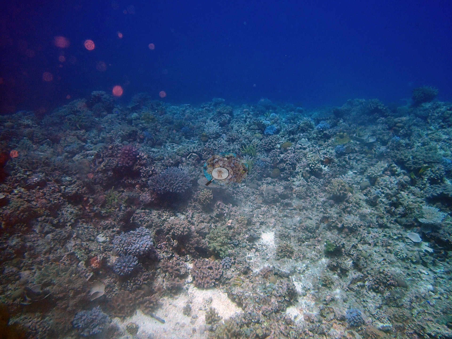
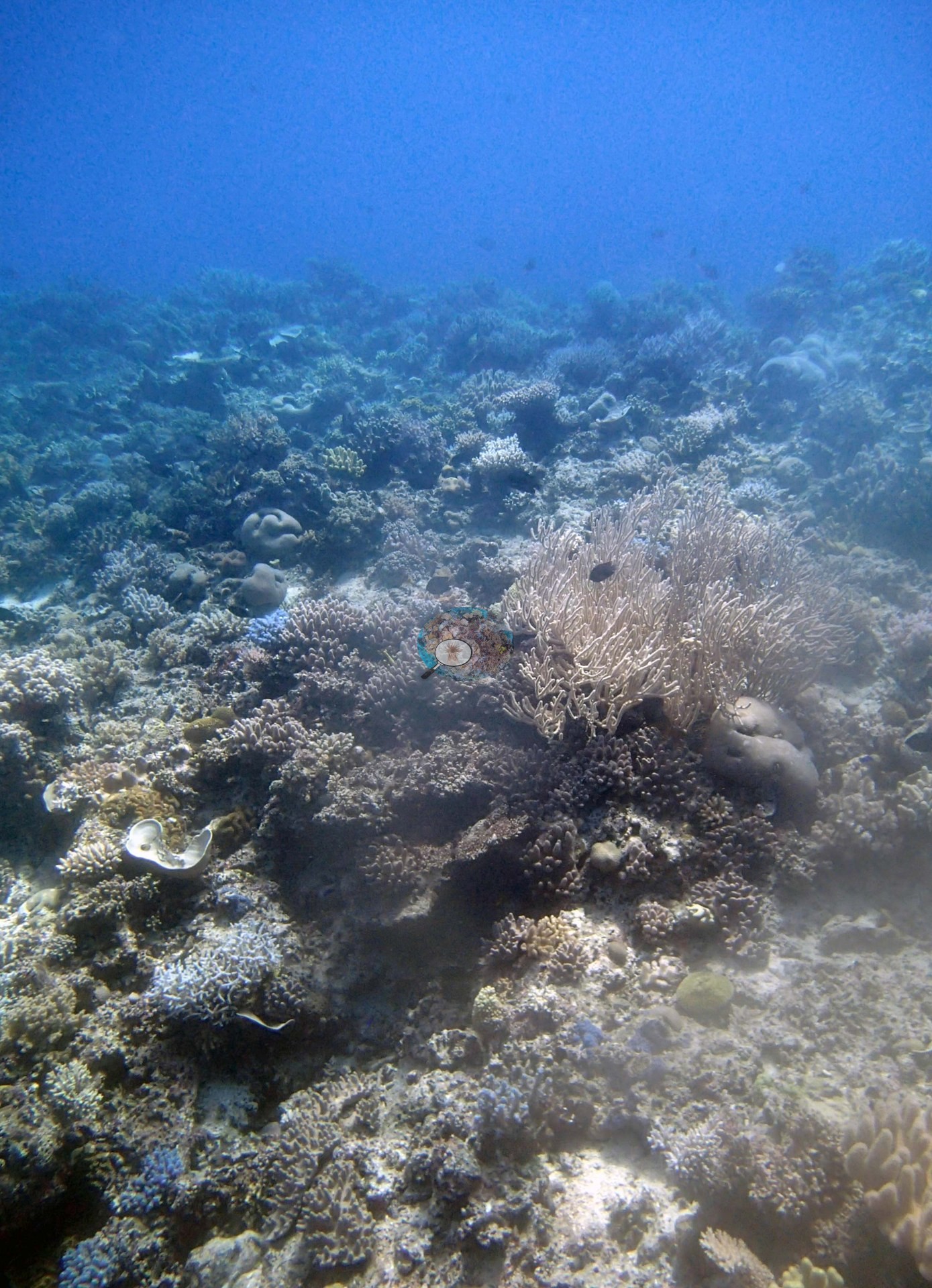
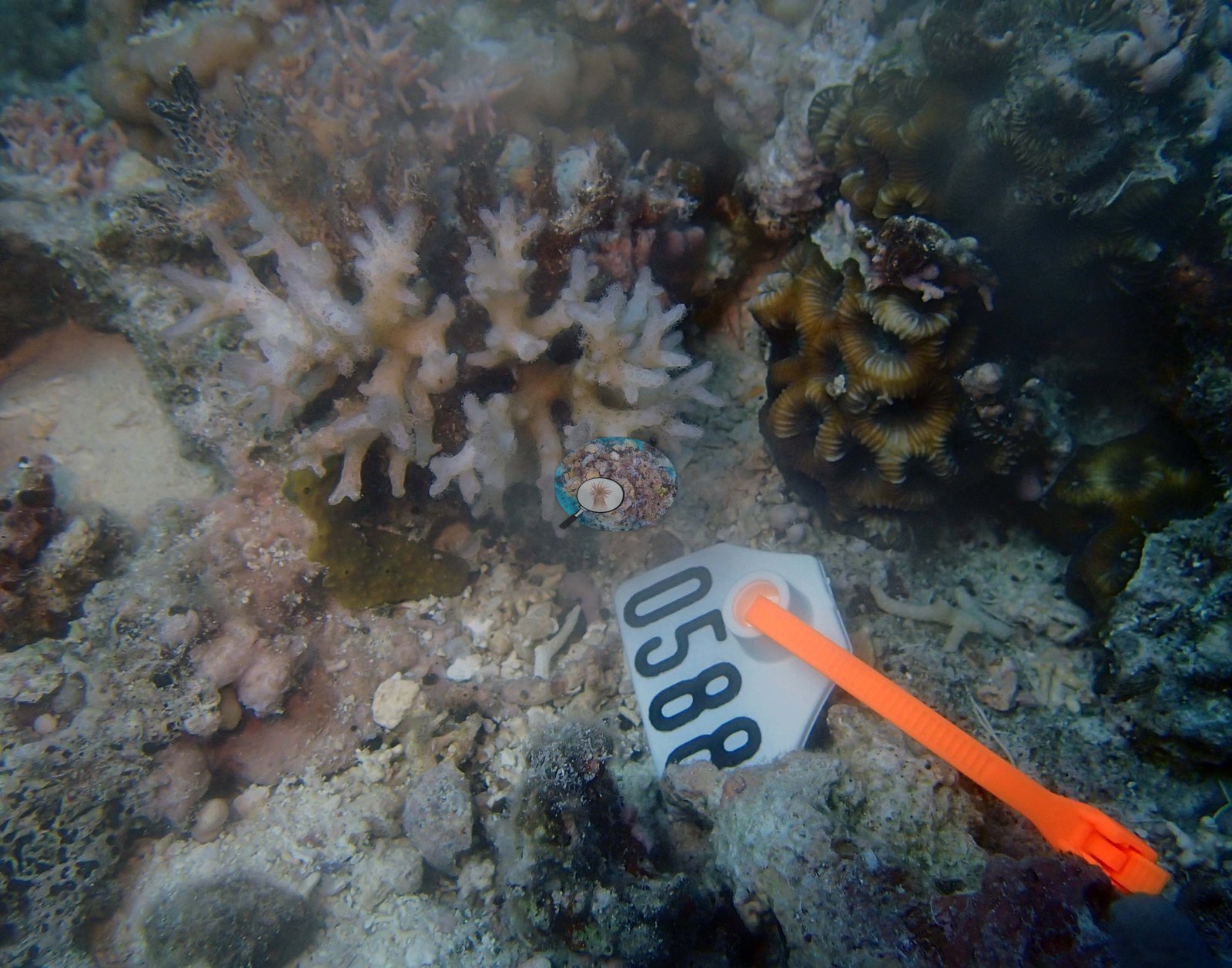
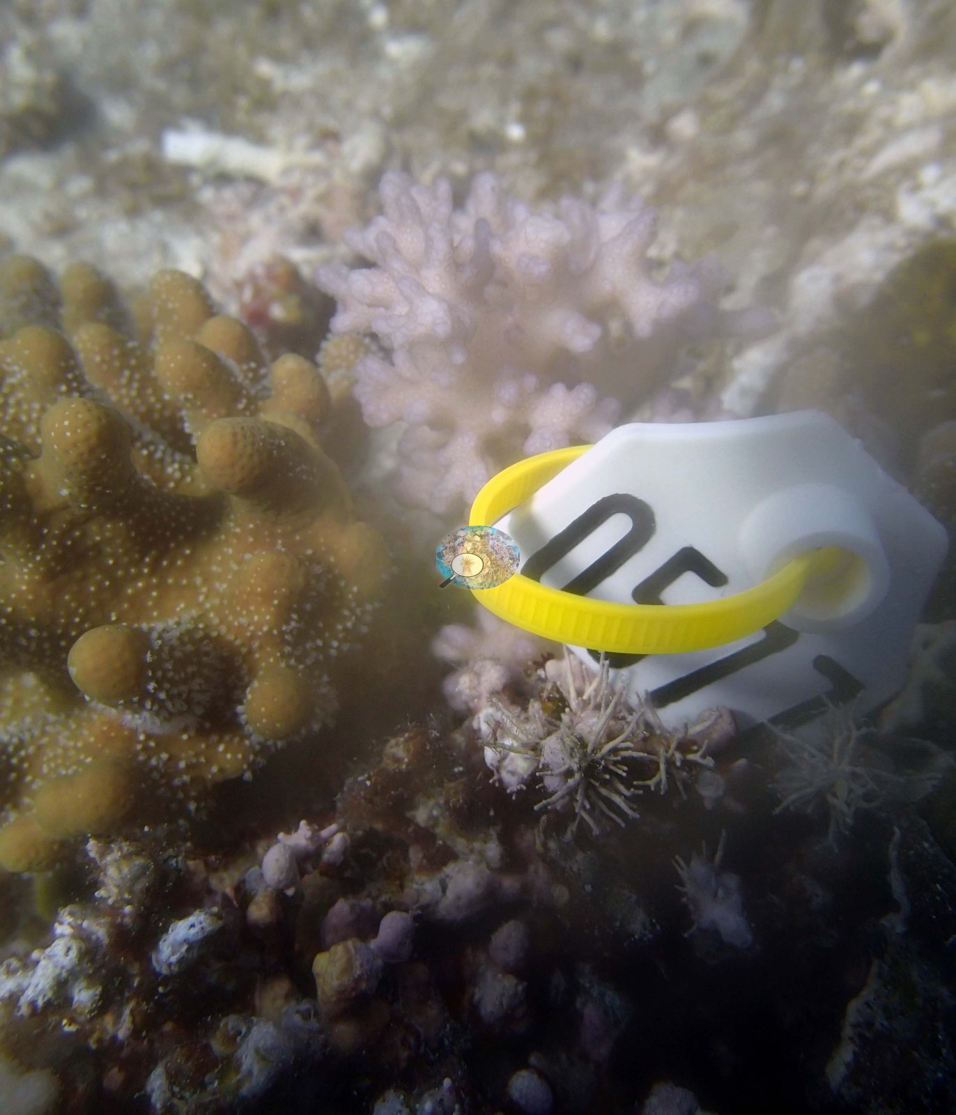
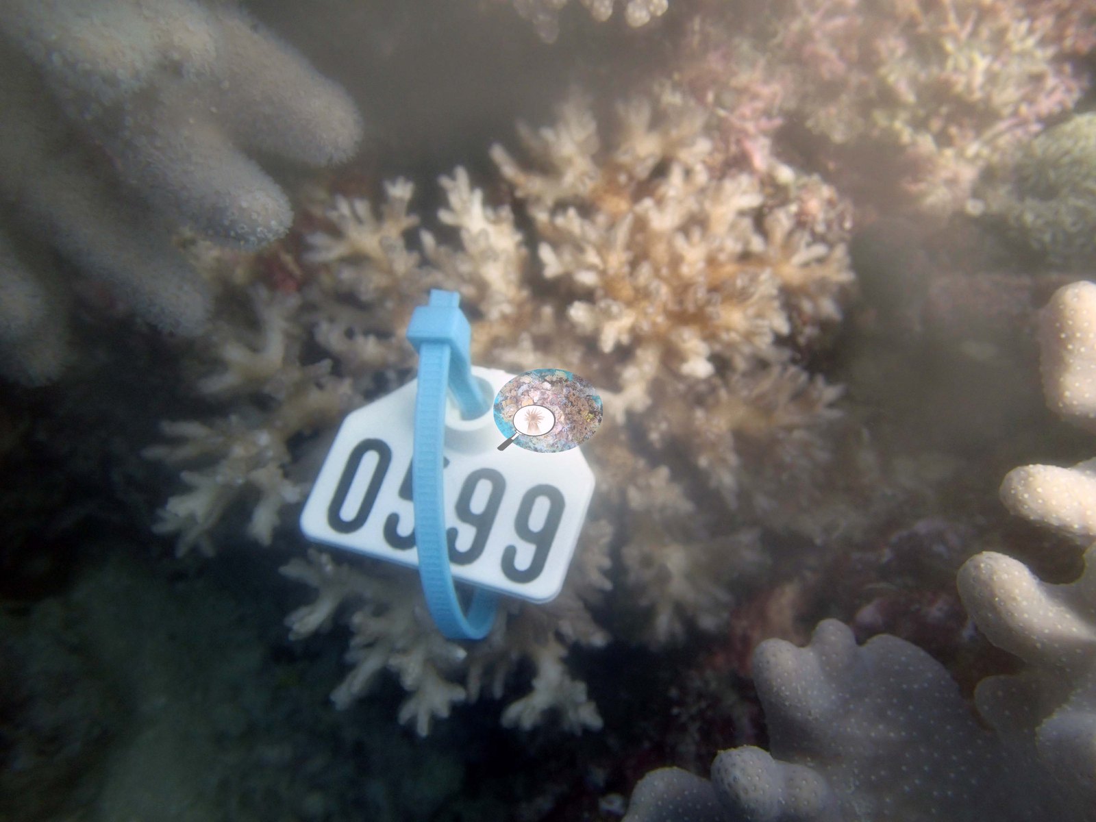
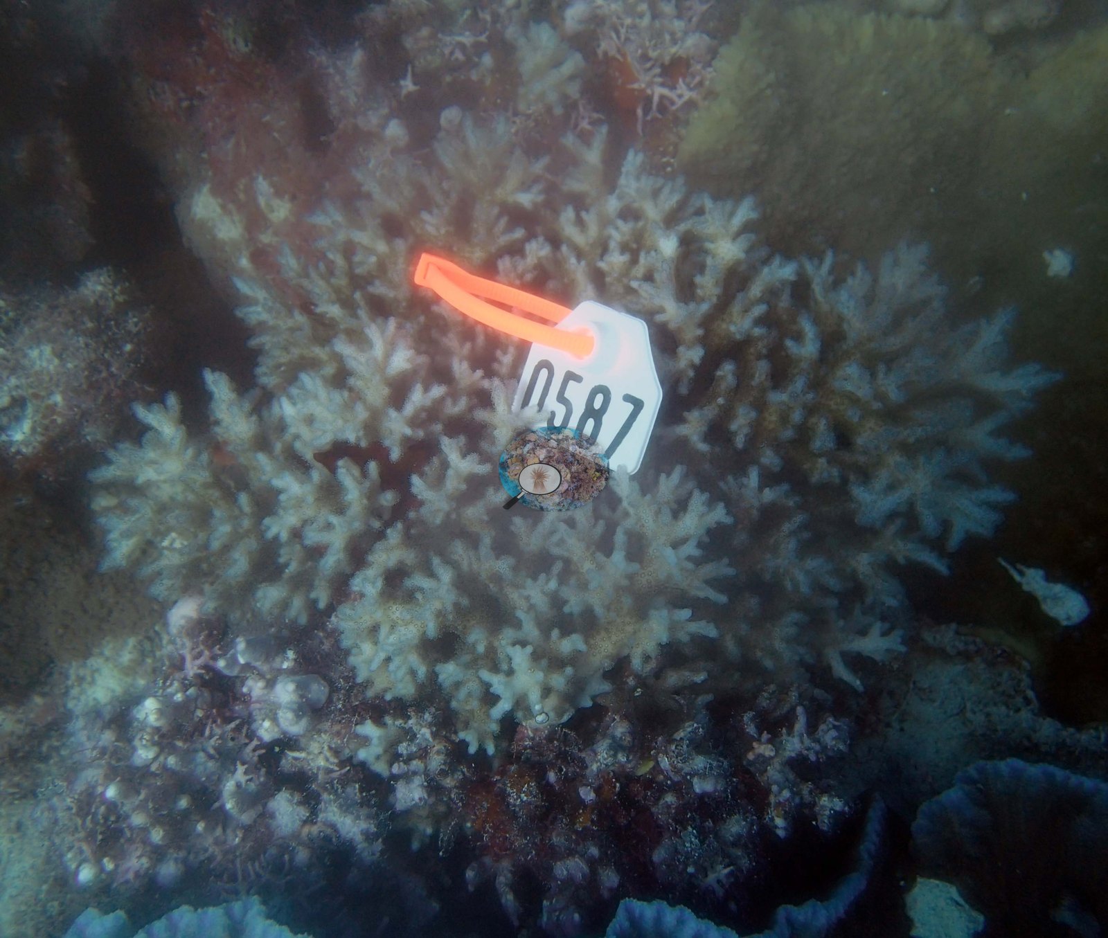
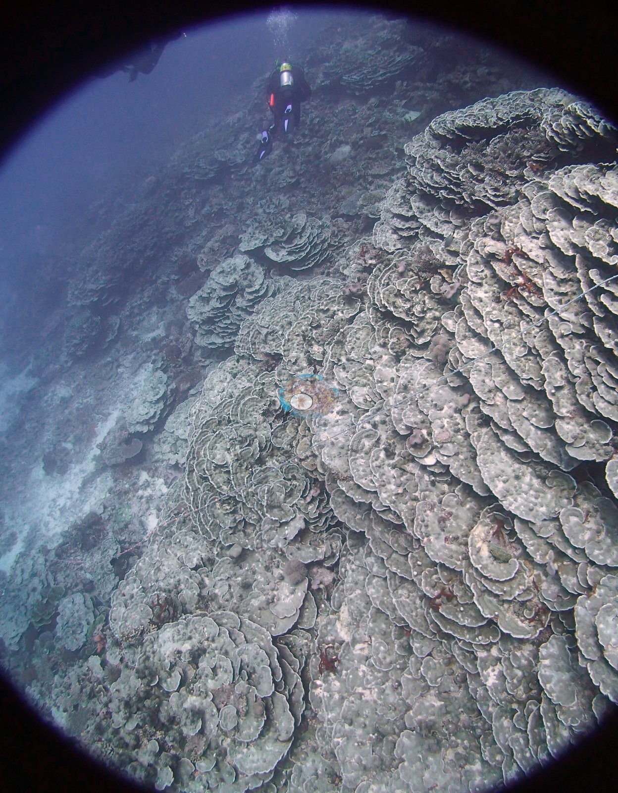
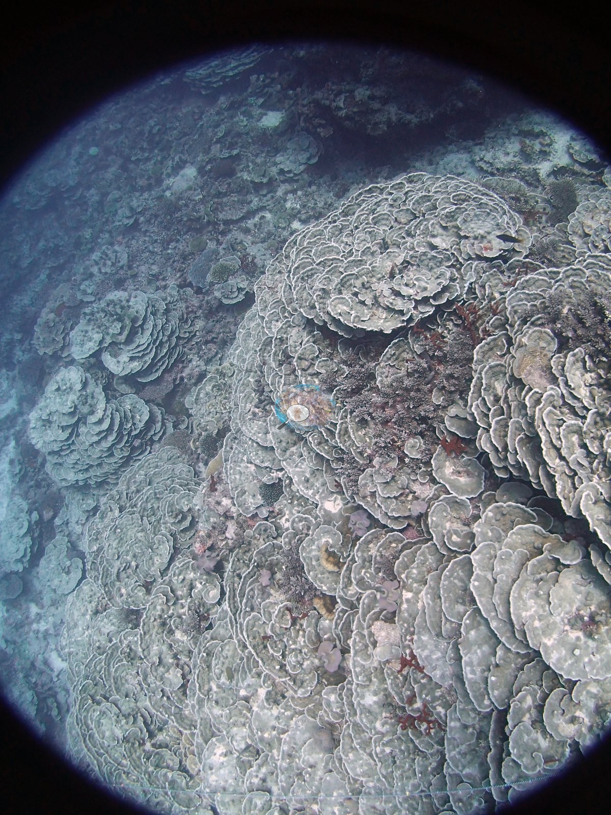
The surveyors' account — with its soft-coral-dominated hardground and its monospecific bands of bottlebrush Acropora, Coscinaraea, Porites rus, Merulina, and Lobophyllia down the slope — remains the record of what this reef is; the 14 Sep frames show part of it, among them a plate-covered mound Anderson identified as an impressive Merulina colony (e.g., Image 22) and plating coral in deeper water (e.g., Image 17).
What the three habitat frames do show is consistent with a low-relief platform. All three are wide, ambient-light views taken looking across the bottom with open blue water above; relief in them is low, a broadly flat hardground carrying small, closely spaced colonies rather than towering structure, with pale sand and rubble showing between. Image 3, in which Anderson noted high coral diversity, is the most informative: a mixed field of small branching, encrusting, and massive colonies at a range of colors and forms, with a conspicuous pale, finely branched fan-like colony standing proud of the bottom on the right of frame — an erect octocoral or gorgonian rather than a stony coral, though it cannot be called more tightly than that. Image 2 centers on a substantial brown branching-to-tabular colony rising from otherwise low ground, surrounded by smaller mixed colonies over pale sediment. Image 1 is the general site frame and is the weakest of the three: dim, blue-cast, with red back-scatter flare across the upper left, showing a broad low-relief field of small colonies and a pale patch near center that cannot be resolved.
Survey team's site notes (slope). There was a slight build-up at the edge dominated by branching acroporids, then a moderately steep slope, vertical in places, from 12 m – 20 m. Scattered large mounds, 2-5 m diameter occurred on the deeper part of the reef, extending from 30 m- 20 m height. Throughout the deeper part of the reef, on the slope and at the base of the slope were extensive 10-30 m wide bands of monospecific assemblages. Thickets of a long-branched bottlebrush acroporid, each 20-30 m X 3-4 m occurred in three locations. One large mound was encrusted by overlapping Coscinaraea plates, covering an area of more than 20 m X 20 m at 60-90% cover. Slightly east of this were three very large assemblages of overlapping sheets (deep) turning into plates and erect branches of Porites rus. Each of these were 5-20 m long and 5 m wide with 60-90% living cover. In another area was a large monospecific assemblage of Merulina, with foliaceous colonies each 1-3 m in diameter and covering 20-30 m up the slope. In another area was a large assemblage of Lobophyllia, 5-10 m wide and in places intermixed with Acropora.
Coral cover
- Reference: Khaled bin Sultan Living Oceans Foundation, Global Reef Expedition (in situ transect)
- 22%, from the Khaled bin Sultan Living Oceans Foundation's in situ transect survey (Global Reef Expedition site data); the photographs illustrate the site.
- Coral Health Index 3.00/5 (Mayfield et al. 2021, Platax; the higher of the two published calculations).
- Transect mean 22 ± 2.5% SE (n = 6 transects; Living Oceans Foundation per-transect benthic data); the headline above is this all-transect mean.
Stressors
Several of the sampled colonies appear very pale to near-white in these close-ups. That appearance is not interpretable as bleaching from these frames: the macros are lit hard and close and are variously overexposed, hazy, or out of focus, and strobe wash at that range whitens pale tissue on its own. Colony condition cannot be judged from these photographs, but Anderson's sampling sheet for this dive records it: colony 13 was 90% bleached and colony 14 half dead with its remaining tissue bleached (both noted as unhealthy), colony 17 was 10% bleached, colony 15 was pale, and colony 16 was healthy. The Living Oceans Foundation transects here recorded 1.5% cyanobacteria and no recently dead coral; they carry no bleaching, disease, or crown-of-thorns field. Typical recent thermal stress: mean annual maximum of 8.1°C-weeks (Degree Heating Weeks, 2021-2025, NOAA CRW; Southern Tonga virtual station).
Comparisons with other data
Apart from the Living Oceans Foundation survey shown here, we found no other surveys at this site as of 2026. If you would like to share yours, please email us.
Dive record
Anderson dived this station twice: on 13 September 2013 (in at 14:28, 52 minutes, 25.3 m) and again on 14 September (in at 11:03, 53 minutes, 30.8 m), which gave 22 of the photographs on this page; the first dive gave the rest.
Other notes
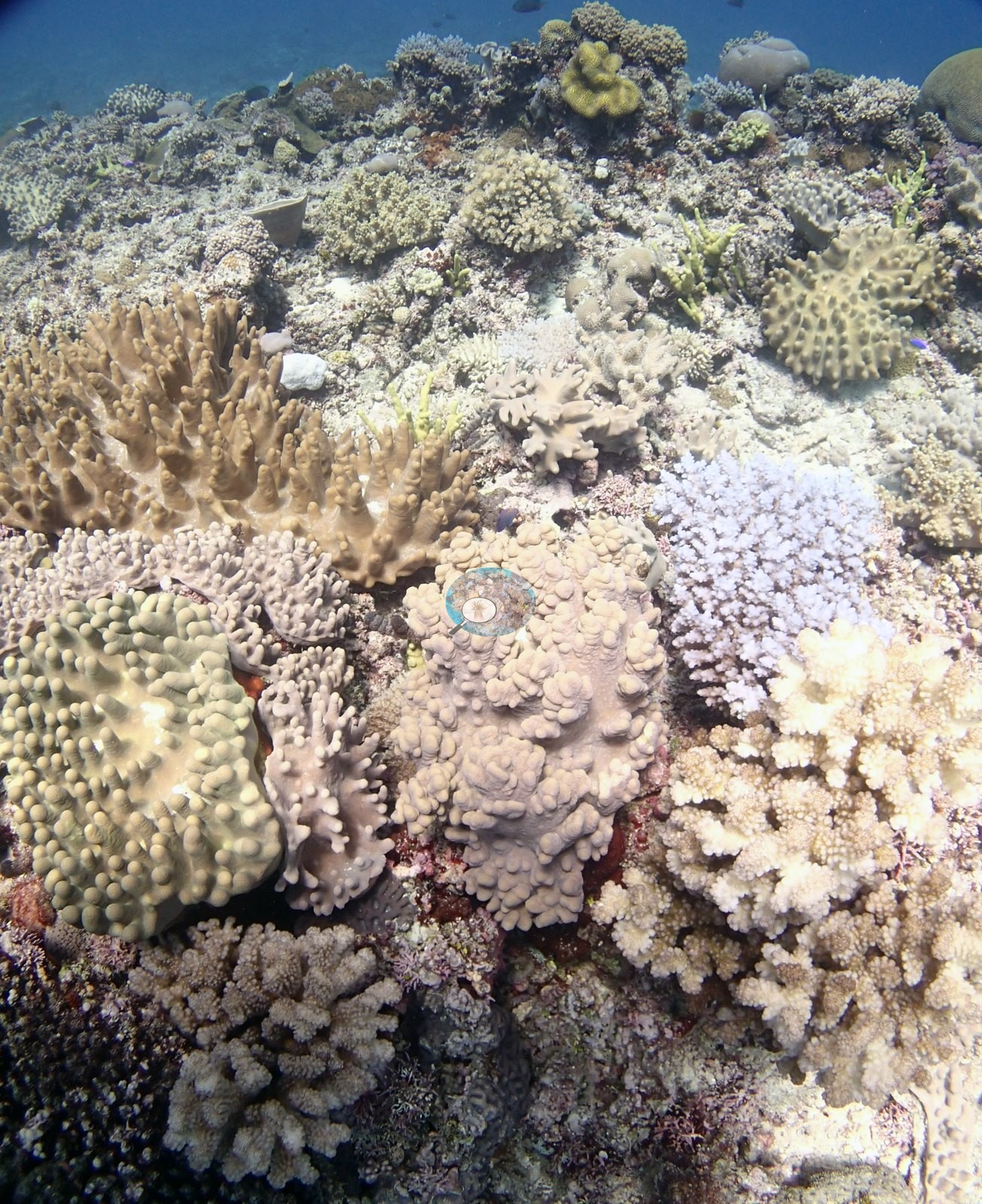
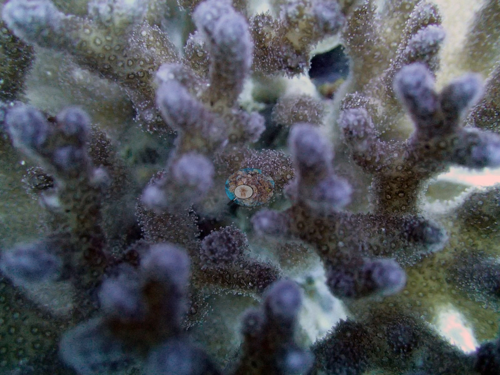
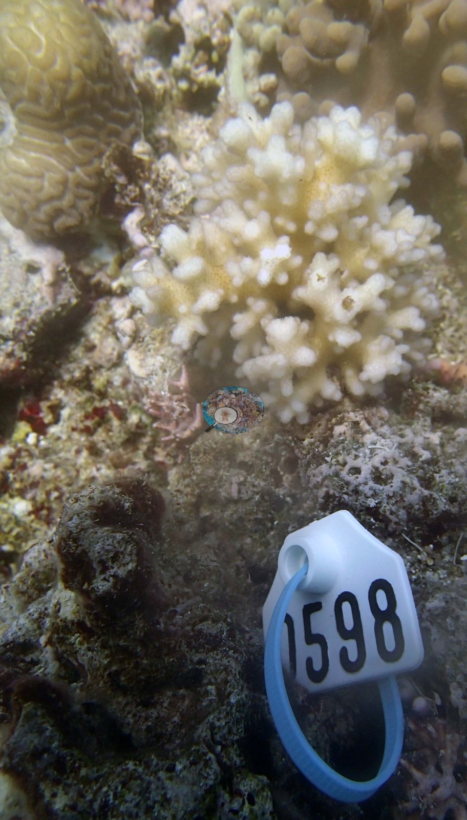
The colony photographs are the strength of this set. Five colonies were sampled and every one of them is photographed: colonies 13 and 15, which Anderson identified as Pocillopora damicornis, and colonies 14, 16, and 17, identified as Pocillopora acuta. These identifications are Anderson's, made in the water. One close-up of each colony is shown (e.g., Image 26, Image 27, Image 28, Image 29, Image 30). Each colony is documented the same way: a mid-range shot establishing the colony in place on the reef, plus one to three macros of the branch tips at polyp resolution. The colonies are small, bushy, tightly branched pocilloporids sitting among mixed encrusting and massive neighbors, one of which — an orange-brown, coarsely septate massive beside colony 14 — recurs in several of the colony frames. No scale reference or quadrat appears in any frame, so colony dimensions are not measurable, and with no depth stamps the frames cannot place any view on the depth profile the surveyors describe.
Survey team's site notes: The tops of the spurs were 0.5-1 m above the channels; these had isolated boulders that were up to 0.8 m tall, but most of the hardground was moderately low relief (up to 0.5 m) with a dominance of soft corals, especially Lobophytum, Sinularia, and Sarcophyton. Intermixed in this community was a high number of smaller massive, submassive and branching corals, including a high diversity of rare species such as Euphyllia, Caulastraea, Coscinaraea, Pocillopora, small table and digitate Acropora, Goniopora, Hydnophora.
CV model comparison
More info
The photo row below is a methods comparison only: it is never averaged with the transect and never used as the headline. It compares site means only: most of the photos come from a second dive at the station, and none from the transect points.| Method | Hard coral cover (%) | Photos (n) ± SE |
|---|---|---|
| Transect mean (all transects) | 22.3 | |
| CoralSCOP unedited | 27.6 | n = 26 · SE 3.4 |
| Claude (edited photos) | 33.8 | n = 26 · SE 3.8 |
The two computer-vision methods agree within 6.2 pp (27.6–33.8%) and read 5.3–11.5 pp above the in-water transect (22.3%); the headline is the in-water transect because a diver transect is independent of the photographs.
See a more detailed, stand-alone version of this table.
Dive history
| Date | Time in | Max depth (m) | Bottom time (min) |
|---|---|---|---|
| 2013-09-13 | 14:28 | 25.3 | 52 |
| 2013-09-14 | 11:03 | 30.8 | 53 |
Data & links
- Download benthic survey data (CSV) ↗
- Download all LOF-GRE data (933 sites) ↗
- Photo portfolio ↗
- Coral Reef Diagnostics region page ↗
All images from Coral Reef Diagnostics. Data are from the Khaled bin Sultan Living Oceans Foundation Global Reef Expedition and Coral Reef Diagnostics.
© Coral Reef Diagnostics.