

Part of the regional summaries: Australia (GBR) - Far North: Pink stations (Preservation Zone reefs) and Australia (GBR)
More info
Northern GBR (NOAA CRW virtual station)A shallow leeward site on Ribbon Reef No. 6 where separate coral heads and short ridges rise off clean white sand, topped with a genuinely mixed crowd of pink Pocillopora, yellow fire coral, Porites domes, and soft-coral fans. Living blue staghorn thickets have white growing tips and dead, algae-covered bases, and Anderson's notes record the Seriatopora colonies as bleached or recently dead. Surveyed on the Living Oceans Foundation's Global Reef Expedition.
Three independent survey stations shown with the program’s logo — click one to see how far it is from this site.
Five other CRD dive sites within 5 km shown in orange — click a marker to open its page.
🗺 Detailed map of the Global Reef Expedition dive sites, Ribbon Reefs, northern Great Barrier Reef (Khaled bin Sultan Living Oceans Foundation; opens in a new window)
Site description
Setting
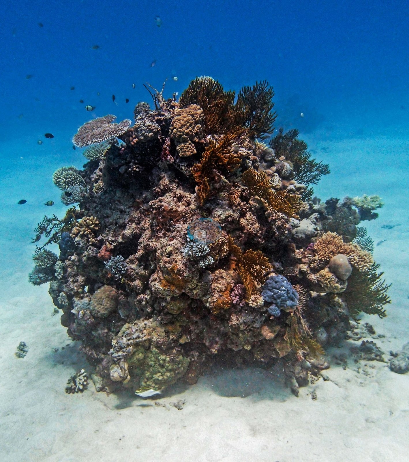
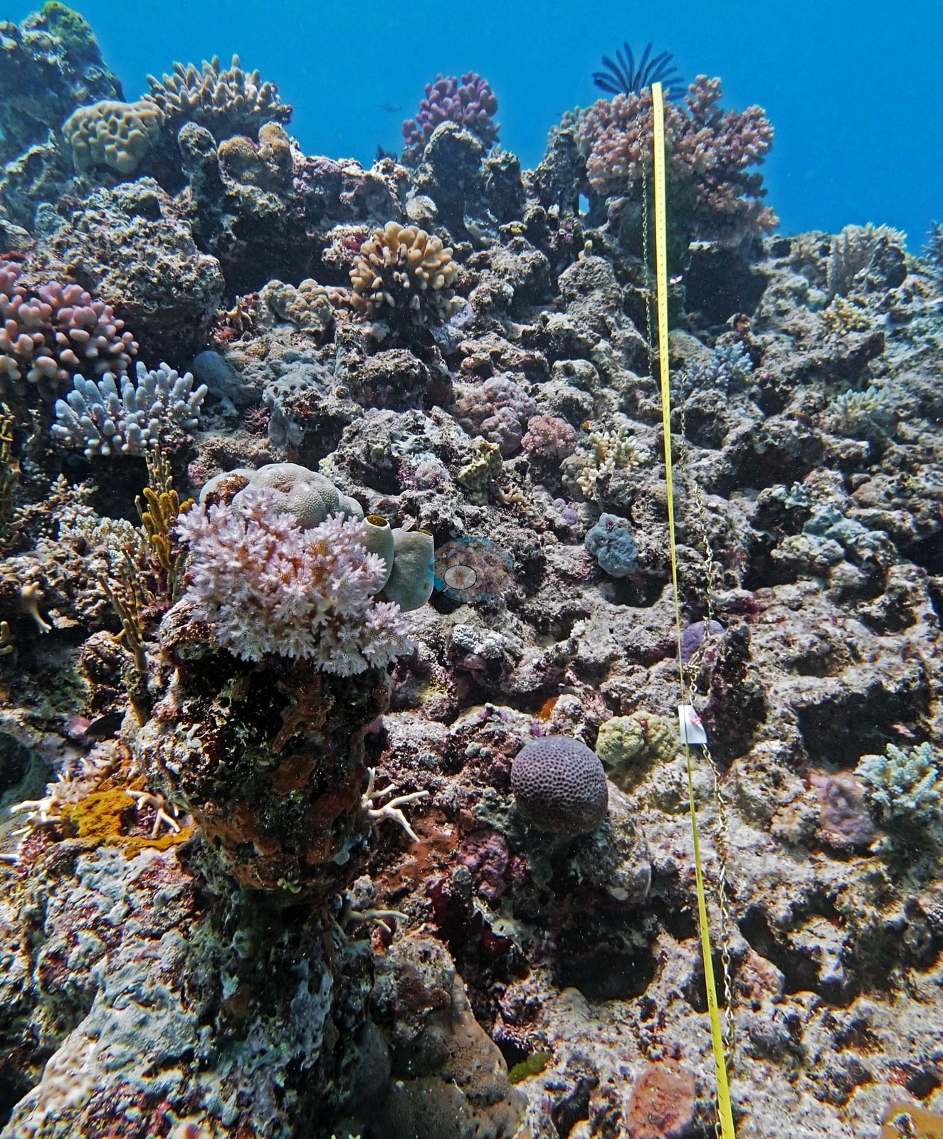
The full 22-frame set is essentially a portrait series of individual bommies: this is not continuous reef but a field of separate coral heads and short ridges rising off clean white sand, photographed one after another (e.g., Image 6, Image 7, Image 9, Image 10, Image 12, Image 13, Image 15, Image 17, Image 18, Image 19, Image 20, Image 21, Image 22).
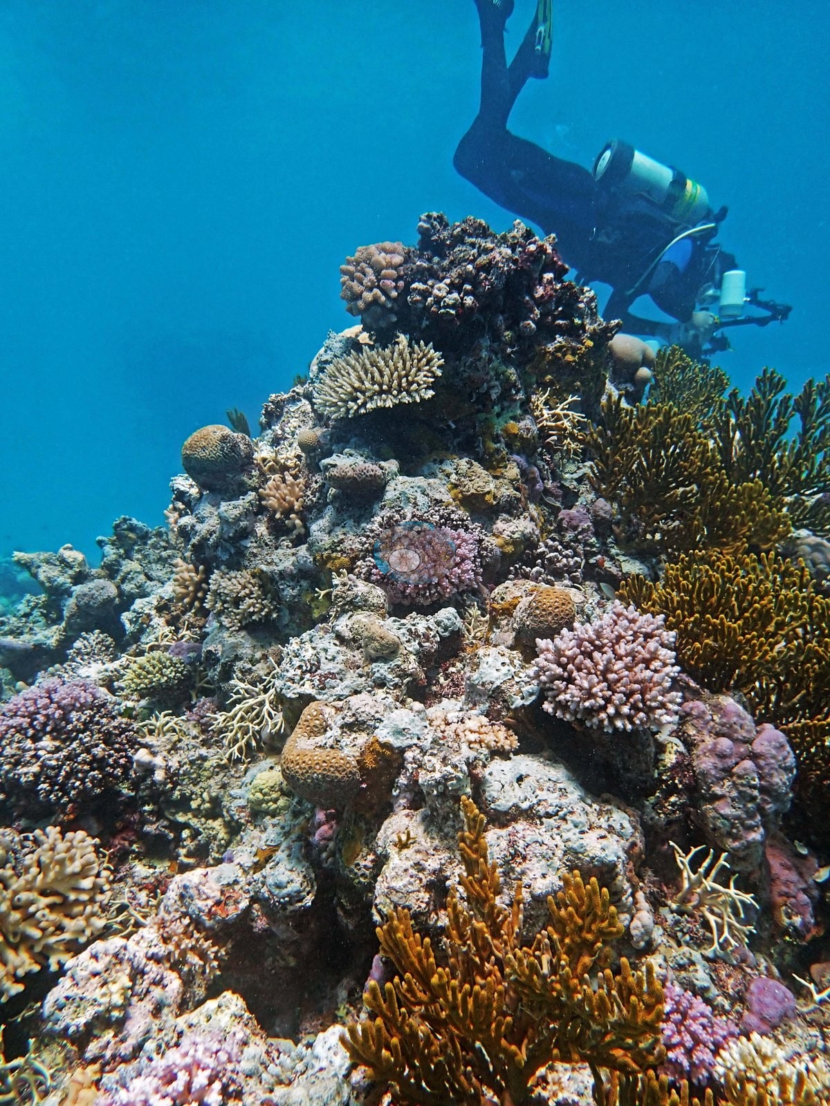
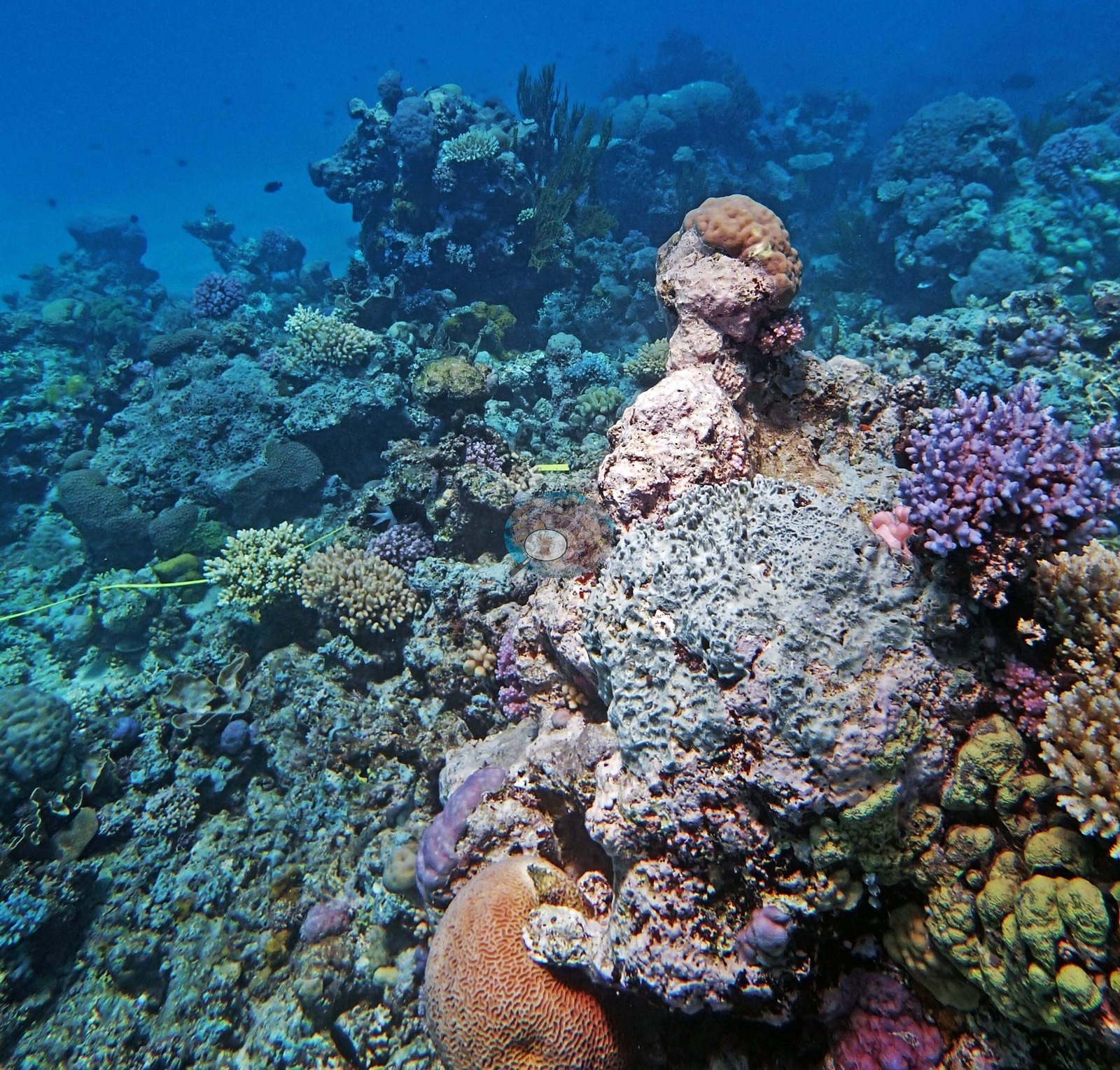
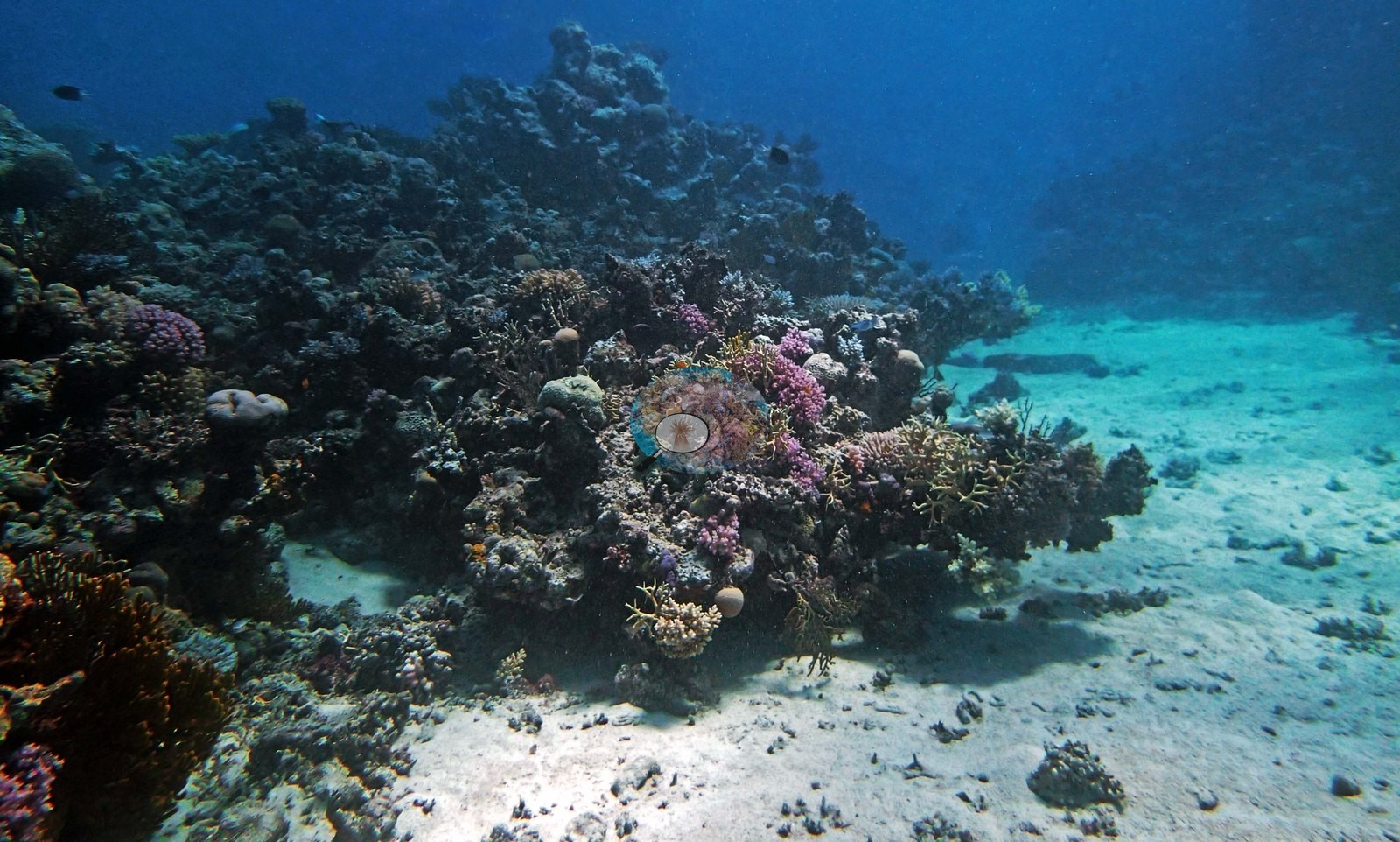
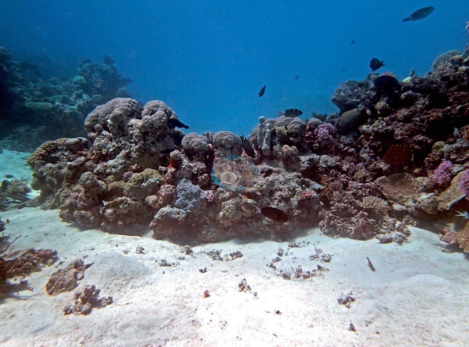
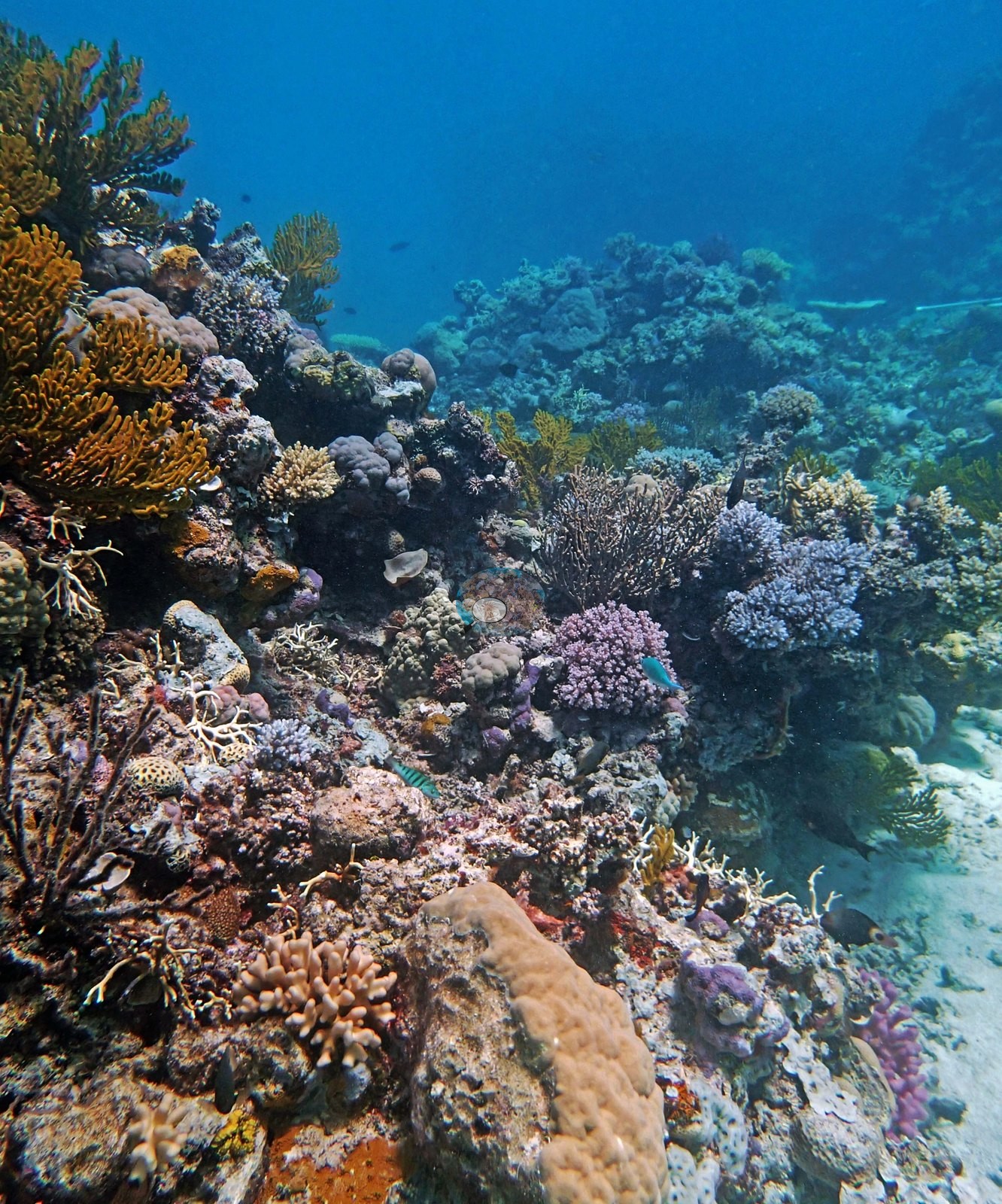
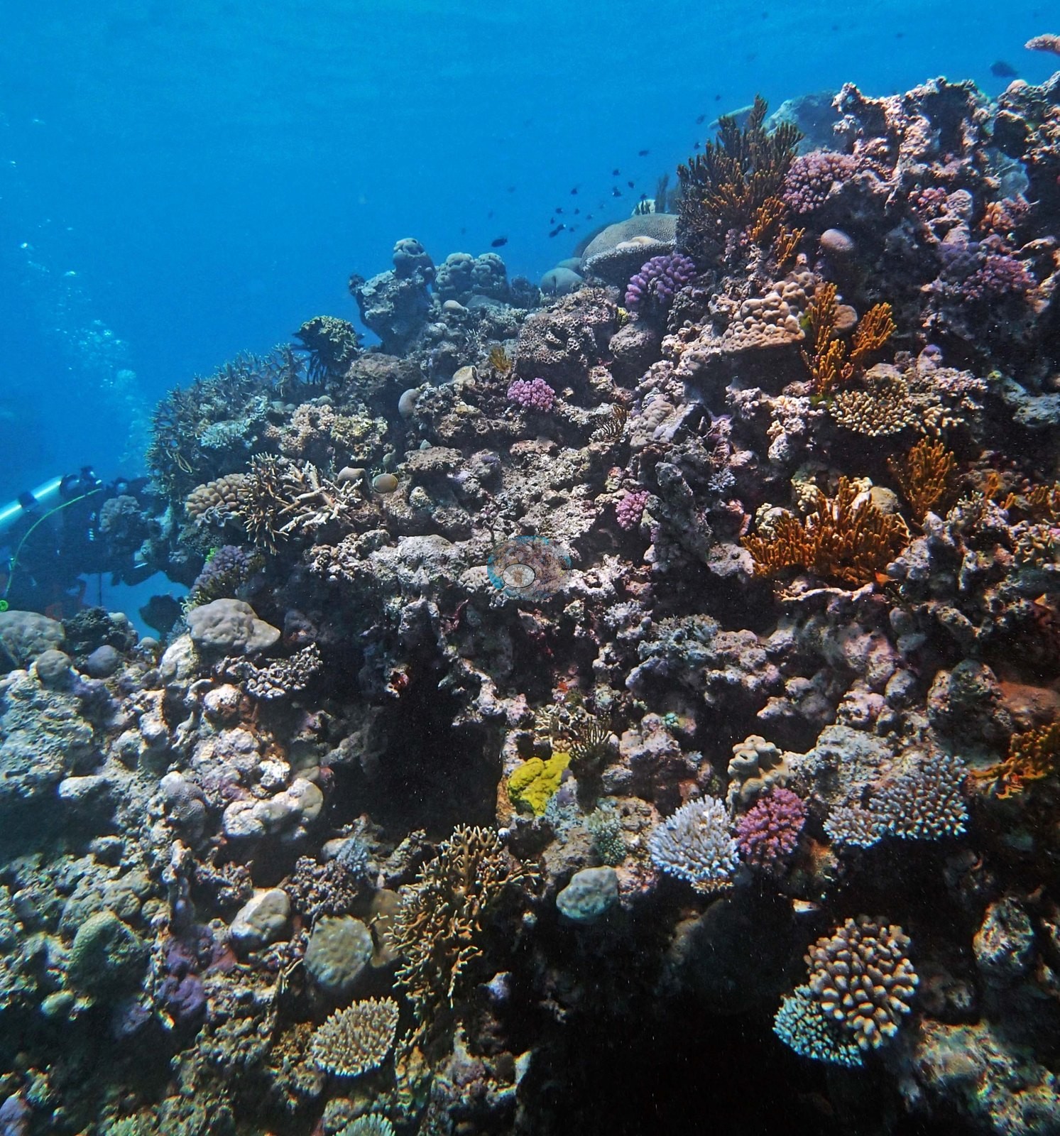
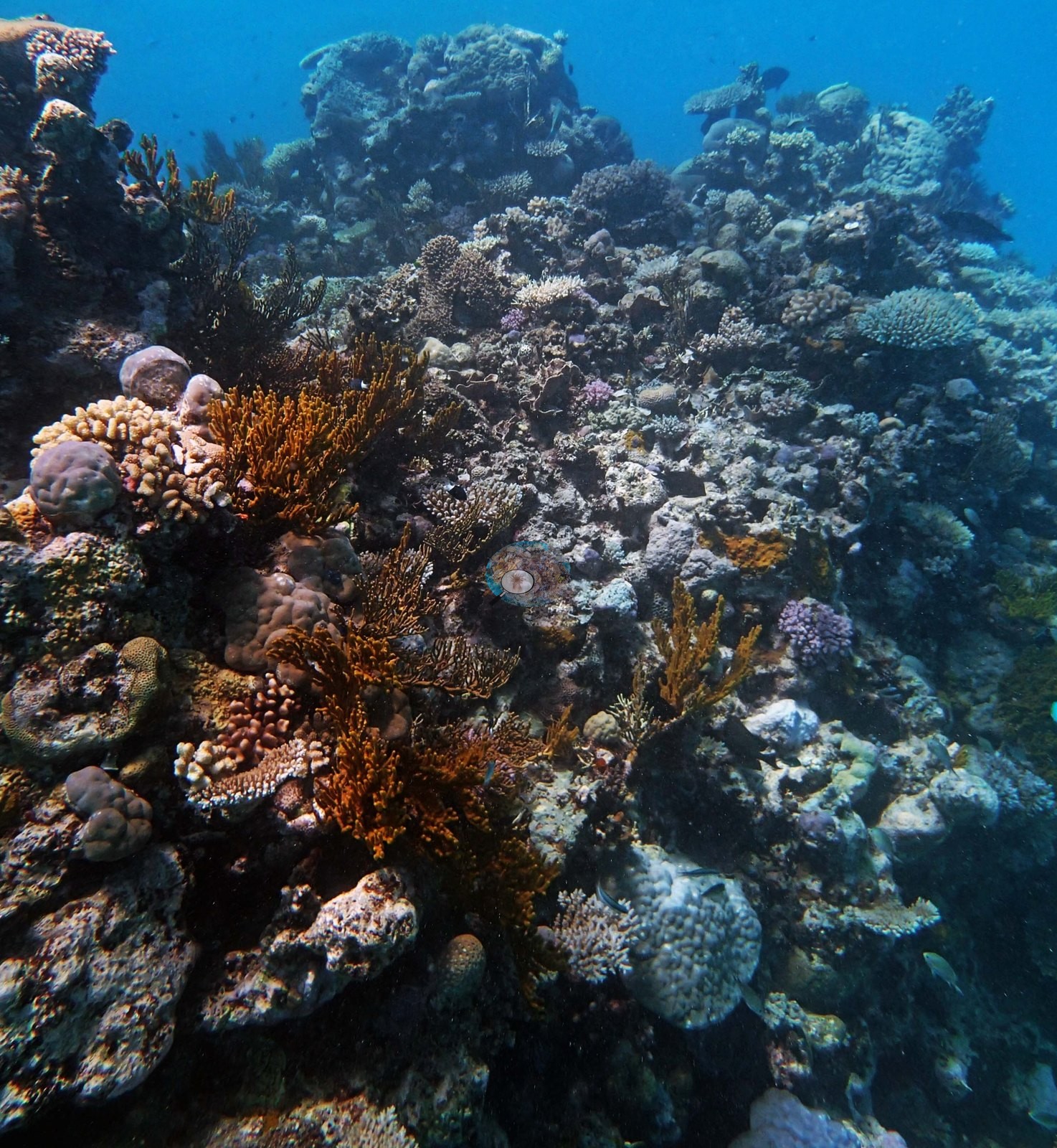
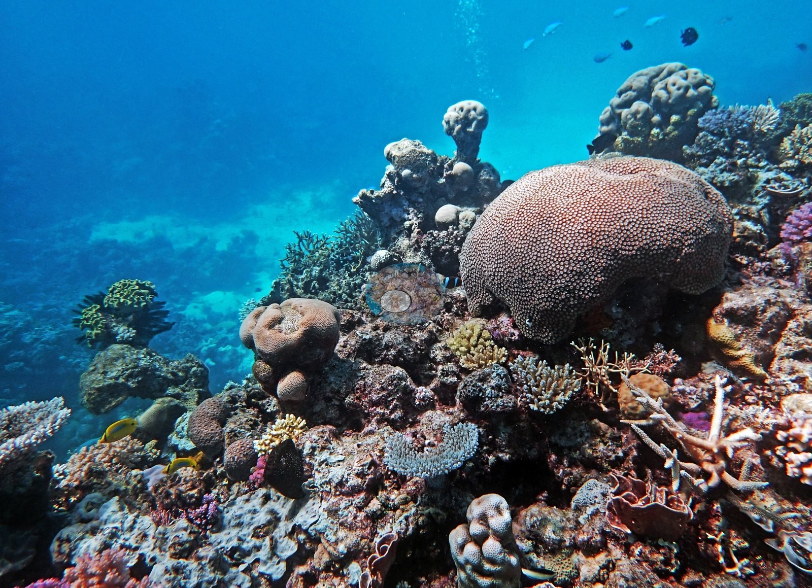
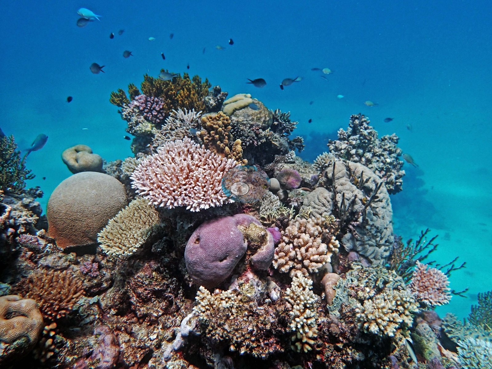
Tucked on the leeward side of Ribbon Reef No. 6, this shallow site, barely 11.1 m at its deepest, is built from coral bommies that knit into a near-continuous reef by 5 m, with point-count cover of 36%. A striking saddle formation saw the reef crest at just 2 m before dropping away again on the windward side of the bommie. This site sits in a Preservation Zone.
General benthic features
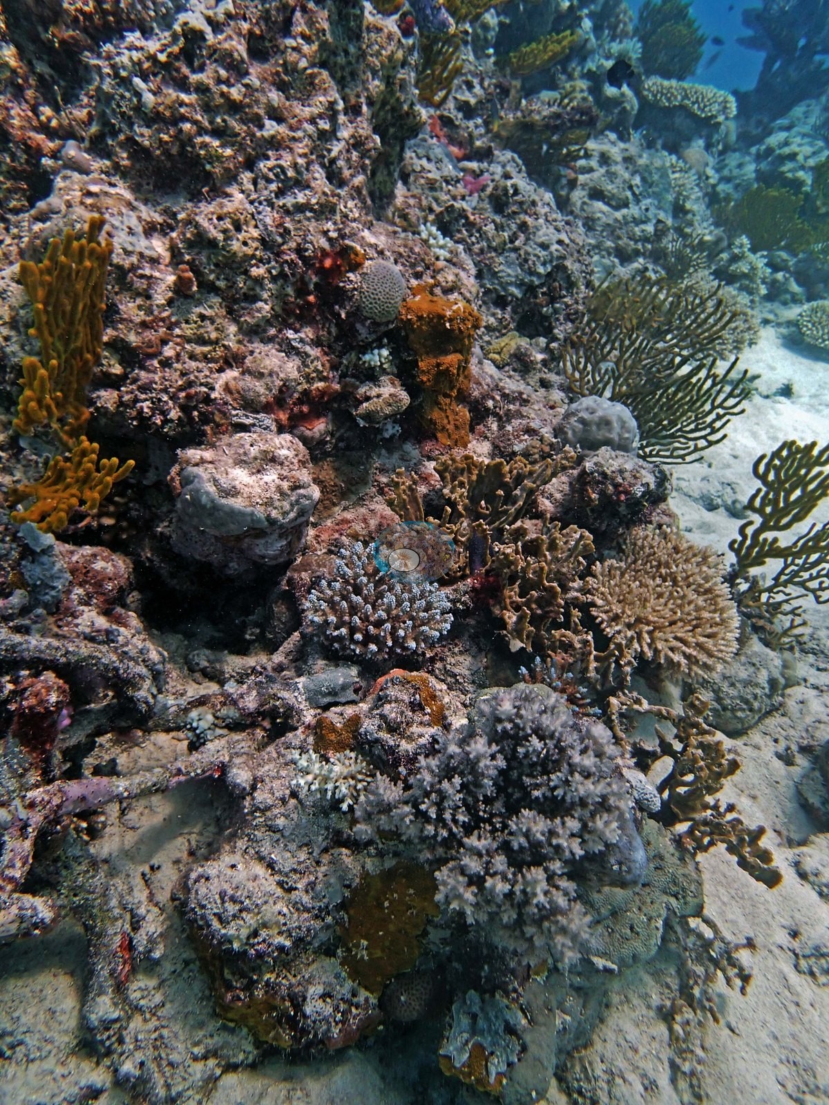
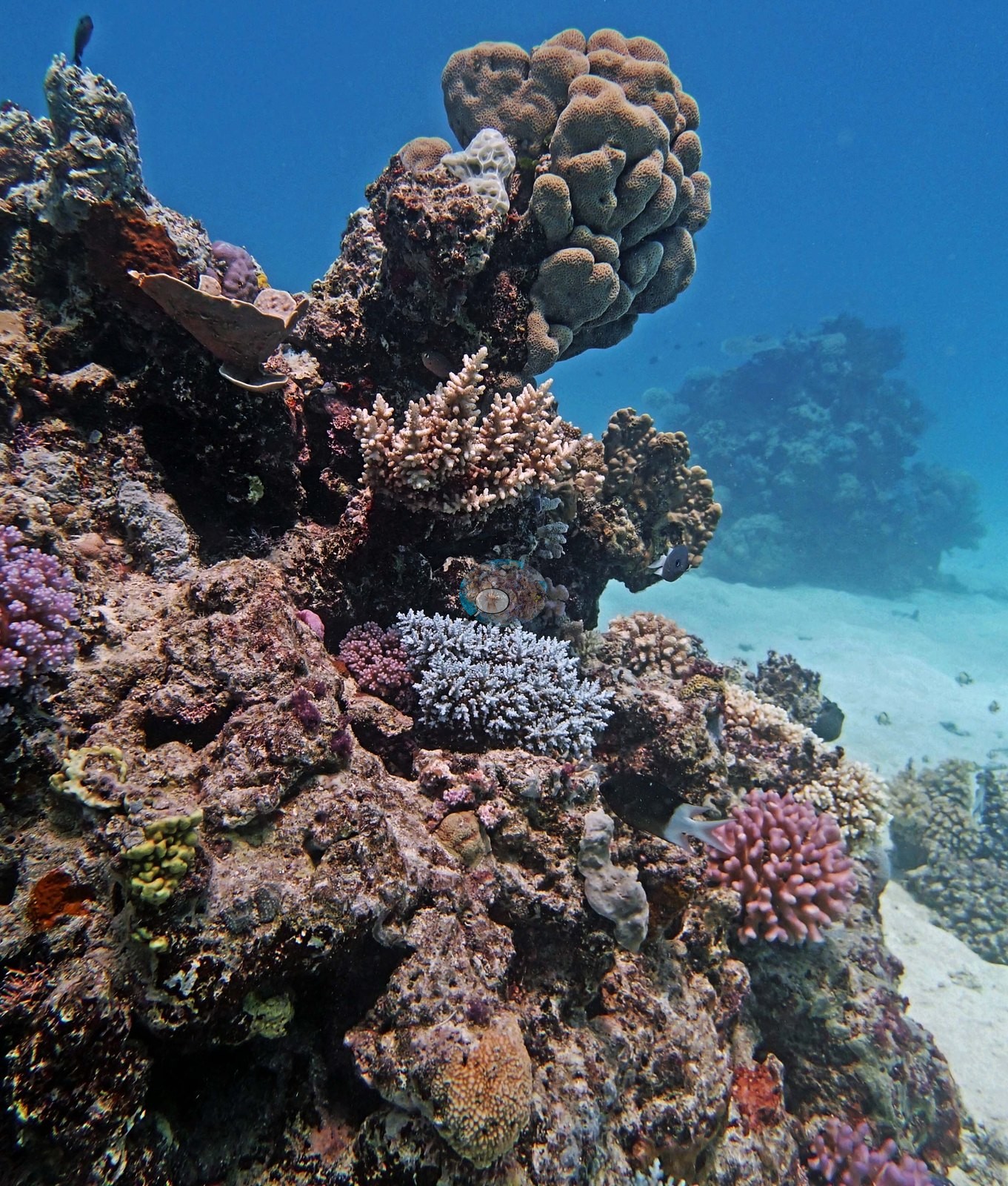
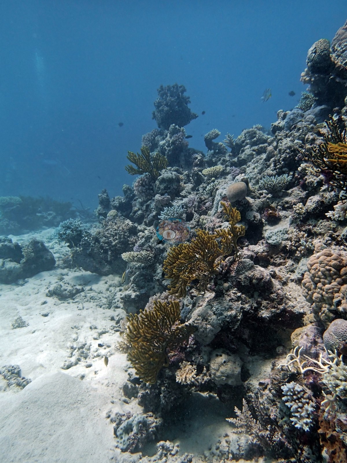
Image 10 and Image 9 are the clearest examples — a single mixed-coral head standing alone on open sand with blue water behind. Image 17 shows the same structure drawn out into a low elongate ridge along the sand. The bommie tops carry a genuinely mixed assemblage rather than a dominant form. Recurring through the frames are pink and mauve Pocillopora clusters (e.g., Image 5, Image 7, Image 12, Image 13, Image 14, Image 19, Image 20), mustard-yellow branching fire coral (Millepora) (e.g., Image 6, Image 18, Image 20, Image 22), smooth brown and tan massive domes, with a large brain-type massive colony crowning the head in Image 21, mounding faviids with neat polygonal corallites (e.g., Image 5, Image 21), yellow and orange knobby encrusting colonies, purple and magenta massive and encrusting colonies (e.g., Image 19, Image 22), corymbose and digitate Acropora, and abundant soft corals: brown and orange gorgonian fans leaning off the reef edge onto sand (e.g., Image 6, Image 18), purple and pink soft-coral clumps (e.g., Image 13), and feather stars perched on the high points (e.g., Image 6, Image 18).
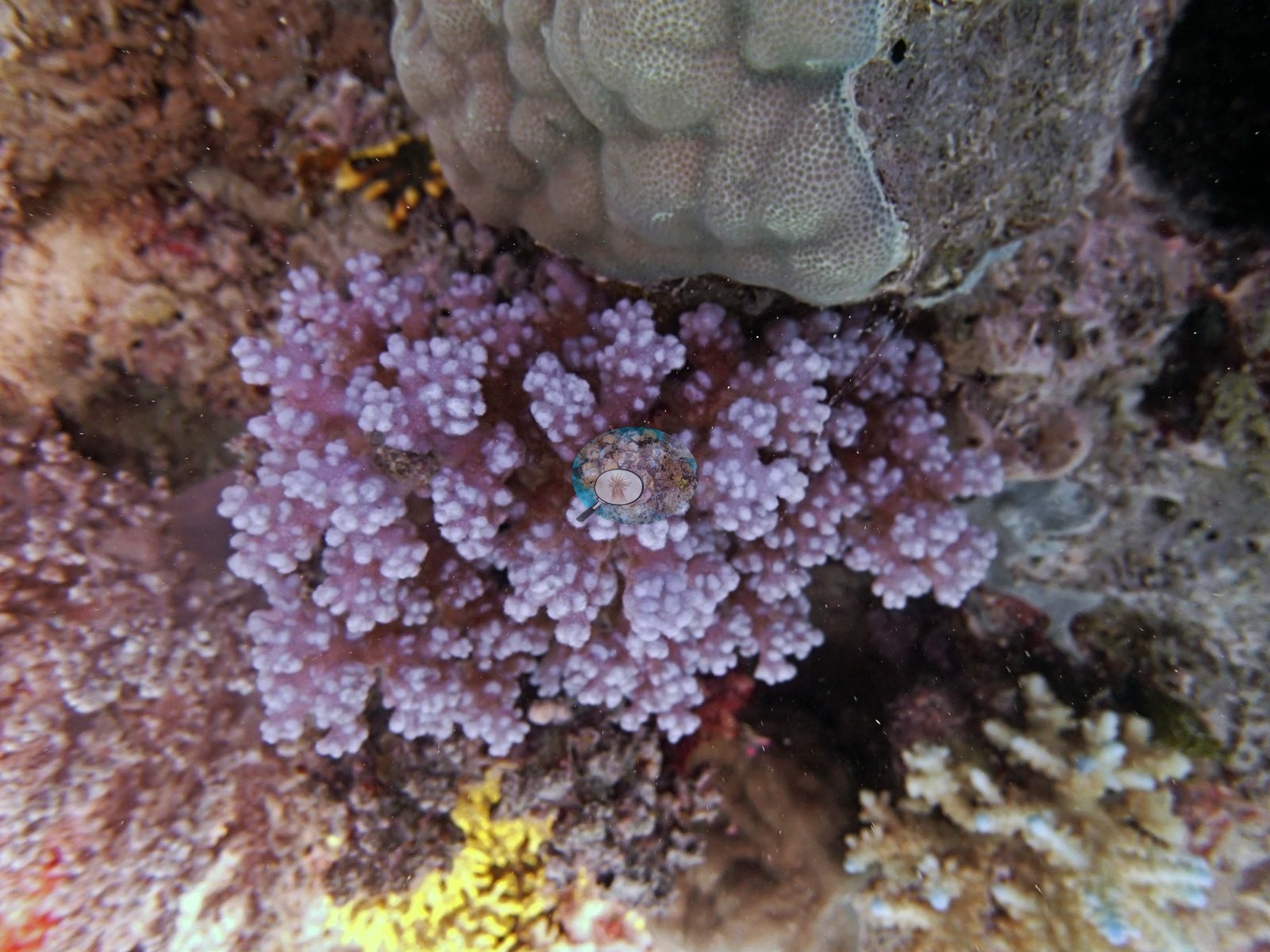
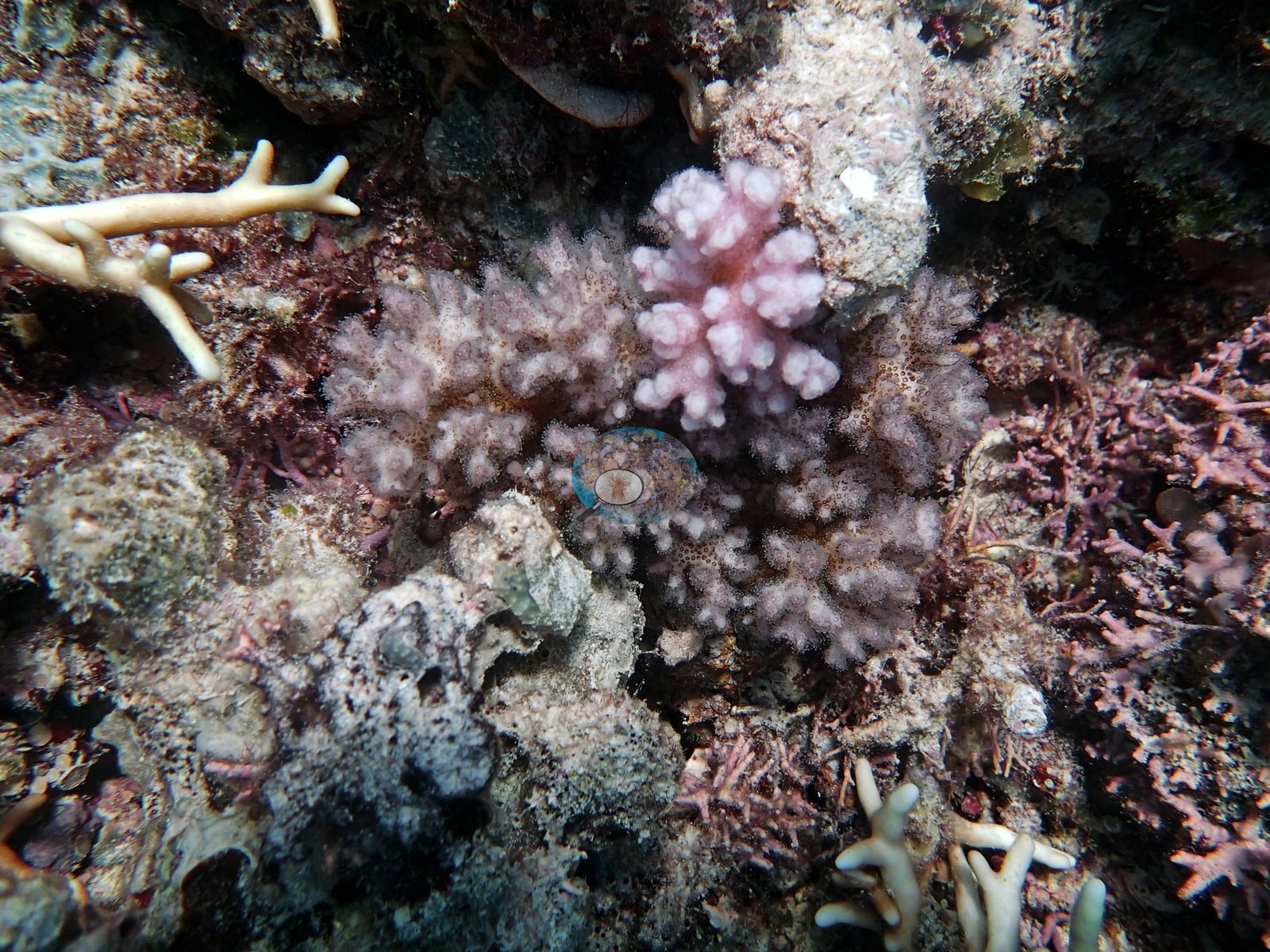
Image 22 is a dense single frame, with a large pale-pink corymbose Acropora in the foreground — pale but pigmented, not white — alongside the yellow fire coral, a pink urchin, and a scatter of damselfishes; Image 20 and Image 19 are similar.
Coral cover
- Reference: Khaled bin Sultan Living Oceans Foundation, Global Reef Expedition (in situ transect)
- The expedition's in situ point-count transects at this station recorded 36% live coral cover against 42% total algal cover.
- Transect mean 37 ± 7.0% SE (n = 3 transects; Living Oceans Foundation per-transect benthic data); the headline above is the expedition's station value (the headline weights each depth equally; one depth had a single transect).
Stressors
Anderson's field notes record that the Seriatopora colonies appeared bleached or had recently died; one close frame shows two small, uniformly cream-white, smooth branching colonies (bleached or newly dead) beside a pink corymbose pocilloporid with its polyps extended (e.g., Image 14). The branching thickets in Image 3, Image 4, and Image 16 are a different coral: living staghorn-form colonies, blue to purple with normal white growing tips, rising from dead, algae-covered bases; rust-red foliose macroalgae and a crimson encrusting patch sit at the base of the Image 3 thicket.
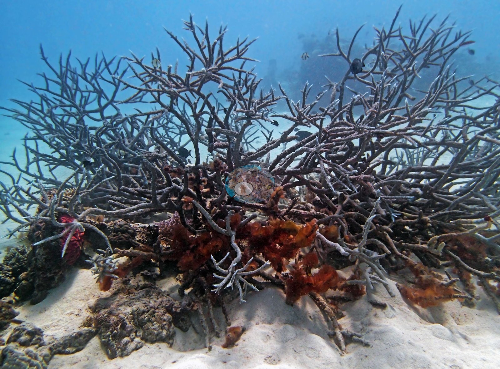
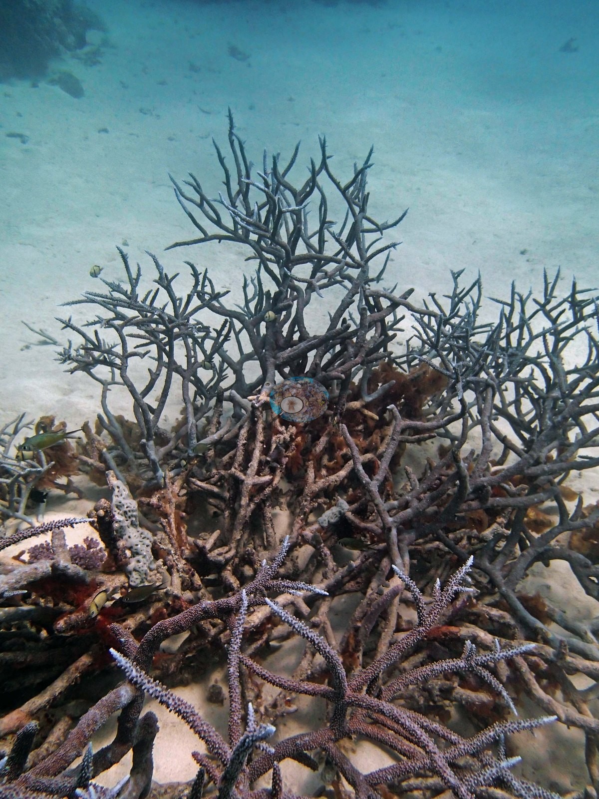
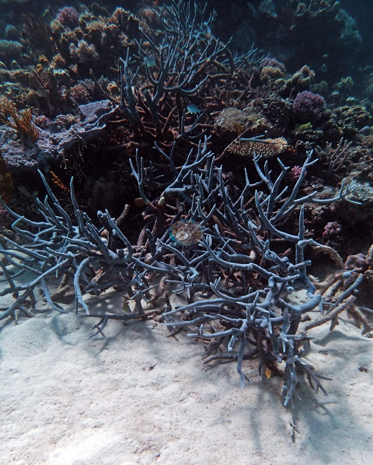
His notes describe "beautiful bright blue staghorn thickets (1-2 m diameter)" as common at 5-10 m. No percentage is estimated from the photographs. No crown-of-thorns starfish (COTS) or other corallivores evident.
Fish and other fauna
Image 2 is a school of barracuda in open blue water over sand, and Image 1 is hazy water over sand with a few fish — both match Anderson's log and neither is benthic imagery.
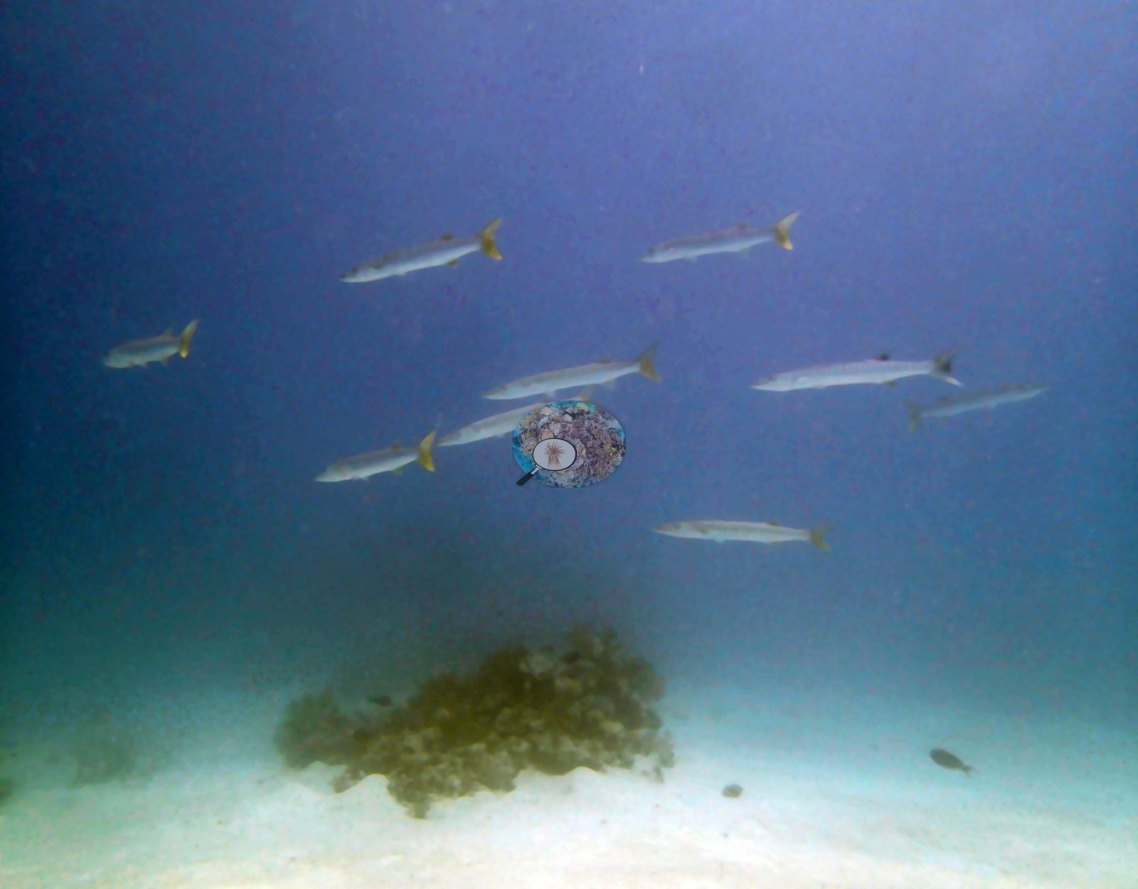
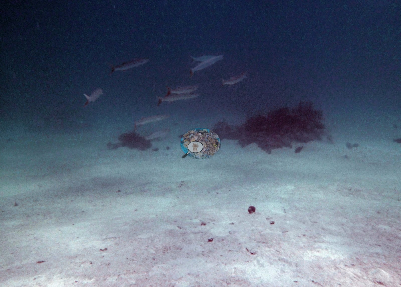
Image 11 is a close frame of one very large sea cucumber lying on white sand, again matching the outsized sea cucumbers Anderson recorded.
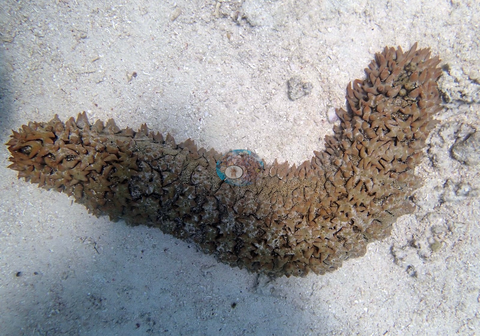
A school of barracuda, a large turtle, and several outsized sea cucumbers rounded out the marine life.
Comparisons with other data
No other surveys have been conducted at this site to date. Within 5 km, three AIMS manta tow stations recorded 11–36% hard coral cover between 1994 and 2021; the nearest, AIMS manta tow at RIBBON NO 6 REEF, 1.07 km away, read 11–35% between 1994 and 2017.
Dive record
Ribbon Reef No. 6, leeward side, dived 4 September 2014.
Other notes
Survey gear and fauna: yellow transect tape runs up the face of the bommie in Image 8; a diver with camera hangs above the reef in Image 12.
What the frames cannot settle: the 2 m saddle crest Anderson describes does not appear in the photo set, and no frame establishes depth, so the bommie/sand structure above cannot be tied to a depth. The turtle Anderson logged is not photographed. Several branching and encrusting colonies here cannot be taken past genus from these images.
Independent surveys nearby
 LOF
Within 5 km, 3 independent survey stations recorded hard coral cover in 15 surveys between 1994 and 2021. Of the 2 stations surveyed in more than one year, 1 declined (by 23.8 points) and 1 increased (by 9.1 points) between their first and latest surveys. The longest record, 15034S (AIMS manta tow, 3.09 km away), went from 26% in 1996 to 35% in 2021. One survey since 2021 recorded 35%. This site's own estimate (36%) sits 1 point above the range of these surveys up to 2 km away (11–35%); the methods differ, so the comparison is context, not a like-for-like test.
Collected by other programs using different methods (AIMS manta tow is a towed visual estimate in categorical bins), so these are context for the figures above, not a like-for-like comparison. Where a station was surveyed more than once, the cell shows either the range of its values or, as a single value, the mean of surveys made in one year. Station names are not dive-site names.
| Agency | Site / location | Date | Hard coral cover (%) | Distance | Link |
|---|---|---|---|---|---|
| AIMS manta tow | RIBBON NO 6 REEF | 1994–2017 | 11–35% (6 surveys) | 1.07 km | doi:10.25845/5c09b0abf315a |
| AIMS manta tow | 15034S | 1996–2021 | 14–36% (8 surveys) | 3.09 km | doi:10.25845/5c09b0abf315a |
| AIMS manta tow | 15037S | 2009 | 26% | 4.51 km | doi:10.25845/5c09b0abf315a |
Data & links
- Download benthic survey data (CSV) ↗
- Download all LOF-GRE data (933 sites) ↗
- Photo portfolio ↗
- Coral Reef Diagnostics country page ↗
All images from Coral Reef Diagnostics. Data are from the Khaled bin Sultan Living Oceans Foundation Global Reef Expedition, Coral Reef Diagnostics, and the organizations named in the data sources above.
 © Coral Reef Diagnostics.