

Part of the regional summaries: Australia (GBR) - Far North: Pink stations (Preservation Zone reefs) and Australia (GBR)
More info
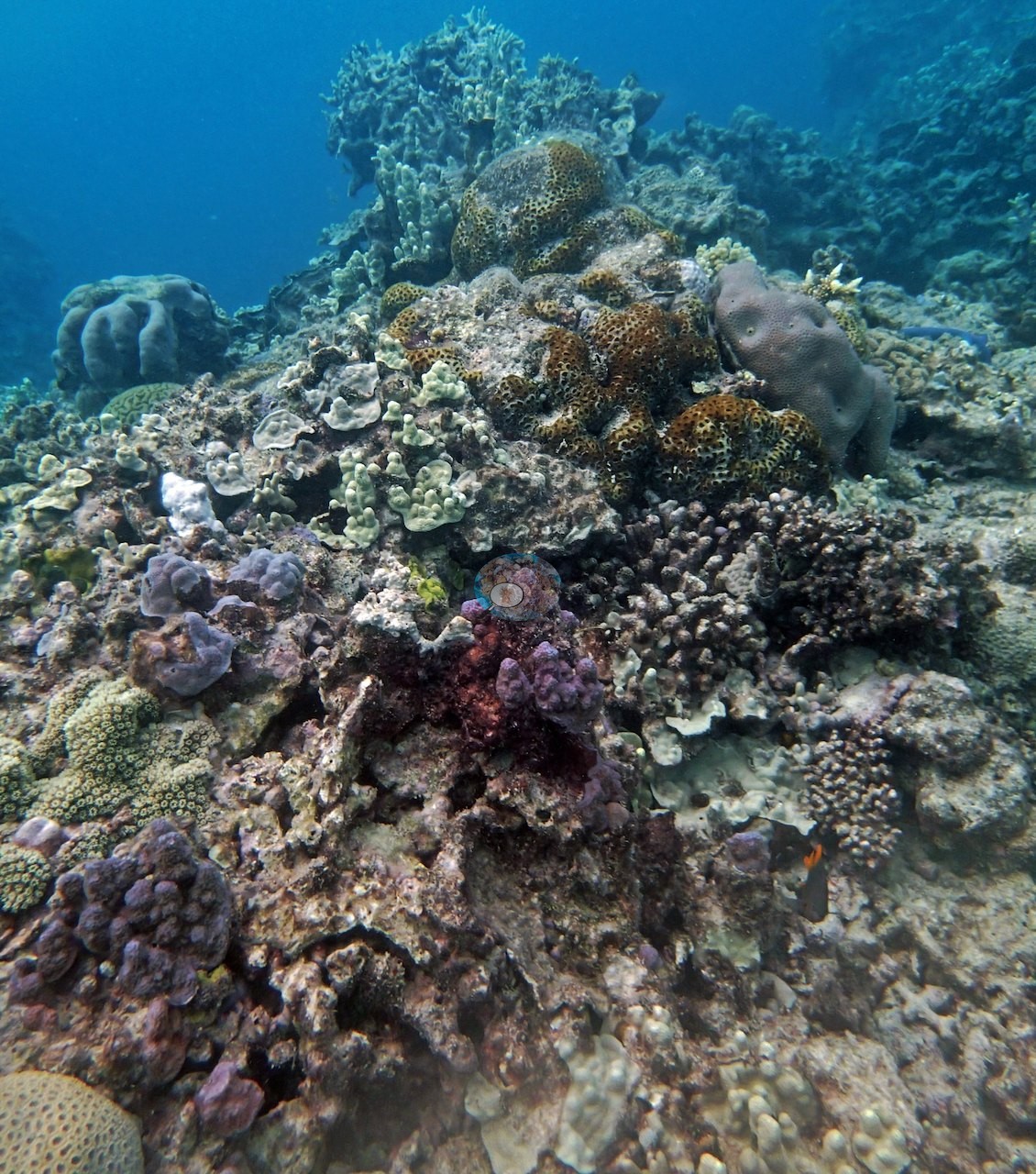
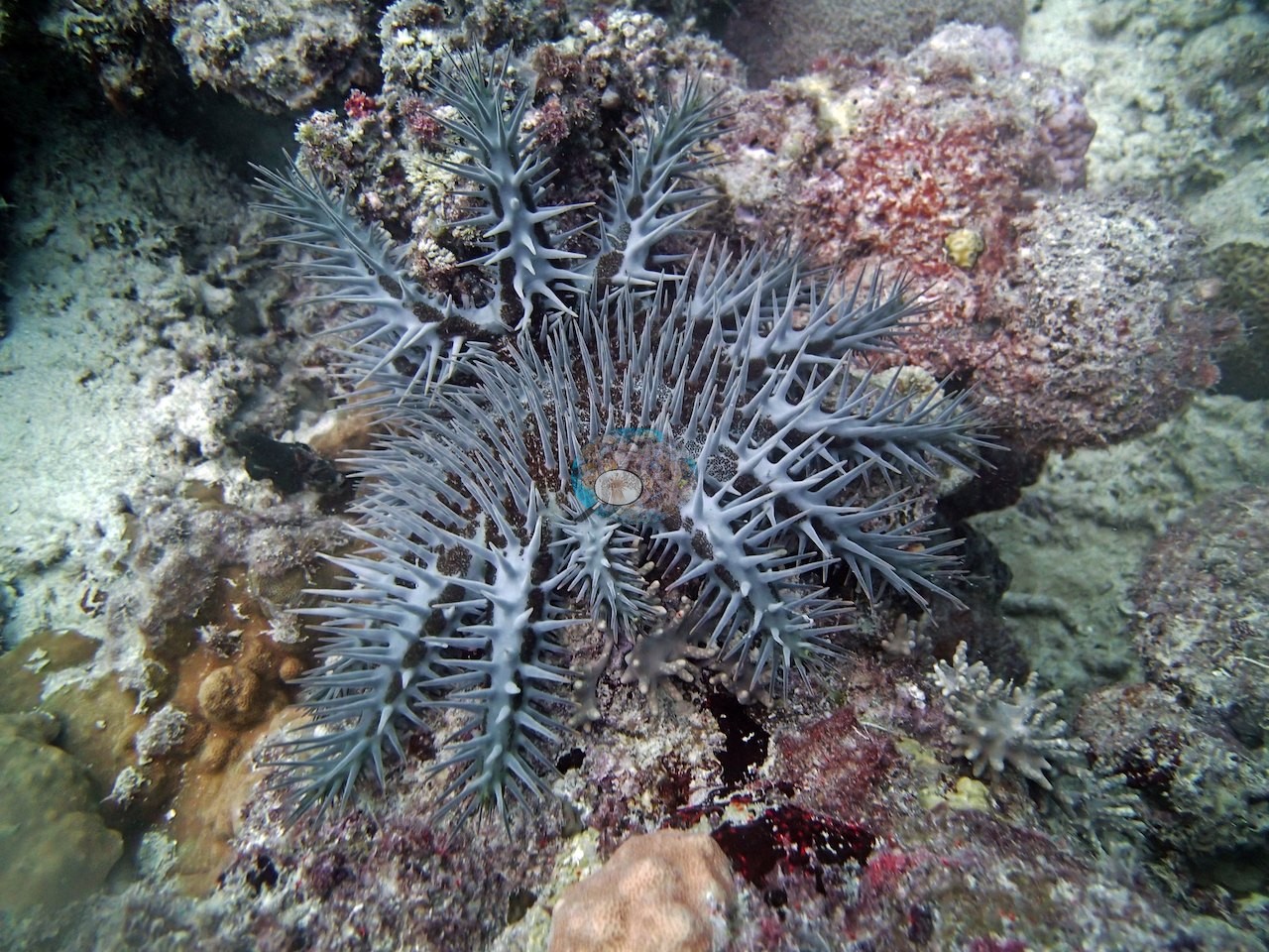
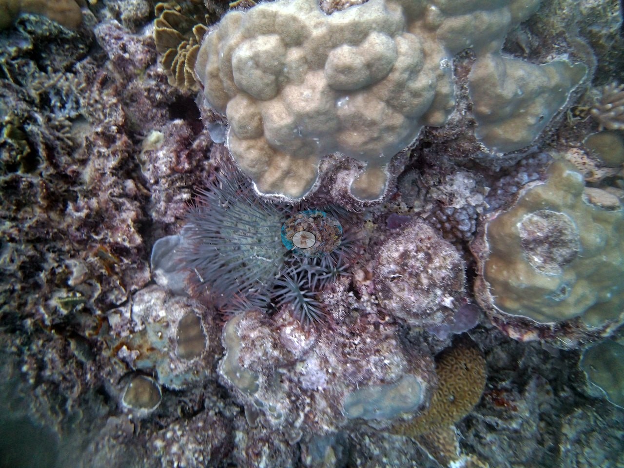
Far Northern GBR (NOAA CRW virtual station)A patchily colonized Pearson Reef slope with golden whorled Turbinaria, fire coral, feather stars, and lilac-pink branching Acropora, at 58% cover. Crown-of-thorns damage was unmistakable, with full-grown starfish photographed sprawled across the reef in two frames. Surveyed on the Living Oceans Foundation's Global Reef Expedition.
One independent survey station shown with the program’s logo — click one to see how far it is from this site.
Five other CRD dive sites within 5 km shown in orange — click a marker to open its page.
🗺 Detailed map of the Global Reef Expedition dive sites, Pearson and Siddons Reefs, northern Great Barrier Reef (Khaled bin Sultan Living Oceans Foundation; opens in a new window)
Site description
Setting
Water is hazy blue-green in several wide frames, which limits fine detail at distance.
General benthic features
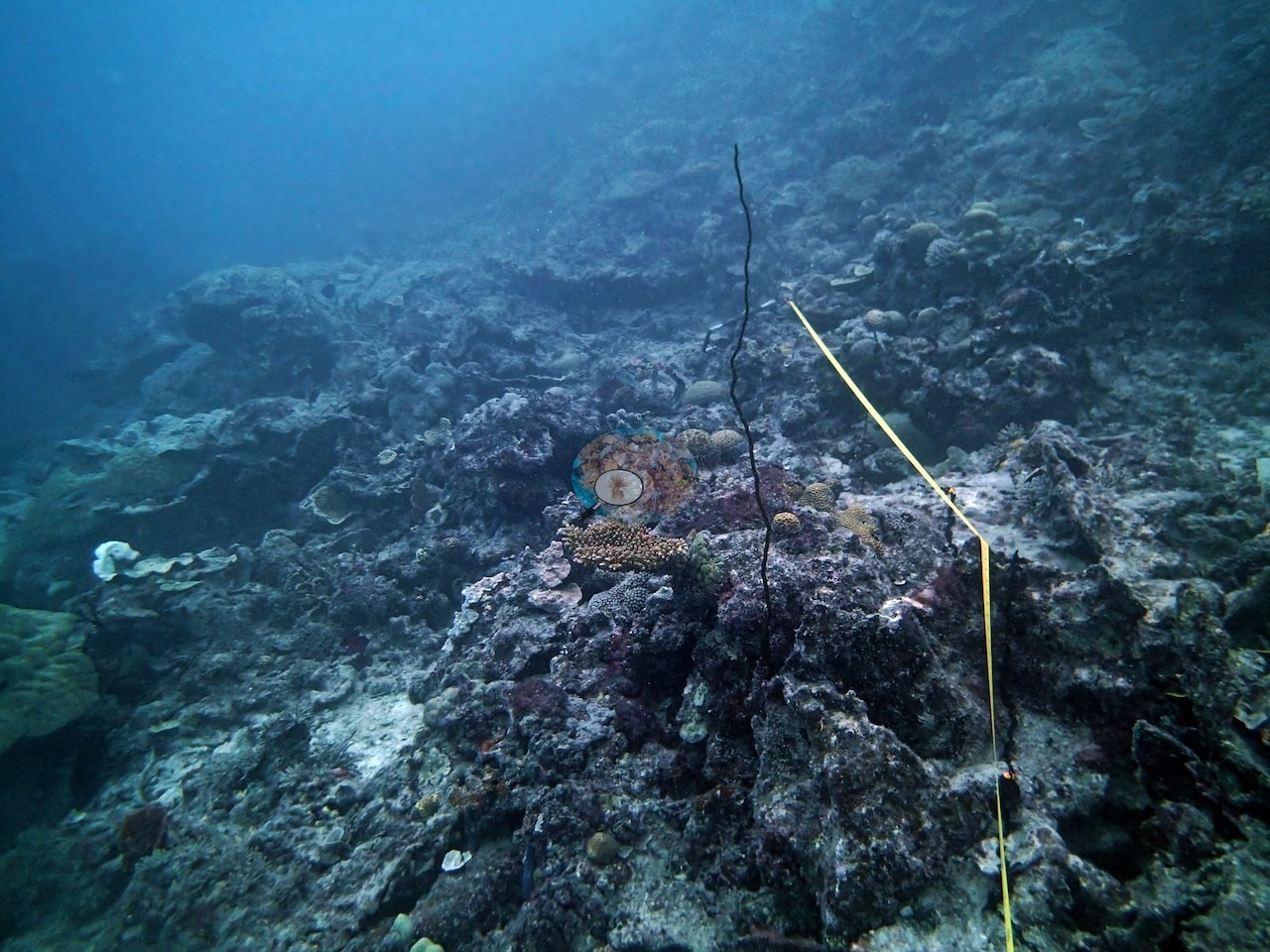
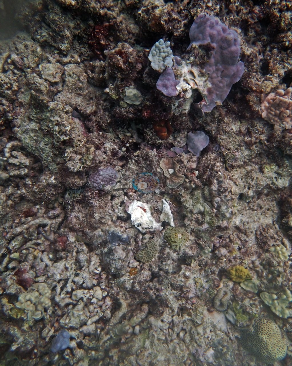
The survey is in the set: Image 1 looks down on low-relief, algal-dark framework with the yellow transect line running across it, thinly colonized and with a lot of crusted bare rock.
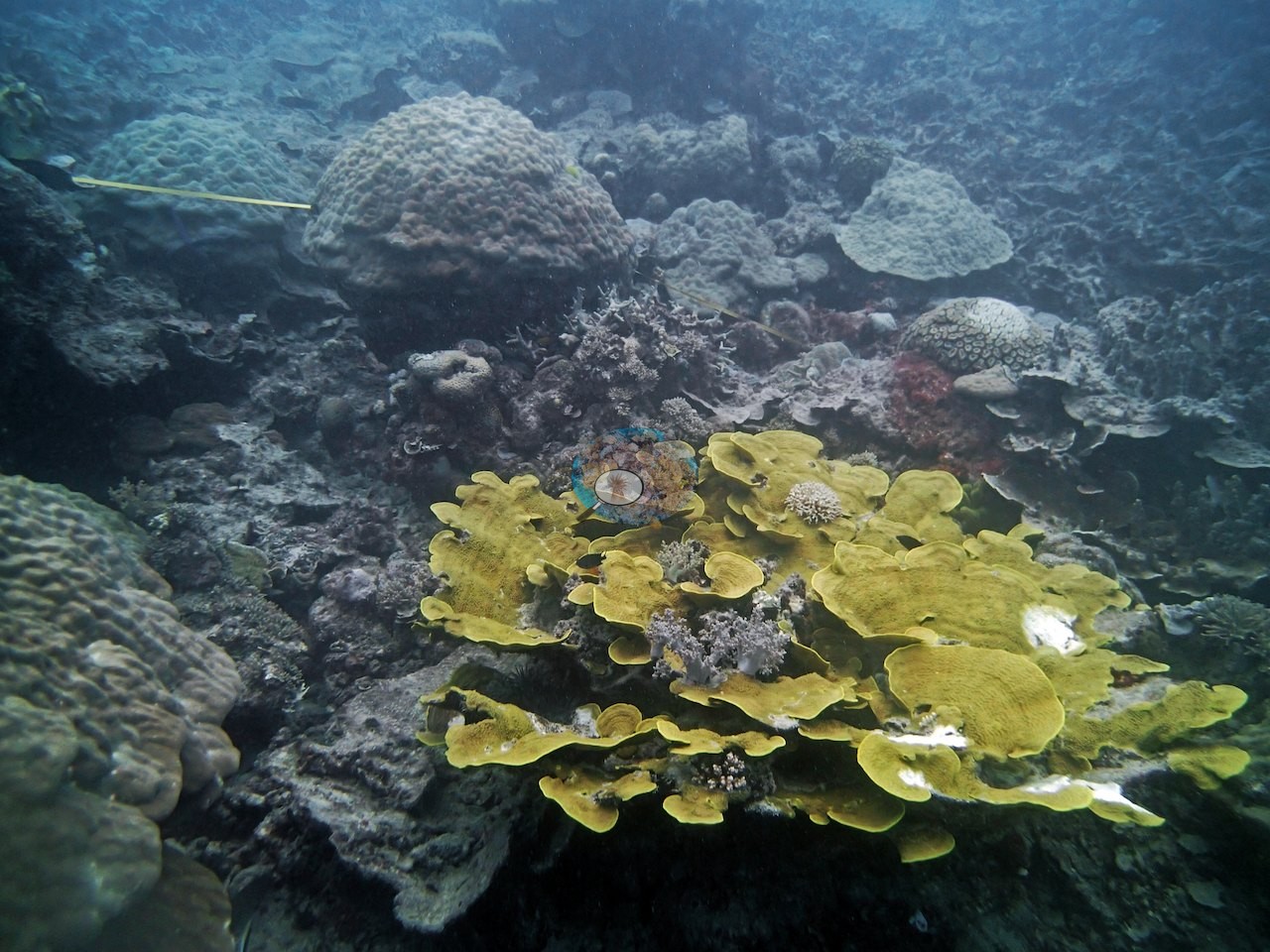
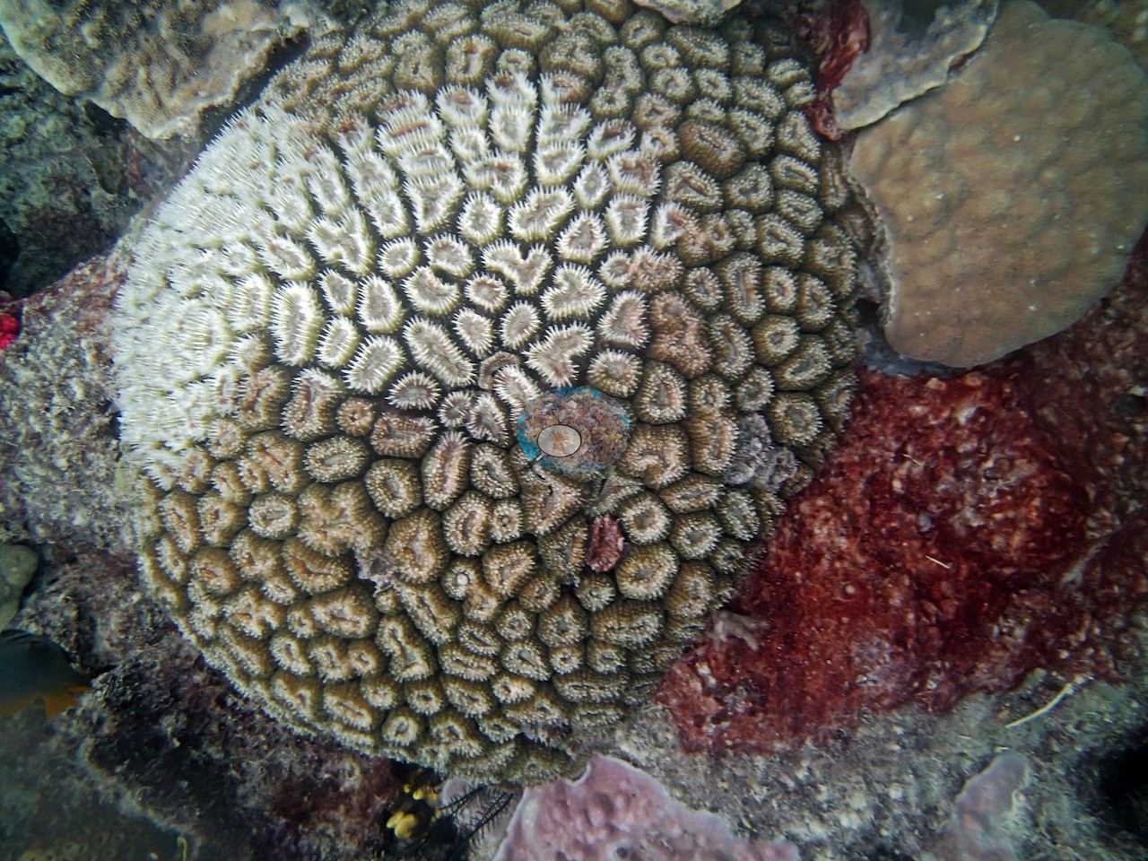
From there the frames divide into the healthy inventory and the trouble. Image 3 is a striking golden-yellow foliose colony of stacked whorled plates on open pavement — the Turbinaria growth form Anderson's notes record. Image 4 is a close view of a massive with large polygonal, thick-walled corallites in a honeycomb mosaic, ringed with pale septal teeth, sitting against red encrusting sponge and pink coralline. Image 11 and Image 13 both show mounded and lobed tan colonies with golden branching fire coral (Millepora) fanning up between them and bright green algal tufts wedged in the gaps; Image 13 adds black feather stars. Image 12, the best single-colony frame, is a close view of slender lilac-pink branching Acropora over a lavender encrusting base with a dark crinoid alongside. Image 5, Image 9, and Image 10 are wide frames of mixed, patchily occupied slope in dimmer, greener light.
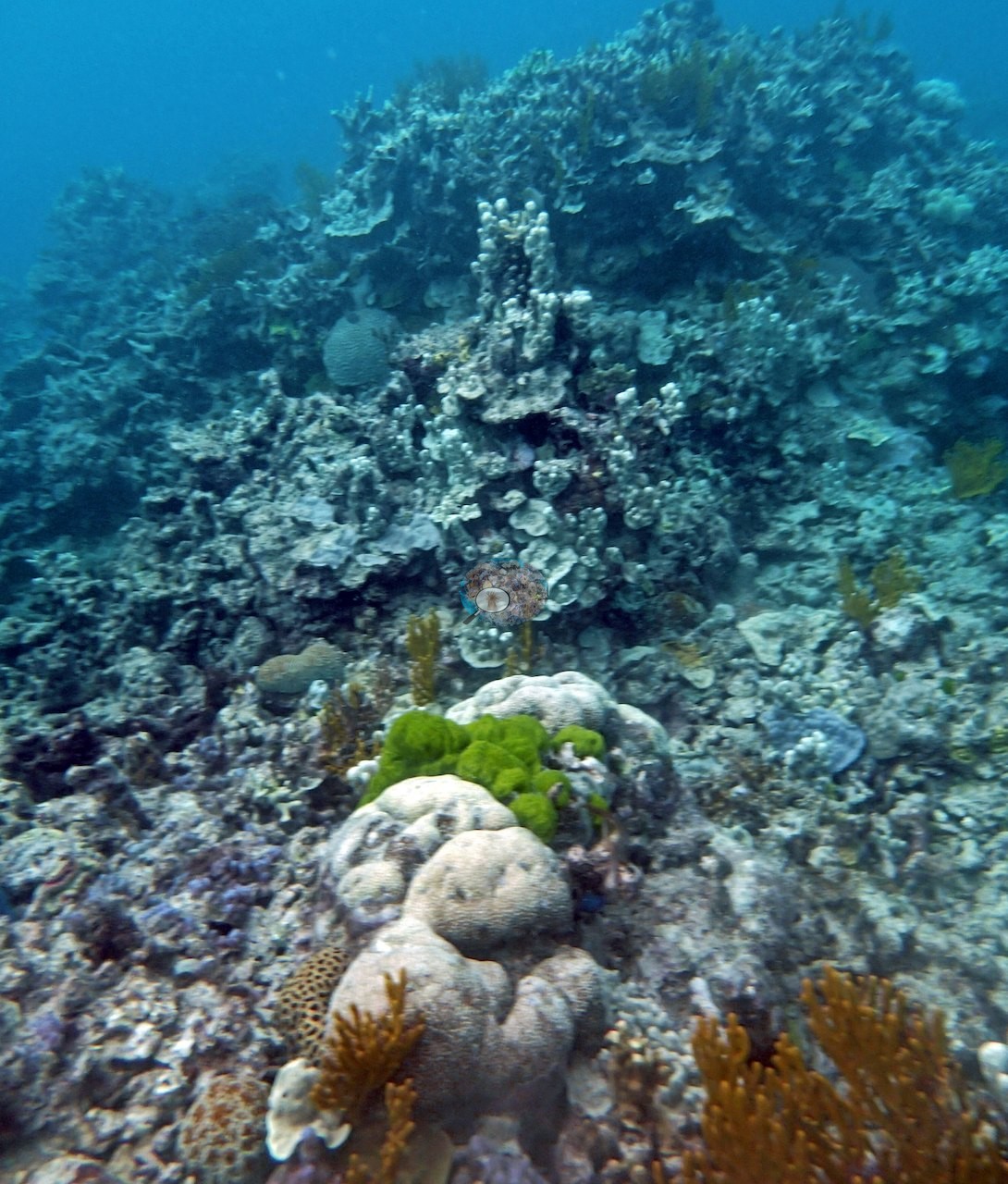
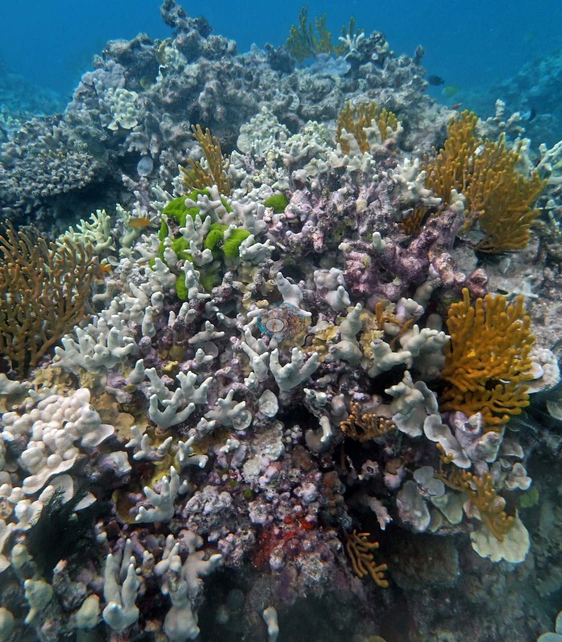
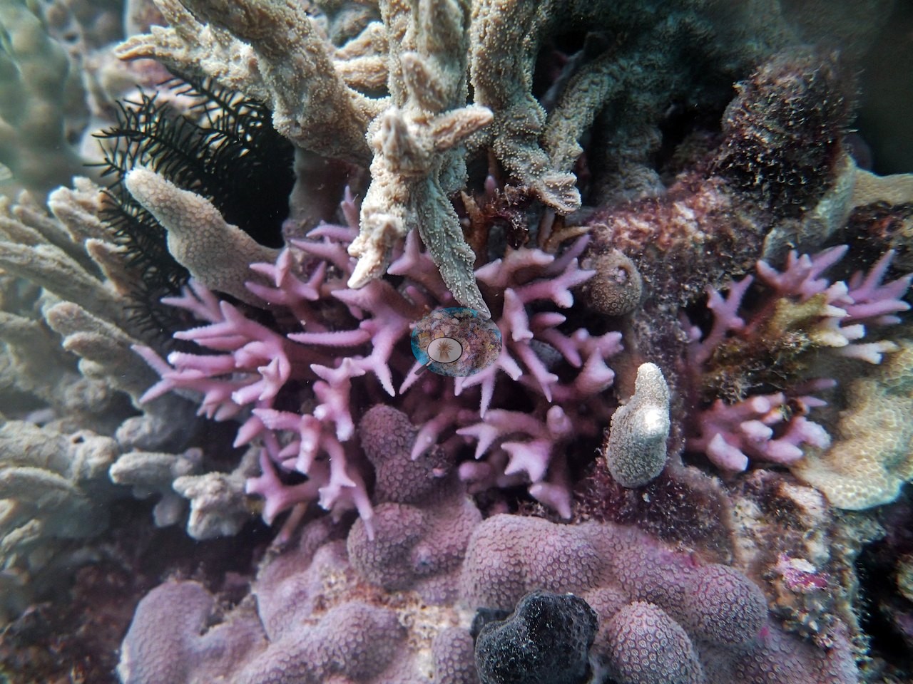
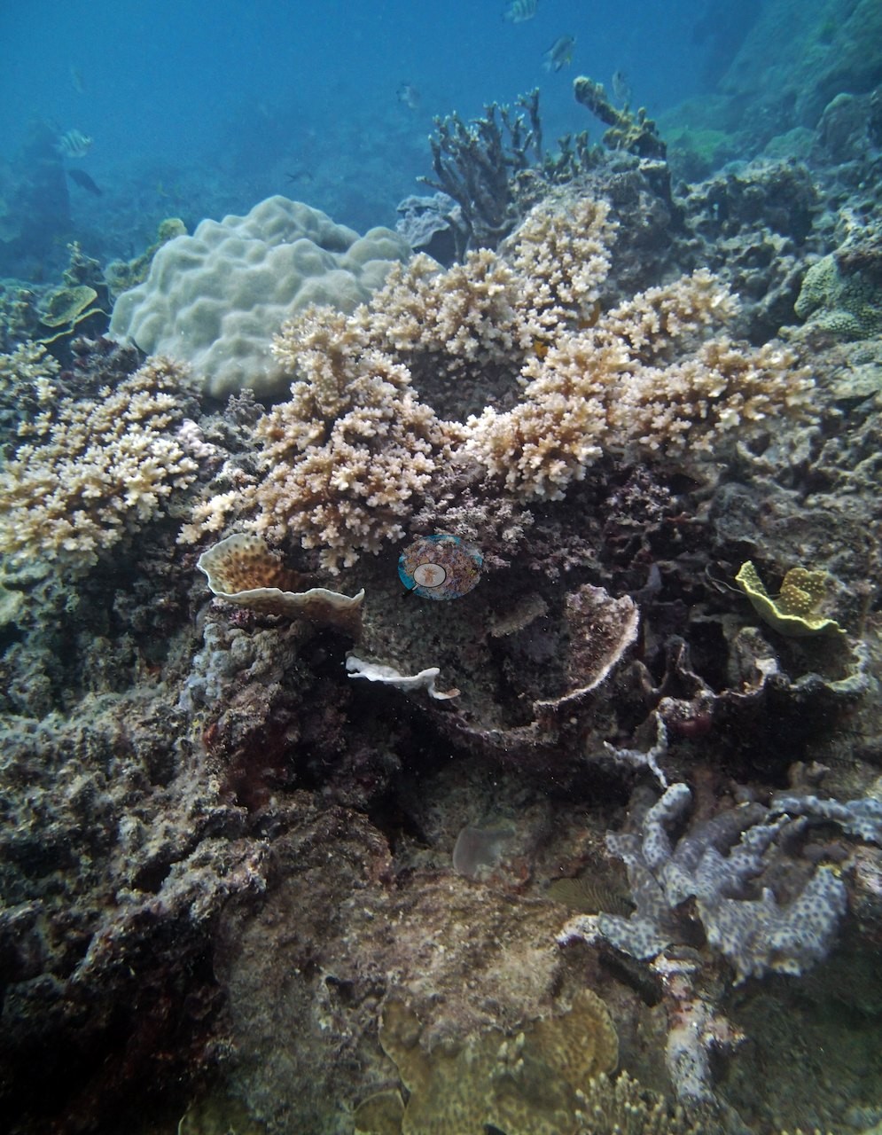
Coral cover
- Reference: Khaled bin Sultan Living Oceans Foundation, Global Reef Expedition (in situ transect)
- The LOF transects recorded 58% live coral cover across three depth strata. Anderson's notes describe the 5-7 m band as built on massive Porites and a Montipora resembling M. capitata, joined by Turbinaria, Lobophyllia, and several Acropora.
- Transect mean 59 ± 3.7% SE (n = 6 transects; Living Oceans Foundation per-transect benthic data); the headline above is the expedition's station value (the headline weights each depth equally; one depth had a single transect).
Stressors
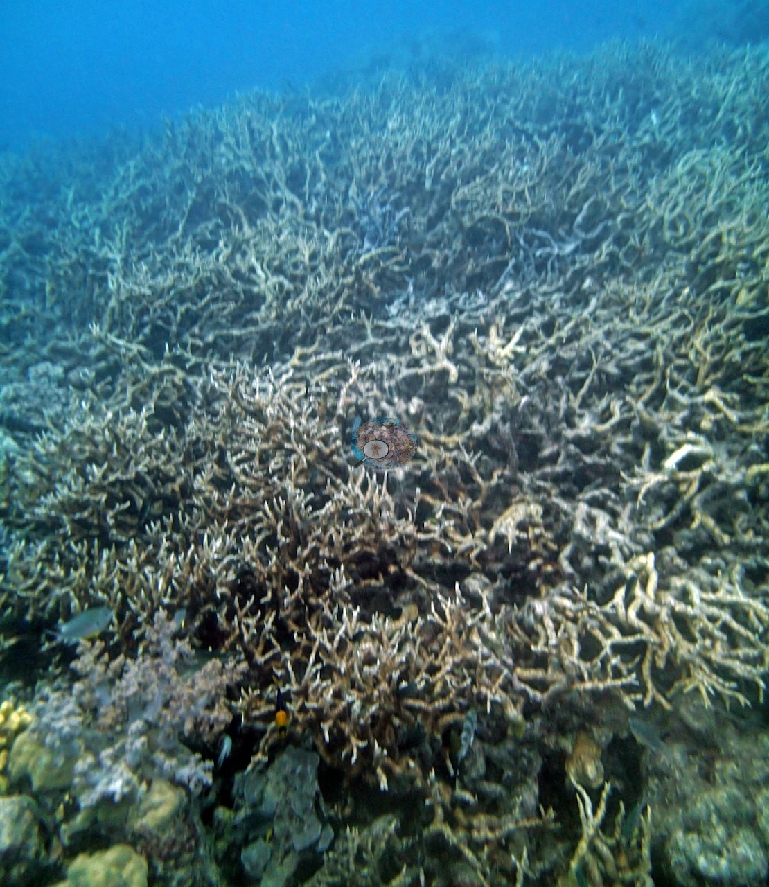
Crown-of-thorns starfish and recent coral mortality both appear in the set. Image 2 is a full-grown crown-of-thorns starfish, blue-gray with orange-tipped spines, sprawled across live substrate at close range; a second crown-of-thorns sits in the middle of Image 6, its arms spread over pale framework between lobed colonies — two individuals photographed, consistent with the three Anderson counted here, one of them directly on a transect. Image 7 shows a vast field of thin staghorn branches running to the limit of visibility, the framework standing, tan-cream to gray in the hazy light; whether it is living or dead in growth form cannot be settled from the frame, and no percentage is put on it here.
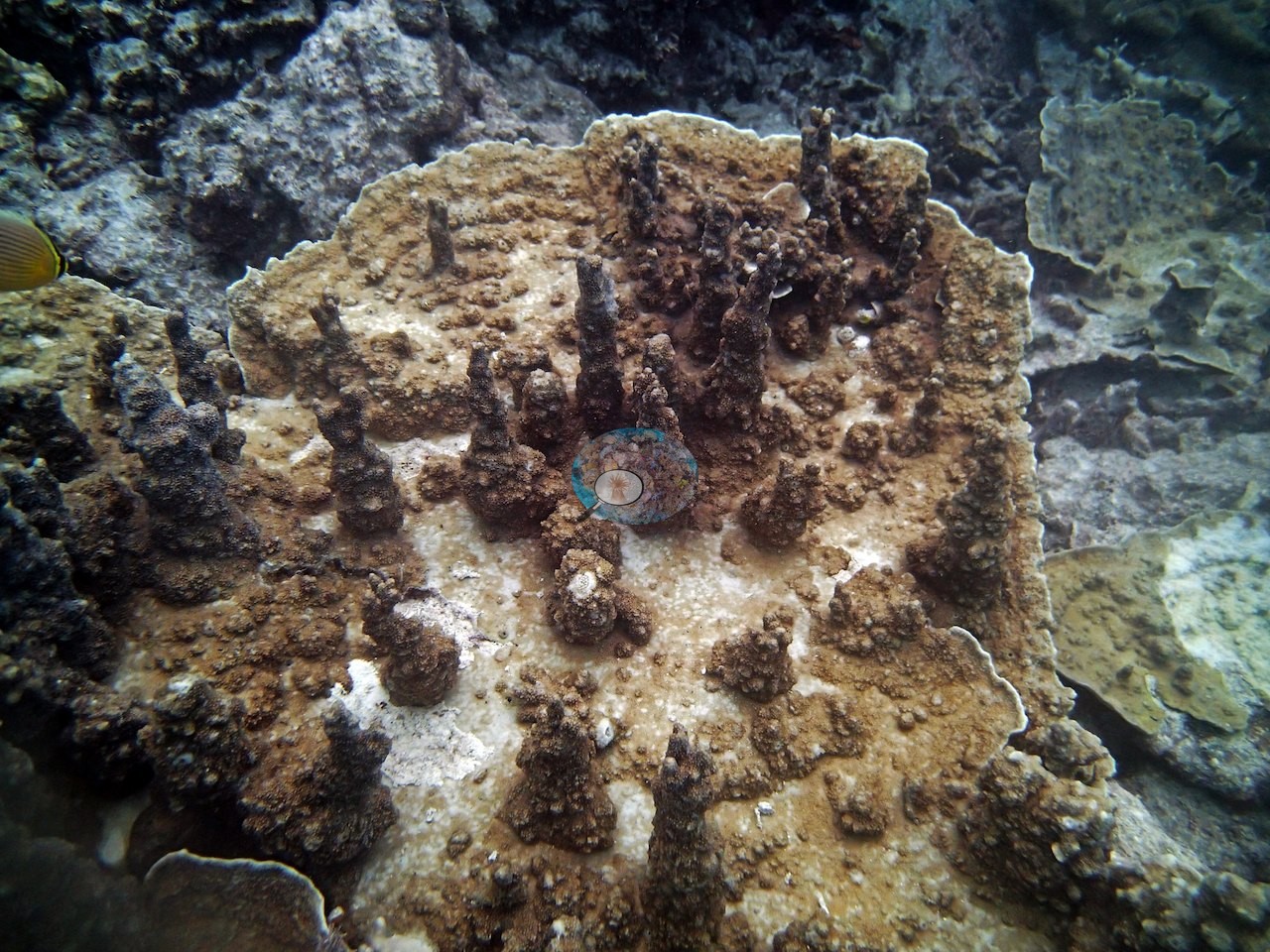
Another frame (Image 8) shows partial mortality on a single colony: a broad plating colony with short brown columns rising from its surface, where wide areas of the plate between the columns are bare chalk-white skeleton while the column bases still hold pigment — consistent with the Montipora Anderson logged at this site, though the genus is not asserted from the photograph.
No bleaching in the paling sense is visible in the set, and no disease lesion is discernible. Anderson's notes also record large patches of rubble at 8 m, some from storm damage and some dead corals in growth form (COTS damage), red cyanobacteria on his 21 m transect, and cyanobacteria on his 20 m transect.
Comparisons with other data
No other surveys have been conducted at this site to date. Within 5 km, one independent station, AIMS manta tow at PEARSON REEF, 0.83 km away, read 10–32% between 1995 and 2023.
Other notes
The 13 posted frames are all reef imagery.
Independent surveys nearby
 LOF
Within 5 km, 1 independent survey station recorded hard coral cover in 9 surveys between 1995 and 2023. The one station surveyed in more than one year declined by 5.8 points between its first and latest surveys. The longest record, PEARSON REEF (AIMS manta tow, 0.83 km away), went from 26% in 1995 to 20% in 2023. Since 2021, station-year means average 24% (range 19–32%; n = 3 station-years from 3 surveys). This site's own estimate (58%) sits 26 points above the recent range (19–32%); the methods differ, so the comparison is context, not a like-for-like test.
Collected by other programs using different methods (AIMS manta tow is a towed visual estimate in categorical bins), so these are context for the figures above, not a like-for-like comparison. Where a station was surveyed more than once, the cell shows either the range of its values or, as a single value, the mean of surveys made in one year. Station names are not dive-site names.
| Agency | Site / location | Date | Hard coral cover (%) | Distance | Link |
|---|---|---|---|---|---|
| AIMS manta tow | PEARSON REEF | 1995–2023 | 10–32% (9 surveys) | 0.83 km | doi:10.25845/5c09b0abf315a |
Data & links
- Download benthic survey data (CSV) ↗
- Download all LOF-GRE data (933 sites) ↗
- Photo portfolio ↗
- Coral Reef Diagnostics country page ↗
All images from Coral Reef Diagnostics. Data are from the Khaled bin Sultan Living Oceans Foundation Global Reef Expedition, Coral Reef Diagnostics, and the organizations named in the data sources above.
 © Coral Reef Diagnostics.