

Part of the regional summaries: Australia (GBR) - Far North: Pink stations (Preservation Zone reefs) and Australia (GBR)
More info
Far Northern GBR (NOAA CRW virtual station)A near-vertical wall at Hilder Reef, dived in a fairly strong 1-knot current, that tells two stories: at 21 m the reef showed signs of a severe disturbance, with rubble and just 1-2% live coral, while a shallower platform was packed with small, colorful colonies. Some needle corals at 10 m were sickly, per his notes. Surveyed on the Living Oceans Foundation's Global Reef Expedition.
One independent survey station shown with the program’s logo — click one to see how far it is from this site.
Eight other CRD dive sites within 5 km shown in orange — click a marker to open its page.
🗺 Detailed map of the Global Reef Expedition dive sites, Jewell, Hilder, and Eyrie Reefs, northern Great Barrier Reef (Khaled bin Sultan Living Oceans Foundation; opens in a new window)
15 of the 22 photographs on this page are shown beside the text that discusses them under "Site description" below.
Site description
Setting
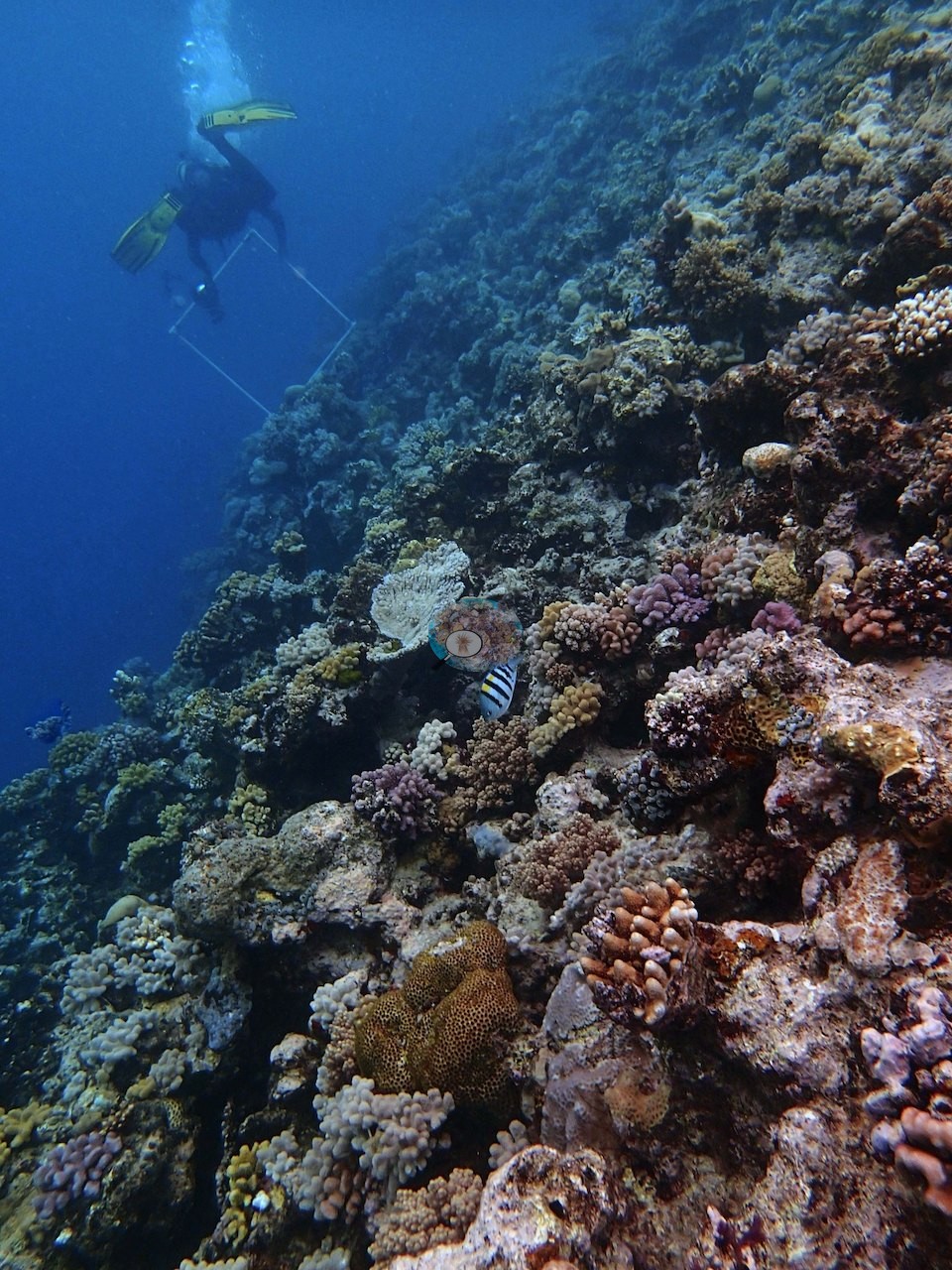
This near-vertical wall dive at Hilder Reef, run in a fairly strong 1-knot current, with chain-tangling problems that limited the survey to four transects, told two different stories depending on depth. The two depth bands Anderson's notes distinguish are both visible.
General benthic features
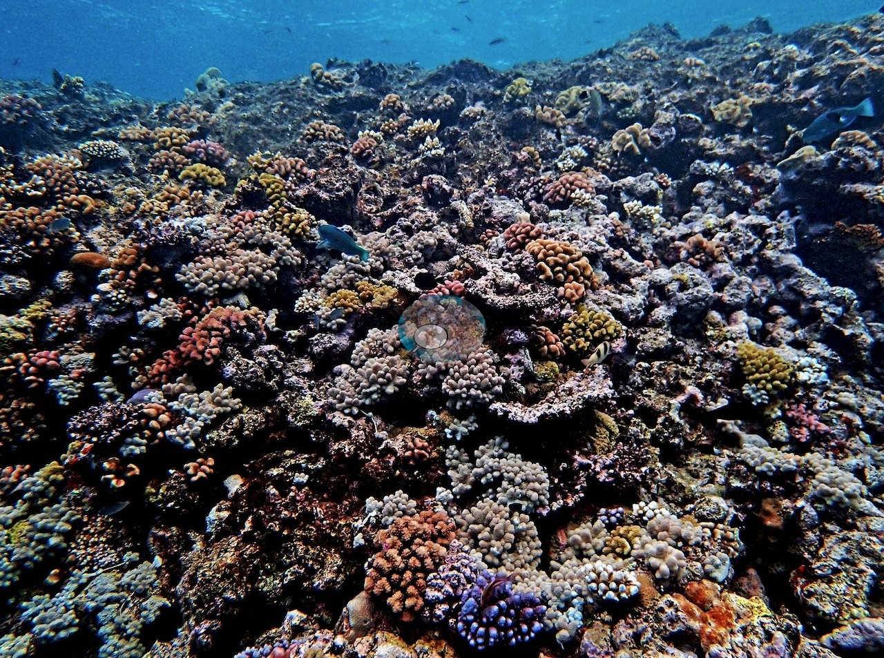
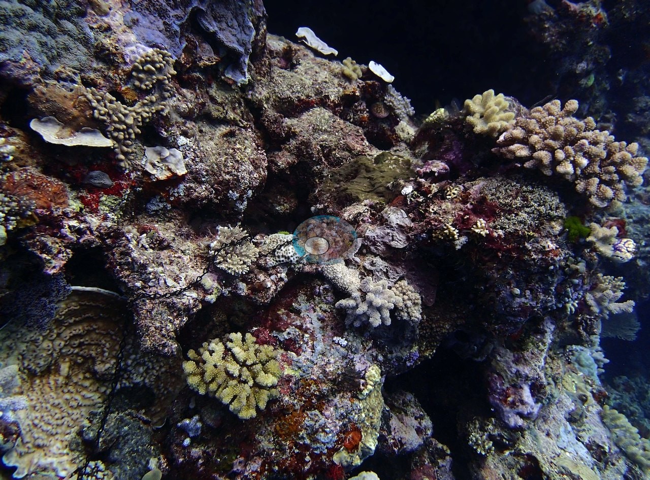
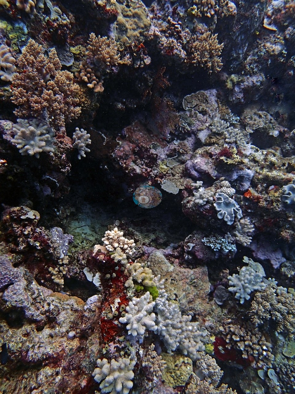
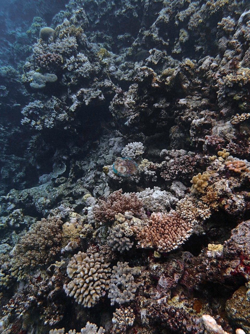
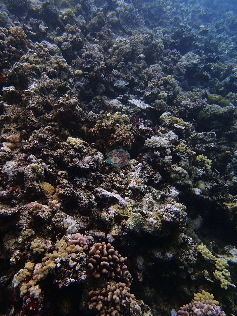
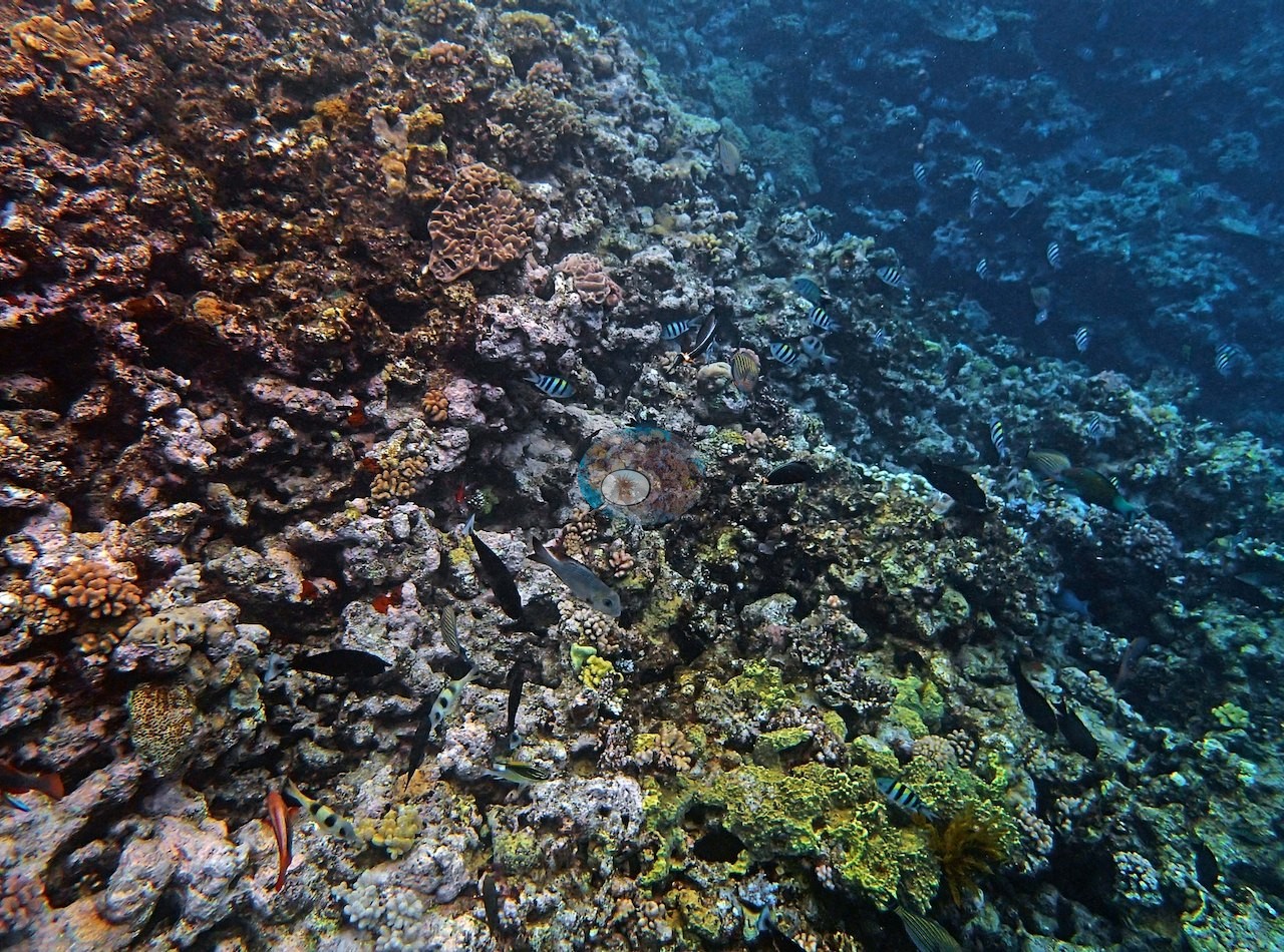
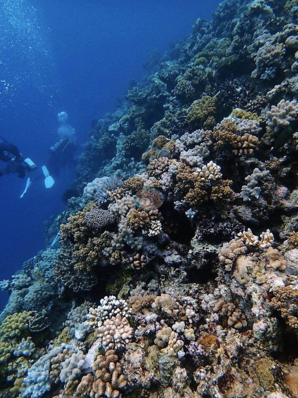
The photographs cover both bands: the wall frames look along the face itself, sponge-textured and thinly covered, dropping away into deep blue with butterflyfish and sergeant majors working the face, while the shallower frames show a crowded, colorful crest of small pink, mauve, and mustard colonies over rubble. Numerous sponge species added texture to the mid-depths. What the line crosses in Image 1 and Image 2 is instructive: crusted, algal-dark framework carrying scattered small branching and digitate colonies, a black long-spined urchin, and a good deal of bare and turfed rock between colonies.
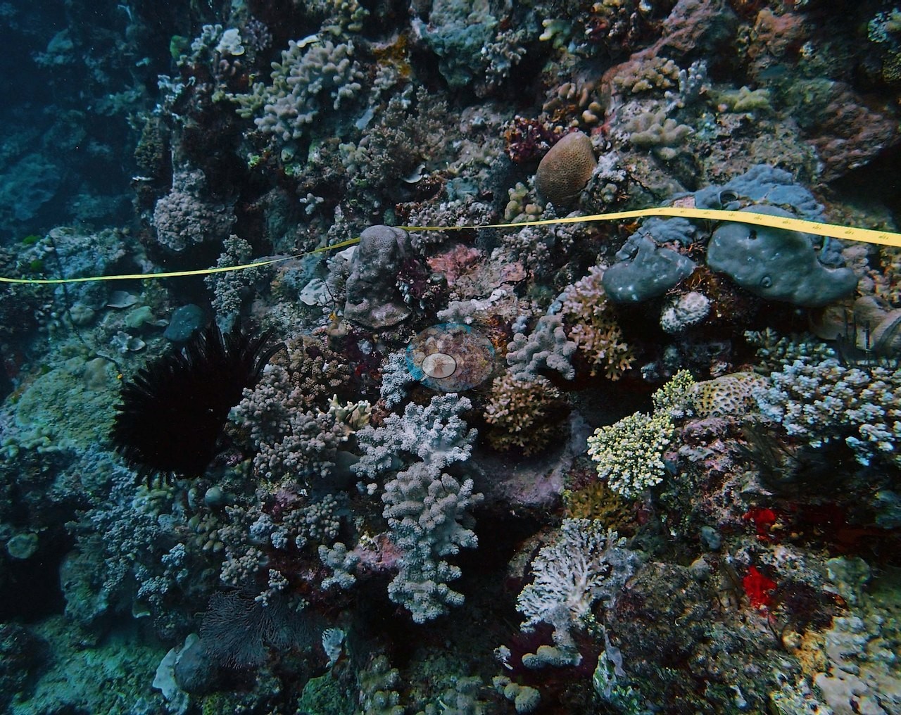
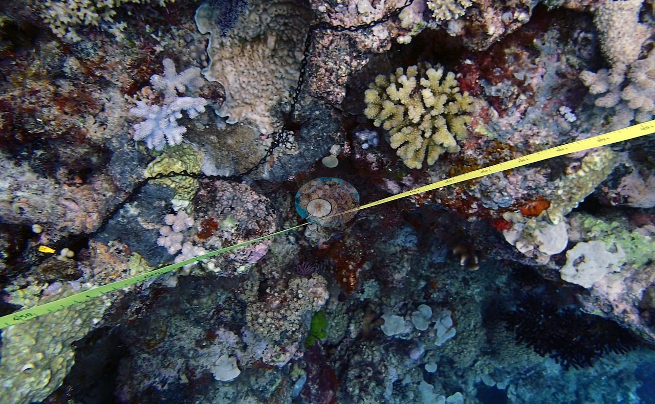
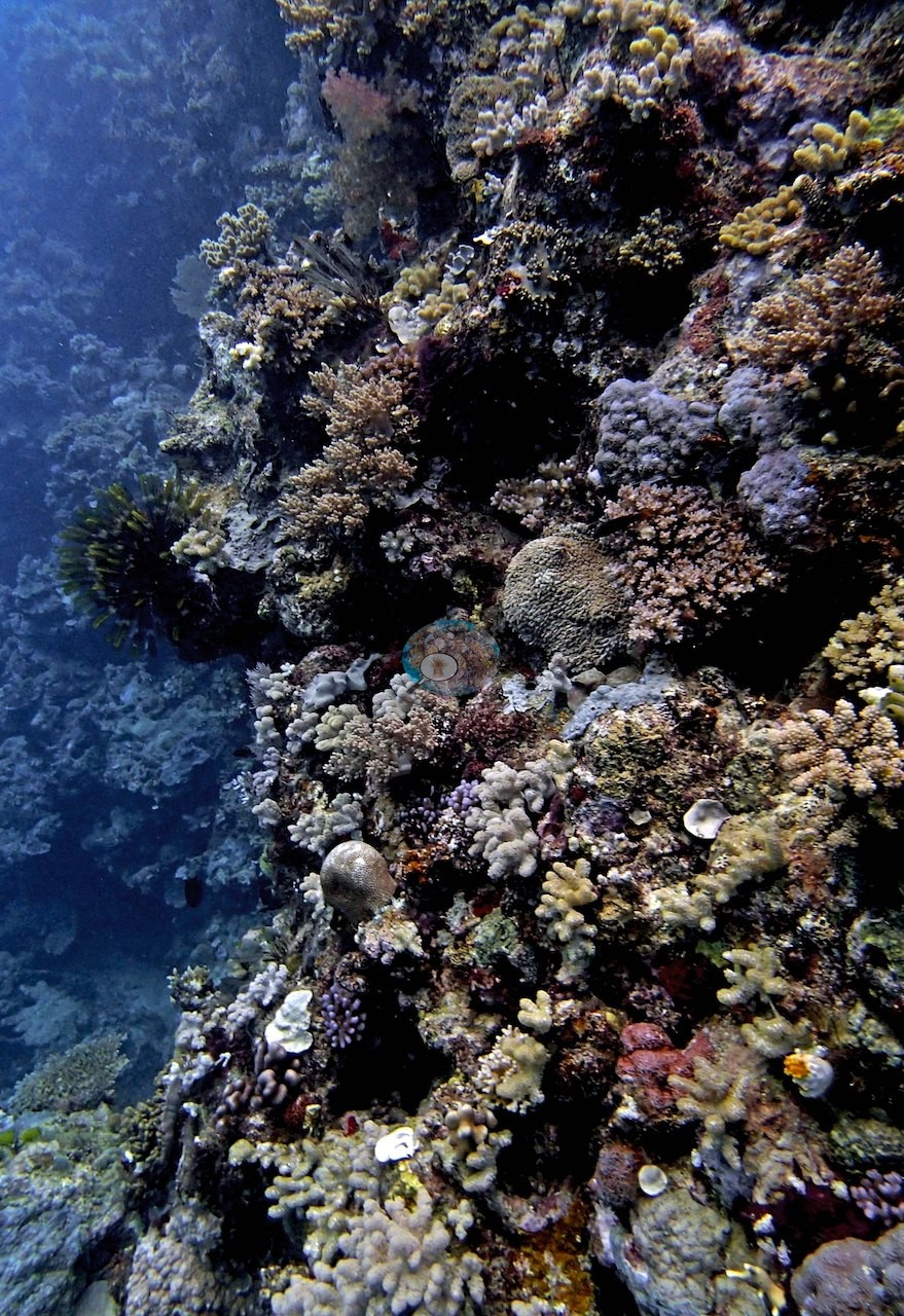
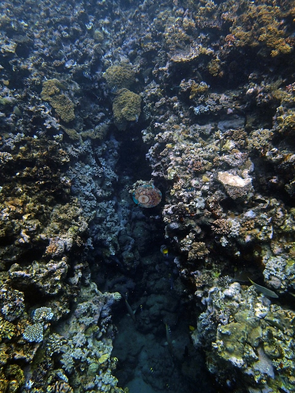
The wall frames (e.g., Image 14), Image 17, Image 21, and Image 22 look along a steep, sponge- and turf-textured face dropping into deep blue with only thin, patchy live cover, and Image 22 shows a deep vertical chute or crevice cutting into the reef; these are the low-relief, rubble-dominated stretches.
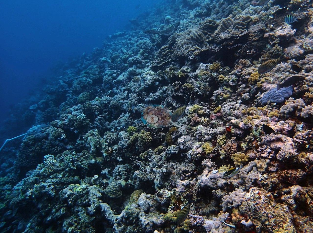
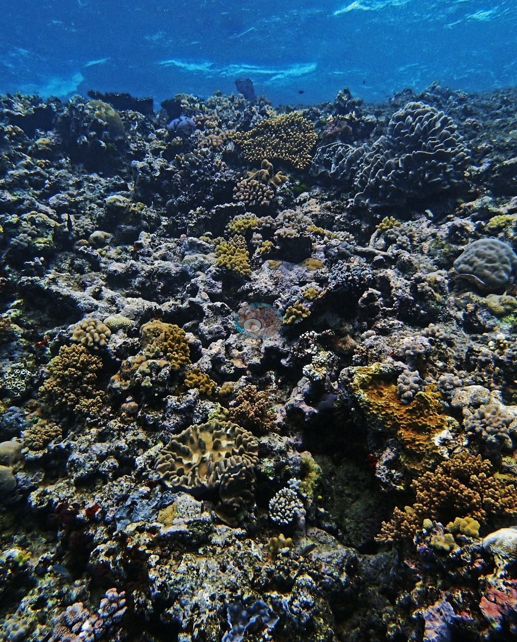
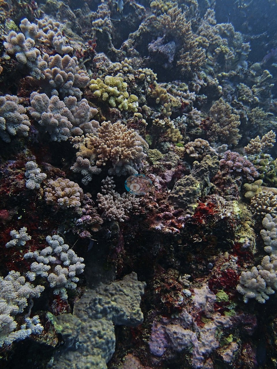
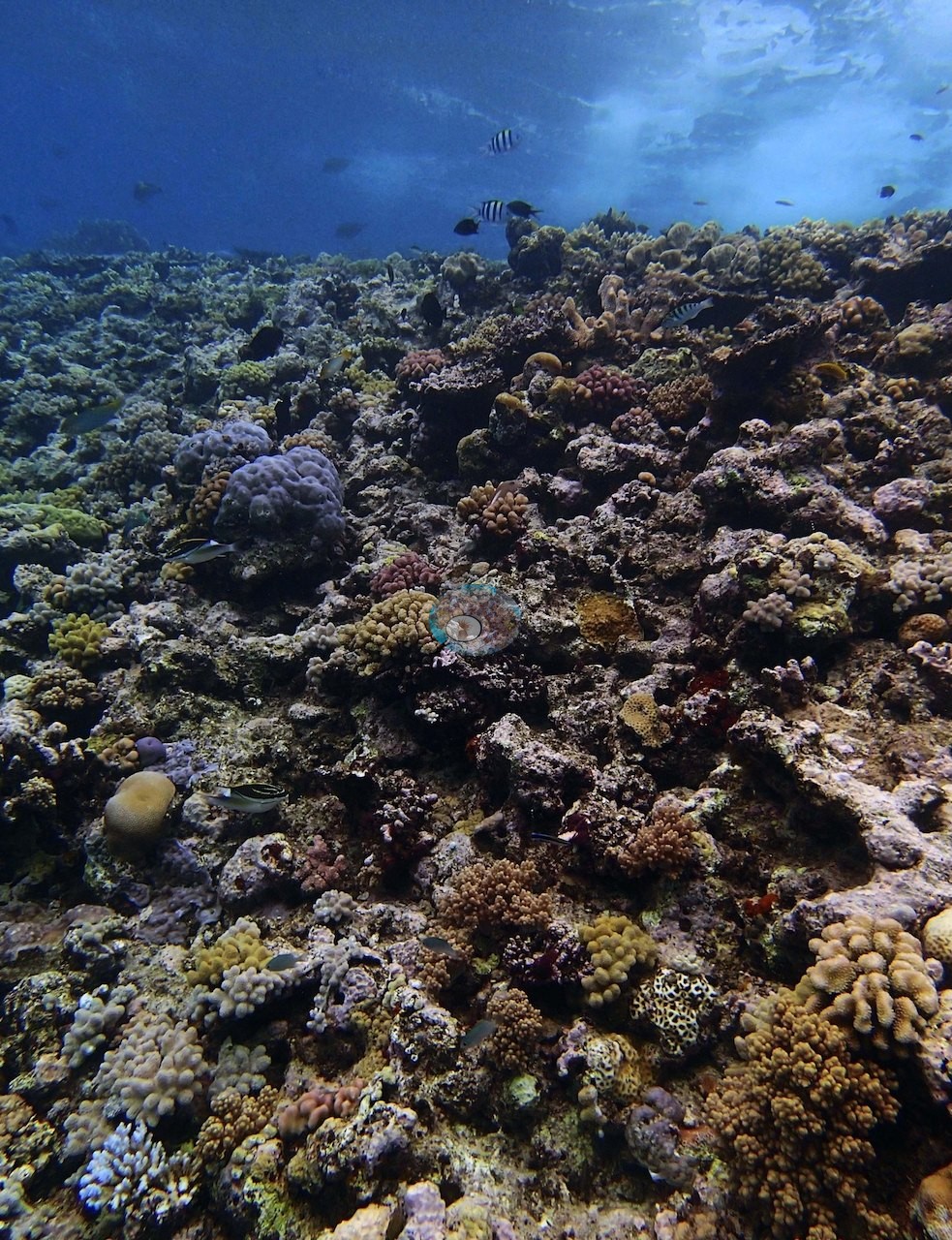
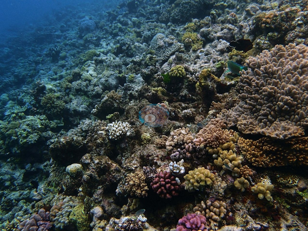
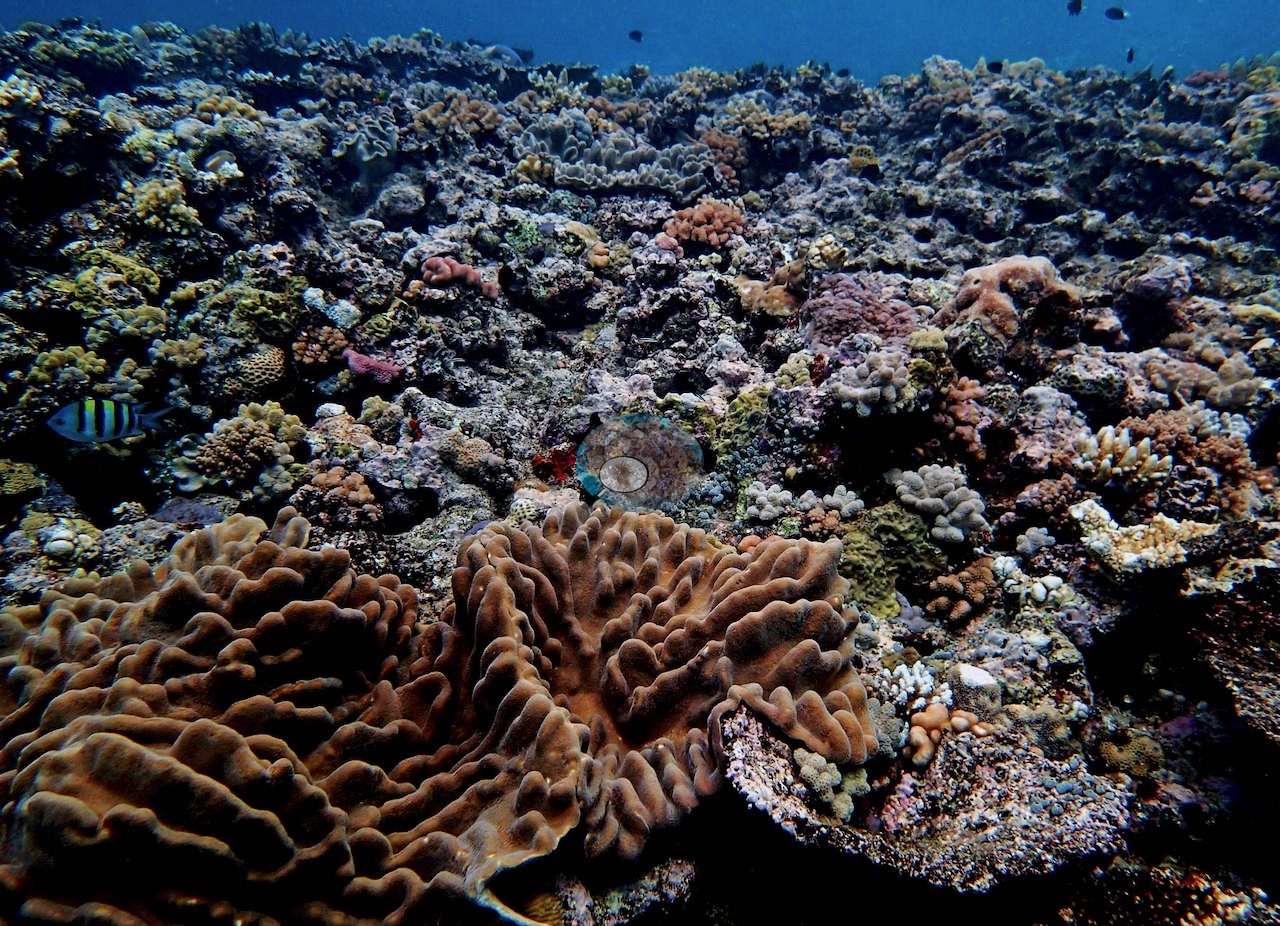
Against that, the shallower frames are strikingly dense. Image 12, Image 16, Image 18, Image 19, and Image 20 show a broad, near-horizontal reef platform where small colonies are packed almost edge to edge over the framework in mustard, olive, tan, salmon, rose, mauve, and pale blue — mostly corymbose, digitate, and knobby branching colonies and small encrusting and submassive colonies, with almost no clean rock showing. Image 16 is the single most striking frame: a large brown colony well over a meter across with thick, fleshy meandering ridges sprawls across the foreground beneath that packed platform, with a striped damselfish beside it; the growth form is unmistakable but the genus cannot be settled from the photograph and is not asserted. Image 12 adds a big tan knobby-lobed mound at the right edge and a parrotfish working the rock.
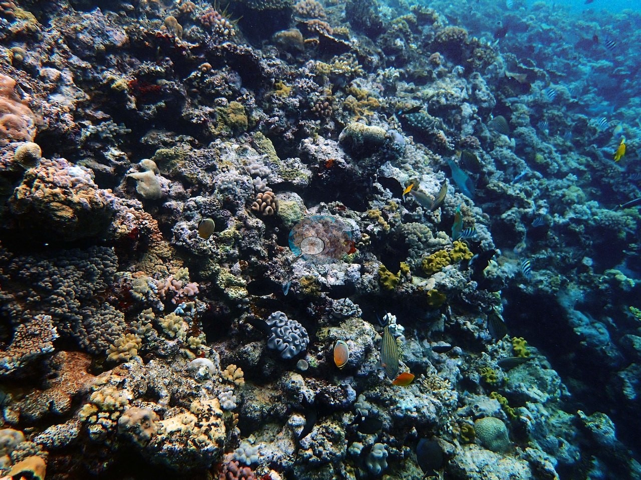
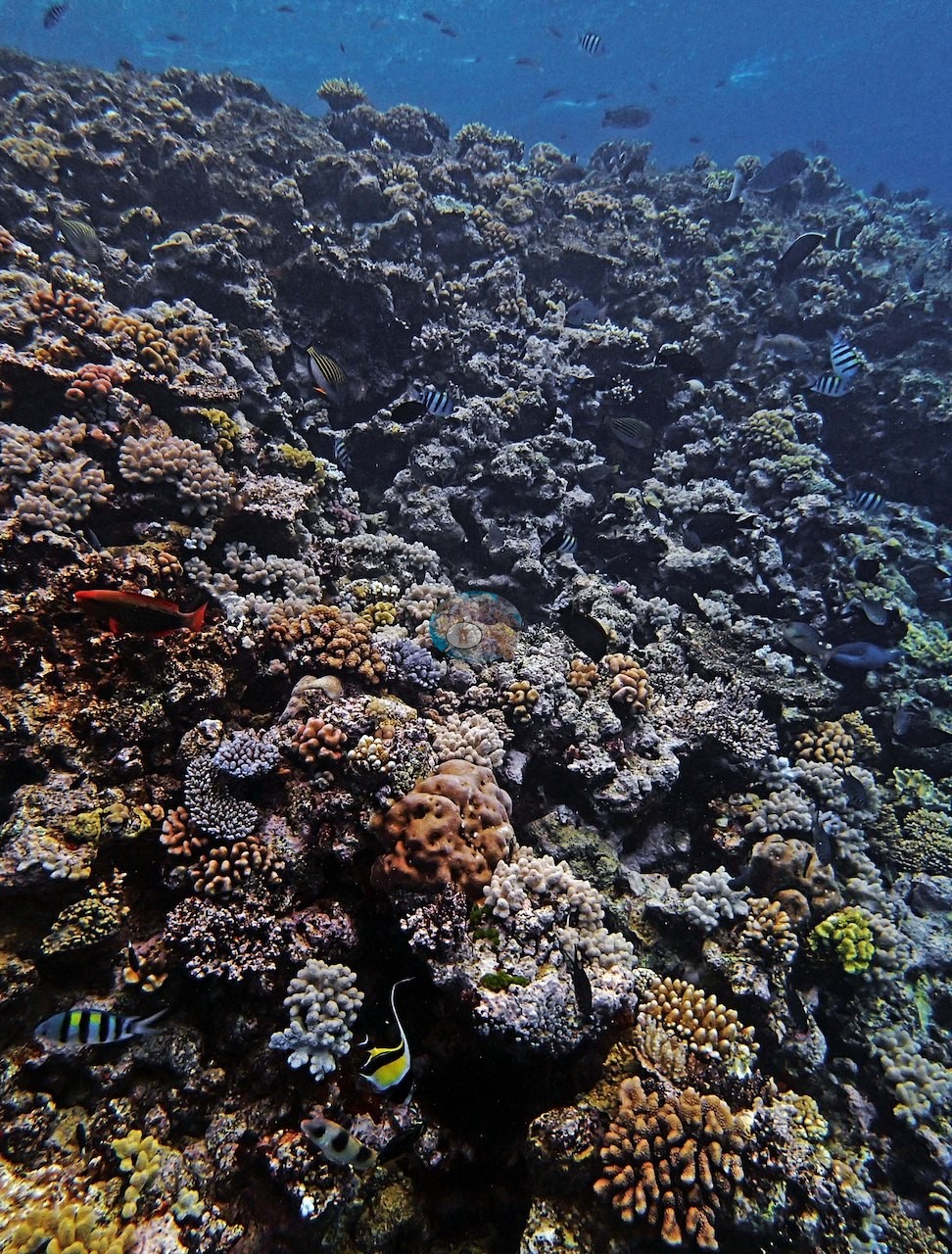
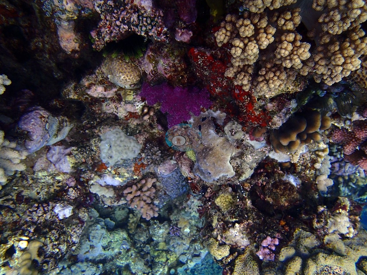
Sponges, coralline crusts, and dark turf are conspicuous throughout, and pink and magenta coralline patches show clearly in Image 9.
Coral cover
- Reference: Khaled bin Sultan Living Oceans Foundation, Global Reef Expedition (in situ transect)
- Higher up, on a genuinely vertical 10 m section, cover rebounded to around 30% with Pocillopora verrucosa, P. meandrina, Stylophora pistillata, and both sickly and healthy Seriatopora hystrix.
- Overall site cover measured 29% by point-count.
- One transect was scored at this station (29%; n = 1, so no SE; Living Oceans Foundation per-transect benthic data); it is the expedition's station value printed above.
Stressors
Down at 21 m, Anderson described the reef as showing "signs of a severe disturbance," abundant coral rubble but almost no living coral, cover of just 1-2%, with the cause left unspecified in his notes. Several frames show conspicuously white colonies among pigmented neighbors; they are recorded here without a call on their cause. The five or six small white knobby-lobed colonies photographed close in Image 5 are soft corals by their form, and every colony of that form in the frame is equally white, so no bleaching is claimed for them (the lilac, mauve, and brown colonies beside them are branching hard corals); Image 12 and Image 20 each contain one or two conspicuously white corymbose colonies in otherwise well-pigmented assemblages.
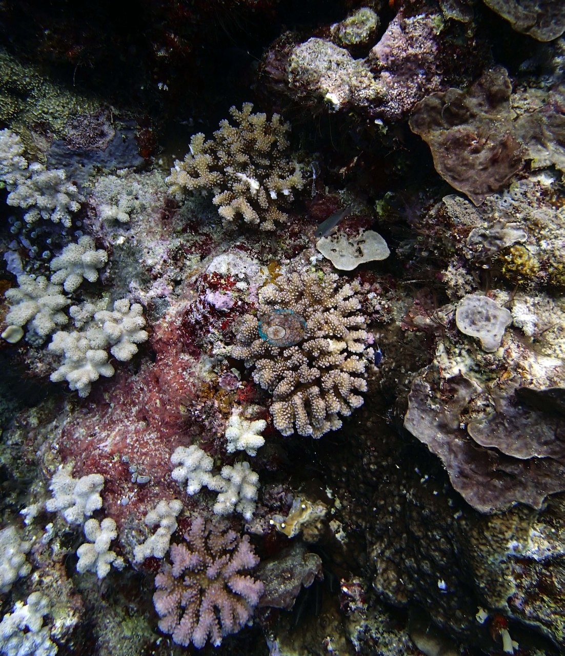
His notes mention only sickly Seriatopora hystrix at 10 m; whether the white corymbose colonies in Image 12 and Image 20 are paled hard corals cannot be settled at this image scale, and no bleaching extent is estimated. Elsewhere across the 22 frames no disease lesions or crown-of-thorns feeding scars are discernible.
Comparisons with other data
No other surveys have been conducted at this site to date. Within 5 km, one independent station, AIMS manta tow at HILDER REEF, 1.94 km away, read 5.5–40% between 1994 and 2023.
Other notes
The survey itself is in the set. Image 1 and Image 2 look straight down on the reef with the yellow transect line lying across it, (Image 11) shows a diver up in the blue with the line running down the face below, and Image 15 has two divers working the wall.
CV model comparison
More info
The photo row below is a methods comparison only: it is never averaged with the transect and never used as the headline. It compares site means only: the photos come from the same survey dive as the transect but not from the same points.| Method | Hard-coral cover (%) | Photos (n) ± SE |
|---|---|---|
| Transect (published) | 29.0 | |
| CoralSCOP edited | 30.4 | n = 22 · SE 2.1 |
| Claude (edited photos) | 18.0 | n = 22 · SE 2.9 |
The two computer-vision methods disagree by 12.4 pp (18–30%) and read on both sides of the in-water transect (29%); the headline is the in-water transect because a diver transect is independent of the photographs.
Independent surveys nearby
 LOF
Within 5 km, 1 independent survey station recorded hard coral cover in 4 surveys between 1994 and 2023. The one station surveyed in more than one year declined by 0.3 points between its first and latest surveys. The longest record, HILDER REEF (AIMS manta tow, 1.94 km away), went from 39% in 1994 to 39% in 2023. One survey since 2021 recorded 39%. This site's own estimate (29%) sits 10 points below the recent value (39%); the methods differ, so the comparison is context, not a like-for-like test.
Collected by other programs using different methods (AIMS manta tow is a towed visual estimate in categorical bins), so these are context for the figures above, not a like-for-like comparison. Where a station was surveyed more than once, the cell shows either the range of its values or, as a single value, the mean of surveys made in one year. Station names are not dive-site names.
| Agency | Site / location | Date | Hard coral cover (%) | Distance | Link |
|---|---|---|---|---|---|
| AIMS manta tow | HILDER REEF | 1994–2023 | 5.5–40% (4 surveys) | 1.94 km | doi:10.25845/5c09b0abf315a |
Data & links
- Download benthic survey data (CSV) ↗
- Download all LOF-GRE data (933 sites) ↗
- Photo portfolio ↗
- Coral Reef Diagnostics country page ↗
All images from Coral Reef Diagnostics. Data are from the Khaled bin Sultan Living Oceans Foundation Global Reef Expedition, Coral Reef Diagnostics, and the organizations named in the data sources above.
 © Coral Reef Diagnostics.