

Part of the regional summaries: Australia (GBR) - Far North: Pink stations (Preservation Zone reefs) and Australia (GBR)
More info
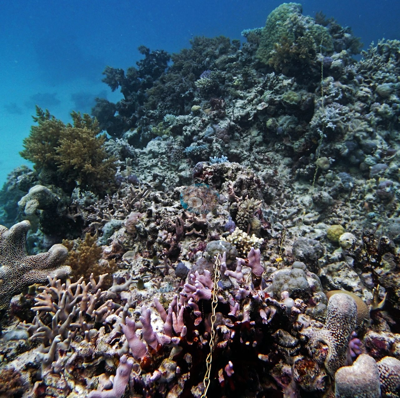
Northern GBR (NOAA CRW virtual station)A multi-tiered channel wall on Carter Reef dropping past 20 m and on to 40 m or more, with huge Diploastrea colonies, a best transect of 30-40% live cover near a bommie, and two large cuttlefish. Visibility was murky; his notes record sickly-looking needle corals, and two frames show stark-white, bleached branching colonies. Surveyed on the Living Oceans Foundation's Global Reef Expedition.
Five independent survey stations shown with the program’s logo — click one to see how far it is from this site.
Five other CRD dive sites within 5 km shown in orange — click a marker to open its page.
🗺 Detailed map of the Global Reef Expedition dive sites, Yonge, Hicks, and Carter Reefs, northern Great Barrier Reef (Khaled bin Sultan Living Oceans Foundation; opens in a new window)
6 of the 23 photographs on this page are shown beside the text that discusses them under "Site description" below.
Site description
Setting
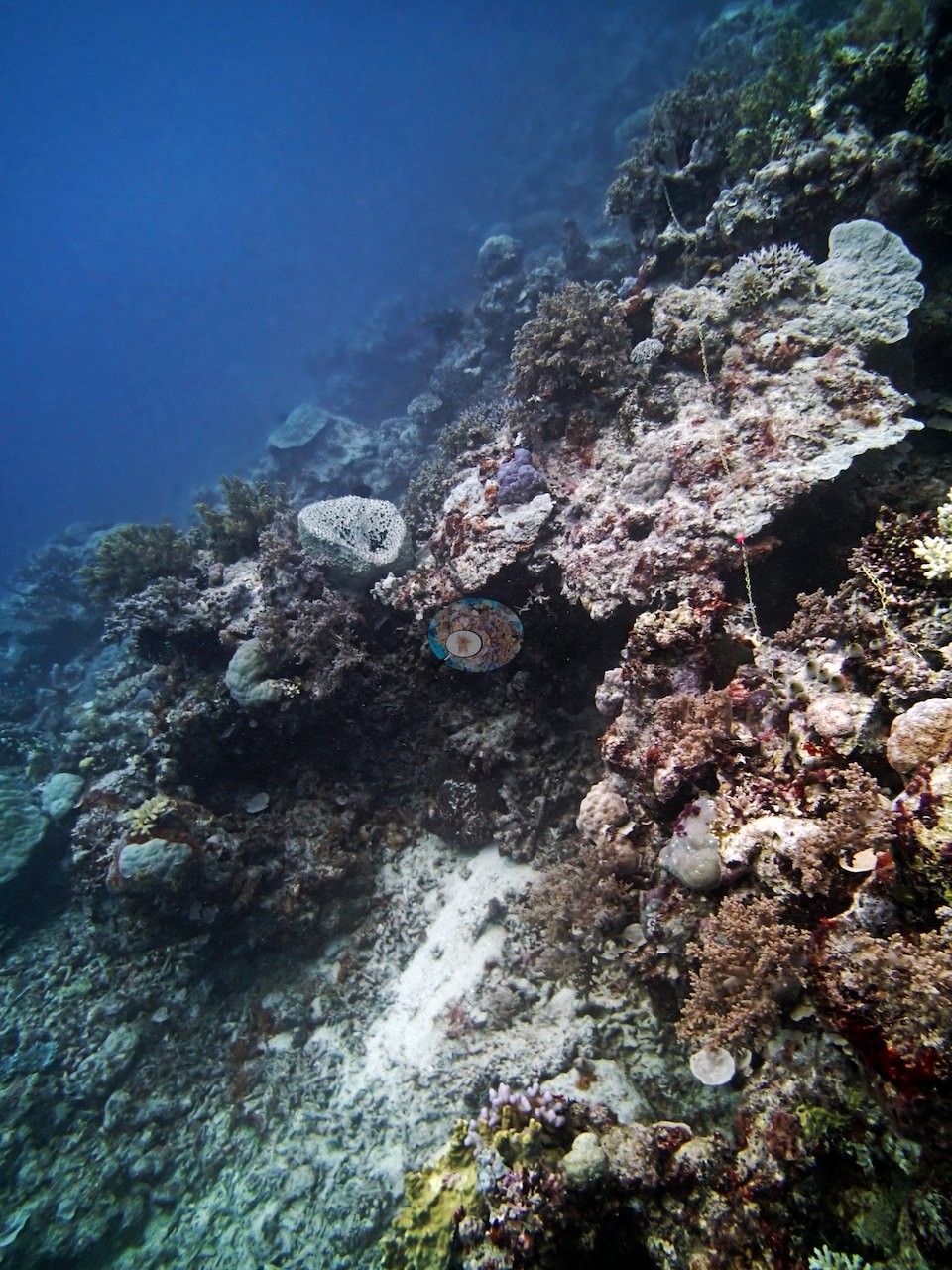
Carter Reef's third dive on 11 September 2014 dropped Anderson onto a multi-tiered channel wall, descending from 15 m past a dramatic drop-off to 20-23 m (with the wall itself continuing to 40 m or more) — his notes call the cover at 20 m "notably high ... (rare for this trip)," though 5-7 m visibility kept the view murky. This site lies in a Preservation (Pink) Zone, the Marine Park's strictest protection tier, where entry is restricted.
General benthic features
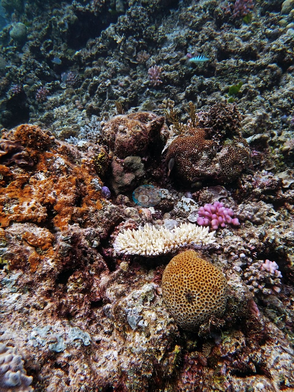
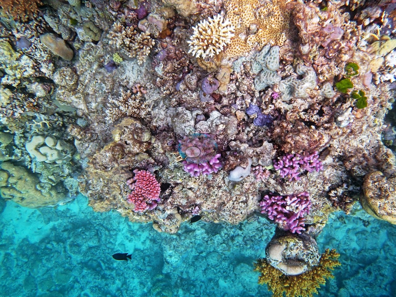
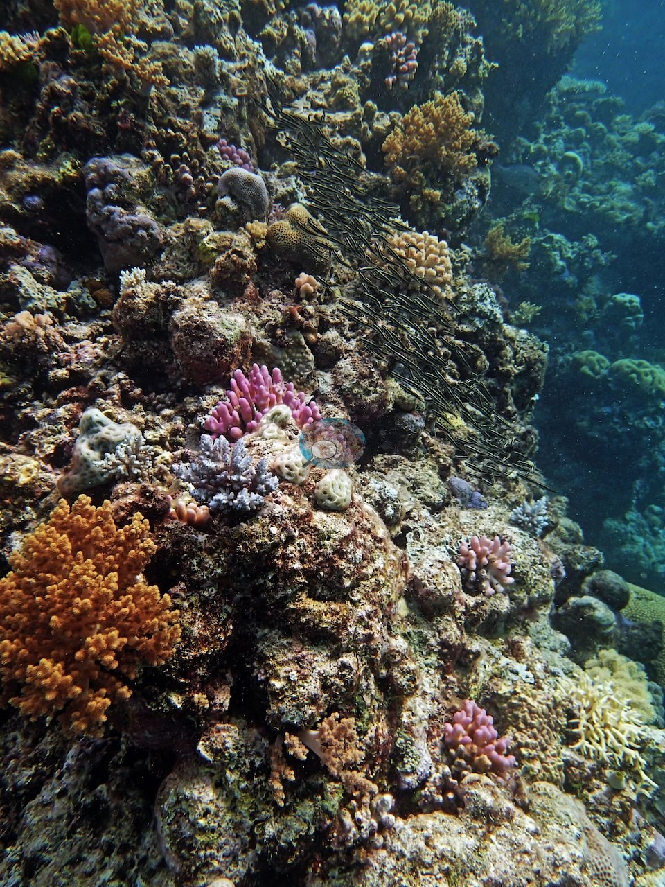
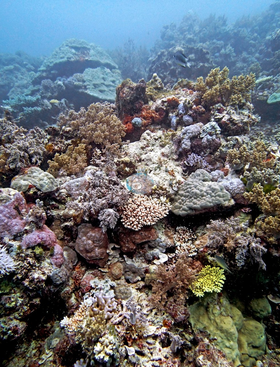
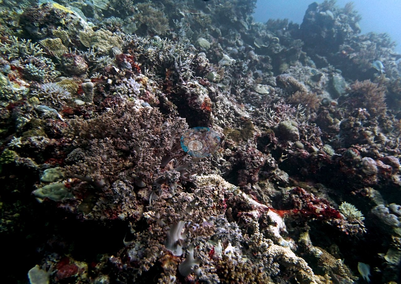
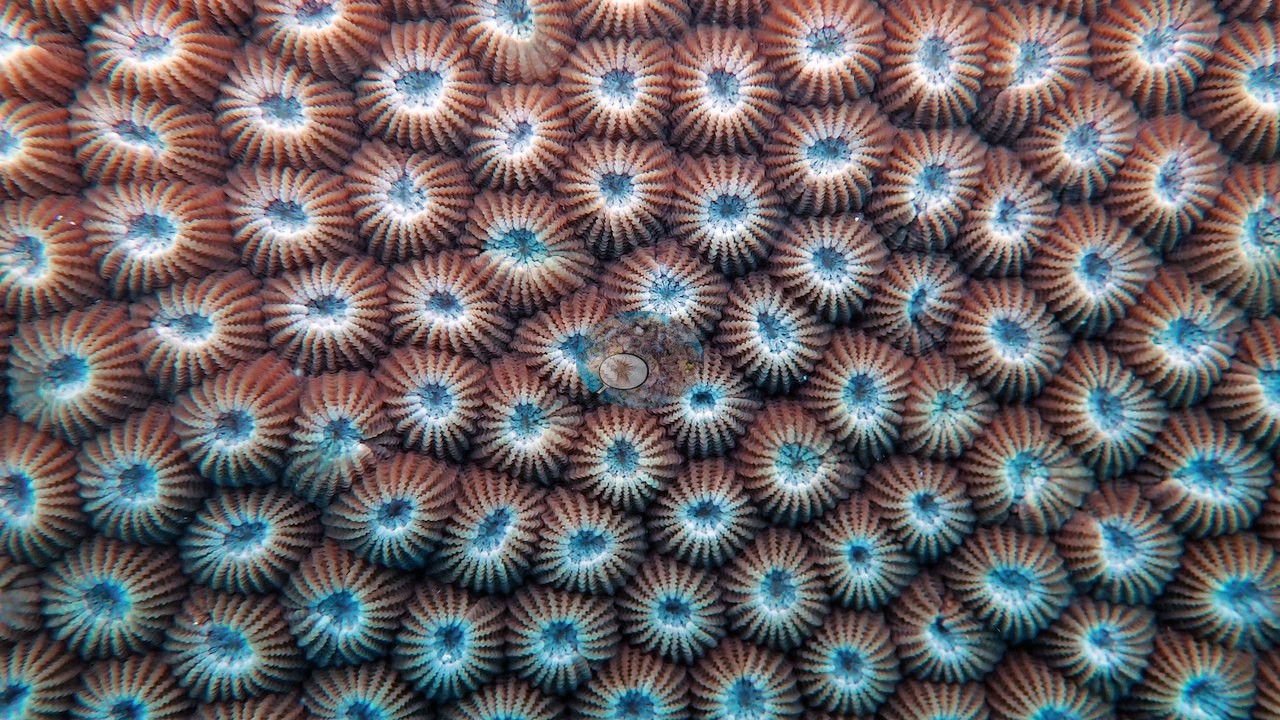
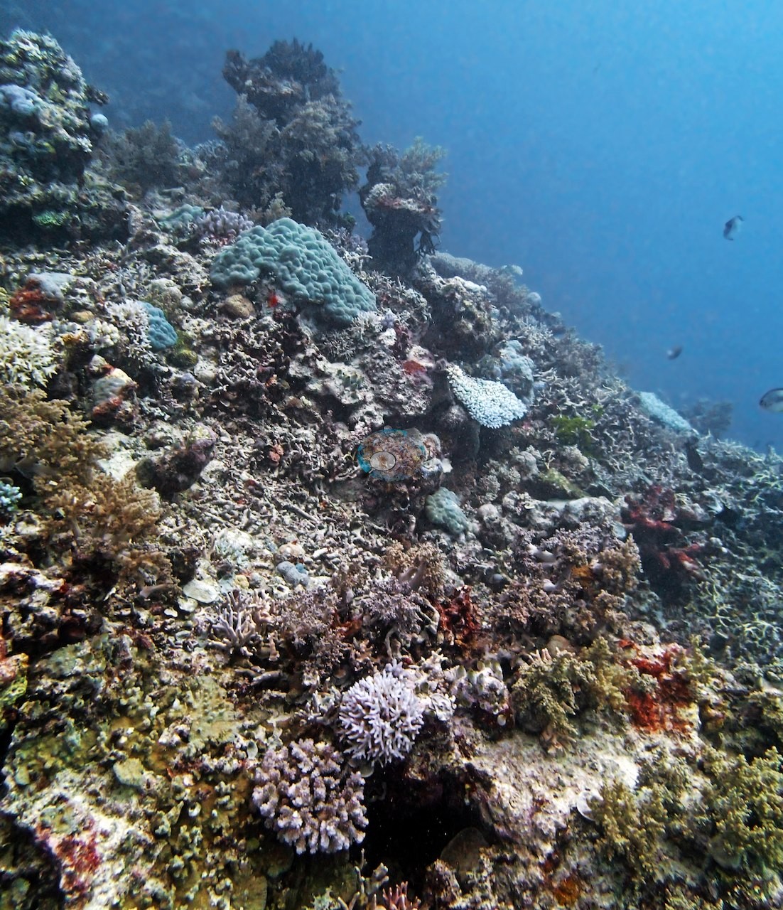
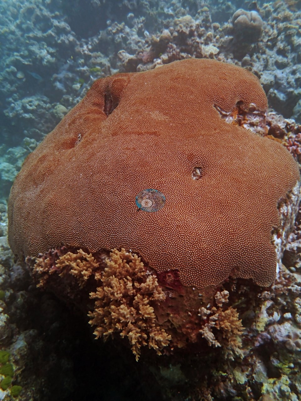
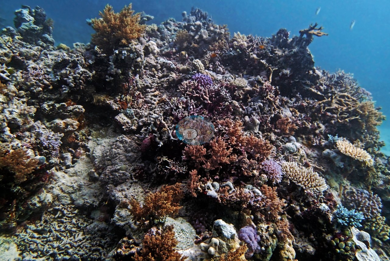
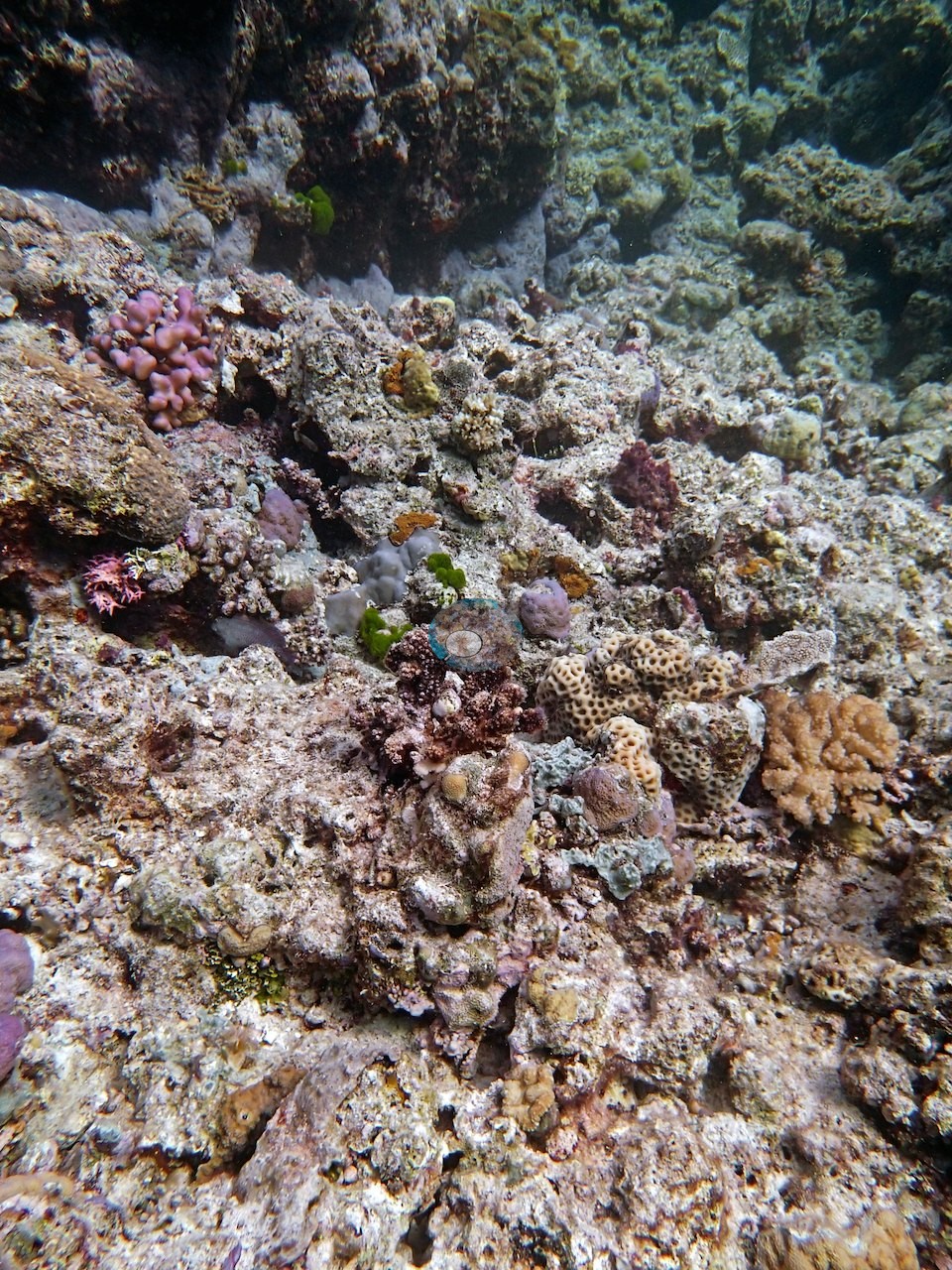
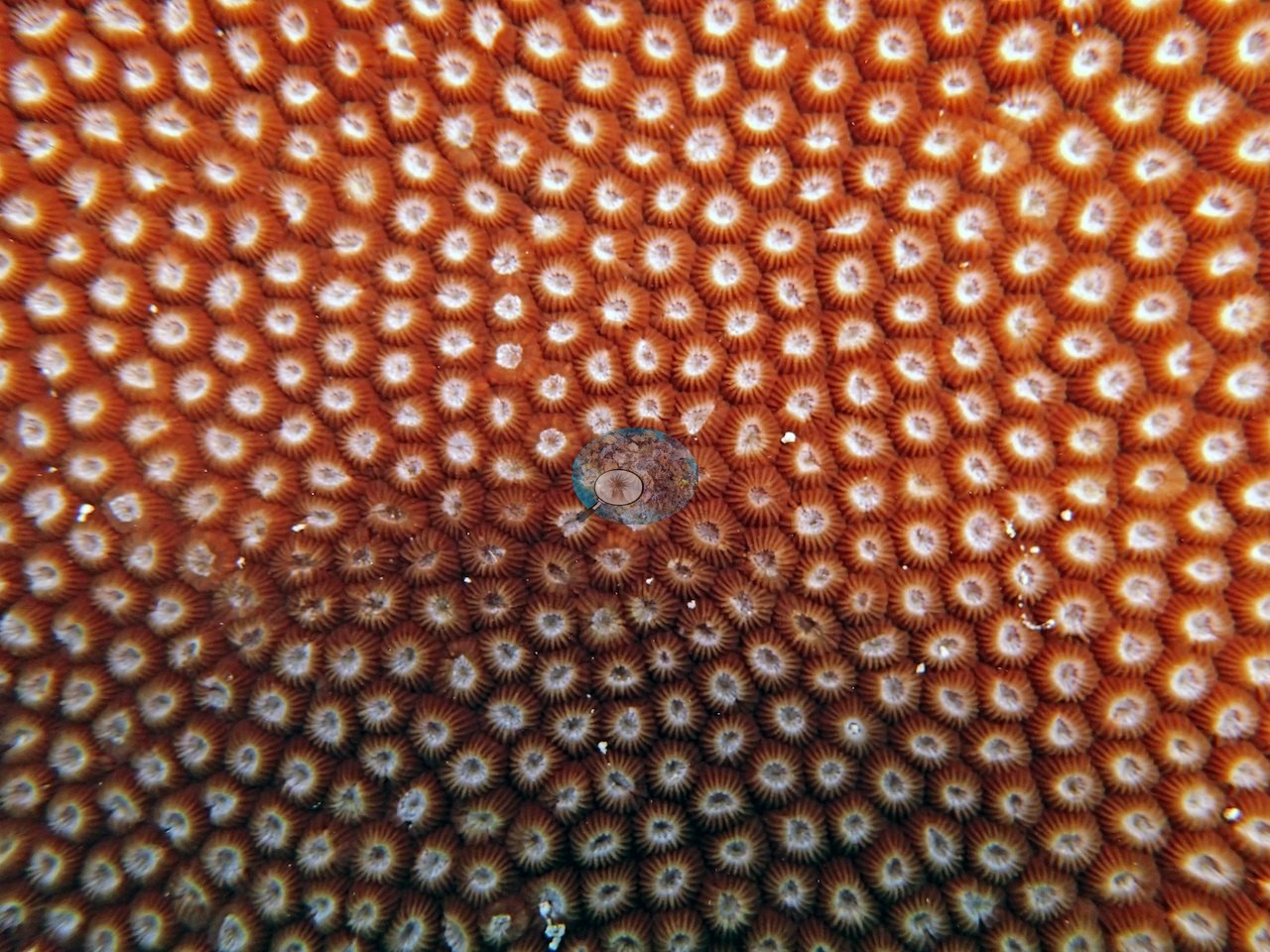
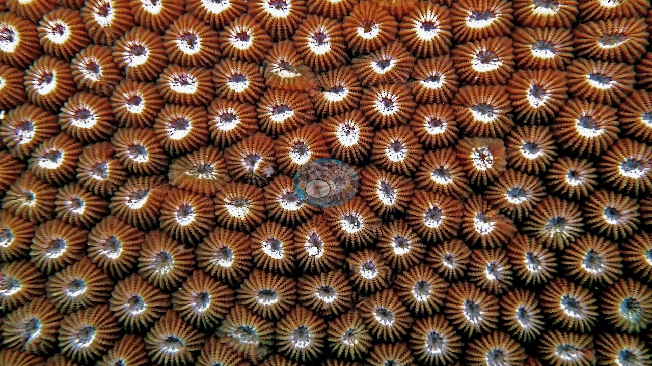
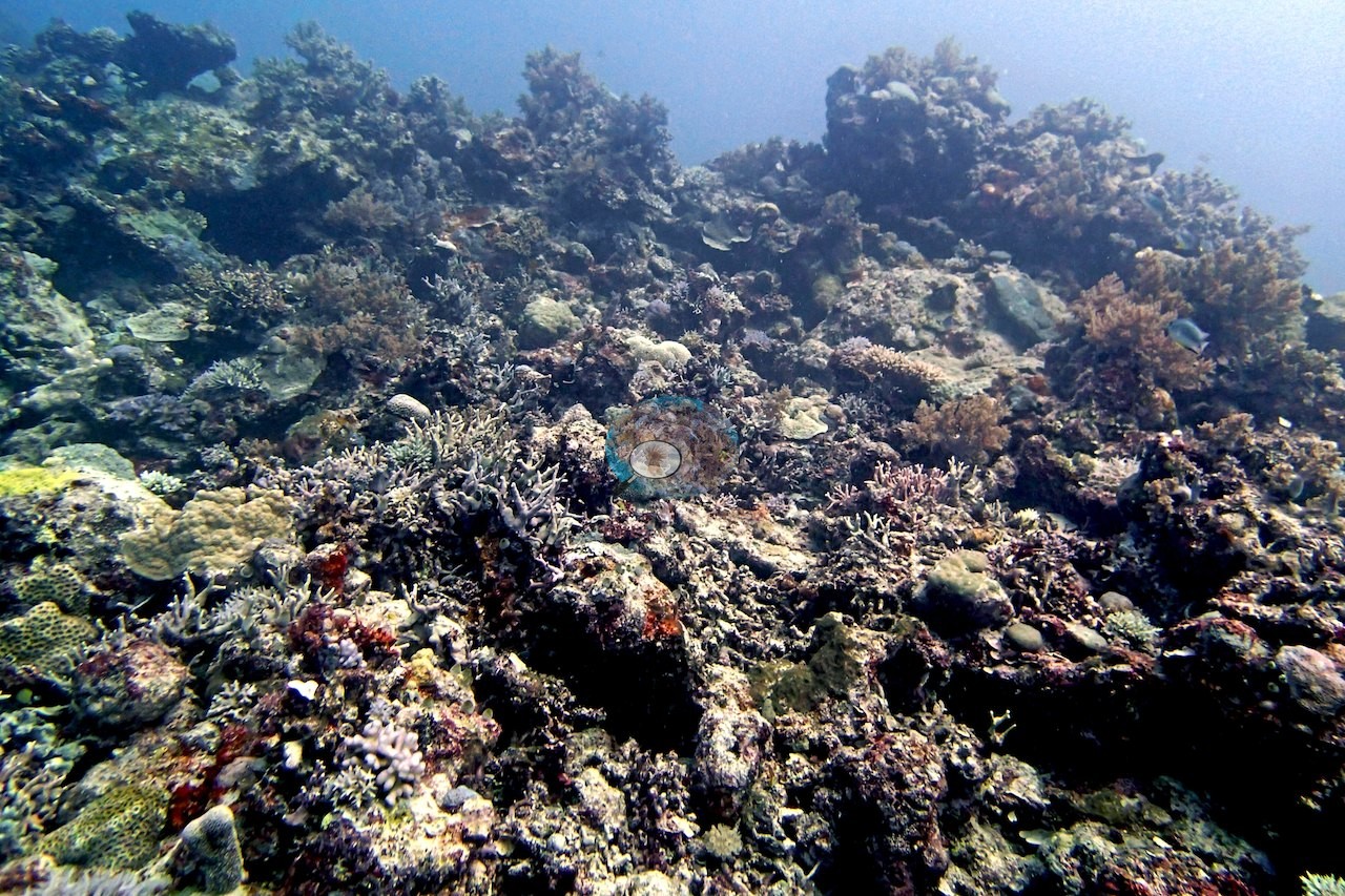
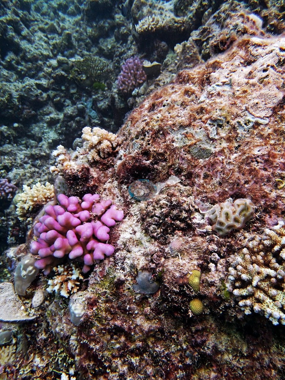
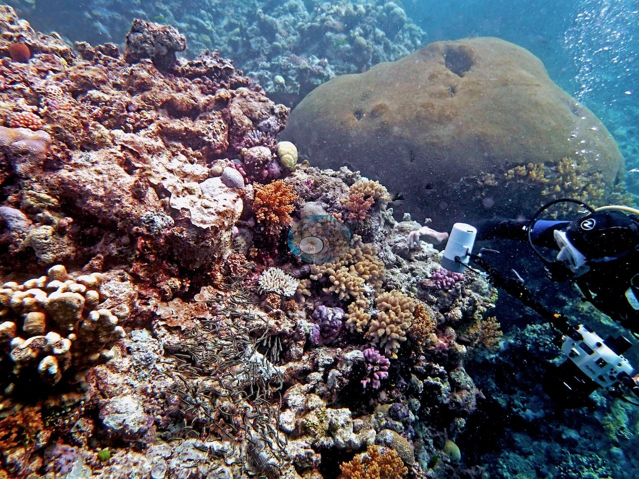
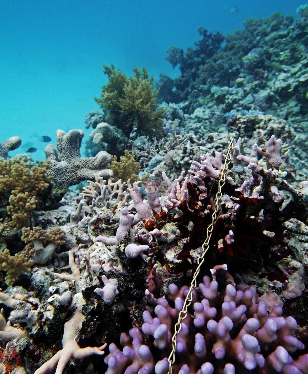
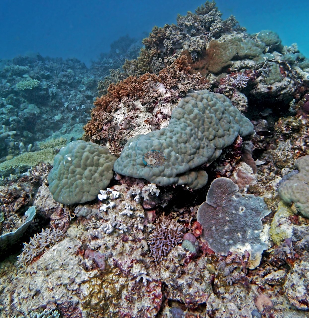
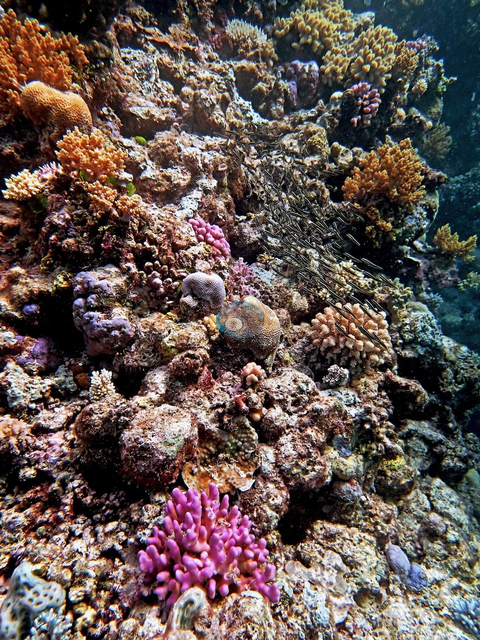
Huge Diploastrea colonies were a common sight, and the best transect, near a bommie at 10.5 m, ran 30-40% live cover with a mix of Porites, Pocillopora, Stylophora, and encrusting corals plus plenty of crustose coralline algae (e.g., Image 1, Image 2, Image 3, Image 5).
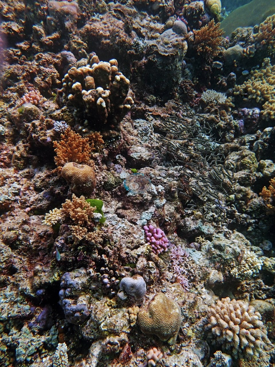
Coral cover
- Reference: Khaled bin Sultan Living Oceans Foundation, Global Reef Expedition (in situ transect)
- The expedition's in situ point-count transect at this station recorded 31% live coral cover.
- One transect was scored at this station (31%; n = 1, so no SE; Living Oceans Foundation per-transect benthic data); it is the expedition's station value printed above.
Stressors
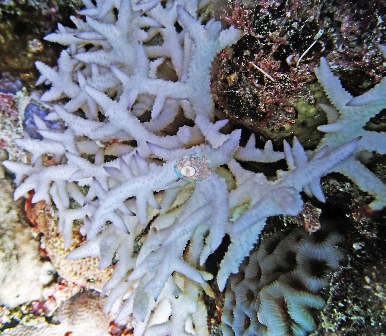
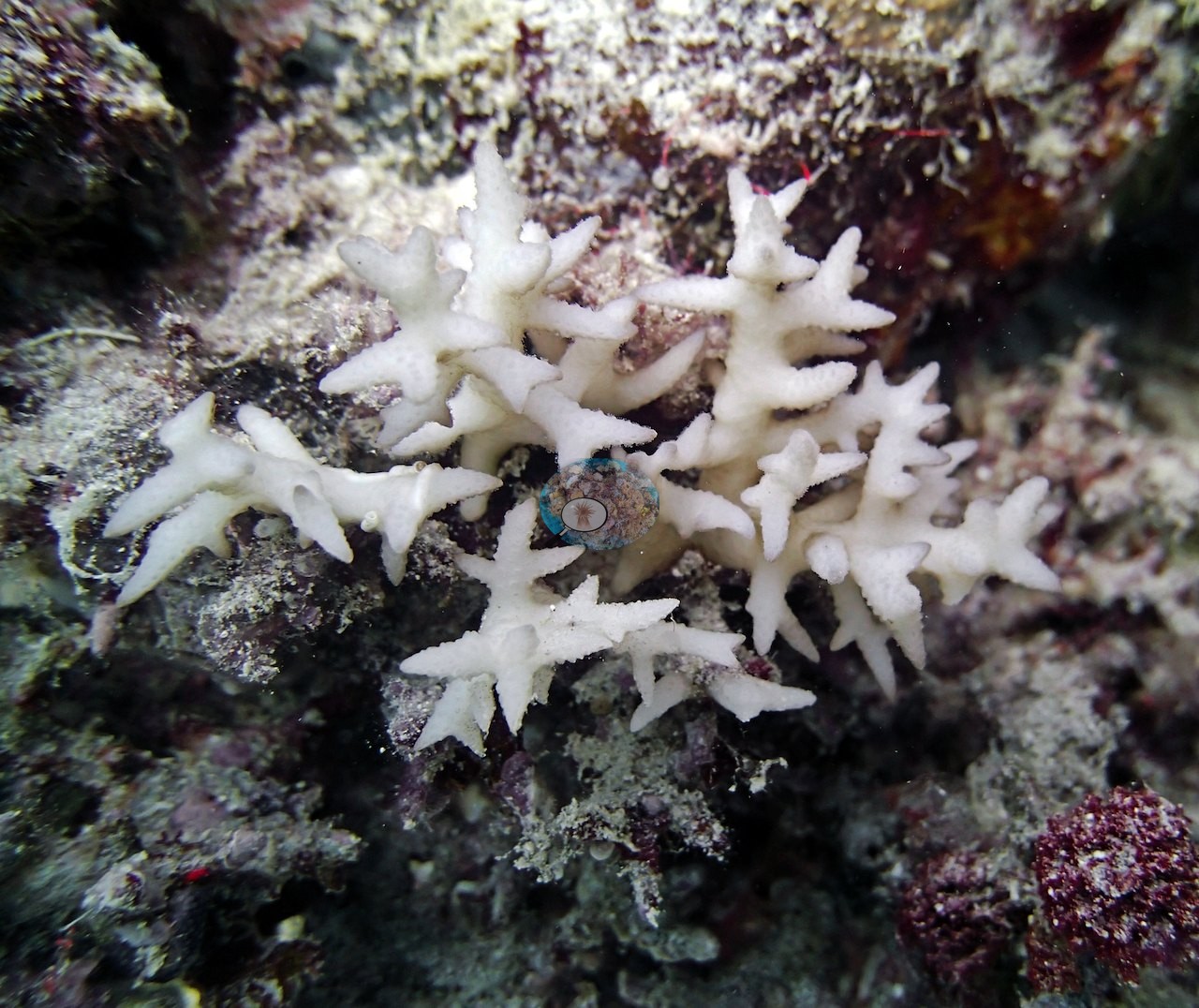
One note of concern: his notes record "Sickly looking S. hystrix" (needle coral). Two frames show fine-branching colonies of that kind that are stark white from base to tip, with crisp corallites, a faint lilac sheen at the tips, and no algal film, among pigmented neighbors: fully bleached living colonies (e.g., Image 10, Image 21).
Fish and other fauna
This 31%-cover survey point also turned up two large cuttlefish along the wall.
Comparisons with other data
No other surveys have been conducted at this site to date. Within 5 km, five independent stations (AIMS LTMP, AIMS manta tow, and XL Catlin Seaview Survey) recorded 3.9–73% hard coral cover between 1993 and 2023; the nearest, AIMS LTMP at CARTER REEF site 3, 0.17 km away, read 7.7–59% between 1993 and 2022.
Other notes
Position approximate: expedition-estimated (three decimals in the 933-site table); Anderson's sheet and the expedition's planning table carry another day's coordinates for this station.
Independent surveys nearby
| Agency / program | Year(s) | Stations / distance | Link |
|---|---|---|---|
| AIMS LTMP | 1993–2022 | 3 stations, 0.17–0.90 km | Records ↓ |
| AIMS manta tow | 1993–2023 | 1 station, 2.26 km | Records ↓ |
| XL Catlin Seaview Survey | 2012–2017 | 1 station, 3.62 km | Records ↓ |
 LOF Global Reef ExpeditionYear-average (illustrative only, programs differ)
Within 5 km, 5 independent survey stations recorded hard coral cover in 93 surveys between 1993 and 2023. Of the 5 stations surveyed in more than one year, 4 were scored by divers or by people annotating photographs: 4 increased (by 10.8–26.0 points) between their first and latest surveys. The other 1 was scored by automated image analysis: changed by 7 points or less, inside the 7-point method-noise floor (inconclusive). The longest record, CARTER REEF (AIMS manta tow, 2.26 km away), went from 16% in 1993 to 33% in 2023. Since 2021, station-year means average 29% (range 18–36%; n = 9 station-years from 9 surveys). This site's own estimate (31%) sits within the recent range up to 2 km away (27–36%); the methods differ, so the comparison is context, not a like-for-like test.
Collected by other programs using different methods (AIMS manta tow is a towed visual estimate in categorical bins; AIMS LTMP uses fixed photo-transects; the XL Catlin Seaview Survey uses photo-transects with automated image annotation), so these are context for the figures above, not a like-for-like comparison. Where a station was surveyed more than once, the cell shows either the range of its values or, as a single value, the mean of surveys made in one year. Station names are not dive-site names.
| Agency | Site / location | Date | Hard coral cover (%) | Distance | Link |
|---|---|---|---|---|---|
| AIMS LTMP | CARTER REEF site 3 | 1993–2022 | 7.7–59% (range of yearly means; 22 surveys) | 0.17 km | doi:10.25845/5c09bc4ff315c |
| AIMS LTMP | CARTER REEF site 2 | 1993–2022 | 8.8–65% (range of yearly means; 22 surveys) | 0.45 km | doi:10.25845/5c09bc4ff315c |
| AIMS LTMP | CARTER REEF site 1 | 1993–2022 | 7.5–73% (range of yearly means; 22 surveys) | 0.90 km | doi:10.25845/5c09bc4ff315c |
| AIMS manta tow | CARTER REEF | 1993–2023 | 3.9–35% (23 surveys) | 2.26 km | doi:10.25845/5c09b0abf315a |
| XL Catlin Seaview Survey | transect 12025 | 2012–2017 | 13–19% (4 surveys) | 3.62 km | doi:10.14264/uql.2019.930 |
Data & links
- Download benthic survey data (CSV) ↗
- Download all LOF-GRE data (933 sites) ↗
- Photo portfolio ↗
- Coral Reef Diagnostics country page ↗
All images from Coral Reef Diagnostics. Data are from the Khaled bin Sultan Living Oceans Foundation Global Reef Expedition, Coral Reef Diagnostics, and the organizations named in the data sources above.
 © Coral Reef Diagnostics.