

Part of the regional summaries: Australia (GBR) - Far North: Blue stations (Habitat Protection Zone reefs) and Australia (GBR)
More info
Northern GBR (NOAA CRW virtual station)Built in tiers, this leeward bommie field on Ribbon Reef 5 runs from soft-coral-draped bommies at 20 m up through a pinnacle of branching acroporid corals to Pocillopora-crowded shallows just 1.5 m below the surface, with 37% cover overall. One diver even came under attack from a very aggressive sea snake. Surveyed on the Living Oceans Foundation's Global Reef Expedition.
Seven independent survey stations shown with the program’s logo — click one to see how far it is from this site.
Five other CRD dive sites within 5 km shown in orange — click a marker to open its page.
🗺 Detailed map of the Global Reef Expedition dive sites, Ribbon Reefs, northern Great Barrier Reef (Khaled bin Sultan Living Oceans Foundation; opens in a new window)
4 of the 5 photographs on this page are shown beside the text that discusses them under "Site description" below.
Site description
Setting
This is a Habitat Protection (Blue) Zone, where line fishing is permitted.
General benthic features
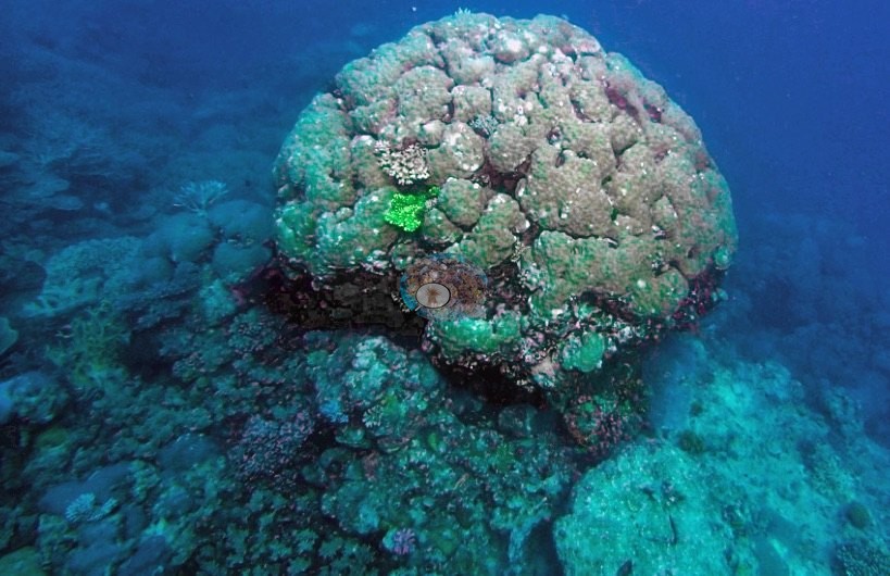
This leeward bommie field on Ribbon Reef No. 5 stacks up in bands with depth: weedy soft corals cloak scattered bommies around 20 m, a high-relief pinnacle of branching acroporids rises from 13-14 m, and the reef crowds to within 1.5 m of the surface, where Pocillopora damicornis and P. verrucosa grow in abundance. One frame shows a single massive Porites dome a couple of meters high standing clear of the surrounding pavement, its lobed surface green in the ambient light with one vivid green patch and a skirt of small colonies at its base (e.g., Image 4).
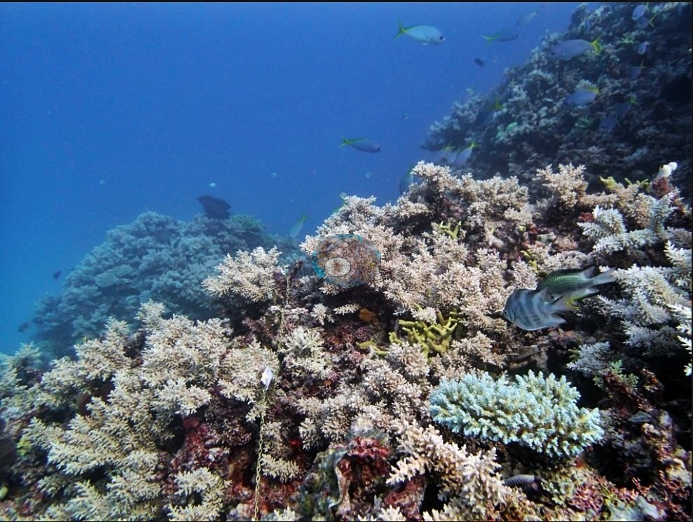
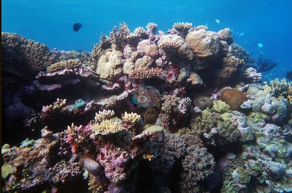
Others look across the shallow mosaic: pale corymbose Acropora thickets and yellow fire coral on a slope edge dropping into blue, sweetlips and damselfish working the crest, and broad fields mixing mounding Porites, pink Pocillopora, and tabulate Acropora (e.g., Image 1, Image 2).
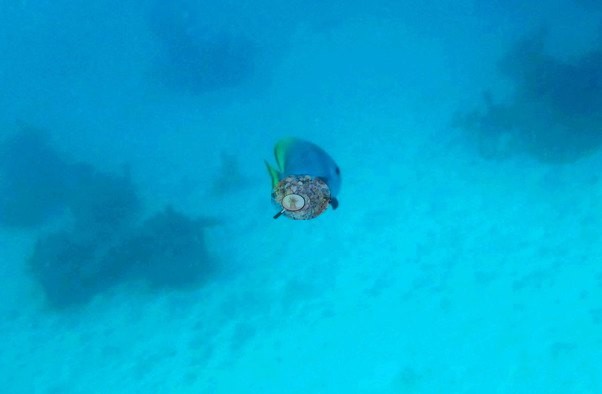
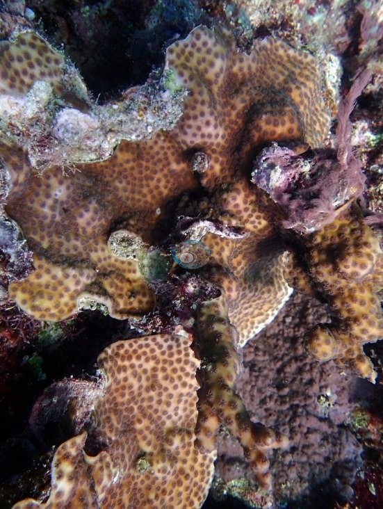
A close-up catches a foliose plate coral of the Turbinaria type, tan with widely spaced round corallites (e.g., Image 3).
Coral cover
- Reference: Khaled bin Sultan Living Oceans Foundation, Global Reef Expedition (in situ transect)
- Point-count cover across the site reached 37%.
- Transect mean 37 ± 10% SE (n = 2 transects; Living Oceans Foundation per-transect benthic data); the headline above is the expedition's station value.
Stressors
No bleaching, disease, or crown-of-thorns starfish were reported here.
Fish and other fauna
The dive's most memorable moment was an extremely aggressive sea snake that actually attacked one of the divers.
Comparisons with other data
No other surveys have been conducted at this site to date. Within 5 km, seven independent stations (Reef Check and XL Catlin Seaview Survey) recorded 7.0–53% hard coral cover between 1999 and 2017; the nearest, XL Catlin Seaview Survey at transect 12036, 2.10 km away, read 11–17% between 2012 and 2017.
Other notes
The field report's station table gives this code a Lizard Island mid-shelf position that belongs to AULK22 (its rows for 5-6 September 2014 are shifted by two stations); the pin uses the 933-site table's position on Ribbon Reef 5, where Anderson's notes place this dive.
Independent surveys nearby
| Agency / program | Year(s) | Stations / distance | Link |
|---|---|---|---|
| Reef Check | 1999–2008 | 3 stations, 4.59–4.87 km | Records ↓ |
| XL Catlin Seaview Survey | 2012–2017 | 4 stations, 2.10–4.72 km | Records ↓ |
 LOF Global Reef ExpeditionYear-average (illustrative only, programs differ)
Within 5 km, 7 independent survey stations recorded hard coral cover in 17 surveys between 1999 and 2017. Of the 4 stations surveyed in more than one year, 1 was scored by divers or by people annotating photographs: increased by 1.9 points between its first and latest surveys. The other 3 were scored by automated image analysis: 3 changed by 7 points or less, inside the 7-point method-noise floor (inconclusive). Two stations share the longest span (2012–2017); one, transect 12036 (XL Catlin Seaview Survey, 2.10 km away), went from 15% in 2012 to 11% in 2017. The most recent nearby survey is from 2017, so these values predate recent heat stress. This site's own estimate (37%) is not compared with these surveys: none lies within 2 km.
Collected by other programs using different methods (Reef Check uses point-intercept transects; the XL Catlin Seaview Survey uses photo-transects with automated image annotation), so these are context for the figures above, not a like-for-like comparison. Where a station was surveyed more than once, the cell shows either the range of its values or, as a single value, the mean of surveys made in one year. Station names are not dive-site names.
| Agency | Site / location | Date | Hard coral cover (%) | Distance | Link |
|---|---|---|---|---|---|
| Reef Check | Ribbon Reef #5 southern patch | 1999 | 53% | 4.59 km | — |
| Reef Check | Ribbon Reef 3 - Clam Beds (Back reef slope) Site 1 | 2004 | 43% | 4.87 km | — |
| Reef Check | Ribbon Reef 3 - Clam Beds (Back reef slope) Site 1 | 2005–2008 | 41–49% (4 surveys) | 4.71 km | — |
| XL Catlin Seaview Survey | transect 12036 | 2012–2017 | 11–17% (4 surveys) | 2.10 km | doi:10.14264/uql.2019.930 |
| XL Catlin Seaview Survey | transect 12038 | 2012–2017 | 8.0–27% (4 surveys) | 2.11 km | doi:10.14264/uql.2019.930 |
| XL Catlin Seaview Survey | transect 12003 | 2012 | 38% | 4.72 km | doi:10.14264/uql.2019.930 |
| XL Catlin Seaview Survey | transect 12037 | 2016–2017 | 7.0–9.5% (2 surveys) | 4.61 km | doi:10.14264/uql.2019.930 |
Data & links
- Download benthic survey data (CSV) ↗
- Download all LOF-GRE data (933 sites) ↗
- Photo portfolio ↗
- Coral Reef Diagnostics country page ↗
All images from Coral Reef Diagnostics. Data are from the Khaled bin Sultan Living Oceans Foundation Global Reef Expedition, Coral Reef Diagnostics, and the organizations named in the data sources above.
 © Coral Reef Diagnostics.