

Part of the regional summaries: Australia (GBR) - Far North: Blue stations (Habitat Protection Zone reefs) and Australia (GBR)
More info
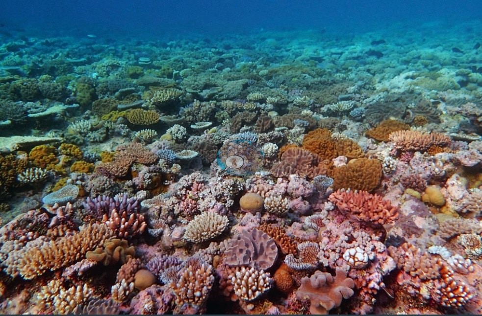
Northern GBR (NOAA CRW virtual station)A colorful, low-relief reef on the sheltered side of Ribbon Reef 5, a close-packed mosaic of Porites domes, branching and plating corals, and vivid orange fleshy colonies, with dusty-pink soft corals massed a meter deep between the heads. A giant clam and a dark gorgonian or black-coral bush on a bommie top add to the scene, at 45% cover. Anderson recorded most of the needle coral (Seriatopora) and some Pocillopora damicornis as bleached, and toppled Acropora at 5-8 m that suggested recent storm damage. Surveyed on the Living Oceans Foundation's Global Reef Expedition.
Four independent survey stations shown with the program’s logo — click one to see how far it is from this site.
Five other CRD dive sites within 5 km shown in orange — click a marker to open its page.
🗺 Detailed map of the Global Reef Expedition dive sites, Ribbon Reefs, northern Great Barrier Reef (Khaled bin Sultan Living Oceans Foundation; opens in a new window)
Site description
Setting
This site sits in a Habitat Protection (Blue) Zone, where line fishing is permitted.
General benthic features
Twelve frames survive of this dive and they show a colorful, structurally low reef with an unusually strong soft-coral component. The wide frames (e.g., Image 1, Image 2, Image 3, Image 4, Image 8, Image 9, Image 10) all look across a broken, close-packed mosaic rather than any single dominant form.
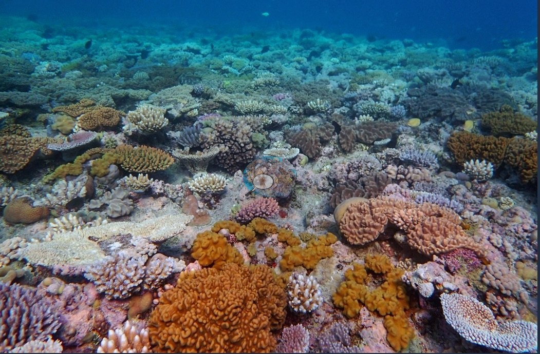
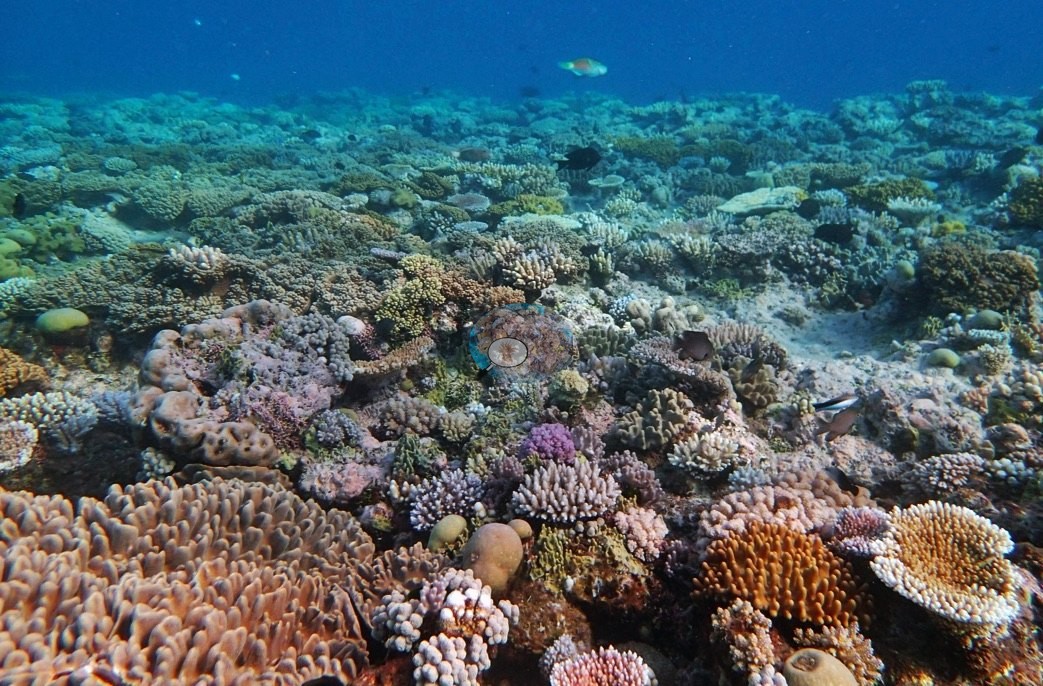
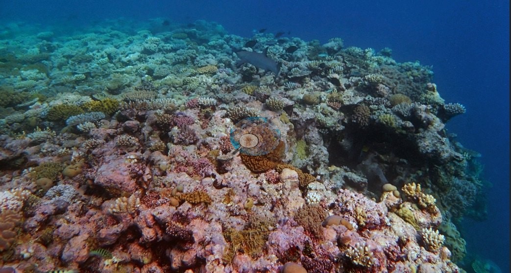
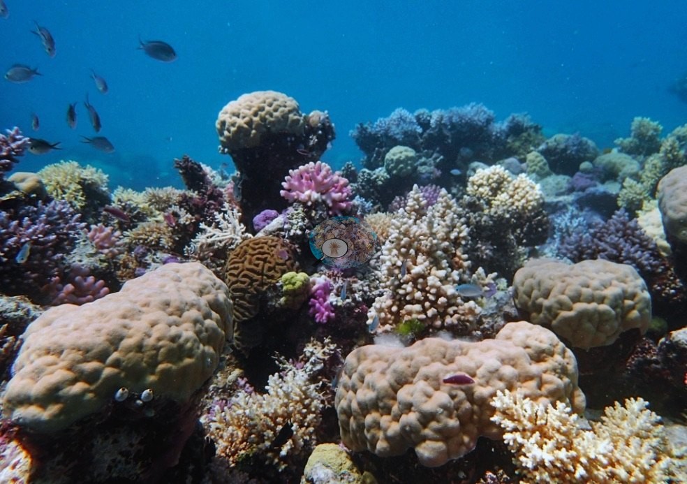
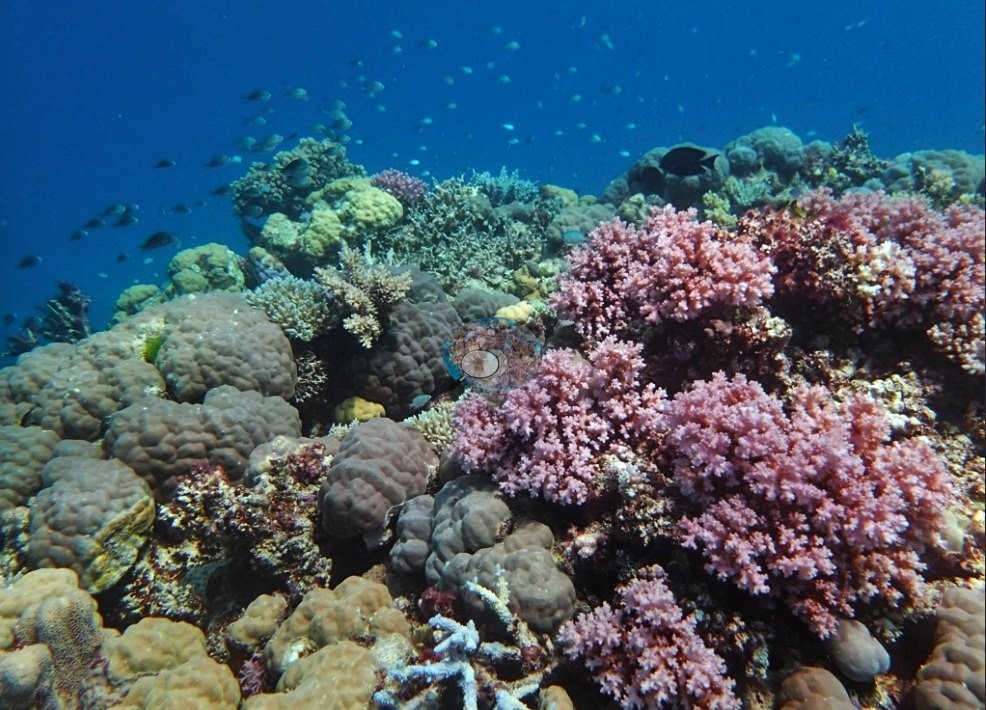
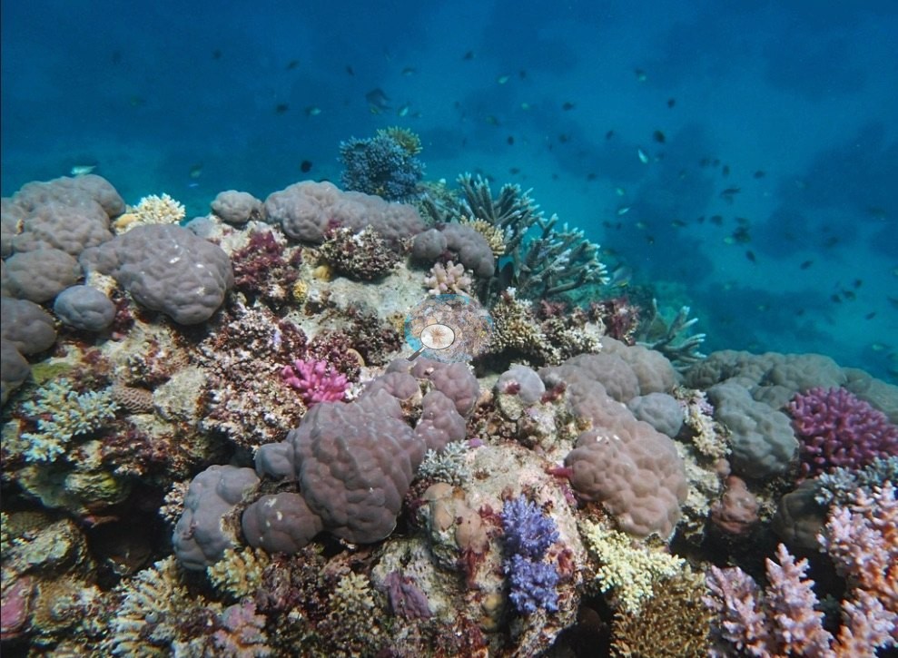
Smooth mounding domes — brown, tan, and gray, consistent with Porites, and mounding faviids — recur in nearly every frame (e.g., Image 8, Image 9, Image 10), and around and between them sit cream, tan, and orange corymbose and branching colonies, pale plating colonies, purple, and blue-tipped branching colonies (e.g., Image 1, Image 10), and small pink and mauve clumps. Image 2 and Image 1 carry a vivid orange fleshy colony each, the brightest hard-substrate color in the set. Soft corals are conspicuous: dusty-pink and mauve bushy soft corals crowd the reef in Image 4, Image 9, and Image 8 — Image 9 has them massed a meter deep between the mounding heads — and Image 7 has a dark branching gorgonian or black-coral bush standing on the top of a bommie against blue water.
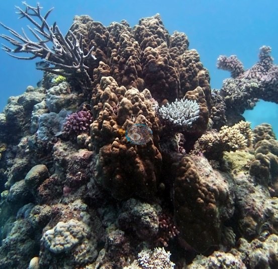
Image 4 and Image 3 show the reef edge falling away into darker blue. Two frames are close-ups. Image 6 is a macro of a lavender-purple colony with large, ruffled, radially fringed polyps fully expanded — a corallimorph or a fleshy-polyped coral; at this resolution the frame does not settle which.
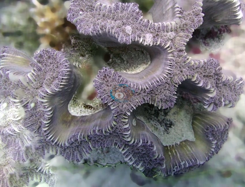
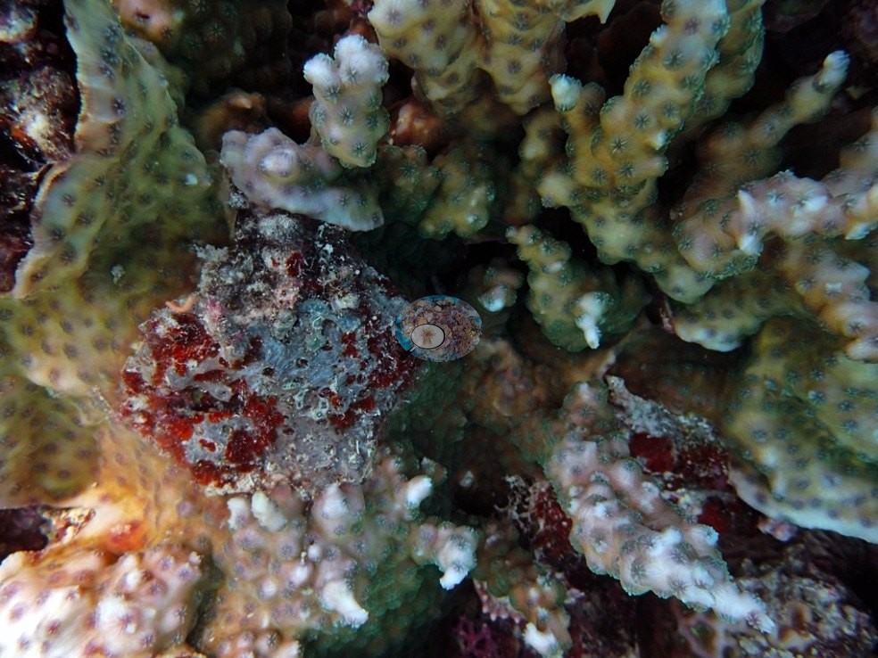
Image 11 is a close view of pale branching and encrusting growth with crimson-red encrusting patches and a gray-green algal-turf patch through the middle.
Coral cover
- Reference: Khaled bin Sultan Living Oceans Foundation, Global Reef Expedition (in situ transect)
- The point-count survey read 45% live coral.
- Transect mean 45 ± 4.0% SE (n = 5 transects; Living Oceans Foundation per-transect benthic data); the headline above is the expedition's station value.
Stressors
Condition, qualitatively: pigmentation looks normal in the wide frames — the mauve and pink colonies here read as pigmented rather than pale. No stark-white colonies, disease lesions, or crown-of-thorns appear in the twelve frames. Anderson's own record for this dive notes that most of the reef's Seriatopora had bleached along with some Pocillopora damicornis, and that a cluster of toppled Acropora colonies at 5-8 m suggested fairly recent storm damage, much of it still alive; neither the bleached fine-branched material nor the toppled colonies are identifiable in this reduced photo set, so his field record stands on its own and no percentage is estimated from the photographs.
Fish and other fauna
Image 12 is a giant clam (Tridacna) wedged into the reef with its mantle in mottled cream, brown, and dark stripes, fringed by tan branching Acropora and encrusting Montipora-type sheets.
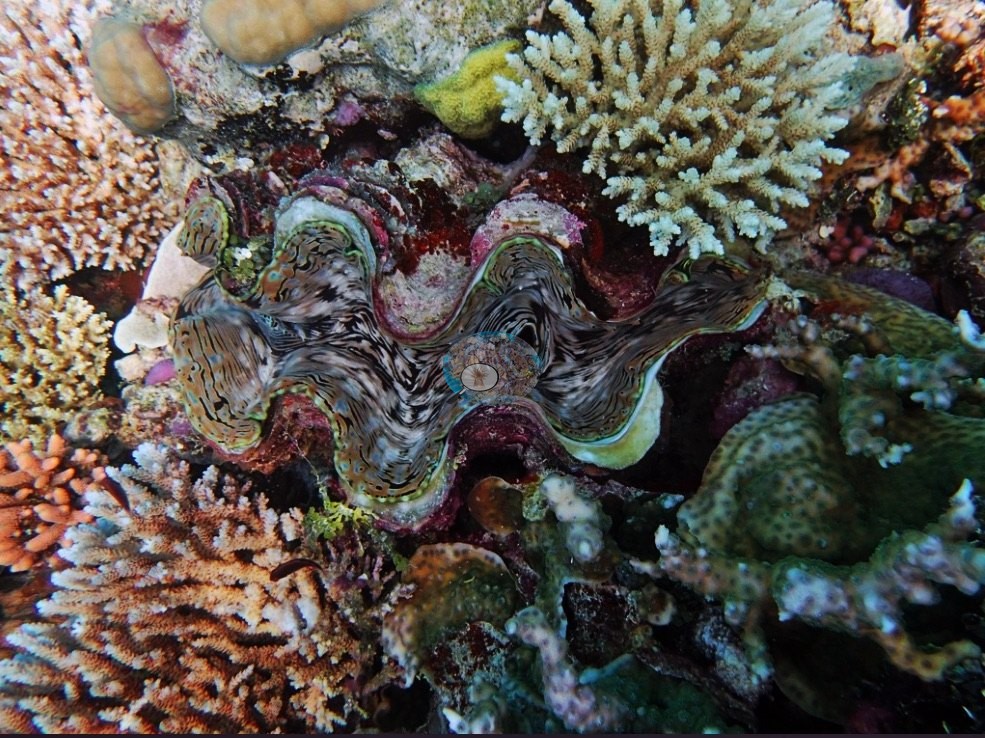
Image 5 records the sea snake Anderson logged: an olive-and-cream banded snake, thin-necked and paddle-tailed, crossing a patch of white sand and rubble with mauve branching corals at the edge.
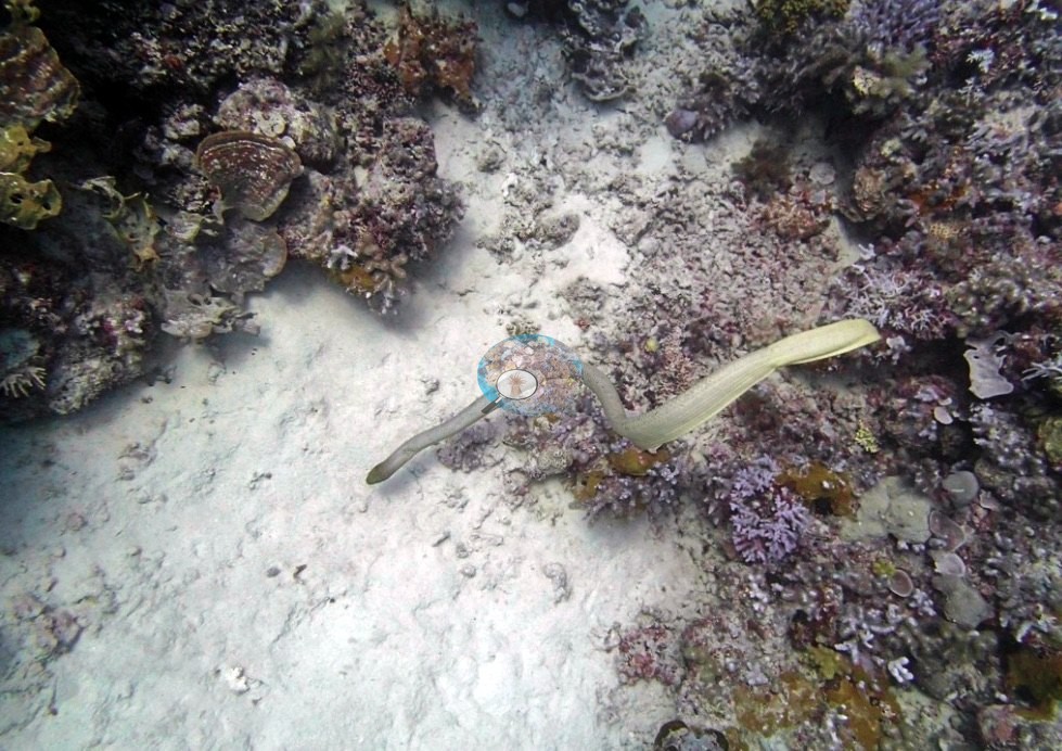
It is a single-subject frame with little usable substrate. An aggressive 2 m olive sea snake patrolled the site.
Comparisons with other data
No other surveys have been conducted at this site to date. Within 5 km, four independent stations (AIMS manta tow and XL Catlin Seaview Survey) recorded 8.0–36% hard coral cover between 1996 and 2021; the nearest, XL Catlin Seaview Survey at transect 12038, 1.24 km away, read 8.0–27% between 2012 and 2017.
Dive record
Ribbon Reef No. 5, sheltered side, dived 5 September 2014.
Other notes
What the frames cannot settle: the depth-related shift from soft-coral-dominated deeper ground to hard coral mosaic higher up that Anderson describes cannot be verified frame by frame, since no frame carries a depth; and at this image size most colonies here cannot be taken past growth form and genus.
Independent surveys nearby
| Agency / program | Year(s) | Stations / distance | Link |
|---|---|---|---|
| AIMS manta tow | 1996–2021 | 2 stations, 3.56–3.85 km | Records ↓ |
| XL Catlin Seaview Survey | 2012–2017 | 2 stations, 1.24–3.84 km | Records ↓ |
 LOF Global Reef ExpeditionYear-average (illustrative only, programs differ)
Within 5 km, 4 independent survey stations recorded hard coral cover in 17 surveys between 1996 and 2021. Of the 3 stations surveyed in more than one year, 1 was scored by divers or by people annotating photographs: increased by 9.1 points between its first and latest surveys. The other 2 were scored by automated image analysis: 2 changed by 7 points or less, inside the 7-point method-noise floor (inconclusive). The longest record, 15034S (AIMS manta tow, 3.85 km away), went from 26% in 1996 to 35% in 2021. One survey since 2021 recorded 35%. This site's own estimate (45%) sits 18 points above the range of these surveys up to 2 km away (8.0–27%); the methods differ, so the comparison is context, not a like-for-like test.
Collected by other programs using different methods (AIMS manta tow is a towed visual estimate in categorical bins; the XL Catlin Seaview Survey uses photo-transects with automated image annotation), so these are context for the figures above, not a like-for-like comparison. Where a station was surveyed more than once, the cell shows either the range of its values or, as a single value, the mean of surveys made in one year. Station names are not dive-site names.
| Agency | Site / location | Date | Hard coral cover (%) | Distance | Link |
|---|---|---|---|---|---|
| AIMS manta tow | 15034S | 1996–2021 | 14–36% (8 surveys) | 3.85 km | doi:10.25845/5c09b0abf315a |
| AIMS manta tow | 15037S | 2009 | 26% | 3.56 km | doi:10.25845/5c09b0abf315a |
| XL Catlin Seaview Survey | transect 12038 | 2012–2017 | 8.0–27% (4 surveys) | 1.24 km | doi:10.14264/uql.2019.930 |
| XL Catlin Seaview Survey | transect 12036 | 2012–2017 | 11–17% (4 surveys) | 3.84 km | doi:10.14264/uql.2019.930 |
Data & links
- Download benthic survey data (CSV) ↗
- Download all LOF-GRE data (933 sites) ↗
- Photo portfolio ↗
- Coral Reef Diagnostics country page ↗
All images from Coral Reef Diagnostics. Data are from the Khaled bin Sultan Living Oceans Foundation Global Reef Expedition, Coral Reef Diagnostics, and the organizations named in the data sources above.
 © Coral Reef Diagnostics.