
Part of the regional summaries: Australia (GBR) - Far North: Blue stations (Habitat Protection Zone reefs) and Australia (GBR)
More info
Far Northern GBR (NOAA CRW virtual station)A murky, wave-battered backreef on Jewell Reef where the crest was too rough to explore and deeper water held only scattered small corals over silt-covered bottom. The best cover was in the shallows at 3-4 m, though Anderson noted some of it may have been soft coral, and a meter-long Napoleon wrasse was logged. Surveyed on the Living Oceans Foundation's Global Reef Expedition.
Two other CRD dive sites within 5 km shown in orange — click a marker to open its page.
🗺 Detailed map of the Global Reef Expedition dive sites, Jewell, Hilder, and Eyrie Reefs, northern Great Barrier Reef (Khaled bin Sultan Living Oceans Foundation; opens in a new window)
Site description
Setting
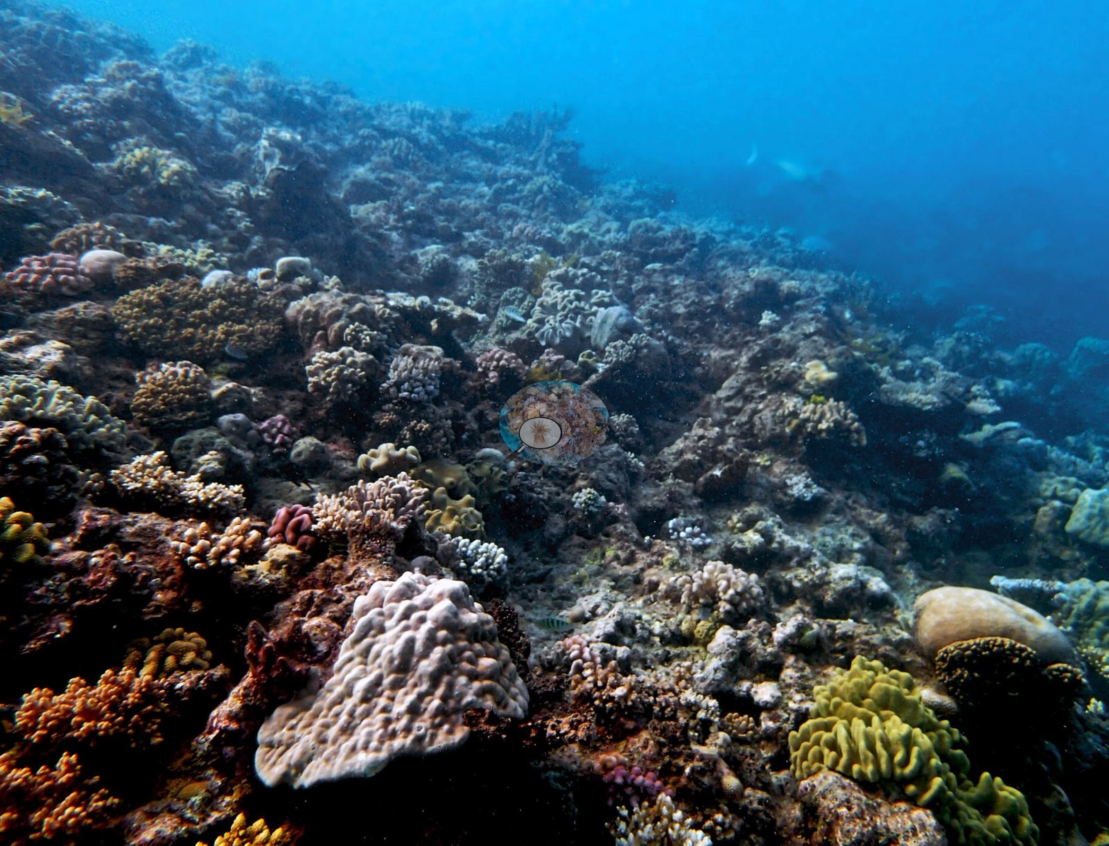
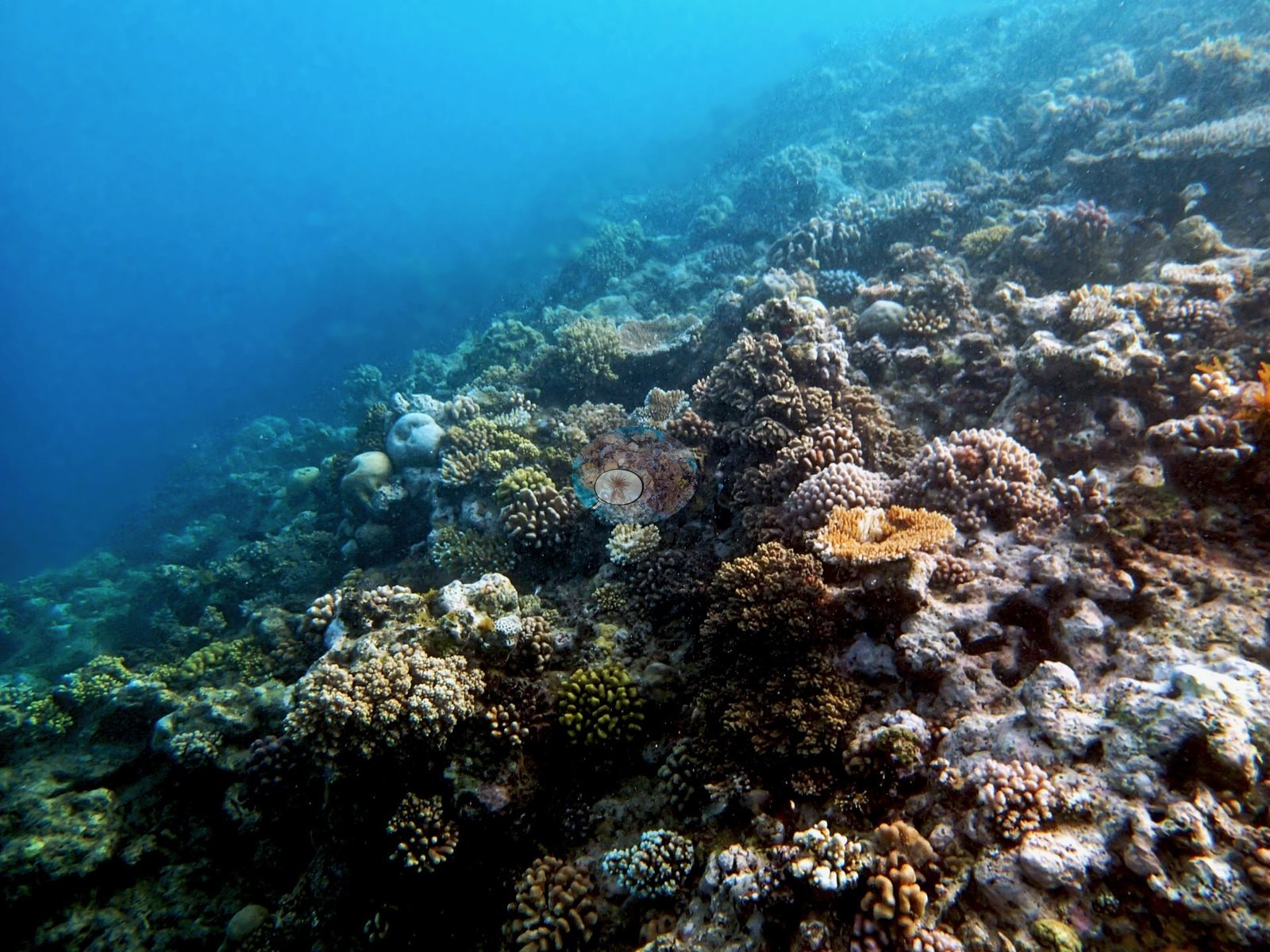
Global Reef Expedition station AUPK59 on Jewell Reef, northern Great Barrier Reef (-14.4350, 145.3450), surveyed on 12 September 2014 on that day's third dive, in a Habitat Protection (Blue) Zone, where line fishing is permitted. The notes describe a murky, wave-battered backreef with visibility down to 3-4 m in places; the reef crested at 1-2 m, too rough to explore safely, while deeper water at 20-25 m held only scattered small corals over an evidently hard coral-built, silt-covered bottom. The two photographs show the slope below the crest: a mix of small corymbose and branching colonies, pocilloporids, lobed massive, and encrusting colonies, and a green lobed colony, thinning into hazy blue water (e.g., Image 1, Image 2).
Coral cover
- Reference: Khaled bin Sultan Living Oceans Foundation, Global Reef Expedition (in situ transect)
- The in situ benthic transects recorded 20% live coral cover against a 40% algal fraction — algae twice the coral fraction.
- One transect was scored at this station (20%; n = 1, so no SE; Living Oceans Foundation per-transect benthic data); it is the expedition's station value printed above.
- Cover looked best in the shallows, estimated by eye at 30-40% around 3-4 m, though Anderson flagged that some of that may have been soft rather than hard coral, given how hard the two were to separate in the gloom.
Stressors
His notes record silt over the deeper hard bottom: on his 20.5 m transect "most of the substrate is covered in silt/sediment," and at 15 m the bottom was "mostly silt-covered coral rubble." Regional context, not an observation here: surveyed about eighteen months before the 2016 mass bleaching, an event that severely bleached hundreds of reefs on the northern Great Barrier Reef (Hughes et al. 2017); 5-year mean annual maximum thermal stress at the Far Northern GBR virtual station is 11.1 degree heating weeks.
Fish and other fauna
A meter-long Napoleon wrasse was logged; no COTS, bleaching, or disease appear in the notes.
Comparisons with other data
No prior survey data from this site. If you would like to share yours, please email us.
Other notes
The expedition's field report lists this day's site as "Jewell / Parke Reef," and its station code AUPK59 points to Parke Reef; Anderson's notes and sheet log the dive as Jewell Reef (sheet code AUJE59), the name used here.
Data & links
- Download benthic survey data (CSV) ↗
- Download all LOF-GRE data (933 sites) ↗
- Photo portfolio ↗
- Coral Reef Diagnostics country page ↗
All images from Coral Reef Diagnostics. Data are from the Khaled bin Sultan Living Oceans Foundation Global Reef Expedition and Coral Reef Diagnostics.
 © Coral Reef Diagnostics.