
Part of the regional summaries: Australia (GBR) - Far North: Blue stations (Habitat Protection Zone reefs) and Australia (GBR)
More info
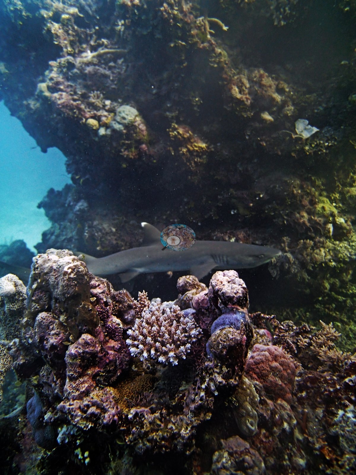
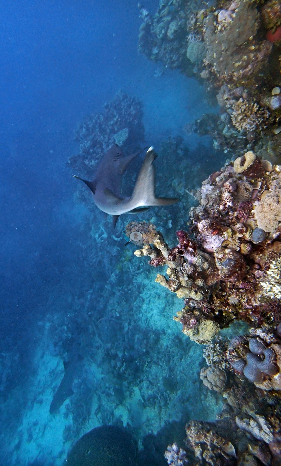
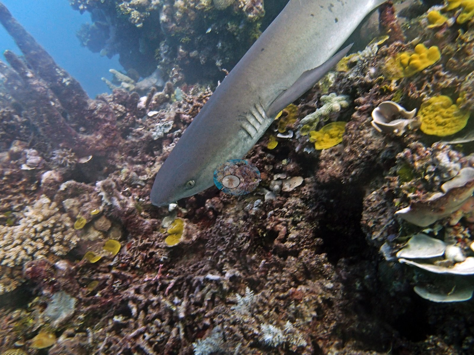
Northern GBR (NOAA CRW virtual station)An aggressive whitetip reef shark shadowed the team through this entire Hicks Reef dive, at one point trying to bite the survey chain. Tall bommies, some 9-10 m high, carried coralline crusts, yellow Turbinaria plates, and patches of 20-50% coral, with no bleaching, disease, or crown-of-thorns seen. Surveyed on the Living Oceans Foundation's Global Reef Expedition.
Three independent survey stations shown with the program’s logo — click one to see how far it is from this site.
Three other CRD dive sites within 5 km shown in orange — click a marker to open its page.
🗺 Detailed map of the Global Reef Expedition dive sites, Yonge, Hicks, and Carter Reefs, northern Great Barrier Reef (Khaled bin Sultan Living Oceans Foundation; opens in a new window)
Site description
Setting
This site sits in a Habitat Protection (Blue) Zone, where line fishing is permitted.
General benthic features
The backgrounds of the shark photographs do the reef work: tall bommie walls, some 9-10 m high, crusted with maroon coralline algae, yellow Turbinaria plates, purple encrusting sheets, and small branching colonies, with sand channels running between them and a sunlit crest overhead (e.g., Image 3, Image 5).
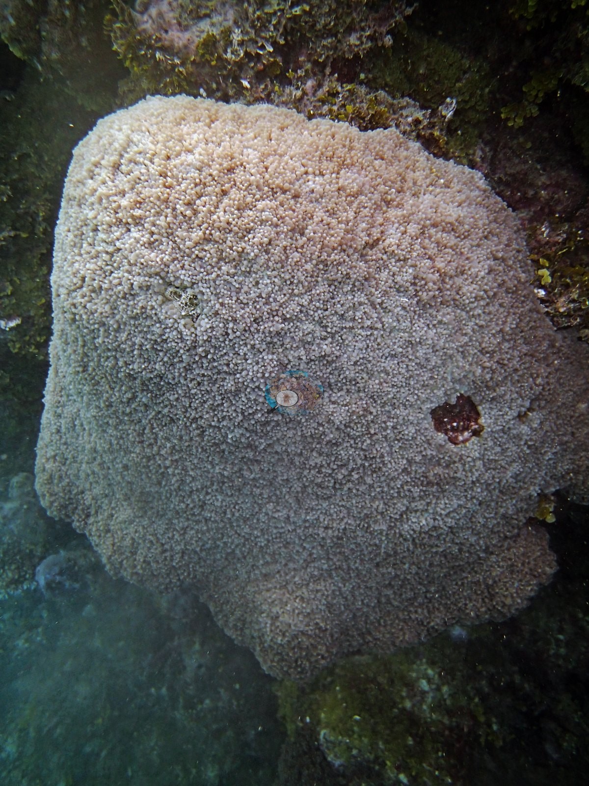
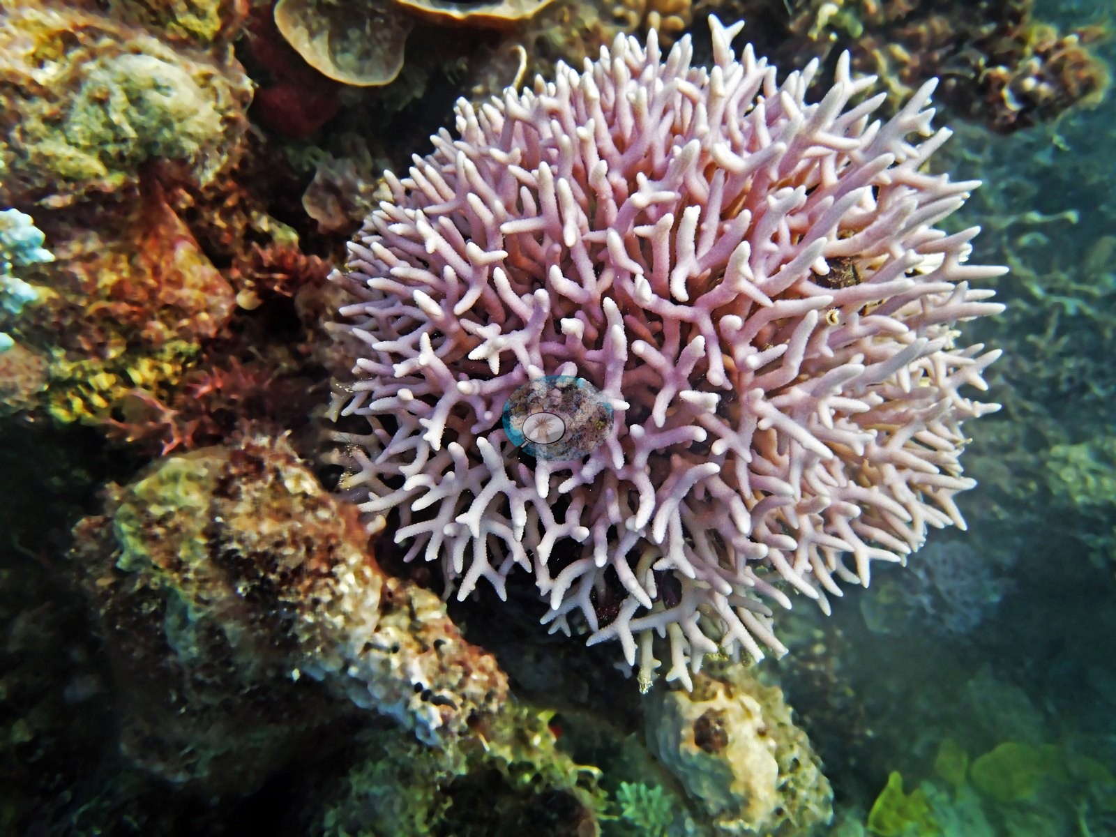
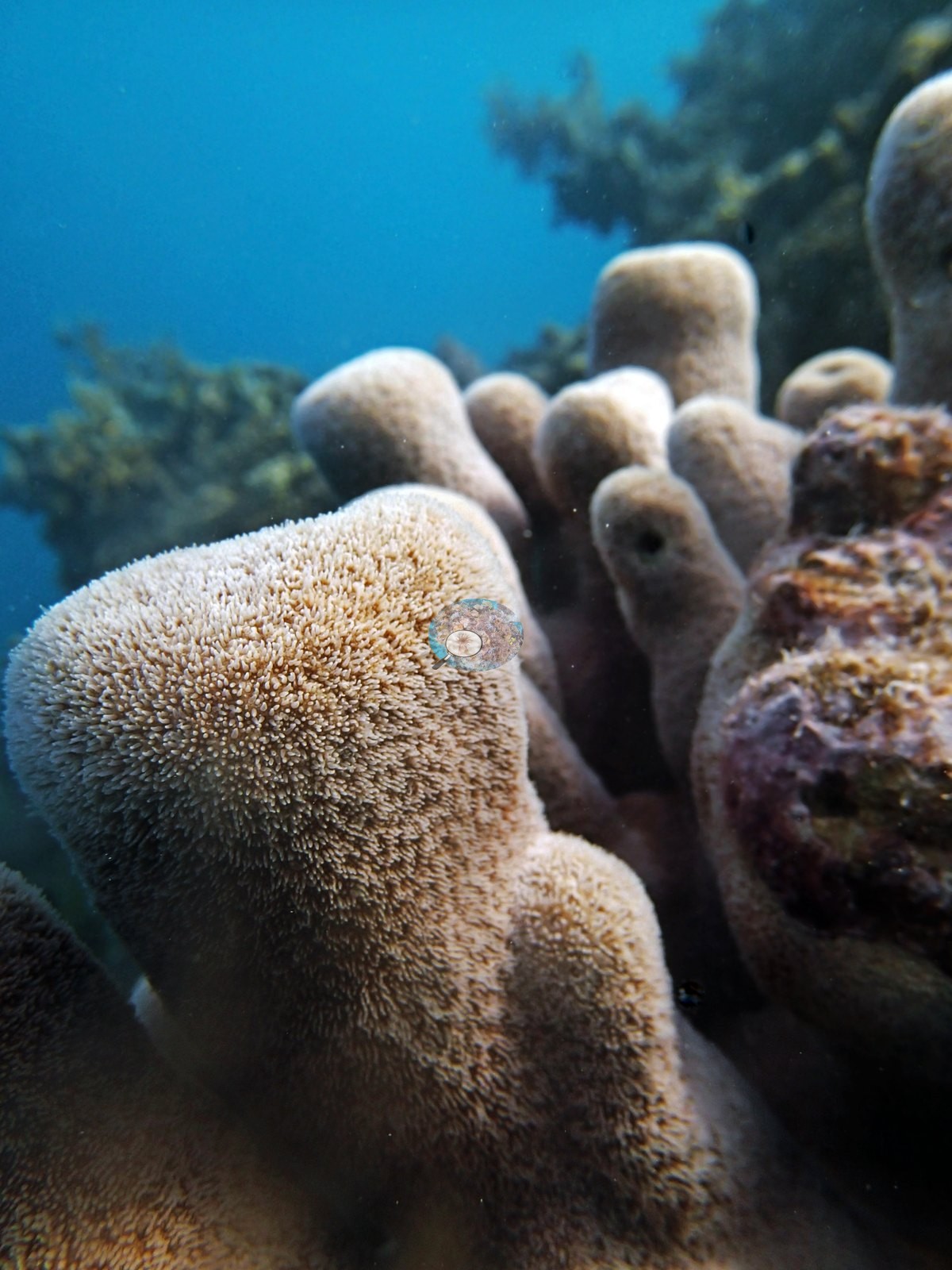
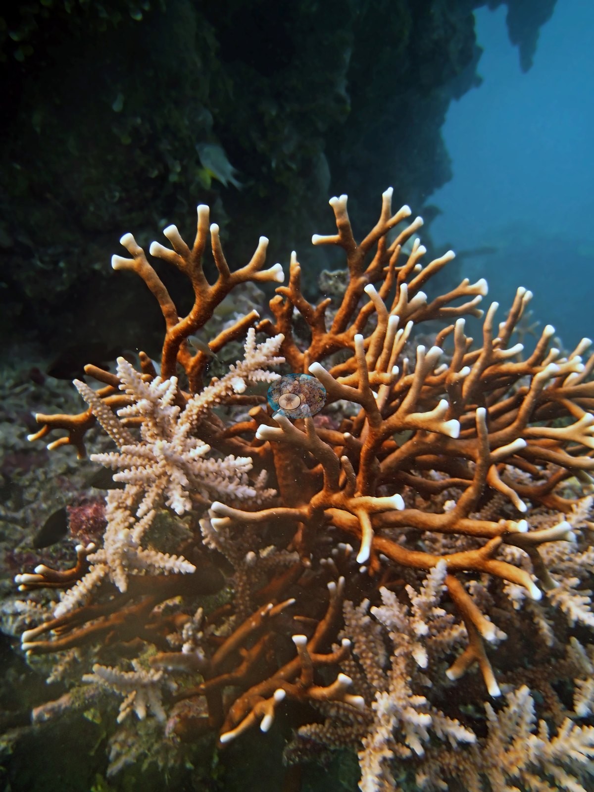
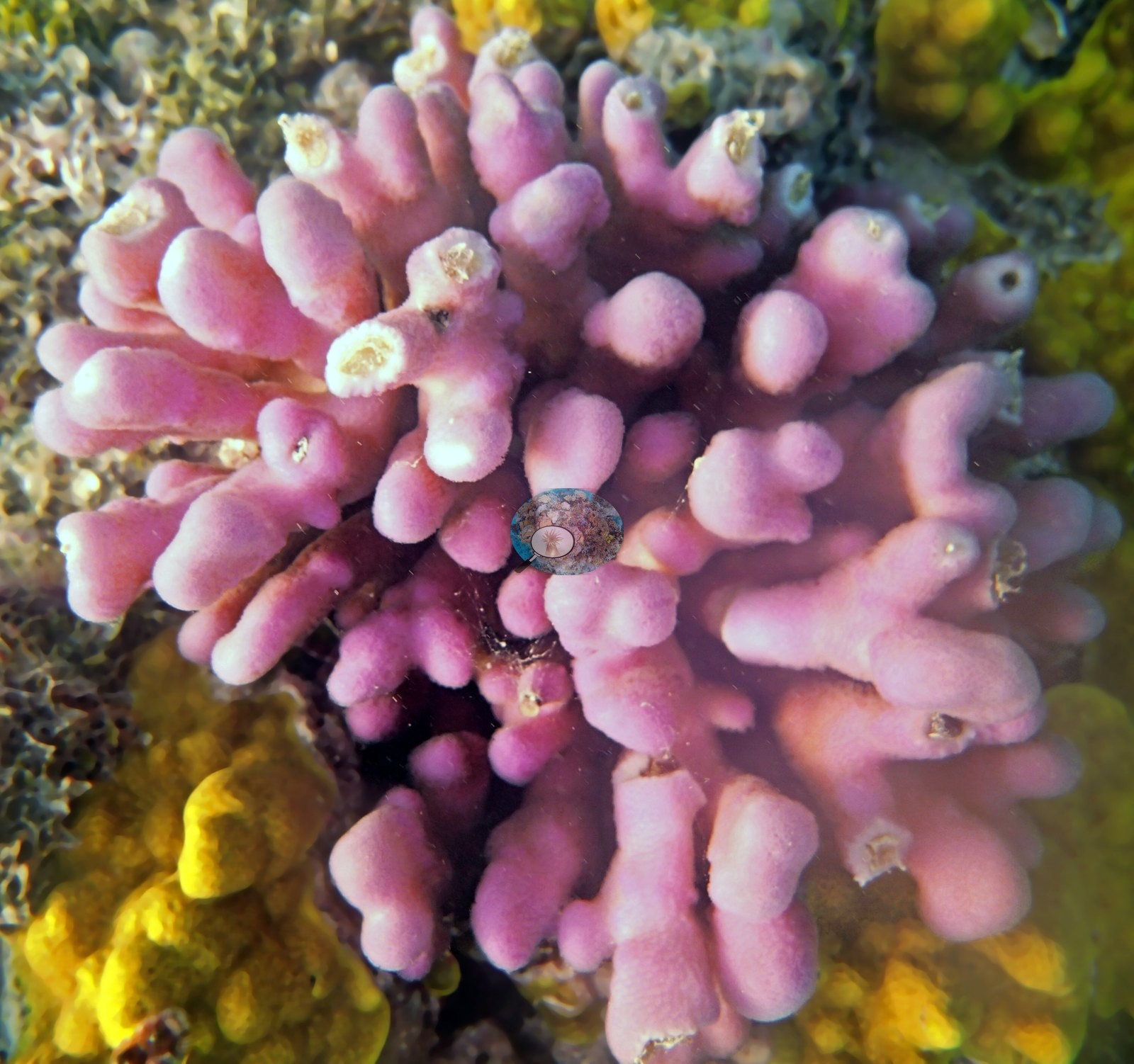
Five frames are coral close-ups: a big massive dome furred with long extended polyps and broken by two small old scars (e.g., Image 1), an evenly pink-lilac fine-branching colony (e.g., Image 6), a cluster of lobed columnar colonies (e.g., Image 9), an orange-brown branching colony (e.g., Image 10), and a pink knobby branching colony beside yellow encrusting growth (e.g., Image 12).
Coral cover
- Reference: Khaled bin Sultan Living Oceans Foundation, Global Reef Expedition (in situ transect)
- Point-count cover at this survey point measured 21%, though the bommies themselves carried Seriatopora hystrix, Stylophora pistillata, and acroporids at 20-50% in places.
- One transect was scored at this station (21%; n = 1, so no SE; Living Oceans Foundation per-transect benthic data); it is the expedition's station value printed above.
Stressors
No bleaching, disease, or COTS here.
Fish and other fauna
Most of the photographs from this stop are the aggressive whitetip reef shark that shadowed the dive: seven frames of it cruising the bommie faces (e.g., Image 2, Image 3, Image 4, Image 5, Image 7, Image 8, Image 11), in one of them close enough to fill the frame (e.g., Image 2).
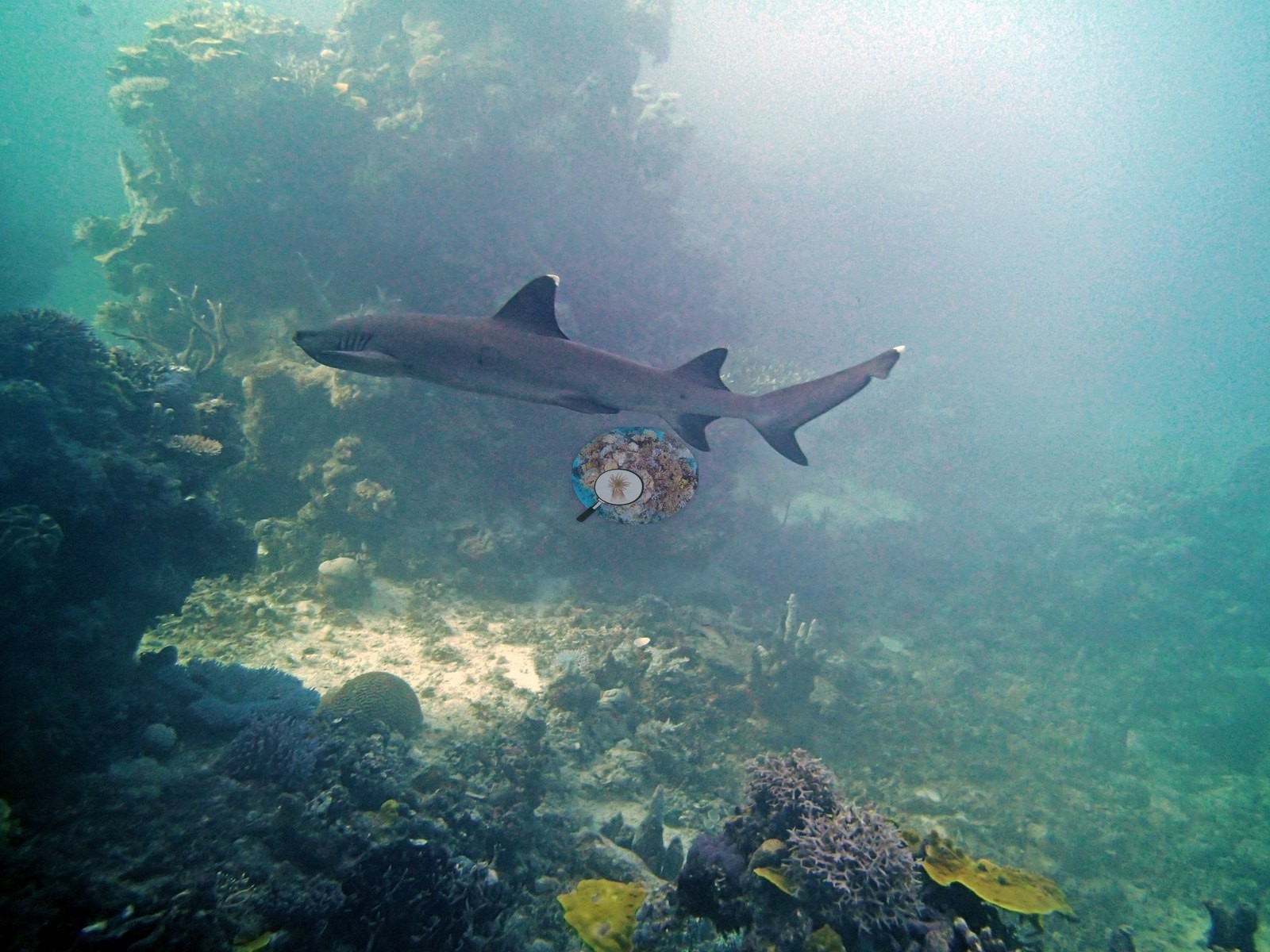
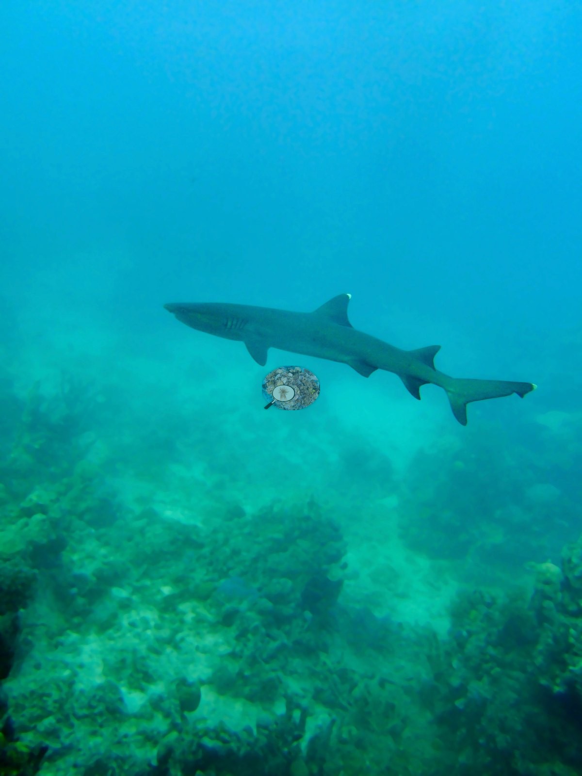
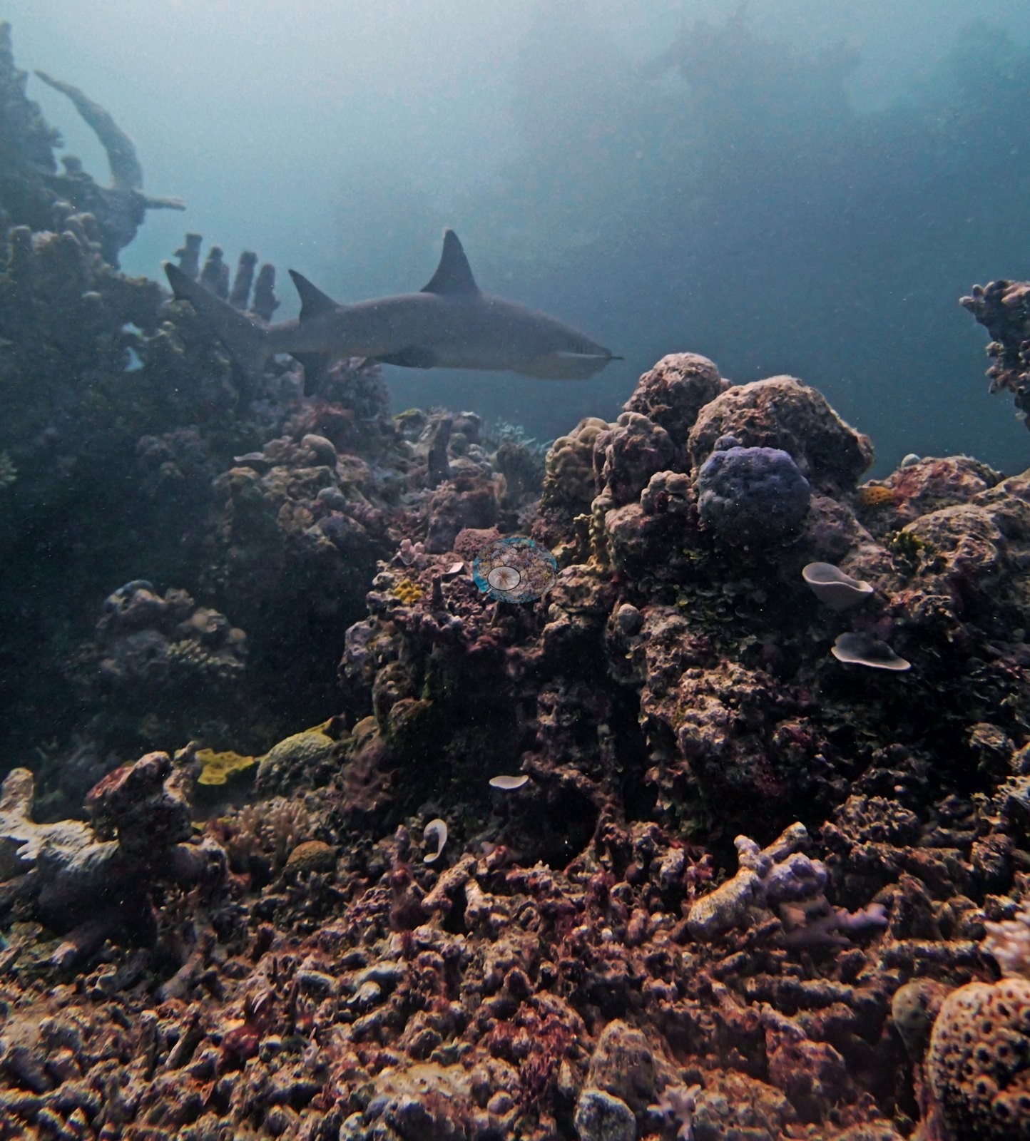
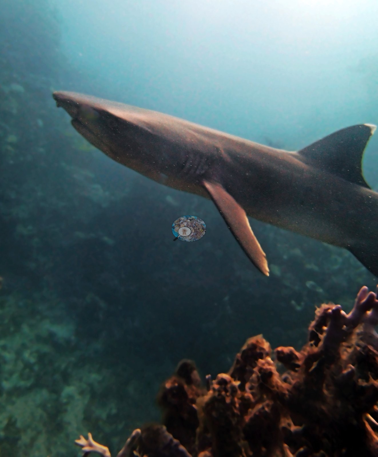
Damselfish tended their own algal gardens on one huge bommie.
Comparisons with other data
No other surveys have been conducted at this site to date. Within 5 km, three XL Catlin Seaview Survey stations recorded 7.3–24% hard coral cover between 2012 and 2017; the nearest, XL Catlin Seaview Survey at transect 12027, 2.27 km away, read 7.3–24% between 2012 and 2017.
Dive record
Anderson's third Hicks Reef dive, on 10 September 2014, turned into something of a standoff: an aggressive whitetip reef shark shadowed the team for the entire dive, at one point trying to bite the survey chain and cutting a transect short.
Independent surveys nearby
 LOF Global Reef ExpeditionYear-average (illustrative only, programs differ)
Within 5 km, 3 independent survey stations recorded hard coral cover in 9 surveys between 2012 and 2017. Of the 2 stations surveyed in more than one year, 2 declined by more than 7 points between their first and latest surveys. Two stations share the longest span (2012–2017); one, transect 12027 (XL Catlin Seaview Survey, 2.27 km away), went from 24% in 2012 to 7.3% in 2017. The most recent nearby survey is from 2017, so these values predate recent heat stress. This site's own estimate (21%) is not compared with these surveys: none lies within 2 km.
Collected by other programs using different methods (the XL Catlin Seaview Survey uses photo-transects with automated image annotation), so these are context for the figures above, not a like-for-like comparison. Where a station was surveyed more than once, the cell shows either the range of its values or, as a single value, the mean of surveys made in one year. Station names are not dive-site names.
| Agency | Site / location | Date | Hard coral cover (%) | Distance | Link |
|---|---|---|---|---|---|
| XL Catlin Seaview Survey | transect 12027 | 2012–2017 | 7.3–24% (4 surveys) | 2.27 km | doi:10.14264/uql.2019.930 |
| XL Catlin Seaview Survey | transect 12026 | 2012–2017 | 7.3–19% (4 surveys) | 3.10 km | doi:10.14264/uql.2019.930 |
| XL Catlin Seaview Survey | transect 12007 | 2012 | 18% | 3.74 km | doi:10.14264/uql.2019.930 |
Data & links
- Download benthic survey data (CSV) ↗
- Download all LOF-GRE data (933 sites) ↗
- Photo portfolio ↗
- Coral Reef Diagnostics country page ↗
All images from Coral Reef Diagnostics. Data are from the Khaled bin Sultan Living Oceans Foundation Global Reef Expedition, Coral Reef Diagnostics, and the organizations named in the data sources above.
 © Coral Reef Diagnostics.