
Part of the regional summaries: Australia (GBR) - Far North: Blue stations (Habitat Protection Zone reefs) and Australia (GBR)
More info
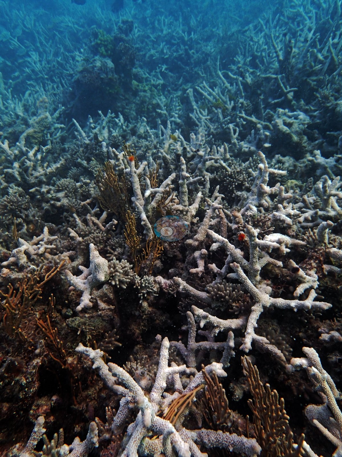
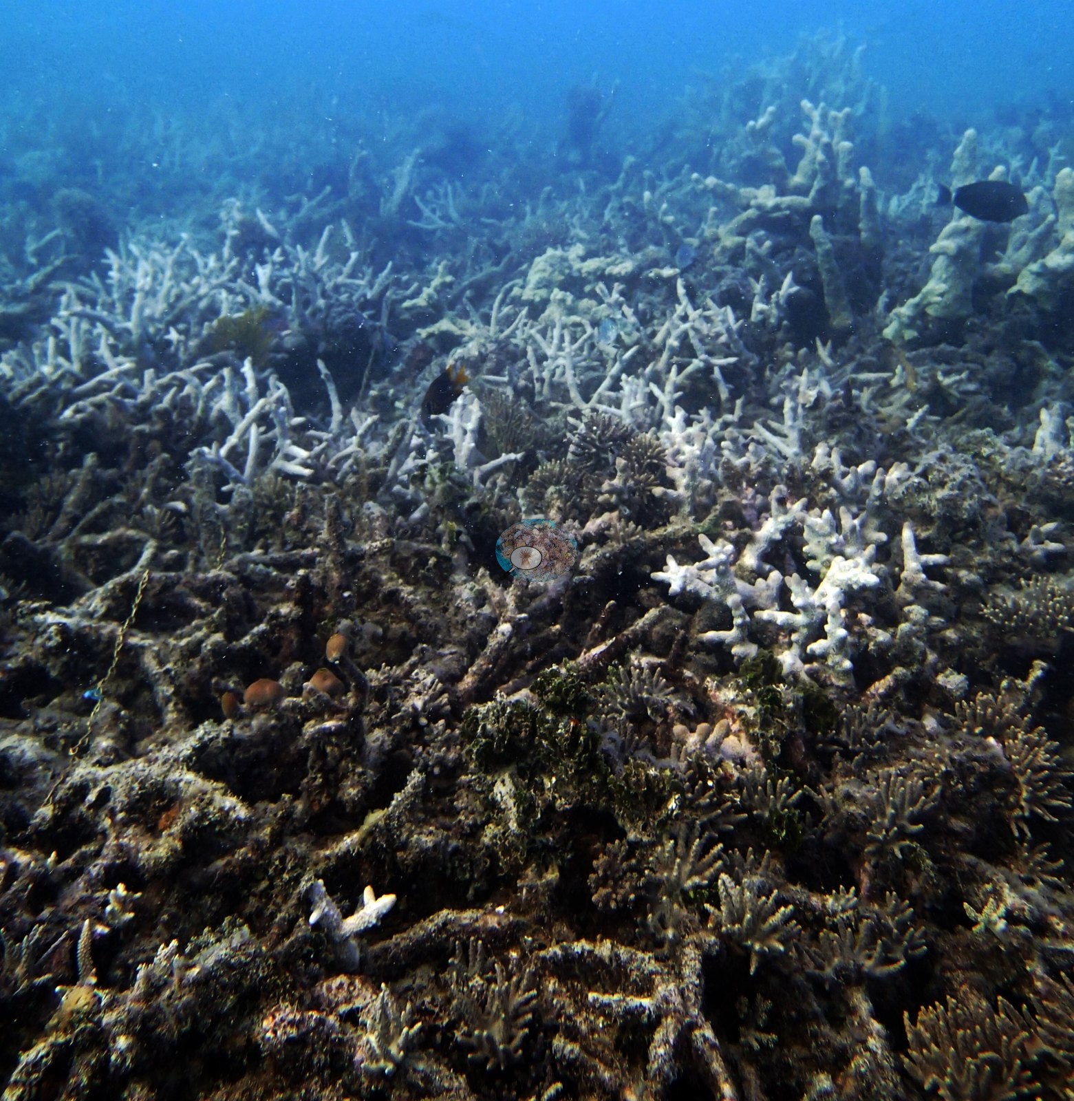
Far Northern GBR (NOAA CRW virtual station)A very shallow reef, barely 6.6 m deep, whose once-rich staghorn meadow was more than 80% dead in 2014, skeletons still standing but overgrown with algae and soft coral. Several crown-of-thorns starfish were seen, though it was unclear how much of the die-off they explained, and Diadema urchins were abundant and out in the open. Surveyed on the Living Oceans Foundation's Global Reef Expedition.
Three other CRD dive sites within 5 km shown in orange — click a marker to open its page.
🗺 Detailed map of the Global Reef Expedition dive sites, Milman and Alpin Reefs, northern Great Barrier Reef (Khaled bin Sultan Living Oceans Foundation; opens in a new window)
2 of the 3 photographs on this page are shown beside the text that discusses them under "Site description" below.
Site description
General benthic features
Anderson's transects, all run between 5 and 6.3 m, kept crossing the dead staghorn framework. Isopora was the most common coral genus on this station's transects (13% of the benthos), followed by Acropora (10%), Montipora (3.0%), Porites (1.7%), and Favia, Fungia, and Seriatopora (0.7% each); bare substrate covered 3.3%, behind turf (45%), the largest non-coral class. Among the algal classes on this station's transects, turf (45%) led, followed by crustose coralline algae (6.7%) and sediment-laden turf (5.7%); macroalgae covered 0.3%.
Coral cover
- Reference: Khaled bin Sultan Living Oceans Foundation, Global Reef Expedition (in situ transect)
- Point-count cover here measured 32%, and what remained was mostly staghorn that had not yet succumbed, with small poritids, faviids, fungiids, Platygyra, and Isopora scattered among the ruins.
- Transect mean 32 ± 8.3% SE (n = 3 transects; Living Oceans Foundation per-transect benthic data); the headline above is the expedition's station value.
Stressors
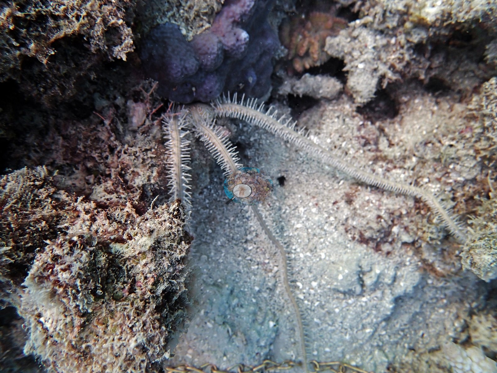
Barely 6.6 m deep at its deepest, the site once carried a dense staghorn Acropora meadow, and on this September 2014 dive more than 80% of those thickets stood dead, skeletons still upright but overgrown with macroalgae and soft coral (e.g., Image 1, Image 2).
Several crown-of-thorns starfish were spotted, though Anderson noted it was unclear how much of the die-off they explained.
Fish and other fauna
Diadema urchins were plentiful, many of them out of hiding (his notes).
Comparisons with other data
No prior survey data from this site. If you would like to share yours, please email us.
Nearby citizen-science imagery within 2 km (not a survey of this site, and not total coral cover):
- Great Reef Census (citizen science, AI + volunteer image analysis): branching Acropora 2.2%, plating Acropora 0.7%, massive corals 4.8% of colonizable substrate, 20 images, 2022-11-19, 0.27 km.
The Great Reef Census scores three coral shapes only, so every other coral is left out, and its denominator is colonizable substrate (sand, water, and shadow excluded): these values are not hard coral cover and should not be added together or compared with the cover figures on this page. The photographs are taken by volunteer snorkelers 3–5 m above the reef. In the program's own validation (Lawson et al. 2025, Environmental Monitoring and Assessment 197:814, doi:10.1007/s10661-025-14261-6, open access), each analysis method on its own differed from expert estimates by up to about 9.5 percentage points on average for these coral types (AI alone: plating Acropora −9.1 points; AI plus volunteers: branching Acropora +9.5 points); the program's “~99% accurate” figure is the average over about 8,000 images after choosing the better method for each coral type, and site values from fewer images carry more error. Sites with fewer than 40 images have fewer images than the 40–80 the method needs to estimate site-level values to within 5 percentage points. Source: Great Reef Census / Citizens of the Great Barrier Reef; Lawson et al. 2026, Limnology & Oceanography Letters, doi:10.1002/lol2.70168 (data CC BY-NC 4.0, doi:10.7910/DVN/KCULSD).
Data & links
- Download benthic survey data (CSV) ↗
- Download all LOF-GRE data (933 sites) ↗
- Photo portfolio ↗
- Coral Reef Diagnostics country page ↗
All images from Coral Reef Diagnostics. Data are from the Khaled bin Sultan Living Oceans Foundation Global Reef Expedition and Coral Reef Diagnostics.
 © Coral Reef Diagnostics.