
Part of the regional summaries: Fiji - Totoya, Fiji - Moala Group (Moala / Totoya / Matuku), and Fiji - Lau
More info
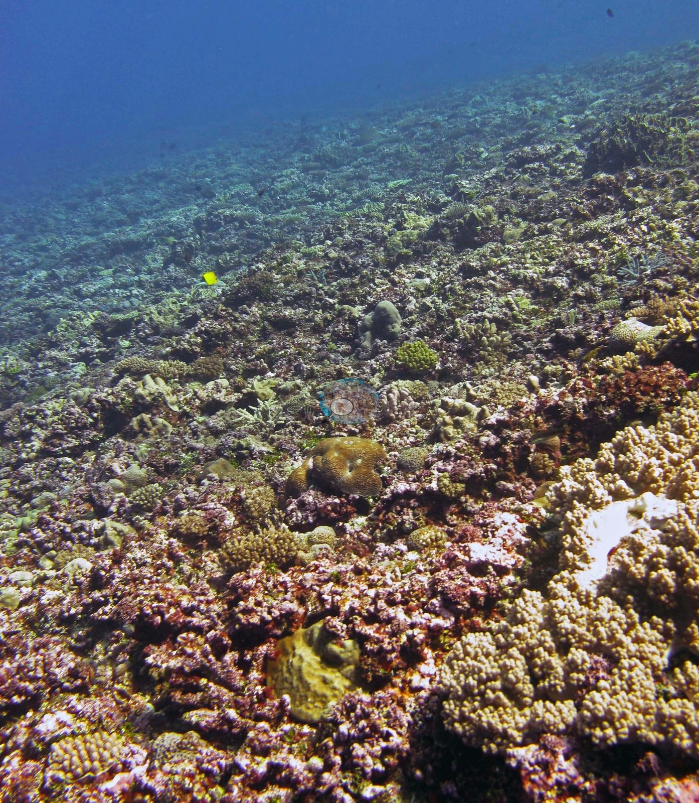
Fiji (NOAA CRW virtual station)A broad, flat, low-relief terrace off Totoya with no spurs or build-ups, just low plating, encrusting, and brain corals set into pink coralline pavement, with life everywhere, as Anderson noted. The standout is a large golden-tan brain coral, and cover is 36%. Surveyed on the Living Oceans Foundation's Global Reef Expedition.
E dua na vanua raraba (terrace) e savasava ka sega ni cecere mai Totoya, e sega ni dua na spur se build-up, e tu ga kina na lase vakaiteba (plating) e sega ni cecere, na lase e kabita na vatu (encrusting), kei na lase vakamona (brain corals) e vakatikori ena vatu raraba ni lumi vakalase (coralline pavement) e roka (pink), ka vola ko Anderson ni levu na bula ena veivanua kece. Na ka e duatani duadua e dua na lase vakamona (brain coral) levu e roka (golden-tan), ka 36% na ubi ni lase (coral cover).
AI translation of this summary; the English is authoritative. (low confidence)
CTD-cast midpoint of 27.3–27.5°C
Seven independent survey stations shown with the program’s logo — click one to see how far it is from this site.
Three other CRD dive sites with their own pages within 5 km shown in orange — click a marker to open its page.
🗺 Detailed map of the Global Reef Expedition dive sites, Totoya, Fiji (Khaled bin Sultan Living Oceans Foundation; opens in a new window)
Site description
Setting
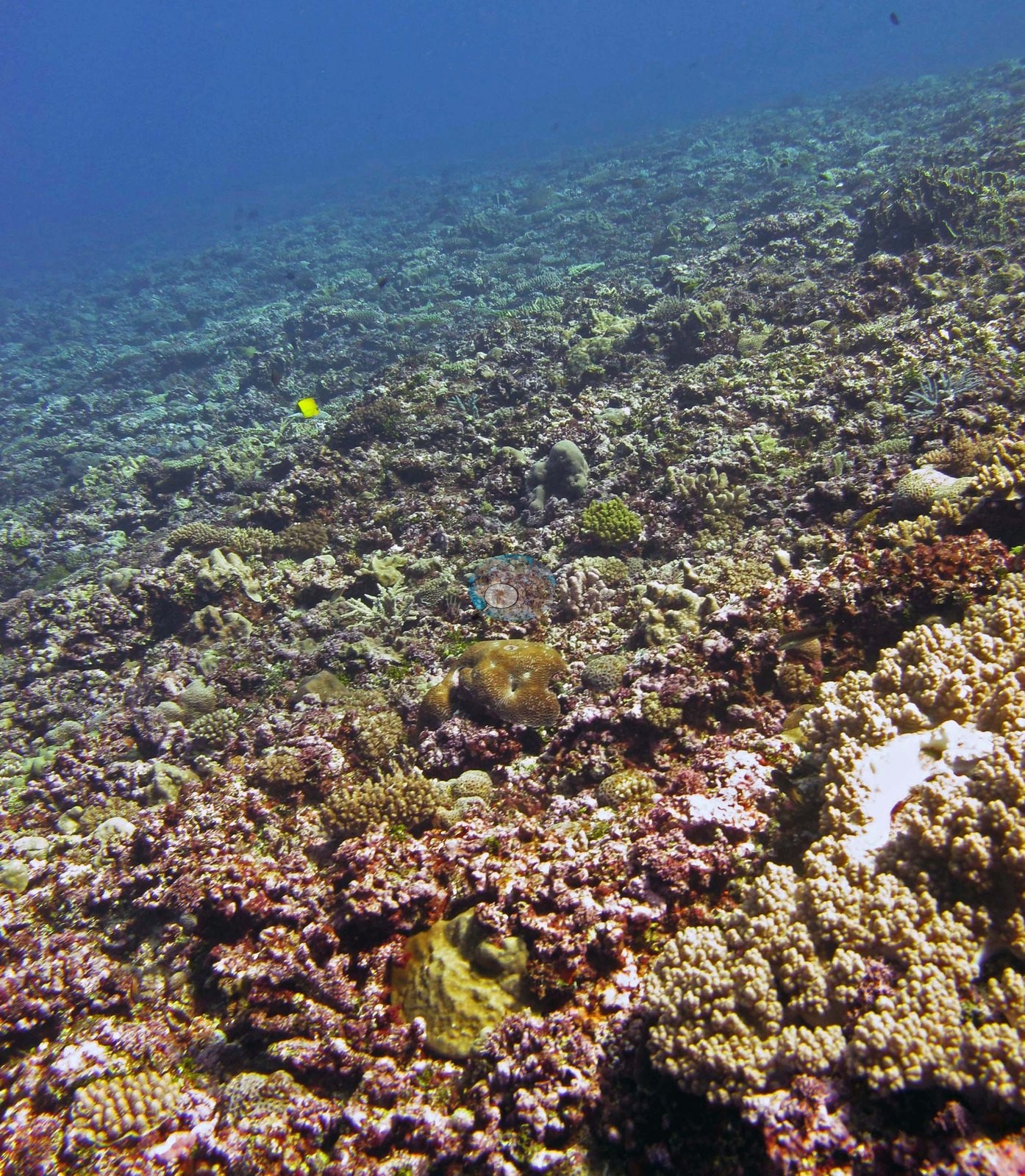
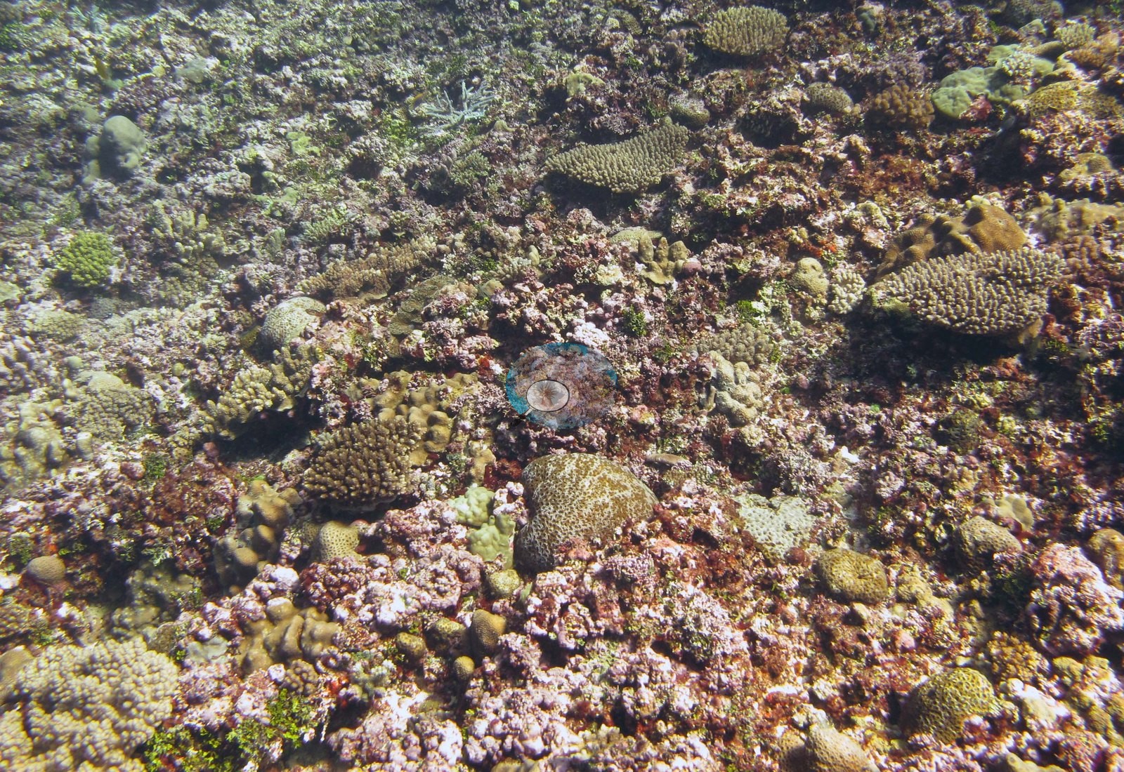
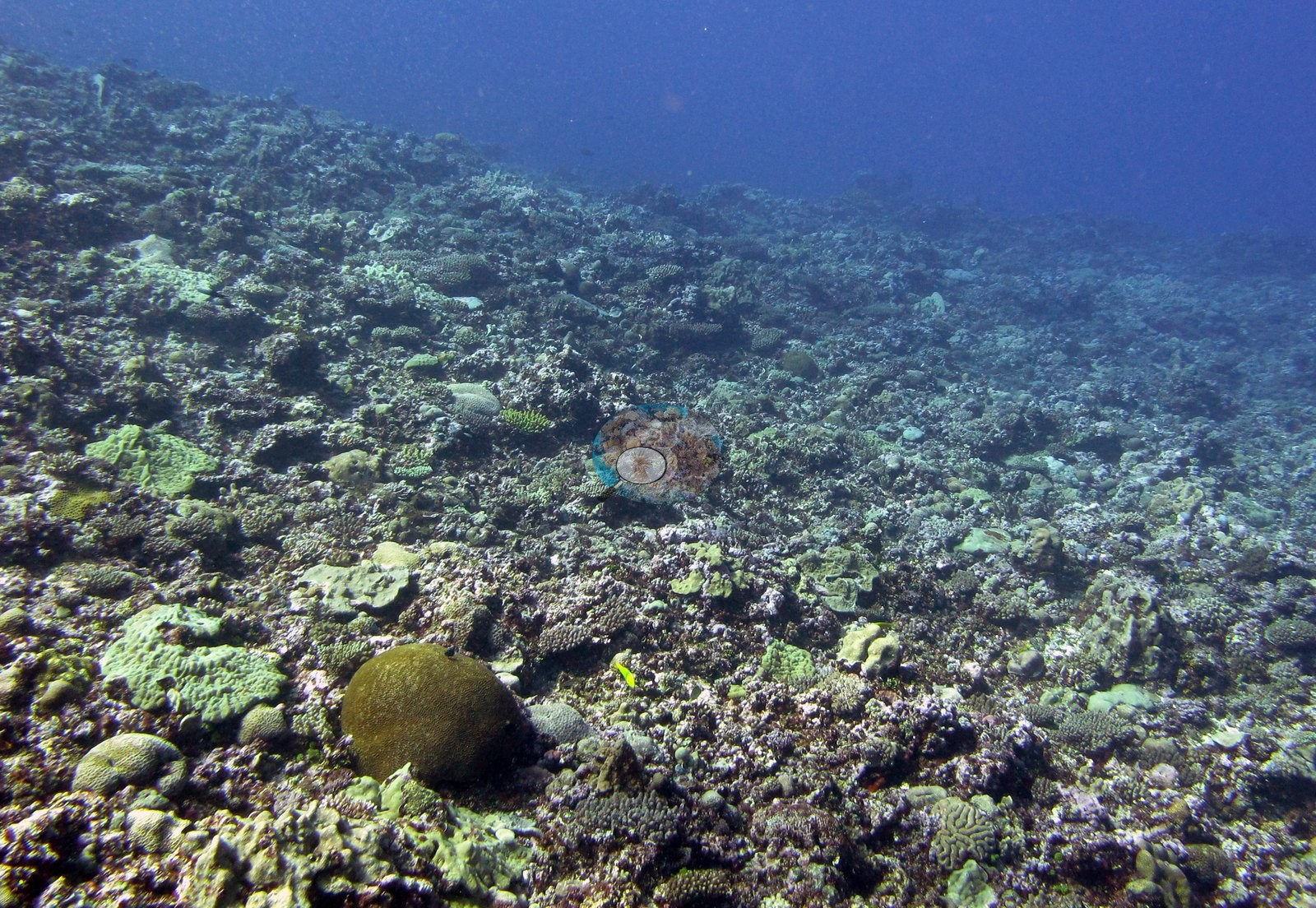
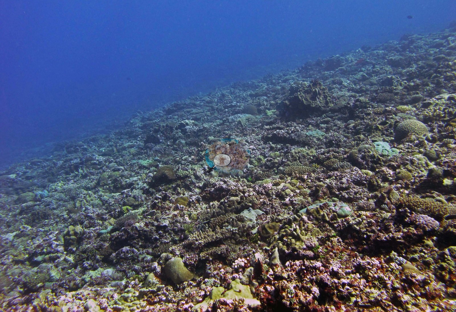
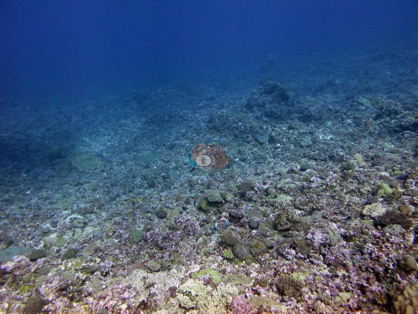
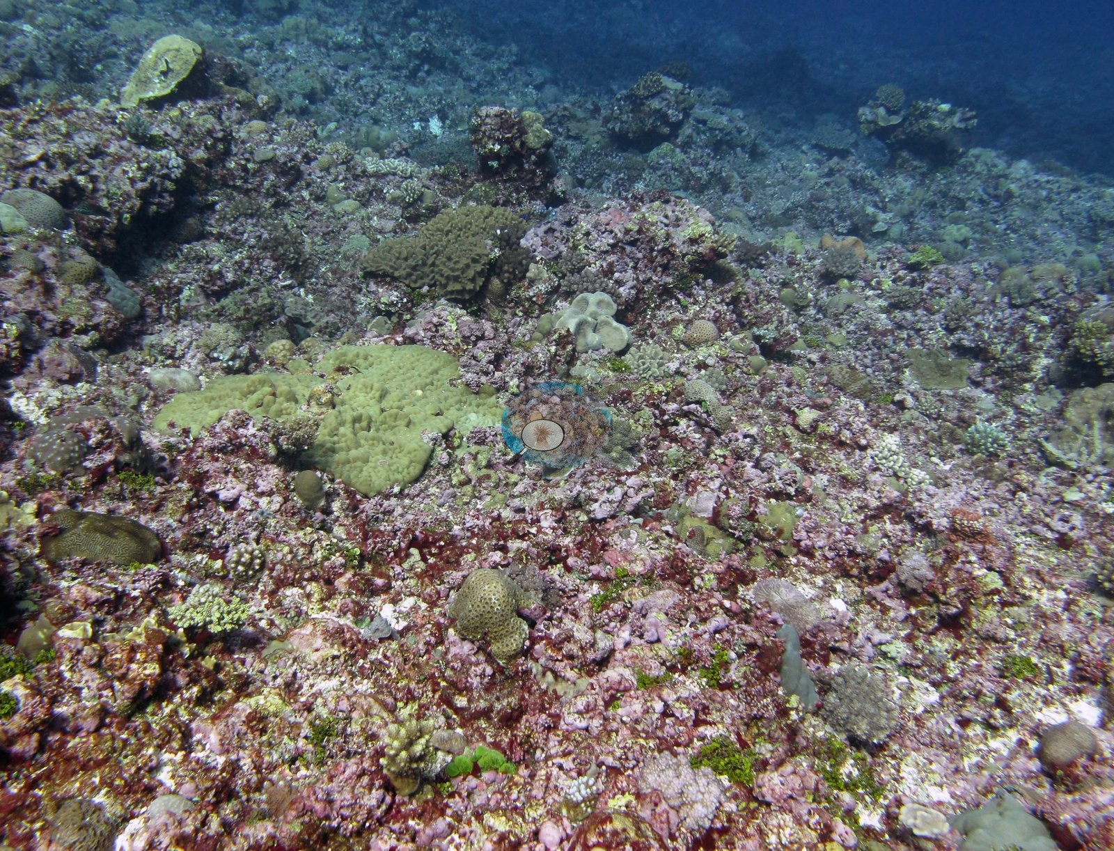
The whole eleven-frame set says the same thing about this station's shape: it is flat. Six frames (e.g., Image 2, Image 3, Image 4, Image 5, Image 7, Image 9) look out across a broad, low-relief terrace that runs unbroken to the limit of visibility, with no build-ups, spurs, grooves, or vertical structure anywhere in view.
General benthic features
Image 5 and Image 4 look along it into blue water; Image 7 is a hazy view over a wide rubble-and-pavement plain sloping very gently away with only scattered small colonies in the foreground; Image 2 is the same ground closer in. On that terrace the community is low-growing and set into the pavement rather than raised above it. The recurring elements across Image 5, Image 4, Image 2, Image 3, and Image 9 are pale mint-green and gray-green plating and encrusting colonies (Image 9 has several), olive and tan massive colonies, small brain corals with meandering valleys, low Porites-type lumps, cream to tan digitate and corymbose colonies, loose branch rubble, and broad sheets of maroon-red and pink coralline crust with small green algal tufts through it. Image 3 is the closest and most occupied view of that ground; Image 9 is a slightly deeper, greener version of it with the mint-green plating colonies prominent. Four frames are colony portraits. Image 10 is a large golden-tan brain coral filling the frame, its surface a dense mesh of fine sinuous valleys, clean and in visibly good condition.
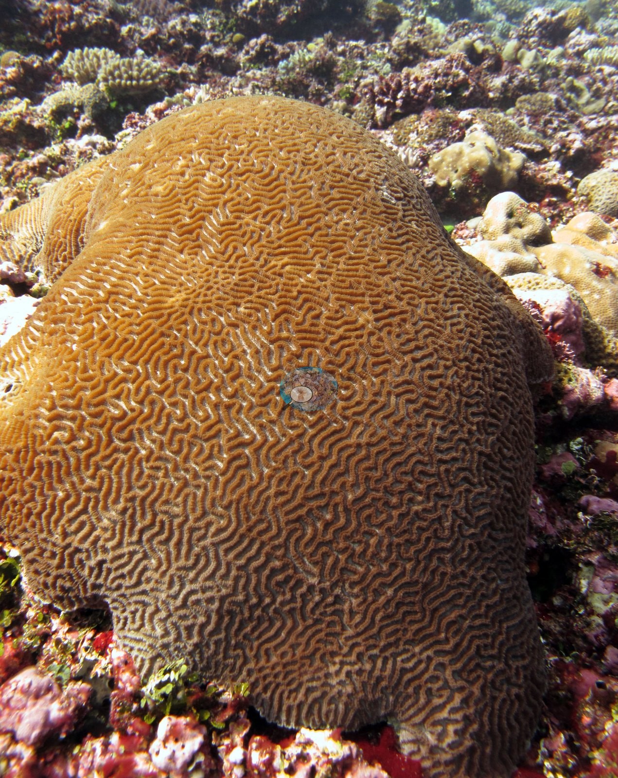
Image 6 is a rounded olive-green massive dome sitting in coralline-crusted rubble.
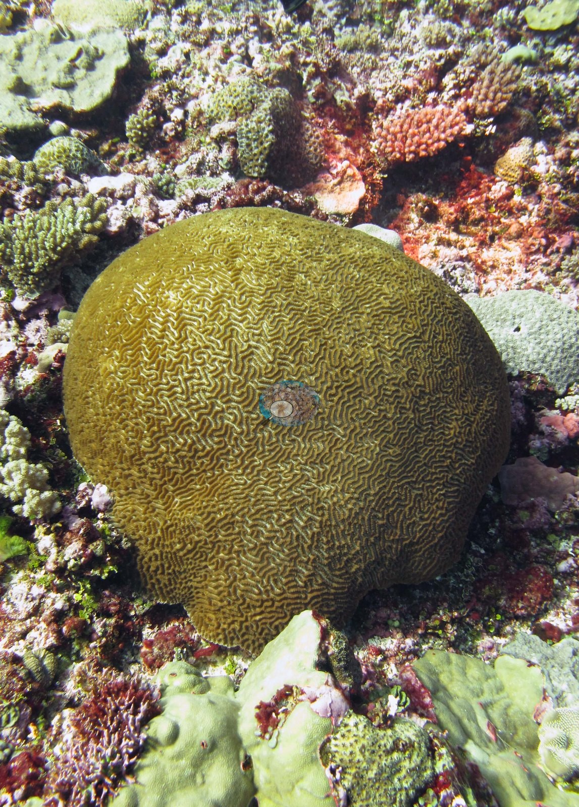
Image 11, an acroporid Anderson left unidentified, is a cream, thick-branched, blunt-tipped colony among red coralline crust and green turf; it is not named further here.
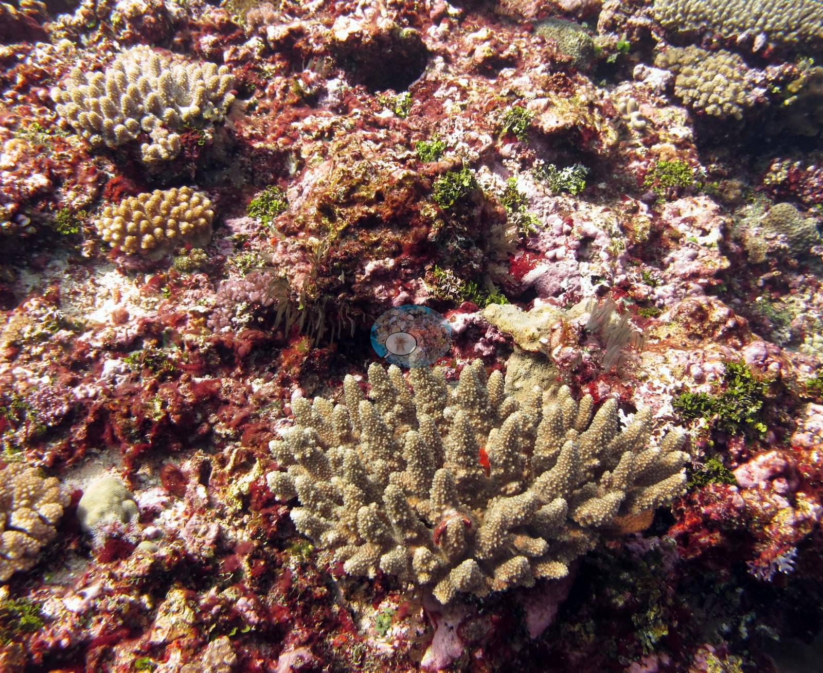
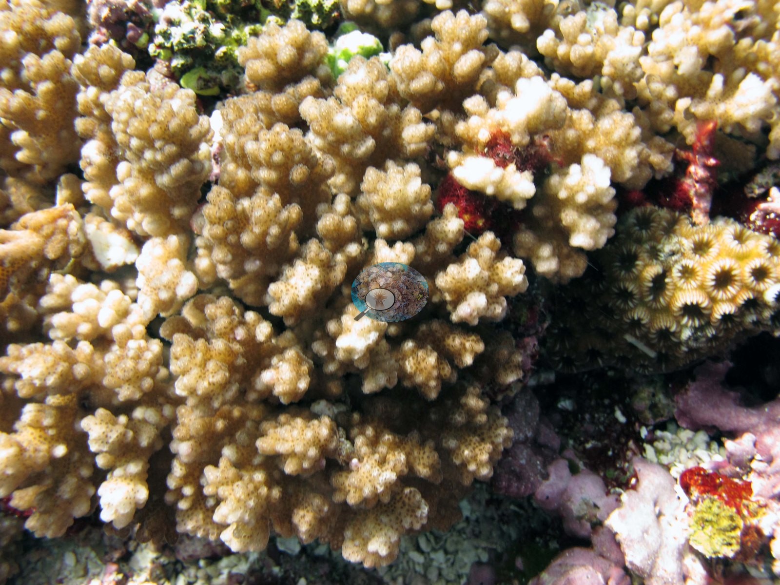
Image 8, identified as P. damicornis, is a close frame of a pale tan verrucose branching colony filling the view, with a crimson-red encrusting patch behind it.
Coral cover
- Reference: Khaled bin Sultan Living Oceans Foundation, Global Reef Expedition (in situ transect)
- Coral cover 36%, from the LOF-GRE in situ benthic transect (this station's own transects in the expedition's per-transect benthic data) — a diver transect, and the authoritative figure for this site.
- Transect mean 36 ± 5.1% SE (n = 6 transects; Living Oceans Foundation per-transect benthic data); the headline above is this all-transect mean. The per-transect file also lists four transects labeled FJTO09 under this station's code; they belong to FJTO09 and are left out of both values (the expedition's 933-site table had pooled them with this station).
Stressors
Nothing in the eleven frames shows disease lesions, crown-of-thorns feeding scars, or anything man-made, and no divers, boats, or open-water frames appear; Image 1 is sampled colony F17, tag in hand.
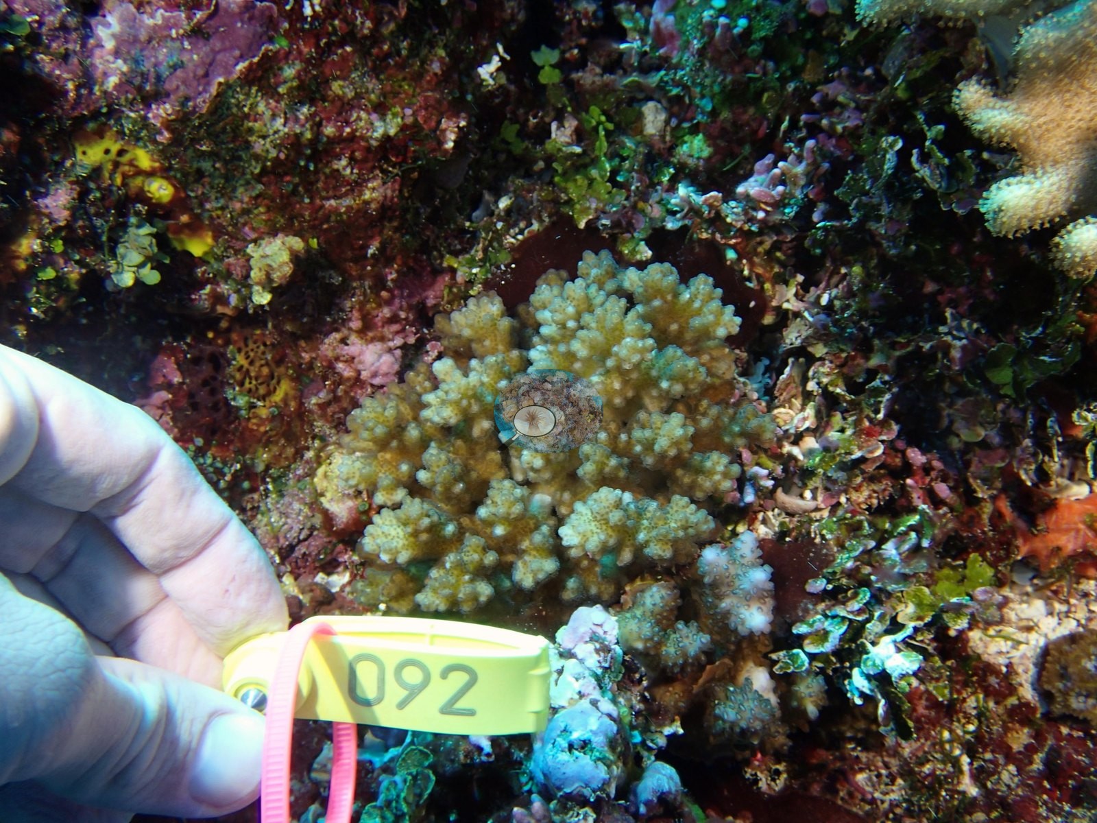
None of the three coral colonies from this site with an outlier score was flagged as a physiological outlier (Mayfield et al. 2017, PLoS ONE). The Living Oceans Foundation transects here recorded 7.5% cyanobacteria and no recently dead coral; they carry no bleaching, disease, or crown-of-thorns field.
Comparisons with other data
Apart from the Living Oceans Foundation survey shown here, we found no other surveys at this site as of 2026. Within 5 km, seven WCS Fiji via MERMAID stations recorded station-year means of 36–64% hard coral cover in 2011; the nearest, WCS Fiji via MERMAID at TY10, 2.81 km away, read 53% in 2011.
Dive record
Totoya, Lau Archipelago, dived 5 June 2013.
Other notes
What the frames cannot settle: depth is not recoverable frame by frame; the haze in Image 5, Image 4, Image 2, and Image 7 limits identification at distance to growth form; and Anderson left the acroporid in Image 11 unidentified.
Survey team's site notes for Totoya's fore-reef sites (island-wide; not specific to this flat station). Small mounds of hosting diverse mixed coral assemblages may be present. At greater depths, colonies take on plating morphologies and form a series of shingle-like structures. Prominent macroalgae include Halimeda, Caulerpa, and Dictyota. High coral cover, with large spur and groove ridges. Sediment filled grooves, with large pieces of rubble. Fore reef sand flats benthic cover is usually very low because the substrate is mobile and largely unconsolidated thus inhibiting colonization by benthic organisms. In some cases, large Porites lobata colonies and tabular acroporids occur within the sand flats, especially in deeper areas (30-50 m). Macroalgae become more common with depth due to the abatement of wave energy with increasing depth. The deeper fore reef habitats at the base of the reef were generally low relief sand flats, mostly uncolonized. Often there were sparse assemblages of cyanobacteria and small patches of macroalgae, along with isolated larger corals.
Independent surveys nearby
Within 5 km, 7 independent survey stations recorded hard coral cover in 2011. The most recent nearby survey is from 2011, so these values predate recent heat stress. This site's own estimate (36%) is not compared with these surveys: none lies within 2 km.
Collected by other programs using different methods (MERMAID is a data platform: each MERMAID row names the organization that did the survey, and its method is in the row's hover text), so these are context for the figures above, not a like-for-like comparison. Where a station was surveyed more than once, the cell shows either the range of its values or, as a single value, the mean of surveys made in one year. Station names are not dive-site names.
| Agency | Site / location | Date | Hard coral cover (%) | Distance | Link |
|---|---|---|---|---|---|
| WCS Fiji via MERMAID | TY10 | 2011 | 53% | 2.81 km | Darling E, Fisher K, Jupiter S, Nand Y, Taga J. 2011. 2011_Totoya. MERMAID |
| WCS Fiji via MERMAID | TY04 | 2011 | 58% | 4.07 km | Darling E, Fisher K, Jupiter S, Nand Y, Taga J. 2011. 2011_Totoya. MERMAID |
| WCS Fiji via MERMAID | TY15 | 2011 | 43% (2 surveys) | 4.14 km | Darling E, Fisher K, Jupiter S, Nand Y, Taga J. 2011. 2011_Totoya. MERMAID |
| WCS Fiji via MERMAID | TY02 | 2011 | 53% | 4.20 km | Darling E, Fisher K, Jupiter S, Nand Y, Taga J. 2011. 2011_Totoya. MERMAID |
| WCS Fiji via MERMAID | TY01 | 2011 | 36% | 4.34 km | Darling E, Fisher K, Jupiter S, Nand Y, Taga J. 2011. 2011_Totoya. MERMAID |
| WCS Fiji via MERMAID | TY13 | 2011 | 64% | 4.37 km | Darling E, Fisher K, Jupiter S, Nand Y, Taga J. 2011. 2011_Totoya. MERMAID |
| WCS Fiji via MERMAID | TY06 | 2011 | 46% | 4.69 km | Darling E, Fisher K, Jupiter S, Nand Y, Taga J. 2011. 2011_Totoya. MERMAID |
Data & links
- Download benthic survey data (CSV) ↗
- Download all LOF-GRE data (933 sites) ↗
- Photo portfolio ↗
- Coral Reef Diagnostics region page ↗
All images from Coral Reef Diagnostics. Data are from the Khaled bin Sultan Living Oceans Foundation Global Reef Expedition, Coral Reef Diagnostics, and the organizations named in the data sources above.
 © Coral Reef Diagnostics.