
Part of the regional summaries: Fiji - Totoya, Fiji - Moala Group (Moala / Totoya / Matuku), and Fiji - Lau
More info
Fiji (NOAA CRW virtual station)A lagoon channel and patch-reef station on Totoya (Anderson's sample sheet), photographed down a steep face and dived to 14.6 m, where knobby old framework is sheeted in mauve and rust algae and live coral is reduced to small scattered pieces, at just 12% cover against roughly three-quarters algae. Anderson tissue-sampled five Pocillopora colonies here; the one with an outlier score was not a physiological outlier. Surveyed on the Living Oceans Foundation's Global Reef Expedition.
E dua na vanua ni vakadidike ena sala ni wai (channel) ni loma ni cakau (lagoon) kei na cakau lalai (patch reef) e Totoya (na ivola ni ivakaraitaki nei Anderson), a taba sobu ena dua na bati titobu ka nunu kina ki na 14.6 m, ka na ivakatudei makawa vakaibulubulu e ubi ena lumi e roka (mauve, rust) ka sa lailai ga na lase bula me tikitiki lalai e veitawasei, e 12% ga na ubi ni lase (coral cover) ni vakatauvatani kei na rauta ni tolu na kena ikava na lumi. A taura ko Anderson na ivakaraitaki ni yago ni lima na Pocillopora eke; na dua e tiko na nona naba ni duidui (outlier score) e sega ni duatani vakayago (physiological outlier).
AI translation of this summary; the English is authoritative. (low confidence)
CTD-cast midpoint of 27.1–27.5°C
Eight independent survey stations shown with the program’s logo — click one to see how far it is from this site.
Two other CRD dive sites with their own pages within 5 km shown in orange — click a marker to open its page.
🗺 Detailed map of the Global Reef Expedition dive sites, Totoya, Fiji (Khaled bin Sultan Living Oceans Foundation; opens in a new window)
Site description
Setting
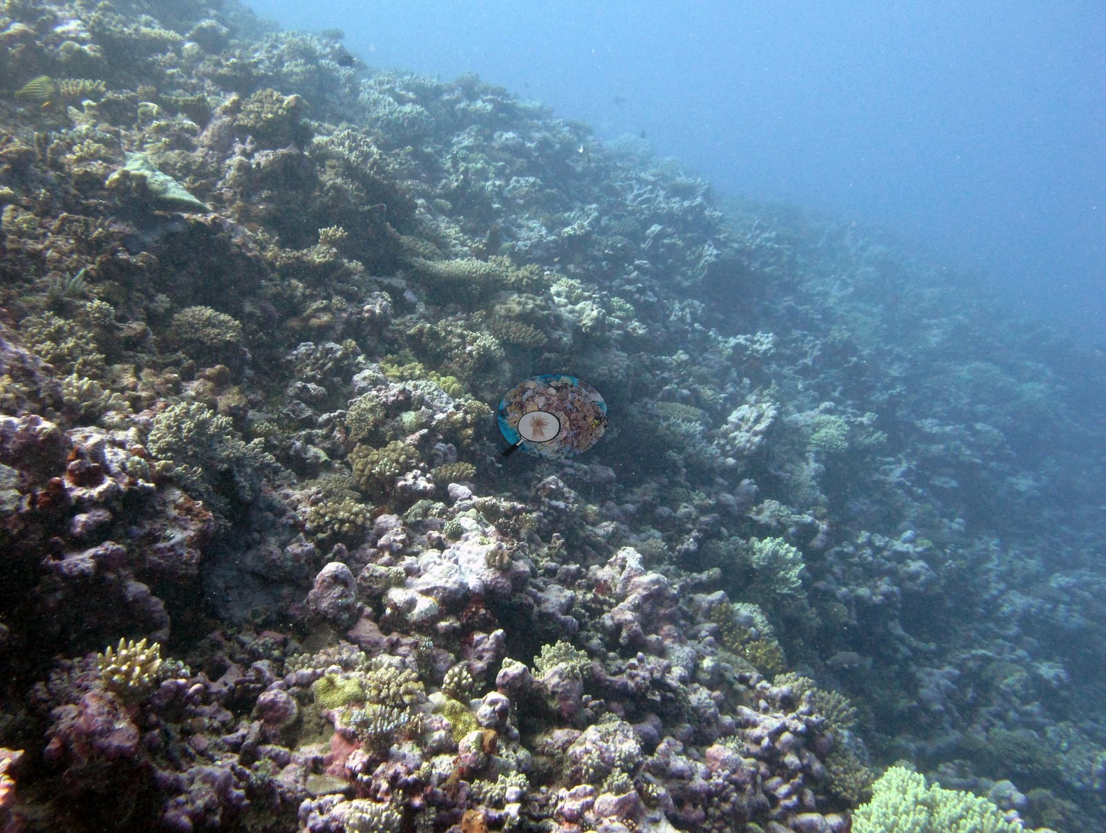
Totoya's FJTO06 is a lagoon channel and patch-reef station (Anderson's sample sheet: lagoonal patch reef/channel, extremely surgy), photographed down a steep face, and the site has essentially one usable wide photograph.
General benthic features
That frame looks obliquely down the slope through hazy water: a continuous, knobbly carbonate framework — old lobed and encrusting heads, ridges and small overhangs — sheeted in mauve, purple, and rust crustose coralline algae and turf, with live coral present as separate patches set into that surface rather than as a closed coral canopy (e.g., Image 1).
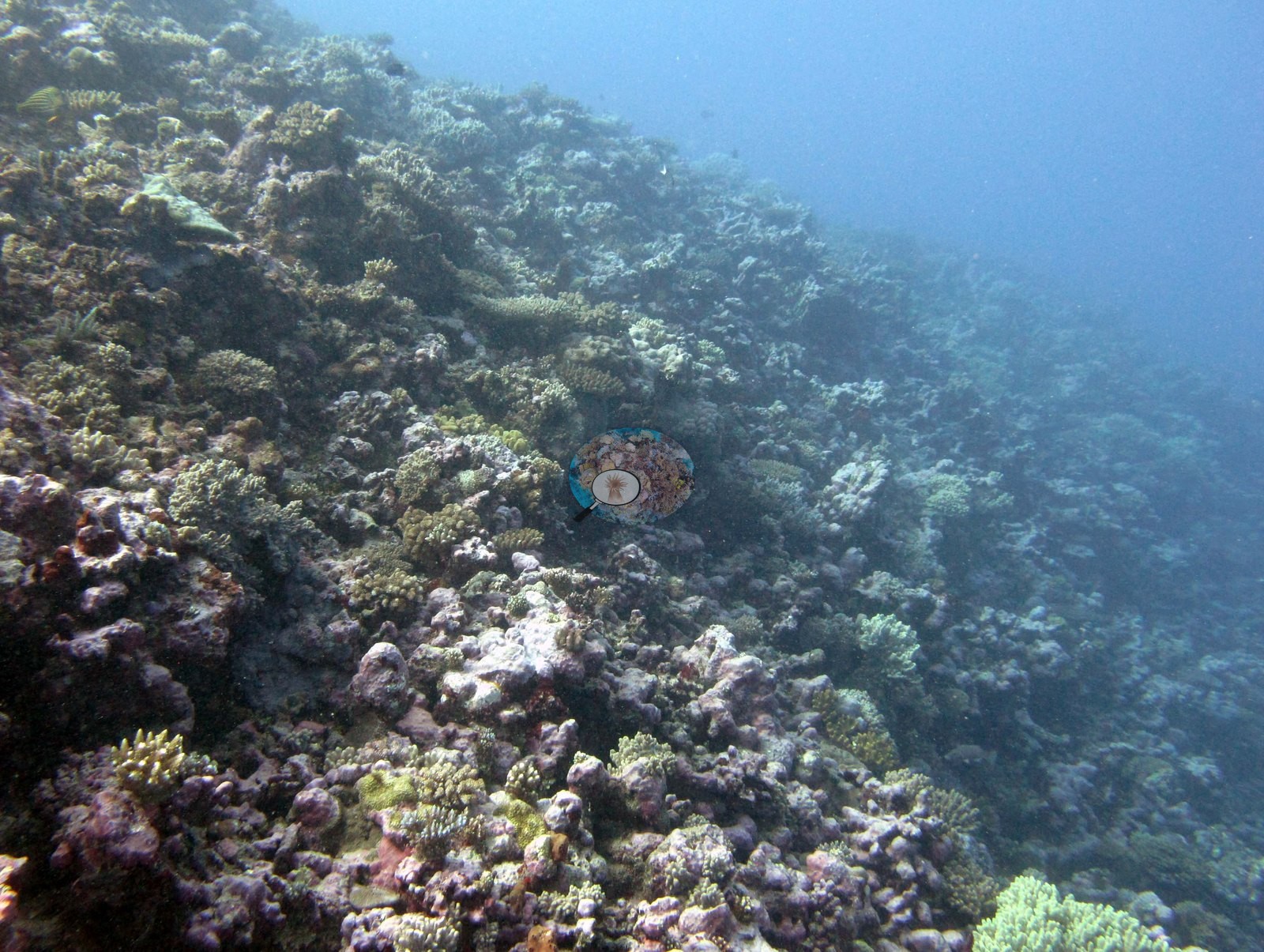
Small yellow-green digitate and corymbose branching colonies and low clumps of what appear to be pocilloporids are the obvious live pieces; a dark-barred sweetlips-type fish holds against the rock at the upper edge, and the blue of open water falls away to the right (e.g., Image 1). The other habitat frame is a tagged-colony close-up: an orange-and-yellow cattle tag cable-tied to a bare boulder beneath a pale mauve-and-cream branching colony with bright white branch tips, growing out of maroon-red crustose algae (e.g., Image 3).
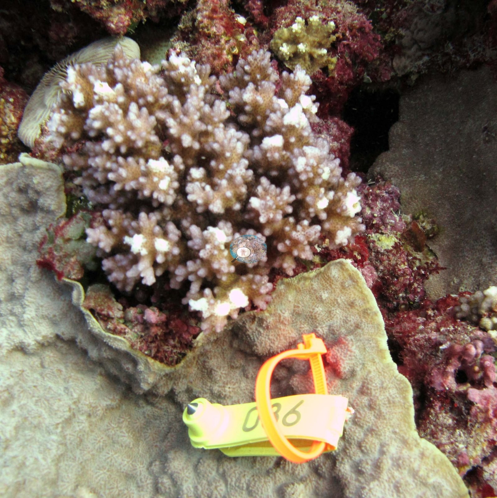
Anderson identified the colony as Pocillopora damicornis.
Coral cover
- Reference: Khaled bin Sultan Living Oceans Foundation, Global Reef Expedition (in situ transect)
- Coral cover: 12%. Live hard coral measured on in situ benthic transects during the Khaled bin Sultan Living Oceans Foundation Global Reef Expedition (LOF-GRE in situ transects; mean of all of this station's own transects).
- Transect data are this site's authoritative cover value; nothing in the photographs overrides it.
- Transect mean 12 ± 2.3% SE (n = 4 transects; Living Oceans Foundation per-transect benthic data); the headline above is this all-transect mean.
Stressors
Tissue on that one colony looks intact, with no lesions in view — a statement about that colony only, not about the reef. Anderson's sampling sheet records fish bites on two of the colonies sampled here (F8 and F10). The Living Oceans Foundation transects here recorded 0.8% cyanobacteria and no recently dead coral; they carry no bleaching, disease, or crown-of-thorns field.
Comparisons with other data
FJTO06 (Totoya, Lau Archipelago) was surveyed on 4 June 2013 during the Global Reef Expedition. Five Pocillopora colonies (F8-F12) were tissue-sampled here for the mission's molecular work, three of them recorded as P. damicornis on Anderson's sample sheet (F8, F9, F10) and two as an unidentified Pocillopora not processed (F11, F12). Typical recent thermal stress: mean annual maximum of 8.9 degree heating weeks (2021-2025, NOAA CRW; Fiji virtual station).
Other notes
The frame is too hazy and too oblique to settle zonation, relief, or the depth range of the slope, and a single wide shot cannot describe condition site-wide.
Independent surveys nearby
Within 5 km, 8 independent survey stations recorded hard coral cover in 2011. The most recent nearby survey is from 2011, so these values predate recent heat stress. This site's own estimate (12%) sits 24 points below the range of these station-year means (36–64%); the methods differ, so the comparison is context, not a like-for-like test.
Collected by other programs using different methods (MERMAID is a data platform: each MERMAID row names the organization that did the survey, and its method is in the row's hover text), so these are context for the figures above, not a like-for-like comparison. Where a station was surveyed more than once, the cell shows either the range of its values or, as a single value, the mean of surveys made in one year. Station names are not dive-site names.
Data & links
- Download benthic survey data (CSV) ↗
- Download all LOF-GRE data (933 sites) ↗
- Photo portfolio ↗
- Coral Reef Diagnostics region page ↗
All images from Coral Reef Diagnostics. Data are from the Khaled bin Sultan Living Oceans Foundation Global Reef Expedition, Coral Reef Diagnostics, and the organizations named in the data sources above.
 © Coral Reef Diagnostics.