
Part of the regional summaries: Fiji - Totoya, Fiji - Moala Group (Moala / Totoya / Matuku), and Fiji - Lau
More info
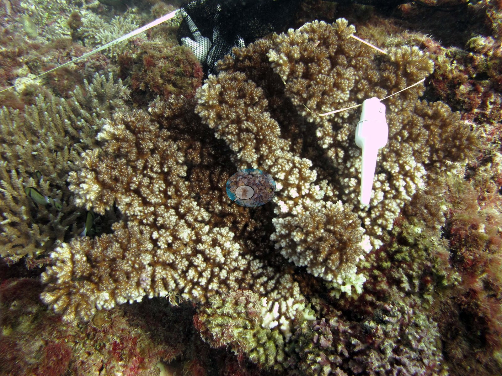
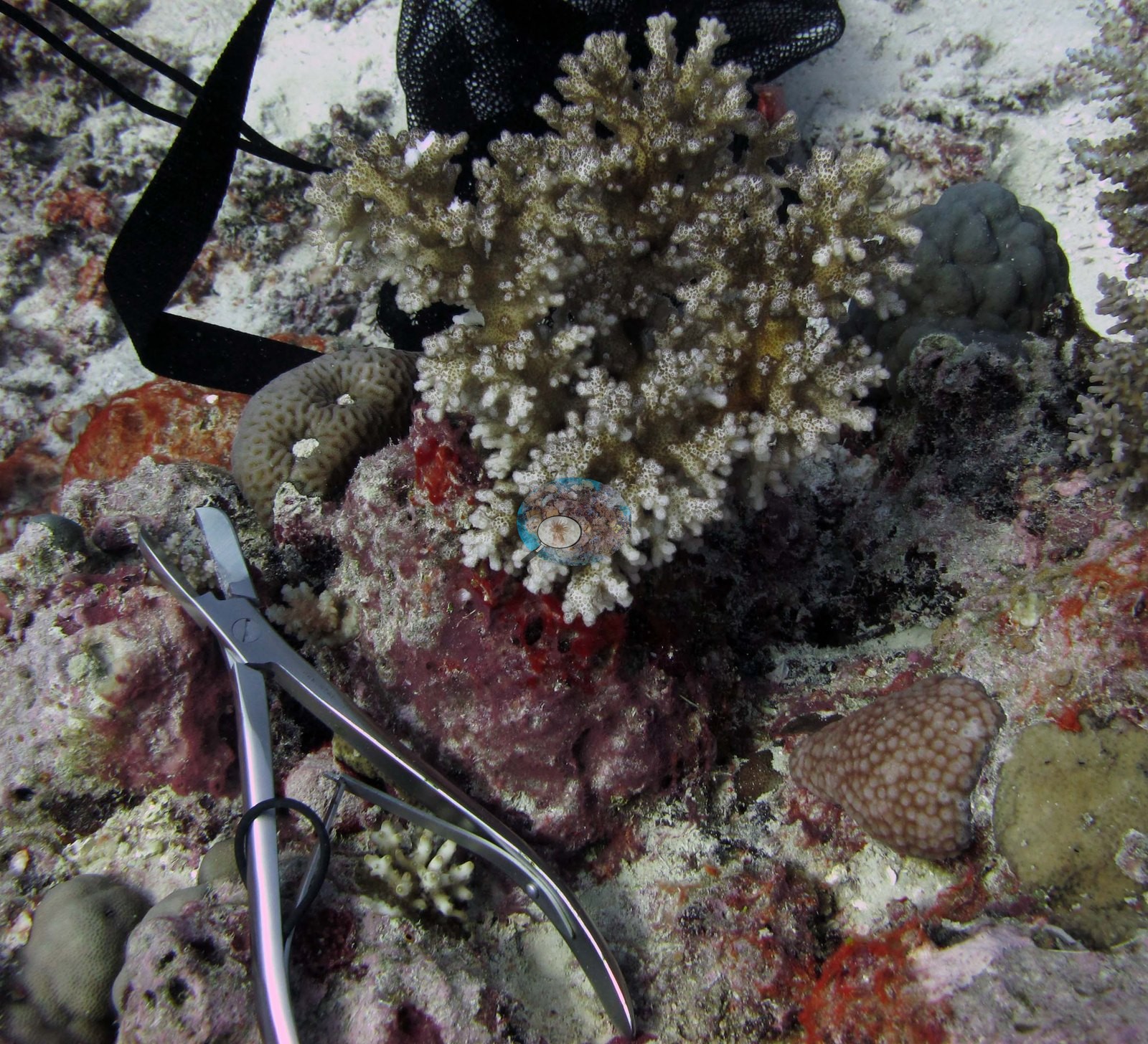
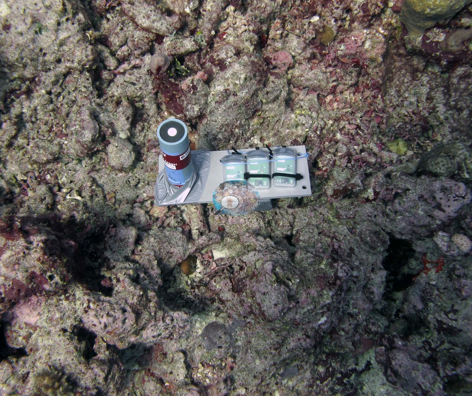
Fiji (NOAA CRW virtual station)A Totoya physiology sampling station photographed mid-dive: tagged colonies, sample vials, and an instrument plate of temperature and light loggers cable-tied to the reef. The surrounding bottom is heavily turfed old framework with small corals (28% cover), and the sampled colonies looked intact. Surveyed on the Living Oceans Foundation's Global Reef Expedition.
E dua na vanua ni taura ivakaraitaki vakayago (physiology sampling station) e Totoya a taba ena loma ni nunu: na lase e vakatakilakilataki (tagged), na tavaya ni ivakaraitaki, kei na dua na veleti ni iyaya ni volai ni katakata kei na rarama (temperature and light loggers) e vauci ena cable-tie ki na cakau. Na botoni e wavokita e ivakatudei makawa e ubi vakalevu ena lumi lekaleka (turf) kei na lase lalai (28% na ubi ni lase), ka rairai bula vinaka na lase a taura kina na ivakaraitaki.
AI translation of this summary; the English is authoritative. (low confidence)
CTD-cast midpoint of 26.9–27.2°C
Three independent survey stations shown with the program’s logo — click one to see how far it is from this site.
Two other CRD dive sites with their own pages within 5 km shown in orange — click a marker to open its page.
🗺 Detailed map of the Global Reef Expedition dive sites, Totoya, Fiji (Khaled bin Sultan Living Oceans Foundation; opens in a new window)
3 of the 6 photographs on this page are shown beside the text that discusses them under "Site description" below.
Site description
General benthic features
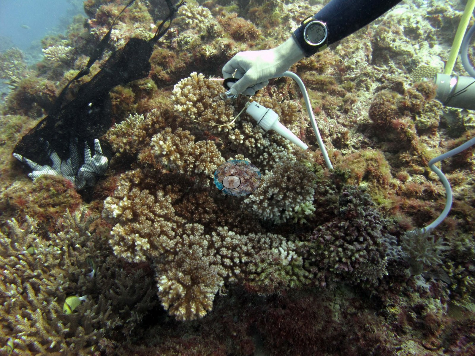
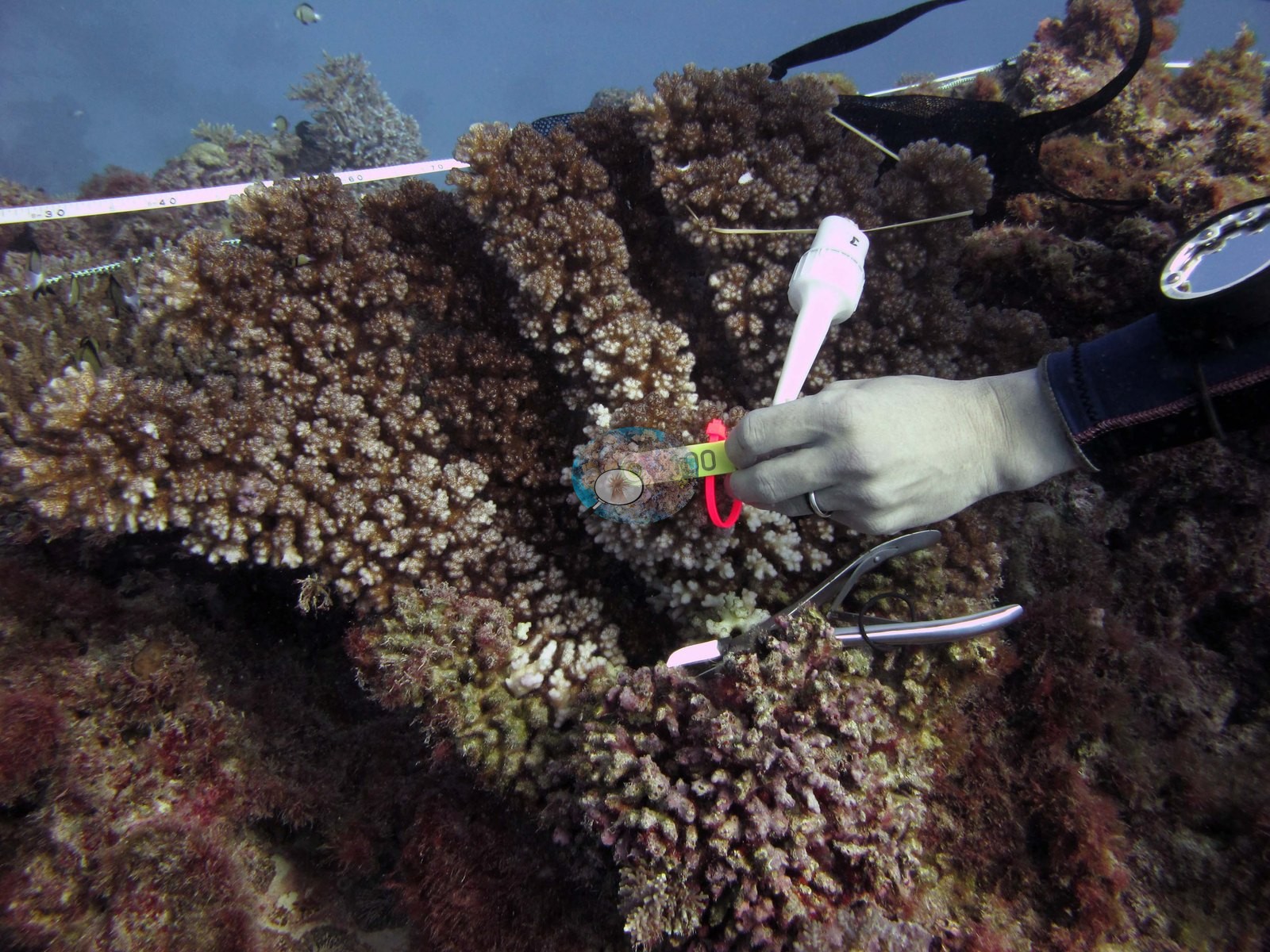
The Totoya frames are working shots rather than reefscapes: this is what a physiology sampling station looks like mid-dive. A gloved hand holds a numbered tag against a broad, low-spreading branching colony while stainless bone cutters and a white sample vial wait alongside; a transect tape runs across the frame behind, and a black mesh collection bag hangs off the reef (e.g., Image 5).
In another frame a small knobby-branched Pocillopora colony sits on coralline-crusted rubble with the cutters laid beside it and a black-and-white speckled cowrie-like snail nearby (e.g., Image 3).
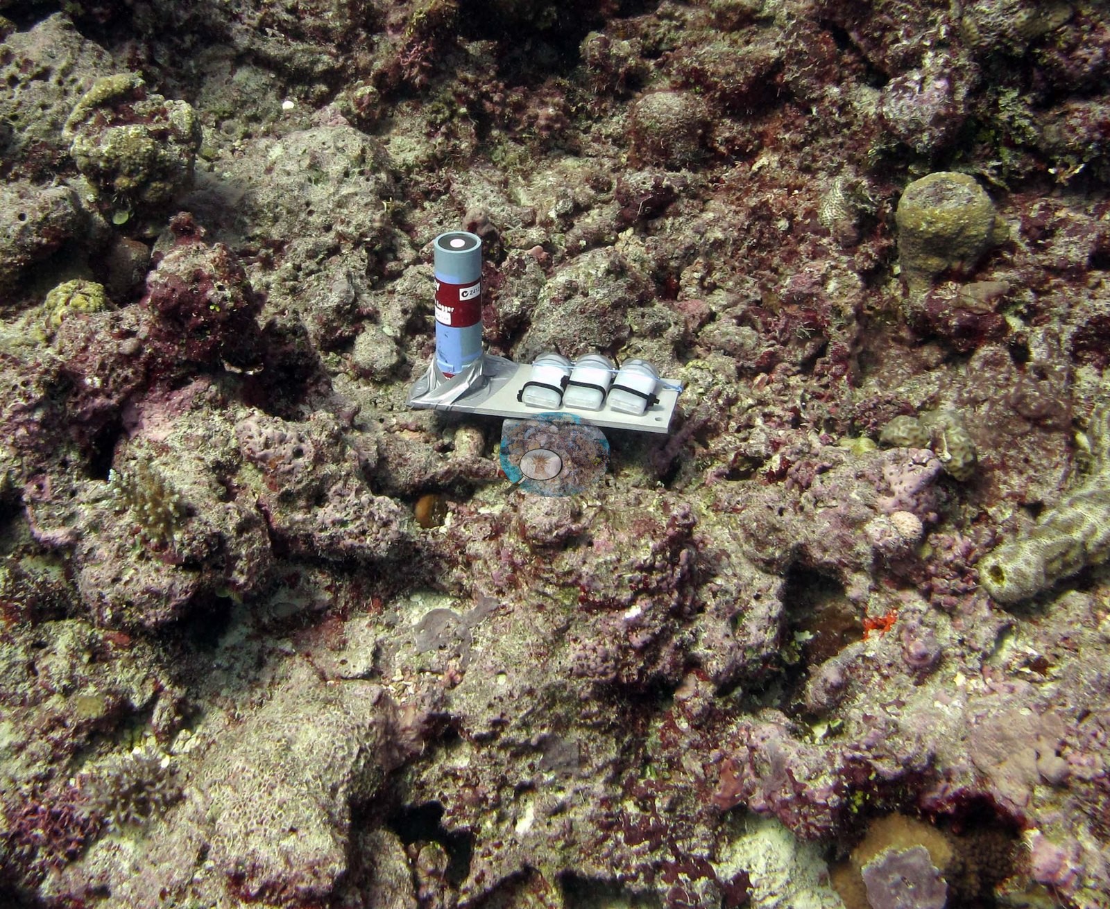
A third shows an instrument plate cable-tied to bare pavement, three pendant temperature/light loggers strapped in a row next to a cylindrical logger in silver tape (e.g., Image 2).
Around all of this, the substrate is heavily worked over: rust and olive turf and fleshy algae covering old framework, pink coralline crusts, patches of white sand, red encrusting sponge, small mounding and brain-textured heads, and thin-branched acroporids at the frame edges.
Coral cover
- Reference: Khaled bin Sultan Living Oceans Foundation, Global Reef Expedition (in situ transect)
- Point-count survey put living coral at 28% here.
- Transect mean 28 ± 5.1% SE (n = 5 transects; Living Oceans Foundation per-transect benthic data); the headline above is this all-transect mean.
Stressors
Tissue on the sampled colonies looks intact — no bleaching, disease lesions, or crown-of-thorns damage in view. The Living Oceans Foundation transects here recorded 7.8% cyanobacteria and no recently dead coral; they carry no bleaching, disease, or crown-of-thorns field.
Comparisons with other data
Apart from the Living Oceans Foundation survey shown here, we found no other surveys at this site as of 2026. Within 5 km, three WCS Fiji via MERMAID stations recorded station-year means of 43–64% hard coral cover in 2011; the nearest, WCS Fiji via MERMAID at TY10, 4.77 km away, read 53% in 2011.
Other notes
Survey team's site notes: Coral community composition is determined by the development stage of each patch. In the early stage, the coral community is dominated by massive species (e.g., Porites sp.) which build to form a pinnacle.
Independent surveys nearby
Within 5 km, 3 independent survey stations recorded hard coral cover in 2011. The most recent nearby survey is from 2011, so these values predate recent heat stress. This site's own estimate (28%) is not compared with these surveys: none lies within 2 km.
Collected by other programs using different methods (MERMAID is a data platform: each MERMAID row names the organization that did the survey, and its method is in the row's hover text), so these are context for the figures above, not a like-for-like comparison. Where a station was surveyed more than once, the cell shows either the range of its values or, as a single value, the mean of surveys made in one year. Station names are not dive-site names.
| Agency | Site / location | Date | Hard coral cover (%) | Distance | Link |
|---|---|---|---|---|---|
| WCS Fiji via MERMAID | TY10 | 2011 | 53% | 4.77 km | Darling E, Fisher K, Jupiter S, Nand Y, Taga J. 2011. 2011_Totoya. MERMAID |
| WCS Fiji via MERMAID | TY13 | 2011 | 64% | 4.92 km | Darling E, Fisher K, Jupiter S, Nand Y, Taga J. 2011. 2011_Totoya. MERMAID |
| WCS Fiji via MERMAID | TY15 | 2011 | 43% (2 surveys) | 4.97 km | Darling E, Fisher K, Jupiter S, Nand Y, Taga J. 2011. 2011_Totoya. MERMAID |
Data & links
- Download benthic survey data (CSV) ↗
- Download all LOF-GRE data (933 sites) ↗
- Photo portfolio ↗
- Coral Reef Diagnostics region page ↗
All images from Coral Reef Diagnostics. Data are from the Khaled bin Sultan Living Oceans Foundation Global Reef Expedition, Coral Reef Diagnostics, and the organizations named in the data sources above.
 © Coral Reef Diagnostics.