
Part of the regional summaries: Fiji - Nayau, Fiji - Northern Lau (Vanua Balavu / Cicia / Nayau), and Fiji - Lau
More info
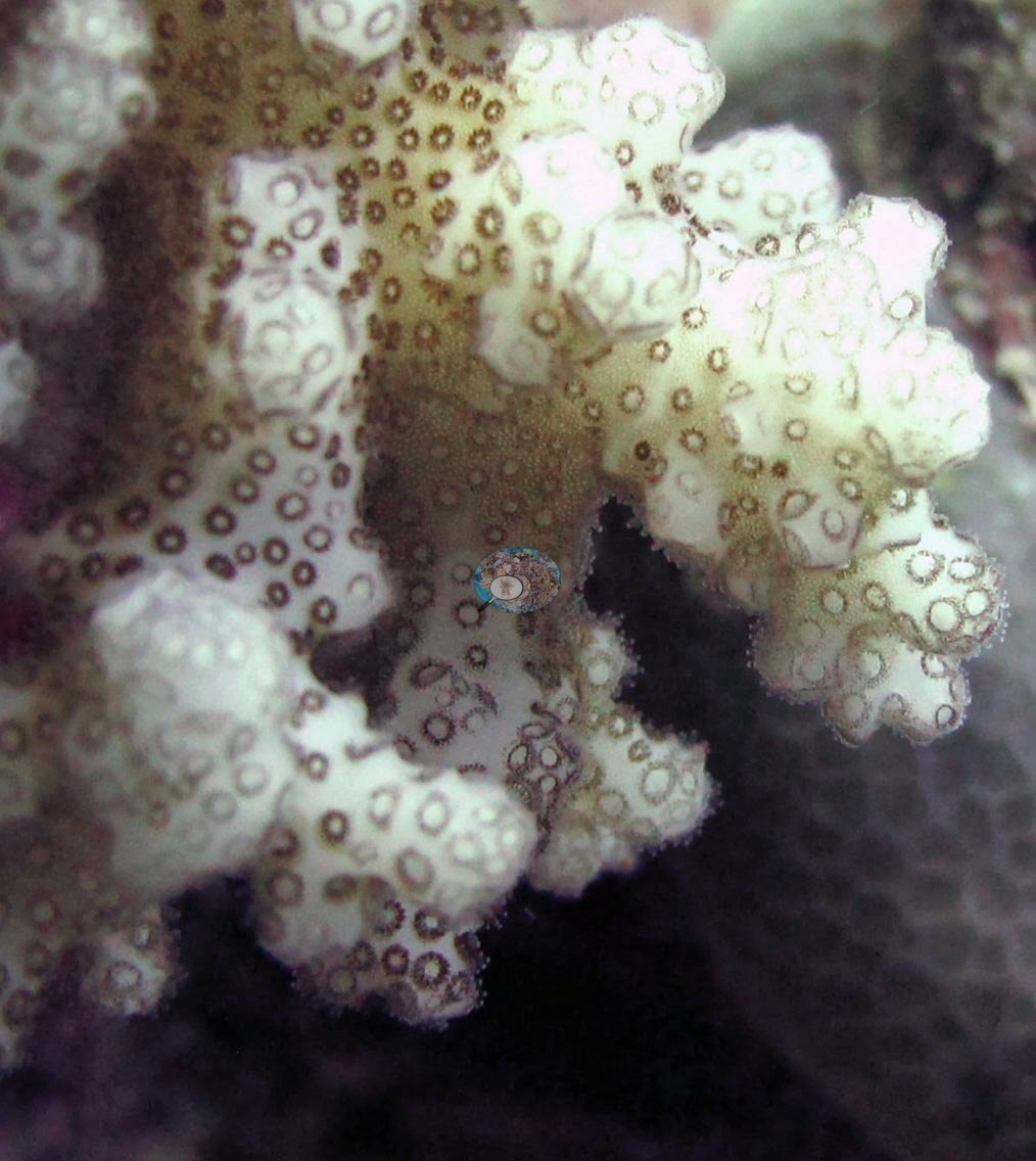
Fiji (NOAA CRW virtual station)A shallow fore-reef slope on Nayau's northwest side whose framework is packed with small branching colonies, at 44% cover. Anderson photographed a bleached pocilloporid and another pocilloporid with pale, partly bleached tissue between brown polyps. Surveyed on the Living Oceans Foundation's Global Reef Expedition.
E dua na baba ni yasana i tuba ni cakau (fore-reef slope) e sega ni titobu ena yasana i vualiku-i-ra i Nayau, ka na kena ivakatudei e vonu ena lase lalai vakatabataba, ka 44% na ubi ni lase (coral cover). A taba ko Anderson e dua na pocilloporid vulavula (bleached) kei na dua tale na pocilloporid e vulavula vakalailai (pale) na yagona, e vulavula vakalailai (partly bleached) ena maliwa ni polyp e roka (brown).
AI translation of this summary; the English is authoritative. (low confidence)
CTD-cast midpoint of 27.1–27.2°C
Three other CRD dive sites with their own pages within 5 km shown in orange — click a marker to open its page.
🗺 Detailed map of the Global Reef Expedition dive sites, Nayau, Fiji (Khaled bin Sultan Living Oceans Foundation; opens in a new window)
17 of the 20 photographs on this page are shown beside the text that discusses them under "Site description" below.
Site description
Setting
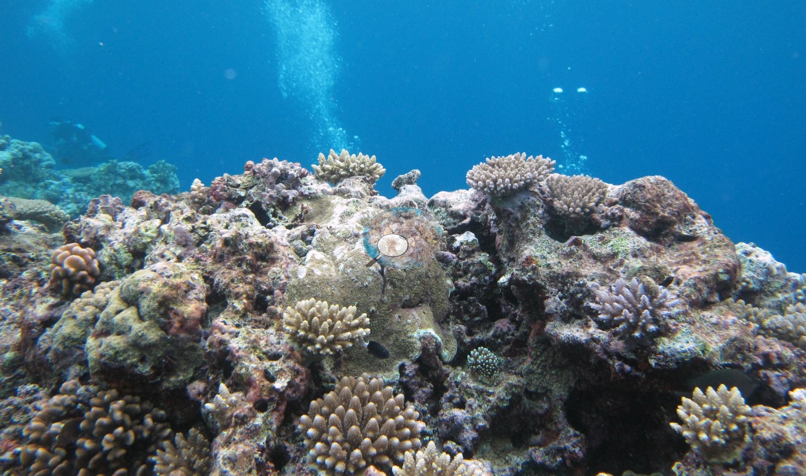
FJNA40 (Nayau, Lau Archipelago): surveyed 16 Jun 2013 during the Khaled bin Sultan Living Oceans Foundation Global Reef Expedition. The water is clear in most views. All sites (FJNA39, FJNA40, FJNA38) were located on the north west side of the island on a shallow fore reef slope. Large reef build up with acroporids made up the majority of reef morphologies. FJNA39 was a classic spur and groove morphology with higher coral cover on the tops of the spurs.
General benthic features
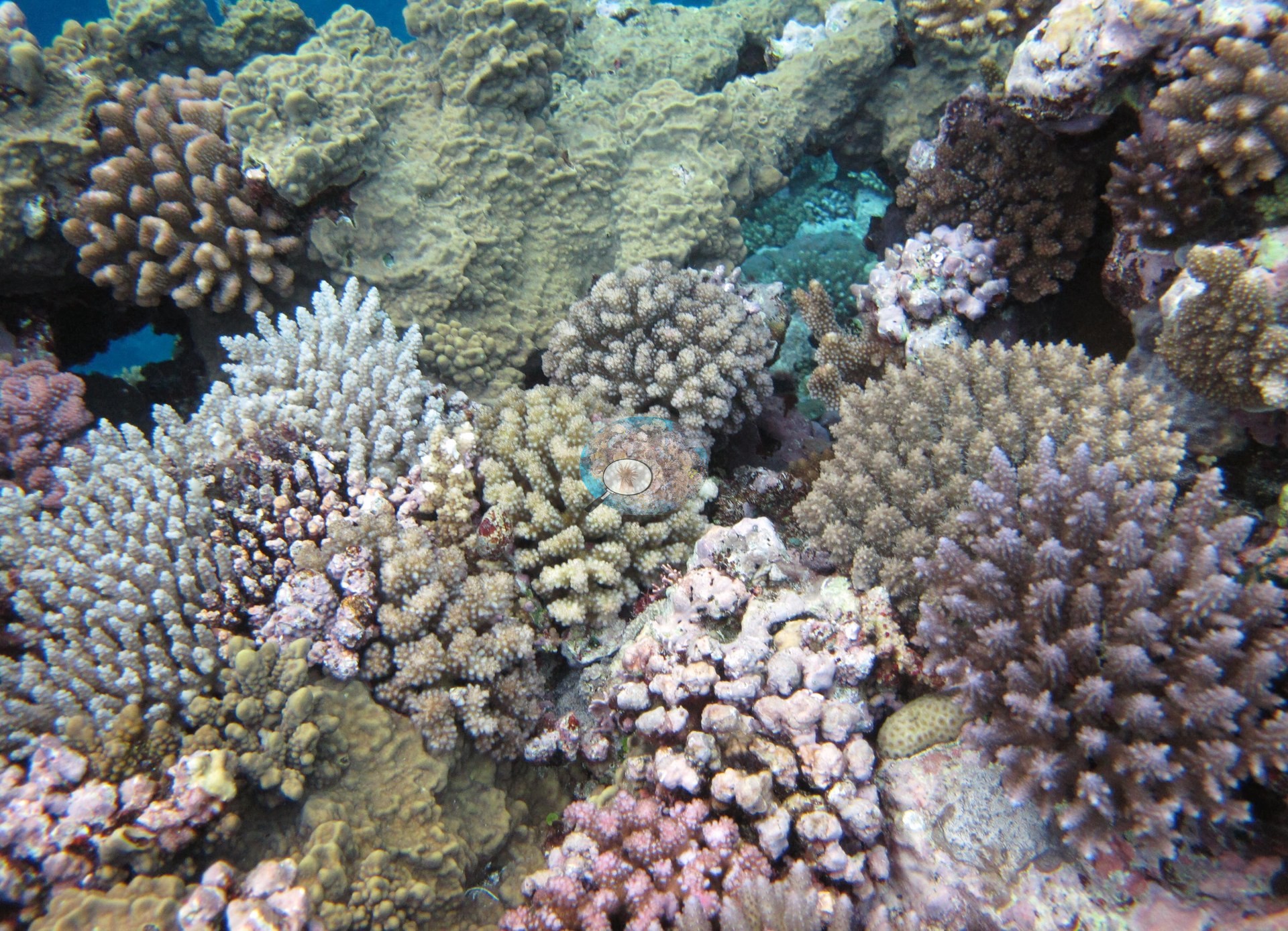
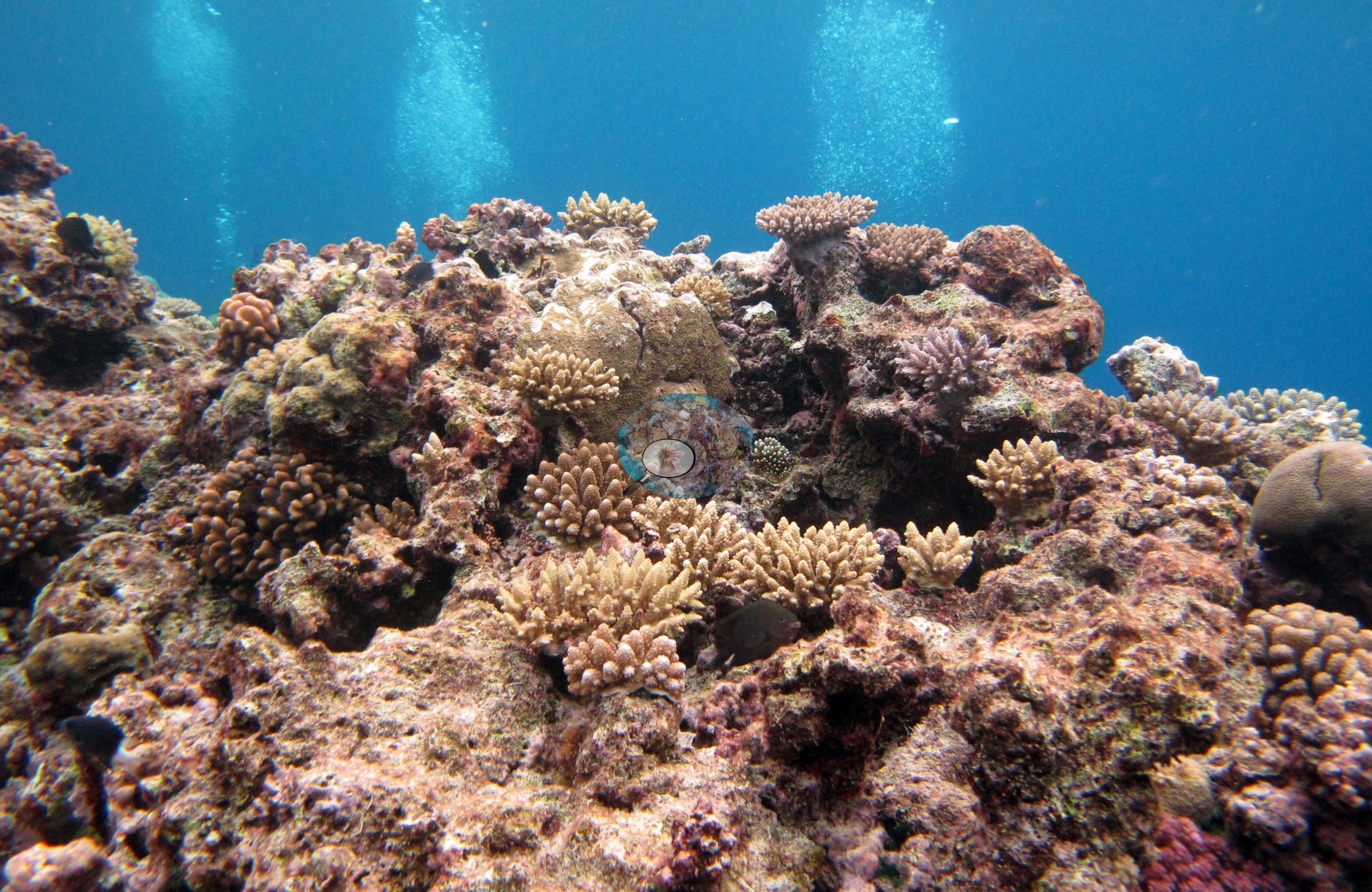
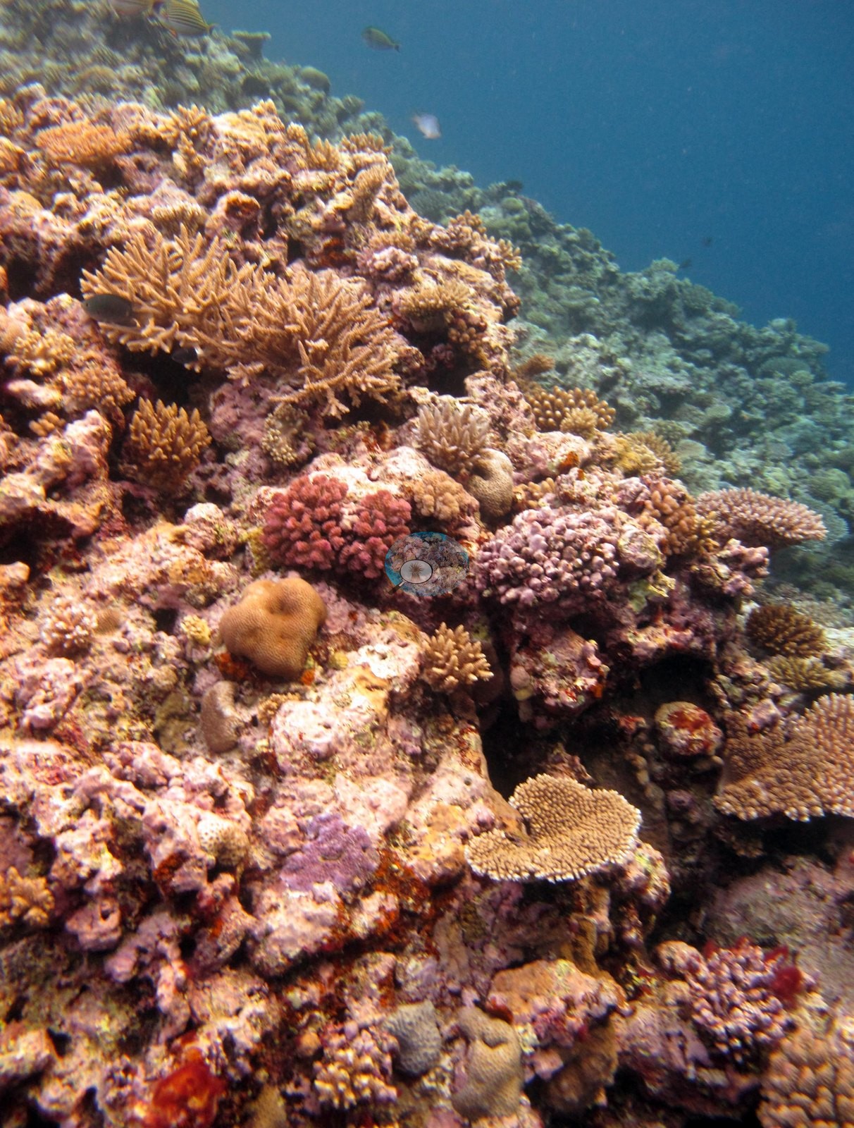
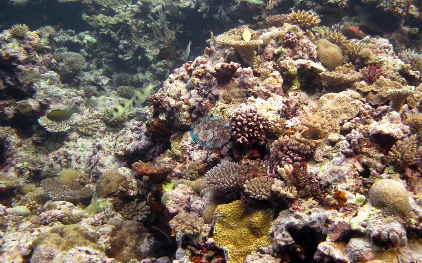
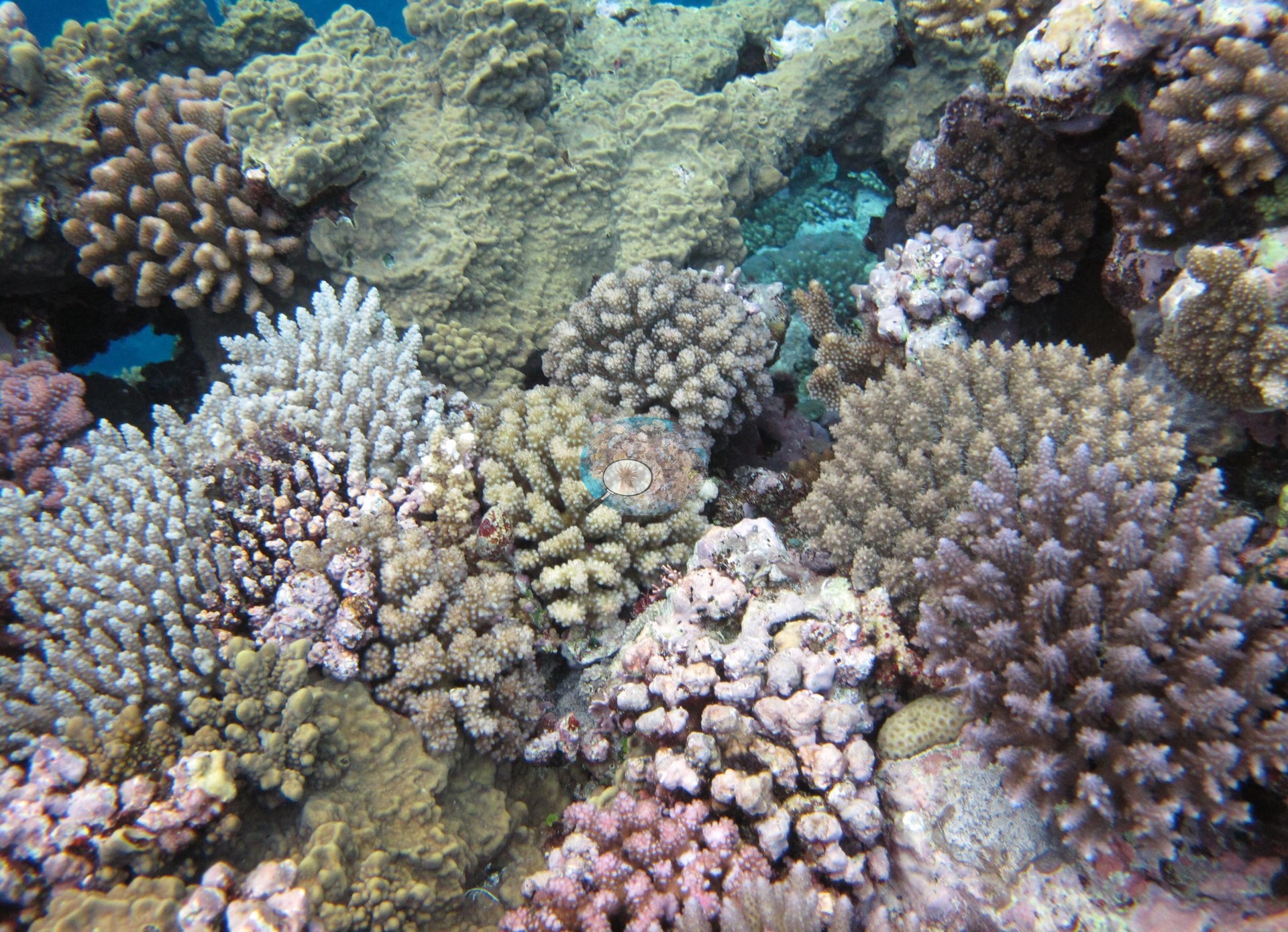
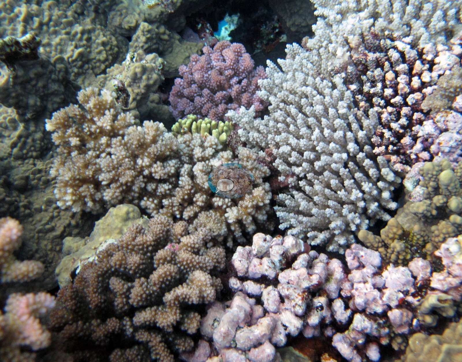
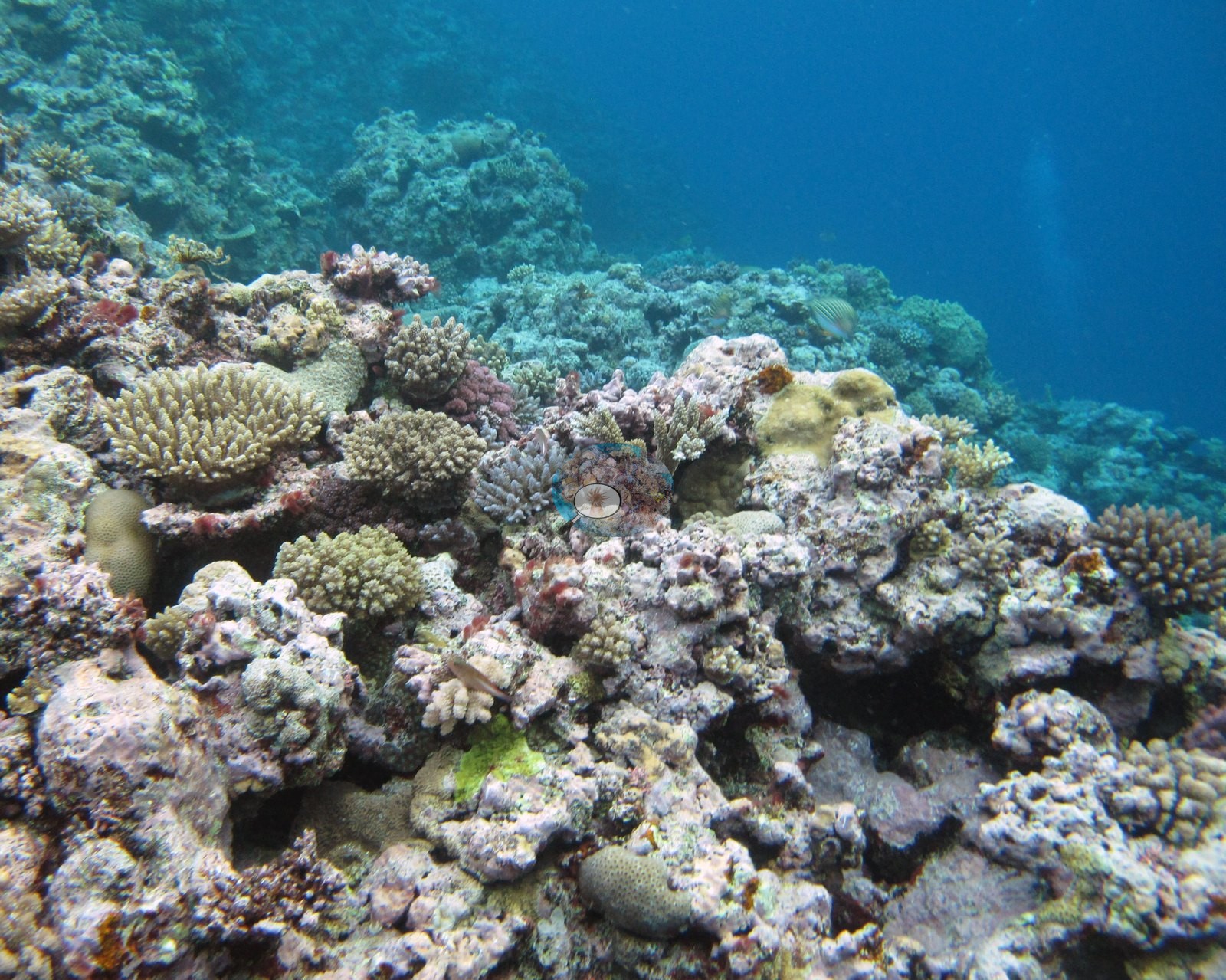
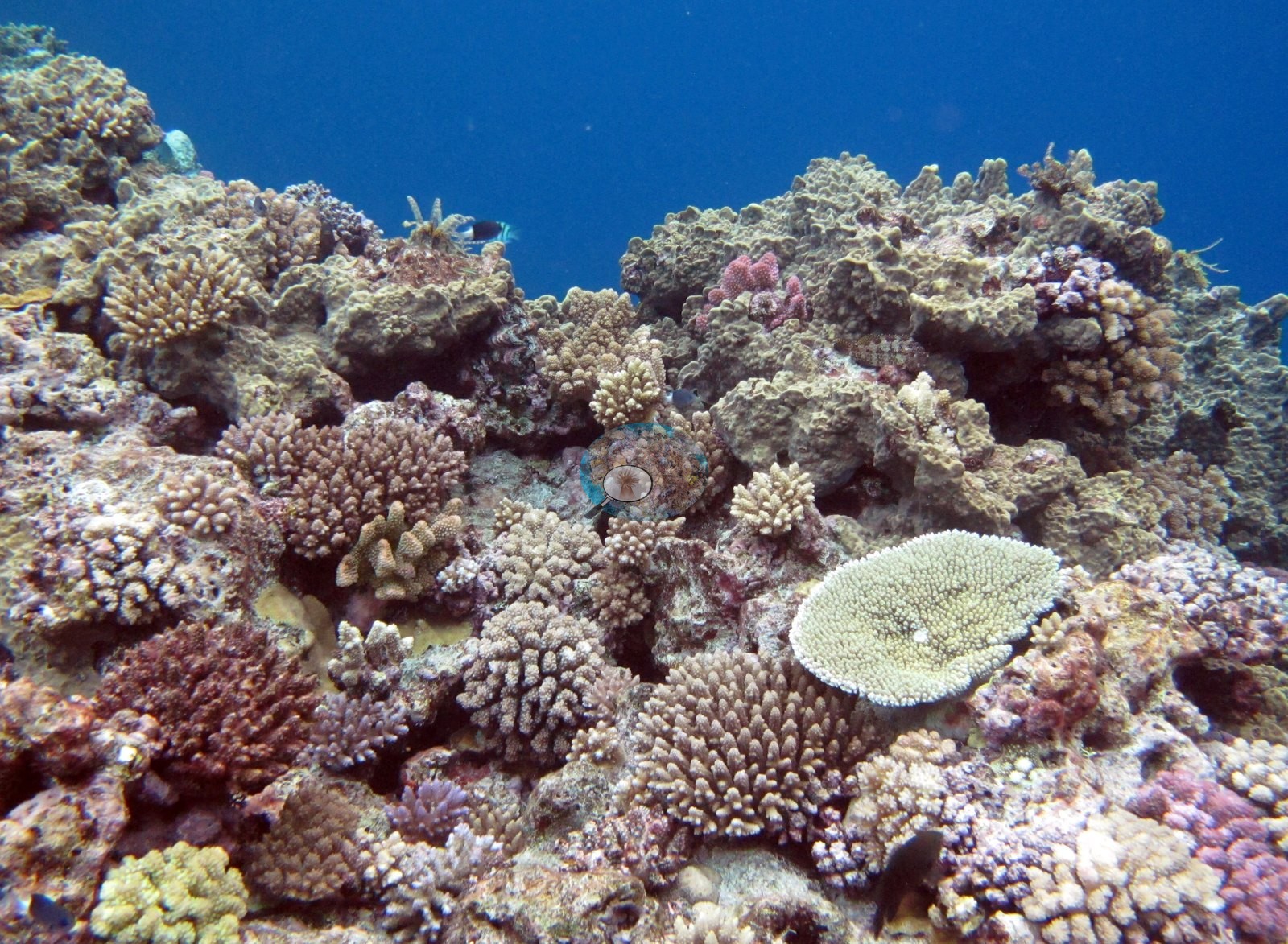
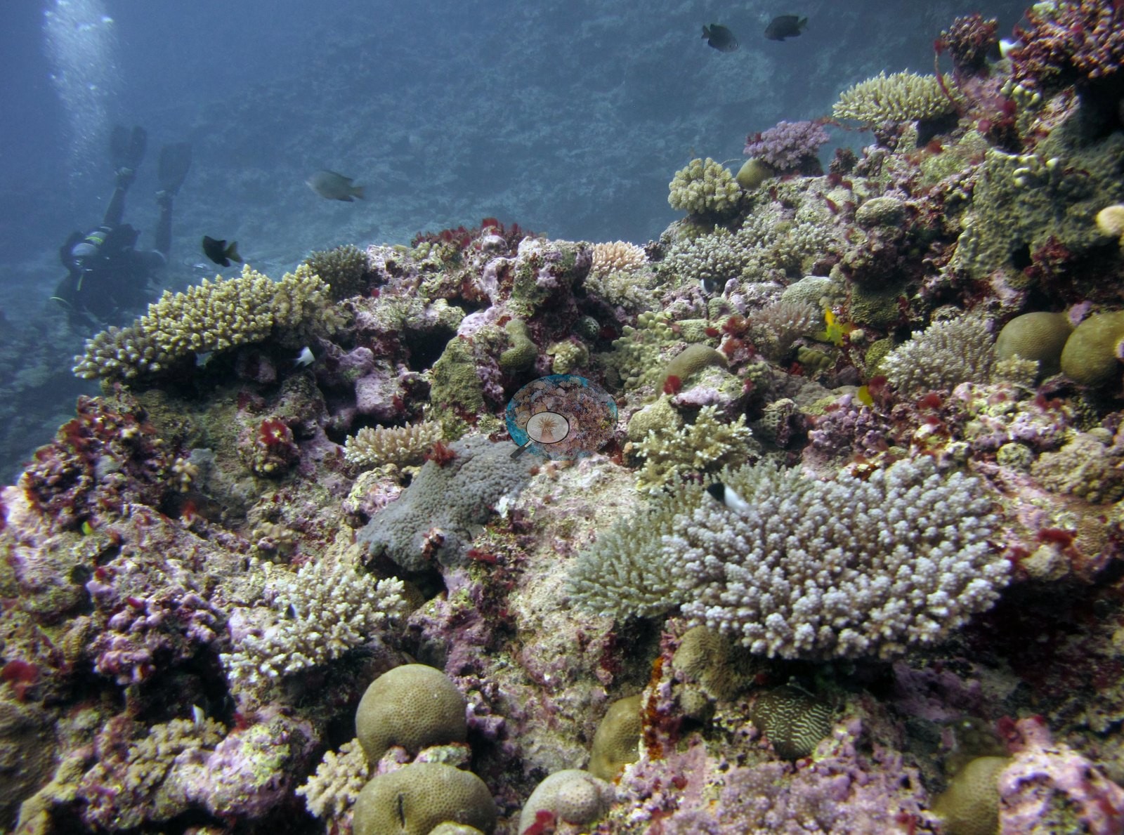
Twenty habitat frames from the dive's own folder were reviewed (a twenty-first is filed with Anderson's selected photographs) (Nayau, Lau Archipelago, 16 Jun 2013); there are no sampled-colony photographs. Anderson's own field identifications and notes are used here. Relief in these views is low to moderate — a built framework of coral rock crusted pink and mauve with coralline algae, carrying discrete colonies rather than large towering structures. Where the camera is close in, the framework is packed with small branching corals: cream, tan, and pale-tipped corymbose and digitate colonies compatible with Acropora, mauve, lilac, and dusty-pink bushy colonies compatible with a pocilloporid, occasional small tables, yellow-green encrusting and small massive colonies, and red, pink, and maroon crustose coralline algae between them.
Survey team's regional notes (the block covering Nayau stations FJNA38, FJNA39, and FJNA40). At the base of reef build ups were large piles of rubble. Macroalgae (Tydemania expeditionis) was also coming on the sides of reef build ups. Large plating/sheeting colonies of Diploastrea were prominent at 15 m. The grooves were scoured with large pieces of coral rubble sediment infill.
Coral cover
- Reference: Khaled bin Sultan Living Oceans Foundation, Global Reef Expedition (in situ transect)
- 44%, from the Khaled bin Sultan Living Oceans Foundation's in situ transect survey (Global Reef Expedition site data); the photographs illustrate the site.
- Anderson noted complete live coral cover in two of these close views (e.g., Image 1, Image 19) and an acroporid garden in a third (e.g., Image 18); those are frame-level notes on what is inside those particular frames and are not measurements of the site.
- No scale reference, quadrat, or transect line appears in any frame, so colony dimensions cannot be measured from them.
- Transect mean 44 ± 4.3% SE (n = 6 transects; Living Oceans Foundation per-transect benthic data); the headline above is this all-transect mean.
Stressors
Two frames add condition detail. Image 5 is a pocilloporid recorded as bleached, and shows exactly that: a bushy branching colony bleached uniformly cream-white across the whole colony, sitting on coralline-crusted pavement between fully pigmented neighbors. Image 6 is a close macro of pocilloporid branch tips with individual polyps resolved: pale, partly bleached tissue between still-brown polyps (Anderson).
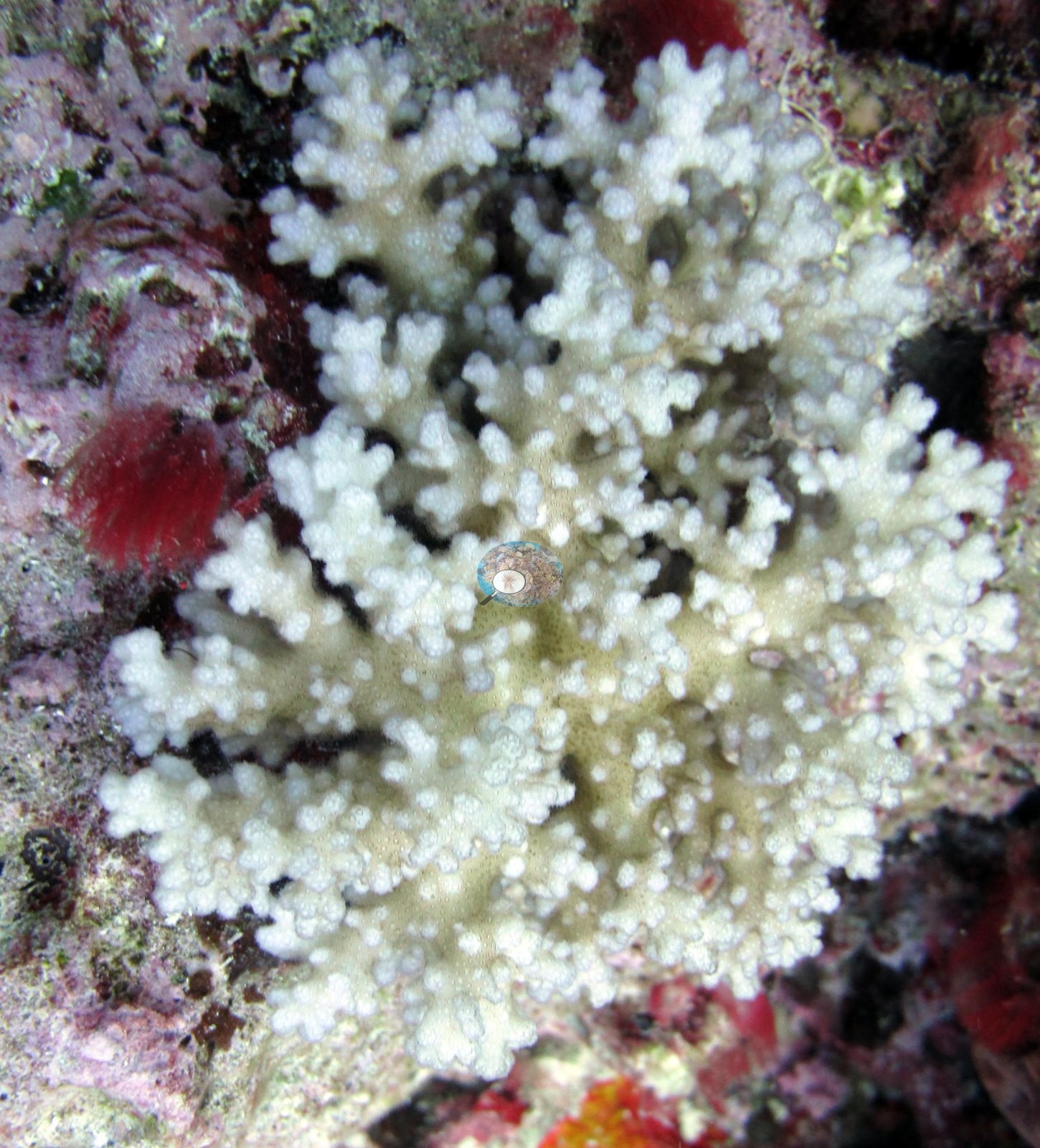
Both are single-colony observations on a June 2013 dive; they are Anderson's identifications and stand as recorded, and they say nothing about how much of the site was affected — no site-level bleaching figure is derived here or anywhere else in this account. The frames also cannot settle several things the surveyors recorded: no rubble piles at the base of the build-ups, no Tydemania macroalgae, no Drupella on Acropora, and no large plating Diploastrea at 15 m can be confirmed in this set, and depth zonation is not readable without depth stamps. The survey team's notes for the three Nayau stations (FJNA38, FJNA39, and FJNA40) record Drupella on several Acropora colonies; which of the three is not stated. Typical recent thermal stress: mean annual maximum of 8.9°C-weeks (Degree Heating Weeks, 2021-2025, NOAA CRW; Fiji virtual station). The Living Oceans Foundation transects here recorded 3.3% cyanobacteria and no recently dead coral.
Fish and other fauna
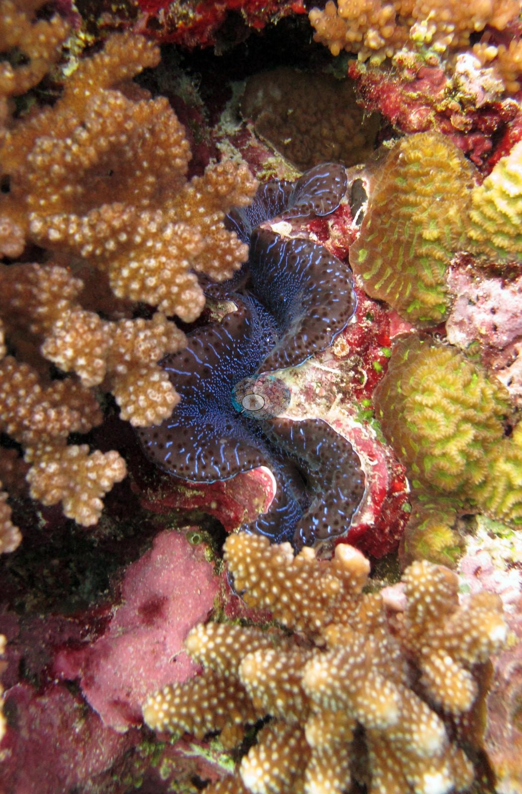
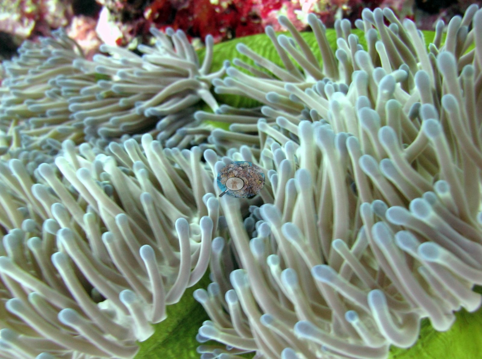
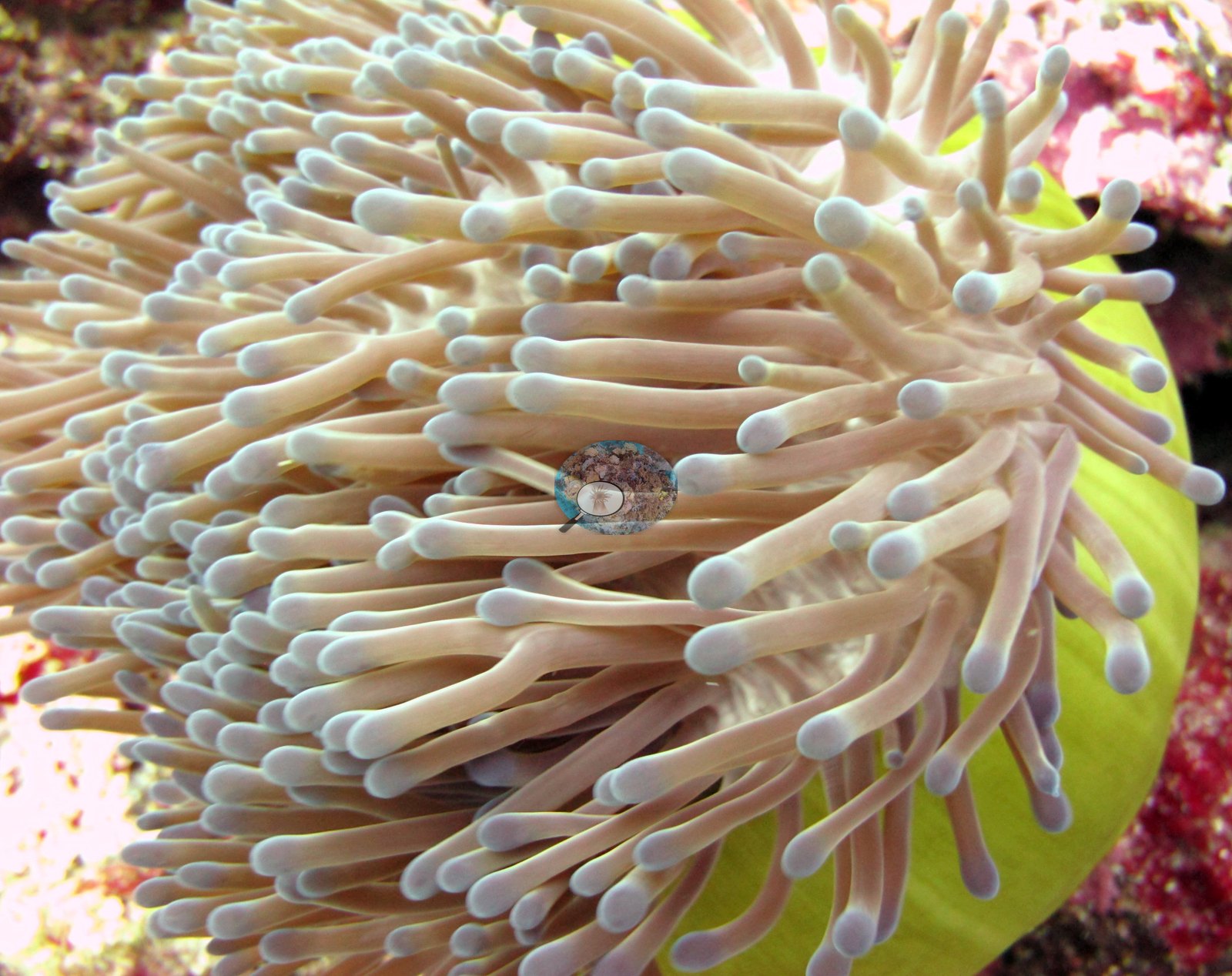
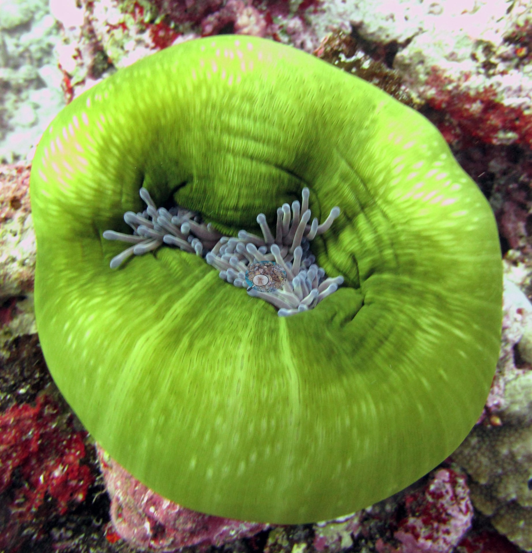
About fourteen of the twenty are reef views; the rest are close-ups of single animals, among them three sea anemones, a giant clam, and a coral macro — and carry no habitat information. The wide frames show a coral-built reef top and upper slope in clear water, shot mostly on ambient light: a crest or ridge line running away from the camera with open blue beyond it (e.g., Image 17, Image 15, Image 7, Image 9), a steeper flank falling away below (e.g., Image 3, Image 16), and one frame taken close under the surface with the water–air interface filling the top of the image (e.g., Image 11).
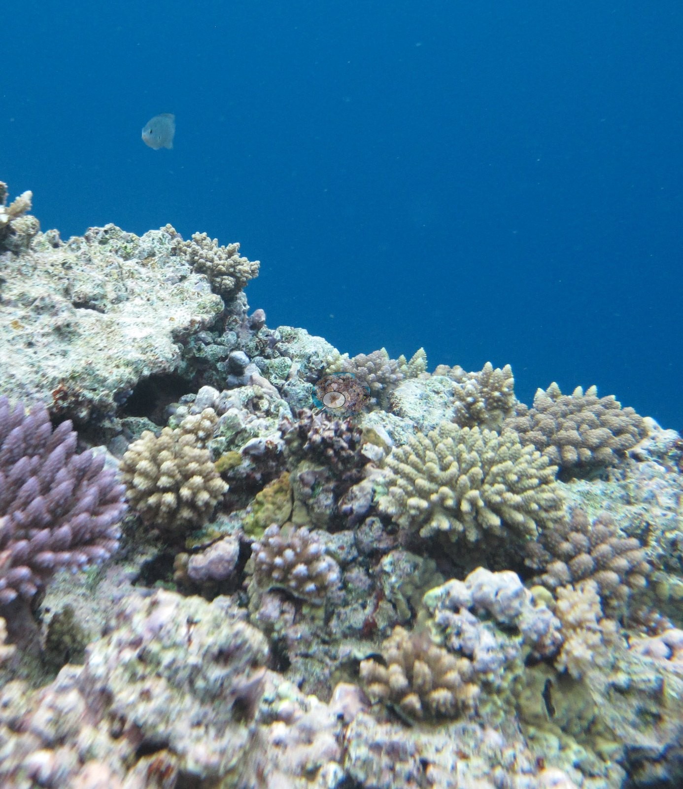
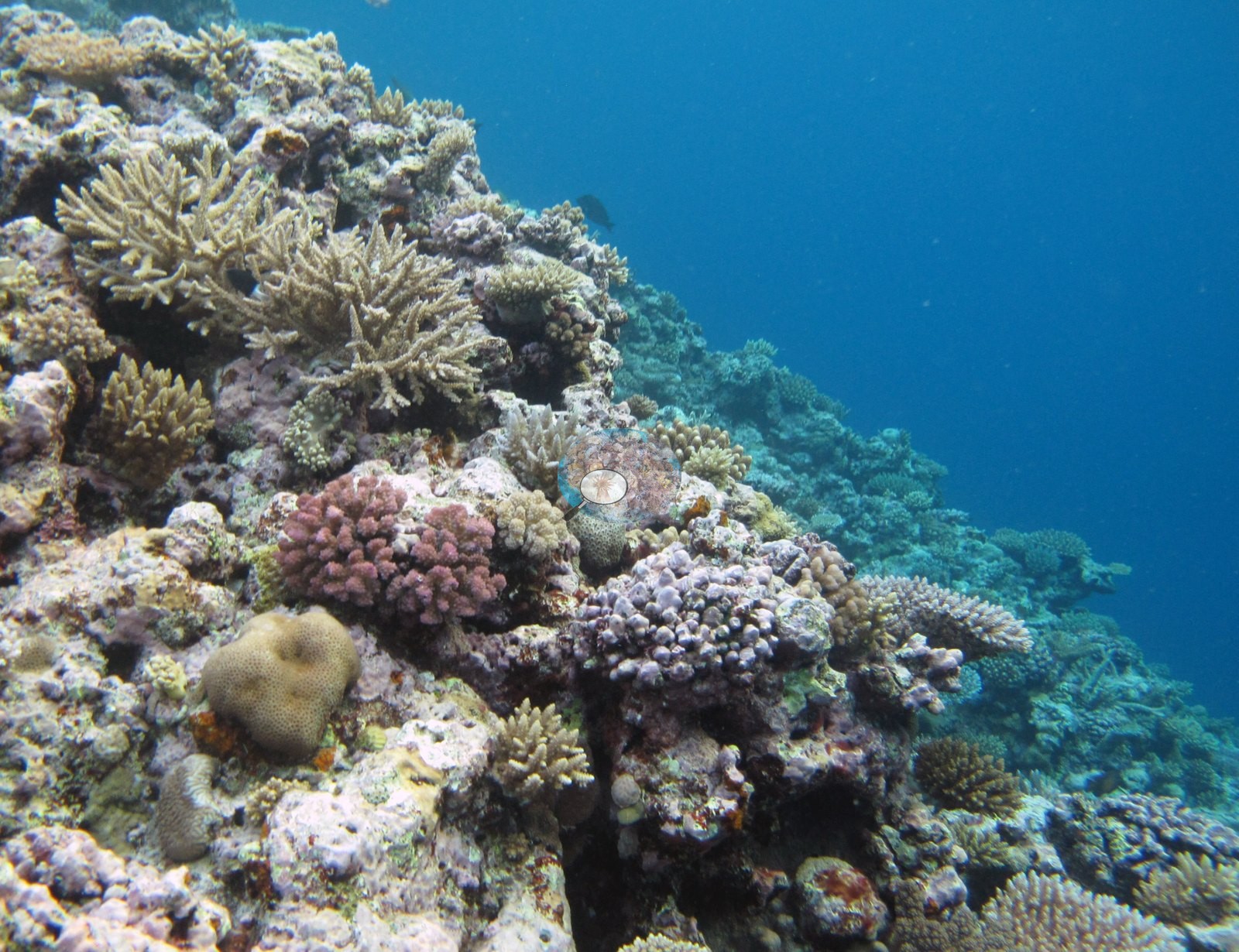
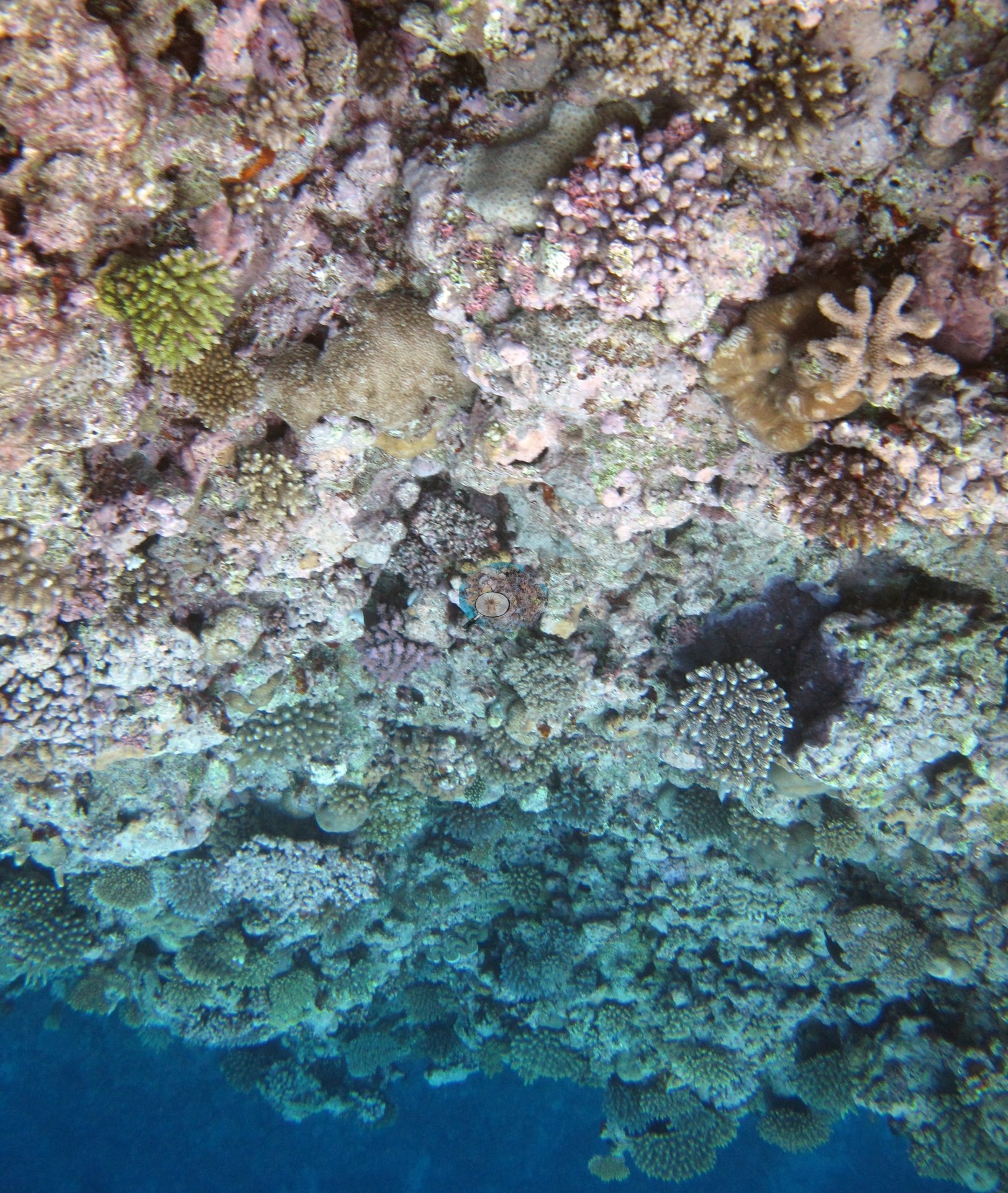
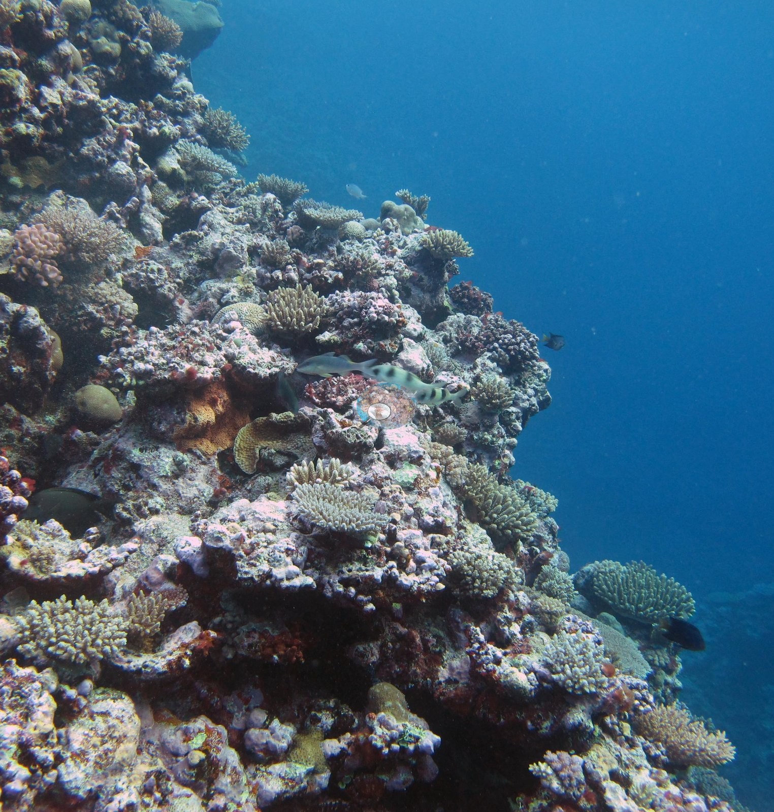
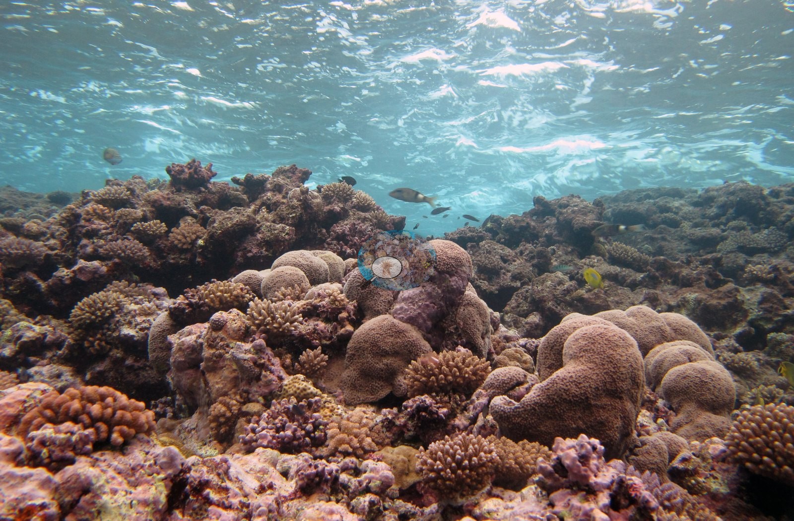
Invertebrate and fish life appear throughout without dominating: a giant clam with a blue-purple patterned mantle wedged between branching colonies (e.g., Image 14), three large sea anemones — one with a green column and long pale swollen-tipped tentacles (e.g., Image 10; in a second frame Image 20, Anderson noted the anemone's abundant dinoflagellate symbionts) and one contracted into a bright yellow-green ball with only the central tentacles showing Image 4 — small damselfishes and a surgeonfish over the reef top, and one mottled elongate bottom-resting fish in Image 16 that is not called here.
A diver with bubble trail is in the background of Image 8.
Comparisons with other data
Apart from the Living Oceans Foundation survey shown here, we found no other surveys at this site as of 2026. If you would like to share yours, please email us.
CV model comparison
More info
The photo row below is a methods comparison only: it is never averaged with the transect and never used as the headline. It compares site means only: the photos come from the same survey dive as the transect but not from the same points.| Method | Hard coral cover (%) | Photos (n) ± SE |
|---|---|---|
| Transect mean (all transects) | 43.5 | |
| CoralSCOP edited | 31.4* | n = 15 · SE 2.2 |
| Claude (edited photos) | 27.8* | n = 15 · SE 4.1 |
The two computer-vision methods agree within 3.6 pp (27.8–31.4%) and read 12.1–15.7 pp below the in-water transect (43.5%); the headline is the in-water transect because a diver transect is independent of the photographs.
*Based on only 15 reef-habitat photos; this estimate is less certain.
See a more detailed, stand-alone version of this table.
Data & links
- Download benthic survey data (CSV) ↗
- Download all LOF-GRE data (933 sites) ↗
- Photo portfolio ↗
- Coral Reef Diagnostics page for this area ↗
All images from Coral Reef Diagnostics. Data are from the Khaled bin Sultan Living Oceans Foundation Global Reef Expedition and Coral Reef Diagnostics.
 © Coral Reef Diagnostics.