
Part of the regional summaries: Chagos Archipelago - Salomon / Blenheim / Speakers Bank and Chagos Archipelago
More info
Chagos (NOAA CRW virtual station)A high-cover lagoon patch reef (56.9% coral, mostly Acropora tables) that stands out for its patchwork: table coral gives way to open rubble and then a broad meadow of ribbon-like, seagrass-type plants seen at no other site in its batch. Surveyed on the Living Oceans Foundation's Global Reef Expedition.
Three independent survey stations shown with the program’s logo — click one to see how far it is from this site.
🗺 Detailed map of the Global Reef Expedition dive sites, Speakers Bank, Chagos (Khaled bin Sultan Living Oceans Foundation; opens in a new window)
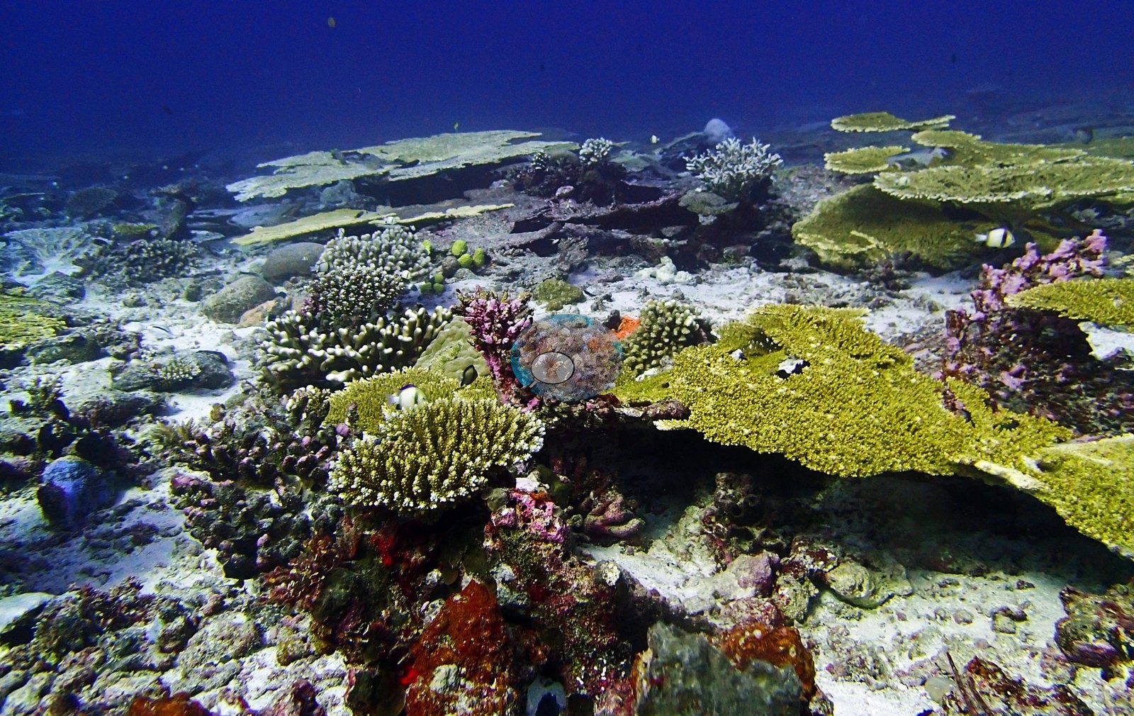
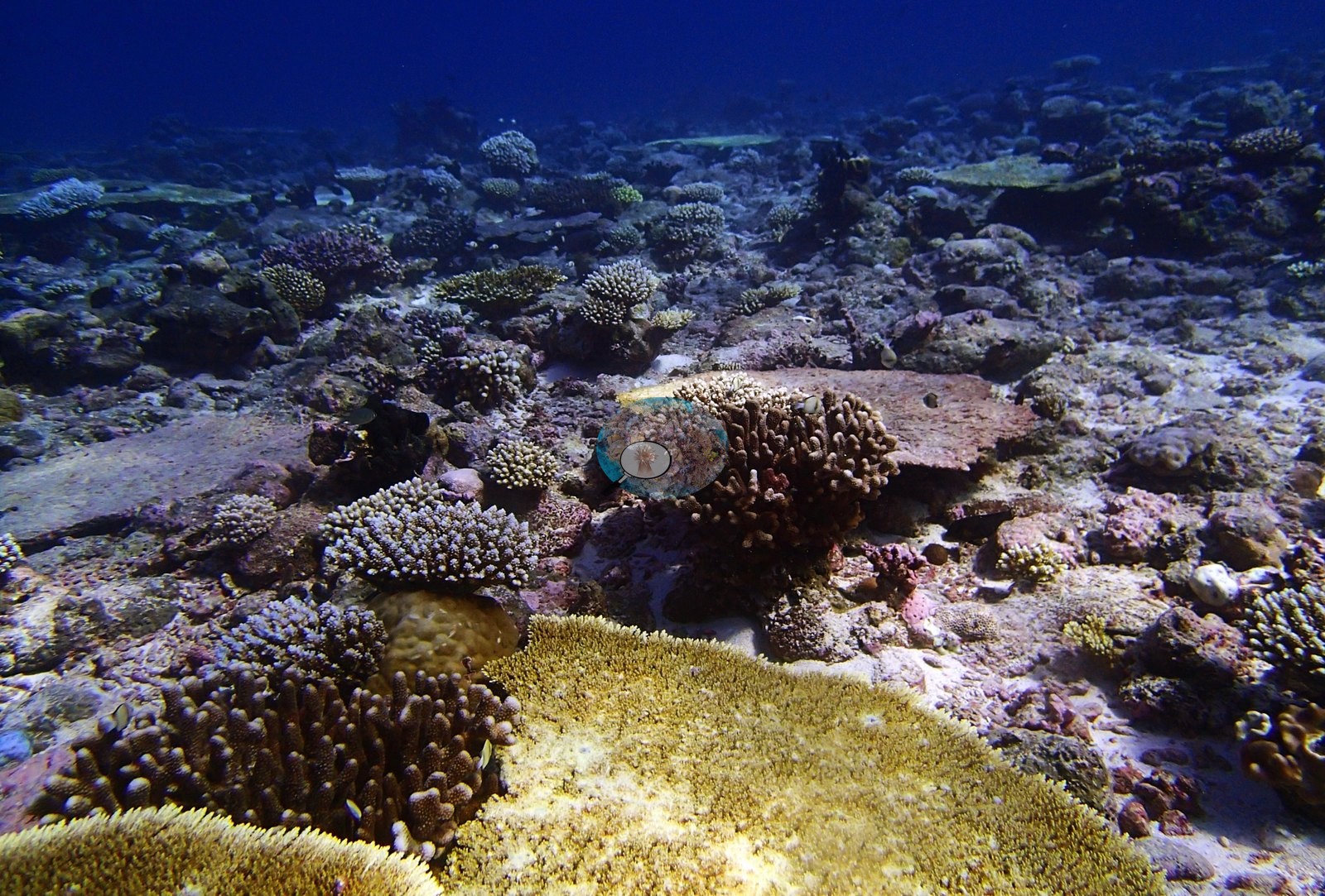
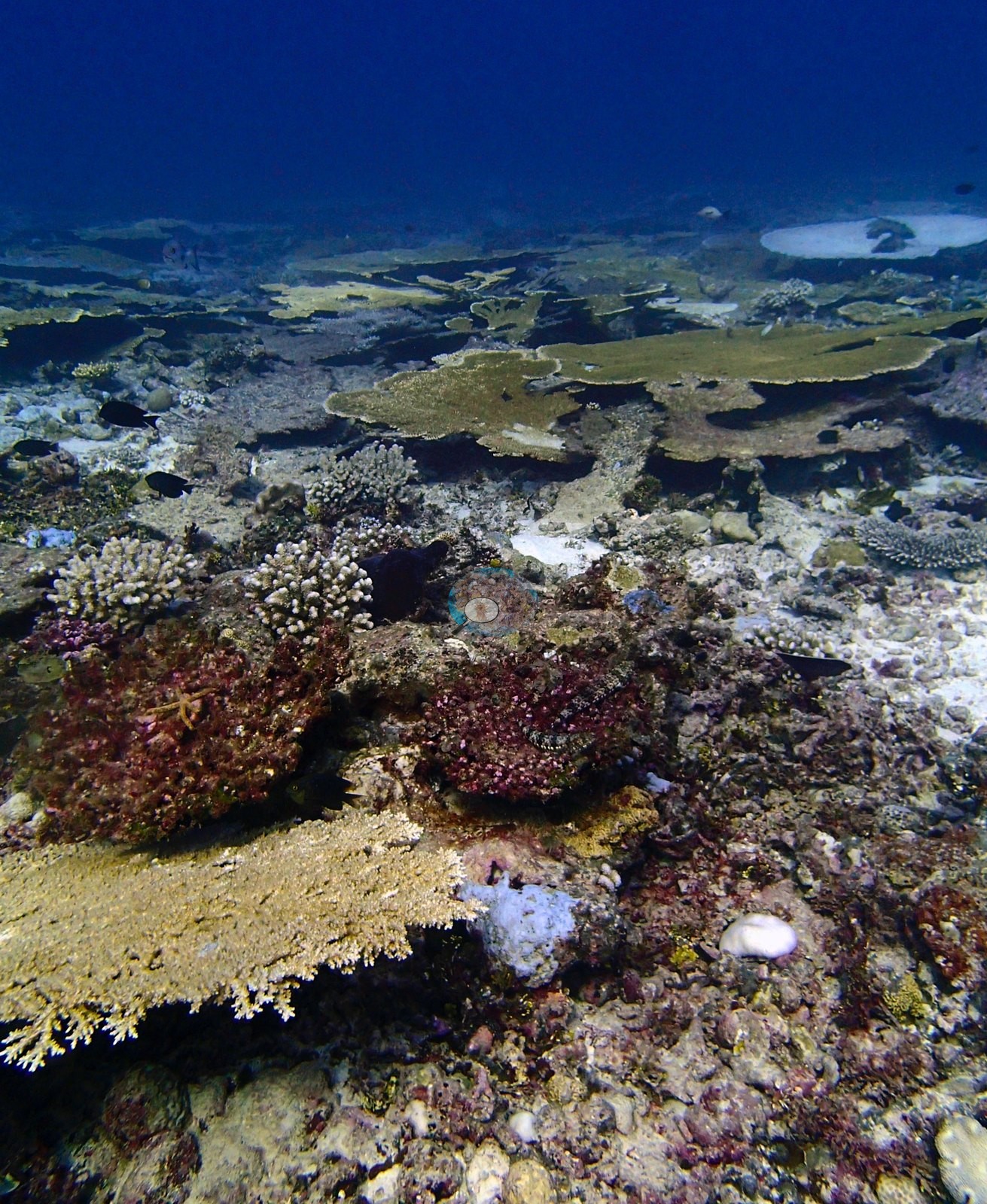
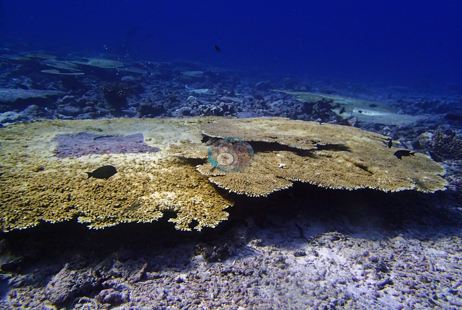
4 of these 26 photographs are shown beside the text that discusses them under "Site description" below.
Site description
Setting
BISP95 is a high-cover lagoonal patch reef whose defining feature is not its coral but its heterogeneity — and a dense marine macrophyte meadow that no other site in this batch carries.
General benthic features
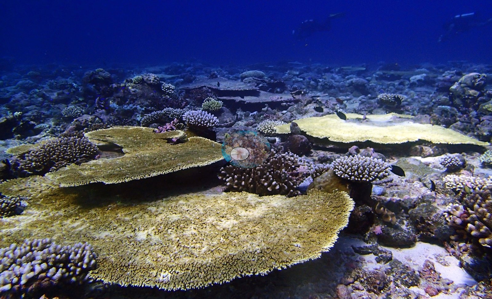
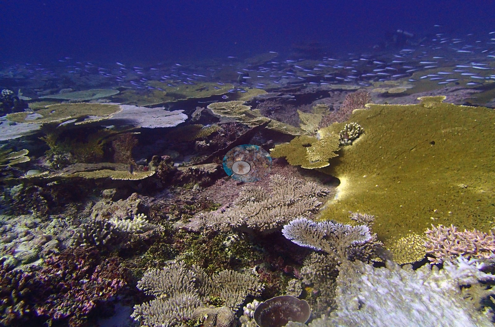
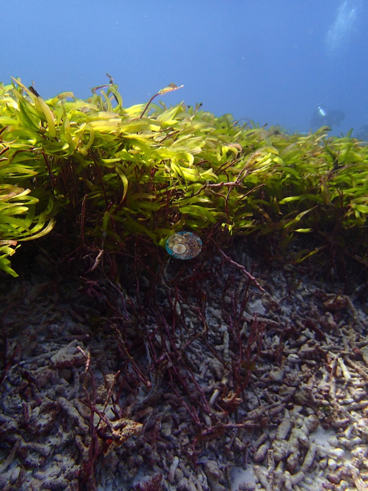
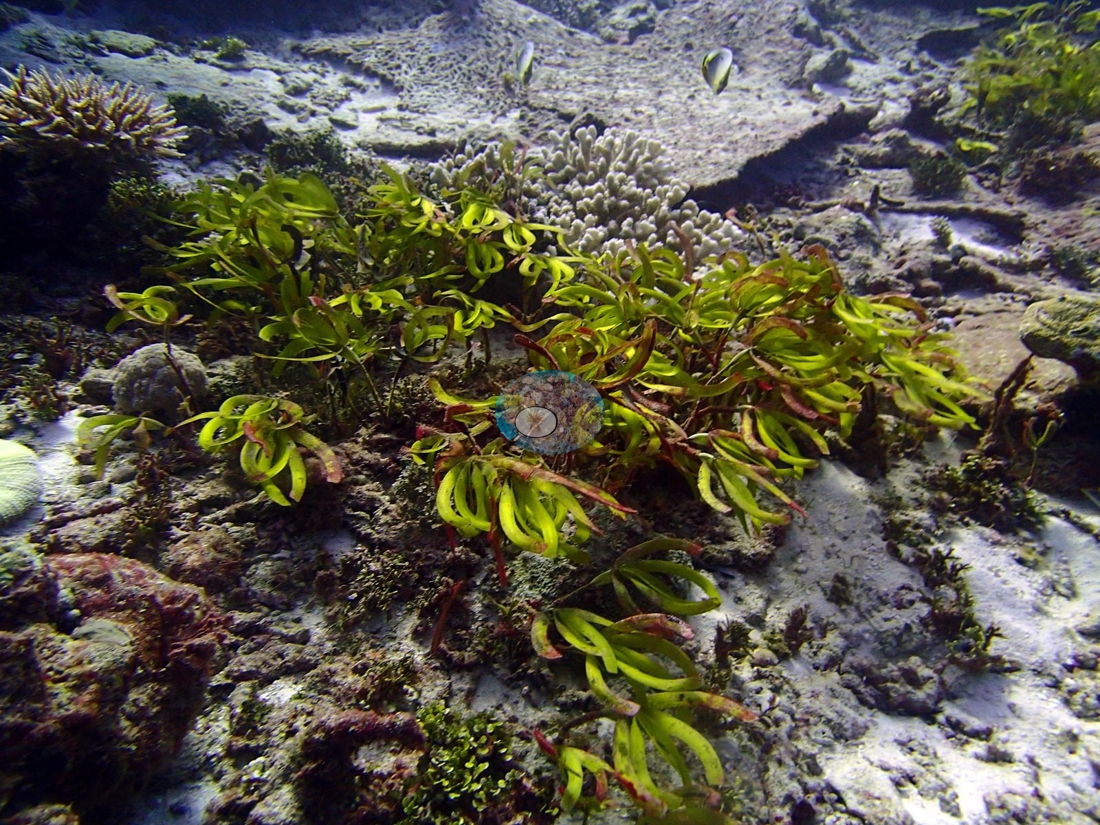
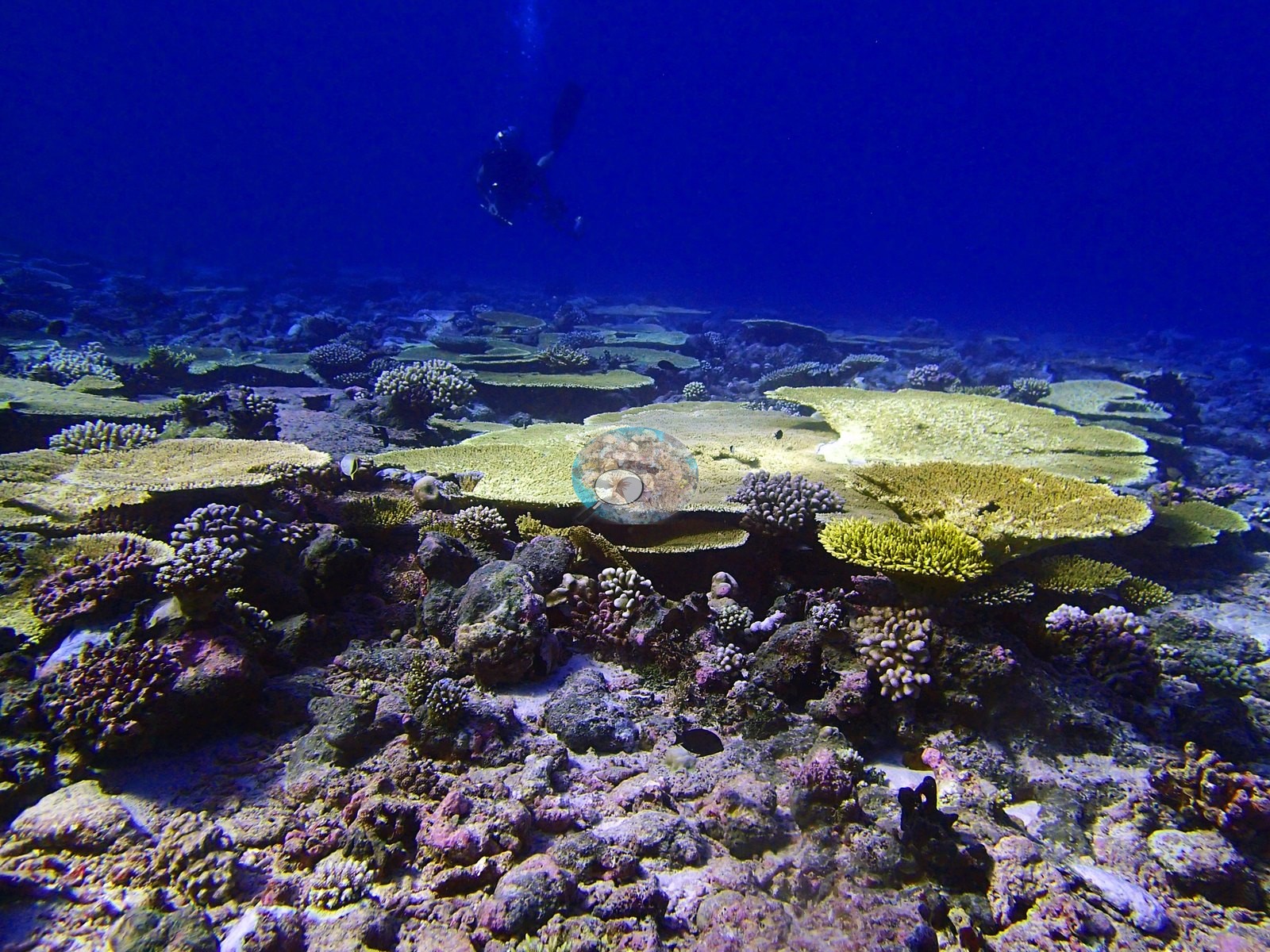
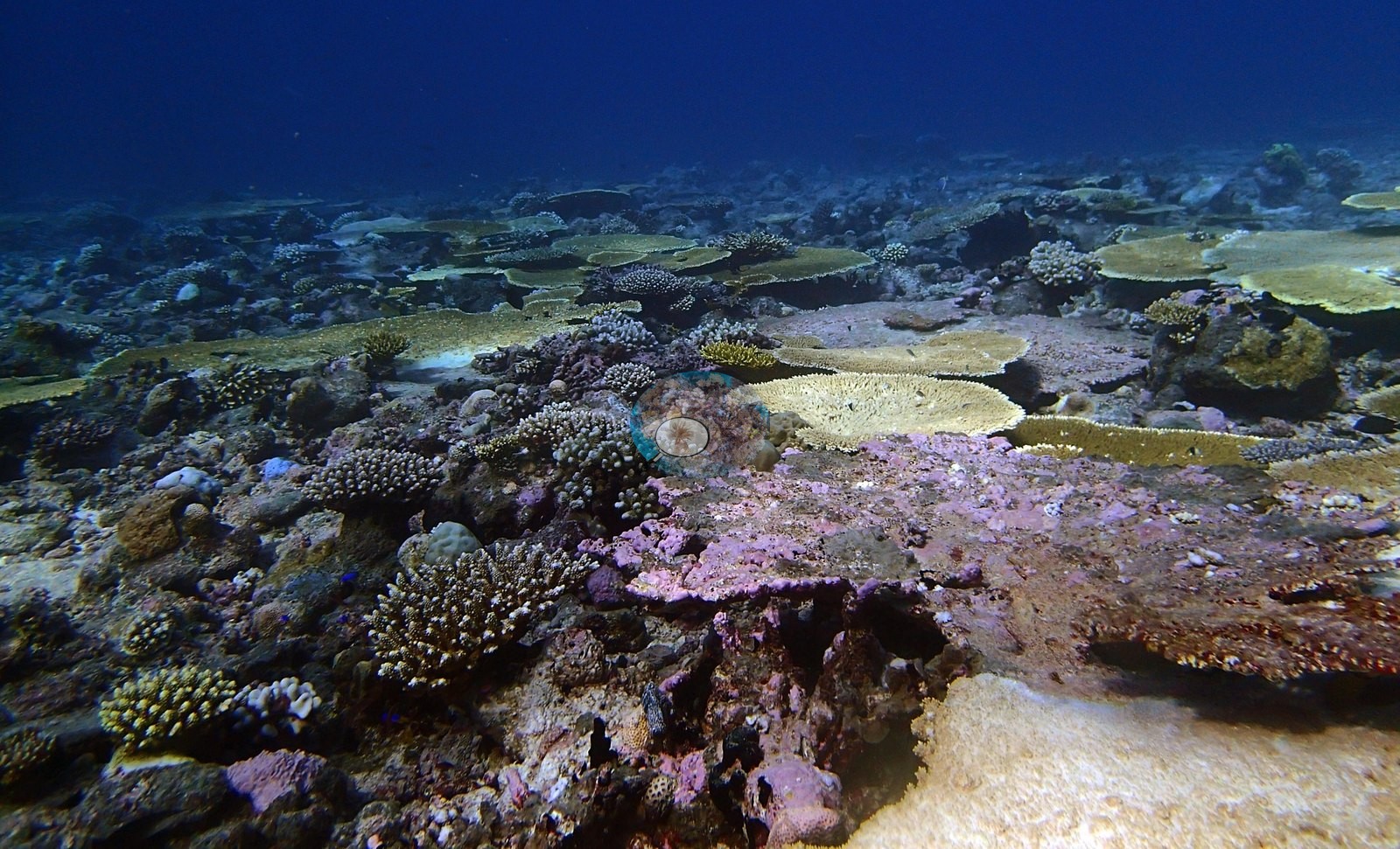
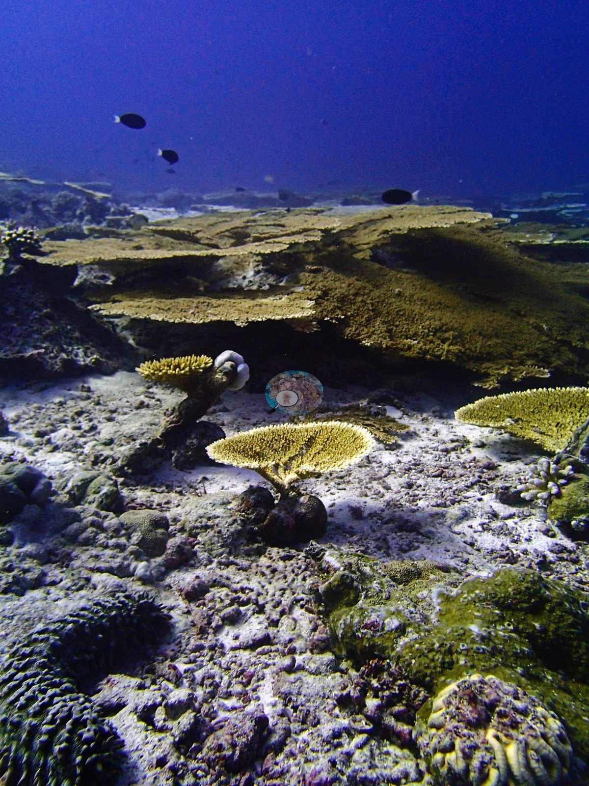
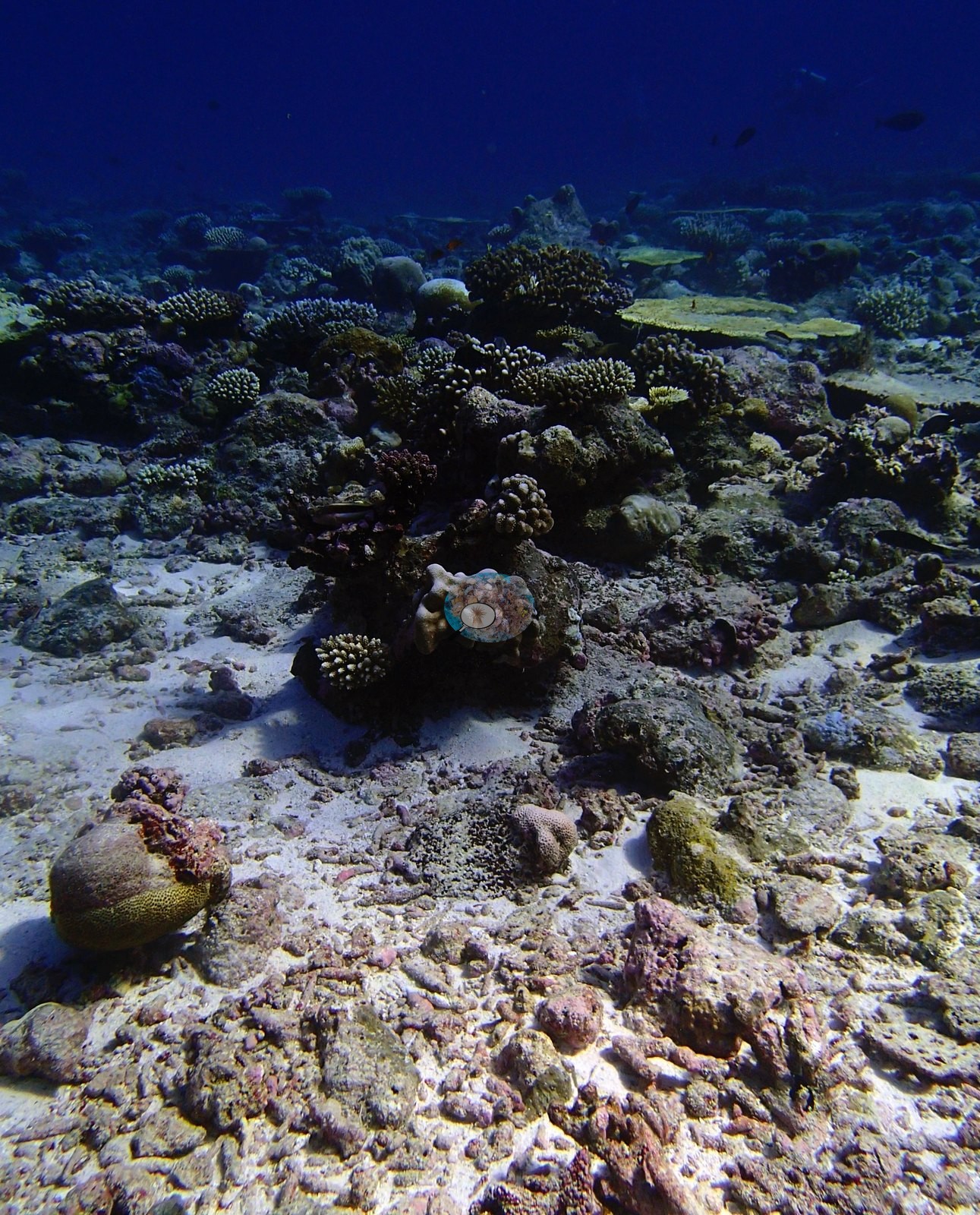
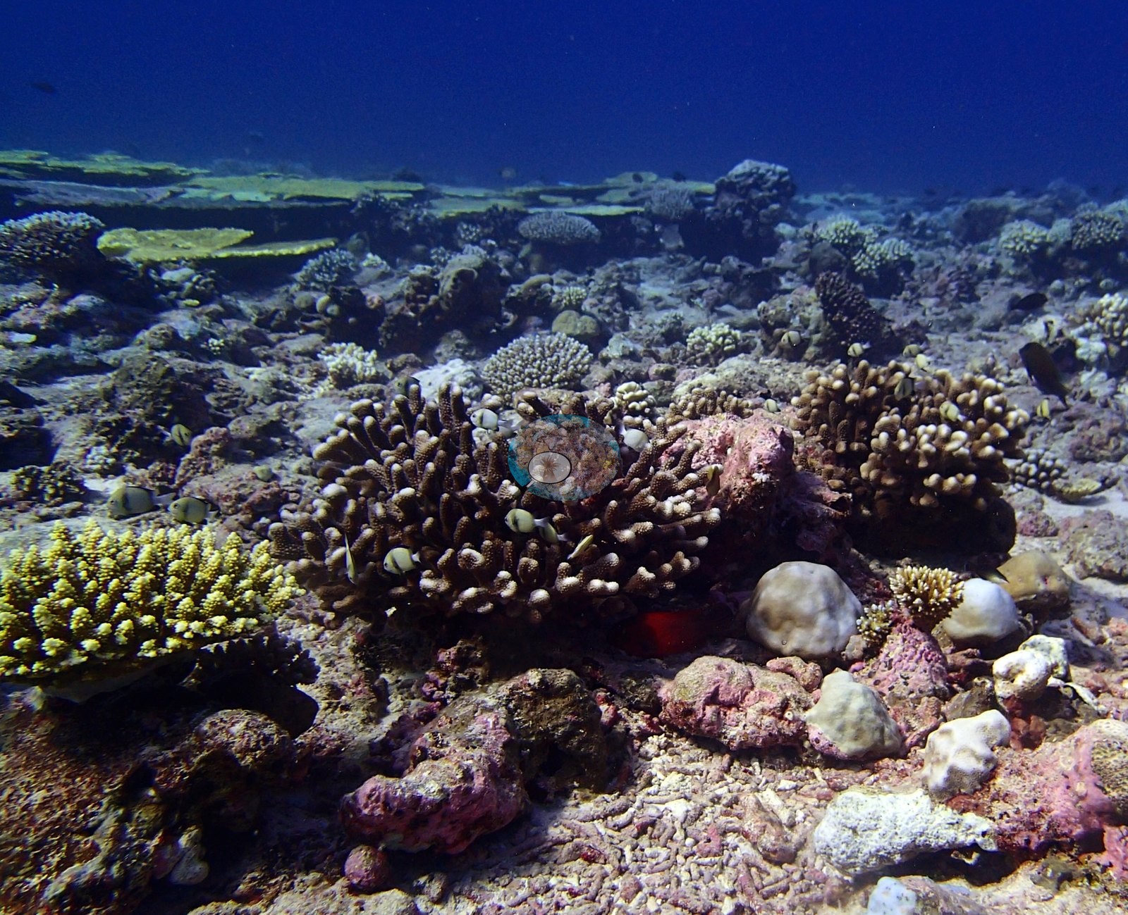
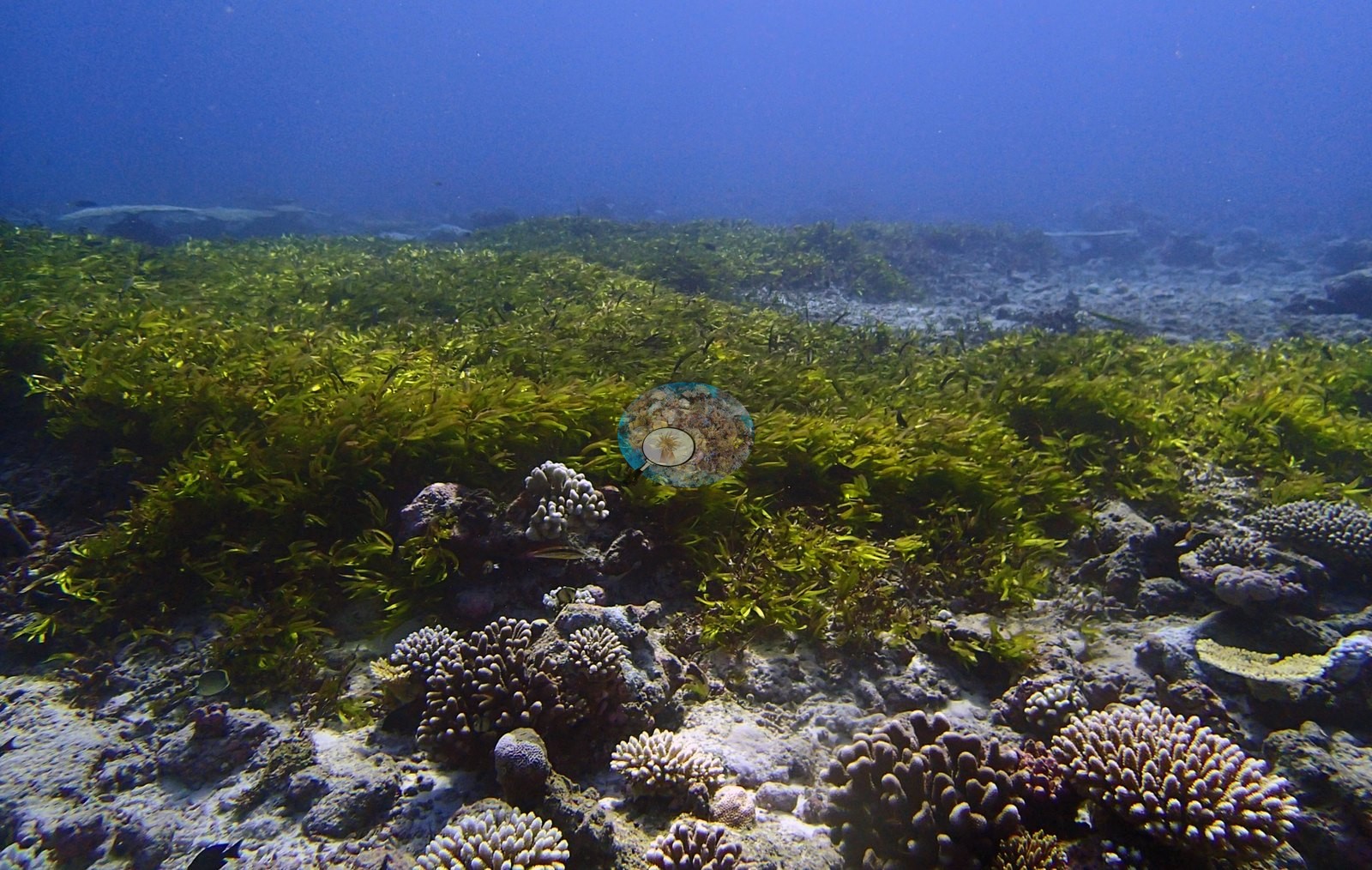
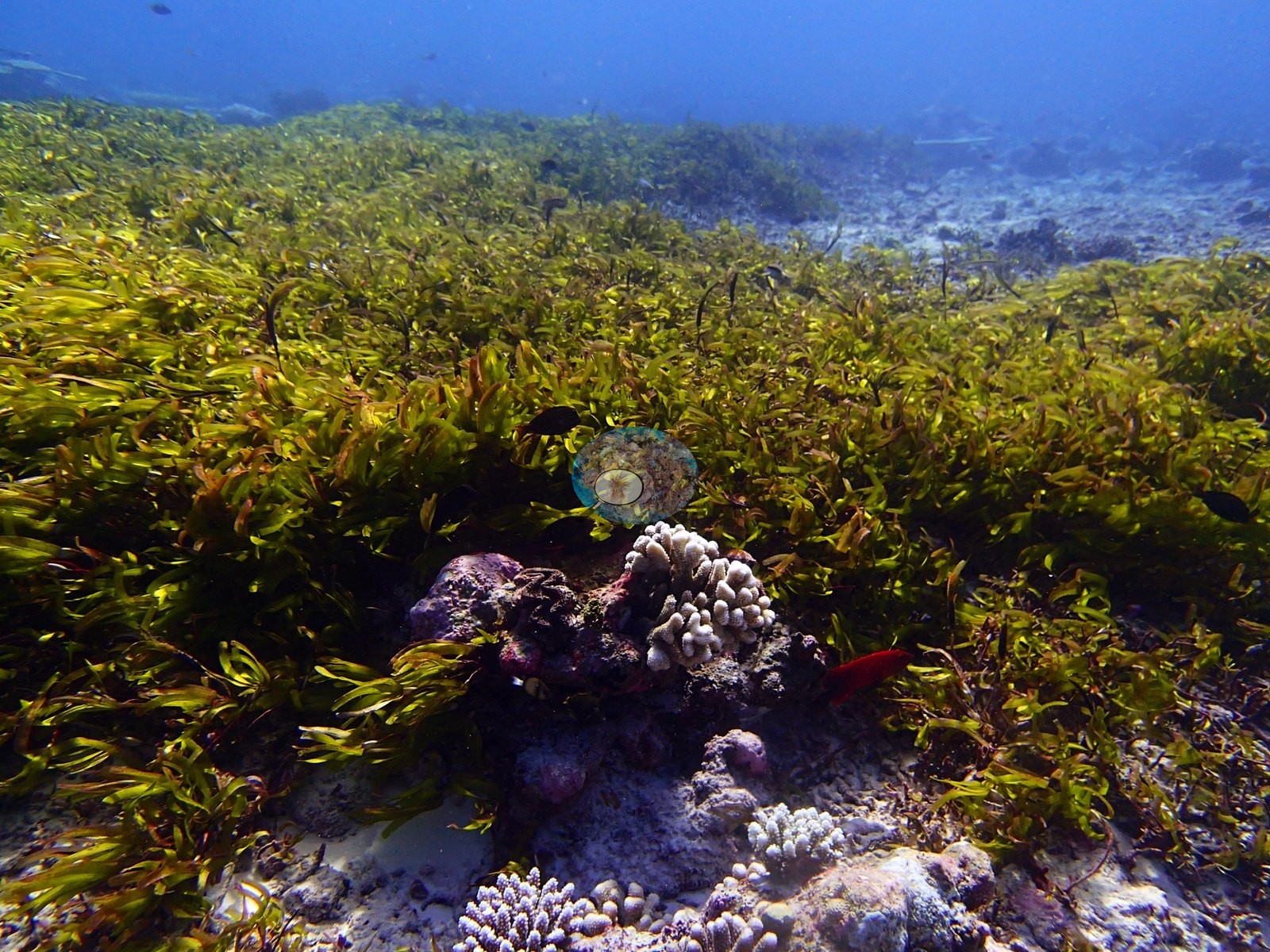
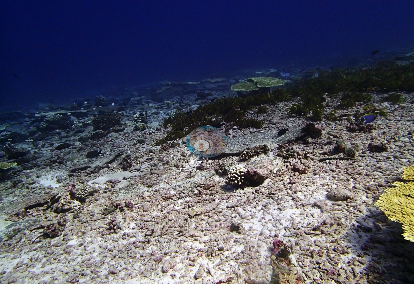
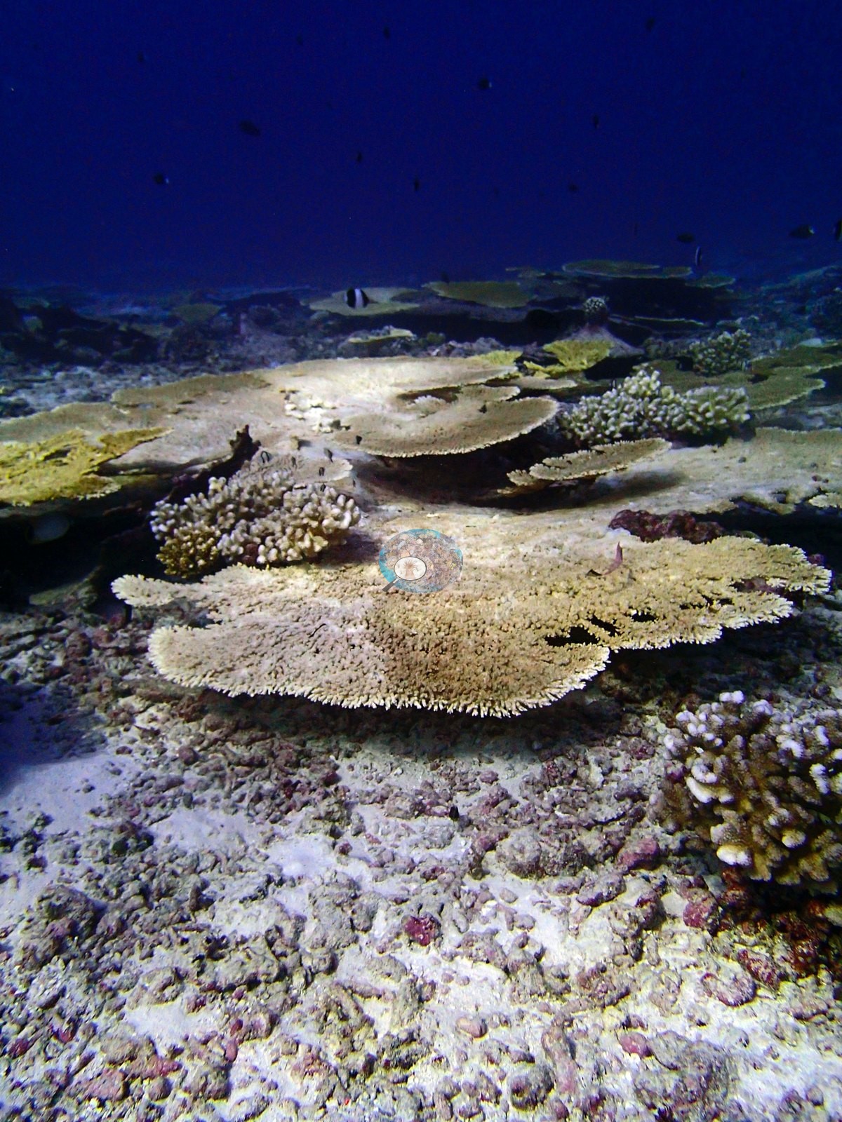
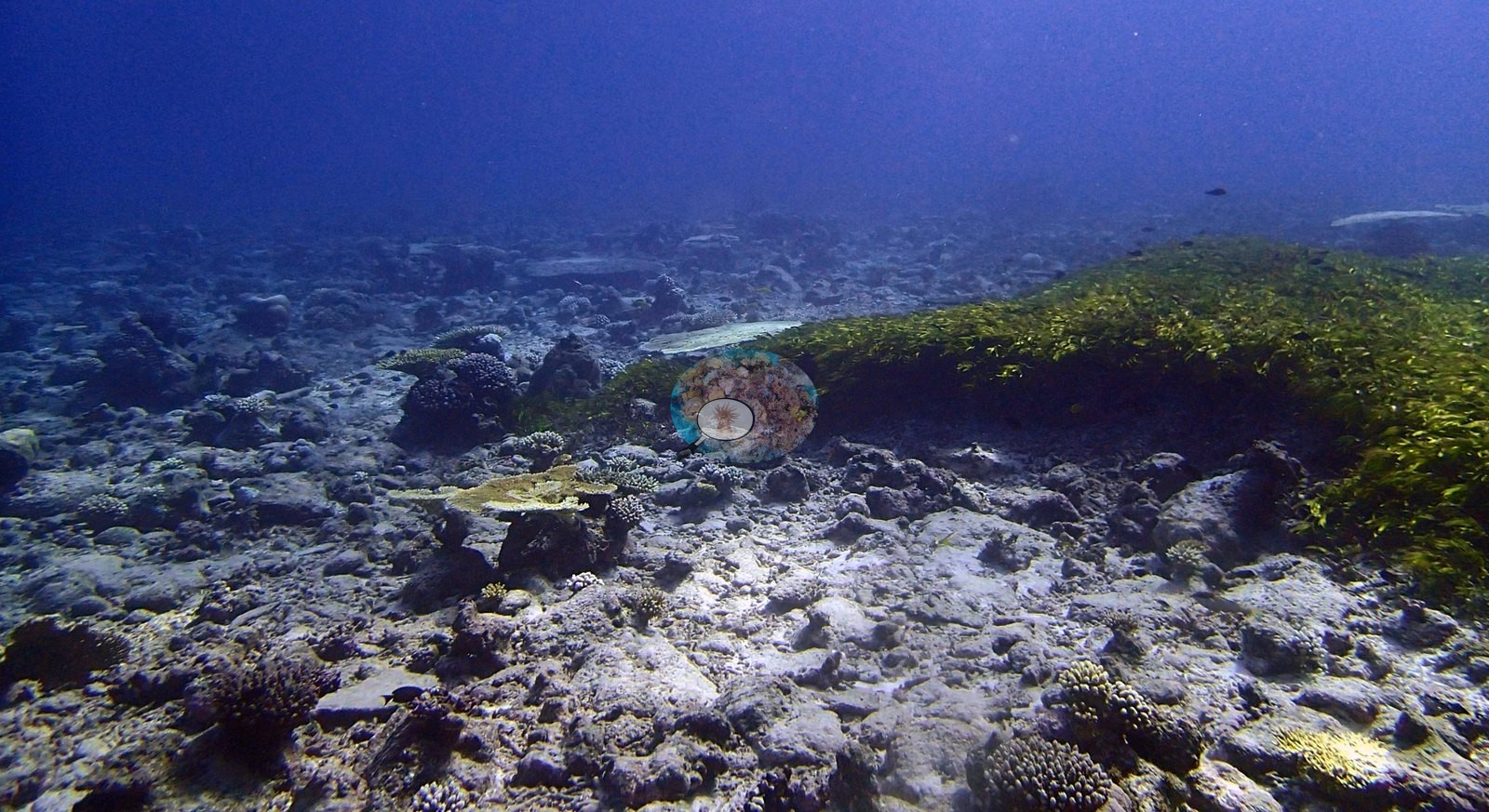
Bare substrate is correspondingly high at 15.2%, with coralline algae 9.6%, turf 8.7%, macroalgae 2.9%, non-coral invertebrates 1.2%, and erect algae 0.9%. The assemblage is strongly Acropora-led across 15 non-zero genera. Acropora holds 46.67% of the benthos — 82% of all coral recorded — then Porites 3.07%, Pocillopora 2.77%, Stylophora 0.93%, Heliopora 0.67%, Pavona 0.60%, and Cynarina and Platygyra both at 0.53%. Seven further genera fall below 0.5%. Algal cover barely moves (25.0%, 25.6%, 29.5%). The genus order is stable throughout — Acropora, then Porites and Pocillopora — so unlike most sites in this batch the site mean is a fair summary of composition, if not of cover. The strap-leaved meadow is the site's distinguishing habitat. One frame shows elongated ribbon-like blades rooted among coral and rubble, and a later run of frames shows a broad meadow occupying much of the bottom. Its form is compatible with seagrass or a seagrass-like marine macrophyte, but the photographs do not justify a species name and none is assigned. The meadow provides a habitat wholly different from the table-coral patches and is the main reason the site reads as heterogeneous. Coral architecture is most developed in the first and middle portions of the sequence (e.g., Image 1, Image 3).
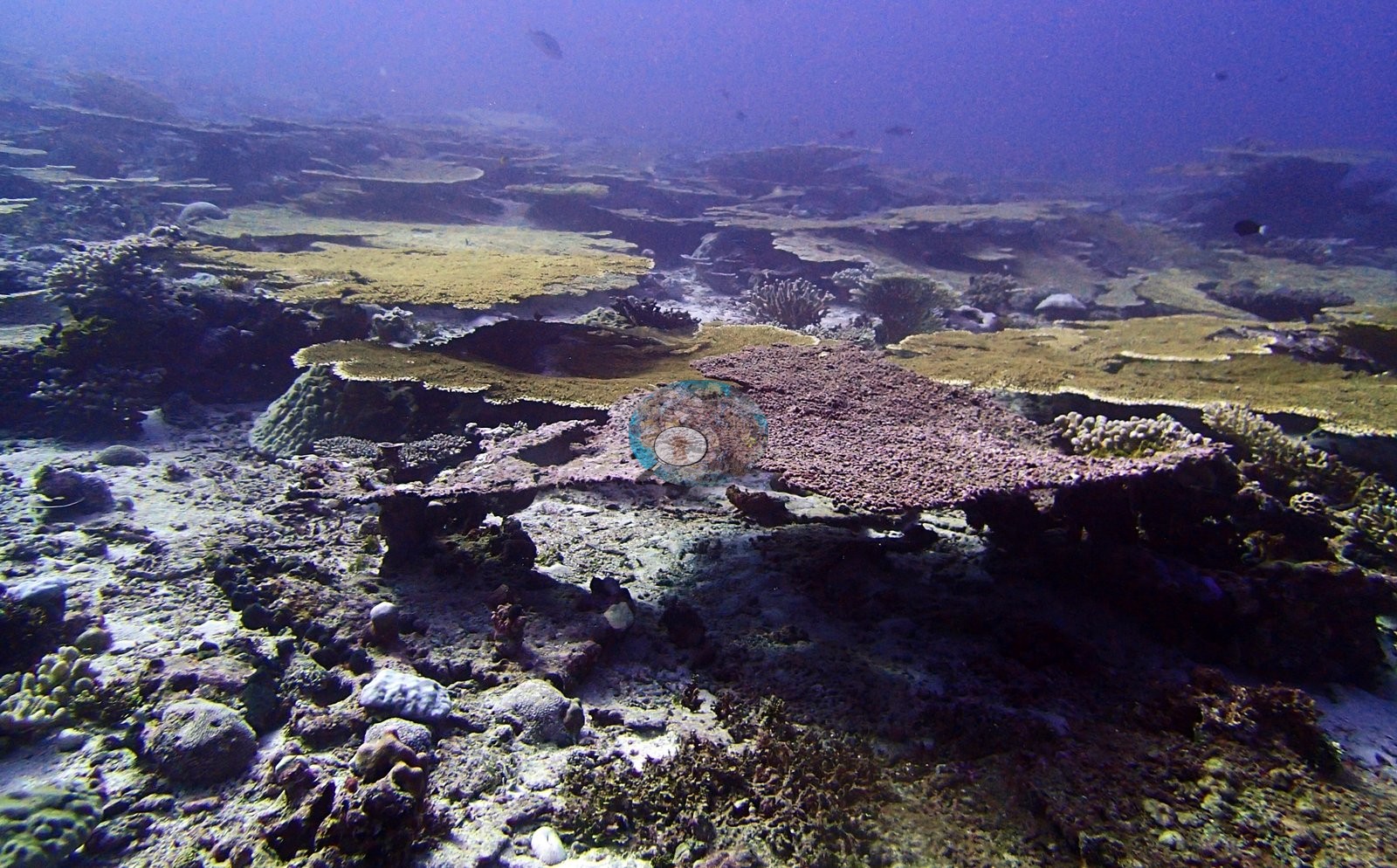
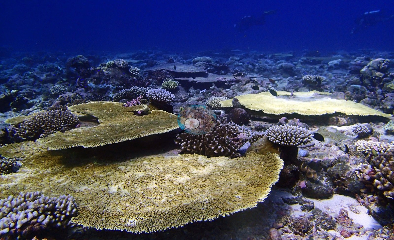
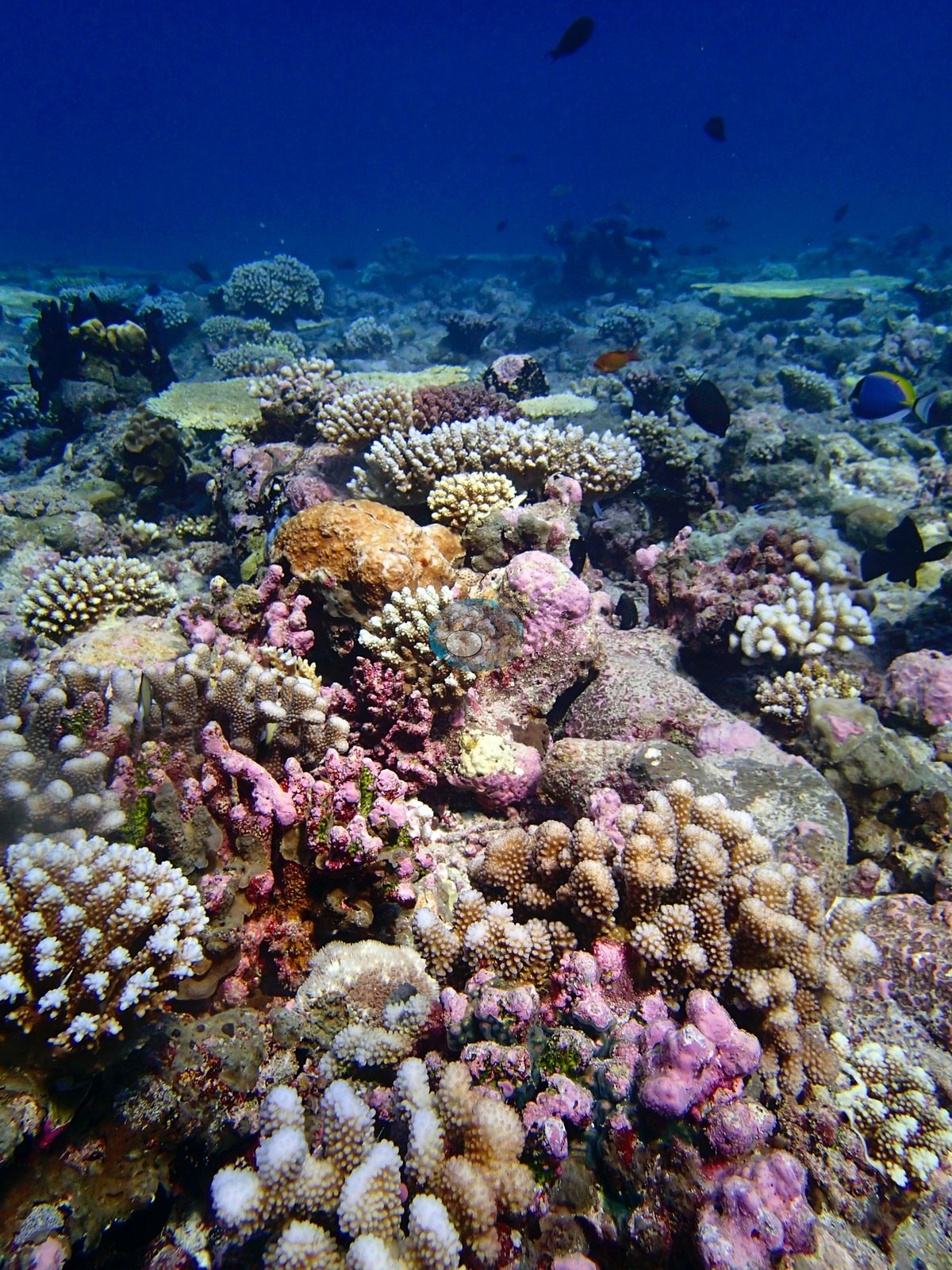
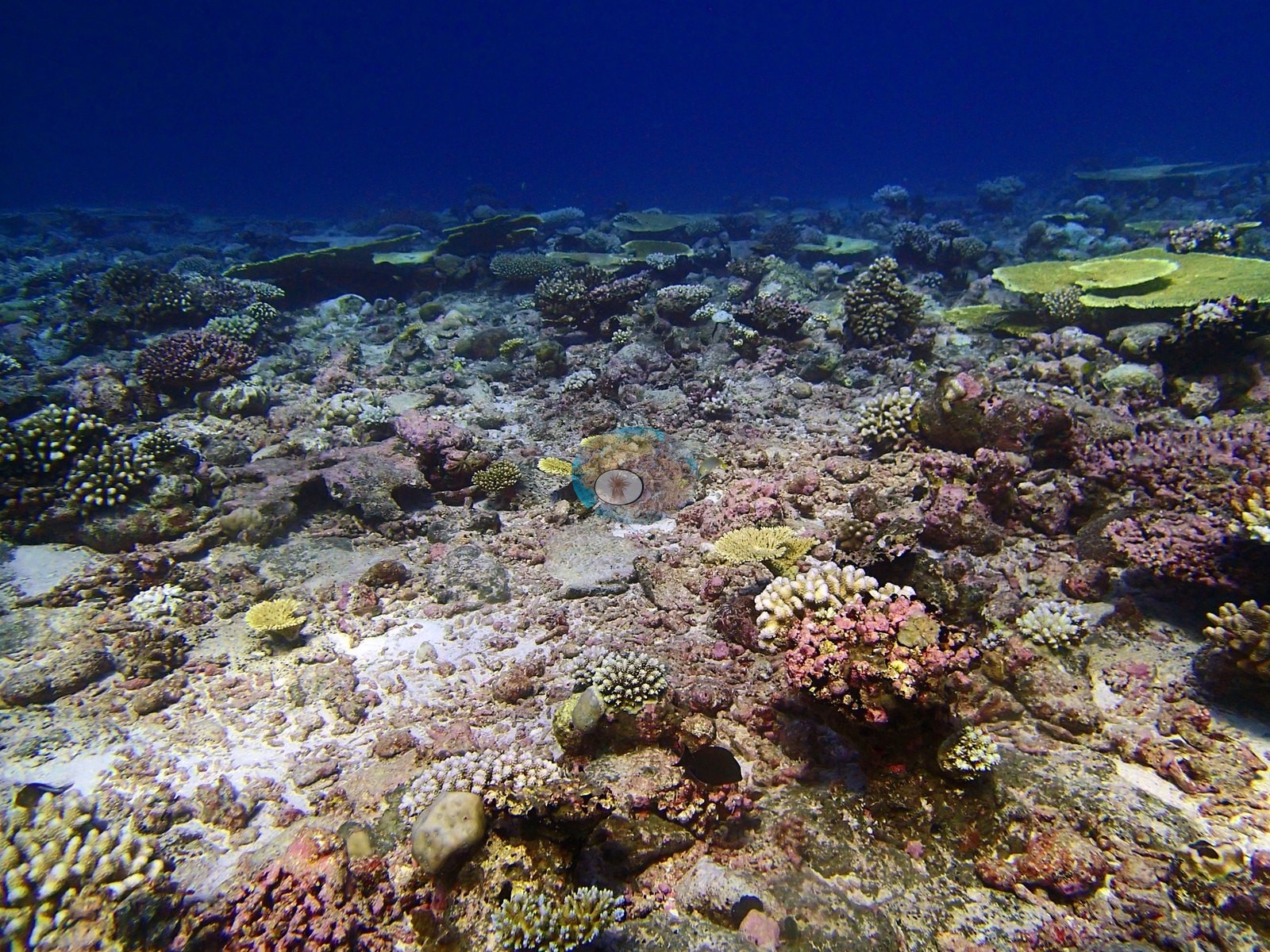
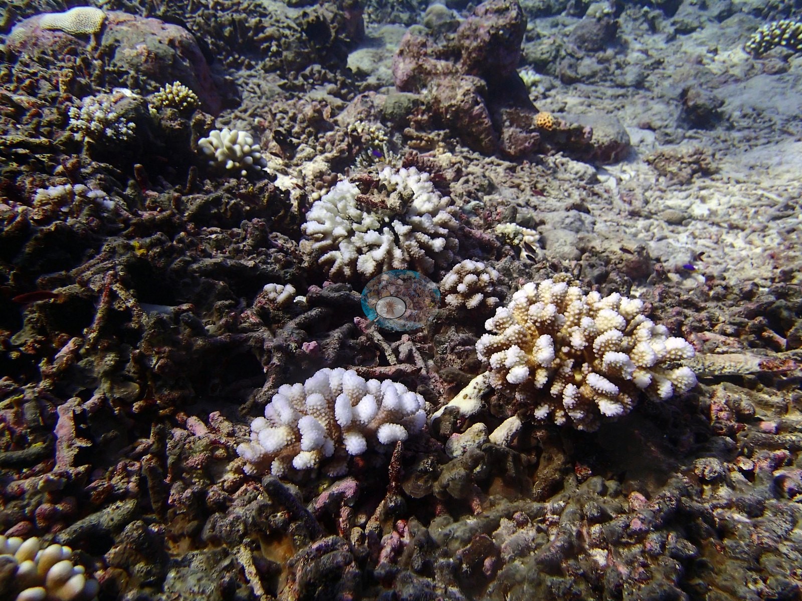
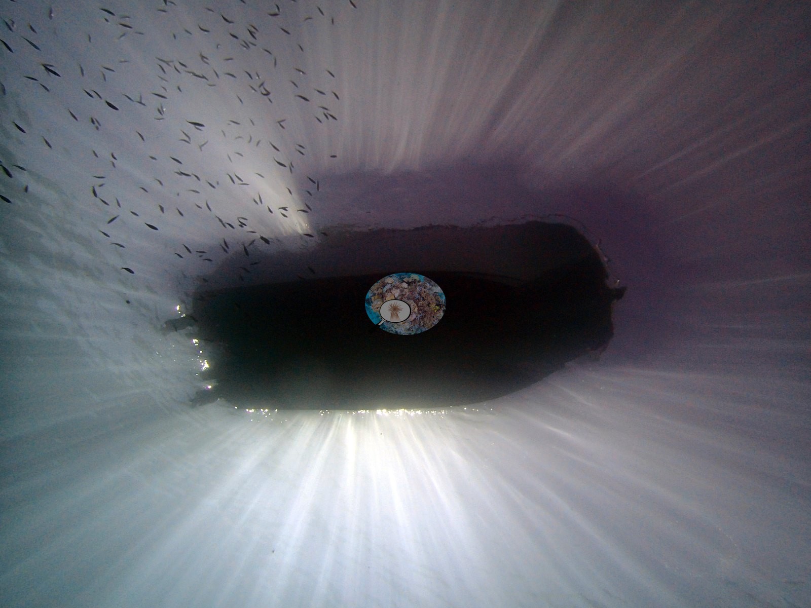
Two frames show overlapping tables with branching colonies in the gaps; two more retain table and corymbose forms but include more exposed substrate; another two show mixed coral patches reappearing after the open rubble views; and a final pair shows the rubble-dominated ground between them. The habitat is genuinely patchy — locally broad living canopies coexisting with low-relief areas where carbonate debris and old framework dominate (e.g., Image 2, Image 4).
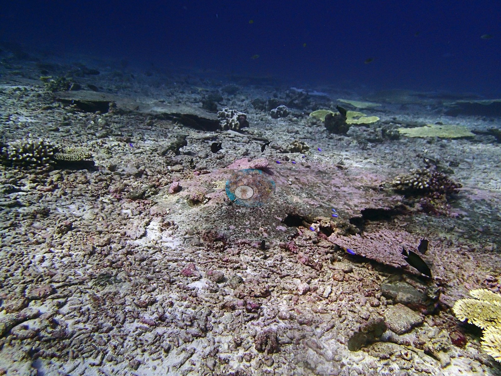
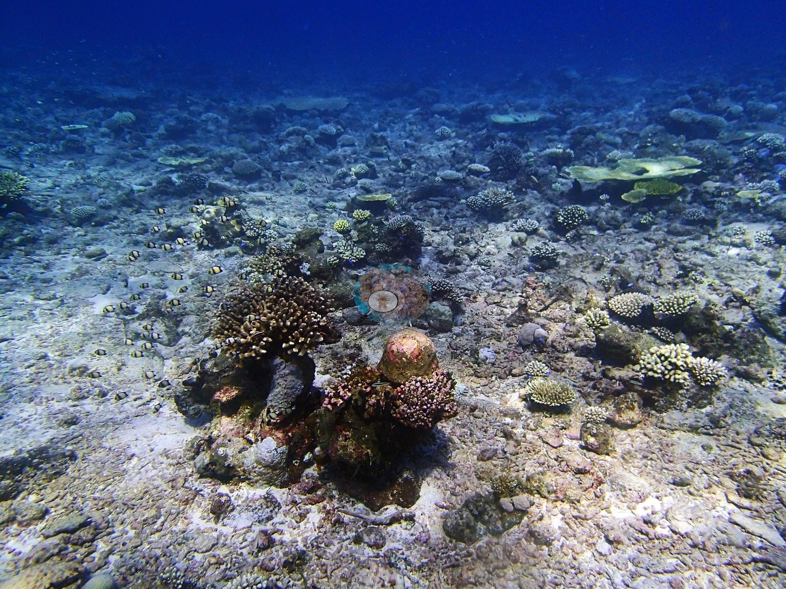
The photographs document a strongly patchy reef — table canopies, open rubble and pavement, and an extensive strap-leaved macrophyte meadow — plus localized partial bleaching in branching colonies.
Coral cover
Coral cover is 57%, 12th of the 109 Chagos sites, against 26.7% algae, but the photographic sequence turns over sharply from table-dominated coral habitat through open rubble and pavement into a broad vegetated meadow. Cover is flat across the two shallower bands and drops at depth. D2 carries 64.8% coral across 11 genera with Acropora at 53.40%; D3 is essentially identical at 65.4% across seven genera with Acropora at 56.60%; D4 falls to 40.5% across seven genera with Acropora at 30.00%. Assemblage composition. Formal surveys give 56.9% coral, 26.7% algae and 1.2% non-coral invertebrates, the coral 82% Acropora with a stable genus order across all three depth bands.
Stressors
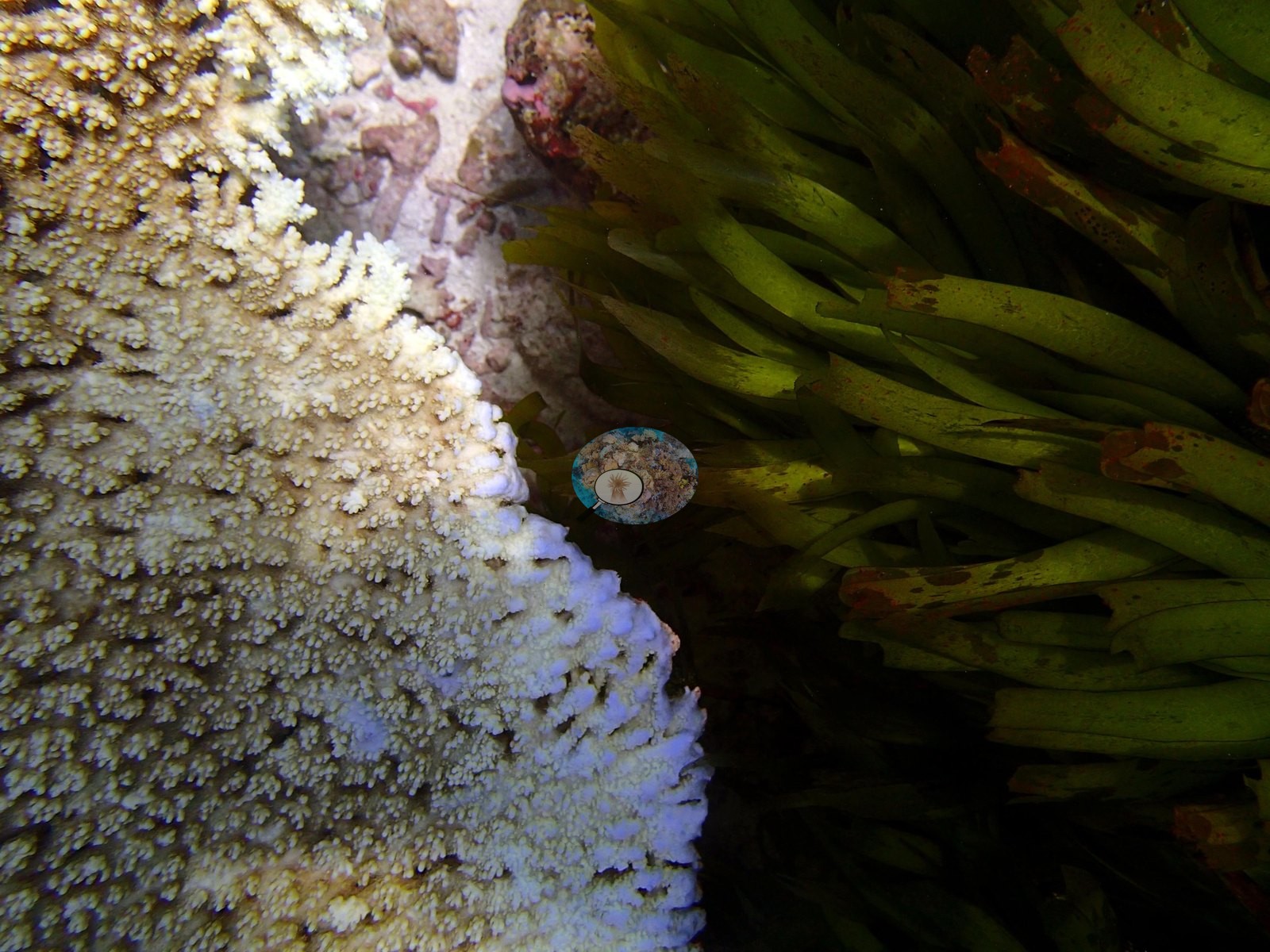
Bleaching is localized but convincing, consistent with the published 6.5% (56th of 98). One frame shows several compact branching colonies with broad white tissue patches and white branch ends while retaining brown tissue elsewhere — a partial-bleaching pattern at high confidence. Another frame shows a table edge beside the vegetation with an extended white margin, but regular edge growth and close illumination are alternative explanations, so it is retained only at medium confidence. Other pale margins were excluded where whitening was narrow and regular. The vegetation and coral are in close contact in the table-edge frame, but the still does not establish competition, abrasion, or causation and no such inference is drawn. Scattered broken branches on the rubble fields likewise cannot be attributed to a storm, an animal, or the survey. No crown-of-thorns starfish (COTS) or other corallivores evident.
Comparisons with other data
No independent survey was made at this exact site; the nearest ones are listed in the table below.
CV model comparison
More info
Those are point counts on the photographs; this is a diver swimming a transect. The models and the reference never saw the same thing. ⚠ SITE-LEVEL ONLY. The 2,500 frames were not associated with any transect taken within 200 m of them, so transect-vs-image comparisons are site means, never frames. The transect value is already in the pin `cover` field (109 of 112 pins, sourced to the paper's suppl. S1) and is read from there, never re-imported. The transect is THE coral-cover value for this site and stands alone. The rows below it are a methods comparison only: no computer-vision value is averaged with it, feeds the headline, or carries over to the site's cover figure (Anderson, 2026-09-22).| Method | Hard-coral cover (%) |
|---|---|
| Transect (published) | 56.9 |
| CoralNet | 21.9 |
| In-house DINOv3 | 20.4 |
| CoralSCOP edited | 23.1 |
| Claude | 17.8 |
Independent surveys nearby
Within 5 km, 3 independent survey stations recorded hard coral cover in 2015. The most recent nearby survey is from 2015, so these values predate recent heat stress. This site's own estimate (57%) sits 27.3 points above the range of these surveys (20–30%); the methods differ, so the comparison is context, not a like-for-like test.
Collected by other programs using different methods (the XL Catlin Seaview Survey uses photo-transects with automated image annotation), so these are context for the figures above, not a like-for-like comparison. Where a station was surveyed more than once the range is shown. Station names are not dive-site names.
| Agency | Site / location | Date | Hard coral cover (%) | Distance | Link |
|---|---|---|---|---|---|
| XL Catlin Seaview Survey | transect 36022 | 2015 | 30% | 1.99 km | — |
| XL Catlin Seaview Survey | transect 36021 | 2015 | 21% | 2.93 km | — |
| XL Catlin Seaview Survey | transect 36023 | 2015 | 20% | 4.71 km | — |
Data & links
- Read the full site report ↗
- Download benthic survey data (CSV) ↗
- Download all LOF-GRE data (933 sites) ↗
- CoralNet image repository for this region ↗
- HeatCRD database ↗
- (reference) ↗
- Photo portfolio ↗
- Coral Reef Diagnostics page for this area ↗
All images from Coral Reef Diagnostics. Data are from Coral Reef Diagnostics and the organizations named in the data-sources table above.
 © Coral Reef Diagnostics.