
Part of the regional summaries: Chagos Archipelago - Salomon / Blenheim / Speakers Bank and Chagos Archipelago
More info
Chagos (NOAA CRW virtual station)An exposed Salomon forereef defined by its condition: at 31.5% bleached, it ranks second-worst of 98 Chagos sites, and the photos back that up emphatically. It is also the richest site in its batch, with 29 coral genera, and unusually Acropora takes over from Porites at the deepest, highest-cover transect. Surveyed on the Living Oceans Foundation's Global Reef Expedition.
Five independent survey stations shown with the program’s logo — click one to see how far it is from this site.
Eight other CRD dive sites within 5 km shown in orange — click a marker to open its page.
🗺 Detailed map of the Global Reef Expedition dive sites, Salomon Atoll, Chagos (Khaled bin Sultan Living Oceans Foundation; opens in a new window)
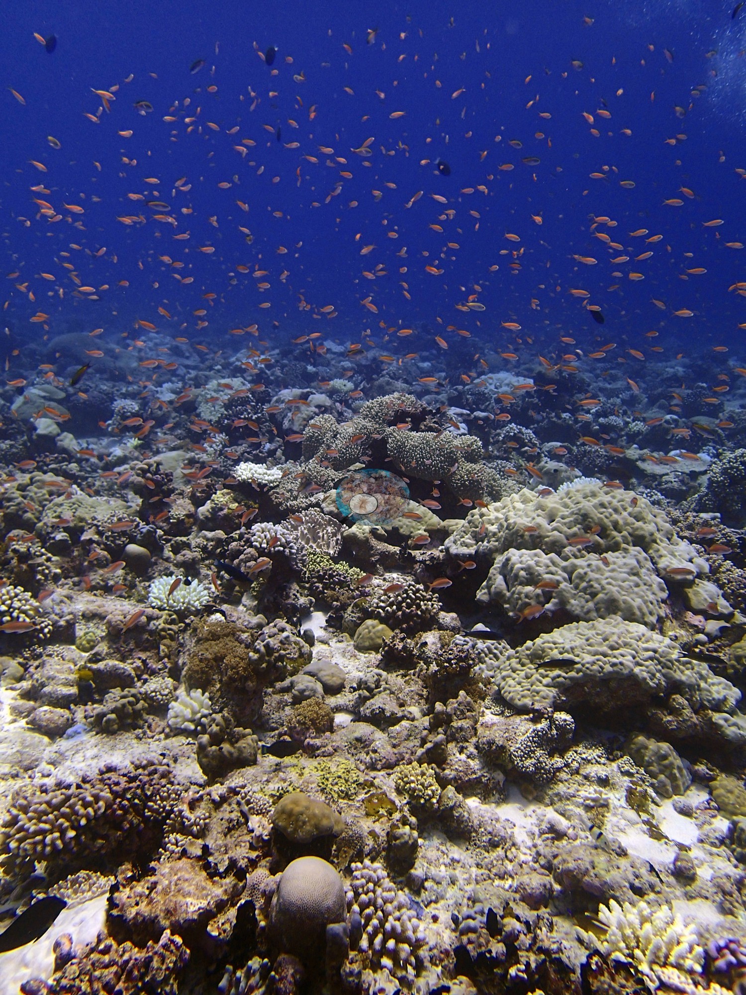
4 of these 16 photographs are shown beside the text that discusses them under "Site description" below.
Site description
Setting
BISA104 is an exposed Salomon forereef whose defining measurement is not its cover but its condition.
General benthic features
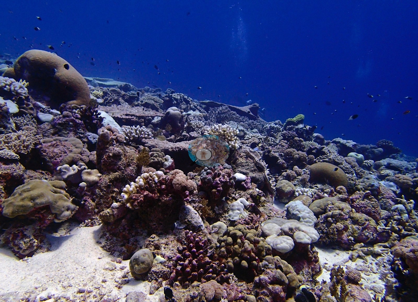
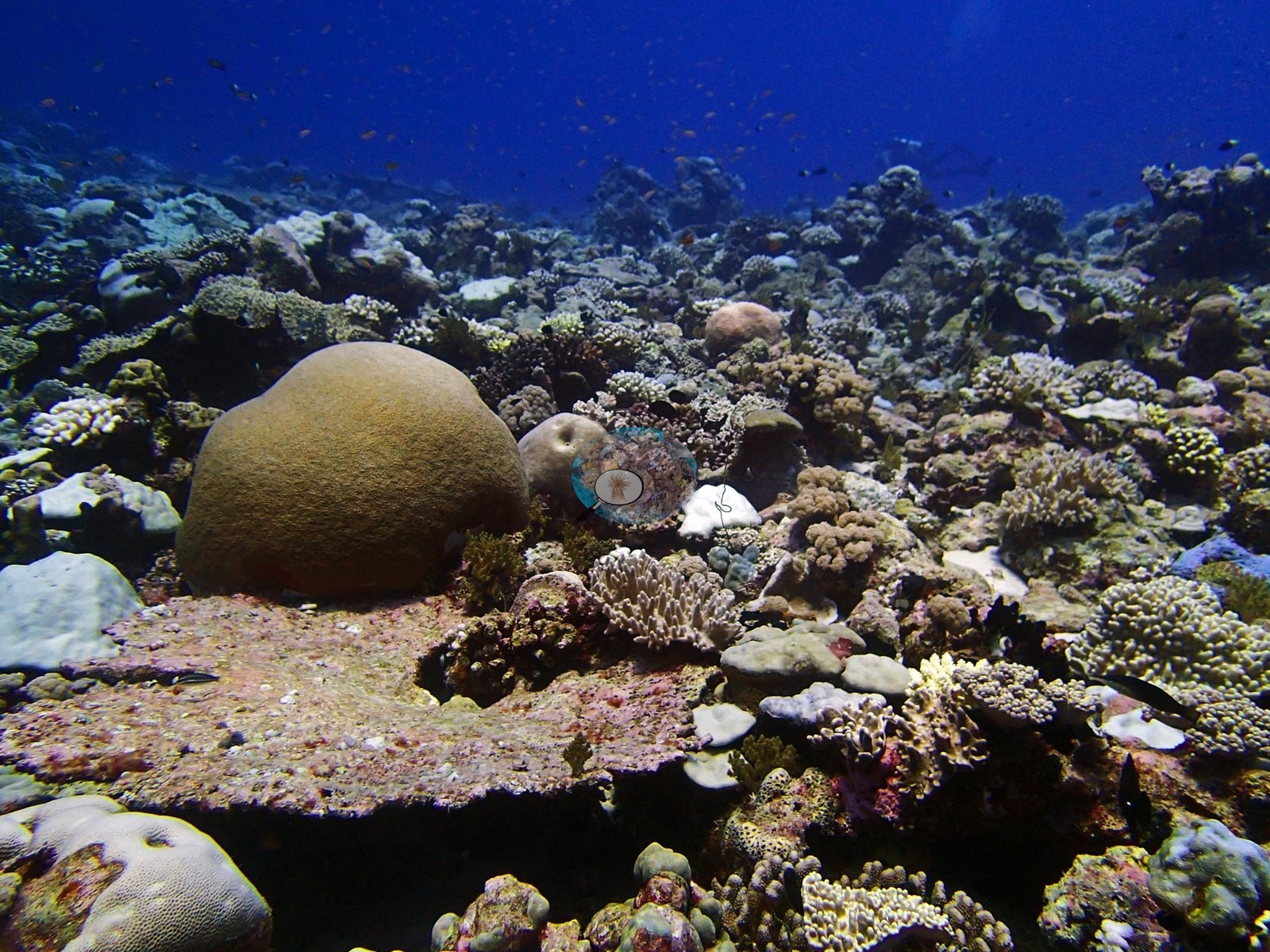
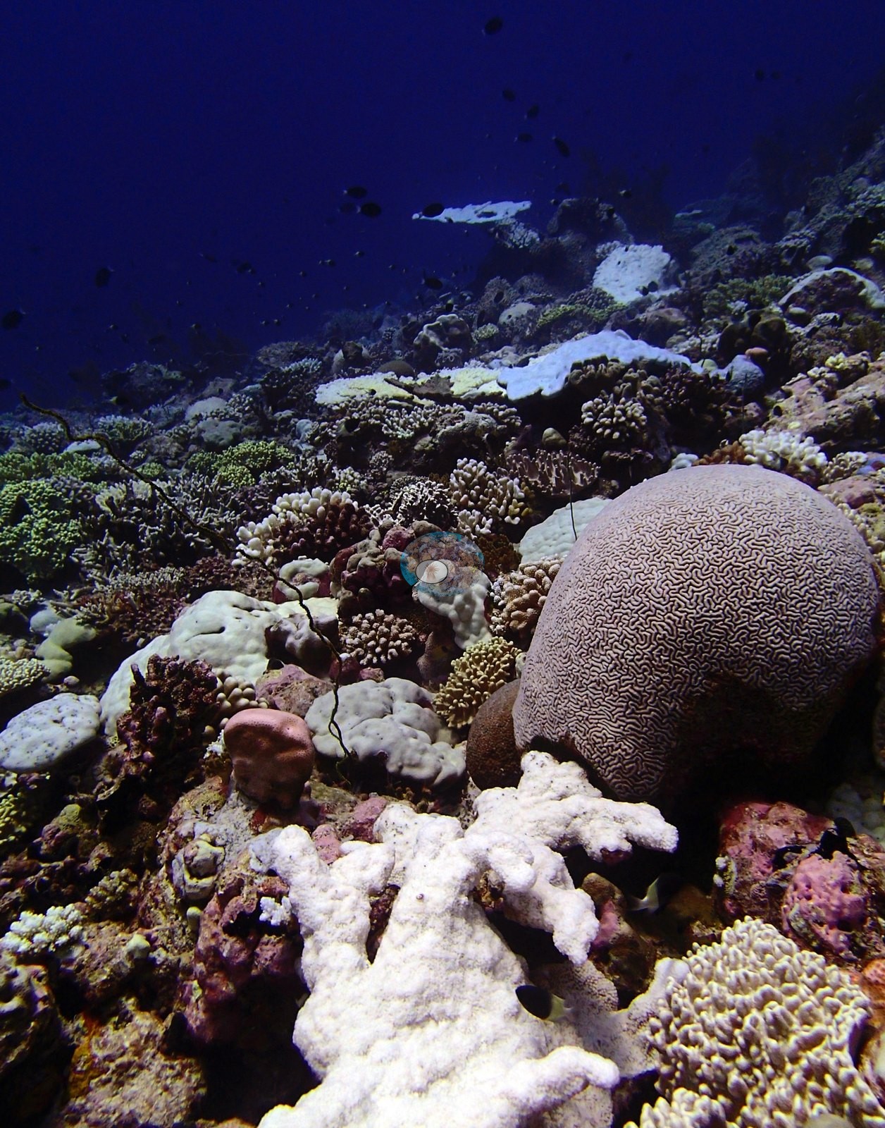
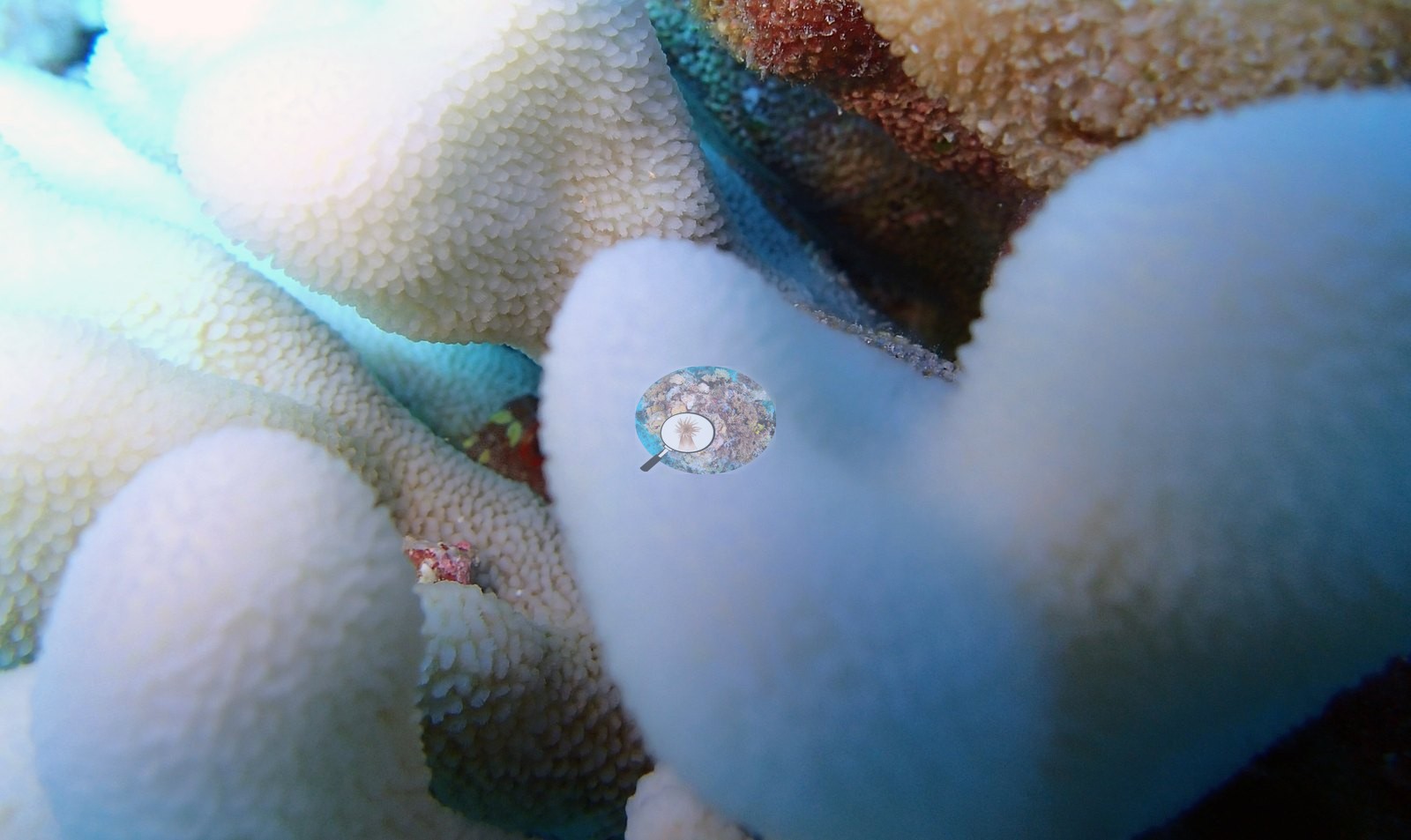
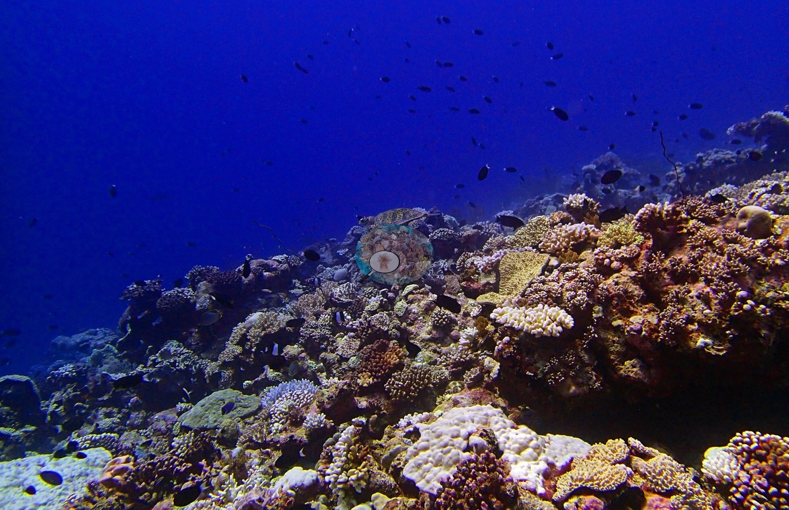
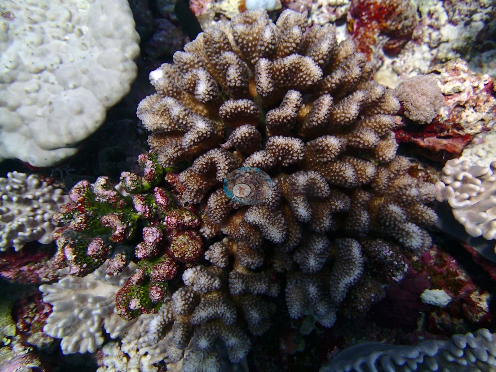
Porites leads at 12.61% of the benthos — 35% of all coral recorded — then Acropora 8.49%, Pocillopora 5.59%, Montipora 2.79%, Favia 1.11%, Pavona 0.94%, Goniastrea 0.78%, and Symphyllia 0.61%. Twenty-one further genera sit below 0.5%, among them Stylophora, Cynarina, Isopora, Cantharellus, Mycedium, Plesiastrea, and Hydnophora. Non-coral invertebrates hold 20.4% of the benthos, crustose coralline algae 16.1%, turf 9.8%, and bare substrate 9.8%. Pocillopora is strongest shallow (7.37% at D2). Genus richness rises with depth from 18 to 22 to 21 codes. The reef surface is structurally heterogeneous. Two frames show low to moderate relief with coral heads projecting from consolidated framework. One frame centers a broad, table-like colony spanning much of the frame and surrounded by smaller colonies of different forms. Another shows a sediment pocket bordered by branching and massive colonies, while a short run of frames documents a denser outcrop with varied colony sizes. This is not a continuous table field but a mosaic of coral patches, encrusted hard bottom, and small open spaces (e.g., Image 1, Image 4).
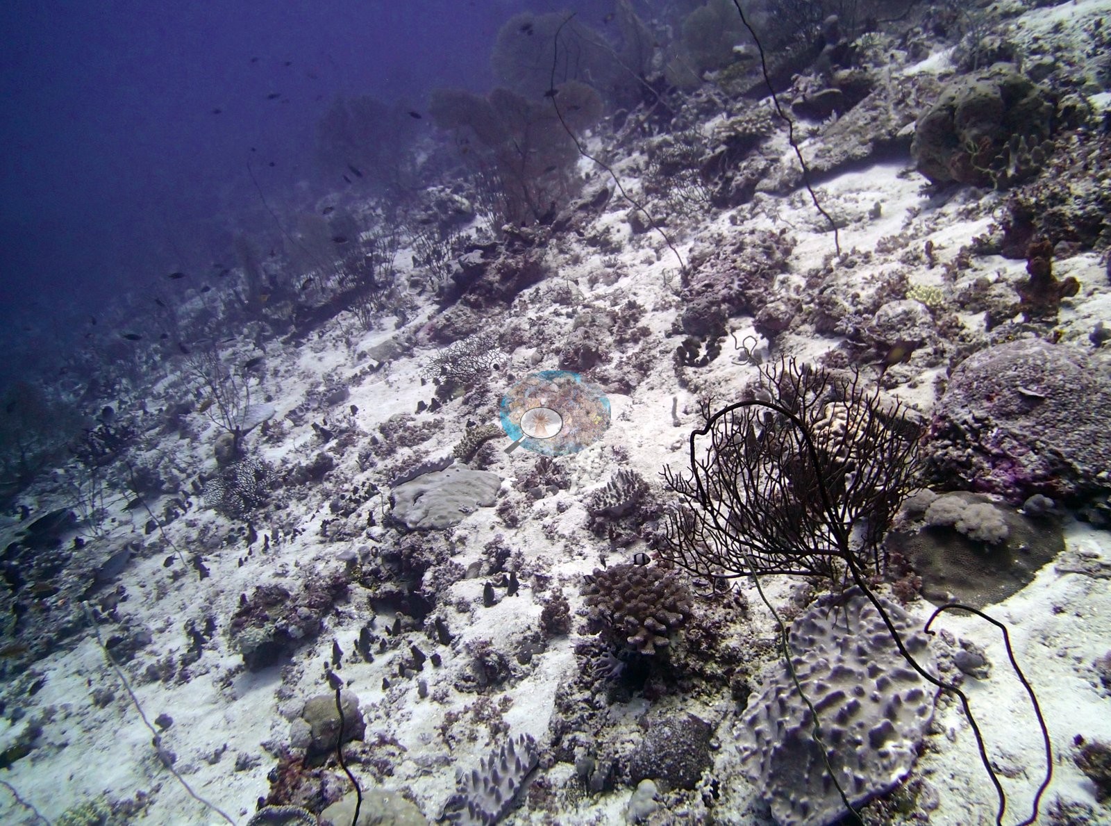
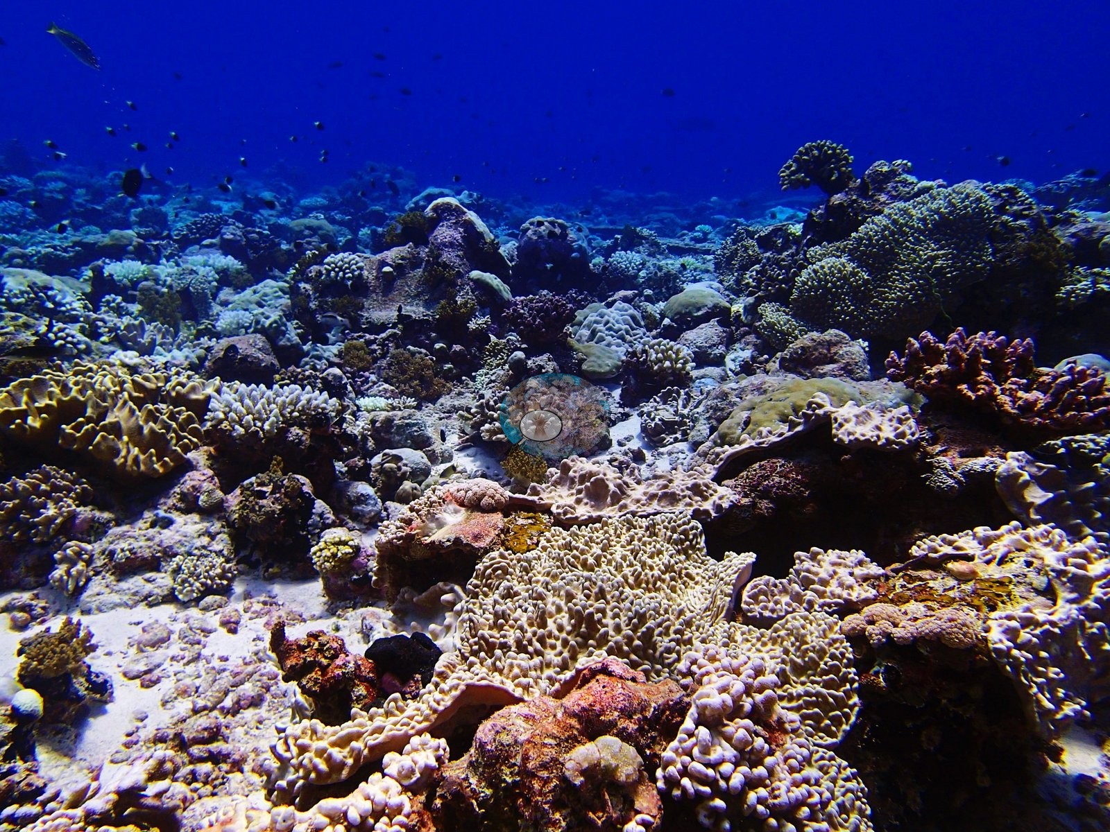
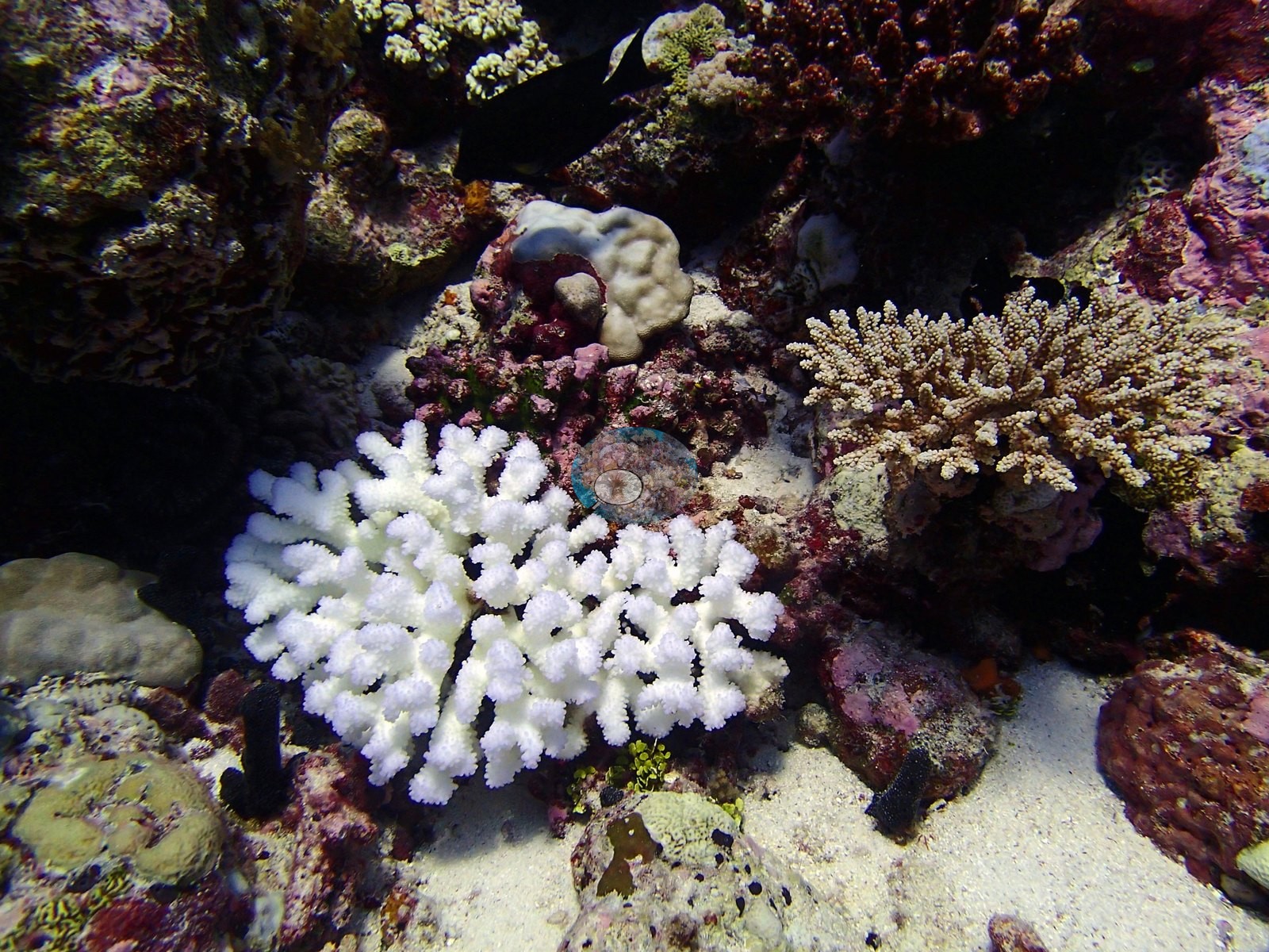
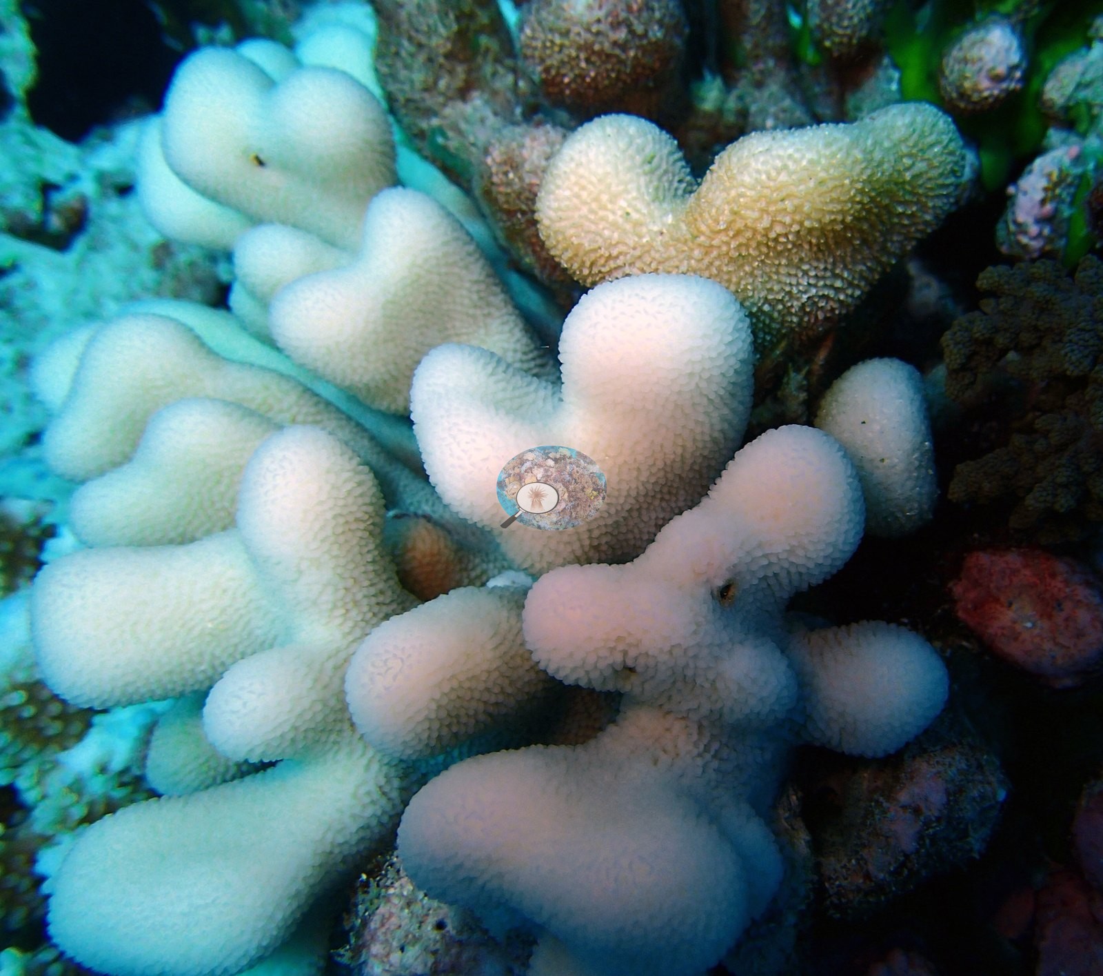
The photographs show a heterogeneous coral-and-framework mosaic — a very large table-like colony, compact branches, massive heads, and lobate forms — with bleaching widespread and visually severe across multiple morphologies.
Coral cover
Coral cover is a middling 36.2% (64th of 109) against 33.6% algae, but the assemblage is the richest of this batch with 29 non-zero coral genera. Cover is remarkably flat across depth while composition rotates. D2 carries 34.2%, D3 35.1% and D4 39.1% — a range of under five points — but the lead genus changes: Porites dominates the shallows at 19.07% on D2 and 12.45% on D3, while D4 inverts to Acropora at 19.00% with Porites down to 6.30%. Unusually for this archipelago, the deepest band is both the highest in Acropora and the highest in cover, which is the opposite of the pattern at BIPB110 and BIPB61. Assemblage composition. Formal surveys give 36.2% coral, 33.6% algae, and 20.4% non-coral invertebrates, the coral led by Porites in the shallows and Acropora at depth across 29 genera.
Stressors
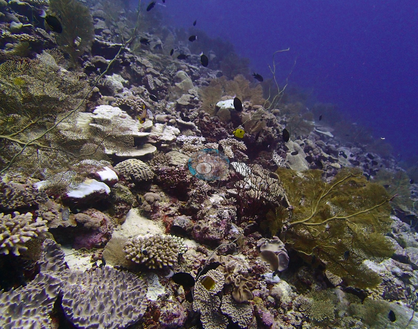
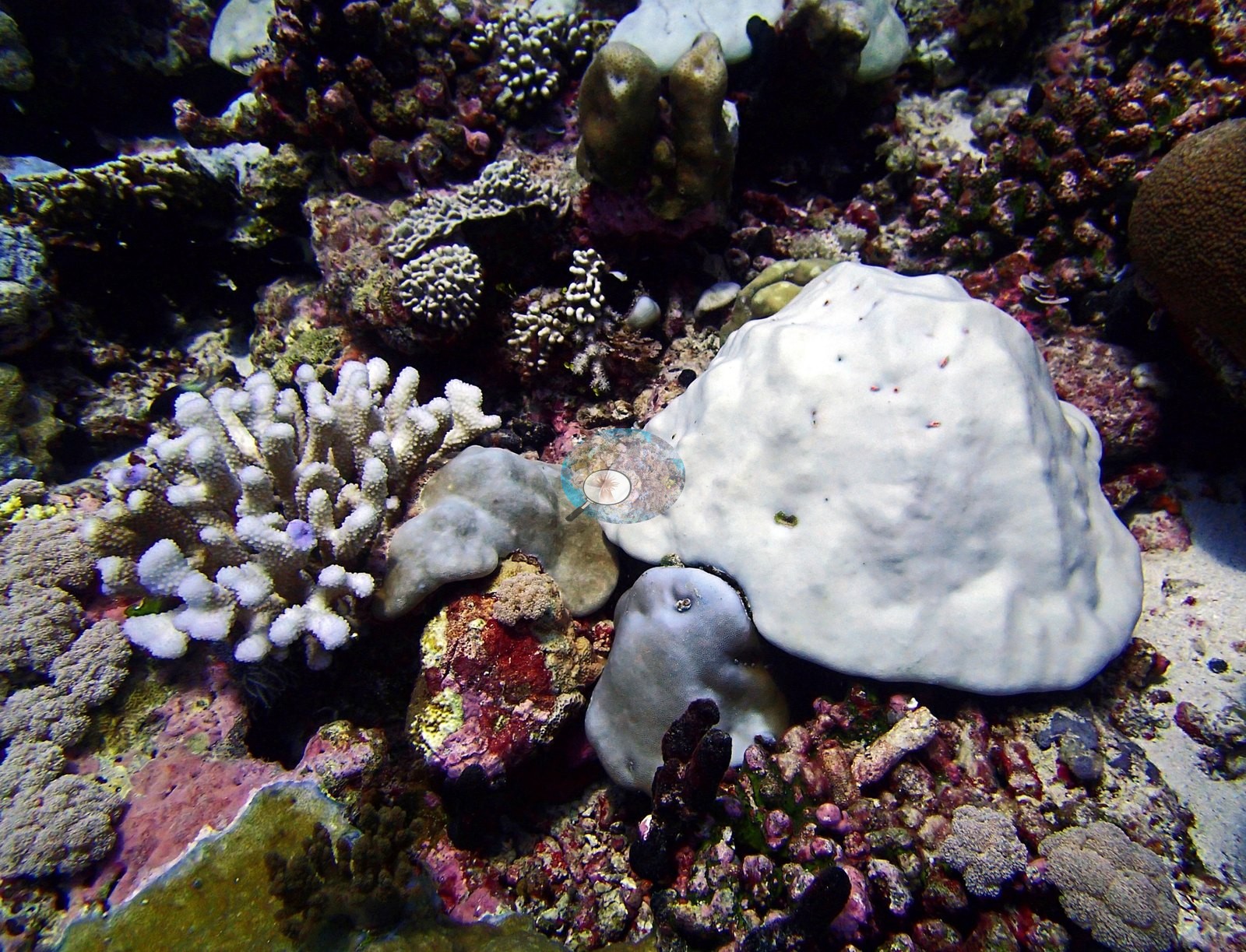
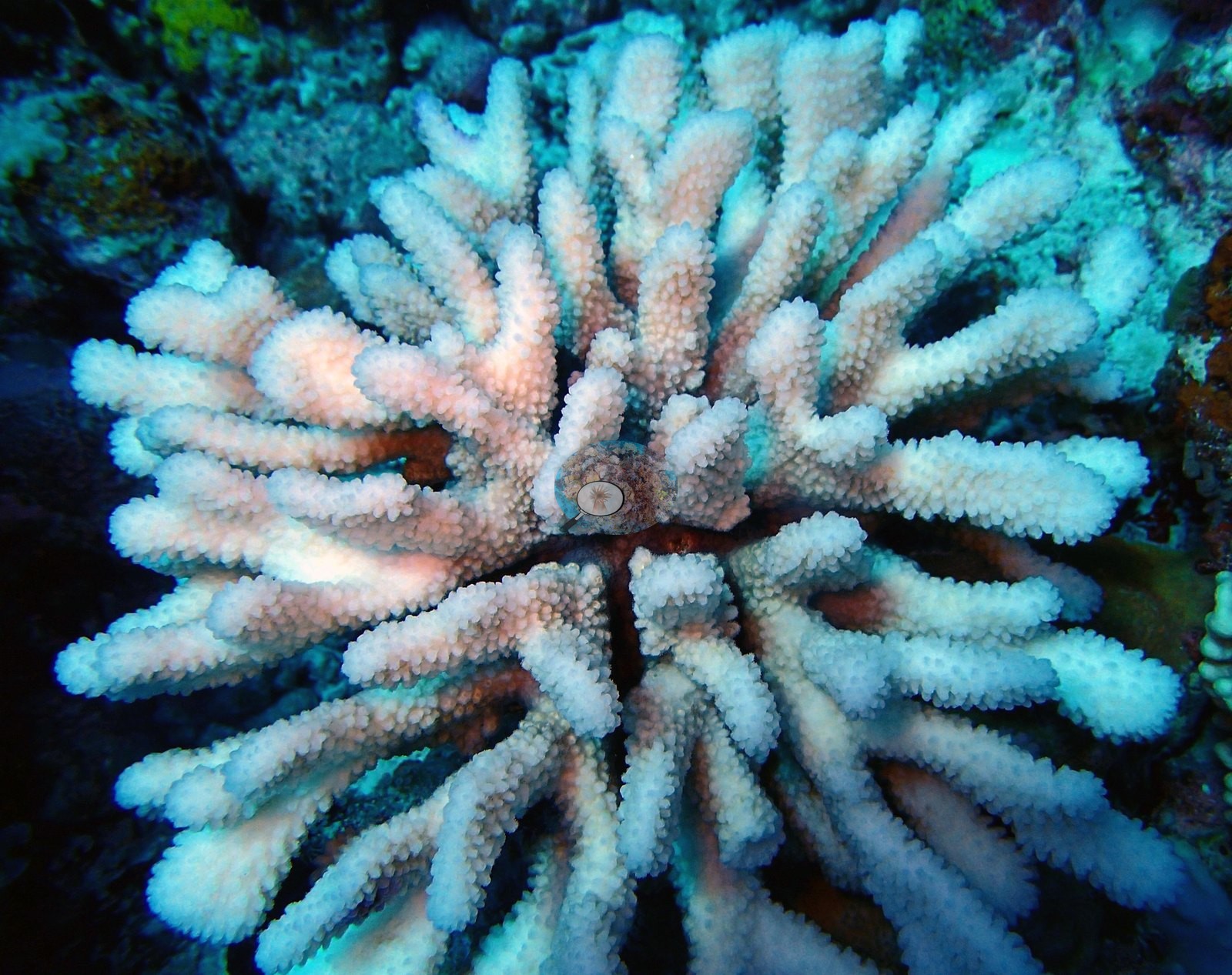
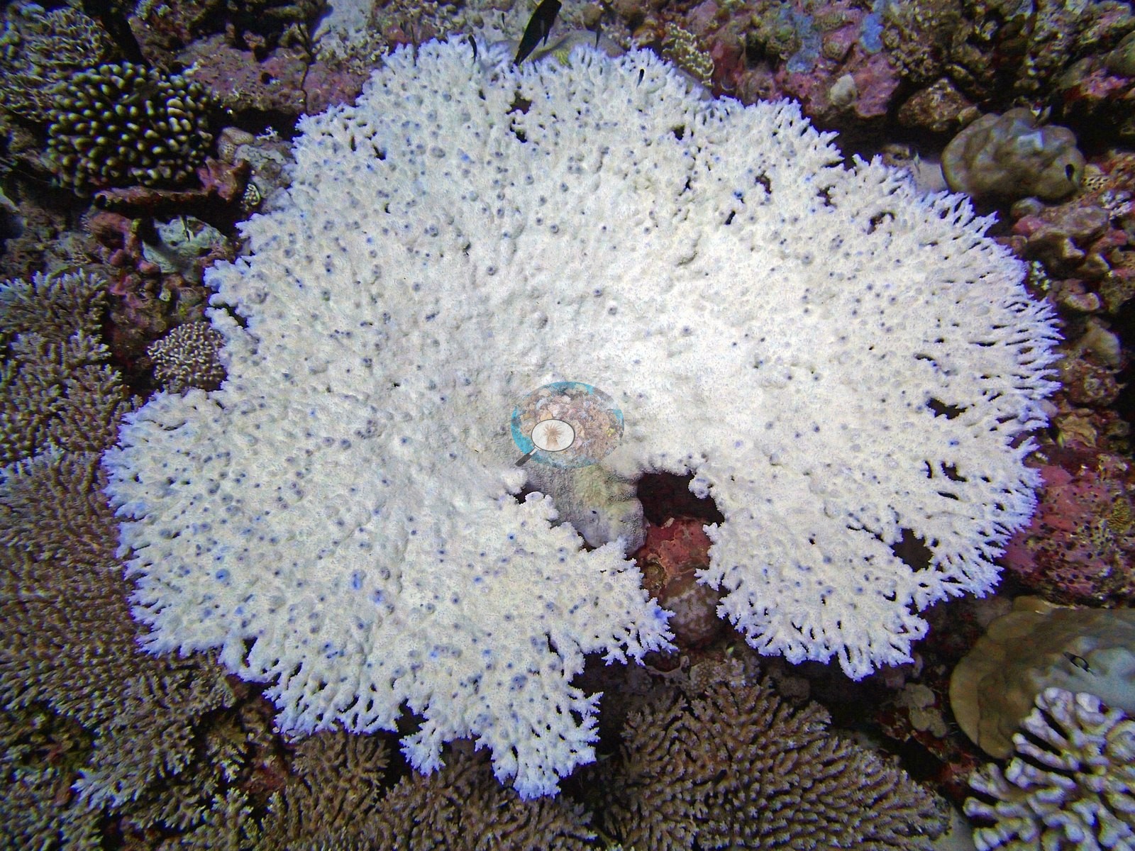
At 31.5% published image bleaching it ranks 2nd of the 98 Chagos sites with a bleaching figure, behind only BISA84 — and the photographs corroborate that ranking emphatically. Bleaching affects several colony morphologies, which is what makes the 31.5% credible (e.g., Image 3).
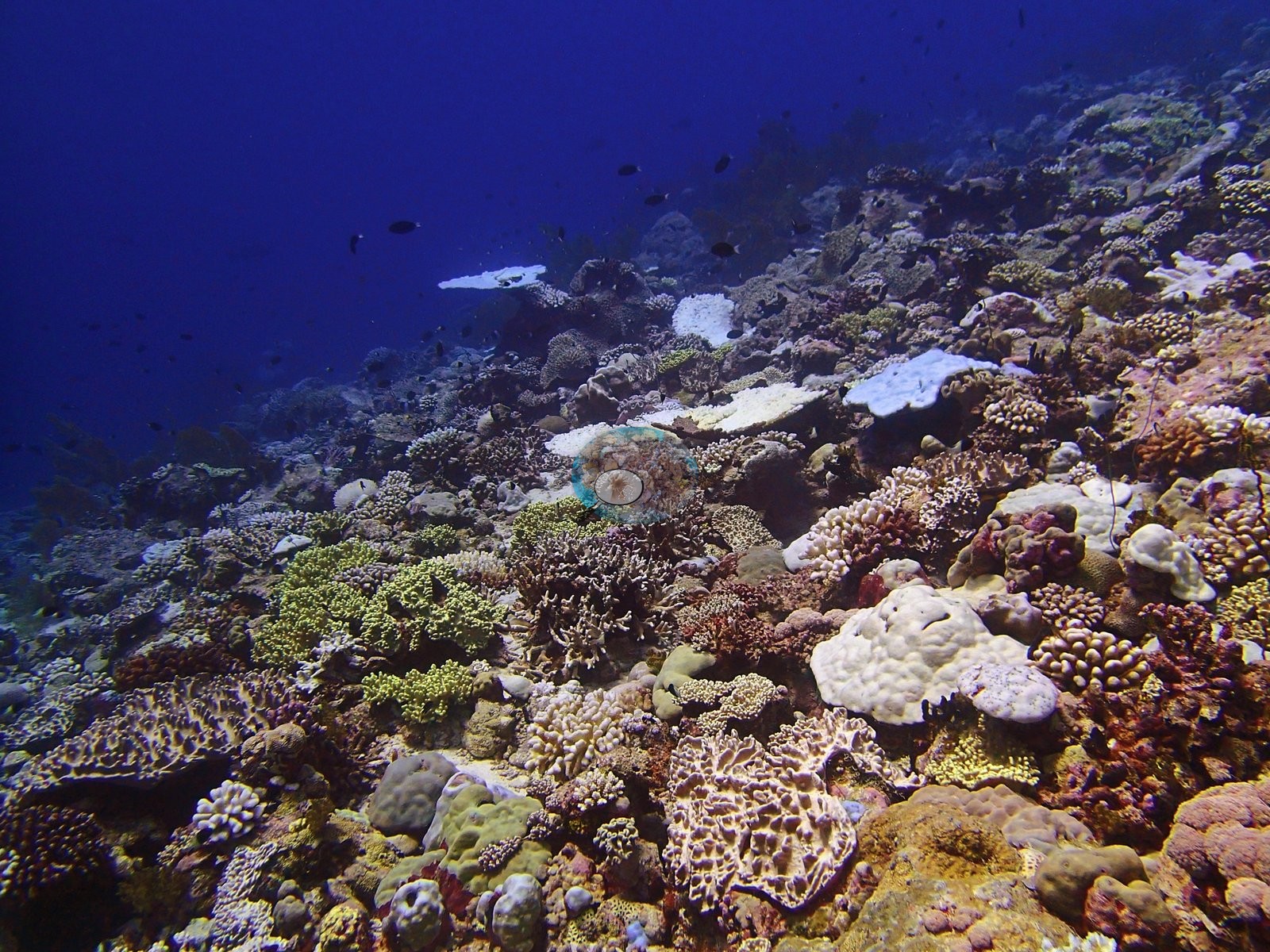
The broad table-like colony is almost entirely white but retains detailed radial branches and surface structure. One frame shows a compact branching colony with coherent white tissue directly beside a brown branching colony, making the contrast especially diagnostic. Two further frames show pale lobate or thick-branched colonies at close range, and smaller white colonies recur in wider scenes. The distribution across growth forms and across both wide and close frames supports a site-wide stress event rather than a few anomalous colonies. The white colonies generally retain intact tissue contours, which favors bleaching over recently denuded skeleton (e.g., Image 2).
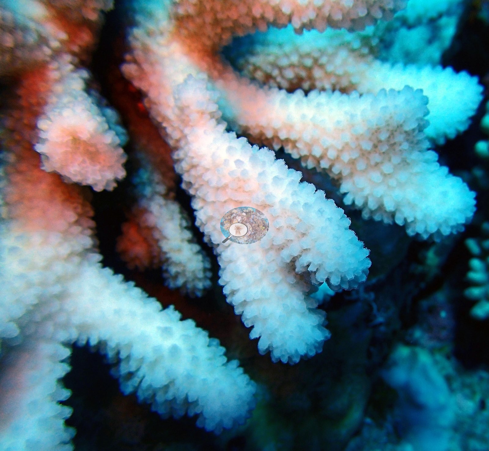
Some carry small dark or reddish spots and local holes, but these do not form a consistent progressive lesion margin, so bleaching is recorded at high confidence while disease is not. Older dead substrate with algal or coralline overgrowth is present in the mosaic and is separated from freshly pale tissue by its darker, irregular, encrusted surface. No crown-of-thorns starfish (COTS) or other corallivores evident.
Fish and other fauna
Fish occur throughout the sequence, including dark surgeonfish-like silhouettes and smaller reef fishes around the coral patches, but the frames do not support standardized abundance or richness estimates.
Comparisons with other data
No independent survey was made at this exact site; the nearest ones are listed in the table below.
CV model comparison
More info
Those are point counts on the photographs; this is a diver swimming a transect. The models and the reference never saw the same thing. ⚠ SITE-LEVEL ONLY. The 2,500 frames were not associated with any transect taken within 200 m of them, so transect-vs-image comparisons are site means, never frames. The transect value is already in the pin `cover` field (109 of 112 pins, sourced to the paper's suppl. S1) and is read from there, never re-imported. The transect is THE coral-cover value for this site and stands alone. The rows below it are a methods comparison only: no computer-vision value is averaged with it, feeds the headline, or carries over to the site's cover figure (Anderson, 2026-09-22).| Method | Hard-coral cover (%) |
|---|---|
| Transect (published) | 36.2 |
| CoralNet | 44.2 |
| In-house DINOv3 | 45.6 |
| CoralSCOP edited | 41.0 |
| Claude | 35.7 |
Independent surveys nearby
| Agency / program | Year(s) | Stations / distance | Link |
|---|---|---|---|
| Lange et al. (2021) | 2006–2020 | 1 station, 4.74 km | Records ↓ |
| MERMAID* | 2020 | 1 station, 4.33 km | Records ↓ |
| XL Catlin Seaview Survey | 2015 | 3 stations, 1.93–4.43 km | Records ↓ |
 Dr. Coral (CRD)Year-average (no detectable trend)
Within 5 km, 5 independent survey stations recorded hard coral cover in 12 records between 2006 and 2020. Of the 1 station surveyed in more than one year, 1 declined between their first and latest surveys. The longest record, Salomon Atoll (Lange et al. 2021, 4.74 km away), went from 29% in 2006 to 12% in 2020. The most recent nearby survey is from 2020, so these values predate recent heat stress. This site's own estimate (36%) sits within the range of these surveys (9.9–43%); the methods differ, so the comparison is context, not a like-for-like test.
Collected by other programs using different methods (MERMAID is a data platform: each MERMAID row names the organization that did the survey, and its method is in the row's hover text; the XL Catlin Seaview Survey uses photo-transects with automated image annotation. *Conducted by citizen scientists), so these are context for the figures above, not a like-for-like comparison. Where a station was surveyed more than once the range is shown. Station names are not dive-site names.
| Agency | Site / location | Date | Hard coral cover (%) | Distance | Link |
|---|---|---|---|---|---|
| Lange et al. (2021) | Salomon Atoll | 2006–2020 | 9.9–43% (5 surveys) | 4.74 km | HeatCRD database |
| XL Catlin Seaview Survey | transect 36014 | 2015 | 34% | 1.93 km | — |
| XL Catlin Seaview Survey | transect 36016 | 2015 | 19% | 2.13 km | — |
| XL Catlin Seaview Survey | transect 36013 | 2015 | 28% | 4.43 km | — |
| MERMAID* | Salomon 219 | 2020 | 30% (4 surveys) | 4.33 km | MERMAID |
Data & links
- Read the full site report ↗
- Download benthic survey data (CSV) ↗
- Download all LOF-GRE data (933 sites) ↗
- CoralNet image repository for this region ↗
- HeatCRD database ↗
- (reference) ↗
- Photo portfolio ↗
- Coral Reef Diagnostics page for this area ↗
All images from Coral Reef Diagnostics. Data are from Coral Reef Diagnostics and the organizations named in the data-sources table above.
 © Coral Reef Diagnostics.
References
- Mayfield AB, Dempsey AC (2026). Using tourist diver images to estimate coral cover and bleaching prevalence in a remote Indian Ocean coral reef system. Oceans 7(1):1. PDF
- Lange ID, Benkwitt CE, McDevitt-Irwin JM, Tietjen KL, Taylor B, Chinkin M, et al. (2021). Wave exposure shapes reef community composition and recovery trajectories at a remote coral atoll. Coral Reefs 40:1819-1829. PDF