
Part of the regional summaries: Chagos Archipelago - Great Chagos Bank West / Brothers / Eagle and Chagos Archipelago
More info
Chagos (NOAA CRW virtual station)The fourth-highest-cover site in Chagos (67%), with extreme zoning: one depth band is 93% blue coral (Heliopora), recalled as blue coral "as far as the eye could see," and the next is 80% Acropora. The low channel bottom is covered in enormous, overlapping table corals. Surveyed on the Living Oceans Foundation's Global Reef Expedition.
Three independent survey stations shown with the program’s logo — click one to see how far it is from this site.
Fourteen other CRD dive sites within 5 km shown in orange — click a marker to open its page.
🗺 Detailed map of the Global Reef Expedition dive sites, Three Brothers, Chagos (Khaled bin Sultan Living Oceans Foundation; opens in a new window)
23 of these 29 photographs are shown beside the text that discusses them under "Site description" below.
Site description
Setting
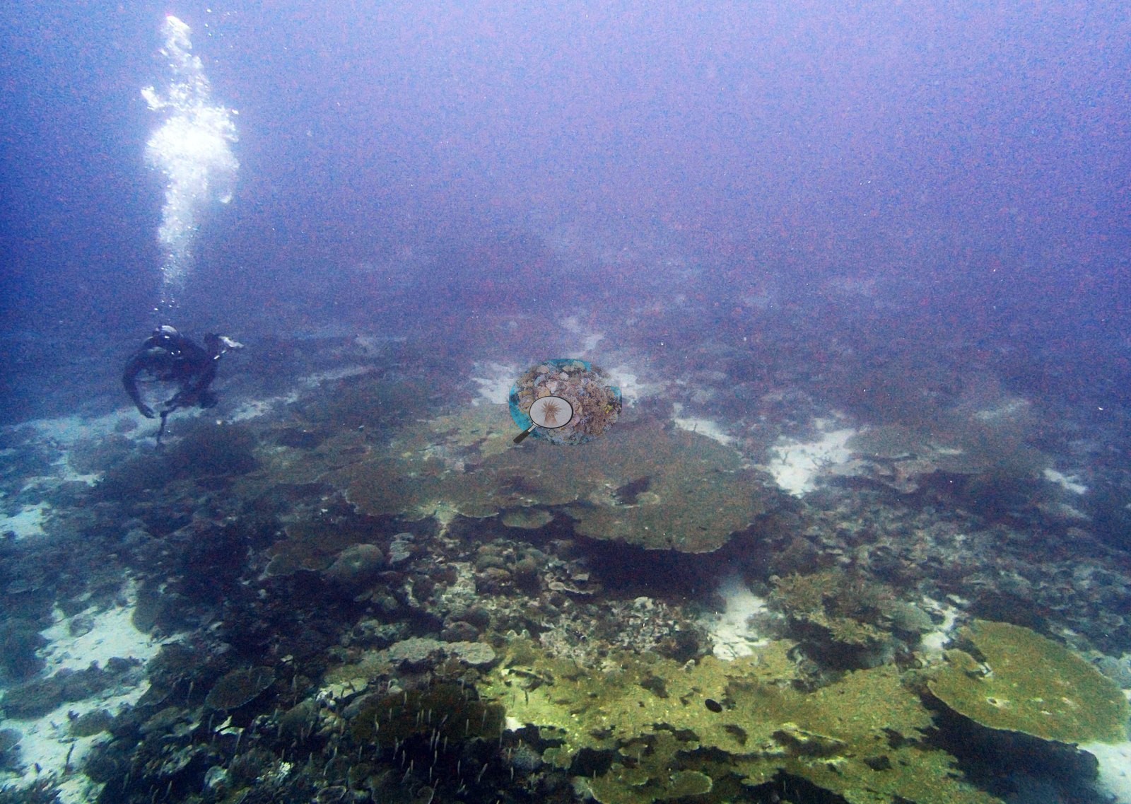
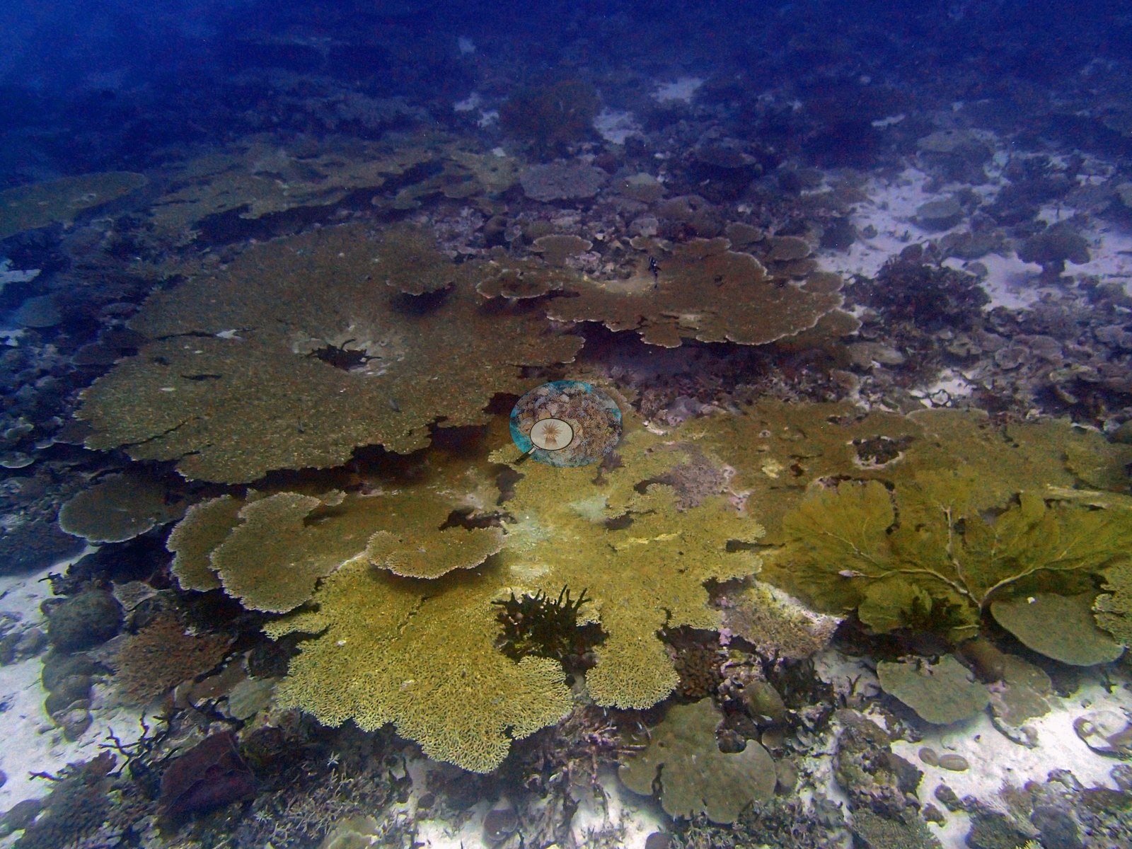
The reef photographs as a broad, low-relief channel bottom rather than a wall or steep slope, and its dominant architecture is tabular (e.g., Image 30).
General benthic features
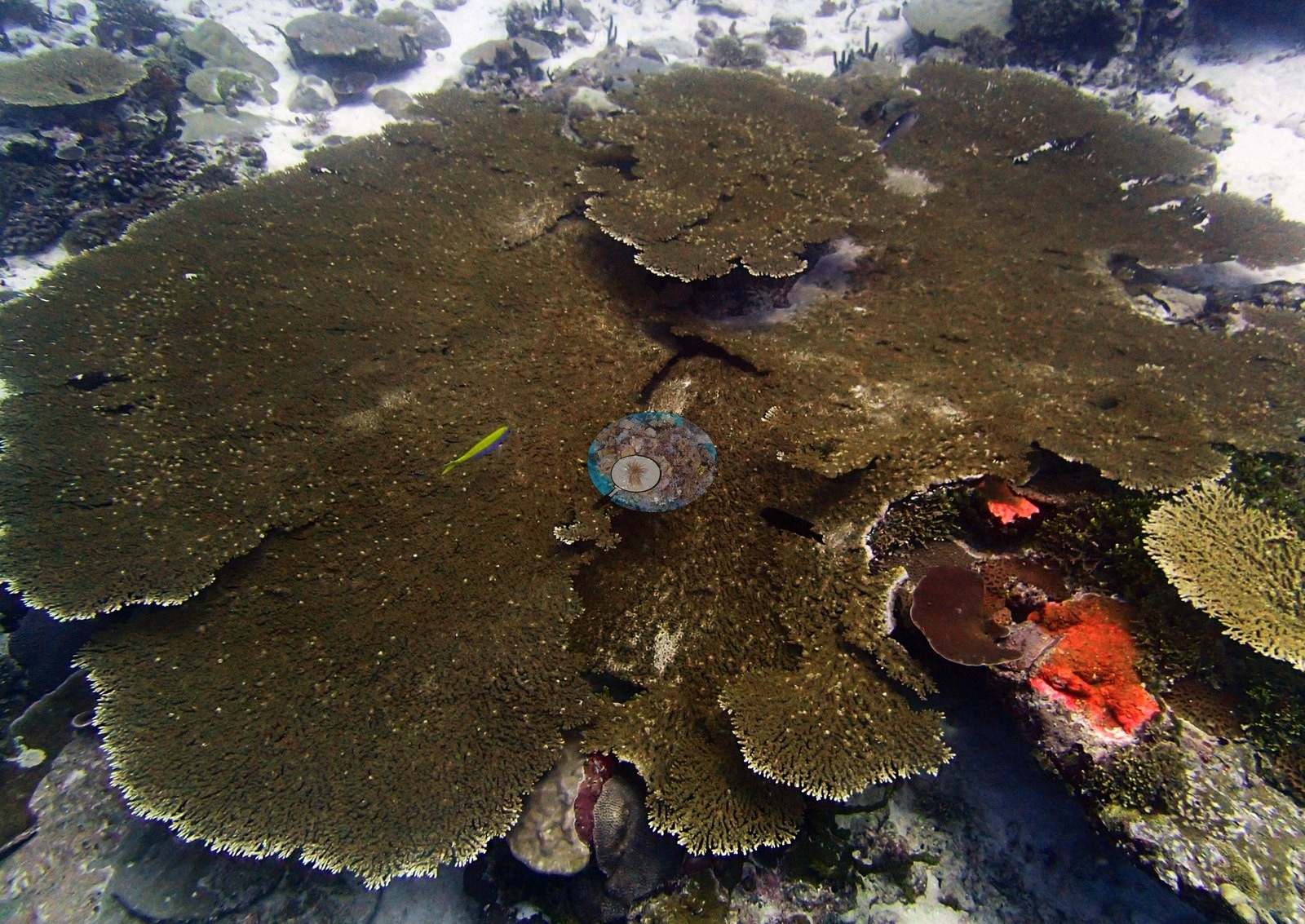
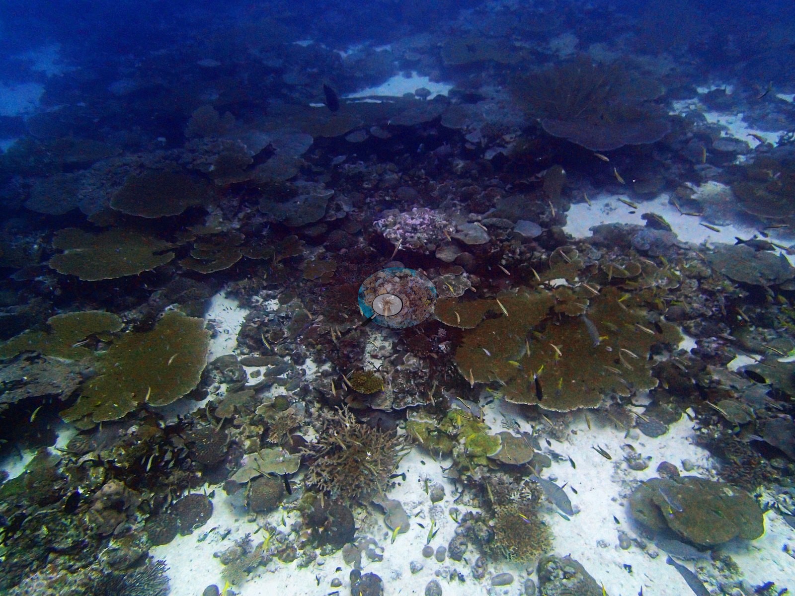
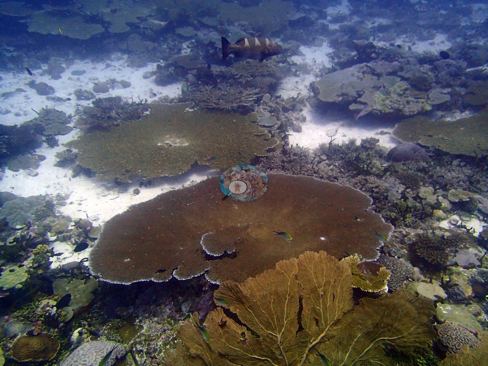
The formal assemblage is carried almost entirely by two genera: Heliopora at 31.33% and Acropora at 27.67%, together 88% of all coral recorded. Goniastrea (3.00%), Pocillopora (2.00%), and Porites (2.00%) follow, with Pavona and Favia below 1%. Only seven coral codes are non-zero — an unusually short list for a site of this cover. Crustose coralline algae hold 21.0% of the benthos, turf 5.33%, bare substrate 4.00%, macroalgae 2.00%, and erect algae 1.00%. The depth structure is the finding here, and it is extreme. The three transects are not variations on a theme; they are three different reefs. D2 carries only 28% coral, spread thinly across Porites (6%), Acropora (3%), and Heliopora (1%). D3 jumps to 93% coral — and every coral point on that transect is Heliopora. D4 holds 80% coral, every point Acropora. Two adjacent depth bands, each effectively a monoculture, of different genera. This is genuine zonation, not a scoring artifact: the surveyor recalls the dive as blue coral as far as the eye could see (A. Mayfield, 2026-08-25). The site mean of 31.33% Heliopora should still be read as the average of three very different transects rather than a uniform site value. One frame is filled by a single enormous table Acropora, meters across, its olive surface set off by pale growing margins and a brilliant orange-red encrusting sponge at its rim; another pulls back to show a continuous field of such tables — olive and yellow-green, tiered and overlapping, running to the limit of visibility with white sand only at the margins (e.g., Image 19, Image 24).
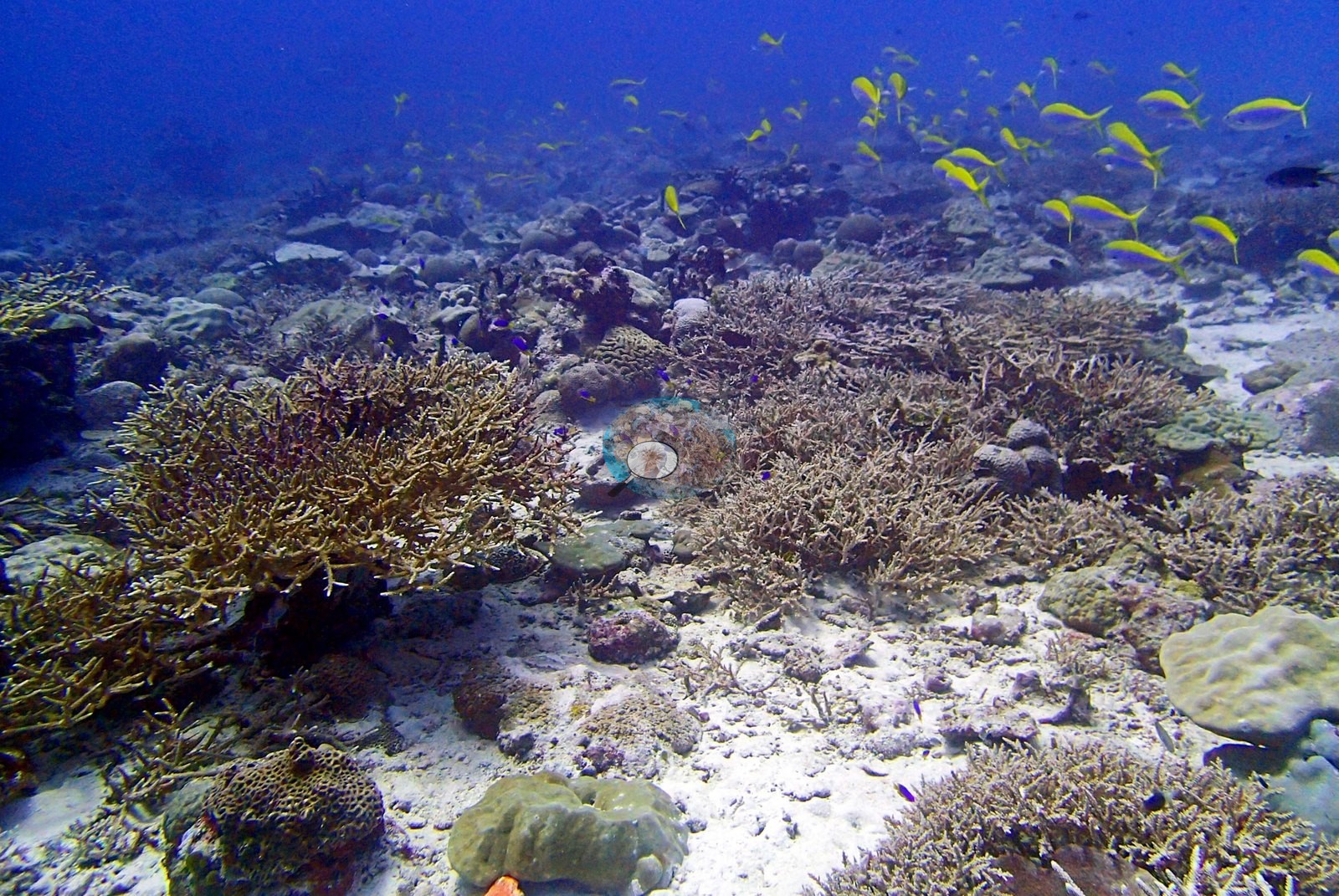
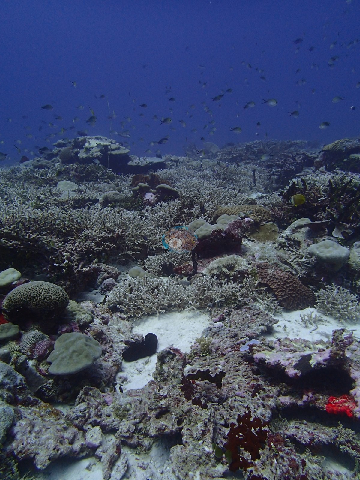
Two frames show the branching zone: multiple large staghorn thickets standing on clean white sand among massive Porites-type domes, reticulate faviids, and foliose plates, with clouds of Chromis overhead (e.g., Image 10, Image 29).
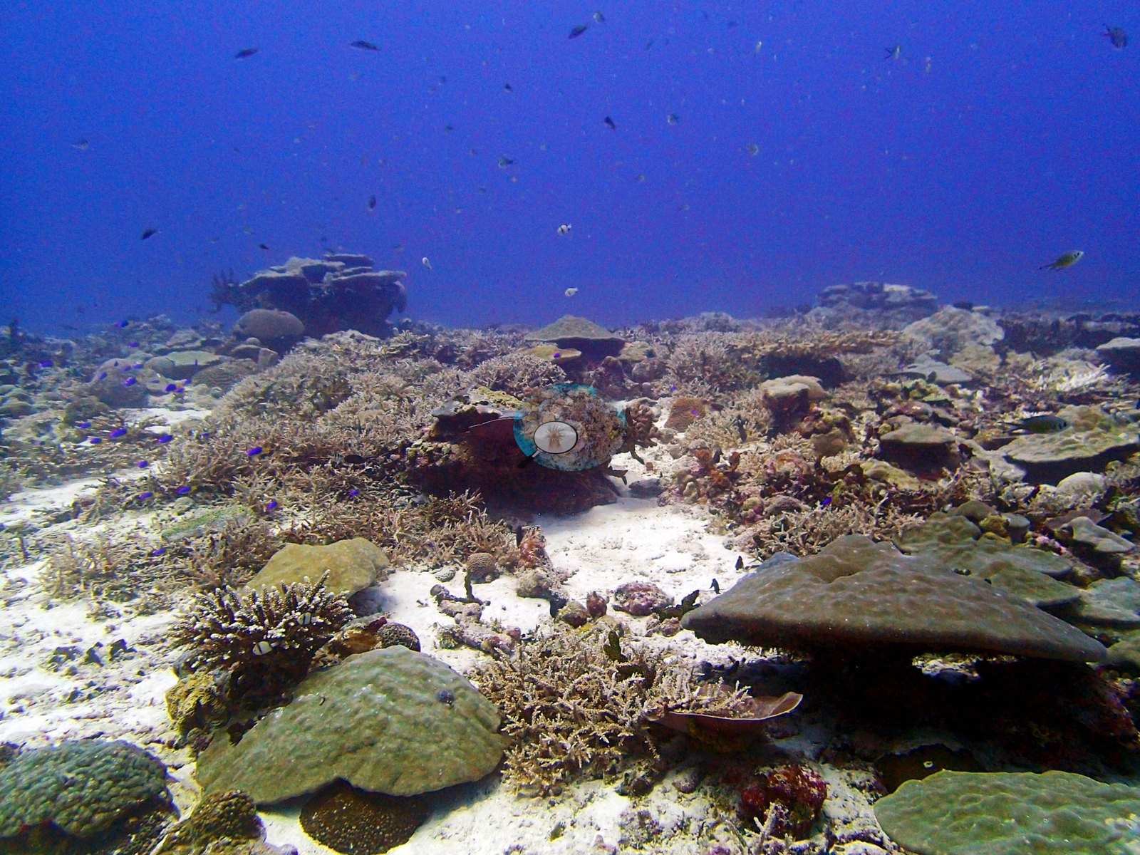
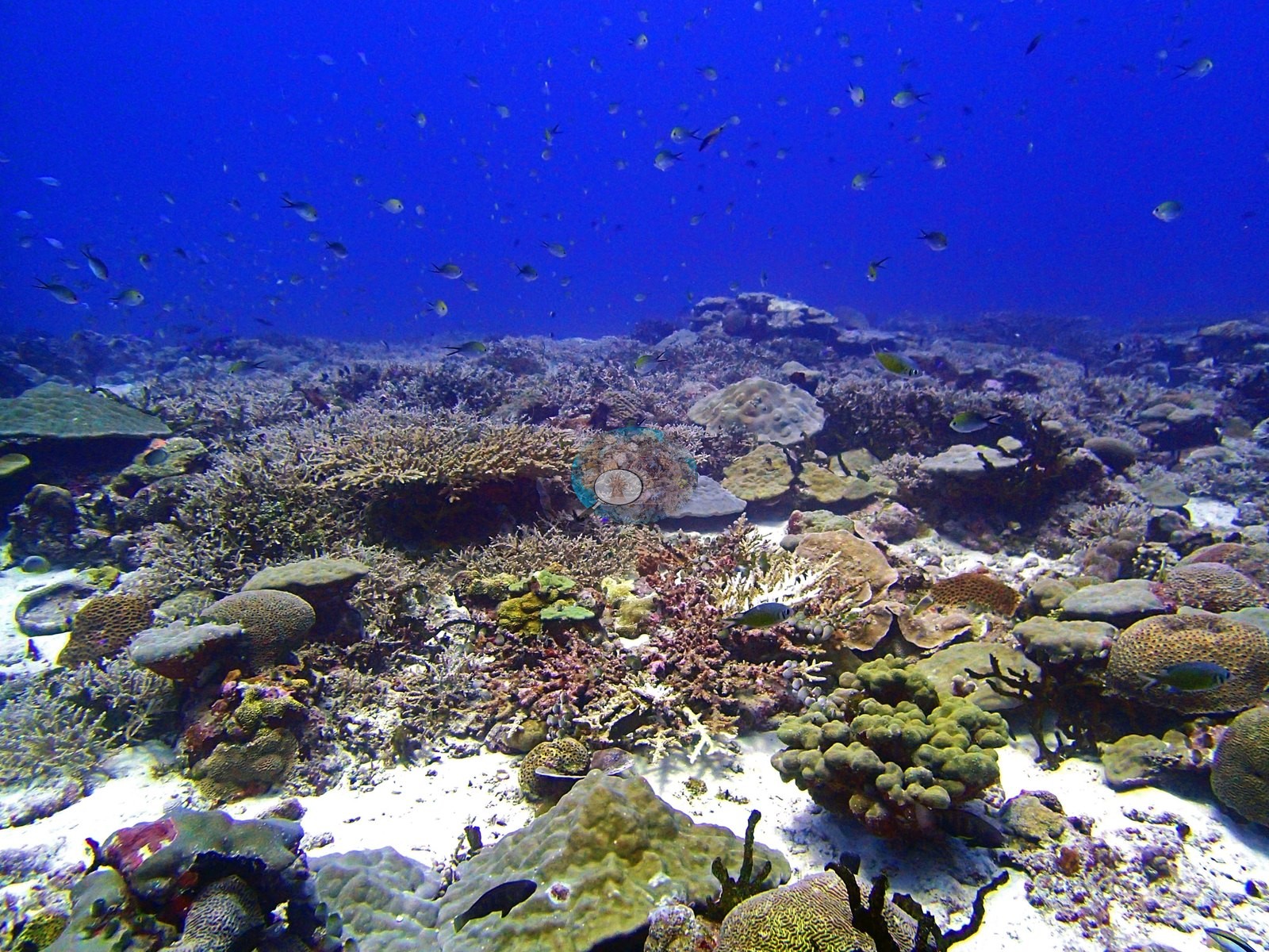
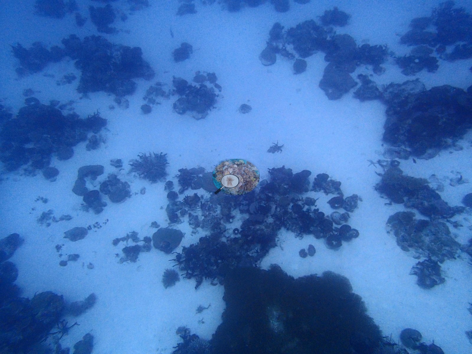
Together these are the photographic match to the 80%-cover Acropora transect. The site is not uniformly dense. One frame looks down on broad white sand flats carrying only isolated coral patches, and two more show pavement where massive Porites domes, reticulate faviids, and pedestalled plates sit widely spaced on open sand — the ground that produces the 28%-cover D2 transect (e.g., Image 13, Image 33).
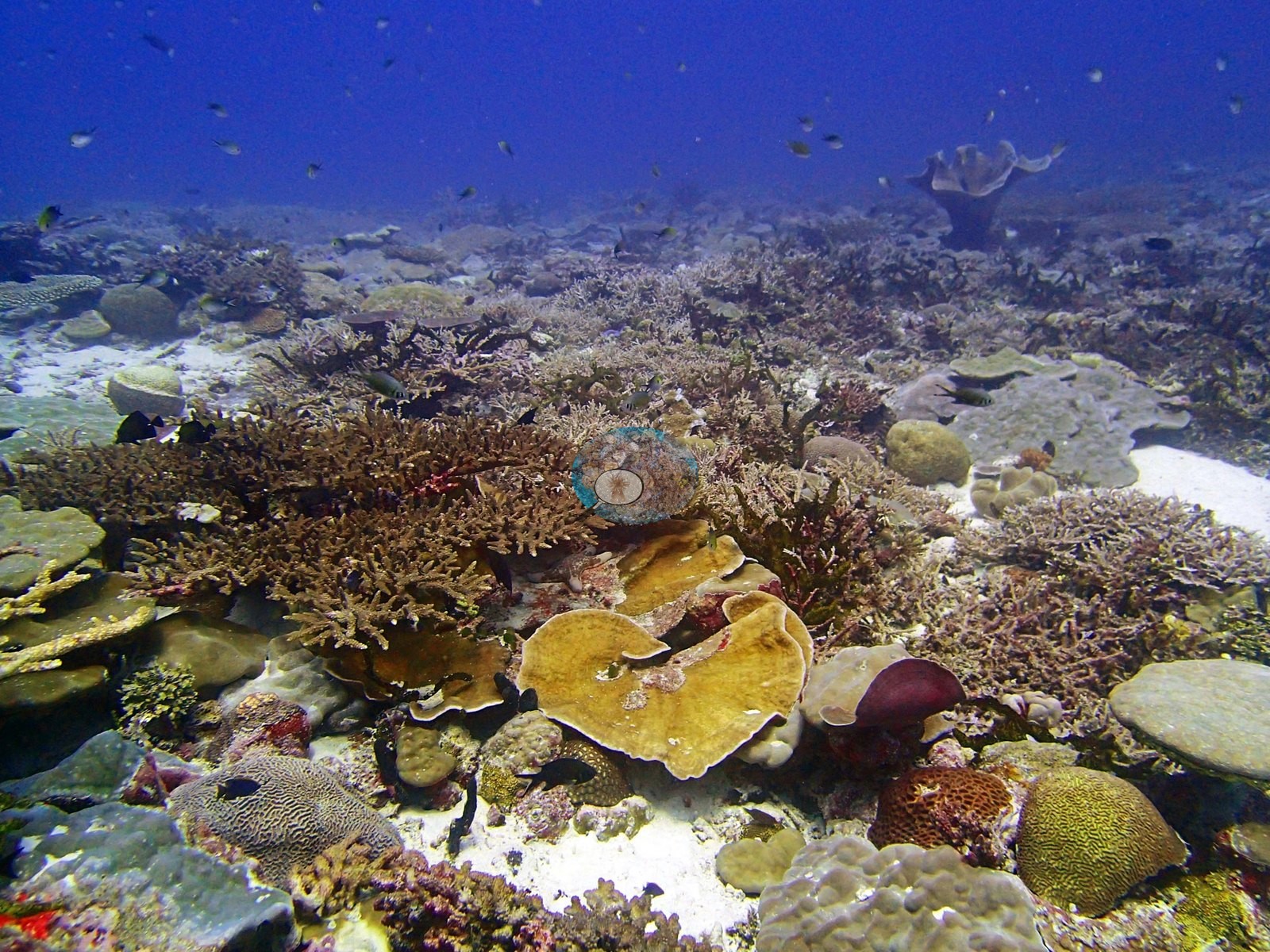
Closer frames show more genus-level variety than the seven-code transect list implies. One frame holds branching Acropora-type thickets alongside large ruffled foliose plates in cream-yellow and one deep maroon, massive meandroid brain coral heads, smooth Porites-type domes, and encrusting colonies (e.g., Image 18).
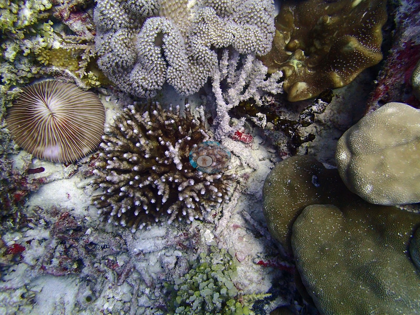
Another contains a solitary free-living fungiid mushroom coral, radiating septa clearly visible (e.g., Image 25).
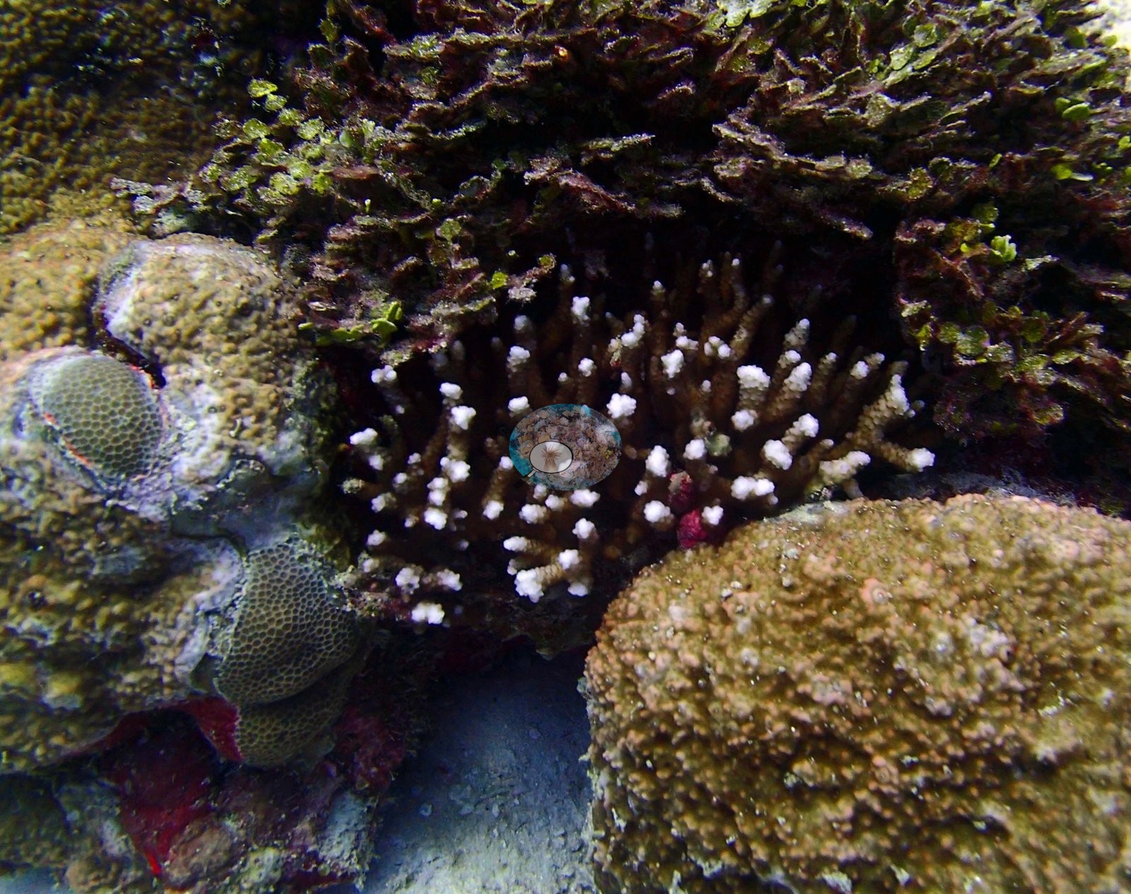
A third is a macro frame: a small brown Acropora whose branch tips are bright white — these are growing tips, not bleaching — wedged between dense brown-green foliose algae and reticulate faviids (e.g., Image 3).
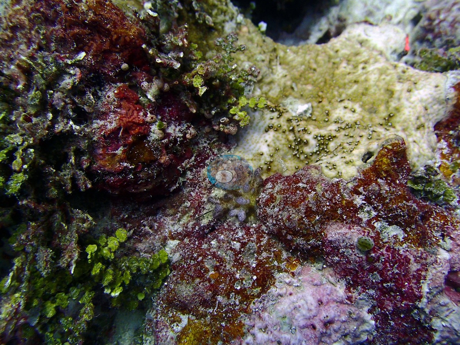
A fourth is pure substrate: turf, dark red encrusting algae, green Halimeda-type segments, small ascidians, pink CCA, and a single pale coral recruit — the matrix behind the 21% CCA and 29.3% algal figures (e.g., Image 4).
A fifth holds the best candidate for the site's dominant taxon: a robust olive-brown colony with thick, blunt, finger-like branches, and a smooth surface, growing beside a delicate fine-branched coral and beneath a large meandroid brain coral (e.g., Image 31).
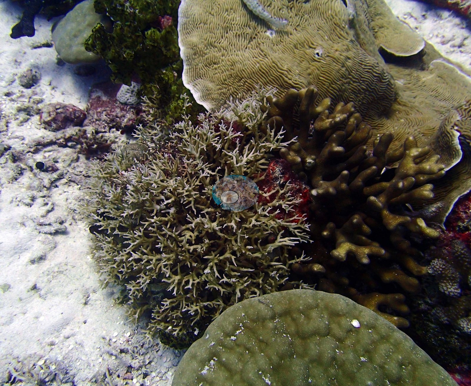
That blunt digitate form is characteristic of Heliopora, and it is the only colony in the set whose growth form matches the 93%-cover D3 transect. Assemblage composition. Formal surveys give 67.0% coral and 29.3% algae, the coral split 88% between Heliopora and Acropora. Photographs document more genus-level variety than that — foliose plates, meandroid faviids, and Porites domes are all conspicuous — which is the expected direction of disagreement when three transects sample a heterogeneous channel bottom.
Coral cover
BITB58 is the fourth-highest-cover site in the 109-site Chagos set at 67.0% transect coral cover, and one of the most compositionally lopsided. Coral cover at BITB58 is therefore a mosaic of near-continuous tabular fields and near-bare sand, not a uniform 67% carpet.
Stressors
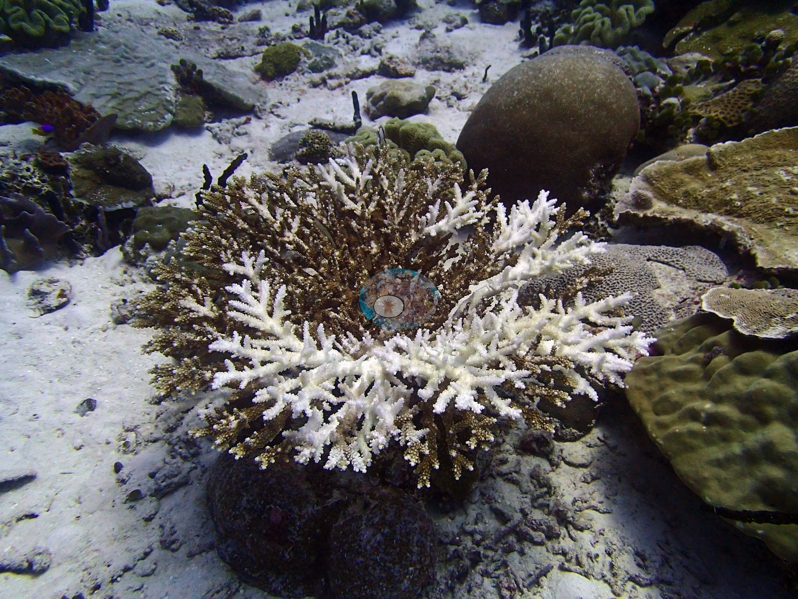
Condition is good. The published image-based bleaching figure is 0.8%, among the lowest in the archipelago (rank 102 of 109). The single clear bleaching subject is a corymbose Acropora with its outer branches stark white and the colony center still fully pigmented brown — a partial, colony-scale event on an otherwise healthy reef, and exactly the kind of isolated case a sub-1% site figure describes (e.g., Image 8).
Two frames record partial mortality of older colonies rather than bleaching: one shows patchy dark red algal overgrowth across parts of the branching thickets with pale, algae-bound branches, and the other holds a large standing table whose whole upper surface is dead and algae-filmed, bare skeleton showing through, immediately beside healthy branching thickets (e.g., Image 17, Image 22).
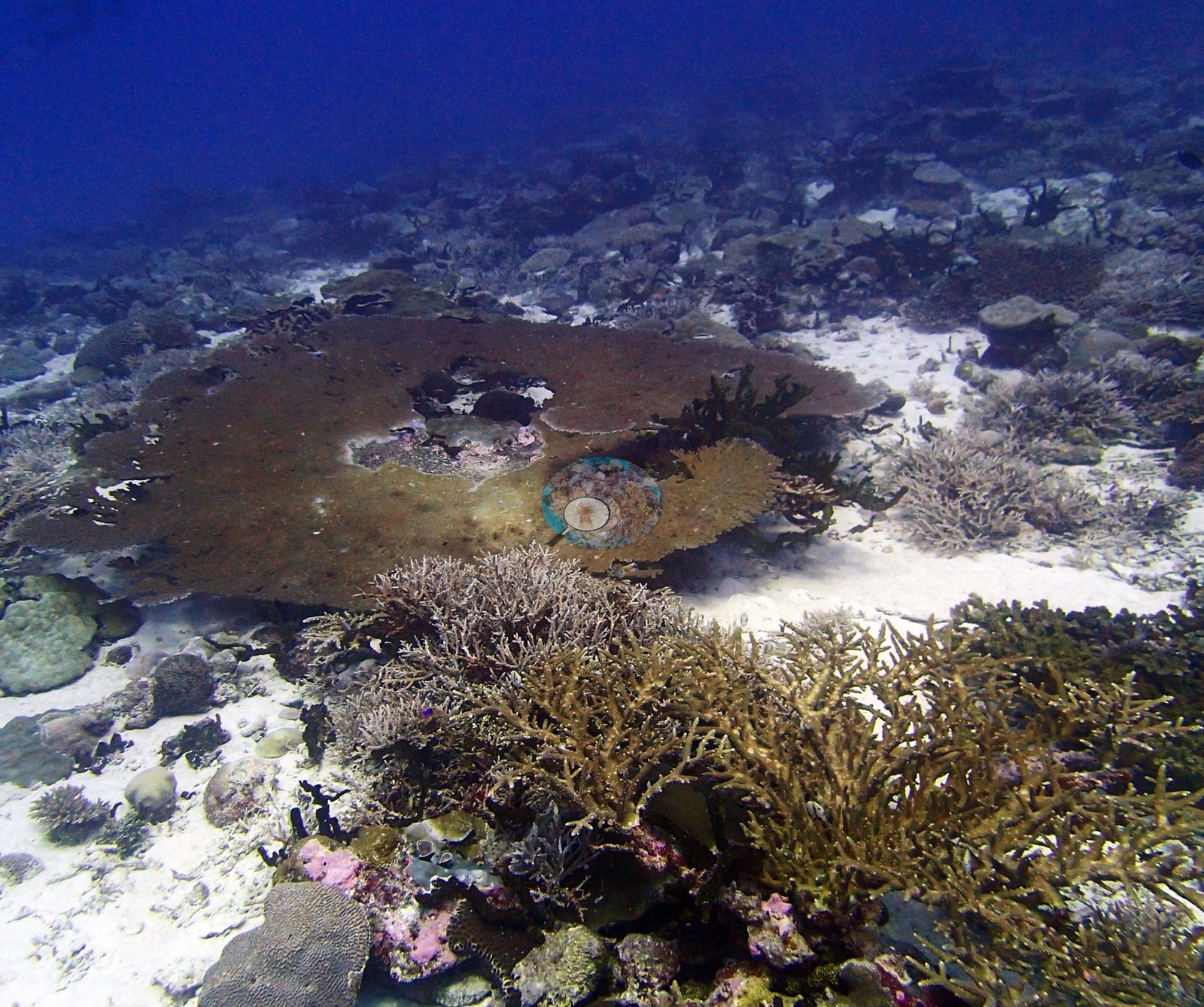
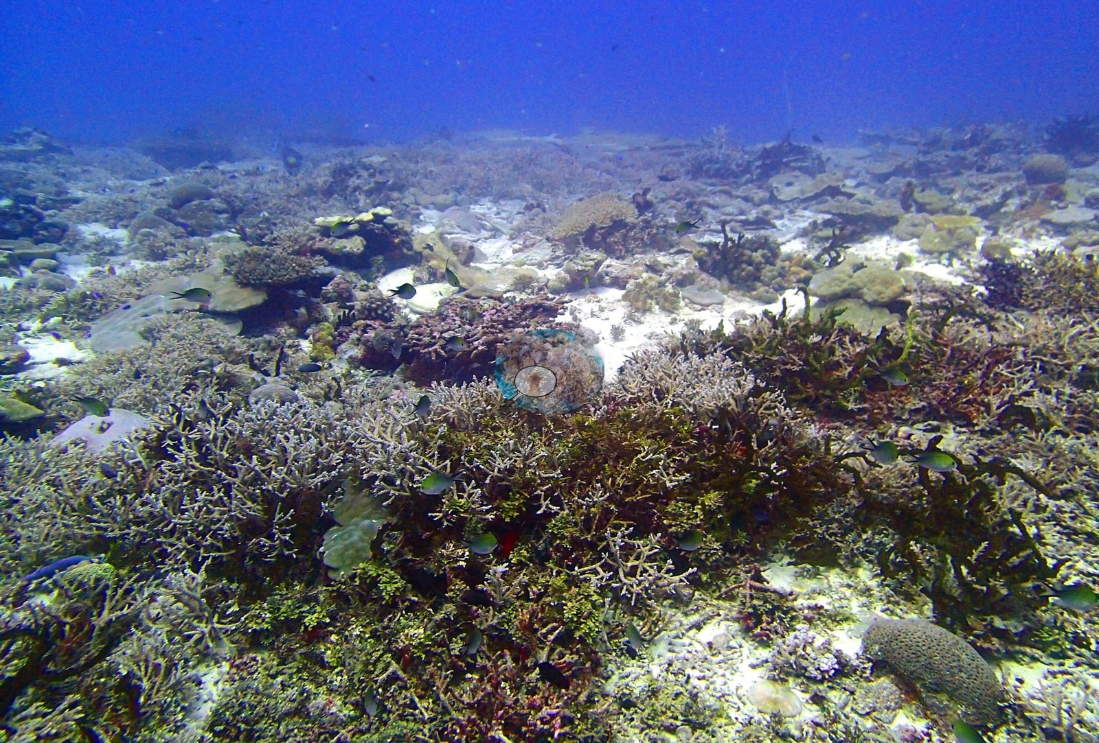
Both read as older loss on large colonies, not an active event. No COTS, no disease fronts, and no corallivore scars were seen in the frames reviewed.
Fish and other fauna
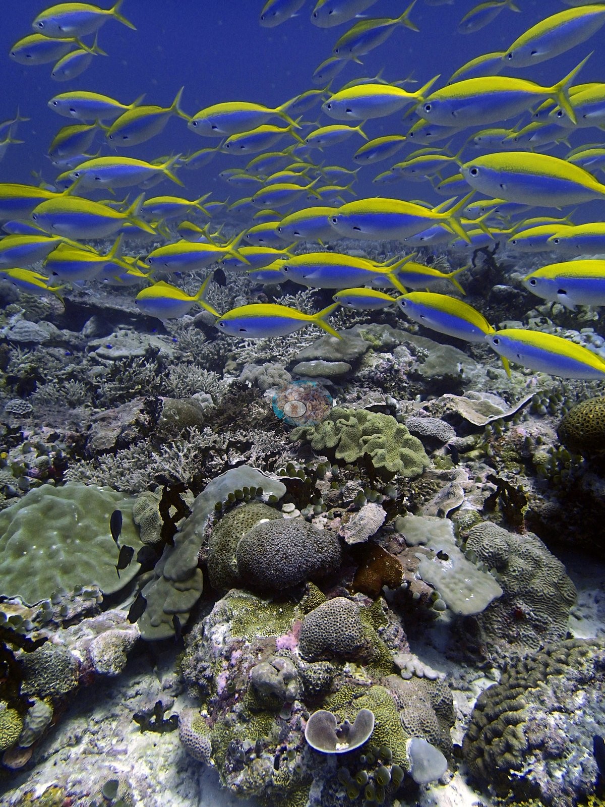
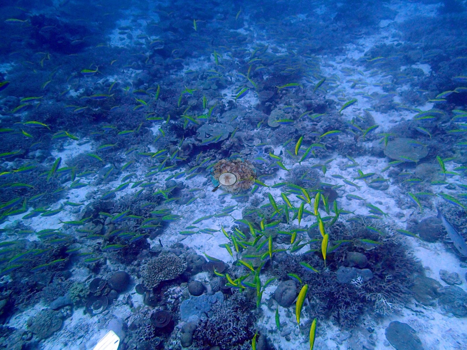
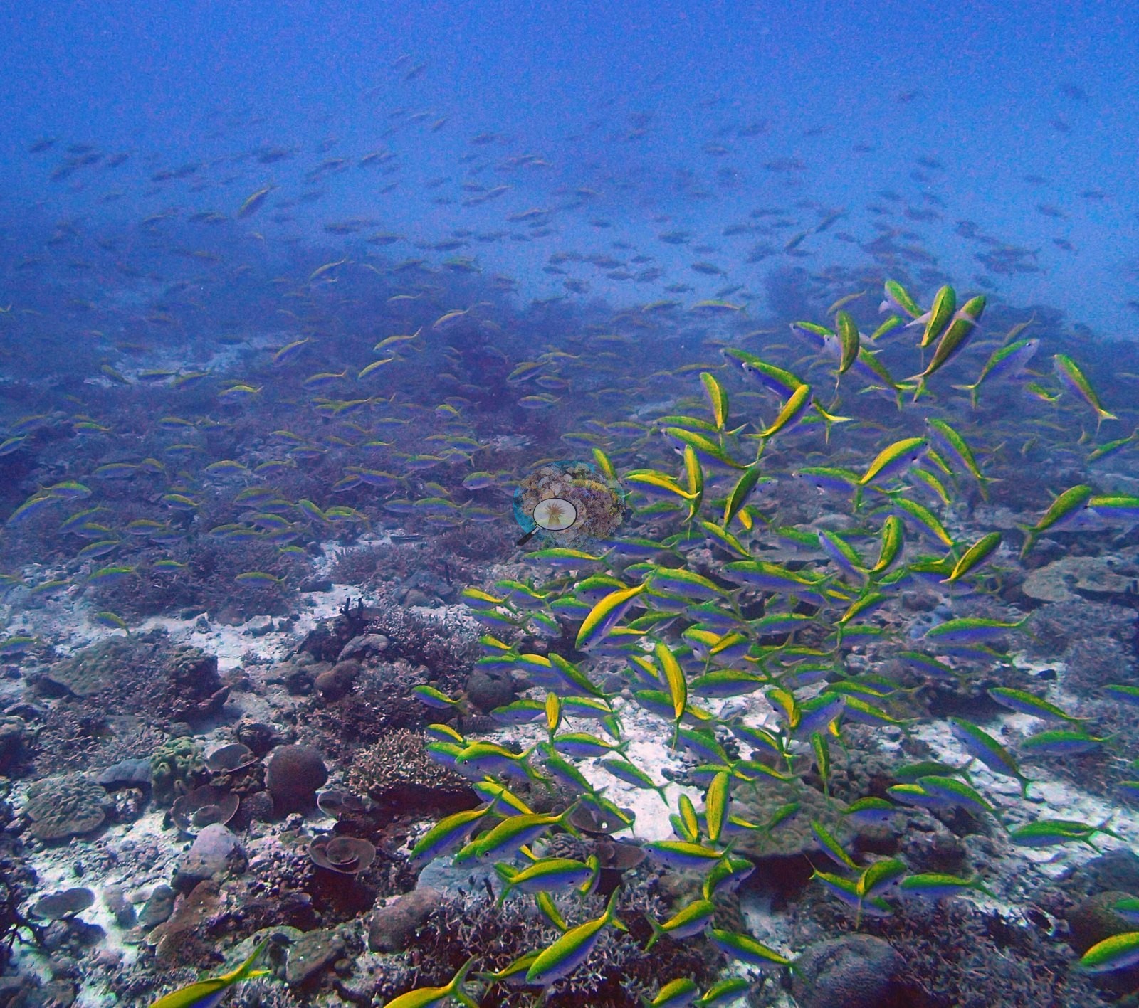
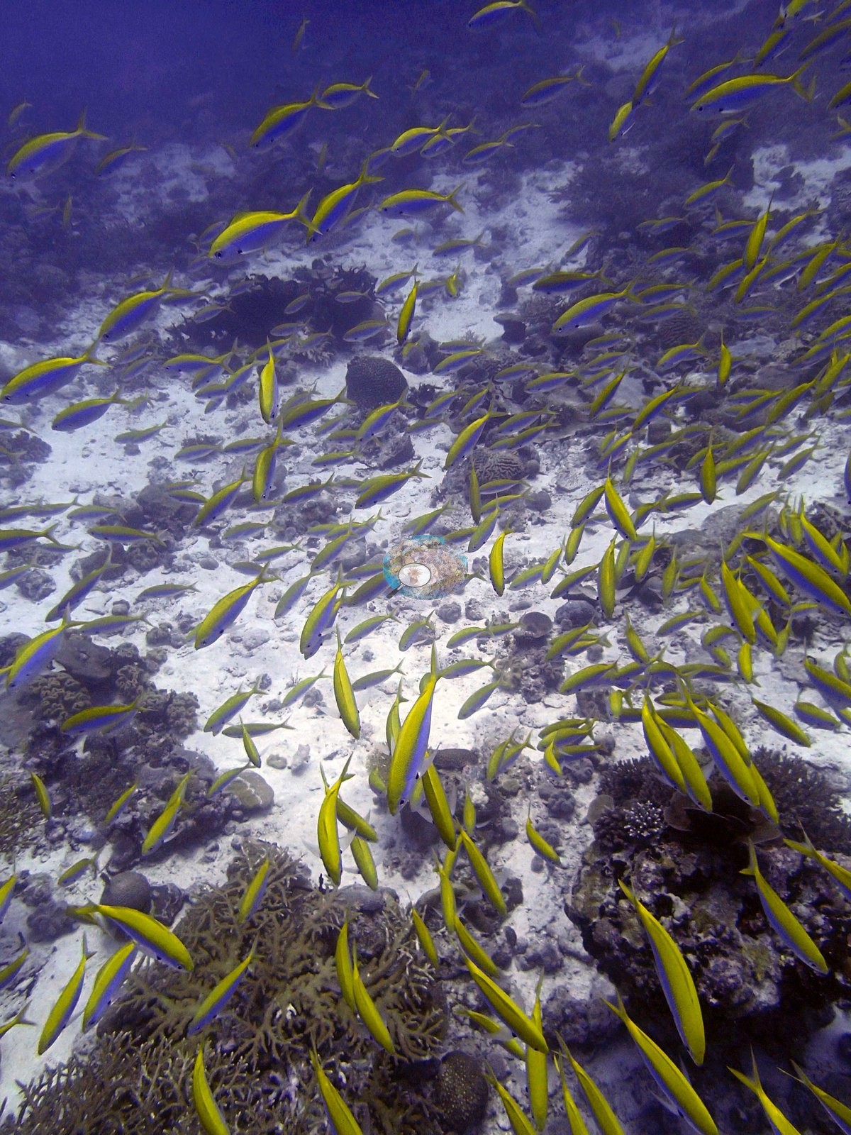
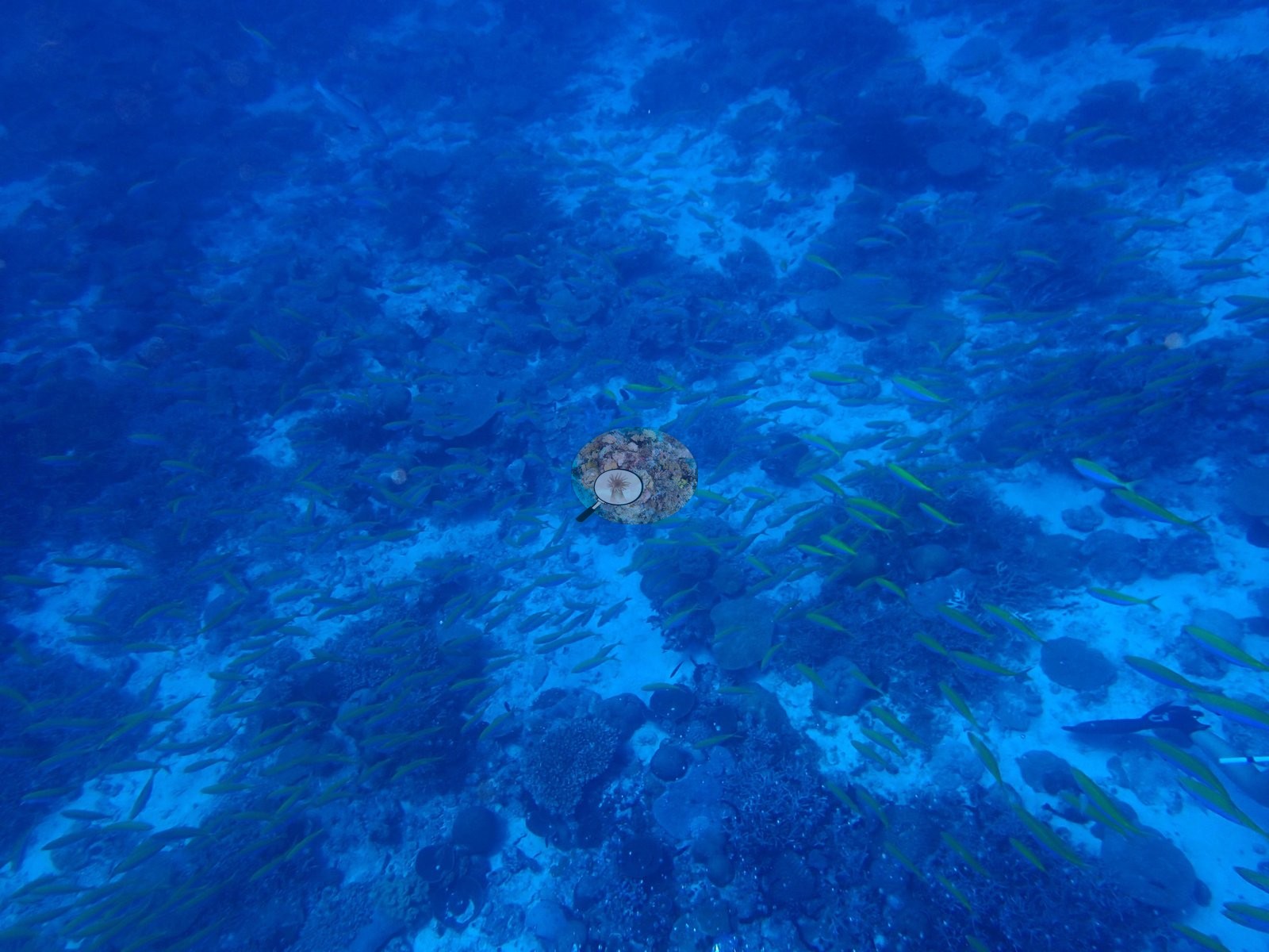
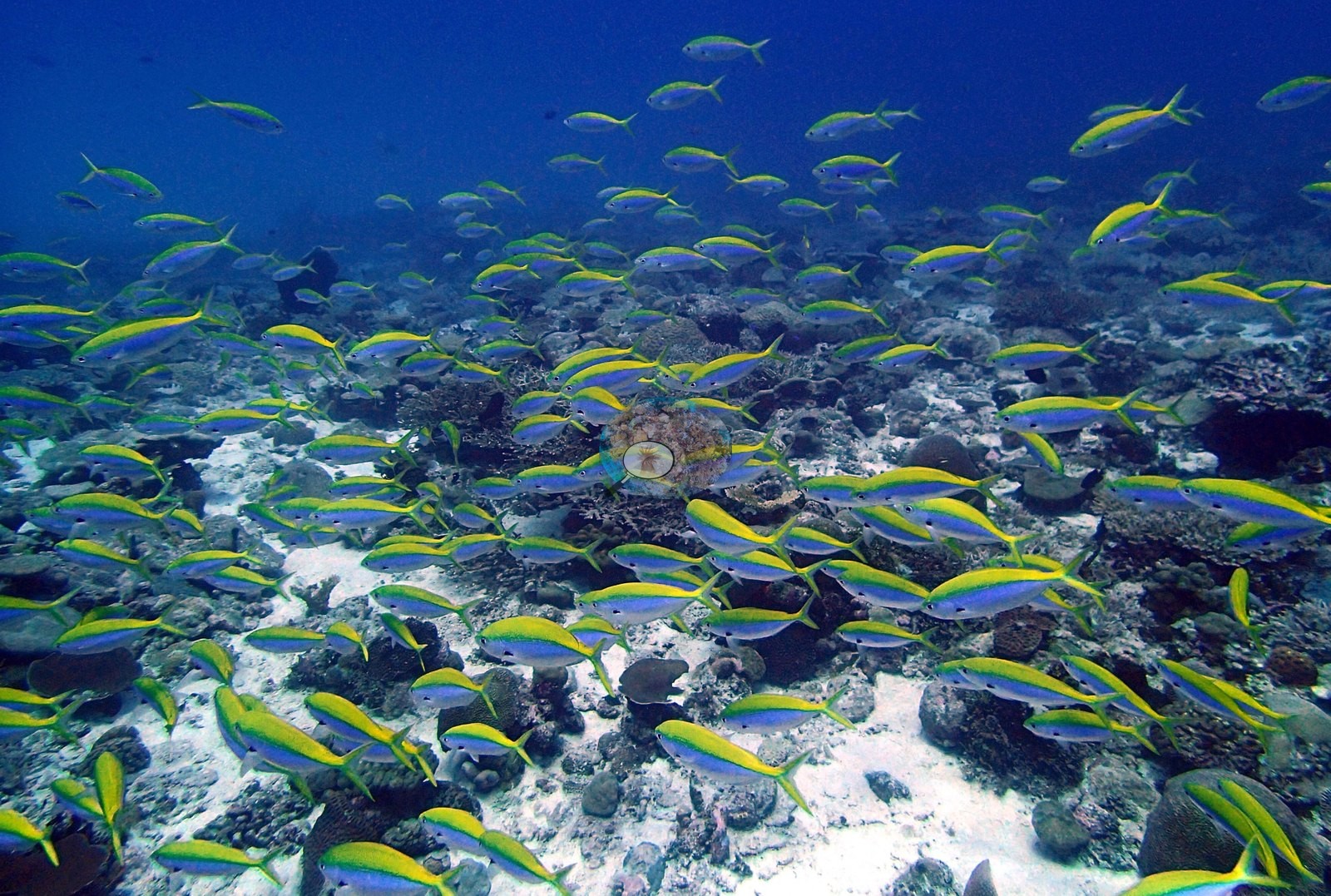
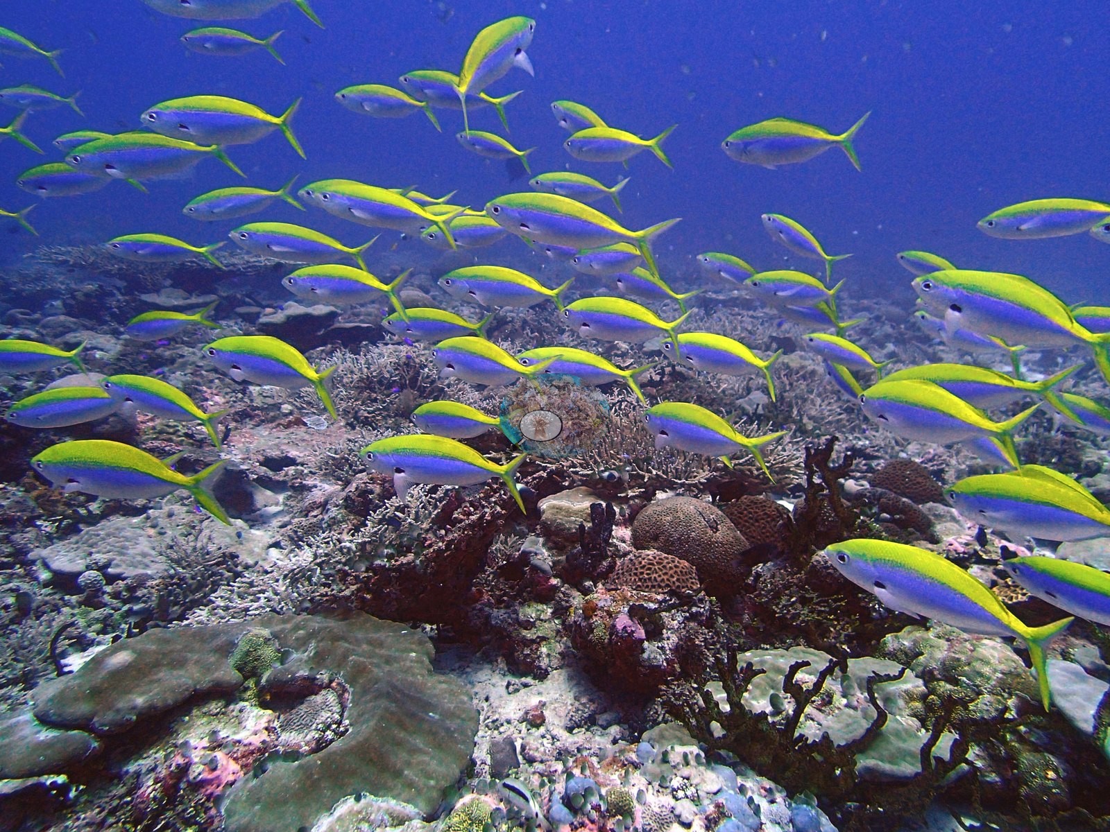
The channel carries substantial fish biomass, and this is the site's most consistent visual feature: eight of the 28 frames are dominated by a very large yellowback fusilier aggregation (e.g., Image 1, Image 11, Image 12).
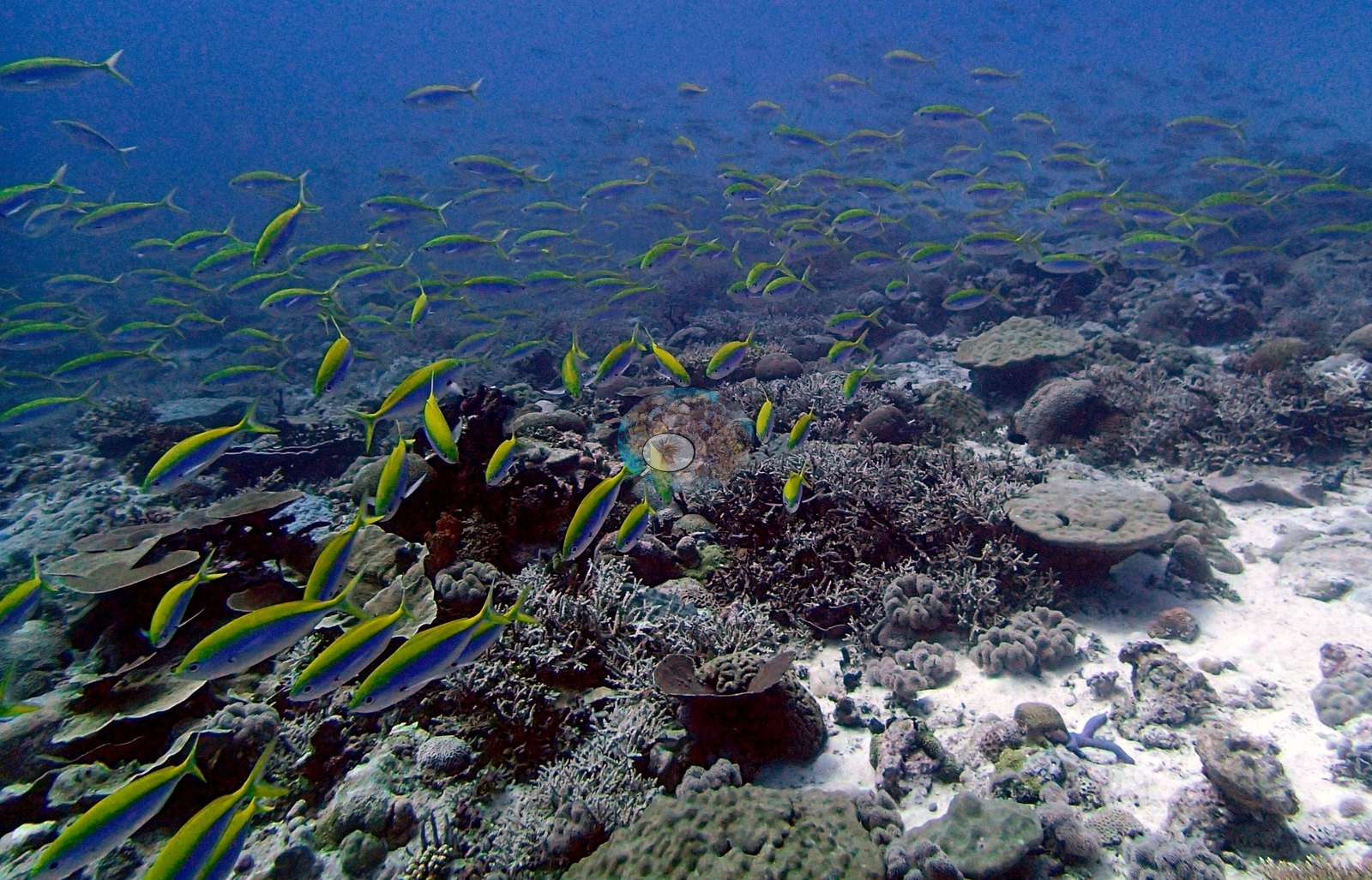
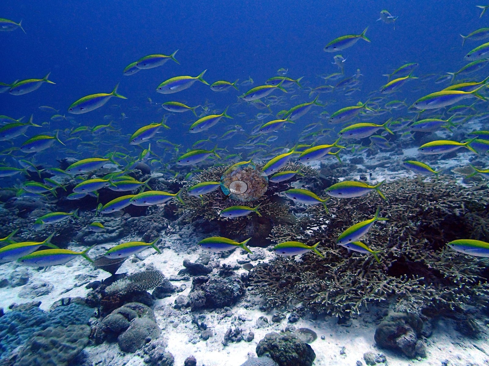
Two frames show it extending to the limit of visibility; six more catch it working over the pavement, with survey gear — a transect tape, a slate — visible at the frame edges (e.g., Image 2, Image 16, Image 20).
Other fauna is sparse but notable: a large golden gorgonian sea fan and a barred grouper in one frame, a blue Linckia sea star on sand in another, black finger sponges, a vivid orange-red encrusting sponge on the rim of the great table, and dense Chromis clouds over the thickets throughout (e.g., Image 23).
Comparisons with other data
No independent survey was made at this exact site; the nearest ones are listed in the table below.
Other notes
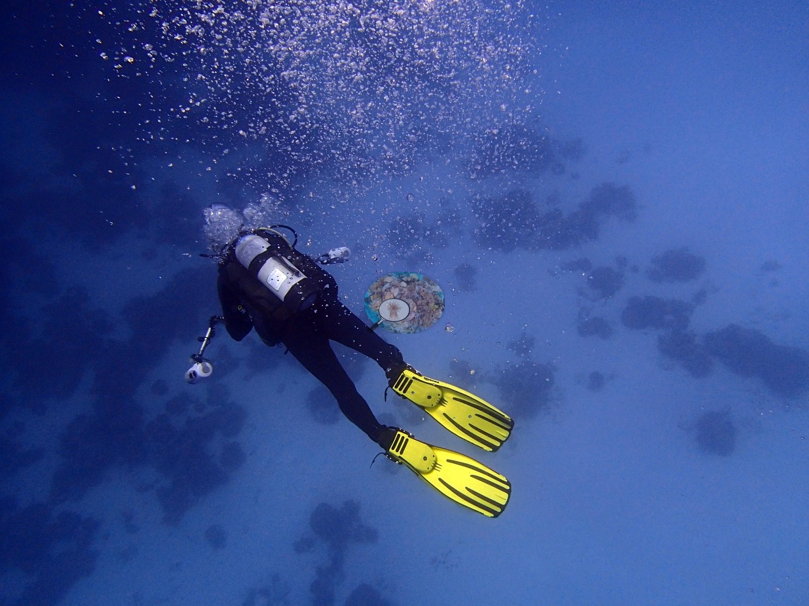
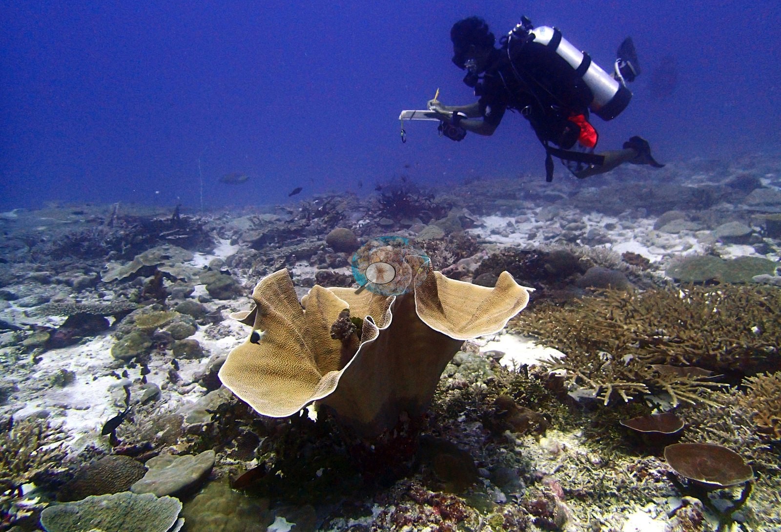
One frame catches a surveyor working a slate above a large cream-tan foliose colony growing as a ruffled vase (e.g., Image 21).
CV model comparison
More info
Those are point counts on the photographs; this is a diver swimming a transect. The models and the reference never saw the same thing. ⚠ SITE-LEVEL ONLY. The 2,500 frames were not associated with any transect taken within 200 m of them, so transect-vs-image comparisons are site means, never frames. The transect value is already in the pin `cover` field (109 of 112 pins, sourced to the paper's suppl. S1) and is read from there, never re-imported. The transect is THE coral-cover value for this site and stands alone. The rows below it are a methods comparison only: no computer-vision value is averaged with it, feeds the headline, or carries over to the site's cover figure (Anderson, 2026-09-22).| Method | Hard-coral cover (%) |
|---|---|
| Transect (published) | 67.0 |
| CoralNet | 31.0 |
| In-house DINOv3 | 40.0 |
| CoralSCOP edited | 29.9 |
| Claude | 31.0 |
Independent surveys nearby
| Agency / program | Year(s) | Stations / distance | Link |
|---|---|---|---|
| Sheppard et al. (2008) | 2006 | 1 station, 2.06 km | Records ↓ |
| Spalding et al. (2024) | 2024 | 1 station, 0.96 km | Records ↓ |
| Spalding et al. 2025 (Chagos 2024 bleaching report) | 2024 | 1 station, 0.96 km | Records ↓ |
| XL Catlin Seaview Survey | 2015 | 1 station, 0.47 km | Records ↓ |
 Dr. Coral (CRD)Year-average (no detectable trend)
Within 5 km, 4 independent survey stations recorded hard coral cover in 8 records between 2006 and 2024. Surveys since 2021 average 50% (range 50%, n=2). This site's own estimate (67%) sits 17.0 points above the recent range (50%); the methods differ, so the comparison is context, not a like-for-like test.
Collected by other programs using different methods (the XL Catlin Seaview Survey uses photo-transects with automated image annotation), so these are context for the figures above, not a like-for-like comparison. Where a station was surveyed more than once the range is shown. Station names are not dive-site names.
| Agency | Site / location | Date | Hard coral cover (%) | Distance | Link |
|---|---|---|---|---|---|
| Sheppard et al. (2008) | Great Chagos Bank | 2006 | 41% (5 surveys) | 2.06 km | HeatCRD database |
| XL Catlin Seaview Survey | transect 36004 | 2015 | 21% | 0.47 km | — |
| Spalding et al. 2025 (Chagos 2024 bleaching report) | Great Chagos Bank - Middle Brother, lagoon (E aspect, 1-3 m) | 2024 | 50% | 0.96 km | — |
| Spalding et al. (2024) | Great Chagos Bank - Middle Brother, lagoon (E aspect, 1-3 m) | 2024 | 50% | 0.96 km | — |
Data & links
- Read the full site report ↗
- Download benthic survey data (CSV) ↗
- Download all LOF-GRE data (933 sites) ↗
- CoralNet image repository for this region ↗
- HeatCRD database ↗
- (reference) ↗
- Photo portfolio ↗
- Coral Reef Diagnostics page for this area ↗
All images from Coral Reef Diagnostics. Data are from Coral Reef Diagnostics and the organizations named in the data-sources table above.
 © Coral Reef Diagnostics.
References
- Mayfield AB, Dempsey AC (2026). Using tourist diver images to estimate coral cover and bleaching prevalence in a remote Indian Ocean coral reef system. Oceans 7(1):1. PDF
- Sheppard C, Harris A, Sheppard A (2008). Archipelago-wide coral recovery patterns since 1998 in the Chagos Archipelago, central Indian Ocean. Marine Ecology Progress Series 362:109-117. PDF
- Spalding M, Bourasseau M, et al. (2025). Coral bleaching and mortality in the Chagos Archipelago, 2024. British Indian Ocean Territory Administration report (gray literature). PDF