
Part of the regional summaries: Chagos Archipelago - Great Chagos Bank West / Brothers / Eagle and Chagos Archipelago
More info
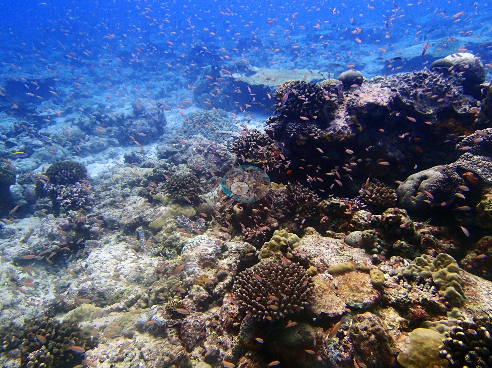
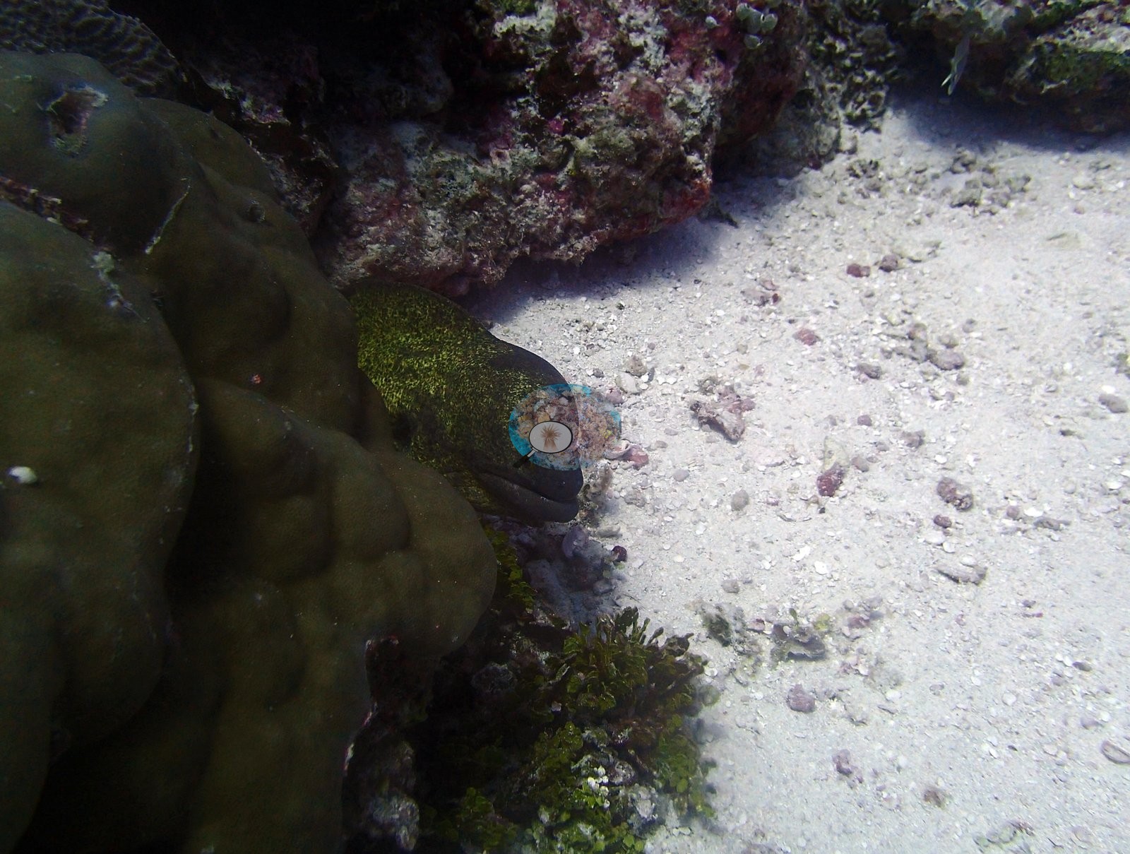
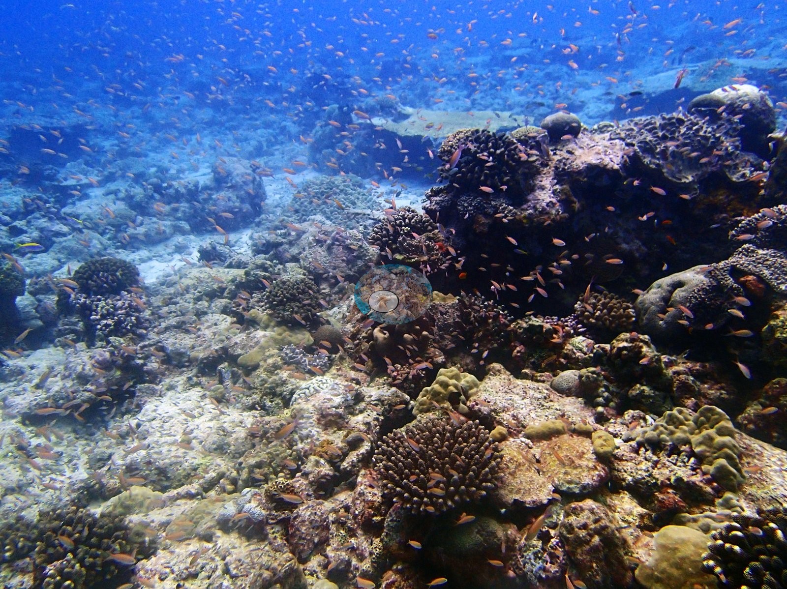
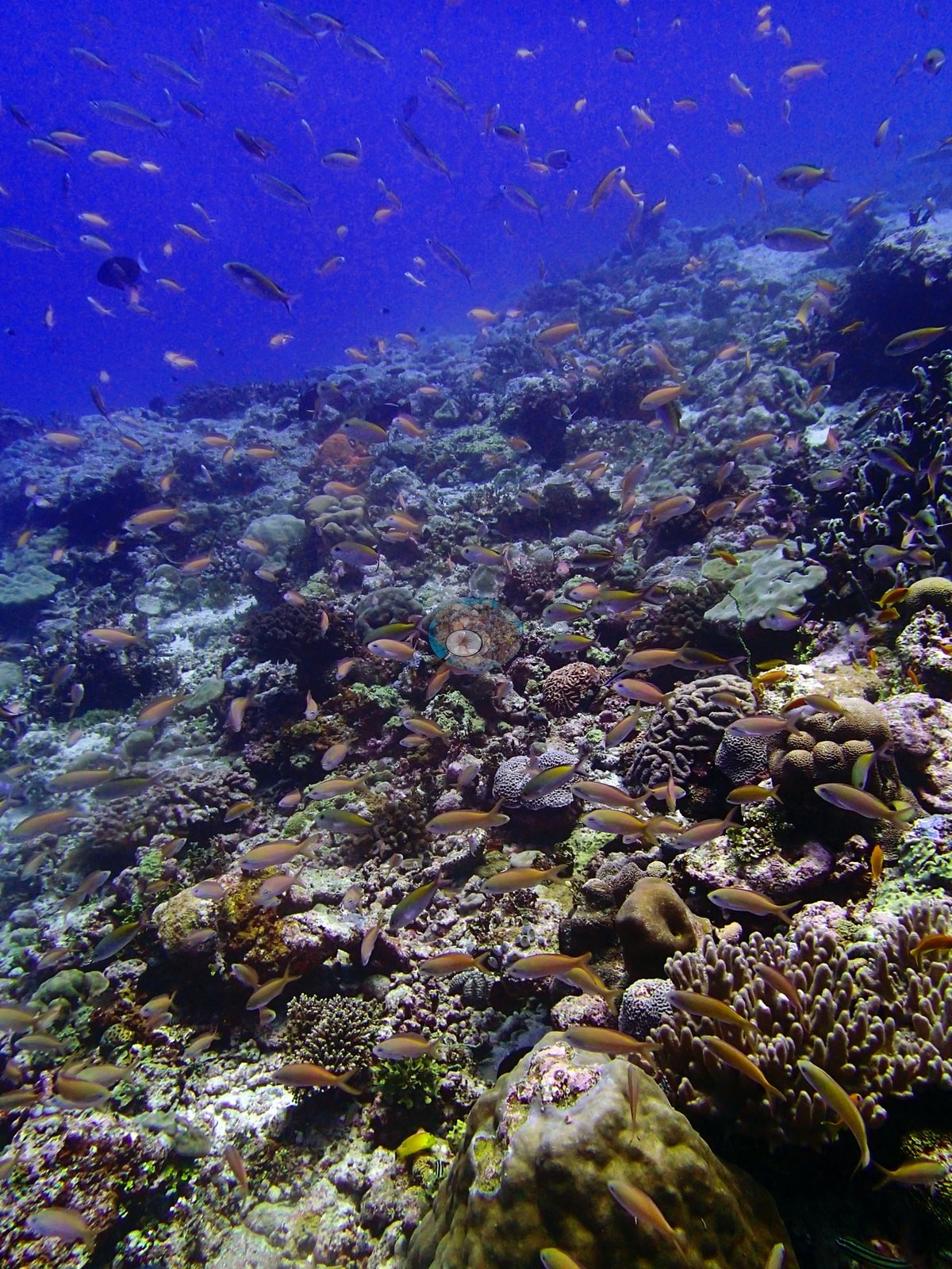
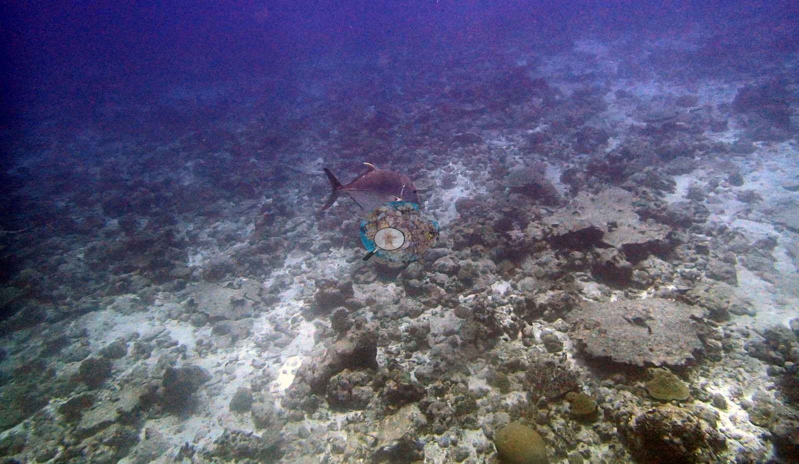
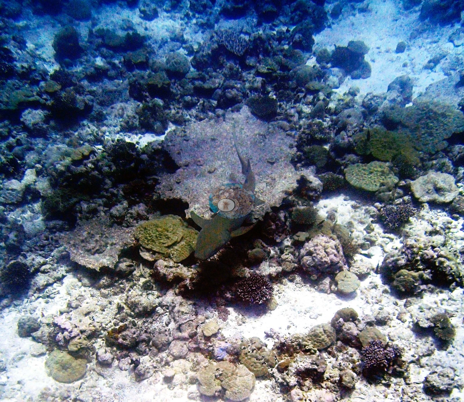
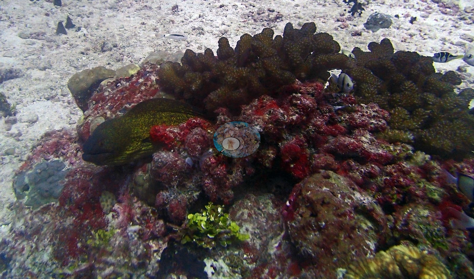
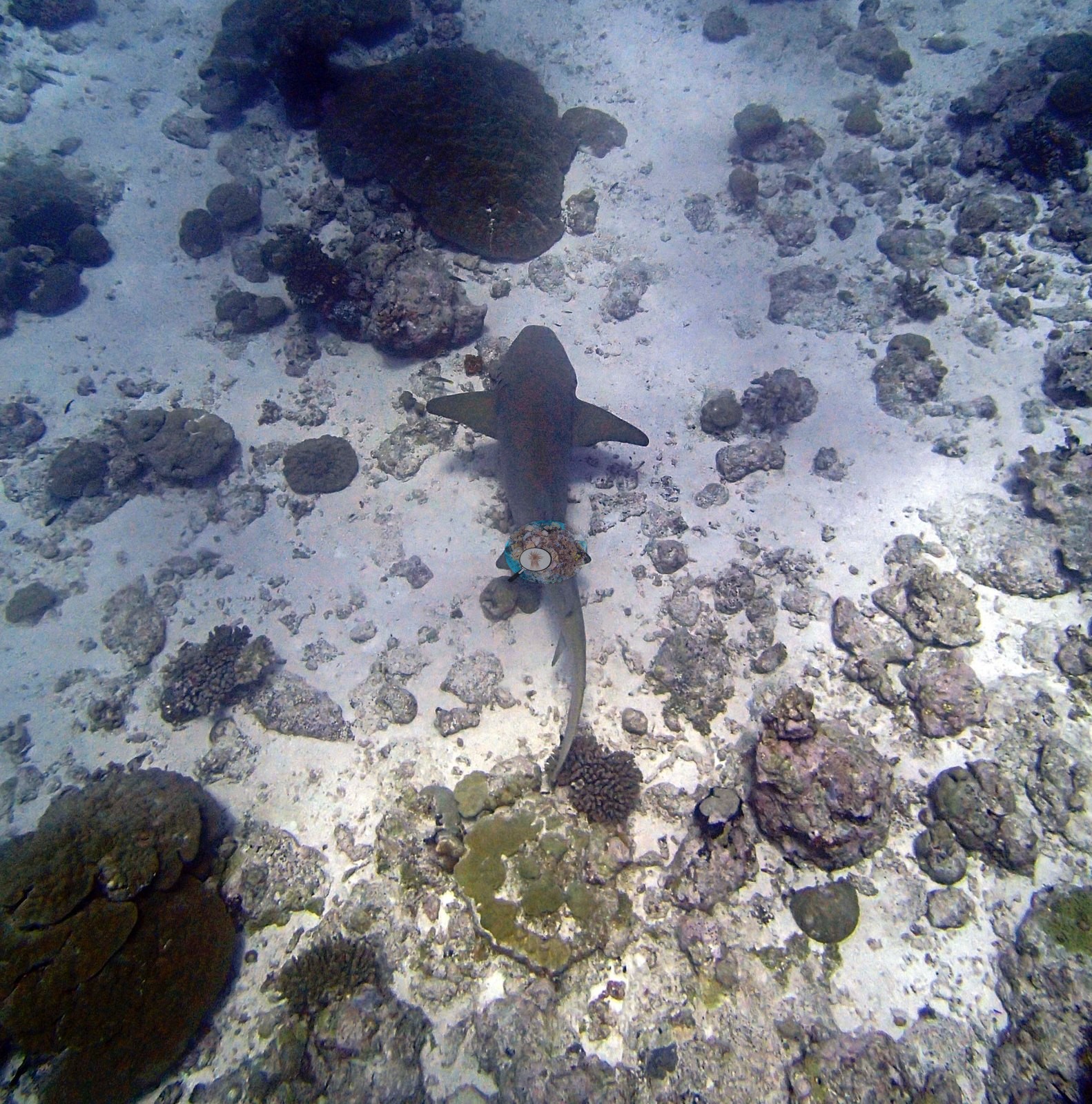
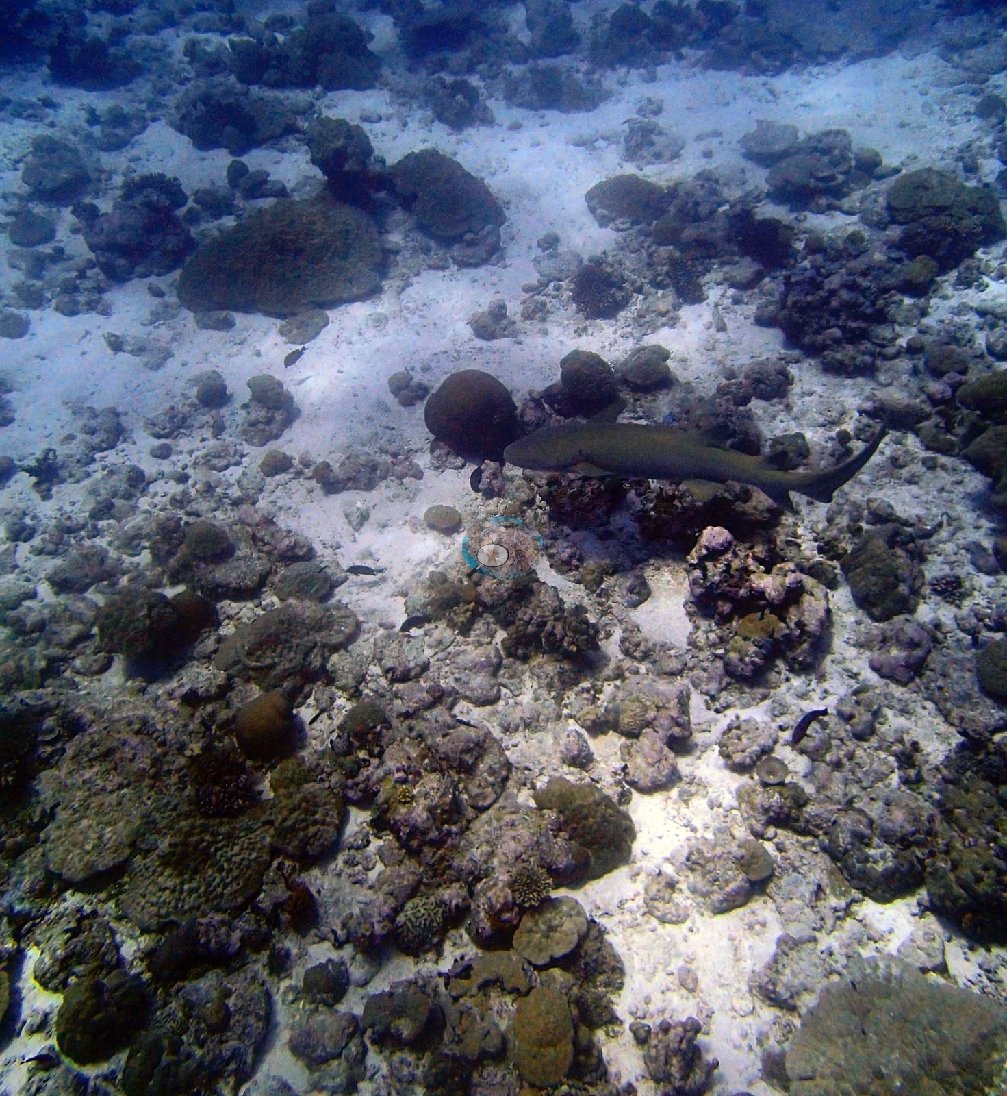
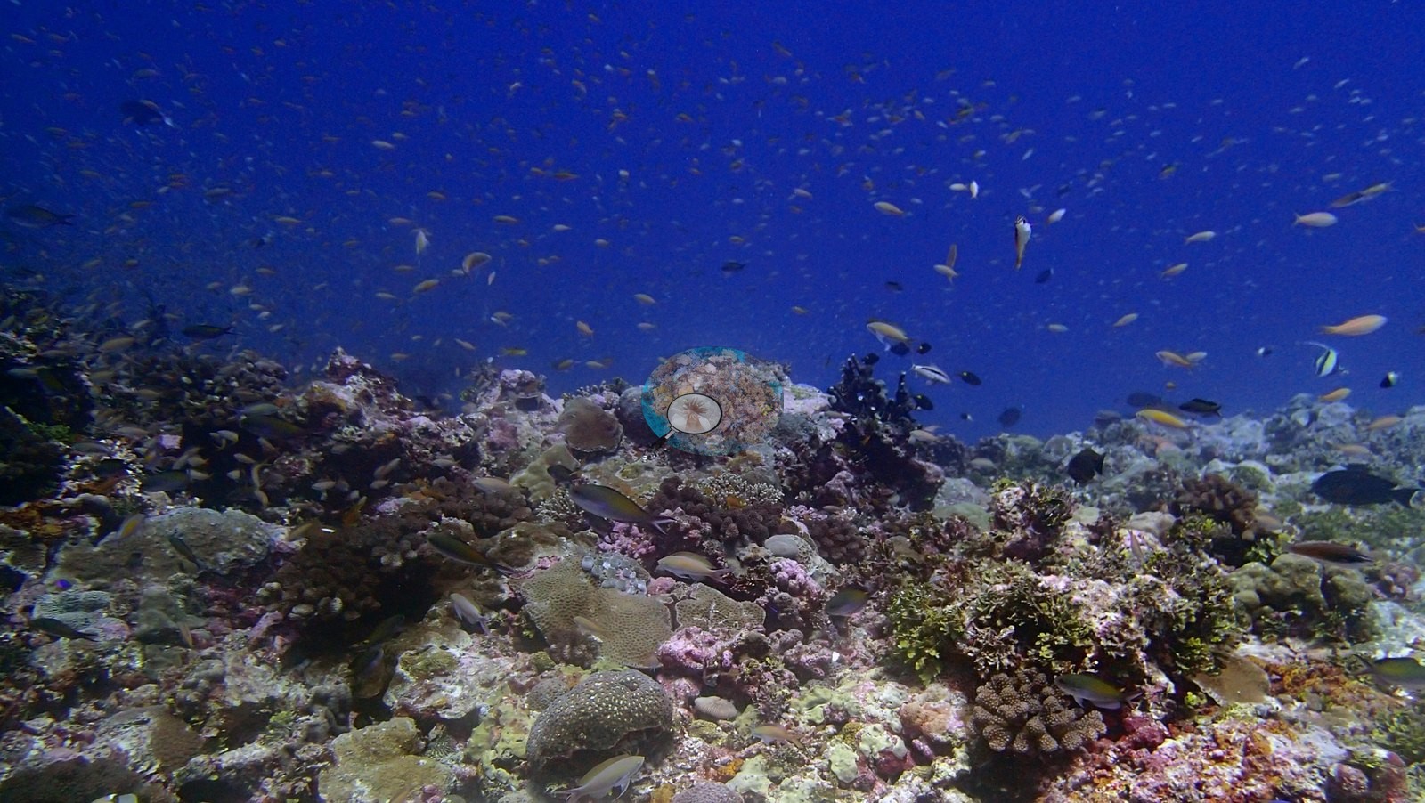
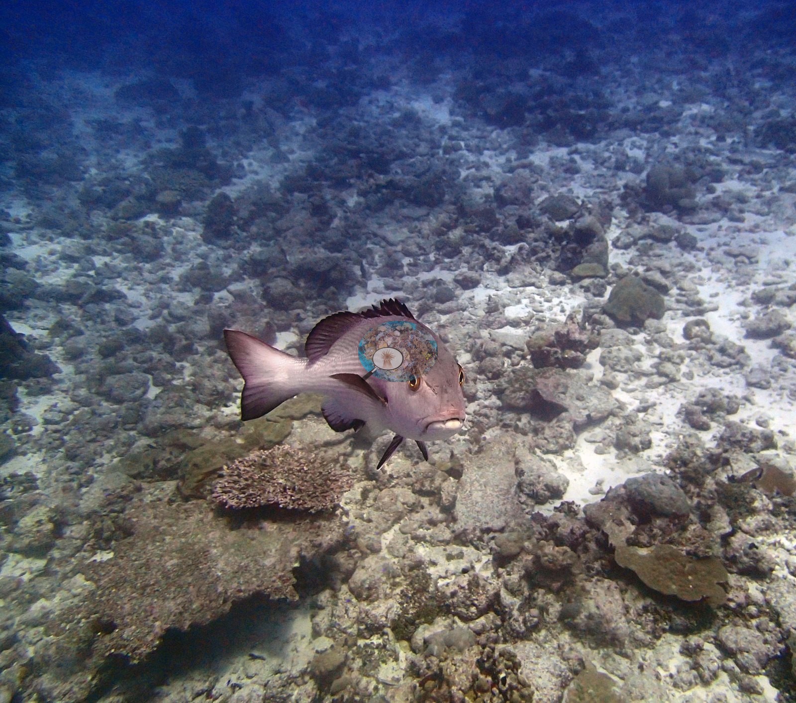
Chagos (NOAA CRW virtual station)BIEA26 has the richest fish life of the Eagle Island survey series - a tawny nurse shark, a giant moray, a mauve-pink snapper, and dense anthias schools thick enough to fill a fifth of some frames. Published cover is 21%, with a notably Porites-heavy assemblage and more rubble than neighboring sites, consistent with an eroded reef plain. Surveyed on the Living Oceans Foundation's Global Reef Expedition.
One independent survey station shown with the program’s logo — click one to see how far it is from this site.
Five other CRD dive sites within 5 km shown in orange — click a marker to open its page.
🗺 Detailed map of the Global Reef Expedition dive sites, Eagle Island, Chagos (Khaled bin Sultan Living Oceans Foundation; opens in a new window)
Site description
Setting
Reef type: fringing, intermediate exposure.
General benthic features
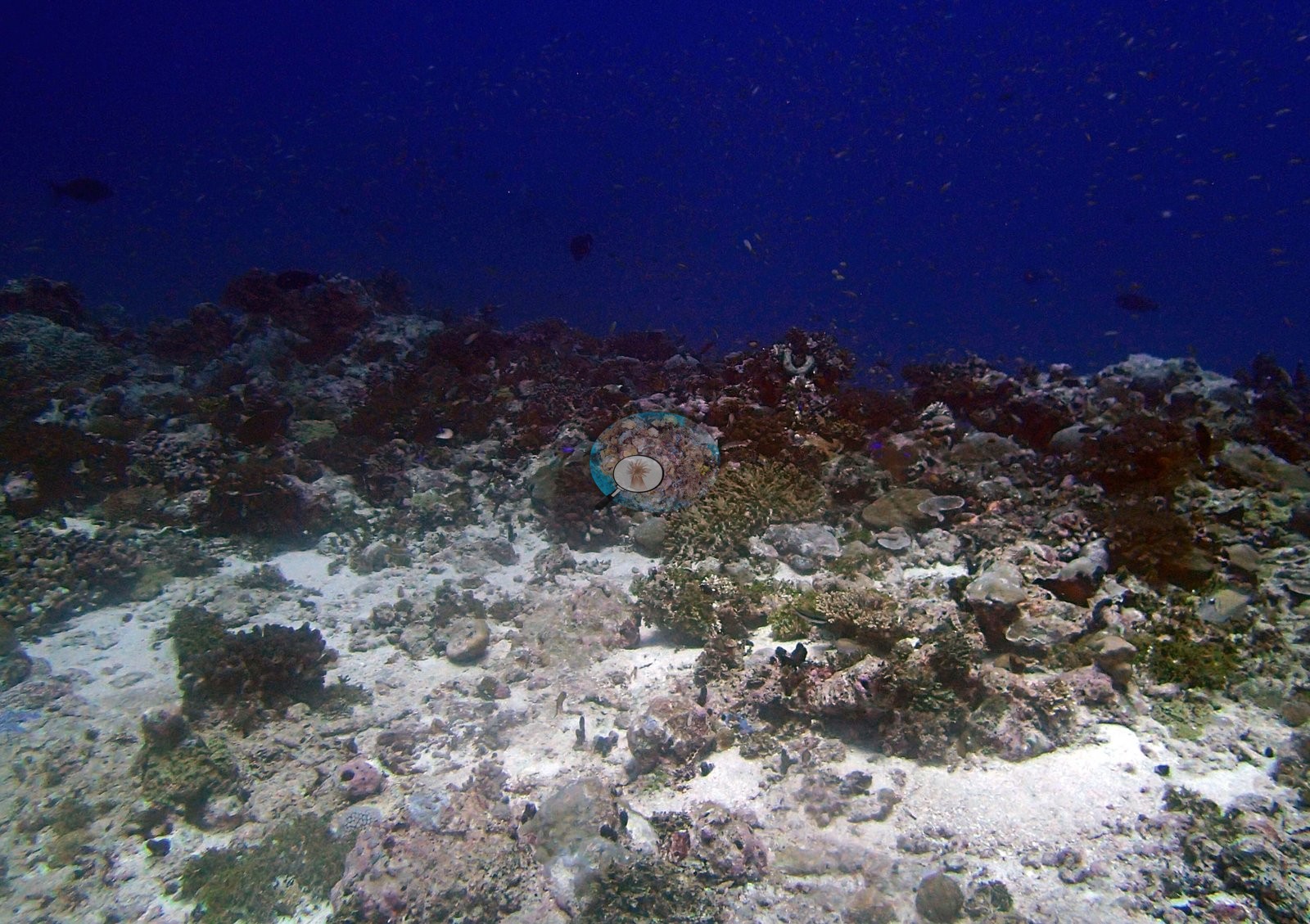
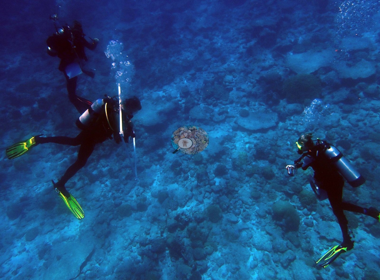
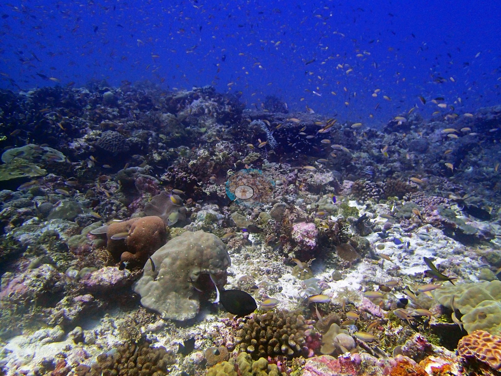
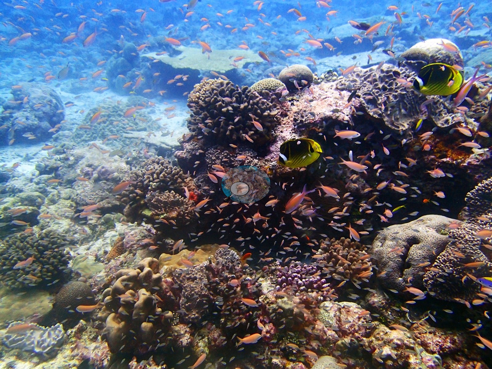
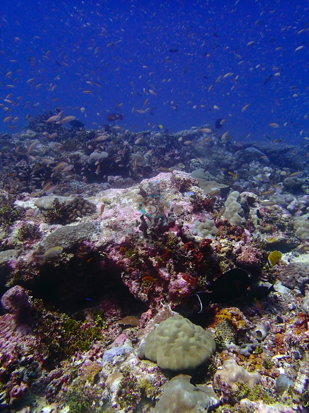
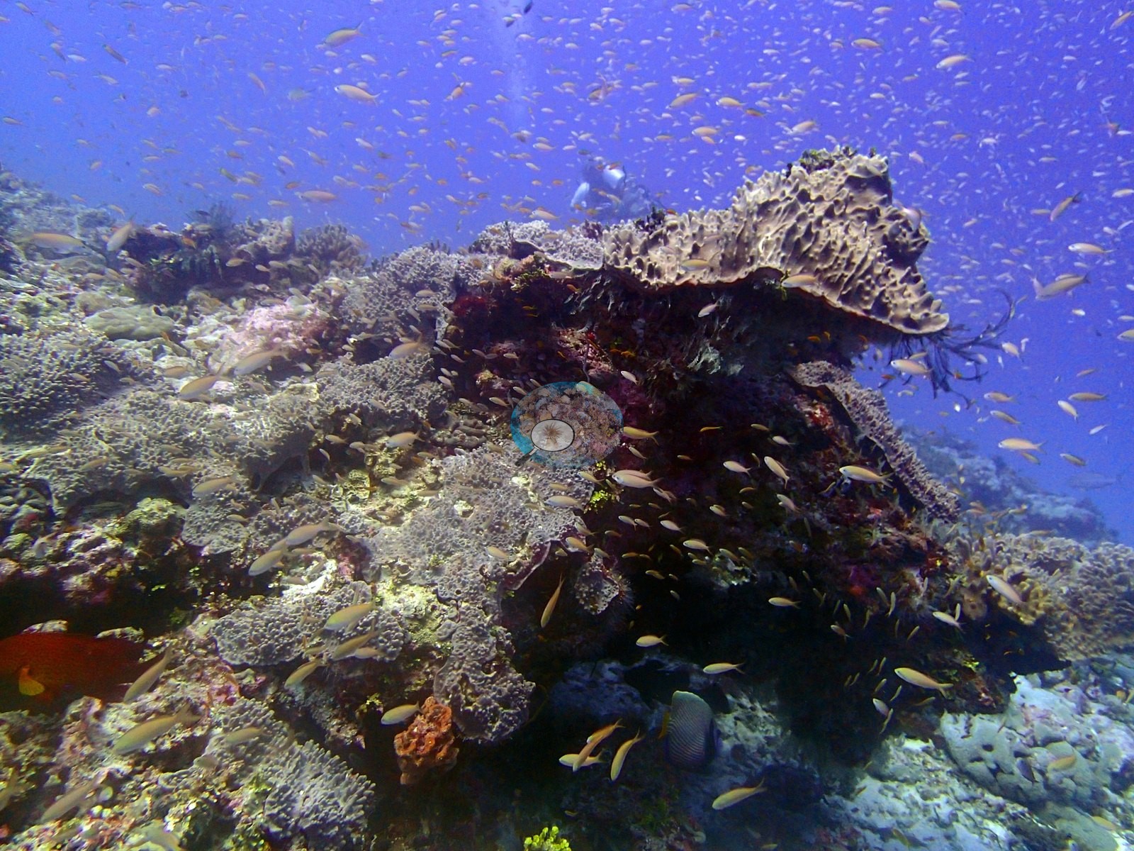
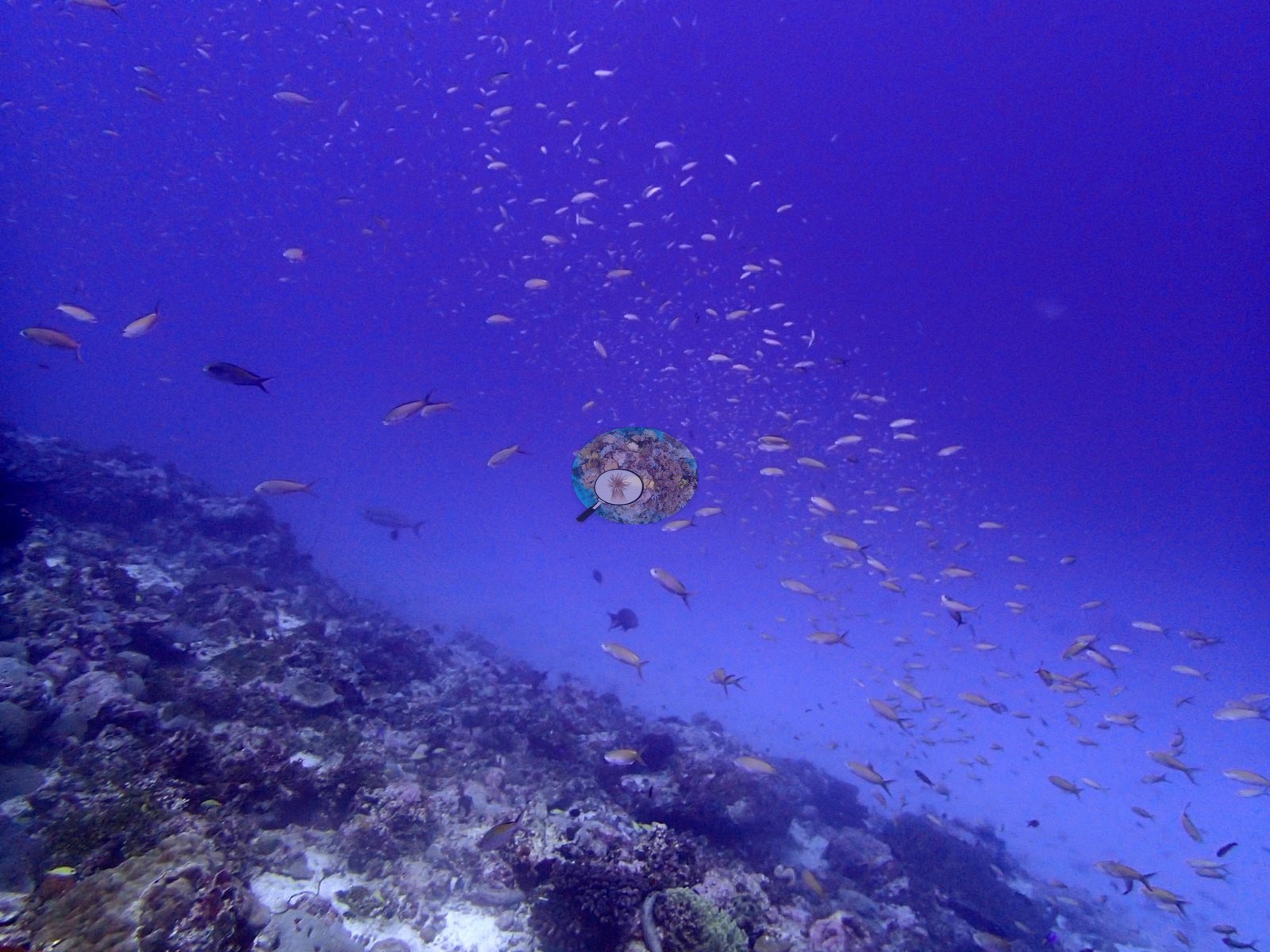
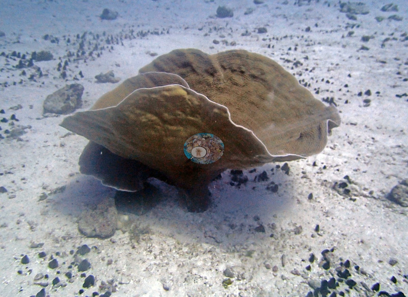
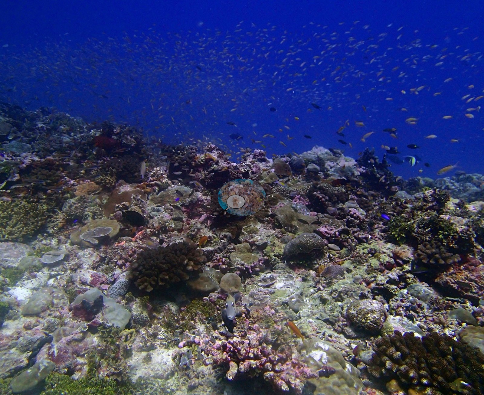
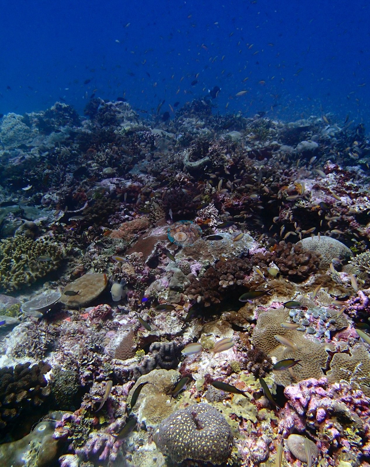
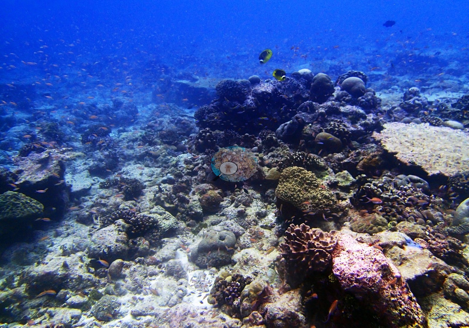
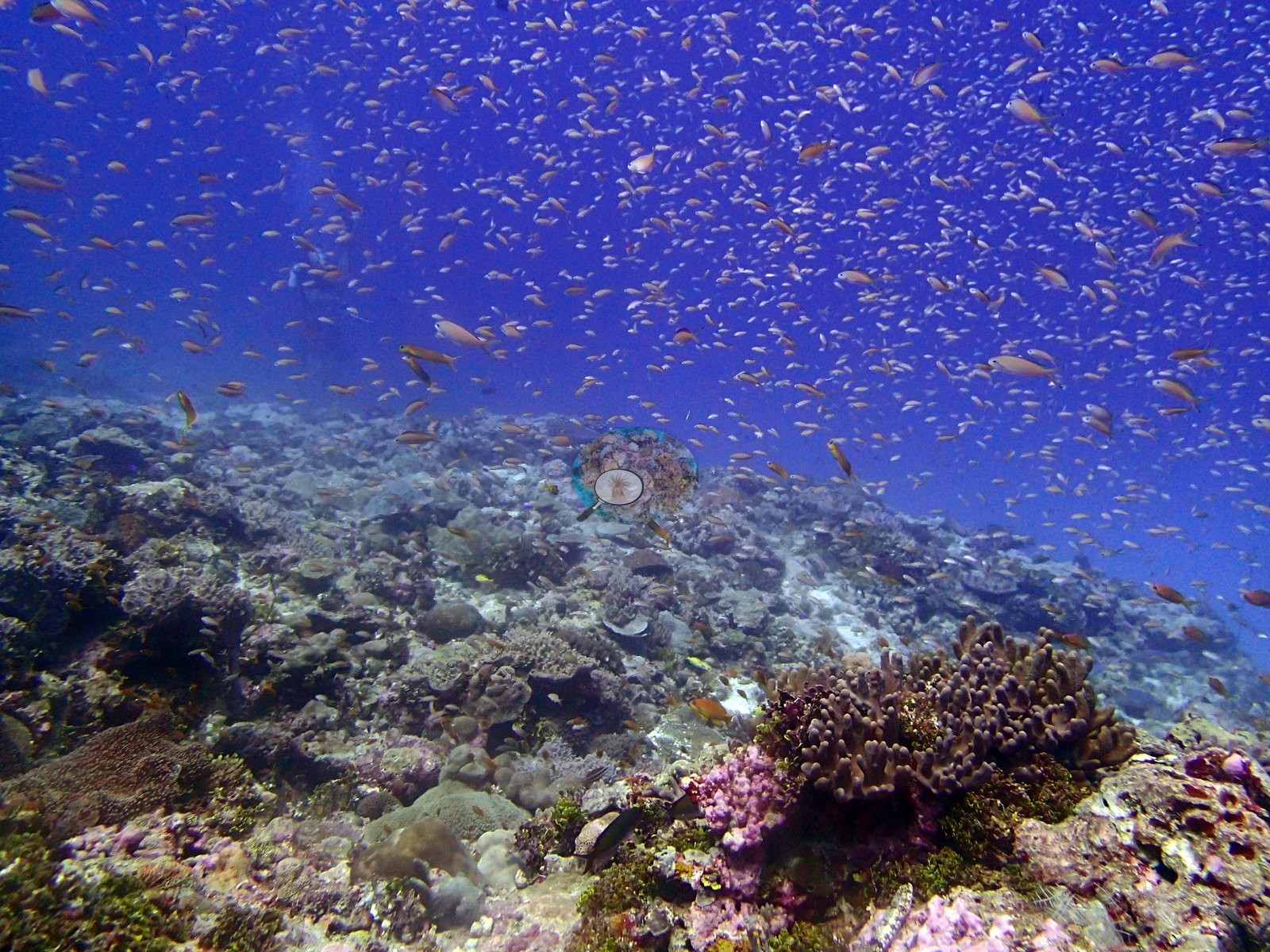
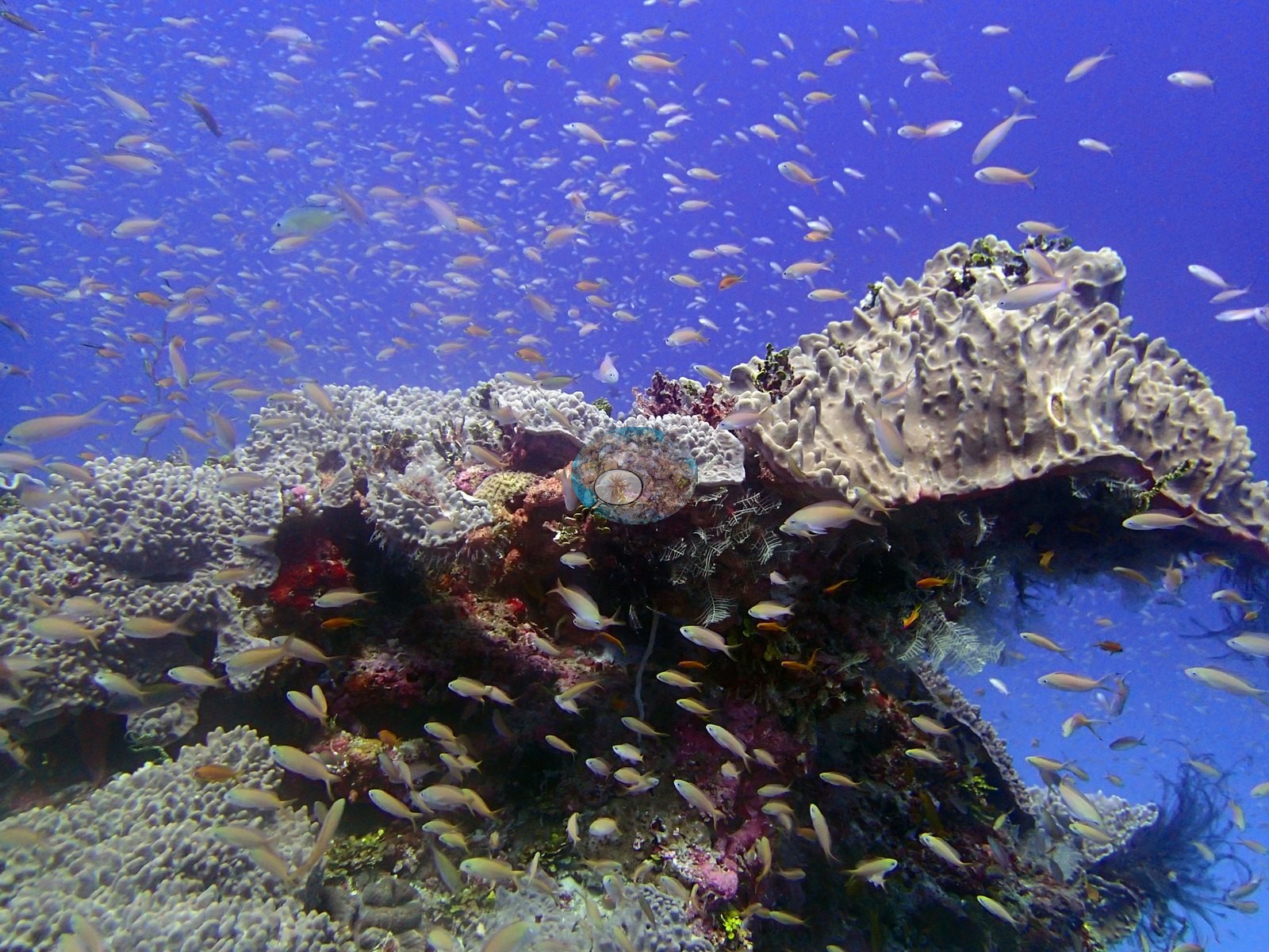
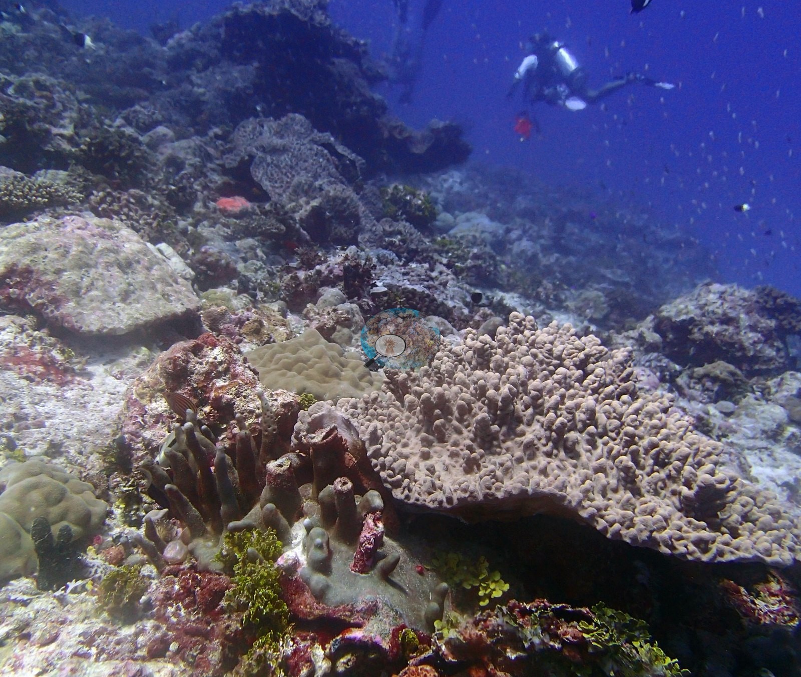
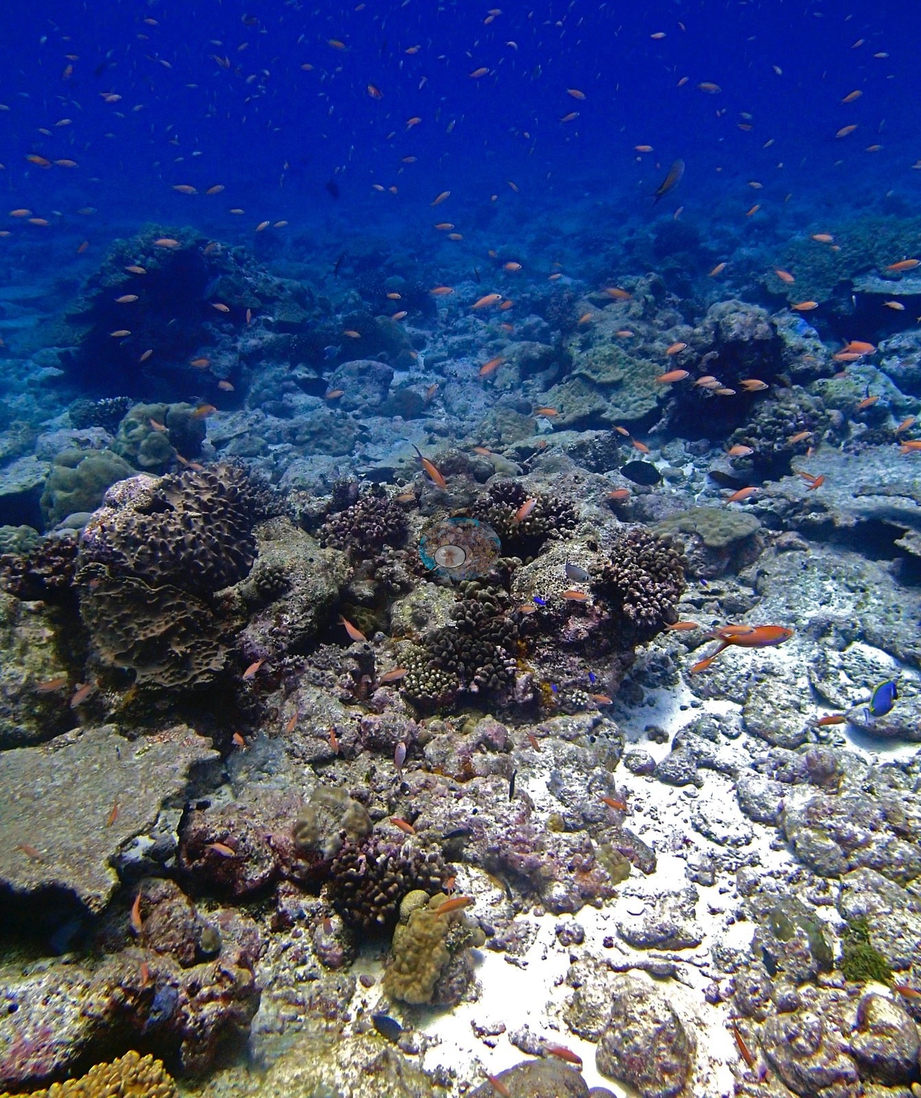
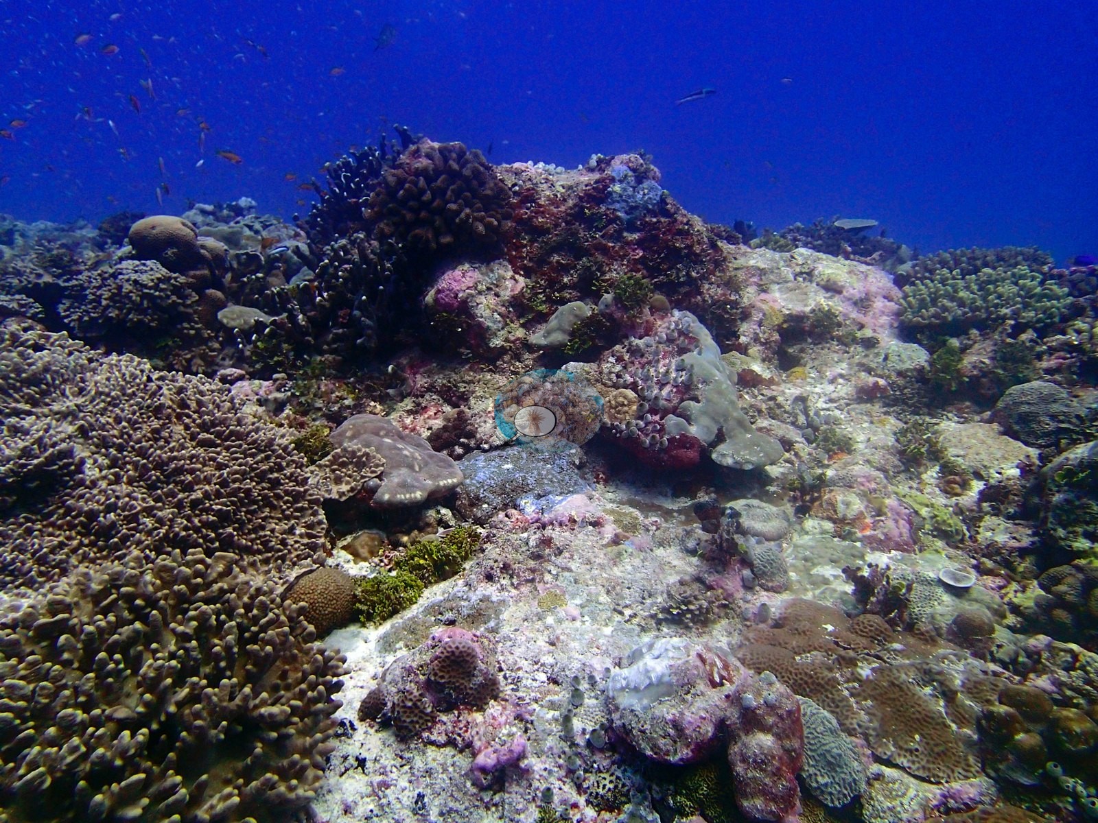
The transect genus list makes this the most Porites-led reef of the Eagle Island series (LOF BIOT-1 survey, supplemental file S1): Porites 12.11% — more than half of all coral cover at the site — then Pocillopora 2.67%, Montipora 1.88%, Acropora 0.83%, Pavona 0.72%, Favites 0.39%, Ctenella 0.39%, Favia 0.32%, Goniastrea 0.27%, Pachyseris 0.23%, Symphyllia 0.20%, Cyphastrea 0.18%, Astreopora 0.17%, Leptastrea 0.15%, Gardineroseris 0.11%, Lobophyllia 0.10%, Galaxea 0.06%, and Alveopora, Montastrea, Psammocora, Fungia, Cantharellus, Leptoseris, Goniopora, and Platygyra each at 0.05% or less — 25 genera in all. The low Acropora figure (0.83%) is a transect result, not a framing accident of the photographs. The substrate and algal categories run crustose coralline algae 24.47%, bare substrate 18.73%, turf 12.62%, erect algae 7.83%, sediment-laden turf 7.57%, non-coral invertebrates 5.78%, macroalgae 1.75% and cyanobacteria 0.26%. From 14:38 to 14:56 (P3170439–P3170462) the camera works a dense, structurally complex reef top — a mosaic of small, tightly packed colonies on CCA-crusted pavement under clouds of anthias and fusiliers. P3170440, P3170441, P3170442, P3170461, P3170462, and P3170469 are the richest benthic frames of the dive. Coral occurs as patches and clusters rather than a continuous carpet: rounded and lobed massive domes compatible with Porites, cream and tan digitate and nodular thickets, encrusting and small foliose forms, bushy Pocillopora-type colonies and scattered small branching colonies in mauve, purple and olive, among broad expanses of pale exposed carbonate, rubble and low turf with pink and maroon coralline crusts on the harder surfaces. Tabular Acropora is conspicuously scarce in these frames compared with the other reefs of this batch — consistent with the transect's 0.83% Acropora. P3170458 and P3170459 hold the most striking piece of structure in the set, a large gray-white foliose colony perched on a bommie with crinoids and red sponge beneath it, and P3170445 is an isolated foliose or leathery colony standing alone on white sand. Then from 15:00 the dive crosses onto a flat, pale, low-relief plain of consolidated pavement, rubble and coarse sand carrying only scattered small colonies — P3170464, P3170465, P3170477, P3170478, and P3170479–P3170482 are all that same barren ground, and it occupies the last twenty-five minutes of the dive.
Coral cover
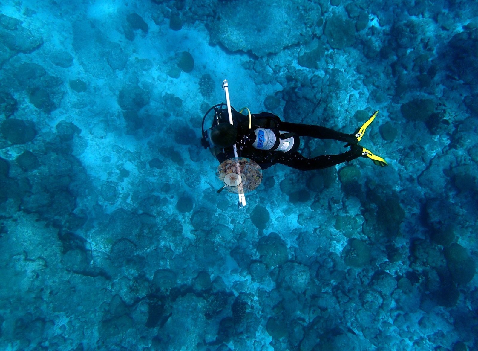
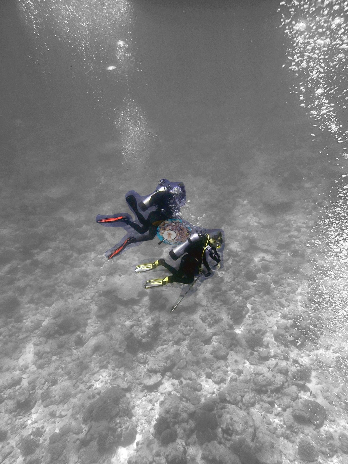
The measurement at BIEA26 is the LOF BIOT-1 benthic transect survey. Coral cover 21%, from LOF BIOT-1 in situ transects (Mayfield & Dempsey 2026, Oceans, suppl. S1) — a diver transect measurement, published by Anderson himself, and the authoritative record of cover and community at this site. Against it the transects put algal cover at 54.5% of the benthos. Everything below supplements that transect; no cover value may be read off any photograph, and where imagery and transect appear to differ, the transect governs. The computer-vision comparison, and the clearest model-failure case in the Eagle Island series. All 32 frames are CoralNet-annotated and all 32 matched to Coralscapes masks, so the CV basis here is complete. Across those 32 frames the masks put live hard coral at 8.9% of image area and the 30-point annotation (960 points) at 14.9% of all points, against the transect's 21.0% — deviations of −12.1 and −6.1 pp, mean of three methods 14.9% ± 6.1. BIEA26 inverts the batch: at BIEA22, BIEA23 and BIEA25 both image methods read high against the transect, and here both read low, with Coralscapes sitting 6.0 pp below CoralNet — its second-widest model-versus-model split of the series. (2) The CoralNet deficit is largely arithmetic; the Coralscapes deficit is not. Renormalised over points that landed on substrate rather than open water, the point set gives 19.4% live — within 1.6 pp of the transect (29.6% if the 26.5% Unknown points are dropped too); the same renormalisation for Coralscapes, excluding its background/dark class, still gives only 15.8%. (3) Coralscapes fails on the fine-grained mosaic, not on the big colonies — this is the main CV finding at the site. Sixteen of the 32 frames get under half the point set's live cover from the masks, and the within-site correlation of the two per-frame estimates is only r = 0.63. Where coral is large, discrete and close-range the masks match or beat the points (P3170454 26.2 vs 20.0, P3170455 26.6 vs 23.3, P3170462 28.4 vs 30.0); where it is a dense wide-angle mosaic of small, turf-fringed, low-contrast colonies they collapse (P3170461 9.6 vs 23.3, P3170469 12.8 vs 30.0, P3170468 10.4 vs 20.0, P3170465 1.2 vs 16.7, P3170480 4.0 vs 23.3) — and those first two are the frames a human reader picks out as the richest at the site. A resolution-and-contrast failure mode, and the single biggest contributor to the −12.1 pp. There is also a real within-dive structural split behind all of this: the eighteen reef-top frames average CoralNet 15.9% / Coralscapes 12.6%, the fourteen frames over the barren plain average 13.6% / 4.2%. A one-hour swim samples that plain heavily; a transect run does not. These are image products with their own footprints and denominators, reported as a method comparison; the transect's 21.0% is unaffected by any of it. In composition, Coralscapes gives massive and meandroid forms by far the largest share of live area at 49.6%, then other hard coral 25.3%, tabular Acropora 9.2% and Pocillopora 9.1%; the point set apportions live coral Porites 54.5%, other hard coral 23.8%, Acropora 18.9% and Pocillopora 2.8% — the most Porites-weighted image assemblage of the series, against BIEA25's Acropora-led 49.2%, and in the same direction as the transect's own Porites-led genus list. Non-coral cover in the point set is crustose coralline algae 4.4% and turf 25.7%; structural loss registers as dead coral 1.8% of image area and rubble 11.4%, more than double BIEA25's 5.2% and consistent with the rubble plain. Frame-to-frame live cover runs 0% to 30.0% by points and 0% to 28.4% by mask area. And the dive's last three frames are diver portraits: P3170483 is the cleanest single-diver-with-transect-pole frame of the redo, a clean overhead of a diver carrying the white banded pole across a Porites-boulder pavement; P3170485 repeats it with three divers; P3170484 shows two more in a heavy selective-desaturation edit. Coralscapes scores those three at 0.4%, 0.0% and 0.0% live, so the dive's final frames contribute nothing but denominator. Live hard coral measured on the in situ benthic transects of the LOF BIOT-1 expedition (Mayfield & Dempsey 2026, Oceans, supplemental S1), against algal cover of 54.5% of the benthos. The transect figure is this site's authoritative cover value; no image-derived product overrides it. Across methods the same reef reads: transects 21% · CoralNet points 14.9% · Coralscapes masks 8.9% (32 frames). These products have different sampling footprints and denominators and should not be averaged.
Stressors
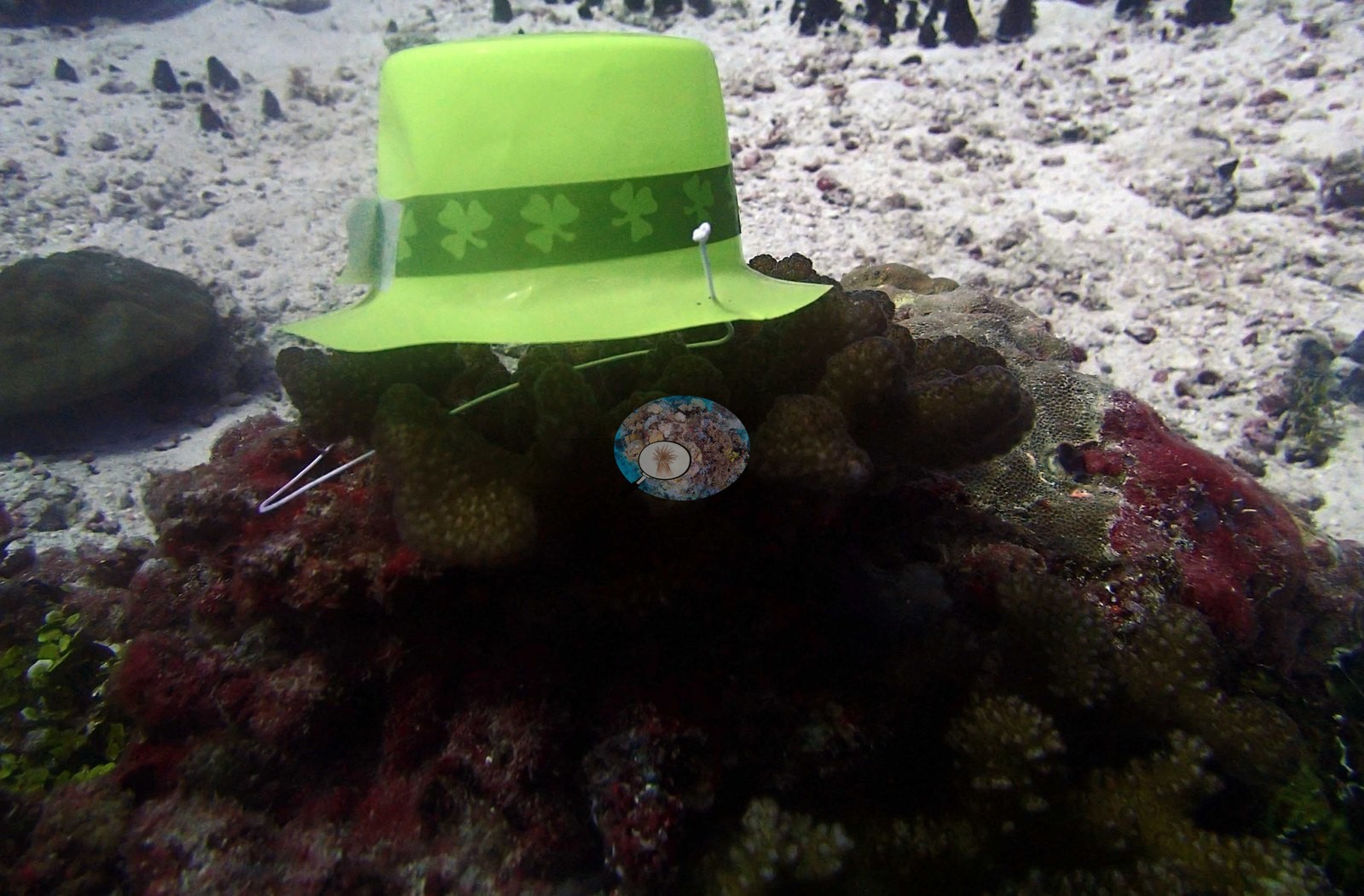
Survey conditions on 17 Mar 2015 at 6.17221°S, 71.33191°E: in situ temperature 29.2°C, salinity 34.5. Anderson's published percentage bleached for this site is 8.61% (% bleaching (2nd training), Mayfield & Dempsey supplemental file S1; the build manifest's null pct_bleached is a manifest gap, not a contradiction). Two frames stand outside the survey. P3170447 shows a bright green St Patrick's Day hat, shamrock hatband and all, set down on top of a living Pocillopora-type colony against white sand — BIEA25's flag (9) predicted this frame from a green woolly hat worn that morning, and it is confirmed. A prop rather than equipment, recorded because it is resting directly on live tissue. Condition and bleaching. Colonies through these frames are normally pigmented in brown, olive, cream, tan, and mauve; the wide pale areas read as old exposed carbonate and turf-covered pavement rather than as recently bleached tissue, and no colony in the set is unambiguously white. No disease lesion or clear predation scar resolves at these ranges, and no crown-of-thorns is present in any frame — the single automated COTS entry, cots_frames: [["P3170479.jpg", 0.01]], is 0.01% of image area, a few dozen pixels on a shark-over-rubble frame, and must not reach the COTS log as a sighting. The photographs do not measure this site's bleached fraction and none is estimated from them: Anderson's published 8.61% (Mayfield & Dempsey supplemental file S1) is the authoritative number. The image products' own bleaching outputs are reported as method outputs only: the point set puts bleaching at 1.35% of annotated points — 13 points in total, concentrated in Acropora 1.15% and other hard coral 0.21% — while Coralscapes reads 0.01% bleached area site-wide. Four of those 13 points sit where the frames do not support them (two bleached-Acropora points on P3170445, a frame holding one brown laminar colony on white sand with no Acropora in it, and two on P3170485, a 70%-water diver frame; P3170481 and P3170482 carry three more on turf pavement). That is a point-set provenance problem and concerns the point set alone.
Fish and other fauna
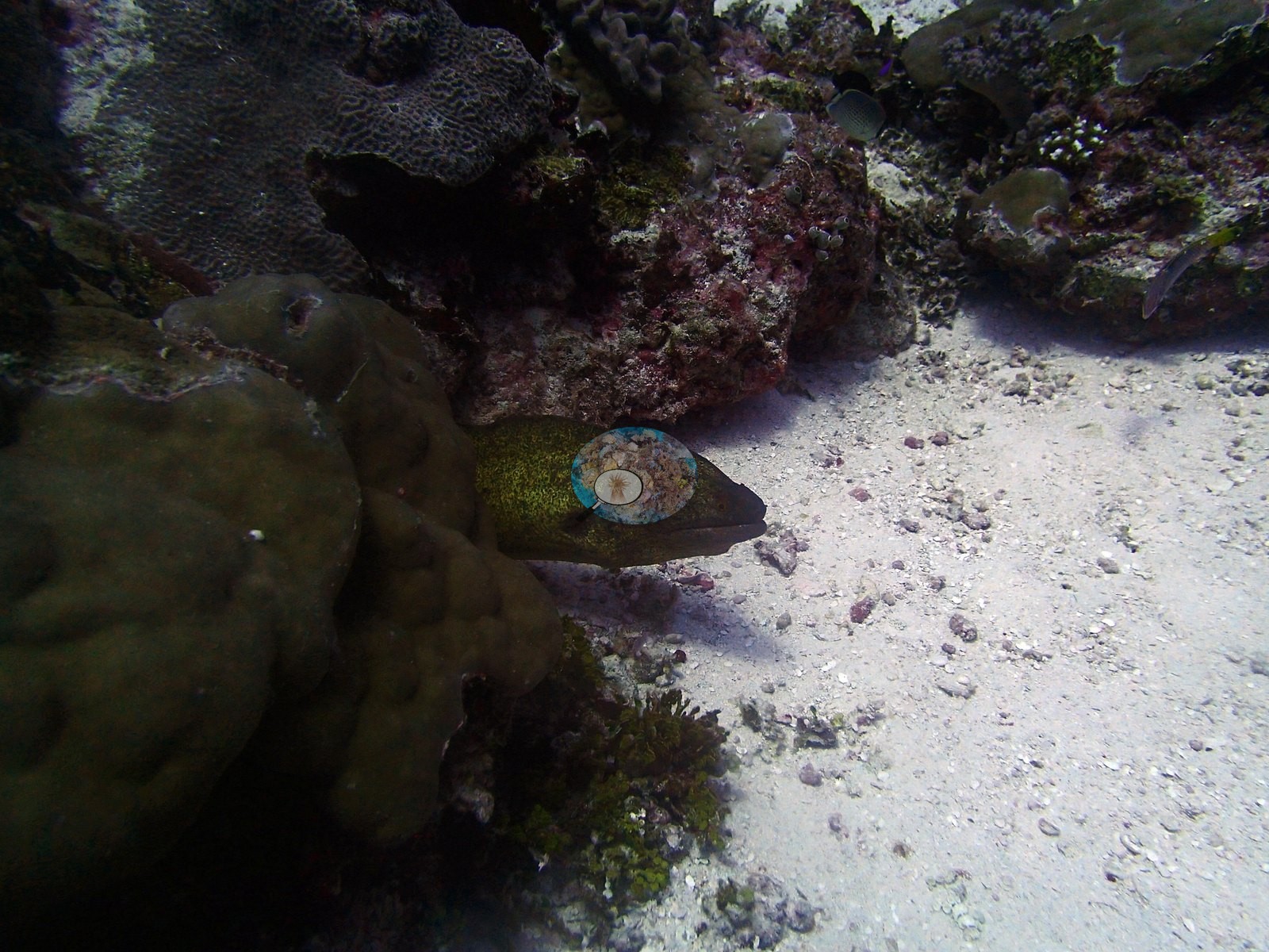
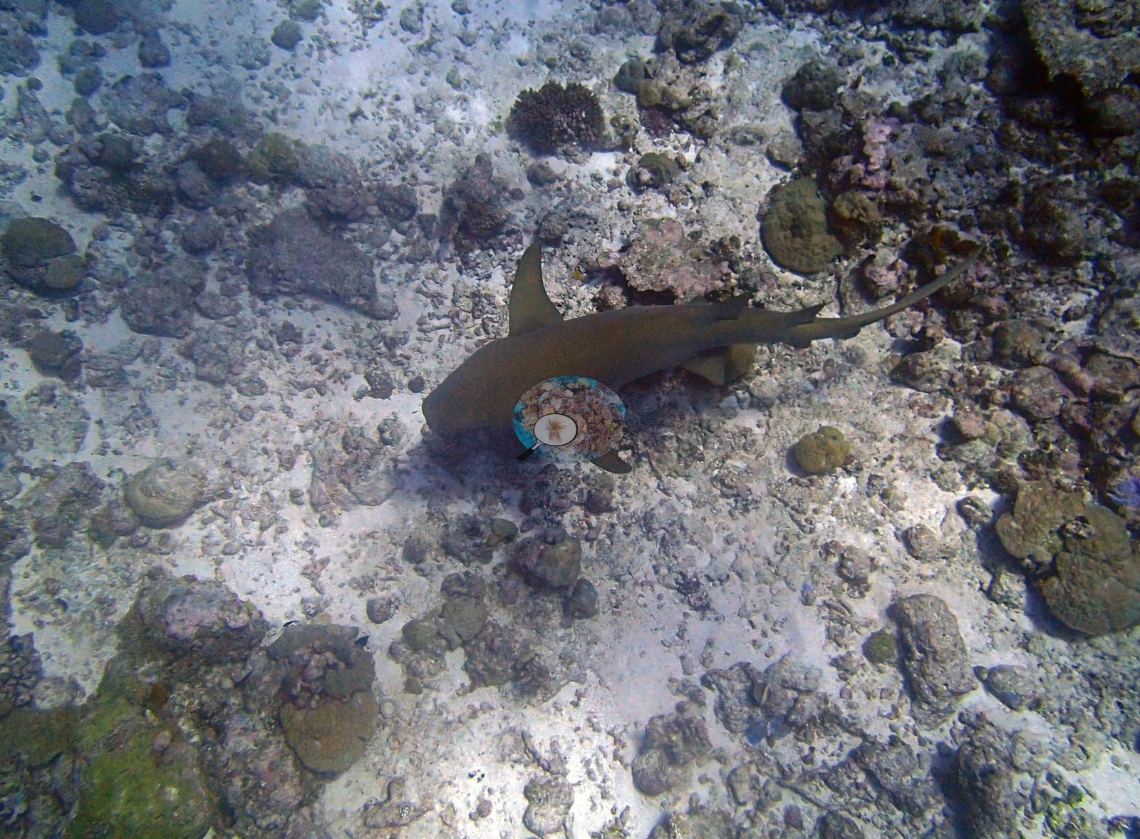
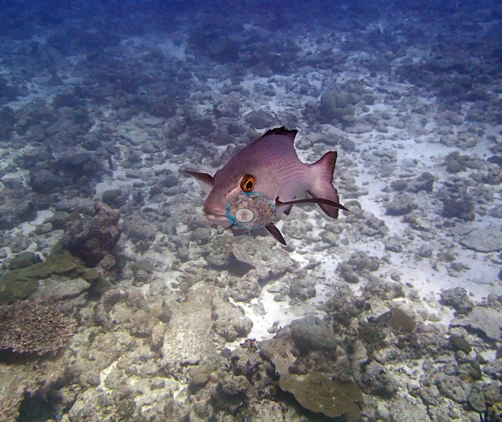
Sponges appear in 21 frames, debris in 5, urchins in 1 and anemones in 1. The macrofauna is the best of the Eagle Island series and nearly all of it is in the second half. Four frames hold sharks. P3170479, P3170480 and P3170481 were shot in fourteen seconds and are one animal: broad-headed, dorsals set well back over the pelvics, caudal long and low — compatible with a tawny nurse shark (Nebrius ferrugineus), P3170480 the clearest. P3170482, forty-four seconds later, shows a slimmer animal with a more forward first dorsal, plausibly a whitetip reef shark (Triaenodon obesus) and probably a second individual, but neither call is safe from these frames and the BIEG04 precedent argues for leaving both hedged. A large olive-yellow, densely speckled moray compatible with the giant moray (Gymnothorax javanicus) appears in P3170446 and again eight minutes later in P3170454 and P3170455; whether that is one animal or two is not resolvable. P3170464 and P3170465 are portraits of a single mauve-pink, orange-eyed snapper compatible with Lutjanus gibbus. Also a jack or trevally (Carangidae) over the barren pavement in the strongly magenta-cast P3170478, raccoon-type butterflyfish (Chaetodon lunula-type) in P3170467 and P3170469, a powder-blue surgeonfish (Acanthurus leucosternon) in P3170477, and dense Pseudanthias-type anthias over almost every reef-top frame — thick enough in P3170459, P3170461 and P3170469 that Coralscapes assigns 18–20% of their area to fish.
Comparisons with other data
Also on record for this site: Coral cover: 21%.
Other notes
No depth-stratified (D1–D4) breakdown is carried for this site in the pin material. Three things were tested. (1) Blue-water dilution is present and far too small to account for it. Nine frames are ≥40% water (P3170441, P3170443, P3170457, P3170460, P3170462, P3170478, P3170483, P3170484, P3170485); dropping them moves CoralNet 14.9→16.5% and Coralscapes 8.9→9.9%, narrowing the gaps by only 1.6 and 1.0 pp. A <30%-water filter (19 frames) gives 17.4% and 9.6%, and dropping the five diver frames as well changes almost nothing. Image-by-image: two reefs photographed in one hour. All 32 habitat frames from Anderson's folder BiEa26-finished were reviewed (dive window 14:38–15:39 from frame EXIF — the second dive of the 17th and the last Eagle Island site of the mission, entering the water 1 h 19 min after BIEA25 surfaced). There are no sampled-colony frames, no quadrat and no scale bar anywhere in the set; the only measuring object is the white banded transect pole a diver carries in P3170483.
CV model comparison
More info
Those are point counts on the photographs; this is a diver swimming a transect. The models and the reference never saw the same thing. ⚠ SITE-LEVEL ONLY. The 2,500 frames were not associated with any transect taken within 200 m of them, so transect-vs-image comparisons are site means, never frames. The transect value is already in the pin `cover` field (109 of 112 pins, sourced to the paper's suppl. S1) and is read from there, never re-imported. The transect is THE coral-cover value for this site and stands alone. The rows below it are a methods comparison only: no computer-vision value is averaged with it, feeds the headline, or carries over to the site's cover figure (Anderson, 2026-09-22).| Method | Hard-coral cover (%) |
|---|---|
| Transect (published) | 21.0 |
| CoralNet | 21.0 |
| In-house DINOv3 | 14.1 |
| CoralSCOP edited | 27.2 |
| Claude | 14.5 |
Independent surveys nearby
Within 5 km, 1 independent survey station recorded hard coral cover in 2015. The most recent nearby survey is from 2015, so these values predate recent heat stress. This site's own estimate (21%) sits 8.0 points above the range of these surveys (13%); the methods differ, so the comparison is context, not a like-for-like test.
Collected by other programs using different methods (the XL Catlin Seaview Survey uses photo-transects with automated image annotation), so these are context for the figures above, not a like-for-like comparison. Where a station was surveyed more than once the range is shown. Station names are not dive-site names.
| Agency | Site / location | Date | Hard coral cover (%) | Distance | Link |
|---|---|---|---|---|---|
| XL Catlin Seaview Survey | transect 36003 | 2015 | 13% | 4.89 km | — |
Data & links
- Read the full site report ↗
- Download benthic survey data (CSV) ↗
- Download all LOF-GRE data (933 sites) ↗
- CoralNet image repository for this region ↗
- Photo portfolio ↗
- Coral Reef Diagnostics page for this area ↗
All images from Coral Reef Diagnostics. Data are from Coral Reef Diagnostics and the organizations named in the data-sources table above.
 © Coral Reef Diagnostics.