
Part of the regional summaries: Chagos Archipelago - Great Chagos Bank West / Brothers / Eagle and Chagos Archipelago
More info
Chagos (NOAA CRW virtual station)BIEA25 splits almost exactly in two: forty minutes over a barren, low-relief plain of pale rubble and sparse Porites heads, then a sudden shift to dense corymbose Acropora thickets where live cover jumps to 60%, so the site's 15.7% published cover describes an average of two very different habitats. A large octopus occupied three consecutive frames, and lined and powder-blue surgeonfish schooled over the thickets. Surveyed on the Living Oceans Foundation's Global Reef Expedition.
One independent survey station shown with the program’s logo — click one to see how far it is from this site.
Six other CRD dive sites within 5 km shown in orange — click a marker to open its page.
🗺 Detailed map of the Global Reef Expedition dive sites, Eagle Island, Chagos (Khaled bin Sultan Living Oceans Foundation; opens in a new window)
12 of these 20 photographs are shown beside the text that discusses them under "Site description" below.
Site description
Setting
BIEA25 is a site of two halves, and the split is almost exactly chronological.
General benthic features
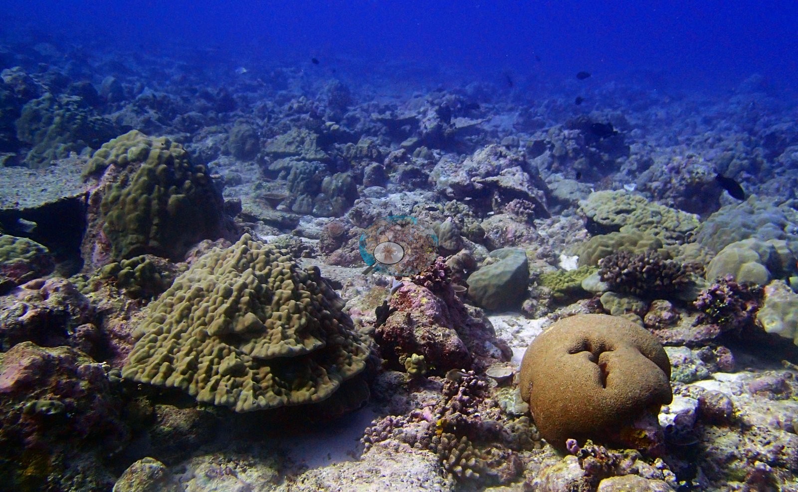
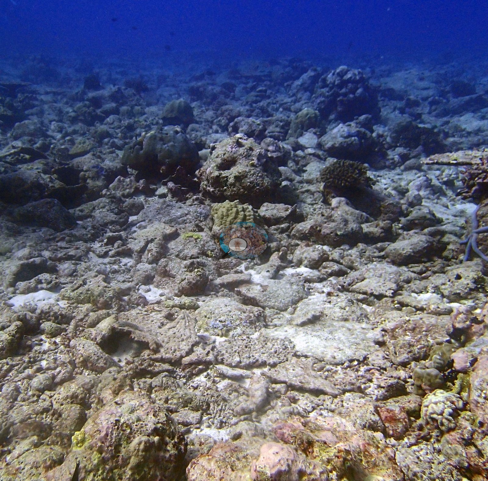
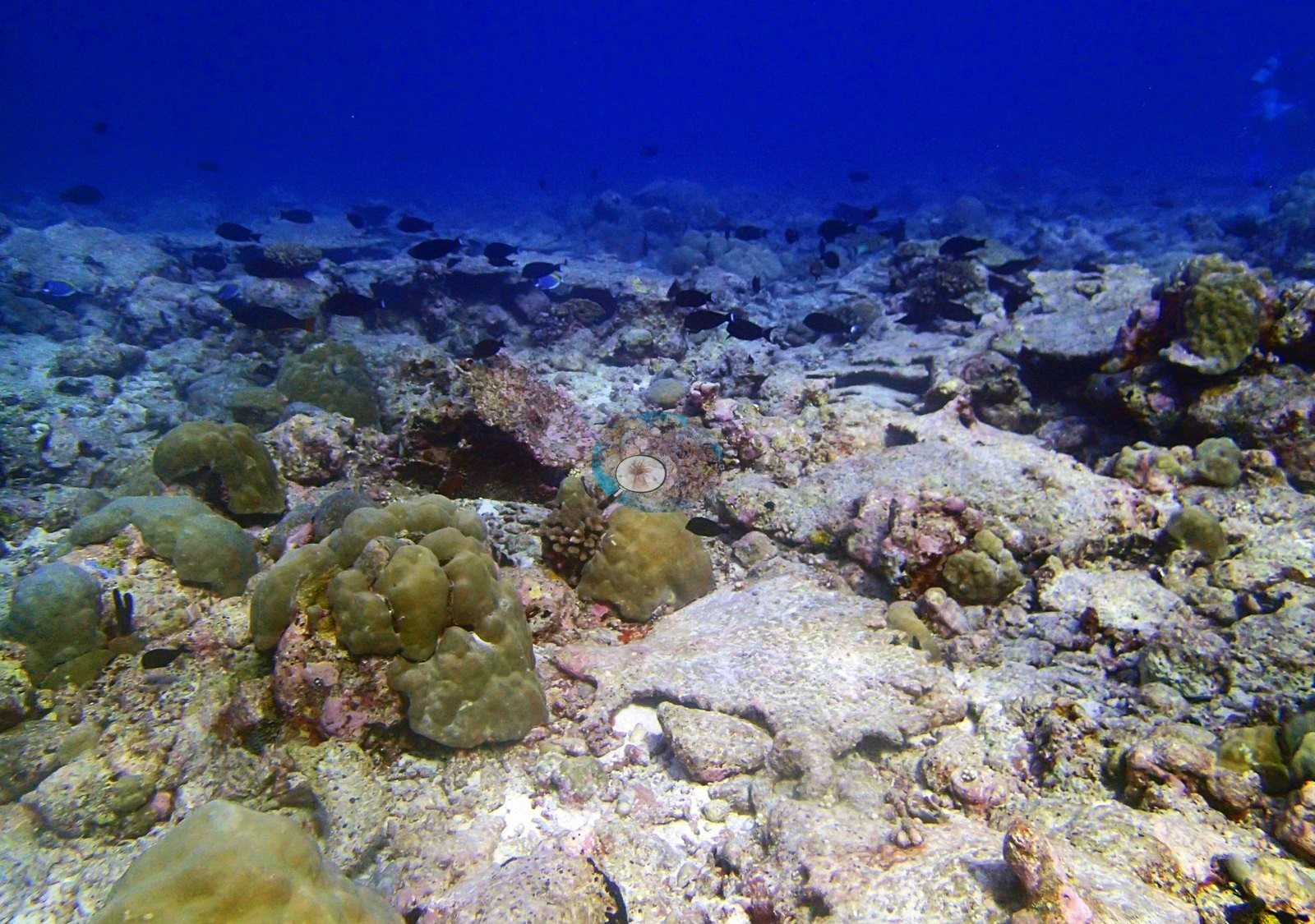
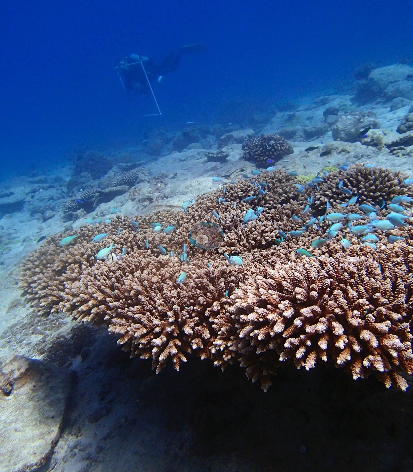
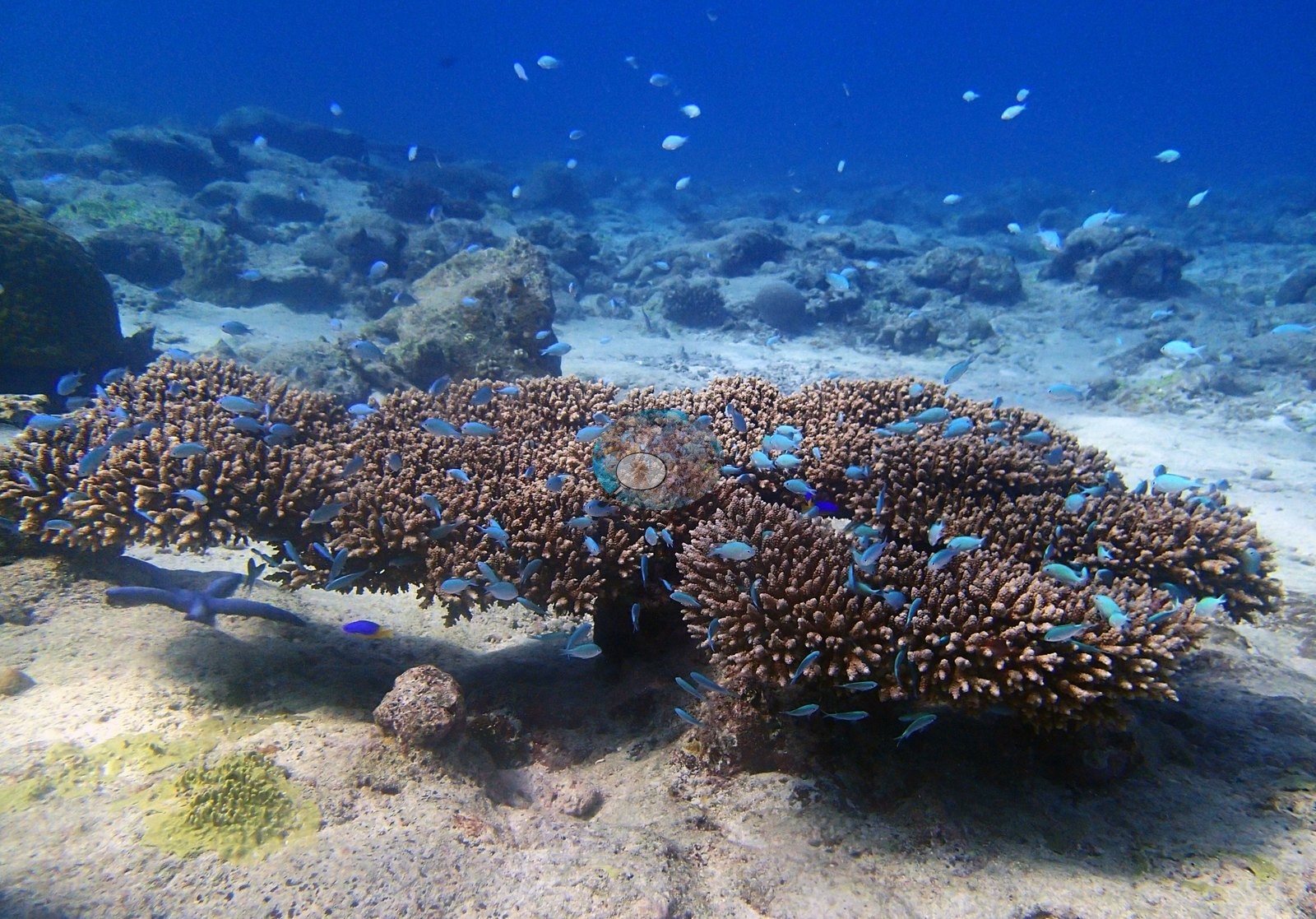
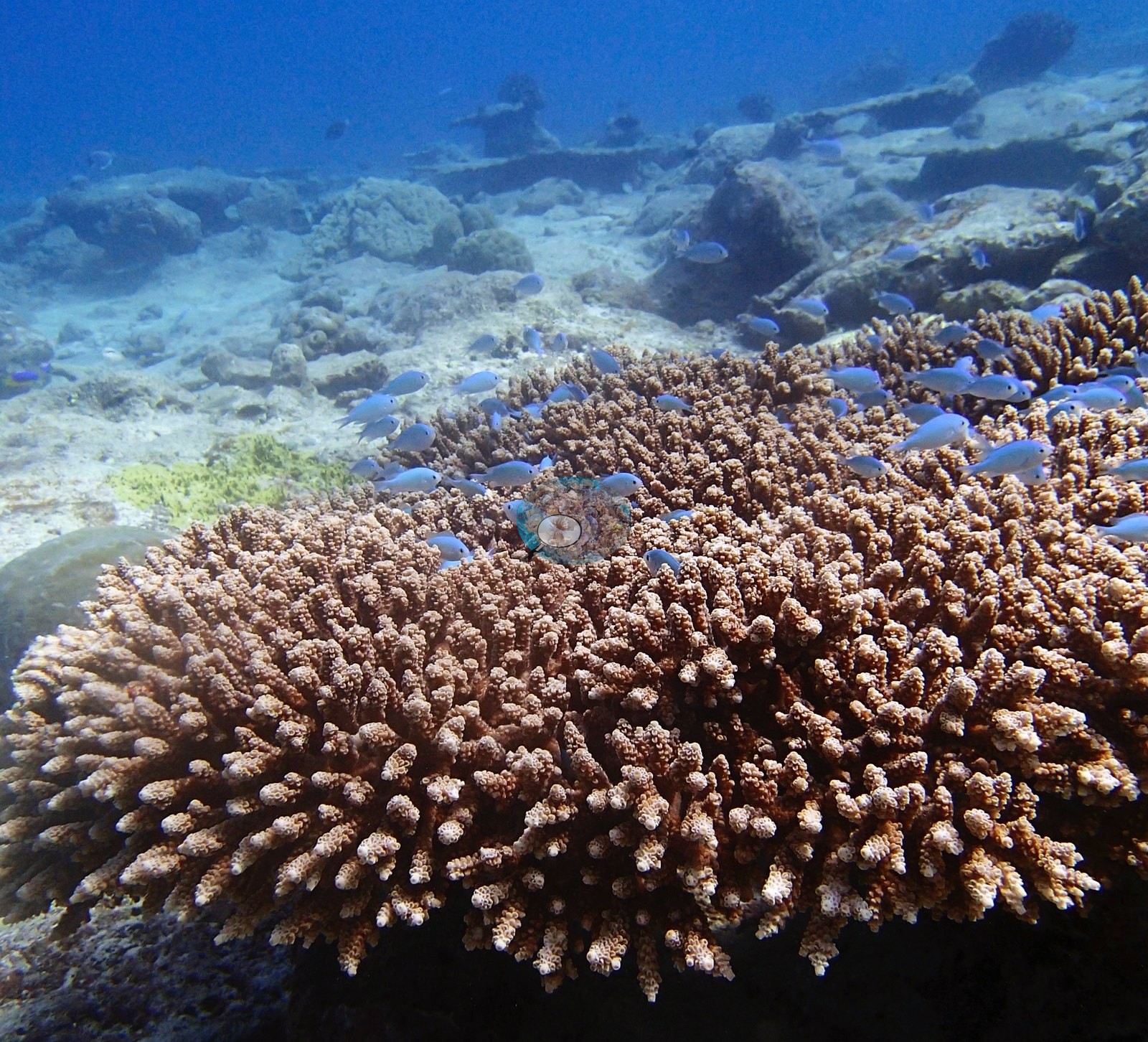
For the first forty minutes (12:26 through 13:08) the camera is over a low-relief plain of pale consolidated carbonate, rubble, and coarse sand carrying small, well-spaced colonies — olive knobby and domal Porites-type heads, scattered small branching colonies, old tabular plates already given over to turf and coralline algae (four frames all show the same ground). Then, from 13:15, the dive arrives at broad corymbose Acropora-type thickets standing clear of white sand — a run of six consecutive frames — and frame-level live cover jumps from single figures to 60% (e.g., Image 16, Image 18, Image 19).
Assemblage composition. Across 20 analyzed frames the Coralscapes masks put live hard coral at 17.0% of image area, of which Acropora (non-tabular) is by far the largest component at 60.1%; the rest breaks down as other hard coral 19.8% and massive and meandroid 15.5% of live cover. The independent 30-point human annotation of the same frames (600 points) gives live hard coral as 21.0% of all points and apportions it Acropora 49.2%, Porites 40.5%, other hard coral 5.6%, Pocillopora 4.8% of live coral. Non-coral cover is dominated by crustose coralline algae 4.3%, turf 23.0% of all points.
Coral cover
The 15.7% transect number is the average of two worlds and describes neither: the last six frames, shot inside three minutes, carry roughly three times the coral of the first fourteen. These six carry most of the site's blue-water load, which is why the un-filtered photo estimates sit closer to the transect than the benthic-only ones do. Frame-to-frame live cover runs 0% to 60.0% by point count (0% to 72.5% by mask area). Coral cover: 16%. Live hard coral measured on the in situ benthic transects of the LOF BIOT-1 expedition (Mayfield & Dempsey 2026, Oceans, supplemental S1), against algal cover of 62% of the benthos. The transect figure is this site's authoritative cover value; no image-derived product overrides it. Across methods the same reef reads: transects 15.7% · CoralNet points 21% · Coralscapes masks 17% (20 frames). These products have different sampling footprints and denominators and should not be averaged.
Stressors
Two frames matter for condition. One is a macro of a cream-white knobby branching colony with prominent, well-separated circular corallites, tissue apparently intact but pigment absent (e.g., Image 15).
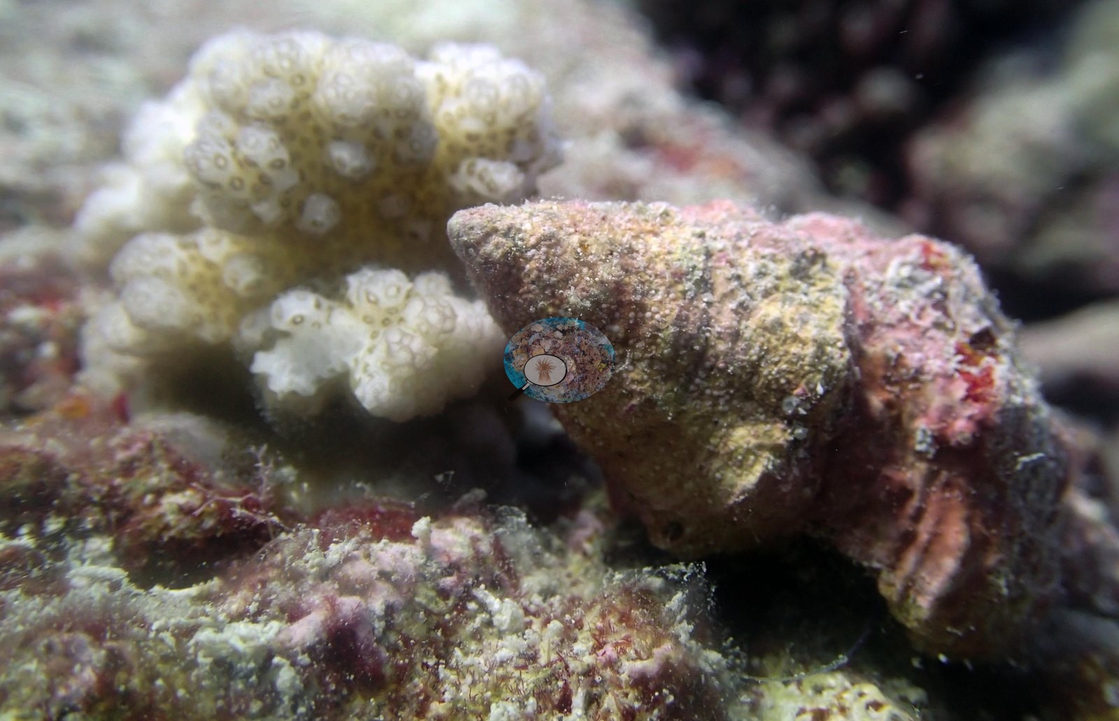
It is the one frame where both methods flag bleaching in the same place — 2 human bleached points and Coralscapes' highest bleached reading at BIEA25, 5.53% of image area — but its corallite scale looks coarser than the Porites the annotation called it, so genus and bleaching both want checking at full resolution. The other is a downward macro of pavement carrying a dense field of small dark boreholes or oscula — bioerosion or a boring sponge, not resolvable — ringed by pale coral recruits with blue-white polyp tips, which are healthy and should not be read as bleaching (e.g., Image 17).
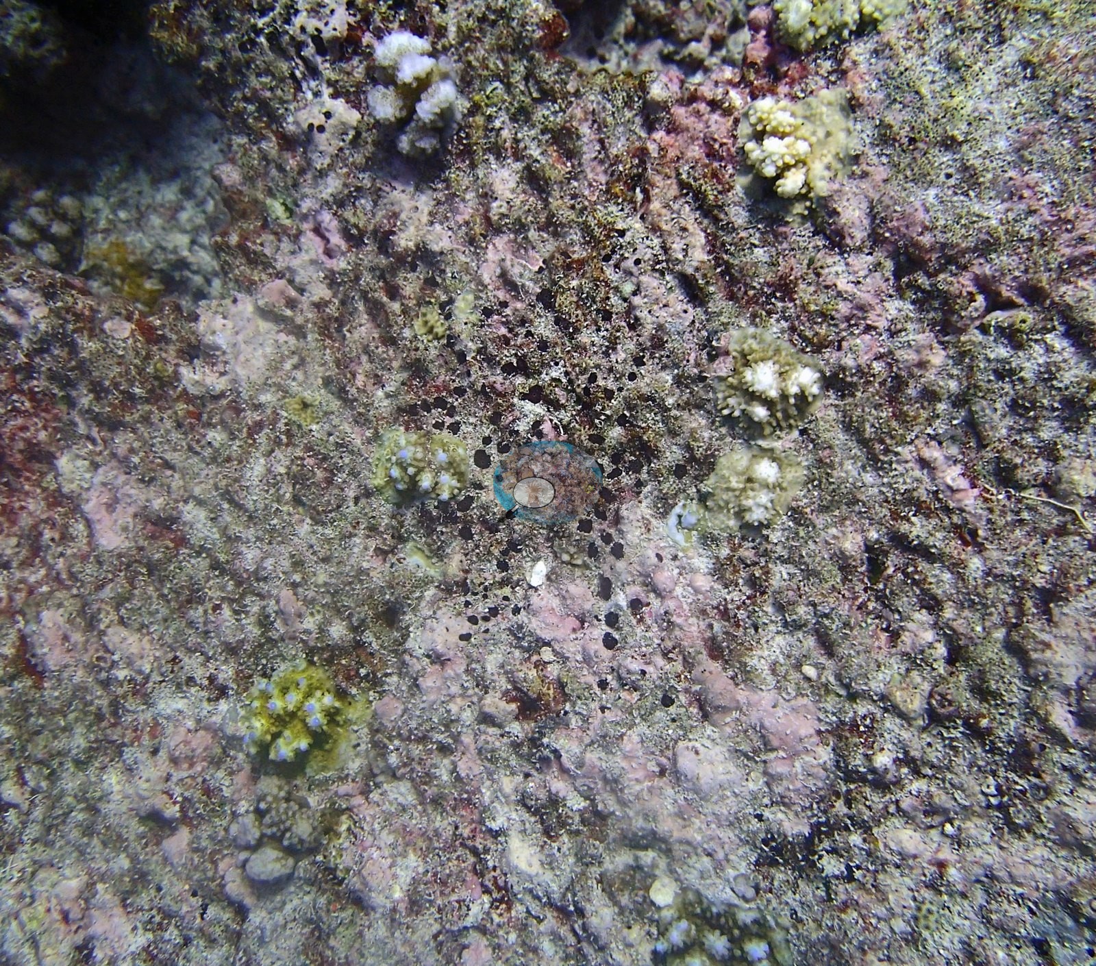
Structural loss registers as dead coral 1.4% of image area and rubble 5.2%. Bleaching stands at 2.5% of annotated points — 15 points in total — concentrated in Acropora 1.7%, other hard coral 0.8% of points. No COTS were recorded by either method or seen in review.
Fish and other fauna
The macrofauna is dominated by one animal. A large octopus, compatible with Octopus cyanea, occupies three consecutive frames — shot between 13:01:53 and 13:02:19 — wedged against a maroon- and pink-encrusted ledge, mantle, papillae, and red-rimmed eye filling the frame; the last is the best (e.g., Image 13, Image 14, Image 23).
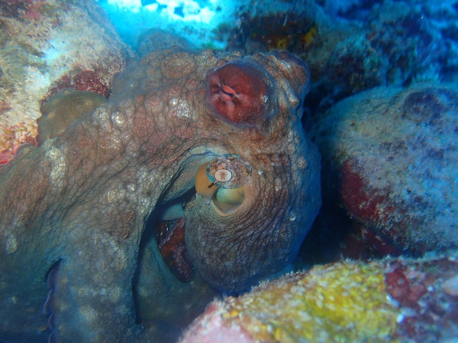
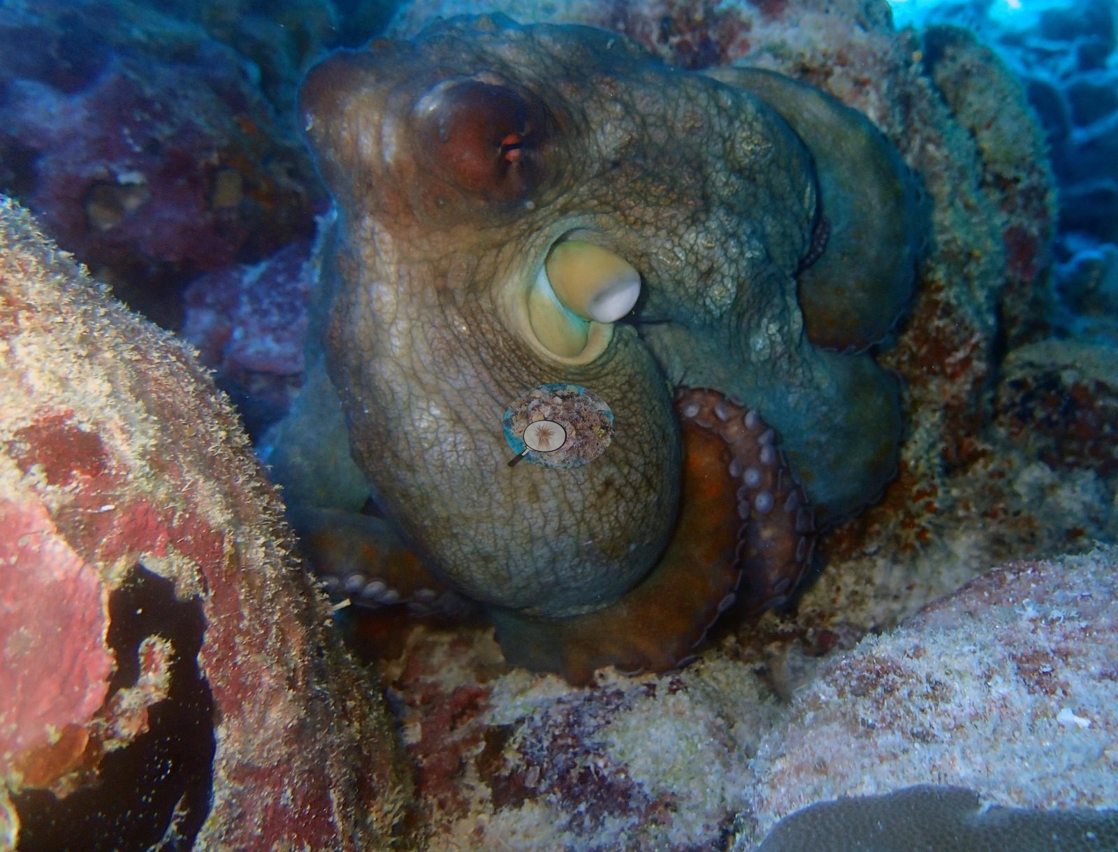
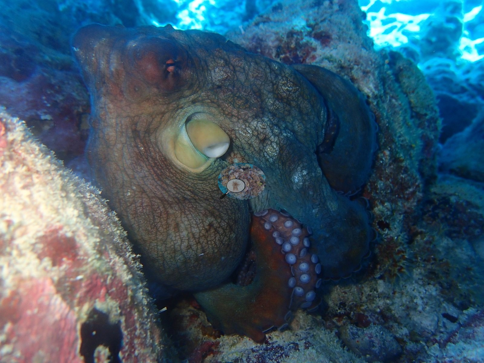
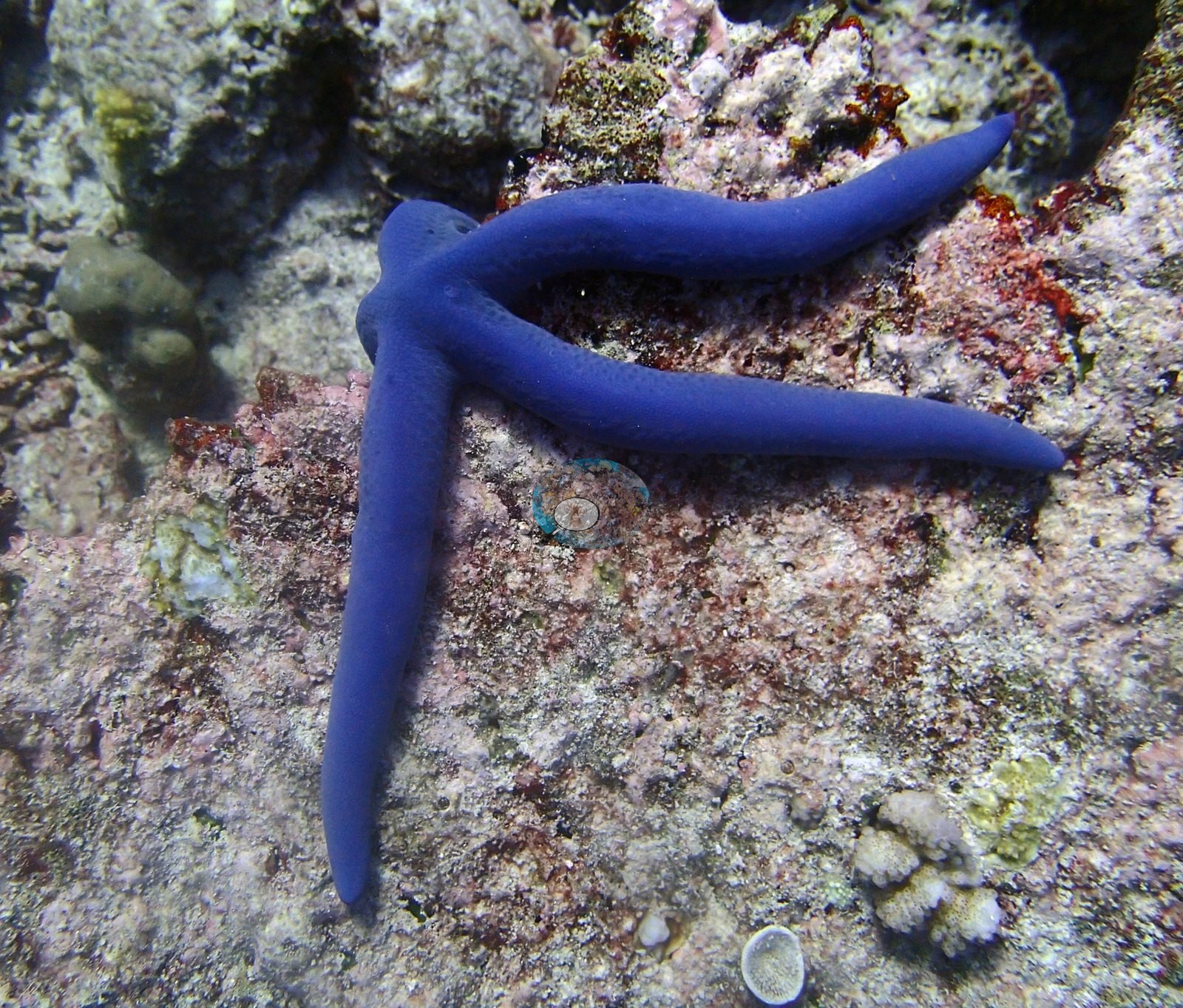
(The existing description calls this "four consecutive close-up shots" and then lists three; there are three.) Beyond it, a blue sea star compatible with Linckia laevigata appears on CCA-crusted pavement in one frame and on the sand under the thickets in two more — the latter two five seconds apart and almost certainly one animal, so two sightings, not three (e.g., Image 24).
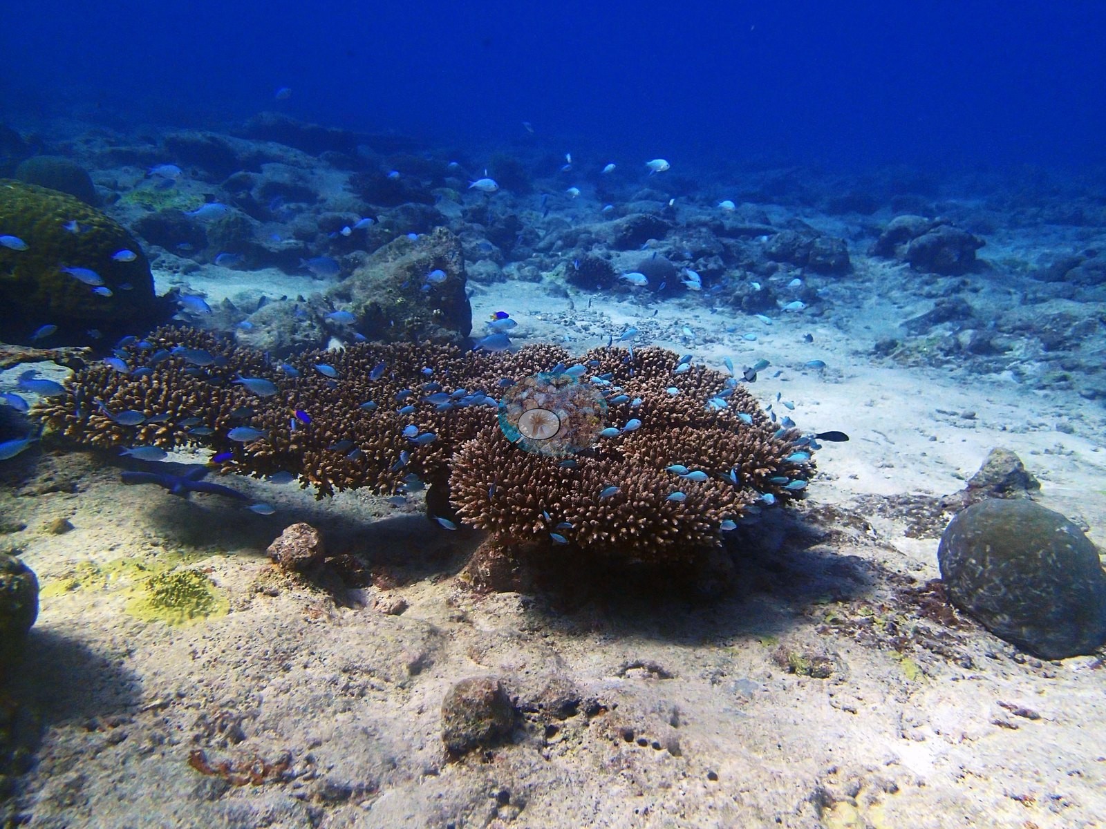
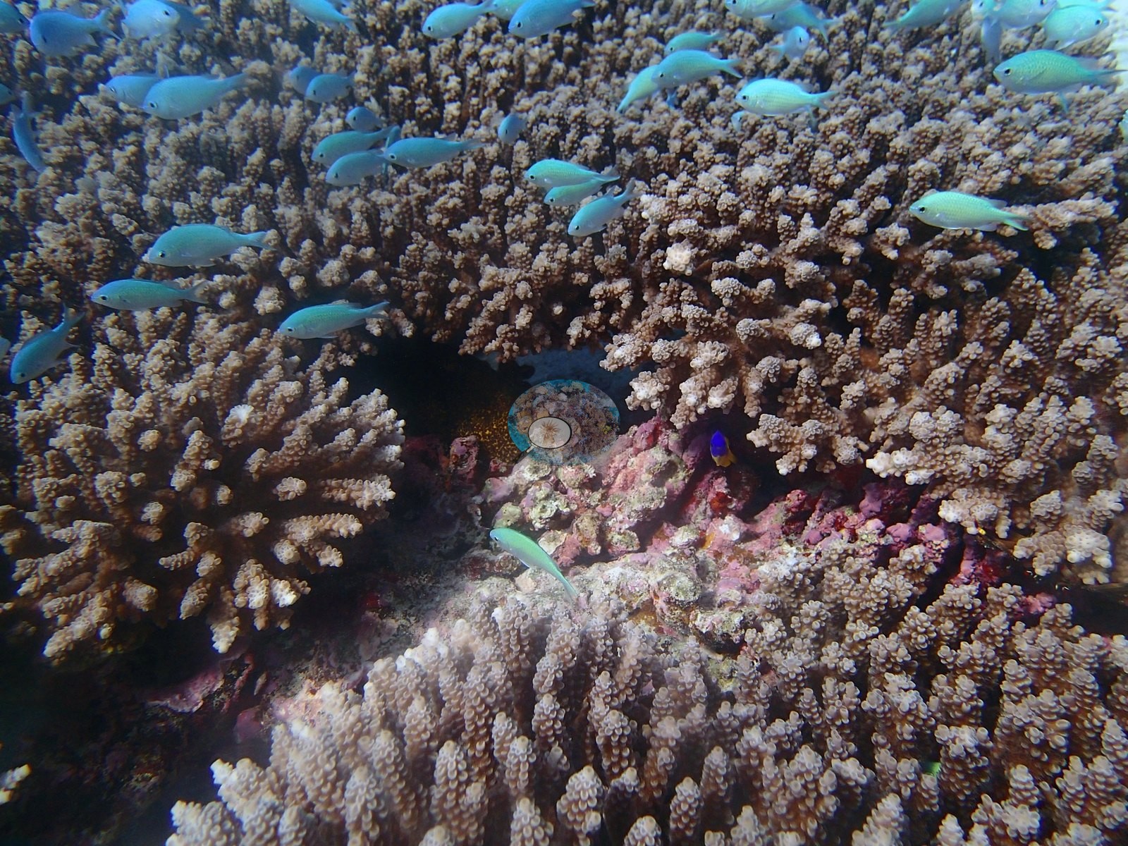
The thickets swarm with blue-green chromis compatible with Chromis viridis, a blue-and-yellow Chrysiptera-type damselfish in the branches of one frame, and a humbug-type Dascyllus in another (e.g., Image 10).
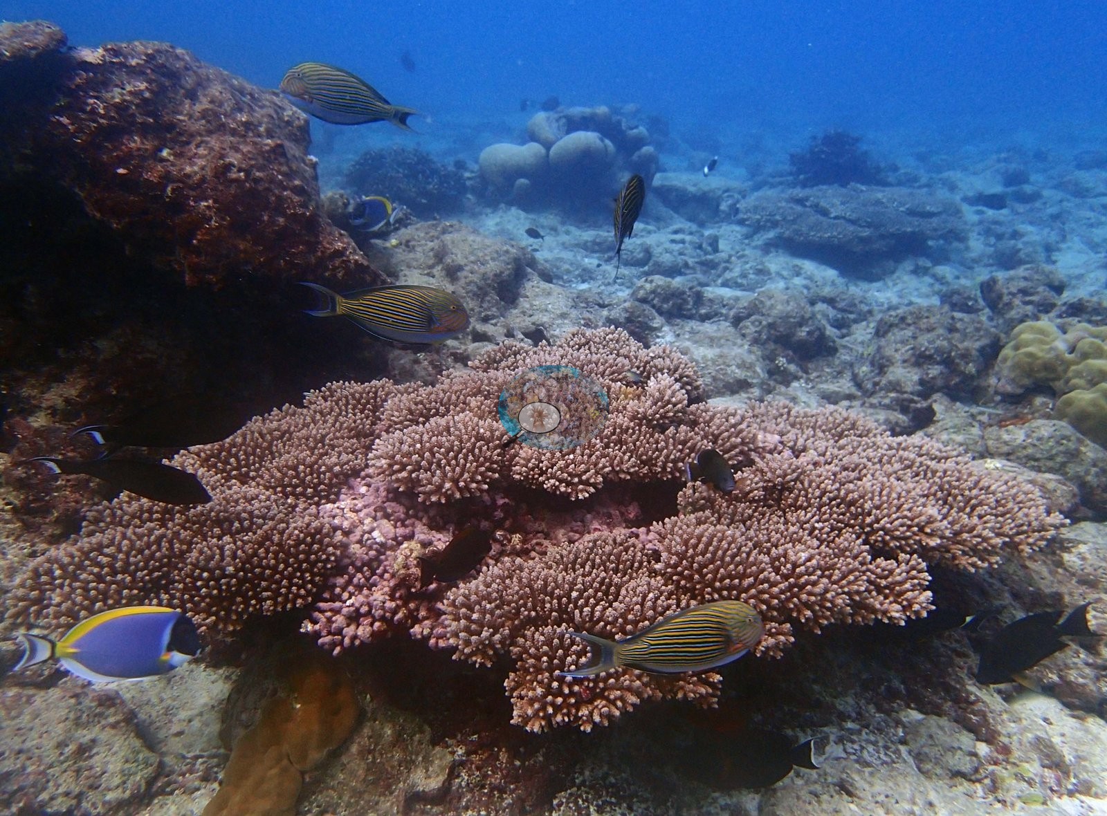
One frame is the site's best fish frame: three lined surgeonfish (Acanthurus lineatus) and two powder-blue surgeonfish (Acanthurus leucosternon) over a broad mauve-pink corymbose table (e.g., Image 4).
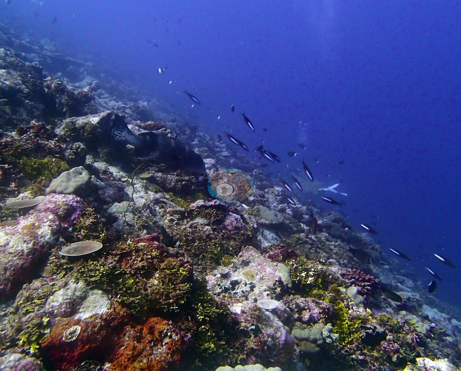
The deepest and most algal frame — an eroded ridge falling into blue under pink CCA, maroon crusts, and yellow-green turf — carries a stream of fusiliers (Caesionidae) and a dark blotched mass that is probably an encrusting sponge but is not resolvable (e.g., Image 5).
Conspicuous fauna and sessile invertebrates appear as sponges in 7 frames, giant clams in 3 frames, sea cucumbers in 3 frames, anemones in 3 frames, debris in 3 frames.
Comparisons with other data
No independent survey was made at this exact site; the nearest ones are listed in the table below.
Other notes
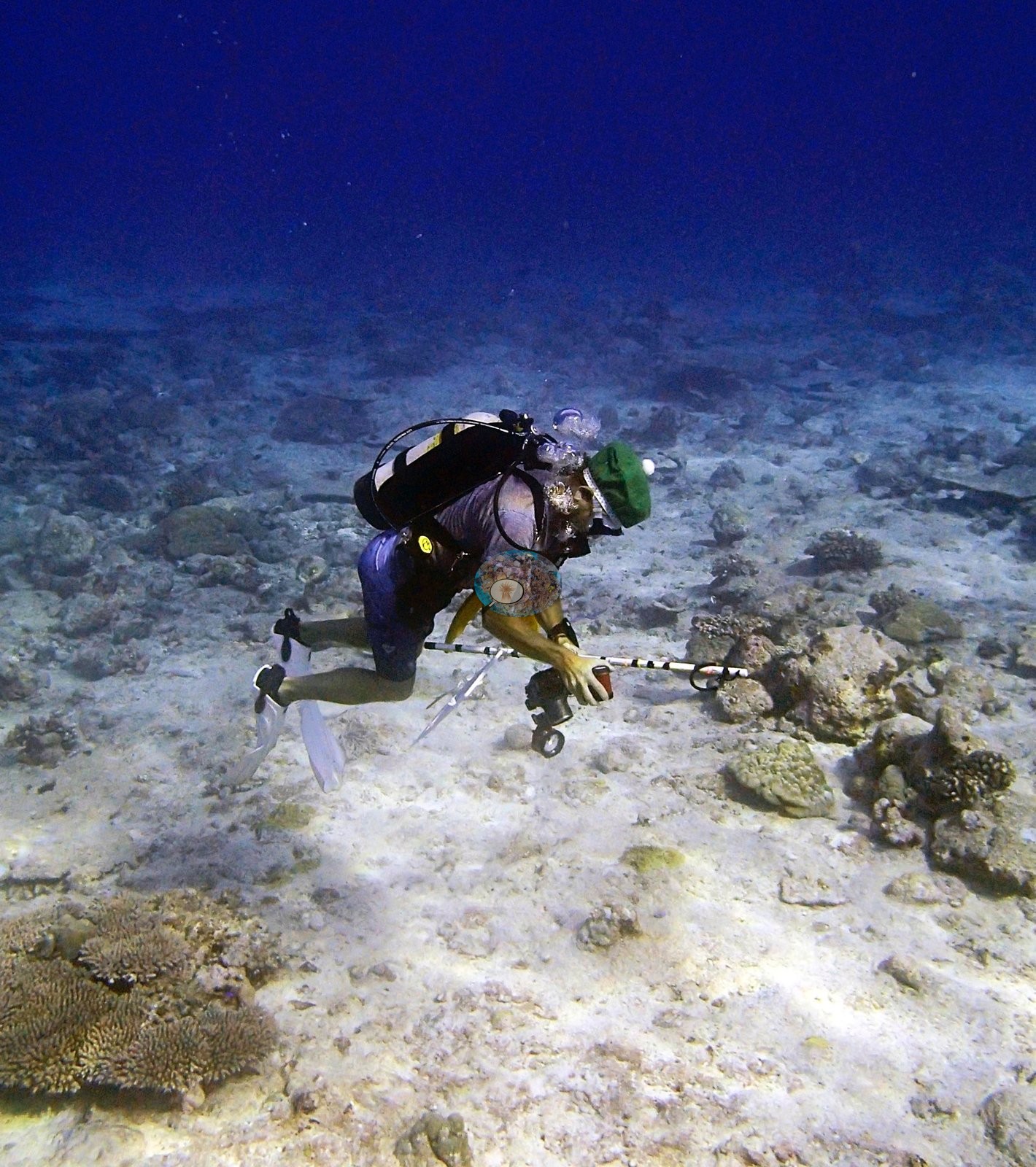
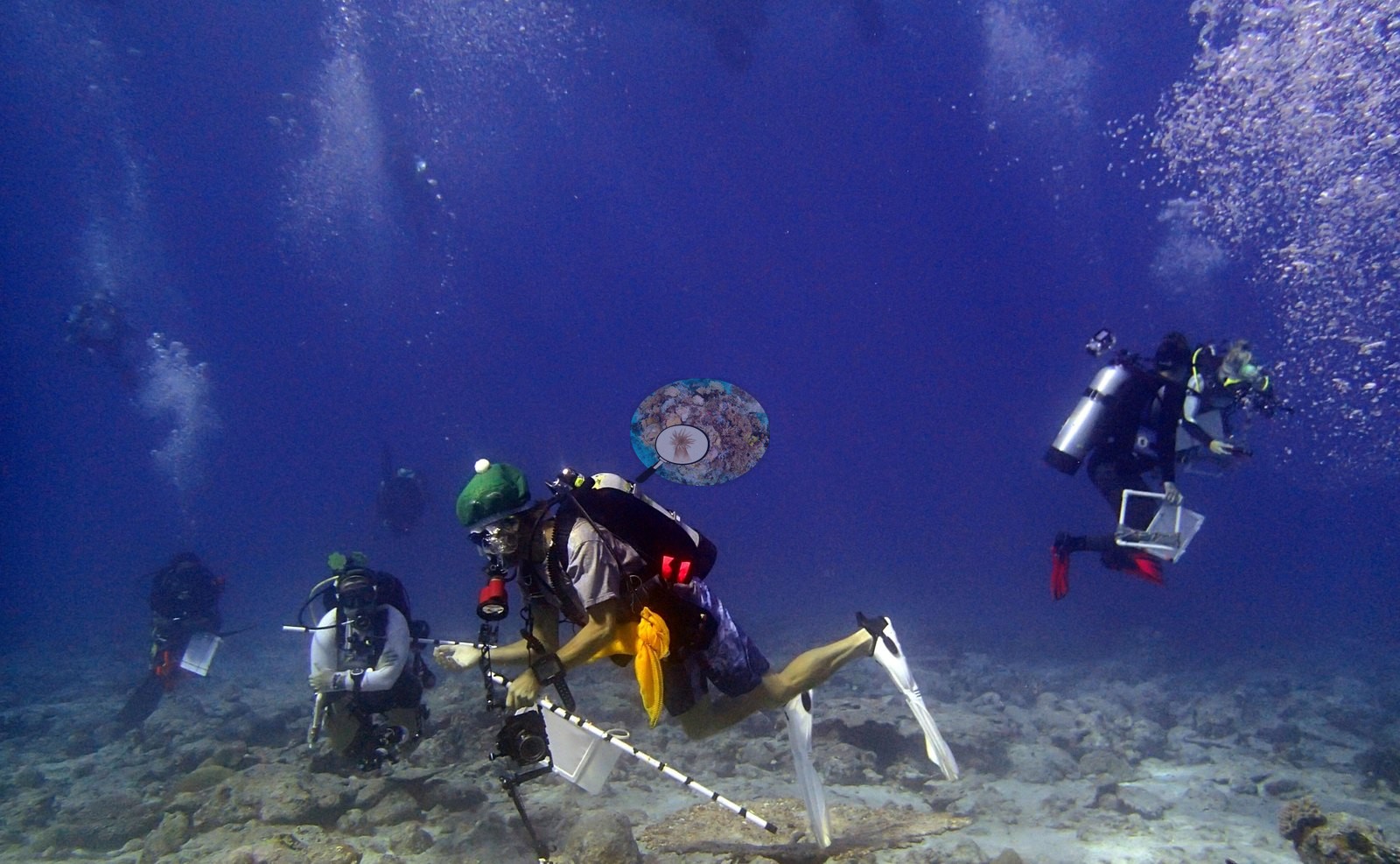
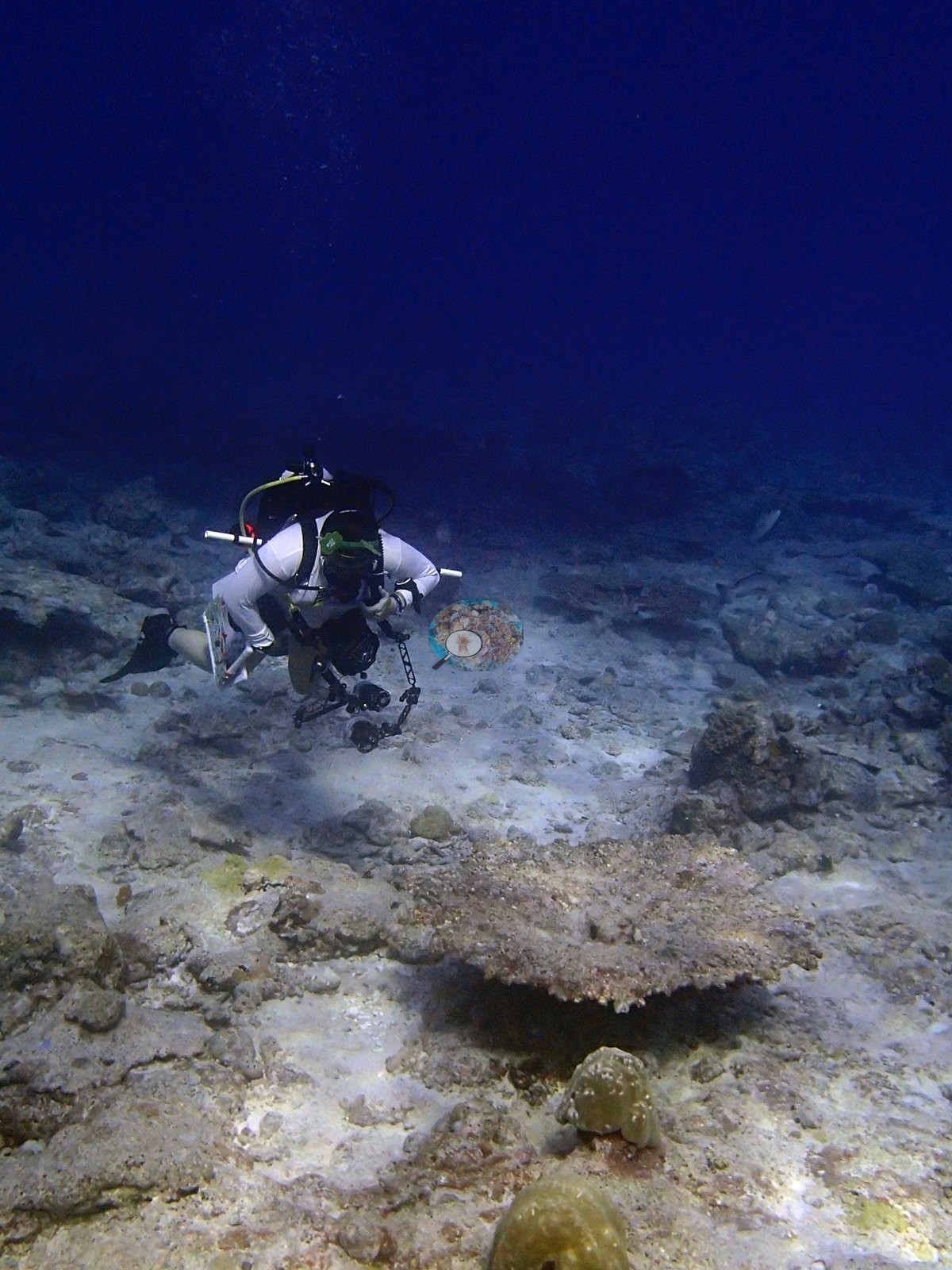
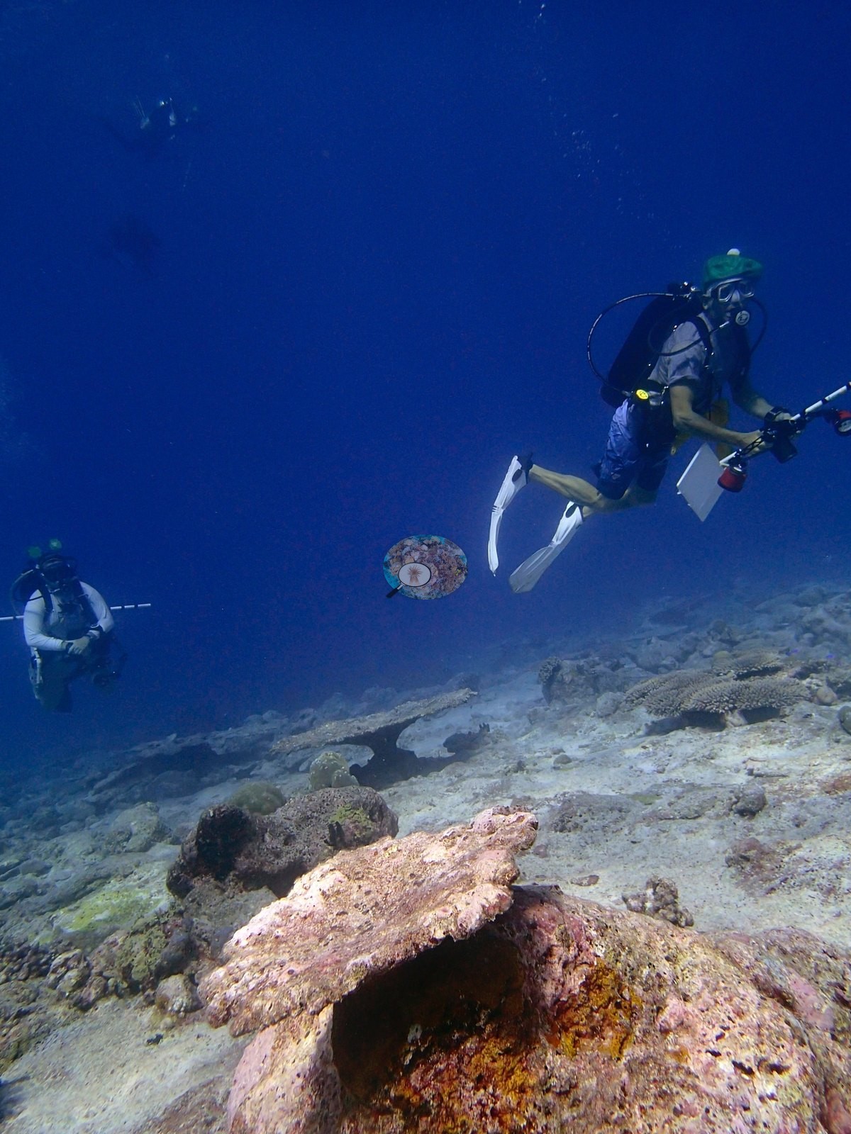
The opening sequence is a methodology record, not a benthic one. One frame shows a diver kneeling on the pavement working a black-and-white banded transect pole, camera housing and strobe beside them; another a second diver with slate and housing; a third two divers with the pole strung between them. One frame is the fullest apparatus frame at the site — five divers in open water, the banded pole, a camera tray, and at upper right a diver carrying a distinct white rectangular open frame that reads as a photoquadrat; another has a diver in the background blue holding the same frame.
CV model comparison
More info
Those are point counts on the photographs; this is a diver swimming a transect. The models and the reference never saw the same thing. ⚠ SITE-LEVEL ONLY. The 2,500 frames were not associated with any transect taken within 200 m of them, so transect-vs-image comparisons are site means, never frames. The transect value is already in the pin `cover` field (109 of 112 pins, sourced to the paper's suppl. S1) and is read from there, never re-imported. The transect is THE coral-cover value for this site and stands alone. The rows below it are a methods comparison only: no computer-vision value is averaged with it, feeds the headline, or carries over to the site's cover figure (Anderson, 2026-09-22).| Method | Hard-coral cover (%) |
|---|---|
| Transect (published) | 15.7 |
| CoralNet | 29.5 |
| In-house DINOv3 | 25.6 |
| CoralSCOP edited | 29.8 |
| Claude | 16.4 |
Independent surveys nearby
Within 5 km, 1 independent survey station recorded hard coral cover in 2015. The most recent nearby survey is from 2015, so these values predate recent heat stress. This site's own estimate (16%) is indistinguishable from the range of these surveys (13%): the 2.7-point gap is inside the ±7 percentage-point noise between methods; the methods differ, so the comparison is context, not a like-for-like test.
Collected by other programs using different methods (the XL Catlin Seaview Survey uses photo-transects with automated image annotation), so these are context for the figures above, not a like-for-like comparison. Where a station was surveyed more than once the range is shown. Station names are not dive-site names.
| Agency | Site / location | Date | Hard coral cover (%) | Distance | Link |
|---|---|---|---|---|---|
| XL Catlin Seaview Survey | transect 36003 | 2015 | 13% | 2.35 km | — |
Data & links
- Read the full site report ↗
- Download benthic survey data (CSV) ↗
- Download all LOF-GRE data (933 sites) ↗
- CoralNet image repository for this region ↗
- Photo portfolio ↗
- Coral Reef Diagnostics page for this area ↗
All images from Coral Reef Diagnostics. Data are from Coral Reef Diagnostics and the organizations named in the data-sources table above.
 © Coral Reef Diagnostics.