
Part of the regional summaries: Chagos Archipelago - Great Chagos Bank West / Brothers / Eagle and Chagos Archipelago
More info
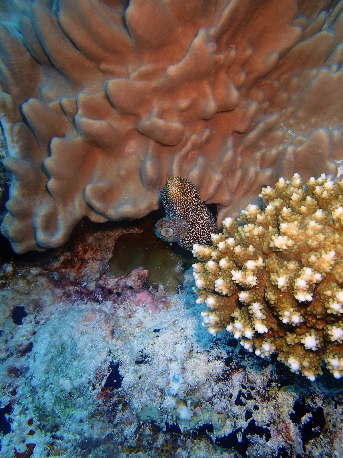
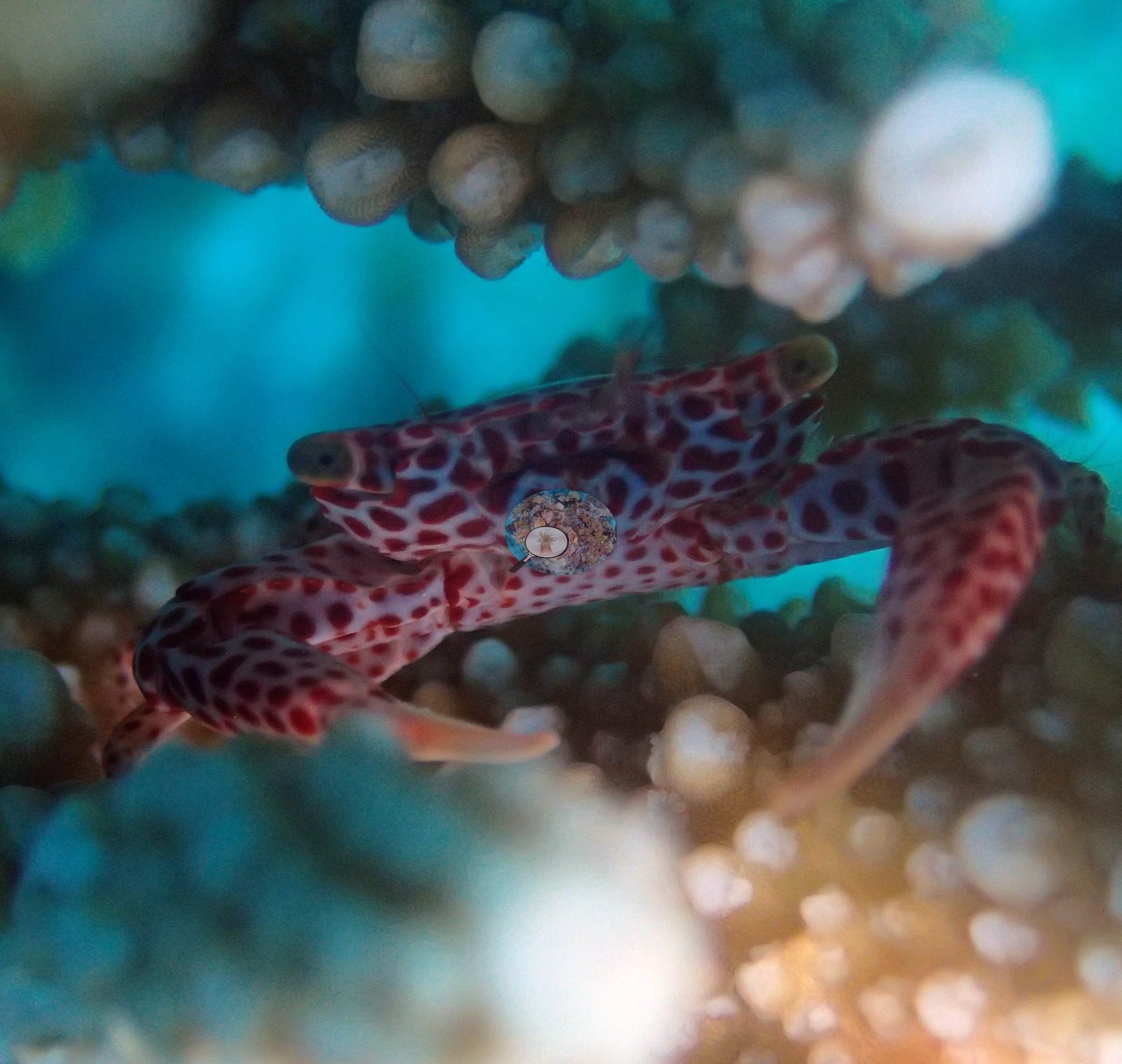
Chagos (NOAA CRW virtual station)BIEA24 is a lower-cover site (12.7%) notable for two corrected wildlife identifications: what an earlier pass called a pair of moray eels is actually a single red-spotted coral guard crab, and what was called a puffer is a whitemouth moray. A cleaning station was also caught mid-service, with a wrasse working a fish amid a dense school of small golden cardinalfish, and sharply-edged patches of recent partial mortality were noted on the site's largest Porites dome. Surveyed on the Living Oceans Foundation's Global Reef Expedition.
One independent survey station shown with the program’s logo — click one to see how far it is from this site.
Three other CRD dive sites within 5 km shown in orange — click a marker to open its page.
🗺 Detailed map of the Global Reef Expedition dive sites, Eagle Island, Chagos (Khaled bin Sultan Living Oceans Foundation; opens in a new window)
Site description
Setting
S1) — Anderson's own published value, surveyed 16 March 2015 at Eagle Island on the western Great Chagos Bank (6.20961°S, 71.30426°E; fringing reef, intermediate exposure; in situ temperature 29.3°C, salinity 34.3).
General benthic features
Porites leads at 5.73% of the benthos, 45% of all live coral present, then Pocillopora 2.60%, Acropora 0.97%, Favites 0.57%, Montipora and Ctenella 0.40% each (Ctenella being the Chagos-endemic monotypic genus, not Cynarina), Astreopora 0.37%, Leptastrea 0.33%, Platygyra 0.27%, Goniastrea 0.23%, Pavona 0.20%, Heliopora 0.20%, Pachyseris 0.17%, Turbinaria 0.13%, and Galaxea and Gardineroseris 0.067% each. A note on that Heliopora record, which is Anderson's own determination: the LOF codebook lists code HELI as Heliofungia, but the field data are Heliopora, blue coral — determined by A. Mayfield, the expedition's coral-physiology lead, on 2026-08-25. The corroborating evidence is that HELI reaches 93% cover on one transect, impossible for a solitary free-living mushroom coral, while HEFU, the Heliopora code, has only three records across all 3,067 GRE transects. It is labeled Heliopora here. The non-coral substrate is dominated by non-coral invertebrates at 24.6% — nearly twice the live coral cover, and the largest single benthic category at this site — then bare substrate 18.77%, crustose coralline algae 11.27%, erect algae 10.87%, turf 10.07%, turf-with-sediment 9.9%, macroalgae 1.7% and cyanobacteria 0.13%.
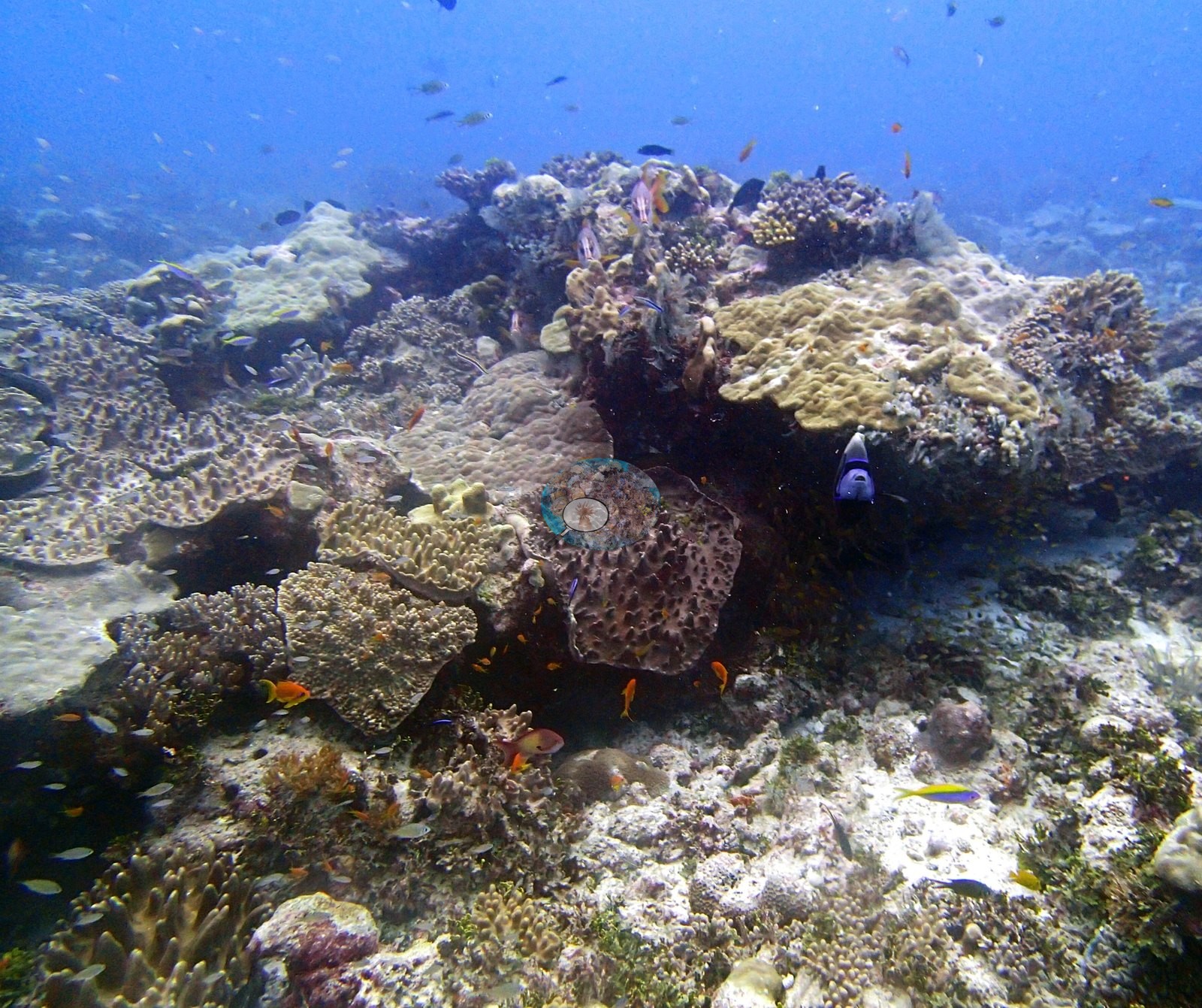
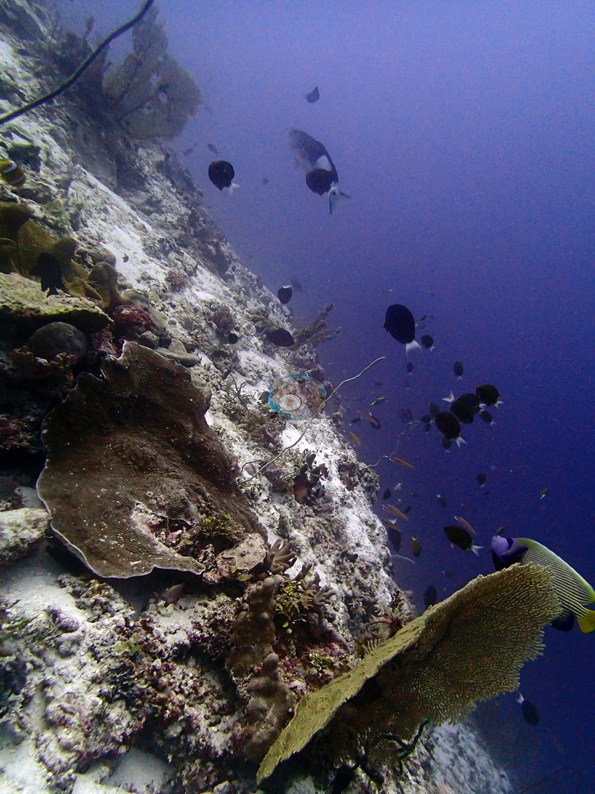
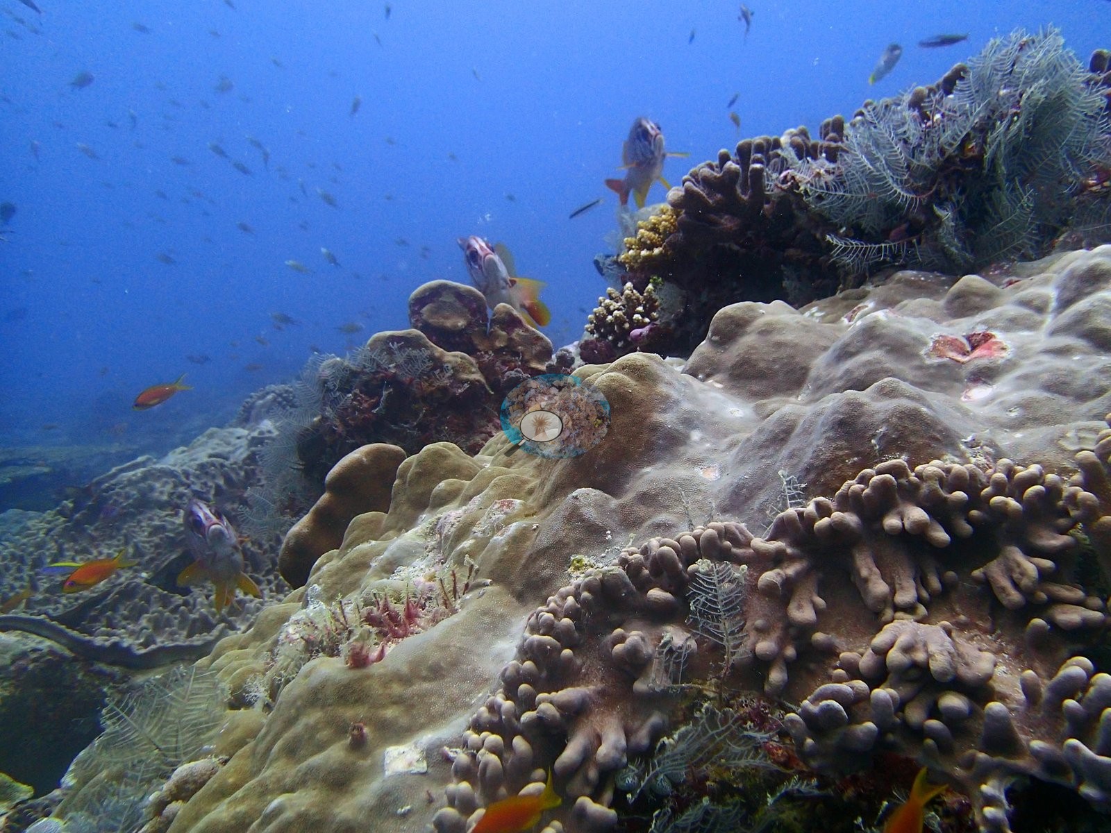
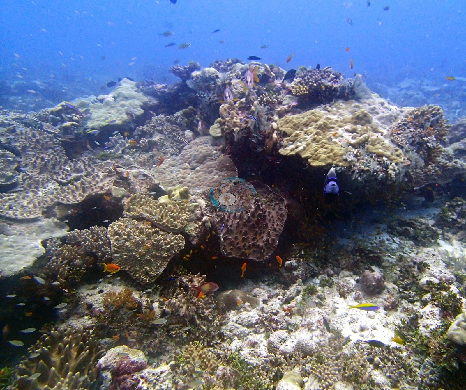
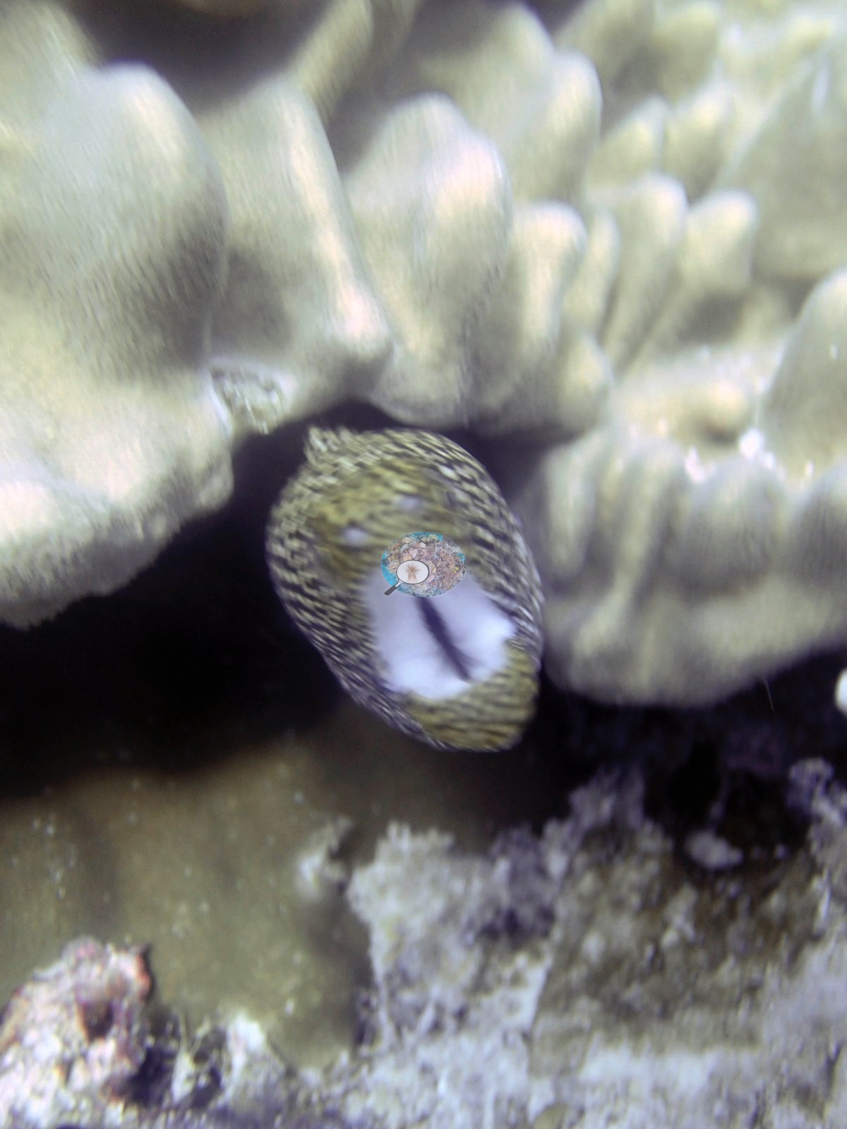
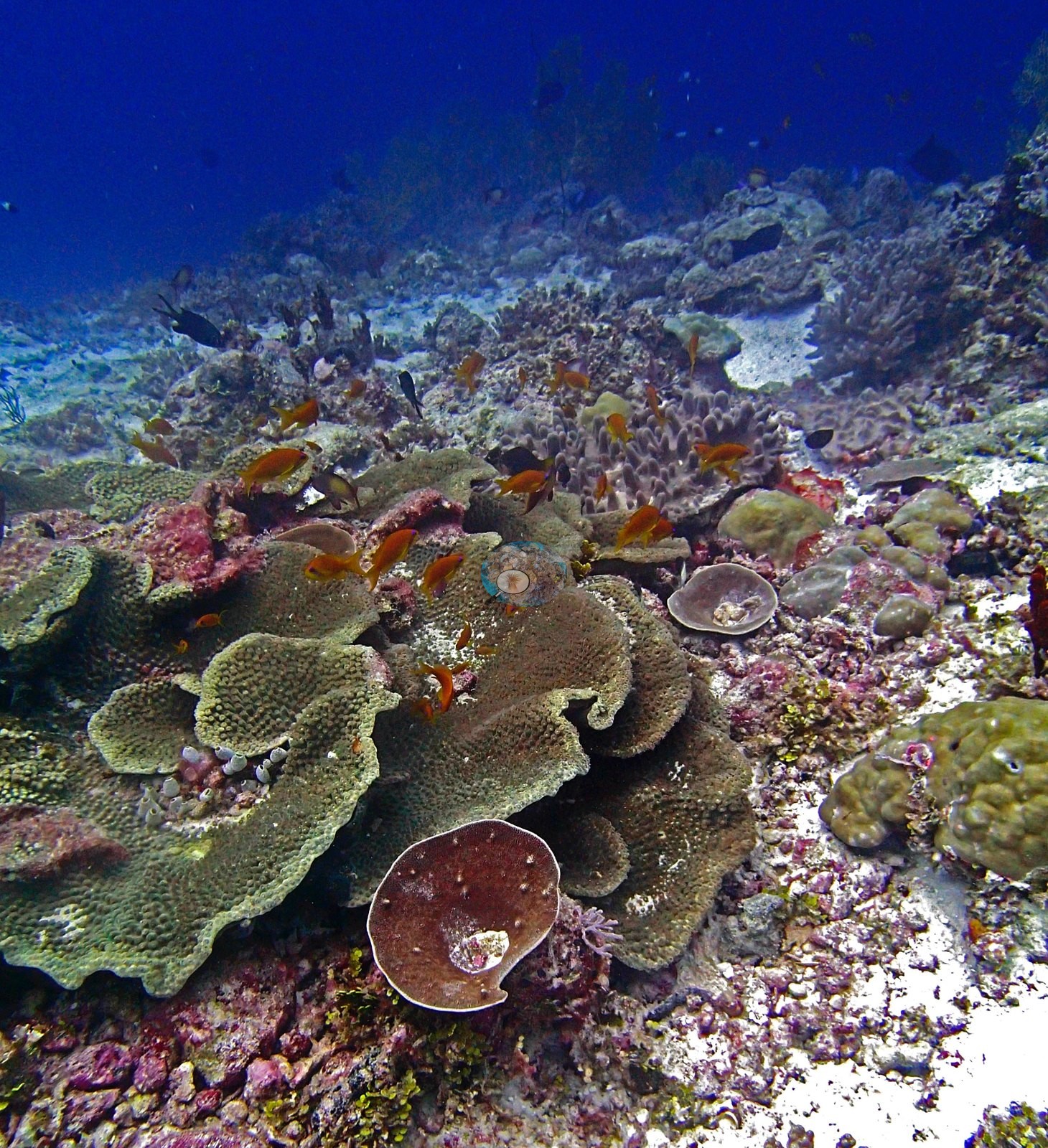
The dive opens on a wall and moves onto a terrace. P3160320, at 14:32, is a near-vertical pale carbonate face falling into deep blue: a brown ridged foliose plate and a yellow-green plating colony with fine even corallites on the lip, antipatharian whips and a bushy octocoral trailing off it, surgeonfish and white-tailed damselfishes streaming into open water. It is the only genuinely water-dominated frame at the site (47% of its points fall on water) and both image methods read it low and agree. Thirteen minutes on the dive is on the reef proper: P3160321 is the best wide benthic frame — a bommie of large, ruffled, pale yellow-green foliose, and scrolling plates compatible with Turbinaria or Montipora folded over deeply pink- and magenta-crusted rock, a maroon foliose plate beside them, a yellow-green massive at the right edge and orange anthias across all of it. P3160338 is the broadest view of the bottom: pale tan massives and a dark honeycomb-corallite massive compatible with Favites or Goniastrea standing among foliose plates over rubble and turf-crusted pavement. P3160337 is the frame with the most live coral in it (the point set reads it 46.7% live, Coralscapes 43.3% — both frame-level image values, not reef values): a broad pale gray-tan massive dome compatible with Porites, knobby digitate colonies around it, feather stars, squirrelfish and anthias. It sits between a large pink-cream lobate-columnar colony compatible with Porites and a golden-tan corymbose Acropora with brilliant white branch tips, over pavement carrying pink coralline crusts and inky black patches compatible with an excavating sponge. P3160347, 26 s earlier, is a blurred close-up of a mottled head with the mouth agape and pale lining showing, among pale cream nodular colonies; it is most consistent with the same animal, but the frame is too soft to settle that and it is not counted as a separate identification. P3160348 also carries the site's highest image dead-coral value.
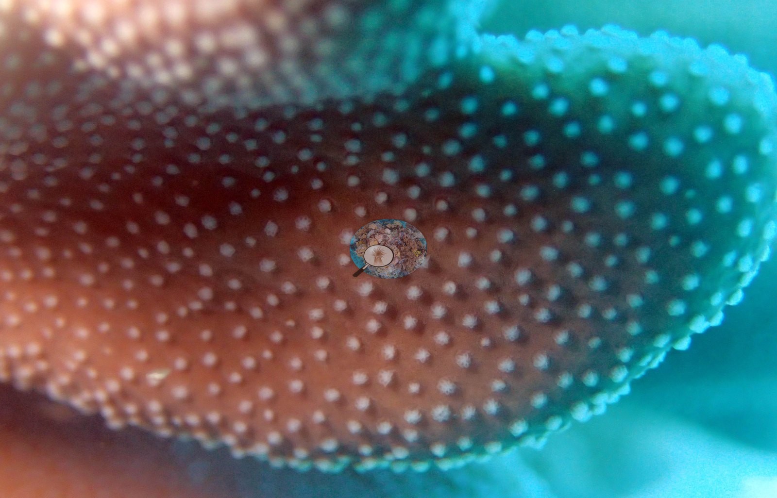
P3160340 needs a specific note. It is a frame-filling macro of a foliose plate margin — red-brown tissue grading to teal-green, with conical, well-spaced corallites whose oral discs are pale white — compatible with Turbinaria. Non-coral cover is dominated by crustose coralline algae 3.3%, turf 13.6%, macroalgae 4.2% of points.
Coral cover
The measurement at BIEA24 is the benthic transect survey. Coral cover 13%, from LOF BIOT-1 in situ transects (Mayfield & Dempsey 2026, Oceans, suppl. That diver transect figure is the authoritative record of cover and community here. The photographs described below supplement it; they are qualitative only, no cover value may be read off any of them, and where the imagery and the transect appear to disagree the transect governs.
What the transects recorded. Live hard coral 12.7% — a genuinely low-cover site — against algal cover 43.9% of the benthos, across 16 scleractinian genera plus the blue coral Heliopora.
Computer-vision comparison — method against method, not against the transect. Fifteen frames exist on disk but only 11 carry CoralNet annotation and only those same 11 were run through Coralscapes, so every image-derived number below rests on n = 11 paired frames. On those 11, CoralNet point annotation returns 21.5% live hard coral and Coralscapes mask segmentation 35.3% of image area, against the transect's 12.7%: deviation +8.8 to +22.6 pp, mean of the three methods 23.2% ± 11.4. BIEA24 is the site where the image products read above the transect rather than below it, and where they also disagree most with each other — a 13.8 pp model-vs-model split, the widest in the Chagos redo — and the reason is a label-definition difference, not a segmentation failure. The split is entirely bleached tissue. Coralscapes assigns 0.00% bleached area in all 11 frames and folds pale tissue into live coral; add the point annotation's 11.5% bleached points back into its live class and the two read 33.0% against 35.3%, i.e. they converge. The pattern is frame-specific: on the seven frames carrying no bleached signal Coralscapes reads 2.1 pp below the point set, while on the four that carry bleached points — P3160340, P3160347, P3160348, P3160350 — it reads +41.4 pp above on average (+68.3, +31.0, +26.1, +40.2). BIEA24 should therefore not be cited as evidence that the photo methods disagree about coral; they disagree about bleaching. A second, independent artifact depresses the point column: 25.5% of its points are labeled Unknown, peaking at 56.7% on P3160334, a frame that scores 0.0% live despite plainly showing a coral-covered ridge. Renormalising the point set without Unknown lifts it to 28.3% live, or 41.8% counting bleached tissue as coral. The composition of the frame set matters too: this is a curated highlight set, eight of the fifteen frames are close or macro subjects and several are composed on animals rather than substrate, so none of the three numbers is an unbiased areal estimate of the same thing. The transect measured the reef; the image products measured these photographs. They have different sampling footprints and different denominators, neither corrects the transect, and they must not be averaged.
Coral cover 13%, measured on the in situ benthic transects of the LOF BIOT-1 expedition (Mayfield & Dempsey 2026, Oceans, supplemental S1) — a diver transect measurement, not a photographic or computer-vision estimate. That transect figure is the authoritative record of cover and community at BIEA24; the photographs above are illustrative and secondary, and no cover value has been or should be read off them.
Also on record for this site: Assemblage composition. Across 11 analyzed frames the Coralscapes masks put live hard coral at 35.3% of image area, of which massive and meandroid is the largest component at 47.7%; the rest is other hard coral, 46.0% of live cover. The independent 30-point human annotation of the same frames (330 points) puts live hard coral at 21.5% of points and apportions it Porites 64.8%, Acropora 21.1%, other hard coral 14.1% of live coral. Frame-to-frame live cover runs 0% to 46.7% by point count and 4.1% to 81.7% by mask. Coral cover: 13%. Live hard coral measured on the in situ benthic transects of the LOF BIOT-1 expedition (Mayfield & Dempsey 2026, Oceans, supplemental S1), against algal cover of 43.9% of the benthos. The transect figure is this site's authoritative cover value; no image-derived product overrides it. Across methods the same reef reads: transects 12.7% · CoralNet points 21.5% · Coralscapes masks 35.3% (11 frames). These products have different sampling footprints and denominators and should not be averaged.
Stressors
The same adult carries the next frames, appearing in P3160335, P3160336 and again in P3160338. It is also the site's condition frame — the dome carries sharply-edged pale patches of what reads as recent partial mortality, with small pink-red lesions among them. Those lesions read as a pigmentation response to injury or boring organisms and are explicitly not called a named disease; they cannot be diagnosed from an image. The tissue in this frame is pigmented: the white is the corallite mouths, not bare skeleton. That is worth recording because a 30-point annotation of this frame scored 16 of its 30 points as bleached, while Coralscapes read the same frame 81.7% live and 0% bleached. Both independent photo reviews of this frame describe pigmented tissue. It is reported here as seen, no bleaching percentage is derived from it, and the site's published bleached fraction is a separate, authoritative number that no photograph revises; the frame is flagged for Anderson because if it sits in a CoralNet training or QA set the annotation is worth re-checking. The same restraint applies to the brilliant white branch tips on the corymbose Acropora in P3160349, P3160350 and P3160351: white tips fit both normal growing axial corallites and early tip bleaching, they cannot be separated at this magnification, and they are reported as seen and not diagnosed. Anderson's call.
Condition, in summary. The frames show three things and no more: sharply-edged pale patches with small pink-red lesions on the massive dome in P3160337, pigmented tissue with white corallite mouths in the P3160340 macro, and unresolved white branch tips in the closing moray sequence. No crown-of-thorns, no named disease, no storm rubble field appears anywhere in the set. No percentage bleached is estimated from these frames. Structural loss registers as dead coral 2.3% of image area and rubble 3.7%. Bleaching stands at 11.5% of annotated points — 38 points — concentrated in other hard coral 9.1%, Acropora 2.4% of points.
Fish and other fauna
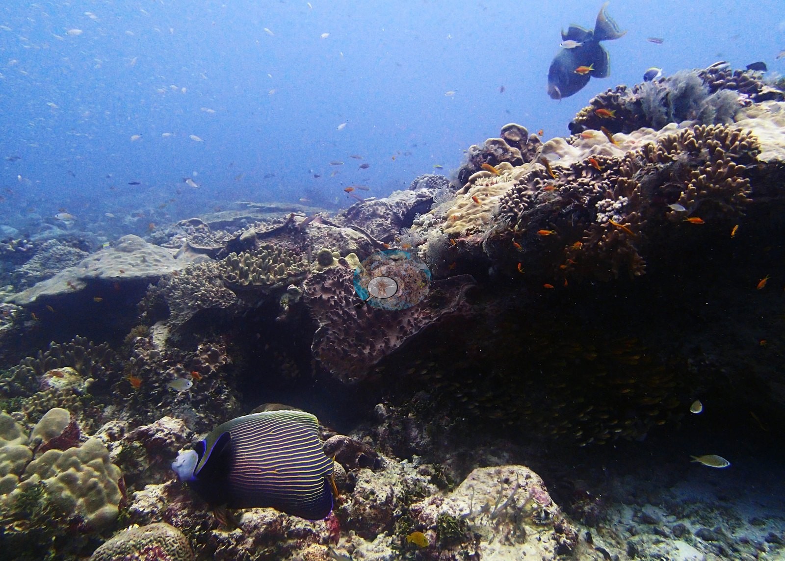
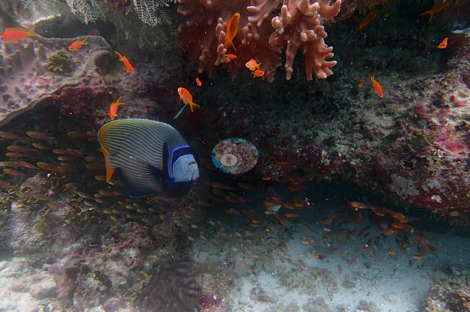
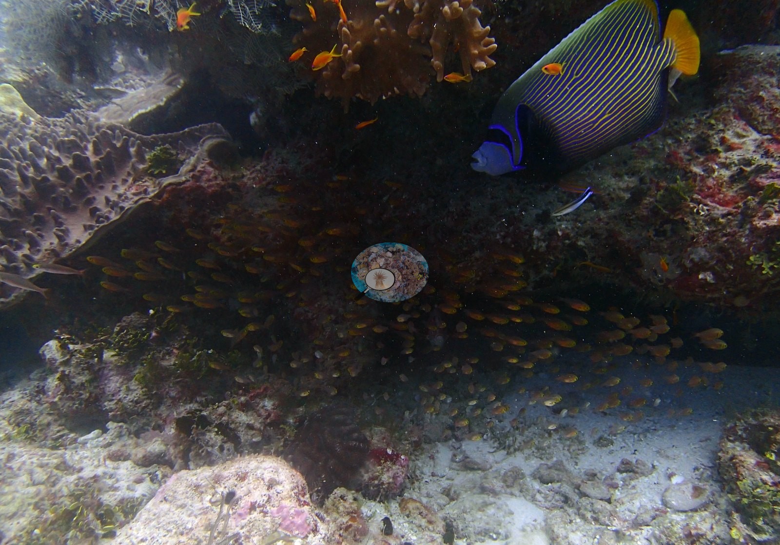
A burst of five frames in 44 seconds (14:58:54–14:59:38) works one overhang, and the emperor angelfish is the animal of the dive. P3160334 establishes the ledge: a ridge of brown digitate colonies over a maroon foliose plate, anthias, a dark-blue triggerfish compatible with Pseudobalistes fuscus, and an adult emperor angelfish (Pomacanthus imperator) at its base. P3160336 is the observation worth keeping: the angelfish hangs stationary with a small striped wrasse compatible with Labroides dimidiatus at its flank — a cleaning station mid-service, over a dense stream of small golden fish compatible with apogonid cardinalfishes or sweepers filling the shadow under the ledge in P3160335 and P3160336.
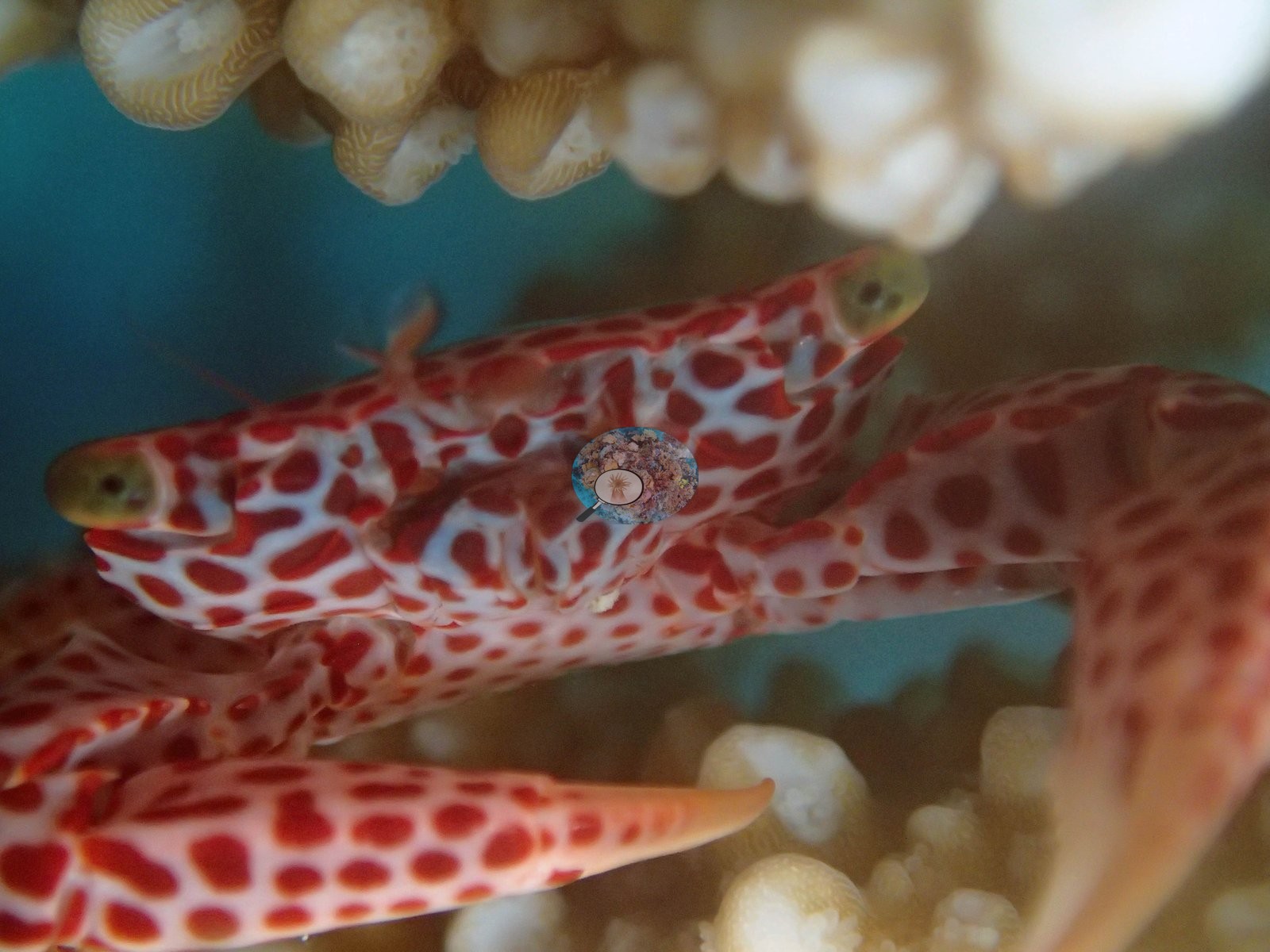
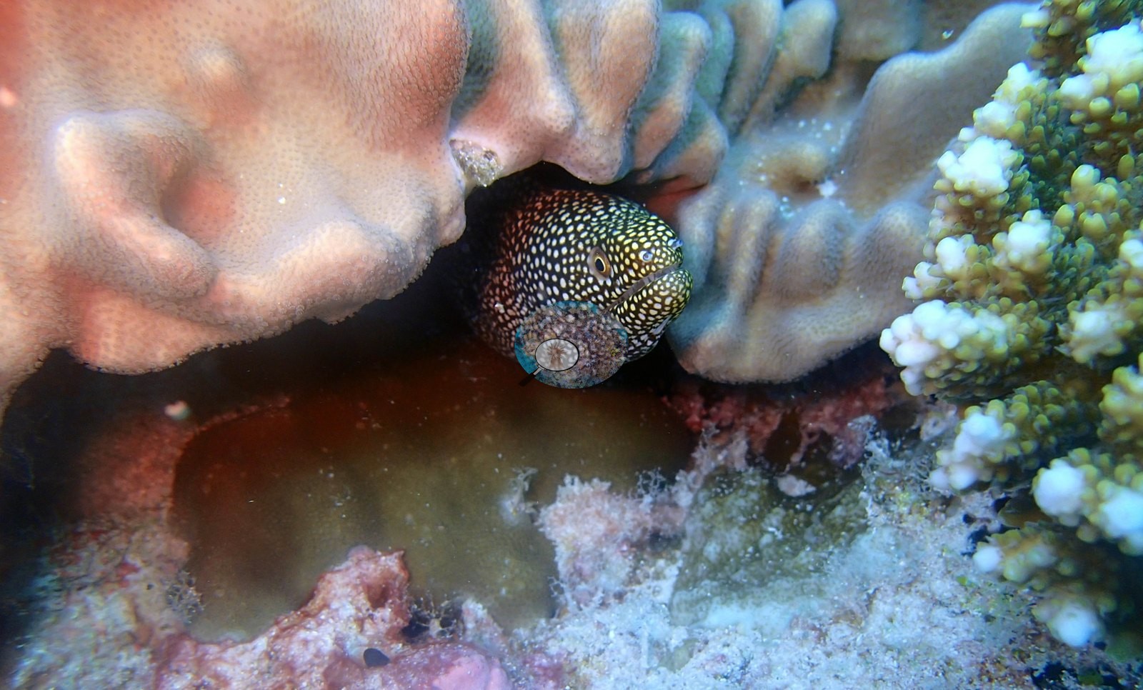
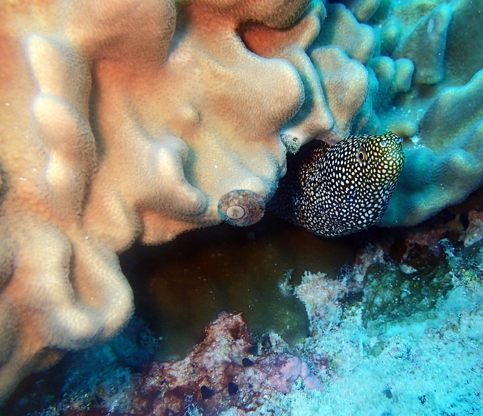
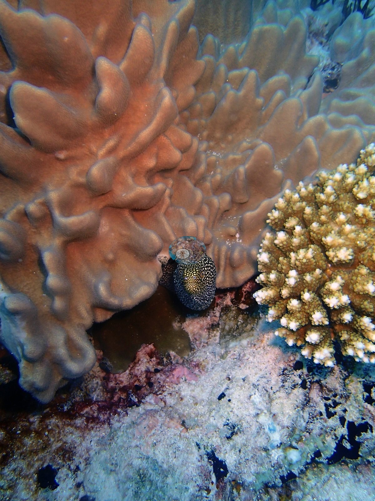
The last nine minutes are flash macro, and they hold the two best portraits at the site. P3160343 and P3160344 are frame-filling close-ups of a single coral guard crab front-on among the pale nodular branches of its host colony: cream-white carapace and limbs boldly blotched and reticulated with crimson, stalked yellow-green eyes, jointed chelipeds tapering to orange-tipped dactyls — a Trapezia rufopunctata-type red-spotted guard crab, and the sharpest invertebrate portrait in the Chagos redo. These frames were previously logged as 'a pair of red-and-cream mottled moray eels'; they are not eels, and both independent reads agree they are one crab. P3160344 is the sharper of the two. The closing sequence is a moray, not a puffer. P3160348, P3160349, P3160350, and P3160351 show the same animal from progressively wider range — elongate head, small forward-set eye, tubular anterior nostril, jaw sloping back past the eye, dark ground densely peppered with white spots — compatible with a whitemouth moray, Gymnothorax meleagris-type, and previously logged as a puffer compatible with Arothron. Conspicuous fauna and sessile invertebrates appear as sponges in 8 frames, sea cucumbers in 2, giant clams and anemones in 1 each.
Comparisons with other data
No independent survey was made at this exact site; the nearest ones are listed in the table below.
Other notes
Image-by-image. Fifteen habitat frames from the 16 March dive (window 14:32–15:12 by frame EXIF, Olympus TG-2), all from Anderson's own folder BiEa24-finished; there are no sampled-colony frames. The set is strongly bimodal — seven reef-scale frames followed by eight close and macro subjects, seven of the latter composed on two animals — and the camera changes job halfway through. Quality is good: the wide frames are sharp with natural color and good visibility, the strobe-lit macros are the sharpest images in the batch, and P3160347 is the only genuinely soft frame. No quadrat, transect line, diver or scale object appears in any of the fifteen frames — worth recording, given BIEA20 holds eight such images.
CV model comparison
More info
Those are point counts on the photographs; this is a diver swimming a transect. The models and the reference never saw the same thing. ⚠ SITE-LEVEL ONLY. The 2,500 frames were not associated with any transect taken within 200 m of them, so transect-vs-image comparisons are site means, never frames. The transect value is already in the pin `cover` field (109 of 112 pins, sourced to the paper's suppl. S1) and is read from there, never re-imported. The transect is THE coral-cover value for this site and stands alone. The rows below it are a methods comparison only: no computer-vision value is averaged with it, feeds the headline, or carries over to the site's cover figure (Anderson, 2026-09-22).| Method | Hard-coral cover (%) |
|---|---|
| Transect (published) | 12.7 |
| CoralNet | 40.6 |
| In-house DINOv3 | 41.2 |
| CoralSCOP edited | 39.2 |
| Claude | 37.4 |
Independent surveys nearby
Within 5 km, 1 independent survey station recorded hard coral cover in 2015. The most recent nearby survey is from 2015, so these values predate recent heat stress. This site's own estimate (13%) is indistinguishable from the range of these surveys (13%): the 0.3-point gap is inside the ±7 percentage-point noise between methods; the methods differ, so the comparison is context, not a like-for-like test.
Collected by other programs using different methods (the XL Catlin Seaview Survey uses photo-transects with automated image annotation), so these are context for the figures above, not a like-for-like comparison. Where a station was surveyed more than once the range is shown. Station names are not dive-site names.
| Agency | Site / location | Date | Hard coral cover (%) | Distance | Link |
|---|---|---|---|---|---|
| XL Catlin Seaview Survey | transect 36003 | 2015 | 13% | 0.30 km | — |
Data & links
- Read the full site report ↗
- Download benthic survey data (CSV) ↗
- Download all LOF-GRE data (933 sites) ↗
- CoralNet image repository for this region ↗
- Photo portfolio ↗
- Coral Reef Diagnostics page for this area ↗
All images from Coral Reef Diagnostics. Data are from Coral Reef Diagnostics and the organizations named in the data-sources table above.
 © Coral Reef Diagnostics.